Timezone:Pacific Standard Time
Current Time:Tuesday, November 17, 2026 3:46 AM
Longitude:-116.574364
Latitude:33.02954
Sunrise Time Today:6:20:13 AM
Sunset Time Today:4:45:13 PM
Daylength Today:10h 24m 59s
Sunrise Time Tomorrow:6:21:08 AM
Sunset Time Tomorrow:4:44:43 PM
Daylength Tomorrow:10h 23m 34s

: Show All Dates

Date Sunrise Time Sunset Time Daylength
Jan 1, 2026 6:50:23 AM 4:50:46 PM 10h 0m 22s
Feb 1, 2026 6:43:34 AM 5:18:25 PM 10h 34m 50s
Mar 1, 2026 6:16:58 AM 5:43:37 PM 11h 26m 39s
Apr 1, 2026 6:36:35 AM 7:06:35 PM 12h 29m 59s
May 1, 2026 6:00:53 AM 7:28:30 PM 13h 27m 37s
Jun 1, 2026 5:40:17 AM 7:50:38 PM 14h 10m 21s
Jul 1, 2026 5:42:01 AM 8:00:14 PM 14h 18m 13s
Aug 1, 2026 6:00:09 AM 7:47:37 PM 13h 47m 28s
Sep 1, 2026 6:21:33 AM 7:14:41 PM 12h 53m 7s
Oct 1, 2026 6:40:58 AM 6:34:02 PM 11h 53m 3s
Nov 1, 2026 7:04:44 AM 5:57:32 PM 10h 52m 47s
Nov 17, 2026 6:19:17 AM 4:45:44 PM 10h 26m 26s
Nov 18, 2026 6:20:13 AM 4:45:13 PM 10h 24m 59s
Dec 1, 2026 6:31:57 AM 4:41:02 PM 10h 9m 4s

Sunrise & Sunset Photos

Milky Way and Stars Reflecting On Lake Kevin by slworking2, A couple days ago I headed out to the Anza-Borrego Desert to chase some thunderstorms. While I got t
Milky Way and Stars Reflecting On Lake Kevin by slworking2
Cuyamaca Christmas by mojo2u, Christmas day was overcast so this sunset really caught me by surprise.  I grabbed my camera but no
Cuyamaca Christmas by mojo2u
NEOWISE from Lake Cuyamaca by Dan@propeakphotography, From Lake Cuyamaca east of San Diego, the light pollution from LA kept the horizon pretty bright wel
NEOWISE from Lake Cuyamaca by Dan@propeakphotography
Milky Way and silhouettes of burnt trees in Cuyamaca Rancho State Park by slworking2, Flashback to July 2013. This shot was previously a reject. We won't again see the Milky Way this bri
Milky Way and silhouettes of burnt trees in Cuyamaca Rancho State Park by slworking2
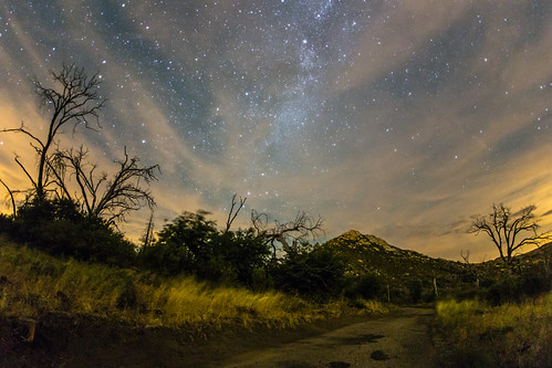
Stonewall Peak, Milky Way, and burnt trees on a cloudy night by slworking2, Cuyamaca Rancho State Park.california sky night clouds julian unitedstates sandiego astronomy milkyw
Stonewall Peak, Milky Way, and burnt trees on a cloudy night by slworking2
Highway To Heaven by slworking2, Milky Way over pine tree lined Sunrise Highway in Mount Laguna.

This is is a two exposure blend sho
Highway To Heaven by slworking2
Milky Way Panorama at Cuyamaca Rancho State Park. Different processing. by slworking2, Same frames as the image I posted earlier today, but I've improved my processing, stitching, and war
Milky Way Panorama at Cuyamaca Rancho State Park. Different processing. by slworking2
California - Cleveland National Forest by Michael.Kemper, Viewpoint near Julian
In the background you can see the Anza-Borrego desert.

Aussichtspunkt nahe Ju
California - Cleveland National Forest by Michael.Kemper
Sunrise Highway, San Diego County, California by paccode, julian california unitedstates us
Sunrise Highway, San Diego County, California by paccode
Sunrise Highway, San Diego County, California by paccode, julian california unitedstates us
Sunrise Highway, San Diego County, California by paccode
Reflection Sunset In The Anza-Borrego Desert by slworking2, Reflecting On A Day Trip To Anza-Borrego.

At around noon today I first headed to the mountains in h
Reflection Sunset In The Anza-Borrego Desert by slworking2
The night sky at Cuyamaca Rancho State Park by slworking2, Milky Way somewhat obscured by clouds. galaxy astronomy milkyway vialactea cuyamacaranchostatepark c
The night sky at Cuyamaca Rancho State Park by slworking2
Sunrise Highway, San Diego County, California by paccode, julian california unitedstates us
Sunrise Highway, San Diego County, California by paccode
Estimation by Kent Mercurio, Garnet Peak | San Diego County, California

© Kent Mercuriocalifornia blackandwhite bw 120 6x6 film
Estimation by Kent Mercurio
Stonewall Peak at nighttime. Milky Way, too. by slworking2, Cuyamaca Rancho State Park.california sky night clouds julian unitedstates sandiego astronomy milkyw
Stonewall Peak at nighttime. Milky Way, too. by slworking2
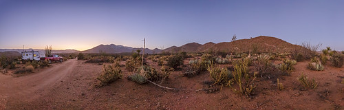
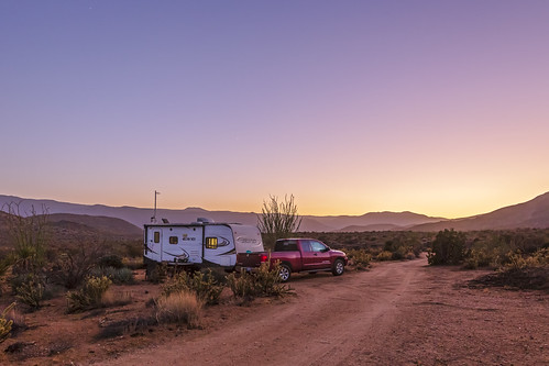
Deserted In the Desert - New Favorite Campsite In Anza-Borrego. Panorama. by slworking2, Panorama of my camper and truck at my new favorite Anza-Borrego Desert campsite during twilight. Whi
Deserted In the Desert - New Favorite Campsite In Anza-Borrego. Panorama. by slworking2
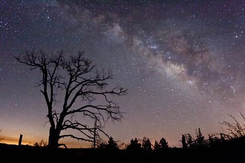
Vía Láctea by slworking2, Milky Way and a dead tree at Filaree Meadow in Mount Laguna, Californiacalifornia julian unitedstate
Vía Láctea by slworking2
Deserted In the Desert - New Favorite Campsite In Anza-Borrego by slworking2, Panorama of my camper and truck at my new favorite Anza-Borrego Desert campsite during twilight. Whi
Deserted In the Desert - New Favorite Campsite In Anza-Borrego by slworking2
The Milky Way and burnt trees by slworking2, Cuyamaca Rancho State Park.california sky night clouds julian unitedstates sandiego astronomy milkyw
The Milky Way and burnt trees by slworking2
Banner Grade Sunrise by Alan Greenberg Photography, julian california unitedstates desert flowers cactus borrego wildflowers flower spring ocotillo anza
Banner Grade Sunrise by Alan Greenberg Photography
Feeding in the Sunset by Bartfett, Taken @ Julian, CAcalifornia ca trees sunset sky horses horse sun mountains west tree beautiful gras
Feeding in the Sunset by Bartfett
The Old Shack Behind the Trees by Bartfett, Taken at Julian, Californiacalifornia ca old autumn trees sunset house colors beautiful grass contra
The Old Shack Behind the Trees by Bartfett
Inspiration Point Scenic Overlook by Alan Greenberg Photography, 
julian california unitedstates mountains valley fog clouds panorama pano sunrise
Inspiration Point Scenic Overlook by Alan Greenberg Photography
☀️ Sunset Over the Mountains 🌄 by slworking2, Tonight's sunset as seen from Mount Laguna. The mountains in the background here are Cuyamaca Peak,
☀️ Sunset Over the Mountains 🌄 by slworking2
The Milky Way at Cuyamaca Rancho State Park by slworking2, Paso Picacho Campgroundcalifornia julian unitedstates sandiego astrophotography astronomy cuyamaca m
The Milky Way at Cuyamaca Rancho State Park by slworking2
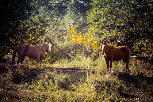
A Moment in the Forest by Bartfett, Taken in Julian, Californiacalifornia ca autumn trees light sunset two horses horse sun tree green f
A Moment in the Forest by Bartfett
The Milky Way and fire-damaged trees. Paso Picacho Campground at Cuyamaca Rancho State Park by slworking2, california way geotagged via galaxy milky milkyway lactea vialactea cuyamacaranchostatepark geo:lat=
The Milky Way and fire-damaged trees. Paso Picacho Campground at Cuyamaca Rancho State Park by slworking2
Camping in Blair Valley in Anza-Borrego Desert State Park by slworking2, My RV, truck, and campfire. Dry lake bed in the background.california camping sky night stars us jul
Camping in Blair Valley in Anza-Borrego Desert State Park by slworking2
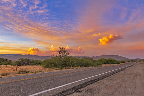
On A Colorful Desert Highway... by slworking2, Anza-Borrego Desert sunset over Highway 78 near the Banner Grade on the evening of June 15, 2018. Th
On A Colorful Desert Highway... by slworking2
A fellow photographer's camera in my frame here. I'm still getting used to the insanely-wide angle that my Sigma 15mm has now that I've recently started using a full frame camera body. by slworking2, The Milky Way at Cuyamaca Rancho State Park.california julian unitedstates
A fellow photographer's camera in my frame here. I'm still getting used to the insanely-wide angle that my Sigma 15mm has now that I've recently started using a full frame camera body. by slworking2
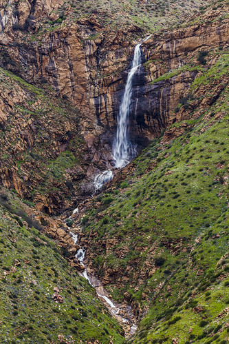
Mildred Falls: San Diego County's Tallest Waterfall by slworking2, These falls are about 300 feet tall and generally only flow this well when there has been unusually
Mildred Falls: San Diego County's Tallest Waterfall by slworking2
Mildred Falls: San Diego County's Tallest Waterfall by slworking2, These falls are about 300 feet tall and generally only flow this well when there has been unusually
Mildred Falls: San Diego County's Tallest Waterfall by slworking2
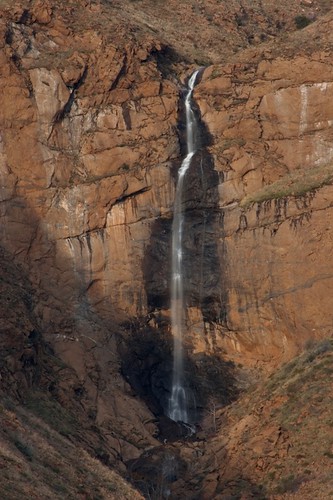
Magic Hour at Mildred Falls by goldenstatephoto, Mildred Falls was not as full as I would have thought after having received 10.13 inches rain in the
Magic Hour at Mildred Falls by goldenstatephoto
Up the Steps, Into the Light by Bartfett, Taken @ Julian CA, Pioneer Cemetery california ca trees light sunset sun green cemetery canon julian
Up the Steps, Into the Light by Bartfett
Running in the Twilight by Bartfett, Taken in Julian, Californiasunset horse green forest twilight julian farm running
Running in the Twilight by Bartfett
Mildred Falls: San Diego County's Tallest Waterfall by slworking2, These falls are about 300 feet tall and generally only flow this well when there has been unusually
Mildred Falls: San Diego County's Tallest Waterfall by slworking2
Scenic Way Down by charles25001, Near Laguna Mountain, off of the Sunset Highway. The hang Gliders make there way down to landing zon
Scenic Way Down by charles25001
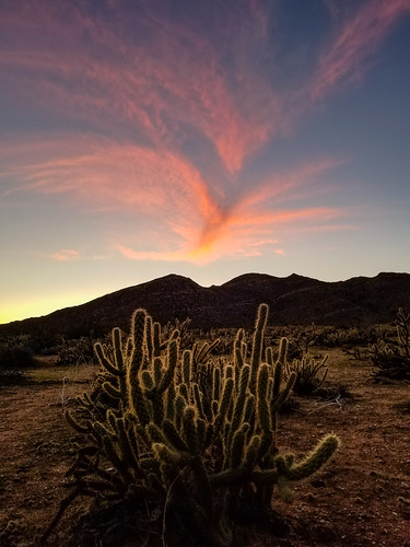
Cholla and Interesting Clouds at Sunset by slworking2, Cholla cactus at sunset in Anza-Borrego Desert State Park.
Cholla and Interesting Clouds at Sunset by slworking2
Sunrise Highway northern entrance in snow by slworking2, ❄ Let it Snow ❄

Winter storms in the mountains of San Diego County. Julian / Mount Laguna area.juli
Sunrise Highway northern entrance in snow by slworking2
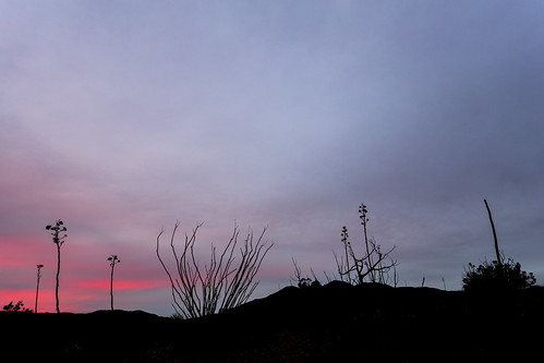
Overcast Desert Sunset With a Hint Of Color by slworking2, I shot this back on December 14, 2018 while camping near Blair Valley in Anza-Borrego Desert State P
Overcast Desert Sunset With a Hint Of Color by slworking2
Rainbow Over Anza-Borrego Desert State Park by slworking2, I saw this on my way back from a weekend trip to the desert. This was shot looking east between the
Rainbow Over Anza-Borrego Desert State Park by slworking2
Kwaaymi Point by Alan Greenberg Photography, sunrise cloud mountains desert flora sky clouds sunset sun blue storm landscape sea nature mountain
Kwaaymi Point by Alan Greenberg Photography
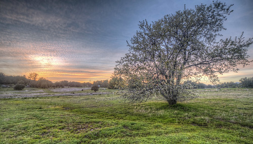
Field of Sunset by Michael F. Nyiri, The sunset in Wynola Junction, across the street from my motel, framed by a flowering apple tree, on
Field of Sunset by Michael F. Nyiri
Sunrise Highway northern entrance in snow by slworking2, ❄ Let it Snow ❄

Winter storms in the mountains of San Diego County. Julian / Mount Laguna area.juli
Sunrise Highway northern entrance in snow by slworking2
2021 New Year Sunrise by 27nm,
2021 New Year Sunrise by 27nm
Rainbow Over the Anza-Borrego Desert by slworking2, I saw this on my way back from a weekend trip to the desert. This was shot looking east between the
Rainbow Over the Anza-Borrego Desert by slworking2
Sunrise Highway northern entrance in snow by slworking2, ❄ Let it Snow ❄

Winter storms in the mountains of San Diego County. Julian / Mount Laguna area.juli
Sunrise Highway northern entrance in snow by slworking2
Tom (our Borador) on Indian Creek Road - Mt.Laguna (Calif) 12-25-13 by Bob_ Perry, TOM IS A BORADOR (PART LAB AND PART BORDER COLLIE).  IT'S A DESIGNER BREED.  GOOGLE IT AND A BUNCH O
Tom (our Borador) on Indian Creek Road - Mt.Laguna (Calif) 12-25-13 by Bob_ Perry
Waiting for Sunset near Granite Springs Camp, Cuyamaca Rancho State Park (Day 2) by andrew c mace, california statepark sandiego anzaborrego cuyamacarancho
Waiting for Sunset near Granite Springs Camp, Cuyamaca Rancho State Park (Day 2) by andrew c mace
Looking south to Cleveland National Forest near Granite Springs, Cuyamaca Rancho (Day 2) by andrew c mace, california sunset nature landscape sandiego vista clevelandnationalforest granitesprings cuyamacaran
Looking south to Cleveland National Forest near Granite Springs, Cuyamaca Rancho (Day 2) by andrew c mace
Anza-Borrego Desert Mountains by zeesstof, A 5-image panoramacalifornia mountainstodesert pacificcresttrail roadtrip s1 sandiegotosaltoncity so
Anza-Borrego Desert Mountains by zeesstof
Desert sunset. Blair Valley area of Anza-Borrego Desert State Park. #blairvalley #anzaborrego #desert #sunset by slworking2, moblog samsunggalaxysiii
Desert sunset. Blair Valley area of Anza-Borrego Desert State Park. #blairvalley #anzaborrego #desert #sunset by slworking2
Sunset near Granite Springs camp, Cuyamaca Rancho (Day 2) by andrew c mace, The clouds to the west should have warned us that there would be rain later.california sunset mounta
Sunset near Granite Springs camp, Cuyamaca Rancho (Day 2) by andrew c mace
Tom on Indian Creak Road - Mt. Laguna (Calif) - 12-25-13 b by Bob_ Perry, This is what I call the Indian Creek Road.  Here I'm looking  east towards the junction with the Pin
Tom on Indian Creak Road - Mt. Laguna (Calif) - 12-25-13 b by Bob_ Perry
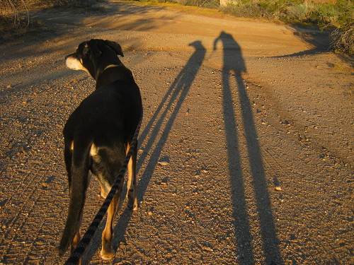
Two long shadows on a morning walk at 7 a.m. on Plantation Road - Anza Borrego Desert State Park - Oct 3, 2013 - This was Rudy's last trip with us. by Bob_ Perry, In the state park dogs are limited to roads.  They cannot go on trails.  In Anza-Borrego it's just a
Two long shadows on a morning walk at 7 a.m. on Plantation Road - Anza Borrego Desert State Park - Oct 3, 2013 - This was Rudy's last trip with us. by Bob_ Perry
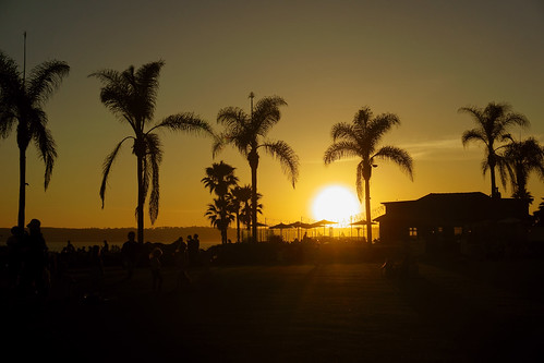
I do like to be beside the ocean side <3 by Katarzyna Aleksandra, sunset california palms ocean pacific people
I do like to be beside the ocean side <3 by Katarzyna Aleksandra
MY 3 MILE LOOP HIKE TO CHAMPAGNE PASS - 10-23-2012 =  GREEN line is passable dirt track that I drove in my ultra low clearance 2 wheel drive Toyota Matrix = ORANGE route of hike = for larger image LEF by Bob_ Perry, I drove 1.1 miles south from Sunrise Highway on a passable dirt road with my two-wheel drive, low cl
MY 3 MILE LOOP HIKE TO CHAMPAGNE PASS - 10-23-2012 = GREEN line is passable dirt track that I drove in my ultra low clearance 2 wheel drive Toyota Matrix = ORANGE route of hike = for larger image LEF by Bob_ Perry
Main and B in Julian, Calif. 7-14-10  - Main Street is also California Highway 78 and 79 by Bob_ Perry, An old mining town now a tourist destination.  There is a real gold mine you can tour on the north e
Main and B in Julian, Calif. 7-14-10 - Main Street is also California Highway 78 and 79 by Bob_ Perry
Pacific Crest Trail in foreground and distance as seen from Pioneer Mail PIcnic Area  8-21-2013 by Bob_ Perry,  A SHORT STRETCH OF SUNRISE HIGHWAY (COUNTY S-1) CAN BE SEEN AT TOP RIGHT.                       pac
Pacific Crest Trail in foreground and distance as seen from Pioneer Mail PIcnic Area 8-21-2013 by Bob_ Perry
Pine Mountain Trail starts beside Sunrise Highway across from Pionner Mail Trailhead (Mt. Laguna) (San Diego S-1) 12-25-13 by Bob_ Perry, THE PINE MOUNTAIN ROAD ENDS AT A JUNCTION WITH THE INDIAN CREEK TRAIL.  AT THAT JUNCTION A LEFT TURN
Pine Mountain Trail starts beside Sunrise Highway across from Pionner Mail Trailhead (Mt. Laguna) (San Diego S-1) 12-25-13 by Bob_ Perry