85 The Way West Rd, Cody, WY アメリカ合衆国日の出日の入り時間
Location: アメリカ合衆国 > ワイオミング州 > パーク > アメリカ合衆国 〒 ワイオミング州 コーディ >
時間帯:
America/Denver
現地時間:
2024-05-13 16:05:07
経度:
-109.451149
緯度:
44.763629
今日の日の出時刻:
05:49:15 AM
今日の日の入時刻:
08:39:05 PM
今日の日長:
14h 49m 50s
明日の日の出時刻:
05:48:09 AM
明日の日の入時刻:
08:40:12 PM
明日の日長:
14h 52m 3s
すべて表示する
| 日付 | 日出 | 日没 | 日長 |
|---|---|---|---|
| 2024年01月01日 | 07:55:07 AM | 04:48:11 PM | 8h 53m 4s |
| 2024年01月02日 | 07:55:06 AM | 04:49:07 PM | 8h 54m 1s |
| 2024年01月03日 | 07:55:03 AM | 04:50:04 PM | 8h 55m 1s |
| 2024年01月04日 | 07:54:58 AM | 04:51:04 PM | 8h 56m 6s |
| 2024年01月05日 | 07:54:50 AM | 04:52:05 PM | 8h 57m 15s |
| 2024年01月06日 | 07:54:39 AM | 04:53:08 PM | 8h 58m 29s |
| 2024年01月07日 | 07:54:26 AM | 04:54:13 PM | 8h 59m 47s |
| 2024年01月08日 | 07:54:10 AM | 04:55:19 PM | 9h 1m 9s |
| 2024年01月09日 | 07:53:52 AM | 04:56:27 PM | 9h 2m 35s |
| 2024年01月10日 | 07:53:31 AM | 04:57:36 PM | 9h 4m 5s |
| 2024年01月11日 | 07:53:08 AM | 04:58:46 PM | 9h 5m 38s |
| 2024年01月12日 | 07:52:42 AM | 04:59:58 PM | 9h 7m 16s |
| 2024年01月13日 | 07:52:14 AM | 05:01:10 PM | 9h 8m 56s |
| 2024年01月14日 | 07:51:43 AM | 05:02:24 PM | 9h 10m 41s |
| 2024年01月15日 | 07:51:10 AM | 05:03:40 PM | 9h 12m 30s |
| 2024年01月16日 | 07:50:34 AM | 05:04:56 PM | 9h 14m 22s |
| 2024年01月17日 | 07:49:56 AM | 05:06:13 PM | 9h 16m 17s |
| 2024年01月18日 | 07:49:16 AM | 05:07:31 PM | 9h 18m 15s |
| 2024年01月19日 | 07:48:33 AM | 05:08:50 PM | 9h 20m 17s |
| 2024年01月20日 | 07:47:48 AM | 05:10:09 PM | 9h 22m 21s |
| 2024年01月21日 | 07:47:01 AM | 05:11:30 PM | 9h 24m 29s |
| 2024年01月22日 | 07:46:12 AM | 05:12:51 PM | 9h 26m 39s |
| 2024年01月23日 | 07:45:20 AM | 05:14:12 PM | 9h 28m 52s |
| 2024年01月24日 | 07:44:26 AM | 05:15:35 PM | 9h 31m 9s |
| 2024年01月25日 | 07:43:31 AM | 05:16:57 PM | 9h 33m 26s |
| 2024年01月26日 | 07:42:33 AM | 05:18:20 PM | 9h 35m 47s |
| 2024年01月27日 | 07:41:33 AM | 05:19:44 PM | 9h 38m 11s |
| 2024年01月28日 | 07:40:31 AM | 05:21:08 PM | 9h 40m 37s |
| 2024年01月29日 | 07:39:27 AM | 05:22:32 PM | 9h 43m 5s |
| 2024年01月30日 | 07:38:22 AM | 05:23:57 PM | 9h 45m 35s |
| 2024年01月31日 | 07:37:14 AM | 05:25:22 PM | 9h 48m 8s |
| 2024年02月01日 | 07:36:05 AM | 05:26:47 PM | 9h 50m 42s |
| 2024年02月02日 | 07:34:54 AM | 05:28:12 PM | 9h 53m 18s |
| 2024年02月03日 | 07:33:41 AM | 05:29:37 PM | 9h 55m 56s |
| 2024年02月04日 | 07:32:26 AM | 05:31:02 PM | 9h 58m 36s |
| 2024年02月05日 | 07:31:10 AM | 05:32:28 PM | 10h 1m 18s |
| 2024年02月06日 | 07:29:52 AM | 05:33:53 PM | 10h 4m 1s |
| 2024年02月07日 | 07:28:33 AM | 05:35:18 PM | 10h 6m 45s |
| 2024年02月08日 | 07:27:12 AM | 05:36:44 PM | 10h 9m 32s |
| 2024年02月09日 | 07:25:49 AM | 05:38:09 PM | 10h 12m 20s |
| 2024年02月10日 | 07:24:25 AM | 05:39:34 PM | 10h 15m 9s |
| 2024年02月11日 | 07:23:00 AM | 05:40:59 PM | 10h 17m 59s |
| 2024年02月12日 | 07:21:33 AM | 05:42:24 PM | 10h 20m 51s |
| 2024年02月13日 | 07:20:05 AM | 05:43:49 PM | 10h 23m 44s |
| 2024年02月14日 | 07:18:36 AM | 05:45:13 PM | 10h 26m 37s |
| 2024年02月15日 | 07:17:05 AM | 05:46:37 PM | 10h 29m 32s |
| 2024年02月16日 | 07:15:34 AM | 05:48:02 PM | 10h 32m 28s |
| 2024年02月17日 | 07:14:01 AM | 05:49:26 PM | 10h 35m 25s |
| 2024年02月18日 | 07:12:27 AM | 05:50:49 PM | 10h 38m 22s |
| 2024年02月19日 | 07:10:51 AM | 05:52:13 PM | 10h 41m 22s |
| 2024年02月20日 | 07:09:15 AM | 05:53:36 PM | 10h 44m 21s |
| 2024年02月21日 | 07:07:38 AM | 05:54:59 PM | 10h 47m 21s |
| 2024年02月22日 | 07:05:59 AM | 05:56:21 PM | 10h 50m 22s |
| 2024年02月23日 | 07:04:20 AM | 05:57:44 PM | 10h 53m 24s |
| 2024年02月24日 | 07:02:40 AM | 05:59:06 PM | 10h 56m 26s |
| 2024年02月25日 | 07:00:59 AM | 06:00:28 PM | 10h 59m 29s |
| 2024年02月26日 | 06:59:17 AM | 06:01:49 PM | 11h 2m 32s |
| 2024年02月27日 | 06:57:34 AM | 06:03:10 PM | 11h 5m 36s |
| 2024年02月28日 | 06:55:51 AM | 06:04:31 PM | 11h 8m 40s |
| 2024年02月29日 | 06:54:07 AM | 06:05:52 PM | 11h 11m 45s |
| 2024年03月01日 | 06:52:22 AM | 06:07:12 PM | 11h 14m 50s |
| 2024年03月02日 | 06:50:36 AM | 06:08:33 PM | 11h 17m 57s |
| 2024年03月03日 | 06:48:50 AM | 06:09:52 PM | 11h 21m 2s |
| 2024年03月04日 | 06:47:03 AM | 06:11:12 PM | 11h 24m 9s |
| 2024年03月05日 | 06:45:16 AM | 06:12:31 PM | 11h 27m 15s |
| 2024年03月06日 | 06:43:28 AM | 06:13:50 PM | 11h 30m 22s |
| 2024年03月07日 | 06:41:40 AM | 06:15:09 PM | 11h 33m 29s |
| 2024年03月08日 | 06:39:51 AM | 06:16:28 PM | 11h 36m 37s |
| 2024年03月09日 | 06:38:02 AM | 06:17:46 PM | 11h 39m 44s |
| 2024年03月10日 | 07:36:17 AM | 07:19:01 PM | 11h 42m 44s |
| 2024年03月11日 | 07:34:27 AM | 07:20:18 PM | 11h 45m 51s |
| 2024年03月12日 | 07:32:36 AM | 07:21:36 PM | 11h 49m 0s |
| 2024年03月13日 | 07:30:46 AM | 07:22:53 PM | 11h 52m 7s |
| 2024年03月14日 | 07:28:55 AM | 07:24:11 PM | 11h 55m 16s |
| 2024年03月15日 | 07:27:04 AM | 07:25:28 PM | 11h 58m 24s |
| 2024年03月16日 | 07:25:12 AM | 07:26:45 PM | 12h 1m 33s |
| 2024年03月17日 | 07:23:21 AM | 07:28:01 PM | 12h 4m 40s |
| 2024年03月18日 | 07:21:29 AM | 07:29:18 PM | 12h 7m 49s |
| 2024年03月19日 | 07:19:37 AM | 07:30:34 PM | 12h 10m 57s |
| 2024年03月20日 | 07:17:45 AM | 07:31:50 PM | 12h 14m 5s |
| 2024年03月21日 | 07:15:53 AM | 07:33:06 PM | 12h 17m 13s |
| 2024年03月22日 | 07:14:01 AM | 07:34:22 PM | 12h 20m 21s |
| 2024年03月23日 | 07:12:10 AM | 07:35:38 PM | 12h 23m 28s |
| 2024年03月24日 | 07:10:18 AM | 07:36:54 PM | 12h 26m 36s |
| 2024年03月25日 | 07:08:26 AM | 07:38:09 PM | 12h 29m 43s |
| 2024年03月26日 | 07:06:34 AM | 07:39:25 PM | 12h 32m 51s |
| 2024年03月27日 | 07:04:42 AM | 07:40:40 PM | 12h 35m 58s |
| 2024年03月28日 | 07:02:51 AM | 07:41:56 PM | 12h 39m 5s |
| 2024年03月29日 | 07:01:00 AM | 07:43:11 PM | 12h 42m 11s |
| 2024年03月30日 | 06:59:09 AM | 07:44:26 PM | 12h 45m 17s |
| 2024年03月31日 | 06:57:18 AM | 07:45:41 PM | 12h 48m 23s |
| 2024年04月01日 | 06:55:27 AM | 07:46:57 PM | 12h 51m 30s |
| 2024年04月02日 | 06:53:37 AM | 07:48:12 PM | 12h 54m 35s |
| 2024年04月03日 | 06:51:47 AM | 07:49:27 PM | 12h 57m 40s |
| 2024年04月04日 | 06:49:58 AM | 07:50:42 PM | 13h 0m 44s |
| 2024年04月05日 | 06:48:09 AM | 07:51:57 PM | 13h 3m 48s |
| 2024年04月06日 | 06:46:20 AM | 07:53:12 PM | 13h 6m 52s |
| 2024年04月07日 | 06:44:32 AM | 07:54:27 PM | 13h 9m 55s |
| 2024年04月08日 | 06:42:45 AM | 07:55:42 PM | 13h 12m 57s |
| 2024年04月09日 | 06:40:58 AM | 07:56:57 PM | 13h 15m 59s |
| 2024年04月10日 | 06:39:11 AM | 07:58:12 PM | 13h 19m 1s |
| 2024年04月11日 | 06:37:25 AM | 07:59:27 PM | 13h 22m 2s |
| 2024年04月12日 | 06:35:40 AM | 08:00:42 PM | 13h 25m 2s |
| 2024年04月13日 | 06:33:56 AM | 08:01:57 PM | 13h 28m 1s |
| 2024年04月14日 | 06:32:12 AM | 08:03:12 PM | 13h 31m 0s |
| 2024年04月15日 | 06:30:29 AM | 08:04:27 PM | 13h 33m 58s |
| 2024年04月16日 | 06:28:46 AM | 08:05:42 PM | 13h 36m 56s |
| 2024年04月17日 | 06:27:05 AM | 08:06:57 PM | 13h 39m 52s |
| 2024年04月18日 | 06:25:24 AM | 08:08:12 PM | 13h 42m 48s |
| 2024年04月19日 | 06:23:44 AM | 08:09:27 PM | 13h 45m 43s |
| 2024年04月20日 | 06:22:05 AM | 08:10:42 PM | 13h 48m 37s |
| 2024年04月21日 | 06:20:28 AM | 08:11:57 PM | 13h 51m 29s |
| 2024年04月22日 | 06:18:51 AM | 08:13:12 PM | 13h 54m 21s |
| 2024年04月23日 | 06:17:15 AM | 08:14:27 PM | 13h 57m 12s |
| 2024年04月24日 | 06:15:40 AM | 08:15:41 PM | 14h 0m 1s |
| 2024年04月25日 | 06:14:06 AM | 08:16:56 PM | 14h 2m 50s |
| 2024年04月26日 | 06:12:33 AM | 08:18:10 PM | 14h 5m 37s |
| 2024年04月27日 | 06:11:02 AM | 08:19:24 PM | 14h 8m 22s |
| 2024年04月28日 | 06:09:31 AM | 08:20:39 PM | 14h 11m 8s |
| 2024年04月29日 | 06:08:02 AM | 08:21:53 PM | 14h 13m 51s |
| 2024年04月30日 | 06:06:34 AM | 08:23:06 PM | 14h 16m 32s |
| 2024年05月01日 | 06:05:07 AM | 08:24:20 PM | 14h 19m 13s |
| 2024年05月02日 | 06:03:42 AM | 08:25:33 PM | 14h 21m 51s |
| 2024年05月03日 | 06:02:18 AM | 08:26:46 PM | 14h 24m 28s |
| 2024年05月04日 | 06:00:56 AM | 08:27:59 PM | 14h 27m 3s |
| 2024年05月05日 | 05:59:35 AM | 08:29:12 PM | 14h 29m 37s |
| 2024年05月06日 | 05:58:15 AM | 08:30:24 PM | 14h 32m 9s |
| 2024年05月07日 | 05:56:57 AM | 08:31:35 PM | 14h 34m 38s |
| 2024年05月08日 | 05:55:41 AM | 08:32:47 PM | 14h 37m 6s |
| 2024年05月09日 | 05:54:26 AM | 08:33:58 PM | 14h 39m 32s |
| 2024年05月10日 | 05:53:12 AM | 08:35:08 PM | 14h 41m 56s |
| 2024年05月11日 | 05:52:01 AM | 08:36:18 PM | 14h 44m 17s |
| 2024年05月12日 | 05:50:51 AM | 08:37:27 PM | 14h 46m 36s |
| 2024年05月13日 | 05:49:43 AM | 08:38:36 PM | 14h 48m 53s |
| 2024年05月14日 | 05:48:36 AM | 08:39:44 PM | 14h 51m 8s |
| 2024年05月15日 | 05:47:31 AM | 08:40:52 PM | 14h 53m 21s |
| 2024年05月16日 | 05:46:29 AM | 08:41:58 PM | 14h 55m 29s |
| 2024年05月17日 | 05:45:28 AM | 08:43:04 PM | 14h 57m 36s |
| 2024年05月18日 | 05:44:28 AM | 08:44:10 PM | 14h 59m 42s |
| 2024年05月19日 | 05:43:31 AM | 08:45:14 PM | 15h 1m 43s |
| 2024年05月20日 | 05:42:36 AM | 08:46:18 PM | 15h 3m 42s |
| 2024年05月21日 | 05:41:43 AM | 08:47:20 PM | 15h 5m 37s |
| 2024年05月22日 | 05:40:52 AM | 08:48:22 PM | 15h 7m 30s |
| 2024年05月23日 | 05:40:03 AM | 08:49:22 PM | 15h 9m 19s |
| 2024年05月24日 | 05:39:15 AM | 08:50:22 PM | 15h 11m 7s |
| 2024年05月25日 | 05:38:30 AM | 08:51:20 PM | 15h 12m 50s |
| 2024年05月26日 | 05:37:48 AM | 08:52:17 PM | 15h 14m 29s |
| 2024年05月27日 | 05:37:07 AM | 08:53:13 PM | 15h 16m 6s |
| 2024年05月28日 | 05:36:28 AM | 08:54:08 PM | 15h 17m 40s |
| 2024年05月29日 | 05:35:52 AM | 08:55:01 PM | 15h 19m 9s |
| 2024年05月30日 | 05:35:18 AM | 08:55:53 PM | 15h 20m 35s |
| 2024年05月31日 | 05:34:46 AM | 08:56:43 PM | 15h 21m 57s |
| 2024年06月01日 | 05:34:16 AM | 08:57:32 PM | 15h 23m 16s |
| 2024年06月02日 | 05:33:49 AM | 08:58:20 PM | 15h 24m 31s |
| 2024年06月03日 | 05:33:24 AM | 08:59:06 PM | 15h 25m 42s |
| 2024年06月04日 | 05:33:01 AM | 08:59:50 PM | 15h 26m 49s |
| 2024年06月05日 | 05:32:40 AM | 09:00:33 PM | 15h 27m 53s |
| 2024年06月06日 | 05:32:22 AM | 09:01:13 PM | 15h 28m 51s |
| 2024年06月07日 | 05:32:06 AM | 09:01:53 PM | 15h 29m 47s |
| 2024年06月08日 | 05:31:52 AM | 09:02:30 PM | 15h 30m 38s |
| 2024年06月09日 | 05:31:41 AM | 09:03:05 PM | 15h 31m 24s |
| 2024年06月10日 | 05:31:32 AM | 09:03:39 PM | 15h 32m 7s |
| 2024年06月11日 | 05:31:25 AM | 09:04:10 PM | 15h 32m 45s |
| 2024年06月12日 | 05:31:21 AM | 09:04:40 PM | 15h 33m 19s |
| 2024年06月13日 | 05:31:19 AM | 09:05:08 PM | 15h 33m 49s |
| 2024年06月14日 | 05:31:19 AM | 09:05:33 PM | 15h 34m 14s |
| 2024年06月15日 | 05:31:21 AM | 09:05:57 PM | 15h 34m 36s |
| 2024年06月16日 | 05:31:26 AM | 09:06:18 PM | 15h 34m 52s |
| 2024年06月17日 | 05:31:33 AM | 09:06:37 PM | 15h 35m 4s |
| 2024年06月18日 | 05:31:42 AM | 09:06:54 PM | 15h 35m 12s |
| 2024年06月19日 | 05:31:53 AM | 09:07:09 PM | 15h 35m 16s |
| 2024年06月20日 | 05:32:07 AM | 09:07:22 PM | 15h 35m 15s |
| 2024年06月21日 | 05:32:22 AM | 09:07:32 PM | 15h 35m 10s |
| 2024年06月22日 | 05:32:40 AM | 09:07:40 PM | 15h 35m 0s |
| 2024年06月23日 | 05:33:00 AM | 09:07:46 PM | 15h 34m 46s |
| 2024年06月24日 | 05:33:22 AM | 09:07:50 PM | 15h 34m 28s |
| 2024年06月25日 | 05:33:46 AM | 09:07:51 PM | 15h 34m 5s |
| 2024年06月26日 | 05:34:12 AM | 09:07:50 PM | 15h 33m 38s |
| 2024年06月27日 | 05:34:40 AM | 09:07:46 PM | 15h 33m 6s |
| 2024年06月28日 | 05:35:09 AM | 09:07:41 PM | 15h 32m 32s |
| 2024年06月29日 | 05:35:41 AM | 09:07:32 PM | 15h 31m 51s |
| 2024年06月30日 | 05:36:15 AM | 09:07:22 PM | 15h 31m 7s |
| 2024年07月01日 | 05:36:50 AM | 09:07:09 PM | 15h 30m 19s |
| 2024年07月02日 | 05:37:27 AM | 09:06:54 PM | 15h 29m 27s |
| 2024年07月03日 | 05:38:06 AM | 09:06:36 PM | 15h 28m 30s |
| 2024年07月04日 | 05:38:47 AM | 09:06:16 PM | 15h 27m 29s |
| 2024年07月05日 | 05:39:29 AM | 09:05:54 PM | 15h 26m 25s |
| 2024年07月06日 | 05:40:12 AM | 09:05:29 PM | 15h 25m 17s |
| 2024年07月07日 | 05:40:58 AM | 09:05:03 PM | 15h 24m 5s |
| 2024年07月08日 | 05:41:44 AM | 09:04:33 PM | 15h 22m 49s |
| 2024年07月09日 | 05:42:32 AM | 09:04:02 PM | 15h 21m 30s |
| 2024年07月10日 | 05:43:22 AM | 09:03:28 PM | 15h 20m 6s |
| 2024年07月11日 | 05:44:13 AM | 09:02:52 PM | 15h 18m 39s |
| 2024年07月12日 | 05:45:05 AM | 09:02:14 PM | 15h 17m 9s |
| 2024年07月13日 | 05:45:58 AM | 09:01:34 PM | 15h 15m 36s |
| 2024年07月14日 | 05:46:53 AM | 09:00:51 PM | 15h 13m 58s |
| 2024年07月15日 | 05:47:48 AM | 09:00:06 PM | 15h 12m 18s |
| 2024年07月16日 | 05:48:45 AM | 08:59:19 PM | 15h 10m 34s |
| 2024年07月17日 | 05:49:43 AM | 08:58:30 PM | 15h 8m 47s |
| 2024年07月18日 | 05:50:41 AM | 08:57:39 PM | 15h 6m 58s |
| 2024年07月19日 | 05:51:41 AM | 08:56:46 PM | 15h 5m 5s |
| 2024年07月20日 | 05:52:42 AM | 08:55:51 PM | 15h 3m 9s |
| 2024年07月21日 | 05:53:43 AM | 08:54:54 PM | 15h 1m 11s |
| 2024年07月22日 | 05:54:45 AM | 08:53:55 PM | 14h 59m 10s |
| 2024年07月23日 | 05:55:48 AM | 08:52:54 PM | 14h 57m 6s |
| 2024年07月24日 | 05:56:52 AM | 08:51:51 PM | 14h 54m 59s |
| 2024年07月25日 | 05:57:56 AM | 08:50:46 PM | 14h 52m 50s |
| 2024年07月26日 | 05:59:01 AM | 08:49:40 PM | 14h 50m 39s |
| 2024年07月27日 | 06:00:07 AM | 08:48:31 PM | 14h 48m 24s |
| 2024年07月28日 | 06:01:13 AM | 08:47:21 PM | 14h 46m 8s |
| 2024年07月29日 | 06:02:19 AM | 08:46:09 PM | 14h 43m 50s |
| 2024年07月30日 | 06:03:26 AM | 08:44:56 PM | 14h 41m 30s |
| 2024年07月31日 | 06:04:34 AM | 08:43:40 PM | 14h 39m 6s |
| 2024年08月01日 | 06:05:42 AM | 08:42:24 PM | 14h 36m 42s |
| 2024年08月02日 | 06:06:50 AM | 08:41:05 PM | 14h 34m 15s |
| 2024年08月03日 | 06:07:59 AM | 08:39:45 PM | 14h 31m 46s |
| 2024年08月04日 | 06:09:08 AM | 08:38:24 PM | 14h 29m 16s |
| 2024年08月05日 | 06:10:17 AM | 08:37:01 PM | 14h 26m 44s |
| 2024年08月06日 | 06:11:26 AM | 08:35:37 PM | 14h 24m 11s |
| 2024年08月07日 | 06:12:36 AM | 08:34:11 PM | 14h 21m 35s |
| 2024年08月08日 | 06:13:46 AM | 08:32:44 PM | 14h 18m 58s |
| 2024年08月09日 | 06:14:56 AM | 08:31:15 PM | 14h 16m 19s |
| 2024年08月10日 | 06:16:06 AM | 08:29:46 PM | 14h 13m 40s |
| 2024年08月11日 | 06:17:16 AM | 08:28:15 PM | 14h 10m 59s |
| 2024年08月12日 | 06:18:27 AM | 08:26:42 PM | 14h 8m 15s |
| 2024年08月13日 | 06:19:37 AM | 08:25:09 PM | 14h 5m 32s |
| 2024年08月14日 | 06:20:48 AM | 08:23:34 PM | 14h 2m 46s |
| 2024年08月15日 | 06:21:58 AM | 08:21:59 PM | 14h 0m 1s |
| 2024年08月16日 | 06:23:09 AM | 08:20:22 PM | 13h 57m 13s |
| 2024年08月17日 | 06:24:20 AM | 08:18:44 PM | 13h 54m 24s |
| 2024年08月18日 | 06:25:31 AM | 08:17:06 PM | 13h 51m 35s |
| 2024年08月19日 | 06:26:41 AM | 08:15:26 PM | 13h 48m 45s |
| 2024年08月20日 | 06:27:52 AM | 08:13:45 PM | 13h 45m 53s |
| 2024年08月21日 | 06:29:03 AM | 08:12:04 PM | 13h 43m 1s |
| 2024年08月22日 | 06:30:14 AM | 08:10:21 PM | 13h 40m 7s |
| 2024年08月23日 | 06:31:24 AM | 08:08:38 PM | 13h 37m 14s |
| 2024年08月24日 | 06:32:35 AM | 08:06:54 PM | 13h 34m 19s |
| 2024年08月25日 | 06:33:46 AM | 08:05:09 PM | 13h 31m 23s |
| 2024年08月26日 | 06:34:57 AM | 08:03:23 PM | 13h 28m 26s |
| 2024年08月27日 | 06:36:07 AM | 08:01:37 PM | 13h 25m 30s |
| 2024年08月28日 | 06:37:18 AM | 07:59:50 PM | 13h 22m 32s |
| 2024年08月29日 | 06:38:29 AM | 07:58:03 PM | 13h 19m 34s |
| 2024年08月30日 | 06:39:39 AM | 07:56:14 PM | 13h 16m 35s |
| 2024年08月31日 | 06:40:50 AM | 07:54:26 PM | 13h 13m 36s |
| 2024年09月01日 | 06:42:00 AM | 07:52:36 PM | 13h 10m 36s |
| 2024年09月02日 | 06:43:11 AM | 07:50:46 PM | 13h 7m 35s |
| 2024年09月03日 | 06:44:21 AM | 07:48:56 PM | 13h 4m 35s |
| 2024年09月04日 | 06:45:32 AM | 07:47:05 PM | 13h 1m 33s |
| 2024年09月05日 | 06:46:42 AM | 07:45:14 PM | 12h 58m 32s |
| 2024年09月06日 | 06:47:53 AM | 07:43:22 PM | 12h 55m 29s |
| 2024年09月07日 | 06:49:03 AM | 07:41:31 PM | 12h 52m 28s |
| 2024年09月08日 | 06:50:14 AM | 07:39:38 PM | 12h 49m 24s |
| 2024年09月09日 | 06:51:24 AM | 07:37:46 PM | 12h 46m 22s |
| 2024年09月10日 | 06:52:35 AM | 07:35:53 PM | 12h 43m 18s |
| 2024年09月11日 | 06:53:45 AM | 07:34:00 PM | 12h 40m 15s |
| 2024年09月12日 | 06:54:56 AM | 07:32:07 PM | 12h 37m 11s |
| 2024年09月13日 | 06:56:07 AM | 07:30:13 PM | 12h 34m 6s |
| 2024年09月14日 | 06:57:17 AM | 07:28:19 PM | 12h 31m 2s |
| 2024年09月15日 | 06:58:28 AM | 07:26:26 PM | 12h 27m 58s |
| 2024年09月16日 | 06:59:39 AM | 07:24:32 PM | 12h 24m 53s |
| 2024年09月17日 | 07:00:50 AM | 07:22:38 PM | 12h 21m 48s |
| 2024年09月18日 | 07:02:01 AM | 07:20:44 PM | 12h 18m 43s |
| 2024年09月19日 | 07:03:12 AM | 07:18:50 PM | 12h 15m 38s |
| 2024年09月20日 | 07:04:24 AM | 07:16:57 PM | 12h 12m 33s |
| 2024年09月21日 | 07:05:35 AM | 07:15:03 PM | 12h 9m 28s |
| 2024年09月22日 | 07:06:47 AM | 07:13:09 PM | 12h 6m 22s |
| 2024年09月23日 | 07:07:58 AM | 07:11:16 PM | 12h 3m 18s |
| 2024年09月24日 | 07:09:10 AM | 07:09:22 PM | 12h 0m 12s |
| 2024年09月25日 | 07:10:23 AM | 07:07:29 PM | 11h 57m 6s |
| 2024年09月26日 | 07:11:35 AM | 07:05:36 PM | 11h 54m 1s |
| 2024年09月27日 | 07:12:47 AM | 07:03:43 PM | 11h 50m 56s |
| 2024年09月28日 | 07:14:00 AM | 07:01:51 PM | 11h 47m 51s |
| 2024年09月29日 | 07:15:13 AM | 06:59:59 PM | 11h 44m 46s |
| 2024年09月30日 | 07:16:26 AM | 06:58:07 PM | 11h 41m 41s |
| 2024年10月01日 | 07:17:39 AM | 06:56:15 PM | 11h 38m 36s |
| 2024年10月02日 | 07:18:53 AM | 06:54:24 PM | 11h 35m 31s |
| 2024年10月03日 | 07:20:07 AM | 06:52:34 PM | 11h 32m 27s |
| 2024年10月04日 | 07:21:21 AM | 06:50:44 PM | 11h 29m 23s |
| 2024年10月05日 | 07:22:36 AM | 06:48:54 PM | 11h 26m 18s |
| 2024年10月06日 | 07:23:50 AM | 06:47:05 PM | 11h 23m 15s |
| 2024年10月07日 | 07:25:05 AM | 06:45:17 PM | 11h 20m 12s |
| 2024年10月08日 | 07:26:20 AM | 06:43:29 PM | 11h 17m 9s |
| 2024年10月09日 | 07:27:36 AM | 06:41:41 PM | 11h 14m 5s |
| 2024年10月10日 | 07:28:52 AM | 06:39:55 PM | 11h 11m 3s |
| 2024年10月11日 | 07:30:08 AM | 06:38:09 PM | 11h 8m 1s |
| 2024年10月12日 | 07:31:25 AM | 06:36:24 PM | 11h 4m 59s |
| 2024年10月13日 | 07:32:41 AM | 06:34:39 PM | 11h 1m 58s |
| 2024年10月14日 | 07:33:58 AM | 06:32:55 PM | 10h 58m 57s |
| 2024年10月15日 | 07:35:16 AM | 06:31:13 PM | 10h 55m 57s |
| 2024年10月16日 | 07:36:33 AM | 06:29:31 PM | 10h 52m 58s |
| 2024年10月17日 | 07:37:51 AM | 06:27:50 PM | 10h 49m 59s |
| 2024年10月18日 | 07:39:10 AM | 06:26:10 PM | 10h 47m 0s |
| 2024年10月19日 | 07:40:28 AM | 06:24:31 PM | 10h 44m 3s |
| 2024年10月20日 | 07:41:47 AM | 06:22:53 PM | 10h 41m 6s |
| 2024年10月21日 | 07:43:07 AM | 06:21:16 PM | 10h 38m 9s |
| 2024年10月22日 | 07:44:26 AM | 06:19:40 PM | 10h 35m 14s |
| 2024年10月23日 | 07:45:46 AM | 06:18:05 PM | 10h 32m 19s |
| 2024年10月24日 | 07:47:06 AM | 06:16:31 PM | 10h 29m 25s |
| 2024年10月25日 | 07:48:26 AM | 06:14:59 PM | 10h 26m 33s |
| 2024年10月26日 | 07:49:47 AM | 06:13:28 PM | 10h 23m 41s |
| 2024年10月27日 | 07:51:07 AM | 06:11:58 PM | 10h 20m 51s |
| 2024年10月28日 | 07:52:28 AM | 06:10:29 PM | 10h 18m 1s |
| 2024年10月29日 | 07:53:49 AM | 06:09:02 PM | 10h 15m 13s |
| 2024年10月30日 | 07:55:11 AM | 06:07:36 PM | 10h 12m 25s |
| 2024年10月31日 | 07:56:32 AM | 06:06:12 PM | 10h 9m 40s |
| 2024年11月01日 | 07:57:54 AM | 06:04:49 PM | 10h 6m 55s |
| 2024年11月02日 | 07:59:15 AM | 06:03:28 PM | 10h 4m 13s |
| 2024年11月03日 | 07:00:40 AM | 05:02:05 PM | 10h 1m 25s |
| 2024年11月04日 | 07:02:02 AM | 05:00:47 PM | 9h 58m 45s |
| 2024年11月05日 | 07:03:24 AM | 04:59:30 PM | 9h 56m 6s |
| 2024年11月06日 | 07:04:46 AM | 04:58:15 PM | 9h 53m 29s |
| 2024年11月07日 | 07:06:07 AM | 04:57:02 PM | 9h 50m 55s |
| 2024年11月08日 | 07:07:29 AM | 04:55:51 PM | 9h 48m 22s |
| 2024年11月09日 | 07:08:51 AM | 04:54:42 PM | 9h 45m 51s |
| 2024年11月10日 | 07:10:12 AM | 04:53:34 PM | 9h 43m 22s |
| 2024年11月11日 | 07:11:33 AM | 04:52:28 PM | 9h 40m 55s |
| 2024年11月12日 | 07:12:54 AM | 04:51:25 PM | 9h 38m 31s |
| 2024年11月13日 | 07:14:15 AM | 04:50:23 PM | 9h 36m 8s |
| 2024年11月14日 | 07:15:35 AM | 04:49:23 PM | 9h 33m 48s |
| 2024年11月15日 | 07:16:55 AM | 04:48:26 PM | 9h 31m 31s |
| 2024年11月16日 | 07:18:15 AM | 04:47:30 PM | 9h 29m 15s |
| 2024年11月17日 | 07:19:34 AM | 04:46:36 PM | 9h 27m 2s |
| 2024年11月18日 | 07:20:52 AM | 04:45:45 PM | 9h 24m 53s |
| 2024年11月19日 | 07:22:10 AM | 04:44:56 PM | 9h 22m 46s |
| 2024年11月20日 | 07:23:28 AM | 04:44:09 PM | 9h 20m 41s |
| 2024年11月21日 | 07:24:44 AM | 04:43:25 PM | 9h 18m 41s |
| 2024年11月22日 | 07:26:00 AM | 04:42:42 PM | 9h 16m 42s |
| 2024年11月23日 | 07:27:15 AM | 04:42:03 PM | 9h 14m 48s |
| 2024年11月24日 | 07:28:29 AM | 04:41:25 PM | 9h 12m 56s |
| 2024年11月25日 | 07:29:43 AM | 04:40:50 PM | 9h 11m 7s |
| 2024年11月26日 | 07:30:55 AM | 04:40:17 PM | 9h 9m 22s |
| 2024年11月27日 | 07:32:06 AM | 04:39:47 PM | 9h 7m 41s |
| 2024年11月28日 | 07:33:16 AM | 04:39:19 PM | 9h 6m 3s |
| 2024年11月29日 | 07:34:25 AM | 04:38:54 PM | 9h 4m 29s |
| 2024年11月30日 | 07:35:33 AM | 04:38:31 PM | 9h 2m 58s |
| 2024年12月01日 | 07:36:40 AM | 04:38:11 PM | 9h 1m 31s |
| 2024年12月02日 | 07:37:45 AM | 04:37:54 PM | 9h 0m 9s |
| 2024年12月03日 | 07:38:48 AM | 04:37:39 PM | 8h 58m 51s |
| 2024年12月04日 | 07:39:50 AM | 04:37:26 PM | 8h 57m 36s |
| 2024年12月05日 | 07:40:51 AM | 04:37:17 PM | 8h 56m 26s |
| 2024年12月06日 | 07:41:50 AM | 04:37:10 PM | 8h 55m 20s |
| 2024年12月07日 | 07:42:47 AM | 04:37:05 PM | 8h 54m 18s |
| 2024年12月08日 | 07:43:43 AM | 04:37:03 PM | 8h 53m 20s |
| 2024年12月09日 | 07:44:37 AM | 04:37:04 PM | 8h 52m 27s |
| 2024年12月10日 | 07:45:29 AM | 04:37:08 PM | 8h 51m 39s |
| 2024年12月11日 | 07:46:19 AM | 04:37:14 PM | 8h 50m 55s |
| 2024年12月12日 | 07:47:07 AM | 04:37:22 PM | 8h 50m 15s |
| 2024年12月13日 | 07:47:53 AM | 04:37:34 PM | 8h 49m 41s |
| 2024年12月14日 | 07:48:36 AM | 04:37:48 PM | 8h 49m 12s |
| 2024年12月15日 | 07:49:18 AM | 04:38:04 PM | 8h 48m 46s |
| 2024年12月16日 | 07:49:58 AM | 04:38:23 PM | 8h 48m 25s |
| 2024年12月17日 | 07:50:35 AM | 04:38:45 PM | 8h 48m 10s |
| 2024年12月18日 | 07:51:10 AM | 04:39:09 PM | 8h 47m 59s |
| 2024年12月19日 | 07:51:43 AM | 04:39:36 PM | 8h 47m 53s |
| 2024年12月20日 | 07:52:14 AM | 04:40:05 PM | 8h 47m 51s |
| 2024年12月21日 | 07:52:42 AM | 04:40:36 PM | 8h 47m 54s |
| 2024年12月22日 | 07:53:08 AM | 04:41:10 PM | 8h 48m 2s |
| 2024年12月23日 | 07:53:31 AM | 04:41:47 PM | 8h 48m 16s |
| 2024年12月24日 | 07:53:52 AM | 04:42:25 PM | 8h 48m 33s |
| 2024年12月25日 | 07:54:10 AM | 04:43:06 PM | 8h 48m 56s |
| 2024年12月26日 | 07:54:26 AM | 04:43:50 PM | 8h 49m 24s |
| 2024年12月27日 | 07:54:39 AM | 04:44:35 PM | 8h 49m 56s |
| 2024年12月28日 | 07:54:50 AM | 04:45:22 PM | 8h 50m 32s |
| 2024年12月29日 | 07:54:58 AM | 04:46:12 PM | 8h 51m 14s |
| 2024年12月30日 | 07:55:03 AM | 04:47:04 PM | 8h 52m 1s |
写真

Moon Rise Over Bald Ridge
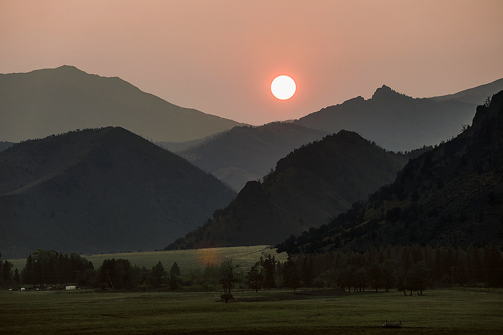
Smokey Sunset

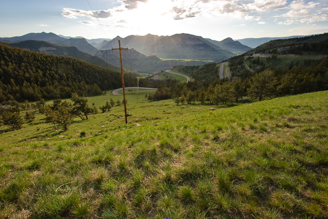
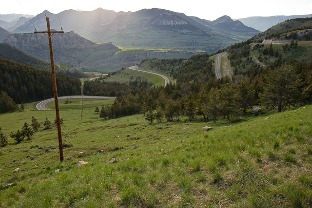
Twlight On The Switchbacks
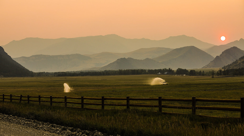
Hazy Sunset
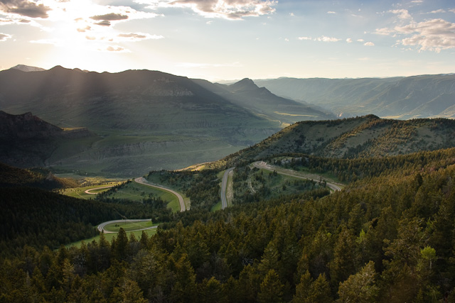
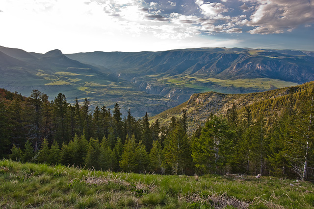
Dead Indian Pass
Dead Indian Pass
Dead Indian Pass
Dead Indian Pass
Dead Indian Pass
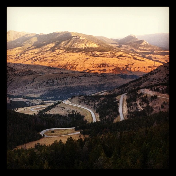
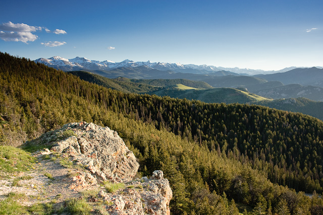
One never tires of this amazing view
85 The Way West Rd, Cody, WY アメリカ合衆国の地図
別の場所を検索
近所の場所
Sunlight Rd, Cody, WY アメリカ合衆国
Chief Joseph Hwy, Cody, WY アメリカ合衆国デッド・インディアン・サミット・オーバールック
アメリカ合衆国 ワイオミング州 パーク
アメリカ合衆国 〒 ワイオミング州 ソウトゥース山
Beartooth Hwy, アメリカ合衆国ベアートゥース・ハイウェイ
アメリカ合衆国 〒 ワイオミング州 ザ・ウォール
Bear Tooth Pass Hwy, Cody, WY アメリカ合衆国Bear Tooth Pass Highway
52 Moore Rd, Powell, WY アメリカ合衆国
N Fork Hwy, Cody, WY アメリカ合衆国
アメリカ合衆国 ワイオミング州 ワピティ
1 Streamside Dr, Wapiti, WY アメリカ合衆国
29 Pack Saddle Trail, Cody, WY アメリカ合衆国
81 Rd 6Cu, Cody, WY アメリカ合衆国
24 Rd 6Cu, Cody, WY アメリカ合衆国
86 N Wapiti Estates Drives, Cody, WY アメリカ合衆国
26 Talon Dr, Cody, WY アメリカ合衆国
Stagecoach Trail, Cody, WY アメリカ合衆国
59 Green Creek Rd, Cody, WY アメリカ合衆国
N Fork Hwy, Cody, WY アメリカ合衆国バッファロー・ビル州立公園
アメリカ合衆国 〒 ワイオミング州 バッジャー・ベイシン
最近の検索
- Hadiya, Ethiopia日の出日の入り時間
- Hosaina, Ethiopia日の出日の入り時間
- アルゼンチン ブエノスアイレス州 ネコチェア日の出日の入り時間
- Maxine St NE, Albuquerque, NM アメリカ合衆国日の出日の入り時間
- カンボジア Krong Bavet, CityManhattan Special Economic Zone日の出日の入り時間
- 日本、〒- 茨城県東茨城郡大洗町磯浜町大洗神社東日の出日の入り時間
- Polzela, スロベニア日の出日の入り時間
- Douro River日の出日の入り時間
- Blue Point Beach, Pecatu, South Kuta, Badung Regency, Bali, インドネシア日の出日の入り時間
- Village Point Dr, Daphne, AL アメリカ合衆国日の出日の入り時間