85 The Way West Rd, Cody, WY, USA Sonnenaufgang Sonnenuntergang Zeiten
Location: USA > Wyoming > Park County > Cody >
Zeitzone:
America/Denver
Ortszeit:
2024-05-06 10:16:13
Länge:
-109.451149
Breite:
44.763629
Sonnenaufgang Heute:
05:57:42 AM
Sonnenuntergang Heute:
08:30:54 PM
Tageslänge heute:
14h 33m 12s
Sonnenaufgang morgen:
05:56:25 AM
Sonnenuntergang Morgen:
08:32:05 PM
Tageslänge von morgen:
14h 35m 40s
Alle Termine anzeigen
| Datum | Sonnenaufgang | Sonnenuntergang | Tageslänge |
|---|---|---|---|
| 2024-01-01 | 07:55:07 AM | 04:48:11 PM | 8h 53m 4s |
| 2024-01-02 | 07:55:06 AM | 04:49:07 PM | 8h 54m 1s |
| 2024-01-03 | 07:55:03 AM | 04:50:04 PM | 8h 55m 1s |
| 2024-01-04 | 07:54:58 AM | 04:51:04 PM | 8h 56m 6s |
| 2024-01-05 | 07:54:50 AM | 04:52:05 PM | 8h 57m 15s |
| 2024-01-06 | 07:54:39 AM | 04:53:08 PM | 8h 58m 29s |
| 2024-01-07 | 07:54:26 AM | 04:54:13 PM | 8h 59m 47s |
| 2024-01-08 | 07:54:10 AM | 04:55:19 PM | 9h 1m 9s |
| 2024-01-09 | 07:53:52 AM | 04:56:27 PM | 9h 2m 35s |
| 2024-01-10 | 07:53:31 AM | 04:57:36 PM | 9h 4m 5s |
| 2024-01-11 | 07:53:08 AM | 04:58:46 PM | 9h 5m 38s |
| 2024-01-12 | 07:52:42 AM | 04:59:58 PM | 9h 7m 16s |
| 2024-01-13 | 07:52:14 AM | 05:01:10 PM | 9h 8m 56s |
| 2024-01-14 | 07:51:43 AM | 05:02:24 PM | 9h 10m 41s |
| 2024-01-15 | 07:51:10 AM | 05:03:40 PM | 9h 12m 30s |
| 2024-01-16 | 07:50:34 AM | 05:04:56 PM | 9h 14m 22s |
| 2024-01-17 | 07:49:56 AM | 05:06:13 PM | 9h 16m 17s |
| 2024-01-18 | 07:49:16 AM | 05:07:31 PM | 9h 18m 15s |
| 2024-01-19 | 07:48:33 AM | 05:08:50 PM | 9h 20m 17s |
| 2024-01-20 | 07:47:48 AM | 05:10:09 PM | 9h 22m 21s |
| 2024-01-21 | 07:47:01 AM | 05:11:30 PM | 9h 24m 29s |
| 2024-01-22 | 07:46:12 AM | 05:12:51 PM | 9h 26m 39s |
| 2024-01-23 | 07:45:20 AM | 05:14:12 PM | 9h 28m 52s |
| 2024-01-24 | 07:44:26 AM | 05:15:35 PM | 9h 31m 9s |
| 2024-01-25 | 07:43:31 AM | 05:16:57 PM | 9h 33m 26s |
| 2024-01-26 | 07:42:33 AM | 05:18:20 PM | 9h 35m 47s |
| 2024-01-27 | 07:41:33 AM | 05:19:44 PM | 9h 38m 11s |
| 2024-01-28 | 07:40:31 AM | 05:21:08 PM | 9h 40m 37s |
| 2024-01-29 | 07:39:27 AM | 05:22:32 PM | 9h 43m 5s |
| 2024-01-30 | 07:38:22 AM | 05:23:57 PM | 9h 45m 35s |
| 2024-01-31 | 07:37:14 AM | 05:25:22 PM | 9h 48m 8s |
| 2024-02-01 | 07:36:05 AM | 05:26:47 PM | 9h 50m 42s |
| 2024-02-02 | 07:34:54 AM | 05:28:12 PM | 9h 53m 18s |
| 2024-02-03 | 07:33:41 AM | 05:29:37 PM | 9h 55m 56s |
| 2024-02-04 | 07:32:26 AM | 05:31:02 PM | 9h 58m 36s |
| 2024-02-05 | 07:31:10 AM | 05:32:28 PM | 10h 1m 18s |
| 2024-02-06 | 07:29:52 AM | 05:33:53 PM | 10h 4m 1s |
| 2024-02-07 | 07:28:33 AM | 05:35:18 PM | 10h 6m 45s |
| 2024-02-08 | 07:27:12 AM | 05:36:44 PM | 10h 9m 32s |
| 2024-02-09 | 07:25:49 AM | 05:38:09 PM | 10h 12m 20s |
| 2024-02-10 | 07:24:25 AM | 05:39:34 PM | 10h 15m 9s |
| 2024-02-11 | 07:23:00 AM | 05:40:59 PM | 10h 17m 59s |
| 2024-02-12 | 07:21:33 AM | 05:42:24 PM | 10h 20m 51s |
| 2024-02-13 | 07:20:05 AM | 05:43:49 PM | 10h 23m 44s |
| 2024-02-14 | 07:18:36 AM | 05:45:13 PM | 10h 26m 37s |
| 2024-02-15 | 07:17:05 AM | 05:46:37 PM | 10h 29m 32s |
| 2024-02-16 | 07:15:34 AM | 05:48:02 PM | 10h 32m 28s |
| 2024-02-17 | 07:14:01 AM | 05:49:26 PM | 10h 35m 25s |
| 2024-02-18 | 07:12:27 AM | 05:50:49 PM | 10h 38m 22s |
| 2024-02-19 | 07:10:51 AM | 05:52:13 PM | 10h 41m 22s |
| 2024-02-20 | 07:09:15 AM | 05:53:36 PM | 10h 44m 21s |
| 2024-02-21 | 07:07:38 AM | 05:54:59 PM | 10h 47m 21s |
| 2024-02-22 | 07:05:59 AM | 05:56:21 PM | 10h 50m 22s |
| 2024-02-23 | 07:04:20 AM | 05:57:44 PM | 10h 53m 24s |
| 2024-02-24 | 07:02:40 AM | 05:59:06 PM | 10h 56m 26s |
| 2024-02-25 | 07:00:59 AM | 06:00:28 PM | 10h 59m 29s |
| 2024-02-26 | 06:59:17 AM | 06:01:49 PM | 11h 2m 32s |
| 2024-02-27 | 06:57:34 AM | 06:03:10 PM | 11h 5m 36s |
| 2024-02-28 | 06:55:51 AM | 06:04:31 PM | 11h 8m 40s |
| 2024-02-29 | 06:54:07 AM | 06:05:52 PM | 11h 11m 45s |
| 2024-03-01 | 06:52:22 AM | 06:07:12 PM | 11h 14m 50s |
| 2024-03-02 | 06:50:36 AM | 06:08:33 PM | 11h 17m 57s |
| 2024-03-03 | 06:48:50 AM | 06:09:52 PM | 11h 21m 2s |
| 2024-03-04 | 06:47:03 AM | 06:11:12 PM | 11h 24m 9s |
| 2024-03-05 | 06:45:16 AM | 06:12:31 PM | 11h 27m 15s |
| 2024-03-06 | 06:43:28 AM | 06:13:50 PM | 11h 30m 22s |
| 2024-03-07 | 06:41:40 AM | 06:15:09 PM | 11h 33m 29s |
| 2024-03-08 | 06:39:51 AM | 06:16:28 PM | 11h 36m 37s |
| 2024-03-09 | 06:38:02 AM | 06:17:46 PM | 11h 39m 44s |
| 2024-03-10 | 07:36:17 AM | 07:19:01 PM | 11h 42m 44s |
| 2024-03-11 | 07:34:27 AM | 07:20:18 PM | 11h 45m 51s |
| 2024-03-12 | 07:32:36 AM | 07:21:36 PM | 11h 49m 0s |
| 2024-03-13 | 07:30:46 AM | 07:22:53 PM | 11h 52m 7s |
| 2024-03-14 | 07:28:55 AM | 07:24:11 PM | 11h 55m 16s |
| 2024-03-15 | 07:27:04 AM | 07:25:28 PM | 11h 58m 24s |
| 2024-03-16 | 07:25:12 AM | 07:26:45 PM | 12h 1m 33s |
| 2024-03-17 | 07:23:21 AM | 07:28:01 PM | 12h 4m 40s |
| 2024-03-18 | 07:21:29 AM | 07:29:18 PM | 12h 7m 49s |
| 2024-03-19 | 07:19:37 AM | 07:30:34 PM | 12h 10m 57s |
| 2024-03-20 | 07:17:45 AM | 07:31:50 PM | 12h 14m 5s |
| 2024-03-21 | 07:15:53 AM | 07:33:06 PM | 12h 17m 13s |
| 2024-03-22 | 07:14:01 AM | 07:34:22 PM | 12h 20m 21s |
| 2024-03-23 | 07:12:10 AM | 07:35:38 PM | 12h 23m 28s |
| 2024-03-24 | 07:10:18 AM | 07:36:54 PM | 12h 26m 36s |
| 2024-03-25 | 07:08:26 AM | 07:38:09 PM | 12h 29m 43s |
| 2024-03-26 | 07:06:34 AM | 07:39:25 PM | 12h 32m 51s |
| 2024-03-27 | 07:04:42 AM | 07:40:40 PM | 12h 35m 58s |
| 2024-03-28 | 07:02:51 AM | 07:41:56 PM | 12h 39m 5s |
| 2024-03-29 | 07:01:00 AM | 07:43:11 PM | 12h 42m 11s |
| 2024-03-30 | 06:59:09 AM | 07:44:26 PM | 12h 45m 17s |
| 2024-03-31 | 06:57:18 AM | 07:45:41 PM | 12h 48m 23s |
| 2024-04-01 | 06:55:27 AM | 07:46:57 PM | 12h 51m 30s |
| 2024-04-02 | 06:53:37 AM | 07:48:12 PM | 12h 54m 35s |
| 2024-04-03 | 06:51:47 AM | 07:49:27 PM | 12h 57m 40s |
| 2024-04-04 | 06:49:58 AM | 07:50:42 PM | 13h 0m 44s |
| 2024-04-05 | 06:48:09 AM | 07:51:57 PM | 13h 3m 48s |
| 2024-04-06 | 06:46:20 AM | 07:53:12 PM | 13h 6m 52s |
| 2024-04-07 | 06:44:32 AM | 07:54:27 PM | 13h 9m 55s |
| 2024-04-08 | 06:42:45 AM | 07:55:42 PM | 13h 12m 57s |
| 2024-04-09 | 06:40:58 AM | 07:56:57 PM | 13h 15m 59s |
| 2024-04-10 | 06:39:11 AM | 07:58:12 PM | 13h 19m 1s |
| 2024-04-11 | 06:37:25 AM | 07:59:27 PM | 13h 22m 2s |
| 2024-04-12 | 06:35:40 AM | 08:00:42 PM | 13h 25m 2s |
| 2024-04-13 | 06:33:56 AM | 08:01:57 PM | 13h 28m 1s |
| 2024-04-14 | 06:32:12 AM | 08:03:12 PM | 13h 31m 0s |
| 2024-04-15 | 06:30:29 AM | 08:04:27 PM | 13h 33m 58s |
| 2024-04-16 | 06:28:46 AM | 08:05:42 PM | 13h 36m 56s |
| 2024-04-17 | 06:27:05 AM | 08:06:57 PM | 13h 39m 52s |
| 2024-04-18 | 06:25:24 AM | 08:08:12 PM | 13h 42m 48s |
| 2024-04-19 | 06:23:44 AM | 08:09:27 PM | 13h 45m 43s |
| 2024-04-20 | 06:22:05 AM | 08:10:42 PM | 13h 48m 37s |
| 2024-04-21 | 06:20:28 AM | 08:11:57 PM | 13h 51m 29s |
| 2024-04-22 | 06:18:51 AM | 08:13:12 PM | 13h 54m 21s |
| 2024-04-23 | 06:17:15 AM | 08:14:27 PM | 13h 57m 12s |
| 2024-04-24 | 06:15:40 AM | 08:15:41 PM | 14h 0m 1s |
| 2024-04-25 | 06:14:06 AM | 08:16:56 PM | 14h 2m 50s |
| 2024-04-26 | 06:12:33 AM | 08:18:10 PM | 14h 5m 37s |
| 2024-04-27 | 06:11:02 AM | 08:19:24 PM | 14h 8m 22s |
| 2024-04-28 | 06:09:31 AM | 08:20:39 PM | 14h 11m 8s |
| 2024-04-29 | 06:08:02 AM | 08:21:53 PM | 14h 13m 51s |
| 2024-04-30 | 06:06:34 AM | 08:23:06 PM | 14h 16m 32s |
| 2024-05-01 | 06:05:07 AM | 08:24:20 PM | 14h 19m 13s |
| 2024-05-02 | 06:03:42 AM | 08:25:33 PM | 14h 21m 51s |
| 2024-05-03 | 06:02:18 AM | 08:26:46 PM | 14h 24m 28s |
| 2024-05-04 | 06:00:56 AM | 08:27:59 PM | 14h 27m 3s |
| 2024-05-05 | 05:59:35 AM | 08:29:12 PM | 14h 29m 37s |
| 2024-05-06 | 05:58:15 AM | 08:30:24 PM | 14h 32m 9s |
| 2024-05-07 | 05:56:57 AM | 08:31:35 PM | 14h 34m 38s |
| 2024-05-08 | 05:55:41 AM | 08:32:47 PM | 14h 37m 6s |
| 2024-05-09 | 05:54:26 AM | 08:33:58 PM | 14h 39m 32s |
| 2024-05-10 | 05:53:12 AM | 08:35:08 PM | 14h 41m 56s |
| 2024-05-11 | 05:52:01 AM | 08:36:18 PM | 14h 44m 17s |
| 2024-05-12 | 05:50:51 AM | 08:37:27 PM | 14h 46m 36s |
| 2024-05-13 | 05:49:43 AM | 08:38:36 PM | 14h 48m 53s |
| 2024-05-14 | 05:48:36 AM | 08:39:44 PM | 14h 51m 8s |
| 2024-05-15 | 05:47:31 AM | 08:40:52 PM | 14h 53m 21s |
| 2024-05-16 | 05:46:29 AM | 08:41:58 PM | 14h 55m 29s |
| 2024-05-17 | 05:45:28 AM | 08:43:04 PM | 14h 57m 36s |
| 2024-05-18 | 05:44:28 AM | 08:44:10 PM | 14h 59m 42s |
| 2024-05-19 | 05:43:31 AM | 08:45:14 PM | 15h 1m 43s |
| 2024-05-20 | 05:42:36 AM | 08:46:18 PM | 15h 3m 42s |
| 2024-05-21 | 05:41:43 AM | 08:47:20 PM | 15h 5m 37s |
| 2024-05-22 | 05:40:52 AM | 08:48:22 PM | 15h 7m 30s |
| 2024-05-23 | 05:40:03 AM | 08:49:22 PM | 15h 9m 19s |
| 2024-05-24 | 05:39:15 AM | 08:50:22 PM | 15h 11m 7s |
| 2024-05-25 | 05:38:30 AM | 08:51:20 PM | 15h 12m 50s |
| 2024-05-26 | 05:37:48 AM | 08:52:17 PM | 15h 14m 29s |
| 2024-05-27 | 05:37:07 AM | 08:53:13 PM | 15h 16m 6s |
| 2024-05-28 | 05:36:28 AM | 08:54:08 PM | 15h 17m 40s |
| 2024-05-29 | 05:35:52 AM | 08:55:01 PM | 15h 19m 9s |
| 2024-05-30 | 05:35:18 AM | 08:55:53 PM | 15h 20m 35s |
| 2024-05-31 | 05:34:46 AM | 08:56:43 PM | 15h 21m 57s |
| 2024-06-01 | 05:34:16 AM | 08:57:32 PM | 15h 23m 16s |
| 2024-06-02 | 05:33:49 AM | 08:58:20 PM | 15h 24m 31s |
| 2024-06-03 | 05:33:24 AM | 08:59:06 PM | 15h 25m 42s |
| 2024-06-04 | 05:33:01 AM | 08:59:50 PM | 15h 26m 49s |
| 2024-06-05 | 05:32:40 AM | 09:00:33 PM | 15h 27m 53s |
| 2024-06-06 | 05:32:22 AM | 09:01:13 PM | 15h 28m 51s |
| 2024-06-07 | 05:32:06 AM | 09:01:53 PM | 15h 29m 47s |
| 2024-06-08 | 05:31:52 AM | 09:02:30 PM | 15h 30m 38s |
| 2024-06-09 | 05:31:41 AM | 09:03:05 PM | 15h 31m 24s |
| 2024-06-10 | 05:31:32 AM | 09:03:39 PM | 15h 32m 7s |
| 2024-06-11 | 05:31:25 AM | 09:04:10 PM | 15h 32m 45s |
| 2024-06-12 | 05:31:21 AM | 09:04:40 PM | 15h 33m 19s |
| 2024-06-13 | 05:31:19 AM | 09:05:08 PM | 15h 33m 49s |
| 2024-06-14 | 05:31:19 AM | 09:05:33 PM | 15h 34m 14s |
| 2024-06-15 | 05:31:21 AM | 09:05:57 PM | 15h 34m 36s |
| 2024-06-16 | 05:31:26 AM | 09:06:18 PM | 15h 34m 52s |
| 2024-06-17 | 05:31:33 AM | 09:06:37 PM | 15h 35m 4s |
| 2024-06-18 | 05:31:42 AM | 09:06:54 PM | 15h 35m 12s |
| 2024-06-19 | 05:31:53 AM | 09:07:09 PM | 15h 35m 16s |
| 2024-06-20 | 05:32:07 AM | 09:07:22 PM | 15h 35m 15s |
| 2024-06-21 | 05:32:22 AM | 09:07:32 PM | 15h 35m 10s |
| 2024-06-22 | 05:32:40 AM | 09:07:40 PM | 15h 35m 0s |
| 2024-06-23 | 05:33:00 AM | 09:07:46 PM | 15h 34m 46s |
| 2024-06-24 | 05:33:22 AM | 09:07:50 PM | 15h 34m 28s |
| 2024-06-25 | 05:33:46 AM | 09:07:51 PM | 15h 34m 5s |
| 2024-06-26 | 05:34:12 AM | 09:07:50 PM | 15h 33m 38s |
| 2024-06-27 | 05:34:40 AM | 09:07:46 PM | 15h 33m 6s |
| 2024-06-28 | 05:35:09 AM | 09:07:41 PM | 15h 32m 32s |
| 2024-06-29 | 05:35:41 AM | 09:07:32 PM | 15h 31m 51s |
| 2024-06-30 | 05:36:15 AM | 09:07:22 PM | 15h 31m 7s |
| 2024-07-01 | 05:36:50 AM | 09:07:09 PM | 15h 30m 19s |
| 2024-07-02 | 05:37:27 AM | 09:06:54 PM | 15h 29m 27s |
| 2024-07-03 | 05:38:06 AM | 09:06:36 PM | 15h 28m 30s |
| 2024-07-04 | 05:38:47 AM | 09:06:16 PM | 15h 27m 29s |
| 2024-07-05 | 05:39:29 AM | 09:05:54 PM | 15h 26m 25s |
| 2024-07-06 | 05:40:12 AM | 09:05:29 PM | 15h 25m 17s |
| 2024-07-07 | 05:40:58 AM | 09:05:03 PM | 15h 24m 5s |
| 2024-07-08 | 05:41:44 AM | 09:04:33 PM | 15h 22m 49s |
| 2024-07-09 | 05:42:32 AM | 09:04:02 PM | 15h 21m 30s |
| 2024-07-10 | 05:43:22 AM | 09:03:28 PM | 15h 20m 6s |
| 2024-07-11 | 05:44:13 AM | 09:02:52 PM | 15h 18m 39s |
| 2024-07-12 | 05:45:05 AM | 09:02:14 PM | 15h 17m 9s |
| 2024-07-13 | 05:45:58 AM | 09:01:34 PM | 15h 15m 36s |
| 2024-07-14 | 05:46:53 AM | 09:00:51 PM | 15h 13m 58s |
| 2024-07-15 | 05:47:48 AM | 09:00:06 PM | 15h 12m 18s |
| 2024-07-16 | 05:48:45 AM | 08:59:19 PM | 15h 10m 34s |
| 2024-07-17 | 05:49:43 AM | 08:58:30 PM | 15h 8m 47s |
| 2024-07-18 | 05:50:41 AM | 08:57:39 PM | 15h 6m 58s |
| 2024-07-19 | 05:51:41 AM | 08:56:46 PM | 15h 5m 5s |
| 2024-07-20 | 05:52:42 AM | 08:55:51 PM | 15h 3m 9s |
| 2024-07-21 | 05:53:43 AM | 08:54:54 PM | 15h 1m 11s |
| 2024-07-22 | 05:54:45 AM | 08:53:55 PM | 14h 59m 10s |
| 2024-07-23 | 05:55:48 AM | 08:52:54 PM | 14h 57m 6s |
| 2024-07-24 | 05:56:52 AM | 08:51:51 PM | 14h 54m 59s |
| 2024-07-25 | 05:57:56 AM | 08:50:46 PM | 14h 52m 50s |
| 2024-07-26 | 05:59:01 AM | 08:49:40 PM | 14h 50m 39s |
| 2024-07-27 | 06:00:07 AM | 08:48:31 PM | 14h 48m 24s |
| 2024-07-28 | 06:01:13 AM | 08:47:21 PM | 14h 46m 8s |
| 2024-07-29 | 06:02:19 AM | 08:46:09 PM | 14h 43m 50s |
| 2024-07-30 | 06:03:26 AM | 08:44:56 PM | 14h 41m 30s |
| 2024-07-31 | 06:04:34 AM | 08:43:40 PM | 14h 39m 6s |
| 2024-08-01 | 06:05:42 AM | 08:42:24 PM | 14h 36m 42s |
| 2024-08-02 | 06:06:50 AM | 08:41:05 PM | 14h 34m 15s |
| 2024-08-03 | 06:07:59 AM | 08:39:45 PM | 14h 31m 46s |
| 2024-08-04 | 06:09:08 AM | 08:38:24 PM | 14h 29m 16s |
| 2024-08-05 | 06:10:17 AM | 08:37:01 PM | 14h 26m 44s |
| 2024-08-06 | 06:11:26 AM | 08:35:37 PM | 14h 24m 11s |
| 2024-08-07 | 06:12:36 AM | 08:34:11 PM | 14h 21m 35s |
| 2024-08-08 | 06:13:46 AM | 08:32:44 PM | 14h 18m 58s |
| 2024-08-09 | 06:14:56 AM | 08:31:15 PM | 14h 16m 19s |
| 2024-08-10 | 06:16:06 AM | 08:29:46 PM | 14h 13m 40s |
| 2024-08-11 | 06:17:16 AM | 08:28:15 PM | 14h 10m 59s |
| 2024-08-12 | 06:18:27 AM | 08:26:42 PM | 14h 8m 15s |
| 2024-08-13 | 06:19:37 AM | 08:25:09 PM | 14h 5m 32s |
| 2024-08-14 | 06:20:48 AM | 08:23:34 PM | 14h 2m 46s |
| 2024-08-15 | 06:21:58 AM | 08:21:59 PM | 14h 0m 1s |
| 2024-08-16 | 06:23:09 AM | 08:20:22 PM | 13h 57m 13s |
| 2024-08-17 | 06:24:20 AM | 08:18:44 PM | 13h 54m 24s |
| 2024-08-18 | 06:25:31 AM | 08:17:06 PM | 13h 51m 35s |
| 2024-08-19 | 06:26:41 AM | 08:15:26 PM | 13h 48m 45s |
| 2024-08-20 | 06:27:52 AM | 08:13:45 PM | 13h 45m 53s |
| 2024-08-21 | 06:29:03 AM | 08:12:04 PM | 13h 43m 1s |
| 2024-08-22 | 06:30:14 AM | 08:10:21 PM | 13h 40m 7s |
| 2024-08-23 | 06:31:24 AM | 08:08:38 PM | 13h 37m 14s |
| 2024-08-24 | 06:32:35 AM | 08:06:54 PM | 13h 34m 19s |
| 2024-08-25 | 06:33:46 AM | 08:05:09 PM | 13h 31m 23s |
| 2024-08-26 | 06:34:57 AM | 08:03:23 PM | 13h 28m 26s |
| 2024-08-27 | 06:36:07 AM | 08:01:37 PM | 13h 25m 30s |
| 2024-08-28 | 06:37:18 AM | 07:59:50 PM | 13h 22m 32s |
| 2024-08-29 | 06:38:29 AM | 07:58:03 PM | 13h 19m 34s |
| 2024-08-30 | 06:39:39 AM | 07:56:14 PM | 13h 16m 35s |
| 2024-08-31 | 06:40:50 AM | 07:54:26 PM | 13h 13m 36s |
| 2024-09-01 | 06:42:00 AM | 07:52:36 PM | 13h 10m 36s |
| 2024-09-02 | 06:43:11 AM | 07:50:46 PM | 13h 7m 35s |
| 2024-09-03 | 06:44:21 AM | 07:48:56 PM | 13h 4m 35s |
| 2024-09-04 | 06:45:32 AM | 07:47:05 PM | 13h 1m 33s |
| 2024-09-05 | 06:46:42 AM | 07:45:14 PM | 12h 58m 32s |
| 2024-09-06 | 06:47:53 AM | 07:43:22 PM | 12h 55m 29s |
| 2024-09-07 | 06:49:03 AM | 07:41:31 PM | 12h 52m 28s |
| 2024-09-08 | 06:50:14 AM | 07:39:38 PM | 12h 49m 24s |
| 2024-09-09 | 06:51:24 AM | 07:37:46 PM | 12h 46m 22s |
| 2024-09-10 | 06:52:35 AM | 07:35:53 PM | 12h 43m 18s |
| 2024-09-11 | 06:53:45 AM | 07:34:00 PM | 12h 40m 15s |
| 2024-09-12 | 06:54:56 AM | 07:32:07 PM | 12h 37m 11s |
| 2024-09-13 | 06:56:07 AM | 07:30:13 PM | 12h 34m 6s |
| 2024-09-14 | 06:57:17 AM | 07:28:19 PM | 12h 31m 2s |
| 2024-09-15 | 06:58:28 AM | 07:26:26 PM | 12h 27m 58s |
| 2024-09-16 | 06:59:39 AM | 07:24:32 PM | 12h 24m 53s |
| 2024-09-17 | 07:00:50 AM | 07:22:38 PM | 12h 21m 48s |
| 2024-09-18 | 07:02:01 AM | 07:20:44 PM | 12h 18m 43s |
| 2024-09-19 | 07:03:12 AM | 07:18:50 PM | 12h 15m 38s |
| 2024-09-20 | 07:04:24 AM | 07:16:57 PM | 12h 12m 33s |
| 2024-09-21 | 07:05:35 AM | 07:15:03 PM | 12h 9m 28s |
| 2024-09-22 | 07:06:47 AM | 07:13:09 PM | 12h 6m 22s |
| 2024-09-23 | 07:07:58 AM | 07:11:16 PM | 12h 3m 18s |
| 2024-09-24 | 07:09:10 AM | 07:09:22 PM | 12h 0m 12s |
| 2024-09-25 | 07:10:23 AM | 07:07:29 PM | 11h 57m 6s |
| 2024-09-26 | 07:11:35 AM | 07:05:36 PM | 11h 54m 1s |
| 2024-09-27 | 07:12:47 AM | 07:03:43 PM | 11h 50m 56s |
| 2024-09-28 | 07:14:00 AM | 07:01:51 PM | 11h 47m 51s |
| 2024-09-29 | 07:15:13 AM | 06:59:59 PM | 11h 44m 46s |
| 2024-09-30 | 07:16:26 AM | 06:58:07 PM | 11h 41m 41s |
| 2024-10-01 | 07:17:39 AM | 06:56:15 PM | 11h 38m 36s |
| 2024-10-02 | 07:18:53 AM | 06:54:24 PM | 11h 35m 31s |
| 2024-10-03 | 07:20:07 AM | 06:52:34 PM | 11h 32m 27s |
| 2024-10-04 | 07:21:21 AM | 06:50:44 PM | 11h 29m 23s |
| 2024-10-05 | 07:22:36 AM | 06:48:54 PM | 11h 26m 18s |
| 2024-10-06 | 07:23:50 AM | 06:47:05 PM | 11h 23m 15s |
| 2024-10-07 | 07:25:05 AM | 06:45:17 PM | 11h 20m 12s |
| 2024-10-08 | 07:26:20 AM | 06:43:29 PM | 11h 17m 9s |
| 2024-10-09 | 07:27:36 AM | 06:41:41 PM | 11h 14m 5s |
| 2024-10-10 | 07:28:52 AM | 06:39:55 PM | 11h 11m 3s |
| 2024-10-11 | 07:30:08 AM | 06:38:09 PM | 11h 8m 1s |
| 2024-10-12 | 07:31:25 AM | 06:36:24 PM | 11h 4m 59s |
| 2024-10-13 | 07:32:41 AM | 06:34:39 PM | 11h 1m 58s |
| 2024-10-14 | 07:33:58 AM | 06:32:55 PM | 10h 58m 57s |
| 2024-10-15 | 07:35:16 AM | 06:31:13 PM | 10h 55m 57s |
| 2024-10-16 | 07:36:33 AM | 06:29:31 PM | 10h 52m 58s |
| 2024-10-17 | 07:37:51 AM | 06:27:50 PM | 10h 49m 59s |
| 2024-10-18 | 07:39:10 AM | 06:26:10 PM | 10h 47m 0s |
| 2024-10-19 | 07:40:28 AM | 06:24:31 PM | 10h 44m 3s |
| 2024-10-20 | 07:41:47 AM | 06:22:53 PM | 10h 41m 6s |
| 2024-10-21 | 07:43:07 AM | 06:21:16 PM | 10h 38m 9s |
| 2024-10-22 | 07:44:26 AM | 06:19:40 PM | 10h 35m 14s |
| 2024-10-23 | 07:45:46 AM | 06:18:05 PM | 10h 32m 19s |
| 2024-10-24 | 07:47:06 AM | 06:16:31 PM | 10h 29m 25s |
| 2024-10-25 | 07:48:26 AM | 06:14:59 PM | 10h 26m 33s |
| 2024-10-26 | 07:49:47 AM | 06:13:28 PM | 10h 23m 41s |
| 2024-10-27 | 07:51:07 AM | 06:11:58 PM | 10h 20m 51s |
| 2024-10-28 | 07:52:28 AM | 06:10:29 PM | 10h 18m 1s |
| 2024-10-29 | 07:53:49 AM | 06:09:02 PM | 10h 15m 13s |
| 2024-10-30 | 07:55:11 AM | 06:07:36 PM | 10h 12m 25s |
| 2024-10-31 | 07:56:32 AM | 06:06:12 PM | 10h 9m 40s |
| 2024-11-01 | 07:57:54 AM | 06:04:49 PM | 10h 6m 55s |
| 2024-11-02 | 07:59:15 AM | 06:03:28 PM | 10h 4m 13s |
| 2024-11-03 | 07:00:40 AM | 05:02:05 PM | 10h 1m 25s |
| 2024-11-04 | 07:02:02 AM | 05:00:47 PM | 9h 58m 45s |
| 2024-11-05 | 07:03:24 AM | 04:59:30 PM | 9h 56m 6s |
| 2024-11-06 | 07:04:46 AM | 04:58:15 PM | 9h 53m 29s |
| 2024-11-07 | 07:06:07 AM | 04:57:02 PM | 9h 50m 55s |
| 2024-11-08 | 07:07:29 AM | 04:55:51 PM | 9h 48m 22s |
| 2024-11-09 | 07:08:51 AM | 04:54:42 PM | 9h 45m 51s |
| 2024-11-10 | 07:10:12 AM | 04:53:34 PM | 9h 43m 22s |
| 2024-11-11 | 07:11:33 AM | 04:52:28 PM | 9h 40m 55s |
| 2024-11-12 | 07:12:54 AM | 04:51:25 PM | 9h 38m 31s |
| 2024-11-13 | 07:14:15 AM | 04:50:23 PM | 9h 36m 8s |
| 2024-11-14 | 07:15:35 AM | 04:49:23 PM | 9h 33m 48s |
| 2024-11-15 | 07:16:55 AM | 04:48:26 PM | 9h 31m 31s |
| 2024-11-16 | 07:18:15 AM | 04:47:30 PM | 9h 29m 15s |
| 2024-11-17 | 07:19:34 AM | 04:46:36 PM | 9h 27m 2s |
| 2024-11-18 | 07:20:52 AM | 04:45:45 PM | 9h 24m 53s |
| 2024-11-19 | 07:22:10 AM | 04:44:56 PM | 9h 22m 46s |
| 2024-11-20 | 07:23:28 AM | 04:44:09 PM | 9h 20m 41s |
| 2024-11-21 | 07:24:44 AM | 04:43:25 PM | 9h 18m 41s |
| 2024-11-22 | 07:26:00 AM | 04:42:42 PM | 9h 16m 42s |
| 2024-11-23 | 07:27:15 AM | 04:42:03 PM | 9h 14m 48s |
| 2024-11-24 | 07:28:29 AM | 04:41:25 PM | 9h 12m 56s |
| 2024-11-25 | 07:29:43 AM | 04:40:50 PM | 9h 11m 7s |
| 2024-11-26 | 07:30:55 AM | 04:40:17 PM | 9h 9m 22s |
| 2024-11-27 | 07:32:06 AM | 04:39:47 PM | 9h 7m 41s |
| 2024-11-28 | 07:33:16 AM | 04:39:19 PM | 9h 6m 3s |
| 2024-11-29 | 07:34:25 AM | 04:38:54 PM | 9h 4m 29s |
| 2024-11-30 | 07:35:33 AM | 04:38:31 PM | 9h 2m 58s |
| 2024-12-01 | 07:36:40 AM | 04:38:11 PM | 9h 1m 31s |
| 2024-12-02 | 07:37:45 AM | 04:37:54 PM | 9h 0m 9s |
| 2024-12-03 | 07:38:48 AM | 04:37:39 PM | 8h 58m 51s |
| 2024-12-04 | 07:39:50 AM | 04:37:26 PM | 8h 57m 36s |
| 2024-12-05 | 07:40:51 AM | 04:37:17 PM | 8h 56m 26s |
| 2024-12-06 | 07:41:50 AM | 04:37:10 PM | 8h 55m 20s |
| 2024-12-07 | 07:42:47 AM | 04:37:05 PM | 8h 54m 18s |
| 2024-12-08 | 07:43:43 AM | 04:37:03 PM | 8h 53m 20s |
| 2024-12-09 | 07:44:37 AM | 04:37:04 PM | 8h 52m 27s |
| 2024-12-10 | 07:45:29 AM | 04:37:08 PM | 8h 51m 39s |
| 2024-12-11 | 07:46:19 AM | 04:37:14 PM | 8h 50m 55s |
| 2024-12-12 | 07:47:07 AM | 04:37:22 PM | 8h 50m 15s |
| 2024-12-13 | 07:47:53 AM | 04:37:34 PM | 8h 49m 41s |
| 2024-12-14 | 07:48:36 AM | 04:37:48 PM | 8h 49m 12s |
| 2024-12-15 | 07:49:18 AM | 04:38:04 PM | 8h 48m 46s |
| 2024-12-16 | 07:49:58 AM | 04:38:23 PM | 8h 48m 25s |
| 2024-12-17 | 07:50:35 AM | 04:38:45 PM | 8h 48m 10s |
| 2024-12-18 | 07:51:10 AM | 04:39:09 PM | 8h 47m 59s |
| 2024-12-19 | 07:51:43 AM | 04:39:36 PM | 8h 47m 53s |
| 2024-12-20 | 07:52:14 AM | 04:40:05 PM | 8h 47m 51s |
| 2024-12-21 | 07:52:42 AM | 04:40:36 PM | 8h 47m 54s |
| 2024-12-22 | 07:53:08 AM | 04:41:10 PM | 8h 48m 2s |
| 2024-12-23 | 07:53:31 AM | 04:41:47 PM | 8h 48m 16s |
| 2024-12-24 | 07:53:52 AM | 04:42:25 PM | 8h 48m 33s |
| 2024-12-25 | 07:54:10 AM | 04:43:06 PM | 8h 48m 56s |
| 2024-12-26 | 07:54:26 AM | 04:43:50 PM | 8h 49m 24s |
| 2024-12-27 | 07:54:39 AM | 04:44:35 PM | 8h 49m 56s |
| 2024-12-28 | 07:54:50 AM | 04:45:22 PM | 8h 50m 32s |
| 2024-12-29 | 07:54:58 AM | 04:46:12 PM | 8h 51m 14s |
| 2024-12-30 | 07:55:03 AM | 04:47:04 PM | 8h 52m 1s |
Fotos

Moon Rise Over Bald Ridge
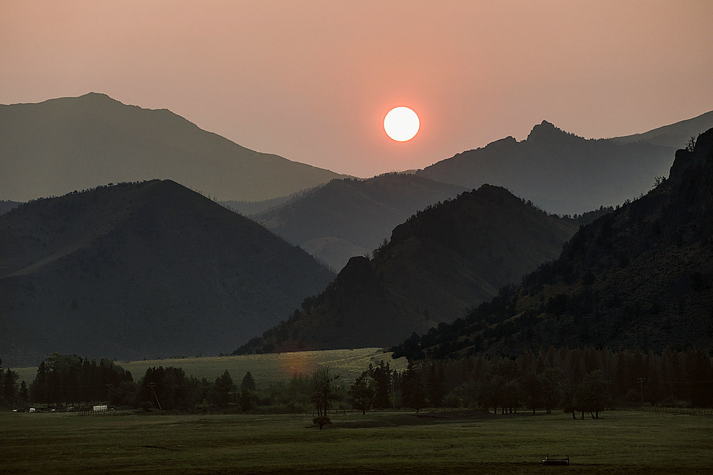
Smokey Sunset

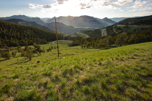
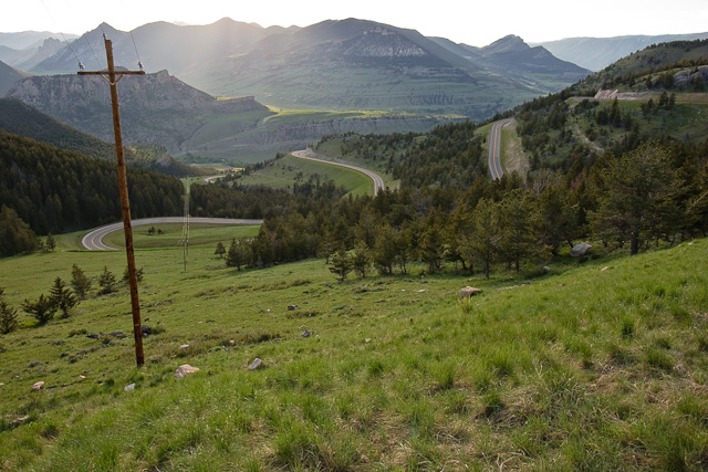
Twlight On The Switchbacks
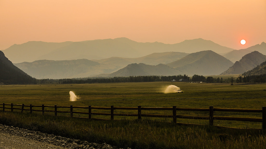
Hazy Sunset
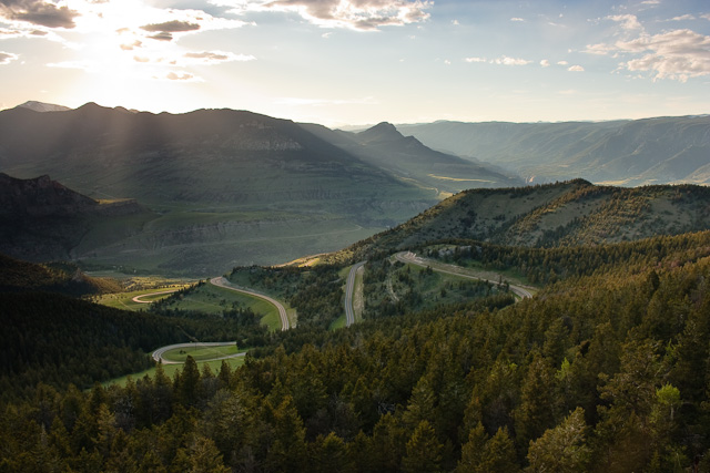
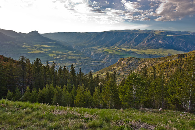
Dead Indian Pass
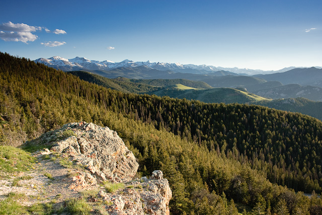
Dead Indian Pass
Dead Indian Pass
Dead Indian Pass
Dead Indian Pass
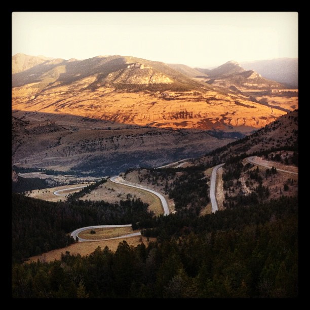
One never tires of this amazing view
85 The Way West Rd, Cody, WY, USA Karte
Suchen Sie einen anderen Ort
Nahe Plätze
Sunlight Rd, Cody, WY, USA
Dead Indian Summit Overlook, Chief Joseph Hwy, Cody, WY, USA
Park County, Wyoming, USA
Sawtooth Mountain, Wyoming, USA
Beartooth Highway, Beartooth Hwy, USA
The Wall, Wyoming, USA
Bear Tooth Pass Highway, Bear Tooth Pass Hwy, Cody, WY, USA
52 Moore Rd, Powell, WY, USA
N Fork Hwy, Cody, WY, USA
Wapiti, WY, USA
1 Streamside Dr, Wapiti, WY, USA
29 Pack Saddle Trail, Cody, WY, USA
81 Rd 6Cu, Cody, WY, USA
24 Rd 6Cu, Cody, WY, USA
86 N Wapiti Estates Drives, Cody, WY, USA
26 Talon Dr, Cody, WY, USA
Stagecoach Trail, Cody, WY, USA
59 Green Creek Rd, Cody, WY, USA
Buffalo Bill State Park, N Fork Hwy, Cody, WY, USA
Badger Basin, Wyoming, USA
Letzte Suche
- 1-chome Tsukaguchicho, Amagasaki, Hyogo -, Japan Sonnenaufgang Sonnenuntergang Zeiten
- Kusushi Shrine, Subashiri, Oyama, Suntō Bezirk, Präfektur Shizuoka -, Japan Sonnenaufgang Sonnenuntergang Zeiten
- Sinai St 16, Be'er Sheva, Israel Sonnenaufgang Sonnenuntergang Zeiten
- Presidente Quintana & Emilio Mitre, Carlos Keen, Provincia de Buenos Aires, Argentina Sonnenaufgang Sonnenuntergang Zeiten
- Deep Gap Farm Rd E, Mill Spring, NC, USA Sonnenaufgang Sonnenuntergang Zeiten
- Jiujiangzhen, Nanhai District, Foshan, Guangdong Province, China Sonnenaufgang Sonnenuntergang Zeiten
- Mountain View, Kalifornien, USA Sonnenaufgang Sonnenuntergang Zeiten
- Road to the sky observatory, Shuenhigashi, Shari, Shari District, Hokkaido -, Japan Sonnenaufgang Sonnenuntergang Zeiten
- 海岸咖啡, No. 31號, Chaishan Ave, Gushan District, Kaohsiung City, Taiwan Sonnenaufgang Sonnenuntergang Zeiten
- Estates Loop, Priest River, ID, USA Sonnenaufgang Sonnenuntergang Zeiten