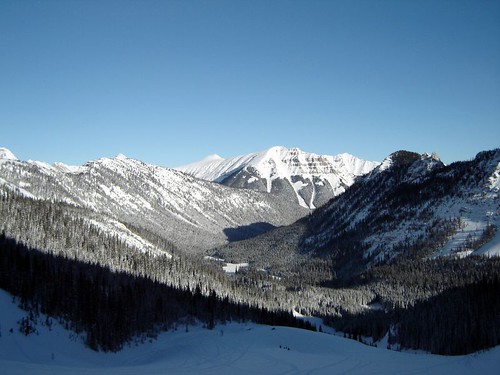
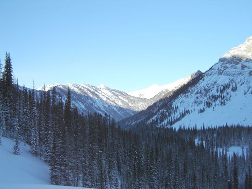
Horas de salida y puesta de sol de Mount Vanbuskirk, East Kootenay A, BC V0B 2G3, Canadá
Location: Canadá > Columbia Británica > East Kootenay > Sparwood >
Zona horaria:
America/Edmonton
Hora local:
2024-05-13 21:12:01
Longitud:
-115.0569443
Latitud:
49.9402777
Salida de sol de hoy:
05:54:10 AM
Puesta de sol de hoy:
09:19:00 PM
La duración del día hoy:
15h 24m 50s
Salida de sol de mañana:
05:52:48 AM
Puesta de sol de mañana:
09:20:24 PM
La duración del día mañana:
15h 27m 36s
Mostrar todas las fechas
| Fecha | Salida de sol | Puesta de sol | Duración del día |
|---|---|---|---|
| 01/01/2024 | 08:38:13 AM | 04:49:55 PM | 8h 11m 42s |
| 02/01/2024 | 08:38:06 AM | 04:50:59 PM | 8h 12m 53s |
| 03/01/2024 | 08:37:55 AM | 04:52:04 PM | 8h 14m 9s |
| 04/01/2024 | 08:37:42 AM | 04:53:12 PM | 8h 15m 30s |
| 05/01/2024 | 08:37:25 AM | 04:54:22 PM | 8h 16m 57s |
| 06/01/2024 | 08:37:05 AM | 04:55:34 PM | 8h 18m 29s |
| 07/01/2024 | 08:36:42 AM | 04:56:49 PM | 8h 20m 7s |
| 08/01/2024 | 08:36:16 AM | 04:58:05 PM | 8h 21m 49s |
| 09/01/2024 | 08:35:47 AM | 04:59:23 PM | 8h 23m 36s |
| 10/01/2024 | 08:35:15 AM | 05:00:43 PM | 8h 25m 28s |
| 11/01/2024 | 08:34:40 AM | 05:02:05 PM | 8h 27m 25s |
| 12/01/2024 | 08:34:02 AM | 05:03:29 PM | 8h 29m 27s |
| 13/01/2024 | 08:33:21 AM | 05:04:54 PM | 8h 31m 33s |
| 14/01/2024 | 08:32:38 AM | 05:06:21 PM | 8h 33m 43s |
| 15/01/2024 | 08:31:51 AM | 05:07:49 PM | 8h 35m 58s |
| 16/01/2024 | 08:31:02 AM | 05:09:19 PM | 8h 38m 17s |
| 17/01/2024 | 08:30:10 AM | 05:10:50 PM | 8h 40m 40s |
| 18/01/2024 | 08:29:16 AM | 05:12:22 PM | 8h 43m 6s |
| 19/01/2024 | 08:28:19 AM | 05:13:55 PM | 8h 45m 36s |
| 20/01/2024 | 08:27:19 AM | 05:15:30 PM | 8h 48m 11s |
| 21/01/2024 | 08:26:17 AM | 05:17:05 PM | 8h 50m 48s |
| 22/01/2024 | 08:25:12 AM | 05:18:41 PM | 8h 53m 29s |
| 23/01/2024 | 08:24:05 AM | 05:20:19 PM | 8h 56m 14s |
| 24/01/2024 | 08:22:56 AM | 05:21:57 PM | 8h 59m 1s |
| 25/01/2024 | 08:21:44 AM | 05:23:35 PM | 9h 1m 51s |
| 26/01/2024 | 08:20:30 AM | 05:25:15 PM | 9h 4m 45s |
| 27/01/2024 | 08:19:13 AM | 05:26:55 PM | 9h 7m 42s |
| 28/01/2024 | 08:17:55 AM | 05:28:35 PM | 9h 10m 40s |
| 29/01/2024 | 08:16:34 AM | 05:30:17 PM | 9h 13m 43s |
| 30/01/2024 | 08:15:12 AM | 05:31:58 PM | 9h 16m 46s |
| 31/01/2024 | 08:13:47 AM | 05:33:40 PM | 9h 19m 53s |
| 01/02/2024 | 08:12:20 AM | 05:35:22 PM | 9h 23m 2s |
| 02/02/2024 | 08:10:52 AM | 05:37:05 PM | 9h 26m 13s |
| 03/02/2024 | 08:09:21 AM | 05:38:48 PM | 9h 29m 27s |
| 04/02/2024 | 08:07:49 AM | 05:40:31 PM | 9h 32m 42s |
| 05/02/2024 | 08:06:15 AM | 05:42:14 PM | 9h 35m 59s |
| 06/02/2024 | 08:04:39 AM | 05:43:57 PM | 9h 39m 18s |
| 07/02/2024 | 08:03:02 AM | 05:45:40 PM | 9h 42m 38s |
| 08/02/2024 | 08:01:23 AM | 05:47:24 PM | 9h 46m 1s |
| 09/02/2024 | 07:59:42 AM | 05:49:07 PM | 9h 49m 25s |
| 10/02/2024 | 07:58:00 AM | 05:50:50 PM | 9h 52m 50s |
| 11/02/2024 | 07:56:16 AM | 05:52:33 PM | 9h 56m 17s |
| 12/02/2024 | 07:54:31 AM | 05:54:17 PM | 9h 59m 46s |
| 13/02/2024 | 07:52:45 AM | 05:56:00 PM | 10h 3m 15s |
| 14/02/2024 | 07:50:57 AM | 05:57:43 PM | 10h 6m 46s |
| 15/02/2024 | 07:49:08 AM | 05:59:26 PM | 10h 10m 18s |
| 16/02/2024 | 07:47:18 AM | 06:01:08 PM | 10h 13m 50s |
| 17/02/2024 | 07:45:26 AM | 06:02:51 PM | 10h 17m 25s |
| 18/02/2024 | 07:43:33 AM | 06:04:33 PM | 10h 21m 0s |
| 19/02/2024 | 07:41:40 AM | 06:06:15 PM | 10h 24m 35s |
| 20/02/2024 | 07:39:45 AM | 06:07:57 PM | 10h 28m 12s |
| 21/02/2024 | 07:37:49 AM | 06:09:38 PM | 10h 31m 49s |
| 22/02/2024 | 07:35:52 AM | 06:11:20 PM | 10h 35m 28s |
| 23/02/2024 | 07:33:54 AM | 06:13:01 PM | 10h 39m 7s |
| 24/02/2024 | 07:31:55 AM | 06:14:41 PM | 10h 42m 46s |
| 25/02/2024 | 07:29:55 AM | 06:16:22 PM | 10h 46m 27s |
| 26/02/2024 | 07:27:55 AM | 06:18:02 PM | 10h 50m 7s |
| 27/02/2024 | 07:25:53 AM | 06:19:42 PM | 10h 53m 49s |
| 28/02/2024 | 07:23:51 AM | 06:21:22 PM | 10h 57m 31s |
| 29/02/2024 | 07:21:48 AM | 06:23:01 PM | 11h 1m 13s |
| 01/03/2024 | 07:19:44 AM | 06:24:40 PM | 11h 4m 56s |
| 02/03/2024 | 07:17:40 AM | 06:26:19 PM | 11h 8m 39s |
| 03/03/2024 | 07:15:35 AM | 06:27:58 PM | 11h 12m 23s |
| 04/03/2024 | 07:13:30 AM | 06:29:36 PM | 11h 16m 6s |
| 05/03/2024 | 07:11:23 AM | 06:31:14 PM | 11h 19m 51s |
| 06/03/2024 | 07:09:17 AM | 06:32:52 PM | 11h 23m 35s |
| 07/03/2024 | 07:07:10 AM | 06:34:30 PM | 11h 27m 20s |
| 08/03/2024 | 07:05:02 AM | 06:36:07 PM | 11h 31m 5s |
| 09/03/2024 | 07:02:54 AM | 06:37:44 PM | 11h 34m 50s |
| 10/03/2024 | 08:00:51 AM | 07:39:17 PM | 11h 38m 26s |
| 11/03/2024 | 07:58:42 AM | 07:40:53 PM | 11h 42m 11s |
| 12/03/2024 | 07:56:33 AM | 07:42:30 PM | 11h 45m 57s |
| 13/03/2024 | 07:54:24 AM | 07:44:06 PM | 11h 49m 42s |
| 14/03/2024 | 07:52:14 AM | 07:45:42 PM | 11h 53m 28s |
| 15/03/2024 | 07:50:04 AM | 07:47:17 PM | 11h 57m 13s |
| 16/03/2024 | 07:47:54 AM | 07:48:53 PM | 12h 0m 59s |
| 17/03/2024 | 07:45:44 AM | 07:50:28 PM | 12h 4m 44s |
| 18/03/2024 | 07:43:33 AM | 07:52:04 PM | 12h 8m 31s |
| 19/03/2024 | 07:41:23 AM | 07:53:39 PM | 12h 12m 16s |
| 20/03/2024 | 07:39:12 AM | 07:55:14 PM | 12h 16m 2s |
| 21/03/2024 | 07:37:02 AM | 07:56:48 PM | 12h 19m 46s |
| 22/03/2024 | 07:34:51 AM | 07:58:23 PM | 12h 23m 32s |
| 23/03/2024 | 07:32:40 AM | 07:59:58 PM | 12h 27m 18s |
| 24/03/2024 | 07:30:29 AM | 08:01:32 PM | 12h 31m 3s |
| 25/03/2024 | 07:28:19 AM | 08:03:06 PM | 12h 34m 47s |
| 26/03/2024 | 07:26:08 AM | 08:04:41 PM | 12h 38m 33s |
| 27/03/2024 | 07:23:58 AM | 08:06:15 PM | 12h 42m 17s |
| 28/03/2024 | 07:21:48 AM | 08:07:49 PM | 12h 46m 1s |
| 29/03/2024 | 07:19:38 AM | 08:09:23 PM | 12h 49m 45s |
| 30/03/2024 | 07:17:28 AM | 08:10:57 PM | 12h 53m 29s |
| 31/03/2024 | 07:15:19 AM | 08:12:31 PM | 12h 57m 12s |
| 01/04/2024 | 07:13:10 AM | 08:14:05 PM | 13h 0m 55s |
| 02/04/2024 | 07:11:01 AM | 08:15:39 PM | 13h 4m 38s |
| 03/04/2024 | 07:08:52 AM | 08:17:12 PM | 13h 8m 20s |
| 04/04/2024 | 07:06:44 AM | 08:18:46 PM | 13h 12m 2s |
| 05/04/2024 | 07:04:36 AM | 08:20:20 PM | 13h 15m 44s |
| 06/04/2024 | 07:02:29 AM | 08:21:54 PM | 13h 19m 25s |
| 07/04/2024 | 07:00:22 AM | 08:23:28 PM | 13h 23m 6s |
| 08/04/2024 | 06:58:16 AM | 08:25:01 PM | 13h 26m 45s |
| 09/04/2024 | 06:56:10 AM | 08:26:35 PM | 13h 30m 25s |
| 10/04/2024 | 06:54:05 AM | 08:28:09 PM | 13h 34m 4s |
| 11/04/2024 | 06:52:00 AM | 08:29:43 PM | 13h 37m 43s |
| 12/04/2024 | 06:49:57 AM | 08:31:16 PM | 13h 41m 19s |
| 13/04/2024 | 06:47:53 AM | 08:32:50 PM | 13h 44m 57s |
| 14/04/2024 | 06:45:51 AM | 08:34:24 PM | 13h 48m 33s |
| 15/04/2024 | 06:43:49 AM | 08:35:57 PM | 13h 52m 8s |
| 16/04/2024 | 06:41:48 AM | 08:37:31 PM | 13h 55m 43s |
| 17/04/2024 | 06:39:48 AM | 08:39:05 PM | 13h 59m 17s |
| 18/04/2024 | 06:37:49 AM | 08:40:38 PM | 14h 2m 49s |
| 19/04/2024 | 06:35:51 AM | 08:42:12 PM | 14h 6m 21s |
| 20/04/2024 | 06:33:53 AM | 08:43:45 PM | 14h 9m 52s |
| 21/04/2024 | 06:31:57 AM | 08:45:18 PM | 14h 13m 21s |
| 22/04/2024 | 06:30:01 AM | 08:46:52 PM | 14h 16m 51s |
| 23/04/2024 | 06:28:07 AM | 08:48:25 PM | 14h 20m 18s |
| 24/04/2024 | 06:26:14 AM | 08:49:58 PM | 14h 23m 44s |
| 25/04/2024 | 06:24:21 AM | 08:51:31 PM | 14h 27m 10s |
| 26/04/2024 | 06:22:30 AM | 08:53:03 PM | 14h 30m 33s |
| 27/04/2024 | 06:20:41 AM | 08:54:36 PM | 14h 33m 55s |
| 28/04/2024 | 06:18:52 AM | 08:56:08 PM | 14h 37m 16s |
| 29/04/2024 | 06:17:05 AM | 08:57:40 PM | 14h 40m 35s |
| 30/04/2024 | 06:15:19 AM | 08:59:12 PM | 14h 43m 53s |
| 01/05/2024 | 06:13:35 AM | 09:00:43 PM | 14h 47m 8s |
| 02/05/2024 | 06:11:52 AM | 09:02:14 PM | 14h 50m 22s |
| 03/05/2024 | 06:10:10 AM | 09:03:45 PM | 14h 53m 35s |
| 04/05/2024 | 06:08:30 AM | 09:05:16 PM | 14h 56m 46s |
| 05/05/2024 | 06:06:51 AM | 09:06:46 PM | 14h 59m 55s |
| 06/05/2024 | 06:05:14 AM | 09:08:15 PM | 15h 3m 1s |
| 07/05/2024 | 06:03:39 AM | 09:09:44 PM | 15h 6m 5s |
| 08/05/2024 | 06:02:06 AM | 09:11:13 PM | 15h 9m 7s |
| 09/05/2024 | 06:00:34 AM | 09:12:40 PM | 15h 12m 6s |
| 10/05/2024 | 05:59:04 AM | 09:14:08 PM | 15h 15m 4s |
| 11/05/2024 | 05:57:35 AM | 09:15:34 PM | 15h 17m 59s |
| 12/05/2024 | 05:56:09 AM | 09:17:00 PM | 15h 20m 51s |
| 13/05/2024 | 05:54:44 AM | 09:18:25 PM | 15h 23m 41s |
| 14/05/2024 | 05:53:22 AM | 09:19:49 PM | 15h 26m 27s |
| 15/05/2024 | 05:52:01 AM | 09:21:12 PM | 15h 29m 11s |
| 16/05/2024 | 05:50:43 AM | 09:22:35 PM | 15h 31m 52s |
| 17/05/2024 | 05:49:27 AM | 09:23:56 PM | 15h 34m 29s |
| 18/05/2024 | 05:48:12 AM | 09:25:17 PM | 15h 37m 5s |
| 19/05/2024 | 05:47:00 AM | 09:26:36 PM | 15h 39m 36s |
| 20/05/2024 | 05:45:51 AM | 09:27:54 PM | 15h 42m 3s |
| 21/05/2024 | 05:44:43 AM | 09:29:11 PM | 15h 44m 28s |
| 22/05/2024 | 05:43:38 AM | 09:30:26 PM | 15h 46m 48s |
| 23/05/2024 | 05:42:35 AM | 09:31:40 PM | 15h 49m 5s |
| 24/05/2024 | 05:41:35 AM | 09:32:53 PM | 15h 51m 18s |
| 25/05/2024 | 05:40:37 AM | 09:34:05 PM | 15h 53m 28s |
| 26/05/2024 | 05:39:41 AM | 09:35:14 PM | 15h 55m 33s |
| 27/05/2024 | 05:38:48 AM | 09:36:23 PM | 15h 57m 35s |
| 28/05/2024 | 05:37:58 AM | 09:37:29 PM | 15h 59m 31s |
| 29/05/2024 | 05:37:10 AM | 09:38:34 PM | 16h 1m 24s |
| 30/05/2024 | 05:36:25 AM | 09:39:37 PM | 16h 3m 12s |
| 31/05/2024 | 05:35:42 AM | 09:40:38 PM | 16h 4m 56s |
| 01/06/2024 | 05:35:02 AM | 09:41:37 PM | 16h 6m 35s |
| 02/06/2024 | 05:34:25 AM | 09:42:34 PM | 16h 8m 9s |
| 03/06/2024 | 05:33:51 AM | 09:43:30 PM | 16h 9m 39s |
| 04/06/2024 | 05:33:19 AM | 09:44:23 PM | 16h 11m 4s |
| 05/06/2024 | 05:32:50 AM | 09:45:14 PM | 16h 12m 24s |
| 06/06/2024 | 05:32:24 AM | 09:46:02 PM | 16h 13m 38s |
| 07/06/2024 | 05:32:01 AM | 09:46:49 PM | 16h 14m 48s |
| 08/06/2024 | 05:31:41 AM | 09:47:33 PM | 16h 15m 52s |
| 09/06/2024 | 05:31:23 AM | 09:48:14 PM | 16h 16m 51s |
| 10/06/2024 | 05:31:08 AM | 09:48:54 PM | 16h 17m 46s |
| 11/06/2024 | 05:30:57 AM | 09:49:30 PM | 16h 18m 33s |
| 12/06/2024 | 05:30:48 AM | 09:50:04 PM | 16h 19m 16s |
| 13/06/2024 | 05:30:41 AM | 09:50:36 PM | 16h 19m 55s |
| 14/06/2024 | 05:30:38 AM | 09:51:05 PM | 16h 20m 27s |
| 15/06/2024 | 05:30:38 AM | 09:51:31 PM | 16h 20m 53s |
| 16/06/2024 | 05:30:40 AM | 09:51:55 PM | 16h 21m 15s |
| 17/06/2024 | 05:30:45 AM | 09:52:16 PM | 16h 21m 31s |
| 18/06/2024 | 05:30:54 AM | 09:52:34 PM | 16h 21m 40s |
| 19/06/2024 | 05:31:04 AM | 09:52:49 PM | 16h 21m 45s |
| 20/06/2024 | 05:31:18 AM | 09:53:02 PM | 16h 21m 44s |
| 21/06/2024 | 05:31:34 AM | 09:53:11 PM | 16h 21m 37s |
| 22/06/2024 | 05:31:54 AM | 09:53:18 PM | 16h 21m 24s |
| 23/06/2024 | 05:32:15 AM | 09:53:22 PM | 16h 21m 7s |
| 24/06/2024 | 05:32:40 AM | 09:53:23 PM | 16h 20m 43s |
| 25/06/2024 | 05:33:07 AM | 09:53:21 PM | 16h 20m 14s |
| 26/06/2024 | 05:33:37 AM | 09:53:16 PM | 16h 19m 39s |
| 27/06/2024 | 05:34:09 AM | 09:53:08 PM | 16h 18m 59s |
| 28/06/2024 | 05:34:43 AM | 09:52:58 PM | 16h 18m 15s |
| 29/06/2024 | 05:35:20 AM | 09:52:44 PM | 16h 17m 24s |
| 30/06/2024 | 05:36:00 AM | 09:52:28 PM | 16h 16m 28s |
| 01/07/2024 | 05:36:42 AM | 09:52:08 PM | 16h 15m 26s |
| 02/07/2024 | 05:37:26 AM | 09:51:46 PM | 16h 14m 20s |
| 03/07/2024 | 05:38:12 AM | 09:51:21 PM | 16h 13m 9s |
| 04/07/2024 | 05:39:01 AM | 09:50:53 PM | 16h 11m 52s |
| 05/07/2024 | 05:39:51 AM | 09:50:22 PM | 16h 10m 31s |
| 06/07/2024 | 05:40:44 AM | 09:49:49 PM | 16h 9m 5s |
| 07/07/2024 | 05:41:39 AM | 09:49:12 PM | 16h 7m 33s |
| 08/07/2024 | 05:42:35 AM | 09:48:33 PM | 16h 5m 58s |
| 09/07/2024 | 05:43:34 AM | 09:47:51 PM | 16h 4m 17s |
| 10/07/2024 | 05:44:34 AM | 09:47:07 PM | 16h 2m 33s |
| 11/07/2024 | 05:45:36 AM | 09:46:20 PM | 16h 0m 44s |
| 12/07/2024 | 05:46:40 AM | 09:45:30 PM | 15h 58m 50s |
| 13/07/2024 | 05:47:45 AM | 09:44:38 PM | 15h 56m 53s |
| 14/07/2024 | 05:48:52 AM | 09:43:43 PM | 15h 54m 51s |
| 15/07/2024 | 05:50:00 AM | 09:42:45 PM | 15h 52m 45s |
| 16/07/2024 | 05:51:10 AM | 09:41:45 PM | 15h 50m 35s |
| 17/07/2024 | 05:52:21 AM | 09:40:43 PM | 15h 48m 22s |
| 18/07/2024 | 05:53:34 AM | 09:39:38 PM | 15h 46m 4s |
| 19/07/2024 | 05:54:48 AM | 09:38:31 PM | 15h 43m 43s |
| 20/07/2024 | 05:56:02 AM | 09:37:21 PM | 15h 41m 19s |
| 21/07/2024 | 05:57:18 AM | 09:36:09 PM | 15h 38m 51s |
| 22/07/2024 | 05:58:35 AM | 09:34:56 PM | 15h 36m 21s |
| 23/07/2024 | 05:59:54 AM | 09:33:39 PM | 15h 33m 45s |
| 24/07/2024 | 06:01:13 AM | 09:32:21 PM | 15h 31m 8s |
| 25/07/2024 | 06:02:32 AM | 09:31:01 PM | 15h 28m 29s |
| 26/07/2024 | 06:03:53 AM | 09:29:38 PM | 15h 25m 45s |
| 27/07/2024 | 06:05:15 AM | 09:28:14 PM | 15h 22m 59s |
| 28/07/2024 | 06:06:37 AM | 09:26:48 PM | 15h 20m 11s |
| 29/07/2024 | 06:08:00 AM | 09:25:19 PM | 15h 17m 19s |
| 30/07/2024 | 06:09:23 AM | 09:23:49 PM | 15h 14m 26s |
| 31/07/2024 | 06:10:48 AM | 09:22:17 PM | 15h 11m 29s |
| 01/08/2024 | 06:12:12 AM | 09:20:44 PM | 15h 8m 32s |
| 02/08/2024 | 06:13:38 AM | 09:19:08 PM | 15h 5m 30s |
| 03/08/2024 | 06:15:03 AM | 09:17:31 PM | 15h 2m 28s |
| 04/08/2024 | 06:16:29 AM | 09:15:53 PM | 14h 59m 24s |
| 05/08/2024 | 06:17:56 AM | 09:14:12 PM | 14h 56m 16s |
| 06/08/2024 | 06:19:23 AM | 09:12:31 PM | 14h 53m 8s |
| 07/08/2024 | 06:20:50 AM | 09:10:47 PM | 14h 49m 57s |
| 08/08/2024 | 06:22:17 AM | 09:09:02 PM | 14h 46m 45s |
| 09/08/2024 | 06:23:45 AM | 09:07:16 PM | 14h 43m 31s |
| 10/08/2024 | 06:25:13 AM | 09:05:29 PM | 14h 40m 16s |
| 11/08/2024 | 06:26:41 AM | 09:03:40 PM | 14h 36m 59s |
| 12/08/2024 | 06:28:10 AM | 09:01:50 PM | 14h 33m 40s |
| 13/08/2024 | 06:29:38 AM | 08:59:58 PM | 14h 30m 20s |
| 14/08/2024 | 06:31:07 AM | 08:58:06 PM | 14h 26m 59s |
| 15/08/2024 | 06:32:35 AM | 08:56:12 PM | 14h 23m 37s |
| 16/08/2024 | 06:34:04 AM | 08:54:17 PM | 14h 20m 13s |
| 17/08/2024 | 06:35:33 AM | 08:52:21 PM | 14h 16m 48s |
| 18/08/2024 | 06:37:02 AM | 08:50:24 PM | 14h 13m 22s |
| 19/08/2024 | 06:38:31 AM | 08:48:26 PM | 14h 9m 55s |
| 20/08/2024 | 06:40:00 AM | 08:46:27 PM | 14h 6m 27s |
| 21/08/2024 | 06:41:29 AM | 08:44:27 PM | 14h 2m 58s |
| 22/08/2024 | 06:42:59 AM | 08:42:27 PM | 13h 59m 28s |
| 23/08/2024 | 06:44:28 AM | 08:40:25 PM | 13h 55m 57s |
| 24/08/2024 | 06:45:57 AM | 08:38:23 PM | 13h 52m 26s |
| 25/08/2024 | 06:47:26 AM | 08:36:19 PM | 13h 48m 53s |
| 26/08/2024 | 06:48:55 AM | 08:34:15 PM | 13h 45m 20s |
| 27/08/2024 | 06:50:24 AM | 08:32:11 PM | 13h 41m 47s |
| 28/08/2024 | 06:51:53 AM | 08:30:05 PM | 13h 38m 12s |
| 29/08/2024 | 06:53:22 AM | 08:27:59 PM | 13h 34m 37s |
| 30/08/2024 | 06:54:51 AM | 08:25:53 PM | 13h 31m 2s |
| 31/08/2024 | 06:56:20 AM | 08:23:45 PM | 13h 27m 25s |
| 01/09/2024 | 06:57:49 AM | 08:21:38 PM | 13h 23m 49s |
| 02/09/2024 | 06:59:18 AM | 08:19:29 PM | 13h 20m 11s |
| 03/09/2024 | 07:00:47 AM | 08:17:20 PM | 13h 16m 33s |
| 04/09/2024 | 07:02:16 AM | 08:15:11 PM | 13h 12m 55s |
| 05/09/2024 | 07:03:45 AM | 08:13:02 PM | 13h 9m 17s |
| 06/09/2024 | 07:05:14 AM | 08:10:52 PM | 13h 5m 38s |
| 07/09/2024 | 07:06:43 AM | 08:08:41 PM | 13h 1m 58s |
| 08/09/2024 | 07:08:12 AM | 08:06:30 PM | 12h 58m 18s |
| 09/09/2024 | 07:09:41 AM | 08:04:19 PM | 12h 54m 38s |
| 10/09/2024 | 07:11:10 AM | 08:02:08 PM | 12h 50m 58s |
| 11/09/2024 | 07:12:39 AM | 07:59:57 PM | 12h 47m 18s |
| 12/09/2024 | 07:14:08 AM | 07:57:45 PM | 12h 43m 37s |
| 13/09/2024 | 07:15:37 AM | 07:55:33 PM | 12h 39m 56s |
| 14/09/2024 | 07:17:06 AM | 07:53:21 PM | 12h 36m 15s |
| 15/09/2024 | 07:18:35 AM | 07:51:09 PM | 12h 32m 34s |
| 16/09/2024 | 07:20:05 AM | 07:48:57 PM | 12h 28m 52s |
| 17/09/2024 | 07:21:34 AM | 07:46:44 PM | 12h 25m 10s |
| 18/09/2024 | 07:23:04 AM | 07:44:32 PM | 12h 21m 28s |
| 19/09/2024 | 07:24:33 AM | 07:42:20 PM | 12h 17m 47s |
| 20/09/2024 | 07:26:03 AM | 07:40:07 PM | 12h 14m 4s |
| 21/09/2024 | 07:27:33 AM | 07:37:55 PM | 12h 10m 22s |
| 22/09/2024 | 07:29:03 AM | 07:35:43 PM | 12h 6m 40s |
| 23/09/2024 | 07:30:33 AM | 07:33:31 PM | 12h 2m 58s |
| 24/09/2024 | 07:32:04 AM | 07:31:19 PM | 11h 59m 15s |
| 25/09/2024 | 07:33:34 AM | 07:29:08 PM | 11h 55m 34s |
| 26/09/2024 | 07:35:05 AM | 07:26:56 PM | 11h 51m 51s |
| 27/09/2024 | 07:36:36 AM | 07:24:45 PM | 11h 48m 9s |
| 28/09/2024 | 07:38:07 AM | 07:22:34 PM | 11h 44m 27s |
| 29/09/2024 | 07:39:38 AM | 07:20:23 PM | 11h 40m 45s |
| 30/09/2024 | 07:41:10 AM | 07:18:13 PM | 11h 37m 3s |
| 01/10/2024 | 07:42:42 AM | 07:16:03 PM | 11h 33m 21s |
| 02/10/2024 | 07:44:14 AM | 07:13:54 PM | 11h 29m 40s |
| 03/10/2024 | 07:45:46 AM | 07:11:45 PM | 11h 25m 59s |
| 04/10/2024 | 07:47:19 AM | 07:09:36 PM | 11h 22m 17s |
| 05/10/2024 | 07:48:52 AM | 07:07:28 PM | 11h 18m 36s |
| 06/10/2024 | 07:50:25 AM | 07:05:20 PM | 11h 14m 55s |
| 07/10/2024 | 07:51:58 AM | 07:03:14 PM | 11h 11m 16s |
| 08/10/2024 | 07:53:32 AM | 07:01:07 PM | 11h 7m 35s |
| 09/10/2024 | 07:55:06 AM | 06:59:01 PM | 11h 3m 55s |
| 10/10/2024 | 07:56:41 AM | 06:56:56 PM | 11h 0m 15s |
| 11/10/2024 | 07:58:15 AM | 06:54:52 PM | 10h 56m 37s |
| 12/10/2024 | 07:59:50 AM | 06:52:48 PM | 10h 52m 58s |
| 13/10/2024 | 08:01:25 AM | 06:50:45 PM | 10h 49m 20s |
| 14/10/2024 | 08:03:01 AM | 06:48:43 PM | 10h 45m 42s |
| 15/10/2024 | 08:04:37 AM | 06:46:42 PM | 10h 42m 5s |
| 16/10/2024 | 08:06:13 AM | 06:44:42 PM | 10h 38m 29s |
| 17/10/2024 | 08:07:49 AM | 06:42:42 PM | 10h 34m 53s |
| 18/10/2024 | 08:09:26 AM | 06:40:44 PM | 10h 31m 18s |
| 19/10/2024 | 08:11:03 AM | 06:38:46 PM | 10h 27m 43s |
| 20/10/2024 | 08:12:41 AM | 06:36:50 PM | 10h 24m 9s |
| 21/10/2024 | 08:14:18 AM | 06:34:55 PM | 10h 20m 37s |
| 22/10/2024 | 08:15:56 AM | 06:33:00 PM | 10h 17m 4s |
| 23/10/2024 | 08:17:34 AM | 06:31:07 PM | 10h 13m 33s |
| 24/10/2024 | 08:19:12 AM | 06:29:15 PM | 10h 10m 3s |
| 25/10/2024 | 08:20:51 AM | 06:27:25 PM | 10h 6m 34s |
| 26/10/2024 | 08:22:29 AM | 06:25:35 PM | 10h 3m 6s |
| 27/10/2024 | 08:24:08 AM | 06:23:47 PM | 9h 59m 39s |
| 28/10/2024 | 08:25:47 AM | 06:22:01 PM | 9h 56m 14s |
| 29/10/2024 | 08:27:26 AM | 06:20:16 PM | 9h 52m 50s |
| 30/10/2024 | 08:29:06 AM | 06:18:32 PM | 9h 49m 26s |
| 31/10/2024 | 08:30:45 AM | 06:16:50 PM | 9h 46m 5s |
| 01/11/2024 | 08:32:24 AM | 06:15:09 PM | 9h 42m 45s |
| 02/11/2024 | 08:34:04 AM | 06:13:30 PM | 9h 39m 26s |
| 03/11/2024 | 07:35:47 AM | 05:11:48 PM | 9h 36m 1s |
| 04/11/2024 | 07:37:27 AM | 05:10:13 PM | 9h 32m 46s |
| 05/11/2024 | 07:39:06 AM | 05:08:39 PM | 9h 29m 33s |
| 06/11/2024 | 07:40:45 AM | 05:07:07 PM | 9h 26m 22s |
| 07/11/2024 | 07:42:24 AM | 05:05:37 PM | 9h 23m 13s |
| 08/11/2024 | 07:44:03 AM | 05:04:08 PM | 9h 20m 5s |
| 09/11/2024 | 07:45:41 AM | 05:02:42 PM | 9h 17m 1s |
| 10/11/2024 | 07:47:20 AM | 05:01:18 PM | 9h 13m 58s |
| 11/11/2024 | 07:48:57 AM | 04:59:55 PM | 9h 10m 58s |
| 12/11/2024 | 07:50:35 AM | 04:58:35 PM | 9h 8m 0s |
| 13/11/2024 | 07:52:12 AM | 04:57:17 PM | 9h 5m 5s |
| 14/11/2024 | 07:53:48 AM | 04:56:01 PM | 9h 2m 13s |
| 15/11/2024 | 07:55:24 AM | 04:54:48 PM | 8h 59m 24s |
| 16/11/2024 | 07:56:59 AM | 04:53:36 PM | 8h 56m 37s |
| 17/11/2024 | 07:58:34 AM | 04:52:27 PM | 8h 53m 53s |
| 18/11/2024 | 08:00:08 AM | 04:51:21 PM | 8h 51m 13s |
| 19/11/2024 | 08:01:41 AM | 04:50:17 PM | 8h 48m 36s |
| 20/11/2024 | 08:03:13 AM | 04:49:15 PM | 8h 46m 2s |
| 21/11/2024 | 08:04:44 AM | 04:48:17 PM | 8h 43m 33s |
| 22/11/2024 | 08:06:14 AM | 04:47:20 PM | 8h 41m 6s |
| 23/11/2024 | 08:07:42 AM | 04:46:27 PM | 8h 38m 45s |
| 24/11/2024 | 08:09:10 AM | 04:45:36 PM | 8h 36m 26s |
| 25/11/2024 | 08:10:37 AM | 04:44:47 PM | 8h 34m 10s |
| 26/11/2024 | 08:12:02 AM | 04:44:02 PM | 8h 32m 0s |
| 27/11/2024 | 08:13:25 AM | 04:43:20 PM | 8h 29m 55s |
| 28/11/2024 | 08:14:47 AM | 04:42:40 PM | 8h 27m 53s |
| 29/11/2024 | 08:16:08 AM | 04:42:03 PM | 8h 25m 55s |
| 30/11/2024 | 08:17:27 AM | 04:41:29 PM | 8h 24m 2s |
| 01/12/2024 | 08:18:44 AM | 04:40:59 PM | 8h 22m 15s |
| 02/12/2024 | 08:19:59 AM | 04:40:31 PM | 8h 20m 32s |
| 03/12/2024 | 08:21:13 AM | 04:40:06 PM | 8h 18m 53s |
| 04/12/2024 | 08:22:24 AM | 04:39:44 PM | 8h 17m 20s |
| 05/12/2024 | 08:23:33 AM | 04:39:26 PM | 8h 15m 53s |
| 06/12/2024 | 08:24:41 AM | 04:39:11 PM | 8h 14m 30s |
| 07/12/2024 | 08:25:46 AM | 04:38:58 PM | 8h 13m 12s |
| 08/12/2024 | 08:26:49 AM | 04:38:49 PM | 8h 12m 0s |
| 09/12/2024 | 08:27:49 AM | 04:38:43 PM | 8h 10m 54s |
| 10/12/2024 | 08:28:47 AM | 04:38:41 PM | 8h 9m 54s |
| 11/12/2024 | 08:29:43 AM | 04:38:41 PM | 8h 8m 58s |
| 12/12/2024 | 08:30:36 AM | 04:38:45 PM | 8h 8m 9s |
| 13/12/2024 | 08:31:26 AM | 04:38:52 PM | 8h 7m 26s |
| 14/12/2024 | 08:32:14 AM | 04:39:02 PM | 8h 6m 48s |
| 15/12/2024 | 08:32:59 AM | 04:39:15 PM | 8h 6m 16s |
| 16/12/2024 | 08:33:41 AM | 04:39:32 PM | 8h 5m 51s |
| 17/12/2024 | 08:34:20 AM | 04:39:52 PM | 8h 5m 32s |
| 18/12/2024 | 08:34:57 AM | 04:40:14 PM | 8h 5m 17s |
| 19/12/2024 | 08:35:30 AM | 04:40:40 PM | 8h 5m 10s |
| 20/12/2024 | 08:36:01 AM | 04:41:09 PM | 8h 5m 8s |
| 21/12/2024 | 08:36:29 AM | 04:41:41 PM | 8h 5m 12s |
| 22/12/2024 | 08:36:53 AM | 04:42:16 PM | 8h 5m 23s |
| 23/12/2024 | 08:37:15 AM | 04:42:55 PM | 8h 5m 40s |
| 24/12/2024 | 08:37:33 AM | 04:43:36 PM | 8h 6m 3s |
| 25/12/2024 | 08:37:48 AM | 04:44:19 PM | 8h 6m 31s |
| 26/12/2024 | 08:38:01 AM | 04:45:06 PM | 8h 7m 5s |
| 27/12/2024 | 08:38:10 AM | 04:45:56 PM | 8h 7m 46s |
| 28/12/2024 | 08:38:16 AM | 04:46:48 PM | 8h 8m 32s |
| 29/12/2024 | 08:38:18 AM | 04:47:43 PM | 8h 9m 25s |
| 30/12/2024 | 08:38:18 AM | 04:48:40 PM | 8h 10m 22s |
Fotos
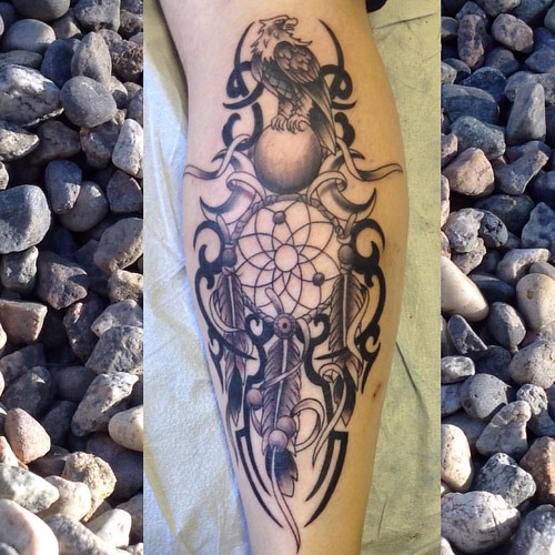
Cleaning out photos and came across this one, don't think I posted it before #arttherapycorp #funwithtribal #traditionaltattoo
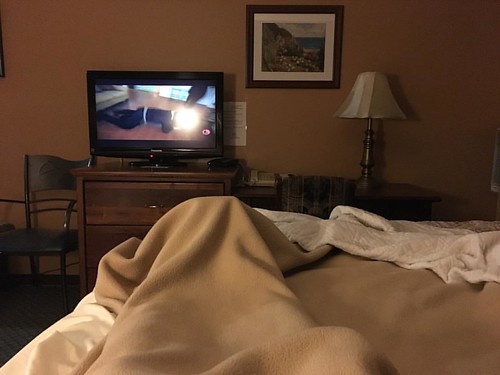
After a cold, fever and completely useless knee kicked my ass, I hunkered down in a motel in Elkford, BC. I opted for two nights and had my first real sleep in weeks. I even have my appetite back. #GDMTBR

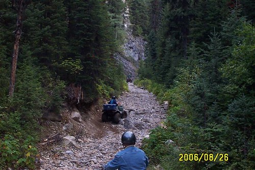
Thursday, June 11 4 hours of riding/walking this morning Had some tire and helmet issues on Tues/Wed so I needed to make side trip to Fernie,BC in afternoon Helmet is another story

Thursday, June 11 4 hours of riding/walking this morning Had some tire and helmet issues on Tues/Wed so I needed to make side trip to Fernie,BC in afternoon Helmet is another story

Thursday, June 11 4 hours of riding/walking this morning Had some tire and helmet issues on Tues/Wed so I needed to make side trip to Fernie,BC in afternoon Helmet is another story
Mapa de Mount Vanbuskirk, East Kootenay A, BC V0B 2G3, Canadá
Buscar otro lugar
Lugares cercanos
Mount Washburn, East Kootenay A, BC V0B, Canadá
Nashton Crescent, Elkford, BC V0B 1H0, Canadá
Elkford, BC V0B, Canadá
Mount Harrison, East Kootenay C, BC V0B, Canadá
Mount Mike, East Kootenay F, BC V0B, Canadá
Elkford, BC V0B, Canadá
Sparwood, BC, Canadá
Mount Hornickel, East Kootenay A, BC V0B, Canadá
Horseshoe Ridge, East Kootenay A, BC V0B, Canadá
Gass SW3, East Kootenay A, BC V0B, Canadá
Peak 09-48, East Kootenay A, BC V0B, Canadá
Mount Hosmer, East Kootenay C, BC V0B, Canadá
O'Rourke W3, East Kootenay A, BC V0B, Canadá
Hosmer, BC V0B, Canadá
Three Sisters, East Kootenay C, BC V0B, Canadá
Mount Gass, East Kootenay A, BC V0B, Canadá
Funnel N3, East Kootenay A, BC V0B, Canadá
Funnel N4, East Kootenay A, BC V0B, Canadá
Mount Erris, Ranchland No. 66, AB T0K, Canadá
Gass N3, East Kootenay A, BC V0B, Canadá
Búsquedas recientes
- Horas de salida y puesta de sol de Hadiya, Ethiopia
- Horas de salida y puesta de sol de Hosaina, Etiopía
- Horas de salida y puesta de sol de Necochea, Provincia de Buenos Aires, Argentina
- Horas de salida y puesta de sol de Maxine St NE, Albuquerque, NM, USA
- Horas de salida y puesta de sol de Manhattan Special Economic Zone, Camboya, Krong Bavet, City
- Horas de salida y puesta de sol de 大洗神社東, Isohamacho, Ōarai, Distrito de Higashiibaraki, Prefectura de Ibaraki -, Japón
- Horas de salida y puesta de sol de Polzela, Eslovenia
- Horas de salida y puesta de sol de Río Duero
- Horas de salida y puesta de sol de Blue Point Beach, Pecatu, South Kuta, Badung Regency, Bali, Indonesia
- Horas de salida y puesta de sol de Village Point Dr, Daphne, AL, EE. UU.

