Cherokee County, Kansas, USA Sonnenaufgang Sonnenuntergang Zeiten
Location: USA > Kansas >
Zeitzone:
America/Chicago
Ortszeit:
2024-05-06 01:00:49
Länge:
-94.8105955
Breite:
37.1142482
Sonnenaufgang Heute:
06:18:09 AM
Sonnenuntergang Heute:
08:13:27 PM
Tageslänge heute:
13h 55m 18s
Sonnenaufgang morgen:
06:17:09 AM
Sonnenuntergang Morgen:
08:14:20 PM
Tageslänge von morgen:
13h 57m 11s
Alle Termine anzeigen
| Datum | Sonnenaufgang | Sonnenuntergang | Tageslänge |
|---|---|---|---|
| 2024-01-01 | 07:32:50 AM | 05:13:16 PM | 9h 40m 26s |
| 2024-01-02 | 07:32:57 AM | 05:14:04 PM | 9h 41m 7s |
| 2024-01-03 | 07:33:02 AM | 05:14:53 PM | 9h 41m 51s |
| 2024-01-04 | 07:33:06 AM | 05:15:44 PM | 9h 42m 38s |
| 2024-01-05 | 07:33:07 AM | 05:16:36 PM | 9h 43m 29s |
| 2024-01-06 | 07:33:06 AM | 05:17:29 PM | 9h 44m 23s |
| 2024-01-07 | 07:33:04 AM | 05:18:24 PM | 9h 45m 20s |
| 2024-01-08 | 07:32:59 AM | 05:19:19 PM | 9h 46m 20s |
| 2024-01-09 | 07:32:52 AM | 05:20:15 PM | 9h 47m 23s |
| 2024-01-10 | 07:32:43 AM | 05:21:12 PM | 9h 48m 29s |
| 2024-01-11 | 07:32:32 AM | 05:22:10 PM | 9h 49m 38s |
| 2024-01-12 | 07:32:19 AM | 05:23:09 PM | 9h 50m 50s |
| 2024-01-13 | 07:32:05 AM | 05:24:08 PM | 9h 52m 3s |
| 2024-01-14 | 07:31:48 AM | 05:25:09 PM | 9h 53m 21s |
| 2024-01-15 | 07:31:29 AM | 05:26:10 PM | 9h 54m 41s |
| 2024-01-16 | 07:31:08 AM | 05:27:11 PM | 9h 56m 3s |
| 2024-01-17 | 07:30:45 AM | 05:28:13 PM | 9h 57m 28s |
| 2024-01-18 | 07:30:20 AM | 05:29:16 PM | 9h 58m 56s |
| 2024-01-19 | 07:29:53 AM | 05:30:19 PM | 10h 0m 26s |
| 2024-01-20 | 07:29:25 AM | 05:31:22 PM | 10h 1m 57s |
| 2024-01-21 | 07:28:54 AM | 05:32:26 PM | 10h 3m 32s |
| 2024-01-22 | 07:28:22 AM | 05:33:31 PM | 10h 5m 9s |
| 2024-01-23 | 07:27:48 AM | 05:34:35 PM | 10h 6m 47s |
| 2024-01-24 | 07:27:11 AM | 05:35:40 PM | 10h 8m 29s |
| 2024-01-25 | 07:26:34 AM | 05:36:45 PM | 10h 10m 11s |
| 2024-01-26 | 07:25:54 AM | 05:37:50 PM | 10h 11m 56s |
| 2024-01-27 | 07:25:12 AM | 05:38:55 PM | 10h 13m 43s |
| 2024-01-28 | 07:24:29 AM | 05:40:01 PM | 10h 15m 32s |
| 2024-01-29 | 07:23:44 AM | 05:41:06 PM | 10h 17m 22s |
| 2024-01-30 | 07:22:58 AM | 05:42:12 PM | 10h 19m 14s |
| 2024-01-31 | 07:22:10 AM | 05:43:17 PM | 10h 21m 7s |
| 2024-02-01 | 07:21:20 AM | 05:44:23 PM | 10h 23m 3s |
| 2024-02-02 | 07:20:28 AM | 05:45:28 PM | 10h 25m 0s |
| 2024-02-03 | 07:19:35 AM | 05:46:34 PM | 10h 26m 59s |
| 2024-02-04 | 07:18:41 AM | 05:47:39 PM | 10h 28m 58s |
| 2024-02-05 | 07:17:45 AM | 05:48:44 PM | 10h 30m 59s |
| 2024-02-06 | 07:16:48 AM | 05:49:50 PM | 10h 33m 2s |
| 2024-02-07 | 07:15:49 AM | 05:50:54 PM | 10h 35m 5s |
| 2024-02-08 | 07:14:48 AM | 05:51:59 PM | 10h 37m 11s |
| 2024-02-09 | 07:13:47 AM | 05:53:04 PM | 10h 39m 17s |
| 2024-02-10 | 07:12:44 AM | 05:54:08 PM | 10h 41m 24s |
| 2024-02-11 | 07:11:40 AM | 05:55:12 PM | 10h 43m 32s |
| 2024-02-12 | 07:10:34 AM | 05:56:16 PM | 10h 45m 42s |
| 2024-02-13 | 07:09:27 AM | 05:57:19 PM | 10h 47m 52s |
| 2024-02-14 | 07:08:19 AM | 05:58:23 PM | 10h 50m 4s |
| 2024-02-15 | 07:07:10 AM | 05:59:26 PM | 10h 52m 16s |
| 2024-02-16 | 07:06:00 AM | 06:00:28 PM | 10h 54m 28s |
| 2024-02-17 | 07:04:49 AM | 06:01:31 PM | 10h 56m 42s |
| 2024-02-18 | 07:03:36 AM | 06:02:33 PM | 10h 58m 57s |
| 2024-02-19 | 07:02:23 AM | 06:03:35 PM | 11h 1m 12s |
| 2024-02-20 | 07:01:08 AM | 06:04:36 PM | 11h 3m 28s |
| 2024-02-21 | 06:59:53 AM | 06:05:37 PM | 11h 5m 44s |
| 2024-02-22 | 06:58:37 AM | 06:06:38 PM | 11h 8m 1s |
| 2024-02-23 | 06:57:19 AM | 06:07:38 PM | 11h 10m 19s |
| 2024-02-24 | 06:56:01 AM | 06:08:39 PM | 11h 12m 38s |
| 2024-02-25 | 06:54:42 AM | 06:09:38 PM | 11h 14m 56s |
| 2024-02-26 | 06:53:23 AM | 06:10:38 PM | 11h 17m 15s |
| 2024-02-27 | 06:52:02 AM | 06:11:37 PM | 11h 19m 35s |
| 2024-02-28 | 06:50:41 AM | 06:12:36 PM | 11h 21m 55s |
| 2024-02-29 | 06:49:19 AM | 06:13:35 PM | 11h 24m 16s |
| 2024-03-01 | 06:47:56 AM | 06:14:33 PM | 11h 26m 37s |
| 2024-03-02 | 06:46:33 AM | 06:15:31 PM | 11h 28m 58s |
| 2024-03-03 | 06:45:09 AM | 06:16:28 PM | 11h 31m 19s |
| 2024-03-04 | 06:43:44 AM | 06:17:26 PM | 11h 33m 42s |
| 2024-03-05 | 06:42:19 AM | 06:18:23 PM | 11h 36m 4s |
| 2024-03-06 | 06:40:54 AM | 06:19:20 PM | 11h 38m 26s |
| 2024-03-07 | 06:39:28 AM | 06:20:16 PM | 11h 40m 48s |
| 2024-03-08 | 06:38:01 AM | 06:21:12 PM | 11h 43m 11s |
| 2024-03-09 | 06:36:34 AM | 06:22:08 PM | 11h 45m 34s |
| 2024-03-10 | 07:35:11 AM | 07:23:02 PM | 11h 47m 51s |
| 2024-03-11 | 07:33:43 AM | 07:23:57 PM | 11h 50m 14s |
| 2024-03-12 | 07:32:15 AM | 07:24:53 PM | 11h 52m 38s |
| 2024-03-13 | 07:30:47 AM | 07:25:48 PM | 11h 55m 1s |
| 2024-03-14 | 07:29:18 AM | 07:26:43 PM | 11h 57m 25s |
| 2024-03-15 | 07:27:49 AM | 07:27:38 PM | 11h 59m 49s |
| 2024-03-16 | 07:26:20 AM | 07:28:32 PM | 12h 2m 12s |
| 2024-03-17 | 07:24:51 AM | 07:29:26 PM | 12h 4m 35s |
| 2024-03-18 | 07:23:22 AM | 07:30:21 PM | 12h 6m 59s |
| 2024-03-19 | 07:21:52 AM | 07:31:15 PM | 12h 9m 23s |
| 2024-03-20 | 07:20:23 AM | 07:32:09 PM | 12h 11m 46s |
| 2024-03-21 | 07:18:53 AM | 07:33:02 PM | 12h 14m 9s |
| 2024-03-22 | 07:17:23 AM | 07:33:56 PM | 12h 16m 33s |
| 2024-03-23 | 07:15:54 AM | 07:34:50 PM | 12h 18m 56s |
| 2024-03-24 | 07:14:24 AM | 07:35:43 PM | 12h 21m 19s |
| 2024-03-25 | 07:12:54 AM | 07:36:36 PM | 12h 23m 42s |
| 2024-03-26 | 07:11:25 AM | 07:37:30 PM | 12h 26m 5s |
| 2024-03-27 | 07:09:55 AM | 07:38:23 PM | 12h 28m 28s |
| 2024-03-28 | 07:08:26 AM | 07:39:16 PM | 12h 30m 50s |
| 2024-03-29 | 07:06:57 AM | 07:40:09 PM | 12h 33m 12s |
| 2024-03-30 | 07:05:28 AM | 07:41:02 PM | 12h 35m 34s |
| 2024-03-31 | 07:04:00 AM | 07:41:55 PM | 12h 37m 55s |
| 2024-04-01 | 07:02:31 AM | 07:42:48 PM | 12h 40m 17s |
| 2024-04-02 | 07:01:03 AM | 07:43:41 PM | 12h 42m 38s |
| 2024-04-03 | 06:59:35 AM | 07:44:34 PM | 12h 44m 59s |
| 2024-04-04 | 06:58:08 AM | 07:45:27 PM | 12h 47m 19s |
| 2024-04-05 | 06:56:41 AM | 07:46:20 PM | 12h 49m 39s |
| 2024-04-06 | 06:55:14 AM | 07:47:13 PM | 12h 51m 59s |
| 2024-04-07 | 06:53:48 AM | 07:48:06 PM | 12h 54m 18s |
| 2024-04-08 | 06:52:23 AM | 07:49:00 PM | 12h 56m 37s |
| 2024-04-09 | 06:50:58 AM | 07:49:53 PM | 12h 58m 55s |
| 2024-04-10 | 06:49:33 AM | 07:50:46 PM | 13h 1m 13s |
| 2024-04-11 | 06:48:09 AM | 07:51:39 PM | 13h 3m 30s |
| 2024-04-12 | 06:46:45 AM | 07:52:32 PM | 13h 5m 47s |
| 2024-04-13 | 06:45:22 AM | 07:53:26 PM | 13h 8m 4s |
| 2024-04-14 | 06:44:00 AM | 07:54:19 PM | 13h 10m 19s |
| 2024-04-15 | 06:42:39 AM | 07:55:12 PM | 13h 12m 33s |
| 2024-04-16 | 06:41:18 AM | 07:56:06 PM | 13h 14m 48s |
| 2024-04-17 | 06:39:58 AM | 07:56:59 PM | 13h 17m 1s |
| 2024-04-18 | 06:38:39 AM | 07:57:53 PM | 13h 19m 14s |
| 2024-04-19 | 06:37:20 AM | 07:58:46 PM | 13h 21m 26s |
| 2024-04-20 | 06:36:02 AM | 07:59:40 PM | 13h 23m 38s |
| 2024-04-21 | 06:34:46 AM | 08:00:34 PM | 13h 25m 48s |
| 2024-04-22 | 06:33:30 AM | 08:01:27 PM | 13h 27m 57s |
| 2024-04-23 | 06:32:15 AM | 08:02:21 PM | 13h 30m 6s |
| 2024-04-24 | 06:31:01 AM | 08:03:15 PM | 13h 32m 14s |
| 2024-04-25 | 06:29:47 AM | 08:04:08 PM | 13h 34m 21s |
| 2024-04-26 | 06:28:35 AM | 08:05:02 PM | 13h 36m 27s |
| 2024-04-27 | 06:27:24 AM | 08:05:56 PM | 13h 38m 32s |
| 2024-04-28 | 06:26:14 AM | 08:06:49 PM | 13h 40m 35s |
| 2024-04-29 | 06:25:05 AM | 08:07:43 PM | 13h 42m 38s |
| 2024-04-30 | 06:23:58 AM | 08:08:36 PM | 13h 44m 38s |
| 2024-05-01 | 06:22:51 AM | 08:09:30 PM | 13h 46m 39s |
| 2024-05-02 | 06:21:46 AM | 08:10:23 PM | 13h 48m 37s |
| 2024-05-03 | 06:20:41 AM | 08:11:17 PM | 13h 50m 36s |
| 2024-05-04 | 06:19:38 AM | 08:12:10 PM | 13h 52m 32s |
| 2024-05-05 | 06:18:37 AM | 08:13:03 PM | 13h 54m 26s |
| 2024-05-06 | 06:17:36 AM | 08:13:56 PM | 13h 56m 20s |
| 2024-05-07 | 06:16:37 AM | 08:14:48 PM | 13h 58m 11s |
| 2024-05-08 | 06:15:39 AM | 08:15:41 PM | 14h 0m 2s |
| 2024-05-09 | 06:14:43 AM | 08:16:33 PM | 14h 1m 50s |
| 2024-05-10 | 06:13:48 AM | 08:17:25 PM | 14h 3m 37s |
| 2024-05-11 | 06:12:54 AM | 08:18:17 PM | 14h 5m 23s |
| 2024-05-12 | 06:12:02 AM | 08:19:08 PM | 14h 7m 6s |
| 2024-05-13 | 06:11:11 AM | 08:20:00 PM | 14h 8m 49s |
| 2024-05-14 | 06:10:22 AM | 08:20:50 PM | 14h 10m 28s |
| 2024-05-15 | 06:09:35 AM | 08:21:41 PM | 14h 12m 6s |
| 2024-05-16 | 06:08:49 AM | 08:22:31 PM | 14h 13m 42s |
| 2024-05-17 | 06:08:04 AM | 08:23:20 PM | 14h 15m 16s |
| 2024-05-18 | 06:07:21 AM | 08:24:09 PM | 14h 16m 48s |
| 2024-05-19 | 06:06:40 AM | 08:24:58 PM | 14h 18m 18s |
| 2024-05-20 | 06:06:00 AM | 08:25:46 PM | 14h 19m 46s |
| 2024-05-21 | 06:05:22 AM | 08:26:33 PM | 14h 21m 11s |
| 2024-05-22 | 06:04:45 AM | 08:27:20 PM | 14h 22m 35s |
| 2024-05-23 | 06:04:10 AM | 08:28:06 PM | 14h 23m 56s |
| 2024-05-24 | 06:03:37 AM | 08:28:51 PM | 14h 25m 14s |
| 2024-05-25 | 06:03:06 AM | 08:29:36 PM | 14h 26m 30s |
| 2024-05-26 | 06:02:36 AM | 08:30:20 PM | 14h 27m 44s |
| 2024-05-27 | 06:02:08 AM | 08:31:03 PM | 14h 28m 55s |
| 2024-05-28 | 06:01:42 AM | 08:31:45 PM | 14h 30m 3s |
| 2024-05-29 | 06:01:17 AM | 08:32:27 PM | 14h 31m 10s |
| 2024-05-30 | 06:00:55 AM | 08:33:07 PM | 14h 32m 12s |
| 2024-05-31 | 06:00:34 AM | 08:33:47 PM | 14h 33m 13s |
| 2024-06-01 | 06:00:14 AM | 08:34:25 PM | 14h 34m 11s |
| 2024-06-02 | 05:59:57 AM | 08:35:03 PM | 14h 35m 6s |
| 2024-06-03 | 05:59:41 AM | 08:35:39 PM | 14h 35m 58s |
| 2024-06-04 | 05:59:27 AM | 08:36:14 PM | 14h 36m 47s |
| 2024-06-05 | 05:59:15 AM | 08:36:48 PM | 14h 37m 33s |
| 2024-06-06 | 05:59:05 AM | 08:37:21 PM | 14h 38m 16s |
| 2024-06-07 | 05:58:56 AM | 08:37:53 PM | 14h 38m 57s |
| 2024-06-08 | 05:58:49 AM | 08:38:24 PM | 14h 39m 35s |
| 2024-06-09 | 05:58:44 AM | 08:38:53 PM | 14h 40m 9s |
| 2024-06-10 | 05:58:40 AM | 08:39:21 PM | 14h 40m 41s |
| 2024-06-11 | 05:58:39 AM | 08:39:47 PM | 14h 41m 8s |
| 2024-06-12 | 05:58:39 AM | 08:40:12 PM | 14h 41m 33s |
| 2024-06-13 | 05:58:41 AM | 08:40:36 PM | 14h 41m 55s |
| 2024-06-14 | 05:58:44 AM | 08:40:58 PM | 14h 42m 14s |
| 2024-06-15 | 05:58:49 AM | 08:41:19 PM | 14h 42m 30s |
| 2024-06-16 | 05:58:56 AM | 08:41:38 PM | 14h 42m 42s |
| 2024-06-17 | 05:59:04 AM | 08:41:56 PM | 14h 42m 52s |
| 2024-06-18 | 05:59:14 AM | 08:42:12 PM | 14h 42m 58s |
| 2024-06-19 | 05:59:26 AM | 08:42:27 PM | 14h 43m 1s |
| 2024-06-20 | 05:59:39 AM | 08:42:39 PM | 14h 43m 0s |
| 2024-06-21 | 05:59:54 AM | 08:42:51 PM | 14h 42m 57s |
| 2024-06-22 | 06:00:11 AM | 08:43:00 PM | 14h 42m 49s |
| 2024-06-23 | 06:00:28 AM | 08:43:08 PM | 14h 42m 40s |
| 2024-06-24 | 06:00:48 AM | 08:43:14 PM | 14h 42m 26s |
| 2024-06-25 | 06:01:08 AM | 08:43:19 PM | 14h 42m 11s |
| 2024-06-26 | 06:01:31 AM | 08:43:21 PM | 14h 41m 50s |
| 2024-06-27 | 06:01:54 AM | 08:43:22 PM | 14h 41m 28s |
| 2024-06-28 | 06:02:19 AM | 08:43:22 PM | 14h 41m 3s |
| 2024-06-29 | 06:02:45 AM | 08:43:19 PM | 14h 40m 34s |
| 2024-06-30 | 06:03:13 AM | 08:43:15 PM | 14h 40m 2s |
| 2024-07-01 | 06:03:41 AM | 08:43:08 PM | 14h 39m 27s |
| 2024-07-02 | 06:04:11 AM | 08:43:00 PM | 14h 38m 49s |
| 2024-07-03 | 06:04:42 AM | 08:42:51 PM | 14h 38m 9s |
| 2024-07-04 | 06:05:15 AM | 08:42:39 PM | 14h 37m 24s |
| 2024-07-05 | 06:05:48 AM | 08:42:26 PM | 14h 36m 38s |
| 2024-07-06 | 06:06:22 AM | 08:42:10 PM | 14h 35m 48s |
| 2024-07-07 | 06:06:58 AM | 08:41:53 PM | 14h 34m 55s |
| 2024-07-08 | 06:07:34 AM | 08:41:35 PM | 14h 34m 1s |
| 2024-07-09 | 06:08:12 AM | 08:41:14 PM | 14h 33m 2s |
| 2024-07-10 | 06:08:50 AM | 08:40:52 PM | 14h 32m 2s |
| 2024-07-11 | 06:09:29 AM | 08:40:27 PM | 14h 30m 58s |
| 2024-07-12 | 06:10:09 AM | 08:40:01 PM | 14h 29m 52s |
| 2024-07-13 | 06:10:50 AM | 08:39:34 PM | 14h 28m 44s |
| 2024-07-14 | 06:11:31 AM | 08:39:04 PM | 14h 27m 33s |
| 2024-07-15 | 06:12:13 AM | 08:38:33 PM | 14h 26m 20s |
| 2024-07-16 | 06:12:56 AM | 08:38:00 PM | 14h 25m 4s |
| 2024-07-17 | 06:13:40 AM | 08:37:25 PM | 14h 23m 45s |
| 2024-07-18 | 06:14:24 AM | 08:36:49 PM | 14h 22m 25s |
| 2024-07-19 | 06:15:09 AM | 08:36:10 PM | 14h 21m 1s |
| 2024-07-20 | 06:15:54 AM | 08:35:31 PM | 14h 19m 37s |
| 2024-07-21 | 06:16:40 AM | 08:34:49 PM | 14h 18m 9s |
| 2024-07-22 | 06:17:26 AM | 08:34:06 PM | 14h 16m 40s |
| 2024-07-23 | 06:18:13 AM | 08:33:21 PM | 14h 15m 8s |
| 2024-07-24 | 06:19:00 AM | 08:32:35 PM | 14h 13m 35s |
| 2024-07-25 | 06:19:48 AM | 08:31:47 PM | 14h 11m 59s |
| 2024-07-26 | 06:20:36 AM | 08:30:58 PM | 14h 10m 22s |
| 2024-07-27 | 06:21:24 AM | 08:30:07 PM | 14h 8m 43s |
| 2024-07-28 | 06:22:12 AM | 08:29:14 PM | 14h 7m 2s |
| 2024-07-29 | 06:23:01 AM | 08:28:20 PM | 14h 5m 19s |
| 2024-07-30 | 06:23:50 AM | 08:27:25 PM | 14h 3m 35s |
| 2024-07-31 | 06:24:39 AM | 08:26:28 PM | 14h 1m 49s |
| 2024-08-01 | 06:25:29 AM | 08:25:30 PM | 14h 0m 1s |
| 2024-08-02 | 06:26:18 AM | 08:24:30 PM | 13h 58m 12s |
| 2024-08-03 | 06:27:08 AM | 08:23:29 PM | 13h 56m 21s |
| 2024-08-04 | 06:27:58 AM | 08:22:27 PM | 13h 54m 29s |
| 2024-08-05 | 06:28:48 AM | 08:21:24 PM | 13h 52m 36s |
| 2024-08-06 | 06:29:38 AM | 08:20:19 PM | 13h 50m 41s |
| 2024-08-07 | 06:30:28 AM | 08:19:13 PM | 13h 48m 45s |
| 2024-08-08 | 06:31:18 AM | 08:18:05 PM | 13h 46m 47s |
| 2024-08-09 | 06:32:08 AM | 08:16:57 PM | 13h 44m 49s |
| 2024-08-10 | 06:32:58 AM | 08:15:47 PM | 13h 42m 49s |
| 2024-08-11 | 06:33:48 AM | 08:14:37 PM | 13h 40m 49s |
| 2024-08-12 | 06:34:39 AM | 08:13:25 PM | 13h 38m 46s |
| 2024-08-13 | 06:35:29 AM | 08:12:12 PM | 13h 36m 43s |
| 2024-08-14 | 06:36:19 AM | 08:10:58 PM | 13h 34m 39s |
| 2024-08-15 | 06:37:09 AM | 08:09:43 PM | 13h 32m 34s |
| 2024-08-16 | 06:37:59 AM | 08:08:27 PM | 13h 30m 28s |
| 2024-08-17 | 06:38:49 AM | 08:07:10 PM | 13h 28m 21s |
| 2024-08-18 | 06:39:39 AM | 08:05:52 PM | 13h 26m 13s |
| 2024-08-19 | 06:40:29 AM | 08:04:33 PM | 13h 24m 4s |
| 2024-08-20 | 06:41:19 AM | 08:03:14 PM | 13h 21m 55s |
| 2024-08-21 | 06:42:08 AM | 08:01:53 PM | 13h 19m 45s |
| 2024-08-22 | 06:42:58 AM | 08:00:32 PM | 13h 17m 34s |
| 2024-08-23 | 06:43:47 AM | 07:59:10 PM | 13h 15m 23s |
| 2024-08-24 | 06:44:37 AM | 07:57:47 PM | 13h 13m 10s |
| 2024-08-25 | 06:45:26 AM | 07:56:24 PM | 13h 10m 58s |
| 2024-08-26 | 06:46:16 AM | 07:55:00 PM | 13h 8m 44s |
| 2024-08-27 | 06:47:05 AM | 07:53:35 PM | 13h 6m 30s |
| 2024-08-28 | 06:47:54 AM | 07:52:10 PM | 13h 4m 16s |
| 2024-08-29 | 06:48:43 AM | 07:50:43 PM | 13h 2m 0s |
| 2024-08-30 | 06:49:32 AM | 07:49:17 PM | 12h 59m 45s |
| 2024-08-31 | 06:50:21 AM | 07:47:50 PM | 12h 57m 29s |
| 2024-09-01 | 06:51:10 AM | 07:46:22 PM | 12h 55m 12s |
| 2024-09-02 | 06:51:59 AM | 07:44:54 PM | 12h 52m 55s |
| 2024-09-03 | 06:52:48 AM | 07:43:25 PM | 12h 50m 37s |
| 2024-09-04 | 06:53:37 AM | 07:41:56 PM | 12h 48m 19s |
| 2024-09-05 | 06:54:25 AM | 07:40:27 PM | 12h 46m 2s |
| 2024-09-06 | 06:55:14 AM | 07:38:57 PM | 12h 43m 43s |
| 2024-09-07 | 06:56:03 AM | 07:37:27 PM | 12h 41m 24s |
| 2024-09-08 | 06:56:51 AM | 07:35:56 PM | 12h 39m 5s |
| 2024-09-09 | 06:57:40 AM | 07:34:26 PM | 12h 36m 46s |
| 2024-09-10 | 06:58:29 AM | 07:32:55 PM | 12h 34m 26s |
| 2024-09-11 | 06:59:18 AM | 07:31:24 PM | 12h 32m 6s |
| 2024-09-12 | 07:00:06 AM | 07:29:52 PM | 12h 29m 46s |
| 2024-09-13 | 07:00:55 AM | 07:28:21 PM | 12h 27m 26s |
| 2024-09-14 | 07:01:44 AM | 07:26:49 PM | 12h 25m 5s |
| 2024-09-15 | 07:02:33 AM | 07:25:17 PM | 12h 22m 44s |
| 2024-09-16 | 07:03:22 AM | 07:23:45 PM | 12h 20m 23s |
| 2024-09-17 | 07:04:11 AM | 07:22:13 PM | 12h 18m 2s |
| 2024-09-18 | 07:05:00 AM | 07:20:42 PM | 12h 15m 42s |
| 2024-09-19 | 07:05:49 AM | 07:19:10 PM | 12h 13m 21s |
| 2024-09-20 | 07:06:39 AM | 07:17:38 PM | 12h 10m 59s |
| 2024-09-21 | 07:07:28 AM | 07:16:06 PM | 12h 8m 38s |
| 2024-09-22 | 07:08:18 AM | 07:14:34 PM | 12h 6m 16s |
| 2024-09-23 | 07:09:07 AM | 07:13:03 PM | 12h 3m 56s |
| 2024-09-24 | 07:09:57 AM | 07:11:31 PM | 12h 1m 34s |
| 2024-09-25 | 07:10:47 AM | 07:10:00 PM | 11h 59m 13s |
| 2024-09-26 | 07:11:38 AM | 07:08:29 PM | 11h 56m 51s |
| 2024-09-27 | 07:12:28 AM | 07:06:58 PM | 11h 54m 30s |
| 2024-09-28 | 07:13:19 AM | 07:05:28 PM | 11h 52m 9s |
| 2024-09-29 | 07:14:10 AM | 07:03:57 PM | 11h 49m 47s |
| 2024-09-30 | 07:15:01 AM | 07:02:28 PM | 11h 47m 27s |
| 2024-10-01 | 07:15:53 AM | 07:00:58 PM | 11h 45m 5s |
| 2024-10-02 | 07:16:44 AM | 06:59:29 PM | 11h 42m 45s |
| 2024-10-03 | 07:17:36 AM | 06:58:00 PM | 11h 40m 24s |
| 2024-10-04 | 07:18:28 AM | 06:56:32 PM | 11h 38m 4s |
| 2024-10-05 | 07:19:21 AM | 06:55:04 PM | 11h 35m 43s |
| 2024-10-06 | 07:20:14 AM | 06:53:37 PM | 11h 33m 23s |
| 2024-10-07 | 07:21:07 AM | 06:52:10 PM | 11h 31m 3s |
| 2024-10-08 | 07:22:00 AM | 06:50:44 PM | 11h 28m 44s |
| 2024-10-09 | 07:22:54 AM | 06:49:19 PM | 11h 26m 25s |
| 2024-10-10 | 07:23:48 AM | 06:47:54 PM | 11h 24m 6s |
| 2024-10-11 | 07:24:42 AM | 06:46:30 PM | 11h 21m 48s |
| 2024-10-12 | 07:25:37 AM | 06:45:06 PM | 11h 19m 29s |
| 2024-10-13 | 07:26:32 AM | 06:43:44 PM | 11h 17m 12s |
| 2024-10-14 | 07:27:27 AM | 06:42:22 PM | 11h 14m 55s |
| 2024-10-15 | 07:28:23 AM | 06:41:00 PM | 11h 12m 37s |
| 2024-10-16 | 07:29:19 AM | 06:39:40 PM | 11h 10m 21s |
| 2024-10-17 | 07:30:15 AM | 06:38:21 PM | 11h 8m 6s |
| 2024-10-18 | 07:31:12 AM | 06:37:02 PM | 11h 5m 50s |
| 2024-10-19 | 07:32:09 AM | 06:35:44 PM | 11h 3m 35s |
| 2024-10-20 | 07:33:06 AM | 06:34:28 PM | 11h 1m 22s |
| 2024-10-21 | 07:34:04 AM | 06:33:12 PM | 10h 59m 8s |
| 2024-10-22 | 07:35:02 AM | 06:31:57 PM | 10h 56m 55s |
| 2024-10-23 | 07:36:01 AM | 06:30:44 PM | 10h 54m 43s |
| 2024-10-24 | 07:36:59 AM | 06:29:31 PM | 10h 52m 32s |
| 2024-10-25 | 07:37:59 AM | 06:28:20 PM | 10h 50m 21s |
| 2024-10-26 | 07:38:58 AM | 06:27:10 PM | 10h 48m 12s |
| 2024-10-27 | 07:39:58 AM | 06:26:01 PM | 10h 46m 3s |
| 2024-10-28 | 07:40:58 AM | 06:24:53 PM | 10h 43m 55s |
| 2024-10-29 | 07:41:58 AM | 06:23:46 PM | 10h 41m 48s |
| 2024-10-30 | 07:42:59 AM | 06:22:41 PM | 10h 39m 42s |
| 2024-10-31 | 07:44:00 AM | 06:21:37 PM | 10h 37m 37s |
| 2024-11-01 | 07:45:01 AM | 06:20:34 PM | 10h 35m 33s |
| 2024-11-02 | 07:46:02 AM | 06:19:33 PM | 10h 33m 31s |
| 2024-11-03 | 06:47:06 AM | 05:18:31 PM | 10h 31m 25s |
| 2024-11-04 | 06:48:08 AM | 05:17:33 PM | 10h 29m 25s |
| 2024-11-05 | 06:49:10 AM | 05:16:36 PM | 10h 27m 26s |
| 2024-11-06 | 06:50:12 AM | 05:15:41 PM | 10h 25m 29s |
| 2024-11-07 | 06:51:15 AM | 05:14:47 PM | 10h 23m 32s |
| 2024-11-08 | 06:52:17 AM | 05:13:55 PM | 10h 21m 38s |
| 2024-11-09 | 06:53:20 AM | 05:13:04 PM | 10h 19m 44s |
| 2024-11-10 | 06:54:22 AM | 05:12:15 PM | 10h 17m 53s |
| 2024-11-11 | 06:55:25 AM | 05:11:28 PM | 10h 16m 3s |
| 2024-11-12 | 06:56:27 AM | 05:10:43 PM | 10h 14m 16s |
| 2024-11-13 | 06:57:30 AM | 05:09:59 PM | 10h 12m 29s |
| 2024-11-14 | 06:58:32 AM | 05:09:17 PM | 10h 10m 45s |
| 2024-11-15 | 06:59:35 AM | 05:08:36 PM | 10h 9m 1s |
| 2024-11-16 | 07:00:37 AM | 05:07:58 PM | 10h 7m 21s |
| 2024-11-17 | 07:01:39 AM | 05:07:21 PM | 10h 5m 42s |
| 2024-11-18 | 07:02:41 AM | 05:06:47 PM | 10h 4m 6s |
| 2024-11-19 | 07:03:43 AM | 05:06:14 PM | 10h 2m 31s |
| 2024-11-20 | 07:04:44 AM | 05:05:43 PM | 10h 0m 59s |
| 2024-11-21 | 07:05:45 AM | 05:05:14 PM | 9h 59m 29s |
| 2024-11-22 | 07:06:45 AM | 05:04:47 PM | 9h 58m 2s |
| 2024-11-23 | 07:07:46 AM | 05:04:22 PM | 9h 56m 36s |
| 2024-11-24 | 07:08:45 AM | 05:03:58 PM | 9h 55m 13s |
| 2024-11-25 | 07:09:45 AM | 05:03:37 PM | 9h 53m 52s |
| 2024-11-26 | 07:10:43 AM | 05:03:18 PM | 9h 52m 35s |
| 2024-11-27 | 07:11:41 AM | 05:03:01 PM | 9h 51m 20s |
| 2024-11-28 | 07:12:39 AM | 05:02:46 PM | 9h 50m 7s |
| 2024-11-29 | 07:13:35 AM | 05:02:33 PM | 9h 48m 58s |
| 2024-11-30 | 07:14:31 AM | 05:02:22 PM | 9h 47m 51s |
| 2024-12-01 | 07:15:26 AM | 05:02:13 PM | 9h 46m 47s |
| 2024-12-02 | 07:16:20 AM | 05:02:07 PM | 9h 45m 47s |
| 2024-12-03 | 07:17:14 AM | 05:02:02 PM | 9h 44m 48s |
| 2024-12-04 | 07:18:06 AM | 05:01:59 PM | 9h 43m 53s |
| 2024-12-05 | 07:18:57 AM | 05:01:59 PM | 9h 43m 2s |
| 2024-12-06 | 07:19:48 AM | 05:02:00 PM | 9h 42m 12s |
| 2024-12-07 | 07:20:37 AM | 05:02:04 PM | 9h 41m 27s |
| 2024-12-08 | 07:21:25 AM | 05:02:09 PM | 9h 40m 44s |
| 2024-12-09 | 07:22:12 AM | 05:02:17 PM | 9h 40m 5s |
| 2024-12-10 | 07:22:57 AM | 05:02:27 PM | 9h 39m 30s |
| 2024-12-11 | 07:23:41 AM | 05:02:39 PM | 9h 38m 58s |
| 2024-12-12 | 07:24:24 AM | 05:02:53 PM | 9h 38m 29s |
| 2024-12-13 | 07:25:06 AM | 05:03:08 PM | 9h 38m 2s |
| 2024-12-14 | 07:25:46 AM | 05:03:26 PM | 9h 37m 40s |
| 2024-12-15 | 07:26:24 AM | 05:03:46 PM | 9h 37m 22s |
| 2024-12-16 | 07:27:01 AM | 05:04:08 PM | 9h 37m 7s |
| 2024-12-17 | 07:27:37 AM | 05:04:31 PM | 9h 36m 54s |
| 2024-12-18 | 07:28:11 AM | 05:04:57 PM | 9h 36m 46s |
| 2024-12-19 | 07:28:43 AM | 05:05:24 PM | 9h 36m 41s |
| 2024-12-20 | 07:29:13 AM | 05:05:53 PM | 9h 36m 40s |
| 2024-12-21 | 07:29:42 AM | 05:06:24 PM | 9h 36m 42s |
| 2024-12-22 | 07:30:09 AM | 05:06:57 PM | 9h 36m 48s |
| 2024-12-23 | 07:30:34 AM | 05:07:31 PM | 9h 36m 57s |
| 2024-12-24 | 07:30:57 AM | 05:08:07 PM | 9h 37m 10s |
| 2024-12-25 | 07:31:19 AM | 05:08:45 PM | 9h 37m 26s |
| 2024-12-26 | 07:31:38 AM | 05:09:25 PM | 9h 37m 47s |
| 2024-12-27 | 07:31:56 AM | 05:10:05 PM | 9h 38m 9s |
| 2024-12-28 | 07:32:12 AM | 05:10:48 PM | 9h 38m 36s |
| 2024-12-29 | 07:32:26 AM | 05:11:32 PM | 9h 39m 6s |
| 2024-12-30 | 07:32:37 AM | 05:12:17 PM | 9h 39m 40s |
Fotos
Abandoned Building Keep Out and Sunset in Picher, OK - 20150124CRN

10-06-09 Day 12 - Route 66
Abandoned 3-2 ballpark & chatpile in Picher, OK, site of the largest toxic waste site in US
Sunset against a Silhouetted Chat Pile in Picher, OK - 20150124CRN
Baxter Springs Cemetery
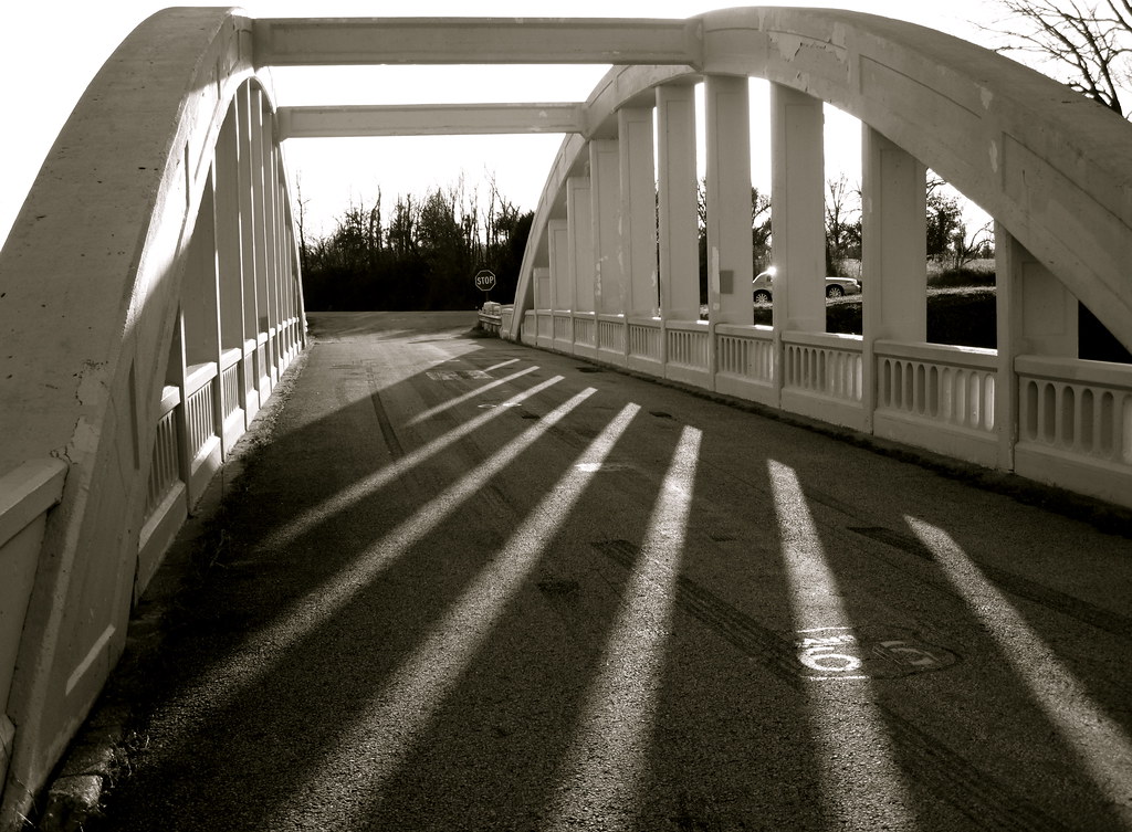
Bridge shadows
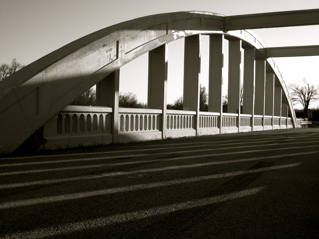
Route 66 Bridge
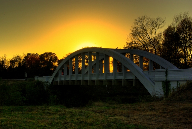
Rainbow Bridge Sunset

Rainbow Sunset

10-06-09 Day 12 - Route 66

10-06-09 Day 12 - Route 66

10-06-09 Day 12 - Route 66

10-06-09 Day 12 - Route 66
Cherokee County, Kansas, USA Karte
Suchen Sie einen anderen Ort
Orte in Cherokee County, Kansas, USA
Galena, Kansas, USA
Lola Township, KS, USA
Mineral, KS, USA
Spring Valley, KS, USA
Pleasant View, KS, USA
Columbus, KS, USA
Weir, KS, USA
Baxter Springs, KS, USA
Garden, KS, USA
Neosho, KS, USA
Sheridan, KS, USA
Salamanca, KS, USA
Nahe Plätze
SE 25th St, Columbus, KS, USA
Columbus, KS, USA
Pennsylvania, Columbus, KS, USA
Spring Valley, KS, USA
SE 68th St, Riverton, KS, USA
W 12th St, Baxter Springs, KS, USA
Riverton, KS, USA
Baxter Springs, KS, USA
28 NE Turkey Ln, Columbus, KS, USA
Salamanca, KS, USA
Baxter Springs Golf & Country Club, Hale Irwin Dr, Baxter Springs, KS, USA
Mineral, KS, USA
Fox 14, US-69, Scammon, KS, USA
Garden, KS, USA
Virginia St, Quapaw, OK, USA
Quapaw, OK, USA
W 6th St, Galena, KS, USA
Galena, Kansas, USA
Mi Torito Mexican Restaurant, S Main St, Galena, KS, USA
Commerce St, Commerce, OK, USA
Letzte Suche
- Presidente Quintana & Emilio Mitre, Carlos Keen, Provincia de Buenos Aires, Argentina Sonnenaufgang Sonnenuntergang Zeiten
- Deep Gap Farm Rd E, Mill Spring, NC, USA Sonnenaufgang Sonnenuntergang Zeiten
- Jiujiangzhen, Nanhai District, Foshan, Guangdong Province, China Sonnenaufgang Sonnenuntergang Zeiten
- Mountain View, CA, USA Sonnenaufgang Sonnenuntergang Zeiten
- Road to the sky observatory, Shuenhigashi, Shari, Shari District, Hokkaido -, Japan Sonnenaufgang Sonnenuntergang Zeiten
- 海岸咖啡, No. 31號, Chaishan Ave, Gushan District, Kaohsiung City, Taiwan Sonnenaufgang Sonnenuntergang Zeiten
- Estates Loop, Priest River, ID, USA Sonnenaufgang Sonnenuntergang Zeiten
- Woodland Oak Pl, Thousand Oaks, CA, USA Sonnenaufgang Sonnenuntergang Zeiten
- Sarangdanda, Nepal Sonnenaufgang Sonnenuntergang Zeiten
- Nakanoshima, Shiogama, Miyagi -, Japan Sonnenaufgang Sonnenuntergang Zeiten