Wet Mill Creek Rd, Celina, TN 美國的日出日落時間表
Location: 美國 > 田納西州 > 克萊郡 > TN 美國 >
時區:
America/Chicago
當地時間:
2025-07-05 05:11:45
經度:
-85.4603115
緯度:
36.4827252
今天日出時間:
05:29:44 AM
今天日落時間:
08:03:26 PM
今天日照時長:
14h 33m 42s
明天日出時間:
05:30:17 AM
明天日落時間:
08:03:12 PM
明天日照時長:
14h 32m 55s
顯示所有日期
| 日期 | 日出 | 日落 | 日照時長 |
|---|---|---|---|
| 2025年01月01日 | 06:53:49 AM | 04:38:08 PM | 9h 44m 19s |
| 2025年01月02日 | 06:53:56 AM | 04:38:57 PM | 9h 45m 1s |
| 2025年01月03日 | 06:54:00 AM | 04:39:47 PM | 9h 45m 47s |
| 2025年01月04日 | 06:54:02 AM | 04:40:38 PM | 9h 46m 36s |
| 2025年01月05日 | 06:54:03 AM | 04:41:30 PM | 9h 47m 27s |
| 2025年01月06日 | 06:54:02 AM | 04:42:24 PM | 9h 48m 22s |
| 2025年01月07日 | 06:53:58 AM | 04:43:18 PM | 9h 49m 20s |
| 2025年01月08日 | 06:53:53 AM | 04:44:13 PM | 9h 50m 20s |
| 2025年01月09日 | 06:53:45 AM | 04:45:09 PM | 9h 51m 24s |
| 2025年01月10日 | 06:53:36 AM | 04:46:06 PM | 9h 52m 30s |
| 2025年01月11日 | 06:53:24 AM | 04:47:04 PM | 9h 53m 40s |
| 2025年01月12日 | 06:53:11 AM | 04:48:02 PM | 9h 54m 51s |
| 2025年01月13日 | 06:52:55 AM | 04:49:01 PM | 9h 56m 6s |
| 2025年01月14日 | 06:52:38 AM | 04:50:01 PM | 9h 57m 23s |
| 2025年01月15日 | 06:52:18 AM | 04:51:01 PM | 9h 58m 43s |
| 2025年01月16日 | 06:51:57 AM | 04:52:02 PM | 10h 0m 5s |
| 2025年01月17日 | 06:51:34 AM | 04:53:04 PM | 10h 1m 30s |
| 2025年01月18日 | 06:51:09 AM | 04:54:05 PM | 10h 2m 56s |
| 2025年01月19日 | 06:50:42 AM | 04:55:08 PM | 10h 4m 26s |
| 2025年01月20日 | 06:50:13 AM | 04:56:10 PM | 10h 5m 57s |
| 2025年01月21日 | 06:49:42 AM | 04:57:13 PM | 10h 7m 31s |
| 2025年01月22日 | 06:49:10 AM | 04:58:17 PM | 10h 9m 7s |
| 2025年01月23日 | 06:48:35 AM | 04:59:20 PM | 10h 10m 45s |
| 2025年01月24日 | 06:47:59 AM | 05:00:24 PM | 10h 12m 25s |
| 2025年01月25日 | 06:47:21 AM | 05:01:28 PM | 10h 14m 7s |
| 2025年01月26日 | 06:46:41 AM | 05:02:32 PM | 10h 15m 51s |
| 2025年01月27日 | 06:46:00 AM | 05:03:36 PM | 10h 17m 36s |
| 2025年01月28日 | 06:45:17 AM | 05:04:40 PM | 10h 19m 23s |
| 2025年01月29日 | 06:44:32 AM | 05:05:44 PM | 10h 21m 12s |
| 2025年01月30日 | 06:43:46 AM | 05:06:48 PM | 10h 23m 2s |
| 2025年01月31日 | 06:42:58 AM | 05:07:53 PM | 10h 24m 55s |
| 2025年02月01日 | 06:42:08 AM | 05:08:57 PM | 10h 26m 49s |
| 2025年02月02日 | 06:41:17 AM | 05:10:01 PM | 10h 28m 44s |
| 2025年02月03日 | 06:40:24 AM | 05:11:05 PM | 10h 30m 41s |
| 2025年02月04日 | 06:39:30 AM | 05:12:09 PM | 10h 32m 39s |
| 2025年02月05日 | 06:38:35 AM | 05:13:12 PM | 10h 34m 37s |
| 2025年02月06日 | 06:37:38 AM | 05:14:16 PM | 10h 36m 38s |
| 2025年02月07日 | 06:36:39 AM | 05:15:19 PM | 10h 38m 40s |
| 2025年02月08日 | 06:35:39 AM | 05:16:22 PM | 10h 40m 43s |
| 2025年02月09日 | 06:34:38 AM | 05:17:25 PM | 10h 42m 47s |
| 2025年02月10日 | 06:33:36 AM | 05:18:28 PM | 10h 44m 52s |
| 2025年02月11日 | 06:32:32 AM | 05:19:30 PM | 10h 46m 58s |
| 2025年02月12日 | 06:31:27 AM | 05:20:32 PM | 10h 49m 5s |
| 2025年02月13日 | 06:30:21 AM | 05:21:34 PM | 10h 51m 13s |
| 2025年02月14日 | 06:29:14 AM | 05:22:35 PM | 10h 53m 21s |
| 2025年02月15日 | 06:28:06 AM | 05:23:37 PM | 10h 55m 31s |
| 2025年02月16日 | 06:26:56 AM | 05:24:37 PM | 10h 57m 41s |
| 2025年02月17日 | 06:25:46 AM | 05:25:38 PM | 10h 59m 52s |
| 2025年02月18日 | 06:24:34 AM | 05:26:38 PM | 11h 2m 4s |
| 2025年02月19日 | 06:23:21 AM | 05:27:38 PM | 11h 4m 17s |
| 2025年02月20日 | 06:22:08 AM | 05:28:38 PM | 11h 6m 30s |
| 2025年02月21日 | 06:20:53 AM | 05:29:37 PM | 11h 8m 44s |
| 2025年02月22日 | 06:19:38 AM | 05:30:36 PM | 11h 10m 58s |
| 2025年02月23日 | 06:18:22 AM | 05:31:35 PM | 11h 13m 13s |
| 2025年02月24日 | 06:17:04 AM | 05:32:33 PM | 11h 15m 29s |
| 2025年02月25日 | 06:15:47 AM | 05:33:31 PM | 11h 17m 44s |
| 2025年02月26日 | 06:14:28 AM | 05:34:29 PM | 11h 20m 1s |
| 2025年02月27日 | 06:13:08 AM | 05:35:26 PM | 11h 22m 18s |
| 2025年02月28日 | 06:11:48 AM | 05:36:23 PM | 11h 24m 35s |
| 2025年03月01日 | 06:10:27 AM | 05:37:20 PM | 11h 26m 53s |
| 2025年03月02日 | 06:09:06 AM | 05:38:16 PM | 11h 29m 10s |
| 2025年03月03日 | 06:07:44 AM | 05:39:13 PM | 11h 31m 29s |
| 2025年03月04日 | 06:06:21 AM | 05:40:08 PM | 11h 33m 47s |
| 2025年03月05日 | 06:04:58 AM | 05:41:04 PM | 11h 36m 6s |
| 2025年03月06日 | 06:03:34 AM | 05:41:59 PM | 11h 38m 25s |
| 2025年03月07日 | 06:02:09 AM | 05:42:54 PM | 11h 40m 45s |
| 2025年03月08日 | 06:00:45 AM | 05:43:49 PM | 11h 43m 4s |
| 2025年03月09日 | 06:59:23 AM | 06:44:41 PM | 11h 45m 18s |
| 2025年03月10日 | 06:57:58 AM | 06:45:35 PM | 11h 47m 37s |
| 2025年03月11日 | 06:56:32 AM | 06:46:29 PM | 11h 49m 57s |
| 2025年03月12日 | 06:55:05 AM | 06:47:23 PM | 11h 52m 18s |
| 2025年03月13日 | 06:53:39 AM | 06:48:17 PM | 11h 54m 38s |
| 2025年03月14日 | 06:52:12 AM | 06:49:10 PM | 11h 56m 58s |
| 2025年03月15日 | 06:50:45 AM | 06:50:03 PM | 11h 59m 18s |
| 2025年03月16日 | 06:49:17 AM | 06:50:56 PM | 12h 1m 39s |
| 2025年03月17日 | 06:47:50 AM | 06:51:49 PM | 12h 3m 59s |
| 2025年03月18日 | 06:46:22 AM | 06:52:41 PM | 12h 6m 19s |
| 2025年03月19日 | 06:44:54 AM | 06:53:34 PM | 12h 8m 40s |
| 2025年03月20日 | 06:43:26 AM | 06:54:26 PM | 12h 11m 0s |
| 2025年03月21日 | 06:41:58 AM | 06:55:18 PM | 12h 13m 20s |
| 2025年03月22日 | 06:40:30 AM | 06:56:10 PM | 12h 15m 40s |
| 2025年03月23日 | 06:39:02 AM | 06:57:02 PM | 12h 18m 0s |
| 2025年03月24日 | 06:37:34 AM | 06:57:54 PM | 12h 20m 20s |
| 2025年03月25日 | 06:36:06 AM | 06:58:46 PM | 12h 22m 40s |
| 2025年03月26日 | 06:34:38 AM | 06:59:38 PM | 12h 25m 0s |
| 2025年03月27日 | 06:33:11 AM | 07:00:29 PM | 12h 27m 18s |
| 2025年03月28日 | 06:31:43 AM | 07:01:21 PM | 12h 29m 38s |
| 2025年03月29日 | 06:30:15 AM | 07:02:12 PM | 12h 31m 57s |
| 2025年03月30日 | 06:28:48 AM | 07:03:04 PM | 12h 34m 16s |
| 2025年03月31日 | 06:27:21 AM | 07:03:55 PM | 12h 36m 34s |
| 2025年04月01日 | 06:25:54 AM | 07:04:47 PM | 12h 38m 53s |
| 2025年04月02日 | 06:24:28 AM | 07:05:38 PM | 12h 41m 10s |
| 2025年04月03日 | 06:23:01 AM | 07:06:29 PM | 12h 43m 28s |
| 2025年04月04日 | 06:21:36 AM | 07:07:21 PM | 12h 45m 45s |
| 2025年04月05日 | 06:20:10 AM | 07:08:12 PM | 12h 48m 2s |
| 2025年04月06日 | 06:18:45 AM | 07:09:04 PM | 12h 50m 19s |
| 2025年04月07日 | 06:17:20 AM | 07:09:55 PM | 12h 52m 35s |
| 2025年04月08日 | 06:15:56 AM | 07:10:47 PM | 12h 54m 51s |
| 2025年04月09日 | 06:14:32 AM | 07:11:38 PM | 12h 57m 6s |
| 2025年04月10日 | 06:13:09 AM | 07:12:30 PM | 12h 59m 21s |
| 2025年04月11日 | 06:11:47 AM | 07:13:21 PM | 13h 1m 34s |
| 2025年04月12日 | 06:10:25 AM | 07:14:13 PM | 13h 3m 48s |
| 2025年04月13日 | 06:09:03 AM | 07:15:05 PM | 13h 6m 2s |
| 2025年04月14日 | 06:07:42 AM | 07:15:56 PM | 13h 8m 14s |
| 2025年04月15日 | 06:06:22 AM | 07:16:48 PM | 13h 10m 26s |
| 2025年04月16日 | 06:05:03 AM | 07:17:40 PM | 13h 12m 37s |
| 2025年04月17日 | 06:03:44 AM | 07:18:32 PM | 13h 14m 48s |
| 2025年04月18日 | 06:02:26 AM | 07:19:24 PM | 13h 16m 58s |
| 2025年04月19日 | 06:01:09 AM | 07:20:16 PM | 13h 19m 7s |
| 2025年04月20日 | 05:59:52 AM | 07:21:08 PM | 13h 21m 16s |
| 2025年04月21日 | 05:58:37 AM | 07:22:00 PM | 13h 23m 23s |
| 2025年04月22日 | 05:57:22 AM | 07:22:52 PM | 13h 25m 30s |
| 2025年04月23日 | 05:56:08 AM | 07:23:45 PM | 13h 27m 37s |
| 2025年04月24日 | 05:54:56 AM | 07:24:37 PM | 13h 29m 41s |
| 2025年04月25日 | 05:53:44 AM | 07:25:29 PM | 13h 31m 45s |
| 2025年04月26日 | 05:52:33 AM | 07:26:21 PM | 13h 33m 48s |
| 2025年04月27日 | 05:51:23 AM | 07:27:13 PM | 13h 35m 50s |
| 2025年04月28日 | 05:50:14 AM | 07:28:06 PM | 13h 37m 52s |
| 2025年04月29日 | 05:49:07 AM | 07:28:58 PM | 13h 39m 51s |
| 2025年04月30日 | 05:48:00 AM | 07:29:50 PM | 13h 41m 50s |
| 2025年05月01日 | 05:46:54 AM | 07:30:42 PM | 13h 43m 48s |
| 2025年05月02日 | 05:45:50 AM | 07:31:34 PM | 13h 45m 44s |
| 2025年05月03日 | 05:44:47 AM | 07:32:26 PM | 13h 47m 39s |
| 2025年05月04日 | 05:43:45 AM | 07:33:18 PM | 13h 49m 33s |
| 2025年05月05日 | 05:42:44 AM | 07:34:09 PM | 13h 51m 25s |
| 2025年05月06日 | 05:41:45 AM | 07:35:01 PM | 13h 53m 16s |
| 2025年05月07日 | 05:40:47 AM | 07:35:52 PM | 13h 55m 5s |
| 2025年05月08日 | 05:39:50 AM | 07:36:44 PM | 13h 56m 54s |
| 2025年05月09日 | 05:38:55 AM | 07:37:35 PM | 13h 58m 40s |
| 2025年05月10日 | 05:38:00 AM | 07:38:25 PM | 14h 0m 25s |
| 2025年05月11日 | 05:37:08 AM | 07:39:16 PM | 14h 2m 8s |
| 2025年05月12日 | 05:36:16 AM | 07:40:06 PM | 14h 3m 50s |
| 2025年05月13日 | 05:35:27 AM | 07:40:56 PM | 14h 5m 29s |
| 2025年05月14日 | 05:34:38 AM | 07:41:46 PM | 14h 7m 8s |
| 2025年05月15日 | 05:33:51 AM | 07:42:35 PM | 14h 8m 44s |
| 2025年05月16日 | 05:33:06 AM | 07:43:24 PM | 14h 10m 18s |
| 2025年05月17日 | 05:32:22 AM | 07:44:13 PM | 14h 11m 51s |
| 2025年05月18日 | 05:31:40 AM | 07:45:01 PM | 14h 13m 21s |
| 2025年05月19日 | 05:30:59 AM | 07:45:48 PM | 14h 14m 49s |
| 2025年05月20日 | 05:30:20 AM | 07:46:35 PM | 14h 16m 15s |
| 2025年05月21日 | 05:29:43 AM | 07:47:22 PM | 14h 17m 39s |
| 2025年05月22日 | 05:29:07 AM | 07:48:07 PM | 14h 19m 0s |
| 2025年05月23日 | 05:28:32 AM | 07:48:53 PM | 14h 20m 21s |
| 2025年05月24日 | 05:28:00 AM | 07:49:37 PM | 14h 21m 37s |
| 2025年05月25日 | 05:27:29 AM | 07:50:21 PM | 14h 22m 52s |
| 2025年05月26日 | 05:27:00 AM | 07:51:04 PM | 14h 24m 4s |
| 2025年05月27日 | 05:26:32 AM | 07:51:47 PM | 14h 25m 15s |
| 2025年05月28日 | 05:26:06 AM | 07:52:28 PM | 14h 26m 22s |
| 2025年05月29日 | 05:25:42 AM | 07:53:09 PM | 14h 27m 27s |
| 2025年05月30日 | 05:25:20 AM | 07:53:49 PM | 14h 28m 29s |
| 2025年05月31日 | 05:24:59 AM | 07:54:28 PM | 14h 29m 29s |
| 2025年06月01日 | 05:24:40 AM | 07:55:06 PM | 14h 30m 26s |
| 2025年06月02日 | 05:24:23 AM | 07:55:43 PM | 14h 31m 20s |
| 2025年06月03日 | 05:24:07 AM | 07:56:19 PM | 14h 32m 12s |
| 2025年06月04日 | 05:23:53 AM | 07:56:54 PM | 14h 33m 1s |
| 2025年06月05日 | 05:23:41 AM | 07:57:28 PM | 14h 33m 47s |
| 2025年06月06日 | 05:23:31 AM | 07:58:01 PM | 14h 34m 30s |
| 2025年06月07日 | 05:23:22 AM | 07:58:33 PM | 14h 35m 11s |
| 2025年06月08日 | 05:23:16 AM | 07:59:03 PM | 14h 35m 47s |
| 2025年06月09日 | 05:23:10 AM | 07:59:32 PM | 14h 36m 22s |
| 2025年06月10日 | 05:23:07 AM | 08:00:00 PM | 14h 36m 53s |
| 2025年06月11日 | 05:23:05 AM | 08:00:26 PM | 14h 37m 21s |
| 2025年06月12日 | 05:23:05 AM | 08:00:51 PM | 14h 37m 46s |
| 2025年06月13日 | 05:23:07 AM | 08:01:15 PM | 14h 38m 8s |
| 2025年06月14日 | 05:23:10 AM | 08:01:38 PM | 14h 38m 28s |
| 2025年06月15日 | 05:23:15 AM | 08:01:59 PM | 14h 38m 44s |
| 2025年06月16日 | 05:23:21 AM | 08:02:18 PM | 14h 38m 57s |
| 2025年06月17日 | 05:23:30 AM | 08:02:36 PM | 14h 39m 6s |
| 2025年06月18日 | 05:23:39 AM | 08:02:52 PM | 14h 39m 13s |
| 2025年06月19日 | 05:23:51 AM | 08:03:07 PM | 14h 39m 16s |
| 2025年06月20日 | 05:24:03 AM | 08:03:21 PM | 14h 39m 18s |
| 2025年06月21日 | 05:24:18 AM | 08:03:32 PM | 14h 39m 14s |
| 2025年06月22日 | 05:24:34 AM | 08:03:42 PM | 14h 39m 8s |
| 2025年06月23日 | 05:24:51 AM | 08:03:51 PM | 14h 39m 0s |
| 2025年06月24日 | 05:25:10 AM | 08:03:58 PM | 14h 38m 48s |
| 2025年06月25日 | 05:25:30 AM | 08:04:03 PM | 14h 38m 33s |
| 2025年06月26日 | 05:25:51 AM | 08:04:06 PM | 14h 38m 15s |
| 2025年06月27日 | 05:26:14 AM | 08:04:08 PM | 14h 37m 54s |
| 2025年06月28日 | 05:26:38 AM | 08:04:08 PM | 14h 37m 30s |
| 2025年06月29日 | 05:27:04 AM | 08:04:06 PM | 14h 37m 2s |
| 2025年06月30日 | 05:27:31 AM | 08:04:03 PM | 14h 36m 32s |
| 2025年07月01日 | 05:27:59 AM | 08:03:57 PM | 14h 35m 58s |
| 2025年07月02日 | 05:28:28 AM | 08:03:50 PM | 14h 35m 22s |
| 2025年07月03日 | 05:28:58 AM | 08:03:41 PM | 14h 34m 43s |
| 2025年07月04日 | 05:29:29 AM | 08:03:31 PM | 14h 34m 2s |
| 2025年07月05日 | 05:30:02 AM | 08:03:19 PM | 14h 33m 17s |
| 2025年07月06日 | 05:30:35 AM | 08:03:04 PM | 14h 32m 29s |
| 2025年07月07日 | 05:31:10 AM | 08:02:49 PM | 14h 31m 39s |
| 2025年07月08日 | 05:31:45 AM | 08:02:31 PM | 14h 30m 46s |
| 2025年07月09日 | 05:32:22 AM | 08:02:12 PM | 14h 29m 50s |
| 2025年07月10日 | 05:32:59 AM | 08:01:50 PM | 14h 28m 51s |
| 2025年07月11日 | 05:33:37 AM | 08:01:27 PM | 14h 27m 50s |
| 2025年07月12日 | 05:34:16 AM | 08:01:03 PM | 14h 26m 47s |
| 2025年07月13日 | 05:34:56 AM | 08:00:36 PM | 14h 25m 40s |
| 2025年07月14日 | 05:35:36 AM | 08:00:08 PM | 14h 24m 32s |
| 2025年07月15日 | 05:36:17 AM | 07:59:38 PM | 14h 23m 21s |
| 2025年07月16日 | 05:36:59 AM | 07:59:07 PM | 14h 22m 8s |
| 2025年07月17日 | 05:37:42 AM | 07:58:33 PM | 14h 20m 51s |
| 2025年07月18日 | 05:38:25 AM | 07:57:58 PM | 14h 19m 33s |
| 2025年07月19日 | 05:39:08 AM | 07:57:22 PM | 14h 18m 14s |
| 2025年07月20日 | 05:39:52 AM | 07:56:43 PM | 14h 16m 51s |
| 2025年07月21日 | 05:40:37 AM | 07:56:03 PM | 14h 15m 26s |
| 2025年07月22日 | 05:41:22 AM | 07:55:22 PM | 14h 14m 0s |
| 2025年07月23日 | 05:42:08 AM | 07:54:39 PM | 14h 12m 31s |
| 2025年07月24日 | 05:42:54 AM | 07:53:54 PM | 14h 11m 0s |
| 2025年07月25日 | 05:43:40 AM | 07:53:08 PM | 14h 9m 28s |
| 2025年07月26日 | 05:44:26 AM | 07:52:20 PM | 14h 7m 54s |
| 2025年07月27日 | 05:45:13 AM | 07:51:30 PM | 14h 6m 17s |
| 2025年07月28日 | 05:46:01 AM | 07:50:40 PM | 14h 4m 39s |
| 2025年07月29日 | 05:46:48 AM | 07:49:47 PM | 14h 2m 59s |
| 2025年07月30日 | 05:47:36 AM | 07:48:53 PM | 14h 1m 17s |
| 2025年07月31日 | 05:48:23 AM | 07:47:58 PM | 13h 59m 35s |
| 2025年08月01日 | 05:49:12 AM | 07:47:02 PM | 13h 57m 50s |
| 2025年08月02日 | 05:50:00 AM | 07:46:04 PM | 13h 56m 4s |
| 2025年08月03日 | 05:50:48 AM | 07:45:05 PM | 13h 54m 17s |
| 2025年08月04日 | 05:51:37 AM | 07:44:04 PM | 13h 52m 27s |
| 2025年08月05日 | 05:52:25 AM | 07:43:02 PM | 13h 50m 37s |
| 2025年08月06日 | 05:53:14 AM | 07:41:59 PM | 13h 48m 45s |
| 2025年08月07日 | 05:54:02 AM | 07:40:55 PM | 13h 46m 53s |
| 2025年08月08日 | 05:54:51 AM | 07:39:49 PM | 13h 44m 58s |
| 2025年08月09日 | 05:55:40 AM | 07:38:42 PM | 13h 43m 2s |
| 2025年08月10日 | 05:56:29 AM | 07:37:34 PM | 13h 41m 5s |
| 2025年08月11日 | 05:57:17 AM | 07:36:25 PM | 13h 39m 8s |
| 2025年08月12日 | 05:58:06 AM | 07:35:15 PM | 13h 37m 9s |
| 2025年08月13日 | 05:58:55 AM | 07:34:04 PM | 13h 35m 9s |
| 2025年08月14日 | 05:59:43 AM | 07:32:52 PM | 13h 33m 9s |
| 2025年08月15日 | 06:00:32 AM | 07:31:39 PM | 13h 31m 7s |
| 2025年08月16日 | 06:01:21 AM | 07:30:24 PM | 13h 29m 3s |
| 2025年08月17日 | 06:02:09 AM | 07:29:09 PM | 13h 27m 0s |
| 2025年08月18日 | 06:02:58 AM | 07:27:53 PM | 13h 24m 55s |
| 2025年08月19日 | 06:03:46 AM | 07:26:36 PM | 13h 22m 50s |
| 2025年08月20日 | 06:04:34 AM | 07:25:18 PM | 13h 20m 44s |
| 2025年08月21日 | 06:05:22 AM | 07:24:00 PM | 13h 18m 38s |
| 2025年08月22日 | 06:06:11 AM | 07:22:40 PM | 13h 16m 29s |
| 2025年08月23日 | 06:06:59 AM | 07:21:20 PM | 13h 14m 21s |
| 2025年08月24日 | 06:07:47 AM | 07:19:59 PM | 13h 12m 12s |
| 2025年08月25日 | 06:08:35 AM | 07:18:37 PM | 13h 10m 2s |
| 2025年08月26日 | 06:09:22 AM | 07:17:15 PM | 13h 7m 53s |
| 2025年08月27日 | 06:10:10 AM | 07:15:51 PM | 13h 5m 41s |
| 2025年08月28日 | 06:10:58 AM | 07:14:28 PM | 13h 3m 30s |
| 2025年08月29日 | 06:11:45 AM | 07:13:03 PM | 13h 1m 18s |
| 2025年08月30日 | 06:12:33 AM | 07:11:39 PM | 12h 59m 6s |
| 2025年08月31日 | 06:13:20 AM | 07:10:13 PM | 12h 56m 53s |
| 2025年09月01日 | 06:14:08 AM | 07:08:47 PM | 12h 54m 39s |
| 2025年09月02日 | 06:14:55 AM | 07:07:21 PM | 12h 52m 26s |
| 2025年09月03日 | 06:15:42 AM | 07:05:54 PM | 12h 50m 12s |
| 2025年09月04日 | 06:16:29 AM | 07:04:26 PM | 12h 47m 57s |
| 2025年09月05日 | 06:17:16 AM | 07:02:59 PM | 12h 45m 43s |
| 2025年09月06日 | 06:18:04 AM | 07:01:31 PM | 12h 43m 27s |
| 2025年09月07日 | 06:18:51 AM | 07:00:02 PM | 12h 41m 11s |
| 2025年09月08日 | 06:19:38 AM | 06:58:33 PM | 12h 38m 55s |
| 2025年09月09日 | 06:20:25 AM | 06:57:04 PM | 12h 36m 39s |
| 2025年09月10日 | 06:21:12 AM | 06:55:35 PM | 12h 34m 23s |
| 2025年09月11日 | 06:21:59 AM | 06:54:05 PM | 12h 32m 6s |
| 2025年09月12日 | 06:22:46 AM | 06:52:36 PM | 12h 29m 50s |
| 2025年09月13日 | 06:23:33 AM | 06:51:06 PM | 12h 27m 33s |
| 2025年09月14日 | 06:24:21 AM | 06:49:36 PM | 12h 25m 15s |
| 2025年09月15日 | 06:25:08 AM | 06:48:06 PM | 12h 22m 58s |
| 2025年09月16日 | 06:25:55 AM | 06:46:35 PM | 12h 20m 40s |
| 2025年09月17日 | 06:26:43 AM | 06:45:05 PM | 12h 18m 22s |
| 2025年09月18日 | 06:27:30 AM | 06:43:35 PM | 12h 16m 5s |
| 2025年09月19日 | 06:28:18 AM | 06:42:04 PM | 12h 13m 46s |
| 2025年09月20日 | 06:29:05 AM | 06:40:34 PM | 12h 11m 29s |
| 2025年09月21日 | 06:29:53 AM | 06:39:04 PM | 12h 9m 11s |
| 2025年09月22日 | 06:30:41 AM | 06:37:34 PM | 12h 6m 53s |
| 2025年09月23日 | 06:31:29 AM | 06:36:04 PM | 12h 4m 35s |
| 2025年09月24日 | 06:32:18 AM | 06:34:34 PM | 12h 2m 16s |
| 2025年09月25日 | 06:33:06 AM | 06:33:04 PM | 11h 59m 58s |
| 2025年09月26日 | 06:33:55 AM | 06:31:35 PM | 11h 57m 40s |
| 2025年09月27日 | 06:34:44 AM | 06:30:05 PM | 11h 55m 21s |
| 2025年09月28日 | 06:35:33 AM | 06:28:36 PM | 11h 53m 3s |
| 2025年09月29日 | 06:36:22 AM | 06:27:08 PM | 11h 50m 46s |
| 2025年09月30日 | 06:37:11 AM | 06:25:39 PM | 11h 48m 28s |
| 2025年10月01日 | 06:38:01 AM | 06:24:11 PM | 11h 46m 10s |
| 2025年10月02日 | 06:38:51 AM | 06:22:44 PM | 11h 43m 53s |
| 2025年10月03日 | 06:39:41 AM | 06:21:17 PM | 11h 41m 36s |
| 2025年10月04日 | 06:40:32 AM | 06:19:50 PM | 11h 39m 18s |
| 2025年10月05日 | 06:41:23 AM | 06:18:24 PM | 11h 37m 1s |
| 2025年10月06日 | 06:42:14 AM | 06:16:58 PM | 11h 34m 44s |
| 2025年10月07日 | 06:43:05 AM | 06:15:33 PM | 11h 32m 28s |
| 2025年10月08日 | 06:43:57 AM | 06:14:08 PM | 11h 30m 11s |
| 2025年10月09日 | 06:44:49 AM | 06:12:44 PM | 11h 27m 55s |
| 2025年10月10日 | 06:45:41 AM | 06:11:20 PM | 11h 25m 39s |
| 2025年10月11日 | 06:46:34 AM | 06:09:58 PM | 11h 23m 24s |
| 2025年10月12日 | 06:47:27 AM | 06:08:36 PM | 11h 21m 9s |
| 2025年10月13日 | 06:48:20 AM | 06:07:14 PM | 11h 18m 54s |
| 2025年10月14日 | 06:49:14 AM | 06:05:54 PM | 11h 16m 40s |
| 2025年10月15日 | 06:50:08 AM | 06:04:34 PM | 11h 14m 26s |
| 2025年10月16日 | 06:51:02 AM | 06:03:15 PM | 11h 12m 13s |
| 2025年10月17日 | 06:51:57 AM | 06:01:57 PM | 11h 10m 0s |
| 2025年10月18日 | 06:52:52 AM | 06:00:39 PM | 11h 7m 47s |
| 2025年10月19日 | 06:53:47 AM | 05:59:23 PM | 11h 5m 36s |
| 2025年10月20日 | 06:54:43 AM | 05:58:08 PM | 11h 3m 25s |
| 2025年10月21日 | 06:55:39 AM | 05:56:53 PM | 11h 1m 14s |
| 2025年10月22日 | 06:56:36 AM | 05:55:40 PM | 10h 59m 4s |
| 2025年10月23日 | 06:57:33 AM | 05:54:27 PM | 10h 56m 54s |
| 2025年10月24日 | 06:58:30 AM | 05:53:16 PM | 10h 54m 46s |
| 2025年10月25日 | 06:59:27 AM | 05:52:06 PM | 10h 52m 39s |
| 2025年10月26日 | 07:00:25 AM | 05:50:57 PM | 10h 50m 32s |
| 2025年10月27日 | 07:01:23 AM | 05:49:49 PM | 10h 48m 26s |
| 2025年10月28日 | 07:02:22 AM | 05:48:42 PM | 10h 46m 20s |
| 2025年10月29日 | 07:03:21 AM | 05:47:37 PM | 10h 44m 16s |
| 2025年10月30日 | 07:04:20 AM | 05:46:33 PM | 10h 42m 13s |
| 2025年10月31日 | 07:05:19 AM | 05:45:30 PM | 10h 40m 11s |
| 2025年11月01日 | 07:06:19 AM | 05:44:29 PM | 10h 38m 10s |
| 2025年11月02日 | 06:07:21 AM | 04:43:26 PM | 10h 36m 5s |
| 2025年11月03日 | 06:08:21 AM | 04:42:27 PM | 10h 34m 6s |
| 2025年11月04日 | 06:09:21 AM | 04:41:30 PM | 10h 32m 9s |
| 2025年11月05日 | 06:10:22 AM | 04:40:34 PM | 10h 30m 12s |
| 2025年11月06日 | 06:11:23 AM | 04:39:40 PM | 10h 28m 17s |
| 2025年11月07日 | 06:12:24 AM | 04:38:47 PM | 10h 26m 23s |
| 2025年11月08日 | 06:13:25 AM | 04:37:56 PM | 10h 24m 31s |
| 2025年11月09日 | 06:14:26 AM | 04:37:06 PM | 10h 22m 40s |
| 2025年11月10日 | 06:15:27 AM | 04:36:18 PM | 10h 20m 51s |
| 2025年11月11日 | 06:16:28 AM | 04:35:32 PM | 10h 19m 4s |
| 2025年11月12日 | 06:17:29 AM | 04:34:47 PM | 10h 17m 18s |
| 2025年11月13日 | 06:18:31 AM | 04:34:04 PM | 10h 15m 33s |
| 2025年11月14日 | 06:19:32 AM | 04:33:23 PM | 10h 13m 51s |
| 2025年11月15日 | 06:20:33 AM | 04:32:44 PM | 10h 12m 11s |
| 2025年11月16日 | 06:21:34 AM | 04:32:06 PM | 10h 10m 32s |
| 2025年11月17日 | 06:22:35 AM | 04:31:30 PM | 10h 8m 55s |
| 2025年11月18日 | 06:23:36 AM | 04:30:56 PM | 10h 7m 20s |
| 2025年11月19日 | 06:24:36 AM | 04:30:24 PM | 10h 5m 48s |
| 2025年11月20日 | 06:25:37 AM | 04:29:54 PM | 10h 4m 17s |
| 2025年11月21日 | 06:26:37 AM | 04:29:25 PM | 10h 2m 48s |
| 2025年11月22日 | 06:27:36 AM | 04:28:59 PM | 10h 1m 23s |
| 2025年11月23日 | 06:28:35 AM | 04:28:34 PM | 9h 59m 59s |
| 2025年11月24日 | 06:29:34 AM | 04:28:11 PM | 9h 58m 37s |
| 2025年11月25日 | 06:30:33 AM | 04:27:51 PM | 9h 57m 18s |
| 2025年11月26日 | 06:31:30 AM | 04:27:32 PM | 9h 56m 2s |
| 2025年11月27日 | 06:32:28 AM | 04:27:15 PM | 9h 54m 47s |
| 2025年11月28日 | 06:33:24 AM | 04:27:01 PM | 9h 53m 37s |
| 2025年11月29日 | 06:34:20 AM | 04:26:48 PM | 9h 52m 28s |
| 2025年11月30日 | 06:35:15 AM | 04:26:37 PM | 9h 51m 22s |
| 2025年12月01日 | 06:36:10 AM | 04:26:29 PM | 9h 50m 19s |
| 2025年12月02日 | 06:37:04 AM | 04:26:22 PM | 9h 49m 18s |
| 2025年12月03日 | 06:37:56 AM | 04:26:18 PM | 9h 48m 22s |
| 2025年12月04日 | 06:38:48 AM | 04:26:15 PM | 9h 47m 27s |
| 2025年12月05日 | 06:39:39 AM | 04:26:15 PM | 9h 46m 36s |
| 2025年12月06日 | 06:40:29 AM | 04:26:16 PM | 9h 45m 47s |
| 2025年12月07日 | 06:41:18 AM | 04:26:20 PM | 9h 45m 2s |
| 2025年12月08日 | 06:42:06 AM | 04:26:25 PM | 9h 44m 19s |
| 2025年12月09日 | 06:42:53 AM | 04:26:33 PM | 9h 43m 40s |
| 2025年12月10日 | 06:43:38 AM | 04:26:43 PM | 9h 43m 5s |
| 2025年12月11日 | 06:44:22 AM | 04:26:54 PM | 9h 42m 32s |
| 2025年12月12日 | 06:45:05 AM | 04:27:08 PM | 9h 42m 3s |
| 2025年12月13日 | 06:45:47 AM | 04:27:24 PM | 9h 41m 37s |
| 2025年12月14日 | 06:46:27 AM | 04:27:41 PM | 9h 41m 14s |
| 2025年12月15日 | 06:47:05 AM | 04:28:01 PM | 9h 40m 56s |
| 2025年12月16日 | 06:47:43 AM | 04:28:22 PM | 9h 40m 39s |
| 2025年12月17日 | 06:48:18 AM | 04:28:45 PM | 9h 40m 27s |
| 2025年12月18日 | 06:48:52 AM | 04:29:10 PM | 9h 40m 18s |
| 2025年12月19日 | 06:49:25 AM | 04:29:37 PM | 9h 40m 12s |
| 2025年12月20日 | 06:49:56 AM | 04:30:06 PM | 9h 40m 10s |
| 2025年12月21日 | 06:50:25 AM | 04:30:37 PM | 9h 40m 12s |
| 2025年12月22日 | 06:50:52 AM | 04:31:09 PM | 9h 40m 17s |
| 2025年12月23日 | 06:51:18 AM | 04:31:43 PM | 9h 40m 25s |
| 2025年12月24日 | 06:51:42 AM | 04:32:18 PM | 9h 40m 36s |
| 2025年12月25日 | 06:52:04 AM | 04:32:55 PM | 9h 40m 51s |
| 2025年12月26日 | 06:52:25 AM | 04:33:34 PM | 9h 41m 9s |
| 2025年12月27日 | 06:52:43 AM | 04:34:14 PM | 9h 41m 31s |
| 2025年12月28日 | 06:53:00 AM | 04:34:56 PM | 9h 41m 56s |
| 2025年12月29日 | 06:53:14 AM | 04:35:39 PM | 9h 42m 25s |
| 2025年12月30日 | 06:53:27 AM | 04:36:24 PM | 9h 42m 57s |
| 2025年12月31日 | 06:53:38 AM | 04:37:10 PM | 9h 43m 32s |
日出日落照片

Livingston Lake at Sunset
Sunset Barn
Fall Fishing - Standing Stone State Park

Roaring River Falls

Roaring River Falls

Standingstone Lake

Cumberland River and Obey River confluence, Clay County, Tennessee 2

Obey River, Donaldson Park, Clay County, Tennessee 2

Dale Hollow Dam - Celina, Tennessee

Clear cut, Standing Stone State Forest, Overton County, Tennessee

Standing Stone State Forest, Overton County, Tennessee 1

Standing Stone State Forest, Overton County, Tennessee 2
N. Grundy Quarles Hwy, Cumberland River, Jackson County, Tennessee 1

N. Grundy Quarles Hwy, Cumberland River, Jackson County, Tennessee 2

Cumberland River, Butlers Landing, Clay County, Tennessee 3

N. Grundy Quarles Hwy, Cumberland River, Jackson County, Tennessee 3

N. Grundy Quarles Hwy, Cumberland River, Jackson County, Tennessee 4

Leipers Catheys Limestone, N. Grundy Quarles Hwy, Cumberland River, Jackson County, Tennessee

N. Grundy Quarles Hwy, Cumberland River, Jackson County, Tennessee 5

Obey River, Donaldson Park, Clay County, Tennessee 1

N. Grundy Quarles Hwy, Cumberland River, Jackson County, Tennessee 6
N. Grundy Quarles Hwy, Cumberland River, Jackson County, Tennessee 7

Cumberland River, Butlers Landing, Clay County, Tennessee 1

Cumberland River, Butlers Landing, Clay County, Tennessee 2

Clay County Highway bridge, Cumberland River, Clay County, Tennessee

Tailrace With All 3 Generators Running
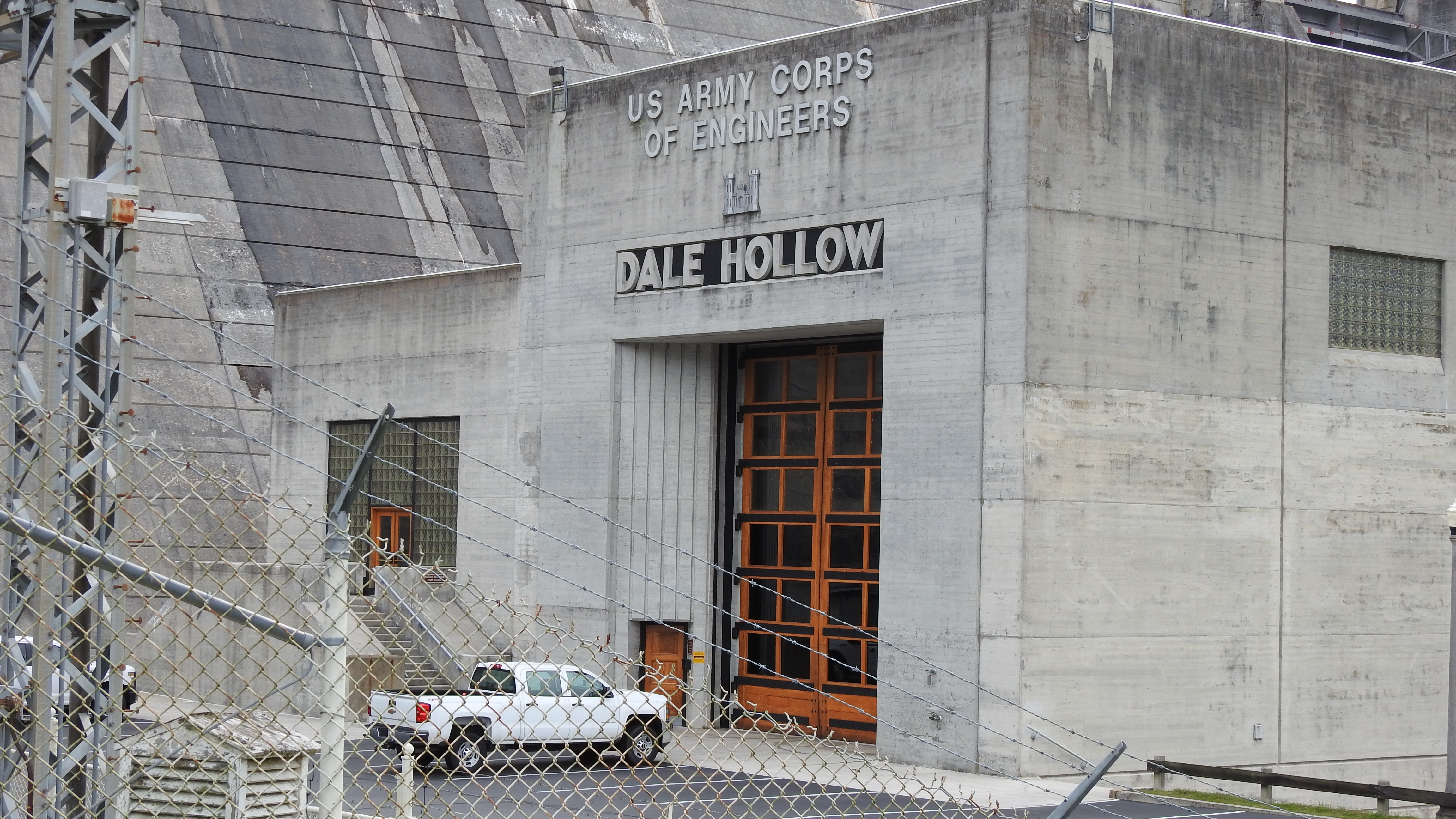
Entrance to Powerhouse
Wet Mill Creek Rd, Celina, TN 美國的地圖
搜索其他地方的日出日落時間
附近地點
R J Bell Rd, Celina, TN 美國
Standing Stone Park Hwy, Hilham, TN 美國Standing Stone State Park
Turkey Town Rd, Hilham, TN 美國
Livingston Hwy, Celina, TN 美國
Hidden Cove Ln, Allons, TN 美國
Crabtree Rd, Hilham, TN 美國Crabtree Road
Hilham, TN 美國
Turkey Town Rd, Hilham, TN 美國
Celina, TN 美國
Livingston Boat Dock Rd, Allons, TN 美國Mitchell Creek Marina
Buford Dr, Celina, TN 美國
Upper Hilham Rd, Livingston, TN 美國
Moss Arcot Rd, Celina, TN 美國
Black Ln, Tennessee 美國Black Lane
Upper Hilham Rd, Livingston, TN 美國
Greasy Hill Ln, Gainesboro, TN 美國
Allons, TN 美國
O'Neal Rd, Tennessee 美國O'Neal Road
Airport Rd, Livingston, TN 美國Airport Road
Hillview Dr, Livingston, TN 美國
最近搜索
- Red Dog Mine, AK, USA的日出日落時間表
- Am bhf, Borken, 德國Am Bahnhof的日出日落時間表
- 4th St E, Sonoma, CA 美國的日出日落時間表
- Oakland Ave, Williamsport, PA 美國的日出日落時間表
- Via Roma, Pieranica CR, 義大利的日出日落時間表
- 克羅埃西亞杜布羅夫尼克 GradClock Tower of Dubrovnik的日出日落時間表
- 阿根廷丘布特省特雷利烏的日出日落時間表
- Hartfords Bluff Cir, Mt Pleasant, SC 美國的日出日落時間表
- 日本熊本縣熊本市北區的日出日落時間表
- 中國福州市平潭縣平潭島的日出日落時間表