Horas de salida y puesta de sol de Wet Mill Creek Rd, Celina, TN, EE. UU.
Location: Estados Unidos > Tennessee > Condado de Clay > Celina >
Zona horaria:
America/Chicago
Hora local:
2025-07-05 22:26:35
Longitud:
-85.4603115
Latitud:
36.4827252
Salida de sol de hoy:
05:30:17 AM
Puesta de sol de hoy:
08:03:12 PM
La duración del día hoy:
14h 32m 55s
Salida de sol de mañana:
05:30:51 AM
Puesta de sol de mañana:
08:02:57 PM
La duración del día mañana:
14h 32m 6s
Mostrar todas las fechas
| Fecha | Salida de sol | Puesta de sol | Duración del día |
|---|---|---|---|
| 01/01/2025 | 06:53:49 AM | 04:38:08 PM | 9h 44m 19s |
| 02/01/2025 | 06:53:56 AM | 04:38:57 PM | 9h 45m 1s |
| 03/01/2025 | 06:54:00 AM | 04:39:47 PM | 9h 45m 47s |
| 04/01/2025 | 06:54:02 AM | 04:40:38 PM | 9h 46m 36s |
| 05/01/2025 | 06:54:03 AM | 04:41:30 PM | 9h 47m 27s |
| 06/01/2025 | 06:54:02 AM | 04:42:24 PM | 9h 48m 22s |
| 07/01/2025 | 06:53:58 AM | 04:43:18 PM | 9h 49m 20s |
| 08/01/2025 | 06:53:53 AM | 04:44:13 PM | 9h 50m 20s |
| 09/01/2025 | 06:53:45 AM | 04:45:09 PM | 9h 51m 24s |
| 10/01/2025 | 06:53:36 AM | 04:46:06 PM | 9h 52m 30s |
| 11/01/2025 | 06:53:24 AM | 04:47:04 PM | 9h 53m 40s |
| 12/01/2025 | 06:53:11 AM | 04:48:02 PM | 9h 54m 51s |
| 13/01/2025 | 06:52:55 AM | 04:49:01 PM | 9h 56m 6s |
| 14/01/2025 | 06:52:38 AM | 04:50:01 PM | 9h 57m 23s |
| 15/01/2025 | 06:52:18 AM | 04:51:01 PM | 9h 58m 43s |
| 16/01/2025 | 06:51:57 AM | 04:52:02 PM | 10h 0m 5s |
| 17/01/2025 | 06:51:34 AM | 04:53:04 PM | 10h 1m 30s |
| 18/01/2025 | 06:51:09 AM | 04:54:05 PM | 10h 2m 56s |
| 19/01/2025 | 06:50:42 AM | 04:55:08 PM | 10h 4m 26s |
| 20/01/2025 | 06:50:13 AM | 04:56:10 PM | 10h 5m 57s |
| 21/01/2025 | 06:49:42 AM | 04:57:13 PM | 10h 7m 31s |
| 22/01/2025 | 06:49:10 AM | 04:58:17 PM | 10h 9m 7s |
| 23/01/2025 | 06:48:35 AM | 04:59:20 PM | 10h 10m 45s |
| 24/01/2025 | 06:47:59 AM | 05:00:24 PM | 10h 12m 25s |
| 25/01/2025 | 06:47:21 AM | 05:01:28 PM | 10h 14m 7s |
| 26/01/2025 | 06:46:41 AM | 05:02:32 PM | 10h 15m 51s |
| 27/01/2025 | 06:46:00 AM | 05:03:36 PM | 10h 17m 36s |
| 28/01/2025 | 06:45:17 AM | 05:04:40 PM | 10h 19m 23s |
| 29/01/2025 | 06:44:32 AM | 05:05:44 PM | 10h 21m 12s |
| 30/01/2025 | 06:43:46 AM | 05:06:48 PM | 10h 23m 2s |
| 31/01/2025 | 06:42:58 AM | 05:07:53 PM | 10h 24m 55s |
| 01/02/2025 | 06:42:08 AM | 05:08:57 PM | 10h 26m 49s |
| 02/02/2025 | 06:41:17 AM | 05:10:01 PM | 10h 28m 44s |
| 03/02/2025 | 06:40:24 AM | 05:11:05 PM | 10h 30m 41s |
| 04/02/2025 | 06:39:30 AM | 05:12:09 PM | 10h 32m 39s |
| 05/02/2025 | 06:38:35 AM | 05:13:12 PM | 10h 34m 37s |
| 06/02/2025 | 06:37:38 AM | 05:14:16 PM | 10h 36m 38s |
| 07/02/2025 | 06:36:39 AM | 05:15:19 PM | 10h 38m 40s |
| 08/02/2025 | 06:35:39 AM | 05:16:22 PM | 10h 40m 43s |
| 09/02/2025 | 06:34:38 AM | 05:17:25 PM | 10h 42m 47s |
| 10/02/2025 | 06:33:36 AM | 05:18:28 PM | 10h 44m 52s |
| 11/02/2025 | 06:32:32 AM | 05:19:30 PM | 10h 46m 58s |
| 12/02/2025 | 06:31:27 AM | 05:20:32 PM | 10h 49m 5s |
| 13/02/2025 | 06:30:21 AM | 05:21:34 PM | 10h 51m 13s |
| 14/02/2025 | 06:29:14 AM | 05:22:35 PM | 10h 53m 21s |
| 15/02/2025 | 06:28:06 AM | 05:23:37 PM | 10h 55m 31s |
| 16/02/2025 | 06:26:56 AM | 05:24:37 PM | 10h 57m 41s |
| 17/02/2025 | 06:25:46 AM | 05:25:38 PM | 10h 59m 52s |
| 18/02/2025 | 06:24:34 AM | 05:26:38 PM | 11h 2m 4s |
| 19/02/2025 | 06:23:21 AM | 05:27:38 PM | 11h 4m 17s |
| 20/02/2025 | 06:22:08 AM | 05:28:38 PM | 11h 6m 30s |
| 21/02/2025 | 06:20:53 AM | 05:29:37 PM | 11h 8m 44s |
| 22/02/2025 | 06:19:38 AM | 05:30:36 PM | 11h 10m 58s |
| 23/02/2025 | 06:18:22 AM | 05:31:35 PM | 11h 13m 13s |
| 24/02/2025 | 06:17:04 AM | 05:32:33 PM | 11h 15m 29s |
| 25/02/2025 | 06:15:47 AM | 05:33:31 PM | 11h 17m 44s |
| 26/02/2025 | 06:14:28 AM | 05:34:29 PM | 11h 20m 1s |
| 27/02/2025 | 06:13:08 AM | 05:35:26 PM | 11h 22m 18s |
| 28/02/2025 | 06:11:48 AM | 05:36:23 PM | 11h 24m 35s |
| 01/03/2025 | 06:10:27 AM | 05:37:20 PM | 11h 26m 53s |
| 02/03/2025 | 06:09:06 AM | 05:38:16 PM | 11h 29m 10s |
| 03/03/2025 | 06:07:44 AM | 05:39:13 PM | 11h 31m 29s |
| 04/03/2025 | 06:06:21 AM | 05:40:08 PM | 11h 33m 47s |
| 05/03/2025 | 06:04:58 AM | 05:41:04 PM | 11h 36m 6s |
| 06/03/2025 | 06:03:34 AM | 05:41:59 PM | 11h 38m 25s |
| 07/03/2025 | 06:02:09 AM | 05:42:54 PM | 11h 40m 45s |
| 08/03/2025 | 06:00:45 AM | 05:43:49 PM | 11h 43m 4s |
| 09/03/2025 | 06:59:23 AM | 06:44:41 PM | 11h 45m 18s |
| 10/03/2025 | 06:57:58 AM | 06:45:35 PM | 11h 47m 37s |
| 11/03/2025 | 06:56:32 AM | 06:46:29 PM | 11h 49m 57s |
| 12/03/2025 | 06:55:05 AM | 06:47:23 PM | 11h 52m 18s |
| 13/03/2025 | 06:53:39 AM | 06:48:17 PM | 11h 54m 38s |
| 14/03/2025 | 06:52:12 AM | 06:49:10 PM | 11h 56m 58s |
| 15/03/2025 | 06:50:45 AM | 06:50:03 PM | 11h 59m 18s |
| 16/03/2025 | 06:49:17 AM | 06:50:56 PM | 12h 1m 39s |
| 17/03/2025 | 06:47:50 AM | 06:51:49 PM | 12h 3m 59s |
| 18/03/2025 | 06:46:22 AM | 06:52:41 PM | 12h 6m 19s |
| 19/03/2025 | 06:44:54 AM | 06:53:34 PM | 12h 8m 40s |
| 20/03/2025 | 06:43:26 AM | 06:54:26 PM | 12h 11m 0s |
| 21/03/2025 | 06:41:58 AM | 06:55:18 PM | 12h 13m 20s |
| 22/03/2025 | 06:40:30 AM | 06:56:10 PM | 12h 15m 40s |
| 23/03/2025 | 06:39:02 AM | 06:57:02 PM | 12h 18m 0s |
| 24/03/2025 | 06:37:34 AM | 06:57:54 PM | 12h 20m 20s |
| 25/03/2025 | 06:36:06 AM | 06:58:46 PM | 12h 22m 40s |
| 26/03/2025 | 06:34:38 AM | 06:59:38 PM | 12h 25m 0s |
| 27/03/2025 | 06:33:11 AM | 07:00:29 PM | 12h 27m 18s |
| 28/03/2025 | 06:31:43 AM | 07:01:21 PM | 12h 29m 38s |
| 29/03/2025 | 06:30:15 AM | 07:02:12 PM | 12h 31m 57s |
| 30/03/2025 | 06:28:48 AM | 07:03:04 PM | 12h 34m 16s |
| 31/03/2025 | 06:27:21 AM | 07:03:55 PM | 12h 36m 34s |
| 01/04/2025 | 06:25:54 AM | 07:04:47 PM | 12h 38m 53s |
| 02/04/2025 | 06:24:28 AM | 07:05:38 PM | 12h 41m 10s |
| 03/04/2025 | 06:23:01 AM | 07:06:29 PM | 12h 43m 28s |
| 04/04/2025 | 06:21:36 AM | 07:07:21 PM | 12h 45m 45s |
| 05/04/2025 | 06:20:10 AM | 07:08:12 PM | 12h 48m 2s |
| 06/04/2025 | 06:18:45 AM | 07:09:04 PM | 12h 50m 19s |
| 07/04/2025 | 06:17:20 AM | 07:09:55 PM | 12h 52m 35s |
| 08/04/2025 | 06:15:56 AM | 07:10:47 PM | 12h 54m 51s |
| 09/04/2025 | 06:14:32 AM | 07:11:38 PM | 12h 57m 6s |
| 10/04/2025 | 06:13:09 AM | 07:12:30 PM | 12h 59m 21s |
| 11/04/2025 | 06:11:47 AM | 07:13:21 PM | 13h 1m 34s |
| 12/04/2025 | 06:10:25 AM | 07:14:13 PM | 13h 3m 48s |
| 13/04/2025 | 06:09:03 AM | 07:15:05 PM | 13h 6m 2s |
| 14/04/2025 | 06:07:42 AM | 07:15:56 PM | 13h 8m 14s |
| 15/04/2025 | 06:06:22 AM | 07:16:48 PM | 13h 10m 26s |
| 16/04/2025 | 06:05:03 AM | 07:17:40 PM | 13h 12m 37s |
| 17/04/2025 | 06:03:44 AM | 07:18:32 PM | 13h 14m 48s |
| 18/04/2025 | 06:02:26 AM | 07:19:24 PM | 13h 16m 58s |
| 19/04/2025 | 06:01:09 AM | 07:20:16 PM | 13h 19m 7s |
| 20/04/2025 | 05:59:52 AM | 07:21:08 PM | 13h 21m 16s |
| 21/04/2025 | 05:58:37 AM | 07:22:00 PM | 13h 23m 23s |
| 22/04/2025 | 05:57:22 AM | 07:22:52 PM | 13h 25m 30s |
| 23/04/2025 | 05:56:08 AM | 07:23:45 PM | 13h 27m 37s |
| 24/04/2025 | 05:54:56 AM | 07:24:37 PM | 13h 29m 41s |
| 25/04/2025 | 05:53:44 AM | 07:25:29 PM | 13h 31m 45s |
| 26/04/2025 | 05:52:33 AM | 07:26:21 PM | 13h 33m 48s |
| 27/04/2025 | 05:51:23 AM | 07:27:13 PM | 13h 35m 50s |
| 28/04/2025 | 05:50:14 AM | 07:28:06 PM | 13h 37m 52s |
| 29/04/2025 | 05:49:07 AM | 07:28:58 PM | 13h 39m 51s |
| 30/04/2025 | 05:48:00 AM | 07:29:50 PM | 13h 41m 50s |
| 01/05/2025 | 05:46:54 AM | 07:30:42 PM | 13h 43m 48s |
| 02/05/2025 | 05:45:50 AM | 07:31:34 PM | 13h 45m 44s |
| 03/05/2025 | 05:44:47 AM | 07:32:26 PM | 13h 47m 39s |
| 04/05/2025 | 05:43:45 AM | 07:33:18 PM | 13h 49m 33s |
| 05/05/2025 | 05:42:44 AM | 07:34:09 PM | 13h 51m 25s |
| 06/05/2025 | 05:41:45 AM | 07:35:01 PM | 13h 53m 16s |
| 07/05/2025 | 05:40:47 AM | 07:35:52 PM | 13h 55m 5s |
| 08/05/2025 | 05:39:50 AM | 07:36:44 PM | 13h 56m 54s |
| 09/05/2025 | 05:38:55 AM | 07:37:35 PM | 13h 58m 40s |
| 10/05/2025 | 05:38:00 AM | 07:38:25 PM | 14h 0m 25s |
| 11/05/2025 | 05:37:08 AM | 07:39:16 PM | 14h 2m 8s |
| 12/05/2025 | 05:36:16 AM | 07:40:06 PM | 14h 3m 50s |
| 13/05/2025 | 05:35:27 AM | 07:40:56 PM | 14h 5m 29s |
| 14/05/2025 | 05:34:38 AM | 07:41:46 PM | 14h 7m 8s |
| 15/05/2025 | 05:33:51 AM | 07:42:35 PM | 14h 8m 44s |
| 16/05/2025 | 05:33:06 AM | 07:43:24 PM | 14h 10m 18s |
| 17/05/2025 | 05:32:22 AM | 07:44:13 PM | 14h 11m 51s |
| 18/05/2025 | 05:31:40 AM | 07:45:01 PM | 14h 13m 21s |
| 19/05/2025 | 05:30:59 AM | 07:45:48 PM | 14h 14m 49s |
| 20/05/2025 | 05:30:20 AM | 07:46:35 PM | 14h 16m 15s |
| 21/05/2025 | 05:29:43 AM | 07:47:22 PM | 14h 17m 39s |
| 22/05/2025 | 05:29:07 AM | 07:48:07 PM | 14h 19m 0s |
| 23/05/2025 | 05:28:32 AM | 07:48:53 PM | 14h 20m 21s |
| 24/05/2025 | 05:28:00 AM | 07:49:37 PM | 14h 21m 37s |
| 25/05/2025 | 05:27:29 AM | 07:50:21 PM | 14h 22m 52s |
| 26/05/2025 | 05:27:00 AM | 07:51:04 PM | 14h 24m 4s |
| 27/05/2025 | 05:26:32 AM | 07:51:47 PM | 14h 25m 15s |
| 28/05/2025 | 05:26:06 AM | 07:52:28 PM | 14h 26m 22s |
| 29/05/2025 | 05:25:42 AM | 07:53:09 PM | 14h 27m 27s |
| 30/05/2025 | 05:25:20 AM | 07:53:49 PM | 14h 28m 29s |
| 31/05/2025 | 05:24:59 AM | 07:54:28 PM | 14h 29m 29s |
| 01/06/2025 | 05:24:40 AM | 07:55:06 PM | 14h 30m 26s |
| 02/06/2025 | 05:24:23 AM | 07:55:43 PM | 14h 31m 20s |
| 03/06/2025 | 05:24:07 AM | 07:56:19 PM | 14h 32m 12s |
| 04/06/2025 | 05:23:53 AM | 07:56:54 PM | 14h 33m 1s |
| 05/06/2025 | 05:23:41 AM | 07:57:28 PM | 14h 33m 47s |
| 06/06/2025 | 05:23:31 AM | 07:58:01 PM | 14h 34m 30s |
| 07/06/2025 | 05:23:22 AM | 07:58:33 PM | 14h 35m 11s |
| 08/06/2025 | 05:23:16 AM | 07:59:03 PM | 14h 35m 47s |
| 09/06/2025 | 05:23:10 AM | 07:59:32 PM | 14h 36m 22s |
| 10/06/2025 | 05:23:07 AM | 08:00:00 PM | 14h 36m 53s |
| 11/06/2025 | 05:23:05 AM | 08:00:26 PM | 14h 37m 21s |
| 12/06/2025 | 05:23:05 AM | 08:00:51 PM | 14h 37m 46s |
| 13/06/2025 | 05:23:07 AM | 08:01:15 PM | 14h 38m 8s |
| 14/06/2025 | 05:23:10 AM | 08:01:38 PM | 14h 38m 28s |
| 15/06/2025 | 05:23:15 AM | 08:01:59 PM | 14h 38m 44s |
| 16/06/2025 | 05:23:21 AM | 08:02:18 PM | 14h 38m 57s |
| 17/06/2025 | 05:23:30 AM | 08:02:36 PM | 14h 39m 6s |
| 18/06/2025 | 05:23:39 AM | 08:02:52 PM | 14h 39m 13s |
| 19/06/2025 | 05:23:51 AM | 08:03:07 PM | 14h 39m 16s |
| 20/06/2025 | 05:24:03 AM | 08:03:21 PM | 14h 39m 18s |
| 21/06/2025 | 05:24:18 AM | 08:03:32 PM | 14h 39m 14s |
| 22/06/2025 | 05:24:34 AM | 08:03:42 PM | 14h 39m 8s |
| 23/06/2025 | 05:24:51 AM | 08:03:51 PM | 14h 39m 0s |
| 24/06/2025 | 05:25:10 AM | 08:03:58 PM | 14h 38m 48s |
| 25/06/2025 | 05:25:30 AM | 08:04:03 PM | 14h 38m 33s |
| 26/06/2025 | 05:25:51 AM | 08:04:06 PM | 14h 38m 15s |
| 27/06/2025 | 05:26:14 AM | 08:04:08 PM | 14h 37m 54s |
| 28/06/2025 | 05:26:38 AM | 08:04:08 PM | 14h 37m 30s |
| 29/06/2025 | 05:27:04 AM | 08:04:06 PM | 14h 37m 2s |
| 30/06/2025 | 05:27:31 AM | 08:04:03 PM | 14h 36m 32s |
| 01/07/2025 | 05:27:59 AM | 08:03:57 PM | 14h 35m 58s |
| 02/07/2025 | 05:28:28 AM | 08:03:50 PM | 14h 35m 22s |
| 03/07/2025 | 05:28:58 AM | 08:03:41 PM | 14h 34m 43s |
| 04/07/2025 | 05:29:29 AM | 08:03:31 PM | 14h 34m 2s |
| 05/07/2025 | 05:30:02 AM | 08:03:19 PM | 14h 33m 17s |
| 06/07/2025 | 05:30:35 AM | 08:03:04 PM | 14h 32m 29s |
| 07/07/2025 | 05:31:10 AM | 08:02:49 PM | 14h 31m 39s |
| 08/07/2025 | 05:31:45 AM | 08:02:31 PM | 14h 30m 46s |
| 09/07/2025 | 05:32:22 AM | 08:02:12 PM | 14h 29m 50s |
| 10/07/2025 | 05:32:59 AM | 08:01:50 PM | 14h 28m 51s |
| 11/07/2025 | 05:33:37 AM | 08:01:27 PM | 14h 27m 50s |
| 12/07/2025 | 05:34:16 AM | 08:01:03 PM | 14h 26m 47s |
| 13/07/2025 | 05:34:56 AM | 08:00:36 PM | 14h 25m 40s |
| 14/07/2025 | 05:35:36 AM | 08:00:08 PM | 14h 24m 32s |
| 15/07/2025 | 05:36:17 AM | 07:59:38 PM | 14h 23m 21s |
| 16/07/2025 | 05:36:59 AM | 07:59:07 PM | 14h 22m 8s |
| 17/07/2025 | 05:37:42 AM | 07:58:33 PM | 14h 20m 51s |
| 18/07/2025 | 05:38:25 AM | 07:57:58 PM | 14h 19m 33s |
| 19/07/2025 | 05:39:08 AM | 07:57:22 PM | 14h 18m 14s |
| 20/07/2025 | 05:39:52 AM | 07:56:43 PM | 14h 16m 51s |
| 21/07/2025 | 05:40:37 AM | 07:56:03 PM | 14h 15m 26s |
| 22/07/2025 | 05:41:22 AM | 07:55:22 PM | 14h 14m 0s |
| 23/07/2025 | 05:42:08 AM | 07:54:39 PM | 14h 12m 31s |
| 24/07/2025 | 05:42:54 AM | 07:53:54 PM | 14h 11m 0s |
| 25/07/2025 | 05:43:40 AM | 07:53:08 PM | 14h 9m 28s |
| 26/07/2025 | 05:44:26 AM | 07:52:20 PM | 14h 7m 54s |
| 27/07/2025 | 05:45:13 AM | 07:51:30 PM | 14h 6m 17s |
| 28/07/2025 | 05:46:01 AM | 07:50:40 PM | 14h 4m 39s |
| 29/07/2025 | 05:46:48 AM | 07:49:47 PM | 14h 2m 59s |
| 30/07/2025 | 05:47:36 AM | 07:48:53 PM | 14h 1m 17s |
| 31/07/2025 | 05:48:23 AM | 07:47:58 PM | 13h 59m 35s |
| 01/08/2025 | 05:49:12 AM | 07:47:02 PM | 13h 57m 50s |
| 02/08/2025 | 05:50:00 AM | 07:46:04 PM | 13h 56m 4s |
| 03/08/2025 | 05:50:48 AM | 07:45:05 PM | 13h 54m 17s |
| 04/08/2025 | 05:51:37 AM | 07:44:04 PM | 13h 52m 27s |
| 05/08/2025 | 05:52:25 AM | 07:43:02 PM | 13h 50m 37s |
| 06/08/2025 | 05:53:14 AM | 07:41:59 PM | 13h 48m 45s |
| 07/08/2025 | 05:54:02 AM | 07:40:55 PM | 13h 46m 53s |
| 08/08/2025 | 05:54:51 AM | 07:39:49 PM | 13h 44m 58s |
| 09/08/2025 | 05:55:40 AM | 07:38:42 PM | 13h 43m 2s |
| 10/08/2025 | 05:56:29 AM | 07:37:34 PM | 13h 41m 5s |
| 11/08/2025 | 05:57:17 AM | 07:36:25 PM | 13h 39m 8s |
| 12/08/2025 | 05:58:06 AM | 07:35:15 PM | 13h 37m 9s |
| 13/08/2025 | 05:58:55 AM | 07:34:04 PM | 13h 35m 9s |
| 14/08/2025 | 05:59:43 AM | 07:32:52 PM | 13h 33m 9s |
| 15/08/2025 | 06:00:32 AM | 07:31:39 PM | 13h 31m 7s |
| 16/08/2025 | 06:01:21 AM | 07:30:24 PM | 13h 29m 3s |
| 17/08/2025 | 06:02:09 AM | 07:29:09 PM | 13h 27m 0s |
| 18/08/2025 | 06:02:58 AM | 07:27:53 PM | 13h 24m 55s |
| 19/08/2025 | 06:03:46 AM | 07:26:36 PM | 13h 22m 50s |
| 20/08/2025 | 06:04:34 AM | 07:25:18 PM | 13h 20m 44s |
| 21/08/2025 | 06:05:22 AM | 07:24:00 PM | 13h 18m 38s |
| 22/08/2025 | 06:06:11 AM | 07:22:40 PM | 13h 16m 29s |
| 23/08/2025 | 06:06:59 AM | 07:21:20 PM | 13h 14m 21s |
| 24/08/2025 | 06:07:47 AM | 07:19:59 PM | 13h 12m 12s |
| 25/08/2025 | 06:08:35 AM | 07:18:37 PM | 13h 10m 2s |
| 26/08/2025 | 06:09:22 AM | 07:17:15 PM | 13h 7m 53s |
| 27/08/2025 | 06:10:10 AM | 07:15:51 PM | 13h 5m 41s |
| 28/08/2025 | 06:10:58 AM | 07:14:28 PM | 13h 3m 30s |
| 29/08/2025 | 06:11:45 AM | 07:13:03 PM | 13h 1m 18s |
| 30/08/2025 | 06:12:33 AM | 07:11:39 PM | 12h 59m 6s |
| 31/08/2025 | 06:13:20 AM | 07:10:13 PM | 12h 56m 53s |
| 01/09/2025 | 06:14:08 AM | 07:08:47 PM | 12h 54m 39s |
| 02/09/2025 | 06:14:55 AM | 07:07:21 PM | 12h 52m 26s |
| 03/09/2025 | 06:15:42 AM | 07:05:54 PM | 12h 50m 12s |
| 04/09/2025 | 06:16:29 AM | 07:04:26 PM | 12h 47m 57s |
| 05/09/2025 | 06:17:16 AM | 07:02:59 PM | 12h 45m 43s |
| 06/09/2025 | 06:18:04 AM | 07:01:31 PM | 12h 43m 27s |
| 07/09/2025 | 06:18:51 AM | 07:00:02 PM | 12h 41m 11s |
| 08/09/2025 | 06:19:38 AM | 06:58:33 PM | 12h 38m 55s |
| 09/09/2025 | 06:20:25 AM | 06:57:04 PM | 12h 36m 39s |
| 10/09/2025 | 06:21:12 AM | 06:55:35 PM | 12h 34m 23s |
| 11/09/2025 | 06:21:59 AM | 06:54:05 PM | 12h 32m 6s |
| 12/09/2025 | 06:22:46 AM | 06:52:36 PM | 12h 29m 50s |
| 13/09/2025 | 06:23:33 AM | 06:51:06 PM | 12h 27m 33s |
| 14/09/2025 | 06:24:21 AM | 06:49:36 PM | 12h 25m 15s |
| 15/09/2025 | 06:25:08 AM | 06:48:06 PM | 12h 22m 58s |
| 16/09/2025 | 06:25:55 AM | 06:46:35 PM | 12h 20m 40s |
| 17/09/2025 | 06:26:43 AM | 06:45:05 PM | 12h 18m 22s |
| 18/09/2025 | 06:27:30 AM | 06:43:35 PM | 12h 16m 5s |
| 19/09/2025 | 06:28:18 AM | 06:42:04 PM | 12h 13m 46s |
| 20/09/2025 | 06:29:05 AM | 06:40:34 PM | 12h 11m 29s |
| 21/09/2025 | 06:29:53 AM | 06:39:04 PM | 12h 9m 11s |
| 22/09/2025 | 06:30:41 AM | 06:37:34 PM | 12h 6m 53s |
| 23/09/2025 | 06:31:29 AM | 06:36:04 PM | 12h 4m 35s |
| 24/09/2025 | 06:32:18 AM | 06:34:34 PM | 12h 2m 16s |
| 25/09/2025 | 06:33:06 AM | 06:33:04 PM | 11h 59m 58s |
| 26/09/2025 | 06:33:55 AM | 06:31:35 PM | 11h 57m 40s |
| 27/09/2025 | 06:34:44 AM | 06:30:05 PM | 11h 55m 21s |
| 28/09/2025 | 06:35:33 AM | 06:28:36 PM | 11h 53m 3s |
| 29/09/2025 | 06:36:22 AM | 06:27:08 PM | 11h 50m 46s |
| 30/09/2025 | 06:37:11 AM | 06:25:39 PM | 11h 48m 28s |
| 01/10/2025 | 06:38:01 AM | 06:24:11 PM | 11h 46m 10s |
| 02/10/2025 | 06:38:51 AM | 06:22:44 PM | 11h 43m 53s |
| 03/10/2025 | 06:39:41 AM | 06:21:17 PM | 11h 41m 36s |
| 04/10/2025 | 06:40:32 AM | 06:19:50 PM | 11h 39m 18s |
| 05/10/2025 | 06:41:23 AM | 06:18:24 PM | 11h 37m 1s |
| 06/10/2025 | 06:42:14 AM | 06:16:58 PM | 11h 34m 44s |
| 07/10/2025 | 06:43:05 AM | 06:15:33 PM | 11h 32m 28s |
| 08/10/2025 | 06:43:57 AM | 06:14:08 PM | 11h 30m 11s |
| 09/10/2025 | 06:44:49 AM | 06:12:44 PM | 11h 27m 55s |
| 10/10/2025 | 06:45:41 AM | 06:11:20 PM | 11h 25m 39s |
| 11/10/2025 | 06:46:34 AM | 06:09:58 PM | 11h 23m 24s |
| 12/10/2025 | 06:47:27 AM | 06:08:36 PM | 11h 21m 9s |
| 13/10/2025 | 06:48:20 AM | 06:07:14 PM | 11h 18m 54s |
| 14/10/2025 | 06:49:14 AM | 06:05:54 PM | 11h 16m 40s |
| 15/10/2025 | 06:50:08 AM | 06:04:34 PM | 11h 14m 26s |
| 16/10/2025 | 06:51:02 AM | 06:03:15 PM | 11h 12m 13s |
| 17/10/2025 | 06:51:57 AM | 06:01:57 PM | 11h 10m 0s |
| 18/10/2025 | 06:52:52 AM | 06:00:39 PM | 11h 7m 47s |
| 19/10/2025 | 06:53:47 AM | 05:59:23 PM | 11h 5m 36s |
| 20/10/2025 | 06:54:43 AM | 05:58:08 PM | 11h 3m 25s |
| 21/10/2025 | 06:55:39 AM | 05:56:53 PM | 11h 1m 14s |
| 22/10/2025 | 06:56:36 AM | 05:55:40 PM | 10h 59m 4s |
| 23/10/2025 | 06:57:33 AM | 05:54:27 PM | 10h 56m 54s |
| 24/10/2025 | 06:58:30 AM | 05:53:16 PM | 10h 54m 46s |
| 25/10/2025 | 06:59:27 AM | 05:52:06 PM | 10h 52m 39s |
| 26/10/2025 | 07:00:25 AM | 05:50:57 PM | 10h 50m 32s |
| 27/10/2025 | 07:01:23 AM | 05:49:49 PM | 10h 48m 26s |
| 28/10/2025 | 07:02:22 AM | 05:48:42 PM | 10h 46m 20s |
| 29/10/2025 | 07:03:21 AM | 05:47:37 PM | 10h 44m 16s |
| 30/10/2025 | 07:04:20 AM | 05:46:33 PM | 10h 42m 13s |
| 31/10/2025 | 07:05:19 AM | 05:45:30 PM | 10h 40m 11s |
| 01/11/2025 | 07:06:19 AM | 05:44:29 PM | 10h 38m 10s |
| 02/11/2025 | 06:07:21 AM | 04:43:26 PM | 10h 36m 5s |
| 03/11/2025 | 06:08:21 AM | 04:42:27 PM | 10h 34m 6s |
| 04/11/2025 | 06:09:21 AM | 04:41:30 PM | 10h 32m 9s |
| 05/11/2025 | 06:10:22 AM | 04:40:34 PM | 10h 30m 12s |
| 06/11/2025 | 06:11:23 AM | 04:39:40 PM | 10h 28m 17s |
| 07/11/2025 | 06:12:24 AM | 04:38:47 PM | 10h 26m 23s |
| 08/11/2025 | 06:13:25 AM | 04:37:56 PM | 10h 24m 31s |
| 09/11/2025 | 06:14:26 AM | 04:37:06 PM | 10h 22m 40s |
| 10/11/2025 | 06:15:27 AM | 04:36:18 PM | 10h 20m 51s |
| 11/11/2025 | 06:16:28 AM | 04:35:32 PM | 10h 19m 4s |
| 12/11/2025 | 06:17:29 AM | 04:34:47 PM | 10h 17m 18s |
| 13/11/2025 | 06:18:31 AM | 04:34:04 PM | 10h 15m 33s |
| 14/11/2025 | 06:19:32 AM | 04:33:23 PM | 10h 13m 51s |
| 15/11/2025 | 06:20:33 AM | 04:32:44 PM | 10h 12m 11s |
| 16/11/2025 | 06:21:34 AM | 04:32:06 PM | 10h 10m 32s |
| 17/11/2025 | 06:22:35 AM | 04:31:30 PM | 10h 8m 55s |
| 18/11/2025 | 06:23:36 AM | 04:30:56 PM | 10h 7m 20s |
| 19/11/2025 | 06:24:36 AM | 04:30:24 PM | 10h 5m 48s |
| 20/11/2025 | 06:25:37 AM | 04:29:54 PM | 10h 4m 17s |
| 21/11/2025 | 06:26:37 AM | 04:29:25 PM | 10h 2m 48s |
| 22/11/2025 | 06:27:36 AM | 04:28:59 PM | 10h 1m 23s |
| 23/11/2025 | 06:28:35 AM | 04:28:34 PM | 9h 59m 59s |
| 24/11/2025 | 06:29:34 AM | 04:28:11 PM | 9h 58m 37s |
| 25/11/2025 | 06:30:33 AM | 04:27:51 PM | 9h 57m 18s |
| 26/11/2025 | 06:31:30 AM | 04:27:32 PM | 9h 56m 2s |
| 27/11/2025 | 06:32:28 AM | 04:27:15 PM | 9h 54m 47s |
| 28/11/2025 | 06:33:24 AM | 04:27:01 PM | 9h 53m 37s |
| 29/11/2025 | 06:34:20 AM | 04:26:48 PM | 9h 52m 28s |
| 30/11/2025 | 06:35:15 AM | 04:26:37 PM | 9h 51m 22s |
| 01/12/2025 | 06:36:10 AM | 04:26:29 PM | 9h 50m 19s |
| 02/12/2025 | 06:37:04 AM | 04:26:22 PM | 9h 49m 18s |
| 03/12/2025 | 06:37:56 AM | 04:26:18 PM | 9h 48m 22s |
| 04/12/2025 | 06:38:48 AM | 04:26:15 PM | 9h 47m 27s |
| 05/12/2025 | 06:39:39 AM | 04:26:15 PM | 9h 46m 36s |
| 06/12/2025 | 06:40:29 AM | 04:26:16 PM | 9h 45m 47s |
| 07/12/2025 | 06:41:18 AM | 04:26:20 PM | 9h 45m 2s |
| 08/12/2025 | 06:42:06 AM | 04:26:25 PM | 9h 44m 19s |
| 09/12/2025 | 06:42:53 AM | 04:26:33 PM | 9h 43m 40s |
| 10/12/2025 | 06:43:38 AM | 04:26:43 PM | 9h 43m 5s |
| 11/12/2025 | 06:44:22 AM | 04:26:54 PM | 9h 42m 32s |
| 12/12/2025 | 06:45:05 AM | 04:27:08 PM | 9h 42m 3s |
| 13/12/2025 | 06:45:47 AM | 04:27:24 PM | 9h 41m 37s |
| 14/12/2025 | 06:46:27 AM | 04:27:41 PM | 9h 41m 14s |
| 15/12/2025 | 06:47:05 AM | 04:28:01 PM | 9h 40m 56s |
| 16/12/2025 | 06:47:43 AM | 04:28:22 PM | 9h 40m 39s |
| 17/12/2025 | 06:48:18 AM | 04:28:45 PM | 9h 40m 27s |
| 18/12/2025 | 06:48:52 AM | 04:29:10 PM | 9h 40m 18s |
| 19/12/2025 | 06:49:25 AM | 04:29:37 PM | 9h 40m 12s |
| 20/12/2025 | 06:49:56 AM | 04:30:06 PM | 9h 40m 10s |
| 21/12/2025 | 06:50:25 AM | 04:30:37 PM | 9h 40m 12s |
| 22/12/2025 | 06:50:52 AM | 04:31:09 PM | 9h 40m 17s |
| 23/12/2025 | 06:51:18 AM | 04:31:43 PM | 9h 40m 25s |
| 24/12/2025 | 06:51:42 AM | 04:32:18 PM | 9h 40m 36s |
| 25/12/2025 | 06:52:04 AM | 04:32:55 PM | 9h 40m 51s |
| 26/12/2025 | 06:52:25 AM | 04:33:34 PM | 9h 41m 9s |
| 27/12/2025 | 06:52:43 AM | 04:34:14 PM | 9h 41m 31s |
| 28/12/2025 | 06:53:00 AM | 04:34:56 PM | 9h 41m 56s |
| 29/12/2025 | 06:53:14 AM | 04:35:39 PM | 9h 42m 25s |
| 30/12/2025 | 06:53:27 AM | 04:36:24 PM | 9h 42m 57s |
| 31/12/2025 | 06:53:38 AM | 04:37:10 PM | 9h 43m 32s |
Fotos

Livingston Lake at Sunset
Sunset Barn
Fall Fishing - Standing Stone State Park

Roaring River Falls

Roaring River Falls

Standingstone Lake

Cumberland River and Obey River confluence, Clay County, Tennessee 2

Obey River, Donaldson Park, Clay County, Tennessee 2

Dale Hollow Dam - Celina, Tennessee

Clear cut, Standing Stone State Forest, Overton County, Tennessee

Standing Stone State Forest, Overton County, Tennessee 1

Standing Stone State Forest, Overton County, Tennessee 2
N. Grundy Quarles Hwy, Cumberland River, Jackson County, Tennessee 1

N. Grundy Quarles Hwy, Cumberland River, Jackson County, Tennessee 2

Cumberland River, Butlers Landing, Clay County, Tennessee 3

N. Grundy Quarles Hwy, Cumberland River, Jackson County, Tennessee 3

N. Grundy Quarles Hwy, Cumberland River, Jackson County, Tennessee 4

Leipers Catheys Limestone, N. Grundy Quarles Hwy, Cumberland River, Jackson County, Tennessee

N. Grundy Quarles Hwy, Cumberland River, Jackson County, Tennessee 5

Obey River, Donaldson Park, Clay County, Tennessee 1

N. Grundy Quarles Hwy, Cumberland River, Jackson County, Tennessee 6
N. Grundy Quarles Hwy, Cumberland River, Jackson County, Tennessee 7

Cumberland River, Butlers Landing, Clay County, Tennessee 1

Cumberland River, Butlers Landing, Clay County, Tennessee 2

Clay County Highway bridge, Cumberland River, Clay County, Tennessee

Tailrace With All 3 Generators Running
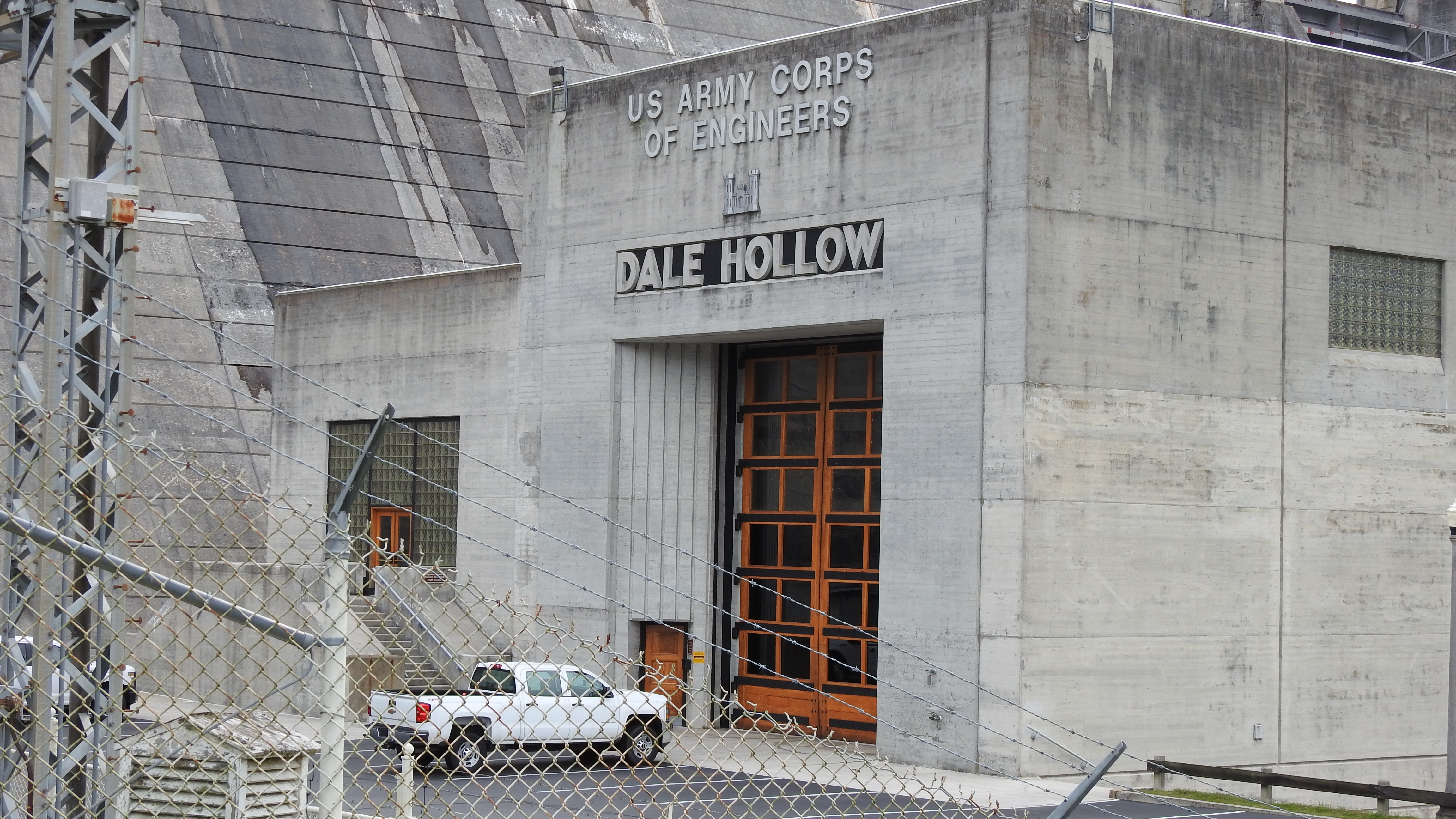
Entrance to Powerhouse
Mapa de Wet Mill Creek Rd, Celina, TN, EE. UU.
Buscar otro lugar
Lugares cercanos
R J Bell Rd, Celina, TN, EE. UU.
Standing Stone State Park, Standing Stone Park Hwy, Hilham, TN, EE. UU.
Turkey Town Rd, Hilham, TN, EE. UU.
Livingston Hwy, Celina, TN, EE. UU.
Hidden Cove Ln, Allons, TN, EE. UU.
Crabtree Road, Crabtree Rd, Hilham, TN, EE. UU.
Hilham, TN, EE. UU.
Turkey Town Rd, Hilham, TN, EE. UU.
Celina, Tennessee, EE. UU.
Mitchell Creek Marina, Livingston Boat Dock Rd, Allons, TN, EE. UU.
Buford Dr, Celina, TN, EE. UU.
Upper Hilham Rd, Livingston, TN, EE. UU.
Moss Arcot Rd, Celina, TN, EE. UU.
Black Lane, Black Ln, Tennessee, EE. UU.
Upper Hilham Rd, Livingston, TN, EE. UU.
Greasy Hill Ln, Gainesboro, TN, EE. UU.
Allons, TN, EE. UU.
O'Neal Road, O'Neal Rd, Tennessee, EE. UU.
Airport Road, Airport Rd, Livingston, TN, EE. UU.
Hillview Dr, Livingston, TN, EE. UU.
Búsquedas recientes
- Horas de salida y puesta de sol de Red Dog Mine, AK, USA
- Horas de salida y puesta de sol de Am Bahnhof, Am bhf, Borken, Germany
- Horas de salida y puesta de sol de 4th St E, Sonoma, CA, EE. UU.
- Horas de salida y puesta de sol de Oakland Ave, Williamsport, PA, EE. UU.
- Horas de salida y puesta de sol de Via Roma, Pieranica CR, Italia
- Horas de salida y puesta de sol de Torre del reloj, Grad, Dubrovnik (Ragusa), Croacia
- Horas de salida y puesta de sol de Trelew, Chubut, Argentina
- Horas de salida y puesta de sol de Hartfords Bluff Cir, Mt Pleasant, SC, EE. UU.
- Horas de salida y puesta de sol de Kita Ward, Kumamoto, Japón
- Horas de salida y puesta de sol de Pingtan Island, Pingtan County, Fuzhou, China