拉卡波希峰的日出日落時間表
時區:
Asia/Karachi
當地時間:
2025-06-29 04:01:35
經度:
74.4898568
緯度:
36.1433269
今天日出時間:
04:47:49 AM
今天日落時間:
07:23:21 PM
今天日照時長:
14h 35m 32s
明天日出時間:
04:48:14 AM
明天日落時間:
07:23:20 PM
明天日照時長:
14h 35m 6s
顯示所有日期
| 日期 | 日出 | 日落 | 日照時長 |
|---|---|---|---|
| 2025年01月01日 | 07:12:59 AM | 04:58:32 PM | 9h 45m 33s |
| 2025年01月02日 | 07:13:08 AM | 04:59:19 PM | 9h 46m 11s |
| 2025年01月03日 | 07:13:14 AM | 05:00:08 PM | 9h 46m 54s |
| 2025年01月04日 | 07:13:19 AM | 05:00:57 PM | 9h 47m 38s |
| 2025年01月05日 | 07:13:22 AM | 05:01:48 PM | 9h 48m 26s |
| 2025年01月06日 | 07:13:22 AM | 05:02:40 PM | 9h 49m 18s |
| 2025年01月07日 | 07:13:21 AM | 05:03:33 PM | 9h 50m 12s |
| 2025年01月08日 | 07:13:18 AM | 05:04:27 PM | 9h 51m 9s |
| 2025年01月09日 | 07:13:12 AM | 05:05:22 PM | 9h 52m 10s |
| 2025年01月10日 | 07:13:05 AM | 05:06:18 PM | 9h 53m 13s |
| 2025年01月11日 | 07:12:56 AM | 05:07:14 PM | 9h 54m 18s |
| 2025年01月12日 | 07:12:45 AM | 05:08:11 PM | 9h 55m 26s |
| 2025年01月13日 | 07:12:32 AM | 05:09:09 PM | 9h 56m 37s |
| 2025年01月14日 | 07:12:16 AM | 05:10:08 PM | 9h 57m 52s |
| 2025年01月15日 | 07:11:59 AM | 05:11:07 PM | 9h 59m 8s |
| 2025年01月16日 | 07:11:40 AM | 05:12:07 PM | 10h 0m 27s |
| 2025年01月17日 | 07:11:19 AM | 05:13:08 PM | 10h 1m 49s |
| 2025年01月18日 | 07:10:57 AM | 05:14:09 PM | 10h 3m 12s |
| 2025年01月19日 | 07:10:32 AM | 05:15:10 PM | 10h 4m 38s |
| 2025年01月20日 | 07:10:05 AM | 05:16:12 PM | 10h 6m 7s |
| 2025年01月21日 | 07:09:37 AM | 05:17:14 PM | 10h 7m 37s |
| 2025年01月22日 | 07:09:06 AM | 05:18:16 PM | 10h 9m 10s |
| 2025年01月23日 | 07:08:34 AM | 05:19:19 PM | 10h 10m 45s |
| 2025年01月24日 | 07:08:00 AM | 05:20:22 PM | 10h 12m 22s |
| 2025年01月25日 | 07:07:25 AM | 05:21:25 PM | 10h 14m 0s |
| 2025年01月26日 | 07:06:47 AM | 05:22:28 PM | 10h 15m 41s |
| 2025年01月27日 | 07:06:08 AM | 05:23:31 PM | 10h 17m 23s |
| 2025年01月28日 | 07:05:27 AM | 05:24:35 PM | 10h 19m 8s |
| 2025年01月29日 | 07:04:45 AM | 05:25:38 PM | 10h 20m 53s |
| 2025年01月30日 | 07:04:00 AM | 05:26:42 PM | 10h 22m 42s |
| 2025年01月31日 | 07:03:15 AM | 05:27:45 PM | 10h 24m 30s |
| 2025年02月01日 | 07:02:27 AM | 05:28:49 PM | 10h 26m 22s |
| 2025年02月02日 | 07:01:38 AM | 05:29:52 PM | 10h 28m 14s |
| 2025年02月03日 | 07:00:48 AM | 05:30:55 PM | 10h 30m 7s |
| 2025年02月04日 | 06:59:56 AM | 05:31:58 PM | 10h 32m 2s |
| 2025年02月05日 | 06:59:02 AM | 05:33:01 PM | 10h 33m 59s |
| 2025年02月06日 | 06:58:07 AM | 05:34:04 PM | 10h 35m 57s |
| 2025年02月07日 | 06:57:11 AM | 05:35:07 PM | 10h 37m 56s |
| 2025年02月08日 | 06:56:13 AM | 05:36:10 PM | 10h 39m 57s |
| 2025年02月09日 | 06:55:14 AM | 05:37:12 PM | 10h 41m 58s |
| 2025年02月10日 | 06:54:13 AM | 05:38:14 PM | 10h 44m 1s |
| 2025年02月11日 | 06:53:12 AM | 05:39:16 PM | 10h 46m 4s |
| 2025年02月12日 | 06:52:09 AM | 05:40:17 PM | 10h 48m 8s |
| 2025年02月13日 | 06:51:05 AM | 05:41:18 PM | 10h 50m 13s |
| 2025年02月14日 | 06:49:59 AM | 05:42:19 PM | 10h 52m 20s |
| 2025年02月15日 | 06:48:53 AM | 05:43:20 PM | 10h 54m 27s |
| 2025年02月16日 | 06:47:45 AM | 05:44:20 PM | 10h 56m 35s |
| 2025年02月17日 | 06:46:36 AM | 05:45:21 PM | 10h 58m 45s |
| 2025年02月18日 | 06:45:26 AM | 05:46:20 PM | 11h 0m 54s |
| 2025年02月19日 | 06:44:15 AM | 05:47:20 PM | 11h 3m 5s |
| 2025年02月20日 | 06:43:04 AM | 05:48:19 PM | 11h 5m 15s |
| 2025年02月21日 | 06:41:51 AM | 05:49:18 PM | 11h 7m 27s |
| 2025年02月22日 | 06:40:37 AM | 05:50:16 PM | 11h 9m 39s |
| 2025年02月23日 | 06:39:22 AM | 05:51:14 PM | 11h 11m 52s |
| 2025年02月24日 | 06:38:07 AM | 05:52:12 PM | 11h 14m 5s |
| 2025年02月25日 | 06:36:50 AM | 05:53:09 PM | 11h 16m 19s |
| 2025年02月26日 | 06:35:33 AM | 05:54:07 PM | 11h 18m 34s |
| 2025年02月27日 | 06:34:15 AM | 05:55:03 PM | 11h 20m 48s |
| 2025年02月28日 | 06:32:57 AM | 05:56:00 PM | 11h 23m 3s |
| 2025年03月01日 | 06:31:37 AM | 05:56:56 PM | 11h 25m 19s |
| 2025年03月02日 | 06:30:17 AM | 05:57:52 PM | 11h 27m 35s |
| 2025年03月03日 | 06:28:56 AM | 05:58:47 PM | 11h 29m 51s |
| 2025年03月04日 | 06:27:35 AM | 05:59:43 PM | 11h 32m 8s |
| 2025年03月05日 | 06:26:13 AM | 06:00:37 PM | 11h 34m 24s |
| 2025年03月06日 | 06:24:51 AM | 06:01:32 PM | 11h 36m 41s |
| 2025年03月07日 | 06:23:28 AM | 06:02:26 PM | 11h 38m 58s |
| 2025年03月08日 | 06:22:04 AM | 06:03:21 PM | 11h 41m 17s |
| 2025年03月09日 | 06:20:40 AM | 06:04:14 PM | 11h 43m 34s |
| 2025年03月10日 | 06:19:16 AM | 06:05:08 PM | 11h 45m 52s |
| 2025年03月11日 | 06:17:51 AM | 06:06:01 PM | 11h 48m 10s |
| 2025年03月12日 | 06:16:26 AM | 06:06:54 PM | 11h 50m 28s |
| 2025年03月13日 | 06:15:00 AM | 06:07:47 PM | 11h 52m 47s |
| 2025年03月14日 | 06:13:35 AM | 06:08:40 PM | 11h 55m 5s |
| 2025年03月15日 | 06:12:09 AM | 06:09:32 PM | 11h 57m 23s |
| 2025年03月16日 | 06:10:42 AM | 06:10:25 PM | 11h 59m 43s |
| 2025年03月17日 | 06:09:16 AM | 06:11:17 PM | 12h 2m 1s |
| 2025年03月18日 | 06:07:49 AM | 06:12:08 PM | 12h 4m 19s |
| 2025年03月19日 | 06:06:22 AM | 06:13:00 PM | 12h 6m 38s |
| 2025年03月20日 | 06:04:55 AM | 06:13:52 PM | 12h 8m 57s |
| 2025年03月21日 | 06:03:28 AM | 06:14:43 PM | 12h 11m 15s |
| 2025年03月22日 | 06:02:01 AM | 06:15:34 PM | 12h 13m 33s |
| 2025年03月23日 | 06:00:34 AM | 06:16:26 PM | 12h 15m 52s |
| 2025年03月24日 | 05:59:07 AM | 06:17:17 PM | 12h 18m 10s |
| 2025年03月25日 | 05:57:40 AM | 06:18:08 PM | 12h 20m 28s |
| 2025年03月26日 | 05:56:12 AM | 06:18:59 PM | 12h 22m 47s |
| 2025年03月27日 | 05:54:45 AM | 06:19:49 PM | 12h 25m 4s |
| 2025年03月28日 | 05:53:18 AM | 06:20:40 PM | 12h 27m 22s |
| 2025年03月29日 | 05:51:52 AM | 06:21:31 PM | 12h 29m 39s |
| 2025年03月30日 | 05:50:25 AM | 06:22:21 PM | 12h 31m 56s |
| 2025年03月31日 | 05:48:59 AM | 06:23:12 PM | 12h 34m 13s |
| 2025年04月01日 | 05:47:33 AM | 06:24:03 PM | 12h 36m 30s |
| 2025年04月02日 | 05:46:07 AM | 06:24:53 PM | 12h 38m 46s |
| 2025年04月03日 | 05:44:41 AM | 06:25:44 PM | 12h 41m 3s |
| 2025年04月04日 | 05:43:16 AM | 06:26:34 PM | 12h 43m 18s |
| 2025年04月05日 | 05:41:51 AM | 06:27:25 PM | 12h 45m 34s |
| 2025年04月06日 | 05:40:26 AM | 06:28:15 PM | 12h 47m 49s |
| 2025年04月07日 | 05:39:02 AM | 06:29:06 PM | 12h 50m 4s |
| 2025年04月08日 | 05:37:38 AM | 06:29:57 PM | 12h 52m 19s |
| 2025年04月09日 | 05:36:15 AM | 06:30:47 PM | 12h 54m 32s |
| 2025年04月10日 | 05:34:52 AM | 06:31:38 PM | 12h 56m 46s |
| 2025年04月11日 | 05:33:30 AM | 06:32:29 PM | 12h 58m 59s |
| 2025年04月12日 | 05:32:08 AM | 06:33:20 PM | 13h 1m 12s |
| 2025年04月13日 | 05:30:47 AM | 06:34:10 PM | 13h 3m 23s |
| 2025年04月14日 | 05:29:26 AM | 06:35:01 PM | 13h 5m 35s |
| 2025年04月15日 | 05:28:07 AM | 06:35:52 PM | 13h 7m 45s |
| 2025年04月16日 | 05:26:47 AM | 06:36:43 PM | 13h 9m 56s |
| 2025年04月17日 | 05:25:29 AM | 06:37:34 PM | 13h 12m 5s |
| 2025年04月18日 | 05:24:11 AM | 06:38:25 PM | 13h 14m 14s |
| 2025年04月19日 | 05:22:54 AM | 06:39:16 PM | 13h 16m 22s |
| 2025年04月20日 | 05:21:38 AM | 06:40:08 PM | 13h 18m 30s |
| 2025年04月21日 | 05:20:22 AM | 06:40:59 PM | 13h 20m 37s |
| 2025年04月22日 | 05:19:08 AM | 06:41:50 PM | 13h 22m 42s |
| 2025年04月23日 | 05:17:54 AM | 06:42:42 PM | 13h 24m 48s |
| 2025年04月24日 | 05:16:41 AM | 06:43:33 PM | 13h 26m 52s |
| 2025年04月25日 | 05:15:29 AM | 06:44:24 PM | 13h 28m 55s |
| 2025年04月26日 | 05:14:18 AM | 06:45:16 PM | 13h 30m 58s |
| 2025年04月27日 | 05:13:08 AM | 06:46:07 PM | 13h 32m 59s |
| 2025年04月28日 | 05:11:59 AM | 06:46:59 PM | 13h 35m 0s |
| 2025年04月29日 | 05:10:51 AM | 06:47:50 PM | 13h 36m 59s |
| 2025年04月30日 | 05:09:45 AM | 06:48:41 PM | 13h 38m 56s |
| 2025年05月01日 | 05:08:39 AM | 06:49:33 PM | 13h 40m 54s |
| 2025年05月02日 | 05:07:34 AM | 06:50:24 PM | 13h 42m 50s |
| 2025年05月03日 | 05:06:31 AM | 06:51:15 PM | 13h 44m 44s |
| 2025年05月04日 | 05:05:29 AM | 06:52:07 PM | 13h 46m 38s |
| 2025年05月05日 | 05:04:28 AM | 06:52:58 PM | 13h 48m 30s |
| 2025年05月06日 | 05:03:28 AM | 06:53:49 PM | 13h 50m 21s |
| 2025年05月07日 | 05:02:29 AM | 06:54:39 PM | 13h 52m 10s |
| 2025年05月08日 | 05:01:32 AM | 06:55:30 PM | 13h 53m 58s |
| 2025年05月09日 | 05:00:36 AM | 06:56:21 PM | 13h 55m 45s |
| 2025年05月10日 | 04:59:42 AM | 06:57:11 PM | 13h 57m 29s |
| 2025年05月11日 | 04:58:48 AM | 06:58:01 PM | 13h 59m 13s |
| 2025年05月12日 | 04:57:57 AM | 06:58:51 PM | 14h 0m 54s |
| 2025年05月13日 | 04:57:06 AM | 06:59:40 PM | 14h 2m 34s |
| 2025年05月14日 | 04:56:17 AM | 07:00:30 PM | 14h 4m 13s |
| 2025年05月15日 | 04:55:30 AM | 07:01:19 PM | 14h 5m 49s |
| 2025年05月16日 | 04:54:44 AM | 07:02:07 PM | 14h 7m 23s |
| 2025年05月17日 | 04:53:59 AM | 07:02:55 PM | 14h 8m 56s |
| 2025年05月18日 | 04:53:16 AM | 07:03:43 PM | 14h 10m 27s |
| 2025年05月19日 | 04:52:35 AM | 07:04:31 PM | 14h 11m 56s |
| 2025年05月20日 | 04:51:55 AM | 07:05:17 PM | 14h 13m 22s |
| 2025年05月21日 | 04:51:17 AM | 07:06:04 PM | 14h 14m 47s |
| 2025年05月22日 | 04:50:40 AM | 07:06:50 PM | 14h 16m 10s |
| 2025年05月23日 | 04:50:05 AM | 07:07:35 PM | 14h 17m 30s |
| 2025年05月24日 | 04:49:31 AM | 07:08:20 PM | 14h 18m 49s |
| 2025年05月25日 | 04:48:59 AM | 07:09:04 PM | 14h 20m 5s |
| 2025年05月26日 | 04:48:29 AM | 07:09:47 PM | 14h 21m 18s |
| 2025年05月27日 | 04:48:01 AM | 07:10:29 PM | 14h 22m 28s |
| 2025年05月28日 | 04:47:34 AM | 07:11:11 PM | 14h 23m 37s |
| 2025年05月29日 | 04:47:09 AM | 07:11:52 PM | 14h 24m 43s |
| 2025年05月30日 | 04:46:45 AM | 07:12:33 PM | 14h 25m 48s |
| 2025年05月31日 | 04:46:23 AM | 07:13:12 PM | 14h 26m 49s |
| 2025年06月01日 | 04:46:03 AM | 07:13:50 PM | 14h 27m 47s |
| 2025年06月02日 | 04:45:45 AM | 07:14:28 PM | 14h 28m 43s |
| 2025年06月03日 | 04:45:28 AM | 07:15:05 PM | 14h 29m 37s |
| 2025年06月04日 | 04:45:13 AM | 07:15:40 PM | 14h 30m 27s |
| 2025年06月05日 | 04:45:00 AM | 07:16:15 PM | 14h 31m 15s |
| 2025年06月06日 | 04:44:49 AM | 07:16:48 PM | 14h 31m 59s |
| 2025年06月07日 | 04:44:39 AM | 07:17:20 PM | 14h 32m 41s |
| 2025年06月08日 | 04:44:31 AM | 07:17:51 PM | 14h 33m 20s |
| 2025年06月09日 | 04:44:24 AM | 07:18:21 PM | 14h 33m 57s |
| 2025年06月10日 | 04:44:20 AM | 07:18:50 PM | 14h 34m 30s |
| 2025年06月11日 | 04:44:17 AM | 07:19:17 PM | 14h 35m 0s |
| 2025年06月12日 | 04:44:15 AM | 07:19:44 PM | 14h 35m 29s |
| 2025年06月13日 | 04:44:16 AM | 07:20:08 PM | 14h 35m 52s |
| 2025年06月14日 | 04:44:18 AM | 07:20:32 PM | 14h 36m 14s |
| 2025年06月15日 | 04:44:21 AM | 07:20:54 PM | 14h 36m 33s |
| 2025年06月16日 | 04:44:26 AM | 07:21:14 PM | 14h 36m 48s |
| 2025年06月17日 | 04:44:33 AM | 07:21:34 PM | 14h 37m 1s |
| 2025年06月18日 | 04:44:42 AM | 07:21:51 PM | 14h 37m 9s |
| 2025年06月19日 | 04:44:52 AM | 07:22:08 PM | 14h 37m 16s |
| 2025年06月20日 | 04:45:03 AM | 07:22:22 PM | 14h 37m 19s |
| 2025年06月21日 | 04:45:16 AM | 07:22:35 PM | 14h 37m 19s |
| 2025年06月22日 | 04:45:31 AM | 07:22:47 PM | 14h 37m 16s |
| 2025年06月23日 | 04:45:47 AM | 07:22:57 PM | 14h 37m 10s |
| 2025年06月24日 | 04:46:04 AM | 07:23:05 PM | 14h 37m 1s |
| 2025年06月25日 | 04:46:23 AM | 07:23:12 PM | 14h 36m 49s |
| 2025年06月26日 | 04:46:43 AM | 07:23:17 PM | 14h 36m 34s |
| 2025年06月27日 | 04:47:05 AM | 07:23:20 PM | 14h 36m 15s |
| 2025年06月28日 | 04:47:28 AM | 07:23:21 PM | 14h 35m 53s |
| 2025年06月29日 | 04:47:52 AM | 07:23:21 PM | 14h 35m 29s |
| 2025年06月30日 | 04:48:18 AM | 07:23:20 PM | 14h 35m 2s |
| 2025年07月01日 | 04:48:44 AM | 07:23:16 PM | 14h 34m 32s |
| 2025年07月02日 | 04:49:12 AM | 07:23:11 PM | 14h 33m 59s |
| 2025年07月03日 | 04:49:41 AM | 07:23:04 PM | 14h 33m 23s |
| 2025年07月04日 | 04:50:11 AM | 07:22:55 PM | 14h 32m 44s |
| 2025年07月05日 | 04:50:43 AM | 07:22:44 PM | 14h 32m 1s |
| 2025年07月06日 | 04:51:15 AM | 07:22:32 PM | 14h 31m 17s |
| 2025年07月07日 | 04:51:48 AM | 07:22:18 PM | 14h 30m 30s |
| 2025年07月08日 | 04:52:23 AM | 07:22:02 PM | 14h 29m 39s |
| 2025年07月09日 | 04:52:58 AM | 07:21:45 PM | 14h 28m 47s |
| 2025年07月10日 | 04:53:34 AM | 07:21:26 PM | 14h 27m 52s |
| 2025年07月11日 | 04:54:11 AM | 07:21:04 PM | 14h 26m 53s |
| 2025年07月12日 | 04:54:49 AM | 07:20:42 PM | 14h 25m 53s |
| 2025年07月13日 | 04:55:27 AM | 07:20:17 PM | 14h 24m 50s |
| 2025年07月14日 | 04:56:07 AM | 07:19:51 PM | 14h 23m 44s |
| 2025年07月15日 | 04:56:47 AM | 07:19:23 PM | 14h 22m 36s |
| 2025年07月16日 | 04:57:28 AM | 07:18:53 PM | 14h 21m 25s |
| 2025年07月17日 | 04:58:09 AM | 07:18:22 PM | 14h 20m 13s |
| 2025年07月18日 | 04:58:51 AM | 07:17:49 PM | 14h 18m 58s |
| 2025年07月19日 | 04:59:34 AM | 07:17:14 PM | 14h 17m 40s |
| 2025年07月20日 | 05:00:17 AM | 07:16:38 PM | 14h 16m 21s |
| 2025年07月21日 | 05:01:00 AM | 07:16:00 PM | 14h 15m 0s |
| 2025年07月22日 | 05:01:45 AM | 07:15:20 PM | 14h 13m 35s |
| 2025年07月23日 | 05:02:29 AM | 07:14:39 PM | 14h 12m 10s |
| 2025年07月24日 | 05:03:14 AM | 07:13:56 PM | 14h 10m 42s |
| 2025年07月25日 | 05:03:59 AM | 07:13:12 PM | 14h 9m 13s |
| 2025年07月26日 | 05:04:45 AM | 07:12:26 PM | 14h 7m 41s |
| 2025年07月27日 | 05:05:31 AM | 07:11:39 PM | 14h 6m 8s |
| 2025年07月28日 | 05:06:17 AM | 07:10:50 PM | 14h 4m 33s |
| 2025年07月29日 | 05:07:04 AM | 07:09:59 PM | 14h 2m 55s |
| 2025年07月30日 | 05:07:51 AM | 07:09:07 PM | 14h 1m 16s |
| 2025年07月31日 | 05:08:38 AM | 07:08:14 PM | 13h 59m 36s |
| 2025年08月01日 | 05:09:25 AM | 07:07:20 PM | 13h 57m 55s |
| 2025年08月02日 | 05:10:12 AM | 07:06:23 PM | 13h 56m 11s |
| 2025年08月03日 | 05:11:00 AM | 07:05:26 PM | 13h 54m 26s |
| 2025年08月04日 | 05:11:48 AM | 07:04:27 PM | 13h 52m 39s |
| 2025年08月05日 | 05:12:35 AM | 07:03:27 PM | 13h 50m 52s |
| 2025年08月06日 | 05:13:23 AM | 07:02:26 PM | 13h 49m 3s |
| 2025年08月07日 | 05:14:11 AM | 07:01:23 PM | 13h 47m 12s |
| 2025年08月08日 | 05:14:59 AM | 07:00:20 PM | 13h 45m 21s |
| 2025年08月09日 | 05:15:47 AM | 06:59:15 PM | 13h 43m 28s |
| 2025年08月10日 | 05:16:35 AM | 06:58:08 PM | 13h 41m 33s |
| 2025年08月11日 | 05:17:23 AM | 06:57:01 PM | 13h 39m 38s |
| 2025年08月12日 | 05:18:11 AM | 06:55:53 PM | 13h 37m 42s |
| 2025年08月13日 | 05:18:59 AM | 06:54:43 PM | 13h 35m 44s |
| 2025年08月14日 | 05:19:47 AM | 06:53:33 PM | 13h 33m 46s |
| 2025年08月15日 | 05:20:35 AM | 06:52:21 PM | 13h 31m 46s |
| 2025年08月16日 | 05:21:23 AM | 06:51:08 PM | 13h 29m 45s |
| 2025年08月17日 | 05:22:10 AM | 06:49:55 PM | 13h 27m 45s |
| 2025年08月18日 | 05:22:58 AM | 06:48:40 PM | 13h 25m 42s |
| 2025年08月19日 | 05:23:46 AM | 06:47:25 PM | 13h 23m 39s |
| 2025年08月20日 | 05:24:33 AM | 06:46:09 PM | 13h 21m 36s |
| 2025年08月21日 | 05:25:21 AM | 06:44:51 PM | 13h 19m 30s |
| 2025年08月22日 | 05:26:08 AM | 06:43:33 PM | 13h 17m 25s |
| 2025年08月23日 | 05:26:56 AM | 06:42:15 PM | 13h 15m 19s |
| 2025年08月24日 | 05:27:43 AM | 06:40:55 PM | 13h 13m 12s |
| 2025年08月25日 | 05:28:30 AM | 06:39:35 PM | 13h 11m 5s |
| 2025年08月26日 | 05:29:17 AM | 06:38:14 PM | 13h 8m 57s |
| 2025年08月27日 | 05:30:04 AM | 06:36:52 PM | 13h 6m 48s |
| 2025年08月28日 | 05:30:51 AM | 06:35:30 PM | 13h 4m 39s |
| 2025年08月29日 | 05:31:38 AM | 06:34:07 PM | 13h 2m 29s |
| 2025年08月30日 | 05:32:24 AM | 06:32:43 PM | 13h 0m 19s |
| 2025年08月31日 | 05:33:11 AM | 06:31:19 PM | 12h 58m 8s |
| 2025年09月01日 | 05:33:58 AM | 06:29:54 PM | 12h 55m 56s |
| 2025年09月02日 | 05:34:44 AM | 06:28:29 PM | 12h 53m 45s |
| 2025年09月03日 | 05:35:31 AM | 06:27:03 PM | 12h 51m 32s |
| 2025年09月04日 | 05:36:17 AM | 06:25:37 PM | 12h 49m 20s |
| 2025年09月05日 | 05:37:03 AM | 06:24:11 PM | 12h 47m 8s |
| 2025年09月06日 | 05:37:50 AM | 06:22:44 PM | 12h 44m 54s |
| 2025年09月07日 | 05:38:36 AM | 06:21:16 PM | 12h 42m 40s |
| 2025年09月08日 | 05:39:22 AM | 06:19:49 PM | 12h 40m 27s |
| 2025年09月09日 | 05:40:09 AM | 06:18:21 PM | 12h 38m 12s |
| 2025年09月10日 | 05:40:55 AM | 06:16:52 PM | 12h 35m 57s |
| 2025年09月11日 | 05:41:41 AM | 06:15:24 PM | 12h 33m 43s |
| 2025年09月12日 | 05:42:27 AM | 06:13:55 PM | 12h 31m 28s |
| 2025年09月13日 | 05:43:14 AM | 06:12:26 PM | 12h 29m 12s |
| 2025年09月14日 | 05:44:00 AM | 06:10:57 PM | 12h 26m 57s |
| 2025年09月15日 | 05:44:46 AM | 06:09:28 PM | 12h 24m 42s |
| 2025年09月16日 | 05:45:33 AM | 06:07:59 PM | 12h 22m 26s |
| 2025年09月17日 | 05:46:19 AM | 06:06:29 PM | 12h 20m 10s |
| 2025年09月18日 | 05:47:06 AM | 06:05:00 PM | 12h 17m 54s |
| 2025年09月19日 | 05:47:53 AM | 06:03:30 PM | 12h 15m 37s |
| 2025年09月20日 | 05:48:39 AM | 06:02:01 PM | 12h 13m 22s |
| 2025年09月21日 | 05:49:26 AM | 06:00:31 PM | 12h 11m 5s |
| 2025年09月22日 | 05:50:13 AM | 05:59:02 PM | 12h 8m 49s |
| 2025年09月23日 | 05:51:00 AM | 05:57:33 PM | 12h 6m 33s |
| 2025年09月24日 | 05:51:48 AM | 05:56:04 PM | 12h 4m 16s |
| 2025年09月25日 | 05:52:35 AM | 05:54:35 PM | 12h 2m 0s |
| 2025年09月26日 | 05:53:23 AM | 05:53:06 PM | 11h 59m 43s |
| 2025年09月27日 | 05:54:11 AM | 05:51:37 PM | 11h 57m 26s |
| 2025年09月28日 | 05:54:59 AM | 05:50:09 PM | 11h 55m 10s |
| 2025年09月29日 | 05:55:47 AM | 05:48:41 PM | 11h 52m 54s |
| 2025年09月30日 | 05:56:35 AM | 05:47:13 PM | 11h 50m 38s |
| 2025年10月01日 | 05:57:24 AM | 05:45:46 PM | 11h 48m 22s |
| 2025年10月02日 | 05:58:13 AM | 05:44:18 PM | 11h 46m 5s |
| 2025年10月03日 | 05:59:02 AM | 05:42:52 PM | 11h 43m 50s |
| 2025年10月04日 | 05:59:51 AM | 05:41:25 PM | 11h 41m 34s |
| 2025年10月05日 | 06:00:41 AM | 05:40:00 PM | 11h 39m 19s |
| 2025年10月06日 | 06:01:31 AM | 05:38:34 PM | 11h 37m 3s |
| 2025年10月07日 | 06:02:21 AM | 05:37:09 PM | 11h 34m 48s |
| 2025年10月08日 | 06:03:12 AM | 05:35:45 PM | 11h 32m 33s |
| 2025年10月09日 | 06:04:03 AM | 05:34:21 PM | 11h 30m 18s |
| 2025年10月10日 | 06:04:54 AM | 05:32:58 PM | 11h 28m 4s |
| 2025年10月11日 | 06:05:46 AM | 05:31:36 PM | 11h 25m 50s |
| 2025年10月12日 | 06:06:37 AM | 05:30:14 PM | 11h 23m 37s |
| 2025年10月13日 | 06:07:30 AM | 05:28:53 PM | 11h 21m 23s |
| 2025年10月14日 | 06:08:22 AM | 05:27:32 PM | 11h 19m 10s |
| 2025年10月15日 | 06:09:15 AM | 05:26:13 PM | 11h 16m 58s |
| 2025年10月16日 | 06:10:08 AM | 05:24:54 PM | 11h 14m 46s |
| 2025年10月17日 | 06:11:02 AM | 05:23:36 PM | 11h 12m 34s |
| 2025年10月18日 | 06:11:56 AM | 05:22:19 PM | 11h 10m 23s |
| 2025年10月19日 | 06:12:50 AM | 05:21:02 PM | 11h 8m 12s |
| 2025年10月20日 | 06:13:45 AM | 05:19:47 PM | 11h 6m 2s |
| 2025年10月21日 | 06:14:40 AM | 05:18:32 PM | 11h 3m 52s |
| 2025年10月22日 | 06:15:35 AM | 05:17:19 PM | 11h 1m 44s |
| 2025年10月23日 | 06:16:31 AM | 05:16:07 PM | 10h 59m 36s |
| 2025年10月24日 | 06:17:27 AM | 05:14:55 PM | 10h 57m 28s |
| 2025年10月25日 | 06:18:23 AM | 05:13:45 PM | 10h 55m 22s |
| 2025年10月26日 | 06:19:20 AM | 05:12:36 PM | 10h 53m 16s |
| 2025年10月27日 | 06:20:17 AM | 05:11:28 PM | 10h 51m 11s |
| 2025年10月28日 | 06:21:14 AM | 05:10:21 PM | 10h 49m 7s |
| 2025年10月29日 | 06:22:12 AM | 05:09:15 PM | 10h 47m 3s |
| 2025年10月30日 | 06:23:10 AM | 05:08:11 PM | 10h 45m 1s |
| 2025年10月31日 | 06:24:08 AM | 05:07:07 PM | 10h 42m 59s |
| 2025年11月01日 | 06:25:07 AM | 05:06:06 PM | 10h 40m 59s |
| 2025年11月02日 | 06:26:06 AM | 05:05:05 PM | 10h 38m 59s |
| 2025年11月03日 | 06:27:05 AM | 05:04:06 PM | 10h 37m 1s |
| 2025年11月04日 | 06:28:05 AM | 05:03:08 PM | 10h 35m 3s |
| 2025年11月05日 | 06:29:04 AM | 05:02:12 PM | 10h 33m 8s |
| 2025年11月06日 | 06:30:04 AM | 05:01:17 PM | 10h 31m 13s |
| 2025年11月07日 | 06:31:04 AM | 05:00:23 PM | 10h 29m 19s |
| 2025年11月08日 | 06:32:04 AM | 04:59:32 PM | 10h 27m 28s |
| 2025年11月09日 | 06:33:04 AM | 04:58:41 PM | 10h 25m 37s |
| 2025年11月10日 | 06:34:05 AM | 04:57:52 PM | 10h 23m 47s |
| 2025年11月11日 | 06:35:05 AM | 04:57:05 PM | 10h 22m 0s |
| 2025年11月12日 | 06:36:06 AM | 04:56:20 PM | 10h 20m 14s |
| 2025年11月13日 | 06:37:06 AM | 04:55:36 PM | 10h 18m 30s |
| 2025年11月14日 | 06:38:07 AM | 04:54:54 PM | 10h 16m 47s |
| 2025年11月15日 | 06:39:08 AM | 04:54:14 PM | 10h 15m 6s |
| 2025年11月16日 | 06:40:08 AM | 04:53:35 PM | 10h 13m 27s |
| 2025年11月17日 | 06:41:08 AM | 04:52:58 PM | 10h 11m 50s |
| 2025年11月18日 | 06:42:09 AM | 04:52:23 PM | 10h 10m 14s |
| 2025年11月19日 | 06:43:09 AM | 04:51:50 PM | 10h 8m 41s |
| 2025年11月20日 | 06:44:09 AM | 04:51:18 PM | 10h 7m 9s |
| 2025年11月21日 | 06:45:08 AM | 04:50:49 PM | 10h 5m 41s |
| 2025年11月22日 | 06:46:08 AM | 04:50:21 PM | 10h 4m 13s |
| 2025年11月23日 | 06:47:07 AM | 04:49:55 PM | 10h 2m 48s |
| 2025年11月24日 | 06:48:05 AM | 04:49:31 PM | 10h 1m 26s |
| 2025年11月25日 | 06:49:04 AM | 04:49:10 PM | 10h 0m 6s |
| 2025年11月26日 | 06:50:01 AM | 04:48:50 PM | 9h 58m 49s |
| 2025年11月27日 | 06:50:59 AM | 04:48:32 PM | 9h 57m 33s |
| 2025年11月28日 | 06:51:55 AM | 04:48:16 PM | 9h 56m 21s |
| 2025年11月29日 | 06:52:51 AM | 04:48:02 PM | 9h 55m 11s |
| 2025年11月30日 | 06:53:47 AM | 04:47:50 PM | 9h 54m 3s |
| 2025年12月01日 | 06:54:42 AM | 04:47:40 PM | 9h 52m 58s |
| 2025年12月02日 | 06:55:36 AM | 04:47:32 PM | 9h 51m 56s |
| 2025年12月03日 | 06:56:29 AM | 04:47:26 PM | 9h 50m 57s |
| 2025年12月04日 | 06:57:21 AM | 04:47:22 PM | 9h 50m 1s |
| 2025年12月05日 | 06:58:13 AM | 04:47:20 PM | 9h 49m 7s |
| 2025年12月06日 | 06:59:03 AM | 04:47:20 PM | 9h 48m 17s |
| 2025年12月07日 | 06:59:53 AM | 04:47:22 PM | 9h 47m 29s |
| 2025年12月08日 | 07:00:41 AM | 04:47:26 PM | 9h 46m 45s |
| 2025年12月09日 | 07:01:28 AM | 04:47:32 PM | 9h 46m 4s |
| 2025年12月10日 | 07:02:15 AM | 04:47:40 PM | 9h 45m 25s |
| 2025年12月11日 | 07:03:00 AM | 04:47:50 PM | 9h 44m 50s |
| 2025年12月12日 | 07:03:44 AM | 04:48:02 PM | 9h 44m 18s |
| 2025年12月13日 | 07:04:26 AM | 04:48:16 PM | 9h 43m 50s |
| 2025年12月14日 | 07:05:07 AM | 04:48:32 PM | 9h 43m 25s |
| 2025年12月15日 | 07:05:47 AM | 04:48:50 PM | 9h 43m 3s |
| 2025年12月16日 | 07:06:26 AM | 04:49:10 PM | 9h 42m 44s |
| 2025年12月17日 | 07:07:03 AM | 04:49:32 PM | 9h 42m 29s |
| 2025年12月18日 | 07:07:38 AM | 04:49:55 PM | 9h 42m 17s |
| 2025年12月19日 | 07:08:12 AM | 04:50:21 PM | 9h 42m 9s |
| 2025年12月20日 | 07:08:44 AM | 04:50:48 PM | 9h 42m 4s |
| 2025年12月21日 | 07:09:15 AM | 04:51:17 PM | 9h 42m 2s |
| 2025年12月22日 | 07:09:44 AM | 04:51:47 PM | 9h 42m 3s |
| 2025年12月23日 | 07:10:11 AM | 04:52:20 PM | 9h 42m 9s |
| 2025年12月24日 | 07:10:37 AM | 04:52:54 PM | 9h 42m 17s |
| 2025年12月25日 | 07:11:01 AM | 04:53:29 PM | 9h 42m 28s |
| 2025年12月26日 | 07:11:23 AM | 04:54:06 PM | 9h 42m 43s |
| 2025年12月27日 | 07:11:43 AM | 04:54:45 PM | 9h 43m 2s |
| 2025年12月28日 | 07:12:02 AM | 04:55:25 PM | 9h 43m 23s |
| 2025年12月29日 | 07:12:18 AM | 04:56:07 PM | 9h 43m 49s |
| 2025年12月30日 | 07:12:33 AM | 04:56:50 PM | 9h 44m 17s |
| 2025年12月31日 | 07:12:46 AM | 04:57:35 PM | 9h 44m 49s |
日出日落照片
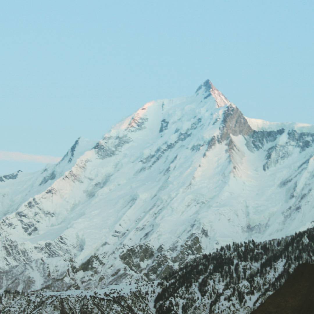
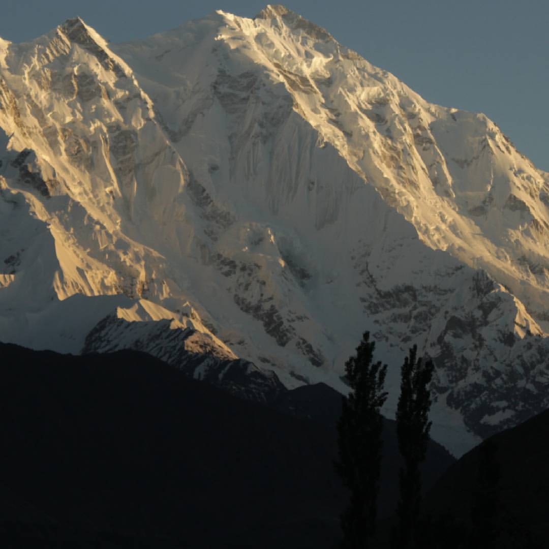
Sunset on Rakaposhi peak west side
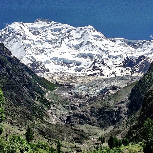
Rakaposhi Peak | Rakaposhi Base Camp View | Hunza Nagar | Hunza Valley | Gilgit-Baltistan, Northern Pakistan

Rakaposhi peak
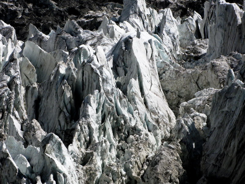
The ice mountain in the glacier
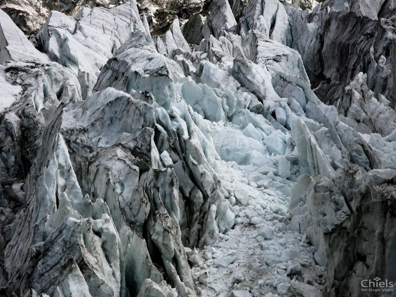
Close view of the ice.

Rakaposhi, viewed from Pisin

Worthwhile drive. Gilgit to Hunza Karakoram Highway, Gilgit Baltistan. #Entouragetonorth #Pakistan

Rakaposhi right, Diran Peak left from Hunza Pakistan #peaks #valleys #hunza #rakaposhipeak #diranpeak

Rakaposhi and Batura Muztagh

Night Panorama of Nasirabad and Minapin

Miachar, Nagar

Miachar, Nagar

Nasirabad and Miachar

Dadimal, Nagar

Miachar, Nagar

Hunza Valley from Murtazabad

Entering Nasirabad

Miachar Nagar, the old Settlement

Phakker and Miachar Nagar

Along the Karakoram highway I

After a landslide
Mount Rakaposhi - the mist of Nagar valley Karakoram Pakistan

Miachar & Dadimal, Nagar

Batura Muztagh
拉卡波希峰的地圖
搜索其他地方的日出日落時間
附近地點
Nilt, Hunza Nagar
Jaglot
Chalt, Hunza Nagar
Nomal Valley
Minawar
Airport Rd, Gilgit吉爾吉特
River View Rd, GilgitGilgit-Baltistan Monument
Gilgit
Chari Khand
納爾塔山谷
Batura Sar
吉尔吉特-巴尔蒂斯坦納爾塔山谷Naltar Lake 4
Naltar Lake, Naltar Valley
Sherqilla
Chatorkhand
Gahkuch
Ishkoman
ChilāsChilas Airport
Chilās
Qorqolti, Yasin ValleyMakuli Yasin Valley
最近搜索
- Red Dog Mine, AK, USA的日出日落時間表
- Am bhf, Borken, 德國Am Bahnhof的日出日落時間表
- 4th St E, Sonoma, CA 美國的日出日落時間表
- Oakland Ave, Williamsport, PA 美國的日出日落時間表
- Via Roma, Pieranica CR, 義大利的日出日落時間表
- 克羅埃西亞杜布羅夫尼克 GradClock Tower of Dubrovnik的日出日落時間表
- 阿根廷丘布特省特雷利烏的日出日落時間表
- Hartfords Bluff Cir, Mt Pleasant, SC 美國的日出日落時間表
- 日本熊本縣熊本市北區的日出日落時間表
- 中國福州市平潭縣平潭島的日出日落時間表