Sunrise Sunset Times of Rakaposhi
Timezone:
Asia/Karachi
Current Time:
2025-05-17 11:51:18
Longitude:
74.4898568
Latitude:
36.1433269
Sunrise Today:
04:54:05 AM
Sunset Today:
07:02:49 PM
Daylength Today:
14h 8m 44s
Sunrise Tomorrow:
04:53:22 AM
Sunset Tomorrow:
07:03:37 PM
Daylength Tomorrow:
14h 10m 15s
Year Show All Dates
| Date | Sunrise | Sunset | Daylength |
|---|---|---|---|
| 01/01/2025 | 07:12:59 AM | 04:58:32 PM | 9h 45m 33s |
| 01/02/2025 | 07:13:08 AM | 04:59:19 PM | 9h 46m 11s |
| 01/03/2025 | 07:13:14 AM | 05:00:08 PM | 9h 46m 54s |
| 01/04/2025 | 07:13:19 AM | 05:00:57 PM | 9h 47m 38s |
| 01/05/2025 | 07:13:22 AM | 05:01:48 PM | 9h 48m 26s |
| 01/06/2025 | 07:13:22 AM | 05:02:40 PM | 9h 49m 18s |
| 01/07/2025 | 07:13:21 AM | 05:03:33 PM | 9h 50m 12s |
| 01/08/2025 | 07:13:18 AM | 05:04:27 PM | 9h 51m 9s |
| 01/09/2025 | 07:13:12 AM | 05:05:22 PM | 9h 52m 10s |
| 01/10/2025 | 07:13:05 AM | 05:06:18 PM | 9h 53m 13s |
| 01/11/2025 | 07:12:56 AM | 05:07:14 PM | 9h 54m 18s |
| 01/12/2025 | 07:12:45 AM | 05:08:11 PM | 9h 55m 26s |
| 01/13/2025 | 07:12:32 AM | 05:09:09 PM | 9h 56m 37s |
| 01/14/2025 | 07:12:16 AM | 05:10:08 PM | 9h 57m 52s |
| 01/15/2025 | 07:11:59 AM | 05:11:07 PM | 9h 59m 8s |
| 01/16/2025 | 07:11:40 AM | 05:12:07 PM | 10h 0m 27s |
| 01/17/2025 | 07:11:19 AM | 05:13:08 PM | 10h 1m 49s |
| 01/18/2025 | 07:10:57 AM | 05:14:09 PM | 10h 3m 12s |
| 01/19/2025 | 07:10:32 AM | 05:15:10 PM | 10h 4m 38s |
| 01/20/2025 | 07:10:05 AM | 05:16:12 PM | 10h 6m 7s |
| 01/21/2025 | 07:09:37 AM | 05:17:14 PM | 10h 7m 37s |
| 01/22/2025 | 07:09:06 AM | 05:18:16 PM | 10h 9m 10s |
| 01/23/2025 | 07:08:34 AM | 05:19:19 PM | 10h 10m 45s |
| 01/24/2025 | 07:08:00 AM | 05:20:22 PM | 10h 12m 22s |
| 01/25/2025 | 07:07:25 AM | 05:21:25 PM | 10h 14m 0s |
| 01/26/2025 | 07:06:47 AM | 05:22:28 PM | 10h 15m 41s |
| 01/27/2025 | 07:06:08 AM | 05:23:31 PM | 10h 17m 23s |
| 01/28/2025 | 07:05:27 AM | 05:24:35 PM | 10h 19m 8s |
| 01/29/2025 | 07:04:45 AM | 05:25:38 PM | 10h 20m 53s |
| 01/30/2025 | 07:04:00 AM | 05:26:42 PM | 10h 22m 42s |
| 01/31/2025 | 07:03:15 AM | 05:27:45 PM | 10h 24m 30s |
| 02/01/2025 | 07:02:27 AM | 05:28:49 PM | 10h 26m 22s |
| 02/02/2025 | 07:01:38 AM | 05:29:52 PM | 10h 28m 14s |
| 02/03/2025 | 07:00:48 AM | 05:30:55 PM | 10h 30m 7s |
| 02/04/2025 | 06:59:56 AM | 05:31:58 PM | 10h 32m 2s |
| 02/05/2025 | 06:59:02 AM | 05:33:01 PM | 10h 33m 59s |
| 02/06/2025 | 06:58:07 AM | 05:34:04 PM | 10h 35m 57s |
| 02/07/2025 | 06:57:11 AM | 05:35:07 PM | 10h 37m 56s |
| 02/08/2025 | 06:56:13 AM | 05:36:10 PM | 10h 39m 57s |
| 02/09/2025 | 06:55:14 AM | 05:37:12 PM | 10h 41m 58s |
| 02/10/2025 | 06:54:13 AM | 05:38:14 PM | 10h 44m 1s |
| 02/11/2025 | 06:53:12 AM | 05:39:16 PM | 10h 46m 4s |
| 02/12/2025 | 06:52:09 AM | 05:40:17 PM | 10h 48m 8s |
| 02/13/2025 | 06:51:05 AM | 05:41:18 PM | 10h 50m 13s |
| 02/14/2025 | 06:49:59 AM | 05:42:19 PM | 10h 52m 20s |
| 02/15/2025 | 06:48:53 AM | 05:43:20 PM | 10h 54m 27s |
| 02/16/2025 | 06:47:45 AM | 05:44:20 PM | 10h 56m 35s |
| 02/17/2025 | 06:46:36 AM | 05:45:21 PM | 10h 58m 45s |
| 02/18/2025 | 06:45:26 AM | 05:46:20 PM | 11h 0m 54s |
| 02/19/2025 | 06:44:15 AM | 05:47:20 PM | 11h 3m 5s |
| 02/20/2025 | 06:43:04 AM | 05:48:19 PM | 11h 5m 15s |
| 02/21/2025 | 06:41:51 AM | 05:49:18 PM | 11h 7m 27s |
| 02/22/2025 | 06:40:37 AM | 05:50:16 PM | 11h 9m 39s |
| 02/23/2025 | 06:39:22 AM | 05:51:14 PM | 11h 11m 52s |
| 02/24/2025 | 06:38:07 AM | 05:52:12 PM | 11h 14m 5s |
| 02/25/2025 | 06:36:50 AM | 05:53:09 PM | 11h 16m 19s |
| 02/26/2025 | 06:35:33 AM | 05:54:07 PM | 11h 18m 34s |
| 02/27/2025 | 06:34:15 AM | 05:55:03 PM | 11h 20m 48s |
| 02/28/2025 | 06:32:57 AM | 05:56:00 PM | 11h 23m 3s |
| 03/01/2025 | 06:31:37 AM | 05:56:56 PM | 11h 25m 19s |
| 03/02/2025 | 06:30:17 AM | 05:57:52 PM | 11h 27m 35s |
| 03/03/2025 | 06:28:56 AM | 05:58:47 PM | 11h 29m 51s |
| 03/04/2025 | 06:27:35 AM | 05:59:43 PM | 11h 32m 8s |
| 03/05/2025 | 06:26:13 AM | 06:00:37 PM | 11h 34m 24s |
| 03/06/2025 | 06:24:51 AM | 06:01:32 PM | 11h 36m 41s |
| 03/07/2025 | 06:23:28 AM | 06:02:26 PM | 11h 38m 58s |
| 03/08/2025 | 06:22:04 AM | 06:03:21 PM | 11h 41m 17s |
| 03/09/2025 | 06:20:40 AM | 06:04:14 PM | 11h 43m 34s |
| 03/10/2025 | 06:19:16 AM | 06:05:08 PM | 11h 45m 52s |
| 03/11/2025 | 06:17:51 AM | 06:06:01 PM | 11h 48m 10s |
| 03/12/2025 | 06:16:26 AM | 06:06:54 PM | 11h 50m 28s |
| 03/13/2025 | 06:15:00 AM | 06:07:47 PM | 11h 52m 47s |
| 03/14/2025 | 06:13:35 AM | 06:08:40 PM | 11h 55m 5s |
| 03/15/2025 | 06:12:09 AM | 06:09:32 PM | 11h 57m 23s |
| 03/16/2025 | 06:10:42 AM | 06:10:25 PM | 11h 59m 43s |
| 03/17/2025 | 06:09:16 AM | 06:11:17 PM | 12h 2m 1s |
| 03/18/2025 | 06:07:49 AM | 06:12:08 PM | 12h 4m 19s |
| 03/19/2025 | 06:06:22 AM | 06:13:00 PM | 12h 6m 38s |
| 03/20/2025 | 06:04:55 AM | 06:13:52 PM | 12h 8m 57s |
| 03/21/2025 | 06:03:28 AM | 06:14:43 PM | 12h 11m 15s |
| 03/22/2025 | 06:02:01 AM | 06:15:34 PM | 12h 13m 33s |
| 03/23/2025 | 06:00:34 AM | 06:16:26 PM | 12h 15m 52s |
| 03/24/2025 | 05:59:07 AM | 06:17:17 PM | 12h 18m 10s |
| 03/25/2025 | 05:57:40 AM | 06:18:08 PM | 12h 20m 28s |
| 03/26/2025 | 05:56:12 AM | 06:18:59 PM | 12h 22m 47s |
| 03/27/2025 | 05:54:45 AM | 06:19:49 PM | 12h 25m 4s |
| 03/28/2025 | 05:53:18 AM | 06:20:40 PM | 12h 27m 22s |
| 03/29/2025 | 05:51:52 AM | 06:21:31 PM | 12h 29m 39s |
| 03/30/2025 | 05:50:25 AM | 06:22:21 PM | 12h 31m 56s |
| 03/31/2025 | 05:48:59 AM | 06:23:12 PM | 12h 34m 13s |
| 04/01/2025 | 05:47:33 AM | 06:24:03 PM | 12h 36m 30s |
| 04/02/2025 | 05:46:07 AM | 06:24:53 PM | 12h 38m 46s |
| 04/03/2025 | 05:44:41 AM | 06:25:44 PM | 12h 41m 3s |
| 04/04/2025 | 05:43:16 AM | 06:26:34 PM | 12h 43m 18s |
| 04/05/2025 | 05:41:51 AM | 06:27:25 PM | 12h 45m 34s |
| 04/06/2025 | 05:40:26 AM | 06:28:15 PM | 12h 47m 49s |
| 04/07/2025 | 05:39:02 AM | 06:29:06 PM | 12h 50m 4s |
| 04/08/2025 | 05:37:38 AM | 06:29:57 PM | 12h 52m 19s |
| 04/09/2025 | 05:36:15 AM | 06:30:47 PM | 12h 54m 32s |
| 04/10/2025 | 05:34:52 AM | 06:31:38 PM | 12h 56m 46s |
| 04/11/2025 | 05:33:30 AM | 06:32:29 PM | 12h 58m 59s |
| 04/12/2025 | 05:32:08 AM | 06:33:20 PM | 13h 1m 12s |
| 04/13/2025 | 05:30:47 AM | 06:34:10 PM | 13h 3m 23s |
| 04/14/2025 | 05:29:26 AM | 06:35:01 PM | 13h 5m 35s |
| 04/15/2025 | 05:28:07 AM | 06:35:52 PM | 13h 7m 45s |
| 04/16/2025 | 05:26:47 AM | 06:36:43 PM | 13h 9m 56s |
| 04/17/2025 | 05:25:29 AM | 06:37:34 PM | 13h 12m 5s |
| 04/18/2025 | 05:24:11 AM | 06:38:25 PM | 13h 14m 14s |
| 04/19/2025 | 05:22:54 AM | 06:39:16 PM | 13h 16m 22s |
| 04/20/2025 | 05:21:38 AM | 06:40:08 PM | 13h 18m 30s |
| 04/21/2025 | 05:20:22 AM | 06:40:59 PM | 13h 20m 37s |
| 04/22/2025 | 05:19:08 AM | 06:41:50 PM | 13h 22m 42s |
| 04/23/2025 | 05:17:54 AM | 06:42:42 PM | 13h 24m 48s |
| 04/24/2025 | 05:16:41 AM | 06:43:33 PM | 13h 26m 52s |
| 04/25/2025 | 05:15:29 AM | 06:44:24 PM | 13h 28m 55s |
| 04/26/2025 | 05:14:18 AM | 06:45:16 PM | 13h 30m 58s |
| 04/27/2025 | 05:13:08 AM | 06:46:07 PM | 13h 32m 59s |
| 04/28/2025 | 05:11:59 AM | 06:46:59 PM | 13h 35m 0s |
| 04/29/2025 | 05:10:51 AM | 06:47:50 PM | 13h 36m 59s |
| 04/30/2025 | 05:09:45 AM | 06:48:41 PM | 13h 38m 56s |
| 05/01/2025 | 05:08:39 AM | 06:49:33 PM | 13h 40m 54s |
| 05/02/2025 | 05:07:34 AM | 06:50:24 PM | 13h 42m 50s |
| 05/03/2025 | 05:06:31 AM | 06:51:15 PM | 13h 44m 44s |
| 05/04/2025 | 05:05:29 AM | 06:52:07 PM | 13h 46m 38s |
| 05/05/2025 | 05:04:28 AM | 06:52:58 PM | 13h 48m 30s |
| 05/06/2025 | 05:03:28 AM | 06:53:49 PM | 13h 50m 21s |
| 05/07/2025 | 05:02:29 AM | 06:54:39 PM | 13h 52m 10s |
| 05/08/2025 | 05:01:32 AM | 06:55:30 PM | 13h 53m 58s |
| 05/09/2025 | 05:00:36 AM | 06:56:21 PM | 13h 55m 45s |
| 05/10/2025 | 04:59:42 AM | 06:57:11 PM | 13h 57m 29s |
| 05/11/2025 | 04:58:48 AM | 06:58:01 PM | 13h 59m 13s |
| 05/12/2025 | 04:57:57 AM | 06:58:51 PM | 14h 0m 54s |
| 05/13/2025 | 04:57:06 AM | 06:59:40 PM | 14h 2m 34s |
| 05/14/2025 | 04:56:17 AM | 07:00:30 PM | 14h 4m 13s |
| 05/15/2025 | 04:55:30 AM | 07:01:19 PM | 14h 5m 49s |
| 05/16/2025 | 04:54:44 AM | 07:02:07 PM | 14h 7m 23s |
| 05/17/2025 | 04:53:59 AM | 07:02:55 PM | 14h 8m 56s |
| 05/18/2025 | 04:53:16 AM | 07:03:43 PM | 14h 10m 27s |
| 05/19/2025 | 04:52:35 AM | 07:04:31 PM | 14h 11m 56s |
| 05/20/2025 | 04:51:55 AM | 07:05:17 PM | 14h 13m 22s |
| 05/21/2025 | 04:51:17 AM | 07:06:04 PM | 14h 14m 47s |
| 05/22/2025 | 04:50:40 AM | 07:06:50 PM | 14h 16m 10s |
| 05/23/2025 | 04:50:05 AM | 07:07:35 PM | 14h 17m 30s |
| 05/24/2025 | 04:49:31 AM | 07:08:20 PM | 14h 18m 49s |
| 05/25/2025 | 04:48:59 AM | 07:09:04 PM | 14h 20m 5s |
| 05/26/2025 | 04:48:29 AM | 07:09:47 PM | 14h 21m 18s |
| 05/27/2025 | 04:48:01 AM | 07:10:29 PM | 14h 22m 28s |
| 05/28/2025 | 04:47:34 AM | 07:11:11 PM | 14h 23m 37s |
| 05/29/2025 | 04:47:09 AM | 07:11:52 PM | 14h 24m 43s |
| 05/30/2025 | 04:46:45 AM | 07:12:33 PM | 14h 25m 48s |
| 05/31/2025 | 04:46:23 AM | 07:13:12 PM | 14h 26m 49s |
| 06/01/2025 | 04:46:03 AM | 07:13:50 PM | 14h 27m 47s |
| 06/02/2025 | 04:45:45 AM | 07:14:28 PM | 14h 28m 43s |
| 06/03/2025 | 04:45:28 AM | 07:15:05 PM | 14h 29m 37s |
| 06/04/2025 | 04:45:13 AM | 07:15:40 PM | 14h 30m 27s |
| 06/05/2025 | 04:45:00 AM | 07:16:15 PM | 14h 31m 15s |
| 06/06/2025 | 04:44:49 AM | 07:16:48 PM | 14h 31m 59s |
| 06/07/2025 | 04:44:39 AM | 07:17:20 PM | 14h 32m 41s |
| 06/08/2025 | 04:44:31 AM | 07:17:51 PM | 14h 33m 20s |
| 06/09/2025 | 04:44:24 AM | 07:18:21 PM | 14h 33m 57s |
| 06/10/2025 | 04:44:20 AM | 07:18:50 PM | 14h 34m 30s |
| 06/11/2025 | 04:44:17 AM | 07:19:17 PM | 14h 35m 0s |
| 06/12/2025 | 04:44:15 AM | 07:19:44 PM | 14h 35m 29s |
| 06/13/2025 | 04:44:16 AM | 07:20:08 PM | 14h 35m 52s |
| 06/14/2025 | 04:44:18 AM | 07:20:32 PM | 14h 36m 14s |
| 06/15/2025 | 04:44:21 AM | 07:20:54 PM | 14h 36m 33s |
| 06/16/2025 | 04:44:26 AM | 07:21:14 PM | 14h 36m 48s |
| 06/17/2025 | 04:44:33 AM | 07:21:34 PM | 14h 37m 1s |
| 06/18/2025 | 04:44:42 AM | 07:21:51 PM | 14h 37m 9s |
| 06/19/2025 | 04:44:52 AM | 07:22:08 PM | 14h 37m 16s |
| 06/20/2025 | 04:45:03 AM | 07:22:22 PM | 14h 37m 19s |
| 06/21/2025 | 04:45:16 AM | 07:22:35 PM | 14h 37m 19s |
| 06/22/2025 | 04:45:31 AM | 07:22:47 PM | 14h 37m 16s |
| 06/23/2025 | 04:45:47 AM | 07:22:57 PM | 14h 37m 10s |
| 06/24/2025 | 04:46:04 AM | 07:23:05 PM | 14h 37m 1s |
| 06/25/2025 | 04:46:23 AM | 07:23:12 PM | 14h 36m 49s |
| 06/26/2025 | 04:46:43 AM | 07:23:17 PM | 14h 36m 34s |
| 06/27/2025 | 04:47:05 AM | 07:23:20 PM | 14h 36m 15s |
| 06/28/2025 | 04:47:28 AM | 07:23:21 PM | 14h 35m 53s |
| 06/29/2025 | 04:47:52 AM | 07:23:21 PM | 14h 35m 29s |
| 06/30/2025 | 04:48:18 AM | 07:23:20 PM | 14h 35m 2s |
| 07/01/2025 | 04:48:44 AM | 07:23:16 PM | 14h 34m 32s |
| 07/02/2025 | 04:49:12 AM | 07:23:11 PM | 14h 33m 59s |
| 07/03/2025 | 04:49:41 AM | 07:23:04 PM | 14h 33m 23s |
| 07/04/2025 | 04:50:11 AM | 07:22:55 PM | 14h 32m 44s |
| 07/05/2025 | 04:50:43 AM | 07:22:44 PM | 14h 32m 1s |
| 07/06/2025 | 04:51:15 AM | 07:22:32 PM | 14h 31m 17s |
| 07/07/2025 | 04:51:48 AM | 07:22:18 PM | 14h 30m 30s |
| 07/08/2025 | 04:52:23 AM | 07:22:02 PM | 14h 29m 39s |
| 07/09/2025 | 04:52:58 AM | 07:21:45 PM | 14h 28m 47s |
| 07/10/2025 | 04:53:34 AM | 07:21:26 PM | 14h 27m 52s |
| 07/11/2025 | 04:54:11 AM | 07:21:04 PM | 14h 26m 53s |
| 07/12/2025 | 04:54:49 AM | 07:20:42 PM | 14h 25m 53s |
| 07/13/2025 | 04:55:27 AM | 07:20:17 PM | 14h 24m 50s |
| 07/14/2025 | 04:56:07 AM | 07:19:51 PM | 14h 23m 44s |
| 07/15/2025 | 04:56:47 AM | 07:19:23 PM | 14h 22m 36s |
| 07/16/2025 | 04:57:28 AM | 07:18:53 PM | 14h 21m 25s |
| 07/17/2025 | 04:58:09 AM | 07:18:22 PM | 14h 20m 13s |
| 07/18/2025 | 04:58:51 AM | 07:17:49 PM | 14h 18m 58s |
| 07/19/2025 | 04:59:34 AM | 07:17:14 PM | 14h 17m 40s |
| 07/20/2025 | 05:00:17 AM | 07:16:38 PM | 14h 16m 21s |
| 07/21/2025 | 05:01:00 AM | 07:16:00 PM | 14h 15m 0s |
| 07/22/2025 | 05:01:45 AM | 07:15:20 PM | 14h 13m 35s |
| 07/23/2025 | 05:02:29 AM | 07:14:39 PM | 14h 12m 10s |
| 07/24/2025 | 05:03:14 AM | 07:13:56 PM | 14h 10m 42s |
| 07/25/2025 | 05:03:59 AM | 07:13:12 PM | 14h 9m 13s |
| 07/26/2025 | 05:04:45 AM | 07:12:26 PM | 14h 7m 41s |
| 07/27/2025 | 05:05:31 AM | 07:11:39 PM | 14h 6m 8s |
| 07/28/2025 | 05:06:17 AM | 07:10:50 PM | 14h 4m 33s |
| 07/29/2025 | 05:07:04 AM | 07:09:59 PM | 14h 2m 55s |
| 07/30/2025 | 05:07:51 AM | 07:09:07 PM | 14h 1m 16s |
| 07/31/2025 | 05:08:38 AM | 07:08:14 PM | 13h 59m 36s |
| 08/01/2025 | 05:09:25 AM | 07:07:20 PM | 13h 57m 55s |
| 08/02/2025 | 05:10:12 AM | 07:06:23 PM | 13h 56m 11s |
| 08/03/2025 | 05:11:00 AM | 07:05:26 PM | 13h 54m 26s |
| 08/04/2025 | 05:11:48 AM | 07:04:27 PM | 13h 52m 39s |
| 08/05/2025 | 05:12:35 AM | 07:03:27 PM | 13h 50m 52s |
| 08/06/2025 | 05:13:23 AM | 07:02:26 PM | 13h 49m 3s |
| 08/07/2025 | 05:14:11 AM | 07:01:23 PM | 13h 47m 12s |
| 08/08/2025 | 05:14:59 AM | 07:00:20 PM | 13h 45m 21s |
| 08/09/2025 | 05:15:47 AM | 06:59:15 PM | 13h 43m 28s |
| 08/10/2025 | 05:16:35 AM | 06:58:08 PM | 13h 41m 33s |
| 08/11/2025 | 05:17:23 AM | 06:57:01 PM | 13h 39m 38s |
| 08/12/2025 | 05:18:11 AM | 06:55:53 PM | 13h 37m 42s |
| 08/13/2025 | 05:18:59 AM | 06:54:43 PM | 13h 35m 44s |
| 08/14/2025 | 05:19:47 AM | 06:53:33 PM | 13h 33m 46s |
| 08/15/2025 | 05:20:35 AM | 06:52:21 PM | 13h 31m 46s |
| 08/16/2025 | 05:21:23 AM | 06:51:08 PM | 13h 29m 45s |
| 08/17/2025 | 05:22:10 AM | 06:49:55 PM | 13h 27m 45s |
| 08/18/2025 | 05:22:58 AM | 06:48:40 PM | 13h 25m 42s |
| 08/19/2025 | 05:23:46 AM | 06:47:25 PM | 13h 23m 39s |
| 08/20/2025 | 05:24:33 AM | 06:46:09 PM | 13h 21m 36s |
| 08/21/2025 | 05:25:21 AM | 06:44:51 PM | 13h 19m 30s |
| 08/22/2025 | 05:26:08 AM | 06:43:33 PM | 13h 17m 25s |
| 08/23/2025 | 05:26:56 AM | 06:42:15 PM | 13h 15m 19s |
| 08/24/2025 | 05:27:43 AM | 06:40:55 PM | 13h 13m 12s |
| 08/25/2025 | 05:28:30 AM | 06:39:35 PM | 13h 11m 5s |
| 08/26/2025 | 05:29:17 AM | 06:38:14 PM | 13h 8m 57s |
| 08/27/2025 | 05:30:04 AM | 06:36:52 PM | 13h 6m 48s |
| 08/28/2025 | 05:30:51 AM | 06:35:30 PM | 13h 4m 39s |
| 08/29/2025 | 05:31:38 AM | 06:34:07 PM | 13h 2m 29s |
| 08/30/2025 | 05:32:24 AM | 06:32:43 PM | 13h 0m 19s |
| 08/31/2025 | 05:33:11 AM | 06:31:19 PM | 12h 58m 8s |
| 09/01/2025 | 05:33:58 AM | 06:29:54 PM | 12h 55m 56s |
| 09/02/2025 | 05:34:44 AM | 06:28:29 PM | 12h 53m 45s |
| 09/03/2025 | 05:35:31 AM | 06:27:03 PM | 12h 51m 32s |
| 09/04/2025 | 05:36:17 AM | 06:25:37 PM | 12h 49m 20s |
| 09/05/2025 | 05:37:03 AM | 06:24:11 PM | 12h 47m 8s |
| 09/06/2025 | 05:37:50 AM | 06:22:44 PM | 12h 44m 54s |
| 09/07/2025 | 05:38:36 AM | 06:21:16 PM | 12h 42m 40s |
| 09/08/2025 | 05:39:22 AM | 06:19:49 PM | 12h 40m 27s |
| 09/09/2025 | 05:40:09 AM | 06:18:21 PM | 12h 38m 12s |
| 09/10/2025 | 05:40:55 AM | 06:16:52 PM | 12h 35m 57s |
| 09/11/2025 | 05:41:41 AM | 06:15:24 PM | 12h 33m 43s |
| 09/12/2025 | 05:42:27 AM | 06:13:55 PM | 12h 31m 28s |
| 09/13/2025 | 05:43:14 AM | 06:12:26 PM | 12h 29m 12s |
| 09/14/2025 | 05:44:00 AM | 06:10:57 PM | 12h 26m 57s |
| 09/15/2025 | 05:44:46 AM | 06:09:28 PM | 12h 24m 42s |
| 09/16/2025 | 05:45:33 AM | 06:07:59 PM | 12h 22m 26s |
| 09/17/2025 | 05:46:19 AM | 06:06:29 PM | 12h 20m 10s |
| 09/18/2025 | 05:47:06 AM | 06:05:00 PM | 12h 17m 54s |
| 09/19/2025 | 05:47:53 AM | 06:03:30 PM | 12h 15m 37s |
| 09/20/2025 | 05:48:39 AM | 06:02:01 PM | 12h 13m 22s |
| 09/21/2025 | 05:49:26 AM | 06:00:31 PM | 12h 11m 5s |
| 09/22/2025 | 05:50:13 AM | 05:59:02 PM | 12h 8m 49s |
| 09/23/2025 | 05:51:00 AM | 05:57:33 PM | 12h 6m 33s |
| 09/24/2025 | 05:51:48 AM | 05:56:04 PM | 12h 4m 16s |
| 09/25/2025 | 05:52:35 AM | 05:54:35 PM | 12h 2m 0s |
| 09/26/2025 | 05:53:23 AM | 05:53:06 PM | 11h 59m 43s |
| 09/27/2025 | 05:54:11 AM | 05:51:37 PM | 11h 57m 26s |
| 09/28/2025 | 05:54:59 AM | 05:50:09 PM | 11h 55m 10s |
| 09/29/2025 | 05:55:47 AM | 05:48:41 PM | 11h 52m 54s |
| 09/30/2025 | 05:56:35 AM | 05:47:13 PM | 11h 50m 38s |
| 10/01/2025 | 05:57:24 AM | 05:45:46 PM | 11h 48m 22s |
| 10/02/2025 | 05:58:13 AM | 05:44:18 PM | 11h 46m 5s |
| 10/03/2025 | 05:59:02 AM | 05:42:52 PM | 11h 43m 50s |
| 10/04/2025 | 05:59:51 AM | 05:41:25 PM | 11h 41m 34s |
| 10/05/2025 | 06:00:41 AM | 05:40:00 PM | 11h 39m 19s |
| 10/06/2025 | 06:01:31 AM | 05:38:34 PM | 11h 37m 3s |
| 10/07/2025 | 06:02:21 AM | 05:37:09 PM | 11h 34m 48s |
| 10/08/2025 | 06:03:12 AM | 05:35:45 PM | 11h 32m 33s |
| 10/09/2025 | 06:04:03 AM | 05:34:21 PM | 11h 30m 18s |
| 10/10/2025 | 06:04:54 AM | 05:32:58 PM | 11h 28m 4s |
| 10/11/2025 | 06:05:46 AM | 05:31:36 PM | 11h 25m 50s |
| 10/12/2025 | 06:06:37 AM | 05:30:14 PM | 11h 23m 37s |
| 10/13/2025 | 06:07:30 AM | 05:28:53 PM | 11h 21m 23s |
| 10/14/2025 | 06:08:22 AM | 05:27:32 PM | 11h 19m 10s |
| 10/15/2025 | 06:09:15 AM | 05:26:13 PM | 11h 16m 58s |
| 10/16/2025 | 06:10:08 AM | 05:24:54 PM | 11h 14m 46s |
| 10/17/2025 | 06:11:02 AM | 05:23:36 PM | 11h 12m 34s |
| 10/18/2025 | 06:11:56 AM | 05:22:19 PM | 11h 10m 23s |
| 10/19/2025 | 06:12:50 AM | 05:21:02 PM | 11h 8m 12s |
| 10/20/2025 | 06:13:45 AM | 05:19:47 PM | 11h 6m 2s |
| 10/21/2025 | 06:14:40 AM | 05:18:32 PM | 11h 3m 52s |
| 10/22/2025 | 06:15:35 AM | 05:17:19 PM | 11h 1m 44s |
| 10/23/2025 | 06:16:31 AM | 05:16:07 PM | 10h 59m 36s |
| 10/24/2025 | 06:17:27 AM | 05:14:55 PM | 10h 57m 28s |
| 10/25/2025 | 06:18:23 AM | 05:13:45 PM | 10h 55m 22s |
| 10/26/2025 | 06:19:20 AM | 05:12:36 PM | 10h 53m 16s |
| 10/27/2025 | 06:20:17 AM | 05:11:28 PM | 10h 51m 11s |
| 10/28/2025 | 06:21:14 AM | 05:10:21 PM | 10h 49m 7s |
| 10/29/2025 | 06:22:12 AM | 05:09:15 PM | 10h 47m 3s |
| 10/30/2025 | 06:23:10 AM | 05:08:11 PM | 10h 45m 1s |
| 10/31/2025 | 06:24:08 AM | 05:07:07 PM | 10h 42m 59s |
| 11/01/2025 | 06:25:07 AM | 05:06:06 PM | 10h 40m 59s |
| 11/02/2025 | 06:26:06 AM | 05:05:05 PM | 10h 38m 59s |
| 11/03/2025 | 06:27:05 AM | 05:04:06 PM | 10h 37m 1s |
| 11/04/2025 | 06:28:05 AM | 05:03:08 PM | 10h 35m 3s |
| 11/05/2025 | 06:29:04 AM | 05:02:12 PM | 10h 33m 8s |
| 11/06/2025 | 06:30:04 AM | 05:01:17 PM | 10h 31m 13s |
| 11/07/2025 | 06:31:04 AM | 05:00:23 PM | 10h 29m 19s |
| 11/08/2025 | 06:32:04 AM | 04:59:32 PM | 10h 27m 28s |
| 11/09/2025 | 06:33:04 AM | 04:58:41 PM | 10h 25m 37s |
| 11/10/2025 | 06:34:05 AM | 04:57:52 PM | 10h 23m 47s |
| 11/11/2025 | 06:35:05 AM | 04:57:05 PM | 10h 22m 0s |
| 11/12/2025 | 06:36:06 AM | 04:56:20 PM | 10h 20m 14s |
| 11/13/2025 | 06:37:06 AM | 04:55:36 PM | 10h 18m 30s |
| 11/14/2025 | 06:38:07 AM | 04:54:54 PM | 10h 16m 47s |
| 11/15/2025 | 06:39:08 AM | 04:54:14 PM | 10h 15m 6s |
| 11/16/2025 | 06:40:08 AM | 04:53:35 PM | 10h 13m 27s |
| 11/17/2025 | 06:41:08 AM | 04:52:58 PM | 10h 11m 50s |
| 11/18/2025 | 06:42:09 AM | 04:52:23 PM | 10h 10m 14s |
| 11/19/2025 | 06:43:09 AM | 04:51:50 PM | 10h 8m 41s |
| 11/20/2025 | 06:44:09 AM | 04:51:18 PM | 10h 7m 9s |
| 11/21/2025 | 06:45:08 AM | 04:50:49 PM | 10h 5m 41s |
| 11/22/2025 | 06:46:08 AM | 04:50:21 PM | 10h 4m 13s |
| 11/23/2025 | 06:47:07 AM | 04:49:55 PM | 10h 2m 48s |
| 11/24/2025 | 06:48:05 AM | 04:49:31 PM | 10h 1m 26s |
| 11/25/2025 | 06:49:04 AM | 04:49:10 PM | 10h 0m 6s |
| 11/26/2025 | 06:50:01 AM | 04:48:50 PM | 9h 58m 49s |
| 11/27/2025 | 06:50:59 AM | 04:48:32 PM | 9h 57m 33s |
| 11/28/2025 | 06:51:55 AM | 04:48:16 PM | 9h 56m 21s |
| 11/29/2025 | 06:52:51 AM | 04:48:02 PM | 9h 55m 11s |
| 11/30/2025 | 06:53:47 AM | 04:47:50 PM | 9h 54m 3s |
| 12/01/2025 | 06:54:42 AM | 04:47:40 PM | 9h 52m 58s |
| 12/02/2025 | 06:55:36 AM | 04:47:32 PM | 9h 51m 56s |
| 12/03/2025 | 06:56:29 AM | 04:47:26 PM | 9h 50m 57s |
| 12/04/2025 | 06:57:21 AM | 04:47:22 PM | 9h 50m 1s |
| 12/05/2025 | 06:58:13 AM | 04:47:20 PM | 9h 49m 7s |
| 12/06/2025 | 06:59:03 AM | 04:47:20 PM | 9h 48m 17s |
| 12/07/2025 | 06:59:53 AM | 04:47:22 PM | 9h 47m 29s |
| 12/08/2025 | 07:00:41 AM | 04:47:26 PM | 9h 46m 45s |
| 12/09/2025 | 07:01:28 AM | 04:47:32 PM | 9h 46m 4s |
| 12/10/2025 | 07:02:15 AM | 04:47:40 PM | 9h 45m 25s |
| 12/11/2025 | 07:03:00 AM | 04:47:50 PM | 9h 44m 50s |
| 12/12/2025 | 07:03:44 AM | 04:48:02 PM | 9h 44m 18s |
| 12/13/2025 | 07:04:26 AM | 04:48:16 PM | 9h 43m 50s |
| 12/14/2025 | 07:05:07 AM | 04:48:32 PM | 9h 43m 25s |
| 12/15/2025 | 07:05:47 AM | 04:48:50 PM | 9h 43m 3s |
| 12/16/2025 | 07:06:26 AM | 04:49:10 PM | 9h 42m 44s |
| 12/17/2025 | 07:07:03 AM | 04:49:32 PM | 9h 42m 29s |
| 12/18/2025 | 07:07:38 AM | 04:49:55 PM | 9h 42m 17s |
| 12/19/2025 | 07:08:12 AM | 04:50:21 PM | 9h 42m 9s |
| 12/20/2025 | 07:08:44 AM | 04:50:48 PM | 9h 42m 4s |
| 12/21/2025 | 07:09:15 AM | 04:51:17 PM | 9h 42m 2s |
| 12/22/2025 | 07:09:44 AM | 04:51:47 PM | 9h 42m 3s |
| 12/23/2025 | 07:10:11 AM | 04:52:20 PM | 9h 42m 9s |
| 12/24/2025 | 07:10:37 AM | 04:52:54 PM | 9h 42m 17s |
| 12/25/2025 | 07:11:01 AM | 04:53:29 PM | 9h 42m 28s |
| 12/26/2025 | 07:11:23 AM | 04:54:06 PM | 9h 42m 43s |
| 12/27/2025 | 07:11:43 AM | 04:54:45 PM | 9h 43m 2s |
| 12/28/2025 | 07:12:02 AM | 04:55:25 PM | 9h 43m 23s |
| 12/29/2025 | 07:12:18 AM | 04:56:07 PM | 9h 43m 49s |
| 12/30/2025 | 07:12:33 AM | 04:56:50 PM | 9h 44m 17s |
| 12/31/2025 | 07:12:46 AM | 04:57:35 PM | 9h 44m 49s |
Sunrise & Sunset Photos
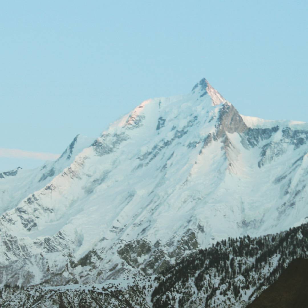
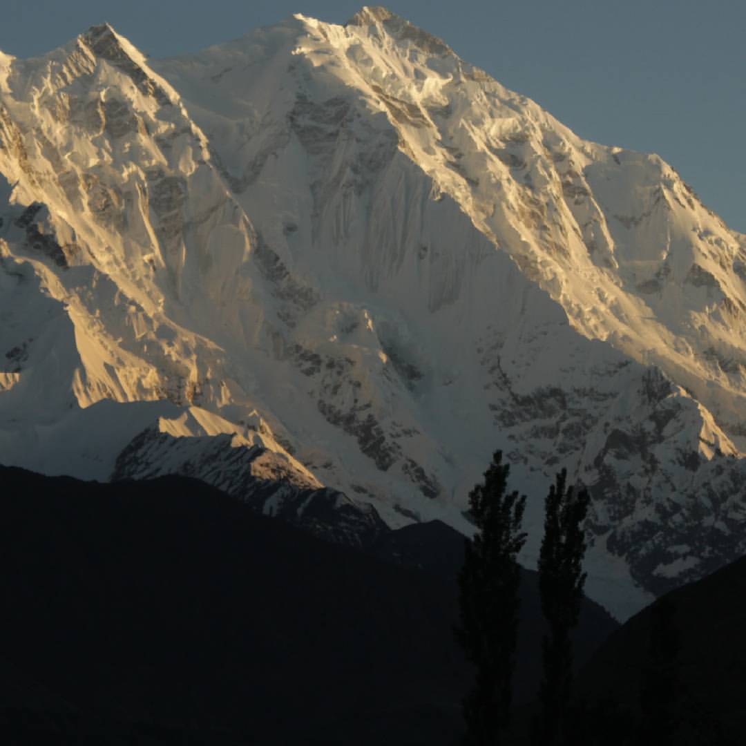
Sunset on Rakaposhi peak west side
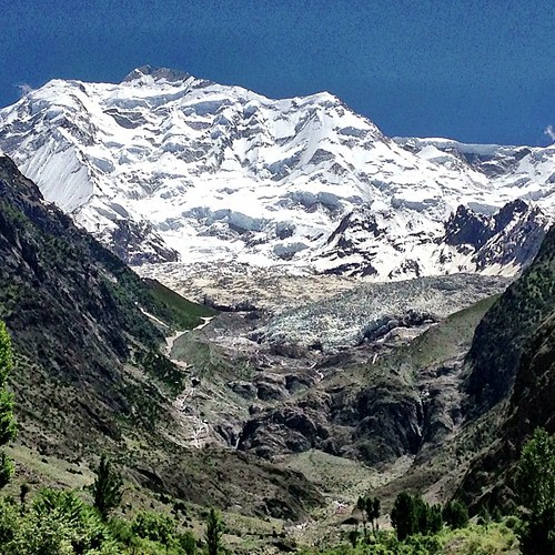
Rakaposhi Peak | Rakaposhi Base Camp View | Hunza Nagar | Hunza Valley | Gilgit-Baltistan, Northern Pakistan

Rakaposhi peak
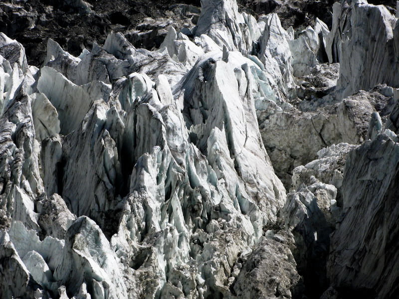
The ice mountain in the glacier
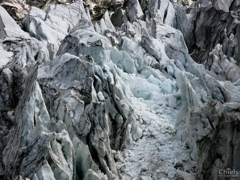
Close view of the ice.

Rakaposhi, viewed from Pisin

Worthwhile drive. Gilgit to Hunza Karakoram Highway, Gilgit Baltistan. #Entouragetonorth #Pakistan

Rakaposhi right, Diran Peak left from Hunza Pakistan #peaks #valleys #hunza #rakaposhipeak #diranpeak

Rakaposhi and Batura Muztagh

Night Panorama of Nasirabad and Minapin

Miachar, Nagar

Miachar, Nagar

Nasirabad and Miachar

Dadimal, Nagar

Miachar, Nagar

Hunza Valley from Murtazabad

Entering Nasirabad

Miachar Nagar, the old Settlement

Phakker and Miachar Nagar

Along the Karakoram highway I

After a landslide
Mount Rakaposhi - the mist of Nagar valley Karakoram Pakistan

Miachar & Dadimal, Nagar

Batura Muztagh
Rakaposhi Map
Search another place
Near Places
Nilt, Hunza Nagar
Jaglot
Chalt, Hunza Nagar
Nomal Valley
Minawar
Gilgit Airport, Airport Rd, Gilgit
Gilgit-Baltistan Monument, River View Rd, Gilgit
Gilgit
Chari Khand
Naltar Valley
Batura Sar
Naltar Lake 4, Naltar Valley, Gilgit-Baltistan
Naltar Lake, Naltar Valley
Sherqilla
Chatorkhand
Gahkuch
Ishkoman
Chilas Airport, Chilās
Chilās
Makuli Yasin Valley, Qorqolti, Yasin Valley
Recent Searches
- Sunrise Sunset Times of Red Dog Mine, AK, USA
- Sunrise Sunset Times of Am Bahnhof, Am bhf, Borken, Germany
- Sunrise Sunset Times of 4th St E, Sonoma, CA, USA
- Sunrise Sunset Times of Oakland Ave, Williamsport, PA, USA
- Sunrise Sunset Times of Via Roma, Pieranica CR, Italy
- Sunrise Sunset Times of Clock Tower of Dubrovnik, Grad, Dubrovnik, Croatia
- Sunrise Sunset Times of Trelew, Chubut Province, Argentina
- Sunrise Sunset Times of Hartfords Bluff Cir, Mt Pleasant, SC, USA
- Sunrise Sunset Times of Kita Ward, Kumamoto, Japan
- Sunrise Sunset Times of Pingtan Island, Pingtan County, Fuzhou, China