Blanding, UT 美國Nizhoni Campground的日出日落時間表
Location: 美國 > 猶他 > 聖胡安縣 > 美國猶他布蘭丁 >
時區:
America/Denver
當地時間:
2025-07-07 20:29:27
經度:
-109.5400128
緯度:
37.7821755
今天日出時間:
06:04:09 AM
今天日落時間:
08:42:38 PM
今天日照時長:
14h 38m 29s
明天日出時間:
06:04:46 AM
明天日落時間:
08:42:17 PM
明天日照時長:
14h 37m 31s
顯示所有日期
| 日期 | 日出 | 日落 | 日照時長 |
|---|---|---|---|
| 2025年01月01日 | 07:33:41 AM | 05:11:01 PM | 9h 37m 20s |
| 2025年01月02日 | 07:33:46 AM | 05:11:51 PM | 9h 38m 5s |
| 2025年01月03日 | 07:33:49 AM | 05:12:42 PM | 9h 38m 53s |
| 2025年01月04日 | 07:33:50 AM | 05:13:35 PM | 9h 39m 45s |
| 2025年01月05日 | 07:33:49 AM | 05:14:29 PM | 9h 40m 40s |
| 2025年01月06日 | 07:33:46 AM | 05:15:23 PM | 9h 41m 37s |
| 2025年01月07日 | 07:33:40 AM | 05:16:19 PM | 9h 42m 39s |
| 2025年01月08日 | 07:33:33 AM | 05:17:16 PM | 9h 43m 43s |
| 2025年01月09日 | 07:33:24 AM | 05:18:14 PM | 9h 44m 50s |
| 2025年01月10日 | 07:33:12 AM | 05:19:13 PM | 9h 46m 1s |
| 2025年01月11日 | 07:32:59 AM | 05:20:12 PM | 9h 47m 13s |
| 2025年01月12日 | 07:32:43 AM | 05:21:13 PM | 9h 48m 30s |
| 2025年01月13日 | 07:32:25 AM | 05:22:14 PM | 9h 49m 49s |
| 2025年01月14日 | 07:32:06 AM | 05:23:16 PM | 9h 51m 10s |
| 2025年01月15日 | 07:31:44 AM | 05:24:18 PM | 9h 52m 34s |
| 2025年01月16日 | 07:31:20 AM | 05:25:21 PM | 9h 54m 1s |
| 2025年01月17日 | 07:30:55 AM | 05:26:25 PM | 9h 55m 30s |
| 2025年01月18日 | 07:30:27 AM | 05:27:29 PM | 9h 57m 2s |
| 2025年01月19日 | 07:29:58 AM | 05:28:34 PM | 9h 58m 36s |
| 2025年01月20日 | 07:29:26 AM | 05:29:39 PM | 10h 0m 13s |
| 2025年01月21日 | 07:28:53 AM | 05:30:44 PM | 10h 1m 51s |
| 2025年01月22日 | 07:28:17 AM | 05:31:50 PM | 10h 3m 33s |
| 2025年01月23日 | 07:27:40 AM | 05:32:56 PM | 10h 5m 16s |
| 2025年01月24日 | 07:27:01 AM | 05:34:03 PM | 10h 7m 2s |
| 2025年01月25日 | 07:26:21 AM | 05:35:09 PM | 10h 8m 48s |
| 2025年01月26日 | 07:25:38 AM | 05:36:16 PM | 10h 10m 38s |
| 2025年01月27日 | 07:24:54 AM | 05:37:23 PM | 10h 12m 29s |
| 2025年01月28日 | 07:24:08 AM | 05:38:30 PM | 10h 14m 22s |
| 2025年01月29日 | 07:23:20 AM | 05:39:37 PM | 10h 16m 17s |
| 2025年01月30日 | 07:22:31 AM | 05:40:44 PM | 10h 18m 13s |
| 2025年01月31日 | 07:21:39 AM | 05:41:51 PM | 10h 20m 12s |
| 2025年02月01日 | 07:20:47 AM | 05:42:58 PM | 10h 22m 11s |
| 2025年02月02日 | 07:19:53 AM | 05:44:05 PM | 10h 24m 12s |
| 2025年02月03日 | 07:18:57 AM | 05:45:12 PM | 10h 26m 15s |
| 2025年02月04日 | 07:18:00 AM | 05:46:18 PM | 10h 28m 18s |
| 2025年02月05日 | 07:17:01 AM | 05:47:25 PM | 10h 30m 24s |
| 2025年02月06日 | 07:16:01 AM | 05:48:32 PM | 10h 32m 31s |
| 2025年02月07日 | 07:14:59 AM | 05:49:38 PM | 10h 34m 39s |
| 2025年02月08日 | 07:13:56 AM | 05:50:44 PM | 10h 36m 48s |
| 2025年02月09日 | 07:12:52 AM | 05:51:50 PM | 10h 38m 58s |
| 2025年02月10日 | 07:11:46 AM | 05:52:56 PM | 10h 41m 10s |
| 2025年02月11日 | 07:10:39 AM | 05:54:01 PM | 10h 43m 22s |
| 2025年02月12日 | 07:09:31 AM | 05:55:06 PM | 10h 45m 35s |
| 2025年02月13日 | 07:08:21 AM | 05:56:11 PM | 10h 47m 50s |
| 2025年02月14日 | 07:07:11 AM | 05:57:16 PM | 10h 50m 5s |
| 2025年02月15日 | 07:05:59 AM | 05:58:20 PM | 10h 52m 21s |
| 2025年02月16日 | 07:04:46 AM | 05:59:25 PM | 10h 54m 39s |
| 2025年02月17日 | 07:03:32 AM | 06:00:28 PM | 10h 56m 56s |
| 2025年02月18日 | 07:02:17 AM | 06:01:32 PM | 10h 59m 15s |
| 2025年02月19日 | 07:01:01 AM | 06:02:35 PM | 11h 1m 34s |
| 2025年02月20日 | 06:59:44 AM | 06:03:38 PM | 11h 3m 54s |
| 2025年02月21日 | 06:58:27 AM | 06:04:41 PM | 11h 6m 14s |
| 2025年02月22日 | 06:57:08 AM | 06:05:43 PM | 11h 8m 35s |
| 2025年02月23日 | 06:55:48 AM | 06:06:45 PM | 11h 10m 57s |
| 2025年02月24日 | 06:54:27 AM | 06:07:46 PM | 11h 13m 19s |
| 2025年02月25日 | 06:53:06 AM | 06:08:48 PM | 11h 15m 42s |
| 2025年02月26日 | 06:51:44 AM | 06:09:49 PM | 11h 18m 5s |
| 2025年02月27日 | 06:50:21 AM | 06:10:49 PM | 11h 20m 28s |
| 2025年02月28日 | 06:48:57 AM | 06:11:50 PM | 11h 22m 53s |
| 2025年03月01日 | 06:47:33 AM | 06:12:50 PM | 11h 25m 17s |
| 2025年03月02日 | 06:46:08 AM | 06:13:49 PM | 11h 27m 41s |
| 2025年03月03日 | 06:44:43 AM | 06:14:49 PM | 11h 30m 6s |
| 2025年03月04日 | 06:43:17 AM | 06:15:48 PM | 11h 32m 31s |
| 2025年03月05日 | 06:41:50 AM | 06:16:47 PM | 11h 34m 57s |
| 2025年03月06日 | 06:40:23 AM | 06:17:46 PM | 11h 37m 23s |
| 2025年03月07日 | 06:38:55 AM | 06:18:44 PM | 11h 39m 49s |
| 2025年03月08日 | 06:37:27 AM | 06:19:42 PM | 11h 42m 15s |
| 2025年03月09日 | 07:36:02 AM | 07:20:37 PM | 11h 44m 35s |
| 2025年03月10日 | 07:34:33 AM | 07:21:35 PM | 11h 47m 2s |
| 2025年03月11日 | 07:33:03 AM | 07:22:32 PM | 11h 49m 29s |
| 2025年03月12日 | 07:31:34 AM | 07:23:29 PM | 11h 51m 55s |
| 2025年03月13日 | 07:30:04 AM | 07:24:26 PM | 11h 54m 22s |
| 2025年03月14日 | 07:28:33 AM | 07:25:23 PM | 11h 56m 50s |
| 2025年03月15日 | 07:27:03 AM | 07:26:19 PM | 11h 59m 16s |
| 2025年03月16日 | 07:25:32 AM | 07:27:16 PM | 12h 1m 44s |
| 2025年03月17日 | 07:24:01 AM | 07:28:12 PM | 12h 4m 11s |
| 2025年03月18日 | 07:22:30 AM | 07:29:08 PM | 12h 6m 38s |
| 2025年03月19日 | 07:20:59 AM | 07:30:04 PM | 12h 9m 5s |
| 2025年03月20日 | 07:19:27 AM | 07:30:59 PM | 12h 11m 32s |
| 2025年03月21日 | 07:17:56 AM | 07:31:55 PM | 12h 13m 59s |
| 2025年03月22日 | 07:16:25 AM | 07:32:50 PM | 12h 16m 25s |
| 2025年03月23日 | 07:14:53 AM | 07:33:46 PM | 12h 18m 53s |
| 2025年03月24日 | 07:13:22 AM | 07:34:41 PM | 12h 21m 19s |
| 2025年03月25日 | 07:11:50 AM | 07:35:36 PM | 12h 23m 46s |
| 2025年03月26日 | 07:10:19 AM | 07:36:31 PM | 12h 26m 12s |
| 2025年03月27日 | 07:08:48 AM | 07:37:26 PM | 12h 28m 38s |
| 2025年03月28日 | 07:07:17 AM | 07:38:21 PM | 12h 31m 4s |
| 2025年03月29日 | 07:05:46 AM | 07:39:16 PM | 12h 33m 30s |
| 2025年03月30日 | 07:04:16 AM | 07:40:11 PM | 12h 35m 55s |
| 2025年03月31日 | 07:02:45 AM | 07:41:05 PM | 12h 38m 20s |
| 2025年04月01日 | 07:01:15 AM | 07:42:00 PM | 12h 40m 45s |
| 2025年04月02日 | 06:59:45 AM | 07:42:55 PM | 12h 43m 10s |
| 2025年04月03日 | 06:58:16 AM | 07:43:50 PM | 12h 45m 34s |
| 2025年04月04日 | 06:56:47 AM | 07:44:44 PM | 12h 47m 57s |
| 2025年04月05日 | 06:55:18 AM | 07:45:39 PM | 12h 50m 21s |
| 2025年04月06日 | 06:53:49 AM | 07:46:34 PM | 12h 52m 45s |
| 2025年04月07日 | 06:52:21 AM | 07:47:29 PM | 12h 55m 8s |
| 2025年04月08日 | 06:50:54 AM | 07:48:24 PM | 12h 57m 30s |
| 2025年04月09日 | 06:49:27 AM | 07:49:18 PM | 12h 59m 51s |
| 2025年04月10日 | 06:48:01 AM | 07:50:13 PM | 13h 2m 12s |
| 2025年04月11日 | 06:46:35 AM | 07:51:08 PM | 13h 4m 33s |
| 2025年04月12日 | 06:45:09 AM | 07:52:03 PM | 13h 6m 54s |
| 2025年04月13日 | 06:43:45 AM | 07:52:58 PM | 13h 9m 13s |
| 2025年04月14日 | 06:42:21 AM | 07:53:53 PM | 13h 11m 32s |
| 2025年04月15日 | 06:40:57 AM | 07:54:48 PM | 13h 13m 51s |
| 2025年04月16日 | 06:39:35 AM | 07:55:43 PM | 13h 16m 8s |
| 2025年04月17日 | 06:38:13 AM | 07:56:38 PM | 13h 18m 25s |
| 2025年04月18日 | 06:36:52 AM | 07:57:34 PM | 13h 20m 42s |
| 2025年04月19日 | 06:35:32 AM | 07:58:29 PM | 13h 22m 57s |
| 2025年04月20日 | 06:34:12 AM | 07:59:24 PM | 13h 25m 12s |
| 2025年04月21日 | 06:32:54 AM | 08:00:19 PM | 13h 27m 25s |
| 2025年04月22日 | 06:31:36 AM | 08:01:15 PM | 13h 29m 39s |
| 2025年04月23日 | 06:30:19 AM | 08:02:10 PM | 13h 31m 51s |
| 2025年04月24日 | 06:29:03 AM | 08:03:05 PM | 13h 34m 2s |
| 2025年04月25日 | 06:27:48 AM | 08:04:01 PM | 13h 36m 13s |
| 2025年04月26日 | 06:26:34 AM | 08:04:56 PM | 13h 38m 22s |
| 2025年04月27日 | 06:25:22 AM | 08:05:51 PM | 13h 40m 29s |
| 2025年04月28日 | 06:24:10 AM | 08:06:46 PM | 13h 42m 36s |
| 2025年04月29日 | 06:22:59 AM | 08:07:42 PM | 13h 44m 43s |
| 2025年04月30日 | 06:21:50 AM | 08:08:37 PM | 13h 46m 47s |
| 2025年05月01日 | 06:20:41 AM | 08:09:32 PM | 13h 48m 51s |
| 2025年05月02日 | 06:19:34 AM | 08:10:27 PM | 13h 50m 53s |
| 2025年05月03日 | 06:18:28 AM | 08:11:22 PM | 13h 52m 54s |
| 2025年05月04日 | 06:17:24 AM | 08:12:16 PM | 13h 54m 52s |
| 2025年05月05日 | 06:16:20 AM | 08:13:11 PM | 13h 56m 51s |
| 2025年05月06日 | 06:15:18 AM | 08:14:05 PM | 13h 58m 47s |
| 2025年05月07日 | 06:14:17 AM | 08:14:59 PM | 14h 0m 42s |
| 2025年05月08日 | 06:13:18 AM | 08:15:53 PM | 14h 2m 35s |
| 2025年05月09日 | 06:12:20 AM | 08:16:47 PM | 14h 4m 27s |
| 2025年05月10日 | 06:11:23 AM | 08:17:41 PM | 14h 6m 18s |
| 2025年05月11日 | 06:10:28 AM | 08:18:34 PM | 14h 8m 6s |
| 2025年05月12日 | 06:09:34 AM | 08:19:27 PM | 14h 9m 53s |
| 2025年05月13日 | 06:08:42 AM | 08:20:19 PM | 14h 11m 37s |
| 2025年05月14日 | 06:07:51 AM | 08:21:11 PM | 14h 13m 20s |
| 2025年05月15日 | 06:07:02 AM | 08:22:03 PM | 14h 15m 1s |
| 2025年05月16日 | 06:06:14 AM | 08:22:54 PM | 14h 16m 40s |
| 2025年05月17日 | 06:05:28 AM | 08:23:45 PM | 14h 18m 17s |
| 2025年05月18日 | 06:04:44 AM | 08:24:36 PM | 14h 19m 52s |
| 2025年05月19日 | 06:04:01 AM | 08:25:25 PM | 14h 21m 24s |
| 2025年05月20日 | 06:03:20 AM | 08:26:15 PM | 14h 22m 55s |
| 2025年05月21日 | 06:02:40 AM | 08:27:03 PM | 14h 24m 23s |
| 2025年05月22日 | 06:02:02 AM | 08:27:51 PM | 14h 25m 49s |
| 2025年05月23日 | 06:01:26 AM | 08:28:38 PM | 14h 27m 12s |
| 2025年05月24日 | 06:00:52 AM | 08:29:25 PM | 14h 28m 33s |
| 2025年05月25日 | 06:00:19 AM | 08:30:11 PM | 14h 29m 52s |
| 2025年05月26日 | 05:59:48 AM | 08:30:56 PM | 14h 31m 8s |
| 2025年05月27日 | 05:59:19 AM | 08:31:40 PM | 14h 32m 21s |
| 2025年05月28日 | 05:58:51 AM | 08:32:23 PM | 14h 33m 32s |
| 2025年05月29日 | 05:58:26 AM | 08:33:06 PM | 14h 34m 40s |
| 2025年05月30日 | 05:58:02 AM | 08:33:47 PM | 14h 35m 45s |
| 2025年05月31日 | 05:57:40 AM | 08:34:28 PM | 14h 36m 48s |
| 2025年06月01日 | 05:57:19 AM | 08:35:07 PM | 14h 37m 48s |
| 2025年06月02日 | 05:57:01 AM | 08:35:46 PM | 14h 38m 45s |
| 2025年06月03日 | 05:56:44 AM | 08:36:23 PM | 14h 39m 39s |
| 2025年06月04日 | 05:56:29 AM | 08:36:59 PM | 14h 40m 30s |
| 2025年06月05日 | 05:56:16 AM | 08:37:34 PM | 14h 41m 18s |
| 2025年06月06日 | 05:56:05 AM | 08:38:08 PM | 14h 42m 3s |
| 2025年06月07日 | 05:55:55 AM | 08:38:40 PM | 14h 42m 45s |
| 2025年06月08日 | 05:55:48 AM | 08:39:12 PM | 14h 43m 24s |
| 2025年06月09日 | 05:55:42 AM | 08:39:42 PM | 14h 44m 0s |
| 2025年06月10日 | 05:55:38 AM | 08:40:10 PM | 14h 44m 32s |
| 2025年06月11日 | 05:55:35 AM | 08:40:37 PM | 14h 45m 2s |
| 2025年06月12日 | 05:55:35 AM | 08:41:03 PM | 14h 45m 28s |
| 2025年06月13日 | 05:55:36 AM | 08:41:27 PM | 14h 45m 51s |
| 2025年06月14日 | 05:55:39 AM | 08:41:50 PM | 14h 46m 11s |
| 2025年06月15日 | 05:55:43 AM | 08:42:11 PM | 14h 46m 28s |
| 2025年06月16日 | 05:55:50 AM | 08:42:31 PM | 14h 46m 41s |
| 2025年06月17日 | 05:55:58 AM | 08:42:49 PM | 14h 46m 51s |
| 2025年06月18日 | 05:56:08 AM | 08:43:05 PM | 14h 46m 57s |
| 2025年06月19日 | 05:56:19 AM | 08:43:20 PM | 14h 47m 1s |
| 2025年06月20日 | 05:56:32 AM | 08:43:33 PM | 14h 47m 1s |
| 2025年06月21日 | 05:56:47 AM | 08:43:45 PM | 14h 46m 58s |
| 2025年06月22日 | 05:57:03 AM | 08:43:54 PM | 14h 46m 51s |
| 2025年06月23日 | 05:57:20 AM | 08:44:02 PM | 14h 46m 42s |
| 2025年06月24日 | 05:57:40 AM | 08:44:09 PM | 14h 46m 29s |
| 2025年06月25日 | 05:58:00 AM | 08:44:13 PM | 14h 46m 13s |
| 2025年06月26日 | 05:58:23 AM | 08:44:16 PM | 14h 45m 53s |
| 2025年06月27日 | 05:58:46 AM | 08:44:17 PM | 14h 45m 31s |
| 2025年06月28日 | 05:59:11 AM | 08:44:16 PM | 14h 45m 5s |
| 2025年06月29日 | 05:59:38 AM | 08:44:13 PM | 14h 44m 35s |
| 2025年06月30日 | 06:00:05 AM | 08:44:09 PM | 14h 44m 4s |
| 2025年07月01日 | 06:00:34 AM | 08:44:02 PM | 14h 43m 28s |
| 2025年07月02日 | 06:01:05 AM | 08:43:54 PM | 14h 42m 49s |
| 2025年07月03日 | 06:01:36 AM | 08:43:44 PM | 14h 42m 8s |
| 2025年07月04日 | 06:02:09 AM | 08:43:32 PM | 14h 41m 23s |
| 2025年07月05日 | 06:02:42 AM | 08:43:18 PM | 14h 40m 36s |
| 2025年07月06日 | 06:03:17 AM | 08:43:03 PM | 14h 39m 46s |
| 2025年07月07日 | 06:03:53 AM | 08:42:45 PM | 14h 38m 52s |
| 2025年07月08日 | 06:04:30 AM | 08:42:26 PM | 14h 37m 56s |
| 2025年07月09日 | 06:05:08 AM | 08:42:05 PM | 14h 36m 57s |
| 2025年07月10日 | 06:05:47 AM | 08:41:42 PM | 14h 35m 55s |
| 2025年07月11日 | 06:06:27 AM | 08:41:17 PM | 14h 34m 50s |
| 2025年07月12日 | 06:07:08 AM | 08:40:51 PM | 14h 33m 43s |
| 2025年07月13日 | 06:07:49 AM | 08:40:22 PM | 14h 32m 33s |
| 2025年07月14日 | 06:08:32 AM | 08:39:52 PM | 14h 31m 20s |
| 2025年07月15日 | 06:09:15 AM | 08:39:20 PM | 14h 30m 5s |
| 2025年07月16日 | 06:09:59 AM | 08:38:46 PM | 14h 28m 47s |
| 2025年07月17日 | 06:10:43 AM | 08:38:11 PM | 14h 27m 28s |
| 2025年07月18日 | 06:11:29 AM | 08:37:33 PM | 14h 26m 4s |
| 2025年07月19日 | 06:12:14 AM | 08:36:54 PM | 14h 24m 40s |
| 2025年07月20日 | 06:13:01 AM | 08:36:14 PM | 14h 23m 13s |
| 2025年07月21日 | 06:13:48 AM | 08:35:31 PM | 14h 21m 43s |
| 2025年07月22日 | 06:14:35 AM | 08:34:47 PM | 14h 20m 12s |
| 2025年07月23日 | 06:15:23 AM | 08:34:02 PM | 14h 18m 39s |
| 2025年07月24日 | 06:16:11 AM | 08:33:14 PM | 14h 17m 3s |
| 2025年07月25日 | 06:17:00 AM | 08:32:26 PM | 14h 15m 26s |
| 2025年07月26日 | 06:17:49 AM | 08:31:35 PM | 14h 13m 46s |
| 2025年07月27日 | 06:18:38 AM | 08:30:43 PM | 14h 12m 5s |
| 2025年07月28日 | 06:19:28 AM | 08:29:50 PM | 14h 10m 22s |
| 2025年07月29日 | 06:20:18 AM | 08:28:55 PM | 14h 8m 37s |
| 2025年07月30日 | 06:21:09 AM | 08:27:58 PM | 14h 6m 49s |
| 2025年07月31日 | 06:21:59 AM | 08:27:00 PM | 14h 5m 1s |
| 2025年08月01日 | 06:22:50 AM | 08:26:01 PM | 14h 3m 11s |
| 2025年08月02日 | 06:23:41 AM | 08:25:00 PM | 14h 1m 19s |
| 2025年08月03日 | 06:24:32 AM | 08:23:58 PM | 13h 59m 26s |
| 2025年08月04日 | 06:25:23 AM | 08:22:54 PM | 13h 57m 31s |
| 2025年08月05日 | 06:26:15 AM | 08:21:49 PM | 13h 55m 34s |
| 2025年08月06日 | 06:27:06 AM | 08:20:43 PM | 13h 53m 37s |
| 2025年08月07日 | 06:27:58 AM | 08:19:36 PM | 13h 51m 38s |
| 2025年08月08日 | 06:28:49 AM | 08:18:27 PM | 13h 49m 38s |
| 2025年08月09日 | 06:29:41 AM | 08:17:17 PM | 13h 47m 36s |
| 2025年08月10日 | 06:30:33 AM | 08:16:06 PM | 13h 45m 33s |
| 2025年08月11日 | 06:31:24 AM | 08:14:54 PM | 13h 43m 30s |
| 2025年08月12日 | 06:32:16 AM | 08:13:41 PM | 13h 41m 25s |
| 2025年08月13日 | 06:33:08 AM | 08:12:27 PM | 13h 39m 19s |
| 2025年08月14日 | 06:34:00 AM | 08:11:11 PM | 13h 37m 11s |
| 2025年08月15日 | 06:34:51 AM | 08:09:55 PM | 13h 35m 4s |
| 2025年08月16日 | 06:35:43 AM | 08:08:38 PM | 13h 32m 55s |
| 2025年08月17日 | 06:36:34 AM | 08:07:19 PM | 13h 30m 45s |
| 2025年08月18日 | 06:37:26 AM | 08:06:00 PM | 13h 28m 34s |
| 2025年08月19日 | 06:38:17 AM | 08:04:40 PM | 13h 26m 23s |
| 2025年08月20日 | 06:39:09 AM | 08:03:19 PM | 13h 24m 10s |
| 2025年08月21日 | 06:40:00 AM | 08:01:57 PM | 13h 21m 57s |
| 2025年08月22日 | 06:40:52 AM | 08:00:34 PM | 13h 19m 42s |
| 2025年08月23日 | 06:41:43 AM | 07:59:10 PM | 13h 17m 27s |
| 2025年08月24日 | 06:42:34 AM | 07:57:46 PM | 13h 15m 12s |
| 2025年08月25日 | 06:43:25 AM | 07:56:21 PM | 13h 12m 56s |
| 2025年08月26日 | 06:44:16 AM | 07:54:55 PM | 13h 10m 39s |
| 2025年08月27日 | 06:45:07 AM | 07:53:29 PM | 13h 8m 22s |
| 2025年08月28日 | 06:45:58 AM | 07:52:02 PM | 13h 6m 4s |
| 2025年08月29日 | 06:46:49 AM | 07:50:34 PM | 13h 3m 45s |
| 2025年08月30日 | 06:47:39 AM | 07:49:06 PM | 13h 1m 27s |
| 2025年08月31日 | 06:48:30 AM | 07:47:37 PM | 12h 59m 7s |
| 2025年09月01日 | 06:49:21 AM | 07:46:08 PM | 12h 56m 47s |
| 2025年09月02日 | 06:50:11 AM | 07:44:38 PM | 12h 54m 27s |
| 2025年09月03日 | 06:51:02 AM | 07:43:08 PM | 12h 52m 6s |
| 2025年09月04日 | 06:51:52 AM | 07:41:37 PM | 12h 49m 45s |
| 2025年09月05日 | 06:52:43 AM | 07:40:06 PM | 12h 47m 23s |
| 2025年09月06日 | 06:53:33 AM | 07:38:35 PM | 12h 45m 2s |
| 2025年09月07日 | 06:54:23 AM | 07:37:03 PM | 12h 42m 40s |
| 2025年09月08日 | 06:55:14 AM | 07:35:31 PM | 12h 40m 17s |
| 2025年09月09日 | 06:56:04 AM | 07:33:59 PM | 12h 37m 55s |
| 2025年09月10日 | 06:56:55 AM | 07:32:26 PM | 12h 35m 31s |
| 2025年09月11日 | 06:57:45 AM | 07:30:53 PM | 12h 33m 8s |
| 2025年09月12日 | 06:58:35 AM | 07:29:20 PM | 12h 30m 45s |
| 2025年09月13日 | 06:59:26 AM | 07:27:47 PM | 12h 28m 21s |
| 2025年09月14日 | 07:00:16 AM | 07:26:13 PM | 12h 25m 57s |
| 2025年09月15日 | 07:01:07 AM | 07:24:40 PM | 12h 23m 33s |
| 2025年09月16日 | 07:01:58 AM | 07:23:06 PM | 12h 21m 8s |
| 2025年09月17日 | 07:02:49 AM | 07:21:33 PM | 12h 18m 44s |
| 2025年09月18日 | 07:03:39 AM | 07:19:59 PM | 12h 16m 20s |
| 2025年09月19日 | 07:04:30 AM | 07:18:25 PM | 12h 13m 55s |
| 2025年09月20日 | 07:05:21 AM | 07:16:52 PM | 12h 11m 31s |
| 2025年09月21日 | 07:06:13 AM | 07:15:18 PM | 12h 9m 5s |
| 2025年09月22日 | 07:07:04 AM | 07:13:45 PM | 12h 6m 41s |
| 2025年09月23日 | 07:07:55 AM | 07:12:12 PM | 12h 4m 17s |
| 2025年09月24日 | 07:08:47 AM | 07:10:38 PM | 12h 1m 51s |
| 2025年09月25日 | 07:09:39 AM | 07:09:05 PM | 11h 59m 26s |
| 2025年09月26日 | 07:10:31 AM | 07:07:33 PM | 11h 57m 2s |
| 2025年09月27日 | 07:11:23 AM | 07:06:00 PM | 11h 54m 37s |
| 2025年09月28日 | 07:12:15 AM | 07:04:28 PM | 11h 52m 13s |
| 2025年09月29日 | 07:13:08 AM | 07:02:56 PM | 11h 49m 48s |
| 2025年09月30日 | 07:14:01 AM | 07:01:24 PM | 11h 47m 23s |
| 2025年10月01日 | 07:14:54 AM | 06:59:53 PM | 11h 44m 59s |
| 2025年10月02日 | 07:15:47 AM | 06:58:22 PM | 11h 42m 35s |
| 2025年10月03日 | 07:16:41 AM | 06:56:51 PM | 11h 40m 10s |
| 2025年10月04日 | 07:17:35 AM | 06:55:21 PM | 11h 37m 46s |
| 2025年10月05日 | 07:18:29 AM | 06:53:52 PM | 11h 35m 23s |
| 2025年10月06日 | 07:19:23 AM | 06:52:23 PM | 11h 33m 0s |
| 2025年10月07日 | 07:20:18 AM | 06:50:54 PM | 11h 30m 36s |
| 2025年10月08日 | 07:21:13 AM | 06:49:26 PM | 11h 28m 13s |
| 2025年10月09日 | 07:22:09 AM | 06:47:59 PM | 11h 25m 50s |
| 2025年10月10日 | 07:23:04 AM | 06:46:32 PM | 11h 23m 28s |
| 2025年10月11日 | 07:24:00 AM | 06:45:06 PM | 11h 21m 6s |
| 2025年10月12日 | 07:24:56 AM | 06:43:41 PM | 11h 18m 45s |
| 2025年10月13日 | 07:25:53 AM | 06:42:17 PM | 11h 16m 24s |
| 2025年10月14日 | 07:26:50 AM | 06:40:53 PM | 11h 14m 3s |
| 2025年10月15日 | 07:27:47 AM | 06:39:30 PM | 11h 11m 43s |
| 2025年10月16日 | 07:28:45 AM | 06:38:08 PM | 11h 9m 23s |
| 2025年10月17日 | 07:29:43 AM | 06:36:46 PM | 11h 7m 3s |
| 2025年10月18日 | 07:30:41 AM | 06:35:26 PM | 11h 4m 45s |
| 2025年10月19日 | 07:31:40 AM | 06:34:06 PM | 11h 2m 26s |
| 2025年10月20日 | 07:32:39 AM | 06:32:48 PM | 11h 0m 9s |
| 2025年10月21日 | 07:33:39 AM | 06:31:30 PM | 10h 57m 51s |
| 2025年10月22日 | 07:34:38 AM | 06:30:14 PM | 10h 55m 36s |
| 2025年10月23日 | 07:35:38 AM | 06:28:58 PM | 10h 53m 20s |
| 2025年10月24日 | 07:36:39 AM | 06:27:44 PM | 10h 51m 5s |
| 2025年10月25日 | 07:37:39 AM | 06:26:31 PM | 10h 48m 52s |
| 2025年10月26日 | 07:38:40 AM | 06:25:19 PM | 10h 46m 39s |
| 2025年10月27日 | 07:39:42 AM | 06:24:08 PM | 10h 44m 26s |
| 2025年10月28日 | 07:40:43 AM | 06:22:58 PM | 10h 42m 15s |
| 2025年10月29日 | 07:41:45 AM | 06:21:50 PM | 10h 40m 5s |
| 2025年10月30日 | 07:42:48 AM | 06:20:43 PM | 10h 37m 55s |
| 2025年10月31日 | 07:43:50 AM | 06:19:37 PM | 10h 35m 47s |
| 2025年11月01日 | 07:44:53 AM | 06:18:33 PM | 10h 33m 40s |
| 2025年11月02日 | 06:45:58 AM | 05:17:27 PM | 10h 31m 29s |
| 2025年11月03日 | 06:47:01 AM | 05:16:26 PM | 10h 29m 25s |
| 2025年11月04日 | 06:48:05 AM | 05:15:26 PM | 10h 27m 21s |
| 2025年11月05日 | 06:49:08 AM | 05:14:27 PM | 10h 25m 19s |
| 2025年11月06日 | 06:50:12 AM | 05:13:30 PM | 10h 23m 18s |
| 2025年11月07日 | 06:51:16 AM | 05:12:34 PM | 10h 21m 18s |
| 2025年11月08日 | 06:52:19 AM | 05:11:41 PM | 10h 19m 22s |
| 2025年11月09日 | 06:53:23 AM | 05:10:48 PM | 10h 17m 25s |
| 2025年11月10日 | 06:54:27 AM | 05:09:58 PM | 10h 15m 31s |
| 2025年11月11日 | 06:55:31 AM | 05:09:09 PM | 10h 13m 38s |
| 2025年11月12日 | 06:56:35 AM | 05:08:22 PM | 10h 11m 47s |
| 2025年11月13日 | 06:57:39 AM | 05:07:36 PM | 10h 9m 57s |
| 2025年11月14日 | 06:58:43 AM | 05:06:52 PM | 10h 8m 9s |
| 2025年11月15日 | 06:59:47 AM | 05:06:11 PM | 10h 6m 24s |
| 2025年11月16日 | 07:00:51 AM | 05:05:31 PM | 10h 4m 40s |
| 2025年11月17日 | 07:01:54 AM | 05:04:52 PM | 10h 2m 58s |
| 2025年11月18日 | 07:02:57 AM | 05:04:16 PM | 10h 1m 19s |
| 2025年11月19日 | 07:04:00 AM | 05:03:42 PM | 9h 59m 42s |
| 2025年11月20日 | 07:05:03 AM | 05:03:09 PM | 9h 58m 6s |
| 2025年11月21日 | 07:06:05 AM | 05:02:39 PM | 9h 56m 34s |
| 2025年11月22日 | 07:07:07 AM | 05:02:10 PM | 9h 55m 3s |
| 2025年11月23日 | 07:08:08 AM | 05:01:43 PM | 9h 53m 35s |
| 2025年11月24日 | 07:09:09 AM | 05:01:19 PM | 9h 52m 10s |
| 2025年11月25日 | 07:10:09 AM | 05:00:56 PM | 9h 50m 47s |
| 2025年11月26日 | 07:11:09 AM | 05:00:36 PM | 9h 49m 27s |
| 2025年11月27日 | 07:12:08 AM | 05:00:17 PM | 9h 48m 9s |
| 2025年11月28日 | 07:13:07 AM | 05:00:01 PM | 9h 46m 54s |
| 2025年11月29日 | 07:14:04 AM | 04:59:47 PM | 9h 45m 43s |
| 2025年11月30日 | 07:15:01 AM | 04:59:35 PM | 9h 44m 34s |
| 2025年12月01日 | 07:15:57 AM | 04:59:25 PM | 9h 43m 28s |
| 2025年12月02日 | 07:16:53 AM | 04:59:17 PM | 9h 42m 24s |
| 2025年12月03日 | 07:17:47 AM | 04:59:11 PM | 9h 41m 24s |
| 2025年12月04日 | 07:18:40 AM | 04:59:07 PM | 9h 40m 27s |
| 2025年12月05日 | 07:19:32 AM | 04:59:06 PM | 9h 39m 34s |
| 2025年12月06日 | 07:20:23 AM | 04:59:06 PM | 9h 38m 43s |
| 2025年12月07日 | 07:21:13 AM | 04:59:09 PM | 9h 37m 56s |
| 2025年12月08日 | 07:22:02 AM | 04:59:13 PM | 9h 37m 11s |
| 2025年12月09日 | 07:22:50 AM | 04:59:20 PM | 9h 36m 30s |
| 2025年12月10日 | 07:23:36 AM | 04:59:29 PM | 9h 35m 53s |
| 2025年12月11日 | 07:24:21 AM | 04:59:40 PM | 9h 35m 19s |
| 2025年12月12日 | 07:25:04 AM | 04:59:53 PM | 9h 34m 49s |
| 2025年12月13日 | 07:25:46 AM | 05:00:08 PM | 9h 34m 22s |
| 2025年12月14日 | 07:26:27 AM | 05:00:26 PM | 9h 33m 59s |
| 2025年12月15日 | 07:27:06 AM | 05:00:45 PM | 9h 33m 39s |
| 2025年12月16日 | 07:27:43 AM | 05:01:06 PM | 9h 33m 23s |
| 2025年12月17日 | 07:28:19 AM | 05:01:29 PM | 9h 33m 10s |
| 2025年12月18日 | 07:28:53 AM | 05:01:54 PM | 9h 33m 1s |
| 2025年12月19日 | 07:29:26 AM | 05:02:21 PM | 9h 32m 55s |
| 2025年12月20日 | 07:29:57 AM | 05:02:50 PM | 9h 32m 53s |
| 2025年12月21日 | 07:30:26 AM | 05:03:21 PM | 9h 32m 55s |
| 2025年12月22日 | 07:30:53 AM | 05:03:53 PM | 9h 33m 0s |
| 2025年12月23日 | 07:31:18 AM | 05:04:27 PM | 9h 33m 9s |
| 2025年12月24日 | 07:31:42 AM | 05:05:03 PM | 9h 33m 21s |
| 2025年12月25日 | 07:32:03 AM | 05:05:41 PM | 9h 33m 38s |
| 2025年12月26日 | 07:32:23 AM | 05:06:21 PM | 9h 33m 58s |
| 2025年12月27日 | 07:32:40 AM | 05:07:02 PM | 9h 34m 22s |
| 2025年12月28日 | 07:32:56 AM | 05:07:44 PM | 9h 34m 48s |
| 2025年12月29日 | 07:33:10 AM | 05:08:28 PM | 9h 35m 18s |
| 2025年12月30日 | 07:33:22 AM | 05:09:14 PM | 9h 35m 52s |
| 2025年12月31日 | 07:33:31 AM | 05:10:01 PM | 9h 36m 30s |
日出日落照片

Sunrise San Juan County, Utah

Sunrise San Juan County, Utah

The Road to Cortez at Dawn

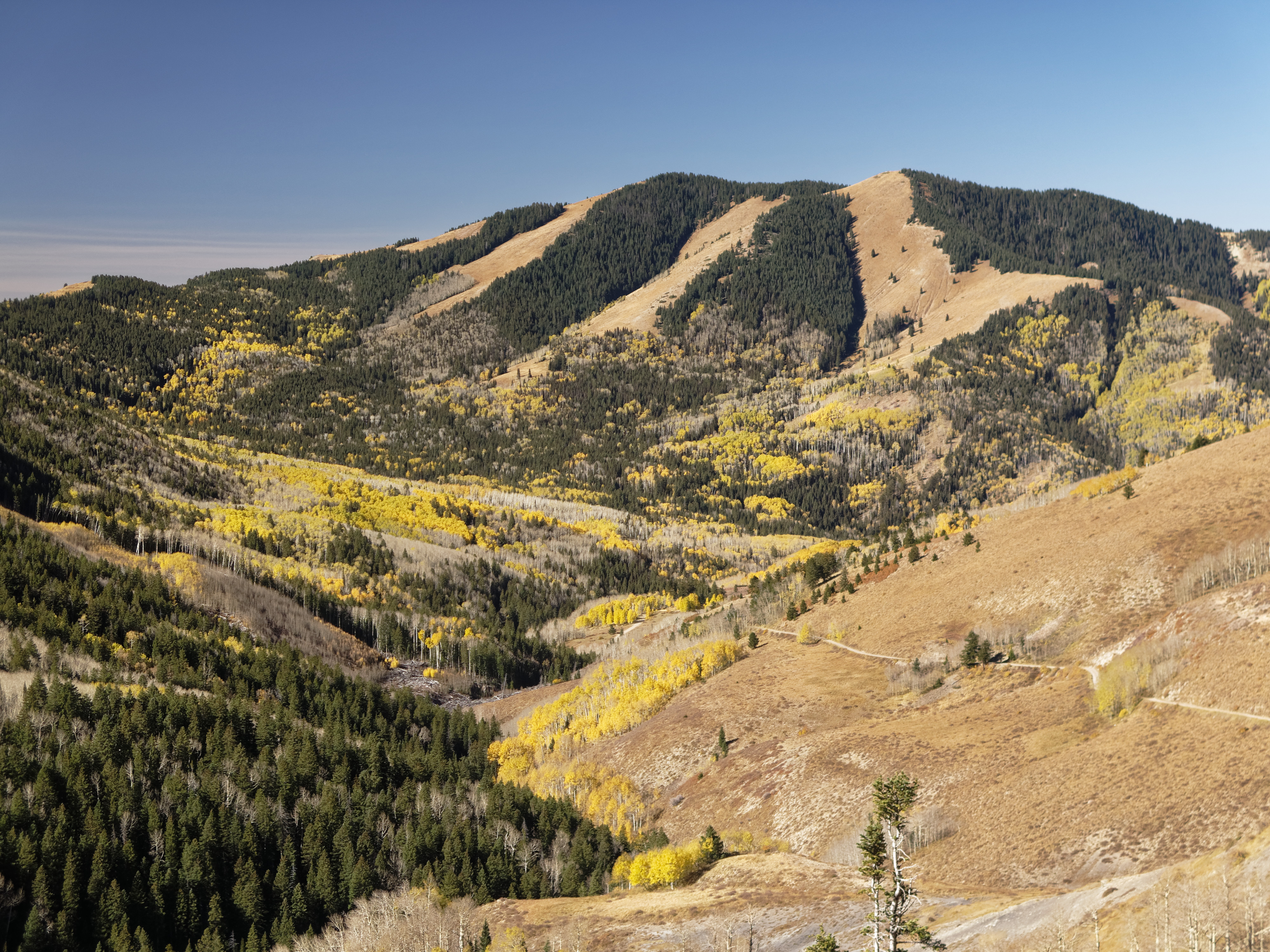
View down to Blanding from the Shay Ridge Quad Trail, Manti-La Sal National Forest, at the edge of Bears Ears National Monument.

Thru the Window

Jackson Ridge, Manti-La Sal National Forest

Blue Creek/ Allen Canyon trail, Manti-La Sal National Forest, Bears Ears National Monument

Cabin at intersection of Blue Creek-Tuerto Trail and Blue Creek-Allan Canyon Trail, Manti-La Sal National Forest, Bears Ears National Monument

At the Shay Ridge Quad Trail, Manti-La Sal National Forest, at the edge of Bears Ears National Monument
Abajo Loop State Scenic Backway

Twin Peaks

Abajo Loop State Scenic Backway

Abajo Loop State Scenic Backway

Abajo Loop State Scenic Backway

Abajo Loop State Scenic Backway

Abajo Loop State Scenic Backway

Mount Linnaeus
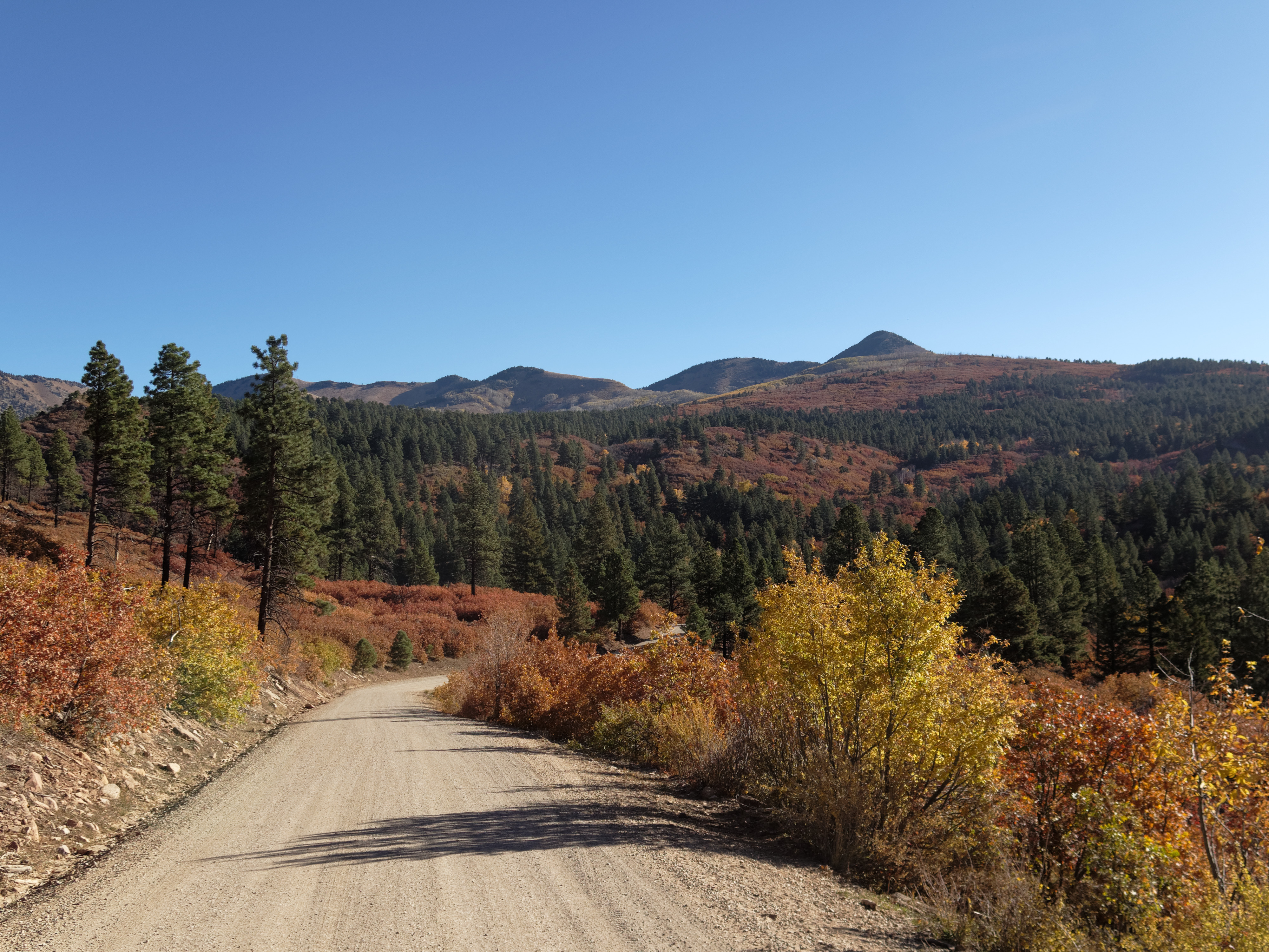
Abajo Loop State Scenic Backway

Recapture Reservoir Night

DJI Phantom Photos in Utah, Monument Valley and Mexican Hat

DJI Phantom Photos in Utah, Monument Valley and Mexican Hat

DJI Phantom Photos in Utah, Monument Valley and Mexican Hat

DJI Phantom Photos in Utah, Monument Valley and Mexican Hat

DJI Phantom Photos in Utah, Monument Valley and Mexican Hat
Blanding, UT 美國Nizhoni Campground的地圖
搜索其他地方的日出日落時間
附近地點
US-, Monticello, UT 美國Devils Canyon Campground
75 W Dude Ranch Rd, Monticello, UT 美國
美國猶他布蘭丁
E S, Blanding, UT 美國
South, US-, Blanding, UT 美國White Mesa Mill
美國猶他蒙蒂塞洛
17 N E, Monticello, UT 美國
White Mesa, UT 美國
Co Rd, Utah, 美國Butler Washington Road
Bluff, UT, 美國
E Main St, Bluff, UT 美國
美國科羅拉多河鳩河
County Rd 2, Dove Creek, CO 美國
Rd P, Dove Creek, CO 美國
Egnar, CO 美國
美國科羅拉多州鳩河
County Road 10, Pleasant View, CO 美國
Road G, Cortez, CO 美國
Cahone, CO 美國
US-, Cahone, CO 美國
最近搜索
- Red Dog Mine, AK, USA的日出日落時間表
- Am bhf, Borken, 德國Am Bahnhof的日出日落時間表
- 4th St E, Sonoma, CA 美國的日出日落時間表
- Oakland Ave, Williamsport, PA 美國的日出日落時間表
- Via Roma, Pieranica CR, 義大利的日出日落時間表
- 克羅埃西亞杜布羅夫尼克 GradClock Tower of Dubrovnik的日出日落時間表
- 阿根廷丘布特省特雷利烏的日出日落時間表
- Hartfords Bluff Cir, Mt Pleasant, SC 美國的日出日落時間表
- 日本熊本縣熊本市北區的日出日落時間表
- 中國福州市平潭縣平潭島的日出日落時間表