Horas de salida y puesta de sol de Nizhoni Campground, Blanding, UT, EE. UU.
Location: Estados Unidos > Utah > Condado de San Juan > Blanding >
Zona horaria:
America/Denver
Hora local:
2025-07-14 00:43:17
Longitud:
-109.5400128
Latitud:
37.7821755
Salida de sol de hoy:
06:08:07 AM
Puesta de sol de hoy:
08:40:10 PM
La duración del día hoy:
14h 32m 3s
Salida de sol de mañana:
06:08:50 AM
Puesta de sol de mañana:
08:39:39 PM
La duración del día mañana:
14h 30m 49s
Mostrar todas las fechas
| Fecha | Salida de sol | Puesta de sol | Duración del día |
|---|---|---|---|
| 01/01/2025 | 07:33:41 AM | 05:11:01 PM | 9h 37m 20s |
| 02/01/2025 | 07:33:46 AM | 05:11:51 PM | 9h 38m 5s |
| 03/01/2025 | 07:33:49 AM | 05:12:42 PM | 9h 38m 53s |
| 04/01/2025 | 07:33:50 AM | 05:13:35 PM | 9h 39m 45s |
| 05/01/2025 | 07:33:49 AM | 05:14:29 PM | 9h 40m 40s |
| 06/01/2025 | 07:33:46 AM | 05:15:23 PM | 9h 41m 37s |
| 07/01/2025 | 07:33:40 AM | 05:16:19 PM | 9h 42m 39s |
| 08/01/2025 | 07:33:33 AM | 05:17:16 PM | 9h 43m 43s |
| 09/01/2025 | 07:33:24 AM | 05:18:14 PM | 9h 44m 50s |
| 10/01/2025 | 07:33:12 AM | 05:19:13 PM | 9h 46m 1s |
| 11/01/2025 | 07:32:59 AM | 05:20:12 PM | 9h 47m 13s |
| 12/01/2025 | 07:32:43 AM | 05:21:13 PM | 9h 48m 30s |
| 13/01/2025 | 07:32:25 AM | 05:22:14 PM | 9h 49m 49s |
| 14/01/2025 | 07:32:06 AM | 05:23:16 PM | 9h 51m 10s |
| 15/01/2025 | 07:31:44 AM | 05:24:18 PM | 9h 52m 34s |
| 16/01/2025 | 07:31:20 AM | 05:25:21 PM | 9h 54m 1s |
| 17/01/2025 | 07:30:55 AM | 05:26:25 PM | 9h 55m 30s |
| 18/01/2025 | 07:30:27 AM | 05:27:29 PM | 9h 57m 2s |
| 19/01/2025 | 07:29:58 AM | 05:28:34 PM | 9h 58m 36s |
| 20/01/2025 | 07:29:26 AM | 05:29:39 PM | 10h 0m 13s |
| 21/01/2025 | 07:28:53 AM | 05:30:44 PM | 10h 1m 51s |
| 22/01/2025 | 07:28:17 AM | 05:31:50 PM | 10h 3m 33s |
| 23/01/2025 | 07:27:40 AM | 05:32:56 PM | 10h 5m 16s |
| 24/01/2025 | 07:27:01 AM | 05:34:03 PM | 10h 7m 2s |
| 25/01/2025 | 07:26:21 AM | 05:35:09 PM | 10h 8m 48s |
| 26/01/2025 | 07:25:38 AM | 05:36:16 PM | 10h 10m 38s |
| 27/01/2025 | 07:24:54 AM | 05:37:23 PM | 10h 12m 29s |
| 28/01/2025 | 07:24:08 AM | 05:38:30 PM | 10h 14m 22s |
| 29/01/2025 | 07:23:20 AM | 05:39:37 PM | 10h 16m 17s |
| 30/01/2025 | 07:22:31 AM | 05:40:44 PM | 10h 18m 13s |
| 31/01/2025 | 07:21:39 AM | 05:41:51 PM | 10h 20m 12s |
| 01/02/2025 | 07:20:47 AM | 05:42:58 PM | 10h 22m 11s |
| 02/02/2025 | 07:19:53 AM | 05:44:05 PM | 10h 24m 12s |
| 03/02/2025 | 07:18:57 AM | 05:45:12 PM | 10h 26m 15s |
| 04/02/2025 | 07:18:00 AM | 05:46:18 PM | 10h 28m 18s |
| 05/02/2025 | 07:17:01 AM | 05:47:25 PM | 10h 30m 24s |
| 06/02/2025 | 07:16:01 AM | 05:48:32 PM | 10h 32m 31s |
| 07/02/2025 | 07:14:59 AM | 05:49:38 PM | 10h 34m 39s |
| 08/02/2025 | 07:13:56 AM | 05:50:44 PM | 10h 36m 48s |
| 09/02/2025 | 07:12:52 AM | 05:51:50 PM | 10h 38m 58s |
| 10/02/2025 | 07:11:46 AM | 05:52:56 PM | 10h 41m 10s |
| 11/02/2025 | 07:10:39 AM | 05:54:01 PM | 10h 43m 22s |
| 12/02/2025 | 07:09:31 AM | 05:55:06 PM | 10h 45m 35s |
| 13/02/2025 | 07:08:21 AM | 05:56:11 PM | 10h 47m 50s |
| 14/02/2025 | 07:07:11 AM | 05:57:16 PM | 10h 50m 5s |
| 15/02/2025 | 07:05:59 AM | 05:58:20 PM | 10h 52m 21s |
| 16/02/2025 | 07:04:46 AM | 05:59:25 PM | 10h 54m 39s |
| 17/02/2025 | 07:03:32 AM | 06:00:28 PM | 10h 56m 56s |
| 18/02/2025 | 07:02:17 AM | 06:01:32 PM | 10h 59m 15s |
| 19/02/2025 | 07:01:01 AM | 06:02:35 PM | 11h 1m 34s |
| 20/02/2025 | 06:59:44 AM | 06:03:38 PM | 11h 3m 54s |
| 21/02/2025 | 06:58:27 AM | 06:04:41 PM | 11h 6m 14s |
| 22/02/2025 | 06:57:08 AM | 06:05:43 PM | 11h 8m 35s |
| 23/02/2025 | 06:55:48 AM | 06:06:45 PM | 11h 10m 57s |
| 24/02/2025 | 06:54:27 AM | 06:07:46 PM | 11h 13m 19s |
| 25/02/2025 | 06:53:06 AM | 06:08:48 PM | 11h 15m 42s |
| 26/02/2025 | 06:51:44 AM | 06:09:49 PM | 11h 18m 5s |
| 27/02/2025 | 06:50:21 AM | 06:10:49 PM | 11h 20m 28s |
| 28/02/2025 | 06:48:57 AM | 06:11:50 PM | 11h 22m 53s |
| 01/03/2025 | 06:47:33 AM | 06:12:50 PM | 11h 25m 17s |
| 02/03/2025 | 06:46:08 AM | 06:13:49 PM | 11h 27m 41s |
| 03/03/2025 | 06:44:43 AM | 06:14:49 PM | 11h 30m 6s |
| 04/03/2025 | 06:43:17 AM | 06:15:48 PM | 11h 32m 31s |
| 05/03/2025 | 06:41:50 AM | 06:16:47 PM | 11h 34m 57s |
| 06/03/2025 | 06:40:23 AM | 06:17:46 PM | 11h 37m 23s |
| 07/03/2025 | 06:38:55 AM | 06:18:44 PM | 11h 39m 49s |
| 08/03/2025 | 06:37:27 AM | 06:19:42 PM | 11h 42m 15s |
| 09/03/2025 | 07:36:02 AM | 07:20:37 PM | 11h 44m 35s |
| 10/03/2025 | 07:34:33 AM | 07:21:35 PM | 11h 47m 2s |
| 11/03/2025 | 07:33:03 AM | 07:22:32 PM | 11h 49m 29s |
| 12/03/2025 | 07:31:34 AM | 07:23:29 PM | 11h 51m 55s |
| 13/03/2025 | 07:30:04 AM | 07:24:26 PM | 11h 54m 22s |
| 14/03/2025 | 07:28:33 AM | 07:25:23 PM | 11h 56m 50s |
| 15/03/2025 | 07:27:03 AM | 07:26:19 PM | 11h 59m 16s |
| 16/03/2025 | 07:25:32 AM | 07:27:16 PM | 12h 1m 44s |
| 17/03/2025 | 07:24:01 AM | 07:28:12 PM | 12h 4m 11s |
| 18/03/2025 | 07:22:30 AM | 07:29:08 PM | 12h 6m 38s |
| 19/03/2025 | 07:20:59 AM | 07:30:04 PM | 12h 9m 5s |
| 20/03/2025 | 07:19:27 AM | 07:30:59 PM | 12h 11m 32s |
| 21/03/2025 | 07:17:56 AM | 07:31:55 PM | 12h 13m 59s |
| 22/03/2025 | 07:16:25 AM | 07:32:50 PM | 12h 16m 25s |
| 23/03/2025 | 07:14:53 AM | 07:33:46 PM | 12h 18m 53s |
| 24/03/2025 | 07:13:22 AM | 07:34:41 PM | 12h 21m 19s |
| 25/03/2025 | 07:11:50 AM | 07:35:36 PM | 12h 23m 46s |
| 26/03/2025 | 07:10:19 AM | 07:36:31 PM | 12h 26m 12s |
| 27/03/2025 | 07:08:48 AM | 07:37:26 PM | 12h 28m 38s |
| 28/03/2025 | 07:07:17 AM | 07:38:21 PM | 12h 31m 4s |
| 29/03/2025 | 07:05:46 AM | 07:39:16 PM | 12h 33m 30s |
| 30/03/2025 | 07:04:16 AM | 07:40:11 PM | 12h 35m 55s |
| 31/03/2025 | 07:02:45 AM | 07:41:05 PM | 12h 38m 20s |
| 01/04/2025 | 07:01:15 AM | 07:42:00 PM | 12h 40m 45s |
| 02/04/2025 | 06:59:45 AM | 07:42:55 PM | 12h 43m 10s |
| 03/04/2025 | 06:58:16 AM | 07:43:50 PM | 12h 45m 34s |
| 04/04/2025 | 06:56:47 AM | 07:44:44 PM | 12h 47m 57s |
| 05/04/2025 | 06:55:18 AM | 07:45:39 PM | 12h 50m 21s |
| 06/04/2025 | 06:53:49 AM | 07:46:34 PM | 12h 52m 45s |
| 07/04/2025 | 06:52:21 AM | 07:47:29 PM | 12h 55m 8s |
| 08/04/2025 | 06:50:54 AM | 07:48:24 PM | 12h 57m 30s |
| 09/04/2025 | 06:49:27 AM | 07:49:18 PM | 12h 59m 51s |
| 10/04/2025 | 06:48:01 AM | 07:50:13 PM | 13h 2m 12s |
| 11/04/2025 | 06:46:35 AM | 07:51:08 PM | 13h 4m 33s |
| 12/04/2025 | 06:45:09 AM | 07:52:03 PM | 13h 6m 54s |
| 13/04/2025 | 06:43:45 AM | 07:52:58 PM | 13h 9m 13s |
| 14/04/2025 | 06:42:21 AM | 07:53:53 PM | 13h 11m 32s |
| 15/04/2025 | 06:40:57 AM | 07:54:48 PM | 13h 13m 51s |
| 16/04/2025 | 06:39:35 AM | 07:55:43 PM | 13h 16m 8s |
| 17/04/2025 | 06:38:13 AM | 07:56:38 PM | 13h 18m 25s |
| 18/04/2025 | 06:36:52 AM | 07:57:34 PM | 13h 20m 42s |
| 19/04/2025 | 06:35:32 AM | 07:58:29 PM | 13h 22m 57s |
| 20/04/2025 | 06:34:12 AM | 07:59:24 PM | 13h 25m 12s |
| 21/04/2025 | 06:32:54 AM | 08:00:19 PM | 13h 27m 25s |
| 22/04/2025 | 06:31:36 AM | 08:01:15 PM | 13h 29m 39s |
| 23/04/2025 | 06:30:19 AM | 08:02:10 PM | 13h 31m 51s |
| 24/04/2025 | 06:29:03 AM | 08:03:05 PM | 13h 34m 2s |
| 25/04/2025 | 06:27:48 AM | 08:04:01 PM | 13h 36m 13s |
| 26/04/2025 | 06:26:34 AM | 08:04:56 PM | 13h 38m 22s |
| 27/04/2025 | 06:25:22 AM | 08:05:51 PM | 13h 40m 29s |
| 28/04/2025 | 06:24:10 AM | 08:06:46 PM | 13h 42m 36s |
| 29/04/2025 | 06:22:59 AM | 08:07:42 PM | 13h 44m 43s |
| 30/04/2025 | 06:21:50 AM | 08:08:37 PM | 13h 46m 47s |
| 01/05/2025 | 06:20:41 AM | 08:09:32 PM | 13h 48m 51s |
| 02/05/2025 | 06:19:34 AM | 08:10:27 PM | 13h 50m 53s |
| 03/05/2025 | 06:18:28 AM | 08:11:22 PM | 13h 52m 54s |
| 04/05/2025 | 06:17:24 AM | 08:12:16 PM | 13h 54m 52s |
| 05/05/2025 | 06:16:20 AM | 08:13:11 PM | 13h 56m 51s |
| 06/05/2025 | 06:15:18 AM | 08:14:05 PM | 13h 58m 47s |
| 07/05/2025 | 06:14:17 AM | 08:14:59 PM | 14h 0m 42s |
| 08/05/2025 | 06:13:18 AM | 08:15:53 PM | 14h 2m 35s |
| 09/05/2025 | 06:12:20 AM | 08:16:47 PM | 14h 4m 27s |
| 10/05/2025 | 06:11:23 AM | 08:17:41 PM | 14h 6m 18s |
| 11/05/2025 | 06:10:28 AM | 08:18:34 PM | 14h 8m 6s |
| 12/05/2025 | 06:09:34 AM | 08:19:27 PM | 14h 9m 53s |
| 13/05/2025 | 06:08:42 AM | 08:20:19 PM | 14h 11m 37s |
| 14/05/2025 | 06:07:51 AM | 08:21:11 PM | 14h 13m 20s |
| 15/05/2025 | 06:07:02 AM | 08:22:03 PM | 14h 15m 1s |
| 16/05/2025 | 06:06:14 AM | 08:22:54 PM | 14h 16m 40s |
| 17/05/2025 | 06:05:28 AM | 08:23:45 PM | 14h 18m 17s |
| 18/05/2025 | 06:04:44 AM | 08:24:36 PM | 14h 19m 52s |
| 19/05/2025 | 06:04:01 AM | 08:25:25 PM | 14h 21m 24s |
| 20/05/2025 | 06:03:20 AM | 08:26:15 PM | 14h 22m 55s |
| 21/05/2025 | 06:02:40 AM | 08:27:03 PM | 14h 24m 23s |
| 22/05/2025 | 06:02:02 AM | 08:27:51 PM | 14h 25m 49s |
| 23/05/2025 | 06:01:26 AM | 08:28:38 PM | 14h 27m 12s |
| 24/05/2025 | 06:00:52 AM | 08:29:25 PM | 14h 28m 33s |
| 25/05/2025 | 06:00:19 AM | 08:30:11 PM | 14h 29m 52s |
| 26/05/2025 | 05:59:48 AM | 08:30:56 PM | 14h 31m 8s |
| 27/05/2025 | 05:59:19 AM | 08:31:40 PM | 14h 32m 21s |
| 28/05/2025 | 05:58:51 AM | 08:32:23 PM | 14h 33m 32s |
| 29/05/2025 | 05:58:26 AM | 08:33:06 PM | 14h 34m 40s |
| 30/05/2025 | 05:58:02 AM | 08:33:47 PM | 14h 35m 45s |
| 31/05/2025 | 05:57:40 AM | 08:34:28 PM | 14h 36m 48s |
| 01/06/2025 | 05:57:19 AM | 08:35:07 PM | 14h 37m 48s |
| 02/06/2025 | 05:57:01 AM | 08:35:46 PM | 14h 38m 45s |
| 03/06/2025 | 05:56:44 AM | 08:36:23 PM | 14h 39m 39s |
| 04/06/2025 | 05:56:29 AM | 08:36:59 PM | 14h 40m 30s |
| 05/06/2025 | 05:56:16 AM | 08:37:34 PM | 14h 41m 18s |
| 06/06/2025 | 05:56:05 AM | 08:38:08 PM | 14h 42m 3s |
| 07/06/2025 | 05:55:55 AM | 08:38:40 PM | 14h 42m 45s |
| 08/06/2025 | 05:55:48 AM | 08:39:12 PM | 14h 43m 24s |
| 09/06/2025 | 05:55:42 AM | 08:39:42 PM | 14h 44m 0s |
| 10/06/2025 | 05:55:38 AM | 08:40:10 PM | 14h 44m 32s |
| 11/06/2025 | 05:55:35 AM | 08:40:37 PM | 14h 45m 2s |
| 12/06/2025 | 05:55:35 AM | 08:41:03 PM | 14h 45m 28s |
| 13/06/2025 | 05:55:36 AM | 08:41:27 PM | 14h 45m 51s |
| 14/06/2025 | 05:55:39 AM | 08:41:50 PM | 14h 46m 11s |
| 15/06/2025 | 05:55:43 AM | 08:42:11 PM | 14h 46m 28s |
| 16/06/2025 | 05:55:50 AM | 08:42:31 PM | 14h 46m 41s |
| 17/06/2025 | 05:55:58 AM | 08:42:49 PM | 14h 46m 51s |
| 18/06/2025 | 05:56:08 AM | 08:43:05 PM | 14h 46m 57s |
| 19/06/2025 | 05:56:19 AM | 08:43:20 PM | 14h 47m 1s |
| 20/06/2025 | 05:56:32 AM | 08:43:33 PM | 14h 47m 1s |
| 21/06/2025 | 05:56:47 AM | 08:43:45 PM | 14h 46m 58s |
| 22/06/2025 | 05:57:03 AM | 08:43:54 PM | 14h 46m 51s |
| 23/06/2025 | 05:57:20 AM | 08:44:02 PM | 14h 46m 42s |
| 24/06/2025 | 05:57:40 AM | 08:44:09 PM | 14h 46m 29s |
| 25/06/2025 | 05:58:00 AM | 08:44:13 PM | 14h 46m 13s |
| 26/06/2025 | 05:58:23 AM | 08:44:16 PM | 14h 45m 53s |
| 27/06/2025 | 05:58:46 AM | 08:44:17 PM | 14h 45m 31s |
| 28/06/2025 | 05:59:11 AM | 08:44:16 PM | 14h 45m 5s |
| 29/06/2025 | 05:59:38 AM | 08:44:13 PM | 14h 44m 35s |
| 30/06/2025 | 06:00:05 AM | 08:44:09 PM | 14h 44m 4s |
| 01/07/2025 | 06:00:34 AM | 08:44:02 PM | 14h 43m 28s |
| 02/07/2025 | 06:01:05 AM | 08:43:54 PM | 14h 42m 49s |
| 03/07/2025 | 06:01:36 AM | 08:43:44 PM | 14h 42m 8s |
| 04/07/2025 | 06:02:09 AM | 08:43:32 PM | 14h 41m 23s |
| 05/07/2025 | 06:02:42 AM | 08:43:18 PM | 14h 40m 36s |
| 06/07/2025 | 06:03:17 AM | 08:43:03 PM | 14h 39m 46s |
| 07/07/2025 | 06:03:53 AM | 08:42:45 PM | 14h 38m 52s |
| 08/07/2025 | 06:04:30 AM | 08:42:26 PM | 14h 37m 56s |
| 09/07/2025 | 06:05:08 AM | 08:42:05 PM | 14h 36m 57s |
| 10/07/2025 | 06:05:47 AM | 08:41:42 PM | 14h 35m 55s |
| 11/07/2025 | 06:06:27 AM | 08:41:17 PM | 14h 34m 50s |
| 12/07/2025 | 06:07:08 AM | 08:40:51 PM | 14h 33m 43s |
| 13/07/2025 | 06:07:49 AM | 08:40:22 PM | 14h 32m 33s |
| 14/07/2025 | 06:08:32 AM | 08:39:52 PM | 14h 31m 20s |
| 15/07/2025 | 06:09:15 AM | 08:39:20 PM | 14h 30m 5s |
| 16/07/2025 | 06:09:59 AM | 08:38:46 PM | 14h 28m 47s |
| 17/07/2025 | 06:10:43 AM | 08:38:11 PM | 14h 27m 28s |
| 18/07/2025 | 06:11:29 AM | 08:37:33 PM | 14h 26m 4s |
| 19/07/2025 | 06:12:14 AM | 08:36:54 PM | 14h 24m 40s |
| 20/07/2025 | 06:13:01 AM | 08:36:14 PM | 14h 23m 13s |
| 21/07/2025 | 06:13:48 AM | 08:35:31 PM | 14h 21m 43s |
| 22/07/2025 | 06:14:35 AM | 08:34:47 PM | 14h 20m 12s |
| 23/07/2025 | 06:15:23 AM | 08:34:02 PM | 14h 18m 39s |
| 24/07/2025 | 06:16:11 AM | 08:33:14 PM | 14h 17m 3s |
| 25/07/2025 | 06:17:00 AM | 08:32:26 PM | 14h 15m 26s |
| 26/07/2025 | 06:17:49 AM | 08:31:35 PM | 14h 13m 46s |
| 27/07/2025 | 06:18:38 AM | 08:30:43 PM | 14h 12m 5s |
| 28/07/2025 | 06:19:28 AM | 08:29:50 PM | 14h 10m 22s |
| 29/07/2025 | 06:20:18 AM | 08:28:55 PM | 14h 8m 37s |
| 30/07/2025 | 06:21:09 AM | 08:27:58 PM | 14h 6m 49s |
| 31/07/2025 | 06:21:59 AM | 08:27:00 PM | 14h 5m 1s |
| 01/08/2025 | 06:22:50 AM | 08:26:01 PM | 14h 3m 11s |
| 02/08/2025 | 06:23:41 AM | 08:25:00 PM | 14h 1m 19s |
| 03/08/2025 | 06:24:32 AM | 08:23:58 PM | 13h 59m 26s |
| 04/08/2025 | 06:25:23 AM | 08:22:54 PM | 13h 57m 31s |
| 05/08/2025 | 06:26:15 AM | 08:21:49 PM | 13h 55m 34s |
| 06/08/2025 | 06:27:06 AM | 08:20:43 PM | 13h 53m 37s |
| 07/08/2025 | 06:27:58 AM | 08:19:36 PM | 13h 51m 38s |
| 08/08/2025 | 06:28:49 AM | 08:18:27 PM | 13h 49m 38s |
| 09/08/2025 | 06:29:41 AM | 08:17:17 PM | 13h 47m 36s |
| 10/08/2025 | 06:30:33 AM | 08:16:06 PM | 13h 45m 33s |
| 11/08/2025 | 06:31:24 AM | 08:14:54 PM | 13h 43m 30s |
| 12/08/2025 | 06:32:16 AM | 08:13:41 PM | 13h 41m 25s |
| 13/08/2025 | 06:33:08 AM | 08:12:27 PM | 13h 39m 19s |
| 14/08/2025 | 06:34:00 AM | 08:11:11 PM | 13h 37m 11s |
| 15/08/2025 | 06:34:51 AM | 08:09:55 PM | 13h 35m 4s |
| 16/08/2025 | 06:35:43 AM | 08:08:38 PM | 13h 32m 55s |
| 17/08/2025 | 06:36:34 AM | 08:07:19 PM | 13h 30m 45s |
| 18/08/2025 | 06:37:26 AM | 08:06:00 PM | 13h 28m 34s |
| 19/08/2025 | 06:38:17 AM | 08:04:40 PM | 13h 26m 23s |
| 20/08/2025 | 06:39:09 AM | 08:03:19 PM | 13h 24m 10s |
| 21/08/2025 | 06:40:00 AM | 08:01:57 PM | 13h 21m 57s |
| 22/08/2025 | 06:40:52 AM | 08:00:34 PM | 13h 19m 42s |
| 23/08/2025 | 06:41:43 AM | 07:59:10 PM | 13h 17m 27s |
| 24/08/2025 | 06:42:34 AM | 07:57:46 PM | 13h 15m 12s |
| 25/08/2025 | 06:43:25 AM | 07:56:21 PM | 13h 12m 56s |
| 26/08/2025 | 06:44:16 AM | 07:54:55 PM | 13h 10m 39s |
| 27/08/2025 | 06:45:07 AM | 07:53:29 PM | 13h 8m 22s |
| 28/08/2025 | 06:45:58 AM | 07:52:02 PM | 13h 6m 4s |
| 29/08/2025 | 06:46:49 AM | 07:50:34 PM | 13h 3m 45s |
| 30/08/2025 | 06:47:39 AM | 07:49:06 PM | 13h 1m 27s |
| 31/08/2025 | 06:48:30 AM | 07:47:37 PM | 12h 59m 7s |
| 01/09/2025 | 06:49:21 AM | 07:46:08 PM | 12h 56m 47s |
| 02/09/2025 | 06:50:11 AM | 07:44:38 PM | 12h 54m 27s |
| 03/09/2025 | 06:51:02 AM | 07:43:08 PM | 12h 52m 6s |
| 04/09/2025 | 06:51:52 AM | 07:41:37 PM | 12h 49m 45s |
| 05/09/2025 | 06:52:43 AM | 07:40:06 PM | 12h 47m 23s |
| 06/09/2025 | 06:53:33 AM | 07:38:35 PM | 12h 45m 2s |
| 07/09/2025 | 06:54:23 AM | 07:37:03 PM | 12h 42m 40s |
| 08/09/2025 | 06:55:14 AM | 07:35:31 PM | 12h 40m 17s |
| 09/09/2025 | 06:56:04 AM | 07:33:59 PM | 12h 37m 55s |
| 10/09/2025 | 06:56:55 AM | 07:32:26 PM | 12h 35m 31s |
| 11/09/2025 | 06:57:45 AM | 07:30:53 PM | 12h 33m 8s |
| 12/09/2025 | 06:58:35 AM | 07:29:20 PM | 12h 30m 45s |
| 13/09/2025 | 06:59:26 AM | 07:27:47 PM | 12h 28m 21s |
| 14/09/2025 | 07:00:16 AM | 07:26:13 PM | 12h 25m 57s |
| 15/09/2025 | 07:01:07 AM | 07:24:40 PM | 12h 23m 33s |
| 16/09/2025 | 07:01:58 AM | 07:23:06 PM | 12h 21m 8s |
| 17/09/2025 | 07:02:49 AM | 07:21:33 PM | 12h 18m 44s |
| 18/09/2025 | 07:03:39 AM | 07:19:59 PM | 12h 16m 20s |
| 19/09/2025 | 07:04:30 AM | 07:18:25 PM | 12h 13m 55s |
| 20/09/2025 | 07:05:21 AM | 07:16:52 PM | 12h 11m 31s |
| 21/09/2025 | 07:06:13 AM | 07:15:18 PM | 12h 9m 5s |
| 22/09/2025 | 07:07:04 AM | 07:13:45 PM | 12h 6m 41s |
| 23/09/2025 | 07:07:55 AM | 07:12:12 PM | 12h 4m 17s |
| 24/09/2025 | 07:08:47 AM | 07:10:38 PM | 12h 1m 51s |
| 25/09/2025 | 07:09:39 AM | 07:09:05 PM | 11h 59m 26s |
| 26/09/2025 | 07:10:31 AM | 07:07:33 PM | 11h 57m 2s |
| 27/09/2025 | 07:11:23 AM | 07:06:00 PM | 11h 54m 37s |
| 28/09/2025 | 07:12:15 AM | 07:04:28 PM | 11h 52m 13s |
| 29/09/2025 | 07:13:08 AM | 07:02:56 PM | 11h 49m 48s |
| 30/09/2025 | 07:14:01 AM | 07:01:24 PM | 11h 47m 23s |
| 01/10/2025 | 07:14:54 AM | 06:59:53 PM | 11h 44m 59s |
| 02/10/2025 | 07:15:47 AM | 06:58:22 PM | 11h 42m 35s |
| 03/10/2025 | 07:16:41 AM | 06:56:51 PM | 11h 40m 10s |
| 04/10/2025 | 07:17:35 AM | 06:55:21 PM | 11h 37m 46s |
| 05/10/2025 | 07:18:29 AM | 06:53:52 PM | 11h 35m 23s |
| 06/10/2025 | 07:19:23 AM | 06:52:23 PM | 11h 33m 0s |
| 07/10/2025 | 07:20:18 AM | 06:50:54 PM | 11h 30m 36s |
| 08/10/2025 | 07:21:13 AM | 06:49:26 PM | 11h 28m 13s |
| 09/10/2025 | 07:22:09 AM | 06:47:59 PM | 11h 25m 50s |
| 10/10/2025 | 07:23:04 AM | 06:46:32 PM | 11h 23m 28s |
| 11/10/2025 | 07:24:00 AM | 06:45:06 PM | 11h 21m 6s |
| 12/10/2025 | 07:24:56 AM | 06:43:41 PM | 11h 18m 45s |
| 13/10/2025 | 07:25:53 AM | 06:42:17 PM | 11h 16m 24s |
| 14/10/2025 | 07:26:50 AM | 06:40:53 PM | 11h 14m 3s |
| 15/10/2025 | 07:27:47 AM | 06:39:30 PM | 11h 11m 43s |
| 16/10/2025 | 07:28:45 AM | 06:38:08 PM | 11h 9m 23s |
| 17/10/2025 | 07:29:43 AM | 06:36:46 PM | 11h 7m 3s |
| 18/10/2025 | 07:30:41 AM | 06:35:26 PM | 11h 4m 45s |
| 19/10/2025 | 07:31:40 AM | 06:34:06 PM | 11h 2m 26s |
| 20/10/2025 | 07:32:39 AM | 06:32:48 PM | 11h 0m 9s |
| 21/10/2025 | 07:33:39 AM | 06:31:30 PM | 10h 57m 51s |
| 22/10/2025 | 07:34:38 AM | 06:30:14 PM | 10h 55m 36s |
| 23/10/2025 | 07:35:38 AM | 06:28:58 PM | 10h 53m 20s |
| 24/10/2025 | 07:36:39 AM | 06:27:44 PM | 10h 51m 5s |
| 25/10/2025 | 07:37:39 AM | 06:26:31 PM | 10h 48m 52s |
| 26/10/2025 | 07:38:40 AM | 06:25:19 PM | 10h 46m 39s |
| 27/10/2025 | 07:39:42 AM | 06:24:08 PM | 10h 44m 26s |
| 28/10/2025 | 07:40:43 AM | 06:22:58 PM | 10h 42m 15s |
| 29/10/2025 | 07:41:45 AM | 06:21:50 PM | 10h 40m 5s |
| 30/10/2025 | 07:42:48 AM | 06:20:43 PM | 10h 37m 55s |
| 31/10/2025 | 07:43:50 AM | 06:19:37 PM | 10h 35m 47s |
| 01/11/2025 | 07:44:53 AM | 06:18:33 PM | 10h 33m 40s |
| 02/11/2025 | 06:45:58 AM | 05:17:27 PM | 10h 31m 29s |
| 03/11/2025 | 06:47:01 AM | 05:16:26 PM | 10h 29m 25s |
| 04/11/2025 | 06:48:05 AM | 05:15:26 PM | 10h 27m 21s |
| 05/11/2025 | 06:49:08 AM | 05:14:27 PM | 10h 25m 19s |
| 06/11/2025 | 06:50:12 AM | 05:13:30 PM | 10h 23m 18s |
| 07/11/2025 | 06:51:16 AM | 05:12:34 PM | 10h 21m 18s |
| 08/11/2025 | 06:52:19 AM | 05:11:41 PM | 10h 19m 22s |
| 09/11/2025 | 06:53:23 AM | 05:10:48 PM | 10h 17m 25s |
| 10/11/2025 | 06:54:27 AM | 05:09:58 PM | 10h 15m 31s |
| 11/11/2025 | 06:55:31 AM | 05:09:09 PM | 10h 13m 38s |
| 12/11/2025 | 06:56:35 AM | 05:08:22 PM | 10h 11m 47s |
| 13/11/2025 | 06:57:39 AM | 05:07:36 PM | 10h 9m 57s |
| 14/11/2025 | 06:58:43 AM | 05:06:52 PM | 10h 8m 9s |
| 15/11/2025 | 06:59:47 AM | 05:06:11 PM | 10h 6m 24s |
| 16/11/2025 | 07:00:51 AM | 05:05:31 PM | 10h 4m 40s |
| 17/11/2025 | 07:01:54 AM | 05:04:52 PM | 10h 2m 58s |
| 18/11/2025 | 07:02:57 AM | 05:04:16 PM | 10h 1m 19s |
| 19/11/2025 | 07:04:00 AM | 05:03:42 PM | 9h 59m 42s |
| 20/11/2025 | 07:05:03 AM | 05:03:09 PM | 9h 58m 6s |
| 21/11/2025 | 07:06:05 AM | 05:02:39 PM | 9h 56m 34s |
| 22/11/2025 | 07:07:07 AM | 05:02:10 PM | 9h 55m 3s |
| 23/11/2025 | 07:08:08 AM | 05:01:43 PM | 9h 53m 35s |
| 24/11/2025 | 07:09:09 AM | 05:01:19 PM | 9h 52m 10s |
| 25/11/2025 | 07:10:09 AM | 05:00:56 PM | 9h 50m 47s |
| 26/11/2025 | 07:11:09 AM | 05:00:36 PM | 9h 49m 27s |
| 27/11/2025 | 07:12:08 AM | 05:00:17 PM | 9h 48m 9s |
| 28/11/2025 | 07:13:07 AM | 05:00:01 PM | 9h 46m 54s |
| 29/11/2025 | 07:14:04 AM | 04:59:47 PM | 9h 45m 43s |
| 30/11/2025 | 07:15:01 AM | 04:59:35 PM | 9h 44m 34s |
| 01/12/2025 | 07:15:57 AM | 04:59:25 PM | 9h 43m 28s |
| 02/12/2025 | 07:16:53 AM | 04:59:17 PM | 9h 42m 24s |
| 03/12/2025 | 07:17:47 AM | 04:59:11 PM | 9h 41m 24s |
| 04/12/2025 | 07:18:40 AM | 04:59:07 PM | 9h 40m 27s |
| 05/12/2025 | 07:19:32 AM | 04:59:06 PM | 9h 39m 34s |
| 06/12/2025 | 07:20:23 AM | 04:59:06 PM | 9h 38m 43s |
| 07/12/2025 | 07:21:13 AM | 04:59:09 PM | 9h 37m 56s |
| 08/12/2025 | 07:22:02 AM | 04:59:13 PM | 9h 37m 11s |
| 09/12/2025 | 07:22:50 AM | 04:59:20 PM | 9h 36m 30s |
| 10/12/2025 | 07:23:36 AM | 04:59:29 PM | 9h 35m 53s |
| 11/12/2025 | 07:24:21 AM | 04:59:40 PM | 9h 35m 19s |
| 12/12/2025 | 07:25:04 AM | 04:59:53 PM | 9h 34m 49s |
| 13/12/2025 | 07:25:46 AM | 05:00:08 PM | 9h 34m 22s |
| 14/12/2025 | 07:26:27 AM | 05:00:26 PM | 9h 33m 59s |
| 15/12/2025 | 07:27:06 AM | 05:00:45 PM | 9h 33m 39s |
| 16/12/2025 | 07:27:43 AM | 05:01:06 PM | 9h 33m 23s |
| 17/12/2025 | 07:28:19 AM | 05:01:29 PM | 9h 33m 10s |
| 18/12/2025 | 07:28:53 AM | 05:01:54 PM | 9h 33m 1s |
| 19/12/2025 | 07:29:26 AM | 05:02:21 PM | 9h 32m 55s |
| 20/12/2025 | 07:29:57 AM | 05:02:50 PM | 9h 32m 53s |
| 21/12/2025 | 07:30:26 AM | 05:03:21 PM | 9h 32m 55s |
| 22/12/2025 | 07:30:53 AM | 05:03:53 PM | 9h 33m 0s |
| 23/12/2025 | 07:31:18 AM | 05:04:27 PM | 9h 33m 9s |
| 24/12/2025 | 07:31:42 AM | 05:05:03 PM | 9h 33m 21s |
| 25/12/2025 | 07:32:03 AM | 05:05:41 PM | 9h 33m 38s |
| 26/12/2025 | 07:32:23 AM | 05:06:21 PM | 9h 33m 58s |
| 27/12/2025 | 07:32:40 AM | 05:07:02 PM | 9h 34m 22s |
| 28/12/2025 | 07:32:56 AM | 05:07:44 PM | 9h 34m 48s |
| 29/12/2025 | 07:33:10 AM | 05:08:28 PM | 9h 35m 18s |
| 30/12/2025 | 07:33:22 AM | 05:09:14 PM | 9h 35m 52s |
| 31/12/2025 | 07:33:31 AM | 05:10:01 PM | 9h 36m 30s |
Fotos

Sunrise San Juan County, Utah

Sunrise San Juan County, Utah

The Road to Cortez at Dawn

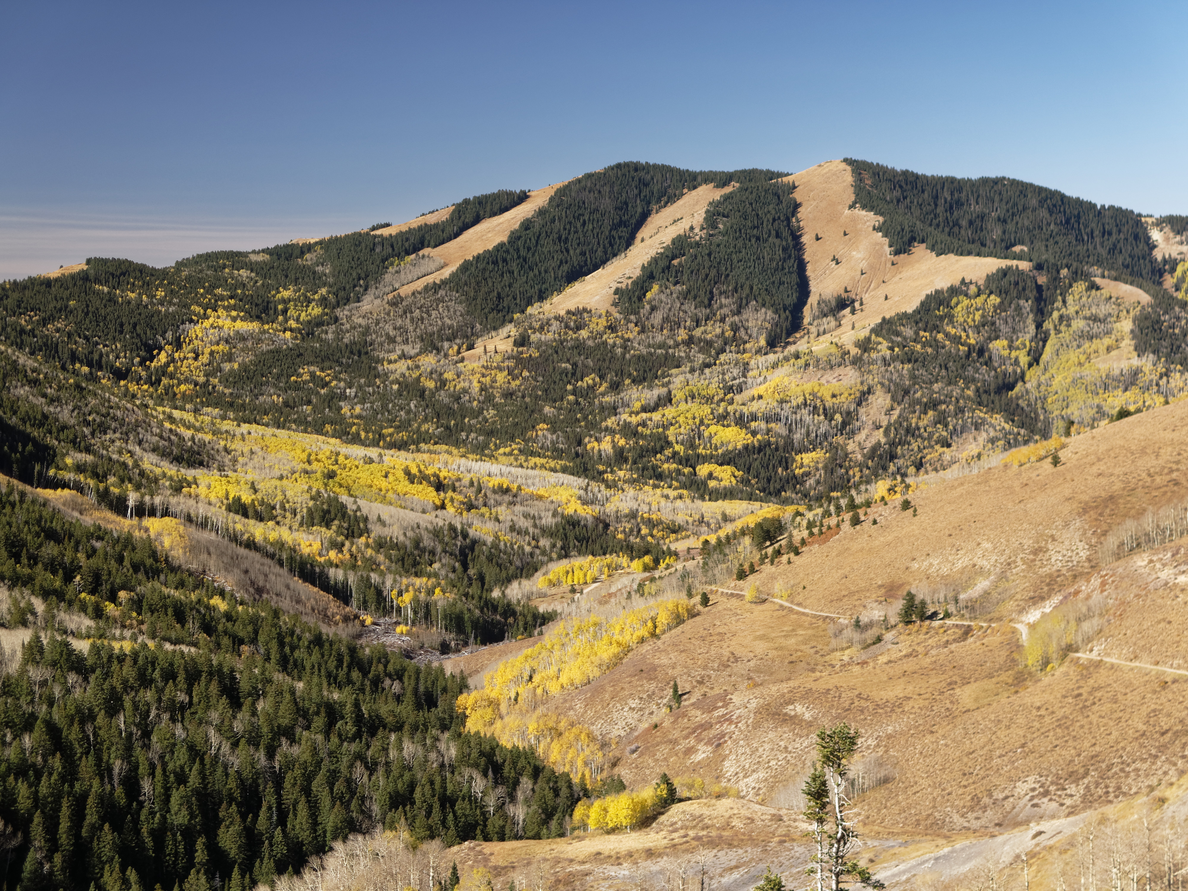
View down to Blanding from the Shay Ridge Quad Trail, Manti-La Sal National Forest, at the edge of Bears Ears National Monument.

Thru the Window

Jackson Ridge, Manti-La Sal National Forest

Blue Creek/ Allen Canyon trail, Manti-La Sal National Forest, Bears Ears National Monument

Cabin at intersection of Blue Creek-Tuerto Trail and Blue Creek-Allan Canyon Trail, Manti-La Sal National Forest, Bears Ears National Monument

At the Shay Ridge Quad Trail, Manti-La Sal National Forest, at the edge of Bears Ears National Monument
Abajo Loop State Scenic Backway

Twin Peaks

Abajo Loop State Scenic Backway

Abajo Loop State Scenic Backway

Abajo Loop State Scenic Backway

Abajo Loop State Scenic Backway

Abajo Loop State Scenic Backway

Mount Linnaeus
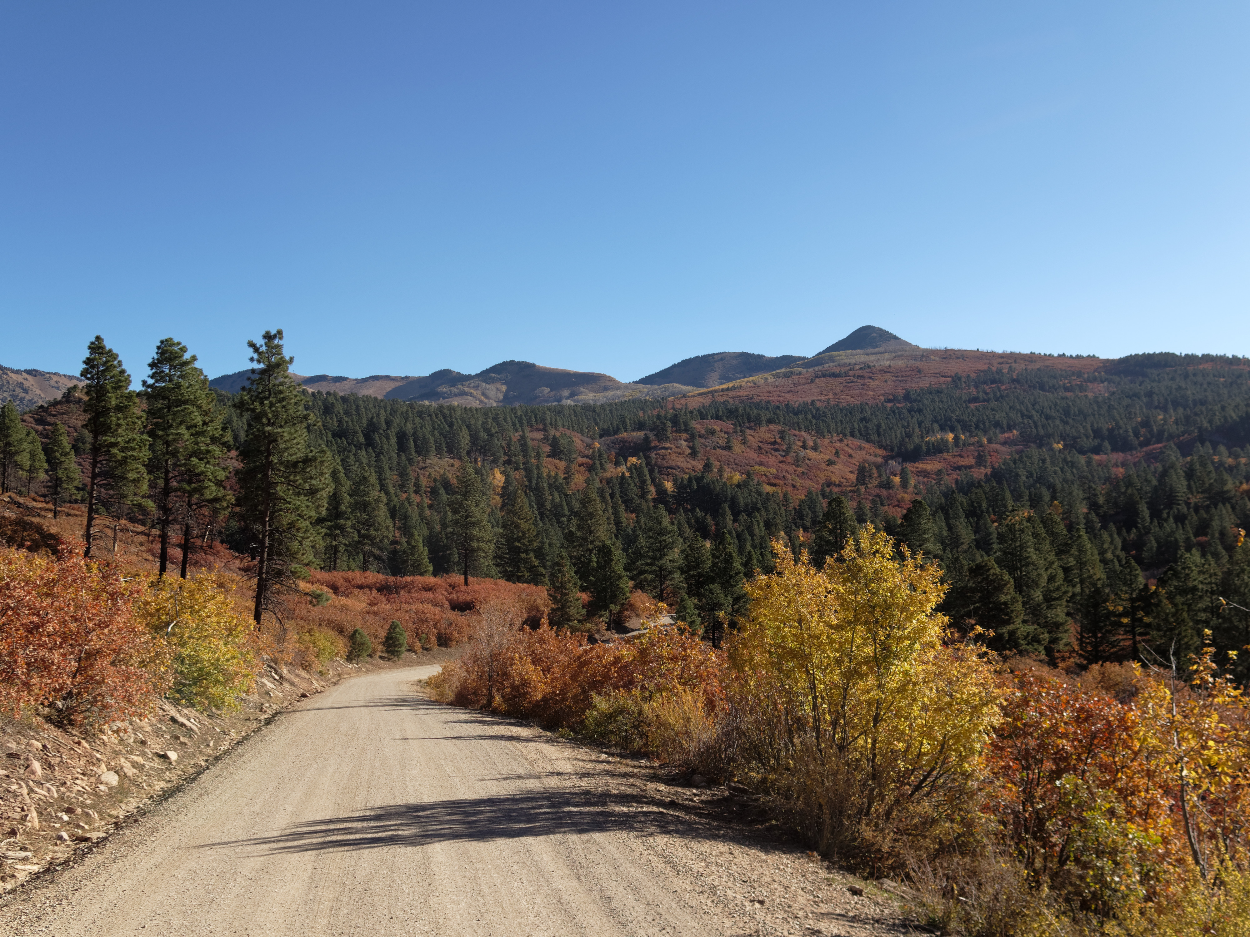
Abajo Loop State Scenic Backway

Recapture Reservoir Night

DJI Phantom Photos in Utah, Monument Valley and Mexican Hat

DJI Phantom Photos in Utah, Monument Valley and Mexican Hat

DJI Phantom Photos in Utah, Monument Valley and Mexican Hat

DJI Phantom Photos in Utah, Monument Valley and Mexican Hat

DJI Phantom Photos in Utah, Monument Valley and Mexican Hat
Mapa de Nizhoni Campground, Blanding, UT, EE. UU.
Buscar otro lugar
Lugares cercanos
Devils Canyon Campground, US-, Monticello, UT, EE. UU.
75 W Dude Ranch Rd, Monticello, UT, EE. UU.
Blanding, Utah, EE. UU.
E S, Blanding, UT, EE. UU.
White Mesa Mill, South, US-, Blanding, UT, EE. UU.
Monticello, Utah, EE. UU.
17 N E, Monticello, UT, EE. UU.
White Mesa, Utah, EE. UU.
Butler Washington Road, Co Rd, Utah, EE. UU.
Bluff, Utah, EE. UU.
E Main St, Bluff, UT, EE. UU.
Dove Creek, Colorado, EE. UU.
County Rd 2, Dove Creek, CO, EE. UU.
Rd P, Dove Creek, CO, EE. UU.
Egnar, CO, EE. UU.
Dove Creek, Colorado, EE. UU.
County Road 10, Pleasant View, CO, EE. UU.
Road G, Cortez, CO, EE. UU.
Cahone, CO, EE. UU.
US-, Cahone, CO, EE. UU.
Búsquedas recientes
- Horas de salida y puesta de sol de Red Dog Mine, AK, USA
- Horas de salida y puesta de sol de Am Bahnhof, Am bhf, Borken, Germany
- Horas de salida y puesta de sol de 4th St E, Sonoma, CA, EE. UU.
- Horas de salida y puesta de sol de Oakland Ave, Williamsport, PA, EE. UU.
- Horas de salida y puesta de sol de Via Roma, Pieranica CR, Italia
- Horas de salida y puesta de sol de Torre del reloj, Grad, Dubrovnik (Ragusa), Croacia
- Horas de salida y puesta de sol de Trelew, Chubut, Argentina
- Horas de salida y puesta de sol de Hartfords Bluff Cir, Mt Pleasant, SC, EE. UU.
- Horas de salida y puesta de sol de Kita Ward, Kumamoto, Japón
- Horas de salida y puesta de sol de Pingtan Island, Pingtan County, Fuzhou, China