Desert Aire, WA 美國的日出日落時間表
Location: 美國 > 華盛頓 > 格蘭特縣 >
時區:
America/Los_Angeles
當地時間:
2025-06-18 09:09:40
經度:
-119.9172672
緯度:
46.6792986
今天日出時間:
05:05:41 AM
今天日落時間:
08:56:45 PM
今天日照時長:
15h 51m 4s
明天日出時間:
05:05:52 AM
明天日落時間:
08:56:59 PM
明天日照時長:
15h 51m 7s
顯示所有日期
| 日期 | 日出 | 日落 | 日照時長 |
|---|---|---|---|
| 2025年01月01日 | 07:44:02 AM | 04:23:45 PM | 8h 39m 43s |
| 2025年01月02日 | 07:43:57 AM | 04:24:45 PM | 8h 40m 48s |
| 2025年01月03日 | 07:43:49 AM | 04:25:47 PM | 8h 41m 58s |
| 2025年01月04日 | 07:43:39 AM | 04:26:51 PM | 8h 43m 12s |
| 2025年01月05日 | 07:43:26 AM | 04:27:56 PM | 8h 44m 30s |
| 2025年01月06日 | 07:43:10 AM | 04:29:04 PM | 8h 45m 54s |
| 2025年01月07日 | 07:42:51 AM | 04:30:13 PM | 8h 47m 22s |
| 2025年01月08日 | 07:42:30 AM | 04:31:24 PM | 8h 48m 54s |
| 2025年01月09日 | 07:42:05 AM | 04:32:37 PM | 8h 50m 32s |
| 2025年01月10日 | 07:41:39 AM | 04:33:51 PM | 8h 52m 12s |
| 2025年01月11日 | 07:41:09 AM | 04:35:06 PM | 8h 53m 57s |
| 2025年01月12日 | 07:40:37 AM | 04:36:23 PM | 8h 55m 46s |
| 2025年01月13日 | 07:40:03 AM | 04:37:41 PM | 8h 57m 38s |
| 2025年01月14日 | 07:39:25 AM | 04:39:00 PM | 8h 59m 35s |
| 2025年01月15日 | 07:38:46 AM | 04:40:21 PM | 9h 1m 35s |
| 2025年01月16日 | 07:38:03 AM | 04:41:42 PM | 9h 3m 39s |
| 2025年01月17日 | 07:37:19 AM | 04:43:05 PM | 9h 5m 46s |
| 2025年01月18日 | 07:36:32 AM | 04:44:28 PM | 9h 7m 56s |
| 2025年01月19日 | 07:35:42 AM | 04:45:53 PM | 9h 10m 11s |
| 2025年01月20日 | 07:34:50 AM | 04:47:18 PM | 9h 12m 28s |
| 2025年01月21日 | 07:33:56 AM | 04:48:44 PM | 9h 14m 48s |
| 2025年01月22日 | 07:33:00 AM | 04:50:11 PM | 9h 17m 11s |
| 2025年01月23日 | 07:32:01 AM | 04:51:38 PM | 9h 19m 37s |
| 2025年01月24日 | 07:31:00 AM | 04:53:06 PM | 9h 22m 6s |
| 2025年01月25日 | 07:29:57 AM | 04:54:35 PM | 9h 24m 38s |
| 2025年01月26日 | 07:28:52 AM | 04:56:04 PM | 9h 27m 12s |
| 2025年01月27日 | 07:27:45 AM | 04:57:34 PM | 9h 29m 49s |
| 2025年01月28日 | 07:26:36 AM | 04:59:04 PM | 9h 32m 28s |
| 2025年01月29日 | 07:25:25 AM | 05:00:34 PM | 9h 35m 9s |
| 2025年01月30日 | 07:24:12 AM | 05:02:04 PM | 9h 37m 52s |
| 2025年01月31日 | 07:22:57 AM | 05:03:35 PM | 9h 40m 38s |
| 2025年02月01日 | 07:21:40 AM | 05:05:06 PM | 9h 43m 26s |
| 2025年02月02日 | 07:20:22 AM | 05:06:38 PM | 9h 46m 16s |
| 2025年02月03日 | 07:19:01 AM | 05:08:09 PM | 9h 49m 8s |
| 2025年02月04日 | 07:17:39 AM | 05:09:40 PM | 9h 52m 1s |
| 2025年02月05日 | 07:16:16 AM | 05:11:12 PM | 9h 54m 56s |
| 2025年02月06日 | 07:14:50 AM | 05:12:43 PM | 9h 57m 53s |
| 2025年02月07日 | 07:13:24 AM | 05:14:15 PM | 10h 0m 51s |
| 2025年02月08日 | 07:11:55 AM | 05:15:46 PM | 10h 3m 51s |
| 2025年02月09日 | 07:10:25 AM | 05:17:18 PM | 10h 6m 53s |
| 2025年02月10日 | 07:08:54 AM | 05:18:49 PM | 10h 9m 55s |
| 2025年02月11日 | 07:07:21 AM | 05:20:20 PM | 10h 12m 59s |
| 2025年02月12日 | 07:05:47 AM | 05:21:51 PM | 10h 16m 4s |
| 2025年02月13日 | 07:04:12 AM | 05:23:22 PM | 10h 19m 10s |
| 2025年02月14日 | 07:02:35 AM | 05:24:53 PM | 10h 22m 18s |
| 2025年02月15日 | 07:00:57 AM | 05:26:23 PM | 10h 25m 26s |
| 2025年02月16日 | 06:59:18 AM | 05:27:54 PM | 10h 28m 36s |
| 2025年02月17日 | 06:57:37 AM | 05:29:24 PM | 10h 31m 47s |
| 2025年02月18日 | 06:55:56 AM | 05:30:54 PM | 10h 34m 58s |
| 2025年02月19日 | 06:54:13 AM | 05:32:23 PM | 10h 38m 10s |
| 2025年02月20日 | 06:52:30 AM | 05:33:53 PM | 10h 41m 23s |
| 2025年02月21日 | 06:50:45 AM | 05:35:22 PM | 10h 44m 37s |
| 2025年02月22日 | 06:49:00 AM | 05:36:51 PM | 10h 47m 51s |
| 2025年02月23日 | 06:47:13 AM | 05:38:19 PM | 10h 51m 6s |
| 2025年02月24日 | 06:45:26 AM | 05:39:48 PM | 10h 54m 22s |
| 2025年02月25日 | 06:43:38 AM | 05:41:16 PM | 10h 57m 38s |
| 2025年02月26日 | 06:41:49 AM | 05:42:44 PM | 11h 0m 55s |
| 2025年02月27日 | 06:39:59 AM | 05:44:11 PM | 11h 4m 12s |
| 2025年02月28日 | 06:38:08 AM | 05:45:38 PM | 11h 7m 30s |
| 2025年03月01日 | 06:36:17 AM | 05:47:05 PM | 11h 10m 48s |
| 2025年03月02日 | 06:34:25 AM | 05:48:32 PM | 11h 14m 7s |
| 2025年03月03日 | 06:32:32 AM | 05:49:58 PM | 11h 17m 26s |
| 2025年03月04日 | 06:30:39 AM | 05:51:24 PM | 11h 20m 45s |
| 2025年03月05日 | 06:28:46 AM | 05:52:50 PM | 11h 24m 4s |
| 2025年03月06日 | 06:26:51 AM | 05:54:16 PM | 11h 27m 25s |
| 2025年03月07日 | 06:24:56 AM | 05:55:41 PM | 11h 30m 45s |
| 2025年03月08日 | 06:23:01 AM | 05:57:06 PM | 11h 34m 5s |
| 2025年03月09日 | 07:21:10 AM | 06:58:28 PM | 11h 37m 18s |
| 2025年03月10日 | 07:19:14 AM | 06:59:52 PM | 11h 40m 38s |
| 2025年03月11日 | 07:17:18 AM | 07:01:17 PM | 11h 43m 59s |
| 2025年03月12日 | 07:15:21 AM | 07:02:41 PM | 11h 47m 20s |
| 2025年03月13日 | 07:13:24 AM | 07:04:05 PM | 11h 50m 41s |
| 2025年03月14日 | 07:11:27 AM | 07:05:28 PM | 11h 54m 1s |
| 2025年03月15日 | 07:09:29 AM | 07:06:52 PM | 11h 57m 23s |
| 2025年03月16日 | 07:07:31 AM | 07:08:15 PM | 12h 0m 44s |
| 2025年03月17日 | 07:05:33 AM | 07:09:39 PM | 12h 4m 6s |
| 2025年03月18日 | 07:03:35 AM | 07:11:02 PM | 12h 7m 27s |
| 2025年03月19日 | 07:01:37 AM | 07:12:24 PM | 12h 10m 47s |
| 2025年03月20日 | 06:59:38 AM | 07:13:47 PM | 12h 14m 9s |
| 2025年03月21日 | 06:57:40 AM | 07:15:10 PM | 12h 17m 30s |
| 2025年03月22日 | 06:55:41 AM | 07:16:32 PM | 12h 20m 51s |
| 2025年03月23日 | 06:53:43 AM | 07:17:55 PM | 12h 24m 12s |
| 2025年03月24日 | 06:51:44 AM | 07:19:17 PM | 12h 27m 33s |
| 2025年03月25日 | 06:49:46 AM | 07:20:39 PM | 12h 30m 53s |
| 2025年03月26日 | 06:47:48 AM | 07:22:01 PM | 12h 34m 13s |
| 2025年03月27日 | 06:45:50 AM | 07:23:23 PM | 12h 37m 33s |
| 2025年03月28日 | 06:43:52 AM | 07:24:45 PM | 12h 40m 53s |
| 2025年03月29日 | 06:41:54 AM | 07:26:07 PM | 12h 44m 13s |
| 2025年03月30日 | 06:39:56 AM | 07:27:28 PM | 12h 47m 32s |
| 2025年03月31日 | 06:37:59 AM | 07:28:50 PM | 12h 50m 51s |
| 2025年04月01日 | 06:36:02 AM | 07:30:12 PM | 12h 54m 10s |
| 2025年04月02日 | 06:34:05 AM | 07:31:33 PM | 12h 57m 28s |
| 2025年04月03日 | 06:32:09 AM | 07:32:55 PM | 13h 0m 46s |
| 2025年04月04日 | 06:30:13 AM | 07:34:17 PM | 13h 4m 4s |
| 2025年04月05日 | 06:28:17 AM | 07:35:38 PM | 13h 7m 21s |
| 2025年04月06日 | 06:26:22 AM | 07:37:00 PM | 13h 10m 38s |
| 2025年04月07日 | 06:24:28 AM | 07:38:21 PM | 13h 13m 53s |
| 2025年04月08日 | 06:22:33 AM | 07:39:43 PM | 13h 17m 10s |
| 2025年04月09日 | 06:20:40 AM | 07:41:04 PM | 13h 20m 24s |
| 2025年04月10日 | 06:18:47 AM | 07:42:26 PM | 13h 23m 39s |
| 2025年04月11日 | 06:16:54 AM | 07:43:47 PM | 13h 26m 53s |
| 2025年04月12日 | 06:15:03 AM | 07:45:09 PM | 13h 30m 6s |
| 2025年04月13日 | 06:13:12 AM | 07:46:30 PM | 13h 33m 18s |
| 2025年04月14日 | 06:11:21 AM | 07:47:52 PM | 13h 36m 31s |
| 2025年04月15日 | 06:09:31 AM | 07:49:13 PM | 13h 39m 42s |
| 2025年04月16日 | 06:07:43 AM | 07:50:35 PM | 13h 42m 52s |
| 2025年04月17日 | 06:05:55 AM | 07:51:56 PM | 13h 46m 1s |
| 2025年04月18日 | 06:04:07 AM | 07:53:17 PM | 13h 49m 10s |
| 2025年04月19日 | 06:02:21 AM | 07:54:39 PM | 13h 52m 18s |
| 2025年04月20日 | 06:00:36 AM | 07:56:00 PM | 13h 55m 24s |
| 2025年04月21日 | 05:58:51 AM | 07:57:21 PM | 13h 58m 30s |
| 2025年04月22日 | 05:57:08 AM | 07:58:42 PM | 14h 1m 34s |
| 2025年04月23日 | 05:55:25 AM | 08:00:03 PM | 14h 4m 38s |
| 2025年04月24日 | 05:53:44 AM | 08:01:24 PM | 14h 7m 40s |
| 2025年04月25日 | 05:52:03 AM | 08:02:45 PM | 14h 10m 42s |
| 2025年04月26日 | 05:50:24 AM | 08:04:06 PM | 14h 13m 42s |
| 2025年04月27日 | 05:48:46 AM | 08:05:26 PM | 14h 16m 40s |
| 2025年04月28日 | 05:47:09 AM | 08:06:47 PM | 14h 19m 38s |
| 2025年04月29日 | 05:45:34 AM | 08:08:07 PM | 14h 22m 33s |
| 2025年04月30日 | 05:44:00 AM | 08:09:27 PM | 14h 25m 27s |
| 2025年05月01日 | 05:42:27 AM | 08:10:47 PM | 14h 28m 20s |
| 2025年05月02日 | 05:40:55 AM | 08:12:06 PM | 14h 31m 11s |
| 2025年05月03日 | 05:39:25 AM | 08:13:25 PM | 14h 34m 0s |
| 2025年05月04日 | 05:37:56 AM | 08:14:44 PM | 14h 36m 48s |
| 2025年05月05日 | 05:36:29 AM | 08:16:03 PM | 14h 39m 34s |
| 2025年05月06日 | 05:35:03 AM | 08:17:21 PM | 14h 42m 18s |
| 2025年05月07日 | 05:33:39 AM | 08:18:38 PM | 14h 44m 59s |
| 2025年05月08日 | 05:32:17 AM | 08:19:56 PM | 14h 47m 39s |
| 2025年05月09日 | 05:30:56 AM | 08:21:12 PM | 14h 50m 16s |
| 2025年05月10日 | 05:29:36 AM | 08:22:28 PM | 14h 52m 52s |
| 2025年05月11日 | 05:28:19 AM | 08:23:44 PM | 14h 55m 25s |
| 2025年05月12日 | 05:27:03 AM | 08:24:59 PM | 14h 57m 56s |
| 2025年05月13日 | 05:25:49 AM | 08:26:13 PM | 15h 0m 24s |
| 2025年05月14日 | 05:24:37 AM | 08:27:27 PM | 15h 2m 50s |
| 2025年05月15日 | 05:23:26 AM | 08:28:40 PM | 15h 5m 14s |
| 2025年05月16日 | 05:22:18 AM | 08:29:52 PM | 15h 7m 34s |
| 2025年05月17日 | 05:21:12 AM | 08:31:04 PM | 15h 9m 52s |
| 2025年05月18日 | 05:20:07 AM | 08:32:14 PM | 15h 12m 7s |
| 2025年05月19日 | 05:19:05 AM | 08:33:23 PM | 15h 14m 18s |
| 2025年05月20日 | 05:18:04 AM | 08:34:32 PM | 15h 16m 28s |
| 2025年05月21日 | 05:17:06 AM | 08:35:40 PM | 15h 18m 34s |
| 2025年05月22日 | 05:16:09 AM | 08:36:46 PM | 15h 20m 37s |
| 2025年05月23日 | 05:15:15 AM | 08:37:51 PM | 15h 22m 36s |
| 2025年05月24日 | 05:14:23 AM | 08:38:55 PM | 15h 24m 32s |
| 2025年05月25日 | 05:13:34 AM | 08:39:58 PM | 15h 26m 24s |
| 2025年05月26日 | 05:12:46 AM | 08:41:00 PM | 15h 28m 14s |
| 2025年05月27日 | 05:12:01 AM | 08:42:00 PM | 15h 29m 59s |
| 2025年05月28日 | 05:11:18 AM | 08:42:59 PM | 15h 31m 41s |
| 2025年05月29日 | 05:10:38 AM | 08:43:56 PM | 15h 33m 18s |
| 2025年05月30日 | 05:09:59 AM | 08:44:52 PM | 15h 34m 53s |
| 2025年05月31日 | 05:09:24 AM | 08:45:46 PM | 15h 36m 22s |
| 2025年06月01日 | 05:08:50 AM | 08:46:39 PM | 15h 37m 49s |
| 2025年06月02日 | 05:08:19 AM | 08:47:30 PM | 15h 39m 11s |
| 2025年06月03日 | 05:07:50 AM | 08:48:19 PM | 15h 40m 29s |
| 2025年06月04日 | 05:07:24 AM | 08:49:07 PM | 15h 41m 43s |
| 2025年06月05日 | 05:07:00 AM | 08:49:52 PM | 15h 42m 52s |
| 2025年06月06日 | 05:06:39 AM | 08:50:36 PM | 15h 43m 57s |
| 2025年06月07日 | 05:06:20 AM | 08:51:18 PM | 15h 44m 58s |
| 2025年06月08日 | 05:06:04 AM | 08:51:58 PM | 15h 45m 54s |
| 2025年06月09日 | 05:05:50 AM | 08:52:36 PM | 15h 46m 46s |
| 2025年06月10日 | 05:05:39 AM | 08:53:12 PM | 15h 47m 33s |
| 2025年06月11日 | 05:05:30 AM | 08:53:45 PM | 15h 48m 15s |
| 2025年06月12日 | 05:05:24 AM | 08:54:17 PM | 15h 48m 53s |
| 2025年06月13日 | 05:05:20 AM | 08:54:46 PM | 15h 49m 26s |
| 2025年06月14日 | 05:05:18 AM | 08:55:13 PM | 15h 49m 55s |
| 2025年06月15日 | 05:05:19 AM | 08:55:38 PM | 15h 50m 19s |
| 2025年06月16日 | 05:05:23 AM | 08:56:01 PM | 15h 50m 38s |
| 2025年06月17日 | 05:05:29 AM | 08:56:21 PM | 15h 50m 52s |
| 2025年06月18日 | 05:05:37 AM | 08:56:39 PM | 15h 51m 2s |
| 2025年06月19日 | 05:05:48 AM | 08:56:54 PM | 15h 51m 6s |
| 2025年06月20日 | 05:06:01 AM | 08:57:07 PM | 15h 51m 6s |
| 2025年06月21日 | 05:06:16 AM | 08:57:18 PM | 15h 51m 2s |
| 2025年06月22日 | 05:06:34 AM | 08:57:26 PM | 15h 50m 52s |
| 2025年06月23日 | 05:06:54 AM | 08:57:31 PM | 15h 50m 37s |
| 2025年06月24日 | 05:07:17 AM | 08:57:34 PM | 15h 50m 17s |
| 2025年06月25日 | 05:07:41 AM | 08:57:35 PM | 15h 49m 54s |
| 2025年06月26日 | 05:08:08 AM | 08:57:33 PM | 15h 49m 25s |
| 2025年06月27日 | 05:08:37 AM | 08:57:29 PM | 15h 48m 52s |
| 2025年06月28日 | 05:09:08 AM | 08:57:22 PM | 15h 48m 14s |
| 2025年06月29日 | 05:09:41 AM | 08:57:12 PM | 15h 47m 31s |
| 2025年06月30日 | 05:10:16 AM | 08:57:00 PM | 15h 46m 44s |
| 2025年07月01日 | 05:10:53 AM | 08:56:46 PM | 15h 45m 53s |
| 2025年07月02日 | 05:11:33 AM | 08:56:29 PM | 15h 44m 56s |
| 2025年07月03日 | 05:12:14 AM | 08:56:09 PM | 15h 43m 55s |
| 2025年07月04日 | 05:12:56 AM | 08:55:47 PM | 15h 42m 51s |
| 2025年07月05日 | 05:13:41 AM | 08:55:22 PM | 15h 41m 41s |
| 2025年07月06日 | 05:14:27 AM | 08:54:55 PM | 15h 40m 28s |
| 2025年07月07日 | 05:15:15 AM | 08:54:26 PM | 15h 39m 11s |
| 2025年07月08日 | 05:16:05 AM | 08:53:54 PM | 15h 37m 49s |
| 2025年07月09日 | 05:16:56 AM | 08:53:19 PM | 15h 36m 23s |
| 2025年07月10日 | 05:17:49 AM | 08:52:42 PM | 15h 34m 53s |
| 2025年07月11日 | 05:18:43 AM | 08:52:03 PM | 15h 33m 20s |
| 2025年07月12日 | 05:19:39 AM | 08:51:21 PM | 15h 31m 42s |
| 2025年07月13日 | 05:20:36 AM | 08:50:37 PM | 15h 30m 1s |
| 2025年07月14日 | 05:21:35 AM | 08:49:51 PM | 15h 28m 16s |
| 2025年07月15日 | 05:22:34 AM | 08:49:02 PM | 15h 26m 28s |
| 2025年07月16日 | 05:23:35 AM | 08:48:12 PM | 15h 24m 37s |
| 2025年07月17日 | 05:24:37 AM | 08:47:19 PM | 15h 22m 42s |
| 2025年07月18日 | 05:25:40 AM | 08:46:23 PM | 15h 20m 43s |
| 2025年07月19日 | 05:26:44 AM | 08:45:26 PM | 15h 18m 42s |
| 2025年07月20日 | 05:27:50 AM | 08:44:26 PM | 15h 16m 36s |
| 2025年07月21日 | 05:28:56 AM | 08:43:25 PM | 15h 14m 29s |
| 2025年07月22日 | 05:30:03 AM | 08:42:21 PM | 15h 12m 18s |
| 2025年07月23日 | 05:31:11 AM | 08:41:15 PM | 15h 10m 4s |
| 2025年07月24日 | 05:32:19 AM | 08:40:07 PM | 15h 7m 48s |
| 2025年07月25日 | 05:33:29 AM | 08:38:58 PM | 15h 5m 29s |
| 2025年07月26日 | 05:34:39 AM | 08:37:46 PM | 15h 3m 7s |
| 2025年07月27日 | 05:35:50 AM | 08:36:33 PM | 15h 0m 43s |
| 2025年07月28日 | 05:37:01 AM | 08:35:18 PM | 14h 58m 17s |
| 2025年07月29日 | 05:38:13 AM | 08:34:00 PM | 14h 55m 47s |
| 2025年07月30日 | 05:39:26 AM | 08:32:42 PM | 14h 53m 16s |
| 2025年07月31日 | 05:40:39 AM | 08:31:21 PM | 14h 50m 42s |
| 2025年08月01日 | 05:41:52 AM | 08:29:59 PM | 14h 48m 7s |
| 2025年08月02日 | 05:43:06 AM | 08:28:35 PM | 14h 45m 29s |
| 2025年08月03日 | 05:44:20 AM | 08:27:10 PM | 14h 42m 50s |
| 2025年08月04日 | 05:45:35 AM | 08:25:43 PM | 14h 40m 8s |
| 2025年08月05日 | 05:46:50 AM | 08:24:14 PM | 14h 37m 24s |
| 2025年08月06日 | 05:48:05 AM | 08:22:44 PM | 14h 34m 39s |
| 2025年08月07日 | 05:49:21 AM | 08:21:12 PM | 14h 31m 51s |
| 2025年08月08日 | 05:50:37 AM | 08:19:40 PM | 14h 29m 3s |
| 2025年08月09日 | 05:51:53 AM | 08:18:05 PM | 14h 26m 12s |
| 2025年08月10日 | 05:53:09 AM | 08:16:30 PM | 14h 23m 21s |
| 2025年08月11日 | 05:54:25 AM | 08:14:53 PM | 14h 20m 28s |
| 2025年08月12日 | 05:55:42 AM | 08:13:15 PM | 14h 17m 33s |
| 2025年08月13日 | 05:56:58 AM | 08:11:36 PM | 14h 14m 38s |
| 2025年08月14日 | 05:58:15 AM | 08:09:55 PM | 14h 11m 40s |
| 2025年08月15日 | 05:59:32 AM | 08:08:13 PM | 14h 8m 41s |
| 2025年08月16日 | 06:00:49 AM | 08:06:31 PM | 14h 5m 42s |
| 2025年08月17日 | 06:02:06 AM | 08:04:47 PM | 14h 2m 41s |
| 2025年08月18日 | 06:03:23 AM | 08:03:02 PM | 13h 59m 39s |
| 2025年08月19日 | 06:04:40 AM | 08:01:16 PM | 13h 56m 36s |
| 2025年08月20日 | 06:05:57 AM | 07:59:29 PM | 13h 53m 32s |
| 2025年08月21日 | 06:07:14 AM | 07:57:42 PM | 13h 50m 28s |
| 2025年08月22日 | 06:08:31 AM | 07:55:53 PM | 13h 47m 22s |
| 2025年08月23日 | 06:09:48 AM | 07:54:04 PM | 13h 44m 16s |
| 2025年08月24日 | 06:11:05 AM | 07:52:13 PM | 13h 41m 8s |
| 2025年08月25日 | 06:12:22 AM | 07:50:22 PM | 13h 38m 0s |
| 2025年08月26日 | 06:13:39 AM | 07:48:30 PM | 13h 34m 51s |
| 2025年08月27日 | 06:14:56 AM | 07:46:38 PM | 13h 31m 42s |
| 2025年08月28日 | 06:16:13 AM | 07:44:45 PM | 13h 28m 32s |
| 2025年08月29日 | 06:17:30 AM | 07:42:51 PM | 13h 25m 21s |
| 2025年08月30日 | 06:18:47 AM | 07:40:56 PM | 13h 22m 9s |
| 2025年08月31日 | 06:20:04 AM | 07:39:01 PM | 13h 18m 57s |
| 2025年09月01日 | 06:21:21 AM | 07:37:06 PM | 13h 15m 45s |
| 2025年09月02日 | 06:22:38 AM | 07:35:10 PM | 13h 12m 32s |
| 2025年09月03日 | 06:23:55 AM | 07:33:13 PM | 13h 9m 18s |
| 2025年09月04日 | 06:25:12 AM | 07:31:16 PM | 13h 6m 4s |
| 2025年09月05日 | 06:26:29 AM | 07:29:18 PM | 13h 2m 49s |
| 2025年09月06日 | 06:27:46 AM | 07:27:20 PM | 12h 59m 34s |
| 2025年09月07日 | 06:29:02 AM | 07:25:22 PM | 12h 56m 20s |
| 2025年09月08日 | 06:30:19 AM | 07:23:24 PM | 12h 53m 5s |
| 2025年09月09日 | 06:31:36 AM | 07:21:25 PM | 12h 49m 49s |
| 2025年09月10日 | 06:32:53 AM | 07:19:25 PM | 12h 46m 32s |
| 2025年09月11日 | 06:34:10 AM | 07:17:26 PM | 12h 43m 16s |
| 2025年09月12日 | 06:35:27 AM | 07:15:26 PM | 12h 39m 59s |
| 2025年09月13日 | 06:36:44 AM | 07:13:27 PM | 12h 36m 43s |
| 2025年09月14日 | 06:38:01 AM | 07:11:27 PM | 12h 33m 26s |
| 2025年09月15日 | 06:39:19 AM | 07:09:27 PM | 12h 30m 8s |
| 2025年09月16日 | 06:40:36 AM | 07:07:26 PM | 12h 26m 50s |
| 2025年09月17日 | 06:41:53 AM | 07:05:26 PM | 12h 23m 33s |
| 2025年09月18日 | 06:43:11 AM | 07:03:26 PM | 12h 20m 15s |
| 2025年09月19日 | 06:44:28 AM | 07:01:26 PM | 12h 16m 58s |
| 2025年09月20日 | 06:45:46 AM | 06:59:25 PM | 12h 13m 39s |
| 2025年09月21日 | 06:47:04 AM | 06:57:25 PM | 12h 10m 21s |
| 2025年09月22日 | 06:48:22 AM | 06:55:25 PM | 12h 7m 3s |
| 2025年09月23日 | 06:49:40 AM | 06:53:25 PM | 12h 3m 45s |
| 2025年09月24日 | 06:50:58 AM | 06:51:25 PM | 12h 0m 27s |
| 2025年09月25日 | 06:52:17 AM | 06:49:26 PM | 11h 57m 9s |
| 2025年09月26日 | 06:53:35 AM | 06:47:26 PM | 11h 53m 51s |
| 2025年09月27日 | 06:54:54 AM | 06:45:27 PM | 11h 50m 33s |
| 2025年09月28日 | 06:56:13 AM | 06:43:28 PM | 11h 47m 15s |
| 2025年09月29日 | 06:57:33 AM | 06:41:29 PM | 11h 43m 56s |
| 2025年09月30日 | 06:58:52 AM | 06:39:31 PM | 11h 40m 39s |
| 2025年10月01日 | 07:00:12 AM | 06:37:33 PM | 11h 37m 21s |
| 2025年10月02日 | 07:01:32 AM | 06:35:36 PM | 11h 34m 4s |
| 2025年10月03日 | 07:02:52 AM | 06:33:39 PM | 11h 30m 47s |
| 2025年10月04日 | 07:04:13 AM | 06:31:42 PM | 11h 27m 29s |
| 2025年10月05日 | 07:05:34 AM | 06:29:46 PM | 11h 24m 12s |
| 2025年10月06日 | 07:06:55 AM | 06:27:50 PM | 11h 20m 55s |
| 2025年10月07日 | 07:08:16 AM | 06:25:55 PM | 11h 17m 39s |
| 2025年10月08日 | 07:09:38 AM | 06:24:01 PM | 11h 14m 23s |
| 2025年10月09日 | 07:10:59 AM | 06:22:07 PM | 11h 11m 8s |
| 2025年10月10日 | 07:12:22 AM | 06:20:14 PM | 11h 7m 52s |
| 2025年10月11日 | 07:13:44 AM | 06:18:21 PM | 11h 4m 37s |
| 2025年10月12日 | 07:15:07 AM | 06:16:30 PM | 11h 1m 23s |
| 2025年10月13日 | 07:16:30 AM | 06:14:39 PM | 10h 58m 9s |
| 2025年10月14日 | 07:17:54 AM | 06:12:49 PM | 10h 54m 55s |
| 2025年10月15日 | 07:19:17 AM | 06:10:59 PM | 10h 51m 42s |
| 2025年10月16日 | 07:20:41 AM | 06:09:11 PM | 10h 48m 30s |
| 2025年10月17日 | 07:22:06 AM | 06:07:23 PM | 10h 45m 17s |
| 2025年10月18日 | 07:23:30 AM | 06:05:37 PM | 10h 42m 7s |
| 2025年10月19日 | 07:24:55 AM | 06:03:51 PM | 10h 38m 56s |
| 2025年10月20日 | 07:26:20 AM | 06:02:06 PM | 10h 35m 46s |
| 2025年10月21日 | 07:27:46 AM | 06:00:23 PM | 10h 32m 37s |
| 2025年10月22日 | 07:29:12 AM | 05:58:40 PM | 10h 29m 28s |
| 2025年10月23日 | 07:30:38 AM | 05:56:59 PM | 10h 26m 21s |
| 2025年10月24日 | 07:32:04 AM | 05:55:19 PM | 10h 23m 15s |
| 2025年10月25日 | 07:33:30 AM | 05:53:40 PM | 10h 20m 10s |
| 2025年10月26日 | 07:34:57 AM | 05:52:03 PM | 10h 17m 6s |
| 2025年10月27日 | 07:36:24 AM | 05:50:26 PM | 10h 14m 2s |
| 2025年10月28日 | 07:37:51 AM | 05:48:51 PM | 10h 11m 0s |
| 2025年10月29日 | 07:39:18 AM | 05:47:18 PM | 10h 8m 0s |
| 2025年10月30日 | 07:40:46 AM | 05:45:45 PM | 10h 4m 59s |
| 2025年10月31日 | 07:42:13 AM | 05:44:15 PM | 10h 2m 2s |
| 2025年11月01日 | 07:43:41 AM | 05:42:45 PM | 9h 59m 4s |
| 2025年11月02日 | 06:45:12 AM | 04:41:14 PM | 9h 56m 2s |
| 2025年11月03日 | 06:46:40 AM | 04:39:48 PM | 9h 53m 8s |
| 2025年11月04日 | 06:48:08 AM | 04:38:24 PM | 9h 50m 16s |
| 2025年11月05日 | 06:49:36 AM | 04:37:01 PM | 9h 47m 25s |
| 2025年11月06日 | 06:51:03 AM | 04:35:40 PM | 9h 44m 37s |
| 2025年11月07日 | 06:52:31 AM | 04:34:21 PM | 9h 41m 50s |
| 2025年11月08日 | 06:53:59 AM | 04:33:03 PM | 9h 39m 4s |
| 2025年11月09日 | 06:55:26 AM | 04:31:48 PM | 9h 36m 22s |
| 2025年11月10日 | 06:56:53 AM | 04:30:34 PM | 9h 33m 41s |
| 2025年11月11日 | 06:58:20 AM | 04:29:23 PM | 9h 31m 3s |
| 2025年11月12日 | 06:59:47 AM | 04:28:13 PM | 9h 28m 26s |
| 2025年11月13日 | 07:01:13 AM | 04:27:05 PM | 9h 25m 52s |
| 2025年11月14日 | 07:02:39 AM | 04:26:00 PM | 9h 23m 21s |
| 2025年11月15日 | 07:04:04 AM | 04:24:56 PM | 9h 20m 52s |
| 2025年11月16日 | 07:05:29 AM | 04:23:55 PM | 9h 18m 26s |
| 2025年11月17日 | 07:06:53 AM | 04:22:56 PM | 9h 16m 3s |
| 2025年11月18日 | 07:08:17 AM | 04:21:59 PM | 9h 13m 42s |
| 2025年11月19日 | 07:09:40 AM | 04:21:04 PM | 9h 11m 24s |
| 2025年11月20日 | 07:11:03 AM | 04:20:12 PM | 9h 9m 9s |
| 2025年11月21日 | 07:12:24 AM | 04:19:22 PM | 9h 6m 58s |
| 2025年11月22日 | 07:13:45 AM | 04:18:35 PM | 9h 4m 50s |
| 2025年11月23日 | 07:15:05 AM | 04:17:50 PM | 9h 2m 45s |
| 2025年11月24日 | 07:16:24 AM | 04:17:07 PM | 9h 0m 43s |
| 2025年11月25日 | 07:17:42 AM | 04:16:28 PM | 8h 58m 46s |
| 2025年11月26日 | 07:18:59 AM | 04:15:50 PM | 8h 56m 51s |
| 2025年11月27日 | 07:20:14 AM | 04:15:15 PM | 8h 55m 1s |
| 2025年11月28日 | 07:21:29 AM | 04:14:43 PM | 8h 53m 14s |
| 2025年11月29日 | 07:22:42 AM | 04:14:14 PM | 8h 51m 32s |
| 2025年11月30日 | 07:23:54 AM | 04:13:47 PM | 8h 49m 53s |
| 2025年12月01日 | 07:25:04 AM | 04:13:23 PM | 8h 48m 19s |
| 2025年12月02日 | 07:26:13 AM | 04:13:01 PM | 8h 46m 48s |
| 2025年12月03日 | 07:27:20 AM | 04:12:42 PM | 8h 45m 22s |
| 2025年12月04日 | 07:28:25 AM | 04:12:26 PM | 8h 44m 1s |
| 2025年12月05日 | 07:29:29 AM | 04:12:13 PM | 8h 42m 44s |
| 2025年12月06日 | 07:30:31 AM | 04:12:03 PM | 8h 41m 32s |
| 2025年12月07日 | 07:31:31 AM | 04:11:55 PM | 8h 40m 24s |
| 2025年12月08日 | 07:32:30 AM | 04:11:51 PM | 8h 39m 21s |
| 2025年12月09日 | 07:33:26 AM | 04:11:49 PM | 8h 38m 23s |
| 2025年12月10日 | 07:34:20 AM | 04:11:50 PM | 8h 37m 30s |
| 2025年12月11日 | 07:35:13 AM | 04:11:53 PM | 8h 36m 40s |
| 2025年12月12日 | 07:36:03 AM | 04:12:00 PM | 8h 35m 57s |
| 2025年12月13日 | 07:36:51 AM | 04:12:09 PM | 8h 35m 18s |
| 2025年12月14日 | 07:37:36 AM | 04:12:21 PM | 8h 34m 45s |
| 2025年12月15日 | 07:38:19 AM | 04:12:36 PM | 8h 34m 17s |
| 2025年12月16日 | 07:39:00 AM | 04:12:54 PM | 8h 33m 54s |
| 2025年12月17日 | 07:39:39 AM | 04:13:15 PM | 8h 33m 36s |
| 2025年12月18日 | 07:40:15 AM | 04:13:38 PM | 8h 33m 23s |
| 2025年12月19日 | 07:40:48 AM | 04:14:04 PM | 8h 33m 16s |
| 2025年12月20日 | 07:41:19 AM | 04:14:32 PM | 8h 33m 13s |
| 2025年12月21日 | 07:41:48 AM | 04:15:04 PM | 8h 33m 16s |
| 2025年12月22日 | 07:42:14 AM | 04:15:38 PM | 8h 33m 24s |
| 2025年12月23日 | 07:42:37 AM | 04:16:14 PM | 8h 33m 37s |
| 2025年12月24日 | 07:42:57 AM | 04:16:53 PM | 8h 33m 56s |
| 2025年12月25日 | 07:43:15 AM | 04:17:35 PM | 8h 34m 20s |
| 2025年12月26日 | 07:43:30 AM | 04:18:18 PM | 8h 34m 48s |
| 2025年12月27日 | 07:43:42 AM | 04:19:05 PM | 8h 35m 23s |
| 2025年12月28日 | 07:43:52 AM | 04:19:53 PM | 8h 36m 1s |
| 2025年12月29日 | 07:43:59 AM | 04:20:44 PM | 8h 36m 45s |
| 2025年12月30日 | 07:44:03 AM | 04:21:38 PM | 8h 37m 35s |
| 2025年12月31日 | 07:44:04 AM | 04:22:33 PM | 8h 38m 29s |
日出日落照片
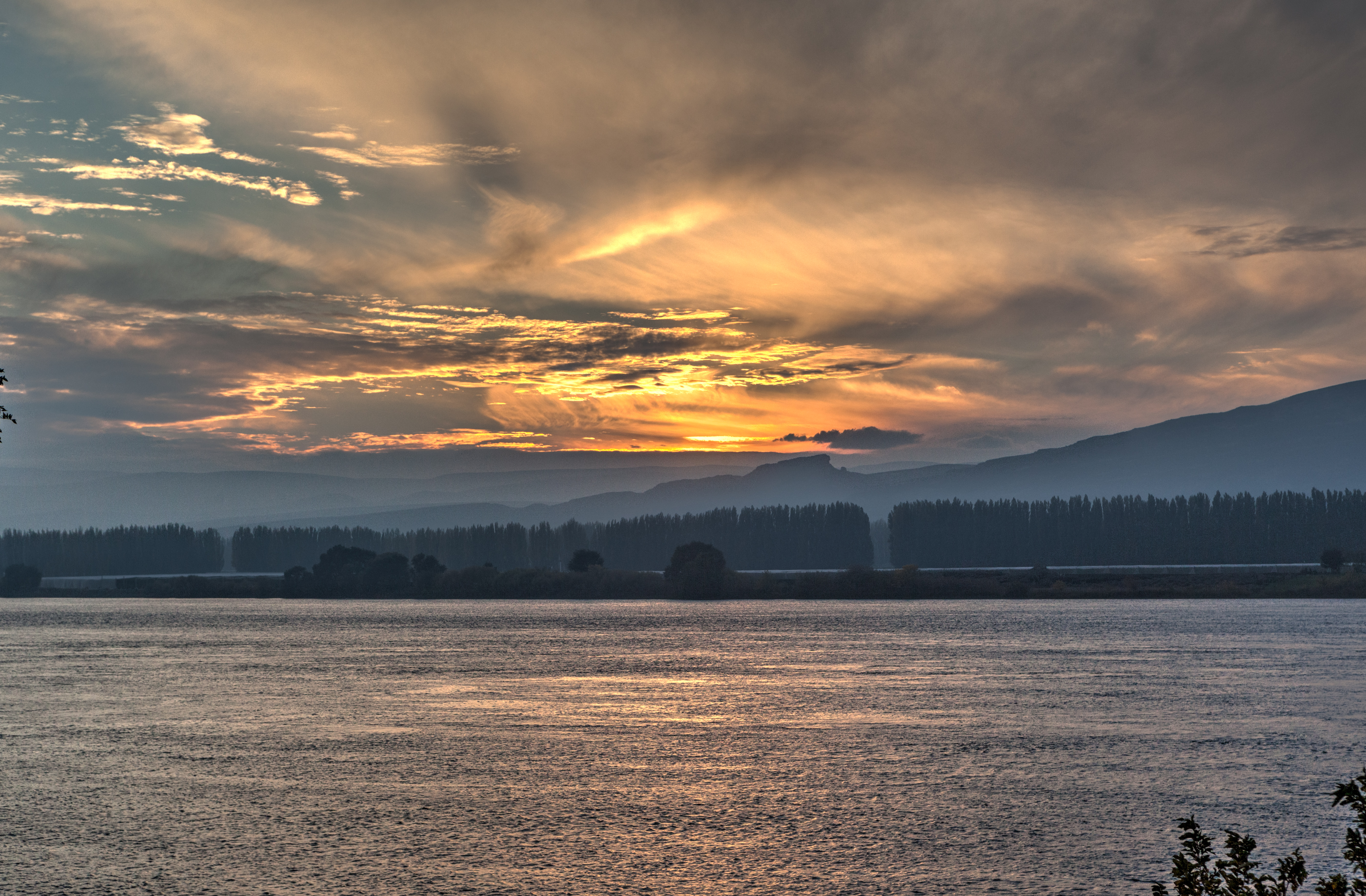
Sunset over Columbia River
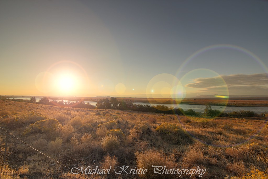
hanford ranch
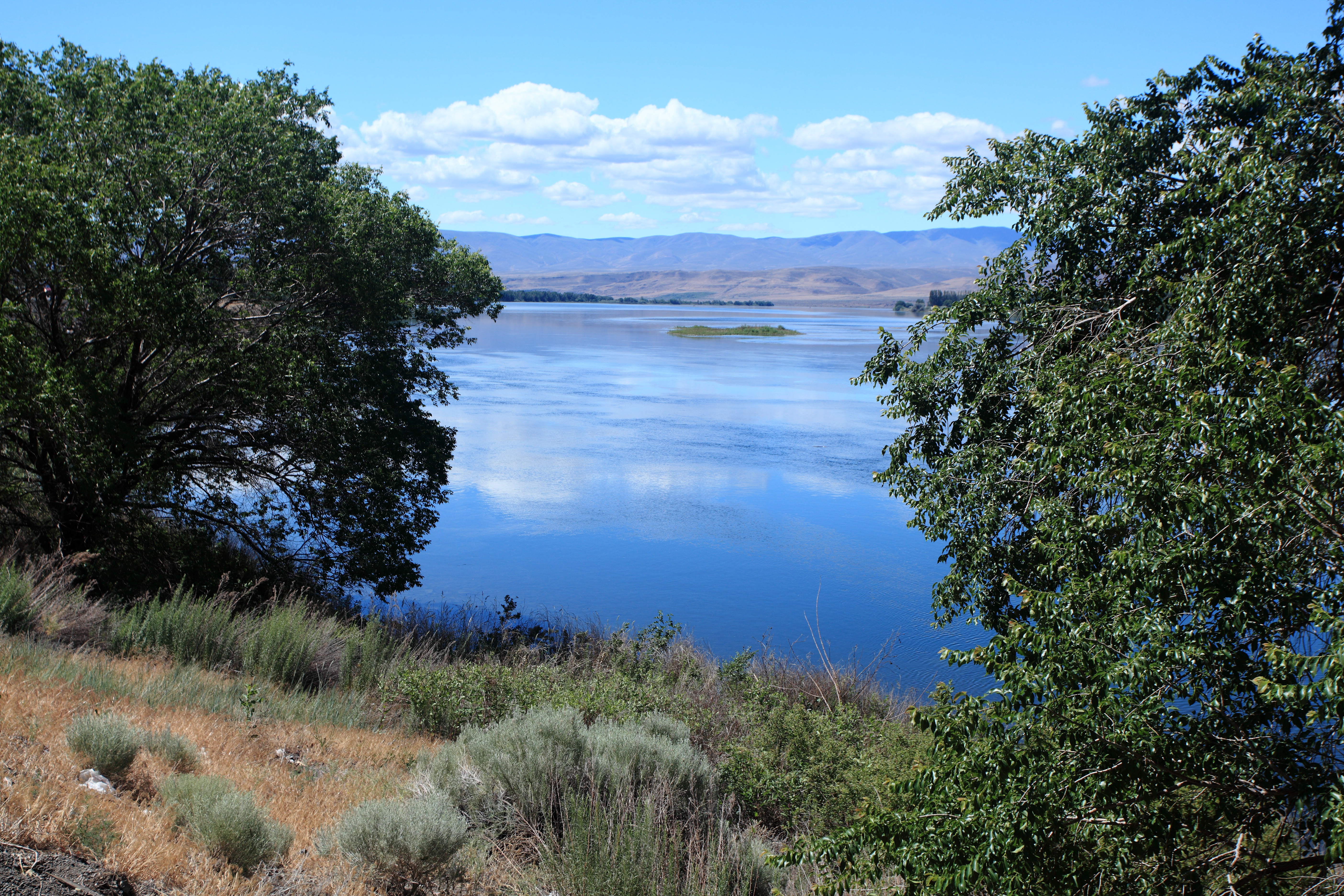
The Grand Columbia River near Priest Rapids Lake, Eastern Washington

Eastern Washington Skies, 2013
New photo added to "VSCO Cam"
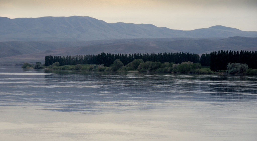
Columbia River
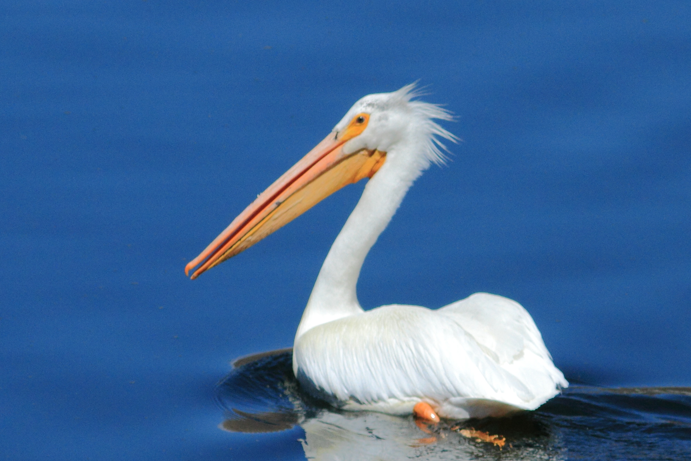
White Pelican

Washington Wasteland

Hanford Reach
Lenore Lake

Sol pur de sable de cold creek top for Syrah
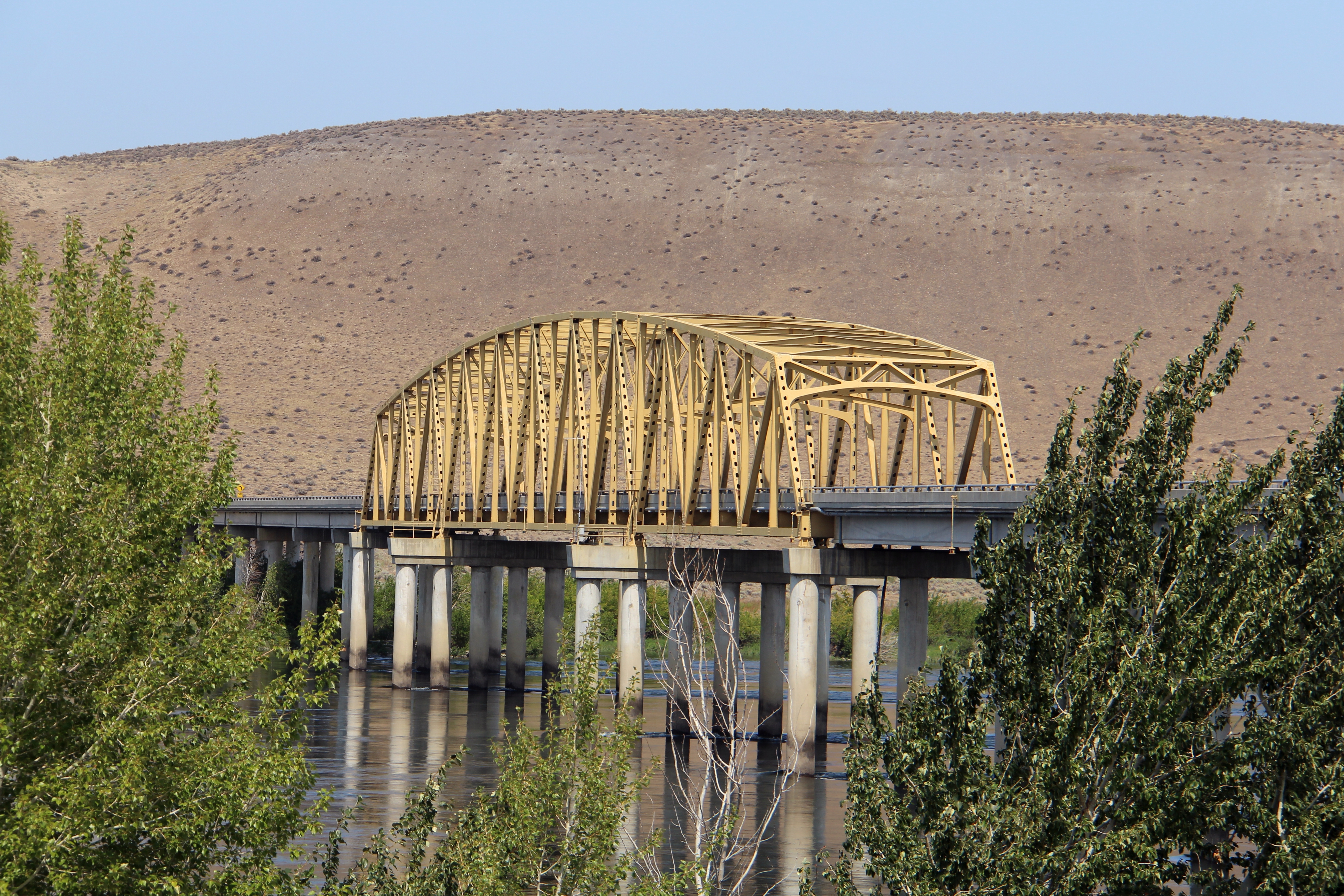
Vernita Bridge (Benton County and Grant County, Washington)
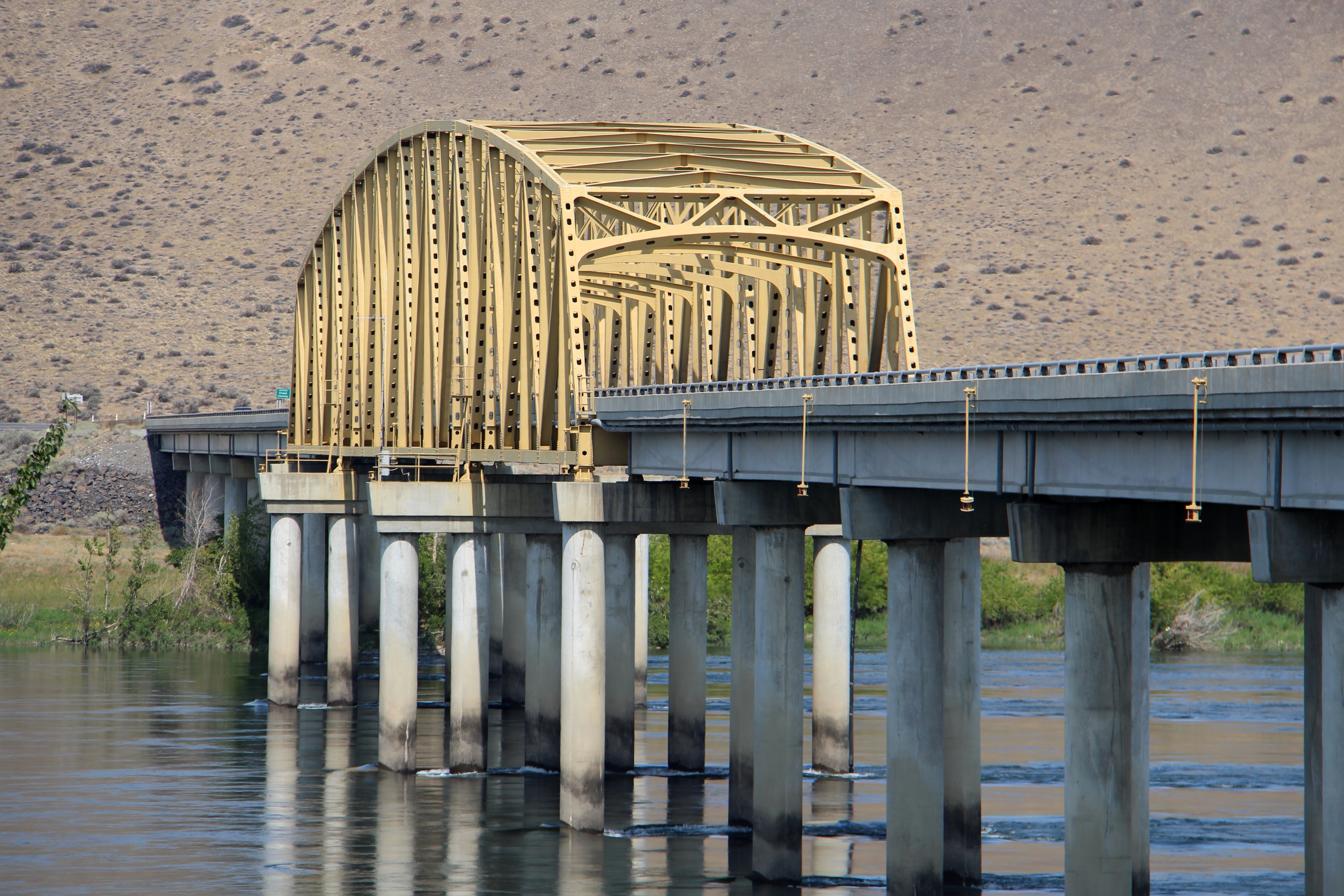
Vernita Bridge (Benton County and Grant County, Washington)

Sagebrush steppe, Priest Rapids Dam area

Sagebrush steppe, Priest Rapids Dam area
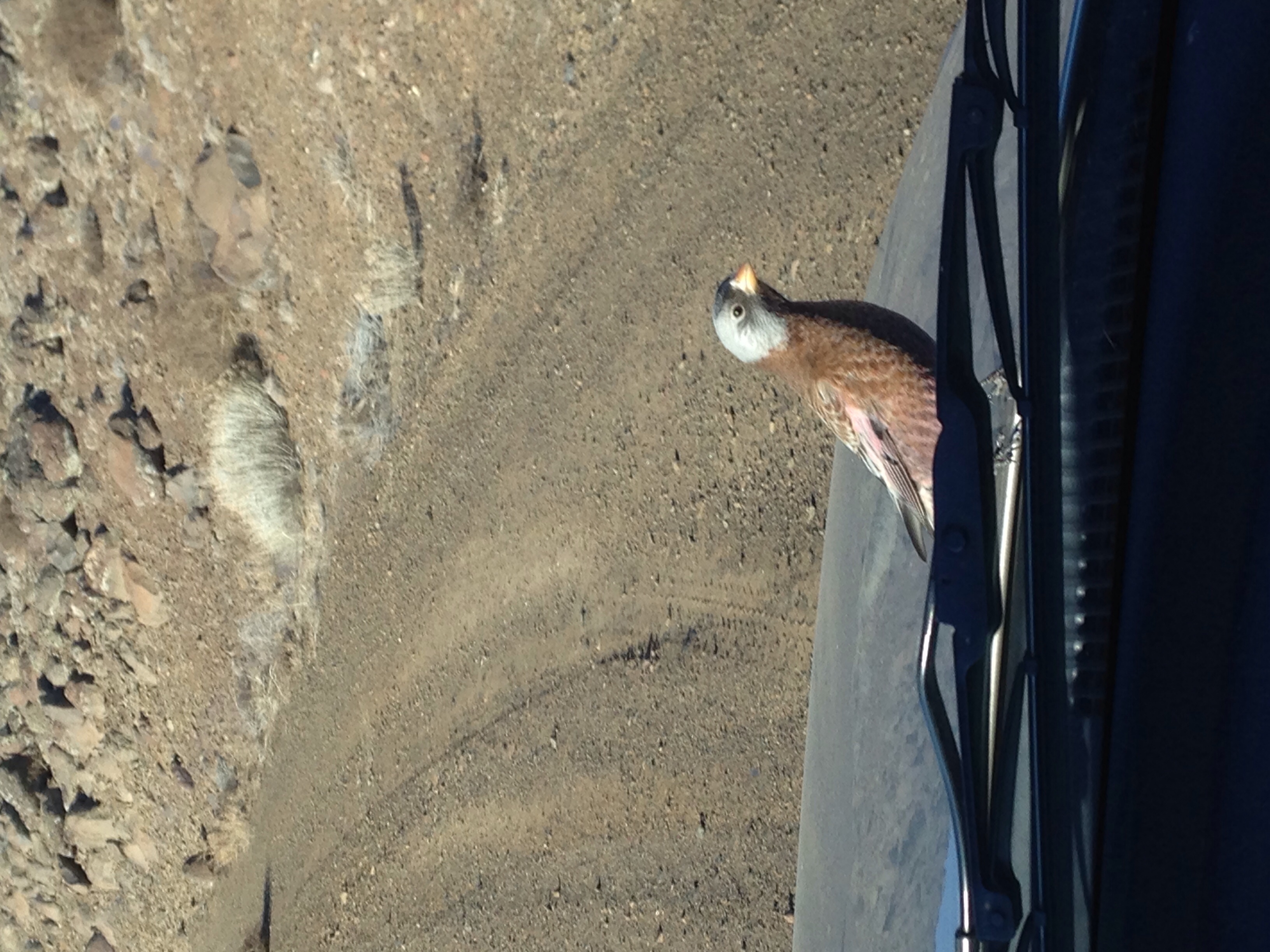
Red-breasted Merganser

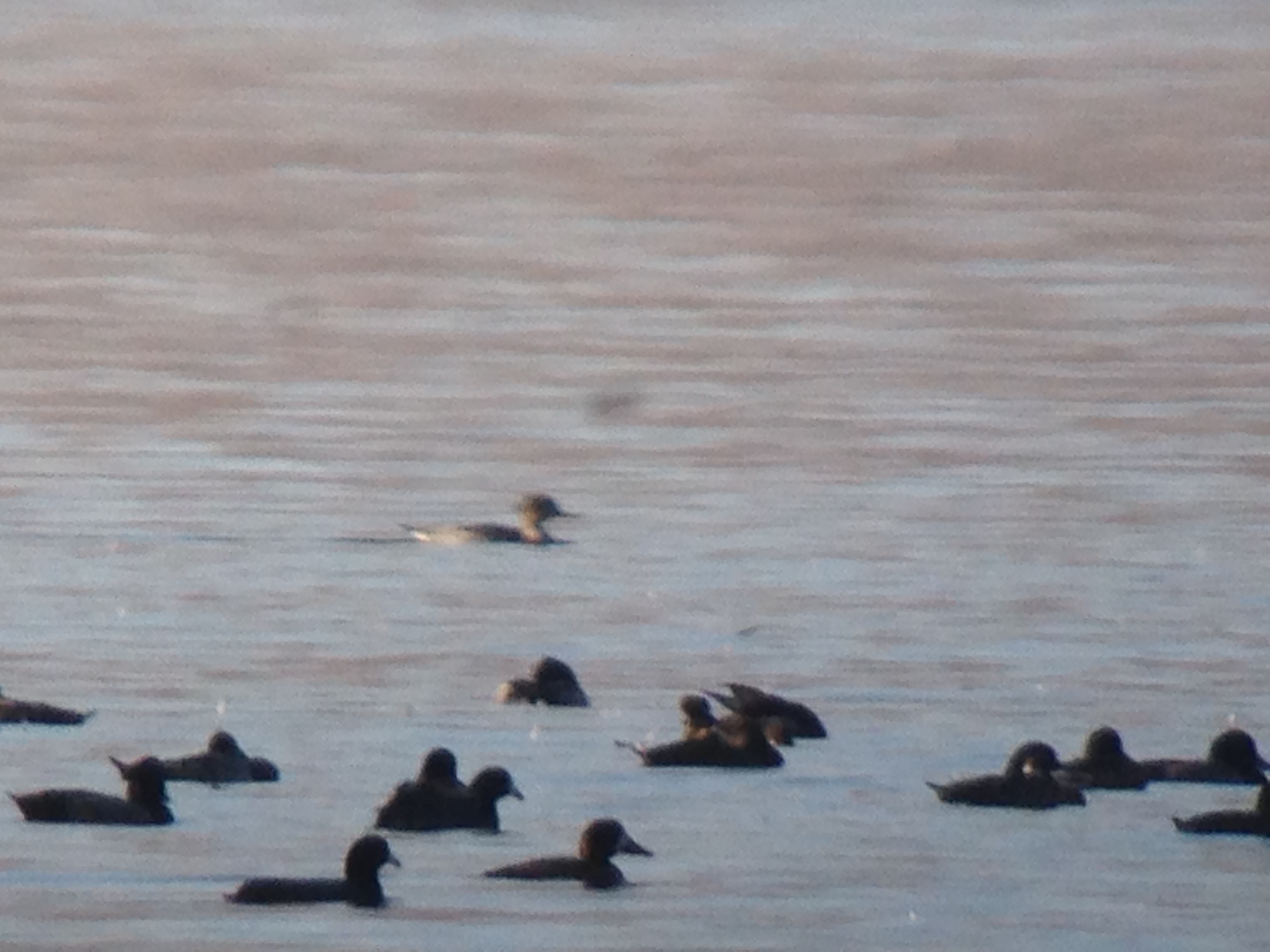
Interesting Common Loon
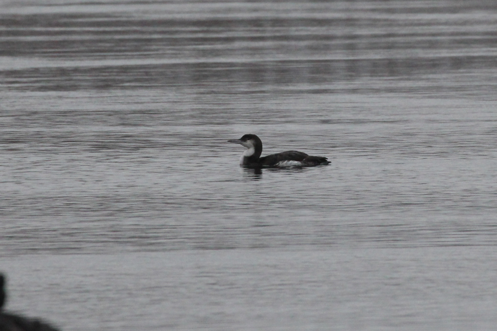
Interesting Common Loon
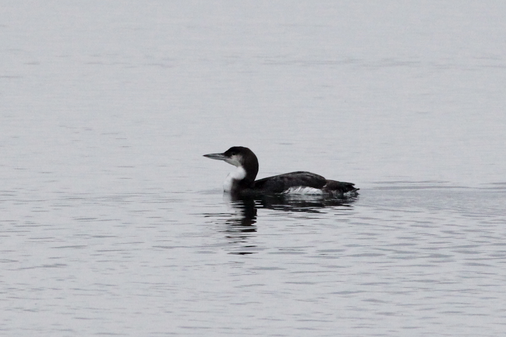
Interesting Common Loon
Excuse me?
Red-breasted Merganser Doc Shot
IMG_0077.JPG
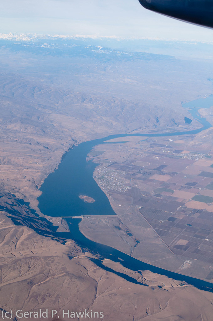
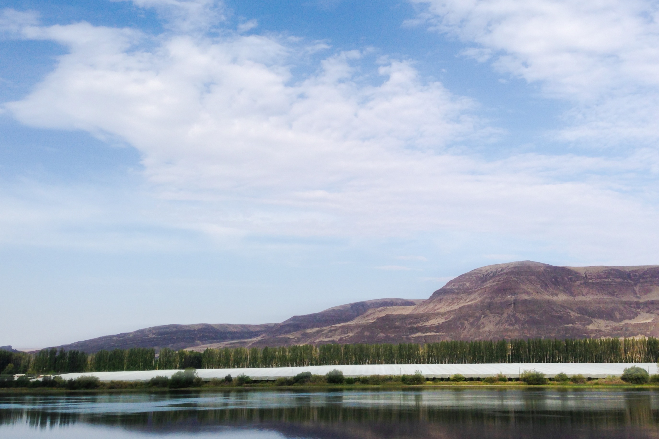
Priest Rapids Lake and Dam
Desert Aire, WA 美國的地圖
搜索其他地方的日出日落時間
附近地點
Apricot Pl S, Mattawa, WA 美國
Mattawa, WA 美國
Riverside Rd, Yakima, WA 美國
Beverly, WA, 美國
WA-, Beverly, WA 美國
Umtanum Ridge, Washington, 美國
美國华盛顿万蒂奇
81 Kittitas St, Ellensburg, WA 美國
Old Vantage Hwy, Washington 美國Old Vantage Highway
美國华盛顿亚基马
Wanapum Lake, Washington, 美國
I-90, Ellensburg, WA 美國Ryegrass Safety Rest Area Eastbound
美國華盛頓齊拉
Sun Acres Rd, Zillah, WA 美國
美國華盛頓喬治
River Dr, Quincy, WA 美國
Yakima Valley Hwy, Zillah, WA 美國
Northstone Pkwy, Zillah, WA 美國
Manastash Ridge, Washington 美國
美國華盛頓莫科斯
最近搜索
- Red Dog Mine, AK, USA的日出日落時間表
- Am bhf, Borken, 德國Am Bahnhof的日出日落時間表
- 4th St E, Sonoma, CA 美國的日出日落時間表
- Oakland Ave, Williamsport, PA 美國的日出日落時間表
- Via Roma, Pieranica CR, 義大利的日出日落時間表
- 克羅埃西亞杜布羅夫尼克 GradClock Tower of Dubrovnik的日出日落時間表
- 阿根廷丘布特省特雷利烏的日出日落時間表
- Hartfords Bluff Cir, Mt Pleasant, SC 美國的日出日落時間表
- 日本熊本縣熊本市北區的日出日落時間表
- 中國福州市平潭縣平潭島的日出日落時間表