Cabin Ridge Rd, Leon, WV 美國Cloverdale School (historical)的日出日落時間表
Location: 美國 > 西維吉尼亞州 > 梅森郡 > 美國西弗吉尼亚州科隆 > 美國西弗吉尼亚州利昂 >
時區:
America/New_York
當地時間:
2025-06-24 18:22:26
經度:
-81.8804196
緯度:
38.7138544
今天日出時間:
06:04:16 AM
今天日落時間:
08:56:24 PM
今天日照時長:
14h 52m 8s
明天日出時間:
06:04:38 AM
明天日落時間:
08:56:27 PM
明天日照時長:
14h 51m 49s
顯示所有日期
| 日期 | 日出 | 日落 | 日照時長 |
|---|---|---|---|
| 2025年01月01日 | 07:45:38 AM | 05:17:38 PM | 9h 32m 0s |
| 2025年01月02日 | 07:45:43 AM | 05:18:28 PM | 9h 32m 45s |
| 2025年01月03日 | 07:45:46 AM | 05:19:20 PM | 9h 33m 34s |
| 2025年01月04日 | 07:45:46 AM | 05:20:14 PM | 9h 34m 28s |
| 2025年01月05日 | 07:45:44 AM | 05:21:08 PM | 9h 35m 24s |
| 2025年01月06日 | 07:45:40 AM | 05:22:04 PM | 9h 36m 24s |
| 2025年01月07日 | 07:45:34 AM | 05:23:01 PM | 9h 37m 27s |
| 2025年01月08日 | 07:45:26 AM | 05:23:59 PM | 9h 38m 33s |
| 2025年01月09日 | 07:45:16 AM | 05:24:58 PM | 9h 39m 42s |
| 2025年01月10日 | 07:45:03 AM | 05:25:58 PM | 9h 40m 55s |
| 2025年01月11日 | 07:44:49 AM | 05:26:58 PM | 9h 42m 9s |
| 2025年01月12日 | 07:44:32 AM | 05:28:00 PM | 9h 43m 28s |
| 2025年01月13日 | 07:44:13 AM | 05:29:03 PM | 9h 44m 50s |
| 2025年01月14日 | 07:43:52 AM | 05:30:06 PM | 9h 46m 14s |
| 2025年01月15日 | 07:43:29 AM | 05:31:10 PM | 9h 47m 41s |
| 2025年01月16日 | 07:43:04 AM | 05:32:15 PM | 9h 49m 11s |
| 2025年01月17日 | 07:42:37 AM | 05:33:20 PM | 9h 50m 43s |
| 2025年01月18日 | 07:42:08 AM | 05:34:26 PM | 9h 52m 18s |
| 2025年01月19日 | 07:41:38 AM | 05:35:32 PM | 9h 53m 54s |
| 2025年01月20日 | 07:41:05 AM | 05:36:39 PM | 9h 55m 34s |
| 2025年01月21日 | 07:40:30 AM | 05:37:46 PM | 9h 57m 16s |
| 2025年01月22日 | 07:39:53 AM | 05:38:53 PM | 9h 59m 0s |
| 2025年01月23日 | 07:39:14 AM | 05:40:01 PM | 10h 0m 47s |
| 2025年01月24日 | 07:38:33 AM | 05:41:10 PM | 10h 2m 37s |
| 2025年01月25日 | 07:37:51 AM | 05:42:18 PM | 10h 4m 27s |
| 2025年01月26日 | 07:37:07 AM | 05:43:27 PM | 10h 6m 20s |
| 2025年01月27日 | 07:36:21 AM | 05:44:36 PM | 10h 8m 15s |
| 2025年01月28日 | 07:35:33 AM | 05:45:45 PM | 10h 10m 12s |
| 2025年01月29日 | 07:34:43 AM | 05:46:54 PM | 10h 12m 11s |
| 2025年01月30日 | 07:33:52 AM | 05:48:03 PM | 10h 14m 11s |
| 2025年01月31日 | 07:32:59 AM | 05:49:12 PM | 10h 16m 13s |
| 2025年02月01日 | 07:32:05 AM | 05:50:21 PM | 10h 18m 16s |
| 2025年02月02日 | 07:31:09 AM | 05:51:30 PM | 10h 20m 21s |
| 2025年02月03日 | 07:30:11 AM | 05:52:39 PM | 10h 22m 28s |
| 2025年02月04日 | 07:29:12 AM | 05:53:48 PM | 10h 24m 36s |
| 2025年02月05日 | 07:28:11 AM | 05:54:57 PM | 10h 26m 46s |
| 2025年02月06日 | 07:27:09 AM | 05:56:06 PM | 10h 28m 57s |
| 2025年02月07日 | 07:26:05 AM | 05:57:15 PM | 10h 31m 10s |
| 2025年02月08日 | 07:25:00 AM | 05:58:23 PM | 10h 33m 23s |
| 2025年02月09日 | 07:23:53 AM | 05:59:31 PM | 10h 35m 38s |
| 2025年02月10日 | 07:22:46 AM | 06:00:39 PM | 10h 37m 53s |
| 2025年02月11日 | 07:21:37 AM | 06:01:47 PM | 10h 40m 10s |
| 2025年02月12日 | 07:20:26 AM | 06:02:55 PM | 10h 42m 29s |
| 2025年02月13日 | 07:19:15 AM | 06:04:02 PM | 10h 44m 47s |
| 2025年02月14日 | 07:18:02 AM | 06:05:09 PM | 10h 47m 7s |
| 2025年02月15日 | 07:16:48 AM | 06:06:16 PM | 10h 49m 28s |
| 2025年02月16日 | 07:15:33 AM | 06:07:23 PM | 10h 51m 50s |
| 2025年02月17日 | 07:14:17 AM | 06:08:29 PM | 10h 54m 12s |
| 2025年02月18日 | 07:13:00 AM | 06:09:35 PM | 10h 56m 35s |
| 2025年02月19日 | 07:11:41 AM | 06:10:41 PM | 10h 59m 0s |
| 2025年02月20日 | 07:10:22 AM | 06:11:46 PM | 11h 1m 24s |
| 2025年02月21日 | 07:09:02 AM | 06:12:51 PM | 11h 3m 49s |
| 2025年02月22日 | 07:07:41 AM | 06:13:56 PM | 11h 6m 15s |
| 2025年02月23日 | 07:06:19 AM | 06:15:00 PM | 11h 8m 41s |
| 2025年02月24日 | 07:04:56 AM | 06:16:04 PM | 11h 11m 8s |
| 2025年02月25日 | 07:03:32 AM | 06:17:08 PM | 11h 13m 36s |
| 2025年02月26日 | 07:02:08 AM | 06:18:12 PM | 11h 16m 4s |
| 2025年02月27日 | 07:00:42 AM | 06:19:15 PM | 11h 18m 33s |
| 2025年02月28日 | 06:59:17 AM | 06:20:18 PM | 11h 21m 1s |
| 2025年03月01日 | 06:57:50 AM | 06:21:20 PM | 11h 23m 30s |
| 2025年03月02日 | 06:56:23 AM | 06:22:23 PM | 11h 26m 0s |
| 2025年03月03日 | 06:54:55 AM | 06:23:25 PM | 11h 28m 30s |
| 2025年03月04日 | 06:53:26 AM | 06:24:26 PM | 11h 31m 0s |
| 2025年03月05日 | 06:51:57 AM | 06:25:28 PM | 11h 33m 31s |
| 2025年03月06日 | 06:50:27 AM | 06:26:29 PM | 11h 36m 2s |
| 2025年03月07日 | 06:48:57 AM | 06:27:30 PM | 11h 38m 33s |
| 2025年03月08日 | 06:47:27 AM | 06:28:30 PM | 11h 41m 3s |
| 2025年03月09日 | 07:45:59 AM | 07:29:28 PM | 11h 43m 29s |
| 2025年03月10日 | 07:44:28 AM | 07:30:28 PM | 11h 46m 0s |
| 2025年03月11日 | 07:42:56 AM | 07:31:28 PM | 11h 48m 32s |
| 2025年03月12日 | 07:41:24 AM | 07:32:28 PM | 11h 51m 4s |
| 2025年03月13日 | 07:39:51 AM | 07:33:27 PM | 11h 53m 36s |
| 2025年03月14日 | 07:38:19 AM | 07:34:26 PM | 11h 56m 7s |
| 2025年03月15日 | 07:36:46 AM | 07:35:25 PM | 11h 58m 39s |
| 2025年03月16日 | 07:35:12 AM | 07:36:24 PM | 12h 1m 12s |
| 2025年03月17日 | 07:33:39 AM | 07:37:23 PM | 12h 3m 44s |
| 2025年03月18日 | 07:32:05 AM | 07:38:21 PM | 12h 6m 16s |
| 2025年03月19日 | 07:30:32 AM | 07:39:20 PM | 12h 8m 48s |
| 2025年03月20日 | 07:28:58 AM | 07:40:18 PM | 12h 11m 20s |
| 2025年03月21日 | 07:27:24 AM | 07:41:16 PM | 12h 13m 52s |
| 2025年03月22日 | 07:25:50 AM | 07:42:14 PM | 12h 16m 24s |
| 2025年03月23日 | 07:24:16 AM | 07:43:12 PM | 12h 18m 56s |
| 2025年03月24日 | 07:22:42 AM | 07:44:10 PM | 12h 21m 28s |
| 2025年03月25日 | 07:21:08 AM | 07:45:07 PM | 12h 23m 59s |
| 2025年03月26日 | 07:19:35 AM | 07:46:05 PM | 12h 26m 30s |
| 2025年03月27日 | 07:18:01 AM | 07:47:02 PM | 12h 29m 1s |
| 2025年03月28日 | 07:16:27 AM | 07:48:00 PM | 12h 31m 33s |
| 2025年03月29日 | 07:14:54 AM | 07:48:57 PM | 12h 34m 3s |
| 2025年03月30日 | 07:13:21 AM | 07:49:54 PM | 12h 36m 33s |
| 2025年03月31日 | 07:11:48 AM | 07:50:52 PM | 12h 39m 4s |
| 2025年04月01日 | 07:10:15 AM | 07:51:49 PM | 12h 41m 34s |
| 2025年04月02日 | 07:08:43 AM | 07:52:46 PM | 12h 44m 3s |
| 2025年04月03日 | 07:07:11 AM | 07:53:43 PM | 12h 46m 32s |
| 2025年04月04日 | 07:05:39 AM | 07:54:41 PM | 12h 49m 2s |
| 2025年04月05日 | 07:04:08 AM | 07:55:38 PM | 12h 51m 30s |
| 2025年04月06日 | 07:02:37 AM | 07:56:35 PM | 12h 53m 58s |
| 2025年04月07日 | 07:01:07 AM | 07:57:32 PM | 12h 56m 25s |
| 2025年04月08日 | 06:59:37 AM | 07:58:30 PM | 12h 58m 53s |
| 2025年04月09日 | 06:58:07 AM | 07:59:27 PM | 13h 1m 20s |
| 2025年04月10日 | 06:56:38 AM | 08:00:24 PM | 13h 3m 46s |
| 2025年04月11日 | 06:55:10 AM | 08:01:21 PM | 13h 6m 11s |
| 2025年04月12日 | 06:53:42 AM | 08:02:19 PM | 13h 8m 37s |
| 2025年04月13日 | 06:52:15 AM | 08:03:16 PM | 13h 11m 1s |
| 2025年04月14日 | 06:50:48 AM | 08:04:14 PM | 13h 13m 26s |
| 2025年04月15日 | 06:49:22 AM | 08:05:11 PM | 13h 15m 49s |
| 2025年04月16日 | 06:47:57 AM | 08:06:09 PM | 13h 18m 12s |
| 2025年04月17日 | 06:46:33 AM | 08:07:06 PM | 13h 20m 33s |
| 2025年04月18日 | 06:45:09 AM | 08:08:04 PM | 13h 22m 55s |
| 2025年04月19日 | 06:43:46 AM | 08:09:01 PM | 13h 25m 15s |
| 2025年04月20日 | 06:42:25 AM | 08:09:59 PM | 13h 27m 34s |
| 2025年04月21日 | 06:41:03 AM | 08:10:57 PM | 13h 29m 54s |
| 2025年04月22日 | 06:39:43 AM | 08:11:54 PM | 13h 32m 11s |
| 2025年04月23日 | 06:38:24 AM | 08:12:52 PM | 13h 34m 28s |
| 2025年04月24日 | 06:37:06 AM | 08:13:49 PM | 13h 36m 43s |
| 2025年04月25日 | 06:35:48 AM | 08:14:47 PM | 13h 38m 59s |
| 2025年04月26日 | 06:34:32 AM | 08:15:45 PM | 13h 41m 13s |
| 2025年04月27日 | 06:33:17 AM | 08:16:42 PM | 13h 43m 25s |
| 2025年04月28日 | 06:32:03 AM | 08:17:40 PM | 13h 45m 37s |
| 2025年04月29日 | 06:30:50 AM | 08:18:37 PM | 13h 47m 47s |
| 2025年04月30日 | 06:29:38 AM | 08:19:35 PM | 13h 49m 57s |
| 2025年05月01日 | 06:28:27 AM | 08:20:32 PM | 13h 52m 5s |
| 2025年05月02日 | 06:27:17 AM | 08:21:29 PM | 13h 54m 12s |
| 2025年05月03日 | 06:26:09 AM | 08:22:26 PM | 13h 56m 17s |
| 2025年05月04日 | 06:25:02 AM | 08:23:23 PM | 13h 58m 21s |
| 2025年05月05日 | 06:23:56 AM | 08:24:20 PM | 14h 0m 24s |
| 2025年05月06日 | 06:22:52 AM | 08:25:16 PM | 14h 2m 24s |
| 2025年05月07日 | 06:21:49 AM | 08:26:12 PM | 14h 4m 23s |
| 2025年05月08日 | 06:20:47 AM | 08:27:09 PM | 14h 6m 22s |
| 2025年05月09日 | 06:19:47 AM | 08:28:04 PM | 14h 8m 17s |
| 2025年05月10日 | 06:18:48 AM | 08:29:00 PM | 14h 10m 12s |
| 2025年05月11日 | 06:17:50 AM | 08:29:55 PM | 14h 12m 5s |
| 2025年05月12日 | 06:16:54 AM | 08:30:50 PM | 14h 13m 56s |
| 2025年05月13日 | 06:16:00 AM | 08:31:45 PM | 14h 15m 45s |
| 2025年05月14日 | 06:15:07 AM | 08:32:39 PM | 14h 17m 32s |
| 2025年05月15日 | 06:14:16 AM | 08:33:32 PM | 14h 19m 16s |
| 2025年05月16日 | 06:13:26 AM | 08:34:25 PM | 14h 20m 59s |
| 2025年05月17日 | 06:12:38 AM | 08:35:18 PM | 14h 22m 40s |
| 2025年05月18日 | 06:11:51 AM | 08:36:10 PM | 14h 24m 19s |
| 2025年05月19日 | 06:11:07 AM | 08:37:02 PM | 14h 25m 55s |
| 2025年05月20日 | 06:10:23 AM | 08:37:53 PM | 14h 27m 30s |
| 2025年05月21日 | 06:09:42 AM | 08:38:43 PM | 14h 29m 1s |
| 2025年05月22日 | 06:09:02 AM | 08:39:33 PM | 14h 30m 31s |
| 2025年05月23日 | 06:08:24 AM | 08:40:22 PM | 14h 31m 58s |
| 2025年05月24日 | 06:07:48 AM | 08:41:10 PM | 14h 33m 22s |
| 2025年05月25日 | 06:07:13 AM | 08:41:58 PM | 14h 34m 45s |
| 2025年05月26日 | 06:06:41 AM | 08:42:44 PM | 14h 36m 3s |
| 2025年05月27日 | 06:06:10 AM | 08:43:30 PM | 14h 37m 20s |
| 2025年05月28日 | 06:05:41 AM | 08:44:15 PM | 14h 38m 34s |
| 2025年05月29日 | 06:05:13 AM | 08:44:59 PM | 14h 39m 46s |
| 2025年05月30日 | 06:04:48 AM | 08:45:42 PM | 14h 40m 54s |
| 2025年05月31日 | 06:04:24 AM | 08:46:24 PM | 14h 42m 0s |
| 2025年06月01日 | 06:04:03 AM | 08:47:04 PM | 14h 43m 1s |
| 2025年06月02日 | 06:03:43 AM | 08:47:44 PM | 14h 44m 1s |
| 2025年06月03日 | 06:03:25 AM | 08:48:23 PM | 14h 44m 58s |
| 2025年06月04日 | 06:03:08 AM | 08:49:00 PM | 14h 45m 52s |
| 2025年06月05日 | 06:02:54 AM | 08:49:36 PM | 14h 46m 42s |
| 2025年06月06日 | 06:02:42 AM | 08:50:11 PM | 14h 47m 29s |
| 2025年06月07日 | 06:02:31 AM | 08:50:44 PM | 14h 48m 13s |
| 2025年06月08日 | 06:02:22 AM | 08:51:17 PM | 14h 48m 55s |
| 2025年06月09日 | 06:02:15 AM | 08:51:47 PM | 14h 49m 32s |
| 2025年06月10日 | 06:02:10 AM | 08:52:17 PM | 14h 50m 7s |
| 2025年06月11日 | 06:02:07 AM | 08:52:45 PM | 14h 50m 38s |
| 2025年06月12日 | 06:02:06 AM | 08:53:11 PM | 14h 51m 5s |
| 2025年06月13日 | 06:02:06 AM | 08:53:36 PM | 14h 51m 30s |
| 2025年06月14日 | 06:02:08 AM | 08:53:59 PM | 14h 51m 51s |
| 2025年06月15日 | 06:02:13 AM | 08:54:21 PM | 14h 52m 8s |
| 2025年06月16日 | 06:02:18 AM | 08:54:41 PM | 14h 52m 23s |
| 2025年06月17日 | 06:02:26 AM | 08:55:00 PM | 14h 52m 34s |
| 2025年06月18日 | 06:02:35 AM | 08:55:17 PM | 14h 52m 42s |
| 2025年06月19日 | 06:02:46 AM | 08:55:32 PM | 14h 52m 46s |
| 2025年06月20日 | 06:02:59 AM | 08:55:45 PM | 14h 52m 46s |
| 2025年06月21日 | 06:03:13 AM | 08:55:57 PM | 14h 52m 44s |
| 2025年06月22日 | 06:03:29 AM | 08:56:07 PM | 14h 52m 38s |
| 2025年06月23日 | 06:03:47 AM | 08:56:15 PM | 14h 52m 28s |
| 2025年06月24日 | 06:04:06 AM | 08:56:21 PM | 14h 52m 15s |
| 2025年06月25日 | 06:04:27 AM | 08:56:26 PM | 14h 51m 59s |
| 2025年06月26日 | 06:04:49 AM | 08:56:28 PM | 14h 51m 39s |
| 2025年06月27日 | 06:05:13 AM | 08:56:29 PM | 14h 51m 16s |
| 2025年06月28日 | 06:05:39 AM | 08:56:28 PM | 14h 50m 49s |
| 2025年06月29日 | 06:06:05 AM | 08:56:25 PM | 14h 50m 20s |
| 2025年06月30日 | 06:06:33 AM | 08:56:20 PM | 14h 49m 47s |
| 2025年07月01日 | 06:07:03 AM | 08:56:14 PM | 14h 49m 11s |
| 2025年07月02日 | 06:07:34 AM | 08:56:05 PM | 14h 48m 31s |
| 2025年07月03日 | 06:08:06 AM | 08:55:54 PM | 14h 47m 48s |
| 2025年07月04日 | 06:08:39 AM | 08:55:42 PM | 14h 47m 3s |
| 2025年07月05日 | 06:09:13 AM | 08:55:28 PM | 14h 46m 15s |
| 2025年07月06日 | 06:09:49 AM | 08:55:11 PM | 14h 45m 22s |
| 2025年07月07日 | 06:10:26 AM | 08:54:53 PM | 14h 44m 27s |
| 2025年07月08日 | 06:11:04 AM | 08:54:33 PM | 14h 43m 29s |
| 2025年07月09日 | 06:11:43 AM | 08:54:11 PM | 14h 42m 28s |
| 2025年07月10日 | 06:12:23 AM | 08:53:47 PM | 14h 41m 24s |
| 2025年07月11日 | 06:13:04 AM | 08:53:22 PM | 14h 40m 18s |
| 2025年07月12日 | 06:13:46 AM | 08:52:54 PM | 14h 39m 8s |
| 2025年07月13日 | 06:14:28 AM | 08:52:25 PM | 14h 37m 57s |
| 2025年07月14日 | 06:15:12 AM | 08:51:53 PM | 14h 36m 41s |
| 2025年07月15日 | 06:15:56 AM | 08:51:20 PM | 14h 35m 24s |
| 2025年07月16日 | 06:16:42 AM | 08:50:45 PM | 14h 34m 3s |
| 2025年07月17日 | 06:17:28 AM | 08:50:08 PM | 14h 32m 40s |
| 2025年07月18日 | 06:18:14 AM | 08:49:30 PM | 14h 31m 16s |
| 2025年07月19日 | 06:19:01 AM | 08:48:50 PM | 14h 29m 49s |
| 2025年07月20日 | 06:19:49 AM | 08:48:08 PM | 14h 28m 19s |
| 2025年07月21日 | 06:20:38 AM | 08:47:24 PM | 14h 26m 46s |
| 2025年07月22日 | 06:21:27 AM | 08:46:38 PM | 14h 25m 11s |
| 2025年07月23日 | 06:22:16 AM | 08:45:51 PM | 14h 23m 35s |
| 2025年07月24日 | 06:23:06 AM | 08:45:03 PM | 14h 21m 57s |
| 2025年07月25日 | 06:23:57 AM | 08:44:12 PM | 14h 20m 15s |
| 2025年07月26日 | 06:24:48 AM | 08:43:20 PM | 14h 18m 32s |
| 2025年07月27日 | 06:25:39 AM | 08:42:26 PM | 14h 16m 47s |
| 2025年07月28日 | 06:26:31 AM | 08:41:31 PM | 14h 15m 0s |
| 2025年07月29日 | 06:27:23 AM | 08:40:34 PM | 14h 13m 11s |
| 2025年07月30日 | 06:28:15 AM | 08:39:36 PM | 14h 11m 21s |
| 2025年07月31日 | 06:29:07 AM | 08:38:37 PM | 14h 9m 30s |
| 2025年08月01日 | 06:30:00 AM | 08:37:35 PM | 14h 7m 35s |
| 2025年08月02日 | 06:30:53 AM | 08:36:33 PM | 14h 5m 40s |
| 2025年08月03日 | 06:31:46 AM | 08:35:29 PM | 14h 3m 43s |
| 2025年08月04日 | 06:32:40 AM | 08:34:23 PM | 14h 1m 43s |
| 2025年08月05日 | 06:33:33 AM | 08:33:17 PM | 13h 59m 44s |
| 2025年08月06日 | 06:34:27 AM | 08:32:09 PM | 13h 57m 42s |
| 2025年08月07日 | 06:35:20 AM | 08:30:59 PM | 13h 55m 39s |
| 2025年08月08日 | 06:36:14 AM | 08:29:49 PM | 13h 53m 35s |
| 2025年08月09日 | 06:37:08 AM | 08:28:37 PM | 13h 51m 29s |
| 2025年08月10日 | 06:38:02 AM | 08:27:24 PM | 13h 49m 22s |
| 2025年08月11日 | 06:38:56 AM | 08:26:10 PM | 13h 47m 14s |
| 2025年08月12日 | 06:39:50 AM | 08:24:54 PM | 13h 45m 4s |
| 2025年08月13日 | 06:40:44 AM | 08:23:38 PM | 13h 42m 54s |
| 2025年08月14日 | 06:41:38 AM | 08:22:21 PM | 13h 40m 43s |
| 2025年08月15日 | 06:42:31 AM | 08:21:02 PM | 13h 38m 31s |
| 2025年08月16日 | 06:43:25 AM | 08:19:43 PM | 13h 36m 18s |
| 2025年08月17日 | 06:44:19 AM | 08:18:22 PM | 13h 34m 3s |
| 2025年08月18日 | 06:45:13 AM | 08:17:01 PM | 13h 31m 48s |
| 2025年08月19日 | 06:46:07 AM | 08:15:38 PM | 13h 29m 31s |
| 2025年08月20日 | 06:47:01 AM | 08:14:15 PM | 13h 27m 14s |
| 2025年08月21日 | 06:47:54 AM | 08:12:51 PM | 13h 24m 57s |
| 2025年08月22日 | 06:48:48 AM | 08:11:26 PM | 13h 22m 38s |
| 2025年08月23日 | 06:49:42 AM | 08:10:00 PM | 13h 20m 18s |
| 2025年08月24日 | 06:50:35 AM | 08:08:34 PM | 13h 17m 59s |
| 2025年08月25日 | 06:51:29 AM | 08:07:06 PM | 13h 15m 37s |
| 2025年08月26日 | 06:52:22 AM | 08:05:38 PM | 13h 13m 16s |
| 2025年08月27日 | 06:53:15 AM | 08:04:10 PM | 13h 10m 55s |
| 2025年08月28日 | 06:54:09 AM | 08:02:40 PM | 13h 8m 31s |
| 2025年08月29日 | 06:55:02 AM | 08:01:10 PM | 13h 6m 8s |
| 2025年08月30日 | 06:55:55 AM | 07:59:40 PM | 13h 3m 45s |
| 2025年08月31日 | 06:56:48 AM | 07:58:09 PM | 13h 1m 21s |
| 2025年09月01日 | 06:57:41 AM | 07:56:37 PM | 12h 58m 56s |
| 2025年09月02日 | 06:58:34 AM | 07:55:05 PM | 12h 56m 31s |
| 2025年09月03日 | 06:59:27 AM | 07:53:33 PM | 12h 54m 6s |
| 2025年09月04日 | 07:00:20 AM | 07:52:00 PM | 12h 51m 40s |
| 2025年09月05日 | 07:01:13 AM | 07:50:26 PM | 12h 49m 13s |
| 2025年09月06日 | 07:02:06 AM | 07:48:52 PM | 12h 46m 46s |
| 2025年09月07日 | 07:02:58 AM | 07:47:18 PM | 12h 44m 20s |
| 2025年09月08日 | 07:03:51 AM | 07:45:44 PM | 12h 41m 53s |
| 2025年09月09日 | 07:04:44 AM | 07:44:09 PM | 12h 39m 25s |
| 2025年09月10日 | 07:05:37 AM | 07:42:34 PM | 12h 36m 57s |
| 2025年09月11日 | 07:06:30 AM | 07:40:59 PM | 12h 34m 29s |
| 2025年09月12日 | 07:07:23 AM | 07:39:23 PM | 12h 32m 0s |
| 2025年09月13日 | 07:08:16 AM | 07:37:47 PM | 12h 29m 31s |
| 2025年09月14日 | 07:09:09 AM | 07:36:12 PM | 12h 27m 3s |
| 2025年09月15日 | 07:10:02 AM | 07:34:36 PM | 12h 24m 34s |
| 2025年09月16日 | 07:10:55 AM | 07:33:00 PM | 12h 22m 5s |
| 2025年09月17日 | 07:11:48 AM | 07:31:24 PM | 12h 19m 36s |
| 2025年09月18日 | 07:12:41 AM | 07:29:47 PM | 12h 17m 6s |
| 2025年09月19日 | 07:13:35 AM | 07:28:11 PM | 12h 14m 36s |
| 2025年09月20日 | 07:14:28 AM | 07:26:35 PM | 12h 12m 7s |
| 2025年09月21日 | 07:15:22 AM | 07:24:59 PM | 12h 9m 37s |
| 2025年09月22日 | 07:16:16 AM | 07:23:23 PM | 12h 7m 7s |
| 2025年09月23日 | 07:17:10 AM | 07:21:47 PM | 12h 4m 37s |
| 2025年09月24日 | 07:18:04 AM | 07:20:12 PM | 12h 2m 8s |
| 2025年09月25日 | 07:18:58 AM | 07:18:36 PM | 11h 59m 38s |
| 2025年09月26日 | 07:19:52 AM | 07:17:01 PM | 11h 57m 9s |
| 2025年09月27日 | 07:20:47 AM | 07:15:26 PM | 11h 54m 39s |
| 2025年09月28日 | 07:21:42 AM | 07:13:51 PM | 11h 52m 9s |
| 2025年09月29日 | 07:22:37 AM | 07:12:17 PM | 11h 49m 40s |
| 2025年09月30日 | 07:23:32 AM | 07:10:42 PM | 11h 47m 10s |
| 2025年10月01日 | 07:24:28 AM | 07:09:09 PM | 11h 44m 41s |
| 2025年10月02日 | 07:25:23 AM | 07:07:35 PM | 11h 42m 12s |
| 2025年10月03日 | 07:26:19 AM | 07:06:02 PM | 11h 39m 43s |
| 2025年10月04日 | 07:27:16 AM | 07:04:30 PM | 11h 37m 14s |
| 2025年10月05日 | 07:28:12 AM | 07:02:58 PM | 11h 34m 46s |
| 2025年10月06日 | 07:29:09 AM | 07:01:26 PM | 11h 32m 17s |
| 2025年10月07日 | 07:30:06 AM | 06:59:55 PM | 11h 29m 49s |
| 2025年10月08日 | 07:31:04 AM | 06:58:25 PM | 11h 27m 21s |
| 2025年10月09日 | 07:32:01 AM | 06:56:55 PM | 11h 24m 54s |
| 2025年10月10日 | 07:32:59 AM | 06:55:25 PM | 11h 22m 26s |
| 2025年10月11日 | 07:33:58 AM | 06:53:57 PM | 11h 19m 59s |
| 2025年10月12日 | 07:34:56 AM | 06:52:29 PM | 11h 17m 33s |
| 2025年10月13日 | 07:35:55 AM | 06:51:02 PM | 11h 15m 7s |
| 2025年10月14日 | 07:36:55 AM | 06:49:36 PM | 11h 12m 41s |
| 2025年10月15日 | 07:37:55 AM | 06:48:10 PM | 11h 10m 15s |
| 2025年10月16日 | 07:38:55 AM | 06:46:45 PM | 11h 7m 50s |
| 2025年10月17日 | 07:39:55 AM | 06:45:21 PM | 11h 5m 26s |
| 2025年10月18日 | 07:40:56 AM | 06:43:59 PM | 11h 3m 3s |
| 2025年10月19日 | 07:41:57 AM | 06:42:36 PM | 11h 0m 39s |
| 2025年10月20日 | 07:42:58 AM | 06:41:15 PM | 10h 58m 17s |
| 2025年10月21日 | 07:44:00 AM | 06:39:55 PM | 10h 55m 55s |
| 2025年10月22日 | 07:45:02 AM | 06:38:36 PM | 10h 53m 34s |
| 2025年10月23日 | 07:46:04 AM | 06:37:18 PM | 10h 51m 14s |
| 2025年10月24日 | 07:47:07 AM | 06:36:01 PM | 10h 48m 54s |
| 2025年10月25日 | 07:48:10 AM | 06:34:46 PM | 10h 46m 36s |
| 2025年10月26日 | 07:49:13 AM | 06:33:31 PM | 10h 44m 18s |
| 2025年10月27日 | 07:50:17 AM | 06:32:18 PM | 10h 42m 1s |
| 2025年10月28日 | 07:51:21 AM | 06:31:06 PM | 10h 39m 45s |
| 2025年10月29日 | 07:52:25 AM | 06:29:55 PM | 10h 37m 30s |
| 2025年10月30日 | 07:53:29 AM | 06:28:45 PM | 10h 35m 16s |
| 2025年10月31日 | 07:54:34 AM | 06:27:37 PM | 10h 33m 3s |
| 2025年11月01日 | 07:55:39 AM | 06:26:30 PM | 10h 30m 51s |
| 2025年11月02日 | 06:56:47 AM | 05:25:22 PM | 10h 28m 35s |
| 2025年11月03日 | 06:57:52 AM | 05:24:18 PM | 10h 26m 26s |
| 2025年11月04日 | 06:58:58 AM | 05:23:15 PM | 10h 24m 17s |
| 2025年11月05日 | 07:00:03 AM | 05:22:14 PM | 10h 22m 11s |
| 2025年11月06日 | 07:01:09 AM | 05:21:15 PM | 10h 20m 6s |
| 2025年11月07日 | 07:02:15 AM | 05:20:17 PM | 10h 18m 2s |
| 2025年11月08日 | 07:03:21 AM | 05:19:21 PM | 10h 16m 0s |
| 2025年11月09日 | 07:04:27 AM | 05:18:26 PM | 10h 13m 59s |
| 2025年11月10日 | 07:05:33 AM | 05:17:33 PM | 10h 12m 0s |
| 2025年11月11日 | 07:06:39 AM | 05:16:42 PM | 10h 10m 3s |
| 2025年11月12日 | 07:07:45 AM | 05:15:52 PM | 10h 8m 7s |
| 2025年11月13日 | 07:08:51 AM | 05:15:05 PM | 10h 6m 14s |
| 2025年11月14日 | 07:09:57 AM | 05:14:19 PM | 10h 4m 22s |
| 2025年11月15日 | 07:11:03 AM | 05:13:35 PM | 10h 2m 32s |
| 2025年11月16日 | 07:12:08 AM | 05:12:52 PM | 10h 0m 44s |
| 2025年11月17日 | 07:13:13 AM | 05:12:12 PM | 9h 58m 59s |
| 2025年11月18日 | 07:14:19 AM | 05:11:34 PM | 9h 57m 15s |
| 2025年11月19日 | 07:15:23 AM | 05:10:57 PM | 9h 55m 34s |
| 2025年11月20日 | 07:16:28 AM | 05:10:23 PM | 9h 53m 55s |
| 2025年11月21日 | 07:17:32 AM | 05:09:50 PM | 9h 52m 18s |
| 2025年11月22日 | 07:18:35 AM | 05:09:19 PM | 9h 50m 44s |
| 2025年11月23日 | 07:19:38 AM | 05:08:51 PM | 9h 49m 13s |
| 2025年11月24日 | 07:20:41 AM | 05:08:24 PM | 9h 47m 43s |
| 2025年11月25日 | 07:21:43 AM | 05:08:00 PM | 9h 46m 17s |
| 2025年11月26日 | 07:22:44 AM | 05:07:38 PM | 9h 44m 54s |
| 2025年11月27日 | 07:23:45 AM | 05:07:17 PM | 9h 43m 32s |
| 2025年11月28日 | 07:24:45 AM | 05:06:59 PM | 9h 42m 14s |
| 2025年11月29日 | 07:25:44 AM | 05:06:43 PM | 9h 40m 59s |
| 2025年11月30日 | 07:26:42 AM | 05:06:30 PM | 9h 39m 48s |
| 2025年12月01日 | 07:27:40 AM | 05:06:18 PM | 9h 38m 38s |
| 2025年12月02日 | 07:28:36 AM | 05:06:08 PM | 9h 37m 32s |
| 2025年12月03日 | 07:29:32 AM | 05:06:01 PM | 9h 36m 29s |
| 2025年12月04日 | 07:30:27 AM | 05:05:56 PM | 9h 35m 29s |
| 2025年12月05日 | 07:31:20 AM | 05:05:53 PM | 9h 34m 33s |
| 2025年12月06日 | 07:32:12 AM | 05:05:52 PM | 9h 33m 40s |
| 2025年12月07日 | 07:33:03 AM | 05:05:54 PM | 9h 32m 51s |
| 2025年12月08日 | 07:33:53 AM | 05:05:57 PM | 9h 32m 4s |
| 2025年12月09日 | 07:34:42 AM | 05:06:03 PM | 9h 31m 21s |
| 2025年12月10日 | 07:35:29 AM | 05:06:11 PM | 9h 30m 42s |
| 2025年12月11日 | 07:36:15 AM | 05:06:21 PM | 9h 30m 6s |
| 2025年12月12日 | 07:36:59 AM | 05:06:33 PM | 9h 29m 34s |
| 2025年12月13日 | 07:37:42 AM | 05:06:47 PM | 9h 29m 5s |
| 2025年12月14日 | 07:38:23 AM | 05:07:04 PM | 9h 28m 41s |
| 2025年12月15日 | 07:39:03 AM | 05:07:22 PM | 9h 28m 19s |
| 2025年12月16日 | 07:39:41 AM | 05:07:43 PM | 9h 28m 2s |
| 2025年12月17日 | 07:40:17 AM | 05:08:05 PM | 9h 27m 48s |
| 2025年12月18日 | 07:40:52 AM | 05:08:30 PM | 9h 27m 38s |
| 2025年12月19日 | 07:41:25 AM | 05:08:56 PM | 9h 27m 31s |
| 2025年12月20日 | 07:41:56 AM | 05:09:25 PM | 9h 27m 29s |
| 2025年12月21日 | 07:42:25 AM | 05:09:55 PM | 9h 27m 30s |
| 2025年12月22日 | 07:42:52 AM | 05:10:28 PM | 9h 27m 36s |
| 2025年12月23日 | 07:43:18 AM | 05:11:02 PM | 9h 27m 44s |
| 2025年12月24日 | 07:43:41 AM | 05:11:38 PM | 9h 27m 57s |
| 2025年12月25日 | 07:44:03 AM | 05:12:15 PM | 9h 28m 12s |
| 2025年12月26日 | 07:44:22 AM | 05:12:55 PM | 9h 28m 33s |
| 2025年12月27日 | 07:44:40 AM | 05:13:36 PM | 9h 28m 56s |
| 2025年12月28日 | 07:44:55 AM | 05:14:19 PM | 9h 29m 24s |
| 2025年12月29日 | 07:45:09 AM | 05:15:03 PM | 9h 29m 54s |
| 2025年12月30日 | 07:45:20 AM | 05:15:49 PM | 9h 30m 29s |
| 2025年12月31日 | 07:45:30 AM | 05:16:37 PM | 9h 31m 7s |
日出日落照片

Westward bound...

Remember me to the people of the Allegheny Plateau. Recall that I was here taking pictures of the region's small rivers on sunny winter days.
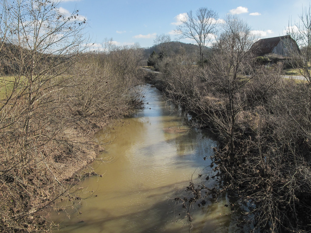
One look and you'll know why it's called Eighteenmile Creek.
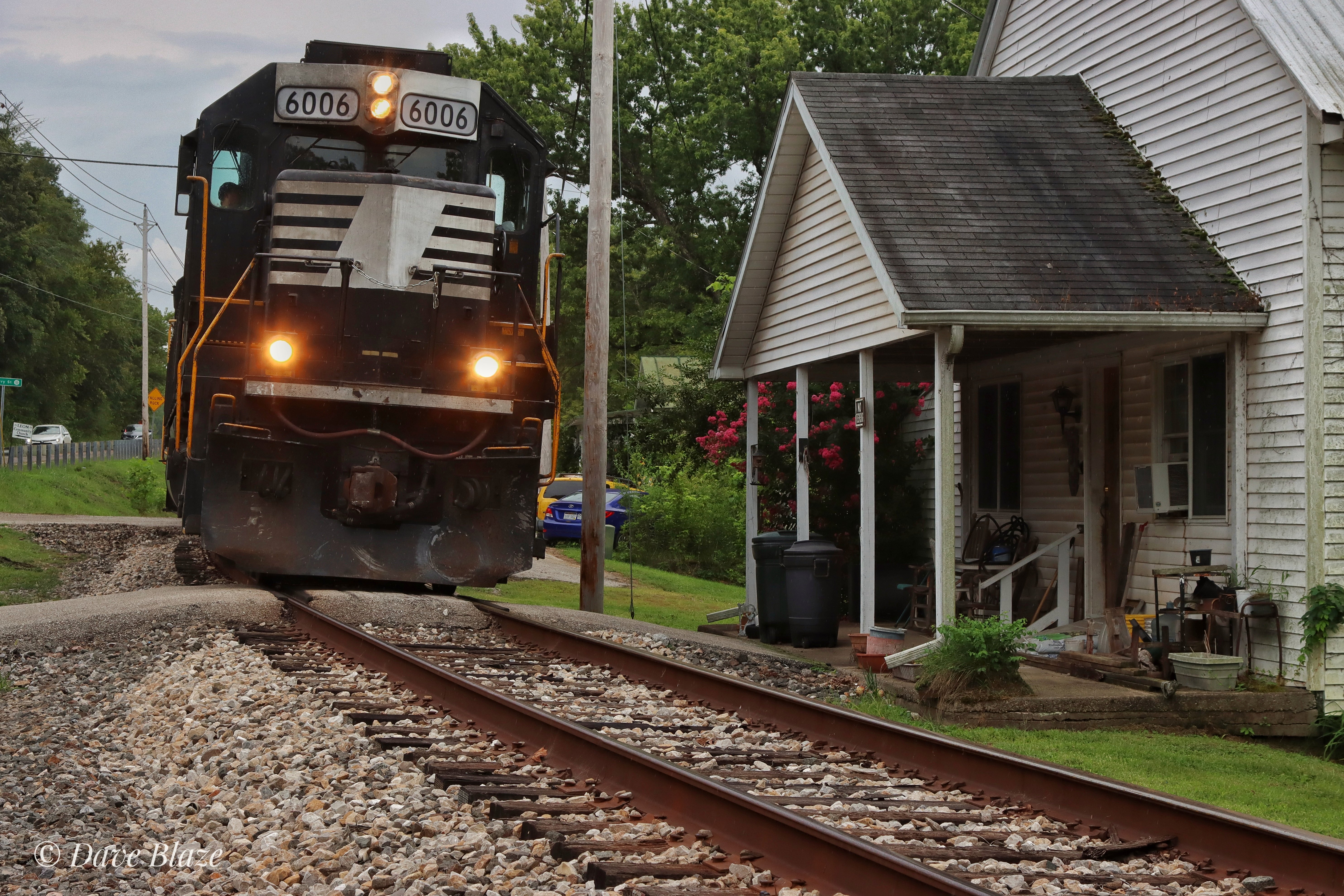
How's This For Close?!

West Virginia Railroading
Cabin Ridge Rd, Leon, WV 美國Cloverdale School (historical)的地圖
搜索其他地方的日出日落時間
附近地點
Tribble Rd, Leon, WV 美國
Tribble Rd, Leon, WV 美國
Union, WV, 美國
Charleston Rd, Leon, WV 美國
美國西弗吉尼亚州科隆
美國西弗吉尼亚州利昂
Southside, WV 美國
Charleston Rd, Leon, WV 美國
Hale Ln, Leon, WV 美國
Long Hollow Rd, Western, WV, 美國Long Hollow Road
Buffalo-Union, WV, 美國
美國西維吉尼亞州梅森郡
Bull Run, Ripley, WV 美國
Debbie Rd, Cooper, WV 美國Debbie Road
美國西維吉尼亞州水牛城
美國西弗吉尼亚州阿巴克尔
Railroad Ave, Buffalo, WV 美國
Given, WV 美國
Nash Ln, Buffalo, WV 美國
Western, WV, 美國
最近搜索
- Red Dog Mine, AK, USA的日出日落時間表
- Am bhf, Borken, 德國Am Bahnhof的日出日落時間表
- 4th St E, Sonoma, CA 美國的日出日落時間表
- Oakland Ave, Williamsport, PA 美國的日出日落時間表
- Via Roma, Pieranica CR, 義大利的日出日落時間表
- 克羅埃西亞杜布羅夫尼克 GradClock Tower of Dubrovnik的日出日落時間表
- 阿根廷丘布特省特雷利烏的日出日落時間表
- Hartfords Bluff Cir, Mt Pleasant, SC 美國的日出日落時間表
- 日本熊本縣熊本市北區的日出日落時間表
- 中國福州市平潭縣平潭島的日出日落時間表