Horas de salida y puesta de sol de Cloverdale School (historical), Cabin Ridge Rd, Leon, WV, EE. UU.
Location: Estados Unidos > Virginia Occidental > Condado de Mason > Cologne > León >
Zona horaria:
America/New_York
Hora local:
2025-07-07 17:40:11
Longitud:
-81.8804196
Latitud:
38.7138544
Salida de sol de hoy:
06:10:45 AM
Puesta de sol de hoy:
08:54:43 PM
La duración del día hoy:
14h 43m 58s
Salida de sol de mañana:
06:11:23 AM
Puesta de sol de mañana:
08:54:22 PM
La duración del día mañana:
14h 42m 59s
Mostrar todas las fechas
| Fecha | Salida de sol | Puesta de sol | Duración del día |
|---|---|---|---|
| 01/01/2025 | 07:45:38 AM | 05:17:38 PM | 9h 32m 0s |
| 02/01/2025 | 07:45:43 AM | 05:18:28 PM | 9h 32m 45s |
| 03/01/2025 | 07:45:46 AM | 05:19:20 PM | 9h 33m 34s |
| 04/01/2025 | 07:45:46 AM | 05:20:14 PM | 9h 34m 28s |
| 05/01/2025 | 07:45:44 AM | 05:21:08 PM | 9h 35m 24s |
| 06/01/2025 | 07:45:40 AM | 05:22:04 PM | 9h 36m 24s |
| 07/01/2025 | 07:45:34 AM | 05:23:01 PM | 9h 37m 27s |
| 08/01/2025 | 07:45:26 AM | 05:23:59 PM | 9h 38m 33s |
| 09/01/2025 | 07:45:16 AM | 05:24:58 PM | 9h 39m 42s |
| 10/01/2025 | 07:45:03 AM | 05:25:58 PM | 9h 40m 55s |
| 11/01/2025 | 07:44:49 AM | 05:26:58 PM | 9h 42m 9s |
| 12/01/2025 | 07:44:32 AM | 05:28:00 PM | 9h 43m 28s |
| 13/01/2025 | 07:44:13 AM | 05:29:03 PM | 9h 44m 50s |
| 14/01/2025 | 07:43:52 AM | 05:30:06 PM | 9h 46m 14s |
| 15/01/2025 | 07:43:29 AM | 05:31:10 PM | 9h 47m 41s |
| 16/01/2025 | 07:43:04 AM | 05:32:15 PM | 9h 49m 11s |
| 17/01/2025 | 07:42:37 AM | 05:33:20 PM | 9h 50m 43s |
| 18/01/2025 | 07:42:08 AM | 05:34:26 PM | 9h 52m 18s |
| 19/01/2025 | 07:41:38 AM | 05:35:32 PM | 9h 53m 54s |
| 20/01/2025 | 07:41:05 AM | 05:36:39 PM | 9h 55m 34s |
| 21/01/2025 | 07:40:30 AM | 05:37:46 PM | 9h 57m 16s |
| 22/01/2025 | 07:39:53 AM | 05:38:53 PM | 9h 59m 0s |
| 23/01/2025 | 07:39:14 AM | 05:40:01 PM | 10h 0m 47s |
| 24/01/2025 | 07:38:33 AM | 05:41:10 PM | 10h 2m 37s |
| 25/01/2025 | 07:37:51 AM | 05:42:18 PM | 10h 4m 27s |
| 26/01/2025 | 07:37:07 AM | 05:43:27 PM | 10h 6m 20s |
| 27/01/2025 | 07:36:21 AM | 05:44:36 PM | 10h 8m 15s |
| 28/01/2025 | 07:35:33 AM | 05:45:45 PM | 10h 10m 12s |
| 29/01/2025 | 07:34:43 AM | 05:46:54 PM | 10h 12m 11s |
| 30/01/2025 | 07:33:52 AM | 05:48:03 PM | 10h 14m 11s |
| 31/01/2025 | 07:32:59 AM | 05:49:12 PM | 10h 16m 13s |
| 01/02/2025 | 07:32:05 AM | 05:50:21 PM | 10h 18m 16s |
| 02/02/2025 | 07:31:09 AM | 05:51:30 PM | 10h 20m 21s |
| 03/02/2025 | 07:30:11 AM | 05:52:39 PM | 10h 22m 28s |
| 04/02/2025 | 07:29:12 AM | 05:53:48 PM | 10h 24m 36s |
| 05/02/2025 | 07:28:11 AM | 05:54:57 PM | 10h 26m 46s |
| 06/02/2025 | 07:27:09 AM | 05:56:06 PM | 10h 28m 57s |
| 07/02/2025 | 07:26:05 AM | 05:57:15 PM | 10h 31m 10s |
| 08/02/2025 | 07:25:00 AM | 05:58:23 PM | 10h 33m 23s |
| 09/02/2025 | 07:23:53 AM | 05:59:31 PM | 10h 35m 38s |
| 10/02/2025 | 07:22:46 AM | 06:00:39 PM | 10h 37m 53s |
| 11/02/2025 | 07:21:37 AM | 06:01:47 PM | 10h 40m 10s |
| 12/02/2025 | 07:20:26 AM | 06:02:55 PM | 10h 42m 29s |
| 13/02/2025 | 07:19:15 AM | 06:04:02 PM | 10h 44m 47s |
| 14/02/2025 | 07:18:02 AM | 06:05:09 PM | 10h 47m 7s |
| 15/02/2025 | 07:16:48 AM | 06:06:16 PM | 10h 49m 28s |
| 16/02/2025 | 07:15:33 AM | 06:07:23 PM | 10h 51m 50s |
| 17/02/2025 | 07:14:17 AM | 06:08:29 PM | 10h 54m 12s |
| 18/02/2025 | 07:13:00 AM | 06:09:35 PM | 10h 56m 35s |
| 19/02/2025 | 07:11:41 AM | 06:10:41 PM | 10h 59m 0s |
| 20/02/2025 | 07:10:22 AM | 06:11:46 PM | 11h 1m 24s |
| 21/02/2025 | 07:09:02 AM | 06:12:51 PM | 11h 3m 49s |
| 22/02/2025 | 07:07:41 AM | 06:13:56 PM | 11h 6m 15s |
| 23/02/2025 | 07:06:19 AM | 06:15:00 PM | 11h 8m 41s |
| 24/02/2025 | 07:04:56 AM | 06:16:04 PM | 11h 11m 8s |
| 25/02/2025 | 07:03:32 AM | 06:17:08 PM | 11h 13m 36s |
| 26/02/2025 | 07:02:08 AM | 06:18:12 PM | 11h 16m 4s |
| 27/02/2025 | 07:00:42 AM | 06:19:15 PM | 11h 18m 33s |
| 28/02/2025 | 06:59:17 AM | 06:20:18 PM | 11h 21m 1s |
| 01/03/2025 | 06:57:50 AM | 06:21:20 PM | 11h 23m 30s |
| 02/03/2025 | 06:56:23 AM | 06:22:23 PM | 11h 26m 0s |
| 03/03/2025 | 06:54:55 AM | 06:23:25 PM | 11h 28m 30s |
| 04/03/2025 | 06:53:26 AM | 06:24:26 PM | 11h 31m 0s |
| 05/03/2025 | 06:51:57 AM | 06:25:28 PM | 11h 33m 31s |
| 06/03/2025 | 06:50:27 AM | 06:26:29 PM | 11h 36m 2s |
| 07/03/2025 | 06:48:57 AM | 06:27:30 PM | 11h 38m 33s |
| 08/03/2025 | 06:47:27 AM | 06:28:30 PM | 11h 41m 3s |
| 09/03/2025 | 07:45:59 AM | 07:29:28 PM | 11h 43m 29s |
| 10/03/2025 | 07:44:28 AM | 07:30:28 PM | 11h 46m 0s |
| 11/03/2025 | 07:42:56 AM | 07:31:28 PM | 11h 48m 32s |
| 12/03/2025 | 07:41:24 AM | 07:32:28 PM | 11h 51m 4s |
| 13/03/2025 | 07:39:51 AM | 07:33:27 PM | 11h 53m 36s |
| 14/03/2025 | 07:38:19 AM | 07:34:26 PM | 11h 56m 7s |
| 15/03/2025 | 07:36:46 AM | 07:35:25 PM | 11h 58m 39s |
| 16/03/2025 | 07:35:12 AM | 07:36:24 PM | 12h 1m 12s |
| 17/03/2025 | 07:33:39 AM | 07:37:23 PM | 12h 3m 44s |
| 18/03/2025 | 07:32:05 AM | 07:38:21 PM | 12h 6m 16s |
| 19/03/2025 | 07:30:32 AM | 07:39:20 PM | 12h 8m 48s |
| 20/03/2025 | 07:28:58 AM | 07:40:18 PM | 12h 11m 20s |
| 21/03/2025 | 07:27:24 AM | 07:41:16 PM | 12h 13m 52s |
| 22/03/2025 | 07:25:50 AM | 07:42:14 PM | 12h 16m 24s |
| 23/03/2025 | 07:24:16 AM | 07:43:12 PM | 12h 18m 56s |
| 24/03/2025 | 07:22:42 AM | 07:44:10 PM | 12h 21m 28s |
| 25/03/2025 | 07:21:08 AM | 07:45:07 PM | 12h 23m 59s |
| 26/03/2025 | 07:19:35 AM | 07:46:05 PM | 12h 26m 30s |
| 27/03/2025 | 07:18:01 AM | 07:47:02 PM | 12h 29m 1s |
| 28/03/2025 | 07:16:27 AM | 07:48:00 PM | 12h 31m 33s |
| 29/03/2025 | 07:14:54 AM | 07:48:57 PM | 12h 34m 3s |
| 30/03/2025 | 07:13:21 AM | 07:49:54 PM | 12h 36m 33s |
| 31/03/2025 | 07:11:48 AM | 07:50:52 PM | 12h 39m 4s |
| 01/04/2025 | 07:10:15 AM | 07:51:49 PM | 12h 41m 34s |
| 02/04/2025 | 07:08:43 AM | 07:52:46 PM | 12h 44m 3s |
| 03/04/2025 | 07:07:11 AM | 07:53:43 PM | 12h 46m 32s |
| 04/04/2025 | 07:05:39 AM | 07:54:41 PM | 12h 49m 2s |
| 05/04/2025 | 07:04:08 AM | 07:55:38 PM | 12h 51m 30s |
| 06/04/2025 | 07:02:37 AM | 07:56:35 PM | 12h 53m 58s |
| 07/04/2025 | 07:01:07 AM | 07:57:32 PM | 12h 56m 25s |
| 08/04/2025 | 06:59:37 AM | 07:58:30 PM | 12h 58m 53s |
| 09/04/2025 | 06:58:07 AM | 07:59:27 PM | 13h 1m 20s |
| 10/04/2025 | 06:56:38 AM | 08:00:24 PM | 13h 3m 46s |
| 11/04/2025 | 06:55:10 AM | 08:01:21 PM | 13h 6m 11s |
| 12/04/2025 | 06:53:42 AM | 08:02:19 PM | 13h 8m 37s |
| 13/04/2025 | 06:52:15 AM | 08:03:16 PM | 13h 11m 1s |
| 14/04/2025 | 06:50:48 AM | 08:04:14 PM | 13h 13m 26s |
| 15/04/2025 | 06:49:22 AM | 08:05:11 PM | 13h 15m 49s |
| 16/04/2025 | 06:47:57 AM | 08:06:09 PM | 13h 18m 12s |
| 17/04/2025 | 06:46:33 AM | 08:07:06 PM | 13h 20m 33s |
| 18/04/2025 | 06:45:09 AM | 08:08:04 PM | 13h 22m 55s |
| 19/04/2025 | 06:43:46 AM | 08:09:01 PM | 13h 25m 15s |
| 20/04/2025 | 06:42:25 AM | 08:09:59 PM | 13h 27m 34s |
| 21/04/2025 | 06:41:03 AM | 08:10:57 PM | 13h 29m 54s |
| 22/04/2025 | 06:39:43 AM | 08:11:54 PM | 13h 32m 11s |
| 23/04/2025 | 06:38:24 AM | 08:12:52 PM | 13h 34m 28s |
| 24/04/2025 | 06:37:06 AM | 08:13:49 PM | 13h 36m 43s |
| 25/04/2025 | 06:35:48 AM | 08:14:47 PM | 13h 38m 59s |
| 26/04/2025 | 06:34:32 AM | 08:15:45 PM | 13h 41m 13s |
| 27/04/2025 | 06:33:17 AM | 08:16:42 PM | 13h 43m 25s |
| 28/04/2025 | 06:32:03 AM | 08:17:40 PM | 13h 45m 37s |
| 29/04/2025 | 06:30:50 AM | 08:18:37 PM | 13h 47m 47s |
| 30/04/2025 | 06:29:38 AM | 08:19:35 PM | 13h 49m 57s |
| 01/05/2025 | 06:28:27 AM | 08:20:32 PM | 13h 52m 5s |
| 02/05/2025 | 06:27:17 AM | 08:21:29 PM | 13h 54m 12s |
| 03/05/2025 | 06:26:09 AM | 08:22:26 PM | 13h 56m 17s |
| 04/05/2025 | 06:25:02 AM | 08:23:23 PM | 13h 58m 21s |
| 05/05/2025 | 06:23:56 AM | 08:24:20 PM | 14h 0m 24s |
| 06/05/2025 | 06:22:52 AM | 08:25:16 PM | 14h 2m 24s |
| 07/05/2025 | 06:21:49 AM | 08:26:12 PM | 14h 4m 23s |
| 08/05/2025 | 06:20:47 AM | 08:27:09 PM | 14h 6m 22s |
| 09/05/2025 | 06:19:47 AM | 08:28:04 PM | 14h 8m 17s |
| 10/05/2025 | 06:18:48 AM | 08:29:00 PM | 14h 10m 12s |
| 11/05/2025 | 06:17:50 AM | 08:29:55 PM | 14h 12m 5s |
| 12/05/2025 | 06:16:54 AM | 08:30:50 PM | 14h 13m 56s |
| 13/05/2025 | 06:16:00 AM | 08:31:45 PM | 14h 15m 45s |
| 14/05/2025 | 06:15:07 AM | 08:32:39 PM | 14h 17m 32s |
| 15/05/2025 | 06:14:16 AM | 08:33:32 PM | 14h 19m 16s |
| 16/05/2025 | 06:13:26 AM | 08:34:25 PM | 14h 20m 59s |
| 17/05/2025 | 06:12:38 AM | 08:35:18 PM | 14h 22m 40s |
| 18/05/2025 | 06:11:51 AM | 08:36:10 PM | 14h 24m 19s |
| 19/05/2025 | 06:11:07 AM | 08:37:02 PM | 14h 25m 55s |
| 20/05/2025 | 06:10:23 AM | 08:37:53 PM | 14h 27m 30s |
| 21/05/2025 | 06:09:42 AM | 08:38:43 PM | 14h 29m 1s |
| 22/05/2025 | 06:09:02 AM | 08:39:33 PM | 14h 30m 31s |
| 23/05/2025 | 06:08:24 AM | 08:40:22 PM | 14h 31m 58s |
| 24/05/2025 | 06:07:48 AM | 08:41:10 PM | 14h 33m 22s |
| 25/05/2025 | 06:07:13 AM | 08:41:58 PM | 14h 34m 45s |
| 26/05/2025 | 06:06:41 AM | 08:42:44 PM | 14h 36m 3s |
| 27/05/2025 | 06:06:10 AM | 08:43:30 PM | 14h 37m 20s |
| 28/05/2025 | 06:05:41 AM | 08:44:15 PM | 14h 38m 34s |
| 29/05/2025 | 06:05:13 AM | 08:44:59 PM | 14h 39m 46s |
| 30/05/2025 | 06:04:48 AM | 08:45:42 PM | 14h 40m 54s |
| 31/05/2025 | 06:04:24 AM | 08:46:24 PM | 14h 42m 0s |
| 01/06/2025 | 06:04:03 AM | 08:47:04 PM | 14h 43m 1s |
| 02/06/2025 | 06:03:43 AM | 08:47:44 PM | 14h 44m 1s |
| 03/06/2025 | 06:03:25 AM | 08:48:23 PM | 14h 44m 58s |
| 04/06/2025 | 06:03:08 AM | 08:49:00 PM | 14h 45m 52s |
| 05/06/2025 | 06:02:54 AM | 08:49:36 PM | 14h 46m 42s |
| 06/06/2025 | 06:02:42 AM | 08:50:11 PM | 14h 47m 29s |
| 07/06/2025 | 06:02:31 AM | 08:50:44 PM | 14h 48m 13s |
| 08/06/2025 | 06:02:22 AM | 08:51:17 PM | 14h 48m 55s |
| 09/06/2025 | 06:02:15 AM | 08:51:47 PM | 14h 49m 32s |
| 10/06/2025 | 06:02:10 AM | 08:52:17 PM | 14h 50m 7s |
| 11/06/2025 | 06:02:07 AM | 08:52:45 PM | 14h 50m 38s |
| 12/06/2025 | 06:02:06 AM | 08:53:11 PM | 14h 51m 5s |
| 13/06/2025 | 06:02:06 AM | 08:53:36 PM | 14h 51m 30s |
| 14/06/2025 | 06:02:08 AM | 08:53:59 PM | 14h 51m 51s |
| 15/06/2025 | 06:02:13 AM | 08:54:21 PM | 14h 52m 8s |
| 16/06/2025 | 06:02:18 AM | 08:54:41 PM | 14h 52m 23s |
| 17/06/2025 | 06:02:26 AM | 08:55:00 PM | 14h 52m 34s |
| 18/06/2025 | 06:02:35 AM | 08:55:17 PM | 14h 52m 42s |
| 19/06/2025 | 06:02:46 AM | 08:55:32 PM | 14h 52m 46s |
| 20/06/2025 | 06:02:59 AM | 08:55:45 PM | 14h 52m 46s |
| 21/06/2025 | 06:03:13 AM | 08:55:57 PM | 14h 52m 44s |
| 22/06/2025 | 06:03:29 AM | 08:56:07 PM | 14h 52m 38s |
| 23/06/2025 | 06:03:47 AM | 08:56:15 PM | 14h 52m 28s |
| 24/06/2025 | 06:04:06 AM | 08:56:21 PM | 14h 52m 15s |
| 25/06/2025 | 06:04:27 AM | 08:56:26 PM | 14h 51m 59s |
| 26/06/2025 | 06:04:49 AM | 08:56:28 PM | 14h 51m 39s |
| 27/06/2025 | 06:05:13 AM | 08:56:29 PM | 14h 51m 16s |
| 28/06/2025 | 06:05:39 AM | 08:56:28 PM | 14h 50m 49s |
| 29/06/2025 | 06:06:05 AM | 08:56:25 PM | 14h 50m 20s |
| 30/06/2025 | 06:06:33 AM | 08:56:20 PM | 14h 49m 47s |
| 01/07/2025 | 06:07:03 AM | 08:56:14 PM | 14h 49m 11s |
| 02/07/2025 | 06:07:34 AM | 08:56:05 PM | 14h 48m 31s |
| 03/07/2025 | 06:08:06 AM | 08:55:54 PM | 14h 47m 48s |
| 04/07/2025 | 06:08:39 AM | 08:55:42 PM | 14h 47m 3s |
| 05/07/2025 | 06:09:13 AM | 08:55:28 PM | 14h 46m 15s |
| 06/07/2025 | 06:09:49 AM | 08:55:11 PM | 14h 45m 22s |
| 07/07/2025 | 06:10:26 AM | 08:54:53 PM | 14h 44m 27s |
| 08/07/2025 | 06:11:04 AM | 08:54:33 PM | 14h 43m 29s |
| 09/07/2025 | 06:11:43 AM | 08:54:11 PM | 14h 42m 28s |
| 10/07/2025 | 06:12:23 AM | 08:53:47 PM | 14h 41m 24s |
| 11/07/2025 | 06:13:04 AM | 08:53:22 PM | 14h 40m 18s |
| 12/07/2025 | 06:13:46 AM | 08:52:54 PM | 14h 39m 8s |
| 13/07/2025 | 06:14:28 AM | 08:52:25 PM | 14h 37m 57s |
| 14/07/2025 | 06:15:12 AM | 08:51:53 PM | 14h 36m 41s |
| 15/07/2025 | 06:15:56 AM | 08:51:20 PM | 14h 35m 24s |
| 16/07/2025 | 06:16:42 AM | 08:50:45 PM | 14h 34m 3s |
| 17/07/2025 | 06:17:28 AM | 08:50:08 PM | 14h 32m 40s |
| 18/07/2025 | 06:18:14 AM | 08:49:30 PM | 14h 31m 16s |
| 19/07/2025 | 06:19:01 AM | 08:48:50 PM | 14h 29m 49s |
| 20/07/2025 | 06:19:49 AM | 08:48:08 PM | 14h 28m 19s |
| 21/07/2025 | 06:20:38 AM | 08:47:24 PM | 14h 26m 46s |
| 22/07/2025 | 06:21:27 AM | 08:46:38 PM | 14h 25m 11s |
| 23/07/2025 | 06:22:16 AM | 08:45:51 PM | 14h 23m 35s |
| 24/07/2025 | 06:23:06 AM | 08:45:03 PM | 14h 21m 57s |
| 25/07/2025 | 06:23:57 AM | 08:44:12 PM | 14h 20m 15s |
| 26/07/2025 | 06:24:48 AM | 08:43:20 PM | 14h 18m 32s |
| 27/07/2025 | 06:25:39 AM | 08:42:26 PM | 14h 16m 47s |
| 28/07/2025 | 06:26:31 AM | 08:41:31 PM | 14h 15m 0s |
| 29/07/2025 | 06:27:23 AM | 08:40:34 PM | 14h 13m 11s |
| 30/07/2025 | 06:28:15 AM | 08:39:36 PM | 14h 11m 21s |
| 31/07/2025 | 06:29:07 AM | 08:38:37 PM | 14h 9m 30s |
| 01/08/2025 | 06:30:00 AM | 08:37:35 PM | 14h 7m 35s |
| 02/08/2025 | 06:30:53 AM | 08:36:33 PM | 14h 5m 40s |
| 03/08/2025 | 06:31:46 AM | 08:35:29 PM | 14h 3m 43s |
| 04/08/2025 | 06:32:40 AM | 08:34:23 PM | 14h 1m 43s |
| 05/08/2025 | 06:33:33 AM | 08:33:17 PM | 13h 59m 44s |
| 06/08/2025 | 06:34:27 AM | 08:32:09 PM | 13h 57m 42s |
| 07/08/2025 | 06:35:20 AM | 08:30:59 PM | 13h 55m 39s |
| 08/08/2025 | 06:36:14 AM | 08:29:49 PM | 13h 53m 35s |
| 09/08/2025 | 06:37:08 AM | 08:28:37 PM | 13h 51m 29s |
| 10/08/2025 | 06:38:02 AM | 08:27:24 PM | 13h 49m 22s |
| 11/08/2025 | 06:38:56 AM | 08:26:10 PM | 13h 47m 14s |
| 12/08/2025 | 06:39:50 AM | 08:24:54 PM | 13h 45m 4s |
| 13/08/2025 | 06:40:44 AM | 08:23:38 PM | 13h 42m 54s |
| 14/08/2025 | 06:41:38 AM | 08:22:21 PM | 13h 40m 43s |
| 15/08/2025 | 06:42:31 AM | 08:21:02 PM | 13h 38m 31s |
| 16/08/2025 | 06:43:25 AM | 08:19:43 PM | 13h 36m 18s |
| 17/08/2025 | 06:44:19 AM | 08:18:22 PM | 13h 34m 3s |
| 18/08/2025 | 06:45:13 AM | 08:17:01 PM | 13h 31m 48s |
| 19/08/2025 | 06:46:07 AM | 08:15:38 PM | 13h 29m 31s |
| 20/08/2025 | 06:47:01 AM | 08:14:15 PM | 13h 27m 14s |
| 21/08/2025 | 06:47:54 AM | 08:12:51 PM | 13h 24m 57s |
| 22/08/2025 | 06:48:48 AM | 08:11:26 PM | 13h 22m 38s |
| 23/08/2025 | 06:49:42 AM | 08:10:00 PM | 13h 20m 18s |
| 24/08/2025 | 06:50:35 AM | 08:08:34 PM | 13h 17m 59s |
| 25/08/2025 | 06:51:29 AM | 08:07:06 PM | 13h 15m 37s |
| 26/08/2025 | 06:52:22 AM | 08:05:38 PM | 13h 13m 16s |
| 27/08/2025 | 06:53:15 AM | 08:04:10 PM | 13h 10m 55s |
| 28/08/2025 | 06:54:09 AM | 08:02:40 PM | 13h 8m 31s |
| 29/08/2025 | 06:55:02 AM | 08:01:10 PM | 13h 6m 8s |
| 30/08/2025 | 06:55:55 AM | 07:59:40 PM | 13h 3m 45s |
| 31/08/2025 | 06:56:48 AM | 07:58:09 PM | 13h 1m 21s |
| 01/09/2025 | 06:57:41 AM | 07:56:37 PM | 12h 58m 56s |
| 02/09/2025 | 06:58:34 AM | 07:55:05 PM | 12h 56m 31s |
| 03/09/2025 | 06:59:27 AM | 07:53:33 PM | 12h 54m 6s |
| 04/09/2025 | 07:00:20 AM | 07:52:00 PM | 12h 51m 40s |
| 05/09/2025 | 07:01:13 AM | 07:50:26 PM | 12h 49m 13s |
| 06/09/2025 | 07:02:06 AM | 07:48:52 PM | 12h 46m 46s |
| 07/09/2025 | 07:02:58 AM | 07:47:18 PM | 12h 44m 20s |
| 08/09/2025 | 07:03:51 AM | 07:45:44 PM | 12h 41m 53s |
| 09/09/2025 | 07:04:44 AM | 07:44:09 PM | 12h 39m 25s |
| 10/09/2025 | 07:05:37 AM | 07:42:34 PM | 12h 36m 57s |
| 11/09/2025 | 07:06:30 AM | 07:40:59 PM | 12h 34m 29s |
| 12/09/2025 | 07:07:23 AM | 07:39:23 PM | 12h 32m 0s |
| 13/09/2025 | 07:08:16 AM | 07:37:47 PM | 12h 29m 31s |
| 14/09/2025 | 07:09:09 AM | 07:36:12 PM | 12h 27m 3s |
| 15/09/2025 | 07:10:02 AM | 07:34:36 PM | 12h 24m 34s |
| 16/09/2025 | 07:10:55 AM | 07:33:00 PM | 12h 22m 5s |
| 17/09/2025 | 07:11:48 AM | 07:31:24 PM | 12h 19m 36s |
| 18/09/2025 | 07:12:41 AM | 07:29:47 PM | 12h 17m 6s |
| 19/09/2025 | 07:13:35 AM | 07:28:11 PM | 12h 14m 36s |
| 20/09/2025 | 07:14:28 AM | 07:26:35 PM | 12h 12m 7s |
| 21/09/2025 | 07:15:22 AM | 07:24:59 PM | 12h 9m 37s |
| 22/09/2025 | 07:16:16 AM | 07:23:23 PM | 12h 7m 7s |
| 23/09/2025 | 07:17:10 AM | 07:21:47 PM | 12h 4m 37s |
| 24/09/2025 | 07:18:04 AM | 07:20:12 PM | 12h 2m 8s |
| 25/09/2025 | 07:18:58 AM | 07:18:36 PM | 11h 59m 38s |
| 26/09/2025 | 07:19:52 AM | 07:17:01 PM | 11h 57m 9s |
| 27/09/2025 | 07:20:47 AM | 07:15:26 PM | 11h 54m 39s |
| 28/09/2025 | 07:21:42 AM | 07:13:51 PM | 11h 52m 9s |
| 29/09/2025 | 07:22:37 AM | 07:12:17 PM | 11h 49m 40s |
| 30/09/2025 | 07:23:32 AM | 07:10:42 PM | 11h 47m 10s |
| 01/10/2025 | 07:24:28 AM | 07:09:09 PM | 11h 44m 41s |
| 02/10/2025 | 07:25:23 AM | 07:07:35 PM | 11h 42m 12s |
| 03/10/2025 | 07:26:19 AM | 07:06:02 PM | 11h 39m 43s |
| 04/10/2025 | 07:27:16 AM | 07:04:30 PM | 11h 37m 14s |
| 05/10/2025 | 07:28:12 AM | 07:02:58 PM | 11h 34m 46s |
| 06/10/2025 | 07:29:09 AM | 07:01:26 PM | 11h 32m 17s |
| 07/10/2025 | 07:30:06 AM | 06:59:55 PM | 11h 29m 49s |
| 08/10/2025 | 07:31:04 AM | 06:58:25 PM | 11h 27m 21s |
| 09/10/2025 | 07:32:01 AM | 06:56:55 PM | 11h 24m 54s |
| 10/10/2025 | 07:32:59 AM | 06:55:25 PM | 11h 22m 26s |
| 11/10/2025 | 07:33:58 AM | 06:53:57 PM | 11h 19m 59s |
| 12/10/2025 | 07:34:56 AM | 06:52:29 PM | 11h 17m 33s |
| 13/10/2025 | 07:35:55 AM | 06:51:02 PM | 11h 15m 7s |
| 14/10/2025 | 07:36:55 AM | 06:49:36 PM | 11h 12m 41s |
| 15/10/2025 | 07:37:55 AM | 06:48:10 PM | 11h 10m 15s |
| 16/10/2025 | 07:38:55 AM | 06:46:45 PM | 11h 7m 50s |
| 17/10/2025 | 07:39:55 AM | 06:45:21 PM | 11h 5m 26s |
| 18/10/2025 | 07:40:56 AM | 06:43:59 PM | 11h 3m 3s |
| 19/10/2025 | 07:41:57 AM | 06:42:36 PM | 11h 0m 39s |
| 20/10/2025 | 07:42:58 AM | 06:41:15 PM | 10h 58m 17s |
| 21/10/2025 | 07:44:00 AM | 06:39:55 PM | 10h 55m 55s |
| 22/10/2025 | 07:45:02 AM | 06:38:36 PM | 10h 53m 34s |
| 23/10/2025 | 07:46:04 AM | 06:37:18 PM | 10h 51m 14s |
| 24/10/2025 | 07:47:07 AM | 06:36:01 PM | 10h 48m 54s |
| 25/10/2025 | 07:48:10 AM | 06:34:46 PM | 10h 46m 36s |
| 26/10/2025 | 07:49:13 AM | 06:33:31 PM | 10h 44m 18s |
| 27/10/2025 | 07:50:17 AM | 06:32:18 PM | 10h 42m 1s |
| 28/10/2025 | 07:51:21 AM | 06:31:06 PM | 10h 39m 45s |
| 29/10/2025 | 07:52:25 AM | 06:29:55 PM | 10h 37m 30s |
| 30/10/2025 | 07:53:29 AM | 06:28:45 PM | 10h 35m 16s |
| 31/10/2025 | 07:54:34 AM | 06:27:37 PM | 10h 33m 3s |
| 01/11/2025 | 07:55:39 AM | 06:26:30 PM | 10h 30m 51s |
| 02/11/2025 | 06:56:47 AM | 05:25:22 PM | 10h 28m 35s |
| 03/11/2025 | 06:57:52 AM | 05:24:18 PM | 10h 26m 26s |
| 04/11/2025 | 06:58:58 AM | 05:23:15 PM | 10h 24m 17s |
| 05/11/2025 | 07:00:03 AM | 05:22:14 PM | 10h 22m 11s |
| 06/11/2025 | 07:01:09 AM | 05:21:15 PM | 10h 20m 6s |
| 07/11/2025 | 07:02:15 AM | 05:20:17 PM | 10h 18m 2s |
| 08/11/2025 | 07:03:21 AM | 05:19:21 PM | 10h 16m 0s |
| 09/11/2025 | 07:04:27 AM | 05:18:26 PM | 10h 13m 59s |
| 10/11/2025 | 07:05:33 AM | 05:17:33 PM | 10h 12m 0s |
| 11/11/2025 | 07:06:39 AM | 05:16:42 PM | 10h 10m 3s |
| 12/11/2025 | 07:07:45 AM | 05:15:52 PM | 10h 8m 7s |
| 13/11/2025 | 07:08:51 AM | 05:15:05 PM | 10h 6m 14s |
| 14/11/2025 | 07:09:57 AM | 05:14:19 PM | 10h 4m 22s |
| 15/11/2025 | 07:11:03 AM | 05:13:35 PM | 10h 2m 32s |
| 16/11/2025 | 07:12:08 AM | 05:12:52 PM | 10h 0m 44s |
| 17/11/2025 | 07:13:13 AM | 05:12:12 PM | 9h 58m 59s |
| 18/11/2025 | 07:14:19 AM | 05:11:34 PM | 9h 57m 15s |
| 19/11/2025 | 07:15:23 AM | 05:10:57 PM | 9h 55m 34s |
| 20/11/2025 | 07:16:28 AM | 05:10:23 PM | 9h 53m 55s |
| 21/11/2025 | 07:17:32 AM | 05:09:50 PM | 9h 52m 18s |
| 22/11/2025 | 07:18:35 AM | 05:09:19 PM | 9h 50m 44s |
| 23/11/2025 | 07:19:38 AM | 05:08:51 PM | 9h 49m 13s |
| 24/11/2025 | 07:20:41 AM | 05:08:24 PM | 9h 47m 43s |
| 25/11/2025 | 07:21:43 AM | 05:08:00 PM | 9h 46m 17s |
| 26/11/2025 | 07:22:44 AM | 05:07:38 PM | 9h 44m 54s |
| 27/11/2025 | 07:23:45 AM | 05:07:17 PM | 9h 43m 32s |
| 28/11/2025 | 07:24:45 AM | 05:06:59 PM | 9h 42m 14s |
| 29/11/2025 | 07:25:44 AM | 05:06:43 PM | 9h 40m 59s |
| 30/11/2025 | 07:26:42 AM | 05:06:30 PM | 9h 39m 48s |
| 01/12/2025 | 07:27:40 AM | 05:06:18 PM | 9h 38m 38s |
| 02/12/2025 | 07:28:36 AM | 05:06:08 PM | 9h 37m 32s |
| 03/12/2025 | 07:29:32 AM | 05:06:01 PM | 9h 36m 29s |
| 04/12/2025 | 07:30:27 AM | 05:05:56 PM | 9h 35m 29s |
| 05/12/2025 | 07:31:20 AM | 05:05:53 PM | 9h 34m 33s |
| 06/12/2025 | 07:32:12 AM | 05:05:52 PM | 9h 33m 40s |
| 07/12/2025 | 07:33:03 AM | 05:05:54 PM | 9h 32m 51s |
| 08/12/2025 | 07:33:53 AM | 05:05:57 PM | 9h 32m 4s |
| 09/12/2025 | 07:34:42 AM | 05:06:03 PM | 9h 31m 21s |
| 10/12/2025 | 07:35:29 AM | 05:06:11 PM | 9h 30m 42s |
| 11/12/2025 | 07:36:15 AM | 05:06:21 PM | 9h 30m 6s |
| 12/12/2025 | 07:36:59 AM | 05:06:33 PM | 9h 29m 34s |
| 13/12/2025 | 07:37:42 AM | 05:06:47 PM | 9h 29m 5s |
| 14/12/2025 | 07:38:23 AM | 05:07:04 PM | 9h 28m 41s |
| 15/12/2025 | 07:39:03 AM | 05:07:22 PM | 9h 28m 19s |
| 16/12/2025 | 07:39:41 AM | 05:07:43 PM | 9h 28m 2s |
| 17/12/2025 | 07:40:17 AM | 05:08:05 PM | 9h 27m 48s |
| 18/12/2025 | 07:40:52 AM | 05:08:30 PM | 9h 27m 38s |
| 19/12/2025 | 07:41:25 AM | 05:08:56 PM | 9h 27m 31s |
| 20/12/2025 | 07:41:56 AM | 05:09:25 PM | 9h 27m 29s |
| 21/12/2025 | 07:42:25 AM | 05:09:55 PM | 9h 27m 30s |
| 22/12/2025 | 07:42:52 AM | 05:10:28 PM | 9h 27m 36s |
| 23/12/2025 | 07:43:18 AM | 05:11:02 PM | 9h 27m 44s |
| 24/12/2025 | 07:43:41 AM | 05:11:38 PM | 9h 27m 57s |
| 25/12/2025 | 07:44:03 AM | 05:12:15 PM | 9h 28m 12s |
| 26/12/2025 | 07:44:22 AM | 05:12:55 PM | 9h 28m 33s |
| 27/12/2025 | 07:44:40 AM | 05:13:36 PM | 9h 28m 56s |
| 28/12/2025 | 07:44:55 AM | 05:14:19 PM | 9h 29m 24s |
| 29/12/2025 | 07:45:09 AM | 05:15:03 PM | 9h 29m 54s |
| 30/12/2025 | 07:45:20 AM | 05:15:49 PM | 9h 30m 29s |
| 31/12/2025 | 07:45:30 AM | 05:16:37 PM | 9h 31m 7s |
Fotos

Westward bound...

Remember me to the people of the Allegheny Plateau. Recall that I was here taking pictures of the region's small rivers on sunny winter days.
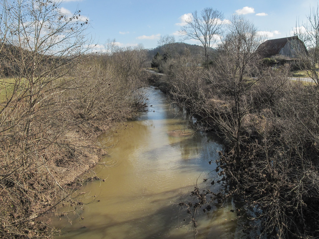
One look and you'll know why it's called Eighteenmile Creek.
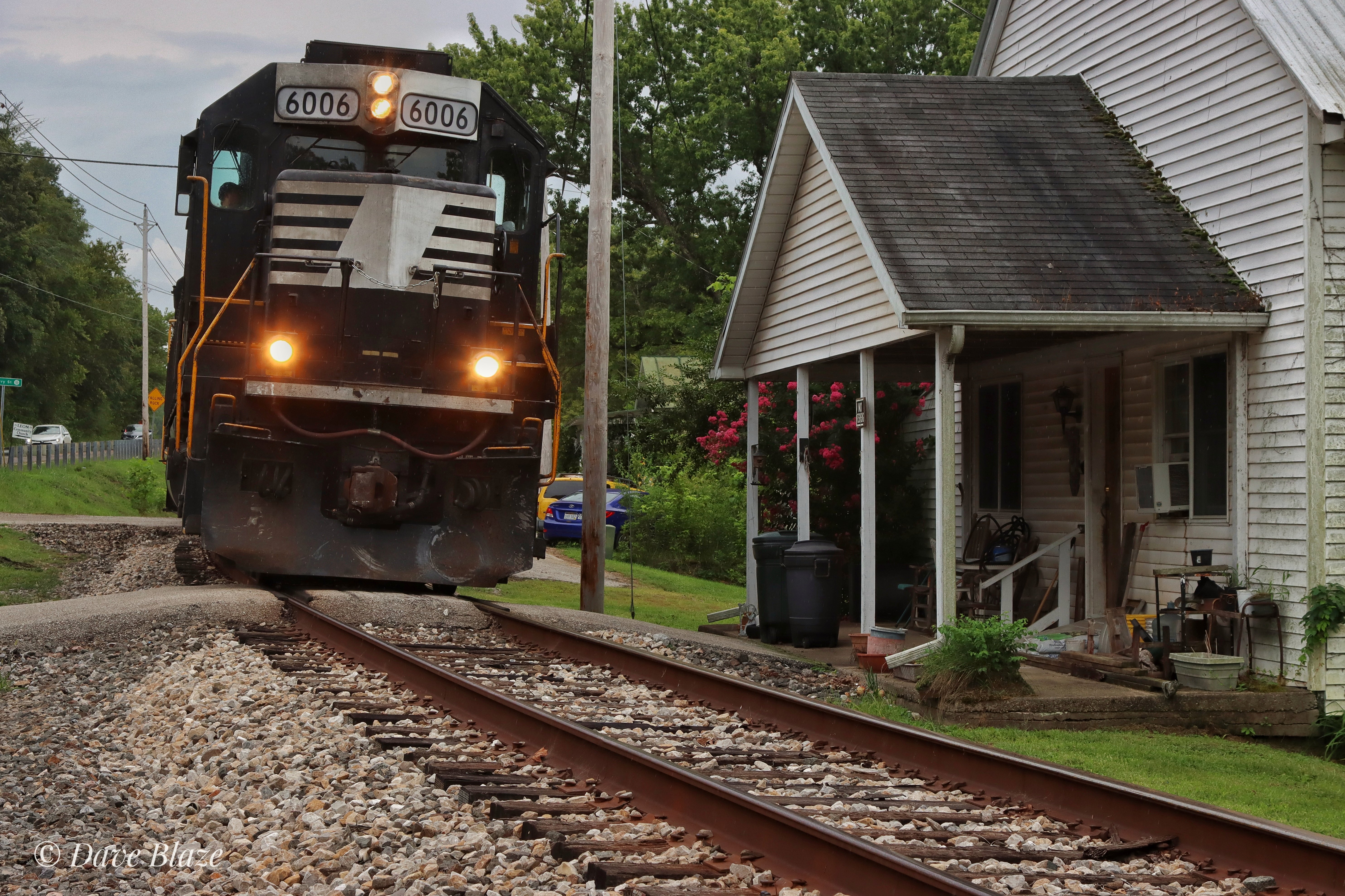
How's This For Close?!

West Virginia Railroading
Mapa de Cloverdale School (historical), Cabin Ridge Rd, Leon, WV, EE. UU.
Buscar otro lugar
Lugares cercanos
Tribble Rd, Leon, WV, EE. UU.
Tribble Rd, Leon, WV, EE. UU.
Union, WV, EE. UU.
Charleston Rd, Leon, WV, EE. UU.
Cologne, WV, EE. UU.
León, Virginia Occidental, EE. UU.
Southside, WV, EE. UU.
Charleston Rd, Leon, WV, EE. UU.
Hale Ln, Leon, WV, EE. UU.
Long Hollow Road, Long Hollow Rd, Western, WV, EE. UU.
Buffalo-Union, WV, EE. UU.
Condado de Mason, Virginia Occidental, EE. UU.
Bull Run, Ripley, WV, EE. UU.
Debbie Road, Debbie Rd, Cooper, WV, EE. UU.
Búfalo, Virginia Occidental, EE. UU.
Arbuckle, WV, EE. UU.
Railroad Ave, Buffalo, WV, EE. UU.
Given, WV, EE. UU.
Nash Ln, Buffalo, WV, EE. UU.
Western, WV, EE. UU.
Búsquedas recientes
- Horas de salida y puesta de sol de Red Dog Mine, AK, USA
- Horas de salida y puesta de sol de Am Bahnhof, Am bhf, Borken, Germany
- Horas de salida y puesta de sol de 4th St E, Sonoma, CA, EE. UU.
- Horas de salida y puesta de sol de Oakland Ave, Williamsport, PA, EE. UU.
- Horas de salida y puesta de sol de Via Roma, Pieranica CR, Italia
- Horas de salida y puesta de sol de Torre del reloj, Grad, Dubrovnik (Ragusa), Croacia
- Horas de salida y puesta de sol de Trelew, Chubut, Argentina
- Horas de salida y puesta de sol de Hartfords Bluff Cir, Mt Pleasant, SC, EE. UU.
- Horas de salida y puesta de sol de Kita Ward, Kumamoto, Japón
- Horas de salida y puesta de sol de Pingtan Island, Pingtan County, Fuzhou, China