Cahill Ln, Weiser, ID 美國的日出日落時間表
Location: 美國 > 愛達荷州 > 華盛頓縣 > ID 美國 >
時區:
America/Denver
當地時間:
2025-07-13 09:44:42
經度:
-116.8905474
緯度:
44.1670116
今天日出時間:
06:17:07 AM
今天日落時間:
09:29:46 PM
今天日照時長:
15h 12m 39s
明天日出時間:
06:17:59 AM
明天日落時間:
09:29:06 PM
明天日照時長:
15h 11m 7s
顯示所有日期
| 日期 | 日出 | 日落 | 日照時長 |
|---|---|---|---|
| 2025年01月01日 | 08:22:47 AM | 05:20:45 PM | 8h 57m 58s |
| 2025年01月02日 | 08:22:45 AM | 05:21:41 PM | 8h 58m 56s |
| 2025年01月03日 | 08:22:41 AM | 05:22:40 PM | 8h 59m 59s |
| 2025年01月04日 | 08:22:34 AM | 05:23:40 PM | 9h 1m 6s |
| 2025年01月05日 | 08:22:25 AM | 05:24:42 PM | 9h 2m 17s |
| 2025年01月06日 | 08:22:13 AM | 05:25:45 PM | 9h 3m 32s |
| 2025年01月07日 | 08:21:59 AM | 05:26:50 PM | 9h 4m 51s |
| 2025年01月08日 | 08:21:43 AM | 05:27:56 PM | 9h 6m 13s |
| 2025年01月09日 | 08:21:23 AM | 05:29:04 PM | 9h 7m 41s |
| 2025年01月10日 | 08:21:02 AM | 05:30:12 PM | 9h 9m 10s |
| 2025年01月11日 | 08:20:37 AM | 05:31:23 PM | 9h 10m 46s |
| 2025年01月12日 | 08:20:11 AM | 05:32:34 PM | 9h 12m 23s |
| 2025年01月13日 | 08:19:42 AM | 05:33:47 PM | 9h 14m 5s |
| 2025年01月14日 | 08:19:10 AM | 05:35:00 PM | 9h 15m 50s |
| 2025年01月15日 | 08:18:37 AM | 05:36:15 PM | 9h 17m 38s |
| 2025年01月16日 | 08:18:01 AM | 05:37:30 PM | 9h 19m 29s |
| 2025年01月17日 | 08:17:22 AM | 05:38:47 PM | 9h 21m 25s |
| 2025年01月18日 | 08:16:41 AM | 05:40:04 PM | 9h 23m 23s |
| 2025年01月19日 | 08:15:58 AM | 05:41:22 PM | 9h 25m 24s |
| 2025年01月20日 | 08:15:13 AM | 05:42:41 PM | 9h 27m 28s |
| 2025年01月21日 | 08:14:26 AM | 05:44:00 PM | 9h 29m 34s |
| 2025年01月22日 | 08:13:36 AM | 05:45:20 PM | 9h 31m 44s |
| 2025年01月23日 | 08:12:45 AM | 05:46:41 PM | 9h 33m 56s |
| 2025年01月24日 | 08:11:51 AM | 05:48:02 PM | 9h 36m 11s |
| 2025年01月25日 | 08:10:55 AM | 05:49:23 PM | 9h 38m 28s |
| 2025年01月26日 | 08:09:58 AM | 05:50:45 PM | 9h 40m 47s |
| 2025年01月27日 | 08:08:58 AM | 05:52:07 PM | 9h 43m 9s |
| 2025年01月28日 | 08:07:56 AM | 05:53:30 PM | 9h 45m 34s |
| 2025年01月29日 | 08:06:53 AM | 05:54:53 PM | 9h 48m 0s |
| 2025年01月30日 | 08:05:47 AM | 05:56:16 PM | 9h 50m 29s |
| 2025年01月31日 | 08:04:40 AM | 05:57:39 PM | 9h 52m 59s |
| 2025年02月01日 | 08:03:31 AM | 05:59:02 PM | 9h 55m 31s |
| 2025年02月02日 | 08:02:20 AM | 06:00:26 PM | 9h 58m 6s |
| 2025年02月03日 | 08:01:08 AM | 06:01:49 PM | 10h 0m 41s |
| 2025年02月04日 | 07:59:54 AM | 06:03:13 PM | 10h 3m 19s |
| 2025年02月05日 | 07:58:38 AM | 06:04:36 PM | 10h 5m 58s |
| 2025年02月06日 | 07:57:21 AM | 06:06:00 PM | 10h 8m 39s |
| 2025年02月07日 | 07:56:02 AM | 06:07:23 PM | 10h 11m 21s |
| 2025年02月08日 | 07:54:42 AM | 06:08:47 PM | 10h 14m 5s |
| 2025年02月09日 | 07:53:20 AM | 06:10:10 PM | 10h 16m 50s |
| 2025年02月10日 | 07:51:57 AM | 06:11:33 PM | 10h 19m 36s |
| 2025年02月11日 | 07:50:32 AM | 06:12:56 PM | 10h 22m 24s |
| 2025年02月12日 | 07:49:06 AM | 06:14:19 PM | 10h 25m 13s |
| 2025年02月13日 | 07:47:39 AM | 06:15:42 PM | 10h 28m 3s |
| 2025年02月14日 | 07:46:11 AM | 06:17:04 PM | 10h 30m 53s |
| 2025年02月15日 | 07:44:41 AM | 06:18:27 PM | 10h 33m 46s |
| 2025年02月16日 | 07:43:10 AM | 06:19:49 PM | 10h 36m 39s |
| 2025年02月17日 | 07:41:38 AM | 06:21:11 PM | 10h 39m 33s |
| 2025年02月18日 | 07:40:05 AM | 06:22:32 PM | 10h 42m 27s |
| 2025年02月19日 | 07:38:31 AM | 06:23:53 PM | 10h 45m 22s |
| 2025年02月20日 | 07:36:56 AM | 06:25:15 PM | 10h 48m 19s |
| 2025年02月21日 | 07:35:20 AM | 06:26:35 PM | 10h 51m 15s |
| 2025年02月22日 | 07:33:43 AM | 06:27:56 PM | 10h 54m 13s |
| 2025年02月23日 | 07:32:05 AM | 06:29:16 PM | 10h 57m 11s |
| 2025年02月24日 | 07:30:26 AM | 06:30:36 PM | 11h 0m 10s |
| 2025年02月25日 | 07:28:46 AM | 06:31:56 PM | 11h 3m 10s |
| 2025年02月26日 | 07:27:05 AM | 06:33:15 PM | 11h 6m 10s |
| 2025年02月27日 | 07:25:24 AM | 06:34:34 PM | 11h 9m 10s |
| 2025年02月28日 | 07:23:42 AM | 06:35:53 PM | 11h 12m 11s |
| 2025年03月01日 | 07:21:59 AM | 06:37:11 PM | 11h 15m 12s |
| 2025年03月02日 | 07:20:16 AM | 06:38:30 PM | 11h 18m 14s |
| 2025年03月03日 | 07:18:32 AM | 06:39:48 PM | 11h 21m 16s |
| 2025年03月04日 | 07:16:47 AM | 06:41:05 PM | 11h 24m 18s |
| 2025年03月05日 | 07:15:02 AM | 06:42:23 PM | 11h 27m 21s |
| 2025年03月06日 | 07:13:16 AM | 06:43:40 PM | 11h 30m 24s |
| 2025年03月07日 | 07:11:29 AM | 06:44:57 PM | 11h 33m 28s |
| 2025年03月08日 | 07:09:43 AM | 06:46:13 PM | 11h 36m 30s |
| 2025年03月09日 | 08:08:00 AM | 07:47:27 PM | 11h 39m 27s |
| 2025年03月10日 | 08:06:12 AM | 07:48:43 PM | 11h 42m 31s |
| 2025年03月11日 | 08:04:24 AM | 07:49:59 PM | 11h 45m 35s |
| 2025年03月12日 | 08:02:36 AM | 07:51:15 PM | 11h 48m 39s |
| 2025年03月13日 | 08:00:47 AM | 07:52:30 PM | 11h 51m 43s |
| 2025年03月14日 | 07:58:58 AM | 07:53:45 PM | 11h 54m 47s |
| 2025年03月15日 | 07:57:09 AM | 07:55:00 PM | 11h 57m 51s |
| 2025年03月16日 | 07:55:20 AM | 07:56:15 PM | 12h 0m 55s |
| 2025年03月17日 | 07:53:30 AM | 07:57:30 PM | 12h 4m 0s |
| 2025年03月18日 | 07:51:41 AM | 07:58:45 PM | 12h 7m 4s |
| 2025年03月19日 | 07:49:51 AM | 07:59:59 PM | 12h 10m 8s |
| 2025年03月20日 | 07:48:01 AM | 08:01:13 PM | 12h 13m 12s |
| 2025年03月21日 | 07:46:11 AM | 08:02:28 PM | 12h 16m 17s |
| 2025年03月22日 | 07:44:21 AM | 08:03:42 PM | 12h 19m 21s |
| 2025年03月23日 | 07:42:31 AM | 08:04:56 PM | 12h 22m 25s |
| 2025年03月24日 | 07:40:41 AM | 08:06:09 PM | 12h 25m 28s |
| 2025年03月25日 | 07:38:51 AM | 08:07:23 PM | 12h 28m 32s |
| 2025年03月26日 | 07:37:01 AM | 08:08:37 PM | 12h 31m 36s |
| 2025年03月27日 | 07:35:11 AM | 08:09:50 PM | 12h 34m 39s |
| 2025年03月28日 | 07:33:22 AM | 08:11:04 PM | 12h 37m 42s |
| 2025年03月29日 | 07:31:33 AM | 08:12:17 PM | 12h 40m 44s |
| 2025年03月30日 | 07:29:43 AM | 08:13:30 PM | 12h 43m 47s |
| 2025年03月31日 | 07:27:54 AM | 08:14:44 PM | 12h 46m 50s |
| 2025年04月01日 | 07:26:06 AM | 08:15:57 PM | 12h 49m 51s |
| 2025年04月02日 | 07:24:18 AM | 08:17:10 PM | 12h 52m 52s |
| 2025年04月03日 | 07:22:30 AM | 08:18:23 PM | 12h 55m 53s |
| 2025年04月04日 | 07:20:42 AM | 08:19:36 PM | 12h 58m 54s |
| 2025年04月05日 | 07:18:55 AM | 08:20:50 PM | 13h 1m 55s |
| 2025年04月06日 | 07:17:08 AM | 08:22:03 PM | 13h 4m 55s |
| 2025年04月07日 | 07:15:22 AM | 08:23:16 PM | 13h 7m 54s |
| 2025年04月08日 | 07:13:36 AM | 08:24:29 PM | 13h 10m 53s |
| 2025年04月09日 | 07:11:51 AM | 08:25:42 PM | 13h 13m 51s |
| 2025年04月10日 | 07:10:06 AM | 08:26:55 PM | 13h 16m 49s |
| 2025年04月11日 | 07:08:22 AM | 08:28:08 PM | 13h 19m 46s |
| 2025年04月12日 | 07:06:39 AM | 08:29:22 PM | 13h 22m 43s |
| 2025年04月13日 | 07:04:56 AM | 08:30:35 PM | 13h 25m 39s |
| 2025年04月14日 | 07:03:14 AM | 08:31:48 PM | 13h 28m 34s |
| 2025年04月15日 | 07:01:32 AM | 08:33:01 PM | 13h 31m 29s |
| 2025年04月16日 | 06:59:52 AM | 08:34:14 PM | 13h 34m 22s |
| 2025年04月17日 | 06:58:12 AM | 08:35:27 PM | 13h 37m 15s |
| 2025年04月18日 | 06:56:33 AM | 08:36:40 PM | 13h 40m 7s |
| 2025年04月19日 | 06:54:55 AM | 08:37:53 PM | 13h 42m 58s |
| 2025年04月20日 | 06:53:18 AM | 08:39:06 PM | 13h 45m 48s |
| 2025年04月21日 | 06:51:41 AM | 08:40:19 PM | 13h 48m 38s |
| 2025年04月22日 | 06:50:06 AM | 08:41:32 PM | 13h 51m 26s |
| 2025年04月23日 | 06:48:32 AM | 08:42:45 PM | 13h 54m 13s |
| 2025年04月24日 | 06:46:58 AM | 08:43:58 PM | 13h 57m 0s |
| 2025年04月25日 | 06:45:26 AM | 08:45:11 PM | 13h 59m 45s |
| 2025年04月26日 | 06:43:55 AM | 08:46:23 PM | 14h 2m 28s |
| 2025年04月27日 | 06:42:25 AM | 08:47:36 PM | 14h 5m 11s |
| 2025年04月28日 | 06:40:56 AM | 08:48:48 PM | 14h 7m 52s |
| 2025年04月29日 | 06:39:29 AM | 08:50:00 PM | 14h 10m 31s |
| 2025年04月30日 | 06:38:02 AM | 08:51:12 PM | 14h 13m 10s |
| 2025年05月01日 | 06:36:37 AM | 08:52:24 PM | 14h 15m 47s |
| 2025年05月02日 | 06:35:13 AM | 08:53:36 PM | 14h 18m 23s |
| 2025年05月03日 | 06:33:51 AM | 08:54:47 PM | 14h 20m 56s |
| 2025年05月04日 | 06:32:30 AM | 08:55:58 PM | 14h 23m 28s |
| 2025年05月05日 | 06:31:10 AM | 08:57:09 PM | 14h 25m 59s |
| 2025年05月06日 | 06:29:52 AM | 08:58:19 PM | 14h 28m 27s |
| 2025年05月07日 | 06:28:35 AM | 08:59:29 PM | 14h 30m 54s |
| 2025年05月08日 | 06:27:20 AM | 09:00:39 PM | 14h 33m 19s |
| 2025年05月09日 | 06:26:07 AM | 09:01:49 PM | 14h 35m 42s |
| 2025年05月10日 | 06:24:55 AM | 09:02:57 PM | 14h 38m 2s |
| 2025年05月11日 | 06:23:44 AM | 09:04:06 PM | 14h 40m 22s |
| 2025年05月12日 | 06:22:36 AM | 09:05:14 PM | 14h 42m 38s |
| 2025年05月13日 | 06:21:29 AM | 09:06:21 PM | 14h 44m 52s |
| 2025年05月14日 | 06:20:23 AM | 09:07:28 PM | 14h 47m 5s |
| 2025年05月15日 | 06:19:20 AM | 09:08:34 PM | 14h 49m 14s |
| 2025年05月16日 | 06:18:18 AM | 09:09:39 PM | 14h 51m 21s |
| 2025年05月17日 | 06:17:18 AM | 09:10:44 PM | 14h 53m 26s |
| 2025年05月18日 | 06:16:20 AM | 09:11:48 PM | 14h 55m 28s |
| 2025年05月19日 | 06:15:24 AM | 09:12:51 PM | 14h 57m 27s |
| 2025年05月20日 | 06:14:30 AM | 09:13:53 PM | 14h 59m 23s |
| 2025年05月21日 | 06:13:38 AM | 09:14:54 PM | 15h 1m 16s |
| 2025年05月22日 | 06:12:47 AM | 09:15:55 PM | 15h 3m 8s |
| 2025年05月23日 | 06:11:59 AM | 09:16:54 PM | 15h 4m 55s |
| 2025年05月24日 | 06:11:13 AM | 09:17:53 PM | 15h 6m 40s |
| 2025年05月25日 | 06:10:29 AM | 09:18:50 PM | 15h 8m 21s |
| 2025年05月26日 | 06:09:47 AM | 09:19:46 PM | 15h 9m 59s |
| 2025年05月27日 | 06:09:07 AM | 09:20:41 PM | 15h 11m 34s |
| 2025年05月28日 | 06:08:29 AM | 09:21:35 PM | 15h 13m 6s |
| 2025年05月29日 | 06:07:53 AM | 09:22:27 PM | 15h 14m 34s |
| 2025年05月30日 | 06:07:19 AM | 09:23:18 PM | 15h 15m 59s |
| 2025年05月31日 | 06:06:48 AM | 09:24:08 PM | 15h 17m 20s |
| 2025年06月01日 | 06:06:19 AM | 09:24:57 PM | 15h 18m 38s |
| 2025年06月02日 | 06:05:52 AM | 09:25:43 PM | 15h 19m 51s |
| 2025年06月03日 | 06:05:27 AM | 09:26:29 PM | 15h 21m 2s |
| 2025年06月04日 | 06:05:05 AM | 09:27:13 PM | 15h 22m 8s |
| 2025年06月05日 | 06:04:44 AM | 09:27:55 PM | 15h 23m 11s |
| 2025年06月06日 | 06:04:26 AM | 09:28:35 PM | 15h 24m 9s |
| 2025年06月07日 | 06:04:10 AM | 09:29:14 PM | 15h 25m 4s |
| 2025年06月08日 | 06:03:57 AM | 09:29:51 PM | 15h 25m 54s |
| 2025年06月09日 | 06:03:46 AM | 09:30:26 PM | 15h 26m 40s |
| 2025年06月10日 | 06:03:37 AM | 09:31:00 PM | 15h 27m 23s |
| 2025年06月11日 | 06:03:30 AM | 09:31:31 PM | 15h 28m 1s |
| 2025年06月12日 | 06:03:25 AM | 09:32:01 PM | 15h 28m 36s |
| 2025年06月13日 | 06:03:23 AM | 09:32:29 PM | 15h 29m 6s |
| 2025年06月14日 | 06:03:23 AM | 09:32:54 PM | 15h 29m 31s |
| 2025年06月15日 | 06:03:25 AM | 09:33:18 PM | 15h 29m 53s |
| 2025年06月16日 | 06:03:30 AM | 09:33:40 PM | 15h 30m 10s |
| 2025年06月17日 | 06:03:36 AM | 09:33:59 PM | 15h 30m 23s |
| 2025年06月18日 | 06:03:45 AM | 09:34:17 PM | 15h 30m 32s |
| 2025年06月19日 | 06:03:56 AM | 09:34:32 PM | 15h 30m 36s |
| 2025年06月20日 | 06:04:09 AM | 09:34:45 PM | 15h 30m 36s |
| 2025年06月21日 | 06:04:24 AM | 09:34:56 PM | 15h 30m 32s |
| 2025年06月22日 | 06:04:41 AM | 09:35:05 PM | 15h 30m 24s |
| 2025年06月23日 | 06:05:00 AM | 09:35:11 PM | 15h 30m 11s |
| 2025年06月24日 | 06:05:22 AM | 09:35:15 PM | 15h 29m 53s |
| 2025年06月25日 | 06:05:45 AM | 09:35:17 PM | 15h 29m 32s |
| 2025年06月26日 | 06:06:10 AM | 09:35:17 PM | 15h 29m 7s |
| 2025年06月27日 | 06:06:37 AM | 09:35:15 PM | 15h 28m 38s |
| 2025年06月28日 | 06:07:06 AM | 09:35:10 PM | 15h 28m 4s |
| 2025年06月29日 | 06:07:37 AM | 09:35:03 PM | 15h 27m 26s |
| 2025年06月30日 | 06:08:10 AM | 09:34:53 PM | 15h 26m 43s |
| 2025年07月01日 | 06:08:44 AM | 09:34:41 PM | 15h 25m 57s |
| 2025年07月02日 | 06:09:20 AM | 09:34:27 PM | 15h 25m 7s |
| 2025年07月03日 | 06:09:58 AM | 09:34:11 PM | 15h 24m 13s |
| 2025年07月04日 | 06:10:37 AM | 09:33:52 PM | 15h 23m 15s |
| 2025年07月05日 | 06:11:18 AM | 09:33:31 PM | 15h 22m 13s |
| 2025年07月06日 | 06:12:01 AM | 09:33:08 PM | 15h 21m 7s |
| 2025年07月07日 | 06:12:45 AM | 09:32:43 PM | 15h 19m 58s |
| 2025年07月08日 | 06:13:30 AM | 09:32:15 PM | 15h 18m 45s |
| 2025年07月09日 | 06:14:17 AM | 09:31:45 PM | 15h 17m 28s |
| 2025年07月10日 | 06:15:05 AM | 09:31:13 PM | 15h 16m 8s |
| 2025年07月11日 | 06:15:55 AM | 09:30:38 PM | 15h 14m 43s |
| 2025年07月12日 | 06:16:45 AM | 09:30:02 PM | 15h 13m 17s |
| 2025年07月13日 | 06:17:37 AM | 09:29:23 PM | 15h 11m 46s |
| 2025年07月14日 | 06:18:30 AM | 09:28:42 PM | 15h 10m 12s |
| 2025年07月15日 | 06:19:24 AM | 09:27:59 PM | 15h 8m 35s |
| 2025年07月16日 | 06:20:20 AM | 09:27:14 PM | 15h 6m 54s |
| 2025年07月17日 | 06:21:16 AM | 09:26:27 PM | 15h 5m 11s |
| 2025年07月18日 | 06:22:13 AM | 09:25:37 PM | 15h 3m 24s |
| 2025年07月19日 | 06:23:11 AM | 09:24:46 PM | 15h 1m 35s |
| 2025年07月20日 | 06:24:10 AM | 09:23:53 PM | 14h 59m 43s |
| 2025年07月21日 | 06:25:10 AM | 09:22:57 PM | 14h 57m 47s |
| 2025年07月22日 | 06:26:11 AM | 09:22:00 PM | 14h 55m 49s |
| 2025年07月23日 | 06:27:12 AM | 09:21:01 PM | 14h 53m 49s |
| 2025年07月24日 | 06:28:14 AM | 09:20:00 PM | 14h 51m 46s |
| 2025年07月25日 | 06:29:17 AM | 09:18:57 PM | 14h 49m 40s |
| 2025年07月26日 | 06:30:20 AM | 09:17:53 PM | 14h 47m 33s |
| 2025年07月27日 | 06:31:24 AM | 09:16:46 PM | 14h 45m 22s |
| 2025年07月28日 | 06:32:28 AM | 09:15:38 PM | 14h 43m 10s |
| 2025年07月29日 | 06:33:33 AM | 09:14:28 PM | 14h 40m 55s |
| 2025年07月30日 | 06:34:38 AM | 09:13:16 PM | 14h 38m 38s |
| 2025年07月31日 | 06:35:44 AM | 09:12:03 PM | 14h 36m 19s |
| 2025年08月01日 | 06:36:50 AM | 09:10:48 PM | 14h 33m 58s |
| 2025年08月02日 | 06:37:57 AM | 09:09:32 PM | 14h 31m 35s |
| 2025年08月03日 | 06:39:03 AM | 09:08:14 PM | 14h 29m 11s |
| 2025年08月04日 | 06:40:11 AM | 09:06:55 PM | 14h 26m 44s |
| 2025年08月05日 | 06:41:18 AM | 09:05:34 PM | 14h 24m 16s |
| 2025年08月06日 | 06:42:26 AM | 09:04:12 PM | 14h 21m 46s |
| 2025年08月07日 | 06:43:33 AM | 09:02:48 PM | 14h 19m 15s |
| 2025年08月08日 | 06:44:41 AM | 09:01:23 PM | 14h 16m 42s |
| 2025年08月09日 | 06:45:50 AM | 08:59:57 PM | 14h 14m 7s |
| 2025年08月10日 | 06:46:58 AM | 08:58:29 PM | 14h 11m 31s |
| 2025年08月11日 | 06:48:07 AM | 08:57:00 PM | 14h 8m 53s |
| 2025年08月12日 | 06:49:15 AM | 08:55:30 PM | 14h 6m 15s |
| 2025年08月13日 | 06:50:24 AM | 08:53:59 PM | 14h 3m 35s |
| 2025年08月14日 | 06:51:33 AM | 08:52:26 PM | 14h 0m 53s |
| 2025年08月15日 | 06:52:41 AM | 08:50:52 PM | 13h 58m 11s |
| 2025年08月16日 | 06:53:50 AM | 08:49:18 PM | 13h 55m 28s |
| 2025年08月17日 | 06:54:59 AM | 08:47:42 PM | 13h 52m 43s |
| 2025年08月18日 | 06:56:08 AM | 08:46:05 PM | 13h 49m 57s |
| 2025年08月19日 | 06:57:17 AM | 08:44:28 PM | 13h 47m 11s |
| 2025年08月20日 | 06:58:26 AM | 08:42:49 PM | 13h 44m 23s |
| 2025年08月21日 | 06:59:35 AM | 08:41:10 PM | 13h 41m 35s |
| 2025年08月22日 | 07:00:44 AM | 08:39:29 PM | 13h 38m 45s |
| 2025年08月23日 | 07:01:53 AM | 08:37:48 PM | 13h 35m 55s |
| 2025年08月24日 | 07:03:02 AM | 08:36:06 PM | 13h 33m 4s |
| 2025年08月25日 | 07:04:10 AM | 08:34:23 PM | 13h 30m 13s |
| 2025年08月26日 | 07:05:19 AM | 08:32:40 PM | 13h 27m 21s |
| 2025年08月27日 | 07:06:28 AM | 08:30:55 PM | 13h 24m 27s |
| 2025年08月28日 | 07:07:37 AM | 08:29:10 PM | 13h 21m 33s |
| 2025年08月29日 | 07:08:46 AM | 08:27:25 PM | 13h 18m 39s |
| 2025年08月30日 | 07:09:54 AM | 08:25:39 PM | 13h 15m 45s |
| 2025年08月31日 | 07:11:03 AM | 08:23:52 PM | 13h 12m 49s |
| 2025年09月01日 | 07:12:12 AM | 08:22:05 PM | 13h 9m 53s |
| 2025年09月02日 | 07:13:20 AM | 08:20:17 PM | 13h 6m 57s |
| 2025年09月03日 | 07:14:29 AM | 08:18:28 PM | 13h 3m 59s |
| 2025年09月04日 | 07:15:37 AM | 08:16:40 PM | 13h 1m 3s |
| 2025年09月05日 | 07:16:46 AM | 08:14:50 PM | 12h 58m 4s |
| 2025年09月06日 | 07:17:55 AM | 08:13:01 PM | 12h 55m 6s |
| 2025年09月07日 | 07:19:03 AM | 08:11:11 PM | 12h 52m 8s |
| 2025年09月08日 | 07:20:12 AM | 08:09:21 PM | 12h 49m 9s |
| 2025年09月09日 | 07:21:20 AM | 08:07:30 PM | 12h 46m 10s |
| 2025年09月10日 | 07:22:29 AM | 08:05:39 PM | 12h 43m 10s |
| 2025年09月11日 | 07:23:38 AM | 08:03:48 PM | 12h 40m 10s |
| 2025年09月12日 | 07:24:46 AM | 08:01:57 PM | 12h 37m 11s |
| 2025年09月13日 | 07:25:55 AM | 08:00:05 PM | 12h 34m 10s |
| 2025年09月14日 | 07:27:04 AM | 07:58:13 PM | 12h 31m 9s |
| 2025年09月15日 | 07:28:13 AM | 07:56:22 PM | 12h 28m 9s |
| 2025年09月16日 | 07:29:22 AM | 07:54:30 PM | 12h 25m 8s |
| 2025年09月17日 | 07:30:31 AM | 07:52:38 PM | 12h 22m 7s |
| 2025年09月18日 | 07:31:40 AM | 07:50:46 PM | 12h 19m 6s |
| 2025年09月19日 | 07:32:49 AM | 07:48:54 PM | 12h 16m 5s |
| 2025年09月20日 | 07:33:59 AM | 07:47:02 PM | 12h 13m 3s |
| 2025年09月21日 | 07:35:08 AM | 07:45:10 PM | 12h 10m 2s |
| 2025年09月22日 | 07:36:18 AM | 07:43:18 PM | 12h 7m 0s |
| 2025年09月23日 | 07:37:28 AM | 07:41:27 PM | 12h 3m 59s |
| 2025年09月24日 | 07:38:37 AM | 07:39:35 PM | 12h 0m 58s |
| 2025年09月25日 | 07:39:48 AM | 07:37:44 PM | 11h 57m 56s |
| 2025年09月26日 | 07:40:58 AM | 07:35:53 PM | 11h 54m 55s |
| 2025年09月27日 | 07:42:09 AM | 07:34:02 PM | 11h 51m 53s |
| 2025年09月28日 | 07:43:19 AM | 07:32:11 PM | 11h 48m 52s |
| 2025年09月29日 | 07:44:30 AM | 07:30:21 PM | 11h 45m 51s |
| 2025年09月30日 | 07:45:41 AM | 07:28:31 PM | 11h 42m 50s |
| 2025年10月01日 | 07:46:53 AM | 07:26:41 PM | 11h 39m 48s |
| 2025年10月02日 | 07:48:04 AM | 07:24:52 PM | 11h 36m 48s |
| 2025年10月03日 | 07:49:16 AM | 07:23:03 PM | 11h 33m 47s |
| 2025年10月04日 | 07:50:29 AM | 07:21:15 PM | 11h 30m 46s |
| 2025年10月05日 | 07:51:41 AM | 07:19:27 PM | 11h 27m 46s |
| 2025年10月06日 | 07:52:54 AM | 07:17:40 PM | 11h 24m 46s |
| 2025年10月07日 | 07:54:07 AM | 07:15:53 PM | 11h 21m 46s |
| 2025年10月08日 | 07:55:20 AM | 07:14:07 PM | 11h 18m 47s |
| 2025年10月09日 | 07:56:34 AM | 07:12:22 PM | 11h 15m 48s |
| 2025年10月10日 | 07:57:48 AM | 07:10:37 PM | 11h 12m 49s |
| 2025年10月11日 | 07:59:02 AM | 07:08:53 PM | 11h 9m 51s |
| 2025年10月12日 | 08:00:16 AM | 07:07:09 PM | 11h 6m 53s |
| 2025年10月13日 | 08:01:31 AM | 07:05:26 PM | 11h 3m 55s |
| 2025年10月14日 | 08:02:46 AM | 07:03:44 PM | 11h 0m 58s |
| 2025年10月15日 | 08:04:02 AM | 07:02:03 PM | 10h 58m 1s |
| 2025年10月16日 | 08:05:17 AM | 07:00:23 PM | 10h 55m 6s |
| 2025年10月17日 | 08:06:33 AM | 06:58:44 PM | 10h 52m 11s |
| 2025年10月18日 | 08:07:50 AM | 06:57:05 PM | 10h 49m 15s |
| 2025年10月19日 | 08:09:06 AM | 06:55:28 PM | 10h 46m 22s |
| 2025年10月20日 | 08:10:23 AM | 06:53:52 PM | 10h 43m 29s |
| 2025年10月21日 | 08:11:41 AM | 06:52:16 PM | 10h 40m 35s |
| 2025年10月22日 | 08:12:58 AM | 06:50:42 PM | 10h 37m 44s |
| 2025年10月23日 | 08:14:16 AM | 06:49:09 PM | 10h 34m 53s |
| 2025年10月24日 | 08:15:34 AM | 06:47:37 PM | 10h 32m 3s |
| 2025年10月25日 | 08:16:52 AM | 06:46:06 PM | 10h 29m 14s |
| 2025年10月26日 | 08:18:11 AM | 06:44:36 PM | 10h 26m 25s |
| 2025年10月27日 | 08:19:30 AM | 06:43:08 PM | 10h 23m 38s |
| 2025年10月28日 | 08:20:49 AM | 06:41:41 PM | 10h 20m 52s |
| 2025年10月29日 | 08:22:08 AM | 06:40:15 PM | 10h 18m 7s |
| 2025年10月30日 | 08:23:27 AM | 06:38:51 PM | 10h 15m 24s |
| 2025年10月31日 | 08:24:47 AM | 06:37:28 PM | 10h 12m 41s |
| 2025年11月01日 | 08:26:07 AM | 06:36:07 PM | 10h 10m 0s |
| 2025年11月02日 | 07:27:30 AM | 05:34:44 PM | 10h 7m 14s |
| 2025年11月03日 | 07:28:50 AM | 05:33:25 PM | 10h 4m 35s |
| 2025年11月04日 | 07:30:10 AM | 05:32:09 PM | 10h 1m 59s |
| 2025年11月05日 | 07:31:30 AM | 05:30:54 PM | 9h 59m 24s |
| 2025年11月06日 | 07:32:50 AM | 05:29:40 PM | 9h 56m 50s |
| 2025年11月07日 | 07:34:10 AM | 05:28:29 PM | 9h 54m 19s |
| 2025年11月08日 | 07:35:30 AM | 05:27:19 PM | 9h 51m 49s |
| 2025年11月09日 | 07:36:50 AM | 05:26:11 PM | 9h 49m 21s |
| 2025年11月10日 | 07:38:09 AM | 05:25:04 PM | 9h 46m 55s |
| 2025年11月11日 | 07:39:29 AM | 05:24:00 PM | 9h 44m 31s |
| 2025年11月12日 | 07:40:48 AM | 05:22:57 PM | 9h 42m 9s |
| 2025年11月13日 | 07:42:07 AM | 05:21:57 PM | 9h 39m 50s |
| 2025年11月14日 | 07:43:26 AM | 05:20:58 PM | 9h 37m 32s |
| 2025年11月15日 | 07:44:45 AM | 05:20:02 PM | 9h 35m 17s |
| 2025年11月16日 | 07:46:03 AM | 05:19:07 PM | 9h 33m 4s |
| 2025年11月17日 | 07:47:20 AM | 05:18:15 PM | 9h 30m 55s |
| 2025年11月18日 | 07:48:38 AM | 05:17:24 PM | 9h 28m 46s |
| 2025年11月19日 | 07:49:54 AM | 05:16:36 PM | 9h 26m 42s |
| 2025年11月20日 | 07:51:10 AM | 05:15:50 PM | 9h 24m 40s |
| 2025年11月21日 | 07:52:26 AM | 05:15:07 PM | 9h 22m 41s |
| 2025年11月22日 | 07:53:40 AM | 05:14:25 PM | 9h 20m 45s |
| 2025年11月23日 | 07:54:54 AM | 05:13:46 PM | 9h 18m 52s |
| 2025年11月24日 | 07:56:07 AM | 05:13:10 PM | 9h 17m 3s |
| 2025年11月25日 | 07:57:19 AM | 05:12:35 PM | 9h 15m 16s |
| 2025年11月26日 | 07:58:31 AM | 05:12:03 PM | 9h 13m 32s |
| 2025年11月27日 | 07:59:41 AM | 05:11:34 PM | 9h 11m 53s |
| 2025年11月28日 | 08:00:50 AM | 05:11:07 PM | 9h 10m 17s |
| 2025年11月29日 | 08:01:58 AM | 05:10:42 PM | 9h 8m 44s |
| 2025年11月30日 | 08:03:05 AM | 05:10:20 PM | 9h 7m 15s |
| 2025年12月01日 | 08:04:11 AM | 05:10:00 PM | 9h 5m 49s |
| 2025年12月02日 | 08:05:15 AM | 05:09:43 PM | 9h 4m 28s |
| 2025年12月03日 | 08:06:18 AM | 05:09:29 PM | 9h 3m 11s |
| 2025年12月04日 | 08:07:20 AM | 05:09:17 PM | 9h 1m 57s |
| 2025年12月05日 | 08:08:20 AM | 05:09:07 PM | 9h 0m 47s |
| 2025年12月06日 | 08:09:18 AM | 05:09:00 PM | 8h 59m 42s |
| 2025年12月07日 | 08:10:15 AM | 05:08:56 PM | 8h 58m 41s |
| 2025年12月08日 | 08:11:11 AM | 05:08:54 PM | 8h 57m 43s |
| 2025年12月09日 | 08:12:04 AM | 05:08:55 PM | 8h 56m 51s |
| 2025年12月10日 | 08:12:56 AM | 05:08:59 PM | 8h 56m 3s |
| 2025年12月11日 | 08:13:46 AM | 05:09:05 PM | 8h 55m 19s |
| 2025年12月12日 | 08:14:34 AM | 05:09:13 PM | 8h 54m 39s |
| 2025年12月13日 | 08:15:20 AM | 05:09:25 PM | 8h 54m 5s |
| 2025年12月14日 | 08:16:04 AM | 05:09:38 PM | 8h 53m 34s |
| 2025年12月15日 | 08:16:46 AM | 05:09:55 PM | 8h 53m 9s |
| 2025年12月16日 | 08:17:25 AM | 05:10:13 PM | 8h 52m 48s |
| 2025年12月17日 | 08:18:03 AM | 05:10:35 PM | 8h 52m 32s |
| 2025年12月18日 | 08:18:39 AM | 05:10:58 PM | 8h 52m 19s |
| 2025年12月19日 | 08:19:12 AM | 05:11:25 PM | 8h 52m 13s |
| 2025年12月20日 | 08:19:43 AM | 05:11:53 PM | 8h 52m 10s |
| 2025年12月21日 | 08:20:11 AM | 05:12:24 PM | 8h 52m 13s |
| 2025年12月22日 | 08:20:38 AM | 05:12:58 PM | 8h 52m 20s |
| 2025年12月23日 | 08:21:02 AM | 05:13:33 PM | 8h 52m 31s |
| 2025年12月24日 | 08:21:23 AM | 05:14:11 PM | 8h 52m 48s |
| 2025年12月25日 | 08:21:42 AM | 05:14:51 PM | 8h 53m 9s |
| 2025年12月26日 | 08:21:59 AM | 05:15:34 PM | 8h 53m 35s |
| 2025年12月27日 | 08:22:13 AM | 05:16:18 PM | 8h 54m 5s |
| 2025年12月28日 | 08:22:25 AM | 05:17:05 PM | 8h 54m 40s |
| 2025年12月29日 | 08:22:34 AM | 05:17:53 PM | 8h 55m 19s |
| 2025年12月30日 | 08:22:41 AM | 05:18:44 PM | 8h 56m 3s |
| 2025年12月31日 | 08:22:45 AM | 05:19:37 PM | 8h 56m 52s |
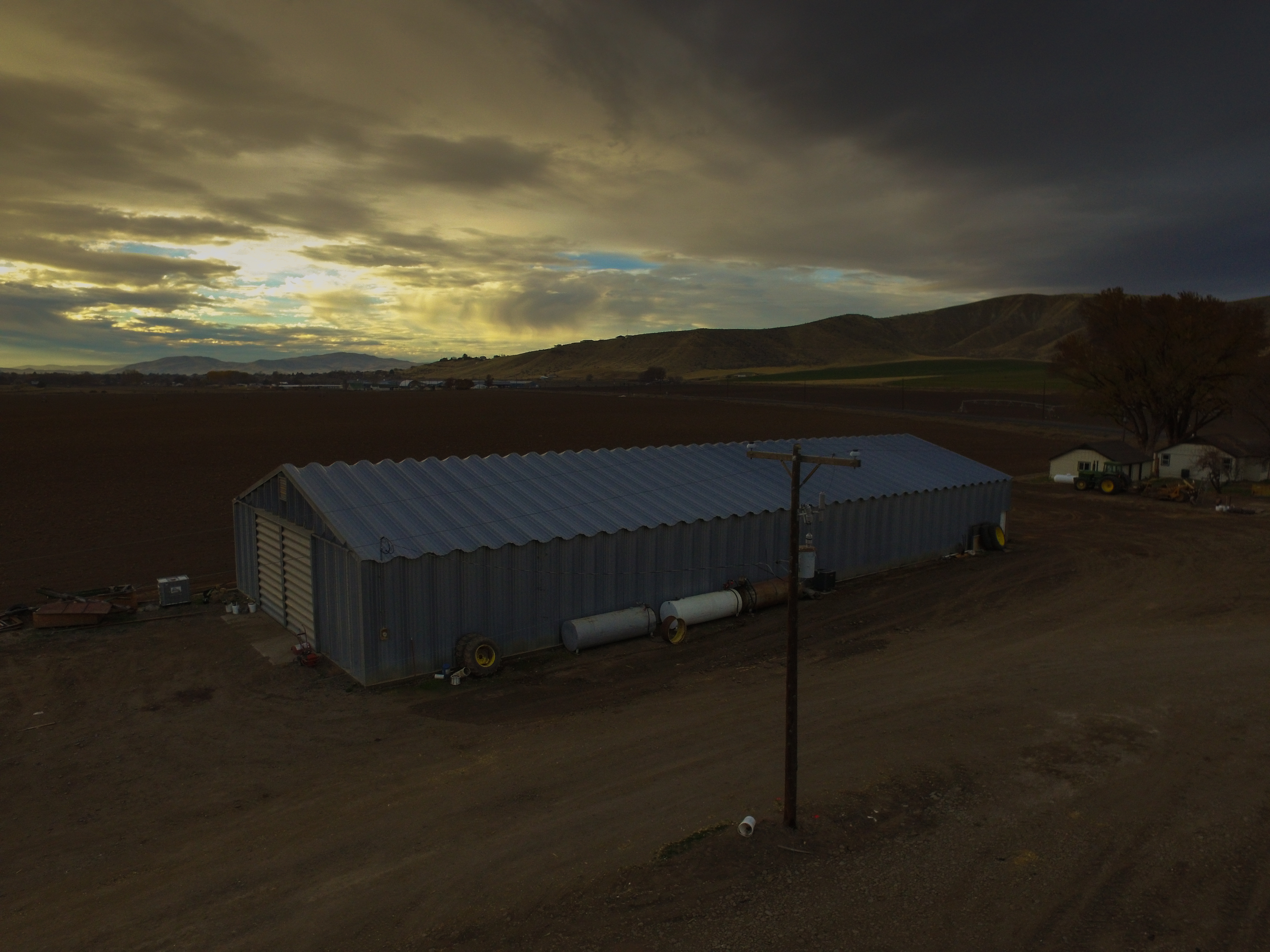
日出日落照片
Indianhead Rd, Weiser, ID #3

DSC_2341 (1)

#roadtripping home to Utah and after a couple of stops for the kids, ended up catching the #sunset from the perfect #viewpoint #pnw #oregon #exploreoregon

DSC_2604 (1)

Indianhead Rd, Weiser, ID #1

Indianhead Rd, Weiser, ID #2

DSC_2381 (2)

DSC_2381 (7)

DSC_2381 (8)

DSC_2381 (5)

DSC_2381 (4)

DSC_2381 (1)

DSC_2604 (2)
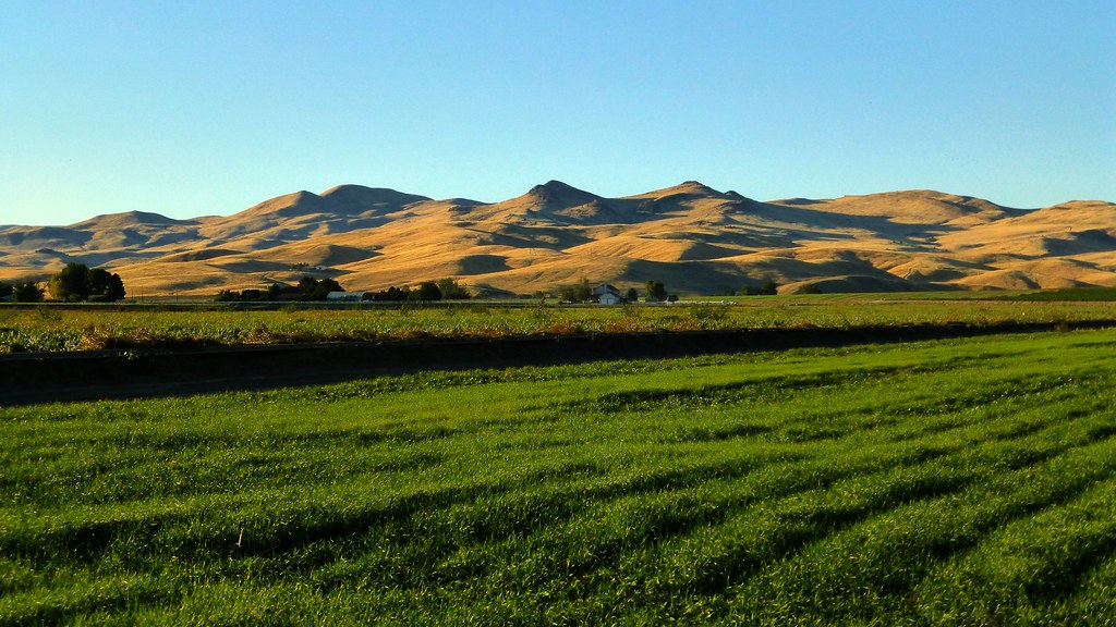
Barn at Sunset
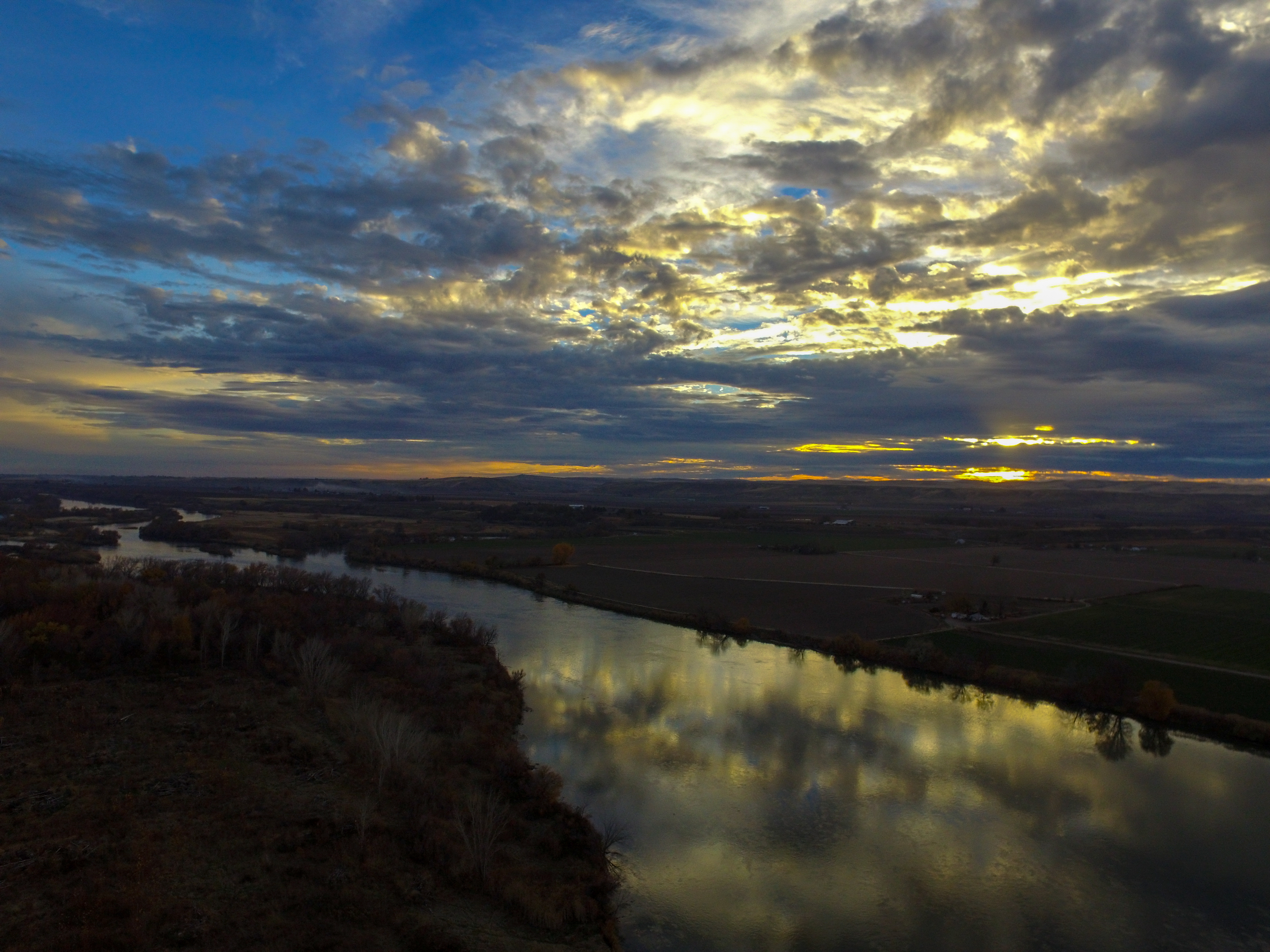
Snake River Sunset

DSC_2381 (6)

DSC_2381 (3)

DSC_2342 (1)
Cahill Ln, Weiser, ID 美國的地圖
搜索其他地方的日出日落時間
附近地點
River Rd, Payette, ID 美國
N 6th St, Payette, ID 美國
Manser Dr, Payette, ID 美國
Payette, ID 美國
Hyline Rd, Ontario, OR 美國
Weiser, ID 美國
W 7th St, Weiser, ID 美國
NW 16th St, Fruitland, ID 美國
NW 11th St, Ontario, OR 美國
SE 1st Ave, Ontario, OR 美國Southeast 1st Avenue
Ontario, OR 美國
Spring Creek Ln, Fruitland, ID 美國
W 1st St, Fruitland, ID 美國
Fruitland, ID 美國
SW 4th St, Fruitland, ID 美國
Ontario Heights Rd, Ontario, OR 美國
SW 2nd St, Ontario, OR 美國
SW 4th Ave, Ontario, OR 美國Idaho Elks Hearing and Balance Center: Ontario
57 NW 16th St, Ontario, OR 美國
River Bend Ln, Weiser, ID 美國
最近搜索
- Red Dog Mine, AK, USA的日出日落時間表
- Am bhf, Borken, 德國Am Bahnhof的日出日落時間表
- 4th St E, Sonoma, CA 美國的日出日落時間表
- Oakland Ave, Williamsport, PA 美國的日出日落時間表
- Via Roma, Pieranica CR, 義大利的日出日落時間表
- 克羅埃西亞杜布羅夫尼克 GradClock Tower of Dubrovnik的日出日落時間表
- 阿根廷丘布特省特雷利烏的日出日落時間表
- Hartfords Bluff Cir, Mt Pleasant, SC 美國的日出日落時間表
- 日本熊本縣熊本市北區的日出日落時間表
- 中國福州市平潭縣平潭島的日出日落時間表