Sunrise Sunset Times of Valley View Ranchettes, AZ, USA
Location: United States > Arizona > Maricopa County > Tonopah >
Timezone:
America/Phoenix
Current Time:
2025-06-23 19:27:15
Longitude:
-112.8239574
Latitude:
33.462211
Sunrise Today:
05:22:52 AM
Sunset Today:
07:44:58 PM
Daylength Today:
14h 22m 6s
Sunrise Tomorrow:
05:23:11 AM
Sunset Tomorrow:
07:45:05 PM
Daylength Tomorrow:
14h 21m 54s
Year Show All Dates
| Date | Sunrise | Sunset | Daylength |
|---|---|---|---|
| 01/01/2025 | 07:35:34 AM | 05:35:25 PM | 9h 59m 51s |
| 01/02/2025 | 07:35:43 AM | 05:36:11 PM | 10h 0m 28s |
| 01/03/2025 | 07:35:50 AM | 05:36:58 PM | 10h 1m 8s |
| 01/04/2025 | 07:35:55 AM | 05:37:47 PM | 10h 1m 52s |
| 01/05/2025 | 07:35:58 AM | 05:38:36 PM | 10h 2m 38s |
| 01/06/2025 | 07:35:59 AM | 05:39:26 PM | 10h 3m 27s |
| 01/07/2025 | 07:35:59 AM | 05:40:17 PM | 10h 4m 18s |
| 01/08/2025 | 07:35:57 AM | 05:41:09 PM | 10h 5m 12s |
| 01/09/2025 | 07:35:53 AM | 05:42:02 PM | 10h 6m 9s |
| 01/10/2025 | 07:35:47 AM | 05:42:55 PM | 10h 7m 8s |
| 01/11/2025 | 07:35:39 AM | 05:43:49 PM | 10h 8m 10s |
| 01/12/2025 | 07:35:30 AM | 05:44:43 PM | 10h 9m 13s |
| 01/13/2025 | 07:35:18 AM | 05:45:38 PM | 10h 10m 20s |
| 01/14/2025 | 07:35:05 AM | 05:46:33 PM | 10h 11m 28s |
| 01/15/2025 | 07:34:50 AM | 05:47:29 PM | 10h 12m 39s |
| 01/16/2025 | 07:34:33 AM | 05:48:25 PM | 10h 13m 52s |
| 01/17/2025 | 07:34:14 AM | 05:49:22 PM | 10h 15m 8s |
| 01/18/2025 | 07:33:54 AM | 05:50:19 PM | 10h 16m 25s |
| 01/19/2025 | 07:33:32 AM | 05:51:16 PM | 10h 17m 44s |
| 01/20/2025 | 07:33:08 AM | 05:52:14 PM | 10h 19m 6s |
| 01/21/2025 | 07:32:42 AM | 05:53:11 PM | 10h 20m 29s |
| 01/22/2025 | 07:32:15 AM | 05:54:09 PM | 10h 21m 54s |
| 01/23/2025 | 07:31:46 AM | 05:55:07 PM | 10h 23m 21s |
| 01/24/2025 | 07:31:15 AM | 05:56:05 PM | 10h 24m 50s |
| 01/25/2025 | 07:30:43 AM | 05:57:04 PM | 10h 26m 21s |
| 01/26/2025 | 07:30:08 AM | 05:58:02 PM | 10h 27m 54s |
| 01/27/2025 | 07:29:33 AM | 05:59:00 PM | 10h 29m 27s |
| 01/28/2025 | 07:28:55 AM | 05:59:58 PM | 10h 31m 3s |
| 01/29/2025 | 07:28:17 AM | 06:00:56 PM | 10h 32m 39s |
| 01/30/2025 | 07:27:36 AM | 06:01:54 PM | 10h 34m 18s |
| 01/31/2025 | 07:26:54 AM | 06:02:52 PM | 10h 35m 58s |
| 02/01/2025 | 07:26:11 AM | 06:03:50 PM | 10h 37m 39s |
| 02/02/2025 | 07:25:26 AM | 06:04:48 PM | 10h 39m 22s |
| 02/03/2025 | 07:24:39 AM | 06:05:45 PM | 10h 41m 6s |
| 02/04/2025 | 07:23:52 AM | 06:06:43 PM | 10h 42m 51s |
| 02/05/2025 | 07:23:03 AM | 06:07:40 PM | 10h 44m 37s |
| 02/06/2025 | 07:22:12 AM | 06:08:37 PM | 10h 46m 25s |
| 02/07/2025 | 07:21:20 AM | 06:09:33 PM | 10h 48m 13s |
| 02/08/2025 | 07:20:27 AM | 06:10:29 PM | 10h 50m 2s |
| 02/09/2025 | 07:19:32 AM | 06:11:25 PM | 10h 51m 53s |
| 02/10/2025 | 07:18:37 AM | 06:12:21 PM | 10h 53m 44s |
| 02/11/2025 | 07:17:40 AM | 06:13:17 PM | 10h 55m 37s |
| 02/12/2025 | 07:16:42 AM | 06:14:12 PM | 10h 57m 30s |
| 02/13/2025 | 07:15:42 AM | 06:15:07 PM | 10h 59m 25s |
| 02/14/2025 | 07:14:42 AM | 06:16:01 PM | 11h 1m 19s |
| 02/15/2025 | 07:13:41 AM | 06:16:55 PM | 11h 3m 14s |
| 02/16/2025 | 07:12:38 AM | 06:17:49 PM | 11h 5m 11s |
| 02/17/2025 | 07:11:35 AM | 06:18:42 PM | 11h 7m 7s |
| 02/18/2025 | 07:10:30 AM | 06:19:36 PM | 11h 9m 6s |
| 02/19/2025 | 07:09:24 AM | 06:20:28 PM | 11h 11m 4s |
| 02/20/2025 | 07:08:18 AM | 06:21:21 PM | 11h 13m 3s |
| 02/21/2025 | 07:07:10 AM | 06:22:13 PM | 11h 15m 3s |
| 02/22/2025 | 07:06:02 AM | 06:23:05 PM | 11h 17m 3s |
| 02/23/2025 | 07:04:53 AM | 06:23:56 PM | 11h 19m 3s |
| 02/24/2025 | 07:03:43 AM | 06:24:47 PM | 11h 21m 4s |
| 02/25/2025 | 07:02:32 AM | 06:25:38 PM | 11h 23m 6s |
| 02/26/2025 | 07:01:21 AM | 06:26:28 PM | 11h 25m 7s |
| 02/27/2025 | 07:00:09 AM | 06:27:18 PM | 11h 27m 9s |
| 02/28/2025 | 06:58:56 AM | 06:28:07 PM | 11h 29m 11s |
| 03/01/2025 | 06:57:42 AM | 06:28:57 PM | 11h 31m 15s |
| 03/02/2025 | 06:56:28 AM | 06:29:46 PM | 11h 33m 18s |
| 03/03/2025 | 06:55:13 AM | 06:30:35 PM | 11h 35m 22s |
| 03/04/2025 | 06:53:58 AM | 06:31:23 PM | 11h 37m 25s |
| 03/05/2025 | 06:52:42 AM | 06:32:11 PM | 11h 39m 29s |
| 03/06/2025 | 06:51:25 AM | 06:32:59 PM | 11h 41m 34s |
| 03/07/2025 | 06:50:08 AM | 06:33:46 PM | 11h 43m 38s |
| 03/08/2025 | 06:48:51 AM | 06:34:34 PM | 11h 45m 43s |
| 03/09/2025 | 06:47:33 AM | 06:35:21 PM | 11h 47m 48s |
| 03/10/2025 | 06:46:15 AM | 06:36:07 PM | 11h 49m 52s |
| 03/11/2025 | 06:44:56 AM | 06:36:54 PM | 11h 51m 58s |
| 03/12/2025 | 06:43:38 AM | 06:37:40 PM | 11h 54m 2s |
| 03/13/2025 | 06:42:18 AM | 06:38:26 PM | 11h 56m 8s |
| 03/14/2025 | 06:40:59 AM | 06:39:12 PM | 11h 58m 13s |
| 03/15/2025 | 06:39:39 AM | 06:39:58 PM | 12h 0m 19s |
| 03/16/2025 | 06:38:19 AM | 06:40:43 PM | 12h 2m 24s |
| 03/17/2025 | 06:36:59 AM | 06:41:28 PM | 12h 4m 29s |
| 03/18/2025 | 06:35:39 AM | 06:42:13 PM | 12h 6m 34s |
| 03/19/2025 | 06:34:19 AM | 06:42:58 PM | 12h 8m 39s |
| 03/20/2025 | 06:32:58 AM | 06:43:43 PM | 12h 10m 45s |
| 03/21/2025 | 06:31:37 AM | 06:44:28 PM | 12h 12m 51s |
| 03/22/2025 | 06:30:17 AM | 06:45:13 PM | 12h 14m 56s |
| 03/23/2025 | 06:28:56 AM | 06:45:57 PM | 12h 17m 1s |
| 03/24/2025 | 06:27:36 AM | 06:46:41 PM | 12h 19m 5s |
| 03/25/2025 | 06:26:15 AM | 06:47:26 PM | 12h 21m 11s |
| 03/26/2025 | 06:24:55 AM | 06:48:10 PM | 12h 23m 15s |
| 03/27/2025 | 06:23:34 AM | 06:48:54 PM | 12h 25m 20s |
| 03/28/2025 | 06:22:14 AM | 06:49:38 PM | 12h 27m 24s |
| 03/29/2025 | 06:20:54 AM | 06:50:22 PM | 12h 29m 28s |
| 03/30/2025 | 06:19:34 AM | 06:51:07 PM | 12h 31m 33s |
| 03/31/2025 | 06:18:14 AM | 06:51:51 PM | 12h 33m 37s |
| 04/01/2025 | 06:16:55 AM | 06:52:35 PM | 12h 35m 40s |
| 04/02/2025 | 06:15:36 AM | 06:53:19 PM | 12h 37m 43s |
| 04/03/2025 | 06:14:17 AM | 06:54:03 PM | 12h 39m 46s |
| 04/04/2025 | 06:12:59 AM | 06:54:47 PM | 12h 41m 48s |
| 04/05/2025 | 06:11:41 AM | 06:55:31 PM | 12h 43m 50s |
| 04/06/2025 | 06:10:23 AM | 06:56:15 PM | 12h 45m 52s |
| 04/07/2025 | 06:09:06 AM | 06:56:59 PM | 12h 47m 53s |
| 04/08/2025 | 06:07:49 AM | 06:57:43 PM | 12h 49m 54s |
| 04/09/2025 | 06:06:32 AM | 06:58:28 PM | 12h 51m 56s |
| 04/10/2025 | 06:05:16 AM | 06:59:12 PM | 12h 53m 56s |
| 04/11/2025 | 06:04:01 AM | 06:59:57 PM | 12h 55m 56s |
| 04/12/2025 | 06:02:46 AM | 07:00:41 PM | 12h 57m 55s |
| 04/13/2025 | 06:01:32 AM | 07:01:26 PM | 12h 59m 54s |
| 04/14/2025 | 06:00:19 AM | 07:02:10 PM | 13h 1m 51s |
| 04/15/2025 | 05:59:06 AM | 07:02:55 PM | 13h 3m 49s |
| 04/16/2025 | 05:57:53 AM | 07:03:40 PM | 13h 5m 47s |
| 04/17/2025 | 05:56:42 AM | 07:04:25 PM | 13h 7m 43s |
| 04/18/2025 | 05:55:31 AM | 07:05:10 PM | 13h 9m 39s |
| 04/19/2025 | 05:54:21 AM | 07:05:55 PM | 13h 11m 34s |
| 04/20/2025 | 05:53:12 AM | 07:06:40 PM | 13h 13m 28s |
| 04/21/2025 | 05:52:03 AM | 07:07:25 PM | 13h 15m 22s |
| 04/22/2025 | 05:50:56 AM | 07:08:10 PM | 13h 17m 14s |
| 04/23/2025 | 05:49:49 AM | 07:08:55 PM | 13h 19m 6s |
| 04/24/2025 | 05:48:43 AM | 07:09:41 PM | 13h 20m 58s |
| 04/25/2025 | 05:47:38 AM | 07:10:26 PM | 13h 22m 48s |
| 04/26/2025 | 05:46:34 AM | 07:11:12 PM | 13h 24m 38s |
| 04/27/2025 | 05:45:31 AM | 07:11:57 PM | 13h 26m 26s |
| 04/28/2025 | 05:44:29 AM | 07:12:43 PM | 13h 28m 14s |
| 04/29/2025 | 05:43:28 AM | 07:13:28 PM | 13h 30m 0s |
| 04/30/2025 | 05:42:28 AM | 07:14:14 PM | 13h 31m 46s |
| 05/01/2025 | 05:41:29 AM | 07:15:00 PM | 13h 33m 31s |
| 05/02/2025 | 05:40:32 AM | 07:15:45 PM | 13h 35m 13s |
| 05/03/2025 | 05:39:35 AM | 07:16:31 PM | 13h 36m 56s |
| 05/04/2025 | 05:38:39 AM | 07:17:16 PM | 13h 38m 37s |
| 05/05/2025 | 05:37:45 AM | 07:18:02 PM | 13h 40m 17s |
| 05/06/2025 | 05:36:52 AM | 07:18:47 PM | 13h 41m 55s |
| 05/07/2025 | 05:36:00 AM | 07:19:32 PM | 13h 43m 32s |
| 05/08/2025 | 05:35:10 AM | 07:20:18 PM | 13h 45m 8s |
| 05/09/2025 | 05:34:20 AM | 07:21:03 PM | 13h 46m 43s |
| 05/10/2025 | 05:33:32 AM | 07:21:48 PM | 13h 48m 16s |
| 05/11/2025 | 05:32:46 AM | 07:22:32 PM | 13h 49m 46s |
| 05/12/2025 | 05:32:00 AM | 07:23:17 PM | 13h 51m 17s |
| 05/13/2025 | 05:31:16 AM | 07:24:01 PM | 13h 52m 45s |
| 05/14/2025 | 05:30:34 AM | 07:24:45 PM | 13h 54m 11s |
| 05/15/2025 | 05:29:52 AM | 07:25:29 PM | 13h 55m 37s |
| 05/16/2025 | 05:29:13 AM | 07:26:13 PM | 13h 57m 0s |
| 05/17/2025 | 05:28:34 AM | 07:26:56 PM | 13h 58m 22s |
| 05/18/2025 | 05:27:57 AM | 07:27:39 PM | 13h 59m 42s |
| 05/19/2025 | 05:27:22 AM | 07:28:21 PM | 14h 0m 59s |
| 05/20/2025 | 05:26:48 AM | 07:29:03 PM | 14h 2m 15s |
| 05/21/2025 | 05:26:15 AM | 07:29:45 PM | 14h 3m 30s |
| 05/22/2025 | 05:25:44 AM | 07:30:26 PM | 14h 4m 42s |
| 05/23/2025 | 05:25:15 AM | 07:31:07 PM | 14h 5m 52s |
| 05/24/2025 | 05:24:47 AM | 07:31:47 PM | 14h 7m 0s |
| 05/25/2025 | 05:24:21 AM | 07:32:26 PM | 14h 8m 5s |
| 05/26/2025 | 05:23:56 AM | 07:33:05 PM | 14h 9m 9s |
| 05/27/2025 | 05:23:32 AM | 07:33:44 PM | 14h 10m 12s |
| 05/28/2025 | 05:23:11 AM | 07:34:21 PM | 14h 11m 10s |
| 05/29/2025 | 05:22:51 AM | 07:34:58 PM | 14h 12m 7s |
| 05/30/2025 | 05:22:32 AM | 07:35:34 PM | 14h 13m 2s |
| 05/31/2025 | 05:22:15 AM | 07:36:10 PM | 14h 13m 55s |
| 06/01/2025 | 05:21:59 AM | 07:36:44 PM | 14h 14m 45s |
| 06/02/2025 | 05:21:46 AM | 07:37:18 PM | 14h 15m 32s |
| 06/03/2025 | 05:21:33 AM | 07:37:51 PM | 14h 16m 18s |
| 06/04/2025 | 05:21:23 AM | 07:38:23 PM | 14h 17m 0s |
| 06/05/2025 | 05:21:13 AM | 07:38:54 PM | 14h 17m 41s |
| 06/06/2025 | 05:21:06 AM | 07:39:24 PM | 14h 18m 18s |
| 06/07/2025 | 05:21:00 AM | 07:39:53 PM | 14h 18m 53s |
| 06/08/2025 | 05:20:55 AM | 07:40:21 PM | 14h 19m 26s |
| 06/09/2025 | 05:20:52 AM | 07:40:48 PM | 14h 19m 56s |
| 06/10/2025 | 05:20:51 AM | 07:41:14 PM | 14h 20m 23s |
| 06/11/2025 | 05:20:51 AM | 07:41:39 PM | 14h 20m 48s |
| 06/12/2025 | 05:20:53 AM | 07:42:02 PM | 14h 21m 9s |
| 06/13/2025 | 05:20:56 AM | 07:42:25 PM | 14h 21m 29s |
| 06/14/2025 | 05:21:01 AM | 07:42:46 PM | 14h 21m 45s |
| 06/15/2025 | 05:21:07 AM | 07:43:06 PM | 14h 21m 59s |
| 06/16/2025 | 05:21:14 AM | 07:43:24 PM | 14h 22m 10s |
| 06/17/2025 | 05:21:23 AM | 07:43:41 PM | 14h 22m 18s |
| 06/18/2025 | 05:21:33 AM | 07:43:57 PM | 14h 22m 24s |
| 06/19/2025 | 05:21:45 AM | 07:44:11 PM | 14h 22m 26s |
| 06/20/2025 | 05:21:58 AM | 07:44:25 PM | 14h 22m 27s |
| 06/21/2025 | 05:22:13 AM | 07:44:36 PM | 14h 22m 23s |
| 06/22/2025 | 05:22:28 AM | 07:44:46 PM | 14h 22m 18s |
| 06/23/2025 | 05:22:45 AM | 07:44:55 PM | 14h 22m 10s |
| 06/24/2025 | 05:23:04 AM | 07:45:02 PM | 14h 21m 58s |
| 06/25/2025 | 05:23:23 AM | 07:45:08 PM | 14h 21m 45s |
| 06/26/2025 | 05:23:44 AM | 07:45:12 PM | 14h 21m 28s |
| 06/27/2025 | 05:24:06 AM | 07:45:15 PM | 14h 21m 9s |
| 06/28/2025 | 05:24:29 AM | 07:45:16 PM | 14h 20m 47s |
| 06/29/2025 | 05:24:53 AM | 07:45:16 PM | 14h 20m 23s |
| 06/30/2025 | 05:25:18 AM | 07:45:14 PM | 14h 19m 56s |
| 07/01/2025 | 05:25:44 AM | 07:45:10 PM | 14h 19m 26s |
| 07/02/2025 | 05:26:11 AM | 07:45:05 PM | 14h 18m 54s |
| 07/03/2025 | 05:26:39 AM | 07:44:58 PM | 14h 18m 19s |
| 07/04/2025 | 05:27:08 AM | 07:44:50 PM | 14h 17m 42s |
| 07/05/2025 | 05:27:38 AM | 07:44:40 PM | 14h 17m 2s |
| 07/06/2025 | 05:28:09 AM | 07:44:28 PM | 14h 16m 19s |
| 07/07/2025 | 05:28:41 AM | 07:44:15 PM | 14h 15m 34s |
| 07/08/2025 | 05:29:14 AM | 07:44:00 PM | 14h 14m 46s |
| 07/09/2025 | 05:29:47 AM | 07:43:44 PM | 14h 13m 57s |
| 07/10/2025 | 05:30:21 AM | 07:43:26 PM | 14h 13m 5s |
| 07/11/2025 | 05:30:56 AM | 07:43:06 PM | 14h 12m 10s |
| 07/12/2025 | 05:31:31 AM | 07:42:45 PM | 14h 11m 14s |
| 07/13/2025 | 05:32:07 AM | 07:42:22 PM | 14h 10m 15s |
| 07/14/2025 | 05:32:44 AM | 07:41:57 PM | 14h 9m 13s |
| 07/15/2025 | 05:33:21 AM | 07:41:31 PM | 14h 8m 10s |
| 07/16/2025 | 05:33:58 AM | 07:41:03 PM | 14h 7m 5s |
| 07/17/2025 | 05:34:37 AM | 07:40:34 PM | 14h 5m 57s |
| 07/18/2025 | 05:35:15 AM | 07:40:03 PM | 14h 4m 48s |
| 07/19/2025 | 05:35:54 AM | 07:39:31 PM | 14h 3m 37s |
| 07/20/2025 | 05:36:34 AM | 07:38:57 PM | 14h 2m 23s |
| 07/21/2025 | 05:37:14 AM | 07:38:22 PM | 14h 1m 8s |
| 07/22/2025 | 05:37:54 AM | 07:37:45 PM | 13h 59m 51s |
| 07/23/2025 | 05:38:35 AM | 07:37:07 PM | 13h 58m 32s |
| 07/24/2025 | 05:39:15 AM | 07:36:27 PM | 13h 57m 12s |
| 07/25/2025 | 05:39:56 AM | 07:35:45 PM | 13h 55m 49s |
| 07/26/2025 | 05:40:38 AM | 07:35:03 PM | 13h 54m 25s |
| 07/27/2025 | 05:41:19 AM | 07:34:18 PM | 13h 52m 59s |
| 07/28/2025 | 05:42:01 AM | 07:33:33 PM | 13h 51m 32s |
| 07/29/2025 | 05:42:43 AM | 07:32:46 PM | 13h 50m 3s |
| 07/30/2025 | 05:43:25 AM | 07:31:58 PM | 13h 48m 33s |
| 07/31/2025 | 05:44:07 AM | 07:31:08 PM | 13h 47m 1s |
| 08/01/2025 | 05:44:49 AM | 07:30:17 PM | 13h 45m 28s |
| 08/02/2025 | 05:45:31 AM | 07:29:25 PM | 13h 43m 54s |
| 08/03/2025 | 05:46:14 AM | 07:28:32 PM | 13h 42m 18s |
| 08/04/2025 | 05:46:56 AM | 07:27:37 PM | 13h 40m 41s |
| 08/05/2025 | 05:47:39 AM | 07:26:41 PM | 13h 39m 2s |
| 08/06/2025 | 05:48:21 AM | 07:25:44 PM | 13h 37m 23s |
| 08/07/2025 | 05:49:03 AM | 07:24:45 PM | 13h 35m 42s |
| 08/08/2025 | 05:49:46 AM | 07:23:46 PM | 13h 34m 0s |
| 08/09/2025 | 05:50:28 AM | 07:22:45 PM | 13h 32m 17s |
| 08/10/2025 | 05:51:11 AM | 07:21:44 PM | 13h 30m 33s |
| 08/11/2025 | 05:51:53 AM | 07:20:41 PM | 13h 28m 48s |
| 08/12/2025 | 05:52:35 AM | 07:19:37 PM | 13h 27m 2s |
| 08/13/2025 | 05:53:17 AM | 07:18:33 PM | 13h 25m 16s |
| 08/14/2025 | 05:53:59 AM | 07:17:27 PM | 13h 23m 28s |
| 08/15/2025 | 05:54:41 AM | 07:16:20 PM | 13h 21m 39s |
| 08/16/2025 | 05:55:23 AM | 07:15:12 PM | 13h 19m 49s |
| 08/17/2025 | 05:56:05 AM | 07:14:04 PM | 13h 17m 59s |
| 08/18/2025 | 05:56:46 AM | 07:12:54 PM | 13h 16m 8s |
| 08/19/2025 | 05:57:28 AM | 07:11:44 PM | 13h 14m 16s |
| 08/20/2025 | 05:58:09 AM | 07:10:33 PM | 13h 12m 24s |
| 08/21/2025 | 05:58:51 AM | 07:09:21 PM | 13h 10m 30s |
| 08/22/2025 | 05:59:32 AM | 07:08:08 PM | 13h 8m 36s |
| 08/23/2025 | 06:00:13 AM | 07:06:55 PM | 13h 6m 42s |
| 08/24/2025 | 06:00:54 AM | 07:05:41 PM | 13h 4m 47s |
| 08/25/2025 | 06:01:35 AM | 07:04:26 PM | 13h 2m 51s |
| 08/26/2025 | 06:02:16 AM | 07:03:10 PM | 13h 0m 54s |
| 08/27/2025 | 06:02:56 AM | 07:01:54 PM | 12h 58m 58s |
| 08/28/2025 | 06:03:37 AM | 07:00:37 PM | 12h 57m 0s |
| 08/29/2025 | 06:04:17 AM | 06:59:20 PM | 12h 55m 3s |
| 08/30/2025 | 06:04:58 AM | 06:58:02 PM | 12h 53m 4s |
| 08/31/2025 | 06:05:38 AM | 06:56:44 PM | 12h 51m 6s |
| 09/01/2025 | 06:06:18 AM | 06:55:25 PM | 12h 49m 7s |
| 09/02/2025 | 06:06:58 AM | 06:54:06 PM | 12h 47m 8s |
| 09/03/2025 | 06:07:38 AM | 06:52:46 PM | 12h 45m 8s |
| 09/04/2025 | 06:08:18 AM | 06:51:25 PM | 12h 43m 7s |
| 09/05/2025 | 06:08:58 AM | 06:50:05 PM | 12h 41m 7s |
| 09/06/2025 | 06:09:38 AM | 06:48:44 PM | 12h 39m 6s |
| 09/07/2025 | 06:10:18 AM | 06:47:23 PM | 12h 37m 5s |
| 09/08/2025 | 06:10:58 AM | 06:46:01 PM | 12h 35m 3s |
| 09/09/2025 | 06:11:38 AM | 06:44:39 PM | 12h 33m 1s |
| 09/10/2025 | 06:12:18 AM | 06:43:17 PM | 12h 30m 59s |
| 09/11/2025 | 06:12:57 AM | 06:41:55 PM | 12h 28m 58s |
| 09/12/2025 | 06:13:37 AM | 06:40:32 PM | 12h 26m 55s |
| 09/13/2025 | 06:14:17 AM | 06:39:10 PM | 12h 24m 53s |
| 09/14/2025 | 06:14:57 AM | 06:37:47 PM | 12h 22m 50s |
| 09/15/2025 | 06:15:37 AM | 06:36:24 PM | 12h 20m 47s |
| 09/16/2025 | 06:16:17 AM | 06:35:01 PM | 12h 18m 44s |
| 09/17/2025 | 06:16:57 AM | 06:33:38 PM | 12h 16m 41s |
| 09/18/2025 | 06:17:37 AM | 06:32:15 PM | 12h 14m 38s |
| 09/19/2025 | 06:18:18 AM | 06:30:52 PM | 12h 12m 34s |
| 09/20/2025 | 06:18:58 AM | 06:29:29 PM | 12h 10m 31s |
| 09/21/2025 | 06:19:39 AM | 06:28:06 PM | 12h 8m 27s |
| 09/22/2025 | 06:20:19 AM | 06:26:44 PM | 12h 6m 25s |
| 09/23/2025 | 06:21:00 AM | 06:25:21 PM | 12h 4m 21s |
| 09/24/2025 | 06:21:41 AM | 06:23:59 PM | 12h 2m 18s |
| 09/25/2025 | 06:22:22 AM | 06:22:36 PM | 12h 0m 14s |
| 09/26/2025 | 06:23:03 AM | 06:21:14 PM | 11h 58m 11s |
| 09/27/2025 | 06:23:45 AM | 06:19:52 PM | 11h 56m 7s |
| 09/28/2025 | 06:24:27 AM | 06:18:31 PM | 11h 54m 4s |
| 09/29/2025 | 06:25:09 AM | 06:17:09 PM | 11h 52m 0s |
| 09/30/2025 | 06:25:51 AM | 06:15:48 PM | 11h 49m 57s |
| 10/01/2025 | 06:26:33 AM | 06:14:28 PM | 11h 47m 55s |
| 10/02/2025 | 06:27:16 AM | 06:13:08 PM | 11h 45m 52s |
| 10/03/2025 | 06:27:59 AM | 06:11:48 PM | 11h 43m 49s |
| 10/04/2025 | 06:28:42 AM | 06:10:28 PM | 11h 41m 46s |
| 10/05/2025 | 06:29:26 AM | 06:09:09 PM | 11h 39m 43s |
| 10/06/2025 | 06:30:10 AM | 06:07:51 PM | 11h 37m 41s |
| 10/07/2025 | 06:30:54 AM | 06:06:33 PM | 11h 35m 39s |
| 10/08/2025 | 06:31:38 AM | 06:05:16 PM | 11h 33m 38s |
| 10/09/2025 | 06:32:23 AM | 06:03:59 PM | 11h 31m 36s |
| 10/10/2025 | 06:33:08 AM | 06:02:43 PM | 11h 29m 35s |
| 10/11/2025 | 06:33:54 AM | 06:01:28 PM | 11h 27m 34s |
| 10/12/2025 | 06:34:39 AM | 06:00:13 PM | 11h 25m 34s |
| 10/13/2025 | 06:35:26 AM | 05:58:59 PM | 11h 23m 33s |
| 10/14/2025 | 06:36:12 AM | 05:57:46 PM | 11h 21m 34s |
| 10/15/2025 | 06:36:59 AM | 05:56:33 PM | 11h 19m 34s |
| 10/16/2025 | 06:37:46 AM | 05:55:22 PM | 11h 17m 36s |
| 10/17/2025 | 06:38:34 AM | 05:54:11 PM | 11h 15m 37s |
| 10/18/2025 | 06:39:22 AM | 05:53:01 PM | 11h 13m 39s |
| 10/19/2025 | 06:40:10 AM | 05:51:52 PM | 11h 11m 42s |
| 10/20/2025 | 06:40:59 AM | 05:50:44 PM | 11h 9m 45s |
| 10/21/2025 | 06:41:48 AM | 05:49:36 PM | 11h 7m 48s |
| 10/22/2025 | 06:42:37 AM | 05:48:30 PM | 11h 5m 53s |
| 10/23/2025 | 06:43:27 AM | 05:47:25 PM | 11h 3m 58s |
| 10/24/2025 | 06:44:18 AM | 05:46:21 PM | 11h 2m 3s |
| 10/25/2025 | 06:45:08 AM | 05:45:18 PM | 11h 0m 10s |
| 10/26/2025 | 06:45:59 AM | 05:44:16 PM | 10h 58m 17s |
| 10/27/2025 | 06:46:51 AM | 05:43:15 PM | 10h 56m 24s |
| 10/28/2025 | 06:47:42 AM | 05:42:15 PM | 10h 54m 33s |
| 10/29/2025 | 06:48:34 AM | 05:41:17 PM | 10h 52m 43s |
| 10/30/2025 | 06:49:27 AM | 05:40:20 PM | 10h 50m 53s |
| 10/31/2025 | 06:50:19 AM | 05:39:24 PM | 10h 49m 5s |
| 11/01/2025 | 06:51:12 AM | 05:38:29 PM | 10h 47m 17s |
| 11/02/2025 | 06:52:06 AM | 05:37:36 PM | 10h 45m 30s |
| 11/03/2025 | 06:52:59 AM | 05:36:44 PM | 10h 43m 45s |
| 11/04/2025 | 06:53:53 AM | 05:35:53 PM | 10h 42m 0s |
| 11/05/2025 | 06:54:48 AM | 05:35:04 PM | 10h 40m 16s |
| 11/06/2025 | 06:55:42 AM | 05:34:16 PM | 10h 38m 34s |
| 11/07/2025 | 06:56:37 AM | 05:33:30 PM | 10h 36m 53s |
| 11/08/2025 | 06:57:31 AM | 05:32:45 PM | 10h 35m 14s |
| 11/09/2025 | 06:58:26 AM | 05:32:02 PM | 10h 33m 36s |
| 11/10/2025 | 06:59:21 AM | 05:31:20 PM | 10h 31m 59s |
| 11/11/2025 | 07:00:17 AM | 05:30:40 PM | 10h 30m 23s |
| 11/12/2025 | 07:01:12 AM | 05:30:01 PM | 10h 28m 49s |
| 11/13/2025 | 07:02:08 AM | 05:29:24 PM | 10h 27m 16s |
| 11/14/2025 | 07:03:03 AM | 05:28:49 PM | 10h 25m 46s |
| 11/15/2025 | 07:03:59 AM | 05:28:16 PM | 10h 24m 17s |
| 11/16/2025 | 07:04:54 AM | 05:27:44 PM | 10h 22m 50s |
| 11/17/2025 | 07:05:50 AM | 05:27:13 PM | 10h 21m 23s |
| 11/18/2025 | 07:06:45 AM | 05:26:45 PM | 10h 20m 0s |
| 11/19/2025 | 07:07:40 AM | 05:26:18 PM | 10h 18m 38s |
| 11/20/2025 | 07:08:35 AM | 05:25:53 PM | 10h 17m 18s |
| 11/21/2025 | 07:09:30 AM | 05:25:30 PM | 10h 16m 0s |
| 11/22/2025 | 07:10:25 AM | 05:25:08 PM | 10h 14m 43s |
| 11/23/2025 | 07:11:19 AM | 05:24:49 PM | 10h 13m 30s |
| 11/24/2025 | 07:12:14 AM | 05:24:31 PM | 10h 12m 17s |
| 11/25/2025 | 07:13:07 AM | 05:24:15 PM | 10h 11m 8s |
| 11/26/2025 | 07:14:01 AM | 05:24:01 PM | 10h 10m 0s |
| 11/27/2025 | 07:14:54 AM | 05:23:49 PM | 10h 8m 55s |
| 11/28/2025 | 07:15:46 AM | 05:23:38 PM | 10h 7m 52s |
| 11/29/2025 | 07:16:38 AM | 05:23:30 PM | 10h 6m 52s |
| 11/30/2025 | 07:17:30 AM | 05:23:23 PM | 10h 5m 53s |
| 12/01/2025 | 07:18:20 AM | 05:23:18 PM | 10h 4m 58s |
| 12/02/2025 | 07:19:11 AM | 05:23:15 PM | 10h 4m 4s |
| 12/03/2025 | 07:20:00 AM | 05:23:14 PM | 10h 3m 14s |
| 12/04/2025 | 07:20:49 AM | 05:23:15 PM | 10h 2m 26s |
| 12/05/2025 | 07:21:37 AM | 05:23:18 PM | 10h 1m 41s |
| 12/06/2025 | 07:22:24 AM | 05:23:23 PM | 10h 0m 59s |
| 12/07/2025 | 07:23:10 AM | 05:23:29 PM | 10h 0m 19s |
| 12/08/2025 | 07:23:55 AM | 05:23:37 PM | 9h 59m 42s |
| 12/09/2025 | 07:24:39 AM | 05:23:47 PM | 9h 59m 8s |
| 12/10/2025 | 07:25:23 AM | 05:23:59 PM | 9h 58m 36s |
| 12/11/2025 | 07:26:05 AM | 05:24:13 PM | 9h 58m 8s |
| 12/12/2025 | 07:26:46 AM | 05:24:29 PM | 9h 57m 43s |
| 12/13/2025 | 07:27:26 AM | 05:24:46 PM | 9h 57m 20s |
| 12/14/2025 | 07:28:04 AM | 05:25:05 PM | 9h 57m 1s |
| 12/15/2025 | 07:28:42 AM | 05:25:26 PM | 9h 56m 44s |
| 12/16/2025 | 07:29:18 AM | 05:25:48 PM | 9h 56m 30s |
| 12/17/2025 | 07:29:53 AM | 05:26:12 PM | 9h 56m 19s |
| 12/18/2025 | 07:30:26 AM | 05:26:38 PM | 9h 56m 12s |
| 12/19/2025 | 07:30:58 AM | 05:27:06 PM | 9h 56m 8s |
| 12/20/2025 | 07:31:29 AM | 05:27:35 PM | 9h 56m 6s |
| 12/21/2025 | 07:31:58 AM | 05:28:05 PM | 9h 56m 7s |
| 12/22/2025 | 07:32:25 AM | 05:28:37 PM | 9h 56m 12s |
| 12/23/2025 | 07:32:51 AM | 05:29:11 PM | 9h 56m 20s |
| 12/24/2025 | 07:33:16 AM | 05:29:46 PM | 9h 56m 30s |
| 12/25/2025 | 07:33:39 AM | 05:30:22 PM | 9h 56m 43s |
| 12/26/2025 | 07:34:00 AM | 05:31:00 PM | 9h 57m 0s |
| 12/27/2025 | 07:34:19 AM | 05:31:39 PM | 9h 57m 20s |
| 12/28/2025 | 07:34:37 AM | 05:32:20 PM | 9h 57m 43s |
| 12/29/2025 | 07:34:53 AM | 05:33:01 PM | 9h 58m 8s |
| 12/30/2025 | 07:35:08 AM | 05:33:44 PM | 9h 58m 36s |
| 12/31/2025 | 07:35:21 AM | 05:34:28 PM | 9h 59m 7s |
Sunrise & Sunset Photos

Dramatic Trader

White Tank Mountains at Sunset
sunset on the Arizona highway

bird is my co-pilot

Sunset Over Saddle Mountain

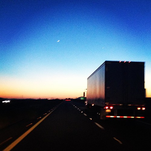
Sunset along I-10

Smoke Stacks? Nuclear tests? Con trails? What new hell is being unleashed?!#bearsontheroad #roadtripparanoia

I-10 Sunset

IMG_5905 Sunrise(border)

Sunset along I-10

Sunset along I-10
Valley View Ranchettes, AZ, USA Map
Search another place
Near Places
N th Ave, Tonopah, AZ, USA
W Indian School Rd, Tonopah, AZ, USA
North th Avenue, N th Ave, Tonopah, AZ, USA
Tartesso, Buckeye, AZ, USA
W Fairmount Ave, Buckeye, AZ, USA
West Victory Street, W Victory St, Buckeye, AZ, USA
Westpark, Buckeye, AZ, USA
Watson Estates, Buckeye, AZ, USA
W Whyman Ave, Buckeye, AZ, USA
Sundance, Buckeye, AZ, USA
W Shadow Dr, Buckeye, AZ, USA
Verrado Lost Creek Trail, Buckeye, AZ, USA
West Palo Brea Circle, W Palo Brea Cir, Buckeye, AZ, USA
N Chelsea Dr, Buckeye, AZ, USA
Verrado Main Street District, Buckeye, AZ, USA
W Sunrise Ln, Buckeye, AZ, USA
N Verrado Way, Buckeye, AZ, USA
W Wycliff Dr, Buckeye, AZ, USA
The Vic Bar + Kitchen, N. Verrado Way, Buckeye, AZ, USA
N th Ave, Buckeye, AZ, USA
Recent Searches
- Sunrise Sunset Times of Red Dog Mine, AK, USA
- Sunrise Sunset Times of Am Bahnhof, Am bhf, Borken, Germany
- Sunrise Sunset Times of 4th St E, Sonoma, CA, USA
- Sunrise Sunset Times of Oakland Ave, Williamsport, PA, USA
- Sunrise Sunset Times of Via Roma, Pieranica CR, Italy
- Sunrise Sunset Times of Clock Tower of Dubrovnik, Grad, Dubrovnik, Croatia
- Sunrise Sunset Times of Trelew, Chubut Province, Argentina
- Sunrise Sunset Times of Hartfords Bluff Cir, Mt Pleasant, SC, USA
- Sunrise Sunset Times of Kita Ward, Kumamoto, Japan
- Sunrise Sunset Times of Pingtan Island, Pingtan County, Fuzhou, China