Sunrise Sunset Times of Tonto Basin, AZ, USA
Location: United States > Arizona > Gila County >
Timezone:
America/Phoenix
Current Time:
2025-07-06 09:18:18
Longitude:
-111.3104752
Latitude:
33.8502345
Sunrise Today:
05:21:18 AM
Sunset Today:
07:39:20 PM
Daylength Today:
14h 18m 2s
Sunrise Tomorrow:
05:21:51 AM
Sunset Tomorrow:
07:39:05 PM
Daylength Tomorrow:
14h 17m 14s
Year Show All Dates
| Date | Sunrise | Sunset | Daylength |
|---|---|---|---|
| 01/01/2025 | 07:30:28 AM | 05:28:24 PM | 9h 57m 56s |
| 01/02/2025 | 07:30:37 AM | 05:29:10 PM | 9h 58m 33s |
| 01/03/2025 | 07:30:43 AM | 05:29:58 PM | 9h 59m 15s |
| 01/04/2025 | 07:30:48 AM | 05:30:47 PM | 9h 59m 59s |
| 01/05/2025 | 07:30:51 AM | 05:31:37 PM | 10h 0m 46s |
| 01/06/2025 | 07:30:52 AM | 05:32:27 PM | 10h 1m 35s |
| 01/07/2025 | 07:30:51 AM | 05:33:19 PM | 10h 2m 28s |
| 01/08/2025 | 07:30:48 AM | 05:34:11 PM | 10h 3m 23s |
| 01/09/2025 | 07:30:44 AM | 05:35:04 PM | 10h 4m 20s |
| 01/10/2025 | 07:30:38 AM | 05:35:57 PM | 10h 5m 19s |
| 01/11/2025 | 07:30:29 AM | 05:36:52 PM | 10h 6m 23s |
| 01/12/2025 | 07:30:19 AM | 05:37:46 PM | 10h 7m 27s |
| 01/13/2025 | 07:30:07 AM | 05:38:42 PM | 10h 8m 35s |
| 01/14/2025 | 07:29:54 AM | 05:39:38 PM | 10h 9m 44s |
| 01/15/2025 | 07:29:38 AM | 05:40:34 PM | 10h 10m 56s |
| 01/16/2025 | 07:29:21 AM | 05:41:31 PM | 10h 12m 10s |
| 01/17/2025 | 07:29:01 AM | 05:42:28 PM | 10h 13m 27s |
| 01/18/2025 | 07:28:40 AM | 05:43:26 PM | 10h 14m 46s |
| 01/19/2025 | 07:28:18 AM | 05:44:24 PM | 10h 16m 6s |
| 01/20/2025 | 07:27:53 AM | 05:45:22 PM | 10h 17m 29s |
| 01/21/2025 | 07:27:27 AM | 05:46:20 PM | 10h 18m 53s |
| 01/22/2025 | 07:26:59 AM | 05:47:19 PM | 10h 20m 20s |
| 01/23/2025 | 07:26:29 AM | 05:48:18 PM | 10h 21m 49s |
| 01/24/2025 | 07:25:57 AM | 05:49:16 PM | 10h 23m 19s |
| 01/25/2025 | 07:25:24 AM | 05:50:15 PM | 10h 24m 51s |
| 01/26/2025 | 07:24:50 AM | 05:51:14 PM | 10h 26m 24s |
| 01/27/2025 | 07:24:13 AM | 05:52:13 PM | 10h 28m 0s |
| 01/28/2025 | 07:23:35 AM | 05:53:12 PM | 10h 29m 37s |
| 01/29/2025 | 07:22:55 AM | 05:54:11 PM | 10h 31m 16s |
| 01/30/2025 | 07:22:14 AM | 05:55:10 PM | 10h 32m 56s |
| 01/31/2025 | 07:21:32 AM | 05:56:09 PM | 10h 34m 37s |
| 02/01/2025 | 07:20:47 AM | 05:57:07 PM | 10h 36m 20s |
| 02/02/2025 | 07:20:02 AM | 05:58:06 PM | 10h 38m 4s |
| 02/03/2025 | 07:19:14 AM | 05:59:04 PM | 10h 39m 50s |
| 02/04/2025 | 07:18:26 AM | 06:00:02 PM | 10h 41m 36s |
| 02/05/2025 | 07:17:36 AM | 06:01:00 PM | 10h 43m 24s |
| 02/06/2025 | 07:16:45 AM | 06:01:57 PM | 10h 45m 12s |
| 02/07/2025 | 07:15:52 AM | 06:02:55 PM | 10h 47m 3s |
| 02/08/2025 | 07:14:58 AM | 06:03:52 PM | 10h 48m 54s |
| 02/09/2025 | 07:14:03 AM | 06:04:49 PM | 10h 50m 46s |
| 02/10/2025 | 07:13:06 AM | 06:05:46 PM | 10h 52m 40s |
| 02/11/2025 | 07:12:08 AM | 06:06:42 PM | 10h 54m 34s |
| 02/12/2025 | 07:11:09 AM | 06:07:38 PM | 10h 56m 29s |
| 02/13/2025 | 07:10:09 AM | 06:08:33 PM | 10h 58m 24s |
| 02/14/2025 | 07:09:08 AM | 06:09:29 PM | 11h 0m 21s |
| 02/15/2025 | 07:08:06 AM | 06:10:24 PM | 11h 2m 18s |
| 02/16/2025 | 07:07:02 AM | 06:11:19 PM | 11h 4m 17s |
| 02/17/2025 | 07:05:58 AM | 06:12:13 PM | 11h 6m 15s |
| 02/18/2025 | 07:04:52 AM | 06:13:07 PM | 11h 8m 15s |
| 02/19/2025 | 07:03:46 AM | 06:14:01 PM | 11h 10m 15s |
| 02/20/2025 | 07:02:38 AM | 06:14:54 PM | 11h 12m 16s |
| 02/21/2025 | 07:01:30 AM | 06:15:47 PM | 11h 14m 17s |
| 02/22/2025 | 07:00:21 AM | 06:16:39 PM | 11h 16m 18s |
| 02/23/2025 | 06:59:11 AM | 06:17:32 PM | 11h 18m 21s |
| 02/24/2025 | 06:58:00 AM | 06:18:24 PM | 11h 20m 24s |
| 02/25/2025 | 06:56:48 AM | 06:19:15 PM | 11h 22m 27s |
| 02/26/2025 | 06:55:36 AM | 06:20:06 PM | 11h 24m 30s |
| 02/27/2025 | 06:54:23 AM | 06:20:57 PM | 11h 26m 34s |
| 02/28/2025 | 06:53:09 AM | 06:21:48 PM | 11h 28m 39s |
| 03/01/2025 | 06:51:55 AM | 06:22:38 PM | 11h 30m 43s |
| 03/02/2025 | 06:50:39 AM | 06:23:28 PM | 11h 32m 49s |
| 03/03/2025 | 06:49:24 AM | 06:24:18 PM | 11h 34m 54s |
| 03/04/2025 | 06:48:07 AM | 06:25:07 PM | 11h 37m 0s |
| 03/05/2025 | 06:46:51 AM | 06:25:56 PM | 11h 39m 5s |
| 03/06/2025 | 06:45:33 AM | 06:26:45 PM | 11h 41m 12s |
| 03/07/2025 | 06:44:15 AM | 06:27:33 PM | 11h 43m 18s |
| 03/08/2025 | 06:42:57 AM | 06:28:21 PM | 11h 45m 24s |
| 03/09/2025 | 06:41:38 AM | 06:29:09 PM | 11h 47m 31s |
| 03/10/2025 | 06:40:19 AM | 06:29:57 PM | 11h 49m 38s |
| 03/11/2025 | 06:39:00 AM | 06:30:44 PM | 11h 51m 44s |
| 03/12/2025 | 06:37:40 AM | 06:31:31 PM | 11h 53m 51s |
| 03/13/2025 | 06:36:20 AM | 06:32:18 PM | 11h 55m 58s |
| 03/14/2025 | 06:34:59 AM | 06:33:05 PM | 11h 58m 6s |
| 03/15/2025 | 06:33:39 AM | 06:33:52 PM | 12h 0m 13s |
| 03/16/2025 | 06:32:18 AM | 06:34:38 PM | 12h 2m 20s |
| 03/17/2025 | 06:30:57 AM | 06:35:24 PM | 12h 4m 27s |
| 03/18/2025 | 06:29:36 AM | 06:36:10 PM | 12h 6m 34s |
| 03/19/2025 | 06:28:14 AM | 06:36:56 PM | 12h 8m 42s |
| 03/20/2025 | 06:26:53 AM | 06:37:42 PM | 12h 10m 49s |
| 03/21/2025 | 06:25:31 AM | 06:38:28 PM | 12h 12m 57s |
| 03/22/2025 | 06:24:10 AM | 06:39:13 PM | 12h 15m 3s |
| 03/23/2025 | 06:22:48 AM | 06:39:59 PM | 12h 17m 11s |
| 03/24/2025 | 06:21:27 AM | 06:40:44 PM | 12h 19m 17s |
| 03/25/2025 | 06:20:05 AM | 06:41:29 PM | 12h 21m 24s |
| 03/26/2025 | 06:18:44 AM | 06:42:14 PM | 12h 23m 30s |
| 03/27/2025 | 06:17:23 AM | 06:43:00 PM | 12h 25m 37s |
| 03/28/2025 | 06:16:02 AM | 06:43:45 PM | 12h 27m 43s |
| 03/29/2025 | 06:14:41 AM | 06:44:30 PM | 12h 29m 49s |
| 03/30/2025 | 06:13:20 AM | 06:45:15 PM | 12h 31m 55s |
| 03/31/2025 | 06:11:59 AM | 06:46:00 PM | 12h 34m 1s |
| 04/01/2025 | 06:10:39 AM | 06:46:45 PM | 12h 36m 6s |
| 04/02/2025 | 06:09:19 AM | 06:47:29 PM | 12h 38m 10s |
| 04/03/2025 | 06:07:59 AM | 06:48:14 PM | 12h 40m 15s |
| 04/04/2025 | 06:06:40 AM | 06:48:59 PM | 12h 42m 19s |
| 04/05/2025 | 06:05:21 AM | 06:49:44 PM | 12h 44m 23s |
| 04/06/2025 | 06:04:02 AM | 06:50:30 PM | 12h 46m 28s |
| 04/07/2025 | 06:02:44 AM | 06:51:15 PM | 12h 48m 31s |
| 04/08/2025 | 06:01:26 AM | 06:52:00 PM | 12h 50m 34s |
| 04/09/2025 | 06:00:09 AM | 06:52:45 PM | 12h 52m 36s |
| 04/10/2025 | 05:58:52 AM | 06:53:30 PM | 12h 54m 38s |
| 04/11/2025 | 05:57:36 AM | 06:54:15 PM | 12h 56m 39s |
| 04/12/2025 | 05:56:20 AM | 06:55:01 PM | 12h 58m 41s |
| 04/13/2025 | 05:55:05 AM | 06:55:46 PM | 13h 0m 41s |
| 04/14/2025 | 05:53:51 AM | 06:56:32 PM | 13h 2m 41s |
| 04/15/2025 | 05:52:37 AM | 06:57:17 PM | 13h 4m 40s |
| 04/16/2025 | 05:51:24 AM | 06:58:03 PM | 13h 6m 39s |
| 04/17/2025 | 05:50:11 AM | 06:58:49 PM | 13h 8m 38s |
| 04/18/2025 | 05:48:59 AM | 06:59:35 PM | 13h 10m 36s |
| 04/19/2025 | 05:47:49 AM | 07:00:21 PM | 13h 12m 32s |
| 04/20/2025 | 05:46:38 AM | 07:01:07 PM | 13h 14m 29s |
| 04/21/2025 | 05:45:29 AM | 07:01:53 PM | 13h 16m 24s |
| 04/22/2025 | 05:44:21 AM | 07:02:39 PM | 13h 18m 18s |
| 04/23/2025 | 05:43:13 AM | 07:03:25 PM | 13h 20m 12s |
| 04/24/2025 | 05:42:06 AM | 07:04:11 PM | 13h 22m 5s |
| 04/25/2025 | 05:41:01 AM | 07:04:57 PM | 13h 23m 56s |
| 04/26/2025 | 05:39:56 AM | 07:05:44 PM | 13h 25m 48s |
| 04/27/2025 | 05:38:52 AM | 07:06:30 PM | 13h 27m 38s |
| 04/28/2025 | 05:37:49 AM | 07:07:16 PM | 13h 29m 27s |
| 04/29/2025 | 05:36:47 AM | 07:08:03 PM | 13h 31m 16s |
| 04/30/2025 | 05:35:46 AM | 07:08:49 PM | 13h 33m 3s |
| 05/01/2025 | 05:34:47 AM | 07:09:36 PM | 13h 34m 49s |
| 05/02/2025 | 05:33:48 AM | 07:10:22 PM | 13h 36m 34s |
| 05/03/2025 | 05:32:51 AM | 07:11:08 PM | 13h 38m 17s |
| 05/04/2025 | 05:31:55 AM | 07:11:55 PM | 13h 40m 0s |
| 05/05/2025 | 05:31:00 AM | 07:12:41 PM | 13h 41m 41s |
| 05/06/2025 | 05:30:06 AM | 07:13:27 PM | 13h 43m 21s |
| 05/07/2025 | 05:29:13 AM | 07:14:13 PM | 13h 45m 0s |
| 05/08/2025 | 05:28:22 AM | 07:14:59 PM | 13h 46m 37s |
| 05/09/2025 | 05:27:32 AM | 07:15:45 PM | 13h 48m 13s |
| 05/10/2025 | 05:26:43 AM | 07:16:30 PM | 13h 49m 47s |
| 05/11/2025 | 05:25:56 AM | 07:17:16 PM | 13h 51m 20s |
| 05/12/2025 | 05:25:10 AM | 07:18:01 PM | 13h 52m 51s |
| 05/13/2025 | 05:24:25 AM | 07:18:46 PM | 13h 54m 21s |
| 05/14/2025 | 05:23:42 AM | 07:19:31 PM | 13h 55m 49s |
| 05/15/2025 | 05:23:00 AM | 07:20:15 PM | 13h 57m 15s |
| 05/16/2025 | 05:22:19 AM | 07:21:00 PM | 13h 58m 41s |
| 05/17/2025 | 05:21:40 AM | 07:21:43 PM | 14h 0m 3s |
| 05/18/2025 | 05:21:03 AM | 07:22:27 PM | 14h 1m 24s |
| 05/19/2025 | 05:20:27 AM | 07:23:10 PM | 14h 2m 43s |
| 05/20/2025 | 05:19:52 AM | 07:23:53 PM | 14h 4m 1s |
| 05/21/2025 | 05:19:19 AM | 07:24:35 PM | 14h 5m 16s |
| 05/22/2025 | 05:18:47 AM | 07:25:17 PM | 14h 6m 30s |
| 05/23/2025 | 05:18:17 AM | 07:25:58 PM | 14h 7m 41s |
| 05/24/2025 | 05:17:49 AM | 07:26:38 PM | 14h 8m 49s |
| 05/25/2025 | 05:17:22 AM | 07:27:19 PM | 14h 9m 57s |
| 05/26/2025 | 05:16:56 AM | 07:27:58 PM | 14h 11m 2s |
| 05/27/2025 | 05:16:33 AM | 07:28:37 PM | 14h 12m 4s |
| 05/28/2025 | 05:16:10 AM | 07:29:15 PM | 14h 13m 5s |
| 05/29/2025 | 05:15:50 AM | 07:29:52 PM | 14h 14m 2s |
| 05/30/2025 | 05:15:31 AM | 07:30:29 PM | 14h 14m 58s |
| 05/31/2025 | 05:15:13 AM | 07:31:05 PM | 14h 15m 52s |
| 06/01/2025 | 05:14:57 AM | 07:31:40 PM | 14h 16m 43s |
| 06/02/2025 | 05:14:43 AM | 07:32:14 PM | 14h 17m 31s |
| 06/03/2025 | 05:14:31 AM | 07:32:47 PM | 14h 18m 16s |
| 06/04/2025 | 05:14:20 AM | 07:33:20 PM | 14h 19m 0s |
| 06/05/2025 | 05:14:10 AM | 07:33:51 PM | 14h 19m 41s |
| 06/06/2025 | 05:14:02 AM | 07:34:21 PM | 14h 20m 19s |
| 06/07/2025 | 05:13:56 AM | 07:34:51 PM | 14h 20m 55s |
| 06/08/2025 | 05:13:51 AM | 07:35:19 PM | 14h 21m 28s |
| 06/09/2025 | 05:13:48 AM | 07:35:46 PM | 14h 21m 58s |
| 06/10/2025 | 05:13:46 AM | 07:36:12 PM | 14h 22m 26s |
| 06/11/2025 | 05:13:46 AM | 07:36:37 PM | 14h 22m 51s |
| 06/12/2025 | 05:13:48 AM | 07:37:01 PM | 14h 23m 13s |
| 06/13/2025 | 05:13:51 AM | 07:37:23 PM | 14h 23m 32s |
| 06/14/2025 | 05:13:55 AM | 07:37:45 PM | 14h 23m 50s |
| 06/15/2025 | 05:14:01 AM | 07:38:04 PM | 14h 24m 3s |
| 06/16/2025 | 05:14:08 AM | 07:38:23 PM | 14h 24m 15s |
| 06/17/2025 | 05:14:17 AM | 07:38:40 PM | 14h 24m 23s |
| 06/18/2025 | 05:14:28 AM | 07:38:56 PM | 14h 24m 28s |
| 06/19/2025 | 05:14:39 AM | 07:39:11 PM | 14h 24m 32s |
| 06/20/2025 | 05:14:52 AM | 07:39:24 PM | 14h 24m 32s |
| 06/21/2025 | 05:15:07 AM | 07:39:35 PM | 14h 24m 28s |
| 06/22/2025 | 05:15:23 AM | 07:39:46 PM | 14h 24m 23s |
| 06/23/2025 | 05:15:40 AM | 07:39:54 PM | 14h 24m 14s |
| 06/24/2025 | 05:15:58 AM | 07:40:01 PM | 14h 24m 3s |
| 06/25/2025 | 05:16:18 AM | 07:40:07 PM | 14h 23m 49s |
| 06/26/2025 | 05:16:38 AM | 07:40:11 PM | 14h 23m 33s |
| 06/27/2025 | 05:17:00 AM | 07:40:14 PM | 14h 23m 14s |
| 06/28/2025 | 05:17:23 AM | 07:40:15 PM | 14h 22m 52s |
| 06/29/2025 | 05:17:48 AM | 07:40:14 PM | 14h 22m 26s |
| 06/30/2025 | 05:18:13 AM | 07:40:12 PM | 14h 21m 59s |
| 07/01/2025 | 05:18:40 AM | 07:40:08 PM | 14h 21m 28s |
| 07/02/2025 | 05:19:07 AM | 07:40:02 PM | 14h 20m 55s |
| 07/03/2025 | 05:19:35 AM | 07:39:55 PM | 14h 20m 20s |
| 07/04/2025 | 05:20:05 AM | 07:39:47 PM | 14h 19m 42s |
| 07/05/2025 | 05:20:35 AM | 07:39:36 PM | 14h 19m 1s |
| 07/06/2025 | 05:21:06 AM | 07:39:25 PM | 14h 18m 19s |
| 07/07/2025 | 05:21:38 AM | 07:39:11 PM | 14h 17m 33s |
| 07/08/2025 | 05:22:11 AM | 07:38:56 PM | 14h 16m 45s |
| 07/09/2025 | 05:22:45 AM | 07:38:39 PM | 14h 15m 54s |
| 07/10/2025 | 05:23:19 AM | 07:38:20 PM | 14h 15m 1s |
| 07/11/2025 | 05:23:55 AM | 07:38:00 PM | 14h 14m 5s |
| 07/12/2025 | 05:24:30 AM | 07:37:38 PM | 14h 13m 8s |
| 07/13/2025 | 05:25:07 AM | 07:37:15 PM | 14h 12m 8s |
| 07/14/2025 | 05:25:44 AM | 07:36:50 PM | 14h 11m 6s |
| 07/15/2025 | 05:26:22 AM | 07:36:24 PM | 14h 10m 2s |
| 07/16/2025 | 05:27:00 AM | 07:35:55 PM | 14h 8m 55s |
| 07/17/2025 | 05:27:39 AM | 07:35:26 PM | 14h 7m 47s |
| 07/18/2025 | 05:28:18 AM | 07:34:54 PM | 14h 6m 36s |
| 07/19/2025 | 05:28:58 AM | 07:34:21 PM | 14h 5m 23s |
| 07/20/2025 | 05:29:38 AM | 07:33:47 PM | 14h 4m 9s |
| 07/21/2025 | 05:30:18 AM | 07:33:11 PM | 14h 2m 53s |
| 07/22/2025 | 05:30:59 AM | 07:32:34 PM | 14h 1m 35s |
| 07/23/2025 | 05:31:40 AM | 07:31:55 PM | 14h 0m 15s |
| 07/24/2025 | 05:32:21 AM | 07:31:14 PM | 13h 58m 53s |
| 07/25/2025 | 05:33:03 AM | 07:30:32 PM | 13h 57m 29s |
| 07/26/2025 | 05:33:45 AM | 07:29:49 PM | 13h 56m 4s |
| 07/27/2025 | 05:34:27 AM | 07:29:04 PM | 13h 54m 37s |
| 07/28/2025 | 05:35:10 AM | 07:28:18 PM | 13h 53m 8s |
| 07/29/2025 | 05:35:52 AM | 07:27:30 PM | 13h 51m 38s |
| 07/30/2025 | 05:36:35 AM | 07:26:41 PM | 13h 50m 6s |
| 07/31/2025 | 05:37:18 AM | 07:25:51 PM | 13h 48m 33s |
| 08/01/2025 | 05:38:01 AM | 07:24:59 PM | 13h 46m 58s |
| 08/02/2025 | 05:38:44 AM | 07:24:06 PM | 13h 45m 22s |
| 08/03/2025 | 05:39:27 AM | 07:23:12 PM | 13h 43m 45s |
| 08/04/2025 | 05:40:10 AM | 07:22:17 PM | 13h 42m 7s |
| 08/05/2025 | 05:40:53 AM | 07:21:20 PM | 13h 40m 27s |
| 08/06/2025 | 05:41:36 AM | 07:20:22 PM | 13h 38m 46s |
| 08/07/2025 | 05:42:20 AM | 07:19:23 PM | 13h 37m 3s |
| 08/08/2025 | 05:43:03 AM | 07:18:23 PM | 13h 35m 20s |
| 08/09/2025 | 05:43:46 AM | 07:17:21 PM | 13h 33m 35s |
| 08/10/2025 | 05:44:29 AM | 07:16:19 PM | 13h 31m 50s |
| 08/11/2025 | 05:45:12 AM | 07:15:15 PM | 13h 30m 3s |
| 08/12/2025 | 05:45:55 AM | 07:14:11 PM | 13h 28m 16s |
| 08/13/2025 | 05:46:38 AM | 07:13:05 PM | 13h 26m 27s |
| 08/14/2025 | 05:47:21 AM | 07:11:59 PM | 13h 24m 38s |
| 08/15/2025 | 05:48:04 AM | 07:10:51 PM | 13h 22m 47s |
| 08/16/2025 | 05:48:46 AM | 07:09:43 PM | 13h 20m 57s |
| 08/17/2025 | 05:49:29 AM | 07:08:33 PM | 13h 19m 4s |
| 08/18/2025 | 05:50:11 AM | 07:07:23 PM | 13h 17m 12s |
| 08/19/2025 | 05:50:54 AM | 07:06:12 PM | 13h 15m 18s |
| 08/20/2025 | 05:51:36 AM | 07:05:00 PM | 13h 13m 24s |
| 08/21/2025 | 05:52:18 AM | 07:03:47 PM | 13h 11m 29s |
| 08/22/2025 | 05:53:00 AM | 07:02:33 PM | 13h 9m 33s |
| 08/23/2025 | 05:53:42 AM | 07:01:19 PM | 13h 7m 37s |
| 08/24/2025 | 05:54:24 AM | 07:00:04 PM | 13h 5m 40s |
| 08/25/2025 | 05:55:06 AM | 06:58:48 PM | 13h 3m 42s |
| 08/26/2025 | 05:55:48 AM | 06:57:32 PM | 13h 1m 44s |
| 08/27/2025 | 05:56:29 AM | 06:56:15 PM | 12h 59m 46s |
| 08/28/2025 | 05:57:11 AM | 06:54:57 PM | 12h 57m 46s |
| 08/29/2025 | 05:57:52 AM | 06:53:39 PM | 12h 55m 47s |
| 08/30/2025 | 05:58:33 AM | 06:52:20 PM | 12h 53m 47s |
| 08/31/2025 | 05:59:14 AM | 06:51:01 PM | 12h 51m 47s |
| 09/01/2025 | 05:59:55 AM | 06:49:41 PM | 12h 49m 46s |
| 09/02/2025 | 06:00:36 AM | 06:48:21 PM | 12h 47m 45s |
| 09/03/2025 | 06:01:17 AM | 06:47:00 PM | 12h 45m 43s |
| 09/04/2025 | 06:01:58 AM | 06:45:39 PM | 12h 43m 41s |
| 09/05/2025 | 06:02:39 AM | 06:44:18 PM | 12h 41m 39s |
| 09/06/2025 | 06:03:20 AM | 06:42:56 PM | 12h 39m 36s |
| 09/07/2025 | 06:04:01 AM | 06:41:34 PM | 12h 37m 33s |
| 09/08/2025 | 06:04:41 AM | 06:40:11 PM | 12h 35m 30s |
| 09/09/2025 | 06:05:22 AM | 06:38:49 PM | 12h 33m 27s |
| 09/10/2025 | 06:06:03 AM | 06:37:26 PM | 12h 31m 23s |
| 09/11/2025 | 06:06:44 AM | 06:36:02 PM | 12h 29m 18s |
| 09/12/2025 | 06:07:24 AM | 06:34:39 PM | 12h 27m 15s |
| 09/13/2025 | 06:08:05 AM | 06:33:15 PM | 12h 25m 10s |
| 09/14/2025 | 06:08:46 AM | 06:31:52 PM | 12h 23m 6s |
| 09/15/2025 | 06:09:27 AM | 06:30:28 PM | 12h 21m 1s |
| 09/16/2025 | 06:10:08 AM | 06:29:04 PM | 12h 18m 56s |
| 09/17/2025 | 06:10:49 AM | 06:27:40 PM | 12h 16m 51s |
| 09/18/2025 | 06:11:30 AM | 06:26:16 PM | 12h 14m 46s |
| 09/19/2025 | 06:12:11 AM | 06:24:52 PM | 12h 12m 41s |
| 09/20/2025 | 06:12:52 AM | 06:23:29 PM | 12h 10m 37s |
| 09/21/2025 | 06:13:34 AM | 06:22:05 PM | 12h 8m 31s |
| 09/22/2025 | 06:14:15 AM | 06:20:41 PM | 12h 6m 26s |
| 09/23/2025 | 06:14:57 AM | 06:19:18 PM | 12h 4m 21s |
| 09/24/2025 | 06:15:39 AM | 06:17:54 PM | 12h 2m 15s |
| 09/25/2025 | 06:16:21 AM | 06:16:31 PM | 12h 0m 10s |
| 09/26/2025 | 06:17:03 AM | 06:15:08 PM | 11h 58m 5s |
| 09/27/2025 | 06:17:46 AM | 06:13:45 PM | 11h 55m 59s |
| 09/28/2025 | 06:18:29 AM | 06:12:23 PM | 11h 53m 54s |
| 09/29/2025 | 06:19:11 AM | 06:11:00 PM | 11h 51m 49s |
| 09/30/2025 | 06:19:54 AM | 06:09:39 PM | 11h 49m 45s |
| 10/01/2025 | 06:20:38 AM | 06:08:17 PM | 11h 47m 39s |
| 10/02/2025 | 06:21:21 AM | 06:06:56 PM | 11h 45m 35s |
| 10/03/2025 | 06:22:05 AM | 06:05:35 PM | 11h 43m 30s |
| 10/04/2025 | 06:22:49 AM | 06:04:15 PM | 11h 41m 26s |
| 10/05/2025 | 06:23:34 AM | 06:02:55 PM | 11h 39m 21s |
| 10/06/2025 | 06:24:19 AM | 06:01:36 PM | 11h 37m 17s |
| 10/07/2025 | 06:25:04 AM | 06:00:17 PM | 11h 35m 13s |
| 10/08/2025 | 06:25:49 AM | 05:58:59 PM | 11h 33m 10s |
| 10/09/2025 | 06:26:35 AM | 05:57:41 PM | 11h 31m 6s |
| 10/10/2025 | 06:27:21 AM | 05:56:24 PM | 11h 29m 3s |
| 10/11/2025 | 06:28:07 AM | 05:55:08 PM | 11h 27m 1s |
| 10/12/2025 | 06:28:54 AM | 05:53:52 PM | 11h 24m 58s |
| 10/13/2025 | 06:29:41 AM | 05:52:37 PM | 11h 22m 56s |
| 10/14/2025 | 06:30:28 AM | 05:51:23 PM | 11h 20m 55s |
| 10/15/2025 | 06:31:16 AM | 05:50:10 PM | 11h 18m 54s |
| 10/16/2025 | 06:32:04 AM | 05:48:57 PM | 11h 16m 53s |
| 10/17/2025 | 06:32:53 AM | 05:47:45 PM | 11h 14m 52s |
| 10/18/2025 | 06:33:42 AM | 05:46:35 PM | 11h 12m 53s |
| 10/19/2025 | 06:34:31 AM | 05:45:25 PM | 11h 10m 54s |
| 10/20/2025 | 06:35:20 AM | 05:44:16 PM | 11h 8m 56s |
| 10/21/2025 | 06:36:10 AM | 05:43:08 PM | 11h 6m 58s |
| 10/22/2025 | 06:37:01 AM | 05:42:00 PM | 11h 4m 59s |
| 10/23/2025 | 06:37:52 AM | 05:40:54 PM | 11h 3m 2s |
| 10/24/2025 | 06:38:43 AM | 05:39:49 PM | 11h 1m 6s |
| 10/25/2025 | 06:39:34 AM | 05:38:45 PM | 10h 59m 11s |
| 10/26/2025 | 06:40:26 AM | 05:37:43 PM | 10h 57m 17s |
| 10/27/2025 | 06:41:18 AM | 05:36:41 PM | 10h 55m 23s |
| 10/28/2025 | 06:42:11 AM | 05:35:40 PM | 10h 53m 29s |
| 10/29/2025 | 06:43:04 AM | 05:34:41 PM | 10h 51m 37s |
| 10/30/2025 | 06:43:57 AM | 05:33:43 PM | 10h 49m 46s |
| 10/31/2025 | 06:44:50 AM | 05:32:46 PM | 10h 47m 56s |
| 11/01/2025 | 06:45:44 AM | 05:31:51 PM | 10h 46m 7s |
| 11/02/2025 | 06:46:38 AM | 05:30:57 PM | 10h 44m 19s |
| 11/03/2025 | 06:47:33 AM | 05:30:04 PM | 10h 42m 31s |
| 11/04/2025 | 06:48:27 AM | 05:29:13 PM | 10h 40m 46s |
| 11/05/2025 | 06:49:22 AM | 05:28:23 PM | 10h 39m 1s |
| 11/06/2025 | 06:50:18 AM | 05:27:34 PM | 10h 37m 16s |
| 11/07/2025 | 06:51:13 AM | 05:26:47 PM | 10h 35m 34s |
| 11/08/2025 | 06:52:09 AM | 05:26:01 PM | 10h 33m 52s |
| 11/09/2025 | 06:53:04 AM | 05:25:17 PM | 10h 32m 13s |
| 11/10/2025 | 06:54:00 AM | 05:24:35 PM | 10h 30m 35s |
| 11/11/2025 | 06:54:56 AM | 05:23:54 PM | 10h 28m 58s |
| 11/12/2025 | 06:55:52 AM | 05:23:15 PM | 10h 27m 23s |
| 11/13/2025 | 06:56:49 AM | 05:22:37 PM | 10h 25m 48s |
| 11/14/2025 | 06:57:45 AM | 05:22:01 PM | 10h 24m 16s |
| 11/15/2025 | 06:58:41 AM | 05:21:27 PM | 10h 22m 46s |
| 11/16/2025 | 06:59:37 AM | 05:20:54 PM | 10h 21m 17s |
| 11/17/2025 | 07:00:33 AM | 05:20:23 PM | 10h 19m 50s |
| 11/18/2025 | 07:01:29 AM | 05:19:54 PM | 10h 18m 25s |
| 11/19/2025 | 07:02:25 AM | 05:19:26 PM | 10h 17m 1s |
| 11/20/2025 | 07:03:21 AM | 05:19:01 PM | 10h 15m 40s |
| 11/21/2025 | 07:04:17 AM | 05:18:37 PM | 10h 14m 20s |
| 11/22/2025 | 07:05:12 AM | 05:18:15 PM | 10h 13m 3s |
| 11/23/2025 | 07:06:07 AM | 05:17:55 PM | 10h 11m 48s |
| 11/24/2025 | 07:07:02 AM | 05:17:36 PM | 10h 10m 34s |
| 11/25/2025 | 07:07:56 AM | 05:17:20 PM | 10h 9m 24s |
| 11/26/2025 | 07:08:50 AM | 05:17:05 PM | 10h 8m 15s |
| 11/27/2025 | 07:09:43 AM | 05:16:52 PM | 10h 7m 9s |
| 11/28/2025 | 07:10:36 AM | 05:16:41 PM | 10h 6m 5s |
| 11/29/2025 | 07:11:29 AM | 05:16:32 PM | 10h 5m 3s |
| 11/30/2025 | 07:12:21 AM | 05:16:25 PM | 10h 4m 4s |
| 12/01/2025 | 07:13:12 AM | 05:16:20 PM | 10h 3m 8s |
| 12/02/2025 | 07:14:03 AM | 05:16:17 PM | 10h 2m 14s |
| 12/03/2025 | 07:14:52 AM | 05:16:15 PM | 10h 1m 23s |
| 12/04/2025 | 07:15:41 AM | 05:16:16 PM | 10h 0m 35s |
| 12/05/2025 | 07:16:30 AM | 05:16:18 PM | 9h 59m 48s |
| 12/06/2025 | 07:17:17 AM | 05:16:22 PM | 9h 59m 5s |
| 12/07/2025 | 07:18:04 AM | 05:16:28 PM | 9h 58m 24s |
| 12/08/2025 | 07:18:49 AM | 05:16:36 PM | 9h 57m 47s |
| 12/09/2025 | 07:19:34 AM | 05:16:46 PM | 9h 57m 12s |
| 12/10/2025 | 07:20:17 AM | 05:16:58 PM | 9h 56m 41s |
| 12/11/2025 | 07:21:00 AM | 05:17:12 PM | 9h 56m 12s |
| 12/12/2025 | 07:21:41 AM | 05:17:27 PM | 9h 55m 46s |
| 12/13/2025 | 07:22:21 AM | 05:17:44 PM | 9h 55m 23s |
| 12/14/2025 | 07:23:00 AM | 05:18:03 PM | 9h 55m 3s |
| 12/15/2025 | 07:23:37 AM | 05:18:24 PM | 9h 54m 47s |
| 12/16/2025 | 07:24:13 AM | 05:18:46 PM | 9h 54m 33s |
| 12/17/2025 | 07:24:48 AM | 05:19:10 PM | 9h 54m 22s |
| 12/18/2025 | 07:25:22 AM | 05:19:36 PM | 9h 54m 14s |
| 12/19/2025 | 07:25:54 AM | 05:20:03 PM | 9h 54m 9s |
| 12/20/2025 | 07:26:25 AM | 05:20:32 PM | 9h 54m 7s |
| 12/21/2025 | 07:26:54 AM | 05:21:03 PM | 9h 54m 9s |
| 12/22/2025 | 07:27:21 AM | 05:21:35 PM | 9h 54m 14s |
| 12/23/2025 | 07:27:47 AM | 05:22:08 PM | 9h 54m 21s |
| 12/24/2025 | 07:28:12 AM | 05:22:44 PM | 9h 54m 32s |
| 12/25/2025 | 07:28:34 AM | 05:23:20 PM | 9h 54m 46s |
| 12/26/2025 | 07:28:55 AM | 05:23:58 PM | 9h 55m 3s |
| 12/27/2025 | 07:29:15 AM | 05:24:37 PM | 9h 55m 22s |
| 12/28/2025 | 07:29:32 AM | 05:25:18 PM | 9h 55m 46s |
| 12/29/2025 | 07:29:48 AM | 05:26:00 PM | 9h 56m 12s |
| 12/30/2025 | 07:30:03 AM | 05:26:43 PM | 9h 56m 40s |
| 12/31/2025 | 07:30:15 AM | 05:27:27 PM | 9h 57m 12s |
Sunrise & Sunset Photos

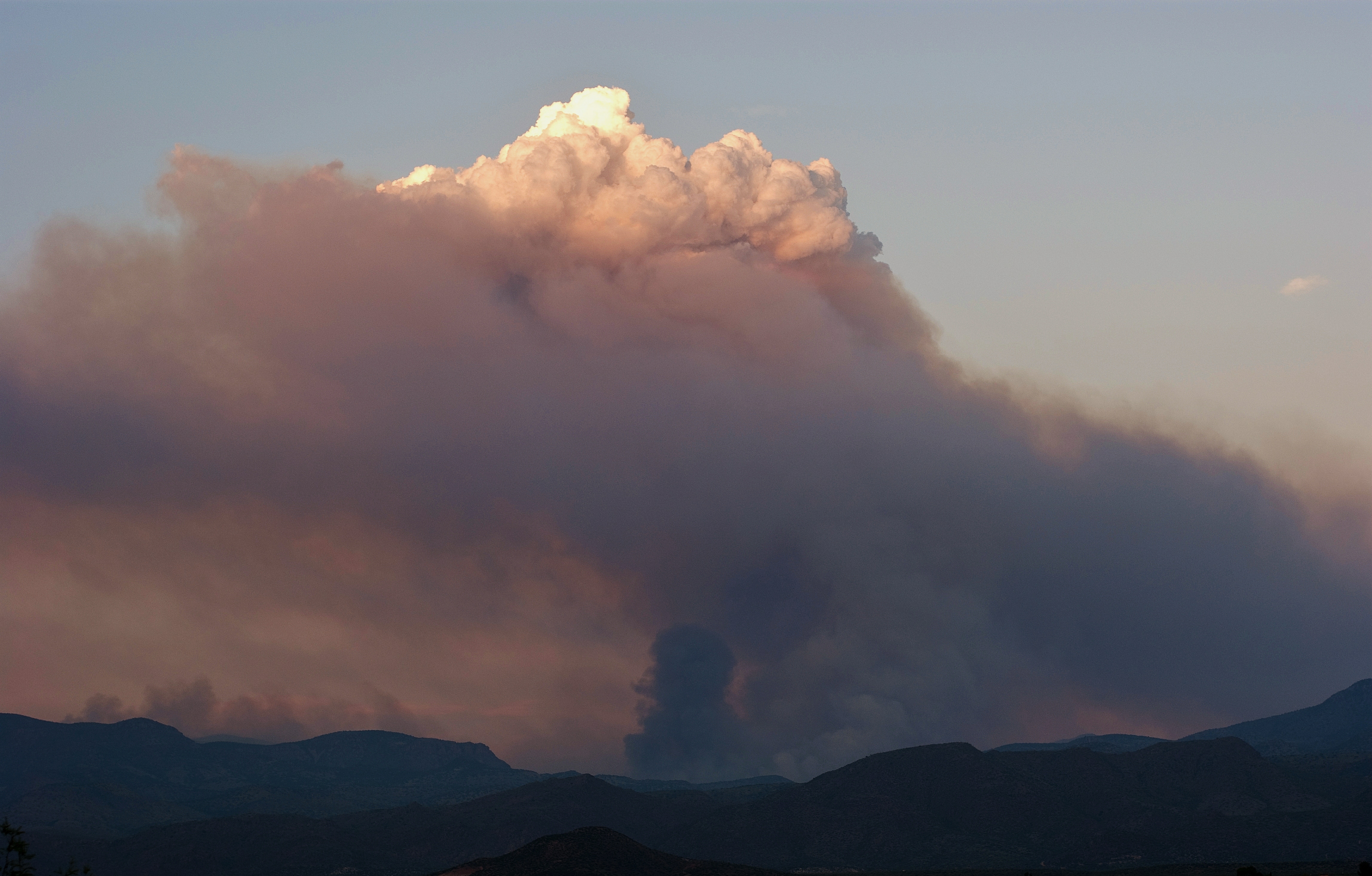
Distant Storm
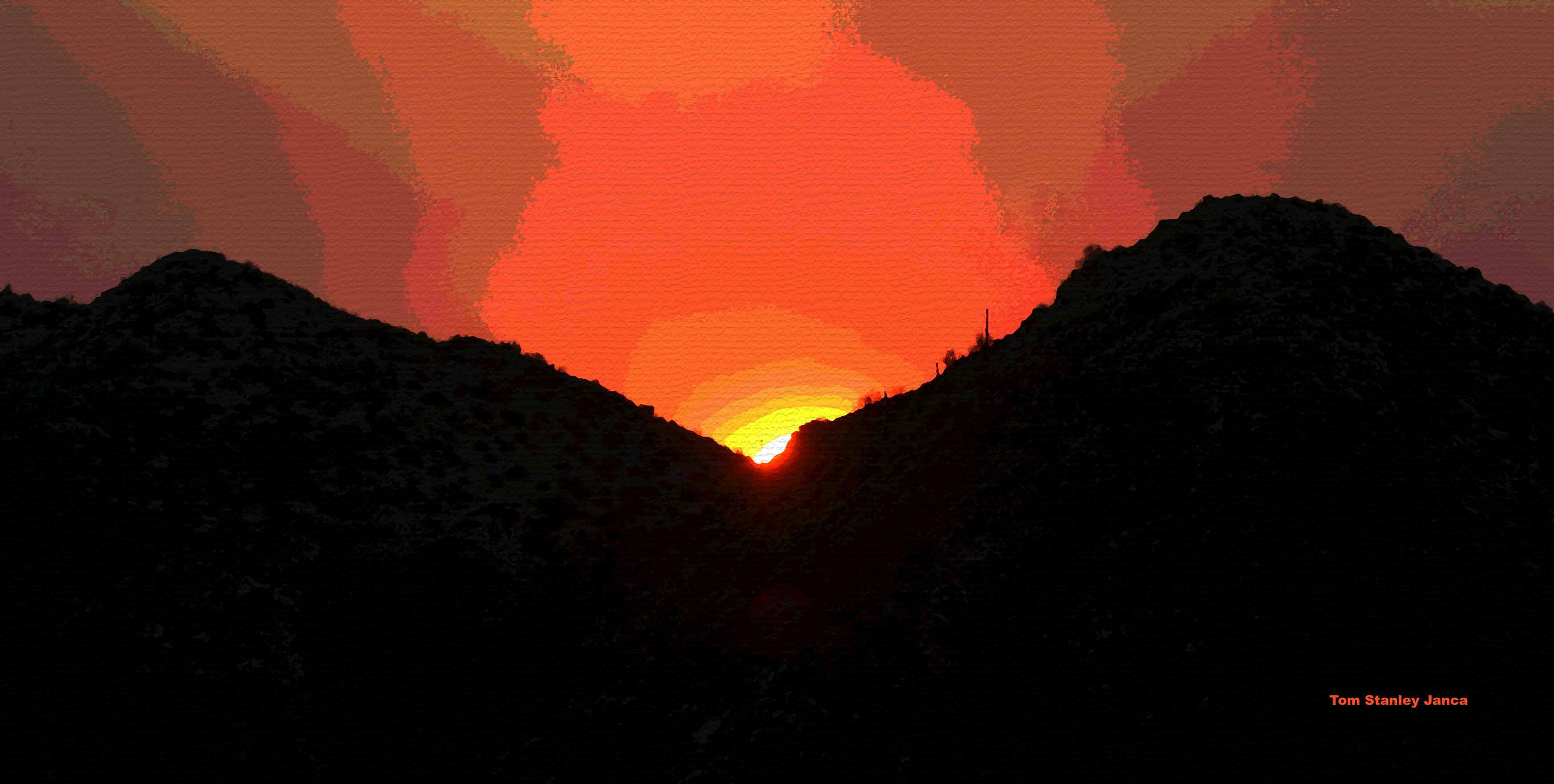
Mistake Peak Fire at Sunset
Sunset Sunflower Fire Smoke
031415-Setting Sun Hwy 87
Not Happening

Mt Ord Arizona

View from the top of Mt Ord, Gila County, Arizona

Four Peaks Rd (FR143)

View from the top of Mt Ord, Gila County, Arizona

Four Peaks Rd (FR143)

Four Peaks Rd (FR143)

Four Peaks Rd (FR143)

Four Peaks Rd (FR143)
Desert Highway

Four Peaks Rd (FR143)

Four Peaks Rd (FR143)

Mt. Ord Wedding

Four Peaks Rd (FR143)

Four Peaks Rd (FR143)

Four Peaks Rd (FR143)

Four Peaks Rd (FR143)

Four Peaks Rd (FR143)

Four Peaks Rd (FR143)

Four Peaks Rd (FR143)

Four Peaks Rd (FR143)
Tonto Basin, AZ, USA Map
Search another place
Places in Tonto Basin, AZ, USA
Near Places
Rocky Rd, Tonto Basin, AZ, USA
Punkin Center, Tonto Basin, AZ, USA
Whitney Ranch Estates, AZ, USA
Rio Verde, AZ, USA
Deercreek Drive, Deercreek Dr, Arizona, USA
Deercreek Dr, Payson, AZ, USA
Deercreek Dr, Payson, AZ, USA
Gisela, AZ, USA
Mazatzal Peak, Arizona, USA
Oxbow Trail, Payson, AZ, USA
Oxbow Trail, Payson, AZ, USA
North Peak, Arizona, USA
West Gibson Ranch Road, W Gibson Ranch Rd, Payson, AZ, USA
Mazatzal Hotel & Casino, Highway 87, Mile Marker, Payson, AZ, USA
E Phoenix St, Payson, AZ, USA
Payson, AZ, USA
W Frontier St, Payson, AZ, USA
S Tonto St, Payson, AZ, USA
Days Inn & Suites by Wyndham Payson, S Beeline Hwy A, Payson, AZ, USA
S Beeline Hwy, Payson, AZ, USA
Recent Searches
- Sunrise Sunset Times of Red Dog Mine, AK, USA
- Sunrise Sunset Times of Am Bahnhof, Am bhf, Borken, Germany
- Sunrise Sunset Times of 4th St E, Sonoma, CA, USA
- Sunrise Sunset Times of Oakland Ave, Williamsport, PA, USA
- Sunrise Sunset Times of Via Roma, Pieranica CR, Italy
- Sunrise Sunset Times of Clock Tower of Dubrovnik, Grad, Dubrovnik, Croatia
- Sunrise Sunset Times of Trelew, Chubut Province, Argentina
- Sunrise Sunset Times of Hartfords Bluff Cir, Mt Pleasant, SC, USA
- Sunrise Sunset Times of Kita Ward, Kumamoto, Japan
- Sunrise Sunset Times of Pingtan Island, Pingtan County, Fuzhou, China