Timezone:Brasilia Standard Time
Current Time:Tuesday, November 10, 2026 1:11 AM
Longitude:-40.3088626
Latitude:-19.1834229
Sunrise Time Today:4:58:09 AM
Sunset Time Today:5:54:49 PM
Daylength Today:12h 56m 39s
Sunrise Time Tomorrow:4:57:50 AM
Sunset Time Tomorrow:5:55:22 PM
Daylength Tomorrow:12h 57m 32s

: Show All Dates

Date Sunrise Time Sunset Time Daylength
Jan 1, 2026 5:07:26 AM 6:23:25 PM 13h 15m 58s
Feb 1, 2026 5:27:09 AM 6:24:38 PM 12h 57m 29s
Mar 1, 2026 5:40:32 AM 6:10:02 PM 12h 29m 29s
Apr 1, 2026 5:48:49 AM 5:44:21 PM 11h 55m 32s
May 1, 2026 5:57:02 AM 5:22:17 PM 11h 25m 14s
Jun 1, 2026 6:08:42 AM 5:12:01 PM 11h 3m 19s
Jul 1, 2026 6:16:24 AM 5:15:38 PM 10h 59m 13s
Aug 1, 2026 6:11:29 AM 5:26:11 PM 11h 14m 41s
Sep 1, 2026 5:51:42 AM 5:34:33 PM 11h 42m 50s
Oct 1, 2026 5:25:06 AM 5:39:55 PM 12h 14m 48s
Nov 1, 2026 5:02:23 AM 5:49:46 PM 12h 47m 22s
Nov 10, 2026 4:58:29 AM 5:54:17 PM 12h 55m 47s
Nov 11, 2026 4:58:09 AM 5:54:49 PM 12h 56m 39s
Dec 1, 2026 4:55:47 AM 6:06:55 PM 13h 11m 7s

Sunrise & Sunset Photos

Twilight from the Summit at Pico da Bandeira (Flag Peak) at 2,892 m (9,488 ft) MSL, Caparaó National Park, on the border between the municipalities of Ibitirama (Espírito Santo State) and Alto Caparaó by ER's Eyes - Our planet is so beautiful., It is the third highest mountain in Brazil, situated on the border of Espírito Santo and Minas Gerai
Twilight from the Summit at Pico da Bandeira (Flag Peak) at 2,892 m (9,488 ft) MSL, Caparaó National Park, on the border between the municipalities of Ibitirama (Espírito Santo State) and Alto Caparaó by ER's Eyes - Our planet is so beautiful.
Sunrise from the Summit at Pico da Bandeira (Flag Peak) at 2,892 m (9,488 ft) MSL, Caparaó National Park, on the border between the municipalities of Ibitirama (Espírito Santo State) and Alto Caparaó  by ER's Eyes - Our planet is so beautiful., Pico da Bandeira (2,892 m / 9,488 ft) is the highest point in the region. Other peaks also worth men
Sunrise from the Summit at Pico da Bandeira (Flag Peak) at 2,892 m (9,488 ft) MSL, Caparaó National Park, on the border between the municipalities of Ibitirama (Espírito Santo State) and Alto Caparaó by ER's Eyes - Our planet is so beautiful.
Sunrise from the Summit at Pico da Bandeira (Flag Peak) at 2,892 m (9,488 ft) MSL, Caparaó National Park, on the border between the municipalities of Ibitirama (Espírito Santo State) and Alto Caparaó  by ER's Eyes - Our planet is so beautiful., The Serra do Caparaó has a very representative area of Atlantic Forest, with unique examples of alpi
Sunrise from the Summit at Pico da Bandeira (Flag Peak) at 2,892 m (9,488 ft) MSL, Caparaó National Park, on the border between the municipalities of Ibitirama (Espírito Santo State) and Alto Caparaó by ER's Eyes - Our planet is so beautiful.
Sunrise from the Summit at Pico da Bandeira (Flag Peak) at 2,892 m (9,488 ft) MSL, Caparaó National Park, on the border between the municipalities of Ibitirama (Espírito Santo State) and Alto Caparaó  by ER's Eyes - Our planet is so beautiful., The Cristal peak is the sixth highest peak in Brazil, with 2,769.05 meters of altitude, according to
Sunrise from the Summit at Pico da Bandeira (Flag Peak) at 2,892 m (9,488 ft) MSL, Caparaó National Park, on the border between the municipalities of Ibitirama (Espírito Santo State) and Alto Caparaó by ER's Eyes - Our planet is so beautiful.
Sunrise from the Summit at Pico da Bandeira (Flag Peak) at 2,892 m (9,488 ft) MSL, Caparaó National Park, on the border between the municipalities of Ibitirama (Espírito Santo State) and Alto Caparaó  by ER's Eyes - Our planet is so beautiful., My eldest nephew and his girlfriend in their moments of affection and contemplation, after the arduo
Sunrise from the Summit at Pico da Bandeira (Flag Peak) at 2,892 m (9,488 ft) MSL, Caparaó National Park, on the border between the municipalities of Ibitirama (Espírito Santo State) and Alto Caparaó by ER's Eyes - Our planet is so beautiful.
Pico da Bandeira (Flag Peak) seen from the Summit of Pico do Calçado (Shoe Peak) at 2,849 m (9,347 ft), Caparaó National Park, on the border between the municipalities of Ibitirama (Espírito Santo Sta by ER's Eyes - Our planet is so beautiful., Summit and canyon on the side of Espírito Santo.

How many trails of those massive mountain ranges w
Pico da Bandeira (Flag Peak) seen from the Summit of Pico do Calçado (Shoe Peak) at 2,849 m (9,347 ft), Caparaó National Park, on the border between the municipalities of Ibitirama (Espírito Santo Sta by ER's Eyes - Our planet is so beautiful.
Pedra Duas Irmãs (Two Sisters Stone) at 2,390 m (7,841 ft) MSL, Trail by way of Caparaó-Capixaba, Caparaó National Park, Alto Caparaó, Minas Gerais State, Brazil. by ER's Eyes - Our planet is so beautiful., Rocky massif with a summit at an altitude of 2,600 m (8,530 ft) MSL, located near the Casa Queimada
Pedra Duas Irmãs (Two Sisters Stone) at 2,390 m (7,841 ft) MSL, Trail by way of Caparaó-Capixaba, Caparaó National Park, Alto Caparaó, Minas Gerais State, Brazil. by ER's Eyes - Our planet is so beautiful.
Sunrise from the Cruzeiro at the Summit at Pico da Bandeira (Flag Peak) at 2,892 m (9,488 ft) MSL, Caparaó National Park, on the border between the municipalities of Ibitirama (Espírito Santo State) a by ER's Eyes - Our planet is so beautiful., – Pico da Bandeira: 2,892 m / 9,488 ft;
– Peak 2 or Pico do Cruzeiro: 2,852 m / 9,356 ft;


Around 5
Sunrise from the Cruzeiro at the Summit at Pico da Bandeira (Flag Peak) at 2,892 m (9,488 ft) MSL, Caparaó National Park, on the border between the municipalities of Ibitirama (Espírito Santo State) a by ER's Eyes - Our planet is so beautiful.
Sunrise from the Summit at Pico da Bandeira (Flag Peak) at 2,892 m (9,488 ft) MSL, Caparaó National Park, on the border between the municipalities of Ibitirama (Espírito Santo State) and Alto Caparaó  by ER's Eyes - Our planet is so beautiful., View of Serra do Caparaó, with Pico do Calçado in evidence. In the background can be seen the Serra
Sunrise from the Summit at Pico da Bandeira (Flag Peak) at 2,892 m (9,488 ft) MSL, Caparaó National Park, on the border between the municipalities of Ibitirama (Espírito Santo State) and Alto Caparaó by ER's Eyes - Our planet is so beautiful.
Sunrise from the Summit at Pico da Bandeira (Flag Peak) at 2,892 m (9,488 ft) MSL, Caparaó National Park, on the border between the municipalities of Ibitirama (Espírito Santo State) and Alto Caparaó  by ER's Eyes - Our planet is so beautiful., The peak of Cristal is a massive point that has this denomination due to its abundant rock formation
Sunrise from the Summit at Pico da Bandeira (Flag Peak) at 2,892 m (9,488 ft) MSL, Caparaó National Park, on the border between the municipalities of Ibitirama (Espírito Santo State) and Alto Caparaó by ER's Eyes - Our planet is so beautiful.
Trail by way of Caparaó-Capixaba at 2,480 m (8,136 ft) MSL, Caparaó National Park, Dores do Rio Preto, Espírito Santo State, Brazil. by ER's Eyes - Our planet is so beautiful., Calçado and Cristal Peaks covered by fog at the end of the afternoon and without sunset.

We tested
Trail by way of Caparaó-Capixaba at 2,480 m (8,136 ft) MSL, Caparaó National Park, Dores do Rio Preto, Espírito Santo State, Brazil. by ER's Eyes - Our planet is so beautiful.
Trail by way of Caparaó-Capixaba at 2,540 m (8,333 ft) MSL, Caparaó National Park, Dores do Rio Preto, Espírito Santo State, Brazil. by ER's Eyes - Our planet is so beautiful., Picos do Calçado (Shoe Peak) and Calçado Mirim (Little Shoe Peak) are covered by fog in the late aft
Trail by way of Caparaó-Capixaba at 2,540 m (8,333 ft) MSL, Caparaó National Park, Dores do Rio Preto, Espírito Santo State, Brazil. by ER's Eyes - Our planet is so beautiful.
Sunset in the Wolf's Farm by de Paula FJ, A Fazenda do Lobo, localizada na Região Sudeste do Brasil, no Estado de Minas Gerais, é uma propried
Sunset in the Wolf's Farm by de Paula FJ
Historic Centre of Pirenópolis by Francisco Aragão, = = = = = = = = = = = = = = = = = = = = = 
<b>© Copyright 2014 Francisco Aragão. All Rights Reserved
Historic Centre of Pirenópolis by Francisco Aragão
Casa da Serra Caparaó (Caparao Mountain Range House) at 1,220 m (4,002 ft) MSL, Forquilha do Rio, Minas Gerais State, Brazil. by ER's Eyes - Our planet is so beautiful., We had the option of renting one of the guest houses (the white house) fully equipped or the space i
Casa da Serra Caparaó (Caparao Mountain Range House) at 1,220 m (4,002 ft) MSL, Forquilha do Rio, Minas Gerais State, Brazil. by ER's Eyes - Our planet is so beautiful.
Guest Houses, Casa da Serra Caparaó at 1,220 m (4,002 ft) MSL, Forquilha do Rio, Minas Gerais, Brazil. by ER's Eyes - Our planet is so beautiful., We had the option of renting one of the houses (the white house) fully equipped or the space in the
Guest Houses, Casa da Serra Caparaó at 1,220 m (4,002 ft) MSL, Forquilha do Rio, Minas Gerais, Brazil. by ER's Eyes - Our planet is so beautiful.
Golden Sky by de Paula FJ, A Fazenda do Lobo, localizada na Região Sudeste do Brasil, no Estado de Minas Gerais, é uma propried
Golden Sky by de Paula FJ
Sunrise in the Wolf's Farm by de Paula FJ, A Fazenda do Lobo, localizada na Região Sudeste do Brasil, no Estado de Minas Gerais, é uma propried
Sunrise in the Wolf's Farm by de Paula FJ
Golden Dunes by Helenɑ, Jalapão State Park | Tocantins | Brazil

The wind, rain and temperature changes, are the main causat
Golden Dunes by Helenɑ
Golden Sky by de Paula FJ, A Fazenda do Lobo, localizada na Região Sudeste do Brasil, no Estado de Minas Gerais, é uma propried
Golden Sky by de Paula FJ
Golden Tree by de Paula FJ, A Fazenda do Lobo, localizada na Região Sudeste do Brasil, no Estado de Minas Gerais, é uma propried
Golden Tree by de Paula FJ
Golden Sky by de Paula FJ, A Fazenda do Lobo, localizada na Região Sudeste do Brasil, no Estado de Minas Gerais, é uma propried
Golden Sky by de Paula FJ
Sunset in the Wolf's Farm by de Paula FJ, A Fazenda do Lobo, localizada na Região Sudeste do Brasil, no Estado de Minas Gerais, é uma propried
Sunset in the Wolf's Farm by de Paula FJ
Sunset in the Wolf's Farm by de Paula FJ, A Fazenda do Lobo, localizada na Região Sudeste do Brasil, no Estado de Minas Gerais, é uma propried
Sunset in the Wolf's Farm by de Paula FJ
Golden Sky by de Paula FJ, A Fazenda do Lobo, localizada na Região Sudeste do Brasil, no Estado de Minas Gerais, é uma propried
Golden Sky by de Paula FJ
Golden Sky by de Paula FJ, A Fazenda do Lobo, localizada na Região Sudeste do Brasil, no Estado de Minas Gerais, é uma propried
Golden Sky by de Paula FJ
Golden Sky by de Paula FJ, A Fazenda do Lobo, localizada na Região Sudeste do Brasil, no Estado de Minas Gerais, é uma propried
Golden Sky by de Paula FJ
Golden Sky by de Paula FJ, A Fazenda do Lobo, localizada na Região Sudeste do Brasil, no Estado de Minas Gerais, é uma propried
Golden Sky by de Paula FJ
Sunset in the Wolf's Farm by de Paula FJ, A Fazenda do Lobo, localizada na Região Sudeste do Brasil, no Estado de Minas Gerais, é uma propried
Sunset in the Wolf's Farm by de Paula FJ
Golden Sky by de Paula FJ, A Fazenda do Lobo, localizada na Região Sudeste do Brasil, no Estado de Minas Gerais, é uma propried
Golden Sky by de Paula FJ
Golden Sky by de Paula FJ, A Fazenda do Lobo, localizada na Região Sudeste do Brasil, no Estado de Minas Gerais, é uma propried
Golden Sky by de Paula FJ
Golden Sky by de Paula FJ, A Fazenda do Lobo, localizada na Região Sudeste do Brasil, no Estado de Minas Gerais, é uma propried
Golden Sky by de Paula FJ
Stone - "Frade e a Freira" - Brazil by BrunoOrnelas, (Por) A pedra do Frade e a Freira é uma formação rochosa 683 metros de altura, localizada na divisa
Stone - "Frade e a Freira" - Brazil by BrunoOrnelas
Sunset in the Wolf's Farm by de Paula FJ, A Fazenda do Lobo, localizada na Região Sudeste do Brasil, no Estado de Minas Gerais, é uma propried
Sunset in the Wolf's Farm by de Paula FJ
Por do sol na Fazenda do Lobo - Sunset in the Wolf's Farm - Brazil by de Paula FJ, Fazenda do Lobo, localizada na Região Sudeste do Brasil, no Estado de Minas Gerais, é uma propriedad
Por do sol na Fazenda do Lobo - Sunset in the Wolf's Farm - Brazil by de Paula FJ
Sunset in the Wolf's Farm by de Paula FJ, A Fazenda do Lobo, localizada na Região Sudeste do Brasil, no Estado de Minas Gerais, é uma propried
Sunset in the Wolf's Farm by de Paula FJ
Por do sol na Fazenda do Lobo - Sunset in the Wolf's Farm - Brazil by de Paula FJ, Fazenda do Lobo, localizada na Região Sudeste do Brasil, no Estado de Minas Gerais, é uma propriedad
Por do sol na Fazenda do Lobo - Sunset in the Wolf's Farm - Brazil by de Paula FJ
Sunset in the Wolf's Farm by de Paula FJ, A Fazenda do Lobo, localizada na Região Sudeste do Brasil, no Estado de Minas Gerais, é uma propried
Sunset in the Wolf's Farm by de Paula FJ
Por do sol na Fazenda do Lobo - Sunset in the Wolf's Farm - Brazil by de Paula FJ, Fazenda do Lobo, localizada na Região Sudeste do Brasil, no Estado de Minas Gerais, é uma propriedad
Por do sol na Fazenda do Lobo - Sunset in the Wolf's Farm - Brazil by de Paula FJ
Golden Sky by de Paula FJ, A Fazenda do Lobo, localizada na Região Sudeste do Brasil, no Estado de Minas Gerais, é uma propried
Golden Sky by de Paula FJ
Por do sol na Fazenda do Lobo - Sunset in the Wolf's Farm - Brazil by de Paula FJ, Fazenda do Lobo, localizada na Região Sudeste do Brasil, no Estado de Minas Gerais, é uma propriedad
Por do sol na Fazenda do Lobo - Sunset in the Wolf's Farm - Brazil by de Paula FJ
Sunset in the Wolf's Farm by de Paula FJ, A Fazenda do Lobo, localizada na Região Sudeste do Brasil, no Estado de Minas Gerais, é uma propried
Sunset in the Wolf's Farm by de Paula FJ
Sunset in the Wolf's Farm by de Paula FJ, A Fazenda do Lobo, localizada na Região Sudeste do Brasil, no Estado de Minas Gerais, é uma propried
Sunset in the Wolf's Farm by de Paula FJ
Por do sol na Fazenda do Lobo - Sunset in the Wolf's Farm - Brazil by de Paula FJ, Fazenda do Lobo, localizada na Região Sudeste do Brasil, no Estado de Minas Gerais, é uma propriedad
Por do sol na Fazenda do Lobo - Sunset in the Wolf's Farm - Brazil by de Paula FJ
Serra do Mar vegetation silhouette.  Brazil. by Ant1_G, Serra do Mar (Portuguese for Sea's ridge or Sea ridge) [ˈsɛʁɐ du ˈmaɾ]) is a 1,500 km long system of
Serra do Mar vegetation silhouette. Brazil. by Ant1_G
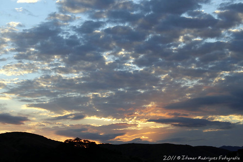
Sunset On The Itabapoana Valley - RJ/Brazil by itamar.rod, Por do Sol No Vale do Itabapoana - RJ/Brasil

O Vale do Itabapoana formado ao longo do Rio Itabapoan
Sunset On The Itabapoana Valley - RJ/Brazil by itamar.rod
Por do sol na Fazenda do Lobo - Sunset in the Wolf's Farm - Brazil by de Paula FJ, Fazenda do Lobo, localizada na Região Sudeste do Brasil, no Estado de Minas Gerais, é uma propriedad
Por do sol na Fazenda do Lobo - Sunset in the Wolf's Farm - Brazil by de Paula FJ
Por do sol na Fazenda do Lobo - Sunset in the Wolf's Farm - Brazil by de Paula FJ, Fazenda do Lobo, localizada na Região Sudeste do Brasil, no Estado de Minas Gerais, é uma propriedad
Por do sol na Fazenda do Lobo - Sunset in the Wolf's Farm - Brazil by de Paula FJ
Por do sol na Fazenda do Lobo - Sunset in the Wolf's Farm - Brazil by de Paula FJ, Fazenda do Lobo, localizada na Região Sudeste do Brasil, no Estado de Minas Gerais, é uma propriedad
Por do sol na Fazenda do Lobo - Sunset in the Wolf's Farm - Brazil by de Paula FJ
Por do sol na Fazenda do Lobo - Sunset in the Wolf's Farm - Brazil by de Paula FJ, Fazenda do Lobo, localizada na Região Sudeste do Brasil, no Estado de Minas Gerais, é uma propriedad
Por do sol na Fazenda do Lobo - Sunset in the Wolf's Farm - Brazil by de Paula FJ
Por do sol na Fazenda do Lobo - Sunset in the Wolf's Farm - Brazil by de Paula FJ, Fazenda do Lobo, localizada na Região Sudeste do Brasil, no Estado de Minas Gerais, é uma propriedad
Por do sol na Fazenda do Lobo - Sunset in the Wolf's Farm - Brazil by de Paula FJ
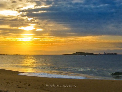
Sunrise by arturcanceliere, This a coast of state of Espírito Santo - Brazil. 
In background has the Island of Garças. This isla
Sunrise by arturcanceliere
Rio de Janeiro by Tula_tulipa, <b>O Rio de Janeiro é uma das 27 unidades federativas do Brasil. Situa-se na porção leste da região
Rio de Janeiro by Tula_tulipa