Timezone:Brasilia Standard Time
Current Time:Wednesday, September 16, 2026 11:23 AM
Longitude:-41.533839
Latitude:-20.3537145
Sunrise Time Today:5:42:51 AM
Sunset Time Today:5:42:04 PM
Daylength Today:11h 59m 12s
Sunrise Time Tomorrow:5:41:55 AM
Sunset Time Tomorrow:5:42:16 PM
Daylength Tomorrow:12h 0m 21s

: Show All Dates

Date Sunrise Time Sunset Time Daylength
Jan 1, 2026 5:10:01 AM 6:30:38 PM 13h 20m 36s
Feb 1, 2026 5:30:21 AM 6:31:14 PM 13h 0m 52s
Mar 1, 2026 5:44:40 AM 6:15:42 PM 12h 31m 1s
Apr 1, 2026 5:54:05 AM 5:48:54 PM 11h 54m 49s
May 1, 2026 6:03:18 AM 5:25:48 PM 11h 22m 30s
Jun 1, 2026 6:15:43 AM 5:14:48 PM 10h 59m 5s
Jul 1, 2026 6:23:33 AM 5:18:17 PM 10h 54m 43s
Aug 1, 2026 6:18:07 AM 5:29:21 PM 11h 11m 14s
Sep 1, 2026 5:57:23 AM 5:38:40 PM 11h 41m 17s
Sep 16, 2026 5:43:48 AM 5:41:52 PM 11h 58m 4s
Sep 17, 2026 5:42:51 AM 5:42:04 PM 11h 59m 12s
Oct 1, 2026 5:29:43 AM 5:45:06 PM 12h 15m 22s
Nov 1, 2026 5:05:55 AM 5:56:02 PM 12h 50m 6s
Dec 1, 2026 4:58:32 AM 6:13:58 PM 13h 15m 25s

Sunrise & Sunset Photos

Sunrise from the Summit at Pico da Bandeira (Flag Peak) at 2,892 m (9,488 ft) MSL, Caparaó National Park, on the border between the municipalities of Ibitirama (Espírito Santo State) and Alto Caparaó  by ER's Eyes - Our planet is so beautiful., legends and history

Pico da Bandeira is considered the highest point in exclusively Brazilian terri
Sunrise from the Summit at Pico da Bandeira (Flag Peak) at 2,892 m (9,488 ft) MSL, Caparaó National Park, on the border between the municipalities of Ibitirama (Espírito Santo State) and Alto Caparaó by ER's Eyes - Our planet is so beautiful.
Climbing down Pico do Cristal (Crystal Peak) at 2,770 m (9,087 ft) MSL, Caparaó National Park, Alto Caparaó, Minas Gerais State, Brazil. by ER's Eyes - Our planet is so beautiful.,  
In this photograph, you will have the exact idea of the trail to reach the third highest in Brazil
Climbing down Pico do Cristal (Crystal Peak) at 2,770 m (9,087 ft) MSL, Caparaó National Park, Alto Caparaó, Minas Gerais State, Brazil. by ER's Eyes - Our planet is so beautiful.
Camp Casa Queimada at 2,190 m (7,185 ft) MSL, Caparaó National Park, Dores do Rio Preto, Espírito Santo, Brazil. by ER's Eyes - Our planet is so beautiful., Trail by way of Caparaó-Capixaba.


Trail reconnaissance training to climb to Pico da Bandeira (thir
Camp Casa Queimada at 2,190 m (7,185 ft) MSL, Caparaó National Park, Dores do Rio Preto, Espírito Santo, Brazil. by ER's Eyes - Our planet is so beautiful.
Twilight from the Summit at Pico da Bandeira (Flag Peak) at 2,892 m (9,488 ft) MSL, Caparaó National Park, on the border between the municipalities of Ibitirama (Espírito Santo State) and Alto Caparaó by ER's Eyes - Our planet is so beautiful., It is the third highest mountain in Brazil, situated on the border of Espírito Santo and Minas Gerai
Twilight from the Summit at Pico da Bandeira (Flag Peak) at 2,892 m (9,488 ft) MSL, Caparaó National Park, on the border between the municipalities of Ibitirama (Espírito Santo State) and Alto Caparaó by ER's Eyes - Our planet is so beautiful.
Sunrise from the Summit at Pico da Bandeira (Flag Peak) at 2,892 m (9,488 ft) MSL, Caparaó National Park, on the border between the municipalities of Ibitirama (Espírito Santo State) and Alto Caparaó  by ER's Eyes - Our planet is so beautiful., Pico da Bandeira (2,892 m / 9,488 ft) is the highest point in the region. Other peaks also worth men
Sunrise from the Summit at Pico da Bandeira (Flag Peak) at 2,892 m (9,488 ft) MSL, Caparaó National Park, on the border between the municipalities of Ibitirama (Espírito Santo State) and Alto Caparaó by ER's Eyes - Our planet is so beautiful.
Sunrise from the Summit at Pico da Bandeira (Flag Peak) at 2,892 m (9,488 ft) MSL, Caparaó National Park, on the border between the municipalities of Ibitirama (Espírito Santo State) and Alto Caparaó  by ER's Eyes - Our planet is so beautiful., The Serra do Caparaó has a very representative area of Atlantic Forest, with unique examples of alpi
Sunrise from the Summit at Pico da Bandeira (Flag Peak) at 2,892 m (9,488 ft) MSL, Caparaó National Park, on the border between the municipalities of Ibitirama (Espírito Santo State) and Alto Caparaó by ER's Eyes - Our planet is so beautiful.
Sunrise from the Summit at Pico da Bandeira (Flag Peak) at 2,892 m (9,488 ft) MSL, Caparaó National Park, on the border between the municipalities of Ibitirama (Espírito Santo State) and Alto Caparaó  by ER's Eyes - Our planet is so beautiful., The Cristal peak is the sixth highest peak in Brazil, with 2,769.05 meters of altitude, according to
Sunrise from the Summit at Pico da Bandeira (Flag Peak) at 2,892 m (9,488 ft) MSL, Caparaó National Park, on the border between the municipalities of Ibitirama (Espírito Santo State) and Alto Caparaó by ER's Eyes - Our planet is so beautiful.
Sunrise from the Summit at Pico da Bandeira (Flag Peak) at 2,892 m (9,488 ft) MSL, Caparaó National Park, on the border between the municipalities of Ibitirama (Espírito Santo State) and Alto Caparaó  by ER's Eyes - Our planet is so beautiful., My eldest nephew and his girlfriend in their moments of affection and contemplation, after the arduo
Sunrise from the Summit at Pico da Bandeira (Flag Peak) at 2,892 m (9,488 ft) MSL, Caparaó National Park, on the border between the municipalities of Ibitirama (Espírito Santo State) and Alto Caparaó by ER's Eyes - Our planet is so beautiful.
Twilight from the Summit at Pico da Bandeira (Flag Peak) at 2,892 m (9,488 ft) MSL, Caparaó National Park, on the border between the municipalities of Ibitirama (Espírito Santo State) and Alto Caparaó by ER's Eyes - Our planet is so beautiful., Almost, a few more minutes and the sunset will appear for the third highest point in Brazil.


***
Twilight from the Summit at Pico da Bandeira (Flag Peak) at 2,892 m (9,488 ft) MSL, Caparaó National Park, on the border between the municipalities of Ibitirama (Espírito Santo State) and Alto Caparaó by ER's Eyes - Our planet is so beautiful.
Pico da Bandeira (Flag Peak) seen from the Summit of Pico do Calçado (Shoe Peak) at 2,849 m (9,347 ft), Caparaó National Park, on the border between the municipalities of Ibitirama (Espírito Santo Sta by ER's Eyes - Our planet is so beautiful., Summit and canyon on the side of Espírito Santo.

How many trails of those massive mountain ranges w
Pico da Bandeira (Flag Peak) seen from the Summit of Pico do Calçado (Shoe Peak) at 2,849 m (9,347 ft), Caparaó National Park, on the border between the municipalities of Ibitirama (Espírito Santo Sta by ER's Eyes - Our planet is so beautiful.
Sunrise from the Summit at Pico da Bandeira (Flag Peak) at 2,892 m (9,488 ft) MSL, Caparaó National Park, on the border between the municipalities of Ibitirama (Espírito Santo State) and Alto Caparaó  by ER's Eyes - Our planet is so beautiful., The peak has this name because, around 1859, Emperor Pedro II determined that an Empire flag be plac
Sunrise from the Summit at Pico da Bandeira (Flag Peak) at 2,892 m (9,488 ft) MSL, Caparaó National Park, on the border between the municipalities of Ibitirama (Espírito Santo State) and Alto Caparaó by ER's Eyes - Our planet is so beautiful.
Pedra Duas Irmãs (Two Sisters Stone) at 2,390 m (7,841 ft) MSL, Trail by way of Caparaó-Capixaba, Caparaó National Park, Alto Caparaó, Minas Gerais State, Brazil. by ER's Eyes - Our planet is so beautiful., Rocky massif with a summit at an altitude of 2,600 m (8,530 ft) MSL, located near the Casa Queimada
Pedra Duas Irmãs (Two Sisters Stone) at 2,390 m (7,841 ft) MSL, Trail by way of Caparaó-Capixaba, Caparaó National Park, Alto Caparaó, Minas Gerais State, Brazil. by ER's Eyes - Our planet is so beautiful.
Sunrise from the Cruzeiro at the Summit at Pico da Bandeira (Flag Peak) at 2,892 m (9,488 ft) MSL, Caparaó National Park, on the border between the municipalities of Ibitirama (Espírito Santo State) a by ER's Eyes - Our planet is so beautiful., – Pico da Bandeira: 2,892 m / 9,488 ft;
– Peak 2 or Pico do Cruzeiro: 2,852 m / 9,356 ft;


Around 5
Sunrise from the Cruzeiro at the Summit at Pico da Bandeira (Flag Peak) at 2,892 m (9,488 ft) MSL, Caparaó National Park, on the border between the municipalities of Ibitirama (Espírito Santo State) a by ER's Eyes - Our planet is so beautiful.
Sunrise from the Summit at Pico da Bandeira (Flag Peak) at 2,892 m (9,488 ft) MSL, Caparaó National Park, on the border between the municipalities of Ibitirama (Espírito Santo State) and Alto Caparaó  by ER's Eyes - Our planet is so beautiful., View of Serra do Caparaó, with Pico do Calçado in evidence. In the background can be seen the Serra
Sunrise from the Summit at Pico da Bandeira (Flag Peak) at 2,892 m (9,488 ft) MSL, Caparaó National Park, on the border between the municipalities of Ibitirama (Espírito Santo State) and Alto Caparaó by ER's Eyes - Our planet is so beautiful.
Sunrise from the Summit at Pico da Bandeira (Flag Peak) at 2,892 m (9,488 ft) MSL, Caparaó National Park, on the border between the municipalities of Ibitirama (Espírito Santo State) and Alto Caparaó  by ER's Eyes - Our planet is so beautiful., The peak of Cristal is a massive point that has this denomination due to its abundant rock formation
Sunrise from the Summit at Pico da Bandeira (Flag Peak) at 2,892 m (9,488 ft) MSL, Caparaó National Park, on the border between the municipalities of Ibitirama (Espírito Santo State) and Alto Caparaó by ER's Eyes - Our planet is so beautiful.
Trail by way of Caparaó-Capixaba at 2,480 m (8,136 ft) MSL, Caparaó National Park, Dores do Rio Preto, Espírito Santo State, Brazil. by ER's Eyes - Our planet is so beautiful., Calçado and Cristal Peaks covered by fog at the end of the afternoon and without sunset.

We tested
Trail by way of Caparaó-Capixaba at 2,480 m (8,136 ft) MSL, Caparaó National Park, Dores do Rio Preto, Espírito Santo State, Brazil. by ER's Eyes - Our planet is so beautiful.
Trail by way of Caparaó-Capixaba at 2,540 m (8,333 ft) MSL, Caparaó National Park, Dores do Rio Preto, Espírito Santo State, Brazil. by ER's Eyes - Our planet is so beautiful., Picos do Calçado (Shoe Peak) and Calçado Mirim (Little Shoe Peak) are covered by fog in the late aft
Trail by way of Caparaó-Capixaba at 2,540 m (8,333 ft) MSL, Caparaó National Park, Dores do Rio Preto, Espírito Santo State, Brazil. by ER's Eyes - Our planet is so beautiful.
2010 - Trilha  ao Pico da Bandeira, Alto Caparaó e Natividade, Inverno by Wilson Moura, Copyright ©.All the images are inclosed on international copyright laws.All rights reservedsubmarino
2010 - Trilha ao Pico da Bandeira, Alto Caparaó e Natividade, Inverno by Wilson Moura
2010 - Trilha  ao Pico da Bandeira, Alto Caparaó e Natividade, Inverno by Wilson Moura, Copyright ©.All the images are inclosed on international copyright laws.All rights reservedpordosol
2010 - Trilha ao Pico da Bandeira, Alto Caparaó e Natividade, Inverno by Wilson Moura
2010 - Trilha  ao Pico da Bandeira, Alto Caparaó e Natividade, Inverno by Wilson Moura, Copyright ©.All the images are inclosed on international copyright laws.All rights reservedsubmarino
2010 - Trilha ao Pico da Bandeira, Alto Caparaó e Natividade, Inverno by Wilson Moura
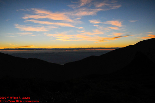
2010 - Trilha  ao Pico da Bandeira, Alto Caparaó e Natividade, Inverno by Wilson Moura, Copyright ©.All the images are inclosed on international copyright laws.All rights reservedsubmarino
2010 - Trilha ao Pico da Bandeira, Alto Caparaó e Natividade, Inverno by Wilson Moura
2010 - Trilha  ao Pico da Bandeira, Alto Caparaó e Natividade, Inverno by Wilson Moura, Copyright ©.All the images are inclosed on international copyright laws.All rights reservedsubmarino
2010 - Trilha ao Pico da Bandeira, Alto Caparaó e Natividade, Inverno by Wilson Moura
2010 - Trilha  ao Pico da Bandeira, Alto Caparaó e Natividade, Inverno by Wilson Moura, Copyright ©.All the images are inclosed on international copyright laws.All rights reservedsubmarino
2010 - Trilha ao Pico da Bandeira, Alto Caparaó e Natividade, Inverno by Wilson Moura
Por-do-sol ... Pedra Menina by Tody Macedo, menina pedra
Por-do-sol ... Pedra Menina by Tody Macedo
2010 - Trilha  ao Pico da Bandeira, Alto Caparaó e Natividade, Inverno by Wilson Moura, Copyright ©.All the images are inclosed on international copyright laws.All rights reservedsubmarino
2010 - Trilha ao Pico da Bandeira, Alto Caparaó e Natividade, Inverno by Wilson Moura
2010 - Trilha  ao Pico da Bandeira, Alto Caparaó e Natividade, Inverno by Wilson Moura, Copyright ©.All the images are inclosed on international copyright laws.All rights reservedsubmarino
2010 - Trilha ao Pico da Bandeira, Alto Caparaó e Natividade, Inverno by Wilson Moura
2010 - Trilha  ao Pico da Bandeira, Alto Caparaó e Natividade, Inverno by Wilson Moura, Copyright ©.All the images are inclosed on international copyright laws.All rights reservedsubmarino
2010 - Trilha ao Pico da Bandeira, Alto Caparaó e Natividade, Inverno by Wilson Moura
2010 - Trilha  ao Pico da Bandeira, Alto Caparaó e Natividade, Inverno by Wilson Moura, Copyright ©.All the images are inclosed on international copyright laws.All rights reservedsubmarino
2010 - Trilha ao Pico da Bandeira, Alto Caparaó e Natividade, Inverno by Wilson Moura
2010 - Trilha  ao Pico da Bandeira, Alto Caparaó e Natividade, Inverno by Wilson Moura, Copyright ©.All the images are inclosed on international copyright laws.All rights reservedsubmarino
2010 - Trilha ao Pico da Bandeira, Alto Caparaó e Natividade, Inverno by Wilson Moura
Sun Rising by OPEN YOUR EYES TO THE WORLD, Pico da Bandeira, Alto Caparaó - MGsun bandeira rising paradise minas gerais pico da alto caparaó go
Sun Rising by OPEN YOUR EYES TO THE WORLD
2010 - Trilha  ao Pico da Bandeira, Alto Caparaó e Natividade, Inverno by Wilson Moura, Copyright ©.All the images are inclosed on international copyright laws.All rights reservedacampamen
2010 - Trilha ao Pico da Bandeira, Alto Caparaó e Natividade, Inverno by Wilson Moura
noite no Pico da Bandeira by André Valério, sunset sky moon
noite no Pico da Bandeira by André Valério
foto 3 by Zumerle, Pico
foto 3 by Zumerle
Foto de ontem 10/08 :3 by josy280, square squareformat iphoneography instagramapp uploaded:by=instagram foursquare:venue=4f7d855fe4b02b
Foto de ontem 10/08 :3 by josy280