アメリカ合衆国 ワシントン州 スリー・フールズ・ピーク日の出日の入り時間
Location: アメリカ合衆国 > ワシントン州 > オウカノガン >
時間帯:
America/Los_Angeles
現地時間:
2025-06-26 00:21:56
経度:
-120.7631707
緯度:
48.9006913
今日の日の出時刻:
05:01:10 AM
今日の日の入時刻:
09:11:02 PM
今日の日長:
16h 9m 52s
明日の日の出時刻:
05:01:39 AM
明日の日の入時刻:
09:10:58 PM
明日の日長:
16h 9m 19s
すべて表示する
| 日付 | 日出 | 日没 | 日長 |
|---|---|---|---|
| 2025年01月01日 | 07:56:24 AM | 04:18:09 PM | 8h 21m 45s |
| 2025年01月02日 | 07:56:16 AM | 04:19:12 PM | 8h 22m 56s |
| 2025年01月03日 | 07:56:04 AM | 04:20:18 PM | 8h 24m 14s |
| 2025年01月04日 | 07:55:50 AM | 04:21:26 PM | 8h 25m 36s |
| 2025年01月05日 | 07:55:33 AM | 04:22:35 PM | 8h 27m 2s |
| 2025年01月06日 | 07:55:13 AM | 04:23:47 PM | 8h 28m 34s |
| 2025年01月07日 | 07:54:50 AM | 04:25:01 PM | 8h 30m 11s |
| 2025年01月08日 | 07:54:24 AM | 04:26:16 PM | 8h 31m 52s |
| 2025年01月09日 | 07:53:55 AM | 04:27:34 PM | 8h 33m 39s |
| 2025年01月10日 | 07:53:23 AM | 04:28:53 PM | 8h 35m 30s |
| 2025年01月11日 | 07:52:48 AM | 04:30:13 PM | 8h 37m 25s |
| 2025年01月12日 | 07:52:11 AM | 04:31:35 PM | 8h 39m 24s |
| 2025年01月13日 | 07:51:31 AM | 04:32:59 PM | 8h 41m 28s |
| 2025年01月14日 | 07:50:48 AM | 04:34:24 PM | 8h 43m 36s |
| 2025年01月15日 | 07:50:02 AM | 04:35:50 PM | 8h 45m 48s |
| 2025年01月16日 | 07:49:14 AM | 04:37:18 PM | 8h 48m 4s |
| 2025年01月17日 | 07:48:23 AM | 04:38:47 PM | 8h 50m 24s |
| 2025年01月18日 | 07:47:30 AM | 04:40:17 PM | 8h 52m 47s |
| 2025年01月19日 | 07:46:34 AM | 04:41:47 PM | 8h 55m 13s |
| 2025年01月20日 | 07:45:35 AM | 04:43:19 PM | 8h 57m 44s |
| 2025年01月21日 | 07:44:34 AM | 04:44:52 PM | 9h 0m 18s |
| 2025年01月22日 | 07:43:31 AM | 04:46:26 PM | 9h 2m 55s |
| 2025年01月23日 | 07:42:26 AM | 04:48:00 PM | 9h 5m 34s |
| 2025年01月24日 | 07:41:18 AM | 04:49:35 PM | 9h 8m 17s |
| 2025年01月25日 | 07:40:08 AM | 04:51:11 PM | 9h 11m 3s |
| 2025年01月26日 | 07:38:56 AM | 04:52:47 PM | 9h 13m 51s |
| 2025年01月27日 | 07:37:41 AM | 04:54:24 PM | 9h 16m 43s |
| 2025年01月28日 | 07:36:25 AM | 04:56:01 PM | 9h 19m 36s |
| 2025年01月29日 | 07:35:06 AM | 04:57:39 PM | 9h 22m 33s |
| 2025年01月30日 | 07:33:46 AM | 04:59:17 PM | 9h 25m 31s |
| 2025年01月31日 | 07:32:23 AM | 05:00:55 PM | 9h 28m 32s |
| 2025年02月01日 | 07:30:59 AM | 05:02:34 PM | 9h 31m 35s |
| 2025年02月02日 | 07:29:33 AM | 05:04:13 PM | 9h 34m 40s |
| 2025年02月03日 | 07:28:05 AM | 05:05:52 PM | 9h 37m 47s |
| 2025年02月04日 | 07:26:35 AM | 05:07:31 PM | 9h 40m 56s |
| 2025年02月05日 | 07:25:04 AM | 05:09:10 PM | 9h 44m 6s |
| 2025年02月06日 | 07:23:30 AM | 05:10:49 PM | 9h 47m 19s |
| 2025年02月07日 | 07:21:56 AM | 05:12:29 PM | 9h 50m 33s |
| 2025年02月08日 | 07:20:19 AM | 05:14:08 PM | 9h 53m 49s |
| 2025年02月09日 | 07:18:41 AM | 05:15:47 PM | 9h 57m 6s |
| 2025年02月10日 | 07:17:02 AM | 05:17:27 PM | 10h 0m 25s |
| 2025年02月11日 | 07:15:21 AM | 05:19:06 PM | 10h 3m 45s |
| 2025年02月12日 | 07:13:39 AM | 05:20:45 PM | 10h 7m 6s |
| 2025年02月13日 | 07:11:56 AM | 05:22:24 PM | 10h 10m 28s |
| 2025年02月14日 | 07:10:11 AM | 05:24:03 PM | 10h 13m 52s |
| 2025年02月15日 | 07:08:25 AM | 05:25:41 PM | 10h 17m 16s |
| 2025年02月16日 | 07:06:38 AM | 05:27:20 PM | 10h 20m 42s |
| 2025年02月17日 | 07:04:49 AM | 05:28:58 PM | 10h 24m 9s |
| 2025年02月18日 | 07:03:00 AM | 05:30:36 PM | 10h 27m 36s |
| 2025年02月19日 | 07:01:09 AM | 05:32:14 PM | 10h 31m 5s |
| 2025年02月20日 | 06:59:17 AM | 05:33:51 PM | 10h 34m 34s |
| 2025年02月21日 | 06:57:25 AM | 05:35:28 PM | 10h 38m 3s |
| 2025年02月22日 | 06:55:31 AM | 05:37:05 PM | 10h 41m 34s |
| 2025年02月23日 | 06:53:36 AM | 05:38:42 PM | 10h 45m 6s |
| 2025年02月24日 | 06:51:41 AM | 05:40:19 PM | 10h 48m 38s |
| 2025年02月25日 | 06:49:44 AM | 05:41:55 PM | 10h 52m 11s |
| 2025年02月26日 | 06:47:47 AM | 05:43:31 PM | 10h 55m 44s |
| 2025年02月27日 | 06:45:49 AM | 05:45:07 PM | 10h 59m 18s |
| 2025年02月28日 | 06:43:51 AM | 05:46:42 PM | 11h 2m 51s |
| 2025年03月01日 | 06:41:51 AM | 05:48:17 PM | 11h 6m 26s |
| 2025年03月02日 | 06:39:51 AM | 05:49:52 PM | 11h 10m 1s |
| 2025年03月03日 | 06:37:50 AM | 05:51:26 PM | 11h 13m 36s |
| 2025年03月04日 | 06:35:49 AM | 05:53:01 PM | 11h 17m 12s |
| 2025年03月05日 | 06:33:47 AM | 05:54:35 PM | 11h 20m 48s |
| 2025年03月06日 | 06:31:45 AM | 05:56:08 PM | 11h 24m 23s |
| 2025年03月07日 | 06:29:42 AM | 05:57:42 PM | 11h 28m 0s |
| 2025年03月08日 | 06:27:38 AM | 05:59:15 PM | 11h 31m 37s |
| 2025年03月09日 | 07:25:40 AM | 07:00:44 PM | 11h 35m 4s |
| 2025年03月10日 | 07:23:35 AM | 07:02:17 PM | 11h 38m 42s |
| 2025年03月11日 | 07:21:31 AM | 07:03:50 PM | 11h 42m 19s |
| 2025年03月12日 | 07:19:26 AM | 07:05:22 PM | 11h 45m 56s |
| 2025年03月13日 | 07:17:20 AM | 07:06:54 PM | 11h 49m 34s |
| 2025年03月14日 | 07:15:15 AM | 07:08:26 PM | 11h 53m 11s |
| 2025年03月15日 | 07:13:09 AM | 07:09:58 PM | 11h 56m 49s |
| 2025年03月16日 | 07:11:03 AM | 07:11:29 PM | 12h 0m 26s |
| 2025年03月17日 | 07:08:57 AM | 07:13:01 PM | 12h 4m 4s |
| 2025年03月18日 | 07:06:51 AM | 07:14:32 PM | 12h 7m 41s |
| 2025年03月19日 | 07:04:44 AM | 07:16:03 PM | 12h 11m 19s |
| 2025年03月20日 | 07:02:38 AM | 07:17:34 PM | 12h 14m 56s |
| 2025年03月21日 | 07:00:31 AM | 07:19:04 PM | 12h 18m 33s |
| 2025年03月22日 | 06:58:24 AM | 07:20:35 PM | 12h 22m 11s |
| 2025年03月23日 | 06:56:18 AM | 07:22:06 PM | 12h 25m 48s |
| 2025年03月24日 | 06:54:11 AM | 07:23:36 PM | 12h 29m 25s |
| 2025年03月25日 | 06:52:05 AM | 07:25:06 PM | 12h 33m 1s |
| 2025年03月26日 | 06:49:58 AM | 07:26:36 PM | 12h 36m 38s |
| 2025年03月27日 | 06:47:52 AM | 07:28:07 PM | 12h 40m 15s |
| 2025年03月28日 | 06:45:46 AM | 07:29:37 PM | 12h 43m 51s |
| 2025年03月29日 | 06:43:40 AM | 07:31:07 PM | 12h 47m 27s |
| 2025年03月30日 | 06:41:34 AM | 07:32:37 PM | 12h 51m 3s |
| 2025年03月31日 | 06:39:29 AM | 07:34:06 PM | 12h 54m 37s |
| 2025年04月01日 | 06:37:24 AM | 07:35:36 PM | 12h 58m 12s |
| 2025年04月02日 | 06:35:19 AM | 07:37:06 PM | 13h 1m 47s |
| 2025年04月03日 | 06:33:14 AM | 07:38:36 PM | 13h 5m 22s |
| 2025年04月04日 | 06:31:10 AM | 07:40:06 PM | 13h 8m 56s |
| 2025年04月05日 | 06:29:06 AM | 07:41:35 PM | 13h 12m 29s |
| 2025年04月06日 | 06:27:03 AM | 07:43:05 PM | 13h 16m 2s |
| 2025年04月07日 | 06:25:00 AM | 07:44:35 PM | 13h 19m 35s |
| 2025年04月08日 | 06:22:58 AM | 07:46:04 PM | 13h 23m 6s |
| 2025年04月09日 | 06:20:56 AM | 07:47:34 PM | 13h 26m 38s |
| 2025年04月10日 | 06:18:55 AM | 07:49:04 PM | 13h 30m 9s |
| 2025年04月11日 | 06:16:54 AM | 07:50:33 PM | 13h 33m 39s |
| 2025年04月12日 | 06:14:55 AM | 07:52:03 PM | 13h 37m 8s |
| 2025年04月13日 | 06:12:55 AM | 07:53:33 PM | 13h 40m 38s |
| 2025年04月14日 | 06:10:57 AM | 07:55:02 PM | 13h 44m 5s |
| 2025年04月15日 | 06:08:59 AM | 07:56:32 PM | 13h 47m 33s |
| 2025年04月16日 | 06:07:02 AM | 07:58:01 PM | 13h 50m 59s |
| 2025年04月17日 | 06:05:06 AM | 07:59:31 PM | 13h 54m 25s |
| 2025年04月18日 | 06:03:11 AM | 08:01:00 PM | 13h 57m 49s |
| 2025年04月19日 | 06:01:16 AM | 08:02:30 PM | 14h 1m 14s |
| 2025年04月20日 | 05:59:23 AM | 08:03:59 PM | 14h 4m 36s |
| 2025年04月21日 | 05:57:30 AM | 08:05:28 PM | 14h 7m 58s |
| 2025年04月22日 | 05:55:39 AM | 08:06:57 PM | 14h 11m 18s |
| 2025年04月23日 | 05:53:48 AM | 08:08:27 PM | 14h 14m 39s |
| 2025年04月24日 | 05:51:59 AM | 08:09:56 PM | 14h 17m 57s |
| 2025年04月25日 | 05:50:10 AM | 08:11:24 PM | 14h 21m 14s |
| 2025年04月26日 | 05:48:23 AM | 08:12:53 PM | 14h 24m 30s |
| 2025年04月27日 | 05:46:37 AM | 08:14:22 PM | 14h 27m 45s |
| 2025年04月28日 | 05:44:52 AM | 08:15:50 PM | 14h 30m 58s |
| 2025年04月29日 | 05:43:09 AM | 08:17:18 PM | 14h 34m 9s |
| 2025年04月30日 | 05:41:27 AM | 08:18:46 PM | 14h 37m 19s |
| 2025年05月01日 | 05:39:46 AM | 08:20:13 PM | 14h 40m 27s |
| 2025年05月02日 | 05:38:07 AM | 08:21:40 PM | 14h 43m 33s |
| 2025年05月03日 | 05:36:29 AM | 08:23:07 PM | 14h 46m 38s |
| 2025年05月04日 | 05:34:52 AM | 08:24:34 PM | 14h 49m 42s |
| 2025年05月05日 | 05:33:18 AM | 08:26:00 PM | 14h 52m 42s |
| 2025年05月06日 | 05:31:44 AM | 08:27:26 PM | 14h 55m 42s |
| 2025年05月07日 | 05:30:13 AM | 08:28:51 PM | 14h 58m 38s |
| 2025年05月08日 | 05:28:42 AM | 08:30:16 PM | 15h 1m 34s |
| 2025年05月09日 | 05:27:14 AM | 08:31:40 PM | 15h 4m 26s |
| 2025年05月10日 | 05:25:47 AM | 08:33:03 PM | 15h 7m 16s |
| 2025年05月11日 | 05:24:23 AM | 08:34:26 PM | 15h 10m 3s |
| 2025年05月12日 | 05:23:00 AM | 08:35:48 PM | 15h 12m 48s |
| 2025年05月13日 | 05:21:38 AM | 08:37:10 PM | 15h 15m 32s |
| 2025年05月14日 | 05:20:19 AM | 08:38:31 PM | 15h 18m 12s |
| 2025年05月15日 | 05:19:02 AM | 08:39:51 PM | 15h 20m 49s |
| 2025年05月16日 | 05:17:47 AM | 08:41:10 PM | 15h 23m 23s |
| 2025年05月17日 | 05:16:33 AM | 08:42:28 PM | 15h 25m 55s |
| 2025年05月18日 | 05:15:22 AM | 08:43:45 PM | 15h 28m 23s |
| 2025年05月19日 | 05:14:13 AM | 08:45:01 PM | 15h 30m 48s |
| 2025年05月20日 | 05:13:06 AM | 08:46:16 PM | 15h 33m 10s |
| 2025年05月21日 | 05:12:02 AM | 08:47:30 PM | 15h 35m 28s |
| 2025年05月22日 | 05:10:59 AM | 08:48:42 PM | 15h 37m 43s |
| 2025年05月23日 | 05:09:59 AM | 08:49:53 PM | 15h 39m 54s |
| 2025年05月24日 | 05:09:01 AM | 08:51:03 PM | 15h 42m 2s |
| 2025年05月25日 | 05:08:06 AM | 08:52:12 PM | 15h 44m 6s |
| 2025年05月26日 | 05:07:13 AM | 08:53:19 PM | 15h 46m 6s |
| 2025年05月27日 | 05:06:22 AM | 08:54:25 PM | 15h 48m 3s |
| 2025年05月28日 | 05:05:34 AM | 08:55:29 PM | 15h 49m 55s |
| 2025年05月29日 | 05:04:49 AM | 08:56:31 PM | 15h 51m 42s |
| 2025年05月30日 | 05:04:05 AM | 08:57:32 PM | 15h 53m 27s |
| 2025年05月31日 | 05:03:25 AM | 08:58:31 PM | 15h 55m 6s |
| 2025年06月01日 | 05:02:47 AM | 08:59:28 PM | 15h 56m 41s |
| 2025年06月02日 | 05:02:11 AM | 09:00:24 PM | 15h 58m 13s |
| 2025年06月03日 | 05:01:39 AM | 09:01:17 PM | 15h 59m 38s |
| 2025年06月04日 | 05:01:09 AM | 09:02:08 PM | 16h 0m 59s |
| 2025年06月05日 | 05:00:41 AM | 09:02:58 PM | 16h 2m 17s |
| 2025年06月06日 | 05:00:16 AM | 09:03:45 PM | 16h 3m 29s |
| 2025年06月07日 | 04:59:54 AM | 09:04:30 PM | 16h 4m 36s |
| 2025年06月08日 | 04:59:35 AM | 09:05:13 PM | 16h 5m 38s |
| 2025年06月09日 | 04:59:18 AM | 09:05:54 PM | 16h 6m 36s |
| 2025年06月10日 | 04:59:05 AM | 09:06:32 PM | 16h 7m 27s |
| 2025年06月11日 | 04:58:53 AM | 09:07:08 PM | 16h 8m 15s |
| 2025年06月12日 | 04:58:45 AM | 09:07:42 PM | 16h 8m 57s |
| 2025年06月13日 | 04:58:39 AM | 09:08:13 PM | 16h 9m 34s |
| 2025年06月14日 | 04:58:36 AM | 09:08:41 PM | 16h 10m 5s |
| 2025年06月15日 | 04:58:36 AM | 09:09:07 PM | 16h 10m 31s |
| 2025年06月16日 | 04:58:39 AM | 09:09:31 PM | 16h 10m 52s |
| 2025年06月17日 | 04:58:44 AM | 09:09:52 PM | 16h 11m 8s |
| 2025年06月18日 | 04:58:52 AM | 09:10:10 PM | 16h 11m 18s |
| 2025年06月19日 | 04:59:02 AM | 09:10:26 PM | 16h 11m 24s |
| 2025年06月20日 | 04:59:15 AM | 09:10:39 PM | 16h 11m 24s |
| 2025年06月21日 | 04:59:31 AM | 09:10:49 PM | 16h 11m 18s |
| 2025年06月22日 | 04:59:49 AM | 09:10:57 PM | 16h 11m 8s |
| 2025年06月23日 | 05:00:10 AM | 09:11:02 PM | 16h 10m 52s |
| 2025年06月24日 | 05:00:34 AM | 09:11:04 PM | 16h 10m 30s |
| 2025年06月25日 | 05:00:59 AM | 09:11:03 PM | 16h 10m 4s |
| 2025年06月26日 | 05:01:28 AM | 09:11:00 PM | 16h 9m 32s |
| 2025年06月27日 | 05:01:59 AM | 09:10:53 PM | 16h 8m 54s |
| 2025年06月28日 | 05:02:32 AM | 09:10:44 PM | 16h 8m 12s |
| 2025年06月29日 | 05:03:07 AM | 09:10:32 PM | 16h 7m 25s |
| 2025年06月30日 | 05:03:45 AM | 09:10:18 PM | 16h 6m 33s |
| 2025年07月01日 | 05:04:25 AM | 09:10:01 PM | 16h 5m 36s |
| 2025年07月02日 | 05:05:07 AM | 09:09:40 PM | 16h 4m 33s |
| 2025年07月03日 | 05:05:51 AM | 09:09:18 PM | 16h 3m 27s |
| 2025年07月04日 | 05:06:37 AM | 09:08:52 PM | 16h 2m 15s |
| 2025年07月05日 | 05:07:26 AM | 09:08:24 PM | 16h 0m 58s |
| 2025年07月06日 | 05:08:16 AM | 09:07:53 PM | 15h 59m 37s |
| 2025年07月07日 | 05:09:08 AM | 09:07:19 PM | 15h 58m 11s |
| 2025年07月08日 | 05:10:02 AM | 09:06:43 PM | 15h 56m 41s |
| 2025年07月09日 | 05:10:58 AM | 09:06:04 PM | 15h 55m 6s |
| 2025年07月10日 | 05:11:55 AM | 09:05:22 PM | 15h 53m 27s |
| 2025年07月11日 | 05:12:55 AM | 09:04:38 PM | 15h 51m 43s |
| 2025年07月12日 | 05:13:55 AM | 09:03:51 PM | 15h 49m 56s |
| 2025年07月13日 | 05:14:58 AM | 09:03:02 PM | 15h 48m 4s |
| 2025年07月14日 | 05:16:01 AM | 09:02:10 PM | 15h 46m 9s |
| 2025年07月15日 | 05:17:07 AM | 09:01:16 PM | 15h 44m 9s |
| 2025年07月16日 | 05:18:13 AM | 09:00:20 PM | 15h 42m 7s |
| 2025年07月17日 | 05:19:21 AM | 08:59:21 PM | 15h 40m 0s |
| 2025年07月18日 | 05:20:30 AM | 08:58:20 PM | 15h 37m 50s |
| 2025年07月19日 | 05:21:40 AM | 08:57:16 PM | 15h 35m 36s |
| 2025年07月20日 | 05:22:52 AM | 08:56:10 PM | 15h 33m 18s |
| 2025年07月21日 | 05:24:04 AM | 08:55:02 PM | 15h 30m 58s |
| 2025年07月22日 | 05:25:18 AM | 08:53:52 PM | 15h 28m 34s |
| 2025年07月23日 | 05:26:32 AM | 08:52:40 PM | 15h 26m 8s |
| 2025年07月24日 | 05:27:48 AM | 08:51:25 PM | 15h 23m 37s |
| 2025年07月25日 | 05:29:04 AM | 08:50:09 PM | 15h 21m 5s |
| 2025年07月26日 | 05:30:21 AM | 08:48:50 PM | 15h 18m 29s |
| 2025年07月27日 | 05:31:39 AM | 08:47:30 PM | 15h 15m 51s |
| 2025年07月28日 | 05:32:57 AM | 08:46:08 PM | 15h 13m 11s |
| 2025年07月29日 | 05:34:16 AM | 08:44:43 PM | 15h 10m 27s |
| 2025年07月30日 | 05:35:36 AM | 08:43:17 PM | 15h 7m 41s |
| 2025年07月31日 | 05:36:56 AM | 08:41:49 PM | 15h 4m 53s |
| 2025年08月01日 | 05:38:17 AM | 08:40:20 PM | 15h 2m 3s |
| 2025年08月02日 | 05:39:38 AM | 08:38:49 PM | 14h 59m 11s |
| 2025年08月03日 | 05:41:00 AM | 08:37:16 PM | 14h 56m 16s |
| 2025年08月04日 | 05:42:22 AM | 08:35:41 PM | 14h 53m 19s |
| 2025年08月05日 | 05:43:45 AM | 08:34:05 PM | 14h 50m 20s |
| 2025年08月06日 | 05:45:08 AM | 08:32:27 PM | 14h 47m 19s |
| 2025年08月07日 | 05:46:31 AM | 08:30:48 PM | 14h 44m 17s |
| 2025年08月08日 | 05:47:55 AM | 08:29:08 PM | 14h 41m 13s |
| 2025年08月09日 | 05:49:18 AM | 08:27:26 PM | 14h 38m 8s |
| 2025年08月10日 | 05:50:42 AM | 08:25:42 PM | 14h 35m 0s |
| 2025年08月11日 | 05:52:07 AM | 08:23:58 PM | 14h 31m 51s |
| 2025年08月12日 | 05:53:31 AM | 08:22:12 PM | 14h 28m 41s |
| 2025年08月13日 | 05:54:55 AM | 08:20:25 PM | 14h 25m 30s |
| 2025年08月14日 | 05:56:20 AM | 08:18:36 PM | 14h 22m 16s |
| 2025年08月15日 | 05:57:45 AM | 08:16:47 PM | 14h 19m 2s |
| 2025年08月16日 | 05:59:09 AM | 08:14:56 PM | 14h 15m 47s |
| 2025年08月17日 | 06:00:34 AM | 08:13:04 PM | 14h 12m 30s |
| 2025年08月18日 | 06:01:59 AM | 08:11:12 PM | 14h 9m 13s |
| 2025年08月19日 | 06:03:24 AM | 08:09:18 PM | 14h 5m 54s |
| 2025年08月20日 | 06:04:49 AM | 08:07:23 PM | 14h 2m 34s |
| 2025年08月21日 | 06:06:14 AM | 08:05:27 PM | 13h 59m 13s |
| 2025年08月22日 | 06:07:40 AM | 08:03:31 PM | 13h 55m 51s |
| 2025年08月23日 | 06:09:05 AM | 08:01:33 PM | 13h 52m 28s |
| 2025年08月24日 | 06:10:30 AM | 07:59:35 PM | 13h 49m 5s |
| 2025年08月25日 | 06:11:55 AM | 07:57:36 PM | 13h 45m 41s |
| 2025年08月26日 | 06:13:20 AM | 07:55:36 PM | 13h 42m 16s |
| 2025年08月27日 | 06:14:45 AM | 07:53:36 PM | 13h 38m 51s |
| 2025年08月28日 | 06:16:10 AM | 07:51:34 PM | 13h 35m 24s |
| 2025年08月29日 | 06:17:35 AM | 07:49:32 PM | 13h 31m 57s |
| 2025年08月30日 | 06:19:00 AM | 07:47:30 PM | 13h 28m 30s |
| 2025年08月31日 | 06:20:25 AM | 07:45:27 PM | 13h 25m 2s |
| 2025年09月01日 | 06:21:50 AM | 07:43:23 PM | 13h 21m 33s |
| 2025年09月02日 | 06:23:15 AM | 07:41:19 PM | 13h 18m 4s |
| 2025年09月03日 | 06:24:40 AM | 07:39:14 PM | 13h 14m 34s |
| 2025年09月04日 | 06:26:05 AM | 07:37:09 PM | 13h 11m 4s |
| 2025年09月05日 | 06:27:29 AM | 07:35:04 PM | 13h 7m 35s |
| 2025年09月06日 | 06:28:54 AM | 07:32:58 PM | 13h 4m 4s |
| 2025年09月07日 | 06:30:19 AM | 07:30:51 PM | 13h 0m 32s |
| 2025年09月08日 | 06:31:44 AM | 07:28:45 PM | 12h 57m 1s |
| 2025年09月09日 | 06:33:09 AM | 07:26:38 PM | 12h 53m 29s |
| 2025年09月10日 | 06:34:34 AM | 07:24:31 PM | 12h 49m 57s |
| 2025年09月11日 | 06:35:59 AM | 07:22:23 PM | 12h 46m 24s |
| 2025年09月12日 | 06:37:24 AM | 07:20:15 PM | 12h 42m 51s |
| 2025年09月13日 | 06:38:49 AM | 07:18:08 PM | 12h 39m 19s |
| 2025年09月14日 | 06:40:14 AM | 07:16:00 PM | 12h 35m 46s |
| 2025年09月15日 | 06:41:40 AM | 07:13:51 PM | 12h 32m 11s |
| 2025年09月16日 | 06:43:05 AM | 07:11:43 PM | 12h 28m 38s |
| 2025年09月17日 | 06:44:30 AM | 07:09:35 PM | 12h 25m 5s |
| 2025年09月18日 | 06:45:56 AM | 07:07:27 PM | 12h 21m 31s |
| 2025年09月19日 | 06:47:21 AM | 07:05:18 PM | 12h 17m 57s |
| 2025年09月20日 | 06:48:47 AM | 07:03:10 PM | 12h 14m 23s |
| 2025年09月21日 | 06:50:13 AM | 07:01:02 PM | 12h 10m 49s |
| 2025年09月22日 | 06:51:39 AM | 06:58:54 PM | 12h 7m 15s |
| 2025年09月23日 | 06:53:05 AM | 06:56:46 PM | 12h 3m 41s |
| 2025年09月24日 | 06:54:32 AM | 06:54:38 PM | 12h 0m 6s |
| 2025年09月25日 | 06:55:58 AM | 06:52:30 PM | 11h 56m 32s |
| 2025年09月26日 | 06:57:25 AM | 06:50:23 PM | 11h 52m 58s |
| 2025年09月27日 | 06:58:52 AM | 06:48:16 PM | 11h 49m 24s |
| 2025年09月28日 | 07:00:19 AM | 06:46:09 PM | 11h 45m 50s |
| 2025年09月29日 | 07:01:46 AM | 06:44:02 PM | 11h 42m 16s |
| 2025年09月30日 | 07:03:14 AM | 06:41:56 PM | 11h 38m 42s |
| 2025年10月01日 | 07:04:41 AM | 06:39:50 PM | 11h 35m 9s |
| 2025年10月02日 | 07:06:10 AM | 06:37:44 PM | 11h 31m 34s |
| 2025年10月03日 | 07:07:38 AM | 06:35:39 PM | 11h 28m 1s |
| 2025年10月04日 | 07:09:06 AM | 06:33:34 PM | 11h 24m 28s |
| 2025年10月05日 | 07:10:35 AM | 06:31:30 PM | 11h 20m 55s |
| 2025年10月06日 | 07:12:04 AM | 06:29:27 PM | 11h 17m 23s |
| 2025年10月07日 | 07:13:34 AM | 06:27:23 PM | 11h 13m 49s |
| 2025年10月08日 | 07:15:03 AM | 06:25:21 PM | 11h 10m 18s |
| 2025年10月09日 | 07:16:33 AM | 06:23:19 PM | 11h 6m 46s |
| 2025年10月10日 | 07:18:04 AM | 06:21:18 PM | 11h 3m 14s |
| 2025年10月11日 | 07:19:34 AM | 06:19:17 PM | 10h 59m 43s |
| 2025年10月12日 | 07:21:05 AM | 06:17:18 PM | 10h 56m 13s |
| 2025年10月13日 | 07:22:36 AM | 06:15:19 PM | 10h 52m 43s |
| 2025年10月14日 | 07:24:08 AM | 06:13:20 PM | 10h 49m 12s |
| 2025年10月15日 | 07:25:39 AM | 06:11:23 PM | 10h 45m 44s |
| 2025年10月16日 | 07:27:11 AM | 06:09:27 PM | 10h 42m 16s |
| 2025年10月17日 | 07:28:44 AM | 06:07:31 PM | 10h 38m 47s |
| 2025年10月18日 | 07:30:16 AM | 06:05:36 PM | 10h 35m 20s |
| 2025年10月19日 | 07:31:49 AM | 06:03:43 PM | 10h 31m 54s |
| 2025年10月20日 | 07:33:23 AM | 06:01:50 PM | 10h 28m 27s |
| 2025年10月21日 | 07:34:56 AM | 05:59:59 PM | 10h 25m 3s |
| 2025年10月22日 | 07:36:30 AM | 05:58:08 PM | 10h 21m 38s |
| 2025年10月23日 | 07:38:04 AM | 05:56:19 PM | 10h 18m 15s |
| 2025年10月24日 | 07:39:38 AM | 05:54:31 PM | 10h 14m 53s |
| 2025年10月25日 | 07:41:12 AM | 05:52:44 PM | 10h 11m 32s |
| 2025年10月26日 | 07:42:47 AM | 05:50:58 PM | 10h 8m 11s |
| 2025年10月27日 | 07:44:22 AM | 05:49:14 PM | 10h 4m 52s |
| 2025年10月28日 | 07:45:57 AM | 05:47:31 PM | 10h 1m 34s |
| 2025年10月29日 | 07:47:32 AM | 05:45:50 PM | 9h 58m 18s |
| 2025年10月30日 | 07:49:07 AM | 05:44:10 PM | 9h 55m 3s |
| 2025年10月31日 | 07:50:43 AM | 05:42:31 PM | 9h 51m 48s |
| 2025年11月01日 | 07:52:18 AM | 05:40:54 PM | 9h 48m 36s |
| 2025年11月02日 | 06:53:58 AM | 04:39:15 PM | 9h 45m 17s |
| 2025年11月03日 | 06:55:33 AM | 04:37:41 PM | 9h 42m 8s |
| 2025年11月04日 | 06:57:09 AM | 04:36:09 PM | 9h 39m 0s |
| 2025年11月05日 | 06:58:44 AM | 04:34:39 PM | 9h 35m 55s |
| 2025年11月06日 | 07:00:19 AM | 04:33:10 PM | 9h 32m 51s |
| 2025年11月07日 | 07:01:55 AM | 04:31:43 PM | 9h 29m 48s |
| 2025年11月08日 | 07:03:30 AM | 04:30:18 PM | 9h 26m 48s |
| 2025年11月09日 | 07:05:04 AM | 04:28:56 PM | 9h 23m 52s |
| 2025年11月10日 | 07:06:39 AM | 04:27:35 PM | 9h 20m 56s |
| 2025年11月11日 | 07:08:13 AM | 04:26:16 PM | 9h 18m 3s |
| 2025年11月12日 | 07:09:47 AM | 04:24:59 PM | 9h 15m 12s |
| 2025年11月13日 | 07:11:20 AM | 04:23:44 PM | 9h 12m 24s |
| 2025年11月14日 | 07:12:53 AM | 04:22:31 PM | 9h 9m 38s |
| 2025年11月15日 | 07:14:26 AM | 04:21:21 PM | 9h 6m 55s |
| 2025年11月16日 | 07:15:57 AM | 04:20:13 PM | 9h 4m 16s |
| 2025年11月17日 | 07:17:29 AM | 04:19:07 PM | 9h 1m 38s |
| 2025年11月18日 | 07:18:59 AM | 04:18:03 PM | 8h 59m 4s |
| 2025年11月19日 | 07:20:29 AM | 04:17:02 PM | 8h 56m 33s |
| 2025年11月20日 | 07:21:58 AM | 04:16:04 PM | 8h 54m 6s |
| 2025年11月21日 | 07:23:25 AM | 04:15:07 PM | 8h 51m 42s |
| 2025年11月22日 | 07:24:52 AM | 04:14:14 PM | 8h 49m 22s |
| 2025年11月23日 | 07:26:18 AM | 04:13:23 PM | 8h 47m 5s |
| 2025年11月24日 | 07:27:43 AM | 04:12:34 PM | 8h 44m 51s |
| 2025年11月25日 | 07:29:07 AM | 04:11:49 PM | 8h 42m 42s |
| 2025年11月26日 | 07:30:29 AM | 04:11:06 PM | 8h 40m 37s |
| 2025年11月27日 | 07:31:50 AM | 04:10:25 PM | 8h 38m 35s |
| 2025年11月28日 | 07:33:10 AM | 04:09:48 PM | 8h 36m 38s |
| 2025年11月29日 | 07:34:28 AM | 04:09:13 PM | 8h 34m 45s |
| 2025年11月30日 | 07:35:45 AM | 04:08:42 PM | 8h 32m 57s |
| 2025年12月01日 | 07:37:00 AM | 04:08:13 PM | 8h 31m 13s |
| 2025年12月02日 | 07:38:13 AM | 04:07:47 PM | 8h 29m 34s |
| 2025年12月03日 | 07:39:25 AM | 04:07:24 PM | 8h 27m 59s |
| 2025年12月04日 | 07:40:34 AM | 04:07:04 PM | 8h 26m 30s |
| 2025年12月05日 | 07:41:42 AM | 04:06:47 PM | 8h 25m 5s |
| 2025年12月06日 | 07:42:48 AM | 04:06:32 PM | 8h 23m 44s |
| 2025年12月07日 | 07:43:51 AM | 04:06:21 PM | 8h 22m 30s |
| 2025年12月08日 | 07:44:53 AM | 04:06:14 PM | 8h 21m 21s |
| 2025年12月09日 | 07:45:52 AM | 04:06:09 PM | 8h 20m 17s |
| 2025年12月10日 | 07:46:49 AM | 04:06:07 PM | 8h 19m 18s |
| 2025年12月11日 | 07:47:44 AM | 04:06:08 PM | 8h 18m 24s |
| 2025年12月12日 | 07:48:36 AM | 04:06:12 PM | 8h 17m 36s |
| 2025年12月13日 | 07:49:26 AM | 04:06:20 PM | 8h 16m 54s |
| 2025年12月14日 | 07:50:14 AM | 04:06:30 PM | 8h 16m 16s |
| 2025年12月15日 | 07:50:58 AM | 04:06:44 PM | 8h 15m 46s |
| 2025年12月16日 | 07:51:40 AM | 04:07:00 PM | 8h 15m 20s |
| 2025年12月17日 | 07:52:20 AM | 04:07:20 PM | 8h 15m 0s |
| 2025年12月18日 | 07:52:57 AM | 04:07:42 PM | 8h 14m 45s |
| 2025年12月19日 | 07:53:30 AM | 04:08:08 PM | 8h 14m 38s |
| 2025年12月20日 | 07:54:02 AM | 04:08:36 PM | 8h 14m 34s |
| 2025年12月21日 | 07:54:30 AM | 04:09:08 PM | 8h 14m 38s |
| 2025年12月22日 | 07:54:55 AM | 04:09:42 PM | 8h 14m 47s |
| 2025年12月23日 | 07:55:18 AM | 04:10:19 PM | 8h 15m 1s |
| 2025年12月24日 | 07:55:37 AM | 04:10:59 PM | 8h 15m 22s |
| 2025年12月25日 | 07:55:54 AM | 04:11:42 PM | 8h 15m 48s |
| 2025年12月26日 | 07:56:07 AM | 04:12:27 PM | 8h 16m 20s |
| 2025年12月27日 | 07:56:18 AM | 04:13:16 PM | 8h 16m 58s |
| 2025年12月28日 | 07:56:25 AM | 04:14:06 PM | 8h 17m 41s |
| 2025年12月29日 | 07:56:30 AM | 04:14:59 PM | 8h 18m 29s |
| 2025年12月30日 | 07:56:31 AM | 04:15:55 PM | 8h 19m 24s |
| 2025年12月31日 | 07:56:30 AM | 04:16:53 PM | 8h 20m 23s |
写真

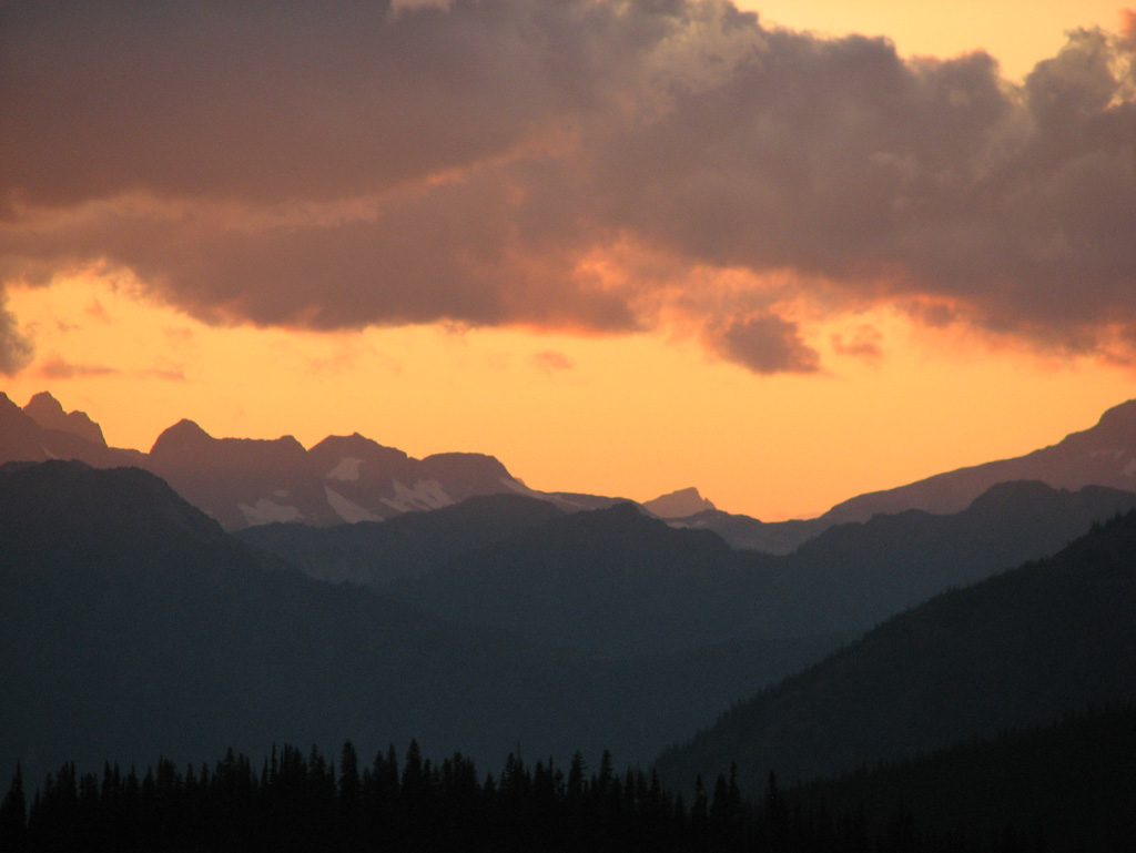
Sunset from Windy Joe

Sunset from Windy Joe
Sunset from Anacortes Crossing 3

More Sunset
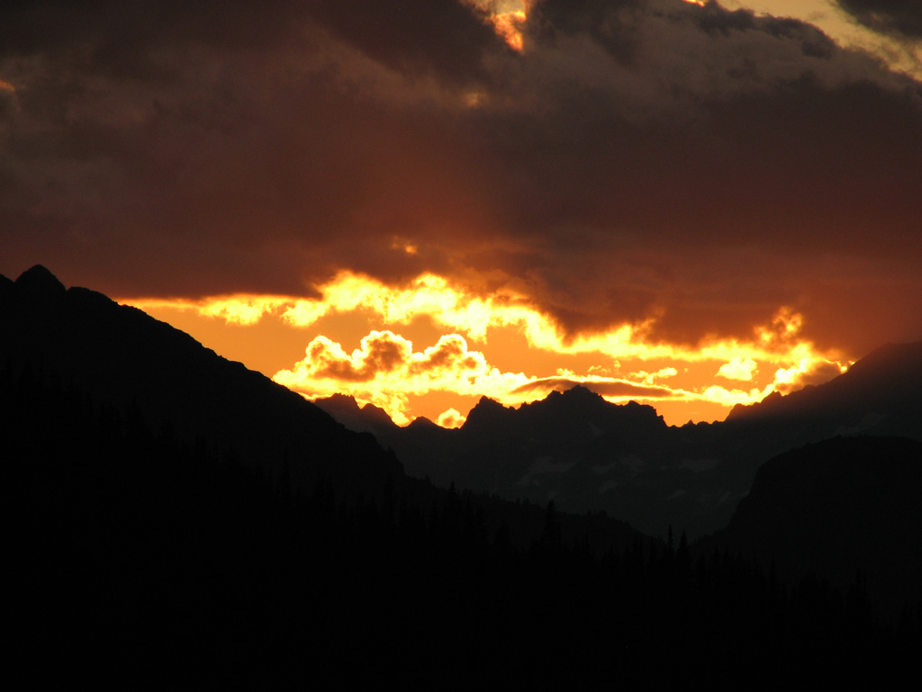
Sunset Near Anacortes Crossing 2

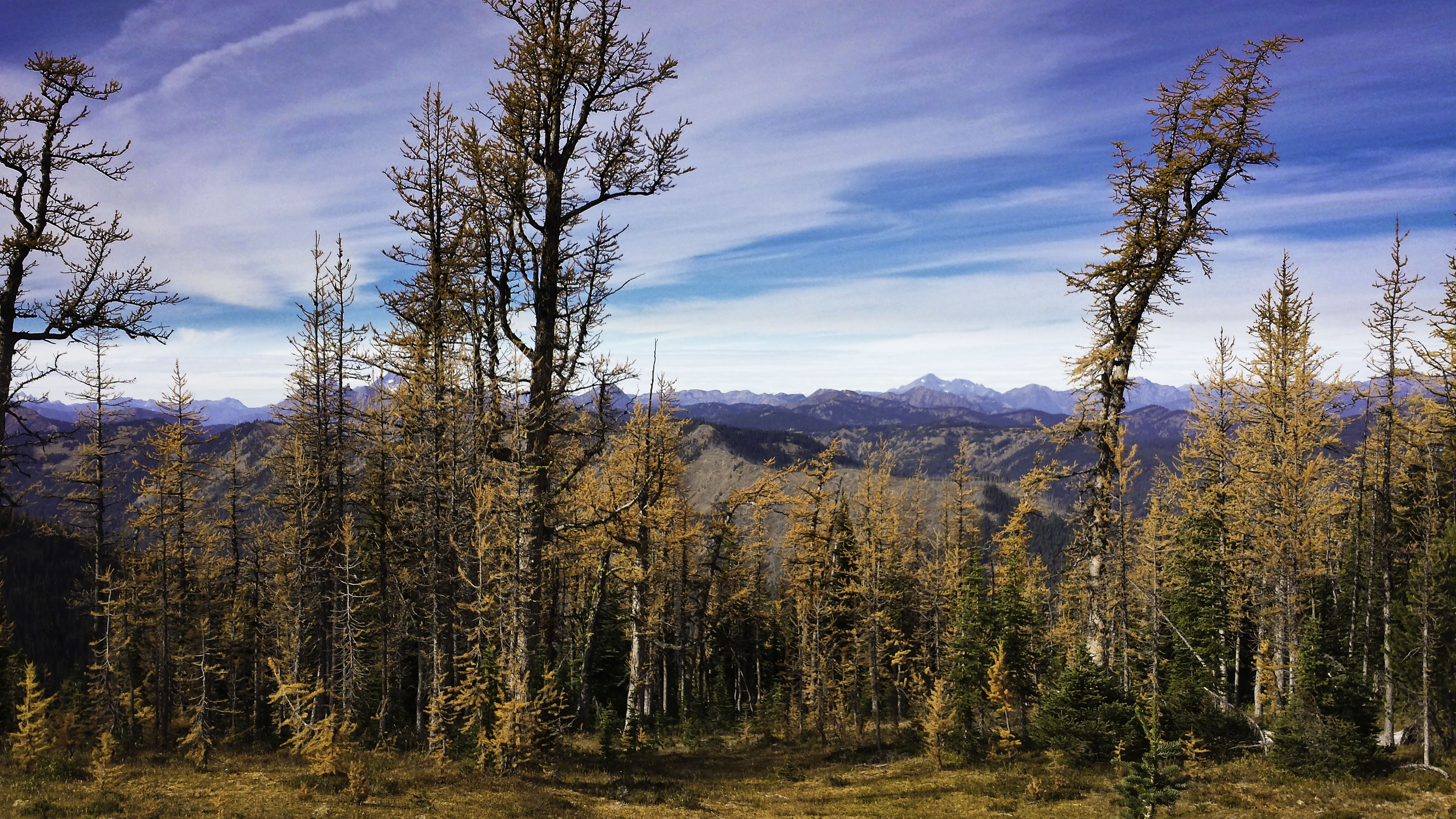
Sunset with the Larches
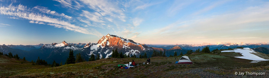
Jack Mountain sunrise panorama from summit camp on Devils Dome - Labor Day 2011
Sunrise on Jack Mountain from Devils Dome - Labor Day 2011
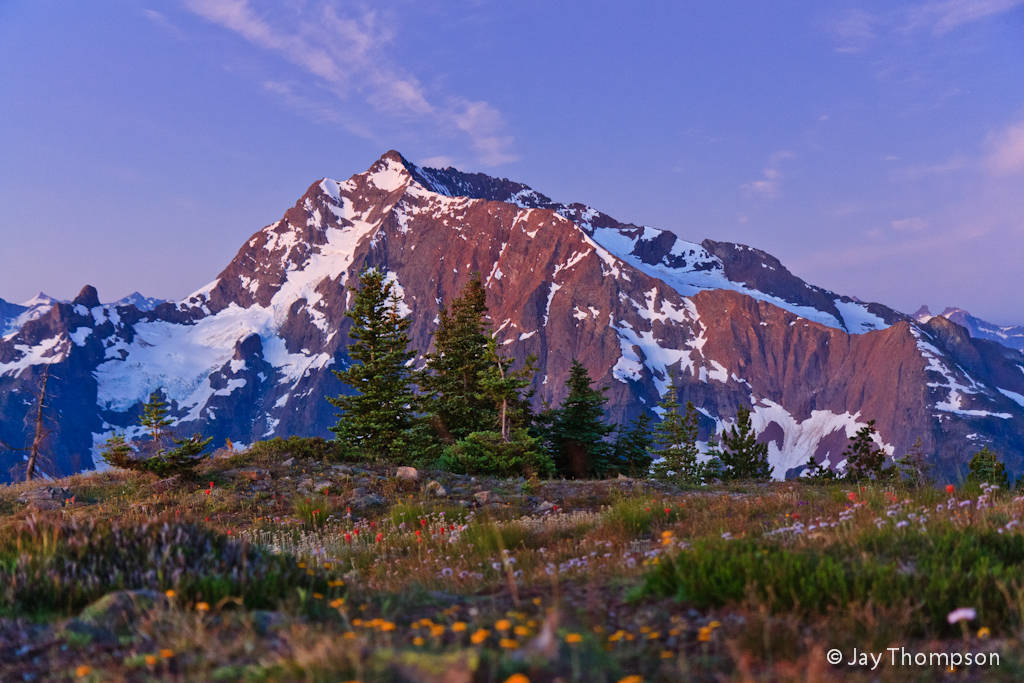
Golden scenery

From the top

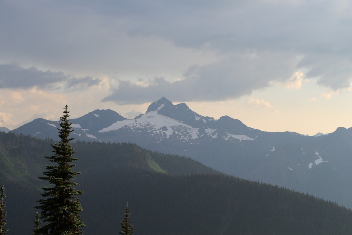
3783 Zoomed-in view of Slate Peak (far left) from the Devils Dome Trail northeast of Devils Pass
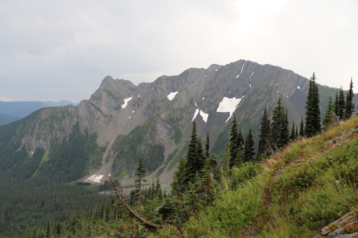
3773 View of the north face of Peak 7270 from the Devils Dome Trail northeast of Devils Pass
3852 Zoomed-in view of the northeast face of Crater Mountain from the Jackita Ridge Trail near Devils Pass
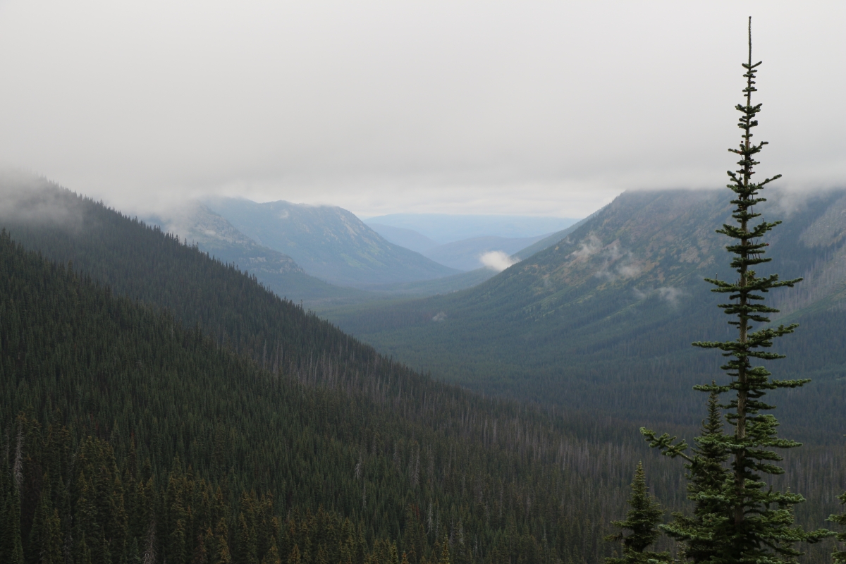
2894 View north into the West Fork Pasayten River Valley from the PCT south of Foggy Pass
Mt Frosty Ridgeline

View into North Cascades National Park from Jakita Ridge
2891 View into the West Fork Pasayten River Valley from the PCT south of Foggy Pass
3754 View from a nice campsite below Peak 7514 on the Devils Dome Trail northeast of Devils Pass

2824 No views except mist from the ridge above the WACS2636 Campsite on the PCT at Windy Pass
アメリカ合衆国 ワシントン州 スリー・フールズ・ピークの地図
別の場所を検索
近所の場所
アメリカ合衆国 ワシントン州 パウダー山
アメリカ合衆国 ワシントン州 ブリザード・ピーク
アメリカ合衆国 ワシントン州 シュール山
アメリカ合衆国 ワシントン州 ホルマン・ピーク
アメリカ合衆国 ワシントン州 ソーダ・ピーク
アメリカ合衆国 ワシントン州 スモーキー山
アメリカ合衆国 ワシントン州 ウィスロップ山
Pacific Crest Trail, Manning Park, WA, アメリカ合衆国Pacific Crest Trail - Northern Terminus
アメリカ合衆国 ワシントン州 ホルドーバー・リッジ
アメリカ合衆国 ワシントン州 ジョカー山
アメリカ合衆国 ワシントン州 キャッスル・ピーク
アメリカ合衆国 ワシントン州 フリーズアウト山
アメリカ合衆国 ワシントン州 ジャッキータ・リッジ
アメリカ合衆国 ワシントン州 ジャッキータ・リッジ・サウス
アメリカ合衆国 ワシントン州 ポイント・ディファイアンス
BC-3, Manning Park, BC V0X 1R0 カナダManning Park Resort
カナダ 〒V0X ブリティッシュコロンビア州 マニング・パーク
カナダ 〒V0X ブリティッシュコロンビア州 オカナガン=シミルカミーン H ライトニング湖
Manning Park, BC V0X 1R0 カナダCascade Lookout
カナダ 〒V0X ブリティッシュコロンビア州 フレイザー・バレー B サイミター・ノール
最近の検索
- アメリカ合衆国 アラスカ州 レッド・ドッグ・マイン日の出日の入り時間
- Am bhf, Borken, ドイツアム・バーンホーフ日の出日の入り時間
- 4th St E, Sonoma, CA, USA日の出日の入り時間
- Oakland Ave, Williamsport, PA アメリカ合衆国日の出日の入り時間
- Via Roma, Pieranica CR, イタリアローマ通り日の出日の入り時間
- クロアチア 〒 ドゥブロブニク GradClock Tower of Dubrovnik日の出日の入り時間
- アルゼンチン チュブ州 トレリュー日の出日の入り時間
- Hartfords Bluff Cir, Mt Pleasant, SC アメリカ合衆国日の出日の入り時間
- 日本、熊本県熊本市北区日の出日の入り時間
- 中華人民共和国 福州市 平潭県 平潭島日の出日の入り時間