アメリカ合衆国 〒 ウェスト・バージニア州 ミラン日の出日の入り時間
Location: アメリカ合衆国 > ウェスト・バージニア州 > ハーディ > アメリカ合衆国 ウェスト・バージニア州 サウス・フォーク >
時間帯:
America/New_York
現地時間:
2025-07-09 13:09:43
経度:
-79.0992004
緯度:
38.8140017
今日の日の出時刻:
06:00:37 AM
今日の日の入時刻:
08:43:10 PM
今日の日長:
14h 42m 33s
明日の日の出時刻:
06:01:18 AM
明日の日の入時刻:
08:42:45 PM
明日の日長:
14h 41m 27s
すべて表示する
| 日付 | 日出 | 日没 | 日長 |
|---|---|---|---|
| 2025年01月01日 | 07:34:48 AM | 05:06:13 PM | 9h 31m 25s |
| 2025年01月02日 | 07:34:53 AM | 05:07:04 PM | 9h 32m 11s |
| 2025年01月03日 | 07:34:55 AM | 05:07:56 PM | 9h 33m 1s |
| 2025年01月04日 | 07:34:55 AM | 05:08:49 PM | 9h 33m 54s |
| 2025年01月05日 | 07:34:53 AM | 05:09:44 PM | 9h 34m 51s |
| 2025年01月06日 | 07:34:49 AM | 05:10:39 PM | 9h 35m 50s |
| 2025年01月07日 | 07:34:43 AM | 05:11:36 PM | 9h 36m 53s |
| 2025年01月08日 | 07:34:35 AM | 05:12:34 PM | 9h 37m 59s |
| 2025年01月09日 | 07:34:24 AM | 05:13:34 PM | 9h 39m 10s |
| 2025年01月10日 | 07:34:12 AM | 05:14:34 PM | 9h 40m 22s |
| 2025年01月11日 | 07:33:57 AM | 05:15:35 PM | 9h 41m 38s |
| 2025年01月12日 | 07:33:40 AM | 05:16:36 PM | 9h 42m 56s |
| 2025年01月13日 | 07:33:21 AM | 05:17:39 PM | 9h 44m 18s |
| 2025年01月14日 | 07:33:00 AM | 05:18:42 PM | 9h 45m 42s |
| 2025年01月15日 | 07:32:37 AM | 05:19:47 PM | 9h 47m 10s |
| 2025年01月16日 | 07:32:12 AM | 05:20:51 PM | 9h 48m 39s |
| 2025年01月17日 | 07:31:45 AM | 05:21:57 PM | 9h 50m 12s |
| 2025年01月18日 | 07:31:16 AM | 05:23:03 PM | 9h 51m 47s |
| 2025年01月19日 | 07:30:45 AM | 05:24:09 PM | 9h 53m 24s |
| 2025年01月20日 | 07:30:12 AM | 05:25:16 PM | 9h 55m 4s |
| 2025年01月21日 | 07:29:37 AM | 05:26:24 PM | 9h 56m 47s |
| 2025年01月22日 | 07:29:00 AM | 05:27:32 PM | 9h 58m 32s |
| 2025年01月23日 | 07:28:21 AM | 05:28:40 PM | 10h 0m 19s |
| 2025年01月24日 | 07:27:40 AM | 05:29:48 PM | 10h 2m 8s |
| 2025年01月25日 | 07:26:57 AM | 05:30:57 PM | 10h 4m 0s |
| 2025年01月26日 | 07:26:13 AM | 05:32:06 PM | 10h 5m 53s |
| 2025年01月27日 | 07:25:26 AM | 05:33:15 PM | 10h 7m 49s |
| 2025年01月28日 | 07:24:38 AM | 05:34:24 PM | 10h 9m 46s |
| 2025年01月29日 | 07:23:49 AM | 05:35:33 PM | 10h 11m 44s |
| 2025年01月30日 | 07:22:57 AM | 05:36:42 PM | 10h 13m 45s |
| 2025年01月31日 | 07:22:04 AM | 05:37:52 PM | 10h 15m 48s |
| 2025年02月01日 | 07:21:09 AM | 05:39:01 PM | 10h 17m 52s |
| 2025年02月02日 | 07:20:13 AM | 05:40:11 PM | 10h 19m 58s |
| 2025年02月03日 | 07:19:15 AM | 05:41:20 PM | 10h 22m 5s |
| 2025年02月04日 | 07:18:16 AM | 05:42:29 PM | 10h 24m 13s |
| 2025年02月05日 | 07:17:15 AM | 05:43:38 PM | 10h 26m 23s |
| 2025年02月06日 | 07:16:12 AM | 05:44:47 PM | 10h 28m 35s |
| 2025年02月07日 | 07:15:08 AM | 05:45:56 PM | 10h 30m 48s |
| 2025年02月08日 | 07:14:03 AM | 05:47:05 PM | 10h 33m 2s |
| 2025年02月09日 | 07:12:56 AM | 05:48:14 PM | 10h 35m 18s |
| 2025年02月10日 | 07:11:48 AM | 05:49:22 PM | 10h 37m 34s |
| 2025年02月11日 | 07:10:39 AM | 05:50:30 PM | 10h 39m 51s |
| 2025年02月12日 | 07:09:28 AM | 05:51:38 PM | 10h 42m 10s |
| 2025年02月13日 | 07:08:17 AM | 05:52:46 PM | 10h 44m 29s |
| 2025年02月14日 | 07:07:04 AM | 05:53:53 PM | 10h 46m 49s |
| 2025年02月15日 | 07:05:49 AM | 05:55:00 PM | 10h 49m 11s |
| 2025年02月16日 | 07:04:34 AM | 05:56:07 PM | 10h 51m 33s |
| 2025年02月17日 | 07:03:18 AM | 05:57:13 PM | 10h 53m 55s |
| 2025年02月18日 | 07:02:00 AM | 05:58:20 PM | 10h 56m 20s |
| 2025年02月19日 | 07:00:42 AM | 05:59:26 PM | 10h 58m 44s |
| 2025年02月20日 | 06:59:22 AM | 06:00:31 PM | 11h 1m 9s |
| 2025年02月21日 | 06:58:02 AM | 06:01:37 PM | 11h 3m 35s |
| 2025年02月22日 | 06:56:40 AM | 06:02:42 PM | 11h 6m 2s |
| 2025年02月23日 | 06:55:18 AM | 06:03:46 PM | 11h 8m 28s |
| 2025年02月24日 | 06:53:55 AM | 06:04:51 PM | 11h 10m 56s |
| 2025年02月25日 | 06:52:31 AM | 06:05:55 PM | 11h 13m 24s |
| 2025年02月26日 | 06:51:06 AM | 06:06:58 PM | 11h 15m 52s |
| 2025年02月27日 | 06:49:41 AM | 06:08:02 PM | 11h 18m 21s |
| 2025年02月28日 | 06:48:14 AM | 06:09:05 PM | 11h 20m 51s |
| 2025年03月01日 | 06:46:48 AM | 06:10:08 PM | 11h 23m 20s |
| 2025年03月02日 | 06:45:20 AM | 06:11:10 PM | 11h 25m 50s |
| 2025年03月03日 | 06:43:52 AM | 06:12:13 PM | 11h 28m 21s |
| 2025年03月04日 | 06:42:23 AM | 06:13:15 PM | 11h 30m 52s |
| 2025年03月05日 | 06:40:54 AM | 06:14:16 PM | 11h 33m 22s |
| 2025年03月06日 | 06:39:24 AM | 06:15:18 PM | 11h 35m 54s |
| 2025年03月07日 | 06:37:53 AM | 06:16:19 PM | 11h 38m 26s |
| 2025年03月08日 | 06:36:22 AM | 06:17:20 PM | 11h 40m 58s |
| 2025年03月09日 | 07:34:55 AM | 07:18:18 PM | 11h 43m 23s |
| 2025年03月10日 | 07:33:23 AM | 07:19:18 PM | 11h 45m 55s |
| 2025年03月11日 | 07:31:51 AM | 07:20:18 PM | 11h 48m 27s |
| 2025年03月12日 | 07:30:19 AM | 07:21:18 PM | 11h 50m 59s |
| 2025年03月13日 | 07:28:46 AM | 07:22:18 PM | 11h 53m 32s |
| 2025年03月14日 | 07:27:13 AM | 07:23:18 PM | 11h 56m 5s |
| 2025年03月15日 | 07:25:40 AM | 07:24:17 PM | 11h 58m 37s |
| 2025年03月16日 | 07:24:06 AM | 07:25:16 PM | 12h 1m 10s |
| 2025年03月17日 | 07:22:32 AM | 07:26:15 PM | 12h 3m 43s |
| 2025年03月18日 | 07:20:59 AM | 07:27:14 PM | 12h 6m 15s |
| 2025年03月19日 | 07:19:25 AM | 07:28:12 PM | 12h 8m 47s |
| 2025年03月20日 | 07:17:50 AM | 07:29:11 PM | 12h 11m 21s |
| 2025年03月21日 | 07:16:16 AM | 07:30:09 PM | 12h 13m 53s |
| 2025年03月22日 | 07:14:42 AM | 07:31:07 PM | 12h 16m 25s |
| 2025年03月23日 | 07:13:08 AM | 07:32:05 PM | 12h 18m 57s |
| 2025年03月24日 | 07:11:34 AM | 07:33:03 PM | 12h 21m 29s |
| 2025年03月25日 | 07:10:00 AM | 07:34:01 PM | 12h 24m 1s |
| 2025年03月26日 | 07:08:26 AM | 07:34:59 PM | 12h 26m 33s |
| 2025年03月27日 | 07:06:52 AM | 07:35:57 PM | 12h 29m 5s |
| 2025年03月28日 | 07:05:18 AM | 07:36:55 PM | 12h 31m 37s |
| 2025年03月29日 | 07:03:44 AM | 07:37:52 PM | 12h 34m 8s |
| 2025年03月30日 | 07:02:11 AM | 07:38:50 PM | 12h 36m 39s |
| 2025年03月31日 | 07:00:38 AM | 07:39:47 PM | 12h 39m 9s |
| 2025年04月01日 | 06:59:05 AM | 07:40:45 PM | 12h 41m 40s |
| 2025年04月02日 | 06:57:32 AM | 07:41:42 PM | 12h 44m 10s |
| 2025年04月03日 | 06:56:00 AM | 07:42:40 PM | 12h 46m 40s |
| 2025年04月04日 | 06:54:28 AM | 07:43:37 PM | 12h 49m 9s |
| 2025年04月05日 | 06:52:56 AM | 07:44:35 PM | 12h 51m 39s |
| 2025年04月06日 | 06:51:25 AM | 07:45:32 PM | 12h 54m 7s |
| 2025年04月07日 | 06:49:54 AM | 07:46:30 PM | 12h 56m 36s |
| 2025年04月08日 | 06:48:24 AM | 07:47:27 PM | 12h 59m 3s |
| 2025年04月09日 | 06:46:54 AM | 07:48:25 PM | 13h 1m 31s |
| 2025年04月10日 | 06:45:25 AM | 07:49:22 PM | 13h 3m 57s |
| 2025年04月11日 | 06:43:56 AM | 07:50:20 PM | 13h 6m 24s |
| 2025年04月12日 | 06:42:28 AM | 07:51:18 PM | 13h 8m 50s |
| 2025年04月13日 | 06:41:01 AM | 07:52:15 PM | 13h 11m 14s |
| 2025年04月14日 | 06:39:34 AM | 07:53:13 PM | 13h 13m 39s |
| 2025年04月15日 | 06:38:08 AM | 07:54:11 PM | 13h 16m 3s |
| 2025年04月16日 | 06:36:43 AM | 07:55:09 PM | 13h 18m 26s |
| 2025年04月17日 | 06:35:18 AM | 07:56:06 PM | 13h 20m 48s |
| 2025年04月18日 | 06:33:54 AM | 07:57:04 PM | 13h 23m 10s |
| 2025年04月19日 | 06:32:31 AM | 07:58:02 PM | 13h 25m 31s |
| 2025年04月20日 | 06:31:09 AM | 07:59:00 PM | 13h 27m 51s |
| 2025年04月21日 | 06:29:47 AM | 07:59:58 PM | 13h 30m 11s |
| 2025年04月22日 | 06:28:27 AM | 08:00:56 PM | 13h 32m 29s |
| 2025年04月23日 | 06:27:07 AM | 08:01:54 PM | 13h 34m 47s |
| 2025年04月24日 | 06:25:49 AM | 08:02:51 PM | 13h 37m 2s |
| 2025年04月25日 | 06:24:31 AM | 08:03:49 PM | 13h 39m 18s |
| 2025年04月26日 | 06:23:15 AM | 08:04:47 PM | 13h 41m 32s |
| 2025年04月27日 | 06:21:59 AM | 08:05:45 PM | 13h 43m 46s |
| 2025年04月28日 | 06:20:45 AM | 08:06:43 PM | 13h 45m 58s |
| 2025年04月29日 | 06:19:31 AM | 08:07:40 PM | 13h 48m 9s |
| 2025年04月30日 | 06:18:19 AM | 08:08:38 PM | 13h 50m 19s |
| 2025年05月01日 | 06:17:08 AM | 08:09:36 PM | 13h 52m 28s |
| 2025年05月02日 | 06:15:58 AM | 08:10:33 PM | 13h 54m 35s |
| 2025年05月03日 | 06:14:50 AM | 08:11:30 PM | 13h 56m 40s |
| 2025年05月04日 | 06:13:43 AM | 08:12:27 PM | 13h 58m 44s |
| 2025年05月05日 | 06:12:37 AM | 08:13:24 PM | 14h 0m 47s |
| 2025年05月06日 | 06:11:32 AM | 08:14:21 PM | 14h 2m 49s |
| 2025年05月07日 | 06:10:29 AM | 08:15:18 PM | 14h 4m 49s |
| 2025年05月08日 | 06:09:27 AM | 08:16:14 PM | 14h 6m 47s |
| 2025年05月09日 | 06:08:26 AM | 08:17:10 PM | 14h 8m 44s |
| 2025年05月10日 | 06:07:27 AM | 08:18:06 PM | 14h 10m 39s |
| 2025年05月11日 | 06:06:29 AM | 08:19:01 PM | 14h 12m 32s |
| 2025年05月12日 | 06:05:33 AM | 08:19:56 PM | 14h 14m 23s |
| 2025年05月13日 | 06:04:39 AM | 08:20:51 PM | 14h 16m 12s |
| 2025年05月14日 | 06:03:45 AM | 08:21:45 PM | 14h 18m 0s |
| 2025年05月15日 | 06:02:54 AM | 08:22:39 PM | 14h 19m 45s |
| 2025年05月16日 | 06:02:04 AM | 08:23:33 PM | 14h 21m 29s |
| 2025年05月17日 | 06:01:16 AM | 08:24:26 PM | 14h 23m 10s |
| 2025年05月18日 | 06:00:29 AM | 08:25:18 PM | 14h 24m 49s |
| 2025年05月19日 | 05:59:44 AM | 08:26:10 PM | 14h 26m 26s |
| 2025年05月20日 | 05:59:00 AM | 08:27:01 PM | 14h 28m 1s |
| 2025年05月21日 | 05:58:19 AM | 08:27:51 PM | 14h 29m 32s |
| 2025年05月22日 | 05:57:39 AM | 08:28:41 PM | 14h 31m 2s |
| 2025年05月23日 | 05:57:01 AM | 08:29:31 PM | 14h 32m 30s |
| 2025年05月24日 | 05:56:24 AM | 08:30:19 PM | 14h 33m 55s |
| 2025年05月25日 | 05:55:50 AM | 08:31:07 PM | 14h 35m 17s |
| 2025年05月26日 | 05:55:17 AM | 08:31:53 PM | 14h 36m 36s |
| 2025年05月27日 | 05:54:46 AM | 08:32:39 PM | 14h 37m 53s |
| 2025年05月28日 | 05:54:16 AM | 08:33:24 PM | 14h 39m 8s |
| 2025年05月29日 | 05:53:49 AM | 08:34:08 PM | 14h 40m 19s |
| 2025年05月30日 | 05:53:23 AM | 08:34:51 PM | 14h 41m 28s |
| 2025年05月31日 | 05:52:59 AM | 08:35:33 PM | 14h 42m 34s |
| 2025年06月01日 | 05:52:38 AM | 08:36:14 PM | 14h 43m 36s |
| 2025年06月02日 | 05:52:17 AM | 08:36:54 PM | 14h 44m 37s |
| 2025年06月03日 | 05:51:59 AM | 08:37:33 PM | 14h 45m 34s |
| 2025年06月04日 | 05:51:43 AM | 08:38:10 PM | 14h 46m 27s |
| 2025年06月05日 | 05:51:29 AM | 08:38:46 PM | 14h 47m 17s |
| 2025年06月06日 | 05:51:16 AM | 08:39:21 PM | 14h 48m 5s |
| 2025年06月07日 | 05:51:05 AM | 08:39:55 PM | 14h 48m 50s |
| 2025年06月08日 | 05:50:56 AM | 08:40:27 PM | 14h 49m 31s |
| 2025年06月09日 | 05:50:49 AM | 08:40:58 PM | 14h 50m 9s |
| 2025年06月10日 | 05:50:44 AM | 08:41:28 PM | 14h 50m 44s |
| 2025年06月11日 | 05:50:41 AM | 08:41:56 PM | 14h 51m 15s |
| 2025年06月12日 | 05:50:40 AM | 08:42:22 PM | 14h 51m 42s |
| 2025年06月13日 | 05:50:40 AM | 08:42:47 PM | 14h 52m 7s |
| 2025年06月14日 | 05:50:42 AM | 08:43:11 PM | 14h 52m 29s |
| 2025年06月15日 | 05:50:46 AM | 08:43:32 PM | 14h 52m 46s |
| 2025年06月16日 | 05:50:52 AM | 08:43:53 PM | 14h 53m 1s |
| 2025年06月17日 | 05:51:00 AM | 08:44:11 PM | 14h 53m 11s |
| 2025年06月18日 | 05:51:09 AM | 08:44:28 PM | 14h 53m 19s |
| 2025年06月19日 | 05:51:20 AM | 08:44:43 PM | 14h 53m 23s |
| 2025年06月20日 | 05:51:33 AM | 08:44:57 PM | 14h 53m 24s |
| 2025年06月21日 | 05:51:47 AM | 08:45:08 PM | 14h 53m 21s |
| 2025年06月22日 | 05:52:03 AM | 08:45:18 PM | 14h 53m 15s |
| 2025年06月23日 | 05:52:21 AM | 08:45:26 PM | 14h 53m 5s |
| 2025年06月24日 | 05:52:40 AM | 08:45:33 PM | 14h 52m 53s |
| 2025年06月25日 | 05:53:01 AM | 08:45:37 PM | 14h 52m 36s |
| 2025年06月26日 | 05:53:23 AM | 08:45:40 PM | 14h 52m 17s |
| 2025年06月27日 | 05:53:47 AM | 08:45:40 PM | 14h 51m 53s |
| 2025年06月28日 | 05:54:12 AM | 08:45:39 PM | 14h 51m 27s |
| 2025年06月29日 | 05:54:39 AM | 08:45:36 PM | 14h 50m 57s |
| 2025年06月30日 | 05:55:07 AM | 08:45:31 PM | 14h 50m 24s |
| 2025年07月01日 | 05:55:37 AM | 08:45:25 PM | 14h 49m 48s |
| 2025年07月02日 | 05:56:07 AM | 08:45:16 PM | 14h 49m 9s |
| 2025年07月03日 | 05:56:40 AM | 08:45:05 PM | 14h 48m 25s |
| 2025年07月04日 | 05:57:13 AM | 08:44:53 PM | 14h 47m 40s |
| 2025年07月05日 | 05:57:48 AM | 08:44:38 PM | 14h 46m 50s |
| 2025年07月06日 | 05:58:23 AM | 08:44:22 PM | 14h 45m 59s |
| 2025年07月07日 | 05:59:00 AM | 08:44:04 PM | 14h 45m 4s |
| 2025年07月08日 | 05:59:38 AM | 08:43:44 PM | 14h 44m 6s |
| 2025年07月09日 | 06:00:17 AM | 08:43:21 PM | 14h 43m 4s |
| 2025年07月10日 | 06:00:58 AM | 08:42:57 PM | 14h 41m 59s |
| 2025年07月11日 | 06:01:39 AM | 08:42:32 PM | 14h 40m 53s |
| 2025年07月12日 | 06:02:21 AM | 08:42:04 PM | 14h 39m 43s |
| 2025年07月13日 | 06:03:04 AM | 08:41:34 PM | 14h 38m 30s |
| 2025年07月14日 | 06:03:47 AM | 08:41:03 PM | 14h 37m 16s |
| 2025年07月15日 | 06:04:32 AM | 08:40:30 PM | 14h 35m 58s |
| 2025年07月16日 | 06:05:17 AM | 08:39:55 PM | 14h 34m 38s |
| 2025年07月17日 | 06:06:03 AM | 08:39:18 PM | 14h 33m 15s |
| 2025年07月18日 | 06:06:50 AM | 08:38:39 PM | 14h 31m 49s |
| 2025年07月19日 | 06:07:38 AM | 08:37:59 PM | 14h 30m 21s |
| 2025年07月20日 | 06:08:26 AM | 08:37:16 PM | 14h 28m 50s |
| 2025年07月21日 | 06:09:14 AM | 08:36:32 PM | 14h 27m 18s |
| 2025年07月22日 | 06:10:03 AM | 08:35:47 PM | 14h 25m 44s |
| 2025年07月23日 | 06:10:53 AM | 08:35:00 PM | 14h 24m 7s |
| 2025年07月24日 | 06:11:43 AM | 08:34:11 PM | 14h 22m 28s |
| 2025年07月25日 | 06:12:34 AM | 08:33:20 PM | 14h 20m 46s |
| 2025年07月26日 | 06:13:25 AM | 08:32:28 PM | 14h 19m 3s |
| 2025年07月27日 | 06:14:17 AM | 08:31:34 PM | 14h 17m 17s |
| 2025年07月28日 | 06:15:08 AM | 08:30:38 PM | 14h 15m 30s |
| 2025年07月29日 | 06:16:01 AM | 08:29:42 PM | 14h 13m 41s |
| 2025年07月30日 | 06:16:53 AM | 08:28:43 PM | 14h 11m 50s |
| 2025年07月31日 | 06:17:46 AM | 08:27:43 PM | 14h 9m 57s |
| 2025年08月01日 | 06:18:39 AM | 08:26:42 PM | 14h 8m 3s |
| 2025年08月02日 | 06:19:32 AM | 08:25:39 PM | 14h 6m 7s |
| 2025年08月03日 | 06:20:25 AM | 08:24:35 PM | 14h 4m 10s |
| 2025年08月04日 | 06:21:19 AM | 08:23:29 PM | 14h 2m 10s |
| 2025年08月05日 | 06:22:12 AM | 08:22:22 PM | 14h 0m 10s |
| 2025年08月06日 | 06:23:06 AM | 08:21:14 PM | 13h 58m 8s |
| 2025年08月07日 | 06:24:00 AM | 08:20:04 PM | 13h 56m 4s |
| 2025年08月08日 | 06:24:54 AM | 08:18:54 PM | 13h 54m 0s |
| 2025年08月09日 | 06:25:48 AM | 08:17:42 PM | 13h 51m 54s |
| 2025年08月10日 | 06:26:42 AM | 08:16:28 PM | 13h 49m 46s |
| 2025年08月11日 | 06:27:37 AM | 08:15:14 PM | 13h 47m 37s |
| 2025年08月12日 | 06:28:31 AM | 08:13:58 PM | 13h 45m 27s |
| 2025年08月13日 | 06:29:25 AM | 08:12:42 PM | 13h 43m 17s |
| 2025年08月14日 | 06:30:19 AM | 08:11:24 PM | 13h 41m 5s |
| 2025年08月15日 | 06:31:13 AM | 08:10:05 PM | 13h 38m 52s |
| 2025年08月16日 | 06:32:08 AM | 08:08:46 PM | 13h 36m 38s |
| 2025年08月17日 | 06:33:02 AM | 08:07:25 PM | 13h 34m 23s |
| 2025年08月18日 | 06:33:56 AM | 08:06:03 PM | 13h 32m 7s |
| 2025年08月19日 | 06:34:50 AM | 08:04:41 PM | 13h 29m 51s |
| 2025年08月20日 | 06:35:44 AM | 08:03:17 PM | 13h 27m 33s |
| 2025年08月21日 | 06:36:38 AM | 08:01:53 PM | 13h 25m 15s |
| 2025年08月22日 | 06:37:32 AM | 08:00:27 PM | 13h 22m 55s |
| 2025年08月23日 | 06:38:26 AM | 07:59:01 PM | 13h 20m 35s |
| 2025年08月24日 | 06:39:19 AM | 07:57:35 PM | 13h 18m 16s |
| 2025年08月25日 | 06:40:13 AM | 07:56:07 PM | 13h 15m 54s |
| 2025年08月26日 | 06:41:07 AM | 07:54:39 PM | 13h 13m 32s |
| 2025年08月27日 | 06:42:00 AM | 07:53:10 PM | 13h 11m 10s |
| 2025年08月28日 | 06:42:54 AM | 07:51:40 PM | 13h 8m 46s |
| 2025年08月29日 | 06:43:47 AM | 07:50:10 PM | 13h 6m 23s |
| 2025年08月30日 | 06:44:41 AM | 07:48:39 PM | 13h 3m 58s |
| 2025年08月31日 | 06:45:34 AM | 07:47:08 PM | 13h 1m 34s |
| 2025年09月01日 | 06:46:27 AM | 07:45:36 PM | 12h 59m 9s |
| 2025年09月02日 | 06:47:21 AM | 07:44:04 PM | 12h 56m 43s |
| 2025年09月03日 | 06:48:14 AM | 07:42:31 PM | 12h 54m 17s |
| 2025年09月04日 | 06:49:07 AM | 07:40:58 PM | 12h 51m 51s |
| 2025年09月05日 | 06:50:00 AM | 07:39:24 PM | 12h 49m 24s |
| 2025年09月06日 | 06:50:53 AM | 07:37:50 PM | 12h 46m 57s |
| 2025年09月07日 | 06:51:46 AM | 07:36:16 PM | 12h 44m 30s |
| 2025年09月08日 | 06:52:39 AM | 07:34:41 PM | 12h 42m 2s |
| 2025年09月09日 | 06:53:33 AM | 07:33:06 PM | 12h 39m 33s |
| 2025年09月10日 | 06:54:26 AM | 07:31:30 PM | 12h 37m 4s |
| 2025年09月11日 | 06:55:19 AM | 07:29:55 PM | 12h 34m 36s |
| 2025年09月12日 | 06:56:12 AM | 07:28:19 PM | 12h 32m 7s |
| 2025年09月13日 | 06:57:05 AM | 07:26:43 PM | 12h 29m 38s |
| 2025年09月14日 | 06:57:58 AM | 07:25:07 PM | 12h 27m 9s |
| 2025年09月15日 | 06:58:52 AM | 07:23:31 PM | 12h 24m 39s |
| 2025年09月16日 | 06:59:45 AM | 07:21:55 PM | 12h 22m 10s |
| 2025年09月17日 | 07:00:39 AM | 07:20:18 PM | 12h 19m 39s |
| 2025年09月18日 | 07:01:32 AM | 07:18:42 PM | 12h 17m 10s |
| 2025年09月19日 | 07:02:26 AM | 07:17:06 PM | 12h 14m 40s |
| 2025年09月20日 | 07:03:20 AM | 07:15:29 PM | 12h 12m 9s |
| 2025年09月21日 | 07:04:13 AM | 07:13:53 PM | 12h 9m 40s |
| 2025年09月22日 | 07:05:07 AM | 07:12:17 PM | 12h 7m 10s |
| 2025年09月23日 | 07:06:02 AM | 07:10:41 PM | 12h 4m 39s |
| 2025年09月24日 | 07:06:56 AM | 07:09:05 PM | 12h 2m 9s |
| 2025年09月25日 | 07:07:51 AM | 07:07:29 PM | 11h 59m 38s |
| 2025年09月26日 | 07:08:45 AM | 07:05:53 PM | 11h 57m 8s |
| 2025年09月27日 | 07:09:40 AM | 07:04:18 PM | 11h 54m 38s |
| 2025年09月28日 | 07:10:35 AM | 07:02:43 PM | 11h 52m 8s |
| 2025年09月29日 | 07:11:31 AM | 07:01:08 PM | 11h 49m 37s |
| 2025年09月30日 | 07:12:26 AM | 06:59:34 PM | 11h 47m 8s |
| 2025年10月01日 | 07:13:22 AM | 06:58:00 PM | 11h 44m 38s |
| 2025年10月02日 | 07:14:18 AM | 06:56:26 PM | 11h 42m 8s |
| 2025年10月03日 | 07:15:14 AM | 06:54:53 PM | 11h 39m 39s |
| 2025年10月04日 | 07:16:11 AM | 06:53:20 PM | 11h 37m 9s |
| 2025年10月05日 | 07:17:08 AM | 06:51:48 PM | 11h 34m 40s |
| 2025年10月06日 | 07:18:05 AM | 06:50:16 PM | 11h 32m 11s |
| 2025年10月07日 | 07:19:02 AM | 06:48:44 PM | 11h 29m 42s |
| 2025年10月08日 | 07:20:00 AM | 06:47:14 PM | 11h 27m 14s |
| 2025年10月09日 | 07:20:58 AM | 06:45:44 PM | 11h 24m 46s |
| 2025年10月10日 | 07:21:56 AM | 06:44:14 PM | 11h 22m 18s |
| 2025年10月11日 | 07:22:55 AM | 06:42:45 PM | 11h 19m 50s |
| 2025年10月12日 | 07:23:54 AM | 06:41:17 PM | 11h 17m 23s |
| 2025年10月13日 | 07:24:53 AM | 06:39:50 PM | 11h 14m 57s |
| 2025年10月14日 | 07:25:53 AM | 06:38:23 PM | 11h 12m 30s |
| 2025年10月15日 | 07:26:53 AM | 06:36:57 PM | 11h 10m 4s |
| 2025年10月16日 | 07:27:53 AM | 06:35:32 PM | 11h 7m 39s |
| 2025年10月17日 | 07:28:53 AM | 06:34:08 PM | 11h 5m 15s |
| 2025年10月18日 | 07:29:54 AM | 06:32:45 PM | 11h 2m 51s |
| 2025年10月19日 | 07:30:56 AM | 06:31:23 PM | 11h 0m 27s |
| 2025年10月20日 | 07:31:57 AM | 06:30:01 PM | 10h 58m 4s |
| 2025年10月21日 | 07:32:59 AM | 06:28:41 PM | 10h 55m 42s |
| 2025年10月22日 | 07:34:02 AM | 06:27:22 PM | 10h 53m 20s |
| 2025年10月23日 | 07:35:04 AM | 06:26:03 PM | 10h 50m 59s |
| 2025年10月24日 | 07:36:07 AM | 06:24:46 PM | 10h 48m 39s |
| 2025年10月25日 | 07:37:10 AM | 06:23:30 PM | 10h 46m 20s |
| 2025年10月26日 | 07:38:14 AM | 06:22:15 PM | 10h 44m 1s |
| 2025年10月27日 | 07:39:18 AM | 06:21:02 PM | 10h 41m 44s |
| 2025年10月28日 | 07:40:22 AM | 06:19:49 PM | 10h 39m 27s |
| 2025年10月29日 | 07:41:26 AM | 06:18:38 PM | 10h 37m 12s |
| 2025年10月30日 | 07:42:31 AM | 06:17:28 PM | 10h 34m 57s |
| 2025年10月31日 | 07:43:36 AM | 06:16:20 PM | 10h 32m 44s |
| 2025年11月01日 | 07:44:41 AM | 06:15:13 PM | 10h 30m 32s |
| 2025年11月02日 | 06:45:49 AM | 05:14:04 PM | 10h 28m 15s |
| 2025年11月03日 | 06:46:55 AM | 05:13:00 PM | 10h 26m 5s |
| 2025年11月04日 | 06:48:01 AM | 05:11:57 PM | 10h 23m 56s |
| 2025年11月05日 | 06:49:07 AM | 05:10:56 PM | 10h 21m 49s |
| 2025年11月06日 | 06:50:13 AM | 05:09:56 PM | 10h 19m 43s |
| 2025年11月07日 | 06:51:19 AM | 05:08:58 PM | 10h 17m 39s |
| 2025年11月08日 | 06:52:25 AM | 05:08:02 PM | 10h 15m 37s |
| 2025年11月09日 | 06:53:31 AM | 05:07:07 PM | 10h 13m 36s |
| 2025年11月10日 | 06:54:38 AM | 05:06:14 PM | 10h 11m 36s |
| 2025年11月11日 | 06:55:44 AM | 05:05:22 PM | 10h 9m 38s |
| 2025年11月12日 | 06:56:50 AM | 05:04:32 PM | 10h 7m 42s |
| 2025年11月13日 | 06:57:56 AM | 05:03:45 PM | 10h 5m 49s |
| 2025年11月14日 | 06:59:02 AM | 05:02:58 PM | 10h 3m 56s |
| 2025年11月15日 | 07:00:08 AM | 05:02:14 PM | 10h 2m 6s |
| 2025年11月16日 | 07:01:14 AM | 05:01:32 PM | 10h 0m 18s |
| 2025年11月17日 | 07:02:19 AM | 05:00:51 PM | 9h 58m 32s |
| 2025年11月18日 | 07:03:25 AM | 05:00:12 PM | 9h 56m 47s |
| 2025年11月19日 | 07:04:30 AM | 04:59:36 PM | 9h 55m 6s |
| 2025年11月20日 | 07:05:34 AM | 04:59:01 PM | 9h 53m 27s |
| 2025年11月21日 | 07:06:38 AM | 04:58:28 PM | 9h 51m 50s |
| 2025年11月22日 | 07:07:42 AM | 04:57:57 PM | 9h 50m 15s |
| 2025年11月23日 | 07:08:45 AM | 04:57:28 PM | 9h 48m 43s |
| 2025年11月24日 | 07:09:48 AM | 04:57:02 PM | 9h 47m 14s |
| 2025年11月25日 | 07:10:50 AM | 04:56:37 PM | 9h 45m 47s |
| 2025年11月26日 | 07:11:52 AM | 04:56:15 PM | 9h 44m 23s |
| 2025年11月27日 | 07:12:53 AM | 04:55:54 PM | 9h 43m 1s |
| 2025年11月28日 | 07:13:53 AM | 04:55:36 PM | 9h 41m 43s |
| 2025年11月29日 | 07:14:52 AM | 04:55:20 PM | 9h 40m 28s |
| 2025年11月30日 | 07:15:51 AM | 04:55:06 PM | 9h 39m 15s |
| 2025年12月01日 | 07:16:48 AM | 04:54:54 PM | 9h 38m 6s |
| 2025年12月02日 | 07:17:45 AM | 04:54:45 PM | 9h 37m 0s |
| 2025年12月03日 | 07:18:41 AM | 04:54:37 PM | 9h 35m 56s |
| 2025年12月04日 | 07:19:35 AM | 04:54:32 PM | 9h 34m 57s |
| 2025年12月05日 | 07:20:29 AM | 04:54:29 PM | 9h 34m 0s |
| 2025年12月06日 | 07:21:21 AM | 04:54:28 PM | 9h 33m 7s |
| 2025年12月07日 | 07:22:12 AM | 04:54:29 PM | 9h 32m 17s |
| 2025年12月08日 | 07:23:02 AM | 04:54:32 PM | 9h 31m 30s |
| 2025年12月09日 | 07:23:51 AM | 04:54:38 PM | 9h 30m 47s |
| 2025年12月10日 | 07:24:38 AM | 04:54:46 PM | 9h 30m 8s |
| 2025年12月11日 | 07:25:24 AM | 04:54:56 PM | 9h 29m 32s |
| 2025年12月12日 | 07:26:09 AM | 04:55:08 PM | 9h 28m 59s |
| 2025年12月13日 | 07:26:51 AM | 04:55:22 PM | 9h 28m 31s |
| 2025年12月14日 | 07:27:33 AM | 04:55:38 PM | 9h 28m 5s |
| 2025年12月15日 | 07:28:12 AM | 04:55:57 PM | 9h 27m 45s |
| 2025年12月16日 | 07:28:51 AM | 04:56:17 PM | 9h 27m 26s |
| 2025年12月17日 | 07:29:27 AM | 04:56:40 PM | 9h 27m 13s |
| 2025年12月18日 | 07:30:02 AM | 04:57:04 PM | 9h 27m 2s |
| 2025年12月19日 | 07:30:35 AM | 04:57:31 PM | 9h 26m 56s |
| 2025年12月20日 | 07:31:06 AM | 04:57:59 PM | 9h 26m 53s |
| 2025年12月21日 | 07:31:35 AM | 04:58:30 PM | 9h 26m 55s |
| 2025年12月22日 | 07:32:02 AM | 04:59:02 PM | 9h 27m 0s |
| 2025年12月23日 | 07:32:28 AM | 04:59:36 PM | 9h 27m 8s |
| 2025年12月24日 | 07:32:51 AM | 05:00:12 PM | 9h 27m 21s |
| 2025年12月25日 | 07:33:13 AM | 05:00:50 PM | 9h 27m 37s |
| 2025年12月26日 | 07:33:32 AM | 05:01:29 PM | 9h 27m 57s |
| 2025年12月27日 | 07:33:50 AM | 05:02:11 PM | 9h 28m 21s |
| 2025年12月28日 | 07:34:05 AM | 05:02:54 PM | 9h 28m 49s |
| 2025年12月29日 | 07:34:19 AM | 05:03:38 PM | 9h 29m 19s |
| 2025年12月30日 | 07:34:30 AM | 05:04:24 PM | 9h 29m 54s |
| 2025年12月31日 | 07:34:39 AM | 05:05:12 PM | 9h 30m 33s |
写真
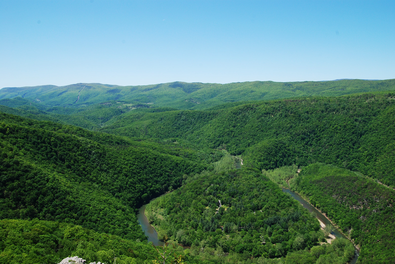
Big Bend

South Fork of the South Branch Potomac River, WV

Monongahela National Forest in Pendleton County, W.Va.

Monongahela National Forest in Pendleton County, W.Va.

Monongahela National Forest in Pendleton County, W.Va.

Monongahela National Forest in Pendleton County, W.Va.

Monongahela National Forest in Pendleton County, W.Va.

Monongahela National Forest in Pendleton County, W.Va.

Monongahela National Forest in Pendleton County, W.Va.

Monongahela National Forest in Pendleton County, W.Va.

Monongahela National Forest in Pendleton County, W.Va.

Monongahela National Forest in Pendleton County, W.Va.

Monongahela National Forest in Pendleton County, W.Va.

Monongahela National Forest in Pendleton County, W.Va.

Monongahela National Forest in Pendleton County, W.Va.

On the brink

On the brink

On the brink

Allegheny Mountains, Fort Seybert, West Virginia

Allegheny Mountains, Fort Seybert, West Virginia

Allegheny Mountains, Fort Seybert, West Virginia

Allegheny Mountains, Fort Seybert, West Virginia
アメリカ合衆国 〒 ウェスト・バージニア州 ミランの地図
別の場所を検索
アメリカ合衆国 〒 ウェスト・バージニア州 ミランでの場所
近所の場所
アメリカ合衆国 ウェスト・バージニア州 ウィルソン・ラン
S Fork Rd, Moorefield, WV アメリカ合衆国
Bennett Run Rd, Criders, VA アメリカ合衆国
Criders Rd, Criders, VA アメリカ合衆国
Overly Hollow, Bergton, VA アメリカ合衆国
Bennett Run Rd, Bergton, VA アメリカ合衆国
Overly Hollow, Bergton, VA アメリカ合衆国
German River Rd, Criders, VA アメリカ合衆国
アメリカ合衆国 〒 バージニア州 クリダーズ
アメリカ合衆国 〒 バージニア州 クリダーズ
アメリカ合衆国 〒 ウェスト・バージニア州 イースタン カウ・ノブ
アメリカ合衆国 バージニア州 プレインズ
Clem Hollow Ln, Bergton, VA アメリカ合衆国
Souder Ln, Bergton, VA アメリカ合衆国
Crab Run Rd, Bergton, VA アメリカ合衆国
Crab Run Rd, Bergton, VA アメリカ合衆国
アメリカ合衆国 〒 バージニア州 バーグトン
Bergton Rd, Bergton, VA アメリカ合衆国
Bergton Rd, Bergton, VA アメリカ合衆国
Fallbush Mountain Dr, Mathias, WV アメリカ合衆国
最近の検索
- アメリカ合衆国 アラスカ州 レッド・ドッグ・マイン日の出日の入り時間
- Am bhf, Borken, ドイツアム・バーンホーフ日の出日の入り時間
- 4th St E, Sonoma, CA, USA日の出日の入り時間
- Oakland Ave, Williamsport, PA アメリカ合衆国日の出日の入り時間
- Via Roma, Pieranica CR, イタリアローマ通り日の出日の入り時間
- クロアチア 〒 ドゥブロブニク GradClock Tower of Dubrovnik日の出日の入り時間
- アルゼンチン チュブ州 トレリュー日の出日の入り時間
- Hartfords Bluff Cir, Mt Pleasant, SC アメリカ合衆国日の出日の入り時間
- 日本、熊本県熊本市北区日の出日の入り時間
- 中華人民共和国 福州市 平潭県 平潭島日の出日の入り時間