Horas de salida y puesta de sol de Milam, WV, EE. UU.
Location: Estados Unidos > Virginia Occidental > Condado de Hardy > South Fork >
Zona horaria:
America/New_York
Hora local:
2025-06-20 22:40:47
Longitud:
-79.0992004
Latitud:
38.8140017
Salida de sol de hoy:
05:51:39 AM
Puesta de sol de hoy:
08:45:03 PM
La duración del día hoy:
14h 53m 24s
Salida de sol de mañana:
05:51:55 AM
Puesta de sol de mañana:
08:45:13 PM
La duración del día mañana:
14h 53m 18s
Mostrar todas las fechas
| Fecha | Salida de sol | Puesta de sol | Duración del día |
|---|---|---|---|
| 01/01/2025 | 07:34:48 AM | 05:06:13 PM | 9h 31m 25s |
| 02/01/2025 | 07:34:53 AM | 05:07:04 PM | 9h 32m 11s |
| 03/01/2025 | 07:34:55 AM | 05:07:56 PM | 9h 33m 1s |
| 04/01/2025 | 07:34:55 AM | 05:08:49 PM | 9h 33m 54s |
| 05/01/2025 | 07:34:53 AM | 05:09:44 PM | 9h 34m 51s |
| 06/01/2025 | 07:34:49 AM | 05:10:39 PM | 9h 35m 50s |
| 07/01/2025 | 07:34:43 AM | 05:11:36 PM | 9h 36m 53s |
| 08/01/2025 | 07:34:35 AM | 05:12:34 PM | 9h 37m 59s |
| 09/01/2025 | 07:34:24 AM | 05:13:34 PM | 9h 39m 10s |
| 10/01/2025 | 07:34:12 AM | 05:14:34 PM | 9h 40m 22s |
| 11/01/2025 | 07:33:57 AM | 05:15:35 PM | 9h 41m 38s |
| 12/01/2025 | 07:33:40 AM | 05:16:36 PM | 9h 42m 56s |
| 13/01/2025 | 07:33:21 AM | 05:17:39 PM | 9h 44m 18s |
| 14/01/2025 | 07:33:00 AM | 05:18:42 PM | 9h 45m 42s |
| 15/01/2025 | 07:32:37 AM | 05:19:47 PM | 9h 47m 10s |
| 16/01/2025 | 07:32:12 AM | 05:20:51 PM | 9h 48m 39s |
| 17/01/2025 | 07:31:45 AM | 05:21:57 PM | 9h 50m 12s |
| 18/01/2025 | 07:31:16 AM | 05:23:03 PM | 9h 51m 47s |
| 19/01/2025 | 07:30:45 AM | 05:24:09 PM | 9h 53m 24s |
| 20/01/2025 | 07:30:12 AM | 05:25:16 PM | 9h 55m 4s |
| 21/01/2025 | 07:29:37 AM | 05:26:24 PM | 9h 56m 47s |
| 22/01/2025 | 07:29:00 AM | 05:27:32 PM | 9h 58m 32s |
| 23/01/2025 | 07:28:21 AM | 05:28:40 PM | 10h 0m 19s |
| 24/01/2025 | 07:27:40 AM | 05:29:48 PM | 10h 2m 8s |
| 25/01/2025 | 07:26:57 AM | 05:30:57 PM | 10h 4m 0s |
| 26/01/2025 | 07:26:13 AM | 05:32:06 PM | 10h 5m 53s |
| 27/01/2025 | 07:25:26 AM | 05:33:15 PM | 10h 7m 49s |
| 28/01/2025 | 07:24:38 AM | 05:34:24 PM | 10h 9m 46s |
| 29/01/2025 | 07:23:49 AM | 05:35:33 PM | 10h 11m 44s |
| 30/01/2025 | 07:22:57 AM | 05:36:42 PM | 10h 13m 45s |
| 31/01/2025 | 07:22:04 AM | 05:37:52 PM | 10h 15m 48s |
| 01/02/2025 | 07:21:09 AM | 05:39:01 PM | 10h 17m 52s |
| 02/02/2025 | 07:20:13 AM | 05:40:11 PM | 10h 19m 58s |
| 03/02/2025 | 07:19:15 AM | 05:41:20 PM | 10h 22m 5s |
| 04/02/2025 | 07:18:16 AM | 05:42:29 PM | 10h 24m 13s |
| 05/02/2025 | 07:17:15 AM | 05:43:38 PM | 10h 26m 23s |
| 06/02/2025 | 07:16:12 AM | 05:44:47 PM | 10h 28m 35s |
| 07/02/2025 | 07:15:08 AM | 05:45:56 PM | 10h 30m 48s |
| 08/02/2025 | 07:14:03 AM | 05:47:05 PM | 10h 33m 2s |
| 09/02/2025 | 07:12:56 AM | 05:48:14 PM | 10h 35m 18s |
| 10/02/2025 | 07:11:48 AM | 05:49:22 PM | 10h 37m 34s |
| 11/02/2025 | 07:10:39 AM | 05:50:30 PM | 10h 39m 51s |
| 12/02/2025 | 07:09:28 AM | 05:51:38 PM | 10h 42m 10s |
| 13/02/2025 | 07:08:17 AM | 05:52:46 PM | 10h 44m 29s |
| 14/02/2025 | 07:07:04 AM | 05:53:53 PM | 10h 46m 49s |
| 15/02/2025 | 07:05:49 AM | 05:55:00 PM | 10h 49m 11s |
| 16/02/2025 | 07:04:34 AM | 05:56:07 PM | 10h 51m 33s |
| 17/02/2025 | 07:03:18 AM | 05:57:13 PM | 10h 53m 55s |
| 18/02/2025 | 07:02:00 AM | 05:58:20 PM | 10h 56m 20s |
| 19/02/2025 | 07:00:42 AM | 05:59:26 PM | 10h 58m 44s |
| 20/02/2025 | 06:59:22 AM | 06:00:31 PM | 11h 1m 9s |
| 21/02/2025 | 06:58:02 AM | 06:01:37 PM | 11h 3m 35s |
| 22/02/2025 | 06:56:40 AM | 06:02:42 PM | 11h 6m 2s |
| 23/02/2025 | 06:55:18 AM | 06:03:46 PM | 11h 8m 28s |
| 24/02/2025 | 06:53:55 AM | 06:04:51 PM | 11h 10m 56s |
| 25/02/2025 | 06:52:31 AM | 06:05:55 PM | 11h 13m 24s |
| 26/02/2025 | 06:51:06 AM | 06:06:58 PM | 11h 15m 52s |
| 27/02/2025 | 06:49:41 AM | 06:08:02 PM | 11h 18m 21s |
| 28/02/2025 | 06:48:14 AM | 06:09:05 PM | 11h 20m 51s |
| 01/03/2025 | 06:46:48 AM | 06:10:08 PM | 11h 23m 20s |
| 02/03/2025 | 06:45:20 AM | 06:11:10 PM | 11h 25m 50s |
| 03/03/2025 | 06:43:52 AM | 06:12:13 PM | 11h 28m 21s |
| 04/03/2025 | 06:42:23 AM | 06:13:15 PM | 11h 30m 52s |
| 05/03/2025 | 06:40:54 AM | 06:14:16 PM | 11h 33m 22s |
| 06/03/2025 | 06:39:24 AM | 06:15:18 PM | 11h 35m 54s |
| 07/03/2025 | 06:37:53 AM | 06:16:19 PM | 11h 38m 26s |
| 08/03/2025 | 06:36:22 AM | 06:17:20 PM | 11h 40m 58s |
| 09/03/2025 | 07:34:55 AM | 07:18:18 PM | 11h 43m 23s |
| 10/03/2025 | 07:33:23 AM | 07:19:18 PM | 11h 45m 55s |
| 11/03/2025 | 07:31:51 AM | 07:20:18 PM | 11h 48m 27s |
| 12/03/2025 | 07:30:19 AM | 07:21:18 PM | 11h 50m 59s |
| 13/03/2025 | 07:28:46 AM | 07:22:18 PM | 11h 53m 32s |
| 14/03/2025 | 07:27:13 AM | 07:23:18 PM | 11h 56m 5s |
| 15/03/2025 | 07:25:40 AM | 07:24:17 PM | 11h 58m 37s |
| 16/03/2025 | 07:24:06 AM | 07:25:16 PM | 12h 1m 10s |
| 17/03/2025 | 07:22:32 AM | 07:26:15 PM | 12h 3m 43s |
| 18/03/2025 | 07:20:59 AM | 07:27:14 PM | 12h 6m 15s |
| 19/03/2025 | 07:19:25 AM | 07:28:12 PM | 12h 8m 47s |
| 20/03/2025 | 07:17:50 AM | 07:29:11 PM | 12h 11m 21s |
| 21/03/2025 | 07:16:16 AM | 07:30:09 PM | 12h 13m 53s |
| 22/03/2025 | 07:14:42 AM | 07:31:07 PM | 12h 16m 25s |
| 23/03/2025 | 07:13:08 AM | 07:32:05 PM | 12h 18m 57s |
| 24/03/2025 | 07:11:34 AM | 07:33:03 PM | 12h 21m 29s |
| 25/03/2025 | 07:10:00 AM | 07:34:01 PM | 12h 24m 1s |
| 26/03/2025 | 07:08:26 AM | 07:34:59 PM | 12h 26m 33s |
| 27/03/2025 | 07:06:52 AM | 07:35:57 PM | 12h 29m 5s |
| 28/03/2025 | 07:05:18 AM | 07:36:55 PM | 12h 31m 37s |
| 29/03/2025 | 07:03:44 AM | 07:37:52 PM | 12h 34m 8s |
| 30/03/2025 | 07:02:11 AM | 07:38:50 PM | 12h 36m 39s |
| 31/03/2025 | 07:00:38 AM | 07:39:47 PM | 12h 39m 9s |
| 01/04/2025 | 06:59:05 AM | 07:40:45 PM | 12h 41m 40s |
| 02/04/2025 | 06:57:32 AM | 07:41:42 PM | 12h 44m 10s |
| 03/04/2025 | 06:56:00 AM | 07:42:40 PM | 12h 46m 40s |
| 04/04/2025 | 06:54:28 AM | 07:43:37 PM | 12h 49m 9s |
| 05/04/2025 | 06:52:56 AM | 07:44:35 PM | 12h 51m 39s |
| 06/04/2025 | 06:51:25 AM | 07:45:32 PM | 12h 54m 7s |
| 07/04/2025 | 06:49:54 AM | 07:46:30 PM | 12h 56m 36s |
| 08/04/2025 | 06:48:24 AM | 07:47:27 PM | 12h 59m 3s |
| 09/04/2025 | 06:46:54 AM | 07:48:25 PM | 13h 1m 31s |
| 10/04/2025 | 06:45:25 AM | 07:49:22 PM | 13h 3m 57s |
| 11/04/2025 | 06:43:56 AM | 07:50:20 PM | 13h 6m 24s |
| 12/04/2025 | 06:42:28 AM | 07:51:18 PM | 13h 8m 50s |
| 13/04/2025 | 06:41:01 AM | 07:52:15 PM | 13h 11m 14s |
| 14/04/2025 | 06:39:34 AM | 07:53:13 PM | 13h 13m 39s |
| 15/04/2025 | 06:38:08 AM | 07:54:11 PM | 13h 16m 3s |
| 16/04/2025 | 06:36:43 AM | 07:55:09 PM | 13h 18m 26s |
| 17/04/2025 | 06:35:18 AM | 07:56:06 PM | 13h 20m 48s |
| 18/04/2025 | 06:33:54 AM | 07:57:04 PM | 13h 23m 10s |
| 19/04/2025 | 06:32:31 AM | 07:58:02 PM | 13h 25m 31s |
| 20/04/2025 | 06:31:09 AM | 07:59:00 PM | 13h 27m 51s |
| 21/04/2025 | 06:29:47 AM | 07:59:58 PM | 13h 30m 11s |
| 22/04/2025 | 06:28:27 AM | 08:00:56 PM | 13h 32m 29s |
| 23/04/2025 | 06:27:07 AM | 08:01:54 PM | 13h 34m 47s |
| 24/04/2025 | 06:25:49 AM | 08:02:51 PM | 13h 37m 2s |
| 25/04/2025 | 06:24:31 AM | 08:03:49 PM | 13h 39m 18s |
| 26/04/2025 | 06:23:15 AM | 08:04:47 PM | 13h 41m 32s |
| 27/04/2025 | 06:21:59 AM | 08:05:45 PM | 13h 43m 46s |
| 28/04/2025 | 06:20:45 AM | 08:06:43 PM | 13h 45m 58s |
| 29/04/2025 | 06:19:31 AM | 08:07:40 PM | 13h 48m 9s |
| 30/04/2025 | 06:18:19 AM | 08:08:38 PM | 13h 50m 19s |
| 01/05/2025 | 06:17:08 AM | 08:09:36 PM | 13h 52m 28s |
| 02/05/2025 | 06:15:58 AM | 08:10:33 PM | 13h 54m 35s |
| 03/05/2025 | 06:14:50 AM | 08:11:30 PM | 13h 56m 40s |
| 04/05/2025 | 06:13:43 AM | 08:12:27 PM | 13h 58m 44s |
| 05/05/2025 | 06:12:37 AM | 08:13:24 PM | 14h 0m 47s |
| 06/05/2025 | 06:11:32 AM | 08:14:21 PM | 14h 2m 49s |
| 07/05/2025 | 06:10:29 AM | 08:15:18 PM | 14h 4m 49s |
| 08/05/2025 | 06:09:27 AM | 08:16:14 PM | 14h 6m 47s |
| 09/05/2025 | 06:08:26 AM | 08:17:10 PM | 14h 8m 44s |
| 10/05/2025 | 06:07:27 AM | 08:18:06 PM | 14h 10m 39s |
| 11/05/2025 | 06:06:29 AM | 08:19:01 PM | 14h 12m 32s |
| 12/05/2025 | 06:05:33 AM | 08:19:56 PM | 14h 14m 23s |
| 13/05/2025 | 06:04:39 AM | 08:20:51 PM | 14h 16m 12s |
| 14/05/2025 | 06:03:45 AM | 08:21:45 PM | 14h 18m 0s |
| 15/05/2025 | 06:02:54 AM | 08:22:39 PM | 14h 19m 45s |
| 16/05/2025 | 06:02:04 AM | 08:23:33 PM | 14h 21m 29s |
| 17/05/2025 | 06:01:16 AM | 08:24:26 PM | 14h 23m 10s |
| 18/05/2025 | 06:00:29 AM | 08:25:18 PM | 14h 24m 49s |
| 19/05/2025 | 05:59:44 AM | 08:26:10 PM | 14h 26m 26s |
| 20/05/2025 | 05:59:00 AM | 08:27:01 PM | 14h 28m 1s |
| 21/05/2025 | 05:58:19 AM | 08:27:51 PM | 14h 29m 32s |
| 22/05/2025 | 05:57:39 AM | 08:28:41 PM | 14h 31m 2s |
| 23/05/2025 | 05:57:01 AM | 08:29:31 PM | 14h 32m 30s |
| 24/05/2025 | 05:56:24 AM | 08:30:19 PM | 14h 33m 55s |
| 25/05/2025 | 05:55:50 AM | 08:31:07 PM | 14h 35m 17s |
| 26/05/2025 | 05:55:17 AM | 08:31:53 PM | 14h 36m 36s |
| 27/05/2025 | 05:54:46 AM | 08:32:39 PM | 14h 37m 53s |
| 28/05/2025 | 05:54:16 AM | 08:33:24 PM | 14h 39m 8s |
| 29/05/2025 | 05:53:49 AM | 08:34:08 PM | 14h 40m 19s |
| 30/05/2025 | 05:53:23 AM | 08:34:51 PM | 14h 41m 28s |
| 31/05/2025 | 05:52:59 AM | 08:35:33 PM | 14h 42m 34s |
| 01/06/2025 | 05:52:38 AM | 08:36:14 PM | 14h 43m 36s |
| 02/06/2025 | 05:52:17 AM | 08:36:54 PM | 14h 44m 37s |
| 03/06/2025 | 05:51:59 AM | 08:37:33 PM | 14h 45m 34s |
| 04/06/2025 | 05:51:43 AM | 08:38:10 PM | 14h 46m 27s |
| 05/06/2025 | 05:51:29 AM | 08:38:46 PM | 14h 47m 17s |
| 06/06/2025 | 05:51:16 AM | 08:39:21 PM | 14h 48m 5s |
| 07/06/2025 | 05:51:05 AM | 08:39:55 PM | 14h 48m 50s |
| 08/06/2025 | 05:50:56 AM | 08:40:27 PM | 14h 49m 31s |
| 09/06/2025 | 05:50:49 AM | 08:40:58 PM | 14h 50m 9s |
| 10/06/2025 | 05:50:44 AM | 08:41:28 PM | 14h 50m 44s |
| 11/06/2025 | 05:50:41 AM | 08:41:56 PM | 14h 51m 15s |
| 12/06/2025 | 05:50:40 AM | 08:42:22 PM | 14h 51m 42s |
| 13/06/2025 | 05:50:40 AM | 08:42:47 PM | 14h 52m 7s |
| 14/06/2025 | 05:50:42 AM | 08:43:11 PM | 14h 52m 29s |
| 15/06/2025 | 05:50:46 AM | 08:43:32 PM | 14h 52m 46s |
| 16/06/2025 | 05:50:52 AM | 08:43:53 PM | 14h 53m 1s |
| 17/06/2025 | 05:51:00 AM | 08:44:11 PM | 14h 53m 11s |
| 18/06/2025 | 05:51:09 AM | 08:44:28 PM | 14h 53m 19s |
| 19/06/2025 | 05:51:20 AM | 08:44:43 PM | 14h 53m 23s |
| 20/06/2025 | 05:51:33 AM | 08:44:57 PM | 14h 53m 24s |
| 21/06/2025 | 05:51:47 AM | 08:45:08 PM | 14h 53m 21s |
| 22/06/2025 | 05:52:03 AM | 08:45:18 PM | 14h 53m 15s |
| 23/06/2025 | 05:52:21 AM | 08:45:26 PM | 14h 53m 5s |
| 24/06/2025 | 05:52:40 AM | 08:45:33 PM | 14h 52m 53s |
| 25/06/2025 | 05:53:01 AM | 08:45:37 PM | 14h 52m 36s |
| 26/06/2025 | 05:53:23 AM | 08:45:40 PM | 14h 52m 17s |
| 27/06/2025 | 05:53:47 AM | 08:45:40 PM | 14h 51m 53s |
| 28/06/2025 | 05:54:12 AM | 08:45:39 PM | 14h 51m 27s |
| 29/06/2025 | 05:54:39 AM | 08:45:36 PM | 14h 50m 57s |
| 30/06/2025 | 05:55:07 AM | 08:45:31 PM | 14h 50m 24s |
| 01/07/2025 | 05:55:37 AM | 08:45:25 PM | 14h 49m 48s |
| 02/07/2025 | 05:56:07 AM | 08:45:16 PM | 14h 49m 9s |
| 03/07/2025 | 05:56:40 AM | 08:45:05 PM | 14h 48m 25s |
| 04/07/2025 | 05:57:13 AM | 08:44:53 PM | 14h 47m 40s |
| 05/07/2025 | 05:57:48 AM | 08:44:38 PM | 14h 46m 50s |
| 06/07/2025 | 05:58:23 AM | 08:44:22 PM | 14h 45m 59s |
| 07/07/2025 | 05:59:00 AM | 08:44:04 PM | 14h 45m 4s |
| 08/07/2025 | 05:59:38 AM | 08:43:44 PM | 14h 44m 6s |
| 09/07/2025 | 06:00:17 AM | 08:43:21 PM | 14h 43m 4s |
| 10/07/2025 | 06:00:58 AM | 08:42:57 PM | 14h 41m 59s |
| 11/07/2025 | 06:01:39 AM | 08:42:32 PM | 14h 40m 53s |
| 12/07/2025 | 06:02:21 AM | 08:42:04 PM | 14h 39m 43s |
| 13/07/2025 | 06:03:04 AM | 08:41:34 PM | 14h 38m 30s |
| 14/07/2025 | 06:03:47 AM | 08:41:03 PM | 14h 37m 16s |
| 15/07/2025 | 06:04:32 AM | 08:40:30 PM | 14h 35m 58s |
| 16/07/2025 | 06:05:17 AM | 08:39:55 PM | 14h 34m 38s |
| 17/07/2025 | 06:06:03 AM | 08:39:18 PM | 14h 33m 15s |
| 18/07/2025 | 06:06:50 AM | 08:38:39 PM | 14h 31m 49s |
| 19/07/2025 | 06:07:38 AM | 08:37:59 PM | 14h 30m 21s |
| 20/07/2025 | 06:08:26 AM | 08:37:16 PM | 14h 28m 50s |
| 21/07/2025 | 06:09:14 AM | 08:36:32 PM | 14h 27m 18s |
| 22/07/2025 | 06:10:03 AM | 08:35:47 PM | 14h 25m 44s |
| 23/07/2025 | 06:10:53 AM | 08:35:00 PM | 14h 24m 7s |
| 24/07/2025 | 06:11:43 AM | 08:34:11 PM | 14h 22m 28s |
| 25/07/2025 | 06:12:34 AM | 08:33:20 PM | 14h 20m 46s |
| 26/07/2025 | 06:13:25 AM | 08:32:28 PM | 14h 19m 3s |
| 27/07/2025 | 06:14:17 AM | 08:31:34 PM | 14h 17m 17s |
| 28/07/2025 | 06:15:08 AM | 08:30:38 PM | 14h 15m 30s |
| 29/07/2025 | 06:16:01 AM | 08:29:42 PM | 14h 13m 41s |
| 30/07/2025 | 06:16:53 AM | 08:28:43 PM | 14h 11m 50s |
| 31/07/2025 | 06:17:46 AM | 08:27:43 PM | 14h 9m 57s |
| 01/08/2025 | 06:18:39 AM | 08:26:42 PM | 14h 8m 3s |
| 02/08/2025 | 06:19:32 AM | 08:25:39 PM | 14h 6m 7s |
| 03/08/2025 | 06:20:25 AM | 08:24:35 PM | 14h 4m 10s |
| 04/08/2025 | 06:21:19 AM | 08:23:29 PM | 14h 2m 10s |
| 05/08/2025 | 06:22:12 AM | 08:22:22 PM | 14h 0m 10s |
| 06/08/2025 | 06:23:06 AM | 08:21:14 PM | 13h 58m 8s |
| 07/08/2025 | 06:24:00 AM | 08:20:04 PM | 13h 56m 4s |
| 08/08/2025 | 06:24:54 AM | 08:18:54 PM | 13h 54m 0s |
| 09/08/2025 | 06:25:48 AM | 08:17:42 PM | 13h 51m 54s |
| 10/08/2025 | 06:26:42 AM | 08:16:28 PM | 13h 49m 46s |
| 11/08/2025 | 06:27:37 AM | 08:15:14 PM | 13h 47m 37s |
| 12/08/2025 | 06:28:31 AM | 08:13:58 PM | 13h 45m 27s |
| 13/08/2025 | 06:29:25 AM | 08:12:42 PM | 13h 43m 17s |
| 14/08/2025 | 06:30:19 AM | 08:11:24 PM | 13h 41m 5s |
| 15/08/2025 | 06:31:13 AM | 08:10:05 PM | 13h 38m 52s |
| 16/08/2025 | 06:32:08 AM | 08:08:46 PM | 13h 36m 38s |
| 17/08/2025 | 06:33:02 AM | 08:07:25 PM | 13h 34m 23s |
| 18/08/2025 | 06:33:56 AM | 08:06:03 PM | 13h 32m 7s |
| 19/08/2025 | 06:34:50 AM | 08:04:41 PM | 13h 29m 51s |
| 20/08/2025 | 06:35:44 AM | 08:03:17 PM | 13h 27m 33s |
| 21/08/2025 | 06:36:38 AM | 08:01:53 PM | 13h 25m 15s |
| 22/08/2025 | 06:37:32 AM | 08:00:27 PM | 13h 22m 55s |
| 23/08/2025 | 06:38:26 AM | 07:59:01 PM | 13h 20m 35s |
| 24/08/2025 | 06:39:19 AM | 07:57:35 PM | 13h 18m 16s |
| 25/08/2025 | 06:40:13 AM | 07:56:07 PM | 13h 15m 54s |
| 26/08/2025 | 06:41:07 AM | 07:54:39 PM | 13h 13m 32s |
| 27/08/2025 | 06:42:00 AM | 07:53:10 PM | 13h 11m 10s |
| 28/08/2025 | 06:42:54 AM | 07:51:40 PM | 13h 8m 46s |
| 29/08/2025 | 06:43:47 AM | 07:50:10 PM | 13h 6m 23s |
| 30/08/2025 | 06:44:41 AM | 07:48:39 PM | 13h 3m 58s |
| 31/08/2025 | 06:45:34 AM | 07:47:08 PM | 13h 1m 34s |
| 01/09/2025 | 06:46:27 AM | 07:45:36 PM | 12h 59m 9s |
| 02/09/2025 | 06:47:21 AM | 07:44:04 PM | 12h 56m 43s |
| 03/09/2025 | 06:48:14 AM | 07:42:31 PM | 12h 54m 17s |
| 04/09/2025 | 06:49:07 AM | 07:40:58 PM | 12h 51m 51s |
| 05/09/2025 | 06:50:00 AM | 07:39:24 PM | 12h 49m 24s |
| 06/09/2025 | 06:50:53 AM | 07:37:50 PM | 12h 46m 57s |
| 07/09/2025 | 06:51:46 AM | 07:36:16 PM | 12h 44m 30s |
| 08/09/2025 | 06:52:39 AM | 07:34:41 PM | 12h 42m 2s |
| 09/09/2025 | 06:53:33 AM | 07:33:06 PM | 12h 39m 33s |
| 10/09/2025 | 06:54:26 AM | 07:31:30 PM | 12h 37m 4s |
| 11/09/2025 | 06:55:19 AM | 07:29:55 PM | 12h 34m 36s |
| 12/09/2025 | 06:56:12 AM | 07:28:19 PM | 12h 32m 7s |
| 13/09/2025 | 06:57:05 AM | 07:26:43 PM | 12h 29m 38s |
| 14/09/2025 | 06:57:58 AM | 07:25:07 PM | 12h 27m 9s |
| 15/09/2025 | 06:58:52 AM | 07:23:31 PM | 12h 24m 39s |
| 16/09/2025 | 06:59:45 AM | 07:21:55 PM | 12h 22m 10s |
| 17/09/2025 | 07:00:39 AM | 07:20:18 PM | 12h 19m 39s |
| 18/09/2025 | 07:01:32 AM | 07:18:42 PM | 12h 17m 10s |
| 19/09/2025 | 07:02:26 AM | 07:17:06 PM | 12h 14m 40s |
| 20/09/2025 | 07:03:20 AM | 07:15:29 PM | 12h 12m 9s |
| 21/09/2025 | 07:04:13 AM | 07:13:53 PM | 12h 9m 40s |
| 22/09/2025 | 07:05:07 AM | 07:12:17 PM | 12h 7m 10s |
| 23/09/2025 | 07:06:02 AM | 07:10:41 PM | 12h 4m 39s |
| 24/09/2025 | 07:06:56 AM | 07:09:05 PM | 12h 2m 9s |
| 25/09/2025 | 07:07:51 AM | 07:07:29 PM | 11h 59m 38s |
| 26/09/2025 | 07:08:45 AM | 07:05:53 PM | 11h 57m 8s |
| 27/09/2025 | 07:09:40 AM | 07:04:18 PM | 11h 54m 38s |
| 28/09/2025 | 07:10:35 AM | 07:02:43 PM | 11h 52m 8s |
| 29/09/2025 | 07:11:31 AM | 07:01:08 PM | 11h 49m 37s |
| 30/09/2025 | 07:12:26 AM | 06:59:34 PM | 11h 47m 8s |
| 01/10/2025 | 07:13:22 AM | 06:58:00 PM | 11h 44m 38s |
| 02/10/2025 | 07:14:18 AM | 06:56:26 PM | 11h 42m 8s |
| 03/10/2025 | 07:15:14 AM | 06:54:53 PM | 11h 39m 39s |
| 04/10/2025 | 07:16:11 AM | 06:53:20 PM | 11h 37m 9s |
| 05/10/2025 | 07:17:08 AM | 06:51:48 PM | 11h 34m 40s |
| 06/10/2025 | 07:18:05 AM | 06:50:16 PM | 11h 32m 11s |
| 07/10/2025 | 07:19:02 AM | 06:48:44 PM | 11h 29m 42s |
| 08/10/2025 | 07:20:00 AM | 06:47:14 PM | 11h 27m 14s |
| 09/10/2025 | 07:20:58 AM | 06:45:44 PM | 11h 24m 46s |
| 10/10/2025 | 07:21:56 AM | 06:44:14 PM | 11h 22m 18s |
| 11/10/2025 | 07:22:55 AM | 06:42:45 PM | 11h 19m 50s |
| 12/10/2025 | 07:23:54 AM | 06:41:17 PM | 11h 17m 23s |
| 13/10/2025 | 07:24:53 AM | 06:39:50 PM | 11h 14m 57s |
| 14/10/2025 | 07:25:53 AM | 06:38:23 PM | 11h 12m 30s |
| 15/10/2025 | 07:26:53 AM | 06:36:57 PM | 11h 10m 4s |
| 16/10/2025 | 07:27:53 AM | 06:35:32 PM | 11h 7m 39s |
| 17/10/2025 | 07:28:53 AM | 06:34:08 PM | 11h 5m 15s |
| 18/10/2025 | 07:29:54 AM | 06:32:45 PM | 11h 2m 51s |
| 19/10/2025 | 07:30:56 AM | 06:31:23 PM | 11h 0m 27s |
| 20/10/2025 | 07:31:57 AM | 06:30:01 PM | 10h 58m 4s |
| 21/10/2025 | 07:32:59 AM | 06:28:41 PM | 10h 55m 42s |
| 22/10/2025 | 07:34:02 AM | 06:27:22 PM | 10h 53m 20s |
| 23/10/2025 | 07:35:04 AM | 06:26:03 PM | 10h 50m 59s |
| 24/10/2025 | 07:36:07 AM | 06:24:46 PM | 10h 48m 39s |
| 25/10/2025 | 07:37:10 AM | 06:23:30 PM | 10h 46m 20s |
| 26/10/2025 | 07:38:14 AM | 06:22:15 PM | 10h 44m 1s |
| 27/10/2025 | 07:39:18 AM | 06:21:02 PM | 10h 41m 44s |
| 28/10/2025 | 07:40:22 AM | 06:19:49 PM | 10h 39m 27s |
| 29/10/2025 | 07:41:26 AM | 06:18:38 PM | 10h 37m 12s |
| 30/10/2025 | 07:42:31 AM | 06:17:28 PM | 10h 34m 57s |
| 31/10/2025 | 07:43:36 AM | 06:16:20 PM | 10h 32m 44s |
| 01/11/2025 | 07:44:41 AM | 06:15:13 PM | 10h 30m 32s |
| 02/11/2025 | 06:45:49 AM | 05:14:04 PM | 10h 28m 15s |
| 03/11/2025 | 06:46:55 AM | 05:13:00 PM | 10h 26m 5s |
| 04/11/2025 | 06:48:01 AM | 05:11:57 PM | 10h 23m 56s |
| 05/11/2025 | 06:49:07 AM | 05:10:56 PM | 10h 21m 49s |
| 06/11/2025 | 06:50:13 AM | 05:09:56 PM | 10h 19m 43s |
| 07/11/2025 | 06:51:19 AM | 05:08:58 PM | 10h 17m 39s |
| 08/11/2025 | 06:52:25 AM | 05:08:02 PM | 10h 15m 37s |
| 09/11/2025 | 06:53:31 AM | 05:07:07 PM | 10h 13m 36s |
| 10/11/2025 | 06:54:38 AM | 05:06:14 PM | 10h 11m 36s |
| 11/11/2025 | 06:55:44 AM | 05:05:22 PM | 10h 9m 38s |
| 12/11/2025 | 06:56:50 AM | 05:04:32 PM | 10h 7m 42s |
| 13/11/2025 | 06:57:56 AM | 05:03:45 PM | 10h 5m 49s |
| 14/11/2025 | 06:59:02 AM | 05:02:58 PM | 10h 3m 56s |
| 15/11/2025 | 07:00:08 AM | 05:02:14 PM | 10h 2m 6s |
| 16/11/2025 | 07:01:14 AM | 05:01:32 PM | 10h 0m 18s |
| 17/11/2025 | 07:02:19 AM | 05:00:51 PM | 9h 58m 32s |
| 18/11/2025 | 07:03:25 AM | 05:00:12 PM | 9h 56m 47s |
| 19/11/2025 | 07:04:30 AM | 04:59:36 PM | 9h 55m 6s |
| 20/11/2025 | 07:05:34 AM | 04:59:01 PM | 9h 53m 27s |
| 21/11/2025 | 07:06:38 AM | 04:58:28 PM | 9h 51m 50s |
| 22/11/2025 | 07:07:42 AM | 04:57:57 PM | 9h 50m 15s |
| 23/11/2025 | 07:08:45 AM | 04:57:28 PM | 9h 48m 43s |
| 24/11/2025 | 07:09:48 AM | 04:57:02 PM | 9h 47m 14s |
| 25/11/2025 | 07:10:50 AM | 04:56:37 PM | 9h 45m 47s |
| 26/11/2025 | 07:11:52 AM | 04:56:15 PM | 9h 44m 23s |
| 27/11/2025 | 07:12:53 AM | 04:55:54 PM | 9h 43m 1s |
| 28/11/2025 | 07:13:53 AM | 04:55:36 PM | 9h 41m 43s |
| 29/11/2025 | 07:14:52 AM | 04:55:20 PM | 9h 40m 28s |
| 30/11/2025 | 07:15:51 AM | 04:55:06 PM | 9h 39m 15s |
| 01/12/2025 | 07:16:48 AM | 04:54:54 PM | 9h 38m 6s |
| 02/12/2025 | 07:17:45 AM | 04:54:45 PM | 9h 37m 0s |
| 03/12/2025 | 07:18:41 AM | 04:54:37 PM | 9h 35m 56s |
| 04/12/2025 | 07:19:35 AM | 04:54:32 PM | 9h 34m 57s |
| 05/12/2025 | 07:20:29 AM | 04:54:29 PM | 9h 34m 0s |
| 06/12/2025 | 07:21:21 AM | 04:54:28 PM | 9h 33m 7s |
| 07/12/2025 | 07:22:12 AM | 04:54:29 PM | 9h 32m 17s |
| 08/12/2025 | 07:23:02 AM | 04:54:32 PM | 9h 31m 30s |
| 09/12/2025 | 07:23:51 AM | 04:54:38 PM | 9h 30m 47s |
| 10/12/2025 | 07:24:38 AM | 04:54:46 PM | 9h 30m 8s |
| 11/12/2025 | 07:25:24 AM | 04:54:56 PM | 9h 29m 32s |
| 12/12/2025 | 07:26:09 AM | 04:55:08 PM | 9h 28m 59s |
| 13/12/2025 | 07:26:51 AM | 04:55:22 PM | 9h 28m 31s |
| 14/12/2025 | 07:27:33 AM | 04:55:38 PM | 9h 28m 5s |
| 15/12/2025 | 07:28:12 AM | 04:55:57 PM | 9h 27m 45s |
| 16/12/2025 | 07:28:51 AM | 04:56:17 PM | 9h 27m 26s |
| 17/12/2025 | 07:29:27 AM | 04:56:40 PM | 9h 27m 13s |
| 18/12/2025 | 07:30:02 AM | 04:57:04 PM | 9h 27m 2s |
| 19/12/2025 | 07:30:35 AM | 04:57:31 PM | 9h 26m 56s |
| 20/12/2025 | 07:31:06 AM | 04:57:59 PM | 9h 26m 53s |
| 21/12/2025 | 07:31:35 AM | 04:58:30 PM | 9h 26m 55s |
| 22/12/2025 | 07:32:02 AM | 04:59:02 PM | 9h 27m 0s |
| 23/12/2025 | 07:32:28 AM | 04:59:36 PM | 9h 27m 8s |
| 24/12/2025 | 07:32:51 AM | 05:00:12 PM | 9h 27m 21s |
| 25/12/2025 | 07:33:13 AM | 05:00:50 PM | 9h 27m 37s |
| 26/12/2025 | 07:33:32 AM | 05:01:29 PM | 9h 27m 57s |
| 27/12/2025 | 07:33:50 AM | 05:02:11 PM | 9h 28m 21s |
| 28/12/2025 | 07:34:05 AM | 05:02:54 PM | 9h 28m 49s |
| 29/12/2025 | 07:34:19 AM | 05:03:38 PM | 9h 29m 19s |
| 30/12/2025 | 07:34:30 AM | 05:04:24 PM | 9h 29m 54s |
| 31/12/2025 | 07:34:39 AM | 05:05:12 PM | 9h 30m 33s |
Fotos
Big Bend

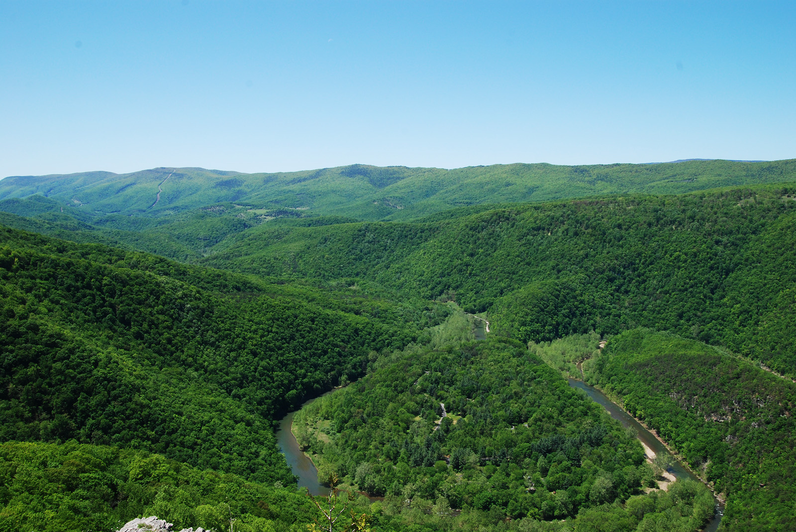
South Fork of the South Branch Potomac River, WV

Monongahela National Forest in Pendleton County, W.Va.

Monongahela National Forest in Pendleton County, W.Va.

Monongahela National Forest in Pendleton County, W.Va.

Monongahela National Forest in Pendleton County, W.Va.

Monongahela National Forest in Pendleton County, W.Va.

Monongahela National Forest in Pendleton County, W.Va.

Monongahela National Forest in Pendleton County, W.Va.

Monongahela National Forest in Pendleton County, W.Va.

Monongahela National Forest in Pendleton County, W.Va.

Monongahela National Forest in Pendleton County, W.Va.

Monongahela National Forest in Pendleton County, W.Va.

Monongahela National Forest in Pendleton County, W.Va.

Monongahela National Forest in Pendleton County, W.Va.

On the brink

On the brink

On the brink

Allegheny Mountains, Fort Seybert, West Virginia

Allegheny Mountains, Fort Seybert, West Virginia

Allegheny Mountains, Fort Seybert, West Virginia

Allegheny Mountains, Fort Seybert, West Virginia
Mapa de Milam, WV, EE. UU.
Buscar otro lugar
lugares en Milam, WV, EE. UU.
Lugares cercanos
Wilson Run, West Virginia, EE. UU.
S Fork Rd, Moorefield, WV, EE. UU.
Bennett Run Rd, Criders, VA, EE. UU.
Criders Rd, Criders, VA, EE. UU.
Overly Hollow, Bergton, VA, EE. UU.
Bennett Run Rd, Bergton, VA, EE. UU.
Overly Hollow, Bergton, VA, EE. UU.
German River Rd, Criders, VA, EE. UU.
Criders, VA, EE. UU.
Criders, VA, EE. UU.
Cow Knob, Eastern, WV, EE. UU.
Plains, VA, EE. UU.
Clem Hollow Ln, Bergton, VA, EE. UU.
Souder Ln, Bergton, VA, EE. UU.
Crab Run Rd, Bergton, VA, EE. UU.
Crab Run Rd, Bergton, VA, EE. UU.
Bergton, VA, EE. UU.
Bergton Rd, Bergton, VA, EE. UU.
Bergton Rd, Bergton, VA, EE. UU.
Fallbush Mountain Dr, Mathias, WV, EE. UU.
Búsquedas recientes
- Horas de salida y puesta de sol de Red Dog Mine, AK, USA
- Horas de salida y puesta de sol de Am Bahnhof, Am bhf, Borken, Germany
- Horas de salida y puesta de sol de 4th St E, Sonoma, CA, EE. UU.
- Horas de salida y puesta de sol de Oakland Ave, Williamsport, PA, EE. UU.
- Horas de salida y puesta de sol de Via Roma, Pieranica CR, Italia
- Horas de salida y puesta de sol de Torre del reloj, Grad, Dubrovnik (Ragusa), Croacia
- Horas de salida y puesta de sol de Trelew, Chubut, Argentina
- Horas de salida y puesta de sol de Hartfords Bluff Cir, Mt Pleasant, SC, EE. UU.
- Horas de salida y puesta de sol de Kita Ward, Kumamoto, Japón
- Horas de salida y puesta de sol de Pingtan Island, Pingtan County, Fuzhou, China