King Ave, Macdoel, CA アメリカ合衆国日の出日の入り時間
Location: アメリカ合衆国 > カリフォルニア州 > シスキュー > アメリカ合衆国 カリフォルニア州 マクドエル >
時間帯:
America/Los_Angeles
現地時間:
2025-06-02 12:39:08
経度:
-122.002961
緯度:
41.786529
今日の日の出時刻:
05:34:23 AM
今日の日の入時刻:
08:38:15 PM
今日の日長:
15h 3m 52s
明日の日の出時刻:
05:34:03 AM
明日の日の入時刻:
08:38:56 PM
明日の日長:
15h 4m 53s
すべて表示する
| 日付 | 日出 | 日没 | 日長 |
|---|---|---|---|
| 2025年01月01日 | 07:35:22 AM | 04:49:06 PM | 9h 13m 44s |
| 2025年01月02日 | 07:35:23 AM | 04:50:00 PM | 9h 14m 37s |
| 2025年01月03日 | 07:35:22 AM | 04:50:56 PM | 9h 15m 34s |
| 2025年01月04日 | 07:35:18 AM | 04:51:53 PM | 9h 16m 35s |
| 2025年01月05日 | 07:35:12 AM | 04:52:52 PM | 9h 17m 40s |
| 2025年01月06日 | 07:35:03 AM | 04:53:52 PM | 9h 18m 49s |
| 2025年01月07日 | 07:34:53 AM | 04:54:53 PM | 9h 20m 0s |
| 2025年01月08日 | 07:34:40 AM | 04:55:55 PM | 9h 21m 15s |
| 2025年01月09日 | 07:34:24 AM | 04:56:59 PM | 9h 22m 35s |
| 2025年01月10日 | 07:34:07 AM | 04:58:04 PM | 9h 23m 57s |
| 2025年01月11日 | 07:33:47 AM | 04:59:10 PM | 9h 25m 23s |
| 2025年01月12日 | 07:33:24 AM | 05:00:17 PM | 9h 26m 53s |
| 2025年01月13日 | 07:33:00 AM | 05:01:25 PM | 9h 28m 25s |
| 2025年01月14日 | 07:32:33 AM | 05:02:34 PM | 9h 30m 1s |
| 2025年01月15日 | 07:32:04 AM | 05:03:44 PM | 9h 31m 40s |
| 2025年01月16日 | 07:31:33 AM | 05:04:54 PM | 9h 33m 21s |
| 2025年01月17日 | 07:30:59 AM | 05:06:06 PM | 9h 35m 7s |
| 2025年01月18日 | 07:30:24 AM | 05:07:18 PM | 9h 36m 54s |
| 2025年01月19日 | 07:29:46 AM | 05:08:30 PM | 9h 38m 44s |
| 2025年01月20日 | 07:29:06 AM | 05:09:43 PM | 9h 40m 37s |
| 2025年01月21日 | 07:28:25 AM | 05:10:57 PM | 9h 42m 32s |
| 2025年01月22日 | 07:27:41 AM | 05:12:12 PM | 9h 44m 31s |
| 2025年01月23日 | 07:26:55 AM | 05:13:26 PM | 9h 46m 31s |
| 2025年01月24日 | 07:26:07 AM | 05:14:41 PM | 9h 48m 34s |
| 2025年01月25日 | 07:25:17 AM | 05:15:57 PM | 9h 50m 40s |
| 2025年01月26日 | 07:24:25 AM | 05:17:13 PM | 9h 52m 48s |
| 2025年01月27日 | 07:23:32 AM | 05:18:29 PM | 9h 54m 57s |
| 2025年01月28日 | 07:22:36 AM | 05:19:45 PM | 9h 57m 9s |
| 2025年01月29日 | 07:21:39 AM | 05:21:01 PM | 9h 59m 22s |
| 2025年01月30日 | 07:20:40 AM | 05:22:18 PM | 10h 1m 38s |
| 2025年01月31日 | 07:19:39 AM | 05:23:35 PM | 10h 3m 56s |
| 2025年02月01日 | 07:18:36 AM | 05:24:52 PM | 10h 6m 16s |
| 2025年02月02日 | 07:17:32 AM | 05:26:08 PM | 10h 8m 36s |
| 2025年02月03日 | 07:16:26 AM | 05:27:25 PM | 10h 10m 59s |
| 2025年02月04日 | 07:15:19 AM | 05:28:42 PM | 10h 13m 23s |
| 2025年02月05日 | 07:14:10 AM | 05:29:59 PM | 10h 15m 49s |
| 2025年02月06日 | 07:12:59 AM | 05:31:16 PM | 10h 18m 17s |
| 2025年02月07日 | 07:11:47 AM | 05:32:32 PM | 10h 20m 45s |
| 2025年02月08日 | 07:10:34 AM | 05:33:49 PM | 10h 23m 15s |
| 2025年02月09日 | 07:09:19 AM | 05:35:05 PM | 10h 25m 46s |
| 2025年02月10日 | 07:08:03 AM | 05:36:21 PM | 10h 28m 18s |
| 2025年02月11日 | 07:06:45 AM | 05:37:37 PM | 10h 30m 52s |
| 2025年02月12日 | 07:05:26 AM | 05:38:53 PM | 10h 33m 27s |
| 2025年02月13日 | 07:04:06 AM | 05:40:09 PM | 10h 36m 3s |
| 2025年02月14日 | 07:02:45 AM | 05:41:24 PM | 10h 38m 39s |
| 2025年02月15日 | 07:01:22 AM | 05:42:39 PM | 10h 41m 17s |
| 2025年02月16日 | 06:59:58 AM | 05:43:54 PM | 10h 43m 56s |
| 2025年02月17日 | 06:58:33 AM | 05:45:09 PM | 10h 46m 36s |
| 2025年02月18日 | 06:57:07 AM | 05:46:23 PM | 10h 49m 16s |
| 2025年02月19日 | 06:55:40 AM | 05:47:37 PM | 10h 51m 57s |
| 2025年02月20日 | 06:54:12 AM | 05:48:51 PM | 10h 54m 39s |
| 2025年02月21日 | 06:52:43 AM | 05:50:05 PM | 10h 57m 22s |
| 2025年02月22日 | 06:51:14 AM | 05:51:18 PM | 11h 0m 4s |
| 2025年02月23日 | 06:49:43 AM | 05:52:31 PM | 11h 2m 48s |
| 2025年02月24日 | 06:48:11 AM | 05:53:43 PM | 11h 5m 32s |
| 2025年02月25日 | 06:46:39 AM | 05:54:56 PM | 11h 8m 17s |
| 2025年02月26日 | 06:45:05 AM | 05:56:08 PM | 11h 11m 3s |
| 2025年02月27日 | 06:43:31 AM | 05:57:20 PM | 11h 13m 49s |
| 2025年02月28日 | 06:41:56 AM | 05:58:31 PM | 11h 16m 35s |
| 2025年03月01日 | 06:40:21 AM | 05:59:42 PM | 11h 19m 21s |
| 2025年03月02日 | 06:38:45 AM | 06:00:53 PM | 11h 22m 8s |
| 2025年03月03日 | 06:37:08 AM | 06:02:04 PM | 11h 24m 56s |
| 2025年03月04日 | 06:35:31 AM | 06:03:14 PM | 11h 27m 43s |
| 2025年03月05日 | 06:33:53 AM | 06:04:24 PM | 11h 30m 31s |
| 2025年03月06日 | 06:32:14 AM | 06:05:34 PM | 11h 33m 20s |
| 2025年03月07日 | 06:30:35 AM | 06:06:43 PM | 11h 36m 8s |
| 2025年03月08日 | 06:28:56 AM | 06:07:53 PM | 11h 38m 57s |
| 2025年03月09日 | 07:27:20 AM | 07:08:59 PM | 11h 41m 39s |
| 2025年03月10日 | 07:25:40 AM | 07:10:08 PM | 11h 44m 28s |
| 2025年03月11日 | 07:23:59 AM | 07:11:16 PM | 11h 47m 17s |
| 2025年03月12日 | 07:22:18 AM | 07:12:25 PM | 11h 50m 7s |
| 2025年03月13日 | 07:20:37 AM | 07:13:33 PM | 11h 52m 56s |
| 2025年03月14日 | 07:18:55 AM | 07:14:41 PM | 11h 55m 46s |
| 2025年03月15日 | 07:17:13 AM | 07:15:48 PM | 11h 58m 35s |
| 2025年03月16日 | 07:15:31 AM | 07:16:56 PM | 12h 1m 25s |
| 2025年03月17日 | 07:13:49 AM | 07:18:03 PM | 12h 4m 14s |
| 2025年03月18日 | 07:12:07 AM | 07:19:10 PM | 12h 7m 3s |
| 2025年03月19日 | 07:10:24 AM | 07:20:18 PM | 12h 9m 54s |
| 2025年03月20日 | 07:08:42 AM | 07:21:24 PM | 12h 12m 42s |
| 2025年03月21日 | 07:06:59 AM | 07:22:31 PM | 12h 15m 32s |
| 2025年03月22日 | 07:05:17 AM | 07:23:38 PM | 12h 18m 21s |
| 2025年03月23日 | 07:03:34 AM | 07:24:44 PM | 12h 21m 10s |
| 2025年03月24日 | 07:01:51 AM | 07:25:51 PM | 12h 24m 0s |
| 2025年03月25日 | 07:00:09 AM | 07:26:57 PM | 12h 26m 48s |
| 2025年03月26日 | 06:58:26 AM | 07:28:03 PM | 12h 29m 37s |
| 2025年03月27日 | 06:56:44 AM | 07:29:10 PM | 12h 32m 26s |
| 2025年03月28日 | 06:55:02 AM | 07:30:16 PM | 12h 35m 14s |
| 2025年03月29日 | 06:53:20 AM | 07:31:22 PM | 12h 38m 2s |
| 2025年03月30日 | 06:51:38 AM | 07:32:28 PM | 12h 40m 50s |
| 2025年03月31日 | 06:49:56 AM | 07:33:34 PM | 12h 43m 38s |
| 2025年04月01日 | 06:48:15 AM | 07:34:40 PM | 12h 46m 25s |
| 2025年04月02日 | 06:46:34 AM | 07:35:45 PM | 12h 49m 11s |
| 2025年04月03日 | 06:44:54 AM | 07:36:51 PM | 12h 51m 57s |
| 2025年04月04日 | 06:43:13 AM | 07:37:57 PM | 12h 54m 44s |
| 2025年04月05日 | 06:41:33 AM | 07:39:03 PM | 12h 57m 30s |
| 2025年04月06日 | 06:39:54 AM | 07:40:09 PM | 13h 0m 15s |
| 2025年04月07日 | 06:38:15 AM | 07:41:15 PM | 13h 3m 0s |
| 2025年04月08日 | 06:36:37 AM | 07:42:21 PM | 13h 5m 44s |
| 2025年04月09日 | 06:34:59 AM | 07:43:26 PM | 13h 8m 27s |
| 2025年04月10日 | 06:33:21 AM | 07:44:32 PM | 13h 11m 11s |
| 2025年04月11日 | 06:31:45 AM | 07:45:38 PM | 13h 13m 53s |
| 2025年04月12日 | 06:30:08 AM | 07:46:44 PM | 13h 16m 36s |
| 2025年04月13日 | 06:28:33 AM | 07:47:50 PM | 13h 19m 17s |
| 2025年04月14日 | 06:26:58 AM | 07:48:56 PM | 13h 21m 58s |
| 2025年04月15日 | 06:25:24 AM | 07:50:02 PM | 13h 24m 38s |
| 2025年04月16日 | 06:23:50 AM | 07:51:08 PM | 13h 27m 18s |
| 2025年04月17日 | 06:22:18 AM | 07:52:14 PM | 13h 29m 56s |
| 2025年04月18日 | 06:20:46 AM | 07:53:20 PM | 13h 32m 34s |
| 2025年04月19日 | 06:19:15 AM | 07:54:26 PM | 13h 35m 11s |
| 2025年04月20日 | 06:17:45 AM | 07:55:32 PM | 13h 37m 47s |
| 2025年04月21日 | 06:16:16 AM | 07:56:37 PM | 13h 40m 21s |
| 2025年04月22日 | 06:14:48 AM | 07:57:43 PM | 13h 42m 55s |
| 2025年04月23日 | 06:13:20 AM | 07:58:49 PM | 13h 45m 29s |
| 2025年04月24日 | 06:11:54 AM | 07:59:55 PM | 13h 48m 1s |
| 2025年04月25日 | 06:10:29 AM | 08:01:01 PM | 13h 50m 32s |
| 2025年04月26日 | 06:09:05 AM | 08:02:06 PM | 13h 53m 1s |
| 2025年04月27日 | 06:07:42 AM | 08:03:12 PM | 13h 55m 30s |
| 2025年04月28日 | 06:06:20 AM | 08:04:18 PM | 13h 57m 58s |
| 2025年04月29日 | 06:04:59 AM | 08:05:23 PM | 14h 0m 24s |
| 2025年04月30日 | 06:03:40 AM | 08:06:28 PM | 14h 2m 48s |
| 2025年05月01日 | 06:02:21 AM | 08:07:33 PM | 14h 5m 12s |
| 2025年05月02日 | 06:01:04 AM | 08:08:38 PM | 14h 7m 34s |
| 2025年05月03日 | 05:59:49 AM | 08:09:43 PM | 14h 9m 54s |
| 2025年05月04日 | 05:58:34 AM | 08:10:47 PM | 14h 12m 13s |
| 2025年05月05日 | 05:57:21 AM | 08:11:52 PM | 14h 14m 31s |
| 2025年05月06日 | 05:56:10 AM | 08:12:55 PM | 14h 16m 45s |
| 2025年05月07日 | 05:54:59 AM | 08:13:59 PM | 14h 19m 0s |
| 2025年05月08日 | 05:53:51 AM | 08:15:03 PM | 14h 21m 12s |
| 2025年05月09日 | 05:52:43 AM | 08:16:06 PM | 14h 23m 23s |
| 2025年05月10日 | 05:51:38 AM | 08:17:08 PM | 14h 25m 30s |
| 2025年05月11日 | 05:50:34 AM | 08:18:10 PM | 14h 27m 36s |
| 2025年05月12日 | 05:49:31 AM | 08:19:12 PM | 14h 29m 41s |
| 2025年05月13日 | 05:48:30 AM | 08:20:13 PM | 14h 31m 43s |
| 2025年05月14日 | 05:47:31 AM | 08:21:14 PM | 14h 33m 43s |
| 2025年05月15日 | 05:46:33 AM | 08:22:14 PM | 14h 35m 41s |
| 2025年05月16日 | 05:45:37 AM | 08:23:14 PM | 14h 37m 37s |
| 2025年05月17日 | 05:44:43 AM | 08:24:13 PM | 14h 39m 30s |
| 2025年05月18日 | 05:43:51 AM | 08:25:11 PM | 14h 41m 20s |
| 2025年05月19日 | 05:43:00 AM | 08:26:09 PM | 14h 43m 9s |
| 2025年05月20日 | 05:42:11 AM | 08:27:06 PM | 14h 44m 55s |
| 2025年05月21日 | 05:41:24 AM | 08:28:02 PM | 14h 46m 38s |
| 2025年05月22日 | 05:40:39 AM | 08:28:57 PM | 14h 48m 18s |
| 2025年05月23日 | 05:39:56 AM | 08:29:52 PM | 14h 49m 56s |
| 2025年05月24日 | 05:39:15 AM | 08:30:45 PM | 14h 51m 30s |
| 2025年05月25日 | 05:38:35 AM | 08:31:38 PM | 14h 53m 3s |
| 2025年05月26日 | 05:37:58 AM | 08:32:29 PM | 14h 54m 31s |
| 2025年05月27日 | 05:37:22 AM | 08:33:20 PM | 14h 55m 58s |
| 2025年05月28日 | 05:36:49 AM | 08:34:09 PM | 14h 57m 20s |
| 2025年05月29日 | 05:36:17 AM | 08:34:58 PM | 14h 58m 41s |
| 2025年05月30日 | 05:35:48 AM | 08:35:45 PM | 14h 59m 57s |
| 2025年05月31日 | 05:35:20 AM | 08:36:31 PM | 15h 1m 11s |
| 2025年06月01日 | 05:34:55 AM | 08:37:15 PM | 15h 2m 20s |
| 2025年06月02日 | 05:34:32 AM | 08:37:59 PM | 15h 3m 27s |
| 2025年06月03日 | 05:34:10 AM | 08:38:41 PM | 15h 4m 31s |
| 2025年06月04日 | 05:33:51 AM | 08:39:21 PM | 15h 5m 30s |
| 2025年06月05日 | 05:33:34 AM | 08:40:00 PM | 15h 6m 26s |
| 2025年06月06日 | 05:33:19 AM | 08:40:38 PM | 15h 7m 19s |
| 2025年06月07日 | 05:33:06 AM | 08:41:14 PM | 15h 8m 8s |
| 2025年06月08日 | 05:32:55 AM | 08:41:49 PM | 15h 8m 54s |
| 2025年06月09日 | 05:32:46 AM | 08:42:22 PM | 15h 9m 36s |
| 2025年06月10日 | 05:32:39 AM | 08:42:53 PM | 15h 10m 14s |
| 2025年06月11日 | 05:32:34 AM | 08:43:23 PM | 15h 10m 49s |
| 2025年06月12日 | 05:32:31 AM | 08:43:51 PM | 15h 11m 20s |
| 2025年06月13日 | 05:32:30 AM | 08:44:17 PM | 15h 11m 47s |
| 2025年06月14日 | 05:32:32 AM | 08:44:41 PM | 15h 12m 9s |
| 2025年06月15日 | 05:32:35 AM | 08:45:04 PM | 15h 12m 29s |
| 2025年06月16日 | 05:32:40 AM | 08:45:24 PM | 15h 12m 44s |
| 2025年06月17日 | 05:32:48 AM | 08:45:43 PM | 15h 12m 55s |
| 2025年06月18日 | 05:32:57 AM | 08:46:00 PM | 15h 13m 3s |
| 2025年06月19日 | 05:33:08 AM | 08:46:15 PM | 15h 13m 7s |
| 2025年06月20日 | 05:33:21 AM | 08:46:28 PM | 15h 13m 7s |
| 2025年06月21日 | 05:33:36 AM | 08:46:39 PM | 15h 13m 3s |
| 2025年06月22日 | 05:33:53 AM | 08:46:48 PM | 15h 12m 55s |
| 2025年06月23日 | 05:34:12 AM | 08:46:55 PM | 15h 12m 43s |
| 2025年06月24日 | 05:34:32 AM | 08:47:00 PM | 15h 12m 28s |
| 2025年06月25日 | 05:34:55 AM | 08:47:03 PM | 15h 12m 8s |
| 2025年06月26日 | 05:35:19 AM | 08:47:04 PM | 15h 11m 45s |
| 2025年06月27日 | 05:35:45 AM | 08:47:02 PM | 15h 11m 17s |
| 2025年06月28日 | 05:36:12 AM | 08:46:59 PM | 15h 10m 47s |
| 2025年06月29日 | 05:36:41 AM | 08:46:54 PM | 15h 10m 13s |
| 2025年06月30日 | 05:37:12 AM | 08:46:46 PM | 15h 9m 34s |
| 2025年07月01日 | 05:37:44 AM | 08:46:36 PM | 15h 8m 52s |
| 2025年07月02日 | 05:38:18 AM | 08:46:25 PM | 15h 8m 7s |
| 2025年07月03日 | 05:38:53 AM | 08:46:11 PM | 15h 7m 18s |
| 2025年07月04日 | 05:39:30 AM | 08:45:55 PM | 15h 6m 25s |
| 2025年07月05日 | 05:40:08 AM | 08:45:37 PM | 15h 5m 29s |
| 2025年07月06日 | 05:40:48 AM | 08:45:16 PM | 15h 4m 28s |
| 2025年07月07日 | 05:41:28 AM | 08:44:54 PM | 15h 3m 26s |
| 2025年07月08日 | 05:42:10 AM | 08:44:30 PM | 15h 2m 20s |
| 2025年07月09日 | 05:42:54 AM | 08:44:03 PM | 15h 1m 9s |
| 2025年07月10日 | 05:43:38 AM | 08:43:35 PM | 14h 59m 57s |
| 2025年07月11日 | 05:44:24 AM | 08:43:04 PM | 14h 58m 40s |
| 2025年07月12日 | 05:45:10 AM | 08:42:31 PM | 14h 57m 21s |
| 2025年07月13日 | 05:45:58 AM | 08:41:57 PM | 14h 55m 59s |
| 2025年07月14日 | 05:46:47 AM | 08:41:20 PM | 14h 54m 33s |
| 2025年07月15日 | 05:47:37 AM | 08:40:41 PM | 14h 53m 4s |
| 2025年07月16日 | 05:48:27 AM | 08:40:01 PM | 14h 51m 34s |
| 2025年07月17日 | 05:49:19 AM | 08:39:18 PM | 14h 49m 59s |
| 2025年07月18日 | 05:50:11 AM | 08:38:34 PM | 14h 48m 23s |
| 2025年07月19日 | 05:51:04 AM | 08:37:47 PM | 14h 46m 43s |
| 2025年07月20日 | 05:51:58 AM | 08:36:59 PM | 14h 45m 1s |
| 2025年07月21日 | 05:52:53 AM | 08:36:09 PM | 14h 43m 16s |
| 2025年07月22日 | 05:53:48 AM | 08:35:17 PM | 14h 41m 29s |
| 2025年07月23日 | 05:54:44 AM | 08:34:23 PM | 14h 39m 39s |
| 2025年07月24日 | 05:55:41 AM | 08:33:27 PM | 14h 37m 46s |
| 2025年07月25日 | 05:56:38 AM | 08:32:30 PM | 14h 35m 52s |
| 2025年07月26日 | 05:57:35 AM | 08:31:31 PM | 14h 33m 56s |
| 2025年07月27日 | 05:58:33 AM | 08:30:30 PM | 14h 31m 57s |
| 2025年07月28日 | 05:59:32 AM | 08:29:28 PM | 14h 29m 56s |
| 2025年07月29日 | 06:00:31 AM | 08:28:24 PM | 14h 27m 53s |
| 2025年07月30日 | 06:01:30 AM | 08:27:18 PM | 14h 25m 48s |
| 2025年07月31日 | 06:02:29 AM | 08:26:11 PM | 14h 23m 42s |
| 2025年08月01日 | 06:03:29 AM | 08:25:03 PM | 14h 21m 34s |
| 2025年08月02日 | 06:04:30 AM | 08:23:52 PM | 14h 19m 22s |
| 2025年08月03日 | 06:05:30 AM | 08:22:41 PM | 14h 17m 11s |
| 2025年08月04日 | 06:06:31 AM | 08:21:28 PM | 14h 14m 57s |
| 2025年08月05日 | 06:07:32 AM | 08:20:13 PM | 14h 12m 41s |
| 2025年08月06日 | 06:08:33 AM | 08:18:57 PM | 14h 10m 24s |
| 2025年08月07日 | 06:09:34 AM | 08:17:40 PM | 14h 8m 6s |
| 2025年08月08日 | 06:10:36 AM | 08:16:22 PM | 14h 5m 46s |
| 2025年08月09日 | 06:11:37 AM | 08:15:02 PM | 14h 3m 25s |
| 2025年08月10日 | 06:12:39 AM | 08:13:41 PM | 14h 1m 2s |
| 2025年08月11日 | 06:13:41 AM | 08:12:18 PM | 13h 58m 37s |
| 2025年08月12日 | 06:14:43 AM | 08:10:55 PM | 13h 56m 12s |
| 2025年08月13日 | 06:15:45 AM | 08:09:30 PM | 13h 53m 45s |
| 2025年08月14日 | 06:16:46 AM | 08:08:05 PM | 13h 51m 19s |
| 2025年08月15日 | 06:17:48 AM | 08:06:38 PM | 13h 48m 50s |
| 2025年08月16日 | 06:18:50 AM | 08:05:10 PM | 13h 46m 20s |
| 2025年08月17日 | 06:19:52 AM | 08:03:41 PM | 13h 43m 49s |
| 2025年08月18日 | 06:20:54 AM | 08:02:12 PM | 13h 41m 18s |
| 2025年08月19日 | 06:21:56 AM | 08:00:41 PM | 13h 38m 45s |
| 2025年08月20日 | 06:22:58 AM | 07:59:09 PM | 13h 36m 11s |
| 2025年08月21日 | 06:24:00 AM | 07:57:37 PM | 13h 33m 37s |
| 2025年08月22日 | 06:25:02 AM | 07:56:03 PM | 13h 31m 1s |
| 2025年08月23日 | 06:26:04 AM | 07:54:29 PM | 13h 28m 25s |
| 2025年08月24日 | 06:27:06 AM | 07:52:54 PM | 13h 25m 48s |
| 2025年08月25日 | 06:28:07 AM | 07:51:18 PM | 13h 23m 11s |
| 2025年08月26日 | 06:29:09 AM | 07:49:42 PM | 13h 20m 33s |
| 2025年08月27日 | 06:30:11 AM | 07:48:05 PM | 13h 17m 54s |
| 2025年08月28日 | 06:31:12 AM | 07:46:27 PM | 13h 15m 15s |
| 2025年08月29日 | 06:32:14 AM | 07:44:48 PM | 13h 12m 34s |
| 2025年08月30日 | 06:33:16 AM | 07:43:09 PM | 13h 9m 53s |
| 2025年08月31日 | 06:34:17 AM | 07:41:29 PM | 13h 7m 12s |
| 2025年09月01日 | 06:35:19 AM | 07:39:49 PM | 13h 4m 30s |
| 2025年09月02日 | 06:36:20 AM | 07:38:09 PM | 13h 1m 49s |
| 2025年09月03日 | 06:37:21 AM | 07:36:27 PM | 12h 59m 6s |
| 2025年09月04日 | 06:38:23 AM | 07:34:46 PM | 12h 56m 23s |
| 2025年09月05日 | 06:39:24 AM | 07:33:04 PM | 12h 53m 40s |
| 2025年09月06日 | 06:40:26 AM | 07:31:21 PM | 12h 50m 55s |
| 2025年09月07日 | 06:41:27 AM | 07:29:39 PM | 12h 48m 12s |
| 2025年09月08日 | 06:42:28 AM | 07:27:55 PM | 12h 45m 27s |
| 2025年09月09日 | 06:43:30 AM | 07:26:12 PM | 12h 42m 42s |
| 2025年09月10日 | 06:44:31 AM | 07:24:28 PM | 12h 39m 57s |
| 2025年09月11日 | 06:45:33 AM | 07:22:45 PM | 12h 37m 12s |
| 2025年09月12日 | 06:46:34 AM | 07:21:00 PM | 12h 34m 26s |
| 2025年09月13日 | 06:47:36 AM | 07:19:16 PM | 12h 31m 40s |
| 2025年09月14日 | 06:48:37 AM | 07:17:32 PM | 12h 28m 55s |
| 2025年09月15日 | 06:49:39 AM | 07:15:47 PM | 12h 26m 8s |
| 2025年09月16日 | 06:50:41 AM | 07:14:03 PM | 12h 23m 22s |
| 2025年09月17日 | 06:51:42 AM | 07:12:18 PM | 12h 20m 36s |
| 2025年09月18日 | 06:52:44 AM | 07:10:33 PM | 12h 17m 49s |
| 2025年09月19日 | 06:53:46 AM | 07:08:48 PM | 12h 15m 2s |
| 2025年09月20日 | 06:54:48 AM | 07:07:04 PM | 12h 12m 16s |
| 2025年09月21日 | 06:55:51 AM | 07:05:19 PM | 12h 9m 28s |
| 2025年09月22日 | 06:56:53 AM | 07:03:35 PM | 12h 6m 42s |
| 2025年09月23日 | 06:57:56 AM | 07:01:50 PM | 12h 3m 54s |
| 2025年09月24日 | 06:58:58 AM | 07:00:06 PM | 12h 1m 8s |
| 2025年09月25日 | 07:00:01 AM | 06:58:22 PM | 11h 58m 21s |
| 2025年09月26日 | 07:01:04 AM | 06:56:38 PM | 11h 55m 34s |
| 2025年09月27日 | 07:02:08 AM | 06:54:55 PM | 11h 52m 47s |
| 2025年09月28日 | 07:03:11 AM | 06:53:11 PM | 11h 50m 0s |
| 2025年09月29日 | 07:04:15 AM | 06:51:28 PM | 11h 47m 13s |
| 2025年09月30日 | 07:05:19 AM | 06:49:45 PM | 11h 44m 26s |
| 2025年10月01日 | 07:06:23 AM | 06:48:03 PM | 11h 41m 40s |
| 2025年10月02日 | 07:07:27 AM | 06:46:21 PM | 11h 38m 54s |
| 2025年10月03日 | 07:08:32 AM | 06:44:40 PM | 11h 36m 8s |
| 2025年10月04日 | 07:09:37 AM | 06:42:59 PM | 11h 33m 22s |
| 2025年10月05日 | 07:10:42 AM | 06:41:18 PM | 11h 30m 36s |
| 2025年10月06日 | 07:11:48 AM | 06:39:38 PM | 11h 27m 50s |
| 2025年10月07日 | 07:12:54 AM | 06:37:59 PM | 11h 25m 5s |
| 2025年10月08日 | 07:14:00 AM | 06:36:20 PM | 11h 22m 20s |
| 2025年10月09日 | 07:15:06 AM | 06:34:41 PM | 11h 19m 35s |
| 2025年10月10日 | 07:16:13 AM | 06:33:04 PM | 11h 16m 51s |
| 2025年10月11日 | 07:17:20 AM | 06:31:27 PM | 11h 14m 7s |
| 2025年10月12日 | 07:18:27 AM | 06:29:51 PM | 11h 11m 24s |
| 2025年10月13日 | 07:19:35 AM | 06:28:15 PM | 11h 8m 40s |
| 2025年10月14日 | 07:20:42 AM | 06:26:41 PM | 11h 5m 59s |
| 2025年10月15日 | 07:21:51 AM | 06:25:07 PM | 11h 3m 16s |
| 2025年10月16日 | 07:22:59 AM | 06:23:34 PM | 11h 0m 35s |
| 2025年10月17日 | 07:24:08 AM | 06:22:02 PM | 10h 57m 54s |
| 2025年10月18日 | 07:25:17 AM | 06:20:30 PM | 10h 55m 13s |
| 2025年10月19日 | 07:26:27 AM | 06:19:00 PM | 10h 52m 33s |
| 2025年10月20日 | 07:27:37 AM | 06:17:31 PM | 10h 49m 54s |
| 2025年10月21日 | 07:28:47 AM | 06:16:03 PM | 10h 47m 16s |
| 2025年10月22日 | 07:29:57 AM | 06:14:36 PM | 10h 44m 39s |
| 2025年10月23日 | 07:31:08 AM | 06:13:10 PM | 10h 42m 2s |
| 2025年10月24日 | 07:32:19 AM | 06:11:45 PM | 10h 39m 26s |
| 2025年10月25日 | 07:33:31 AM | 06:10:21 PM | 10h 36m 50s |
| 2025年10月26日 | 07:34:42 AM | 06:08:59 PM | 10h 34m 17s |
| 2025年10月27日 | 07:35:54 AM | 06:07:37 PM | 10h 31m 43s |
| 2025年10月28日 | 07:37:06 AM | 06:06:17 PM | 10h 29m 11s |
| 2025年10月29日 | 07:38:18 AM | 06:04:59 PM | 10h 26m 41s |
| 2025年10月30日 | 07:39:31 AM | 06:03:41 PM | 10h 24m 10s |
| 2025年10月31日 | 07:40:44 AM | 06:02:25 PM | 10h 21m 41s |
| 2025年11月01日 | 07:41:57 AM | 06:01:11 PM | 10h 19m 14s |
| 2025年11月02日 | 06:43:13 AM | 04:59:55 PM | 10h 16m 42s |
| 2025年11月03日 | 06:44:26 AM | 04:58:43 PM | 10h 14m 17s |
| 2025年11月04日 | 06:45:39 AM | 04:57:33 PM | 10h 11m 54s |
| 2025年11月05日 | 06:46:53 AM | 04:56:25 PM | 10h 9m 32s |
| 2025年11月06日 | 06:48:06 AM | 04:55:18 PM | 10h 7m 12s |
| 2025年11月07日 | 06:49:20 AM | 04:54:13 PM | 10h 4m 53s |
| 2025年11月08日 | 06:50:33 AM | 04:53:10 PM | 10h 2m 37s |
| 2025年11月09日 | 06:51:47 AM | 04:52:08 PM | 10h 0m 21s |
| 2025年11月10日 | 06:53:00 AM | 04:51:08 PM | 9h 58m 8s |
| 2025年11月11日 | 06:54:13 AM | 04:50:10 PM | 9h 55m 57s |
| 2025年11月12日 | 06:55:27 AM | 04:49:14 PM | 9h 53m 47s |
| 2025年11月13日 | 06:56:40 AM | 04:48:20 PM | 9h 51m 40s |
| 2025年11月14日 | 06:57:52 AM | 04:47:27 PM | 9h 49m 35s |
| 2025年11月15日 | 06:59:05 AM | 04:46:37 PM | 9h 47m 32s |
| 2025年11月16日 | 07:00:17 AM | 04:45:48 PM | 9h 45m 31s |
| 2025年11月17日 | 07:01:29 AM | 04:45:02 PM | 9h 43m 33s |
| 2025年11月18日 | 07:02:40 AM | 04:44:17 PM | 9h 41m 37s |
| 2025年11月19日 | 07:03:51 AM | 04:43:35 PM | 9h 39m 44s |
| 2025年11月20日 | 07:05:02 AM | 04:42:54 PM | 9h 37m 52s |
| 2025年11月21日 | 07:06:12 AM | 04:42:16 PM | 9h 36m 4s |
| 2025年11月22日 | 07:07:21 AM | 04:41:40 PM | 9h 34m 19s |
| 2025年11月23日 | 07:08:30 AM | 04:41:06 PM | 9h 32m 36s |
| 2025年11月24日 | 07:09:38 AM | 04:40:35 PM | 9h 30m 57s |
| 2025年11月25日 | 07:10:46 AM | 04:40:05 PM | 9h 29m 19s |
| 2025年11月26日 | 07:11:52 AM | 04:39:38 PM | 9h 27m 46s |
| 2025年11月27日 | 07:12:58 AM | 04:39:13 PM | 9h 26m 15s |
| 2025年11月28日 | 07:14:03 AM | 04:38:50 PM | 9h 24m 47s |
| 2025年11月29日 | 07:15:07 AM | 04:38:30 PM | 9h 23m 23s |
| 2025年11月30日 | 07:16:09 AM | 04:38:12 PM | 9h 22m 3s |
| 2025年12月01日 | 07:17:11 AM | 04:37:57 PM | 9h 20m 46s |
| 2025年12月02日 | 07:18:12 AM | 04:37:43 PM | 9h 19m 31s |
| 2025年12月03日 | 07:19:11 AM | 04:37:33 PM | 9h 18m 22s |
| 2025年12月04日 | 07:20:09 AM | 04:37:24 PM | 9h 17m 15s |
| 2025年12月05日 | 07:21:06 AM | 04:37:18 PM | 9h 16m 12s |
| 2025年12月06日 | 07:22:01 AM | 04:37:14 PM | 9h 15m 13s |
| 2025年12月07日 | 07:22:55 AM | 04:37:13 PM | 9h 14m 18s |
| 2025年12月08日 | 07:23:48 AM | 04:37:14 PM | 9h 13m 26s |
| 2025年12月09日 | 07:24:39 AM | 04:37:17 PM | 9h 12m 38s |
| 2025年12月10日 | 07:25:28 AM | 04:37:23 PM | 9h 11m 55s |
| 2025年12月11日 | 07:26:16 AM | 04:37:32 PM | 9h 11m 16s |
| 2025年12月12日 | 07:27:02 AM | 04:37:42 PM | 9h 10m 40s |
| 2025年12月13日 | 07:27:46 AM | 04:37:55 PM | 9h 10m 9s |
| 2025年12月14日 | 07:28:29 AM | 04:38:10 PM | 9h 9m 41s |
| 2025年12月15日 | 07:29:09 AM | 04:38:28 PM | 9h 9m 19s |
| 2025年12月16日 | 07:29:48 AM | 04:38:48 PM | 9h 9m 0s |
| 2025年12月17日 | 07:30:25 AM | 04:39:10 PM | 9h 8m 45s |
| 2025年12月18日 | 07:31:00 AM | 04:39:34 PM | 9h 8m 34s |
| 2025年12月19日 | 07:31:33 AM | 04:40:01 PM | 9h 8m 28s |
| 2025年12月20日 | 07:32:03 AM | 04:40:30 PM | 9h 8m 27s |
| 2025年12月21日 | 07:32:32 AM | 04:41:01 PM | 9h 8m 29s |
| 2025年12月22日 | 07:32:59 AM | 04:41:34 PM | 9h 8m 35s |
| 2025年12月23日 | 07:33:23 AM | 04:42:09 PM | 9h 8m 46s |
| 2025年12月24日 | 07:33:45 AM | 04:42:47 PM | 9h 9m 2s |
| 2025年12月25日 | 07:34:05 AM | 04:43:26 PM | 9h 9m 21s |
| 2025年12月26日 | 07:34:23 AM | 04:44:07 PM | 9h 9m 44s |
| 2025年12月27日 | 07:34:38 AM | 04:44:50 PM | 9h 10m 12s |
| 2025年12月28日 | 07:34:51 AM | 04:45:35 PM | 9h 10m 44s |
| 2025年12月29日 | 07:35:02 AM | 04:46:22 PM | 9h 11m 20s |
| 2025年12月30日 | 07:35:11 AM | 04:47:11 PM | 9h 12m 0s |
| 2025年12月31日 | 07:35:17 AM | 04:48:01 PM | 9h 12m 44s |
写真
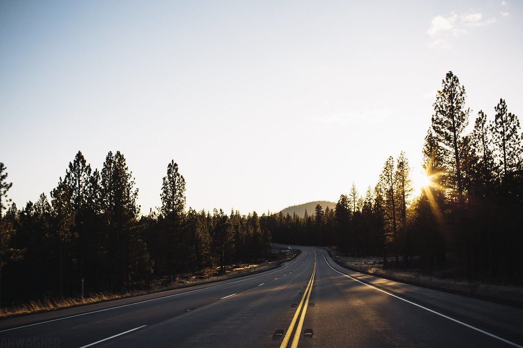
Highway 97 [03.29.13]
Heading north to Klamath Fall, OR
lovely sunset, gazillion bugs, mt. Shasta.
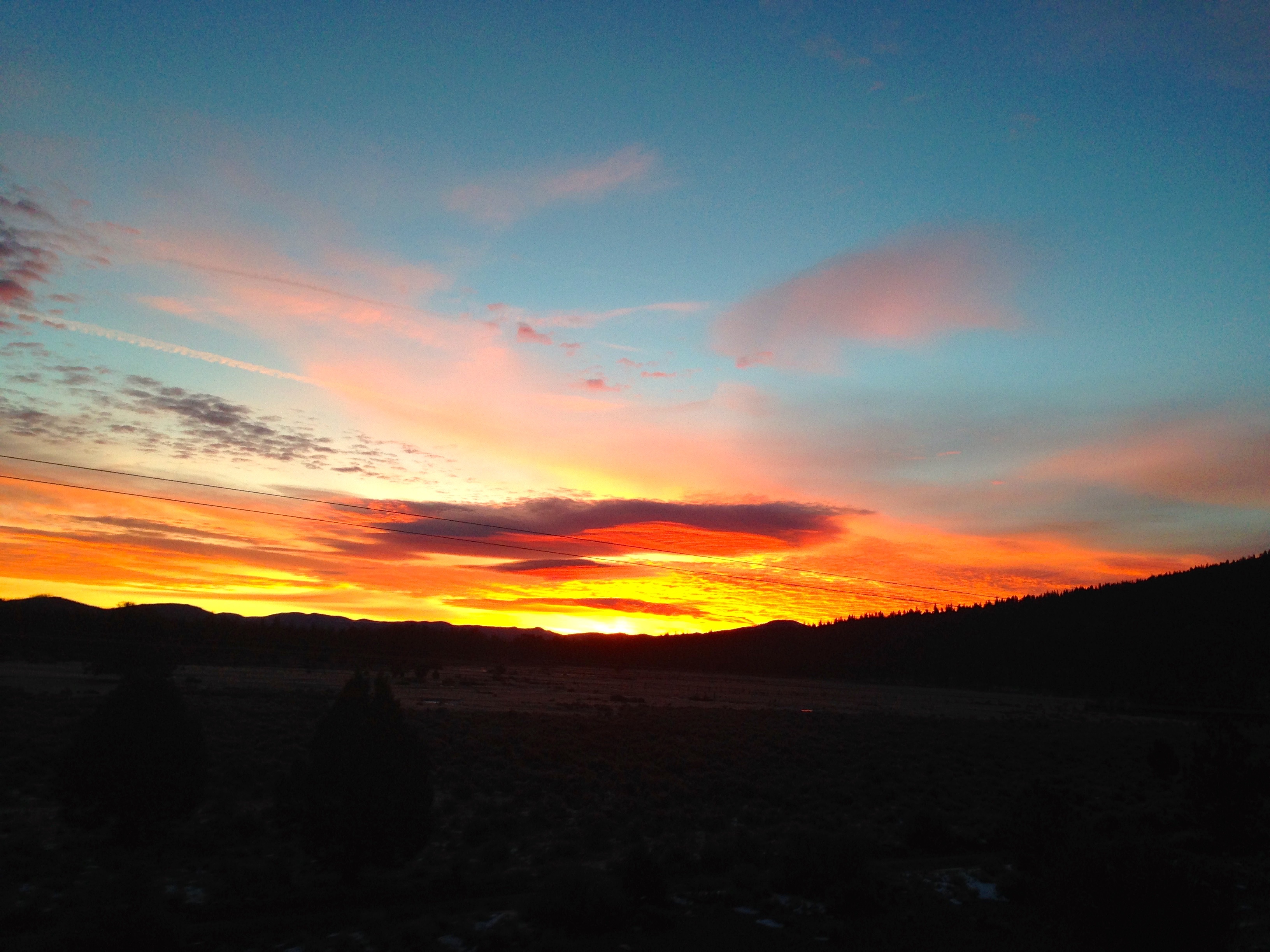
Lonely U.S. Route 97 Sunrise

Outmoded communication infrastructure... 20101008_1732
20101008_1839...Bray Siding without the siding

815_1266.NEF

815_1267.NEF

815_1268.NEF

815_1269.NEF

815_1270.NEF

Meet me at the pit

What a load of trash...

Slam Dunked at Mt Hebron

Goosenest Ranger Station

Highball Kegg

Cinder Source

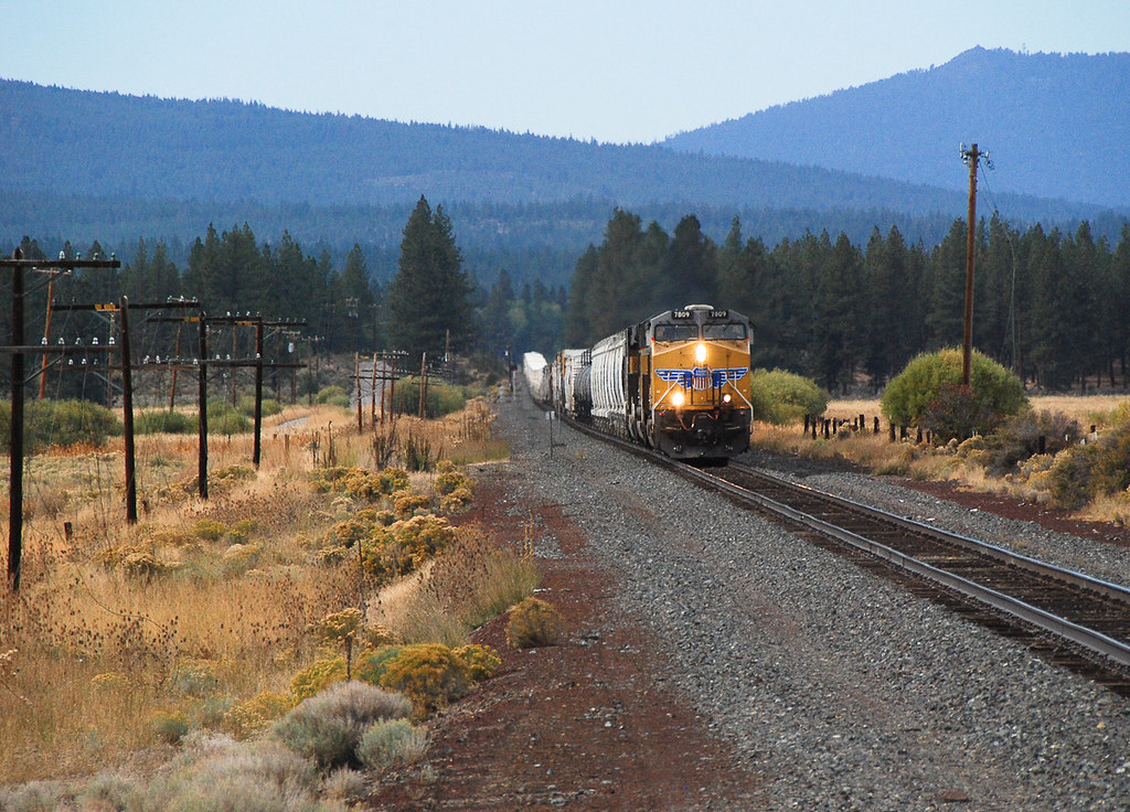
Yes, there were once two clean SP units on the Black Butte Sub at the same time.

A Friendly Vestige
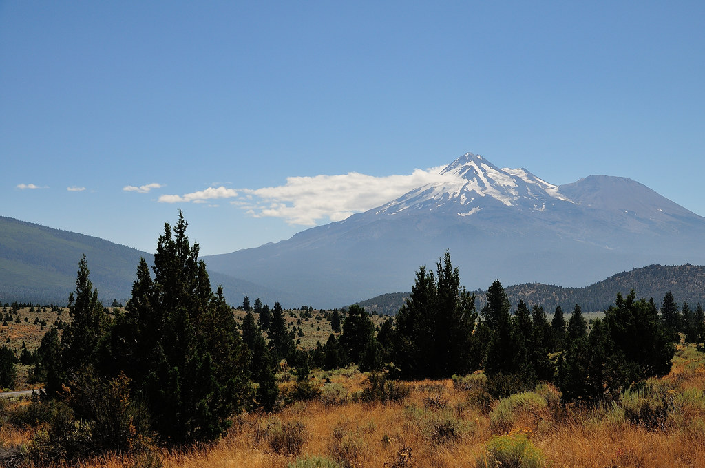
Mt. Shasta
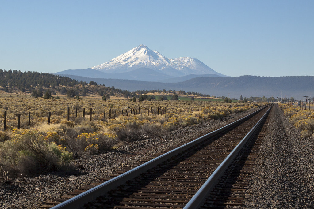
Mt. Shasta on the Tracks
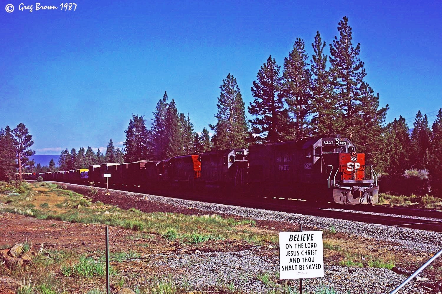
Not even Divine Intervention could save the Friendly

The RoadPig at Penoyar

What does not fit in this picture?

20131105-111331.jpg
Halfstok ivm 9/11, Mount Shasta in de verte
King Ave, Macdoel, CA アメリカ合衆国の地図
別の場所を検索
近所の場所
アメリカ合衆国 カリフォルニア州 マクドエル
Old State Hwy, Macdoel, CA アメリカ合衆国
Sheep Mountain Rd, Macdoel, CA アメリカ合衆国
Rocky Ridge Rd, Dorris, CA アメリカ合衆国
Andrews Rd, Dorris, CA アメリカ合衆国
Seattle, Dorris, CA アメリカ合衆国
アメリカ合衆国 〒 カリフォルニア州 ドーリス
Tennant Rd, Macdoel, CA アメリカ合衆国
アメリカ合衆国 〒 カリフォルニア州 グースネスト
アメリカ合衆国 〒 カリフォルニア州 ウィロー・クリーク山
アメリカ合衆国 〒 カリフォルニア州 グラス・レイク
アメリカ合衆国 〒 オレゴン州 ハメーカー山
アメリカ合衆国 カリフォルニア州 ザ・ホエールバック
Overland Dr, Klamath Falls, OR アメリカ合衆国
アメリカ合衆国 カリフォルニア州 インコンスタンス川
アメリカ合衆国 カリフォルニア州 アッシュ・クリーク・ビュート
アメリカ合衆国 オレゴン州 キーノー
Freight Rd Ln, Klamath Falls, OR アメリカ合衆国
Lower Klamath Lake Rd, Klamath Falls, OR アメリカ合衆国
アメリカ合衆国 オレゴン州 ミッドランド
最近の検索
- アメリカ合衆国 アラスカ州 レッド・ドッグ・マイン日の出日の入り時間
- Am bhf, Borken, ドイツアム・バーンホーフ日の出日の入り時間
- 4th St E, Sonoma, CA, USA日の出日の入り時間
- Oakland Ave, Williamsport, PA アメリカ合衆国日の出日の入り時間
- Via Roma, Pieranica CR, イタリアローマ通り日の出日の入り時間
- クロアチア 〒 ドゥブロブニク GradClock Tower of Dubrovnik日の出日の入り時間
- アルゼンチン チュブ州 トレリュー日の出日の入り時間
- Hartfords Bluff Cir, Mt Pleasant, SC アメリカ合衆国日の出日の入り時間
- 日本、熊本県熊本市北区日の出日の入り時間
- 中華人民共和国 福州市 平潭県 平潭島日の出日の入り時間