Horas de salida y puesta de sol de King Ave, Macdoel, CA, EE. UU.
Location: Estados Unidos > California > Condado de Siskiyou > Macdoel >
Zona horaria:
America/Los_Angeles
Hora local:
2025-06-22 19:06:57
Longitud:
-122.002961
Latitud:
41.786529
Salida de sol de hoy:
05:34:00 AM
Puesta de sol de hoy:
08:46:51 PM
La duración del día hoy:
15h 12m 51s
Salida de sol de mañana:
05:34:19 AM
Puesta de sol de mañana:
08:46:57 PM
La duración del día mañana:
15h 12m 38s
Mostrar todas las fechas
| Fecha | Salida de sol | Puesta de sol | Duración del día |
|---|---|---|---|
| 01/01/2025 | 07:35:22 AM | 04:49:06 PM | 9h 13m 44s |
| 02/01/2025 | 07:35:23 AM | 04:50:00 PM | 9h 14m 37s |
| 03/01/2025 | 07:35:22 AM | 04:50:56 PM | 9h 15m 34s |
| 04/01/2025 | 07:35:18 AM | 04:51:53 PM | 9h 16m 35s |
| 05/01/2025 | 07:35:12 AM | 04:52:52 PM | 9h 17m 40s |
| 06/01/2025 | 07:35:03 AM | 04:53:52 PM | 9h 18m 49s |
| 07/01/2025 | 07:34:53 AM | 04:54:53 PM | 9h 20m 0s |
| 08/01/2025 | 07:34:40 AM | 04:55:55 PM | 9h 21m 15s |
| 09/01/2025 | 07:34:24 AM | 04:56:59 PM | 9h 22m 35s |
| 10/01/2025 | 07:34:07 AM | 04:58:04 PM | 9h 23m 57s |
| 11/01/2025 | 07:33:47 AM | 04:59:10 PM | 9h 25m 23s |
| 12/01/2025 | 07:33:24 AM | 05:00:17 PM | 9h 26m 53s |
| 13/01/2025 | 07:33:00 AM | 05:01:25 PM | 9h 28m 25s |
| 14/01/2025 | 07:32:33 AM | 05:02:34 PM | 9h 30m 1s |
| 15/01/2025 | 07:32:04 AM | 05:03:44 PM | 9h 31m 40s |
| 16/01/2025 | 07:31:33 AM | 05:04:54 PM | 9h 33m 21s |
| 17/01/2025 | 07:30:59 AM | 05:06:06 PM | 9h 35m 7s |
| 18/01/2025 | 07:30:24 AM | 05:07:18 PM | 9h 36m 54s |
| 19/01/2025 | 07:29:46 AM | 05:08:30 PM | 9h 38m 44s |
| 20/01/2025 | 07:29:06 AM | 05:09:43 PM | 9h 40m 37s |
| 21/01/2025 | 07:28:25 AM | 05:10:57 PM | 9h 42m 32s |
| 22/01/2025 | 07:27:41 AM | 05:12:12 PM | 9h 44m 31s |
| 23/01/2025 | 07:26:55 AM | 05:13:26 PM | 9h 46m 31s |
| 24/01/2025 | 07:26:07 AM | 05:14:41 PM | 9h 48m 34s |
| 25/01/2025 | 07:25:17 AM | 05:15:57 PM | 9h 50m 40s |
| 26/01/2025 | 07:24:25 AM | 05:17:13 PM | 9h 52m 48s |
| 27/01/2025 | 07:23:32 AM | 05:18:29 PM | 9h 54m 57s |
| 28/01/2025 | 07:22:36 AM | 05:19:45 PM | 9h 57m 9s |
| 29/01/2025 | 07:21:39 AM | 05:21:01 PM | 9h 59m 22s |
| 30/01/2025 | 07:20:40 AM | 05:22:18 PM | 10h 1m 38s |
| 31/01/2025 | 07:19:39 AM | 05:23:35 PM | 10h 3m 56s |
| 01/02/2025 | 07:18:36 AM | 05:24:52 PM | 10h 6m 16s |
| 02/02/2025 | 07:17:32 AM | 05:26:08 PM | 10h 8m 36s |
| 03/02/2025 | 07:16:26 AM | 05:27:25 PM | 10h 10m 59s |
| 04/02/2025 | 07:15:19 AM | 05:28:42 PM | 10h 13m 23s |
| 05/02/2025 | 07:14:10 AM | 05:29:59 PM | 10h 15m 49s |
| 06/02/2025 | 07:12:59 AM | 05:31:16 PM | 10h 18m 17s |
| 07/02/2025 | 07:11:47 AM | 05:32:32 PM | 10h 20m 45s |
| 08/02/2025 | 07:10:34 AM | 05:33:49 PM | 10h 23m 15s |
| 09/02/2025 | 07:09:19 AM | 05:35:05 PM | 10h 25m 46s |
| 10/02/2025 | 07:08:03 AM | 05:36:21 PM | 10h 28m 18s |
| 11/02/2025 | 07:06:45 AM | 05:37:37 PM | 10h 30m 52s |
| 12/02/2025 | 07:05:26 AM | 05:38:53 PM | 10h 33m 27s |
| 13/02/2025 | 07:04:06 AM | 05:40:09 PM | 10h 36m 3s |
| 14/02/2025 | 07:02:45 AM | 05:41:24 PM | 10h 38m 39s |
| 15/02/2025 | 07:01:22 AM | 05:42:39 PM | 10h 41m 17s |
| 16/02/2025 | 06:59:58 AM | 05:43:54 PM | 10h 43m 56s |
| 17/02/2025 | 06:58:33 AM | 05:45:09 PM | 10h 46m 36s |
| 18/02/2025 | 06:57:07 AM | 05:46:23 PM | 10h 49m 16s |
| 19/02/2025 | 06:55:40 AM | 05:47:37 PM | 10h 51m 57s |
| 20/02/2025 | 06:54:12 AM | 05:48:51 PM | 10h 54m 39s |
| 21/02/2025 | 06:52:43 AM | 05:50:05 PM | 10h 57m 22s |
| 22/02/2025 | 06:51:14 AM | 05:51:18 PM | 11h 0m 4s |
| 23/02/2025 | 06:49:43 AM | 05:52:31 PM | 11h 2m 48s |
| 24/02/2025 | 06:48:11 AM | 05:53:43 PM | 11h 5m 32s |
| 25/02/2025 | 06:46:39 AM | 05:54:56 PM | 11h 8m 17s |
| 26/02/2025 | 06:45:05 AM | 05:56:08 PM | 11h 11m 3s |
| 27/02/2025 | 06:43:31 AM | 05:57:20 PM | 11h 13m 49s |
| 28/02/2025 | 06:41:56 AM | 05:58:31 PM | 11h 16m 35s |
| 01/03/2025 | 06:40:21 AM | 05:59:42 PM | 11h 19m 21s |
| 02/03/2025 | 06:38:45 AM | 06:00:53 PM | 11h 22m 8s |
| 03/03/2025 | 06:37:08 AM | 06:02:04 PM | 11h 24m 56s |
| 04/03/2025 | 06:35:31 AM | 06:03:14 PM | 11h 27m 43s |
| 05/03/2025 | 06:33:53 AM | 06:04:24 PM | 11h 30m 31s |
| 06/03/2025 | 06:32:14 AM | 06:05:34 PM | 11h 33m 20s |
| 07/03/2025 | 06:30:35 AM | 06:06:43 PM | 11h 36m 8s |
| 08/03/2025 | 06:28:56 AM | 06:07:53 PM | 11h 38m 57s |
| 09/03/2025 | 07:27:20 AM | 07:08:59 PM | 11h 41m 39s |
| 10/03/2025 | 07:25:40 AM | 07:10:08 PM | 11h 44m 28s |
| 11/03/2025 | 07:23:59 AM | 07:11:16 PM | 11h 47m 17s |
| 12/03/2025 | 07:22:18 AM | 07:12:25 PM | 11h 50m 7s |
| 13/03/2025 | 07:20:37 AM | 07:13:33 PM | 11h 52m 56s |
| 14/03/2025 | 07:18:55 AM | 07:14:41 PM | 11h 55m 46s |
| 15/03/2025 | 07:17:13 AM | 07:15:48 PM | 11h 58m 35s |
| 16/03/2025 | 07:15:31 AM | 07:16:56 PM | 12h 1m 25s |
| 17/03/2025 | 07:13:49 AM | 07:18:03 PM | 12h 4m 14s |
| 18/03/2025 | 07:12:07 AM | 07:19:10 PM | 12h 7m 3s |
| 19/03/2025 | 07:10:24 AM | 07:20:18 PM | 12h 9m 54s |
| 20/03/2025 | 07:08:42 AM | 07:21:24 PM | 12h 12m 42s |
| 21/03/2025 | 07:06:59 AM | 07:22:31 PM | 12h 15m 32s |
| 22/03/2025 | 07:05:17 AM | 07:23:38 PM | 12h 18m 21s |
| 23/03/2025 | 07:03:34 AM | 07:24:44 PM | 12h 21m 10s |
| 24/03/2025 | 07:01:51 AM | 07:25:51 PM | 12h 24m 0s |
| 25/03/2025 | 07:00:09 AM | 07:26:57 PM | 12h 26m 48s |
| 26/03/2025 | 06:58:26 AM | 07:28:03 PM | 12h 29m 37s |
| 27/03/2025 | 06:56:44 AM | 07:29:10 PM | 12h 32m 26s |
| 28/03/2025 | 06:55:02 AM | 07:30:16 PM | 12h 35m 14s |
| 29/03/2025 | 06:53:20 AM | 07:31:22 PM | 12h 38m 2s |
| 30/03/2025 | 06:51:38 AM | 07:32:28 PM | 12h 40m 50s |
| 31/03/2025 | 06:49:56 AM | 07:33:34 PM | 12h 43m 38s |
| 01/04/2025 | 06:48:15 AM | 07:34:40 PM | 12h 46m 25s |
| 02/04/2025 | 06:46:34 AM | 07:35:45 PM | 12h 49m 11s |
| 03/04/2025 | 06:44:54 AM | 07:36:51 PM | 12h 51m 57s |
| 04/04/2025 | 06:43:13 AM | 07:37:57 PM | 12h 54m 44s |
| 05/04/2025 | 06:41:33 AM | 07:39:03 PM | 12h 57m 30s |
| 06/04/2025 | 06:39:54 AM | 07:40:09 PM | 13h 0m 15s |
| 07/04/2025 | 06:38:15 AM | 07:41:15 PM | 13h 3m 0s |
| 08/04/2025 | 06:36:37 AM | 07:42:21 PM | 13h 5m 44s |
| 09/04/2025 | 06:34:59 AM | 07:43:26 PM | 13h 8m 27s |
| 10/04/2025 | 06:33:21 AM | 07:44:32 PM | 13h 11m 11s |
| 11/04/2025 | 06:31:45 AM | 07:45:38 PM | 13h 13m 53s |
| 12/04/2025 | 06:30:08 AM | 07:46:44 PM | 13h 16m 36s |
| 13/04/2025 | 06:28:33 AM | 07:47:50 PM | 13h 19m 17s |
| 14/04/2025 | 06:26:58 AM | 07:48:56 PM | 13h 21m 58s |
| 15/04/2025 | 06:25:24 AM | 07:50:02 PM | 13h 24m 38s |
| 16/04/2025 | 06:23:50 AM | 07:51:08 PM | 13h 27m 18s |
| 17/04/2025 | 06:22:18 AM | 07:52:14 PM | 13h 29m 56s |
| 18/04/2025 | 06:20:46 AM | 07:53:20 PM | 13h 32m 34s |
| 19/04/2025 | 06:19:15 AM | 07:54:26 PM | 13h 35m 11s |
| 20/04/2025 | 06:17:45 AM | 07:55:32 PM | 13h 37m 47s |
| 21/04/2025 | 06:16:16 AM | 07:56:37 PM | 13h 40m 21s |
| 22/04/2025 | 06:14:48 AM | 07:57:43 PM | 13h 42m 55s |
| 23/04/2025 | 06:13:20 AM | 07:58:49 PM | 13h 45m 29s |
| 24/04/2025 | 06:11:54 AM | 07:59:55 PM | 13h 48m 1s |
| 25/04/2025 | 06:10:29 AM | 08:01:01 PM | 13h 50m 32s |
| 26/04/2025 | 06:09:05 AM | 08:02:06 PM | 13h 53m 1s |
| 27/04/2025 | 06:07:42 AM | 08:03:12 PM | 13h 55m 30s |
| 28/04/2025 | 06:06:20 AM | 08:04:18 PM | 13h 57m 58s |
| 29/04/2025 | 06:04:59 AM | 08:05:23 PM | 14h 0m 24s |
| 30/04/2025 | 06:03:40 AM | 08:06:28 PM | 14h 2m 48s |
| 01/05/2025 | 06:02:21 AM | 08:07:33 PM | 14h 5m 12s |
| 02/05/2025 | 06:01:04 AM | 08:08:38 PM | 14h 7m 34s |
| 03/05/2025 | 05:59:49 AM | 08:09:43 PM | 14h 9m 54s |
| 04/05/2025 | 05:58:34 AM | 08:10:47 PM | 14h 12m 13s |
| 05/05/2025 | 05:57:21 AM | 08:11:52 PM | 14h 14m 31s |
| 06/05/2025 | 05:56:10 AM | 08:12:55 PM | 14h 16m 45s |
| 07/05/2025 | 05:54:59 AM | 08:13:59 PM | 14h 19m 0s |
| 08/05/2025 | 05:53:51 AM | 08:15:03 PM | 14h 21m 12s |
| 09/05/2025 | 05:52:43 AM | 08:16:06 PM | 14h 23m 23s |
| 10/05/2025 | 05:51:38 AM | 08:17:08 PM | 14h 25m 30s |
| 11/05/2025 | 05:50:34 AM | 08:18:10 PM | 14h 27m 36s |
| 12/05/2025 | 05:49:31 AM | 08:19:12 PM | 14h 29m 41s |
| 13/05/2025 | 05:48:30 AM | 08:20:13 PM | 14h 31m 43s |
| 14/05/2025 | 05:47:31 AM | 08:21:14 PM | 14h 33m 43s |
| 15/05/2025 | 05:46:33 AM | 08:22:14 PM | 14h 35m 41s |
| 16/05/2025 | 05:45:37 AM | 08:23:14 PM | 14h 37m 37s |
| 17/05/2025 | 05:44:43 AM | 08:24:13 PM | 14h 39m 30s |
| 18/05/2025 | 05:43:51 AM | 08:25:11 PM | 14h 41m 20s |
| 19/05/2025 | 05:43:00 AM | 08:26:09 PM | 14h 43m 9s |
| 20/05/2025 | 05:42:11 AM | 08:27:06 PM | 14h 44m 55s |
| 21/05/2025 | 05:41:24 AM | 08:28:02 PM | 14h 46m 38s |
| 22/05/2025 | 05:40:39 AM | 08:28:57 PM | 14h 48m 18s |
| 23/05/2025 | 05:39:56 AM | 08:29:52 PM | 14h 49m 56s |
| 24/05/2025 | 05:39:15 AM | 08:30:45 PM | 14h 51m 30s |
| 25/05/2025 | 05:38:35 AM | 08:31:38 PM | 14h 53m 3s |
| 26/05/2025 | 05:37:58 AM | 08:32:29 PM | 14h 54m 31s |
| 27/05/2025 | 05:37:22 AM | 08:33:20 PM | 14h 55m 58s |
| 28/05/2025 | 05:36:49 AM | 08:34:09 PM | 14h 57m 20s |
| 29/05/2025 | 05:36:17 AM | 08:34:58 PM | 14h 58m 41s |
| 30/05/2025 | 05:35:48 AM | 08:35:45 PM | 14h 59m 57s |
| 31/05/2025 | 05:35:20 AM | 08:36:31 PM | 15h 1m 11s |
| 01/06/2025 | 05:34:55 AM | 08:37:15 PM | 15h 2m 20s |
| 02/06/2025 | 05:34:32 AM | 08:37:59 PM | 15h 3m 27s |
| 03/06/2025 | 05:34:10 AM | 08:38:41 PM | 15h 4m 31s |
| 04/06/2025 | 05:33:51 AM | 08:39:21 PM | 15h 5m 30s |
| 05/06/2025 | 05:33:34 AM | 08:40:00 PM | 15h 6m 26s |
| 06/06/2025 | 05:33:19 AM | 08:40:38 PM | 15h 7m 19s |
| 07/06/2025 | 05:33:06 AM | 08:41:14 PM | 15h 8m 8s |
| 08/06/2025 | 05:32:55 AM | 08:41:49 PM | 15h 8m 54s |
| 09/06/2025 | 05:32:46 AM | 08:42:22 PM | 15h 9m 36s |
| 10/06/2025 | 05:32:39 AM | 08:42:53 PM | 15h 10m 14s |
| 11/06/2025 | 05:32:34 AM | 08:43:23 PM | 15h 10m 49s |
| 12/06/2025 | 05:32:31 AM | 08:43:51 PM | 15h 11m 20s |
| 13/06/2025 | 05:32:30 AM | 08:44:17 PM | 15h 11m 47s |
| 14/06/2025 | 05:32:32 AM | 08:44:41 PM | 15h 12m 9s |
| 15/06/2025 | 05:32:35 AM | 08:45:04 PM | 15h 12m 29s |
| 16/06/2025 | 05:32:40 AM | 08:45:24 PM | 15h 12m 44s |
| 17/06/2025 | 05:32:48 AM | 08:45:43 PM | 15h 12m 55s |
| 18/06/2025 | 05:32:57 AM | 08:46:00 PM | 15h 13m 3s |
| 19/06/2025 | 05:33:08 AM | 08:46:15 PM | 15h 13m 7s |
| 20/06/2025 | 05:33:21 AM | 08:46:28 PM | 15h 13m 7s |
| 21/06/2025 | 05:33:36 AM | 08:46:39 PM | 15h 13m 3s |
| 22/06/2025 | 05:33:53 AM | 08:46:48 PM | 15h 12m 55s |
| 23/06/2025 | 05:34:12 AM | 08:46:55 PM | 15h 12m 43s |
| 24/06/2025 | 05:34:32 AM | 08:47:00 PM | 15h 12m 28s |
| 25/06/2025 | 05:34:55 AM | 08:47:03 PM | 15h 12m 8s |
| 26/06/2025 | 05:35:19 AM | 08:47:04 PM | 15h 11m 45s |
| 27/06/2025 | 05:35:45 AM | 08:47:02 PM | 15h 11m 17s |
| 28/06/2025 | 05:36:12 AM | 08:46:59 PM | 15h 10m 47s |
| 29/06/2025 | 05:36:41 AM | 08:46:54 PM | 15h 10m 13s |
| 30/06/2025 | 05:37:12 AM | 08:46:46 PM | 15h 9m 34s |
| 01/07/2025 | 05:37:44 AM | 08:46:36 PM | 15h 8m 52s |
| 02/07/2025 | 05:38:18 AM | 08:46:25 PM | 15h 8m 7s |
| 03/07/2025 | 05:38:53 AM | 08:46:11 PM | 15h 7m 18s |
| 04/07/2025 | 05:39:30 AM | 08:45:55 PM | 15h 6m 25s |
| 05/07/2025 | 05:40:08 AM | 08:45:37 PM | 15h 5m 29s |
| 06/07/2025 | 05:40:48 AM | 08:45:16 PM | 15h 4m 28s |
| 07/07/2025 | 05:41:28 AM | 08:44:54 PM | 15h 3m 26s |
| 08/07/2025 | 05:42:10 AM | 08:44:30 PM | 15h 2m 20s |
| 09/07/2025 | 05:42:54 AM | 08:44:03 PM | 15h 1m 9s |
| 10/07/2025 | 05:43:38 AM | 08:43:35 PM | 14h 59m 57s |
| 11/07/2025 | 05:44:24 AM | 08:43:04 PM | 14h 58m 40s |
| 12/07/2025 | 05:45:10 AM | 08:42:31 PM | 14h 57m 21s |
| 13/07/2025 | 05:45:58 AM | 08:41:57 PM | 14h 55m 59s |
| 14/07/2025 | 05:46:47 AM | 08:41:20 PM | 14h 54m 33s |
| 15/07/2025 | 05:47:37 AM | 08:40:41 PM | 14h 53m 4s |
| 16/07/2025 | 05:48:27 AM | 08:40:01 PM | 14h 51m 34s |
| 17/07/2025 | 05:49:19 AM | 08:39:18 PM | 14h 49m 59s |
| 18/07/2025 | 05:50:11 AM | 08:38:34 PM | 14h 48m 23s |
| 19/07/2025 | 05:51:04 AM | 08:37:47 PM | 14h 46m 43s |
| 20/07/2025 | 05:51:58 AM | 08:36:59 PM | 14h 45m 1s |
| 21/07/2025 | 05:52:53 AM | 08:36:09 PM | 14h 43m 16s |
| 22/07/2025 | 05:53:48 AM | 08:35:17 PM | 14h 41m 29s |
| 23/07/2025 | 05:54:44 AM | 08:34:23 PM | 14h 39m 39s |
| 24/07/2025 | 05:55:41 AM | 08:33:27 PM | 14h 37m 46s |
| 25/07/2025 | 05:56:38 AM | 08:32:30 PM | 14h 35m 52s |
| 26/07/2025 | 05:57:35 AM | 08:31:31 PM | 14h 33m 56s |
| 27/07/2025 | 05:58:33 AM | 08:30:30 PM | 14h 31m 57s |
| 28/07/2025 | 05:59:32 AM | 08:29:28 PM | 14h 29m 56s |
| 29/07/2025 | 06:00:31 AM | 08:28:24 PM | 14h 27m 53s |
| 30/07/2025 | 06:01:30 AM | 08:27:18 PM | 14h 25m 48s |
| 31/07/2025 | 06:02:29 AM | 08:26:11 PM | 14h 23m 42s |
| 01/08/2025 | 06:03:29 AM | 08:25:03 PM | 14h 21m 34s |
| 02/08/2025 | 06:04:30 AM | 08:23:52 PM | 14h 19m 22s |
| 03/08/2025 | 06:05:30 AM | 08:22:41 PM | 14h 17m 11s |
| 04/08/2025 | 06:06:31 AM | 08:21:28 PM | 14h 14m 57s |
| 05/08/2025 | 06:07:32 AM | 08:20:13 PM | 14h 12m 41s |
| 06/08/2025 | 06:08:33 AM | 08:18:57 PM | 14h 10m 24s |
| 07/08/2025 | 06:09:34 AM | 08:17:40 PM | 14h 8m 6s |
| 08/08/2025 | 06:10:36 AM | 08:16:22 PM | 14h 5m 46s |
| 09/08/2025 | 06:11:37 AM | 08:15:02 PM | 14h 3m 25s |
| 10/08/2025 | 06:12:39 AM | 08:13:41 PM | 14h 1m 2s |
| 11/08/2025 | 06:13:41 AM | 08:12:18 PM | 13h 58m 37s |
| 12/08/2025 | 06:14:43 AM | 08:10:55 PM | 13h 56m 12s |
| 13/08/2025 | 06:15:45 AM | 08:09:30 PM | 13h 53m 45s |
| 14/08/2025 | 06:16:46 AM | 08:08:05 PM | 13h 51m 19s |
| 15/08/2025 | 06:17:48 AM | 08:06:38 PM | 13h 48m 50s |
| 16/08/2025 | 06:18:50 AM | 08:05:10 PM | 13h 46m 20s |
| 17/08/2025 | 06:19:52 AM | 08:03:41 PM | 13h 43m 49s |
| 18/08/2025 | 06:20:54 AM | 08:02:12 PM | 13h 41m 18s |
| 19/08/2025 | 06:21:56 AM | 08:00:41 PM | 13h 38m 45s |
| 20/08/2025 | 06:22:58 AM | 07:59:09 PM | 13h 36m 11s |
| 21/08/2025 | 06:24:00 AM | 07:57:37 PM | 13h 33m 37s |
| 22/08/2025 | 06:25:02 AM | 07:56:03 PM | 13h 31m 1s |
| 23/08/2025 | 06:26:04 AM | 07:54:29 PM | 13h 28m 25s |
| 24/08/2025 | 06:27:06 AM | 07:52:54 PM | 13h 25m 48s |
| 25/08/2025 | 06:28:07 AM | 07:51:18 PM | 13h 23m 11s |
| 26/08/2025 | 06:29:09 AM | 07:49:42 PM | 13h 20m 33s |
| 27/08/2025 | 06:30:11 AM | 07:48:05 PM | 13h 17m 54s |
| 28/08/2025 | 06:31:12 AM | 07:46:27 PM | 13h 15m 15s |
| 29/08/2025 | 06:32:14 AM | 07:44:48 PM | 13h 12m 34s |
| 30/08/2025 | 06:33:16 AM | 07:43:09 PM | 13h 9m 53s |
| 31/08/2025 | 06:34:17 AM | 07:41:29 PM | 13h 7m 12s |
| 01/09/2025 | 06:35:19 AM | 07:39:49 PM | 13h 4m 30s |
| 02/09/2025 | 06:36:20 AM | 07:38:09 PM | 13h 1m 49s |
| 03/09/2025 | 06:37:21 AM | 07:36:27 PM | 12h 59m 6s |
| 04/09/2025 | 06:38:23 AM | 07:34:46 PM | 12h 56m 23s |
| 05/09/2025 | 06:39:24 AM | 07:33:04 PM | 12h 53m 40s |
| 06/09/2025 | 06:40:26 AM | 07:31:21 PM | 12h 50m 55s |
| 07/09/2025 | 06:41:27 AM | 07:29:39 PM | 12h 48m 12s |
| 08/09/2025 | 06:42:28 AM | 07:27:55 PM | 12h 45m 27s |
| 09/09/2025 | 06:43:30 AM | 07:26:12 PM | 12h 42m 42s |
| 10/09/2025 | 06:44:31 AM | 07:24:28 PM | 12h 39m 57s |
| 11/09/2025 | 06:45:33 AM | 07:22:45 PM | 12h 37m 12s |
| 12/09/2025 | 06:46:34 AM | 07:21:00 PM | 12h 34m 26s |
| 13/09/2025 | 06:47:36 AM | 07:19:16 PM | 12h 31m 40s |
| 14/09/2025 | 06:48:37 AM | 07:17:32 PM | 12h 28m 55s |
| 15/09/2025 | 06:49:39 AM | 07:15:47 PM | 12h 26m 8s |
| 16/09/2025 | 06:50:41 AM | 07:14:03 PM | 12h 23m 22s |
| 17/09/2025 | 06:51:42 AM | 07:12:18 PM | 12h 20m 36s |
| 18/09/2025 | 06:52:44 AM | 07:10:33 PM | 12h 17m 49s |
| 19/09/2025 | 06:53:46 AM | 07:08:48 PM | 12h 15m 2s |
| 20/09/2025 | 06:54:48 AM | 07:07:04 PM | 12h 12m 16s |
| 21/09/2025 | 06:55:51 AM | 07:05:19 PM | 12h 9m 28s |
| 22/09/2025 | 06:56:53 AM | 07:03:35 PM | 12h 6m 42s |
| 23/09/2025 | 06:57:56 AM | 07:01:50 PM | 12h 3m 54s |
| 24/09/2025 | 06:58:58 AM | 07:00:06 PM | 12h 1m 8s |
| 25/09/2025 | 07:00:01 AM | 06:58:22 PM | 11h 58m 21s |
| 26/09/2025 | 07:01:04 AM | 06:56:38 PM | 11h 55m 34s |
| 27/09/2025 | 07:02:08 AM | 06:54:55 PM | 11h 52m 47s |
| 28/09/2025 | 07:03:11 AM | 06:53:11 PM | 11h 50m 0s |
| 29/09/2025 | 07:04:15 AM | 06:51:28 PM | 11h 47m 13s |
| 30/09/2025 | 07:05:19 AM | 06:49:45 PM | 11h 44m 26s |
| 01/10/2025 | 07:06:23 AM | 06:48:03 PM | 11h 41m 40s |
| 02/10/2025 | 07:07:27 AM | 06:46:21 PM | 11h 38m 54s |
| 03/10/2025 | 07:08:32 AM | 06:44:40 PM | 11h 36m 8s |
| 04/10/2025 | 07:09:37 AM | 06:42:59 PM | 11h 33m 22s |
| 05/10/2025 | 07:10:42 AM | 06:41:18 PM | 11h 30m 36s |
| 06/10/2025 | 07:11:48 AM | 06:39:38 PM | 11h 27m 50s |
| 07/10/2025 | 07:12:54 AM | 06:37:59 PM | 11h 25m 5s |
| 08/10/2025 | 07:14:00 AM | 06:36:20 PM | 11h 22m 20s |
| 09/10/2025 | 07:15:06 AM | 06:34:41 PM | 11h 19m 35s |
| 10/10/2025 | 07:16:13 AM | 06:33:04 PM | 11h 16m 51s |
| 11/10/2025 | 07:17:20 AM | 06:31:27 PM | 11h 14m 7s |
| 12/10/2025 | 07:18:27 AM | 06:29:51 PM | 11h 11m 24s |
| 13/10/2025 | 07:19:35 AM | 06:28:15 PM | 11h 8m 40s |
| 14/10/2025 | 07:20:42 AM | 06:26:41 PM | 11h 5m 59s |
| 15/10/2025 | 07:21:51 AM | 06:25:07 PM | 11h 3m 16s |
| 16/10/2025 | 07:22:59 AM | 06:23:34 PM | 11h 0m 35s |
| 17/10/2025 | 07:24:08 AM | 06:22:02 PM | 10h 57m 54s |
| 18/10/2025 | 07:25:17 AM | 06:20:30 PM | 10h 55m 13s |
| 19/10/2025 | 07:26:27 AM | 06:19:00 PM | 10h 52m 33s |
| 20/10/2025 | 07:27:37 AM | 06:17:31 PM | 10h 49m 54s |
| 21/10/2025 | 07:28:47 AM | 06:16:03 PM | 10h 47m 16s |
| 22/10/2025 | 07:29:57 AM | 06:14:36 PM | 10h 44m 39s |
| 23/10/2025 | 07:31:08 AM | 06:13:10 PM | 10h 42m 2s |
| 24/10/2025 | 07:32:19 AM | 06:11:45 PM | 10h 39m 26s |
| 25/10/2025 | 07:33:31 AM | 06:10:21 PM | 10h 36m 50s |
| 26/10/2025 | 07:34:42 AM | 06:08:59 PM | 10h 34m 17s |
| 27/10/2025 | 07:35:54 AM | 06:07:37 PM | 10h 31m 43s |
| 28/10/2025 | 07:37:06 AM | 06:06:17 PM | 10h 29m 11s |
| 29/10/2025 | 07:38:18 AM | 06:04:59 PM | 10h 26m 41s |
| 30/10/2025 | 07:39:31 AM | 06:03:41 PM | 10h 24m 10s |
| 31/10/2025 | 07:40:44 AM | 06:02:25 PM | 10h 21m 41s |
| 01/11/2025 | 07:41:57 AM | 06:01:11 PM | 10h 19m 14s |
| 02/11/2025 | 06:43:13 AM | 04:59:55 PM | 10h 16m 42s |
| 03/11/2025 | 06:44:26 AM | 04:58:43 PM | 10h 14m 17s |
| 04/11/2025 | 06:45:39 AM | 04:57:33 PM | 10h 11m 54s |
| 05/11/2025 | 06:46:53 AM | 04:56:25 PM | 10h 9m 32s |
| 06/11/2025 | 06:48:06 AM | 04:55:18 PM | 10h 7m 12s |
| 07/11/2025 | 06:49:20 AM | 04:54:13 PM | 10h 4m 53s |
| 08/11/2025 | 06:50:33 AM | 04:53:10 PM | 10h 2m 37s |
| 09/11/2025 | 06:51:47 AM | 04:52:08 PM | 10h 0m 21s |
| 10/11/2025 | 06:53:00 AM | 04:51:08 PM | 9h 58m 8s |
| 11/11/2025 | 06:54:13 AM | 04:50:10 PM | 9h 55m 57s |
| 12/11/2025 | 06:55:27 AM | 04:49:14 PM | 9h 53m 47s |
| 13/11/2025 | 06:56:40 AM | 04:48:20 PM | 9h 51m 40s |
| 14/11/2025 | 06:57:52 AM | 04:47:27 PM | 9h 49m 35s |
| 15/11/2025 | 06:59:05 AM | 04:46:37 PM | 9h 47m 32s |
| 16/11/2025 | 07:00:17 AM | 04:45:48 PM | 9h 45m 31s |
| 17/11/2025 | 07:01:29 AM | 04:45:02 PM | 9h 43m 33s |
| 18/11/2025 | 07:02:40 AM | 04:44:17 PM | 9h 41m 37s |
| 19/11/2025 | 07:03:51 AM | 04:43:35 PM | 9h 39m 44s |
| 20/11/2025 | 07:05:02 AM | 04:42:54 PM | 9h 37m 52s |
| 21/11/2025 | 07:06:12 AM | 04:42:16 PM | 9h 36m 4s |
| 22/11/2025 | 07:07:21 AM | 04:41:40 PM | 9h 34m 19s |
| 23/11/2025 | 07:08:30 AM | 04:41:06 PM | 9h 32m 36s |
| 24/11/2025 | 07:09:38 AM | 04:40:35 PM | 9h 30m 57s |
| 25/11/2025 | 07:10:46 AM | 04:40:05 PM | 9h 29m 19s |
| 26/11/2025 | 07:11:52 AM | 04:39:38 PM | 9h 27m 46s |
| 27/11/2025 | 07:12:58 AM | 04:39:13 PM | 9h 26m 15s |
| 28/11/2025 | 07:14:03 AM | 04:38:50 PM | 9h 24m 47s |
| 29/11/2025 | 07:15:07 AM | 04:38:30 PM | 9h 23m 23s |
| 30/11/2025 | 07:16:09 AM | 04:38:12 PM | 9h 22m 3s |
| 01/12/2025 | 07:17:11 AM | 04:37:57 PM | 9h 20m 46s |
| 02/12/2025 | 07:18:12 AM | 04:37:43 PM | 9h 19m 31s |
| 03/12/2025 | 07:19:11 AM | 04:37:33 PM | 9h 18m 22s |
| 04/12/2025 | 07:20:09 AM | 04:37:24 PM | 9h 17m 15s |
| 05/12/2025 | 07:21:06 AM | 04:37:18 PM | 9h 16m 12s |
| 06/12/2025 | 07:22:01 AM | 04:37:14 PM | 9h 15m 13s |
| 07/12/2025 | 07:22:55 AM | 04:37:13 PM | 9h 14m 18s |
| 08/12/2025 | 07:23:48 AM | 04:37:14 PM | 9h 13m 26s |
| 09/12/2025 | 07:24:39 AM | 04:37:17 PM | 9h 12m 38s |
| 10/12/2025 | 07:25:28 AM | 04:37:23 PM | 9h 11m 55s |
| 11/12/2025 | 07:26:16 AM | 04:37:32 PM | 9h 11m 16s |
| 12/12/2025 | 07:27:02 AM | 04:37:42 PM | 9h 10m 40s |
| 13/12/2025 | 07:27:46 AM | 04:37:55 PM | 9h 10m 9s |
| 14/12/2025 | 07:28:29 AM | 04:38:10 PM | 9h 9m 41s |
| 15/12/2025 | 07:29:09 AM | 04:38:28 PM | 9h 9m 19s |
| 16/12/2025 | 07:29:48 AM | 04:38:48 PM | 9h 9m 0s |
| 17/12/2025 | 07:30:25 AM | 04:39:10 PM | 9h 8m 45s |
| 18/12/2025 | 07:31:00 AM | 04:39:34 PM | 9h 8m 34s |
| 19/12/2025 | 07:31:33 AM | 04:40:01 PM | 9h 8m 28s |
| 20/12/2025 | 07:32:03 AM | 04:40:30 PM | 9h 8m 27s |
| 21/12/2025 | 07:32:32 AM | 04:41:01 PM | 9h 8m 29s |
| 22/12/2025 | 07:32:59 AM | 04:41:34 PM | 9h 8m 35s |
| 23/12/2025 | 07:33:23 AM | 04:42:09 PM | 9h 8m 46s |
| 24/12/2025 | 07:33:45 AM | 04:42:47 PM | 9h 9m 2s |
| 25/12/2025 | 07:34:05 AM | 04:43:26 PM | 9h 9m 21s |
| 26/12/2025 | 07:34:23 AM | 04:44:07 PM | 9h 9m 44s |
| 27/12/2025 | 07:34:38 AM | 04:44:50 PM | 9h 10m 12s |
| 28/12/2025 | 07:34:51 AM | 04:45:35 PM | 9h 10m 44s |
| 29/12/2025 | 07:35:02 AM | 04:46:22 PM | 9h 11m 20s |
| 30/12/2025 | 07:35:11 AM | 04:47:11 PM | 9h 12m 0s |
| 31/12/2025 | 07:35:17 AM | 04:48:01 PM | 9h 12m 44s |
Fotos
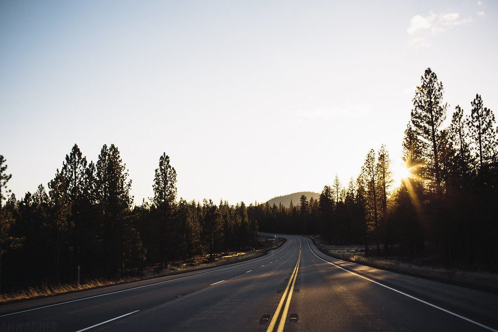
Highway 97 [03.29.13]
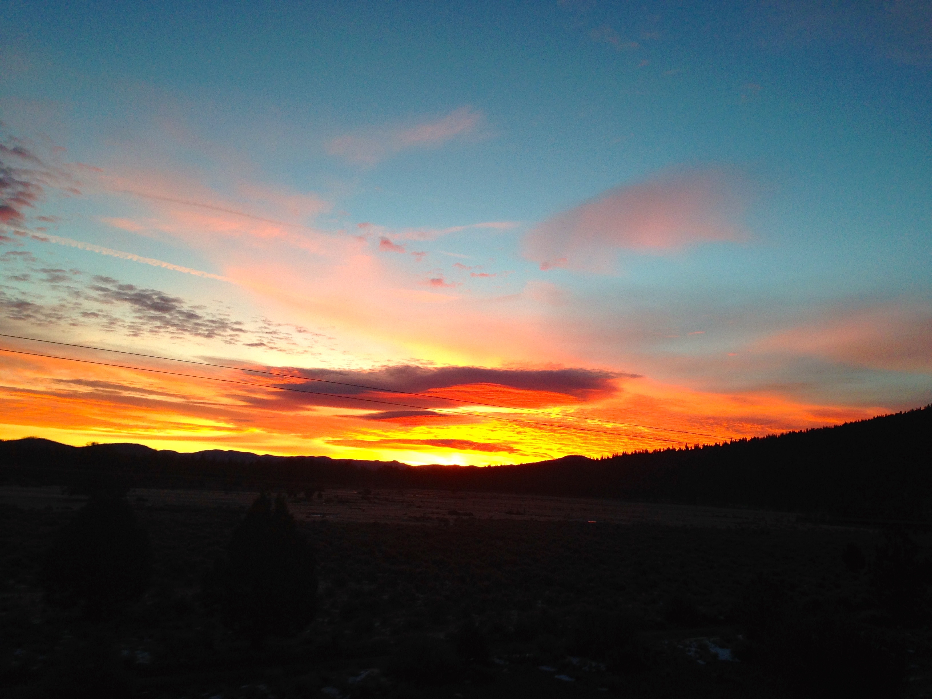
Heading north to Klamath Fall, OR
lovely sunset, gazillion bugs, mt. Shasta.
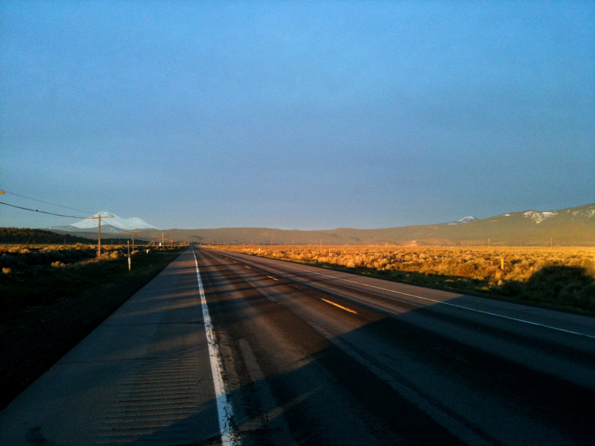
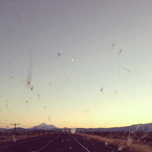
Lonely U.S. Route 97 Sunrise

Outmoded communication infrastructure... 20101008_1732
20101008_1839...Bray Siding without the siding

815_1266.NEF

815_1267.NEF

815_1268.NEF

815_1269.NEF

815_1270.NEF

Meet me at the pit

What a load of trash...

Slam Dunked at Mt Hebron

Goosenest Ranger Station

Highball Kegg

Cinder Source

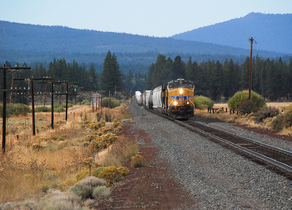
Yes, there were once two clean SP units on the Black Butte Sub at the same time.

A Friendly Vestige
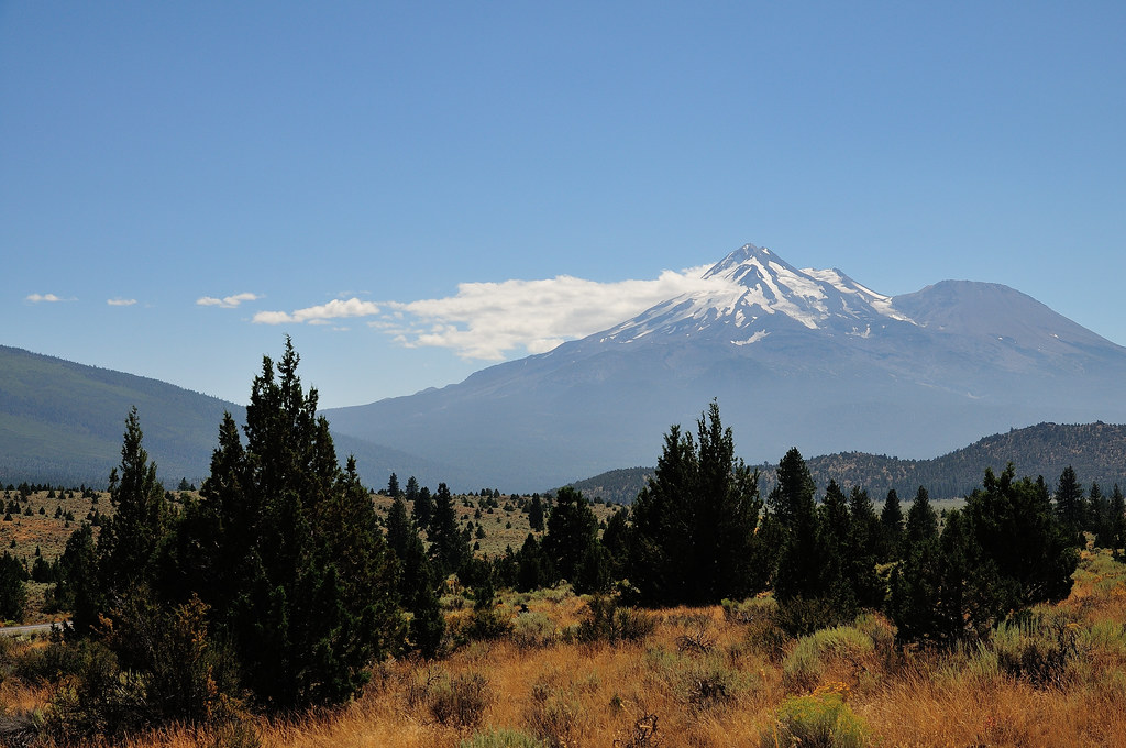
Mt. Shasta
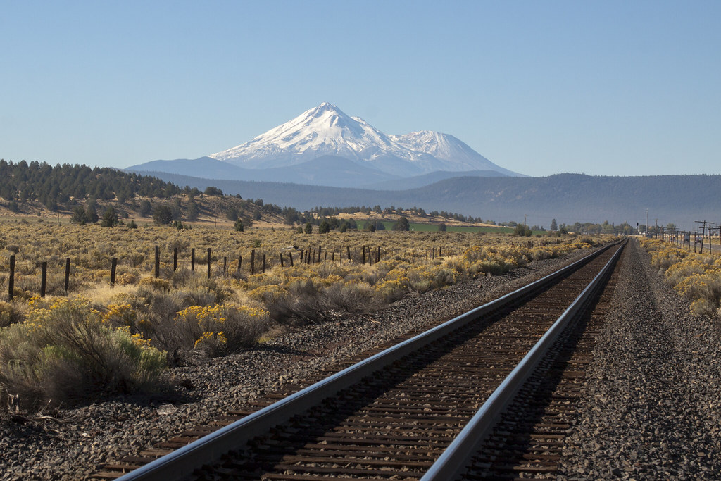
Mt. Shasta on the Tracks
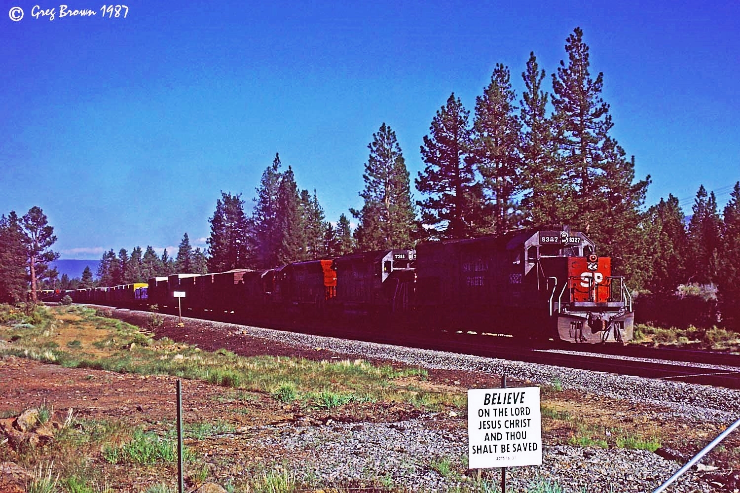
Not even Divine Intervention could save the Friendly

The RoadPig at Penoyar

What does not fit in this picture?

20131105-111331.jpg
Halfstok ivm 9/11, Mount Shasta in de verte
Mapa de King Ave, Macdoel, CA, EE. UU.
Buscar otro lugar
Lugares cercanos
Macdoel, California, EE. UU.
Old State Hwy, Macdoel, CA, EE. UU.
Sheep Mountain Rd, Macdoel, CA, EE. UU.
Rocky Ridge Rd, Dorris, CA, EE. UU.
Andrews Rd, Dorris, CA, EE. UU.
Seattle, Dorris, CA, EE. UU.
Dorris, California, EE. UU.
Tennant Rd, Macdoel, CA, EE. UU.
Goosenest, California, EE. UU.
Willow Creek Mountain, California, EE. UU.
Grass Lake, CA, EE. UU.
Hamaker Mountain, Oregon, EE. UU.
The Whaleback, California, EE. UU.
Overland Dr, Klamath Falls, OR, EE. UU.
Inconstance Creek, California, EE. UU.
Ash Creek Butte, California, EE. UU.
Keno, OR, EE. UU.
Freight Rd Ln, Klamath Falls, OR, EE. UU.
Lower Klamath Lake Rd, Klamath Falls, OR, EE. UU.
Midland, OR, EE. UU.
Búsquedas recientes
- Horas de salida y puesta de sol de Red Dog Mine, AK, USA
- Horas de salida y puesta de sol de Am Bahnhof, Am bhf, Borken, Germany
- Horas de salida y puesta de sol de 4th St E, Sonoma, CA, EE. UU.
- Horas de salida y puesta de sol de Oakland Ave, Williamsport, PA, EE. UU.
- Horas de salida y puesta de sol de Via Roma, Pieranica CR, Italia
- Horas de salida y puesta de sol de Torre del reloj, Grad, Dubrovnik (Ragusa), Croacia
- Horas de salida y puesta de sol de Trelew, Chubut, Argentina
- Horas de salida y puesta de sol de Hartfords Bluff Cir, Mt Pleasant, SC, EE. UU.
- Horas de salida y puesta de sol de Kita Ward, Kumamoto, Japón
- Horas de salida y puesta de sol de Pingtan Island, Pingtan County, Fuzhou, China