US-, Monticello, UT アメリカ合衆国デヴィルズ・キャニオン・キャンプグランド日の出日の入り時間
Location: アメリカ合衆国 > ユタ州 > サンフアン > アメリカ合衆国 〒 ユタ州 ブランディング >
時間帯:
America/Denver
現地時間:
2025-07-12 13:21:24
経度:
-109.4113719
緯度:
37.7355365
今日の日の出時刻:
06:07:02 AM
今日の日の入時刻:
08:40:00 PM
今日の日長:
14h 32m 58s
明日の日の出時刻:
06:07:44 AM
明日の日の入時刻:
08:39:31 PM
明日の日長:
14h 31m 47s
すべて表示する
| 日付 | 日出 | 日没 | 日長 |
|---|---|---|---|
| 2025年01月01日 | 07:33:02 AM | 05:10:38 PM | 9h 37m 36s |
| 2025年01月02日 | 07:33:07 AM | 05:11:28 PM | 9h 38m 21s |
| 2025年01月03日 | 07:33:10 AM | 05:12:19 PM | 9h 39m 9s |
| 2025年01月04日 | 07:33:11 AM | 05:13:12 PM | 9h 40m 1s |
| 2025年01月05日 | 07:33:10 AM | 05:14:05 PM | 9h 40m 55s |
| 2025年01月06日 | 07:33:07 AM | 05:15:00 PM | 9h 41m 53s |
| 2025年01月07日 | 07:33:02 AM | 05:15:56 PM | 9h 42m 54s |
| 2025年01月08日 | 07:32:55 AM | 05:16:53 PM | 9h 43m 58s |
| 2025年01月09日 | 07:32:45 AM | 05:17:50 PM | 9h 45m 5s |
| 2025年01月10日 | 07:32:34 AM | 05:18:49 PM | 9h 46m 15s |
| 2025年01月11日 | 07:32:21 AM | 05:19:49 PM | 9h 47m 28s |
| 2025年01月12日 | 07:32:05 AM | 05:20:49 PM | 9h 48m 44s |
| 2025年01月13日 | 07:31:47 AM | 05:21:50 PM | 9h 50m 3s |
| 2025年01月14日 | 07:31:28 AM | 05:22:52 PM | 9h 51m 24s |
| 2025年01月15日 | 07:31:06 AM | 05:23:54 PM | 9h 52m 48s |
| 2025年01月16日 | 07:30:43 AM | 05:24:57 PM | 9h 54m 14s |
| 2025年01月17日 | 07:30:17 AM | 05:26:01 PM | 9h 55m 44s |
| 2025年01月18日 | 07:29:50 AM | 05:27:05 PM | 9h 57m 15s |
| 2025年01月19日 | 07:29:20 AM | 05:28:10 PM | 9h 58m 50s |
| 2025年01月20日 | 07:28:49 AM | 05:29:15 PM | 10h 0m 26s |
| 2025年01月21日 | 07:28:15 AM | 05:30:20 PM | 10h 2m 5s |
| 2025年01月22日 | 07:27:40 AM | 05:31:26 PM | 10h 3m 46s |
| 2025年01月23日 | 07:27:03 AM | 05:32:32 PM | 10h 5m 29s |
| 2025年01月24日 | 07:26:24 AM | 05:33:38 PM | 10h 7m 14s |
| 2025年01月25日 | 07:25:44 AM | 05:34:44 PM | 10h 9m 0s |
| 2025年01月26日 | 07:25:01 AM | 05:35:51 PM | 10h 10m 50s |
| 2025年01月27日 | 07:24:17 AM | 05:36:58 PM | 10h 12m 41s |
| 2025年01月28日 | 07:23:31 AM | 05:38:04 PM | 10h 14m 33s |
| 2025年01月29日 | 07:22:43 AM | 05:39:11 PM | 10h 16m 28s |
| 2025年01月30日 | 07:21:54 AM | 05:40:18 PM | 10h 18m 24s |
| 2025年01月31日 | 07:21:03 AM | 05:41:25 PM | 10h 20m 22s |
| 2025年02月01日 | 07:20:11 AM | 05:42:32 PM | 10h 22m 21s |
| 2025年02月02日 | 07:19:17 AM | 05:43:39 PM | 10h 24m 22s |
| 2025年02月03日 | 07:18:21 AM | 05:44:46 PM | 10h 26m 25s |
| 2025年02月04日 | 07:17:24 AM | 05:45:52 PM | 10h 28m 28s |
| 2025年02月05日 | 07:16:25 AM | 05:46:59 PM | 10h 30m 34s |
| 2025年02月06日 | 07:15:25 AM | 05:48:05 PM | 10h 32m 40s |
| 2025年02月07日 | 07:14:24 AM | 05:49:12 PM | 10h 34m 48s |
| 2025年02月08日 | 07:13:21 AM | 05:50:18 PM | 10h 36m 57s |
| 2025年02月09日 | 07:12:16 AM | 05:51:23 PM | 10h 39m 7s |
| 2025年02月10日 | 07:11:11 AM | 05:52:29 PM | 10h 41m 18s |
| 2025年02月11日 | 07:10:04 AM | 05:53:34 PM | 10h 43m 30s |
| 2025年02月12日 | 07:08:56 AM | 05:54:40 PM | 10h 45m 44s |
| 2025年02月13日 | 07:07:47 AM | 05:55:44 PM | 10h 47m 57s |
| 2025年02月14日 | 07:06:36 AM | 05:56:49 PM | 10h 50m 13s |
| 2025年02月15日 | 07:05:25 AM | 05:57:53 PM | 10h 52m 28s |
| 2025年02月16日 | 07:04:12 AM | 05:58:57 PM | 10h 54m 45s |
| 2025年02月17日 | 07:02:58 AM | 06:00:01 PM | 10h 57m 3s |
| 2025年02月18日 | 07:01:43 AM | 06:01:04 PM | 10h 59m 21s |
| 2025年02月19日 | 07:00:27 AM | 06:02:07 PM | 11h 1m 40s |
| 2025年02月20日 | 06:59:11 AM | 06:03:10 PM | 11h 3m 59s |
| 2025年02月21日 | 06:57:53 AM | 06:04:13 PM | 11h 6m 20s |
| 2025年02月22日 | 06:56:34 AM | 06:05:15 PM | 11h 8m 41s |
| 2025年02月23日 | 06:55:14 AM | 06:06:17 PM | 11h 11m 3s |
| 2025年02月24日 | 06:53:54 AM | 06:07:18 PM | 11h 13m 24s |
| 2025年02月25日 | 06:52:33 AM | 06:08:19 PM | 11h 15m 46s |
| 2025年02月26日 | 06:51:11 AM | 06:09:20 PM | 11h 18m 9s |
| 2025年02月27日 | 06:49:48 AM | 06:10:21 PM | 11h 20m 33s |
| 2025年02月28日 | 06:48:24 AM | 06:11:21 PM | 11h 22m 57s |
| 2025年03月01日 | 06:47:00 AM | 06:12:21 PM | 11h 25m 21s |
| 2025年03月02日 | 06:45:35 AM | 06:13:20 PM | 11h 27m 45s |
| 2025年03月03日 | 06:44:10 AM | 06:14:20 PM | 11h 30m 10s |
| 2025年03月04日 | 06:42:44 AM | 06:15:19 PM | 11h 32m 35s |
| 2025年03月05日 | 06:41:17 AM | 06:16:18 PM | 11h 35m 1s |
| 2025年03月06日 | 06:39:50 AM | 06:17:16 PM | 11h 37m 26s |
| 2025年03月07日 | 06:38:23 AM | 06:18:14 PM | 11h 39m 51s |
| 2025年03月08日 | 06:36:55 AM | 06:19:12 PM | 11h 42m 17s |
| 2025年03月09日 | 07:35:30 AM | 07:20:07 PM | 11h 44m 37s |
| 2025年03月10日 | 07:34:01 AM | 07:21:05 PM | 11h 47m 4s |
| 2025年03月11日 | 07:32:32 AM | 07:22:02 PM | 11h 49m 30s |
| 2025年03月12日 | 07:31:02 AM | 07:22:59 PM | 11h 51m 57s |
| 2025年03月13日 | 07:29:32 AM | 07:23:56 PM | 11h 54m 24s |
| 2025年03月14日 | 07:28:02 AM | 07:24:52 PM | 11h 56m 50s |
| 2025年03月15日 | 07:26:32 AM | 07:25:49 PM | 11h 59m 17s |
| 2025年03月16日 | 07:25:01 AM | 07:26:45 PM | 12h 1m 44s |
| 2025年03月17日 | 07:23:30 AM | 07:27:41 PM | 12h 4m 11s |
| 2025年03月18日 | 07:21:59 AM | 07:28:37 PM | 12h 6m 38s |
| 2025年03月19日 | 07:20:28 AM | 07:29:33 PM | 12h 9m 5s |
| 2025年03月20日 | 07:18:57 AM | 07:30:28 PM | 12h 11m 31s |
| 2025年03月21日 | 07:17:26 AM | 07:31:24 PM | 12h 13m 58s |
| 2025年03月22日 | 07:15:54 AM | 07:32:19 PM | 12h 16m 25s |
| 2025年03月23日 | 07:14:23 AM | 07:33:14 PM | 12h 18m 51s |
| 2025年03月24日 | 07:12:52 AM | 07:34:09 PM | 12h 21m 17s |
| 2025年03月25日 | 07:11:21 AM | 07:35:04 PM | 12h 23m 43s |
| 2025年03月26日 | 07:09:49 AM | 07:35:59 PM | 12h 26m 10s |
| 2025年03月27日 | 07:08:18 AM | 07:36:54 PM | 12h 28m 36s |
| 2025年03月28日 | 07:06:48 AM | 07:37:49 PM | 12h 31m 1s |
| 2025年03月29日 | 07:05:17 AM | 07:38:43 PM | 12h 33m 26s |
| 2025年03月30日 | 07:03:46 AM | 07:39:38 PM | 12h 35m 52s |
| 2025年03月31日 | 07:02:16 AM | 07:40:33 PM | 12h 38m 17s |
| 2025年04月01日 | 07:00:46 AM | 07:41:27 PM | 12h 40m 41s |
| 2025年04月02日 | 06:59:16 AM | 07:42:22 PM | 12h 43m 6s |
| 2025年04月03日 | 06:57:47 AM | 07:43:17 PM | 12h 45m 30s |
| 2025年04月04日 | 06:56:18 AM | 07:44:11 PM | 12h 47m 53s |
| 2025年04月05日 | 06:54:49 AM | 07:45:06 PM | 12h 50m 17s |
| 2025年04月06日 | 06:53:21 AM | 07:46:01 PM | 12h 52m 40s |
| 2025年04月07日 | 06:51:53 AM | 07:46:55 PM | 12h 55m 2s |
| 2025年04月08日 | 06:50:26 AM | 07:47:50 PM | 12h 57m 24s |
| 2025年04月09日 | 06:48:59 AM | 07:48:45 PM | 12h 59m 46s |
| 2025年04月10日 | 06:47:33 AM | 07:49:39 PM | 13h 2m 6s |
| 2025年04月11日 | 06:46:07 AM | 07:50:34 PM | 13h 4m 27s |
| 2025年04月12日 | 06:44:42 AM | 07:51:29 PM | 13h 6m 47s |
| 2025年04月13日 | 06:43:17 AM | 07:52:24 PM | 13h 9m 7s |
| 2025年04月14日 | 06:41:53 AM | 07:53:19 PM | 13h 11m 26s |
| 2025年04月15日 | 06:40:30 AM | 07:54:14 PM | 13h 13m 44s |
| 2025年04月16日 | 06:39:08 AM | 07:55:09 PM | 13h 16m 1s |
| 2025年04月17日 | 06:37:46 AM | 07:56:04 PM | 13h 18m 18s |
| 2025年04月18日 | 06:36:25 AM | 07:56:59 PM | 13h 20m 34s |
| 2025年04月19日 | 06:35:05 AM | 07:57:54 PM | 13h 22m 49s |
| 2025年04月20日 | 06:33:45 AM | 07:58:49 PM | 13h 25m 4s |
| 2025年04月21日 | 06:32:27 AM | 07:59:44 PM | 13h 27m 17s |
| 2025年04月22日 | 06:31:09 AM | 08:00:39 PM | 13h 29m 30s |
| 2025年04月23日 | 06:29:53 AM | 08:01:35 PM | 13h 31m 42s |
| 2025年04月24日 | 06:28:37 AM | 08:02:30 PM | 13h 33m 53s |
| 2025年04月25日 | 06:27:22 AM | 08:03:25 PM | 13h 36m 3s |
| 2025年04月26日 | 06:26:08 AM | 08:04:20 PM | 13h 38m 12s |
| 2025年04月27日 | 06:24:56 AM | 08:05:15 PM | 13h 40m 19s |
| 2025年04月28日 | 06:23:44 AM | 08:06:11 PM | 13h 42m 27s |
| 2025年04月29日 | 06:22:34 AM | 08:07:06 PM | 13h 44m 32s |
| 2025年04月30日 | 06:21:24 AM | 08:08:01 PM | 13h 46m 37s |
| 2025年05月01日 | 06:20:16 AM | 08:08:56 PM | 13h 48m 40s |
| 2025年05月02日 | 06:19:09 AM | 08:09:50 PM | 13h 50m 41s |
| 2025年05月03日 | 06:18:03 AM | 08:10:45 PM | 13h 52m 42s |
| 2025年05月04日 | 06:16:58 AM | 08:11:40 PM | 13h 54m 42s |
| 2025年05月05日 | 06:15:55 AM | 08:12:34 PM | 13h 56m 39s |
| 2025年05月06日 | 06:14:53 AM | 08:13:28 PM | 13h 58m 35s |
| 2025年05月07日 | 06:13:52 AM | 08:14:23 PM | 14h 0m 31s |
| 2025年05月08日 | 06:12:53 AM | 08:15:16 PM | 14h 2m 23s |
| 2025年05月09日 | 06:11:55 AM | 08:16:10 PM | 14h 4m 15s |
| 2025年05月10日 | 06:10:59 AM | 08:17:03 PM | 14h 6m 4s |
| 2025年05月11日 | 06:10:04 AM | 08:17:57 PM | 14h 7m 53s |
| 2025年05月12日 | 06:09:10 AM | 08:18:49 PM | 14h 9m 39s |
| 2025年05月13日 | 06:08:18 AM | 08:19:42 PM | 14h 11m 24s |
| 2025年05月14日 | 06:07:27 AM | 08:20:34 PM | 14h 13m 7s |
| 2025年05月15日 | 06:06:38 AM | 08:21:25 PM | 14h 14m 47s |
| 2025年05月16日 | 06:05:50 AM | 08:22:17 PM | 14h 16m 27s |
| 2025年05月17日 | 06:05:04 AM | 08:23:07 PM | 14h 18m 3s |
| 2025年05月18日 | 06:04:20 AM | 08:23:58 PM | 14h 19m 38s |
| 2025年05月19日 | 06:03:37 AM | 08:24:47 PM | 14h 21m 10s |
| 2025年05月20日 | 06:02:56 AM | 08:25:36 PM | 14h 22m 40s |
| 2025年05月21日 | 06:02:17 AM | 08:26:25 PM | 14h 24m 8s |
| 2025年05月22日 | 06:01:39 AM | 08:27:13 PM | 14h 25m 34s |
| 2025年05月23日 | 06:01:03 AM | 08:28:00 PM | 14h 26m 57s |
| 2025年05月24日 | 06:00:28 AM | 08:28:47 PM | 14h 28m 19s |
| 2025年05月25日 | 05:59:56 AM | 08:29:32 PM | 14h 29m 36s |
| 2025年05月26日 | 05:59:25 AM | 08:30:17 PM | 14h 30m 52s |
| 2025年05月27日 | 05:58:56 AM | 08:31:01 PM | 14h 32m 5s |
| 2025年05月28日 | 05:58:28 AM | 08:31:45 PM | 14h 33m 17s |
| 2025年05月29日 | 05:58:03 AM | 08:32:27 PM | 14h 34m 24s |
| 2025年05月30日 | 05:57:39 AM | 08:33:09 PM | 14h 35m 30s |
| 2025年05月31日 | 05:57:17 AM | 08:33:49 PM | 14h 36m 32s |
| 2025年06月01日 | 05:56:56 AM | 08:34:28 PM | 14h 37m 32s |
| 2025年06月02日 | 05:56:38 AM | 08:35:07 PM | 14h 38m 29s |
| 2025年06月03日 | 05:56:21 AM | 08:35:44 PM | 14h 39m 23s |
| 2025年06月04日 | 05:56:06 AM | 08:36:20 PM | 14h 40m 14s |
| 2025年06月05日 | 05:55:53 AM | 08:36:55 PM | 14h 41m 2s |
| 2025年06月06日 | 05:55:42 AM | 08:37:29 PM | 14h 41m 47s |
| 2025年06月07日 | 05:55:33 AM | 08:38:01 PM | 14h 42m 28s |
| 2025年06月08日 | 05:55:25 AM | 08:38:32 PM | 14h 43m 7s |
| 2025年06月09日 | 05:55:19 AM | 08:39:02 PM | 14h 43m 43s |
| 2025年06月10日 | 05:55:15 AM | 08:39:31 PM | 14h 44m 16s |
| 2025年06月11日 | 05:55:13 AM | 08:39:58 PM | 14h 44m 45s |
| 2025年06月12日 | 05:55:12 AM | 08:40:24 PM | 14h 45m 12s |
| 2025年06月13日 | 05:55:13 AM | 08:40:48 PM | 14h 45m 35s |
| 2025年06月14日 | 05:55:16 AM | 08:41:11 PM | 14h 45m 55s |
| 2025年06月15日 | 05:55:21 AM | 08:41:32 PM | 14h 46m 11s |
| 2025年06月16日 | 05:55:27 AM | 08:41:51 PM | 14h 46m 24s |
| 2025年06月17日 | 05:55:35 AM | 08:42:09 PM | 14h 46m 34s |
| 2025年06月18日 | 05:55:45 AM | 08:42:26 PM | 14h 46m 41s |
| 2025年06月19日 | 05:55:57 AM | 08:42:41 PM | 14h 46m 44s |
| 2025年06月20日 | 05:56:10 AM | 08:42:54 PM | 14h 46m 44s |
| 2025年06月21日 | 05:56:24 AM | 08:43:05 PM | 14h 46m 41s |
| 2025年06月22日 | 05:56:40 AM | 08:43:15 PM | 14h 46m 35s |
| 2025年06月23日 | 05:56:58 AM | 08:43:23 PM | 14h 46m 25s |
| 2025年06月24日 | 05:57:17 AM | 08:43:29 PM | 14h 46m 12s |
| 2025年06月25日 | 05:57:38 AM | 08:43:34 PM | 14h 45m 56s |
| 2025年06月26日 | 05:58:00 AM | 08:43:37 PM | 14h 45m 37s |
| 2025年06月27日 | 05:58:24 AM | 08:43:37 PM | 14h 45m 13s |
| 2025年06月28日 | 05:58:49 AM | 08:43:37 PM | 14h 44m 48s |
| 2025年06月29日 | 05:59:15 AM | 08:43:34 PM | 14h 44m 19s |
| 2025年06月30日 | 05:59:43 AM | 08:43:29 PM | 14h 43m 46s |
| 2025年07月01日 | 06:00:12 AM | 08:43:23 PM | 14h 43m 11s |
| 2025年07月02日 | 06:00:42 AM | 08:43:15 PM | 14h 42m 33s |
| 2025年07月03日 | 06:01:13 AM | 08:43:05 PM | 14h 41m 52s |
| 2025年07月04日 | 06:01:46 AM | 08:42:53 PM | 14h 41m 7s |
| 2025年07月05日 | 06:02:20 AM | 08:42:39 PM | 14h 40m 19s |
| 2025年07月06日 | 06:02:55 AM | 08:42:24 PM | 14h 39m 29s |
| 2025年07月07日 | 06:03:30 AM | 08:42:06 PM | 14h 38m 36s |
| 2025年07月08日 | 06:04:07 AM | 08:41:47 PM | 14h 37m 40s |
| 2025年07月09日 | 06:04:45 AM | 08:41:26 PM | 14h 36m 41s |
| 2025年07月10日 | 06:05:24 AM | 08:41:03 PM | 14h 35m 39s |
| 2025年07月11日 | 06:06:04 AM | 08:40:39 PM | 14h 34m 35s |
| 2025年07月12日 | 06:06:45 AM | 08:40:12 PM | 14h 33m 27s |
| 2025年07月13日 | 06:07:26 AM | 08:39:44 PM | 14h 32m 18s |
| 2025年07月14日 | 06:08:09 AM | 08:39:13 PM | 14h 31m 4s |
| 2025年07月15日 | 06:08:52 AM | 08:38:42 PM | 14h 29m 50s |
| 2025年07月16日 | 06:09:35 AM | 08:38:08 PM | 14h 28m 33s |
| 2025年07月17日 | 06:10:20 AM | 08:37:32 PM | 14h 27m 12s |
| 2025年07月18日 | 06:11:05 AM | 08:36:55 PM | 14h 25m 50s |
| 2025年07月19日 | 06:11:51 AM | 08:36:16 PM | 14h 24m 25s |
| 2025年07月20日 | 06:12:37 AM | 08:35:36 PM | 14h 22m 59s |
| 2025年07月21日 | 06:13:24 AM | 08:34:54 PM | 14h 21m 30s |
| 2025年07月22日 | 06:14:11 AM | 08:34:10 PM | 14h 19m 59s |
| 2025年07月23日 | 06:14:59 AM | 08:33:24 PM | 14h 18m 25s |
| 2025年07月24日 | 06:15:47 AM | 08:32:37 PM | 14h 16m 50s |
| 2025年07月25日 | 06:16:36 AM | 08:31:48 PM | 14h 15m 12s |
| 2025年07月26日 | 06:17:25 AM | 08:30:58 PM | 14h 13m 33s |
| 2025年07月27日 | 06:18:14 AM | 08:30:06 PM | 14h 11m 52s |
| 2025年07月28日 | 06:19:04 AM | 08:29:12 PM | 14h 10m 8s |
| 2025年07月29日 | 06:19:54 AM | 08:28:17 PM | 14h 8m 23s |
| 2025年07月30日 | 06:20:44 AM | 08:27:21 PM | 14h 6m 37s |
| 2025年07月31日 | 06:21:34 AM | 08:26:23 PM | 14h 4m 49s |
| 2025年08月01日 | 06:22:25 AM | 08:25:24 PM | 14h 2m 59s |
| 2025年08月02日 | 06:23:16 AM | 08:24:23 PM | 14h 1m 7s |
| 2025年08月03日 | 06:24:07 AM | 08:23:21 PM | 13h 59m 14s |
| 2025年08月04日 | 06:24:58 AM | 08:22:18 PM | 13h 57m 20s |
| 2025年08月05日 | 06:25:49 AM | 08:21:13 PM | 13h 55m 24s |
| 2025年08月06日 | 06:26:41 AM | 08:20:07 PM | 13h 53m 26s |
| 2025年08月07日 | 06:27:32 AM | 08:19:00 PM | 13h 51m 28s |
| 2025年08月08日 | 06:28:24 AM | 08:17:51 PM | 13h 49m 27s |
| 2025年08月09日 | 06:29:15 AM | 08:16:41 PM | 13h 47m 26s |
| 2025年08月10日 | 06:30:07 AM | 08:15:30 PM | 13h 45m 23s |
| 2025年08月11日 | 06:30:58 AM | 08:14:18 PM | 13h 43m 20s |
| 2025年08月12日 | 06:31:50 AM | 08:13:05 PM | 13h 41m 15s |
| 2025年08月13日 | 06:32:42 AM | 08:11:51 PM | 13h 39m 9s |
| 2025年08月14日 | 06:33:33 AM | 08:10:36 PM | 13h 37m 3s |
| 2025年08月15日 | 06:34:25 AM | 08:09:20 PM | 13h 34m 55s |
| 2025年08月16日 | 06:35:16 AM | 08:08:02 PM | 13h 32m 46s |
| 2025年08月17日 | 06:36:08 AM | 08:06:44 PM | 13h 30m 36s |
| 2025年08月18日 | 06:36:59 AM | 08:05:25 PM | 13h 28m 26s |
| 2025年08月19日 | 06:37:51 AM | 08:04:05 PM | 13h 26m 14s |
| 2025年08月20日 | 06:38:42 AM | 08:02:44 PM | 13h 24m 2s |
| 2025年08月21日 | 06:39:33 AM | 08:01:22 PM | 13h 21m 49s |
| 2025年08月22日 | 06:40:24 AM | 07:59:59 PM | 13h 19m 35s |
| 2025年08月23日 | 06:41:16 AM | 07:58:36 PM | 13h 17m 20s |
| 2025年08月24日 | 06:42:07 AM | 07:57:12 PM | 13h 15m 5s |
| 2025年08月25日 | 06:42:58 AM | 07:55:47 PM | 13h 12m 49s |
| 2025年08月26日 | 06:43:48 AM | 07:54:21 PM | 13h 10m 33s |
| 2025年08月27日 | 06:44:39 AM | 07:52:55 PM | 13h 8m 16s |
| 2025年08月28日 | 06:45:30 AM | 07:51:28 PM | 13h 5m 58s |
| 2025年08月29日 | 06:46:21 AM | 07:50:01 PM | 13h 3m 40s |
| 2025年08月30日 | 06:47:11 AM | 07:48:32 PM | 13h 1m 21s |
| 2025年08月31日 | 06:48:02 AM | 07:47:04 PM | 12h 59m 2s |
| 2025年09月01日 | 06:48:52 AM | 07:45:35 PM | 12h 56m 43s |
| 2025年09月02日 | 06:49:43 AM | 07:44:05 PM | 12h 54m 22s |
| 2025年09月03日 | 06:50:33 AM | 07:42:35 PM | 12h 52m 2s |
| 2025年09月04日 | 06:51:23 AM | 07:41:04 PM | 12h 49m 41s |
| 2025年09月05日 | 06:52:14 AM | 07:39:33 PM | 12h 47m 19s |
| 2025年09月06日 | 06:53:04 AM | 07:38:02 PM | 12h 44m 58s |
| 2025年09月07日 | 06:53:54 AM | 07:36:30 PM | 12h 42m 36s |
| 2025年09月08日 | 06:54:45 AM | 07:34:58 PM | 12h 40m 13s |
| 2025年09月09日 | 06:55:35 AM | 07:33:26 PM | 12h 37m 51s |
| 2025年09月10日 | 06:56:25 AM | 07:31:54 PM | 12h 35m 29s |
| 2025年09月11日 | 06:57:16 AM | 07:30:21 PM | 12h 33m 5s |
| 2025年09月12日 | 06:58:06 AM | 07:28:48 PM | 12h 30m 42s |
| 2025年09月13日 | 06:58:56 AM | 07:27:15 PM | 12h 28m 19s |
| 2025年09月14日 | 06:59:47 AM | 07:25:42 PM | 12h 25m 55s |
| 2025年09月15日 | 07:00:37 AM | 07:24:08 PM | 12h 23m 31s |
| 2025年09月16日 | 07:01:28 AM | 07:22:35 PM | 12h 21m 7s |
| 2025年09月17日 | 07:02:18 AM | 07:21:01 PM | 12h 18m 43s |
| 2025年09月18日 | 07:03:09 AM | 07:19:28 PM | 12h 16m 19s |
| 2025年09月19日 | 07:04:00 AM | 07:17:54 PM | 12h 13m 54s |
| 2025年09月20日 | 07:04:51 AM | 07:16:21 PM | 12h 11m 30s |
| 2025年09月21日 | 07:05:42 AM | 07:14:47 PM | 12h 9m 5s |
| 2025年09月22日 | 07:06:33 AM | 07:13:14 PM | 12h 6m 41s |
| 2025年09月23日 | 07:07:24 AM | 07:11:41 PM | 12h 4m 17s |
| 2025年09月24日 | 07:08:16 AM | 07:10:08 PM | 12h 1m 52s |
| 2025年09月25日 | 07:09:08 AM | 07:08:35 PM | 11h 59m 27s |
| 2025年09月26日 | 07:10:00 AM | 07:07:02 PM | 11h 57m 2s |
| 2025年09月27日 | 07:10:52 AM | 07:05:30 PM | 11h 54m 38s |
| 2025年09月28日 | 07:11:44 AM | 07:03:58 PM | 11h 52m 14s |
| 2025年09月29日 | 07:12:36 AM | 07:02:26 PM | 11h 49m 50s |
| 2025年09月30日 | 07:13:29 AM | 07:00:54 PM | 11h 47m 25s |
| 2025年10月01日 | 07:14:22 AM | 06:59:23 PM | 11h 45m 1s |
| 2025年10月02日 | 07:15:15 AM | 06:57:52 PM | 11h 42m 37s |
| 2025年10月03日 | 07:16:09 AM | 06:56:22 PM | 11h 40m 13s |
| 2025年10月04日 | 07:17:03 AM | 06:54:52 PM | 11h 37m 49s |
| 2025年10月05日 | 07:17:57 AM | 06:53:22 PM | 11h 35m 25s |
| 2025年10月06日 | 07:18:51 AM | 06:51:54 PM | 11h 33m 3s |
| 2025年10月07日 | 07:19:45 AM | 06:50:25 PM | 11h 30m 40s |
| 2025年10月08日 | 07:20:40 AM | 06:48:57 PM | 11h 28m 17s |
| 2025年10月09日 | 07:21:36 AM | 06:47:30 PM | 11h 25m 54s |
| 2025年10月10日 | 07:22:31 AM | 06:46:04 PM | 11h 23m 33s |
| 2025年10月11日 | 07:23:27 AM | 06:44:38 PM | 11h 21m 11s |
| 2025年10月12日 | 07:24:23 AM | 06:43:13 PM | 11h 18m 50s |
| 2025年10月13日 | 07:25:20 AM | 06:41:48 PM | 11h 16m 28s |
| 2025年10月14日 | 07:26:17 AM | 06:40:25 PM | 11h 14m 8s |
| 2025年10月15日 | 07:27:14 AM | 06:39:02 PM | 11h 11m 48s |
| 2025年10月16日 | 07:28:11 AM | 06:37:40 PM | 11h 9m 29s |
| 2025年10月17日 | 07:29:09 AM | 06:36:18 PM | 11h 7m 9s |
| 2025年10月18日 | 07:30:07 AM | 06:34:58 PM | 11h 4m 51s |
| 2025年10月19日 | 07:31:06 AM | 06:33:39 PM | 11h 2m 33s |
| 2025年10月20日 | 07:32:05 AM | 06:32:20 PM | 11h 0m 15s |
| 2025年10月21日 | 07:33:04 AM | 06:31:03 PM | 10h 57m 59s |
| 2025年10月22日 | 07:34:04 AM | 06:29:47 PM | 10h 55m 43s |
| 2025年10月23日 | 07:35:04 AM | 06:28:31 PM | 10h 53m 27s |
| 2025年10月24日 | 07:36:04 AM | 06:27:17 PM | 10h 51m 13s |
| 2025年10月25日 | 07:37:05 AM | 06:26:04 PM | 10h 48m 59s |
| 2025年10月26日 | 07:38:06 AM | 06:24:52 PM | 10h 46m 46s |
| 2025年10月27日 | 07:39:07 AM | 06:23:41 PM | 10h 44m 34s |
| 2025年10月28日 | 07:40:08 AM | 06:22:32 PM | 10h 42m 24s |
| 2025年10月29日 | 07:41:10 AM | 06:21:23 PM | 10h 40m 13s |
| 2025年10月30日 | 07:42:12 AM | 06:20:16 PM | 10h 38m 4s |
| 2025年10月31日 | 07:43:14 AM | 06:19:11 PM | 10h 35m 57s |
| 2025年11月01日 | 07:44:17 AM | 06:18:07 PM | 10h 33m 50s |
| 2025年11月02日 | 06:45:23 AM | 05:17:01 PM | 10h 31m 38s |
| 2025年11月03日 | 06:46:26 AM | 05:16:00 PM | 10h 29m 34s |
| 2025年11月04日 | 06:47:29 AM | 05:15:00 PM | 10h 27m 31s |
| 2025年11月05日 | 06:48:32 AM | 05:14:01 PM | 10h 25m 29s |
| 2025年11月06日 | 06:49:36 AM | 05:13:04 PM | 10h 23m 28s |
| 2025年11月07日 | 06:50:39 AM | 05:12:09 PM | 10h 21m 30s |
| 2025年11月08日 | 06:51:43 AM | 05:11:15 PM | 10h 19m 32s |
| 2025年11月09日 | 06:52:47 AM | 05:10:23 PM | 10h 17m 36s |
| 2025年11月10日 | 06:53:51 AM | 05:09:33 PM | 10h 15m 42s |
| 2025年11月11日 | 06:54:55 AM | 05:08:44 PM | 10h 13m 49s |
| 2025年11月12日 | 06:55:59 AM | 05:07:57 PM | 10h 11m 58s |
| 2025年11月13日 | 06:57:03 AM | 05:07:11 PM | 10h 10m 8s |
| 2025年11月14日 | 06:58:06 AM | 05:06:28 PM | 10h 8m 22s |
| 2025年11月15日 | 06:59:10 AM | 05:05:46 PM | 10h 6m 36s |
| 2025年11月16日 | 07:00:13 AM | 05:05:06 PM | 10h 4m 53s |
| 2025年11月17日 | 07:01:17 AM | 05:04:28 PM | 10h 3m 11s |
| 2025年11月18日 | 07:02:20 AM | 05:03:52 PM | 10h 1m 32s |
| 2025年11月19日 | 07:03:23 AM | 05:03:17 PM | 9h 59m 54s |
| 2025年11月20日 | 07:04:25 AM | 05:02:45 PM | 9h 58m 20s |
| 2025年11月21日 | 07:05:27 AM | 05:02:14 PM | 9h 56m 47s |
| 2025年11月22日 | 07:06:29 AM | 05:01:46 PM | 9h 55m 17s |
| 2025年11月23日 | 07:07:30 AM | 05:01:19 PM | 9h 53m 49s |
| 2025年11月24日 | 07:08:31 AM | 05:00:55 PM | 9h 52m 24s |
| 2025年11月25日 | 07:09:31 AM | 05:00:32 PM | 9h 51m 1s |
| 2025年11月26日 | 07:10:31 AM | 05:00:12 PM | 9h 49m 41s |
| 2025年11月27日 | 07:11:30 AM | 04:59:54 PM | 9h 48m 24s |
| 2025年11月28日 | 07:12:29 AM | 04:59:37 PM | 9h 47m 8s |
| 2025年11月29日 | 07:13:26 AM | 04:59:23 PM | 9h 45m 57s |
| 2025年11月30日 | 07:14:23 AM | 04:59:11 PM | 9h 44m 48s |
| 2025年12月01日 | 07:15:19 AM | 04:59:01 PM | 9h 43m 42s |
| 2025年12月02日 | 07:16:14 AM | 04:58:53 PM | 9h 42m 39s |
| 2025年12月03日 | 07:17:08 AM | 04:58:47 PM | 9h 41m 39s |
| 2025年12月04日 | 07:18:02 AM | 04:58:44 PM | 9h 40m 42s |
| 2025年12月05日 | 07:18:54 AM | 04:58:42 PM | 9h 39m 48s |
| 2025年12月06日 | 07:19:45 AM | 04:58:43 PM | 9h 38m 58s |
| 2025年12月07日 | 07:20:35 AM | 04:58:45 PM | 9h 38m 10s |
| 2025年12月08日 | 07:21:23 AM | 04:58:50 PM | 9h 37m 27s |
| 2025年12月09日 | 07:22:11 AM | 04:58:57 PM | 9h 36m 46s |
| 2025年12月10日 | 07:22:57 AM | 04:59:06 PM | 9h 36m 9s |
| 2025年12月11日 | 07:23:42 AM | 04:59:17 PM | 9h 35m 35s |
| 2025年12月12日 | 07:24:25 AM | 04:59:30 PM | 9h 35m 5s |
| 2025年12月13日 | 07:25:08 AM | 04:59:45 PM | 9h 34m 37s |
| 2025年12月14日 | 07:25:48 AM | 05:00:03 PM | 9h 34m 15s |
| 2025年12月15日 | 07:26:27 AM | 05:00:22 PM | 9h 33m 55s |
| 2025年12月16日 | 07:27:05 AM | 05:00:43 PM | 9h 33m 38s |
| 2025年12月17日 | 07:27:40 AM | 05:01:06 PM | 9h 33m 26s |
| 2025年12月18日 | 07:28:15 AM | 05:01:31 PM | 9h 33m 16s |
| 2025年12月19日 | 07:28:47 AM | 05:01:58 PM | 9h 33m 11s |
| 2025年12月20日 | 07:29:18 AM | 05:02:27 PM | 9h 33m 9s |
| 2025年12月21日 | 07:29:47 AM | 05:02:58 PM | 9h 33m 11s |
| 2025年12月22日 | 07:30:14 AM | 05:03:30 PM | 9h 33m 16s |
| 2025年12月23日 | 07:30:39 AM | 05:04:05 PM | 9h 33m 26s |
| 2025年12月24日 | 07:31:03 AM | 05:04:41 PM | 9h 33m 38s |
| 2025年12月25日 | 07:31:24 AM | 05:05:18 PM | 9h 33m 54s |
| 2025年12月26日 | 07:31:44 AM | 05:05:58 PM | 9h 34m 14s |
| 2025年12月27日 | 07:32:02 AM | 05:06:39 PM | 9h 34m 37s |
| 2025年12月28日 | 07:32:17 AM | 05:07:21 PM | 9h 35m 4s |
| 2025年12月29日 | 07:32:31 AM | 05:08:05 PM | 9h 35m 34s |
| 2025年12月30日 | 07:32:43 AM | 05:08:51 PM | 9h 36m 8s |
| 2025年12月31日 | 07:32:53 AM | 05:09:38 PM | 9h 36m 45s |
写真
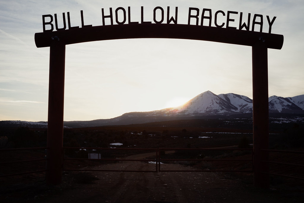
Bull Hollow Raceway

Sunrise San Juan County, Utah

Sunrise San Juan County, Utah

Apparently it was a record-setting gorgeous fall day in #Colorado. I was stuck inside a conference with a ridiculous view of the Boulder foothills and Longs Peak...saw the sun for less time than it took me to post this picture of the it. This #sunset brou
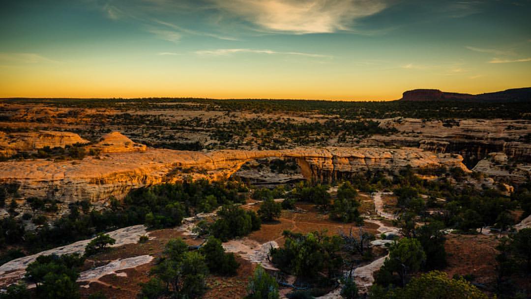
Mentally prepping for spending the entire weekend inside at a Google conference. Would much rather be taking in a desert sunset over Owachomo Bridge, 2nd longest in the world, at Natural Bridges National Park, #Utah #doliferight #travelstoke #MatadorN

Winter Sunset

The Road to Cortez at Dawn
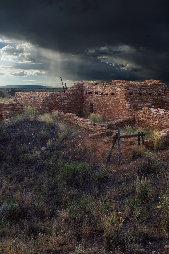
Edge of the Cedars

Last Light at the Edge

View down to Blanding from the Shay Ridge Quad Trail, Manti-La Sal National Forest, at the edge of Bears Ears National Monument.
US-, Monticello, UT アメリカ合衆国デヴィルズ・キャニオン・キャンプグランドの地図
別の場所を検索
近所の場所
75 W Dude Ranch Rd, Monticello, UT アメリカ合衆国
アメリカ合衆国 〒 ユタ州 ブランディング
E S, Blanding, UT アメリカ合衆国
Blanding, UT アメリカ合衆国ニゾーニ・キャンプグランド
アメリカ合衆国 〒 ユタ州 モンティセロ
17 N E, Monticello, UT アメリカ合衆国
South, US-, Blanding, UT アメリカ合衆国White Mesa Mill
アメリカ合衆国 〒 ユタ州 ホワイト・メサ
Co Rd, Utah, アメリカ合衆国Butler Washington Road
アメリカ合衆国 〒 コロラド州 ダヴ・クリーク
County Rd 2, Dove Creek, CO アメリカ合衆国
Rd P, Dove Creek, CO アメリカ合衆国
アメリカ合衆国 ユタ州 ブラフ
E Main St, Bluff, UT アメリカ合衆国
アメリカ合衆国 〒 コロラド州 エグナー
アメリカ合衆国 〒 コロラド州 ダヴ・クリーク
County Road 10, Pleasant View, CO アメリカ合衆国
Road G, Cortez, CO アメリカ合衆国
アメリカ合衆国 〒 コロラド州 カホン
US-, Cahone, CO アメリカ合衆国
最近の検索
- アメリカ合衆国 アラスカ州 レッド・ドッグ・マイン日の出日の入り時間
- Am bhf, Borken, ドイツアム・バーンホーフ日の出日の入り時間
- 4th St E, Sonoma, CA, USA日の出日の入り時間
- Oakland Ave, Williamsport, PA アメリカ合衆国日の出日の入り時間
- Via Roma, Pieranica CR, イタリアローマ通り日の出日の入り時間
- クロアチア 〒 ドゥブロブニク GradClock Tower of Dubrovnik日の出日の入り時間
- アルゼンチン チュブ州 トレリュー日の出日の入り時間
- Hartfords Bluff Cir, Mt Pleasant, SC アメリカ合衆国日の出日の入り時間
- 日本、熊本県熊本市北区日の出日の入り時間
- 中華人民共和国 福州市 平潭県 平潭島日の出日の入り時間