Sunrise Sunset Times of Devils Canyon Campground, US-, Monticello, UT, USA
Location: United States > Utah > San Juan County > Blanding >
Timezone:
America/Denver
Current Time:
2025-07-01 18:30:46
Longitude:
-109.4113719
Latitude:
37.7355365
Sunrise Today:
06:00:24 AM
Sunset Today:
08:43:20 PM
Daylength Today:
14h 42m 56s
Sunrise Tomorrow:
06:00:55 AM
Sunset Tomorrow:
08:43:11 PM
Daylength Tomorrow:
14h 42m 16s
Year Show All Dates
| Date | Sunrise | Sunset | Daylength |
|---|---|---|---|
| 01/01/2025 | 07:33:02 AM | 05:10:38 PM | 9h 37m 36s |
| 01/02/2025 | 07:33:07 AM | 05:11:28 PM | 9h 38m 21s |
| 01/03/2025 | 07:33:10 AM | 05:12:19 PM | 9h 39m 9s |
| 01/04/2025 | 07:33:11 AM | 05:13:12 PM | 9h 40m 1s |
| 01/05/2025 | 07:33:10 AM | 05:14:05 PM | 9h 40m 55s |
| 01/06/2025 | 07:33:07 AM | 05:15:00 PM | 9h 41m 53s |
| 01/07/2025 | 07:33:02 AM | 05:15:56 PM | 9h 42m 54s |
| 01/08/2025 | 07:32:55 AM | 05:16:53 PM | 9h 43m 58s |
| 01/09/2025 | 07:32:45 AM | 05:17:50 PM | 9h 45m 5s |
| 01/10/2025 | 07:32:34 AM | 05:18:49 PM | 9h 46m 15s |
| 01/11/2025 | 07:32:21 AM | 05:19:49 PM | 9h 47m 28s |
| 01/12/2025 | 07:32:05 AM | 05:20:49 PM | 9h 48m 44s |
| 01/13/2025 | 07:31:47 AM | 05:21:50 PM | 9h 50m 3s |
| 01/14/2025 | 07:31:28 AM | 05:22:52 PM | 9h 51m 24s |
| 01/15/2025 | 07:31:06 AM | 05:23:54 PM | 9h 52m 48s |
| 01/16/2025 | 07:30:43 AM | 05:24:57 PM | 9h 54m 14s |
| 01/17/2025 | 07:30:17 AM | 05:26:01 PM | 9h 55m 44s |
| 01/18/2025 | 07:29:50 AM | 05:27:05 PM | 9h 57m 15s |
| 01/19/2025 | 07:29:20 AM | 05:28:10 PM | 9h 58m 50s |
| 01/20/2025 | 07:28:49 AM | 05:29:15 PM | 10h 0m 26s |
| 01/21/2025 | 07:28:15 AM | 05:30:20 PM | 10h 2m 5s |
| 01/22/2025 | 07:27:40 AM | 05:31:26 PM | 10h 3m 46s |
| 01/23/2025 | 07:27:03 AM | 05:32:32 PM | 10h 5m 29s |
| 01/24/2025 | 07:26:24 AM | 05:33:38 PM | 10h 7m 14s |
| 01/25/2025 | 07:25:44 AM | 05:34:44 PM | 10h 9m 0s |
| 01/26/2025 | 07:25:01 AM | 05:35:51 PM | 10h 10m 50s |
| 01/27/2025 | 07:24:17 AM | 05:36:58 PM | 10h 12m 41s |
| 01/28/2025 | 07:23:31 AM | 05:38:04 PM | 10h 14m 33s |
| 01/29/2025 | 07:22:43 AM | 05:39:11 PM | 10h 16m 28s |
| 01/30/2025 | 07:21:54 AM | 05:40:18 PM | 10h 18m 24s |
| 01/31/2025 | 07:21:03 AM | 05:41:25 PM | 10h 20m 22s |
| 02/01/2025 | 07:20:11 AM | 05:42:32 PM | 10h 22m 21s |
| 02/02/2025 | 07:19:17 AM | 05:43:39 PM | 10h 24m 22s |
| 02/03/2025 | 07:18:21 AM | 05:44:46 PM | 10h 26m 25s |
| 02/04/2025 | 07:17:24 AM | 05:45:52 PM | 10h 28m 28s |
| 02/05/2025 | 07:16:25 AM | 05:46:59 PM | 10h 30m 34s |
| 02/06/2025 | 07:15:25 AM | 05:48:05 PM | 10h 32m 40s |
| 02/07/2025 | 07:14:24 AM | 05:49:12 PM | 10h 34m 48s |
| 02/08/2025 | 07:13:21 AM | 05:50:18 PM | 10h 36m 57s |
| 02/09/2025 | 07:12:16 AM | 05:51:23 PM | 10h 39m 7s |
| 02/10/2025 | 07:11:11 AM | 05:52:29 PM | 10h 41m 18s |
| 02/11/2025 | 07:10:04 AM | 05:53:34 PM | 10h 43m 30s |
| 02/12/2025 | 07:08:56 AM | 05:54:40 PM | 10h 45m 44s |
| 02/13/2025 | 07:07:47 AM | 05:55:44 PM | 10h 47m 57s |
| 02/14/2025 | 07:06:36 AM | 05:56:49 PM | 10h 50m 13s |
| 02/15/2025 | 07:05:25 AM | 05:57:53 PM | 10h 52m 28s |
| 02/16/2025 | 07:04:12 AM | 05:58:57 PM | 10h 54m 45s |
| 02/17/2025 | 07:02:58 AM | 06:00:01 PM | 10h 57m 3s |
| 02/18/2025 | 07:01:43 AM | 06:01:04 PM | 10h 59m 21s |
| 02/19/2025 | 07:00:27 AM | 06:02:07 PM | 11h 1m 40s |
| 02/20/2025 | 06:59:11 AM | 06:03:10 PM | 11h 3m 59s |
| 02/21/2025 | 06:57:53 AM | 06:04:13 PM | 11h 6m 20s |
| 02/22/2025 | 06:56:34 AM | 06:05:15 PM | 11h 8m 41s |
| 02/23/2025 | 06:55:14 AM | 06:06:17 PM | 11h 11m 3s |
| 02/24/2025 | 06:53:54 AM | 06:07:18 PM | 11h 13m 24s |
| 02/25/2025 | 06:52:33 AM | 06:08:19 PM | 11h 15m 46s |
| 02/26/2025 | 06:51:11 AM | 06:09:20 PM | 11h 18m 9s |
| 02/27/2025 | 06:49:48 AM | 06:10:21 PM | 11h 20m 33s |
| 02/28/2025 | 06:48:24 AM | 06:11:21 PM | 11h 22m 57s |
| 03/01/2025 | 06:47:00 AM | 06:12:21 PM | 11h 25m 21s |
| 03/02/2025 | 06:45:35 AM | 06:13:20 PM | 11h 27m 45s |
| 03/03/2025 | 06:44:10 AM | 06:14:20 PM | 11h 30m 10s |
| 03/04/2025 | 06:42:44 AM | 06:15:19 PM | 11h 32m 35s |
| 03/05/2025 | 06:41:17 AM | 06:16:18 PM | 11h 35m 1s |
| 03/06/2025 | 06:39:50 AM | 06:17:16 PM | 11h 37m 26s |
| 03/07/2025 | 06:38:23 AM | 06:18:14 PM | 11h 39m 51s |
| 03/08/2025 | 06:36:55 AM | 06:19:12 PM | 11h 42m 17s |
| 03/09/2025 | 07:35:30 AM | 07:20:07 PM | 11h 44m 37s |
| 03/10/2025 | 07:34:01 AM | 07:21:05 PM | 11h 47m 4s |
| 03/11/2025 | 07:32:32 AM | 07:22:02 PM | 11h 49m 30s |
| 03/12/2025 | 07:31:02 AM | 07:22:59 PM | 11h 51m 57s |
| 03/13/2025 | 07:29:32 AM | 07:23:56 PM | 11h 54m 24s |
| 03/14/2025 | 07:28:02 AM | 07:24:52 PM | 11h 56m 50s |
| 03/15/2025 | 07:26:32 AM | 07:25:49 PM | 11h 59m 17s |
| 03/16/2025 | 07:25:01 AM | 07:26:45 PM | 12h 1m 44s |
| 03/17/2025 | 07:23:30 AM | 07:27:41 PM | 12h 4m 11s |
| 03/18/2025 | 07:21:59 AM | 07:28:37 PM | 12h 6m 38s |
| 03/19/2025 | 07:20:28 AM | 07:29:33 PM | 12h 9m 5s |
| 03/20/2025 | 07:18:57 AM | 07:30:28 PM | 12h 11m 31s |
| 03/21/2025 | 07:17:26 AM | 07:31:24 PM | 12h 13m 58s |
| 03/22/2025 | 07:15:54 AM | 07:32:19 PM | 12h 16m 25s |
| 03/23/2025 | 07:14:23 AM | 07:33:14 PM | 12h 18m 51s |
| 03/24/2025 | 07:12:52 AM | 07:34:09 PM | 12h 21m 17s |
| 03/25/2025 | 07:11:21 AM | 07:35:04 PM | 12h 23m 43s |
| 03/26/2025 | 07:09:49 AM | 07:35:59 PM | 12h 26m 10s |
| 03/27/2025 | 07:08:18 AM | 07:36:54 PM | 12h 28m 36s |
| 03/28/2025 | 07:06:48 AM | 07:37:49 PM | 12h 31m 1s |
| 03/29/2025 | 07:05:17 AM | 07:38:43 PM | 12h 33m 26s |
| 03/30/2025 | 07:03:46 AM | 07:39:38 PM | 12h 35m 52s |
| 03/31/2025 | 07:02:16 AM | 07:40:33 PM | 12h 38m 17s |
| 04/01/2025 | 07:00:46 AM | 07:41:27 PM | 12h 40m 41s |
| 04/02/2025 | 06:59:16 AM | 07:42:22 PM | 12h 43m 6s |
| 04/03/2025 | 06:57:47 AM | 07:43:17 PM | 12h 45m 30s |
| 04/04/2025 | 06:56:18 AM | 07:44:11 PM | 12h 47m 53s |
| 04/05/2025 | 06:54:49 AM | 07:45:06 PM | 12h 50m 17s |
| 04/06/2025 | 06:53:21 AM | 07:46:01 PM | 12h 52m 40s |
| 04/07/2025 | 06:51:53 AM | 07:46:55 PM | 12h 55m 2s |
| 04/08/2025 | 06:50:26 AM | 07:47:50 PM | 12h 57m 24s |
| 04/09/2025 | 06:48:59 AM | 07:48:45 PM | 12h 59m 46s |
| 04/10/2025 | 06:47:33 AM | 07:49:39 PM | 13h 2m 6s |
| 04/11/2025 | 06:46:07 AM | 07:50:34 PM | 13h 4m 27s |
| 04/12/2025 | 06:44:42 AM | 07:51:29 PM | 13h 6m 47s |
| 04/13/2025 | 06:43:17 AM | 07:52:24 PM | 13h 9m 7s |
| 04/14/2025 | 06:41:53 AM | 07:53:19 PM | 13h 11m 26s |
| 04/15/2025 | 06:40:30 AM | 07:54:14 PM | 13h 13m 44s |
| 04/16/2025 | 06:39:08 AM | 07:55:09 PM | 13h 16m 1s |
| 04/17/2025 | 06:37:46 AM | 07:56:04 PM | 13h 18m 18s |
| 04/18/2025 | 06:36:25 AM | 07:56:59 PM | 13h 20m 34s |
| 04/19/2025 | 06:35:05 AM | 07:57:54 PM | 13h 22m 49s |
| 04/20/2025 | 06:33:45 AM | 07:58:49 PM | 13h 25m 4s |
| 04/21/2025 | 06:32:27 AM | 07:59:44 PM | 13h 27m 17s |
| 04/22/2025 | 06:31:09 AM | 08:00:39 PM | 13h 29m 30s |
| 04/23/2025 | 06:29:53 AM | 08:01:35 PM | 13h 31m 42s |
| 04/24/2025 | 06:28:37 AM | 08:02:30 PM | 13h 33m 53s |
| 04/25/2025 | 06:27:22 AM | 08:03:25 PM | 13h 36m 3s |
| 04/26/2025 | 06:26:08 AM | 08:04:20 PM | 13h 38m 12s |
| 04/27/2025 | 06:24:56 AM | 08:05:15 PM | 13h 40m 19s |
| 04/28/2025 | 06:23:44 AM | 08:06:11 PM | 13h 42m 27s |
| 04/29/2025 | 06:22:34 AM | 08:07:06 PM | 13h 44m 32s |
| 04/30/2025 | 06:21:24 AM | 08:08:01 PM | 13h 46m 37s |
| 05/01/2025 | 06:20:16 AM | 08:08:56 PM | 13h 48m 40s |
| 05/02/2025 | 06:19:09 AM | 08:09:50 PM | 13h 50m 41s |
| 05/03/2025 | 06:18:03 AM | 08:10:45 PM | 13h 52m 42s |
| 05/04/2025 | 06:16:58 AM | 08:11:40 PM | 13h 54m 42s |
| 05/05/2025 | 06:15:55 AM | 08:12:34 PM | 13h 56m 39s |
| 05/06/2025 | 06:14:53 AM | 08:13:28 PM | 13h 58m 35s |
| 05/07/2025 | 06:13:52 AM | 08:14:23 PM | 14h 0m 31s |
| 05/08/2025 | 06:12:53 AM | 08:15:16 PM | 14h 2m 23s |
| 05/09/2025 | 06:11:55 AM | 08:16:10 PM | 14h 4m 15s |
| 05/10/2025 | 06:10:59 AM | 08:17:03 PM | 14h 6m 4s |
| 05/11/2025 | 06:10:04 AM | 08:17:57 PM | 14h 7m 53s |
| 05/12/2025 | 06:09:10 AM | 08:18:49 PM | 14h 9m 39s |
| 05/13/2025 | 06:08:18 AM | 08:19:42 PM | 14h 11m 24s |
| 05/14/2025 | 06:07:27 AM | 08:20:34 PM | 14h 13m 7s |
| 05/15/2025 | 06:06:38 AM | 08:21:25 PM | 14h 14m 47s |
| 05/16/2025 | 06:05:50 AM | 08:22:17 PM | 14h 16m 27s |
| 05/17/2025 | 06:05:04 AM | 08:23:07 PM | 14h 18m 3s |
| 05/18/2025 | 06:04:20 AM | 08:23:58 PM | 14h 19m 38s |
| 05/19/2025 | 06:03:37 AM | 08:24:47 PM | 14h 21m 10s |
| 05/20/2025 | 06:02:56 AM | 08:25:36 PM | 14h 22m 40s |
| 05/21/2025 | 06:02:17 AM | 08:26:25 PM | 14h 24m 8s |
| 05/22/2025 | 06:01:39 AM | 08:27:13 PM | 14h 25m 34s |
| 05/23/2025 | 06:01:03 AM | 08:28:00 PM | 14h 26m 57s |
| 05/24/2025 | 06:00:28 AM | 08:28:47 PM | 14h 28m 19s |
| 05/25/2025 | 05:59:56 AM | 08:29:32 PM | 14h 29m 36s |
| 05/26/2025 | 05:59:25 AM | 08:30:17 PM | 14h 30m 52s |
| 05/27/2025 | 05:58:56 AM | 08:31:01 PM | 14h 32m 5s |
| 05/28/2025 | 05:58:28 AM | 08:31:45 PM | 14h 33m 17s |
| 05/29/2025 | 05:58:03 AM | 08:32:27 PM | 14h 34m 24s |
| 05/30/2025 | 05:57:39 AM | 08:33:09 PM | 14h 35m 30s |
| 05/31/2025 | 05:57:17 AM | 08:33:49 PM | 14h 36m 32s |
| 06/01/2025 | 05:56:56 AM | 08:34:28 PM | 14h 37m 32s |
| 06/02/2025 | 05:56:38 AM | 08:35:07 PM | 14h 38m 29s |
| 06/03/2025 | 05:56:21 AM | 08:35:44 PM | 14h 39m 23s |
| 06/04/2025 | 05:56:06 AM | 08:36:20 PM | 14h 40m 14s |
| 06/05/2025 | 05:55:53 AM | 08:36:55 PM | 14h 41m 2s |
| 06/06/2025 | 05:55:42 AM | 08:37:29 PM | 14h 41m 47s |
| 06/07/2025 | 05:55:33 AM | 08:38:01 PM | 14h 42m 28s |
| 06/08/2025 | 05:55:25 AM | 08:38:32 PM | 14h 43m 7s |
| 06/09/2025 | 05:55:19 AM | 08:39:02 PM | 14h 43m 43s |
| 06/10/2025 | 05:55:15 AM | 08:39:31 PM | 14h 44m 16s |
| 06/11/2025 | 05:55:13 AM | 08:39:58 PM | 14h 44m 45s |
| 06/12/2025 | 05:55:12 AM | 08:40:24 PM | 14h 45m 12s |
| 06/13/2025 | 05:55:13 AM | 08:40:48 PM | 14h 45m 35s |
| 06/14/2025 | 05:55:16 AM | 08:41:11 PM | 14h 45m 55s |
| 06/15/2025 | 05:55:21 AM | 08:41:32 PM | 14h 46m 11s |
| 06/16/2025 | 05:55:27 AM | 08:41:51 PM | 14h 46m 24s |
| 06/17/2025 | 05:55:35 AM | 08:42:09 PM | 14h 46m 34s |
| 06/18/2025 | 05:55:45 AM | 08:42:26 PM | 14h 46m 41s |
| 06/19/2025 | 05:55:57 AM | 08:42:41 PM | 14h 46m 44s |
| 06/20/2025 | 05:56:10 AM | 08:42:54 PM | 14h 46m 44s |
| 06/21/2025 | 05:56:24 AM | 08:43:05 PM | 14h 46m 41s |
| 06/22/2025 | 05:56:40 AM | 08:43:15 PM | 14h 46m 35s |
| 06/23/2025 | 05:56:58 AM | 08:43:23 PM | 14h 46m 25s |
| 06/24/2025 | 05:57:17 AM | 08:43:29 PM | 14h 46m 12s |
| 06/25/2025 | 05:57:38 AM | 08:43:34 PM | 14h 45m 56s |
| 06/26/2025 | 05:58:00 AM | 08:43:37 PM | 14h 45m 37s |
| 06/27/2025 | 05:58:24 AM | 08:43:37 PM | 14h 45m 13s |
| 06/28/2025 | 05:58:49 AM | 08:43:37 PM | 14h 44m 48s |
| 06/29/2025 | 05:59:15 AM | 08:43:34 PM | 14h 44m 19s |
| 06/30/2025 | 05:59:43 AM | 08:43:29 PM | 14h 43m 46s |
| 07/01/2025 | 06:00:12 AM | 08:43:23 PM | 14h 43m 11s |
| 07/02/2025 | 06:00:42 AM | 08:43:15 PM | 14h 42m 33s |
| 07/03/2025 | 06:01:13 AM | 08:43:05 PM | 14h 41m 52s |
| 07/04/2025 | 06:01:46 AM | 08:42:53 PM | 14h 41m 7s |
| 07/05/2025 | 06:02:20 AM | 08:42:39 PM | 14h 40m 19s |
| 07/06/2025 | 06:02:55 AM | 08:42:24 PM | 14h 39m 29s |
| 07/07/2025 | 06:03:30 AM | 08:42:06 PM | 14h 38m 36s |
| 07/08/2025 | 06:04:07 AM | 08:41:47 PM | 14h 37m 40s |
| 07/09/2025 | 06:04:45 AM | 08:41:26 PM | 14h 36m 41s |
| 07/10/2025 | 06:05:24 AM | 08:41:03 PM | 14h 35m 39s |
| 07/11/2025 | 06:06:04 AM | 08:40:39 PM | 14h 34m 35s |
| 07/12/2025 | 06:06:45 AM | 08:40:12 PM | 14h 33m 27s |
| 07/13/2025 | 06:07:26 AM | 08:39:44 PM | 14h 32m 18s |
| 07/14/2025 | 06:08:09 AM | 08:39:13 PM | 14h 31m 4s |
| 07/15/2025 | 06:08:52 AM | 08:38:42 PM | 14h 29m 50s |
| 07/16/2025 | 06:09:35 AM | 08:38:08 PM | 14h 28m 33s |
| 07/17/2025 | 06:10:20 AM | 08:37:32 PM | 14h 27m 12s |
| 07/18/2025 | 06:11:05 AM | 08:36:55 PM | 14h 25m 50s |
| 07/19/2025 | 06:11:51 AM | 08:36:16 PM | 14h 24m 25s |
| 07/20/2025 | 06:12:37 AM | 08:35:36 PM | 14h 22m 59s |
| 07/21/2025 | 06:13:24 AM | 08:34:54 PM | 14h 21m 30s |
| 07/22/2025 | 06:14:11 AM | 08:34:10 PM | 14h 19m 59s |
| 07/23/2025 | 06:14:59 AM | 08:33:24 PM | 14h 18m 25s |
| 07/24/2025 | 06:15:47 AM | 08:32:37 PM | 14h 16m 50s |
| 07/25/2025 | 06:16:36 AM | 08:31:48 PM | 14h 15m 12s |
| 07/26/2025 | 06:17:25 AM | 08:30:58 PM | 14h 13m 33s |
| 07/27/2025 | 06:18:14 AM | 08:30:06 PM | 14h 11m 52s |
| 07/28/2025 | 06:19:04 AM | 08:29:12 PM | 14h 10m 8s |
| 07/29/2025 | 06:19:54 AM | 08:28:17 PM | 14h 8m 23s |
| 07/30/2025 | 06:20:44 AM | 08:27:21 PM | 14h 6m 37s |
| 07/31/2025 | 06:21:34 AM | 08:26:23 PM | 14h 4m 49s |
| 08/01/2025 | 06:22:25 AM | 08:25:24 PM | 14h 2m 59s |
| 08/02/2025 | 06:23:16 AM | 08:24:23 PM | 14h 1m 7s |
| 08/03/2025 | 06:24:07 AM | 08:23:21 PM | 13h 59m 14s |
| 08/04/2025 | 06:24:58 AM | 08:22:18 PM | 13h 57m 20s |
| 08/05/2025 | 06:25:49 AM | 08:21:13 PM | 13h 55m 24s |
| 08/06/2025 | 06:26:41 AM | 08:20:07 PM | 13h 53m 26s |
| 08/07/2025 | 06:27:32 AM | 08:19:00 PM | 13h 51m 28s |
| 08/08/2025 | 06:28:24 AM | 08:17:51 PM | 13h 49m 27s |
| 08/09/2025 | 06:29:15 AM | 08:16:41 PM | 13h 47m 26s |
| 08/10/2025 | 06:30:07 AM | 08:15:30 PM | 13h 45m 23s |
| 08/11/2025 | 06:30:58 AM | 08:14:18 PM | 13h 43m 20s |
| 08/12/2025 | 06:31:50 AM | 08:13:05 PM | 13h 41m 15s |
| 08/13/2025 | 06:32:42 AM | 08:11:51 PM | 13h 39m 9s |
| 08/14/2025 | 06:33:33 AM | 08:10:36 PM | 13h 37m 3s |
| 08/15/2025 | 06:34:25 AM | 08:09:20 PM | 13h 34m 55s |
| 08/16/2025 | 06:35:16 AM | 08:08:02 PM | 13h 32m 46s |
| 08/17/2025 | 06:36:08 AM | 08:06:44 PM | 13h 30m 36s |
| 08/18/2025 | 06:36:59 AM | 08:05:25 PM | 13h 28m 26s |
| 08/19/2025 | 06:37:51 AM | 08:04:05 PM | 13h 26m 14s |
| 08/20/2025 | 06:38:42 AM | 08:02:44 PM | 13h 24m 2s |
| 08/21/2025 | 06:39:33 AM | 08:01:22 PM | 13h 21m 49s |
| 08/22/2025 | 06:40:24 AM | 07:59:59 PM | 13h 19m 35s |
| 08/23/2025 | 06:41:16 AM | 07:58:36 PM | 13h 17m 20s |
| 08/24/2025 | 06:42:07 AM | 07:57:12 PM | 13h 15m 5s |
| 08/25/2025 | 06:42:58 AM | 07:55:47 PM | 13h 12m 49s |
| 08/26/2025 | 06:43:48 AM | 07:54:21 PM | 13h 10m 33s |
| 08/27/2025 | 06:44:39 AM | 07:52:55 PM | 13h 8m 16s |
| 08/28/2025 | 06:45:30 AM | 07:51:28 PM | 13h 5m 58s |
| 08/29/2025 | 06:46:21 AM | 07:50:01 PM | 13h 3m 40s |
| 08/30/2025 | 06:47:11 AM | 07:48:32 PM | 13h 1m 21s |
| 08/31/2025 | 06:48:02 AM | 07:47:04 PM | 12h 59m 2s |
| 09/01/2025 | 06:48:52 AM | 07:45:35 PM | 12h 56m 43s |
| 09/02/2025 | 06:49:43 AM | 07:44:05 PM | 12h 54m 22s |
| 09/03/2025 | 06:50:33 AM | 07:42:35 PM | 12h 52m 2s |
| 09/04/2025 | 06:51:23 AM | 07:41:04 PM | 12h 49m 41s |
| 09/05/2025 | 06:52:14 AM | 07:39:33 PM | 12h 47m 19s |
| 09/06/2025 | 06:53:04 AM | 07:38:02 PM | 12h 44m 58s |
| 09/07/2025 | 06:53:54 AM | 07:36:30 PM | 12h 42m 36s |
| 09/08/2025 | 06:54:45 AM | 07:34:58 PM | 12h 40m 13s |
| 09/09/2025 | 06:55:35 AM | 07:33:26 PM | 12h 37m 51s |
| 09/10/2025 | 06:56:25 AM | 07:31:54 PM | 12h 35m 29s |
| 09/11/2025 | 06:57:16 AM | 07:30:21 PM | 12h 33m 5s |
| 09/12/2025 | 06:58:06 AM | 07:28:48 PM | 12h 30m 42s |
| 09/13/2025 | 06:58:56 AM | 07:27:15 PM | 12h 28m 19s |
| 09/14/2025 | 06:59:47 AM | 07:25:42 PM | 12h 25m 55s |
| 09/15/2025 | 07:00:37 AM | 07:24:08 PM | 12h 23m 31s |
| 09/16/2025 | 07:01:28 AM | 07:22:35 PM | 12h 21m 7s |
| 09/17/2025 | 07:02:18 AM | 07:21:01 PM | 12h 18m 43s |
| 09/18/2025 | 07:03:09 AM | 07:19:28 PM | 12h 16m 19s |
| 09/19/2025 | 07:04:00 AM | 07:17:54 PM | 12h 13m 54s |
| 09/20/2025 | 07:04:51 AM | 07:16:21 PM | 12h 11m 30s |
| 09/21/2025 | 07:05:42 AM | 07:14:47 PM | 12h 9m 5s |
| 09/22/2025 | 07:06:33 AM | 07:13:14 PM | 12h 6m 41s |
| 09/23/2025 | 07:07:24 AM | 07:11:41 PM | 12h 4m 17s |
| 09/24/2025 | 07:08:16 AM | 07:10:08 PM | 12h 1m 52s |
| 09/25/2025 | 07:09:08 AM | 07:08:35 PM | 11h 59m 27s |
| 09/26/2025 | 07:10:00 AM | 07:07:02 PM | 11h 57m 2s |
| 09/27/2025 | 07:10:52 AM | 07:05:30 PM | 11h 54m 38s |
| 09/28/2025 | 07:11:44 AM | 07:03:58 PM | 11h 52m 14s |
| 09/29/2025 | 07:12:36 AM | 07:02:26 PM | 11h 49m 50s |
| 09/30/2025 | 07:13:29 AM | 07:00:54 PM | 11h 47m 25s |
| 10/01/2025 | 07:14:22 AM | 06:59:23 PM | 11h 45m 1s |
| 10/02/2025 | 07:15:15 AM | 06:57:52 PM | 11h 42m 37s |
| 10/03/2025 | 07:16:09 AM | 06:56:22 PM | 11h 40m 13s |
| 10/04/2025 | 07:17:03 AM | 06:54:52 PM | 11h 37m 49s |
| 10/05/2025 | 07:17:57 AM | 06:53:22 PM | 11h 35m 25s |
| 10/06/2025 | 07:18:51 AM | 06:51:54 PM | 11h 33m 3s |
| 10/07/2025 | 07:19:45 AM | 06:50:25 PM | 11h 30m 40s |
| 10/08/2025 | 07:20:40 AM | 06:48:57 PM | 11h 28m 17s |
| 10/09/2025 | 07:21:36 AM | 06:47:30 PM | 11h 25m 54s |
| 10/10/2025 | 07:22:31 AM | 06:46:04 PM | 11h 23m 33s |
| 10/11/2025 | 07:23:27 AM | 06:44:38 PM | 11h 21m 11s |
| 10/12/2025 | 07:24:23 AM | 06:43:13 PM | 11h 18m 50s |
| 10/13/2025 | 07:25:20 AM | 06:41:48 PM | 11h 16m 28s |
| 10/14/2025 | 07:26:17 AM | 06:40:25 PM | 11h 14m 8s |
| 10/15/2025 | 07:27:14 AM | 06:39:02 PM | 11h 11m 48s |
| 10/16/2025 | 07:28:11 AM | 06:37:40 PM | 11h 9m 29s |
| 10/17/2025 | 07:29:09 AM | 06:36:18 PM | 11h 7m 9s |
| 10/18/2025 | 07:30:07 AM | 06:34:58 PM | 11h 4m 51s |
| 10/19/2025 | 07:31:06 AM | 06:33:39 PM | 11h 2m 33s |
| 10/20/2025 | 07:32:05 AM | 06:32:20 PM | 11h 0m 15s |
| 10/21/2025 | 07:33:04 AM | 06:31:03 PM | 10h 57m 59s |
| 10/22/2025 | 07:34:04 AM | 06:29:47 PM | 10h 55m 43s |
| 10/23/2025 | 07:35:04 AM | 06:28:31 PM | 10h 53m 27s |
| 10/24/2025 | 07:36:04 AM | 06:27:17 PM | 10h 51m 13s |
| 10/25/2025 | 07:37:05 AM | 06:26:04 PM | 10h 48m 59s |
| 10/26/2025 | 07:38:06 AM | 06:24:52 PM | 10h 46m 46s |
| 10/27/2025 | 07:39:07 AM | 06:23:41 PM | 10h 44m 34s |
| 10/28/2025 | 07:40:08 AM | 06:22:32 PM | 10h 42m 24s |
| 10/29/2025 | 07:41:10 AM | 06:21:23 PM | 10h 40m 13s |
| 10/30/2025 | 07:42:12 AM | 06:20:16 PM | 10h 38m 4s |
| 10/31/2025 | 07:43:14 AM | 06:19:11 PM | 10h 35m 57s |
| 11/01/2025 | 07:44:17 AM | 06:18:07 PM | 10h 33m 50s |
| 11/02/2025 | 06:45:23 AM | 05:17:01 PM | 10h 31m 38s |
| 11/03/2025 | 06:46:26 AM | 05:16:00 PM | 10h 29m 34s |
| 11/04/2025 | 06:47:29 AM | 05:15:00 PM | 10h 27m 31s |
| 11/05/2025 | 06:48:32 AM | 05:14:01 PM | 10h 25m 29s |
| 11/06/2025 | 06:49:36 AM | 05:13:04 PM | 10h 23m 28s |
| 11/07/2025 | 06:50:39 AM | 05:12:09 PM | 10h 21m 30s |
| 11/08/2025 | 06:51:43 AM | 05:11:15 PM | 10h 19m 32s |
| 11/09/2025 | 06:52:47 AM | 05:10:23 PM | 10h 17m 36s |
| 11/10/2025 | 06:53:51 AM | 05:09:33 PM | 10h 15m 42s |
| 11/11/2025 | 06:54:55 AM | 05:08:44 PM | 10h 13m 49s |
| 11/12/2025 | 06:55:59 AM | 05:07:57 PM | 10h 11m 58s |
| 11/13/2025 | 06:57:03 AM | 05:07:11 PM | 10h 10m 8s |
| 11/14/2025 | 06:58:06 AM | 05:06:28 PM | 10h 8m 22s |
| 11/15/2025 | 06:59:10 AM | 05:05:46 PM | 10h 6m 36s |
| 11/16/2025 | 07:00:13 AM | 05:05:06 PM | 10h 4m 53s |
| 11/17/2025 | 07:01:17 AM | 05:04:28 PM | 10h 3m 11s |
| 11/18/2025 | 07:02:20 AM | 05:03:52 PM | 10h 1m 32s |
| 11/19/2025 | 07:03:23 AM | 05:03:17 PM | 9h 59m 54s |
| 11/20/2025 | 07:04:25 AM | 05:02:45 PM | 9h 58m 20s |
| 11/21/2025 | 07:05:27 AM | 05:02:14 PM | 9h 56m 47s |
| 11/22/2025 | 07:06:29 AM | 05:01:46 PM | 9h 55m 17s |
| 11/23/2025 | 07:07:30 AM | 05:01:19 PM | 9h 53m 49s |
| 11/24/2025 | 07:08:31 AM | 05:00:55 PM | 9h 52m 24s |
| 11/25/2025 | 07:09:31 AM | 05:00:32 PM | 9h 51m 1s |
| 11/26/2025 | 07:10:31 AM | 05:00:12 PM | 9h 49m 41s |
| 11/27/2025 | 07:11:30 AM | 04:59:54 PM | 9h 48m 24s |
| 11/28/2025 | 07:12:29 AM | 04:59:37 PM | 9h 47m 8s |
| 11/29/2025 | 07:13:26 AM | 04:59:23 PM | 9h 45m 57s |
| 11/30/2025 | 07:14:23 AM | 04:59:11 PM | 9h 44m 48s |
| 12/01/2025 | 07:15:19 AM | 04:59:01 PM | 9h 43m 42s |
| 12/02/2025 | 07:16:14 AM | 04:58:53 PM | 9h 42m 39s |
| 12/03/2025 | 07:17:08 AM | 04:58:47 PM | 9h 41m 39s |
| 12/04/2025 | 07:18:02 AM | 04:58:44 PM | 9h 40m 42s |
| 12/05/2025 | 07:18:54 AM | 04:58:42 PM | 9h 39m 48s |
| 12/06/2025 | 07:19:45 AM | 04:58:43 PM | 9h 38m 58s |
| 12/07/2025 | 07:20:35 AM | 04:58:45 PM | 9h 38m 10s |
| 12/08/2025 | 07:21:23 AM | 04:58:50 PM | 9h 37m 27s |
| 12/09/2025 | 07:22:11 AM | 04:58:57 PM | 9h 36m 46s |
| 12/10/2025 | 07:22:57 AM | 04:59:06 PM | 9h 36m 9s |
| 12/11/2025 | 07:23:42 AM | 04:59:17 PM | 9h 35m 35s |
| 12/12/2025 | 07:24:25 AM | 04:59:30 PM | 9h 35m 5s |
| 12/13/2025 | 07:25:08 AM | 04:59:45 PM | 9h 34m 37s |
| 12/14/2025 | 07:25:48 AM | 05:00:03 PM | 9h 34m 15s |
| 12/15/2025 | 07:26:27 AM | 05:00:22 PM | 9h 33m 55s |
| 12/16/2025 | 07:27:05 AM | 05:00:43 PM | 9h 33m 38s |
| 12/17/2025 | 07:27:40 AM | 05:01:06 PM | 9h 33m 26s |
| 12/18/2025 | 07:28:15 AM | 05:01:31 PM | 9h 33m 16s |
| 12/19/2025 | 07:28:47 AM | 05:01:58 PM | 9h 33m 11s |
| 12/20/2025 | 07:29:18 AM | 05:02:27 PM | 9h 33m 9s |
| 12/21/2025 | 07:29:47 AM | 05:02:58 PM | 9h 33m 11s |
| 12/22/2025 | 07:30:14 AM | 05:03:30 PM | 9h 33m 16s |
| 12/23/2025 | 07:30:39 AM | 05:04:05 PM | 9h 33m 26s |
| 12/24/2025 | 07:31:03 AM | 05:04:41 PM | 9h 33m 38s |
| 12/25/2025 | 07:31:24 AM | 05:05:18 PM | 9h 33m 54s |
| 12/26/2025 | 07:31:44 AM | 05:05:58 PM | 9h 34m 14s |
| 12/27/2025 | 07:32:02 AM | 05:06:39 PM | 9h 34m 37s |
| 12/28/2025 | 07:32:17 AM | 05:07:21 PM | 9h 35m 4s |
| 12/29/2025 | 07:32:31 AM | 05:08:05 PM | 9h 35m 34s |
| 12/30/2025 | 07:32:43 AM | 05:08:51 PM | 9h 36m 8s |
| 12/31/2025 | 07:32:53 AM | 05:09:38 PM | 9h 36m 45s |
Sunrise & Sunset Photos
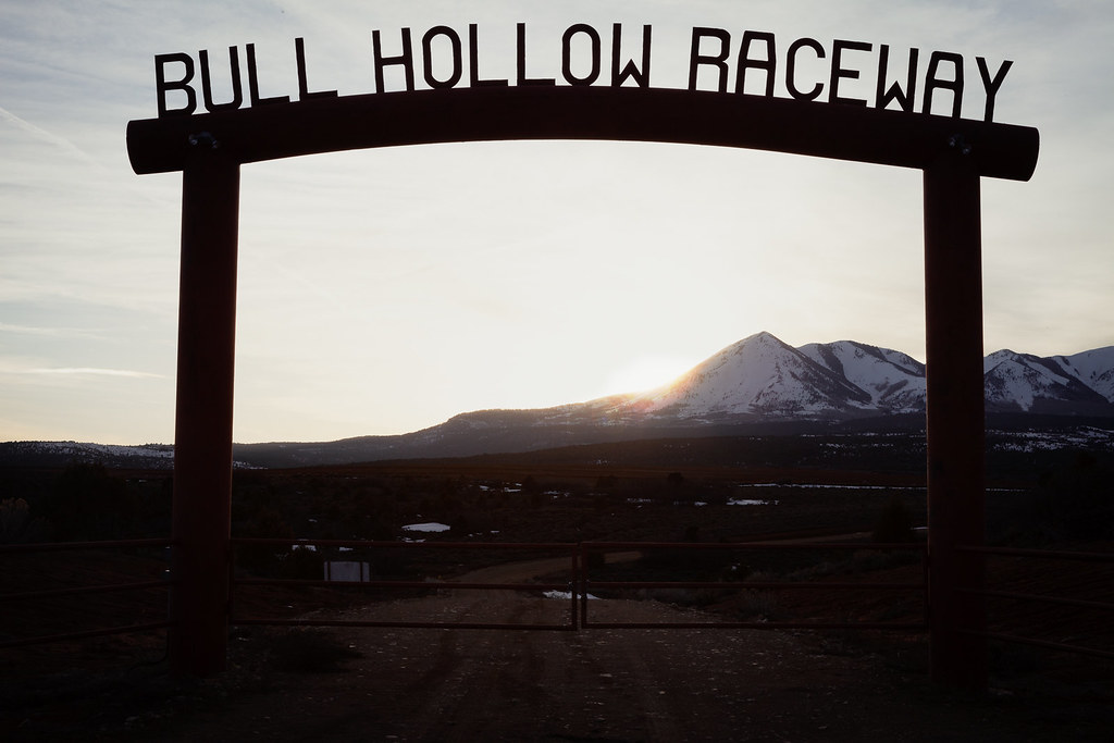
Bull Hollow Raceway

Sunrise San Juan County, Utah

Sunrise San Juan County, Utah

Apparently it was a record-setting gorgeous fall day in #Colorado. I was stuck inside a conference with a ridiculous view of the Boulder foothills and Longs Peak...saw the sun for less time than it took me to post this picture of the it. This #sunset brou
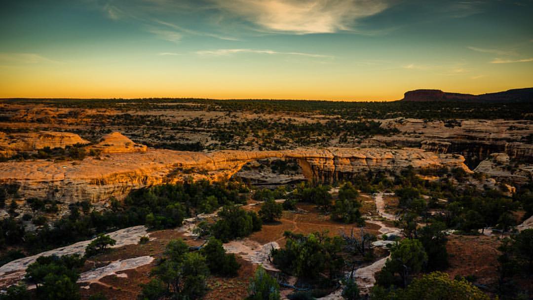
Mentally prepping for spending the entire weekend inside at a Google conference. Would much rather be taking in a desert sunset over Owachomo Bridge, 2nd longest in the world, at Natural Bridges National Park, #Utah #doliferight #travelstoke #MatadorN

Winter Sunset

The Road to Cortez at Dawn
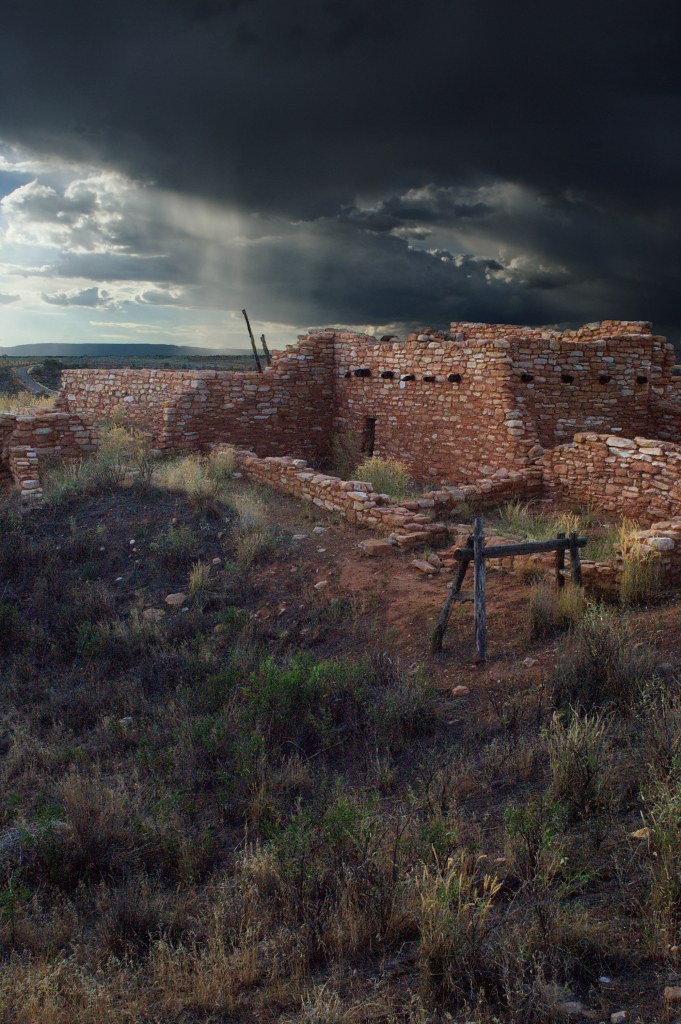
Edge of the Cedars

Last Light at the Edge

View down to Blanding from the Shay Ridge Quad Trail, Manti-La Sal National Forest, at the edge of Bears Ears National Monument.
Devils Canyon Campground, US-, Monticello, UT, USA Map
Search another place
Near Places
75 W Dude Ranch Rd, Monticello, UT, USA
Blanding, UT, USA
E S, Blanding, UT, USA
Nizhoni Campground, Blanding, UT, USA
Monticello, UT, USA
17 N E, Monticello, UT, USA
White Mesa Mill, South, US-, Blanding, UT, USA
White Mesa, UT, USA
Butler Washington Road, Co Rd, Utah, USA
Dove Creek, CO, USA
County Rd 2, Dove Creek, CO, USA
Rd P, Dove Creek, CO, USA
Bluff, UT, USA
E Main St, Bluff, UT, USA
Egnar, CO, USA
Dove Creek, CO, USA
County Road 10, Pleasant View, CO, USA
Road G, Cortez, CO, USA
Cahone, CO, USA
US-, Cahone, CO, USA
Recent Searches
- Sunrise Sunset Times of Red Dog Mine, AK, USA
- Sunrise Sunset Times of Am Bahnhof, Am bhf, Borken, Germany
- Sunrise Sunset Times of 4th St E, Sonoma, CA, USA
- Sunrise Sunset Times of Oakland Ave, Williamsport, PA, USA
- Sunrise Sunset Times of Via Roma, Pieranica CR, Italy
- Sunrise Sunset Times of Clock Tower of Dubrovnik, Grad, Dubrovnik, Croatia
- Sunrise Sunset Times of Trelew, Chubut Province, Argentina
- Sunrise Sunset Times of Hartfords Bluff Cir, Mt Pleasant, SC, USA
- Sunrise Sunset Times of Kita Ward, Kumamoto, Japan
- Sunrise Sunset Times of Pingtan Island, Pingtan County, Fuzhou, China