エクアドル コタロ日の出日の入り時間
Location: エクアドル > トゥングラワ > エクアドル カントン・ペリレオ >
時間帯:
America/Guayaquil
現地時間:
2025-07-01 20:36:17
経度:
-78.509288
緯度:
-1.4240225
今日の日の出時刻:
06:16:59 AM
今日の日の入時刻:
06:19:30 PM
今日の日長:
12h 2m 31s
明日の日の出時刻:
06:17:09 AM
明日の日の入時刻:
06:19:42 PM
明日の日長:
12h 2m 33s
すべて表示する
| 日付 | 日出 | 日没 | 日長 |
|---|---|---|---|
| 2025年01月01日 | 06:12:02 AM | 06:24:16 PM | 12h 12m 14s |
| 2025年01月02日 | 06:12:30 AM | 06:24:42 PM | 12h 12m 12s |
| 2025年01月03日 | 06:12:59 AM | 06:25:09 PM | 12h 12m 10s |
| 2025年01月04日 | 06:13:26 AM | 06:25:35 PM | 12h 12m 9s |
| 2025年01月05日 | 06:13:54 AM | 06:26:00 PM | 12h 12m 6s |
| 2025年01月06日 | 06:14:21 AM | 06:26:25 PM | 12h 12m 4s |
| 2025年01月07日 | 06:14:47 AM | 06:26:49 PM | 12h 12m 2s |
| 2025年01月08日 | 06:15:13 AM | 06:27:13 PM | 12h 12m 0s |
| 2025年01月09日 | 06:15:39 AM | 06:27:36 PM | 12h 11m 57s |
| 2025年01月10日 | 06:16:04 AM | 06:27:58 PM | 12h 11m 54s |
| 2025年01月11日 | 06:16:29 AM | 06:28:20 PM | 12h 11m 51s |
| 2025年01月12日 | 06:16:53 AM | 06:28:41 PM | 12h 11m 48s |
| 2025年01月13日 | 06:17:16 AM | 06:29:01 PM | 12h 11m 45s |
| 2025年01月14日 | 06:17:39 AM | 06:29:21 PM | 12h 11m 42s |
| 2025年01月15日 | 06:18:01 AM | 06:29:40 PM | 12h 11m 39s |
| 2025年01月16日 | 06:18:22 AM | 06:29:58 PM | 12h 11m 36s |
| 2025年01月17日 | 06:18:43 AM | 06:30:16 PM | 12h 11m 33s |
| 2025年01月18日 | 06:19:03 AM | 06:30:32 PM | 12h 11m 29s |
| 2025年01月19日 | 06:19:23 AM | 06:30:48 PM | 12h 11m 25s |
| 2025年01月20日 | 06:19:41 AM | 06:31:03 PM | 12h 11m 22s |
| 2025年01月21日 | 06:19:59 AM | 06:31:18 PM | 12h 11m 19s |
| 2025年01月22日 | 06:20:17 AM | 06:31:31 PM | 12h 11m 14s |
| 2025年01月23日 | 06:20:33 AM | 06:31:44 PM | 12h 11m 11s |
| 2025年01月24日 | 06:20:49 AM | 06:31:56 PM | 12h 11m 7s |
| 2025年01月25日 | 06:21:04 AM | 06:32:07 PM | 12h 11m 3s |
| 2025年01月26日 | 06:21:18 AM | 06:32:17 PM | 12h 10m 59s |
| 2025年01月27日 | 06:21:32 AM | 06:32:26 PM | 12h 10m 54s |
| 2025年01月28日 | 06:21:44 AM | 06:32:35 PM | 12h 10m 51s |
| 2025年01月29日 | 06:21:56 AM | 06:32:42 PM | 12h 10m 46s |
| 2025年01月30日 | 06:22:07 AM | 06:32:49 PM | 12h 10m 42s |
| 2025年01月31日 | 06:22:18 AM | 06:32:55 PM | 12h 10m 37s |
| 2025年02月01日 | 06:22:27 AM | 06:33:00 PM | 12h 10m 33s |
| 2025年02月02日 | 06:22:36 AM | 06:33:04 PM | 12h 10m 28s |
| 2025年02月03日 | 06:22:44 AM | 06:33:08 PM | 12h 10m 24s |
| 2025年02月04日 | 06:22:51 AM | 06:33:10 PM | 12h 10m 19s |
| 2025年02月05日 | 06:22:58 AM | 06:33:12 PM | 12h 10m 14s |
| 2025年02月06日 | 06:23:03 AM | 06:33:13 PM | 12h 10m 10s |
| 2025年02月07日 | 06:23:08 AM | 06:33:13 PM | 12h 10m 5s |
| 2025年02月08日 | 06:23:12 AM | 06:33:13 PM | 12h 10m 1s |
| 2025年02月09日 | 06:23:16 AM | 06:33:11 PM | 12h 9m 55s |
| 2025年02月10日 | 06:23:18 AM | 06:33:09 PM | 12h 9m 51s |
| 2025年02月11日 | 06:23:20 AM | 06:33:06 PM | 12h 9m 46s |
| 2025年02月12日 | 06:23:21 AM | 06:33:02 PM | 12h 9m 41s |
| 2025年02月13日 | 06:23:21 AM | 06:32:58 PM | 12h 9m 37s |
| 2025年02月14日 | 06:23:21 AM | 06:32:52 PM | 12h 9m 31s |
| 2025年02月15日 | 06:23:20 AM | 06:32:46 PM | 12h 9m 26s |
| 2025年02月16日 | 06:23:18 AM | 06:32:40 PM | 12h 9m 22s |
| 2025年02月17日 | 06:23:16 AM | 06:32:32 PM | 12h 9m 16s |
| 2025年02月18日 | 06:23:12 AM | 06:32:24 PM | 12h 9m 12s |
| 2025年02月19日 | 06:23:09 AM | 06:32:15 PM | 12h 9m 6s |
| 2025年02月20日 | 06:23:04 AM | 06:32:06 PM | 12h 9m 2s |
| 2025年02月21日 | 06:22:59 AM | 06:31:56 PM | 12h 8m 57s |
| 2025年02月22日 | 06:22:54 AM | 06:31:45 PM | 12h 8m 51s |
| 2025年02月23日 | 06:22:47 AM | 06:31:34 PM | 12h 8m 47s |
| 2025年02月24日 | 06:22:40 AM | 06:31:22 PM | 12h 8m 42s |
| 2025年02月25日 | 06:22:33 AM | 06:31:10 PM | 12h 8m 37s |
| 2025年02月26日 | 06:22:25 AM | 06:30:57 PM | 12h 8m 32s |
| 2025年02月27日 | 06:22:16 AM | 06:30:43 PM | 12h 8m 27s |
| 2025年02月28日 | 06:22:07 AM | 06:30:29 PM | 12h 8m 22s |
| 2025年03月01日 | 06:21:58 AM | 06:30:14 PM | 12h 8m 16s |
| 2025年03月02日 | 06:21:48 AM | 06:29:59 PM | 12h 8m 11s |
| 2025年03月03日 | 06:21:37 AM | 06:29:44 PM | 12h 8m 7s |
| 2025年03月04日 | 06:21:26 AM | 06:29:28 PM | 12h 8m 2s |
| 2025年03月05日 | 06:21:15 AM | 06:29:12 PM | 12h 7m 57s |
| 2025年03月06日 | 06:21:03 AM | 06:28:55 PM | 12h 7m 52s |
| 2025年03月07日 | 06:20:51 AM | 06:28:38 PM | 12h 7m 47s |
| 2025年03月08日 | 06:20:39 AM | 06:28:20 PM | 12h 7m 41s |
| 2025年03月09日 | 06:20:26 AM | 06:28:03 PM | 12h 7m 37s |
| 2025年03月10日 | 06:20:13 AM | 06:27:44 PM | 12h 7m 31s |
| 2025年03月11日 | 06:19:59 AM | 06:27:26 PM | 12h 7m 27s |
| 2025年03月12日 | 06:19:45 AM | 06:27:07 PM | 12h 7m 22s |
| 2025年03月13日 | 06:19:31 AM | 06:26:48 PM | 12h 7m 17s |
| 2025年03月14日 | 06:19:17 AM | 06:26:29 PM | 12h 7m 12s |
| 2025年03月15日 | 06:19:02 AM | 06:26:10 PM | 12h 7m 8s |
| 2025年03月16日 | 06:18:47 AM | 06:25:50 PM | 12h 7m 3s |
| 2025年03月17日 | 06:18:32 AM | 06:25:30 PM | 12h 6m 58s |
| 2025年03月18日 | 06:18:17 AM | 06:25:10 PM | 12h 6m 53s |
| 2025年03月19日 | 06:18:02 AM | 06:24:50 PM | 12h 6m 48s |
| 2025年03月20日 | 06:17:47 AM | 06:24:30 PM | 12h 6m 43s |
| 2025年03月21日 | 06:17:31 AM | 06:24:10 PM | 12h 6m 39s |
| 2025年03月22日 | 06:17:15 AM | 06:23:49 PM | 12h 6m 34s |
| 2025年03月23日 | 06:17:00 AM | 06:23:29 PM | 12h 6m 29s |
| 2025年03月24日 | 06:16:44 AM | 06:23:09 PM | 12h 6m 25s |
| 2025年03月25日 | 06:16:28 AM | 06:22:48 PM | 12h 6m 20s |
| 2025年03月26日 | 06:16:12 AM | 06:22:28 PM | 12h 6m 16s |
| 2025年03月27日 | 06:15:56 AM | 06:22:07 PM | 12h 6m 11s |
| 2025年03月28日 | 06:15:41 AM | 06:21:47 PM | 12h 6m 6s |
| 2025年03月29日 | 06:15:25 AM | 06:21:27 PM | 12h 6m 2s |
| 2025年03月30日 | 06:15:09 AM | 06:21:07 PM | 12h 5m 58s |
| 2025年03月31日 | 06:14:54 AM | 06:20:47 PM | 12h 5m 53s |
| 2025年04月01日 | 06:14:38 AM | 06:20:27 PM | 12h 5m 49s |
| 2025年04月02日 | 06:14:23 AM | 06:20:07 PM | 12h 5m 44s |
| 2025年04月03日 | 06:14:08 AM | 06:19:47 PM | 12h 5m 39s |
| 2025年04月04日 | 06:13:52 AM | 06:19:28 PM | 12h 5m 36s |
| 2025年04月05日 | 06:13:38 AM | 06:19:09 PM | 12h 5m 31s |
| 2025年04月06日 | 06:13:23 AM | 06:18:50 PM | 12h 5m 27s |
| 2025年04月07日 | 06:13:08 AM | 06:18:31 PM | 12h 5m 23s |
| 2025年04月08日 | 06:12:54 AM | 06:18:13 PM | 12h 5m 19s |
| 2025年04月09日 | 06:12:40 AM | 06:17:55 PM | 12h 5m 15s |
| 2025年04月10日 | 06:12:26 AM | 06:17:37 PM | 12h 5m 11s |
| 2025年04月11日 | 06:12:13 AM | 06:17:19 PM | 12h 5m 6s |
| 2025年04月12日 | 06:12:00 AM | 06:17:02 PM | 12h 5m 2s |
| 2025年04月13日 | 06:11:47 AM | 06:16:45 PM | 12h 4m 58s |
| 2025年04月14日 | 06:11:34 AM | 06:16:28 PM | 12h 4m 54s |
| 2025年04月15日 | 06:11:22 AM | 06:16:12 PM | 12h 4m 50s |
| 2025年04月16日 | 06:11:10 AM | 06:15:57 PM | 12h 4m 47s |
| 2025年04月17日 | 06:10:59 AM | 06:15:41 PM | 12h 4m 42s |
| 2025年04月18日 | 06:10:48 AM | 06:15:26 PM | 12h 4m 38s |
| 2025年04月19日 | 06:10:37 AM | 06:15:12 PM | 12h 4m 35s |
| 2025年04月20日 | 06:10:27 AM | 06:14:58 PM | 12h 4m 31s |
| 2025年04月21日 | 06:10:17 AM | 06:14:44 PM | 12h 4m 27s |
| 2025年04月22日 | 06:10:07 AM | 06:14:31 PM | 12h 4m 24s |
| 2025年04月23日 | 06:09:58 AM | 06:14:18 PM | 12h 4m 20s |
| 2025年04月24日 | 06:09:50 AM | 06:14:06 PM | 12h 4m 16s |
| 2025年04月25日 | 06:09:42 AM | 06:13:55 PM | 12h 4m 13s |
| 2025年04月26日 | 06:09:34 AM | 06:13:44 PM | 12h 4m 10s |
| 2025年04月27日 | 06:09:27 AM | 06:13:33 PM | 12h 4m 6s |
| 2025年04月28日 | 06:09:21 AM | 06:13:23 PM | 12h 4m 2s |
| 2025年04月29日 | 06:09:14 AM | 06:13:14 PM | 12h 4m 0s |
| 2025年04月30日 | 06:09:09 AM | 06:13:05 PM | 12h 3m 56s |
| 2025年05月01日 | 06:09:04 AM | 06:12:56 PM | 12h 3m 52s |
| 2025年05月02日 | 06:08:59 AM | 06:12:49 PM | 12h 3m 50s |
| 2025年05月03日 | 06:08:55 AM | 06:12:41 PM | 12h 3m 46s |
| 2025年05月04日 | 06:08:52 AM | 06:12:35 PM | 12h 3m 43s |
| 2025年05月05日 | 06:08:49 AM | 06:12:29 PM | 12h 3m 40s |
| 2025年05月06日 | 06:08:46 AM | 06:12:23 PM | 12h 3m 37s |
| 2025年05月07日 | 06:08:44 AM | 06:12:18 PM | 12h 3m 34s |
| 2025年05月08日 | 06:08:43 AM | 06:12:14 PM | 12h 3m 31s |
| 2025年05月09日 | 06:08:42 AM | 06:12:11 PM | 12h 3m 29s |
| 2025年05月10日 | 06:08:42 AM | 06:12:08 PM | 12h 3m 26s |
| 2025年05月11日 | 06:08:42 AM | 06:12:05 PM | 12h 3m 23s |
| 2025年05月12日 | 06:08:43 AM | 06:12:03 PM | 12h 3m 20s |
| 2025年05月13日 | 06:08:44 AM | 06:12:02 PM | 12h 3m 18s |
| 2025年05月14日 | 06:08:46 AM | 06:12:01 PM | 12h 3m 15s |
| 2025年05月15日 | 06:08:49 AM | 06:12:01 PM | 12h 3m 12s |
| 2025年05月16日 | 06:08:52 AM | 06:12:02 PM | 12h 3m 10s |
| 2025年05月17日 | 06:08:55 AM | 06:12:03 PM | 12h 3m 8s |
| 2025年05月18日 | 06:08:59 AM | 06:12:05 PM | 12h 3m 6s |
| 2025年05月19日 | 06:09:04 AM | 06:12:07 PM | 12h 3m 3s |
| 2025年05月20日 | 06:09:09 AM | 06:12:10 PM | 12h 3m 1s |
| 2025年05月21日 | 06:09:14 AM | 06:12:13 PM | 12h 2m 59s |
| 2025年05月22日 | 06:09:20 AM | 06:12:17 PM | 12h 2m 57s |
| 2025年05月23日 | 06:09:27 AM | 06:12:22 PM | 12h 2m 55s |
| 2025年05月24日 | 06:09:34 AM | 06:12:27 PM | 12h 2m 53s |
| 2025年05月25日 | 06:09:41 AM | 06:12:32 PM | 12h 2m 51s |
| 2025年05月26日 | 06:09:49 AM | 06:12:38 PM | 12h 2m 49s |
| 2025年05月27日 | 06:09:58 AM | 06:12:45 PM | 12h 2m 47s |
| 2025年05月28日 | 06:10:06 AM | 06:12:52 PM | 12h 2m 46s |
| 2025年05月29日 | 06:10:15 AM | 06:12:59 PM | 12h 2m 44s |
| 2025年05月30日 | 06:10:25 AM | 06:13:07 PM | 12h 2m 42s |
| 2025年05月31日 | 06:10:35 AM | 06:13:16 PM | 12h 2m 41s |
| 2025年06月01日 | 06:10:45 AM | 06:13:24 PM | 12h 2m 39s |
| 2025年06月02日 | 06:10:56 AM | 06:13:34 PM | 12h 2m 38s |
| 2025年06月03日 | 06:11:06 AM | 06:13:43 PM | 12h 2m 37s |
| 2025年06月04日 | 06:11:18 AM | 06:13:53 PM | 12h 2m 35s |
| 2025年06月05日 | 06:11:29 AM | 06:14:04 PM | 12h 2m 35s |
| 2025年06月06日 | 06:11:41 AM | 06:14:14 PM | 12h 2m 33s |
| 2025年06月07日 | 06:11:53 AM | 06:14:25 PM | 12h 2m 32s |
| 2025年06月08日 | 06:12:05 AM | 06:14:36 PM | 12h 2m 31s |
| 2025年06月09日 | 06:12:17 AM | 06:14:48 PM | 12h 2m 31s |
| 2025年06月10日 | 06:12:30 AM | 06:15:00 PM | 12h 2m 30s |
| 2025年06月11日 | 06:12:43 AM | 06:15:12 PM | 12h 2m 29s |
| 2025年06月12日 | 06:12:56 AM | 06:15:24 PM | 12h 2m 28s |
| 2025年06月13日 | 06:13:09 AM | 06:15:36 PM | 12h 2m 27s |
| 2025年06月14日 | 06:13:22 AM | 06:15:49 PM | 12h 2m 27s |
| 2025年06月15日 | 06:13:35 AM | 06:16:02 PM | 12h 2m 27s |
| 2025年06月16日 | 06:13:48 AM | 06:16:15 PM | 12h 2m 27s |
| 2025年06月17日 | 06:14:01 AM | 06:16:28 PM | 12h 2m 27s |
| 2025年06月18日 | 06:14:14 AM | 06:16:41 PM | 12h 2m 27s |
| 2025年06月19日 | 06:14:27 AM | 06:16:54 PM | 12h 2m 27s |
| 2025年06月20日 | 06:14:40 AM | 06:17:07 PM | 12h 2m 27s |
| 2025年06月21日 | 06:14:53 AM | 06:17:20 PM | 12h 2m 27s |
| 2025年06月22日 | 06:15:06 AM | 06:17:33 PM | 12h 2m 27s |
| 2025年06月23日 | 06:15:19 AM | 06:17:46 PM | 12h 2m 27s |
| 2025年06月24日 | 06:15:32 AM | 06:17:59 PM | 12h 2m 27s |
| 2025年06月25日 | 06:15:44 AM | 06:18:11 PM | 12h 2m 27s |
| 2025年06月26日 | 06:15:56 AM | 06:18:24 PM | 12h 2m 28s |
| 2025年06月27日 | 06:16:08 AM | 06:18:37 PM | 12h 2m 29s |
| 2025年06月28日 | 06:16:20 AM | 06:18:49 PM | 12h 2m 29s |
| 2025年06月29日 | 06:16:32 AM | 06:19:01 PM | 12h 2m 29s |
| 2025年06月30日 | 06:16:43 AM | 06:19:13 PM | 12h 2m 30s |
| 2025年07月01日 | 06:16:54 AM | 06:19:25 PM | 12h 2m 31s |
| 2025年07月02日 | 06:17:05 AM | 06:19:36 PM | 12h 2m 31s |
| 2025年07月03日 | 06:17:15 AM | 06:19:48 PM | 12h 2m 33s |
| 2025年07月04日 | 06:17:25 AM | 06:19:59 PM | 12h 2m 34s |
| 2025年07月05日 | 06:17:34 AM | 06:20:09 PM | 12h 2m 35s |
| 2025年07月06日 | 06:17:44 AM | 06:20:19 PM | 12h 2m 35s |
| 2025年07月07日 | 06:17:52 AM | 06:20:29 PM | 12h 2m 37s |
| 2025年07月08日 | 06:18:00 AM | 06:20:39 PM | 12h 2m 39s |
| 2025年07月09日 | 06:18:08 AM | 06:20:48 PM | 12h 2m 40s |
| 2025年07月10日 | 06:18:16 AM | 06:20:57 PM | 12h 2m 41s |
| 2025年07月11日 | 06:18:22 AM | 06:21:05 PM | 12h 2m 43s |
| 2025年07月12日 | 06:18:29 AM | 06:21:13 PM | 12h 2m 44s |
| 2025年07月13日 | 06:18:35 AM | 06:21:21 PM | 12h 2m 46s |
| 2025年07月14日 | 06:18:40 AM | 06:21:28 PM | 12h 2m 48s |
| 2025年07月15日 | 06:18:45 AM | 06:21:34 PM | 12h 2m 49s |
| 2025年07月16日 | 06:18:49 AM | 06:21:40 PM | 12h 2m 51s |
| 2025年07月17日 | 06:18:53 AM | 06:21:46 PM | 12h 2m 53s |
| 2025年07月18日 | 06:18:56 AM | 06:21:51 PM | 12h 2m 55s |
| 2025年07月19日 | 06:18:58 AM | 06:21:55 PM | 12h 2m 57s |
| 2025年07月20日 | 06:19:00 AM | 06:21:59 PM | 12h 2m 59s |
| 2025年07月21日 | 06:19:01 AM | 06:22:03 PM | 12h 3m 2s |
| 2025年07月22日 | 06:19:02 AM | 06:22:05 PM | 12h 3m 3s |
| 2025年07月23日 | 06:19:02 AM | 06:22:08 PM | 12h 3m 6s |
| 2025年07月24日 | 06:19:01 AM | 06:22:10 PM | 12h 3m 9s |
| 2025年07月25日 | 06:19:00 AM | 06:22:11 PM | 12h 3m 11s |
| 2025年07月26日 | 06:18:58 AM | 06:22:11 PM | 12h 3m 13s |
| 2025年07月27日 | 06:18:56 AM | 06:22:11 PM | 12h 3m 15s |
| 2025年07月28日 | 06:18:53 AM | 06:22:11 PM | 12h 3m 18s |
| 2025年07月29日 | 06:18:49 AM | 06:22:10 PM | 12h 3m 21s |
| 2025年07月30日 | 06:18:45 AM | 06:22:08 PM | 12h 3m 23s |
| 2025年07月31日 | 06:18:40 AM | 06:22:06 PM | 12h 3m 26s |
| 2025年08月01日 | 06:18:34 AM | 06:22:03 PM | 12h 3m 29s |
| 2025年08月02日 | 06:18:28 AM | 06:22:00 PM | 12h 3m 32s |
| 2025年08月03日 | 06:18:21 AM | 06:21:56 PM | 12h 3m 35s |
| 2025年08月04日 | 06:18:13 AM | 06:21:51 PM | 12h 3m 38s |
| 2025年08月05日 | 06:18:05 AM | 06:21:46 PM | 12h 3m 41s |
| 2025年08月06日 | 06:17:56 AM | 06:21:40 PM | 12h 3m 44s |
| 2025年08月07日 | 06:17:47 AM | 06:21:34 PM | 12h 3m 47s |
| 2025年08月08日 | 06:17:37 AM | 06:21:27 PM | 12h 3m 50s |
| 2025年08月09日 | 06:17:26 AM | 06:21:19 PM | 12h 3m 53s |
| 2025年08月10日 | 06:17:15 AM | 06:21:12 PM | 12h 3m 57s |
| 2025年08月11日 | 06:17:04 AM | 06:21:03 PM | 12h 3m 59s |
| 2025年08月12日 | 06:16:51 AM | 06:20:54 PM | 12h 4m 3s |
| 2025年08月13日 | 06:16:38 AM | 06:20:44 PM | 12h 4m 6s |
| 2025年08月14日 | 06:16:25 AM | 06:20:34 PM | 12h 4m 9s |
| 2025年08月15日 | 06:16:11 AM | 06:20:24 PM | 12h 4m 13s |
| 2025年08月16日 | 06:15:56 AM | 06:20:13 PM | 12h 4m 17s |
| 2025年08月17日 | 06:15:41 AM | 06:20:01 PM | 12h 4m 20s |
| 2025年08月18日 | 06:15:26 AM | 06:19:49 PM | 12h 4m 23s |
| 2025年08月19日 | 06:15:09 AM | 06:19:37 PM | 12h 4m 28s |
| 2025年08月20日 | 06:14:53 AM | 06:19:24 PM | 12h 4m 31s |
| 2025年08月21日 | 06:14:36 AM | 06:19:10 PM | 12h 4m 34s |
| 2025年08月22日 | 06:14:18 AM | 06:18:57 PM | 12h 4m 39s |
| 2025年08月23日 | 06:14:00 AM | 06:18:42 PM | 12h 4m 42s |
| 2025年08月24日 | 06:13:42 AM | 06:18:28 PM | 12h 4m 46s |
| 2025年08月25日 | 06:13:23 AM | 06:18:13 PM | 12h 4m 50s |
| 2025年08月26日 | 06:13:04 AM | 06:17:57 PM | 12h 4m 53s |
| 2025年08月27日 | 06:12:44 AM | 06:17:42 PM | 12h 4m 58s |
| 2025年08月28日 | 06:12:24 AM | 06:17:26 PM | 12h 5m 2s |
| 2025年08月29日 | 06:12:04 AM | 06:17:09 PM | 12h 5m 5s |
| 2025年08月30日 | 06:11:43 AM | 06:16:53 PM | 12h 5m 10s |
| 2025年08月31日 | 06:11:22 AM | 06:16:36 PM | 12h 5m 14s |
| 2025年09月01日 | 06:11:01 AM | 06:16:18 PM | 12h 5m 17s |
| 2025年09月02日 | 06:10:39 AM | 06:16:01 PM | 12h 5m 22s |
| 2025年09月03日 | 06:10:17 AM | 06:15:43 PM | 12h 5m 26s |
| 2025年09月04日 | 06:09:55 AM | 06:15:25 PM | 12h 5m 30s |
| 2025年09月05日 | 06:09:32 AM | 06:15:07 PM | 12h 5m 35s |
| 2025年09月06日 | 06:09:10 AM | 06:14:49 PM | 12h 5m 39s |
| 2025年09月07日 | 06:08:47 AM | 06:14:30 PM | 12h 5m 43s |
| 2025年09月08日 | 06:08:24 AM | 06:14:11 PM | 12h 5m 47s |
| 2025年09月09日 | 06:08:01 AM | 06:13:53 PM | 12h 5m 52s |
| 2025年09月10日 | 06:07:38 AM | 06:13:34 PM | 12h 5m 56s |
| 2025年09月11日 | 06:07:14 AM | 06:13:15 PM | 12h 6m 1s |
| 2025年09月12日 | 06:06:51 AM | 06:12:56 PM | 12h 6m 5s |
| 2025年09月13日 | 06:06:27 AM | 06:12:36 PM | 12h 6m 9s |
| 2025年09月14日 | 06:06:03 AM | 06:12:17 PM | 12h 6m 14s |
| 2025年09月15日 | 06:05:40 AM | 06:11:58 PM | 12h 6m 18s |
| 2025年09月16日 | 06:05:16 AM | 06:11:39 PM | 12h 6m 23s |
| 2025年09月17日 | 06:04:52 AM | 06:11:20 PM | 12h 6m 28s |
| 2025年09月18日 | 06:04:29 AM | 06:11:01 PM | 12h 6m 32s |
| 2025年09月19日 | 06:04:05 AM | 06:10:42 PM | 12h 6m 37s |
| 2025年09月20日 | 06:03:41 AM | 06:10:23 PM | 12h 6m 42s |
| 2025年09月21日 | 06:03:18 AM | 06:10:04 PM | 12h 6m 46s |
| 2025年09月22日 | 06:02:54 AM | 06:09:45 PM | 12h 6m 51s |
| 2025年09月23日 | 06:02:31 AM | 06:09:26 PM | 12h 6m 55s |
| 2025年09月24日 | 06:02:08 AM | 06:09:08 PM | 12h 7m 0s |
| 2025年09月25日 | 06:01:45 AM | 06:08:50 PM | 12h 7m 5s |
| 2025年09月26日 | 06:01:22 AM | 06:08:32 PM | 12h 7m 10s |
| 2025年09月27日 | 06:00:59 AM | 06:08:14 PM | 12h 7m 15s |
| 2025年09月28日 | 06:00:37 AM | 06:07:56 PM | 12h 7m 19s |
| 2025年09月29日 | 06:00:15 AM | 06:07:39 PM | 12h 7m 24s |
| 2025年09月30日 | 05:59:53 AM | 06:07:22 PM | 12h 7m 29s |
| 2025年10月01日 | 05:59:32 AM | 06:07:05 PM | 12h 7m 33s |
| 2025年10月02日 | 05:59:10 AM | 06:06:49 PM | 12h 7m 39s |
| 2025年10月03日 | 05:58:49 AM | 06:06:33 PM | 12h 7m 44s |
| 2025年10月04日 | 05:58:29 AM | 06:06:17 PM | 12h 7m 48s |
| 2025年10月05日 | 05:58:09 AM | 06:06:02 PM | 12h 7m 53s |
| 2025年10月06日 | 05:57:49 AM | 06:05:47 PM | 12h 7m 58s |
| 2025年10月07日 | 05:57:29 AM | 06:05:33 PM | 12h 8m 4s |
| 2025年10月08日 | 05:57:10 AM | 06:05:18 PM | 12h 8m 8s |
| 2025年10月09日 | 05:56:52 AM | 06:05:05 PM | 12h 8m 13s |
| 2025年10月10日 | 05:56:34 AM | 06:04:52 PM | 12h 8m 18s |
| 2025年10月11日 | 05:56:16 AM | 06:04:39 PM | 12h 8m 23s |
| 2025年10月12日 | 05:55:59 AM | 06:04:27 PM | 12h 8m 28s |
| 2025年10月13日 | 05:55:43 AM | 06:04:16 PM | 12h 8m 33s |
| 2025年10月14日 | 05:55:27 AM | 06:04:05 PM | 12h 8m 38s |
| 2025年10月15日 | 05:55:12 AM | 06:03:54 PM | 12h 8m 42s |
| 2025年10月16日 | 05:54:57 AM | 06:03:44 PM | 12h 8m 47s |
| 2025年10月17日 | 05:54:43 AM | 06:03:35 PM | 12h 8m 52s |
| 2025年10月18日 | 05:54:29 AM | 06:03:26 PM | 12h 8m 57s |
| 2025年10月19日 | 05:54:16 AM | 06:03:18 PM | 12h 9m 2s |
| 2025年10月20日 | 05:54:04 AM | 06:03:11 PM | 12h 9m 7s |
| 2025年10月21日 | 05:53:52 AM | 06:03:04 PM | 12h 9m 12s |
| 2025年10月22日 | 05:53:41 AM | 06:02:58 PM | 12h 9m 17s |
| 2025年10月23日 | 05:53:31 AM | 06:02:53 PM | 12h 9m 22s |
| 2025年10月24日 | 05:53:21 AM | 06:02:48 PM | 12h 9m 27s |
| 2025年10月25日 | 05:53:13 AM | 06:02:44 PM | 12h 9m 31s |
| 2025年10月26日 | 05:53:05 AM | 06:02:41 PM | 12h 9m 36s |
| 2025年10月27日 | 05:52:57 AM | 06:02:39 PM | 12h 9m 42s |
| 2025年10月28日 | 05:52:51 AM | 06:02:37 PM | 12h 9m 46s |
| 2025年10月29日 | 05:52:45 AM | 06:02:36 PM | 12h 9m 51s |
| 2025年10月30日 | 05:52:40 AM | 06:02:36 PM | 12h 9m 56s |
| 2025年10月31日 | 05:52:36 AM | 06:02:37 PM | 12h 10m 1s |
| 2025年11月01日 | 05:52:33 AM | 06:02:38 PM | 12h 10m 5s |
| 2025年11月02日 | 05:52:30 AM | 06:02:40 PM | 12h 10m 10s |
| 2025年11月03日 | 05:52:29 AM | 06:02:43 PM | 12h 10m 14s |
| 2025年11月04日 | 05:52:28 AM | 06:02:47 PM | 12h 10m 19s |
| 2025年11月05日 | 05:52:28 AM | 06:02:51 PM | 12h 10m 23s |
| 2025年11月06日 | 05:52:29 AM | 06:02:57 PM | 12h 10m 28s |
| 2025年11月07日 | 05:52:31 AM | 06:03:03 PM | 12h 10m 32s |
| 2025年11月08日 | 05:52:33 AM | 06:03:10 PM | 12h 10m 37s |
| 2025年11月09日 | 05:52:37 AM | 06:03:18 PM | 12h 10m 41s |
| 2025年11月10日 | 05:52:41 AM | 06:03:27 PM | 12h 10m 46s |
| 2025年11月11日 | 05:52:47 AM | 06:03:36 PM | 12h 10m 49s |
| 2025年11月12日 | 05:52:53 AM | 06:03:47 PM | 12h 10m 54s |
| 2025年11月13日 | 05:53:00 AM | 06:03:58 PM | 12h 10m 58s |
| 2025年11月14日 | 05:53:08 AM | 06:04:10 PM | 12h 11m 2s |
| 2025年11月15日 | 05:53:16 AM | 06:04:23 PM | 12h 11m 7s |
| 2025年11月16日 | 05:53:26 AM | 06:04:36 PM | 12h 11m 10s |
| 2025年11月17日 | 05:53:37 AM | 06:04:51 PM | 12h 11m 14s |
| 2025年11月18日 | 05:53:48 AM | 06:05:06 PM | 12h 11m 18s |
| 2025年11月19日 | 05:54:00 AM | 06:05:22 PM | 12h 11m 22s |
| 2025年11月20日 | 05:54:13 AM | 06:05:38 PM | 12h 11m 25s |
| 2025年11月21日 | 05:54:27 AM | 06:05:56 PM | 12h 11m 29s |
| 2025年11月22日 | 05:54:42 AM | 06:06:14 PM | 12h 11m 32s |
| 2025年11月23日 | 05:54:58 AM | 06:06:33 PM | 12h 11m 35s |
| 2025年11月24日 | 05:55:14 AM | 06:06:53 PM | 12h 11m 39s |
| 2025年11月25日 | 05:55:31 AM | 06:07:13 PM | 12h 11m 42s |
| 2025年11月26日 | 05:55:49 AM | 06:07:34 PM | 12h 11m 45s |
| 2025年11月27日 | 05:56:08 AM | 06:07:56 PM | 12h 11m 48s |
| 2025年11月28日 | 05:56:28 AM | 06:08:18 PM | 12h 11m 50s |
| 2025年11月29日 | 05:56:48 AM | 06:08:41 PM | 12h 11m 53s |
| 2025年11月30日 | 05:57:09 AM | 06:09:05 PM | 12h 11m 56s |
| 2025年12月01日 | 05:57:30 AM | 06:09:29 PM | 12h 11m 59s |
| 2025年12月02日 | 05:57:53 AM | 06:09:54 PM | 12h 12m 1s |
| 2025年12月03日 | 05:58:16 AM | 06:10:19 PM | 12h 12m 3s |
| 2025年12月04日 | 05:58:39 AM | 06:10:45 PM | 12h 12m 6s |
| 2025年12月05日 | 05:59:03 AM | 06:11:11 PM | 12h 12m 8s |
| 2025年12月06日 | 05:59:28 AM | 06:11:38 PM | 12h 12m 10s |
| 2025年12月07日 | 05:59:53 AM | 06:12:05 PM | 12h 12m 12s |
| 2025年12月08日 | 06:00:19 AM | 06:12:32 PM | 12h 12m 13s |
| 2025年12月09日 | 06:00:46 AM | 06:13:00 PM | 12h 12m 14s |
| 2025年12月10日 | 06:01:12 AM | 06:13:29 PM | 12h 12m 17s |
| 2025年12月11日 | 06:01:40 AM | 06:13:57 PM | 12h 12m 17s |
| 2025年12月12日 | 06:02:07 AM | 06:14:26 PM | 12h 12m 19s |
| 2025年12月13日 | 06:02:35 AM | 06:14:55 PM | 12h 12m 20s |
| 2025年12月14日 | 06:03:04 AM | 06:15:24 PM | 12h 12m 20s |
| 2025年12月15日 | 06:03:32 AM | 06:15:54 PM | 12h 12m 22s |
| 2025年12月16日 | 06:04:01 AM | 06:16:23 PM | 12h 12m 22s |
| 2025年12月17日 | 06:04:30 AM | 06:16:53 PM | 12h 12m 23s |
| 2025年12月18日 | 06:05:00 AM | 06:17:23 PM | 12h 12m 23s |
| 2025年12月19日 | 06:05:29 AM | 06:17:53 PM | 12h 12m 24s |
| 2025年12月20日 | 06:05:59 AM | 06:18:23 PM | 12h 12m 24s |
| 2025年12月21日 | 06:06:29 AM | 06:18:52 PM | 12h 12m 23s |
| 2025年12月22日 | 06:06:59 AM | 06:19:22 PM | 12h 12m 23s |
| 2025年12月23日 | 06:07:29 AM | 06:19:52 PM | 12h 12m 23s |
| 2025年12月24日 | 06:07:59 AM | 06:20:21 PM | 12h 12m 22s |
| 2025年12月25日 | 06:08:29 AM | 06:20:51 PM | 12h 12m 22s |
| 2025年12月26日 | 06:08:59 AM | 06:21:20 PM | 12h 12m 21s |
| 2025年12月27日 | 06:09:28 AM | 06:21:49 PM | 12h 12m 21s |
| 2025年12月28日 | 06:09:58 AM | 06:22:18 PM | 12h 12m 20s |
| 2025年12月29日 | 06:10:28 AM | 06:22:46 PM | 12h 12m 18s |
| 2025年12月30日 | 06:10:57 AM | 06:23:14 PM | 12h 12m 17s |
| 2025年12月31日 | 06:11:26 AM | 06:23:42 PM | 12h 12m 16s |
写真

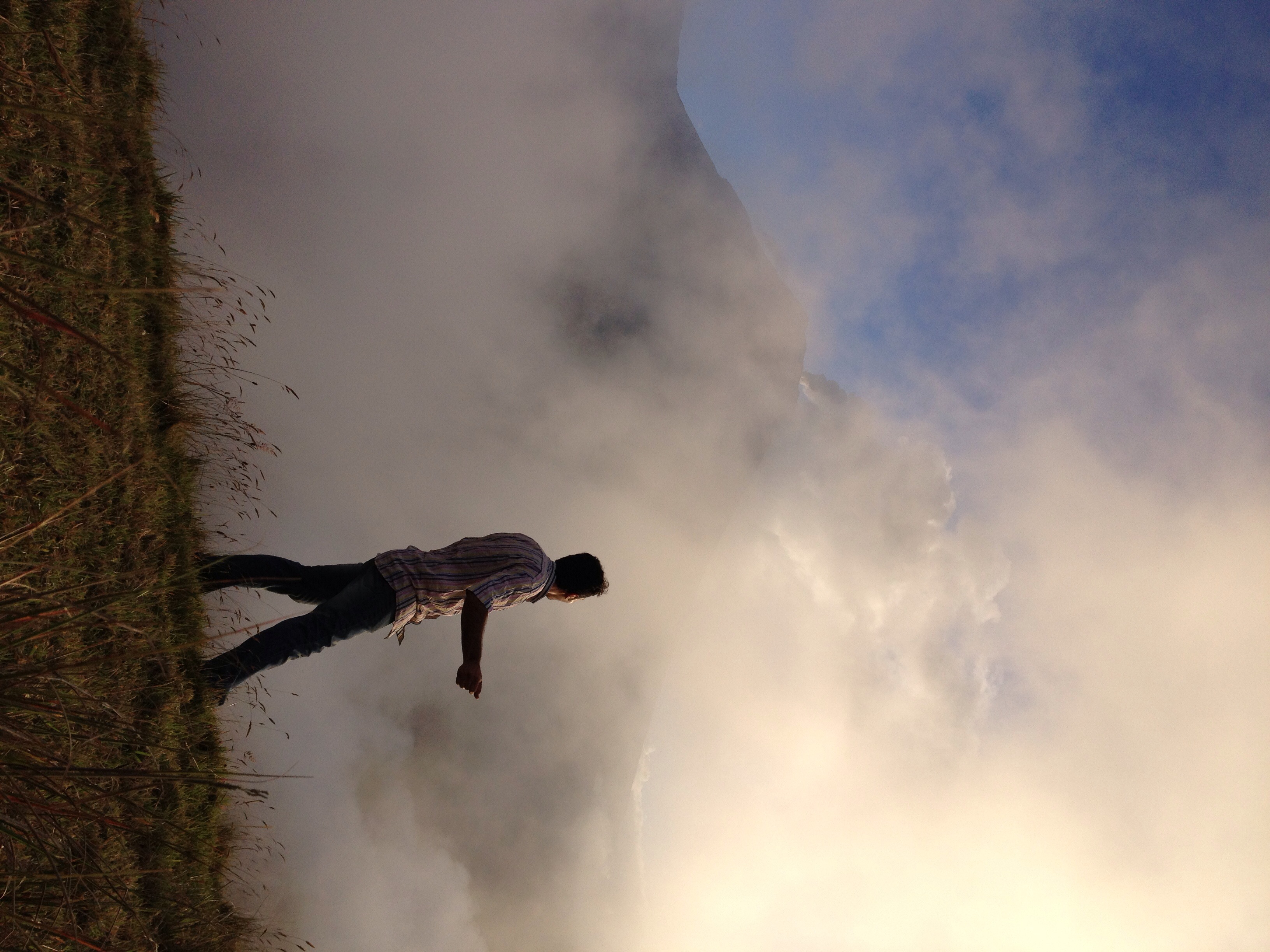
El Refugio del Volcán at 3,830 meters (12,565 feet) above sea level, Climbing the Summit of the Active and Mighty Stratovolcano 'Tungurahua' ('Throat of Fire' volcano) at 5,023 meters (16,479 feet) above sea level, Baños, the Central Highlands, Ecuador.

El Refugio del Volcán at 3,830 meters (12,565 feet) above sea level, Climbing the Summit of the Active and Mighty Stratovolcano 'Tungurahua' ('Throat of Fire' volcano) at 5,023 meters (16,479 feet) above sea level, Baños, the Central Highlands, Ecuador.

El Refugio del Volcán at 3,830 meters (12,565 feet) above sea level, Climbing the Summit of the Active and Mighty Stratovolcano 'Tungurahua' ('Throat of Fire' volcano) at 5,023 meters (16,479 feet) above sea level, Baños, the Central Highlands, Ecuador.

Parque Aventura San Martin at 1,800 meters (5,905 ft) above sea level, Baños, Ecuador.

Ecuador, Feb 2017, Cantón Baños

Ecuador, Feb 2017, Cantón Baños

Ecuador, Feb 2017, Cantón Baños

Ecuador, Feb 2017, Cantón Baños

Ecuador, Feb 2017, Cantón Baños

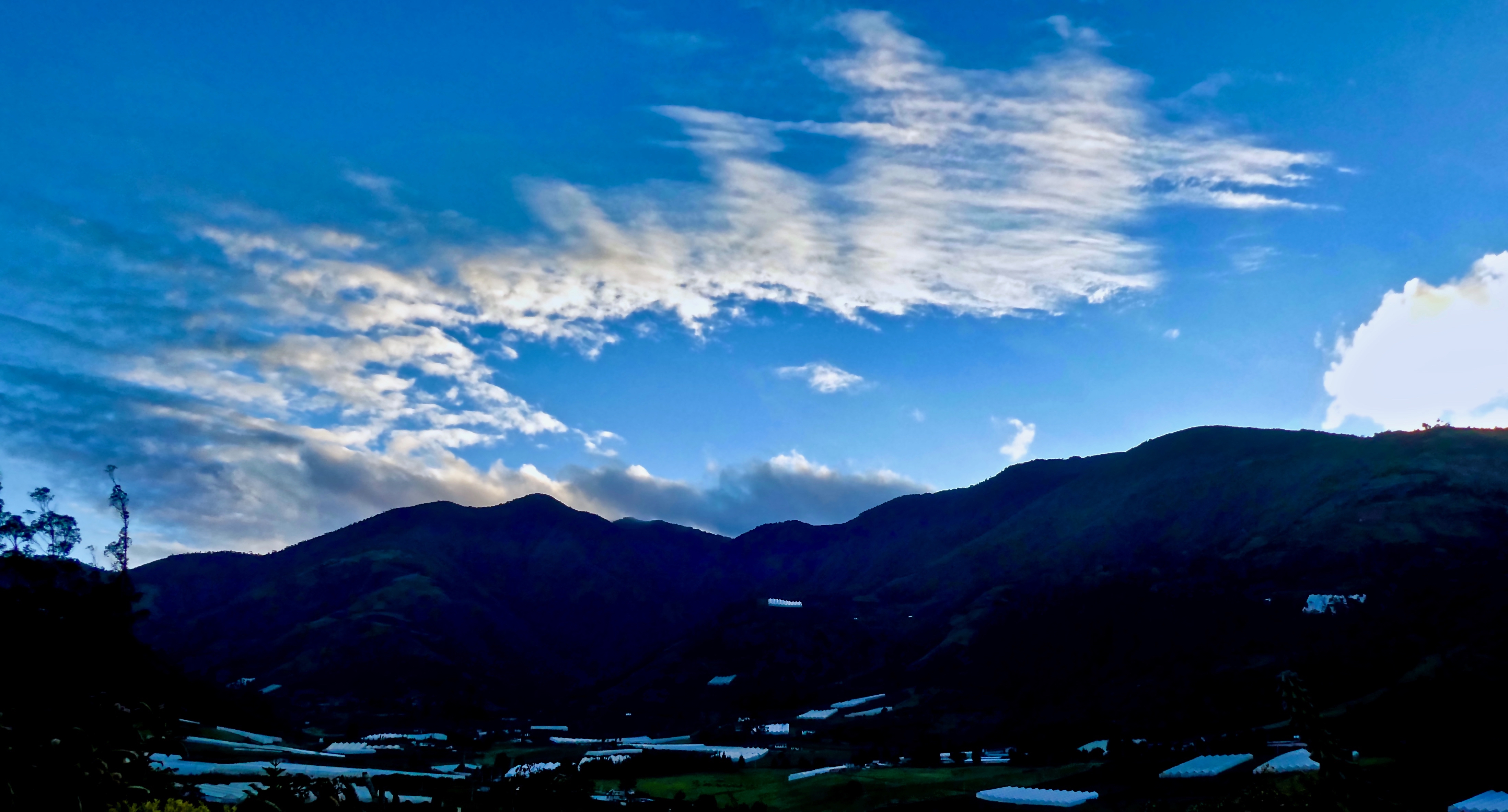
Baños sunset

Ecuador, Feb 2017, Baños de Agua Santa

Ecuador, Feb 2017, Baños de Agua Santa

Ecuador, Feb 2017, Cantón Baños
White haze!

Ecuador, Feb 2017, Baños de Agua Santa

Ecuador, Feb 2017, Baños de Agua Santa

Ecuador, Feb 2017, Baños de Agua Santa

Sunset over Baños

Ecuador, Feb 2017, Baños de Agua Santa

The sunset, looking almost straight up at the huge mountain next door

Sunrise, Climbing the Summit of the Active and Mighty Stratovolcano 'Tungurahua' ('Throat of Fire' volcano) at 5,023 meters (16,479 feet) above sea level, Baños, the Central Highlands, Ecuador.

Climbing the Summit of the Active and Mighty Stratovolcano 'Tungurahua' ('Throat of Fire' volcano) at 5,023 meters (16,479 feet) above sea level, Baños, the Central Highlands, Ecuador.
Sunrise at Hacienda Leito

Valley Sunrise

The Crater, Climbing the Summit of the Active and Mighty Stratovolcano 'Tungurahua' ('Throat of Fire' volcano) at 5,023 meters (16,479 feet) above sea level, Baños, the Central Highlands, Ecuador.

19981204-002
エクアドル コタロの地図
別の場所を検索
近所の場所
エクアドル トゥングラワ
Banos, エクアドルLa Casa del Arbol
エクアドル ウルビナ
エクアドル リオバンバ
Natale Torment, Riobamba, エクアドルナタレ・トルメント
エクアドル チャンボ
エクアドル チャンボ
エクアドル リオバンバ
エクアドル トポ
エクアドル パブロ・セクスト
エクアドル パブロ・セクスト
エクアドルGuargualla Sangay Lodge
エクアドル パスタサ
エクアドル プヨ
エクアドルBanco Pichincha
エクアドル
Calle Vargas Y Torres, Guamote, エクアドルInti Sisa
Vargas Torres y Garcia Moreno, Guamote, エクアドルInti Sisa Art Guesthouse
エクアドル グアモテ
Unnamed Road, エクアドル
最近の検索
- アメリカ合衆国 アラスカ州 レッド・ドッグ・マイン日の出日の入り時間
- Am bhf, Borken, ドイツアム・バーンホーフ日の出日の入り時間
- 4th St E, Sonoma, CA, USA日の出日の入り時間
- Oakland Ave, Williamsport, PA アメリカ合衆国日の出日の入り時間
- Via Roma, Pieranica CR, イタリアローマ通り日の出日の入り時間
- クロアチア 〒 ドゥブロブニク GradClock Tower of Dubrovnik日の出日の入り時間
- アルゼンチン チュブ州 トレリュー日の出日の入り時間
- Hartfords Bluff Cir, Mt Pleasant, SC アメリカ合衆国日の出日の入り時間
- 日本、熊本県熊本市北区日の出日の入り時間
- 中華人民共和国 福州市 平潭県 平潭島日の出日の入り時間