Horas de salida y puesta de sol de Cotalo, Ecuador
Location: Ecuador > Tungurahua > Cantón Pelileo >
Zona horaria:
America/Guayaquil
Hora local:
2025-06-05 17:25:54
Longitud:
-78.509288
Latitud:
-1.4240225
Salida de sol de hoy:
06:11:34 AM
Puesta de sol de hoy:
06:14:08 PM
La duración del día hoy:
12h 2m 34s
Salida de sol de mañana:
06:11:46 AM
Puesta de sol de mañana:
06:14:19 PM
La duración del día mañana:
12h 2m 33s
Mostrar todas las fechas
| Fecha | Salida de sol | Puesta de sol | Duración del día |
|---|---|---|---|
| 01/01/2025 | 06:12:02 AM | 06:24:16 PM | 12h 12m 14s |
| 02/01/2025 | 06:12:30 AM | 06:24:42 PM | 12h 12m 12s |
| 03/01/2025 | 06:12:59 AM | 06:25:09 PM | 12h 12m 10s |
| 04/01/2025 | 06:13:26 AM | 06:25:35 PM | 12h 12m 9s |
| 05/01/2025 | 06:13:54 AM | 06:26:00 PM | 12h 12m 6s |
| 06/01/2025 | 06:14:21 AM | 06:26:25 PM | 12h 12m 4s |
| 07/01/2025 | 06:14:47 AM | 06:26:49 PM | 12h 12m 2s |
| 08/01/2025 | 06:15:13 AM | 06:27:13 PM | 12h 12m 0s |
| 09/01/2025 | 06:15:39 AM | 06:27:36 PM | 12h 11m 57s |
| 10/01/2025 | 06:16:04 AM | 06:27:58 PM | 12h 11m 54s |
| 11/01/2025 | 06:16:29 AM | 06:28:20 PM | 12h 11m 51s |
| 12/01/2025 | 06:16:53 AM | 06:28:41 PM | 12h 11m 48s |
| 13/01/2025 | 06:17:16 AM | 06:29:01 PM | 12h 11m 45s |
| 14/01/2025 | 06:17:39 AM | 06:29:21 PM | 12h 11m 42s |
| 15/01/2025 | 06:18:01 AM | 06:29:40 PM | 12h 11m 39s |
| 16/01/2025 | 06:18:22 AM | 06:29:58 PM | 12h 11m 36s |
| 17/01/2025 | 06:18:43 AM | 06:30:16 PM | 12h 11m 33s |
| 18/01/2025 | 06:19:03 AM | 06:30:32 PM | 12h 11m 29s |
| 19/01/2025 | 06:19:23 AM | 06:30:48 PM | 12h 11m 25s |
| 20/01/2025 | 06:19:41 AM | 06:31:03 PM | 12h 11m 22s |
| 21/01/2025 | 06:19:59 AM | 06:31:18 PM | 12h 11m 19s |
| 22/01/2025 | 06:20:17 AM | 06:31:31 PM | 12h 11m 14s |
| 23/01/2025 | 06:20:33 AM | 06:31:44 PM | 12h 11m 11s |
| 24/01/2025 | 06:20:49 AM | 06:31:56 PM | 12h 11m 7s |
| 25/01/2025 | 06:21:04 AM | 06:32:07 PM | 12h 11m 3s |
| 26/01/2025 | 06:21:18 AM | 06:32:17 PM | 12h 10m 59s |
| 27/01/2025 | 06:21:32 AM | 06:32:26 PM | 12h 10m 54s |
| 28/01/2025 | 06:21:44 AM | 06:32:35 PM | 12h 10m 51s |
| 29/01/2025 | 06:21:56 AM | 06:32:42 PM | 12h 10m 46s |
| 30/01/2025 | 06:22:07 AM | 06:32:49 PM | 12h 10m 42s |
| 31/01/2025 | 06:22:18 AM | 06:32:55 PM | 12h 10m 37s |
| 01/02/2025 | 06:22:27 AM | 06:33:00 PM | 12h 10m 33s |
| 02/02/2025 | 06:22:36 AM | 06:33:04 PM | 12h 10m 28s |
| 03/02/2025 | 06:22:44 AM | 06:33:08 PM | 12h 10m 24s |
| 04/02/2025 | 06:22:51 AM | 06:33:10 PM | 12h 10m 19s |
| 05/02/2025 | 06:22:58 AM | 06:33:12 PM | 12h 10m 14s |
| 06/02/2025 | 06:23:03 AM | 06:33:13 PM | 12h 10m 10s |
| 07/02/2025 | 06:23:08 AM | 06:33:13 PM | 12h 10m 5s |
| 08/02/2025 | 06:23:12 AM | 06:33:13 PM | 12h 10m 1s |
| 09/02/2025 | 06:23:16 AM | 06:33:11 PM | 12h 9m 55s |
| 10/02/2025 | 06:23:18 AM | 06:33:09 PM | 12h 9m 51s |
| 11/02/2025 | 06:23:20 AM | 06:33:06 PM | 12h 9m 46s |
| 12/02/2025 | 06:23:21 AM | 06:33:02 PM | 12h 9m 41s |
| 13/02/2025 | 06:23:21 AM | 06:32:58 PM | 12h 9m 37s |
| 14/02/2025 | 06:23:21 AM | 06:32:52 PM | 12h 9m 31s |
| 15/02/2025 | 06:23:20 AM | 06:32:46 PM | 12h 9m 26s |
| 16/02/2025 | 06:23:18 AM | 06:32:40 PM | 12h 9m 22s |
| 17/02/2025 | 06:23:16 AM | 06:32:32 PM | 12h 9m 16s |
| 18/02/2025 | 06:23:12 AM | 06:32:24 PM | 12h 9m 12s |
| 19/02/2025 | 06:23:09 AM | 06:32:15 PM | 12h 9m 6s |
| 20/02/2025 | 06:23:04 AM | 06:32:06 PM | 12h 9m 2s |
| 21/02/2025 | 06:22:59 AM | 06:31:56 PM | 12h 8m 57s |
| 22/02/2025 | 06:22:54 AM | 06:31:45 PM | 12h 8m 51s |
| 23/02/2025 | 06:22:47 AM | 06:31:34 PM | 12h 8m 47s |
| 24/02/2025 | 06:22:40 AM | 06:31:22 PM | 12h 8m 42s |
| 25/02/2025 | 06:22:33 AM | 06:31:10 PM | 12h 8m 37s |
| 26/02/2025 | 06:22:25 AM | 06:30:57 PM | 12h 8m 32s |
| 27/02/2025 | 06:22:16 AM | 06:30:43 PM | 12h 8m 27s |
| 28/02/2025 | 06:22:07 AM | 06:30:29 PM | 12h 8m 22s |
| 01/03/2025 | 06:21:58 AM | 06:30:14 PM | 12h 8m 16s |
| 02/03/2025 | 06:21:48 AM | 06:29:59 PM | 12h 8m 11s |
| 03/03/2025 | 06:21:37 AM | 06:29:44 PM | 12h 8m 7s |
| 04/03/2025 | 06:21:26 AM | 06:29:28 PM | 12h 8m 2s |
| 05/03/2025 | 06:21:15 AM | 06:29:12 PM | 12h 7m 57s |
| 06/03/2025 | 06:21:03 AM | 06:28:55 PM | 12h 7m 52s |
| 07/03/2025 | 06:20:51 AM | 06:28:38 PM | 12h 7m 47s |
| 08/03/2025 | 06:20:39 AM | 06:28:20 PM | 12h 7m 41s |
| 09/03/2025 | 06:20:26 AM | 06:28:03 PM | 12h 7m 37s |
| 10/03/2025 | 06:20:13 AM | 06:27:44 PM | 12h 7m 31s |
| 11/03/2025 | 06:19:59 AM | 06:27:26 PM | 12h 7m 27s |
| 12/03/2025 | 06:19:45 AM | 06:27:07 PM | 12h 7m 22s |
| 13/03/2025 | 06:19:31 AM | 06:26:48 PM | 12h 7m 17s |
| 14/03/2025 | 06:19:17 AM | 06:26:29 PM | 12h 7m 12s |
| 15/03/2025 | 06:19:02 AM | 06:26:10 PM | 12h 7m 8s |
| 16/03/2025 | 06:18:47 AM | 06:25:50 PM | 12h 7m 3s |
| 17/03/2025 | 06:18:32 AM | 06:25:30 PM | 12h 6m 58s |
| 18/03/2025 | 06:18:17 AM | 06:25:10 PM | 12h 6m 53s |
| 19/03/2025 | 06:18:02 AM | 06:24:50 PM | 12h 6m 48s |
| 20/03/2025 | 06:17:47 AM | 06:24:30 PM | 12h 6m 43s |
| 21/03/2025 | 06:17:31 AM | 06:24:10 PM | 12h 6m 39s |
| 22/03/2025 | 06:17:15 AM | 06:23:49 PM | 12h 6m 34s |
| 23/03/2025 | 06:17:00 AM | 06:23:29 PM | 12h 6m 29s |
| 24/03/2025 | 06:16:44 AM | 06:23:09 PM | 12h 6m 25s |
| 25/03/2025 | 06:16:28 AM | 06:22:48 PM | 12h 6m 20s |
| 26/03/2025 | 06:16:12 AM | 06:22:28 PM | 12h 6m 16s |
| 27/03/2025 | 06:15:56 AM | 06:22:07 PM | 12h 6m 11s |
| 28/03/2025 | 06:15:41 AM | 06:21:47 PM | 12h 6m 6s |
| 29/03/2025 | 06:15:25 AM | 06:21:27 PM | 12h 6m 2s |
| 30/03/2025 | 06:15:09 AM | 06:21:07 PM | 12h 5m 58s |
| 31/03/2025 | 06:14:54 AM | 06:20:47 PM | 12h 5m 53s |
| 01/04/2025 | 06:14:38 AM | 06:20:27 PM | 12h 5m 49s |
| 02/04/2025 | 06:14:23 AM | 06:20:07 PM | 12h 5m 44s |
| 03/04/2025 | 06:14:08 AM | 06:19:47 PM | 12h 5m 39s |
| 04/04/2025 | 06:13:52 AM | 06:19:28 PM | 12h 5m 36s |
| 05/04/2025 | 06:13:38 AM | 06:19:09 PM | 12h 5m 31s |
| 06/04/2025 | 06:13:23 AM | 06:18:50 PM | 12h 5m 27s |
| 07/04/2025 | 06:13:08 AM | 06:18:31 PM | 12h 5m 23s |
| 08/04/2025 | 06:12:54 AM | 06:18:13 PM | 12h 5m 19s |
| 09/04/2025 | 06:12:40 AM | 06:17:55 PM | 12h 5m 15s |
| 10/04/2025 | 06:12:26 AM | 06:17:37 PM | 12h 5m 11s |
| 11/04/2025 | 06:12:13 AM | 06:17:19 PM | 12h 5m 6s |
| 12/04/2025 | 06:12:00 AM | 06:17:02 PM | 12h 5m 2s |
| 13/04/2025 | 06:11:47 AM | 06:16:45 PM | 12h 4m 58s |
| 14/04/2025 | 06:11:34 AM | 06:16:28 PM | 12h 4m 54s |
| 15/04/2025 | 06:11:22 AM | 06:16:12 PM | 12h 4m 50s |
| 16/04/2025 | 06:11:10 AM | 06:15:57 PM | 12h 4m 47s |
| 17/04/2025 | 06:10:59 AM | 06:15:41 PM | 12h 4m 42s |
| 18/04/2025 | 06:10:48 AM | 06:15:26 PM | 12h 4m 38s |
| 19/04/2025 | 06:10:37 AM | 06:15:12 PM | 12h 4m 35s |
| 20/04/2025 | 06:10:27 AM | 06:14:58 PM | 12h 4m 31s |
| 21/04/2025 | 06:10:17 AM | 06:14:44 PM | 12h 4m 27s |
| 22/04/2025 | 06:10:07 AM | 06:14:31 PM | 12h 4m 24s |
| 23/04/2025 | 06:09:58 AM | 06:14:18 PM | 12h 4m 20s |
| 24/04/2025 | 06:09:50 AM | 06:14:06 PM | 12h 4m 16s |
| 25/04/2025 | 06:09:42 AM | 06:13:55 PM | 12h 4m 13s |
| 26/04/2025 | 06:09:34 AM | 06:13:44 PM | 12h 4m 10s |
| 27/04/2025 | 06:09:27 AM | 06:13:33 PM | 12h 4m 6s |
| 28/04/2025 | 06:09:21 AM | 06:13:23 PM | 12h 4m 2s |
| 29/04/2025 | 06:09:14 AM | 06:13:14 PM | 12h 4m 0s |
| 30/04/2025 | 06:09:09 AM | 06:13:05 PM | 12h 3m 56s |
| 01/05/2025 | 06:09:04 AM | 06:12:56 PM | 12h 3m 52s |
| 02/05/2025 | 06:08:59 AM | 06:12:49 PM | 12h 3m 50s |
| 03/05/2025 | 06:08:55 AM | 06:12:41 PM | 12h 3m 46s |
| 04/05/2025 | 06:08:52 AM | 06:12:35 PM | 12h 3m 43s |
| 05/05/2025 | 06:08:49 AM | 06:12:29 PM | 12h 3m 40s |
| 06/05/2025 | 06:08:46 AM | 06:12:23 PM | 12h 3m 37s |
| 07/05/2025 | 06:08:44 AM | 06:12:18 PM | 12h 3m 34s |
| 08/05/2025 | 06:08:43 AM | 06:12:14 PM | 12h 3m 31s |
| 09/05/2025 | 06:08:42 AM | 06:12:11 PM | 12h 3m 29s |
| 10/05/2025 | 06:08:42 AM | 06:12:08 PM | 12h 3m 26s |
| 11/05/2025 | 06:08:42 AM | 06:12:05 PM | 12h 3m 23s |
| 12/05/2025 | 06:08:43 AM | 06:12:03 PM | 12h 3m 20s |
| 13/05/2025 | 06:08:44 AM | 06:12:02 PM | 12h 3m 18s |
| 14/05/2025 | 06:08:46 AM | 06:12:01 PM | 12h 3m 15s |
| 15/05/2025 | 06:08:49 AM | 06:12:01 PM | 12h 3m 12s |
| 16/05/2025 | 06:08:52 AM | 06:12:02 PM | 12h 3m 10s |
| 17/05/2025 | 06:08:55 AM | 06:12:03 PM | 12h 3m 8s |
| 18/05/2025 | 06:08:59 AM | 06:12:05 PM | 12h 3m 6s |
| 19/05/2025 | 06:09:04 AM | 06:12:07 PM | 12h 3m 3s |
| 20/05/2025 | 06:09:09 AM | 06:12:10 PM | 12h 3m 1s |
| 21/05/2025 | 06:09:14 AM | 06:12:13 PM | 12h 2m 59s |
| 22/05/2025 | 06:09:20 AM | 06:12:17 PM | 12h 2m 57s |
| 23/05/2025 | 06:09:27 AM | 06:12:22 PM | 12h 2m 55s |
| 24/05/2025 | 06:09:34 AM | 06:12:27 PM | 12h 2m 53s |
| 25/05/2025 | 06:09:41 AM | 06:12:32 PM | 12h 2m 51s |
| 26/05/2025 | 06:09:49 AM | 06:12:38 PM | 12h 2m 49s |
| 27/05/2025 | 06:09:58 AM | 06:12:45 PM | 12h 2m 47s |
| 28/05/2025 | 06:10:06 AM | 06:12:52 PM | 12h 2m 46s |
| 29/05/2025 | 06:10:15 AM | 06:12:59 PM | 12h 2m 44s |
| 30/05/2025 | 06:10:25 AM | 06:13:07 PM | 12h 2m 42s |
| 31/05/2025 | 06:10:35 AM | 06:13:16 PM | 12h 2m 41s |
| 01/06/2025 | 06:10:45 AM | 06:13:24 PM | 12h 2m 39s |
| 02/06/2025 | 06:10:56 AM | 06:13:34 PM | 12h 2m 38s |
| 03/06/2025 | 06:11:06 AM | 06:13:43 PM | 12h 2m 37s |
| 04/06/2025 | 06:11:18 AM | 06:13:53 PM | 12h 2m 35s |
| 05/06/2025 | 06:11:29 AM | 06:14:04 PM | 12h 2m 35s |
| 06/06/2025 | 06:11:41 AM | 06:14:14 PM | 12h 2m 33s |
| 07/06/2025 | 06:11:53 AM | 06:14:25 PM | 12h 2m 32s |
| 08/06/2025 | 06:12:05 AM | 06:14:36 PM | 12h 2m 31s |
| 09/06/2025 | 06:12:17 AM | 06:14:48 PM | 12h 2m 31s |
| 10/06/2025 | 06:12:30 AM | 06:15:00 PM | 12h 2m 30s |
| 11/06/2025 | 06:12:43 AM | 06:15:12 PM | 12h 2m 29s |
| 12/06/2025 | 06:12:56 AM | 06:15:24 PM | 12h 2m 28s |
| 13/06/2025 | 06:13:09 AM | 06:15:36 PM | 12h 2m 27s |
| 14/06/2025 | 06:13:22 AM | 06:15:49 PM | 12h 2m 27s |
| 15/06/2025 | 06:13:35 AM | 06:16:02 PM | 12h 2m 27s |
| 16/06/2025 | 06:13:48 AM | 06:16:15 PM | 12h 2m 27s |
| 17/06/2025 | 06:14:01 AM | 06:16:28 PM | 12h 2m 27s |
| 18/06/2025 | 06:14:14 AM | 06:16:41 PM | 12h 2m 27s |
| 19/06/2025 | 06:14:27 AM | 06:16:54 PM | 12h 2m 27s |
| 20/06/2025 | 06:14:40 AM | 06:17:07 PM | 12h 2m 27s |
| 21/06/2025 | 06:14:53 AM | 06:17:20 PM | 12h 2m 27s |
| 22/06/2025 | 06:15:06 AM | 06:17:33 PM | 12h 2m 27s |
| 23/06/2025 | 06:15:19 AM | 06:17:46 PM | 12h 2m 27s |
| 24/06/2025 | 06:15:32 AM | 06:17:59 PM | 12h 2m 27s |
| 25/06/2025 | 06:15:44 AM | 06:18:11 PM | 12h 2m 27s |
| 26/06/2025 | 06:15:56 AM | 06:18:24 PM | 12h 2m 28s |
| 27/06/2025 | 06:16:08 AM | 06:18:37 PM | 12h 2m 29s |
| 28/06/2025 | 06:16:20 AM | 06:18:49 PM | 12h 2m 29s |
| 29/06/2025 | 06:16:32 AM | 06:19:01 PM | 12h 2m 29s |
| 30/06/2025 | 06:16:43 AM | 06:19:13 PM | 12h 2m 30s |
| 01/07/2025 | 06:16:54 AM | 06:19:25 PM | 12h 2m 31s |
| 02/07/2025 | 06:17:05 AM | 06:19:36 PM | 12h 2m 31s |
| 03/07/2025 | 06:17:15 AM | 06:19:48 PM | 12h 2m 33s |
| 04/07/2025 | 06:17:25 AM | 06:19:59 PM | 12h 2m 34s |
| 05/07/2025 | 06:17:34 AM | 06:20:09 PM | 12h 2m 35s |
| 06/07/2025 | 06:17:44 AM | 06:20:19 PM | 12h 2m 35s |
| 07/07/2025 | 06:17:52 AM | 06:20:29 PM | 12h 2m 37s |
| 08/07/2025 | 06:18:00 AM | 06:20:39 PM | 12h 2m 39s |
| 09/07/2025 | 06:18:08 AM | 06:20:48 PM | 12h 2m 40s |
| 10/07/2025 | 06:18:16 AM | 06:20:57 PM | 12h 2m 41s |
| 11/07/2025 | 06:18:22 AM | 06:21:05 PM | 12h 2m 43s |
| 12/07/2025 | 06:18:29 AM | 06:21:13 PM | 12h 2m 44s |
| 13/07/2025 | 06:18:35 AM | 06:21:21 PM | 12h 2m 46s |
| 14/07/2025 | 06:18:40 AM | 06:21:28 PM | 12h 2m 48s |
| 15/07/2025 | 06:18:45 AM | 06:21:34 PM | 12h 2m 49s |
| 16/07/2025 | 06:18:49 AM | 06:21:40 PM | 12h 2m 51s |
| 17/07/2025 | 06:18:53 AM | 06:21:46 PM | 12h 2m 53s |
| 18/07/2025 | 06:18:56 AM | 06:21:51 PM | 12h 2m 55s |
| 19/07/2025 | 06:18:58 AM | 06:21:55 PM | 12h 2m 57s |
| 20/07/2025 | 06:19:00 AM | 06:21:59 PM | 12h 2m 59s |
| 21/07/2025 | 06:19:01 AM | 06:22:03 PM | 12h 3m 2s |
| 22/07/2025 | 06:19:02 AM | 06:22:05 PM | 12h 3m 3s |
| 23/07/2025 | 06:19:02 AM | 06:22:08 PM | 12h 3m 6s |
| 24/07/2025 | 06:19:01 AM | 06:22:10 PM | 12h 3m 9s |
| 25/07/2025 | 06:19:00 AM | 06:22:11 PM | 12h 3m 11s |
| 26/07/2025 | 06:18:58 AM | 06:22:11 PM | 12h 3m 13s |
| 27/07/2025 | 06:18:56 AM | 06:22:11 PM | 12h 3m 15s |
| 28/07/2025 | 06:18:53 AM | 06:22:11 PM | 12h 3m 18s |
| 29/07/2025 | 06:18:49 AM | 06:22:10 PM | 12h 3m 21s |
| 30/07/2025 | 06:18:45 AM | 06:22:08 PM | 12h 3m 23s |
| 31/07/2025 | 06:18:40 AM | 06:22:06 PM | 12h 3m 26s |
| 01/08/2025 | 06:18:34 AM | 06:22:03 PM | 12h 3m 29s |
| 02/08/2025 | 06:18:28 AM | 06:22:00 PM | 12h 3m 32s |
| 03/08/2025 | 06:18:21 AM | 06:21:56 PM | 12h 3m 35s |
| 04/08/2025 | 06:18:13 AM | 06:21:51 PM | 12h 3m 38s |
| 05/08/2025 | 06:18:05 AM | 06:21:46 PM | 12h 3m 41s |
| 06/08/2025 | 06:17:56 AM | 06:21:40 PM | 12h 3m 44s |
| 07/08/2025 | 06:17:47 AM | 06:21:34 PM | 12h 3m 47s |
| 08/08/2025 | 06:17:37 AM | 06:21:27 PM | 12h 3m 50s |
| 09/08/2025 | 06:17:26 AM | 06:21:19 PM | 12h 3m 53s |
| 10/08/2025 | 06:17:15 AM | 06:21:12 PM | 12h 3m 57s |
| 11/08/2025 | 06:17:04 AM | 06:21:03 PM | 12h 3m 59s |
| 12/08/2025 | 06:16:51 AM | 06:20:54 PM | 12h 4m 3s |
| 13/08/2025 | 06:16:38 AM | 06:20:44 PM | 12h 4m 6s |
| 14/08/2025 | 06:16:25 AM | 06:20:34 PM | 12h 4m 9s |
| 15/08/2025 | 06:16:11 AM | 06:20:24 PM | 12h 4m 13s |
| 16/08/2025 | 06:15:56 AM | 06:20:13 PM | 12h 4m 17s |
| 17/08/2025 | 06:15:41 AM | 06:20:01 PM | 12h 4m 20s |
| 18/08/2025 | 06:15:26 AM | 06:19:49 PM | 12h 4m 23s |
| 19/08/2025 | 06:15:09 AM | 06:19:37 PM | 12h 4m 28s |
| 20/08/2025 | 06:14:53 AM | 06:19:24 PM | 12h 4m 31s |
| 21/08/2025 | 06:14:36 AM | 06:19:10 PM | 12h 4m 34s |
| 22/08/2025 | 06:14:18 AM | 06:18:57 PM | 12h 4m 39s |
| 23/08/2025 | 06:14:00 AM | 06:18:42 PM | 12h 4m 42s |
| 24/08/2025 | 06:13:42 AM | 06:18:28 PM | 12h 4m 46s |
| 25/08/2025 | 06:13:23 AM | 06:18:13 PM | 12h 4m 50s |
| 26/08/2025 | 06:13:04 AM | 06:17:57 PM | 12h 4m 53s |
| 27/08/2025 | 06:12:44 AM | 06:17:42 PM | 12h 4m 58s |
| 28/08/2025 | 06:12:24 AM | 06:17:26 PM | 12h 5m 2s |
| 29/08/2025 | 06:12:04 AM | 06:17:09 PM | 12h 5m 5s |
| 30/08/2025 | 06:11:43 AM | 06:16:53 PM | 12h 5m 10s |
| 31/08/2025 | 06:11:22 AM | 06:16:36 PM | 12h 5m 14s |
| 01/09/2025 | 06:11:01 AM | 06:16:18 PM | 12h 5m 17s |
| 02/09/2025 | 06:10:39 AM | 06:16:01 PM | 12h 5m 22s |
| 03/09/2025 | 06:10:17 AM | 06:15:43 PM | 12h 5m 26s |
| 04/09/2025 | 06:09:55 AM | 06:15:25 PM | 12h 5m 30s |
| 05/09/2025 | 06:09:32 AM | 06:15:07 PM | 12h 5m 35s |
| 06/09/2025 | 06:09:10 AM | 06:14:49 PM | 12h 5m 39s |
| 07/09/2025 | 06:08:47 AM | 06:14:30 PM | 12h 5m 43s |
| 08/09/2025 | 06:08:24 AM | 06:14:11 PM | 12h 5m 47s |
| 09/09/2025 | 06:08:01 AM | 06:13:53 PM | 12h 5m 52s |
| 10/09/2025 | 06:07:38 AM | 06:13:34 PM | 12h 5m 56s |
| 11/09/2025 | 06:07:14 AM | 06:13:15 PM | 12h 6m 1s |
| 12/09/2025 | 06:06:51 AM | 06:12:56 PM | 12h 6m 5s |
| 13/09/2025 | 06:06:27 AM | 06:12:36 PM | 12h 6m 9s |
| 14/09/2025 | 06:06:03 AM | 06:12:17 PM | 12h 6m 14s |
| 15/09/2025 | 06:05:40 AM | 06:11:58 PM | 12h 6m 18s |
| 16/09/2025 | 06:05:16 AM | 06:11:39 PM | 12h 6m 23s |
| 17/09/2025 | 06:04:52 AM | 06:11:20 PM | 12h 6m 28s |
| 18/09/2025 | 06:04:29 AM | 06:11:01 PM | 12h 6m 32s |
| 19/09/2025 | 06:04:05 AM | 06:10:42 PM | 12h 6m 37s |
| 20/09/2025 | 06:03:41 AM | 06:10:23 PM | 12h 6m 42s |
| 21/09/2025 | 06:03:18 AM | 06:10:04 PM | 12h 6m 46s |
| 22/09/2025 | 06:02:54 AM | 06:09:45 PM | 12h 6m 51s |
| 23/09/2025 | 06:02:31 AM | 06:09:26 PM | 12h 6m 55s |
| 24/09/2025 | 06:02:08 AM | 06:09:08 PM | 12h 7m 0s |
| 25/09/2025 | 06:01:45 AM | 06:08:50 PM | 12h 7m 5s |
| 26/09/2025 | 06:01:22 AM | 06:08:32 PM | 12h 7m 10s |
| 27/09/2025 | 06:00:59 AM | 06:08:14 PM | 12h 7m 15s |
| 28/09/2025 | 06:00:37 AM | 06:07:56 PM | 12h 7m 19s |
| 29/09/2025 | 06:00:15 AM | 06:07:39 PM | 12h 7m 24s |
| 30/09/2025 | 05:59:53 AM | 06:07:22 PM | 12h 7m 29s |
| 01/10/2025 | 05:59:32 AM | 06:07:05 PM | 12h 7m 33s |
| 02/10/2025 | 05:59:10 AM | 06:06:49 PM | 12h 7m 39s |
| 03/10/2025 | 05:58:49 AM | 06:06:33 PM | 12h 7m 44s |
| 04/10/2025 | 05:58:29 AM | 06:06:17 PM | 12h 7m 48s |
| 05/10/2025 | 05:58:09 AM | 06:06:02 PM | 12h 7m 53s |
| 06/10/2025 | 05:57:49 AM | 06:05:47 PM | 12h 7m 58s |
| 07/10/2025 | 05:57:29 AM | 06:05:33 PM | 12h 8m 4s |
| 08/10/2025 | 05:57:10 AM | 06:05:18 PM | 12h 8m 8s |
| 09/10/2025 | 05:56:52 AM | 06:05:05 PM | 12h 8m 13s |
| 10/10/2025 | 05:56:34 AM | 06:04:52 PM | 12h 8m 18s |
| 11/10/2025 | 05:56:16 AM | 06:04:39 PM | 12h 8m 23s |
| 12/10/2025 | 05:55:59 AM | 06:04:27 PM | 12h 8m 28s |
| 13/10/2025 | 05:55:43 AM | 06:04:16 PM | 12h 8m 33s |
| 14/10/2025 | 05:55:27 AM | 06:04:05 PM | 12h 8m 38s |
| 15/10/2025 | 05:55:12 AM | 06:03:54 PM | 12h 8m 42s |
| 16/10/2025 | 05:54:57 AM | 06:03:44 PM | 12h 8m 47s |
| 17/10/2025 | 05:54:43 AM | 06:03:35 PM | 12h 8m 52s |
| 18/10/2025 | 05:54:29 AM | 06:03:26 PM | 12h 8m 57s |
| 19/10/2025 | 05:54:16 AM | 06:03:18 PM | 12h 9m 2s |
| 20/10/2025 | 05:54:04 AM | 06:03:11 PM | 12h 9m 7s |
| 21/10/2025 | 05:53:52 AM | 06:03:04 PM | 12h 9m 12s |
| 22/10/2025 | 05:53:41 AM | 06:02:58 PM | 12h 9m 17s |
| 23/10/2025 | 05:53:31 AM | 06:02:53 PM | 12h 9m 22s |
| 24/10/2025 | 05:53:21 AM | 06:02:48 PM | 12h 9m 27s |
| 25/10/2025 | 05:53:13 AM | 06:02:44 PM | 12h 9m 31s |
| 26/10/2025 | 05:53:05 AM | 06:02:41 PM | 12h 9m 36s |
| 27/10/2025 | 05:52:57 AM | 06:02:39 PM | 12h 9m 42s |
| 28/10/2025 | 05:52:51 AM | 06:02:37 PM | 12h 9m 46s |
| 29/10/2025 | 05:52:45 AM | 06:02:36 PM | 12h 9m 51s |
| 30/10/2025 | 05:52:40 AM | 06:02:36 PM | 12h 9m 56s |
| 31/10/2025 | 05:52:36 AM | 06:02:37 PM | 12h 10m 1s |
| 01/11/2025 | 05:52:33 AM | 06:02:38 PM | 12h 10m 5s |
| 02/11/2025 | 05:52:30 AM | 06:02:40 PM | 12h 10m 10s |
| 03/11/2025 | 05:52:29 AM | 06:02:43 PM | 12h 10m 14s |
| 04/11/2025 | 05:52:28 AM | 06:02:47 PM | 12h 10m 19s |
| 05/11/2025 | 05:52:28 AM | 06:02:51 PM | 12h 10m 23s |
| 06/11/2025 | 05:52:29 AM | 06:02:57 PM | 12h 10m 28s |
| 07/11/2025 | 05:52:31 AM | 06:03:03 PM | 12h 10m 32s |
| 08/11/2025 | 05:52:33 AM | 06:03:10 PM | 12h 10m 37s |
| 09/11/2025 | 05:52:37 AM | 06:03:18 PM | 12h 10m 41s |
| 10/11/2025 | 05:52:41 AM | 06:03:27 PM | 12h 10m 46s |
| 11/11/2025 | 05:52:47 AM | 06:03:36 PM | 12h 10m 49s |
| 12/11/2025 | 05:52:53 AM | 06:03:47 PM | 12h 10m 54s |
| 13/11/2025 | 05:53:00 AM | 06:03:58 PM | 12h 10m 58s |
| 14/11/2025 | 05:53:08 AM | 06:04:10 PM | 12h 11m 2s |
| 15/11/2025 | 05:53:16 AM | 06:04:23 PM | 12h 11m 7s |
| 16/11/2025 | 05:53:26 AM | 06:04:36 PM | 12h 11m 10s |
| 17/11/2025 | 05:53:37 AM | 06:04:51 PM | 12h 11m 14s |
| 18/11/2025 | 05:53:48 AM | 06:05:06 PM | 12h 11m 18s |
| 19/11/2025 | 05:54:00 AM | 06:05:22 PM | 12h 11m 22s |
| 20/11/2025 | 05:54:13 AM | 06:05:38 PM | 12h 11m 25s |
| 21/11/2025 | 05:54:27 AM | 06:05:56 PM | 12h 11m 29s |
| 22/11/2025 | 05:54:42 AM | 06:06:14 PM | 12h 11m 32s |
| 23/11/2025 | 05:54:58 AM | 06:06:33 PM | 12h 11m 35s |
| 24/11/2025 | 05:55:14 AM | 06:06:53 PM | 12h 11m 39s |
| 25/11/2025 | 05:55:31 AM | 06:07:13 PM | 12h 11m 42s |
| 26/11/2025 | 05:55:49 AM | 06:07:34 PM | 12h 11m 45s |
| 27/11/2025 | 05:56:08 AM | 06:07:56 PM | 12h 11m 48s |
| 28/11/2025 | 05:56:28 AM | 06:08:18 PM | 12h 11m 50s |
| 29/11/2025 | 05:56:48 AM | 06:08:41 PM | 12h 11m 53s |
| 30/11/2025 | 05:57:09 AM | 06:09:05 PM | 12h 11m 56s |
| 01/12/2025 | 05:57:30 AM | 06:09:29 PM | 12h 11m 59s |
| 02/12/2025 | 05:57:53 AM | 06:09:54 PM | 12h 12m 1s |
| 03/12/2025 | 05:58:16 AM | 06:10:19 PM | 12h 12m 3s |
| 04/12/2025 | 05:58:39 AM | 06:10:45 PM | 12h 12m 6s |
| 05/12/2025 | 05:59:03 AM | 06:11:11 PM | 12h 12m 8s |
| 06/12/2025 | 05:59:28 AM | 06:11:38 PM | 12h 12m 10s |
| 07/12/2025 | 05:59:53 AM | 06:12:05 PM | 12h 12m 12s |
| 08/12/2025 | 06:00:19 AM | 06:12:32 PM | 12h 12m 13s |
| 09/12/2025 | 06:00:46 AM | 06:13:00 PM | 12h 12m 14s |
| 10/12/2025 | 06:01:12 AM | 06:13:29 PM | 12h 12m 17s |
| 11/12/2025 | 06:01:40 AM | 06:13:57 PM | 12h 12m 17s |
| 12/12/2025 | 06:02:07 AM | 06:14:26 PM | 12h 12m 19s |
| 13/12/2025 | 06:02:35 AM | 06:14:55 PM | 12h 12m 20s |
| 14/12/2025 | 06:03:04 AM | 06:15:24 PM | 12h 12m 20s |
| 15/12/2025 | 06:03:32 AM | 06:15:54 PM | 12h 12m 22s |
| 16/12/2025 | 06:04:01 AM | 06:16:23 PM | 12h 12m 22s |
| 17/12/2025 | 06:04:30 AM | 06:16:53 PM | 12h 12m 23s |
| 18/12/2025 | 06:05:00 AM | 06:17:23 PM | 12h 12m 23s |
| 19/12/2025 | 06:05:29 AM | 06:17:53 PM | 12h 12m 24s |
| 20/12/2025 | 06:05:59 AM | 06:18:23 PM | 12h 12m 24s |
| 21/12/2025 | 06:06:29 AM | 06:18:52 PM | 12h 12m 23s |
| 22/12/2025 | 06:06:59 AM | 06:19:22 PM | 12h 12m 23s |
| 23/12/2025 | 06:07:29 AM | 06:19:52 PM | 12h 12m 23s |
| 24/12/2025 | 06:07:59 AM | 06:20:21 PM | 12h 12m 22s |
| 25/12/2025 | 06:08:29 AM | 06:20:51 PM | 12h 12m 22s |
| 26/12/2025 | 06:08:59 AM | 06:21:20 PM | 12h 12m 21s |
| 27/12/2025 | 06:09:28 AM | 06:21:49 PM | 12h 12m 21s |
| 28/12/2025 | 06:09:58 AM | 06:22:18 PM | 12h 12m 20s |
| 29/12/2025 | 06:10:28 AM | 06:22:46 PM | 12h 12m 18s |
| 30/12/2025 | 06:10:57 AM | 06:23:14 PM | 12h 12m 17s |
| 31/12/2025 | 06:11:26 AM | 06:23:42 PM | 12h 12m 16s |
Fotos

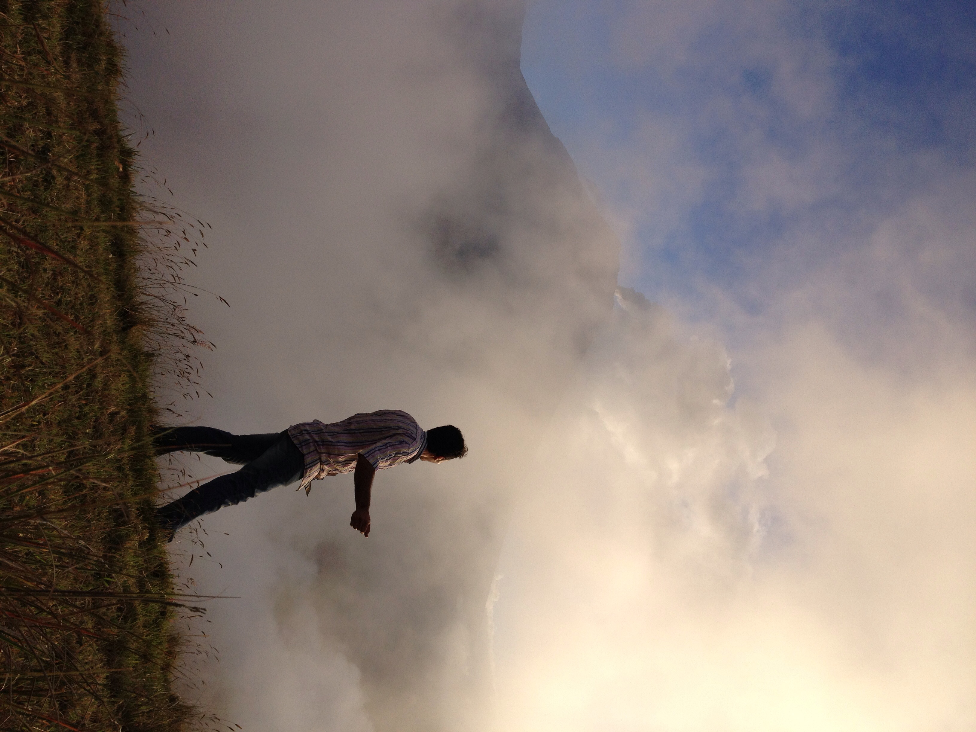
El Refugio del Volcán at 3,830 meters (12,565 feet) above sea level, Climbing the Summit of the Active and Mighty Stratovolcano 'Tungurahua' ('Throat of Fire' volcano) at 5,023 meters (16,479 feet) above sea level, Baños, the Central Highlands, Ecuador.

El Refugio del Volcán at 3,830 meters (12,565 feet) above sea level, Climbing the Summit of the Active and Mighty Stratovolcano 'Tungurahua' ('Throat of Fire' volcano) at 5,023 meters (16,479 feet) above sea level, Baños, the Central Highlands, Ecuador.

El Refugio del Volcán at 3,830 meters (12,565 feet) above sea level, Climbing the Summit of the Active and Mighty Stratovolcano 'Tungurahua' ('Throat of Fire' volcano) at 5,023 meters (16,479 feet) above sea level, Baños, the Central Highlands, Ecuador.

Parque Aventura San Martin at 1,800 meters (5,905 ft) above sea level, Baños, Ecuador.

Ecuador, Feb 2017, Cantón Baños

Ecuador, Feb 2017, Cantón Baños

Ecuador, Feb 2017, Cantón Baños

Ecuador, Feb 2017, Cantón Baños

Ecuador, Feb 2017, Cantón Baños

Baños sunset

Ecuador, Feb 2017, Baños de Agua Santa

Ecuador, Feb 2017, Baños de Agua Santa

Ecuador, Feb 2017, Cantón Baños
White haze!

Ecuador, Feb 2017, Baños de Agua Santa

Ecuador, Feb 2017, Baños de Agua Santa

Ecuador, Feb 2017, Baños de Agua Santa

Sunset over Baños

Ecuador, Feb 2017, Baños de Agua Santa

The sunset, looking almost straight up at the huge mountain next door

Sunrise, Climbing the Summit of the Active and Mighty Stratovolcano 'Tungurahua' ('Throat of Fire' volcano) at 5,023 meters (16,479 feet) above sea level, Baños, the Central Highlands, Ecuador.

Climbing the Summit of the Active and Mighty Stratovolcano 'Tungurahua' ('Throat of Fire' volcano) at 5,023 meters (16,479 feet) above sea level, Baños, the Central Highlands, Ecuador.
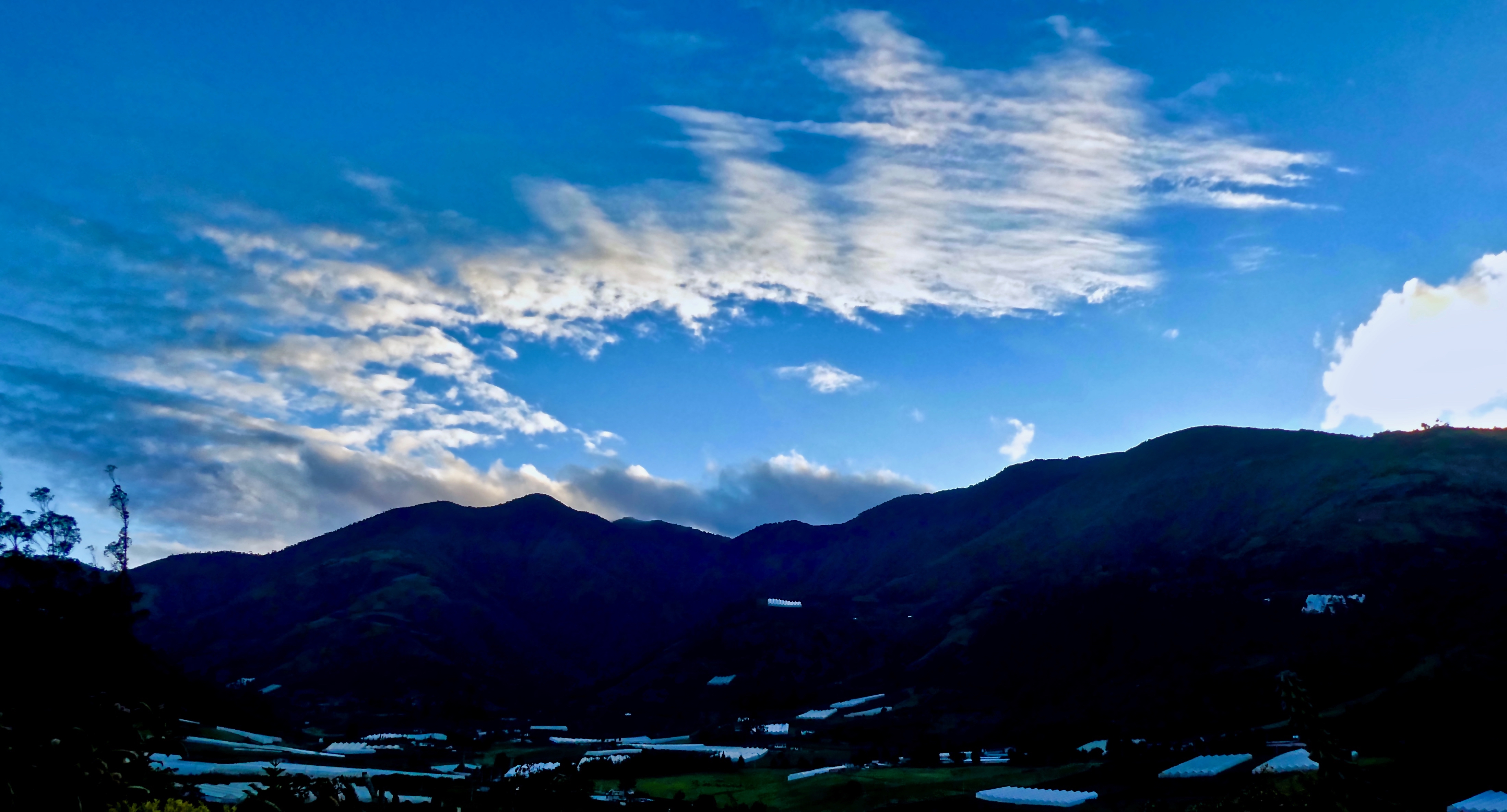
Sunrise at Hacienda Leito

Valley Sunrise

The Crater, Climbing the Summit of the Active and Mighty Stratovolcano 'Tungurahua' ('Throat of Fire' volcano) at 5,023 meters (16,479 feet) above sea level, Baños, the Central Highlands, Ecuador.

19981204-002
Mapa de Cotalo, Ecuador
Buscar otro lugar
Lugares cercanos
Volcán Tungurahua, Ecuador
La Casa del Arbol, Baños de Agua Santa, Ecuador
Urbina, Ecuador
Riobamba, Ecuador
Natale Torment, Riobamba, Ecuador
Chambo, Ecuador
Chambo, Ecuador
Riobamba, Ecuador
Topo, Ecuador
Pablo Sexto, Ecuador
Pablo Sexto, Ecuador
Guargualla Sangay Lodge, Ecuador
Provincia de Pastaza, Ecuador
Puyo, Ecuador
Banco Pichincha, Ecuador
Ecuador
Inti Sisa, Calle Vargas Y Torres, Guamote, Ecuador
Inti Sisa Art Guesthouse, Vargas Torres y Garcia Moreno, Guamote, Ecuador
Guamote, Ecuador
Unnamed Road, Ecuador
Búsquedas recientes
- Horas de salida y puesta de sol de Red Dog Mine, AK, USA
- Horas de salida y puesta de sol de Am Bahnhof, Am bhf, Borken, Germany
- Horas de salida y puesta de sol de 4th St E, Sonoma, CA, EE. UU.
- Horas de salida y puesta de sol de Oakland Ave, Williamsport, PA, EE. UU.
- Horas de salida y puesta de sol de Via Roma, Pieranica CR, Italia
- Horas de salida y puesta de sol de Torre del reloj, Grad, Dubrovnik (Ragusa), Croacia
- Horas de salida y puesta de sol de Trelew, Chubut, Argentina
- Horas de salida y puesta de sol de Hartfords Bluff Cir, Mt Pleasant, SC, EE. UU.
- Horas de salida y puesta de sol de Kita Ward, Kumamoto, Japón
- Horas de salida y puesta de sol de Pingtan Island, Pingtan County, Fuzhou, China