Co Hwy 44, Nevada, OH アメリカ合衆国日の出日の入り時間
Location: アメリカ合衆国 > オハイオ州 > ワイアンドット > アメリカ合衆国 オハイオ州 エデン > アメリカ合衆国 〒 オハイオ州 ネバダ >
時間帯:
America/New_York
現地時間:
2025-06-21 08:38:41
経度:
-83.1496446
緯度:
40.8772197
今日の日の出時刻:
06:01:08 AM
今日の日の入時刻:
09:07:59 PM
今日の日長:
15h 6m 51s
明日の日の出時刻:
06:01:24 AM
明日の日の入時刻:
09:08:09 PM
明日の日長:
15h 6m 45s
すべて表示する
| 日付 | 日出 | 日没 | 日長 |
|---|---|---|---|
| 2025年01月01日 | 07:57:07 AM | 05:16:19 PM | 9h 19m 12s |
| 2025年01月02日 | 07:57:09 AM | 05:17:12 PM | 9h 20m 3s |
| 2025年01月03日 | 07:57:09 AM | 05:18:06 PM | 9h 20m 57s |
| 2025年01月04日 | 07:57:07 AM | 05:19:02 PM | 9h 21m 55s |
| 2025年01月05日 | 07:57:03 AM | 05:19:59 PM | 9h 22m 56s |
| 2025年01月06日 | 07:56:56 AM | 05:20:57 PM | 9h 24m 1s |
| 2025年01月07日 | 07:56:47 AM | 05:21:57 PM | 9h 25m 10s |
| 2025年01月08日 | 07:56:36 AM | 05:22:58 PM | 9h 26m 22s |
| 2025年01月09日 | 07:56:23 AM | 05:24:00 PM | 9h 27m 37s |
| 2025年01月10日 | 07:56:07 AM | 05:25:03 PM | 9h 28m 56s |
| 2025年01月11日 | 07:55:49 AM | 05:26:07 PM | 9h 30m 18s |
| 2025年01月12日 | 07:55:29 AM | 05:27:12 PM | 9h 31m 43s |
| 2025年01月13日 | 07:55:07 AM | 05:28:19 PM | 9h 33m 12s |
| 2025年01月14日 | 07:54:42 AM | 05:29:26 PM | 9h 34m 44s |
| 2025年01月15日 | 07:54:15 AM | 05:30:33 PM | 9h 36m 18s |
| 2025年01月16日 | 07:53:46 AM | 05:31:42 PM | 9h 37m 56s |
| 2025年01月17日 | 07:53:15 AM | 05:32:51 PM | 9h 39m 36s |
| 2025年01月18日 | 07:52:42 AM | 05:34:01 PM | 9h 41m 19s |
| 2025年01月19日 | 07:52:07 AM | 05:35:12 PM | 9h 43m 5s |
| 2025年01月20日 | 07:51:29 AM | 05:36:23 PM | 9h 44m 54s |
| 2025年01月21日 | 07:50:50 AM | 05:37:35 PM | 9h 46m 45s |
| 2025年01月22日 | 07:50:09 AM | 05:38:47 PM | 9h 48m 38s |
| 2025年01月23日 | 07:49:25 AM | 05:39:59 PM | 9h 50m 34s |
| 2025年01月24日 | 07:48:40 AM | 05:41:12 PM | 9h 52m 32s |
| 2025年01月25日 | 07:47:53 AM | 05:42:26 PM | 9h 54m 33s |
| 2025年01月26日 | 07:47:04 AM | 05:43:39 PM | 9h 56m 35s |
| 2025年01月27日 | 07:46:13 AM | 05:44:53 PM | 9h 58m 40s |
| 2025年01月28日 | 07:45:20 AM | 05:46:07 PM | 10h 0m 47s |
| 2025年01月29日 | 07:44:25 AM | 05:47:21 PM | 10h 2m 56s |
| 2025年01月30日 | 07:43:29 AM | 05:48:35 PM | 10h 5m 6s |
| 2025年01月31日 | 07:42:31 AM | 05:49:50 PM | 10h 7m 19s |
| 2025年02月01日 | 07:41:31 AM | 05:51:04 PM | 10h 9m 33s |
| 2025年02月02日 | 07:40:29 AM | 05:52:19 PM | 10h 11m 50s |
| 2025年02月03日 | 07:39:26 AM | 05:53:33 PM | 10h 14m 7s |
| 2025年02月04日 | 07:38:22 AM | 05:54:48 PM | 10h 16m 26s |
| 2025年02月05日 | 07:37:15 AM | 05:56:02 PM | 10h 18m 47s |
| 2025年02月06日 | 07:36:08 AM | 05:57:16 PM | 10h 21m 8s |
| 2025年02月07日 | 07:34:58 AM | 05:58:30 PM | 10h 23m 32s |
| 2025年02月08日 | 07:33:48 AM | 05:59:45 PM | 10h 25m 57s |
| 2025年02月09日 | 07:32:36 AM | 06:00:58 PM | 10h 28m 22s |
| 2025年02月10日 | 07:31:22 AM | 06:02:12 PM | 10h 30m 50s |
| 2025年02月11日 | 07:30:07 AM | 06:03:26 PM | 10h 33m 19s |
| 2025年02月12日 | 07:28:51 AM | 06:04:39 PM | 10h 35m 48s |
| 2025年02月13日 | 07:27:34 AM | 06:05:52 PM | 10h 38m 18s |
| 2025年02月14日 | 07:26:16 AM | 06:07:05 PM | 10h 40m 49s |
| 2025年02月15日 | 07:24:56 AM | 06:08:18 PM | 10h 43m 22s |
| 2025年02月16日 | 07:23:35 AM | 06:09:30 PM | 10h 45m 55s |
| 2025年02月17日 | 07:22:13 AM | 06:10:42 PM | 10h 48m 29s |
| 2025年02月18日 | 07:20:50 AM | 06:11:54 PM | 10h 51m 4s |
| 2025年02月19日 | 07:19:26 AM | 06:13:06 PM | 10h 53m 40s |
| 2025年02月20日 | 07:18:01 AM | 06:14:17 PM | 10h 56m 16s |
| 2025年02月21日 | 07:16:34 AM | 06:15:28 PM | 10h 58m 54s |
| 2025年02月22日 | 07:15:07 AM | 06:16:39 PM | 11h 1m 32s |
| 2025年02月23日 | 07:13:39 AM | 06:17:49 PM | 11h 4m 10s |
| 2025年02月24日 | 07:12:11 AM | 06:18:59 PM | 11h 6m 48s |
| 2025年02月25日 | 07:10:41 AM | 06:20:09 PM | 11h 9m 28s |
| 2025年02月26日 | 07:09:10 AM | 06:21:18 PM | 11h 12m 8s |
| 2025年02月27日 | 07:07:39 AM | 06:22:27 PM | 11h 14m 48s |
| 2025年02月28日 | 07:06:07 AM | 06:23:36 PM | 11h 17m 29s |
| 2025年03月01日 | 07:04:34 AM | 06:24:45 PM | 11h 20m 11s |
| 2025年03月02日 | 07:03:01 AM | 06:25:53 PM | 11h 22m 52s |
| 2025年03月03日 | 07:01:27 AM | 06:27:01 PM | 11h 25m 34s |
| 2025年03月04日 | 06:59:52 AM | 06:28:09 PM | 11h 28m 17s |
| 2025年03月05日 | 06:58:17 AM | 06:29:16 PM | 11h 30m 59s |
| 2025年03月06日 | 06:56:42 AM | 06:30:24 PM | 11h 33m 42s |
| 2025年03月07日 | 06:55:05 AM | 06:31:31 PM | 11h 36m 26s |
| 2025年03月08日 | 06:53:29 AM | 06:32:37 PM | 11h 39m 8s |
| 2025年03月09日 | 07:51:56 AM | 07:33:41 PM | 11h 41m 45s |
| 2025年03月10日 | 07:50:18 AM | 07:34:47 PM | 11h 44m 29s |
| 2025年03月11日 | 07:48:40 AM | 07:35:53 PM | 11h 47m 13s |
| 2025年03月12日 | 07:47:02 AM | 07:36:59 PM | 11h 49m 57s |
| 2025年03月13日 | 07:45:24 AM | 07:38:04 PM | 11h 52m 40s |
| 2025年03月14日 | 07:43:45 AM | 07:39:09 PM | 11h 55m 24s |
| 2025年03月15日 | 07:42:06 AM | 07:40:15 PM | 11h 58m 9s |
| 2025年03月16日 | 07:40:26 AM | 07:41:19 PM | 12h 0m 53s |
| 2025年03月17日 | 07:38:47 AM | 07:42:24 PM | 12h 3m 37s |
| 2025年03月18日 | 07:37:07 AM | 07:43:29 PM | 12h 6m 22s |
| 2025年03月19日 | 07:35:27 AM | 07:44:33 PM | 12h 9m 6s |
| 2025年03月20日 | 07:33:48 AM | 07:45:37 PM | 12h 11m 49s |
| 2025年03月21日 | 07:32:08 AM | 07:46:42 PM | 12h 14m 34s |
| 2025年03月22日 | 07:30:28 AM | 07:47:46 PM | 12h 17m 18s |
| 2025年03月23日 | 07:28:48 AM | 07:48:50 PM | 12h 20m 2s |
| 2025年03月24日 | 07:27:08 AM | 07:49:53 PM | 12h 22m 45s |
| 2025年03月25日 | 07:25:28 AM | 07:50:57 PM | 12h 25m 29s |
| 2025年03月26日 | 07:23:48 AM | 07:52:01 PM | 12h 28m 13s |
| 2025年03月27日 | 07:22:08 AM | 07:53:04 PM | 12h 30m 56s |
| 2025年03月28日 | 07:20:29 AM | 07:54:08 PM | 12h 33m 39s |
| 2025年03月29日 | 07:18:49 AM | 07:55:11 PM | 12h 36m 22s |
| 2025年03月30日 | 07:17:10 AM | 07:56:14 PM | 12h 39m 4s |
| 2025年03月31日 | 07:15:31 AM | 07:57:18 PM | 12h 41m 47s |
| 2025年04月01日 | 07:13:52 AM | 07:58:21 PM | 12h 44m 29s |
| 2025年04月02日 | 07:12:14 AM | 07:59:24 PM | 12h 47m 10s |
| 2025年04月03日 | 07:10:36 AM | 08:00:27 PM | 12h 49m 51s |
| 2025年04月04日 | 07:08:58 AM | 08:01:31 PM | 12h 52m 33s |
| 2025年04月05日 | 07:07:21 AM | 08:02:34 PM | 12h 55m 13s |
| 2025年04月06日 | 07:05:44 AM | 08:03:37 PM | 12h 57m 53s |
| 2025年04月07日 | 07:04:08 AM | 08:04:40 PM | 13h 0m 32s |
| 2025年04月08日 | 07:02:32 AM | 08:05:43 PM | 13h 3m 11s |
| 2025年04月09日 | 07:00:56 AM | 08:06:47 PM | 13h 5m 51s |
| 2025年04月10日 | 06:59:21 AM | 08:07:50 PM | 13h 8m 29s |
| 2025年04月11日 | 06:57:47 AM | 08:08:53 PM | 13h 11m 6s |
| 2025年04月12日 | 06:56:13 AM | 08:09:57 PM | 13h 13m 44s |
| 2025年04月13日 | 06:54:40 AM | 08:11:00 PM | 13h 16m 20s |
| 2025年04月14日 | 06:53:08 AM | 08:12:03 PM | 13h 18m 55s |
| 2025年04月15日 | 06:51:36 AM | 08:13:06 PM | 13h 21m 30s |
| 2025年04月16日 | 06:50:05 AM | 08:14:10 PM | 13h 24m 5s |
| 2025年04月17日 | 06:48:35 AM | 08:15:13 PM | 13h 26m 38s |
| 2025年04月18日 | 06:47:06 AM | 08:16:17 PM | 13h 29m 11s |
| 2025年04月19日 | 06:45:37 AM | 08:17:20 PM | 13h 31m 43s |
| 2025年04月20日 | 06:44:09 AM | 08:18:23 PM | 13h 34m 14s |
| 2025年04月21日 | 06:42:42 AM | 08:19:27 PM | 13h 36m 45s |
| 2025年04月22日 | 06:41:16 AM | 08:20:30 PM | 13h 39m 14s |
| 2025年04月23日 | 06:39:52 AM | 08:21:33 PM | 13h 41m 41s |
| 2025年04月24日 | 06:38:28 AM | 08:22:37 PM | 13h 44m 9s |
| 2025年04月25日 | 06:37:05 AM | 08:23:40 PM | 13h 46m 35s |
| 2025年04月26日 | 06:35:43 AM | 08:24:43 PM | 13h 49m 0s |
| 2025年04月27日 | 06:34:22 AM | 08:25:46 PM | 13h 51m 24s |
| 2025年04月28日 | 06:33:02 AM | 08:26:49 PM | 13h 53m 47s |
| 2025年04月29日 | 06:31:44 AM | 08:27:52 PM | 13h 56m 8s |
| 2025年04月30日 | 06:30:26 AM | 08:28:55 PM | 13h 58m 29s |
| 2025年05月01日 | 06:29:10 AM | 08:29:58 PM | 14h 0m 48s |
| 2025年05月02日 | 06:27:55 AM | 08:31:00 PM | 14h 3m 5s |
| 2025年05月03日 | 06:26:42 AM | 08:32:03 PM | 14h 5m 21s |
| 2025年05月04日 | 06:25:29 AM | 08:33:05 PM | 14h 7m 36s |
| 2025年05月05日 | 06:24:18 AM | 08:34:07 PM | 14h 9m 49s |
| 2025年05月06日 | 06:23:09 AM | 08:35:09 PM | 14h 12m 0s |
| 2025年05月07日 | 06:22:00 AM | 08:36:10 PM | 14h 14m 10s |
| 2025年05月08日 | 06:20:54 AM | 08:37:11 PM | 14h 16m 17s |
| 2025年05月09日 | 06:19:48 AM | 08:38:12 PM | 14h 18m 24s |
| 2025年05月10日 | 06:18:44 AM | 08:39:13 PM | 14h 20m 29s |
| 2025年05月11日 | 06:17:42 AM | 08:40:13 PM | 14h 22m 31s |
| 2025年05月12日 | 06:16:41 AM | 08:41:12 PM | 14h 24m 31s |
| 2025年05月13日 | 06:15:42 AM | 08:42:12 PM | 14h 26m 30s |
| 2025年05月14日 | 06:14:45 AM | 08:43:10 PM | 14h 28m 25s |
| 2025年05月15日 | 06:13:49 AM | 08:44:09 PM | 14h 30m 20s |
| 2025年05月16日 | 06:12:54 AM | 08:45:06 PM | 14h 32m 12s |
| 2025年05月17日 | 06:12:02 AM | 08:46:04 PM | 14h 34m 2s |
| 2025年05月18日 | 06:11:11 AM | 08:47:00 PM | 14h 35m 49s |
| 2025年05月19日 | 06:10:22 AM | 08:47:56 PM | 14h 37m 34s |
| 2025年05月20日 | 06:09:34 AM | 08:48:51 PM | 14h 39m 17s |
| 2025年05月21日 | 06:08:49 AM | 08:49:46 PM | 14h 40m 57s |
| 2025年05月22日 | 06:08:05 AM | 08:50:39 PM | 14h 42m 34s |
| 2025年05月23日 | 06:07:23 AM | 08:51:32 PM | 14h 44m 9s |
| 2025年05月24日 | 06:06:43 AM | 08:52:24 PM | 14h 45m 41s |
| 2025年05月25日 | 06:06:05 AM | 08:53:15 PM | 14h 47m 10s |
| 2025年05月26日 | 06:05:29 AM | 08:54:06 PM | 14h 48m 37s |
| 2025年05月27日 | 06:04:54 AM | 08:54:55 PM | 14h 50m 1s |
| 2025年05月28日 | 06:04:22 AM | 08:55:43 PM | 14h 51m 21s |
| 2025年05月29日 | 06:03:51 AM | 08:56:30 PM | 14h 52m 39s |
| 2025年05月30日 | 06:03:23 AM | 08:57:16 PM | 14h 53m 53s |
| 2025年05月31日 | 06:02:56 AM | 08:58:01 PM | 14h 55m 5s |
| 2025年06月01日 | 06:02:32 AM | 08:58:45 PM | 14h 56m 13s |
| 2025年06月02日 | 06:02:09 AM | 08:59:27 PM | 14h 57m 18s |
| 2025年06月03日 | 06:01:48 AM | 09:00:08 PM | 14h 58m 20s |
| 2025年06月04日 | 06:01:30 AM | 09:00:48 PM | 14h 59m 18s |
| 2025年06月05日 | 06:01:13 AM | 09:01:26 PM | 15h 0m 13s |
| 2025年06月06日 | 06:00:58 AM | 09:02:03 PM | 15h 1m 5s |
| 2025年06月07日 | 06:00:46 AM | 09:02:39 PM | 15h 1m 53s |
| 2025年06月08日 | 06:00:35 AM | 09:03:13 PM | 15h 2m 38s |
| 2025年06月09日 | 06:00:26 AM | 09:03:46 PM | 15h 3m 20s |
| 2025年06月10日 | 06:00:20 AM | 09:04:17 PM | 15h 3m 57s |
| 2025年06月11日 | 06:00:15 AM | 09:04:46 PM | 15h 4m 31s |
| 2025年06月12日 | 06:00:13 AM | 09:05:14 PM | 15h 5m 1s |
| 2025年06月13日 | 06:00:12 AM | 09:05:40 PM | 15h 5m 28s |
| 2025年06月14日 | 06:00:13 AM | 09:06:04 PM | 15h 5m 51s |
| 2025年06月15日 | 06:00:16 AM | 09:06:27 PM | 15h 6m 11s |
| 2025年06月16日 | 06:00:21 AM | 09:06:48 PM | 15h 6m 27s |
| 2025年06月17日 | 06:00:29 AM | 09:07:07 PM | 15h 6m 38s |
| 2025年06月18日 | 06:00:38 AM | 09:07:24 PM | 15h 6m 46s |
| 2025年06月19日 | 06:00:48 AM | 09:07:39 PM | 15h 6m 51s |
| 2025年06月20日 | 06:01:01 AM | 09:07:53 PM | 15h 6m 52s |
| 2025年06月21日 | 06:01:16 AM | 09:08:04 PM | 15h 6m 48s |
| 2025年06月22日 | 06:01:32 AM | 09:08:14 PM | 15h 6m 42s |
| 2025年06月23日 | 06:01:50 AM | 09:08:21 PM | 15h 6m 31s |
| 2025年06月24日 | 06:02:10 AM | 09:08:27 PM | 15h 6m 17s |
| 2025年06月25日 | 06:02:31 AM | 09:08:31 PM | 15h 6m 0s |
| 2025年06月26日 | 06:02:55 AM | 09:08:33 PM | 15h 5m 38s |
| 2025年06月27日 | 06:03:20 AM | 09:08:32 PM | 15h 5m 12s |
| 2025年06月28日 | 06:03:46 AM | 09:08:30 PM | 15h 4m 44s |
| 2025年06月29日 | 06:04:14 AM | 09:08:26 PM | 15h 4m 12s |
| 2025年06月30日 | 06:04:44 AM | 09:08:19 PM | 15h 3m 35s |
| 2025年07月01日 | 06:05:15 AM | 09:08:11 PM | 15h 2m 56s |
| 2025年07月02日 | 06:05:48 AM | 09:08:00 PM | 15h 2m 12s |
| 2025年07月03日 | 06:06:22 AM | 09:07:48 PM | 15h 1m 26s |
| 2025年07月04日 | 06:06:57 AM | 09:07:33 PM | 15h 0m 36s |
| 2025年07月05日 | 06:07:34 AM | 09:07:17 PM | 14h 59m 43s |
| 2025年07月06日 | 06:08:12 AM | 09:06:58 PM | 14h 58m 46s |
| 2025年07月07日 | 06:08:51 AM | 09:06:37 PM | 14h 57m 46s |
| 2025年07月08日 | 06:09:32 AM | 09:06:14 PM | 14h 56m 42s |
| 2025年07月09日 | 06:10:14 AM | 09:05:50 PM | 14h 55m 36s |
| 2025年07月10日 | 06:10:56 AM | 09:05:23 PM | 14h 54m 27s |
| 2025年07月11日 | 06:11:40 AM | 09:04:54 PM | 14h 53m 14s |
| 2025年07月12日 | 06:12:25 AM | 09:04:23 PM | 14h 51m 58s |
| 2025年07月13日 | 06:13:12 AM | 09:03:51 PM | 14h 50m 39s |
| 2025年07月14日 | 06:13:59 AM | 09:03:16 PM | 14h 49m 17s |
| 2025年07月15日 | 06:14:46 AM | 09:02:39 PM | 14h 47m 53s |
| 2025年07月16日 | 06:15:35 AM | 09:02:01 PM | 14h 46m 26s |
| 2025年07月17日 | 06:16:25 AM | 09:01:20 PM | 14h 44m 55s |
| 2025年07月18日 | 06:17:15 AM | 09:00:38 PM | 14h 43m 23s |
| 2025年07月19日 | 06:18:07 AM | 08:59:54 PM | 14h 41m 47s |
| 2025年07月20日 | 06:18:59 AM | 08:59:08 PM | 14h 40m 9s |
| 2025年07月21日 | 06:19:51 AM | 08:58:20 PM | 14h 38m 29s |
| 2025年07月22日 | 06:20:44 AM | 08:57:30 PM | 14h 36m 46s |
| 2025年07月23日 | 06:21:38 AM | 08:56:39 PM | 14h 35m 1s |
| 2025年07月24日 | 06:22:33 AM | 08:55:46 PM | 14h 33m 13s |
| 2025年07月25日 | 06:23:28 AM | 08:54:51 PM | 14h 31m 23s |
| 2025年07月26日 | 06:24:23 AM | 08:53:54 PM | 14h 29m 31s |
| 2025年07月27日 | 06:25:19 AM | 08:52:56 PM | 14h 27m 37s |
| 2025年07月28日 | 06:26:15 AM | 08:51:56 PM | 14h 25m 41s |
| 2025年07月29日 | 06:27:12 AM | 08:50:55 PM | 14h 23m 43s |
| 2025年07月30日 | 06:28:09 AM | 08:49:51 PM | 14h 21m 42s |
| 2025年07月31日 | 06:29:06 AM | 08:48:47 PM | 14h 19m 41s |
| 2025年08月01日 | 06:30:04 AM | 08:47:41 PM | 14h 17m 37s |
| 2025年08月02日 | 06:31:02 AM | 08:46:33 PM | 14h 15m 31s |
| 2025年08月03日 | 06:32:00 AM | 08:45:24 PM | 14h 13m 24s |
| 2025年08月04日 | 06:32:58 AM | 08:44:14 PM | 14h 11m 16s |
| 2025年08月05日 | 06:33:57 AM | 08:43:02 PM | 14h 9m 5s |
| 2025年08月06日 | 06:34:56 AM | 08:41:48 PM | 14h 6m 52s |
| 2025年08月07日 | 06:35:55 AM | 08:40:34 PM | 14h 4m 39s |
| 2025年08月08日 | 06:36:54 AM | 08:39:18 PM | 14h 2m 24s |
| 2025年08月09日 | 06:37:53 AM | 08:38:01 PM | 14h 0m 8s |
| 2025年08月10日 | 06:38:52 AM | 08:36:43 PM | 13h 57m 51s |
| 2025年08月11日 | 06:39:52 AM | 08:35:23 PM | 13h 55m 31s |
| 2025年08月12日 | 06:40:51 AM | 08:34:02 PM | 13h 53m 11s |
| 2025年08月13日 | 06:41:50 AM | 08:32:40 PM | 13h 50m 50s |
| 2025年08月14日 | 06:42:50 AM | 08:31:17 PM | 13h 48m 27s |
| 2025年08月15日 | 06:43:49 AM | 08:29:53 PM | 13h 46m 4s |
| 2025年08月16日 | 06:44:49 AM | 08:28:28 PM | 13h 43m 39s |
| 2025年08月17日 | 06:45:48 AM | 08:27:02 PM | 13h 41m 14s |
| 2025年08月18日 | 06:46:48 AM | 08:25:35 PM | 13h 38m 47s |
| 2025年08月19日 | 06:47:47 AM | 08:24:07 PM | 13h 36m 20s |
| 2025年08月20日 | 06:48:47 AM | 08:22:38 PM | 13h 33m 51s |
| 2025年08月21日 | 06:49:46 AM | 08:21:08 PM | 13h 31m 22s |
| 2025年08月22日 | 06:50:46 AM | 08:19:38 PM | 13h 28m 52s |
| 2025年08月23日 | 06:51:45 AM | 08:18:06 PM | 13h 26m 21s |
| 2025年08月24日 | 06:52:44 AM | 08:16:34 PM | 13h 23m 50s |
| 2025年08月25日 | 06:53:43 AM | 08:15:01 PM | 13h 21m 18s |
| 2025年08月26日 | 06:54:43 AM | 08:13:27 PM | 13h 18m 44s |
| 2025年08月27日 | 06:55:42 AM | 08:11:52 PM | 13h 16m 10s |
| 2025年08月28日 | 06:56:41 AM | 08:10:17 PM | 13h 13m 36s |
| 2025年08月29日 | 06:57:40 AM | 08:08:42 PM | 13h 11m 2s |
| 2025年08月30日 | 06:58:39 AM | 08:07:05 PM | 13h 8m 26s |
| 2025年08月31日 | 06:59:38 AM | 08:05:28 PM | 13h 5m 50s |
| 2025年09月01日 | 07:00:37 AM | 08:03:51 PM | 13h 3m 14s |
| 2025年09月02日 | 07:01:35 AM | 08:02:13 PM | 13h 0m 38s |
| 2025年09月03日 | 07:02:34 AM | 08:00:34 PM | 12h 58m 0s |
| 2025年09月04日 | 07:03:33 AM | 07:58:55 PM | 12h 55m 22s |
| 2025年09月05日 | 07:04:32 AM | 07:57:16 PM | 12h 52m 44s |
| 2025年09月06日 | 07:05:31 AM | 07:55:36 PM | 12h 50m 5s |
| 2025年09月07日 | 07:06:29 AM | 07:53:56 PM | 12h 47m 27s |
| 2025年09月08日 | 07:07:28 AM | 07:52:16 PM | 12h 44m 48s |
| 2025年09月09日 | 07:08:27 AM | 07:50:35 PM | 12h 42m 8s |
| 2025年09月10日 | 07:09:26 AM | 07:48:54 PM | 12h 39m 28s |
| 2025年09月11日 | 07:10:24 AM | 07:47:13 PM | 12h 36m 49s |
| 2025年09月12日 | 07:11:23 AM | 07:45:32 PM | 12h 34m 9s |
| 2025年09月13日 | 07:12:22 AM | 07:43:50 PM | 12h 31m 28s |
| 2025年09月14日 | 07:13:21 AM | 07:42:08 PM | 12h 28m 47s |
| 2025年09月15日 | 07:14:20 AM | 07:40:26 PM | 12h 26m 6s |
| 2025年09月16日 | 07:15:19 AM | 07:38:44 PM | 12h 23m 25s |
| 2025年09月17日 | 07:16:18 AM | 07:37:02 PM | 12h 20m 44s |
| 2025年09月18日 | 07:17:18 AM | 07:35:20 PM | 12h 18m 2s |
| 2025年09月19日 | 07:18:17 AM | 07:33:38 PM | 12h 15m 21s |
| 2025年09月20日 | 07:19:16 AM | 07:31:56 PM | 12h 12m 40s |
| 2025年09月21日 | 07:20:16 AM | 07:30:14 PM | 12h 9m 58s |
| 2025年09月22日 | 07:21:16 AM | 07:28:32 PM | 12h 7m 16s |
| 2025年09月23日 | 07:22:16 AM | 07:26:50 PM | 12h 4m 34s |
| 2025年09月24日 | 07:23:16 AM | 07:25:09 PM | 12h 1m 53s |
| 2025年09月25日 | 07:24:16 AM | 07:23:27 PM | 11h 59m 11s |
| 2025年09月26日 | 07:25:16 AM | 07:21:46 PM | 11h 56m 30s |
| 2025年09月27日 | 07:26:17 AM | 07:20:05 PM | 11h 53m 48s |
| 2025年09月28日 | 07:27:18 AM | 07:18:24 PM | 11h 51m 6s |
| 2025年09月29日 | 07:28:19 AM | 07:16:44 PM | 11h 48m 25s |
| 2025年09月30日 | 07:29:20 AM | 07:15:03 PM | 11h 45m 43s |
| 2025年10月01日 | 07:30:22 AM | 07:13:24 PM | 11h 43m 2s |
| 2025年10月02日 | 07:31:23 AM | 07:11:44 PM | 11h 40m 21s |
| 2025年10月03日 | 07:32:25 AM | 07:10:05 PM | 11h 37m 40s |
| 2025年10月04日 | 07:33:28 AM | 07:08:27 PM | 11h 34m 59s |
| 2025年10月05日 | 07:34:30 AM | 07:06:49 PM | 11h 32m 19s |
| 2025年10月06日 | 07:35:33 AM | 07:05:11 PM | 11h 29m 38s |
| 2025年10月07日 | 07:36:36 AM | 07:03:34 PM | 11h 26m 58s |
| 2025年10月08日 | 07:37:39 AM | 07:01:58 PM | 11h 24m 19s |
| 2025年10月09日 | 07:38:43 AM | 07:00:22 PM | 11h 21m 39s |
| 2025年10月10日 | 07:39:47 AM | 06:58:47 PM | 11h 19m 0s |
| 2025年10月11日 | 07:40:51 AM | 06:57:12 PM | 11h 16m 21s |
| 2025年10月12日 | 07:41:56 AM | 06:55:39 PM | 11h 13m 43s |
| 2025年10月13日 | 07:43:01 AM | 06:54:06 PM | 11h 11m 5s |
| 2025年10月14日 | 07:44:06 AM | 06:52:33 PM | 11h 8m 27s |
| 2025年10月15日 | 07:45:12 AM | 06:51:02 PM | 11h 5m 50s |
| 2025年10月16日 | 07:46:18 AM | 06:49:31 PM | 11h 3m 13s |
| 2025年10月17日 | 07:47:24 AM | 06:48:02 PM | 11h 0m 38s |
| 2025年10月18日 | 07:48:30 AM | 06:46:33 PM | 10h 58m 3s |
| 2025年10月19日 | 07:49:37 AM | 06:45:05 PM | 10h 55m 28s |
| 2025年10月20日 | 07:50:45 AM | 06:43:38 PM | 10h 52m 53s |
| 2025年10月21日 | 07:51:52 AM | 06:42:12 PM | 10h 50m 20s |
| 2025年10月22日 | 07:53:00 AM | 06:40:47 PM | 10h 47m 47s |
| 2025年10月23日 | 07:54:08 AM | 06:39:24 PM | 10h 45m 16s |
| 2025年10月24日 | 07:55:17 AM | 06:38:01 PM | 10h 42m 44s |
| 2025年10月25日 | 07:56:25 AM | 06:36:39 PM | 10h 40m 14s |
| 2025年10月26日 | 07:57:34 AM | 06:35:19 PM | 10h 37m 45s |
| 2025年10月27日 | 07:58:44 AM | 06:34:00 PM | 10h 35m 16s |
| 2025年10月28日 | 07:59:53 AM | 06:32:42 PM | 10h 32m 49s |
| 2025年10月29日 | 08:01:03 AM | 06:31:26 PM | 10h 30m 23s |
| 2025年10月30日 | 08:02:13 AM | 06:30:11 PM | 10h 27m 58s |
| 2025年10月31日 | 08:03:23 AM | 06:28:57 PM | 10h 25m 34s |
| 2025年11月01日 | 08:04:34 AM | 06:27:45 PM | 10h 23m 11s |
| 2025年11月02日 | 07:05:47 AM | 05:26:31 PM | 10h 20m 44s |
| 2025年11月03日 | 07:06:58 AM | 05:25:21 PM | 10h 18m 23s |
| 2025年11月04日 | 07:08:09 AM | 05:24:13 PM | 10h 16m 4s |
| 2025年11月05日 | 07:09:20 AM | 05:23:07 PM | 10h 13m 47s |
| 2025年11月06日 | 07:10:31 AM | 05:22:02 PM | 10h 11m 31s |
| 2025年11月07日 | 07:11:42 AM | 05:20:59 PM | 10h 9m 17s |
| 2025年11月08日 | 07:12:53 AM | 05:19:58 PM | 10h 7m 5s |
| 2025年11月09日 | 07:14:05 AM | 05:18:58 PM | 10h 4m 53s |
| 2025年11月10日 | 07:15:16 AM | 05:18:00 PM | 10h 2m 44s |
| 2025年11月11日 | 07:16:27 AM | 05:17:04 PM | 10h 0m 37s |
| 2025年11月12日 | 07:17:38 AM | 05:16:09 PM | 9h 58m 31s |
| 2025年11月13日 | 07:18:49 AM | 05:15:17 PM | 9h 56m 28s |
| 2025年11月14日 | 07:19:59 AM | 05:14:26 PM | 9h 54m 27s |
| 2025年11月15日 | 07:21:10 AM | 05:13:37 PM | 9h 52m 27s |
| 2025年11月16日 | 07:22:20 AM | 05:12:50 PM | 9h 50m 30s |
| 2025年11月17日 | 07:23:30 AM | 05:12:05 PM | 9h 48m 35s |
| 2025年11月18日 | 07:24:39 AM | 05:11:22 PM | 9h 46m 43s |
| 2025年11月19日 | 07:25:49 AM | 05:10:41 PM | 9h 44m 52s |
| 2025年11月20日 | 07:26:57 AM | 05:10:02 PM | 9h 43m 5s |
| 2025年11月21日 | 07:28:06 AM | 05:09:25 PM | 9h 41m 19s |
| 2025年11月22日 | 07:29:13 AM | 05:08:51 PM | 9h 39m 38s |
| 2025年11月23日 | 07:30:20 AM | 05:08:18 PM | 9h 37m 58s |
| 2025年11月24日 | 07:31:27 AM | 05:07:48 PM | 9h 36m 21s |
| 2025年11月25日 | 07:32:33 AM | 05:07:19 PM | 9h 34m 46s |
| 2025年11月26日 | 07:33:38 AM | 05:06:53 PM | 9h 33m 15s |
| 2025年11月27日 | 07:34:42 AM | 05:06:30 PM | 9h 31m 48s |
| 2025年11月28日 | 07:35:46 AM | 05:06:08 PM | 9h 30m 22s |
| 2025年11月29日 | 07:36:48 AM | 05:05:49 PM | 9h 29m 1s |
| 2025年11月30日 | 07:37:50 AM | 05:05:32 PM | 9h 27m 42s |
| 2025年12月01日 | 07:38:50 AM | 05:05:17 PM | 9h 26m 27s |
| 2025年12月02日 | 07:39:50 AM | 05:05:05 PM | 9h 25m 15s |
| 2025年12月03日 | 07:40:48 AM | 05:04:54 PM | 9h 24m 6s |
| 2025年12月04日 | 07:41:45 AM | 05:04:47 PM | 9h 23m 2s |
| 2025年12月05日 | 07:42:41 AM | 05:04:41 PM | 9h 22m 0s |
| 2025年12月06日 | 07:43:36 AM | 05:04:38 PM | 9h 21m 2s |
| 2025年12月07日 | 07:44:29 AM | 05:04:37 PM | 9h 20m 8s |
| 2025年12月08日 | 07:45:21 AM | 05:04:38 PM | 9h 19m 17s |
| 2025年12月09日 | 07:46:12 AM | 05:04:42 PM | 9h 18m 30s |
| 2025年12月10日 | 07:47:01 AM | 05:04:48 PM | 9h 17m 47s |
| 2025年12月11日 | 07:47:48 AM | 05:04:57 PM | 9h 17m 9s |
| 2025年12月12日 | 07:48:34 AM | 05:05:07 PM | 9h 16m 33s |
| 2025年12月13日 | 07:49:18 AM | 05:05:20 PM | 9h 16m 2s |
| 2025年12月14日 | 07:50:00 AM | 05:05:36 PM | 9h 15m 36s |
| 2025年12月15日 | 07:50:41 AM | 05:05:53 PM | 9h 15m 12s |
| 2025年12月16日 | 07:51:20 AM | 05:06:13 PM | 9h 14m 53s |
| 2025年12月17日 | 07:51:57 AM | 05:06:35 PM | 9h 14m 38s |
| 2025年12月18日 | 07:52:32 AM | 05:06:59 PM | 9h 14m 27s |
| 2025年12月19日 | 07:53:05 AM | 05:07:25 PM | 9h 14m 20s |
| 2025年12月20日 | 07:53:36 AM | 05:07:54 PM | 9h 14m 18s |
| 2025年12月21日 | 07:54:05 AM | 05:08:24 PM | 9h 14m 19s |
| 2025年12月22日 | 07:54:33 AM | 05:08:57 PM | 9h 14m 24s |
| 2025年12月23日 | 07:54:58 AM | 05:09:31 PM | 9h 14m 33s |
| 2025年12月24日 | 07:55:21 AM | 05:10:08 PM | 9h 14m 47s |
| 2025年12月25日 | 07:55:41 AM | 05:10:46 PM | 9h 15m 5s |
| 2025年12月26日 | 07:56:00 AM | 05:11:27 PM | 9h 15m 27s |
| 2025年12月27日 | 07:56:16 AM | 05:12:09 PM | 9h 15m 53s |
| 2025年12月28日 | 07:56:31 AM | 05:12:53 PM | 9h 16m 22s |
| 2025年12月29日 | 07:56:43 AM | 05:13:39 PM | 9h 16m 56s |
| 2025年12月30日 | 07:56:53 AM | 05:14:26 PM | 9h 17m 33s |
| 2025年12月31日 | 07:57:00 AM | 05:15:16 PM | 9h 18m 16s |
写真

Cloudy #sunset. #Ohio

Amber waves of grain [176/365]
"The corn is as high as an elephant's eye"
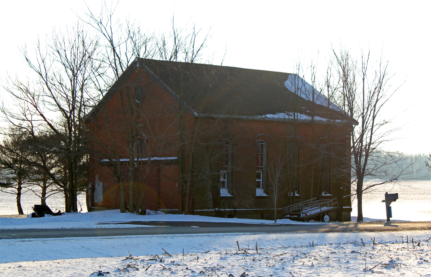
Schoolhouse — Dallas Township, Crawford County, Ohio

Between Sandusky River and Tymochtee Creek.

Wyandot Indian Mill on the Sandusky River
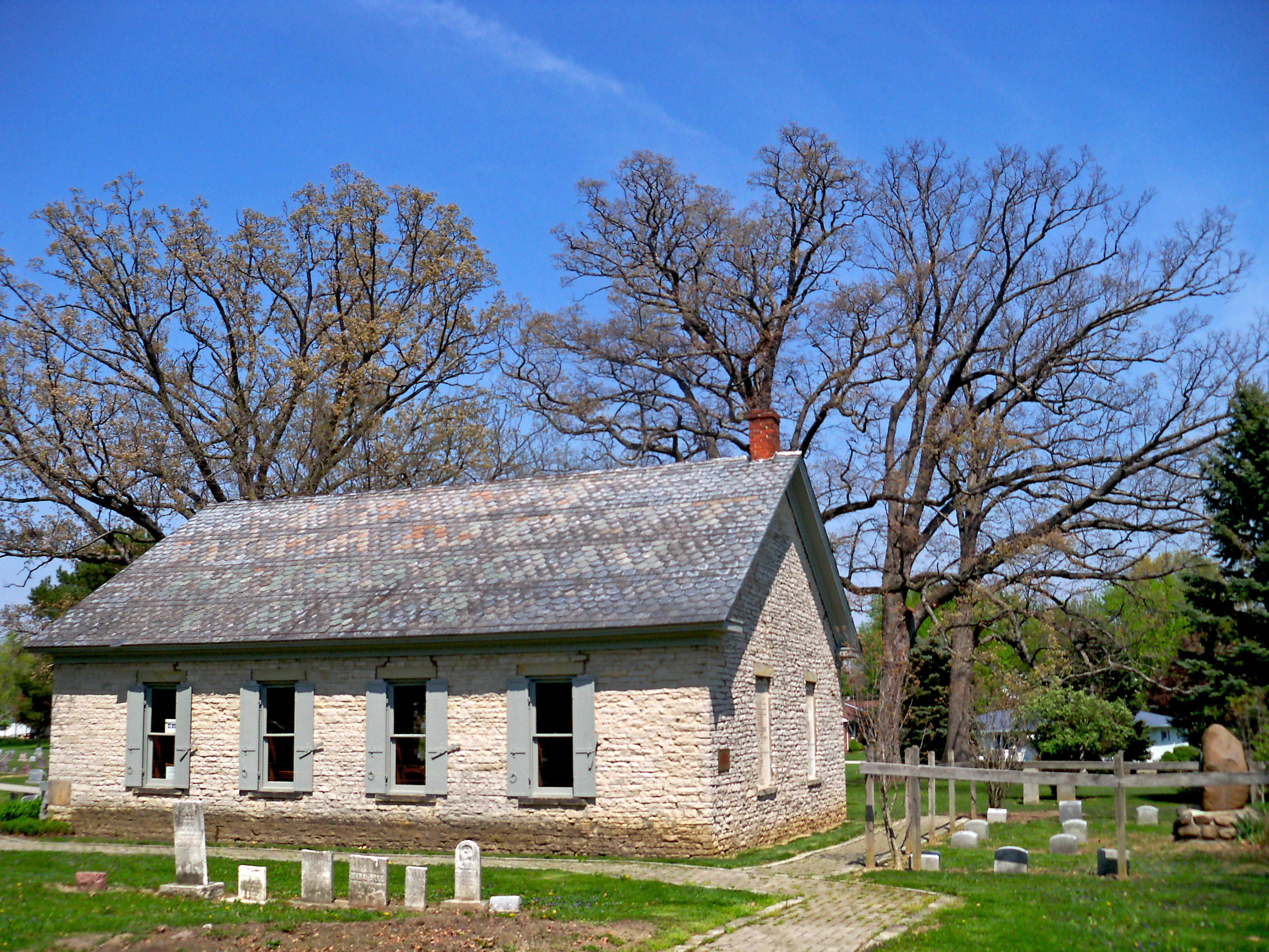
Wyandot Mission Church
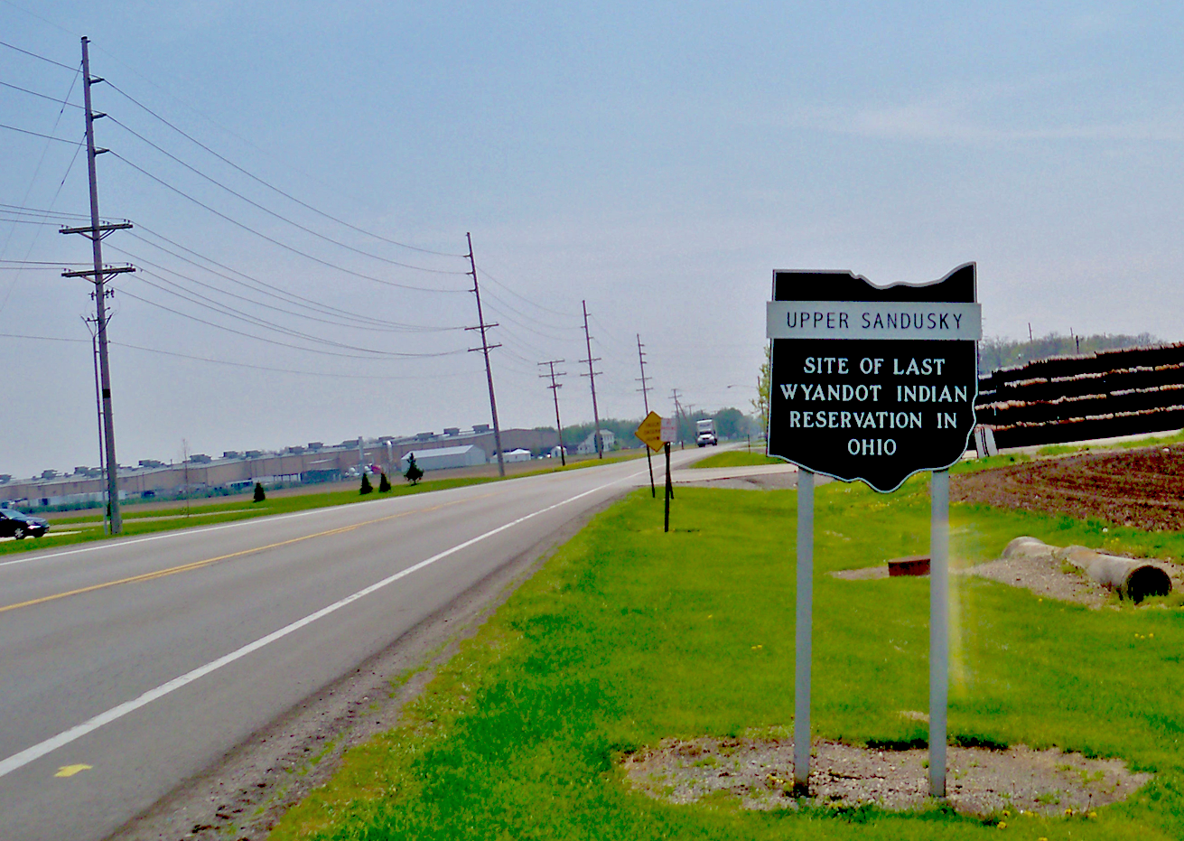
signage – Upper Sandusky, location of last Wyandot reservation in Ohio

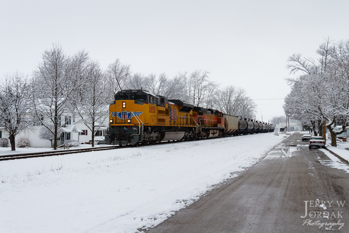
Why not ! A selfie & the view of my cab #freightliner #selfie #cre #atx #coveralls #trucklife #trucker

#openhouse @crossroadscandles
A Splash of Color in a Sea of White

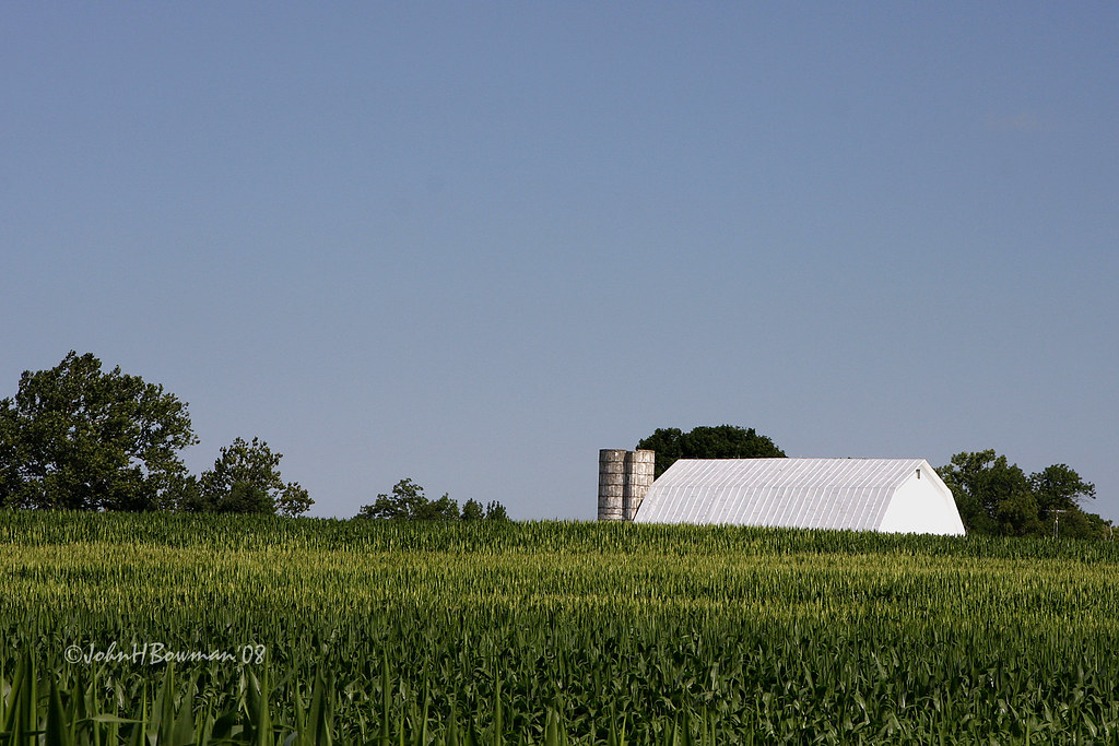
Red Barn and Soy Beans
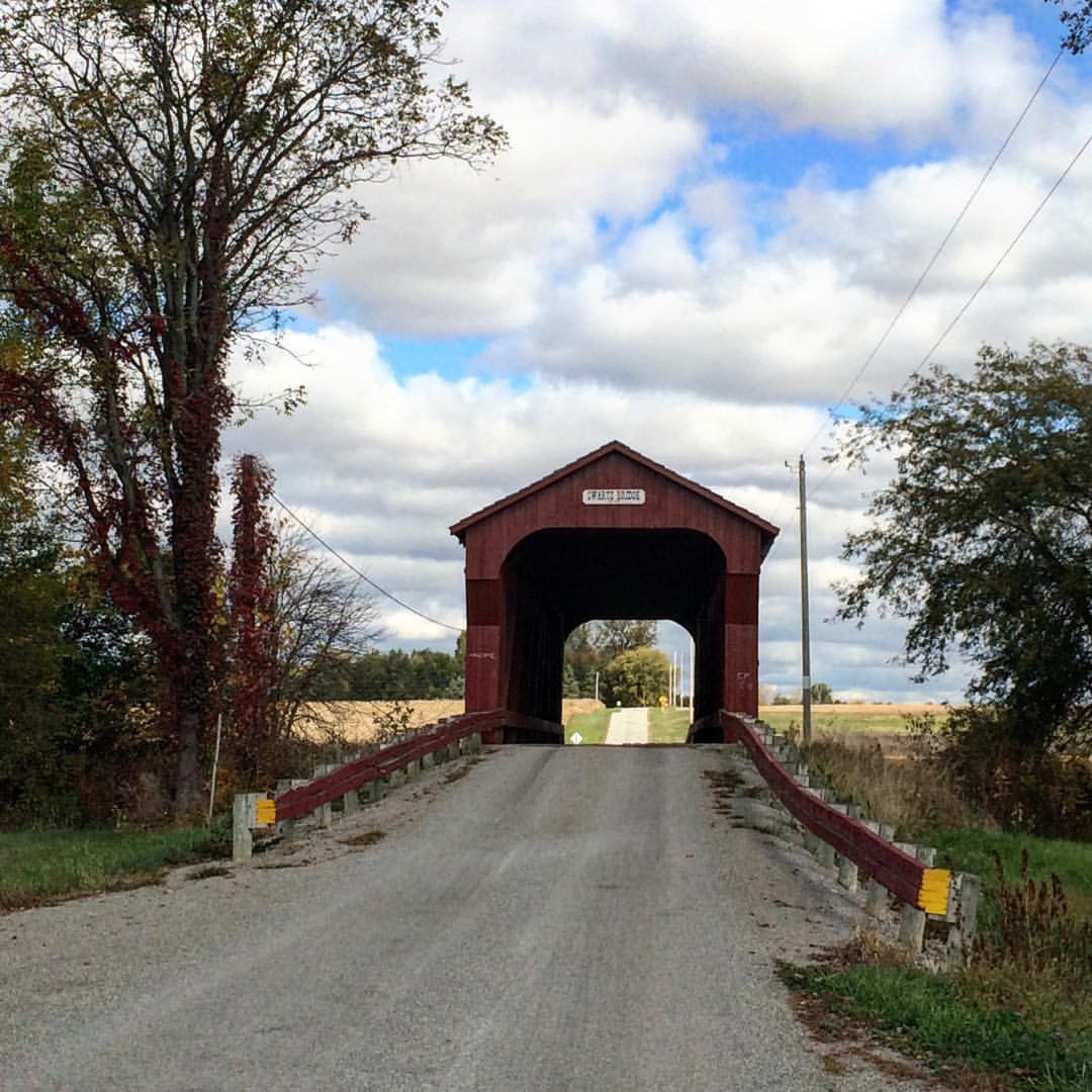
#Swartz #coveredbridge another stop on the #mybigfatcolandjerrweddingadventure #ohio #nwohio #tekkbabe859 #blondebetweenthemountains

juv. Turkey Vulture

juv. Turkey Vulture
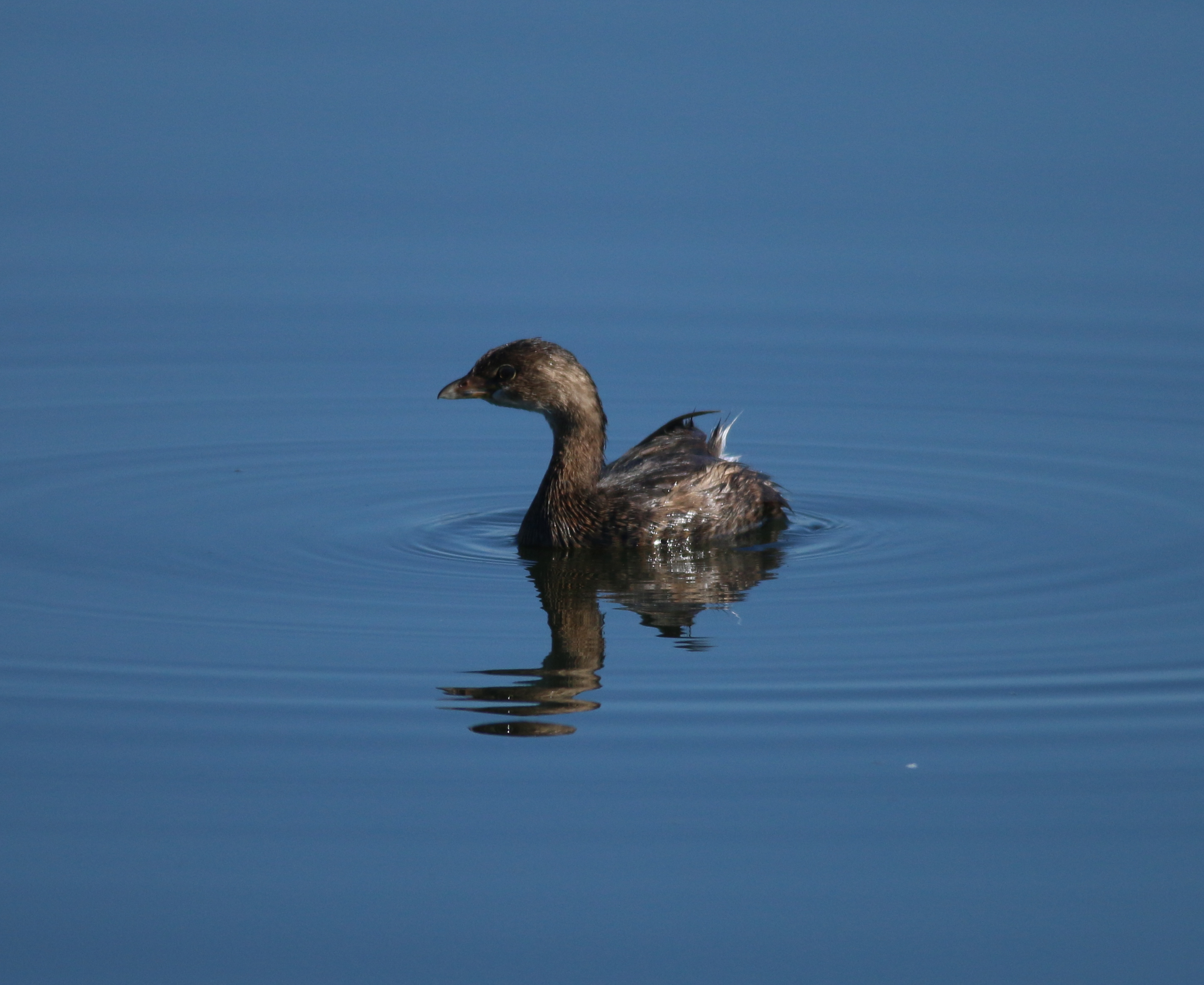
Pied-billed Grebe
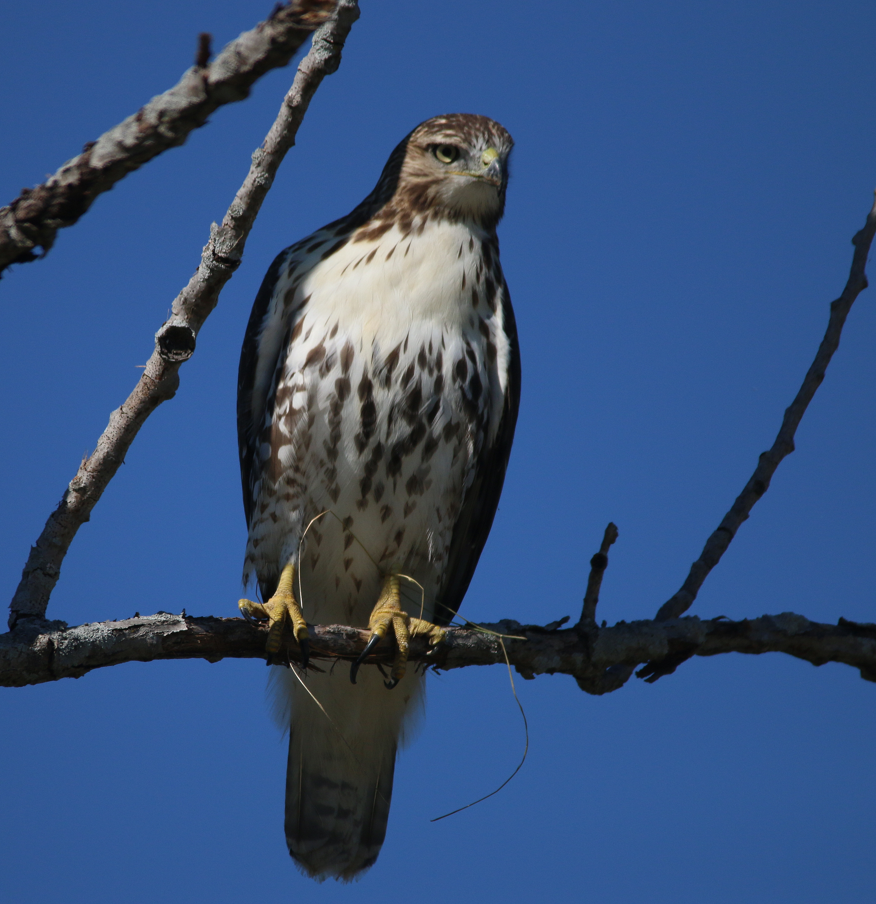
Red-tailed Hawk - juvenile
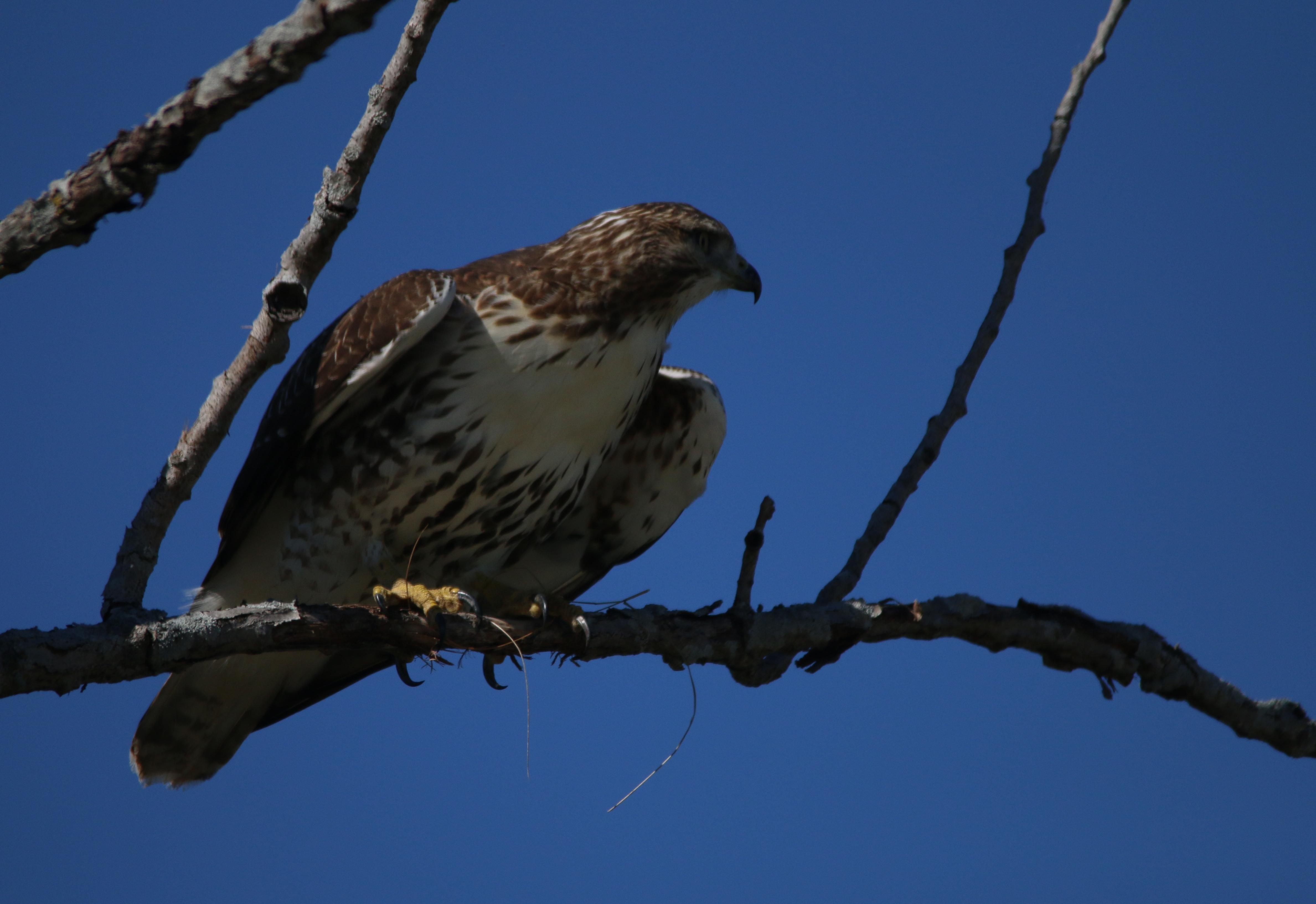
Red-tailed Hawk - juvenile
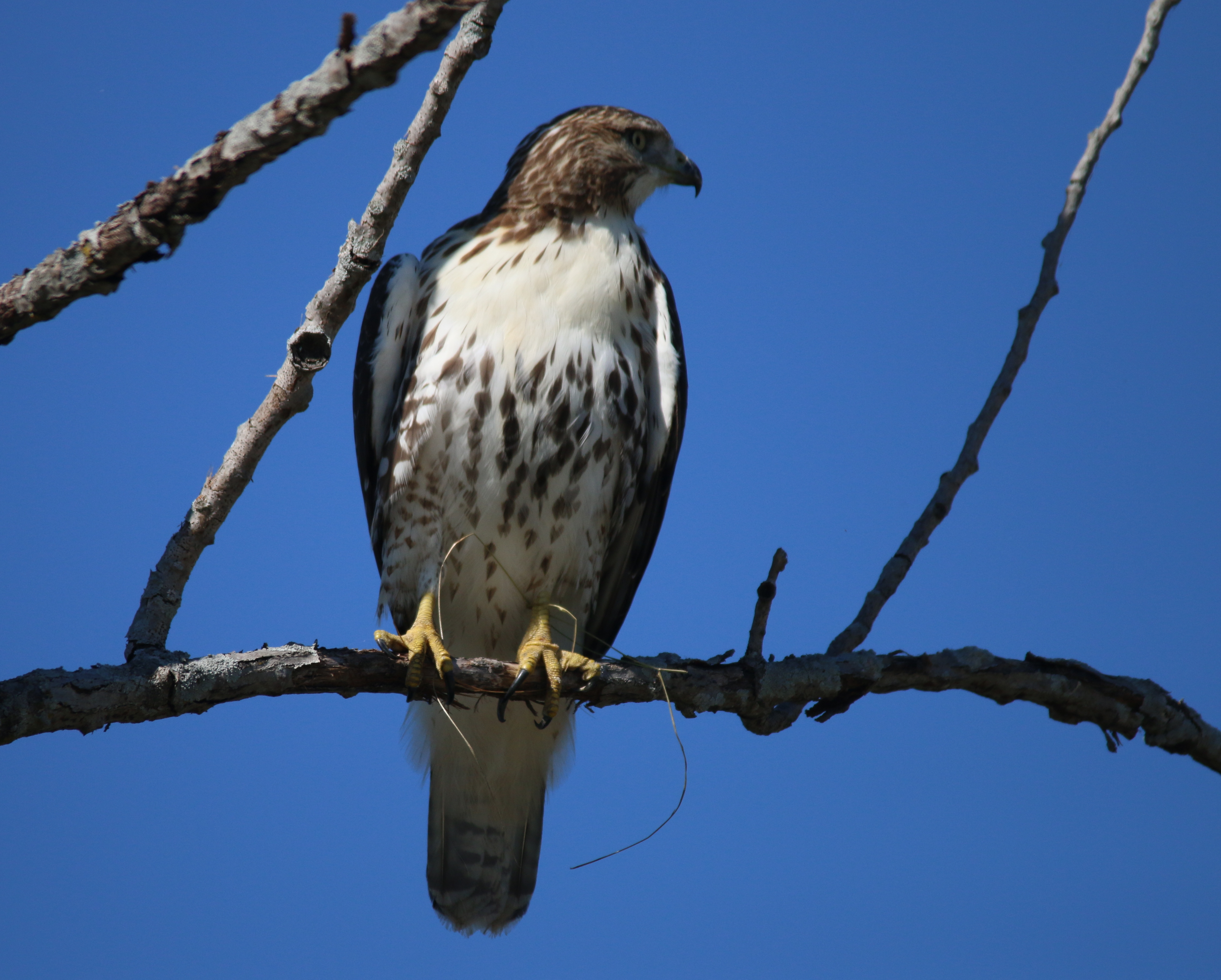
Red-tailed Hawk - juvenile
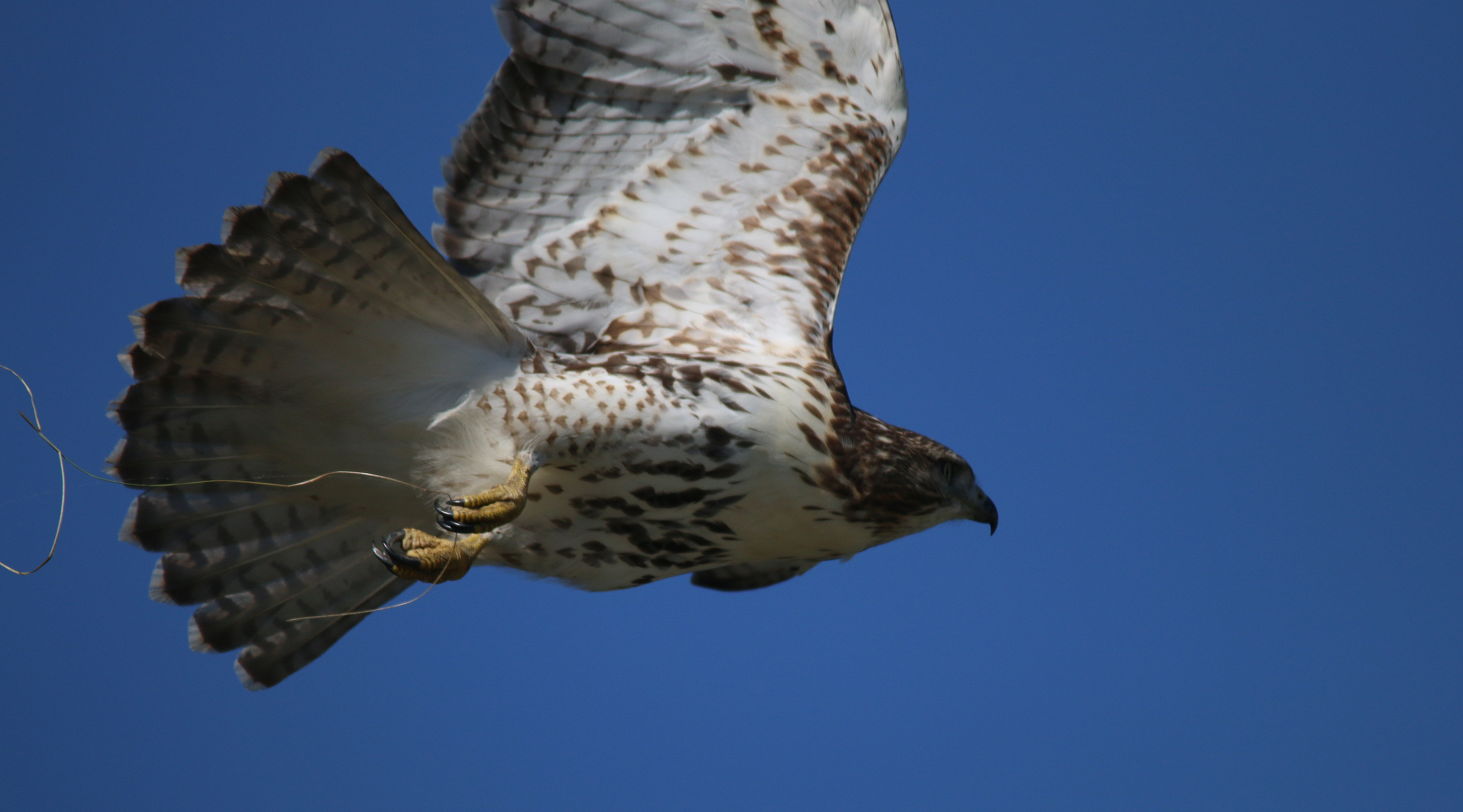
Red-tailed Hawk - juvenile
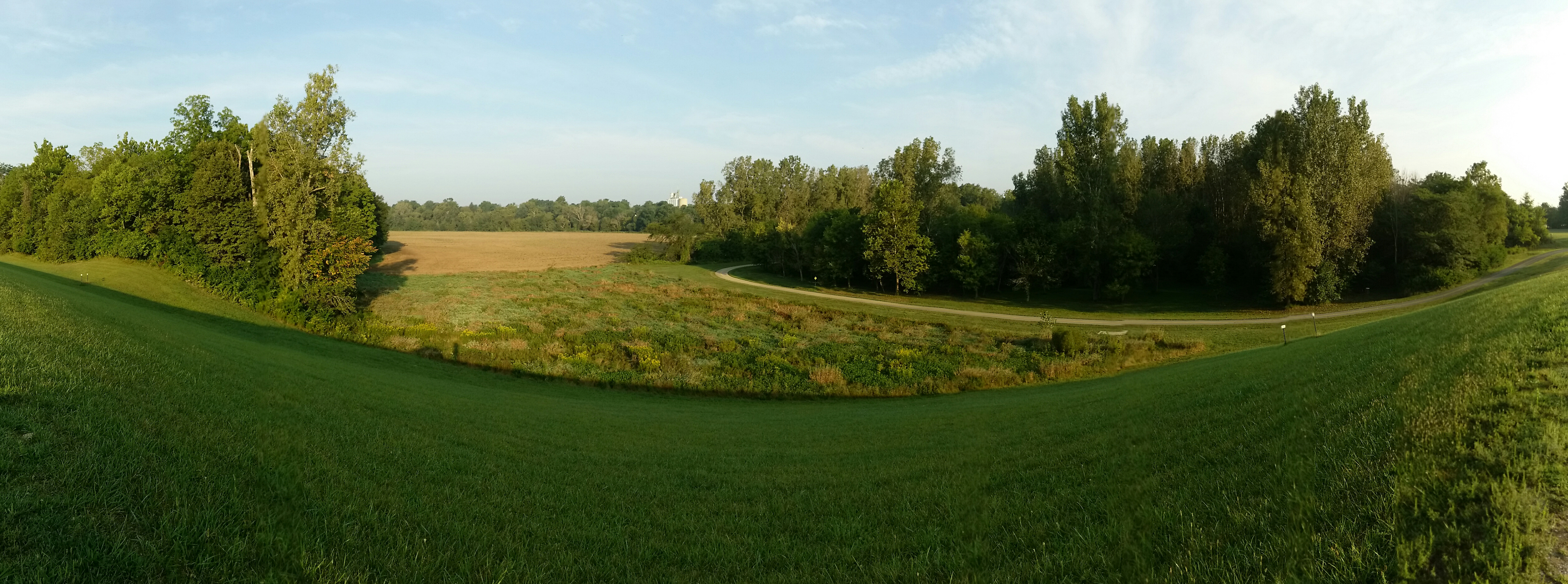
Upper Sandusky Bike Trail
Want some #flowers? Hit us up!

Thursday - Getting to Columbus

Thursday - Getting to Columbus
Co Hwy 44, Nevada, OH アメリカ合衆国の地図
別の場所を検索
近所の場所
アメリカ合衆国 オハイオ州 エデン
T-, Nevada, OH アメリカ合衆国
アメリカ合衆国 〒 オハイオ州 シカモア・タウンシップ
アメリカ合衆国 〒 オハイオ州 ネバダ
アメリカ合衆国 〒 オハイオ州 シカモア
アメリカ合衆国 オハイオ州 タイモックティー・タウンシップ
Spore Brandywine Rd, Bucyrus, OH アメリカ合衆国
Rivers Edge Ln, Upper Sandusky, OH アメリカ合衆国
アメリカ合衆国 〒 オハイオ州 クレーン・タウンシップ
Winding Hollow Ln, Upper Sandusky, OH アメリカ合衆国
Mission Dr, Upper Sandusky, OH アメリカ合衆国
E Bigelow St, Upper Sandusky, OH アメリカ合衆国
アメリカ合衆国 オハイオ州 ホルムズ
W Elm Dr, Upper Sandusky, OH アメリカ合衆国
アメリカ合衆国 〒 オハイオ州 アッパー・サンダスキー
Polaris Dr, Upper Sandusky, OH アメリカ合衆国
W Walker St, Upper Sandusky, OH アメリカ合衆国
Baker Dr, Upper Sandusky, OH アメリカ合衆国
Quaker Rd, Bucyrus, OH アメリカ合衆国
アメリカ合衆国 オハイオ州 クロウフォード
最近の検索
- アメリカ合衆国 アラスカ州 レッド・ドッグ・マイン日の出日の入り時間
- Am bhf, Borken, ドイツアム・バーンホーフ日の出日の入り時間
- 4th St E, Sonoma, CA, USA日の出日の入り時間
- Oakland Ave, Williamsport, PA アメリカ合衆国日の出日の入り時間
- Via Roma, Pieranica CR, イタリアローマ通り日の出日の入り時間
- クロアチア 〒 ドゥブロブニク GradClock Tower of Dubrovnik日の出日の入り時間
- アルゼンチン チュブ州 トレリュー日の出日の入り時間
- Hartfords Bluff Cir, Mt Pleasant, SC アメリカ合衆国日の出日の入り時間
- 日本、熊本県熊本市北区日の出日の入り時間
- 中華人民共和国 福州市 平潭県 平潭島日の出日の入り時間