アメリカ合衆国 〒 オレゴン州 ベイツ日の出日の入り時間
Location: アメリカ合衆国 > オレゴン州 > グラント >
時間帯:
America/Los_Angeles
現地時間:
2025-06-24 14:59:54
経度:
-118.5085558
緯度:
44.5929339
今日の日の出時刻:
05:10:20 AM
今日の日の入時刻:
08:43:24 PM
今日の日長:
15h 33m 4s
明日の日の出時刻:
05:10:45 AM
明日の日の入時刻:
08:43:25 PM
明日の日長:
15h 32m 40s
すべて表示する
| 日付 | 日出 | 日没 | 日長 |
|---|---|---|---|
| 2025年01月01日 | 07:30:44 AM | 04:25:46 PM | 8h 55m 2s |
| 2025年01月02日 | 07:30:42 AM | 04:26:44 PM | 8h 56m 2s |
| 2025年01月03日 | 07:30:37 AM | 04:27:43 PM | 8h 57m 6s |
| 2025年01月04日 | 07:30:30 AM | 04:28:43 PM | 8h 58m 13s |
| 2025年01月05日 | 07:30:20 AM | 04:29:46 PM | 8h 59m 26s |
| 2025年01月06日 | 07:30:07 AM | 04:30:50 PM | 9h 0m 43s |
| 2025年01月07日 | 07:29:52 AM | 04:31:56 PM | 9h 2m 4s |
| 2025年01月08日 | 07:29:35 AM | 04:33:03 PM | 9h 3m 28s |
| 2025年01月09日 | 07:29:15 AM | 04:34:11 PM | 9h 4m 56s |
| 2025年01月10日 | 07:28:52 AM | 04:35:21 PM | 9h 6m 29s |
| 2025年01月11日 | 07:28:27 AM | 04:36:32 PM | 9h 8m 5s |
| 2025年01月12日 | 07:27:59 AM | 04:37:44 PM | 9h 9m 45s |
| 2025年01月13日 | 07:27:29 AM | 04:38:58 PM | 9h 11m 29s |
| 2025年01月14日 | 07:26:57 AM | 04:40:12 PM | 9h 13m 15s |
| 2025年01月15日 | 07:26:22 AM | 04:41:28 PM | 9h 15m 6s |
| 2025年01月16日 | 07:25:45 AM | 04:42:44 PM | 9h 16m 59s |
| 2025年01月17日 | 07:25:05 AM | 04:44:02 PM | 9h 18m 57s |
| 2025年01月18日 | 07:24:24 AM | 04:45:20 PM | 9h 20m 56s |
| 2025年01月19日 | 07:23:40 AM | 04:46:39 PM | 9h 22m 59s |
| 2025年01月20日 | 07:22:53 AM | 04:47:59 PM | 9h 25m 6s |
| 2025年01月21日 | 07:22:05 AM | 04:49:20 PM | 9h 27m 15s |
| 2025年01月22日 | 07:21:14 AM | 04:50:41 PM | 9h 29m 27s |
| 2025年01月23日 | 07:20:21 AM | 04:52:02 PM | 9h 31m 41s |
| 2025年01月24日 | 07:19:26 AM | 04:53:24 PM | 9h 33m 58s |
| 2025年01月25日 | 07:18:29 AM | 04:54:47 PM | 9h 36m 18s |
| 2025年01月26日 | 07:17:30 AM | 04:56:10 PM | 9h 38m 40s |
| 2025年01月27日 | 07:16:29 AM | 04:57:34 PM | 9h 41m 5s |
| 2025年01月28日 | 07:15:26 AM | 04:58:57 PM | 9h 43m 31s |
| 2025年01月29日 | 07:14:21 AM | 05:00:21 PM | 9h 46m 0s |
| 2025年01月30日 | 07:13:15 AM | 05:01:46 PM | 9h 48m 31s |
| 2025年01月31日 | 07:12:06 AM | 05:03:10 PM | 9h 51m 4s |
| 2025年02月01日 | 07:10:56 AM | 05:04:35 PM | 9h 53m 39s |
| 2025年02月02日 | 07:09:44 AM | 05:05:59 PM | 9h 56m 15s |
| 2025年02月03日 | 07:08:30 AM | 05:07:24 PM | 9h 58m 54s |
| 2025年02月04日 | 07:07:15 AM | 05:08:49 PM | 10h 1m 34s |
| 2025年02月05日 | 07:05:57 AM | 05:10:14 PM | 10h 4m 17s |
| 2025年02月06日 | 07:04:39 AM | 05:11:39 PM | 10h 7m 0s |
| 2025年02月07日 | 07:03:19 AM | 05:13:03 PM | 10h 9m 44s |
| 2025年02月08日 | 07:01:57 AM | 05:14:28 PM | 10h 12m 31s |
| 2025年02月09日 | 07:00:34 AM | 05:15:53 PM | 10h 15m 19s |
| 2025年02月10日 | 06:59:09 AM | 05:17:17 PM | 10h 18m 8s |
| 2025年02月11日 | 06:57:43 AM | 05:18:42 PM | 10h 20m 59s |
| 2025年02月12日 | 06:56:16 AM | 05:20:06 PM | 10h 23m 50s |
| 2025年02月13日 | 06:54:48 AM | 05:21:30 PM | 10h 26m 42s |
| 2025年02月14日 | 06:53:18 AM | 05:22:54 PM | 10h 29m 36s |
| 2025年02月15日 | 06:51:47 AM | 05:24:17 PM | 10h 32m 30s |
| 2025年02月16日 | 06:50:14 AM | 05:25:41 PM | 10h 35m 27s |
| 2025年02月17日 | 06:48:41 AM | 05:27:04 PM | 10h 38m 23s |
| 2025年02月18日 | 06:47:07 AM | 05:28:27 PM | 10h 41m 20s |
| 2025年02月19日 | 06:45:31 AM | 05:29:49 PM | 10h 44m 18s |
| 2025年02月20日 | 06:43:55 AM | 05:31:12 PM | 10h 47m 17s |
| 2025年02月21日 | 06:42:17 AM | 05:32:34 PM | 10h 50m 17s |
| 2025年02月22日 | 06:40:38 AM | 05:33:56 PM | 10h 53m 18s |
| 2025年02月23日 | 06:38:59 AM | 05:35:17 PM | 10h 56m 18s |
| 2025年02月24日 | 06:37:19 AM | 05:36:39 PM | 10h 59m 20s |
| 2025年02月25日 | 06:35:37 AM | 05:38:00 PM | 11h 2m 23s |
| 2025年02月26日 | 06:33:56 AM | 05:39:21 PM | 11h 5m 25s |
| 2025年02月27日 | 06:32:13 AM | 05:40:41 PM | 11h 8m 28s |
| 2025年02月28日 | 06:30:29 AM | 05:42:01 PM | 11h 11m 32s |
| 2025年03月01日 | 06:28:45 AM | 05:43:21 PM | 11h 14m 36s |
| 2025年03月02日 | 06:27:00 AM | 05:44:41 PM | 11h 17m 41s |
| 2025年03月03日 | 06:25:15 AM | 05:46:00 PM | 11h 20m 45s |
| 2025年03月04日 | 06:23:29 AM | 05:47:19 PM | 11h 23m 50s |
| 2025年03月05日 | 06:21:42 AM | 05:48:38 PM | 11h 26m 56s |
| 2025年03月06日 | 06:19:55 AM | 05:49:56 PM | 11h 30m 1s |
| 2025年03月07日 | 06:18:07 AM | 05:51:15 PM | 11h 33m 8s |
| 2025年03月08日 | 06:16:19 AM | 05:52:33 PM | 11h 36m 14s |
| 2025年03月09日 | 07:14:35 AM | 06:53:47 PM | 11h 39m 12s |
| 2025年03月10日 | 07:12:46 AM | 06:55:05 PM | 11h 42m 19s |
| 2025年03月11日 | 07:10:56 AM | 06:56:22 PM | 11h 45m 26s |
| 2025年03月12日 | 07:09:07 AM | 06:57:39 PM | 11h 48m 32s |
| 2025年03月13日 | 07:07:17 AM | 06:58:56 PM | 11h 51m 39s |
| 2025年03月14日 | 07:05:26 AM | 07:00:13 PM | 11h 54m 47s |
| 2025年03月15日 | 07:03:36 AM | 07:01:29 PM | 11h 57m 53s |
| 2025年03月16日 | 07:01:45 AM | 07:02:45 PM | 12h 1m 0s |
| 2025年03月17日 | 06:59:54 AM | 07:04:02 PM | 12h 4m 8s |
| 2025年03月18日 | 06:58:03 AM | 07:05:18 PM | 12h 7m 15s |
| 2025年03月19日 | 06:56:12 AM | 07:06:33 PM | 12h 10m 21s |
| 2025年03月20日 | 06:54:20 AM | 07:07:49 PM | 12h 13m 29s |
| 2025年03月21日 | 06:52:29 AM | 07:09:05 PM | 12h 16m 36s |
| 2025年03月22日 | 06:50:38 AM | 07:10:20 PM | 12h 19m 42s |
| 2025年03月23日 | 06:48:46 AM | 07:11:35 PM | 12h 22m 49s |
| 2025年03月24日 | 06:46:55 AM | 07:12:50 PM | 12h 25m 55s |
| 2025年03月25日 | 06:45:03 AM | 07:14:05 PM | 12h 29m 2s |
| 2025年03月26日 | 06:43:12 AM | 07:15:20 PM | 12h 32m 8s |
| 2025年03月27日 | 06:41:21 AM | 07:16:35 PM | 12h 35m 14s |
| 2025年03月28日 | 06:39:30 AM | 07:17:50 PM | 12h 38m 20s |
| 2025年03月29日 | 06:37:40 AM | 07:19:05 PM | 12h 41m 25s |
| 2025年03月30日 | 06:35:49 AM | 07:20:20 PM | 12h 44m 31s |
| 2025年03月31日 | 06:33:59 AM | 07:21:34 PM | 12h 47m 35s |
| 2025年04月01日 | 06:32:09 AM | 07:22:49 PM | 12h 50m 40s |
| 2025年04月02日 | 06:30:19 AM | 07:24:04 PM | 12h 53m 45s |
| 2025年04月03日 | 06:28:30 AM | 07:25:18 PM | 12h 56m 48s |
| 2025年04月04日 | 06:26:41 AM | 07:26:33 PM | 12h 59m 52s |
| 2025年04月05日 | 06:24:52 AM | 07:27:47 PM | 13h 2m 55s |
| 2025年04月06日 | 06:23:04 AM | 07:29:02 PM | 13h 5m 58s |
| 2025年04月07日 | 06:21:17 AM | 07:30:16 PM | 13h 8m 59s |
| 2025年04月08日 | 06:19:30 AM | 07:31:31 PM | 13h 12m 1s |
| 2025年04月09日 | 06:17:43 AM | 07:32:45 PM | 13h 15m 2s |
| 2025年04月10日 | 06:15:57 AM | 07:34:00 PM | 13h 18m 3s |
| 2025年04月11日 | 06:14:12 AM | 07:35:14 PM | 13h 21m 2s |
| 2025年04月12日 | 06:12:27 AM | 07:36:29 PM | 13h 24m 2s |
| 2025年04月13日 | 06:10:43 AM | 07:37:43 PM | 13h 27m 0s |
| 2025年04月14日 | 06:08:59 AM | 07:38:58 PM | 13h 29m 59s |
| 2025年04月15日 | 06:07:17 AM | 07:40:12 PM | 13h 32m 55s |
| 2025年04月16日 | 06:05:35 AM | 07:41:27 PM | 13h 35m 52s |
| 2025年04月17日 | 06:03:54 AM | 07:42:41 PM | 13h 38m 47s |
| 2025年04月18日 | 06:02:13 AM | 07:43:55 PM | 13h 41m 42s |
| 2025年04月19日 | 06:00:34 AM | 07:45:10 PM | 13h 44m 36s |
| 2025年04月20日 | 05:58:55 AM | 07:46:24 PM | 13h 47m 29s |
| 2025年04月21日 | 05:57:18 AM | 07:47:39 PM | 13h 50m 21s |
| 2025年04月22日 | 05:55:41 AM | 07:48:53 PM | 13h 53m 12s |
| 2025年04月23日 | 05:54:05 AM | 07:50:07 PM | 13h 56m 2s |
| 2025年04月24日 | 05:52:31 AM | 07:51:21 PM | 13h 58m 50s |
| 2025年04月25日 | 05:50:57 AM | 07:52:35 PM | 14h 1m 38s |
| 2025年04月26日 | 05:49:25 AM | 07:53:49 PM | 14h 4m 24s |
| 2025年04月27日 | 05:47:54 AM | 07:55:03 PM | 14h 7m 9s |
| 2025年04月28日 | 05:46:24 AM | 07:56:16 PM | 14h 9m 52s |
| 2025年04月29日 | 05:44:55 AM | 07:57:30 PM | 14h 12m 35s |
| 2025年04月30日 | 05:43:27 AM | 07:58:43 PM | 14h 15m 16s |
| 2025年05月01日 | 05:42:01 AM | 07:59:56 PM | 14h 17m 55s |
| 2025年05月02日 | 05:40:36 AM | 08:01:09 PM | 14h 20m 33s |
| 2025年05月03日 | 05:39:12 AM | 08:02:22 PM | 14h 23m 10s |
| 2025年05月04日 | 05:37:50 AM | 08:03:34 PM | 14h 25m 44s |
| 2025年05月05日 | 05:36:29 AM | 08:04:46 PM | 14h 28m 17s |
| 2025年05月06日 | 05:35:10 AM | 08:05:58 PM | 14h 30m 48s |
| 2025年05月07日 | 05:33:52 AM | 08:07:09 PM | 14h 33m 17s |
| 2025年05月08日 | 05:32:36 AM | 08:08:20 PM | 14h 35m 44s |
| 2025年05月09日 | 05:31:21 AM | 08:09:31 PM | 14h 38m 10s |
| 2025年05月10日 | 05:30:08 AM | 08:10:41 PM | 14h 40m 33s |
| 2025年05月11日 | 05:28:57 AM | 08:11:50 PM | 14h 42m 53s |
| 2025年05月12日 | 05:27:47 AM | 08:12:59 PM | 14h 45m 12s |
| 2025年05月13日 | 05:26:39 AM | 08:14:07 PM | 14h 47m 28s |
| 2025年05月14日 | 05:25:32 AM | 08:15:15 PM | 14h 49m 43s |
| 2025年05月15日 | 05:24:28 AM | 08:16:22 PM | 14h 51m 54s |
| 2025年05月16日 | 05:23:25 AM | 08:17:29 PM | 14h 54m 4s |
| 2025年05月17日 | 05:22:24 AM | 08:18:35 PM | 14h 56m 11s |
| 2025年05月18日 | 05:21:25 AM | 08:19:39 PM | 14h 58m 14s |
| 2025年05月19日 | 05:20:28 AM | 08:20:44 PM | 15h 0m 16s |
| 2025年05月20日 | 05:19:33 AM | 08:21:47 PM | 15h 2m 14s |
| 2025年05月21日 | 05:18:40 AM | 08:22:49 PM | 15h 4m 9s |
| 2025年05月22日 | 05:17:49 AM | 08:23:50 PM | 15h 6m 1s |
| 2025年05月23日 | 05:17:00 AM | 08:24:51 PM | 15h 7m 51s |
| 2025年05月24日 | 05:16:13 AM | 08:25:50 PM | 15h 9m 37s |
| 2025年05月25日 | 05:15:28 AM | 08:26:48 PM | 15h 11m 20s |
| 2025年05月26日 | 05:14:45 AM | 08:27:45 PM | 15h 13m 0s |
| 2025年05月27日 | 05:14:04 AM | 08:28:41 PM | 15h 14m 37s |
| 2025年05月28日 | 05:13:25 AM | 08:29:35 PM | 15h 16m 10s |
| 2025年05月29日 | 05:12:49 AM | 08:30:29 PM | 15h 17m 40s |
| 2025年05月30日 | 05:12:15 AM | 08:31:20 PM | 15h 19m 5s |
| 2025年05月31日 | 05:11:43 AM | 08:32:11 PM | 15h 20m 28s |
| 2025年06月01日 | 05:11:13 AM | 08:33:00 PM | 15h 21m 47s |
| 2025年06月02日 | 05:10:45 AM | 08:33:47 PM | 15h 23m 2s |
| 2025年06月03日 | 05:10:20 AM | 08:34:33 PM | 15h 24m 13s |
| 2025年06月04日 | 05:09:57 AM | 08:35:18 PM | 15h 25m 21s |
| 2025年06月05日 | 05:09:36 AM | 08:36:00 PM | 15h 26m 24s |
| 2025年06月06日 | 05:09:18 AM | 08:36:41 PM | 15h 27m 23s |
| 2025年06月07日 | 05:09:02 AM | 08:37:21 PM | 15h 28m 19s |
| 2025年06月08日 | 05:08:48 AM | 08:37:58 PM | 15h 29m 10s |
| 2025年06月09日 | 05:08:36 AM | 08:38:34 PM | 15h 29m 58s |
| 2025年06月10日 | 05:08:27 AM | 08:39:07 PM | 15h 30m 40s |
| 2025年06月11日 | 05:08:20 AM | 08:39:39 PM | 15h 31m 19s |
| 2025年06月12日 | 05:08:15 AM | 08:40:09 PM | 15h 31m 54s |
| 2025年06月13日 | 05:08:13 AM | 08:40:37 PM | 15h 32m 24s |
| 2025年06月14日 | 05:08:13 AM | 08:41:03 PM | 15h 32m 50s |
| 2025年06月15日 | 05:08:15 AM | 08:41:27 PM | 15h 33m 12s |
| 2025年06月16日 | 05:08:19 AM | 08:41:48 PM | 15h 33m 29s |
| 2025年06月17日 | 05:08:26 AM | 08:42:08 PM | 15h 33m 42s |
| 2025年06月18日 | 05:08:34 AM | 08:42:25 PM | 15h 33m 51s |
| 2025年06月19日 | 05:08:45 AM | 08:42:40 PM | 15h 33m 55s |
| 2025年06月20日 | 05:08:58 AM | 08:42:53 PM | 15h 33m 55s |
| 2025年06月21日 | 05:09:14 AM | 08:43:04 PM | 15h 33m 50s |
| 2025年06月22日 | 05:09:31 AM | 08:43:13 PM | 15h 33m 42s |
| 2025年06月23日 | 05:09:50 AM | 08:43:19 PM | 15h 33m 29s |
| 2025年06月24日 | 05:10:12 AM | 08:43:23 PM | 15h 33m 11s |
| 2025年06月25日 | 05:10:35 AM | 08:43:25 PM | 15h 32m 50s |
| 2025年06月26日 | 05:11:01 AM | 08:43:24 PM | 15h 32m 23s |
| 2025年06月27日 | 05:11:28 AM | 08:43:21 PM | 15h 31m 53s |
| 2025年06月28日 | 05:11:58 AM | 08:43:16 PM | 15h 31m 18s |
| 2025年06月29日 | 05:12:29 AM | 08:43:08 PM | 15h 30m 39s |
| 2025年06月30日 | 05:13:02 AM | 08:42:58 PM | 15h 29m 56s |
| 2025年07月01日 | 05:13:37 AM | 08:42:46 PM | 15h 29m 9s |
| 2025年07月02日 | 05:14:14 AM | 08:42:31 PM | 15h 28m 17s |
| 2025年07月03日 | 05:14:52 AM | 08:42:14 PM | 15h 27m 22s |
| 2025年07月04日 | 05:15:32 AM | 08:41:55 PM | 15h 26m 23s |
| 2025年07月05日 | 05:16:14 AM | 08:41:33 PM | 15h 25m 19s |
| 2025年07月06日 | 05:16:57 AM | 08:41:10 PM | 15h 24m 13s |
| 2025年07月07日 | 05:17:41 AM | 08:40:43 PM | 15h 23m 2s |
| 2025年07月08日 | 05:18:28 AM | 08:40:15 PM | 15h 21m 47s |
| 2025年07月09日 | 05:19:15 AM | 08:39:44 PM | 15h 20m 29s |
| 2025年07月10日 | 05:20:04 AM | 08:39:11 PM | 15h 19m 7s |
| 2025年07月11日 | 05:20:54 AM | 08:38:36 PM | 15h 17m 42s |
| 2025年07月12日 | 05:21:46 AM | 08:37:58 PM | 15h 16m 12s |
| 2025年07月13日 | 05:22:39 AM | 08:37:19 PM | 15h 14m 40s |
| 2025年07月14日 | 05:23:33 AM | 08:36:37 PM | 15h 13m 4s |
| 2025年07月15日 | 05:24:28 AM | 08:35:53 PM | 15h 11m 25s |
| 2025年07月16日 | 05:25:24 AM | 08:35:06 PM | 15h 9m 42s |
| 2025年07月17日 | 05:26:21 AM | 08:34:18 PM | 15h 7m 57s |
| 2025年07月18日 | 05:27:19 AM | 08:33:28 PM | 15h 6m 9s |
| 2025年07月19日 | 05:28:19 AM | 08:32:36 PM | 15h 4m 17s |
| 2025年07月20日 | 05:29:19 AM | 08:31:41 PM | 15h 2m 22s |
| 2025年07月21日 | 05:30:19 AM | 08:30:45 PM | 15h 0m 26s |
| 2025年07月22日 | 05:31:21 AM | 08:29:46 PM | 14h 58m 25s |
| 2025年07月23日 | 05:32:23 AM | 08:28:46 PM | 14h 56m 23s |
| 2025年07月24日 | 05:33:27 AM | 08:27:44 PM | 14h 54m 17s |
| 2025年07月25日 | 05:34:30 AM | 08:26:40 PM | 14h 52m 10s |
| 2025年07月26日 | 05:35:35 AM | 08:25:34 PM | 14h 49m 59s |
| 2025年07月27日 | 05:36:40 AM | 08:24:27 PM | 14h 47m 47s |
| 2025年07月28日 | 05:37:45 AM | 08:23:17 PM | 14h 45m 32s |
| 2025年07月29日 | 05:38:51 AM | 08:22:06 PM | 14h 43m 15s |
| 2025年07月30日 | 05:39:58 AM | 08:20:53 PM | 14h 40m 55s |
| 2025年07月31日 | 05:41:05 AM | 08:19:39 PM | 14h 38m 34s |
| 2025年08月01日 | 05:42:12 AM | 08:18:23 PM | 14h 36m 11s |
| 2025年08月02日 | 05:43:20 AM | 08:17:05 PM | 14h 33m 45s |
| 2025年08月03日 | 05:44:28 AM | 08:15:46 PM | 14h 31m 18s |
| 2025年08月04日 | 05:45:36 AM | 08:14:25 PM | 14h 28m 49s |
| 2025年08月05日 | 05:46:45 AM | 08:13:03 PM | 14h 26m 18s |
| 2025年08月06日 | 05:47:54 AM | 08:11:40 PM | 14h 23m 46s |
| 2025年08月07日 | 05:49:03 AM | 08:10:15 PM | 14h 21m 12s |
| 2025年08月08日 | 05:50:12 AM | 08:08:48 PM | 14h 18m 36s |
| 2025年08月09日 | 05:51:21 AM | 08:07:21 PM | 14h 16m 0s |
| 2025年08月10日 | 05:52:31 AM | 08:05:52 PM | 14h 13m 21s |
| 2025年08月11日 | 05:53:41 AM | 08:04:21 PM | 14h 10m 40s |
| 2025年08月12日 | 05:54:51 AM | 08:02:50 PM | 14h 7m 59s |
| 2025年08月13日 | 05:56:01 AM | 08:01:17 PM | 14h 5m 16s |
| 2025年08月14日 | 05:57:11 AM | 07:59:43 PM | 14h 2m 32s |
| 2025年08月15日 | 05:58:21 AM | 07:58:08 PM | 13h 59m 47s |
| 2025年08月16日 | 05:59:31 AM | 07:56:32 PM | 13h 57m 1s |
| 2025年08月17日 | 06:00:41 AM | 07:54:55 PM | 13h 54m 14s |
| 2025年08月18日 | 06:01:52 AM | 07:53:17 PM | 13h 51m 25s |
| 2025年08月19日 | 06:03:02 AM | 07:51:38 PM | 13h 48m 36s |
| 2025年08月20日 | 06:04:12 AM | 07:49:58 PM | 13h 45m 46s |
| 2025年08月21日 | 06:05:22 AM | 07:48:17 PM | 13h 42m 55s |
| 2025年08月22日 | 06:06:33 AM | 07:46:36 PM | 13h 40m 3s |
| 2025年08月23日 | 06:07:43 AM | 07:44:53 PM | 13h 37m 10s |
| 2025年08月24日 | 06:08:53 AM | 07:43:10 PM | 13h 34m 17s |
| 2025年08月25日 | 06:10:03 AM | 07:41:26 PM | 13h 31m 23s |
| 2025年08月26日 | 06:11:13 AM | 07:39:41 PM | 13h 28m 28s |
| 2025年08月27日 | 06:12:23 AM | 07:37:55 PM | 13h 25m 32s |
| 2025年08月28日 | 06:13:34 AM | 07:36:09 PM | 13h 22m 35s |
| 2025年08月29日 | 06:14:44 AM | 07:34:22 PM | 13h 19m 38s |
| 2025年08月30日 | 06:15:54 AM | 07:32:34 PM | 13h 16m 40s |
| 2025年08月31日 | 06:17:04 AM | 07:30:46 PM | 13h 13m 42s |
| 2025年09月01日 | 06:18:14 AM | 07:28:57 PM | 13h 10m 43s |
| 2025年09月02日 | 06:19:24 AM | 07:27:08 PM | 13h 7m 44s |
| 2025年09月03日 | 06:20:34 AM | 07:25:18 PM | 13h 4m 44s |
| 2025年09月04日 | 06:21:44 AM | 07:23:28 PM | 13h 1m 44s |
| 2025年09月05日 | 06:22:53 AM | 07:21:38 PM | 12h 58m 45s |
| 2025年09月06日 | 06:24:03 AM | 07:19:47 PM | 12h 55m 44s |
| 2025年09月07日 | 06:25:13 AM | 07:17:55 PM | 12h 52m 42s |
| 2025年09月08日 | 06:26:23 AM | 07:16:04 PM | 12h 49m 41s |
| 2025年09月09日 | 06:27:33 AM | 07:14:12 PM | 12h 46m 39s |
| 2025年09月10日 | 06:28:43 AM | 07:12:19 PM | 12h 43m 36s |
| 2025年09月11日 | 06:29:53 AM | 07:10:27 PM | 12h 40m 34s |
| 2025年09月12日 | 06:31:03 AM | 07:08:34 PM | 12h 37m 31s |
| 2025年09月13日 | 06:32:13 AM | 07:06:41 PM | 12h 34m 28s |
| 2025年09月14日 | 06:33:24 AM | 07:04:48 PM | 12h 31m 24s |
| 2025年09月15日 | 06:34:34 AM | 07:02:55 PM | 12h 28m 21s |
| 2025年09月16日 | 06:35:44 AM | 07:01:02 PM | 12h 25m 18s |
| 2025年09月17日 | 06:36:55 AM | 06:59:09 PM | 12h 22m 14s |
| 2025年09月18日 | 06:38:05 AM | 06:57:15 PM | 12h 19m 10s |
| 2025年09月19日 | 06:39:16 AM | 06:55:22 PM | 12h 16m 6s |
| 2025年09月20日 | 06:40:26 AM | 06:53:29 PM | 12h 13m 3s |
| 2025年09月21日 | 06:41:37 AM | 06:51:36 PM | 12h 9m 59s |
| 2025年09月22日 | 06:42:48 AM | 06:49:42 PM | 12h 6m 54s |
| 2025年09月23日 | 06:44:00 AM | 06:47:49 PM | 12h 3m 49s |
| 2025年09月24日 | 06:45:11 AM | 06:45:57 PM | 12h 0m 46s |
| 2025年09月25日 | 06:46:22 AM | 06:44:04 PM | 11h 57m 42s |
| 2025年09月26日 | 06:47:34 AM | 06:42:11 PM | 11h 54m 37s |
| 2025年09月27日 | 06:48:46 AM | 06:40:19 PM | 11h 51m 33s |
| 2025年09月28日 | 06:49:58 AM | 06:38:27 PM | 11h 48m 29s |
| 2025年09月29日 | 06:51:10 AM | 06:36:36 PM | 11h 45m 26s |
| 2025年09月30日 | 06:52:23 AM | 06:34:44 PM | 11h 42m 21s |
| 2025年10月01日 | 06:53:36 AM | 06:32:53 PM | 11h 39m 17s |
| 2025年10月02日 | 06:54:49 AM | 06:31:03 PM | 11h 36m 14s |
| 2025年10月03日 | 06:56:02 AM | 06:29:13 PM | 11h 33m 11s |
| 2025年10月04日 | 06:57:16 AM | 06:27:23 PM | 11h 30m 7s |
| 2025年10月05日 | 06:58:29 AM | 06:25:34 PM | 11h 27m 5s |
| 2025年10月06日 | 06:59:44 AM | 06:23:45 PM | 11h 24m 1s |
| 2025年10月07日 | 07:00:58 AM | 06:21:57 PM | 11h 20m 59s |
| 2025年10月08日 | 07:02:13 AM | 06:20:10 PM | 11h 17m 57s |
| 2025年10月09日 | 07:03:28 AM | 06:18:23 PM | 11h 14m 55s |
| 2025年10月10日 | 07:04:43 AM | 06:16:37 PM | 11h 11m 54s |
| 2025年10月11日 | 07:05:58 AM | 06:14:51 PM | 11h 8m 53s |
| 2025年10月12日 | 07:07:14 AM | 06:13:06 PM | 11h 5m 52s |
| 2025年10月13日 | 07:08:30 AM | 06:11:22 PM | 11h 2m 52s |
| 2025年10月14日 | 07:09:47 AM | 06:09:39 PM | 10h 59m 52s |
| 2025年10月15日 | 07:11:04 AM | 06:07:57 PM | 10h 56m 53s |
| 2025年10月16日 | 07:12:21 AM | 06:06:15 PM | 10h 53m 54s |
| 2025年10月17日 | 07:13:38 AM | 06:04:35 PM | 10h 50m 57s |
| 2025年10月18日 | 07:14:56 AM | 06:02:55 PM | 10h 47m 59s |
| 2025年10月19日 | 07:16:14 AM | 06:01:16 PM | 10h 45m 2s |
| 2025年10月20日 | 07:17:32 AM | 05:59:38 PM | 10h 42m 6s |
| 2025年10月21日 | 07:18:51 AM | 05:58:02 PM | 10h 39m 11s |
| 2025年10月22日 | 07:20:10 AM | 05:56:26 PM | 10h 36m 16s |
| 2025年10月23日 | 07:21:29 AM | 05:54:52 PM | 10h 33m 23s |
| 2025年10月24日 | 07:22:48 AM | 05:53:19 PM | 10h 30m 31s |
| 2025年10月25日 | 07:24:08 AM | 05:51:46 PM | 10h 27m 38s |
| 2025年10月26日 | 07:25:28 AM | 05:50:16 PM | 10h 24m 48s |
| 2025年10月27日 | 07:26:48 AM | 05:48:46 PM | 10h 21m 58s |
| 2025年10月28日 | 07:28:08 AM | 05:47:18 PM | 10h 19m 10s |
| 2025年10月29日 | 07:29:29 AM | 05:45:51 PM | 10h 16m 22s |
| 2025年10月30日 | 07:30:50 AM | 05:44:25 PM | 10h 13m 35s |
| 2025年10月31日 | 07:32:10 AM | 05:43:01 PM | 10h 10m 51s |
| 2025年11月01日 | 07:33:31 AM | 05:41:39 PM | 10h 8m 8s |
| 2025年11月02日 | 06:34:56 AM | 04:40:14 PM | 10h 5m 18s |
| 2025年11月03日 | 06:36:17 AM | 04:38:55 PM | 10h 2m 38s |
| 2025年11月04日 | 06:37:38 AM | 04:37:37 PM | 9h 59m 59s |
| 2025年11月05日 | 06:39:00 AM | 04:36:21 PM | 9h 57m 21s |
| 2025年11月06日 | 06:40:21 AM | 04:35:06 PM | 9h 54m 45s |
| 2025年11月07日 | 06:41:42 AM | 04:33:53 PM | 9h 52m 11s |
| 2025年11月08日 | 06:43:03 AM | 04:32:42 PM | 9h 49m 39s |
| 2025年11月09日 | 06:44:25 AM | 04:31:33 PM | 9h 47m 8s |
| 2025年11月10日 | 06:45:45 AM | 04:30:26 PM | 9h 44m 41s |
| 2025年11月11日 | 06:47:06 AM | 04:29:20 PM | 9h 42m 14s |
| 2025年11月12日 | 06:48:27 AM | 04:28:16 PM | 9h 39m 49s |
| 2025年11月13日 | 06:49:47 AM | 04:27:15 PM | 9h 37m 28s |
| 2025年11月14日 | 06:51:07 AM | 04:26:15 PM | 9h 35m 8s |
| 2025年11月15日 | 06:52:26 AM | 04:25:18 PM | 9h 32m 52s |
| 2025年11月16日 | 06:53:46 AM | 04:24:22 PM | 9h 30m 36s |
| 2025年11月17日 | 06:55:04 AM | 04:23:29 PM | 9h 28m 25s |
| 2025年11月18日 | 06:56:23 AM | 04:22:37 PM | 9h 26m 14s |
| 2025年11月19日 | 06:57:40 AM | 04:21:48 PM | 9h 24m 8s |
| 2025年11月20日 | 06:58:57 AM | 04:21:02 PM | 9h 22m 5s |
| 2025年11月21日 | 07:00:14 AM | 04:20:17 PM | 9h 20m 3s |
| 2025年11月22日 | 07:01:29 AM | 04:19:35 PM | 9h 18m 6s |
| 2025年11月23日 | 07:02:44 AM | 04:18:55 PM | 9h 16m 11s |
| 2025年11月24日 | 07:03:58 AM | 04:18:17 PM | 9h 14m 19s |
| 2025年11月25日 | 07:05:11 AM | 04:17:42 PM | 9h 12m 31s |
| 2025年11月26日 | 07:06:23 AM | 04:17:09 PM | 9h 10m 46s |
| 2025年11月27日 | 07:07:34 AM | 04:16:39 PM | 9h 9m 5s |
| 2025年11月28日 | 07:08:44 AM | 04:16:11 PM | 9h 7m 27s |
| 2025年11月29日 | 07:09:53 AM | 04:15:46 PM | 9h 5m 53s |
| 2025年11月30日 | 07:11:01 AM | 04:15:23 PM | 9h 4m 22s |
| 2025年12月01日 | 07:12:07 AM | 04:15:03 PM | 9h 2m 56s |
| 2025年12月02日 | 07:13:12 AM | 04:14:45 PM | 9h 1m 33s |
| 2025年12月03日 | 07:14:16 AM | 04:14:30 PM | 9h 0m 14s |
| 2025年12月04日 | 07:15:18 AM | 04:14:17 PM | 8h 58m 59s |
| 2025年12月05日 | 07:16:19 AM | 04:14:07 PM | 8h 57m 48s |
| 2025年12月06日 | 07:17:18 AM | 04:14:00 PM | 8h 56m 42s |
| 2025年12月07日 | 07:18:15 AM | 04:13:55 PM | 8h 55m 40s |
| 2025年12月08日 | 07:19:11 AM | 04:13:53 PM | 8h 54m 42s |
| 2025年12月09日 | 07:20:05 AM | 04:13:54 PM | 8h 53m 49s |
| 2025年12月10日 | 07:20:57 AM | 04:13:57 PM | 8h 53m 0s |
| 2025年12月11日 | 07:21:47 AM | 04:14:03 PM | 8h 52m 16s |
| 2025年12月12日 | 07:22:35 AM | 04:14:11 PM | 8h 51m 36s |
| 2025年12月13日 | 07:23:21 AM | 04:14:22 PM | 8h 51m 1s |
| 2025年12月14日 | 07:24:05 AM | 04:14:36 PM | 8h 50m 31s |
| 2025年12月15日 | 07:24:47 AM | 04:14:52 PM | 8h 50m 5s |
| 2025年12月16日 | 07:25:27 AM | 04:15:11 PM | 8h 49m 44s |
| 2025年12月17日 | 07:26:05 AM | 04:15:32 PM | 8h 49m 27s |
| 2025年12月18日 | 07:26:41 AM | 04:15:56 PM | 8h 49m 15s |
| 2025年12月19日 | 07:27:14 AM | 04:16:22 PM | 8h 49m 8s |
| 2025年12月20日 | 07:27:45 AM | 04:16:51 PM | 8h 49m 6s |
| 2025年12月21日 | 07:28:13 AM | 04:17:22 PM | 8h 49m 9s |
| 2025年12月22日 | 07:28:39 AM | 04:17:55 PM | 8h 49m 16s |
| 2025年12月23日 | 07:29:03 AM | 04:18:31 PM | 8h 49m 28s |
| 2025年12月24日 | 07:29:24 AM | 04:19:09 PM | 8h 49m 45s |
| 2025年12月25日 | 07:29:43 AM | 04:19:50 PM | 8h 50m 7s |
| 2025年12月26日 | 07:30:00 AM | 04:20:33 PM | 8h 50m 33s |
| 2025年12月27日 | 07:30:13 AM | 04:21:17 PM | 8h 51m 4s |
| 2025年12月28日 | 07:30:25 AM | 04:22:04 PM | 8h 51m 39s |
| 2025年12月29日 | 07:30:33 AM | 04:22:53 PM | 8h 52m 20s |
| 2025年12月30日 | 07:30:39 AM | 04:23:45 PM | 8h 53m 6s |
| 2025年12月31日 | 07:30:43 AM | 04:24:38 PM | 8h 53m 55s |
写真
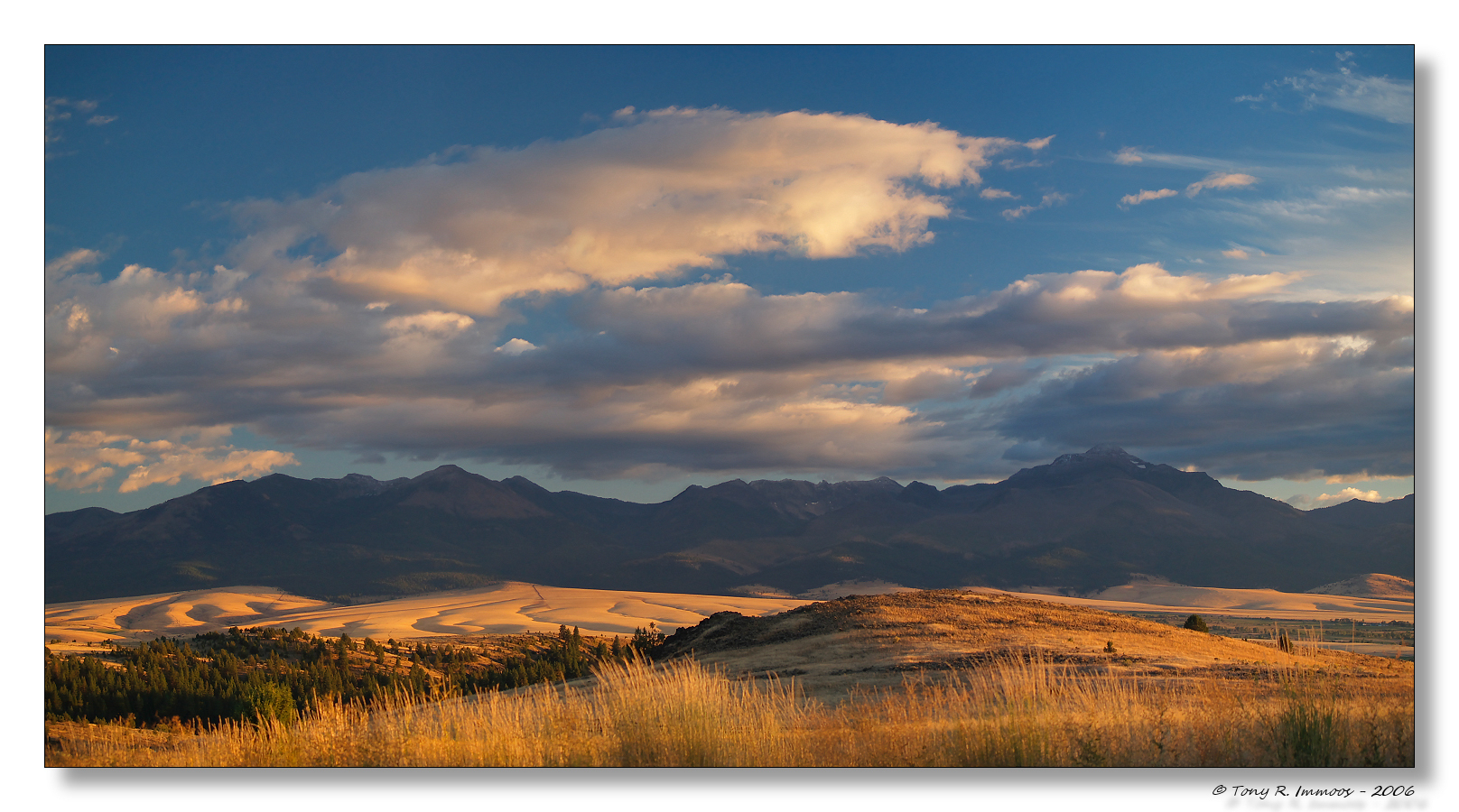
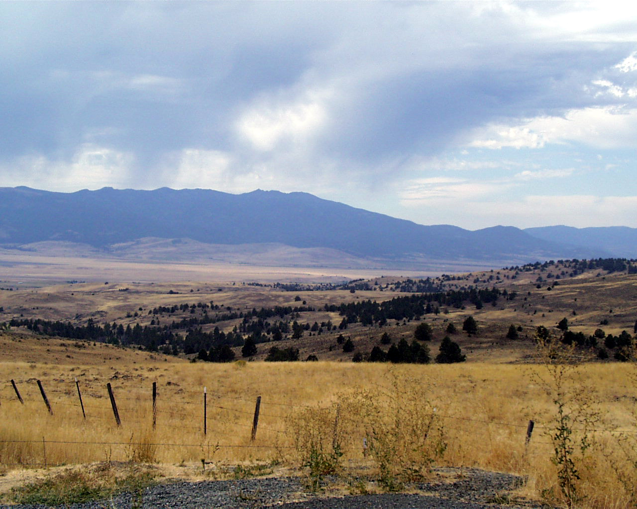
The John Day Valley
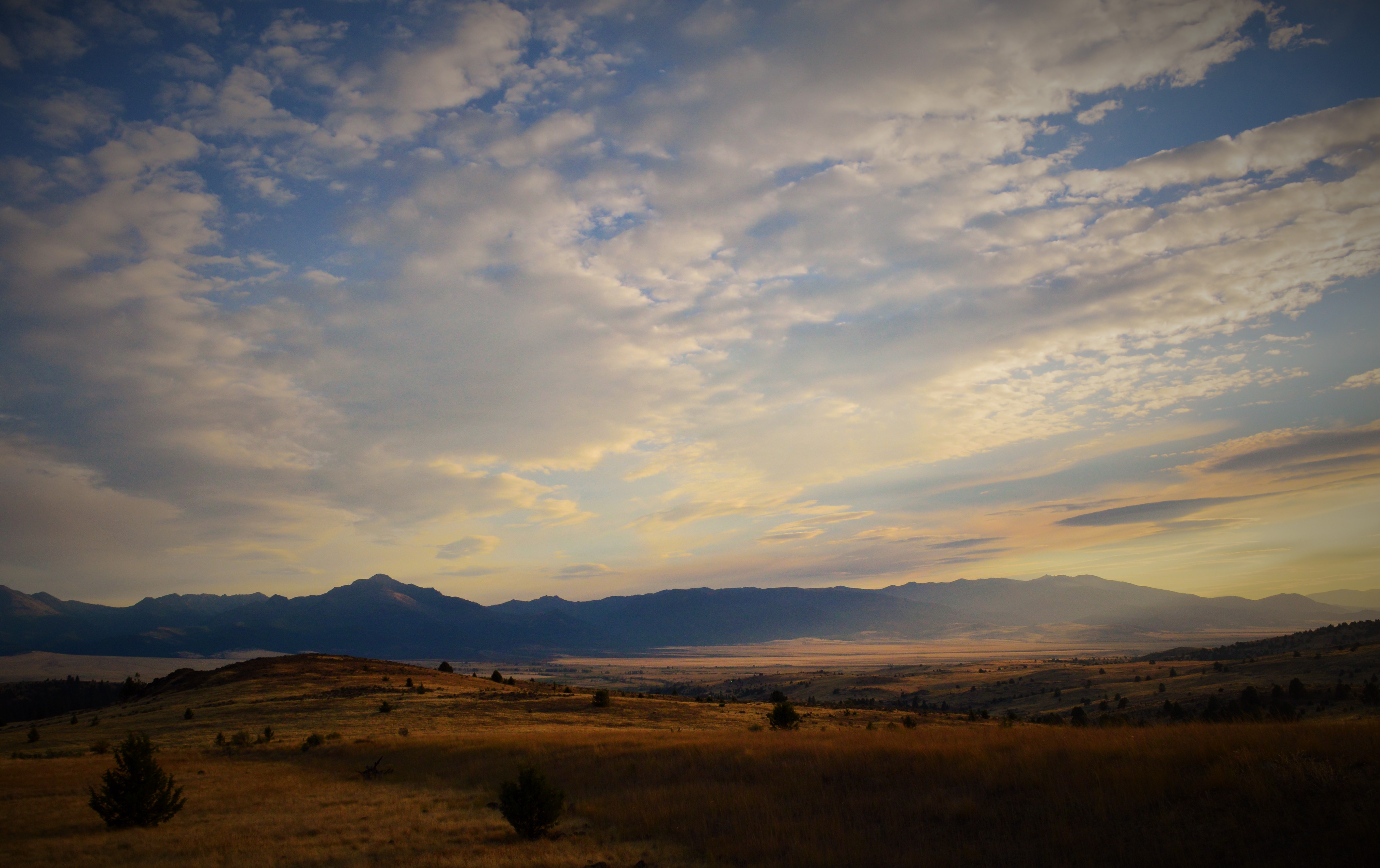
Later that evening
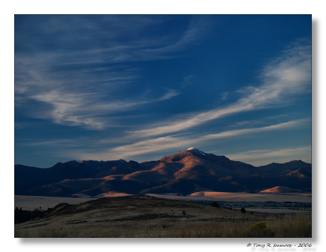
Strawberry Mountain Morning
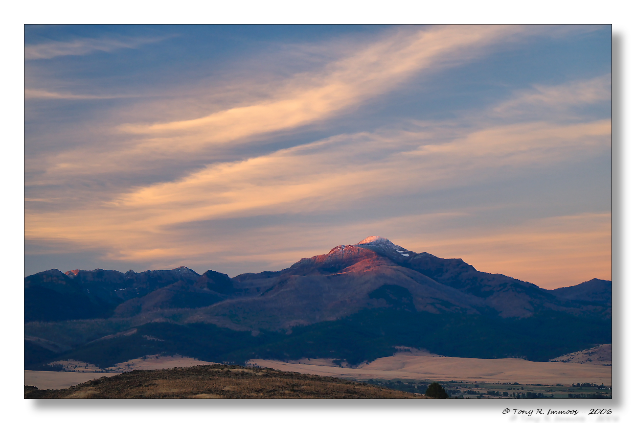
Sunrise, John Day Valley, Strawberry Mountain
083 Oregon, Highway 26, Viewpoint NE of Prairie City - Strawberry Mountain Range
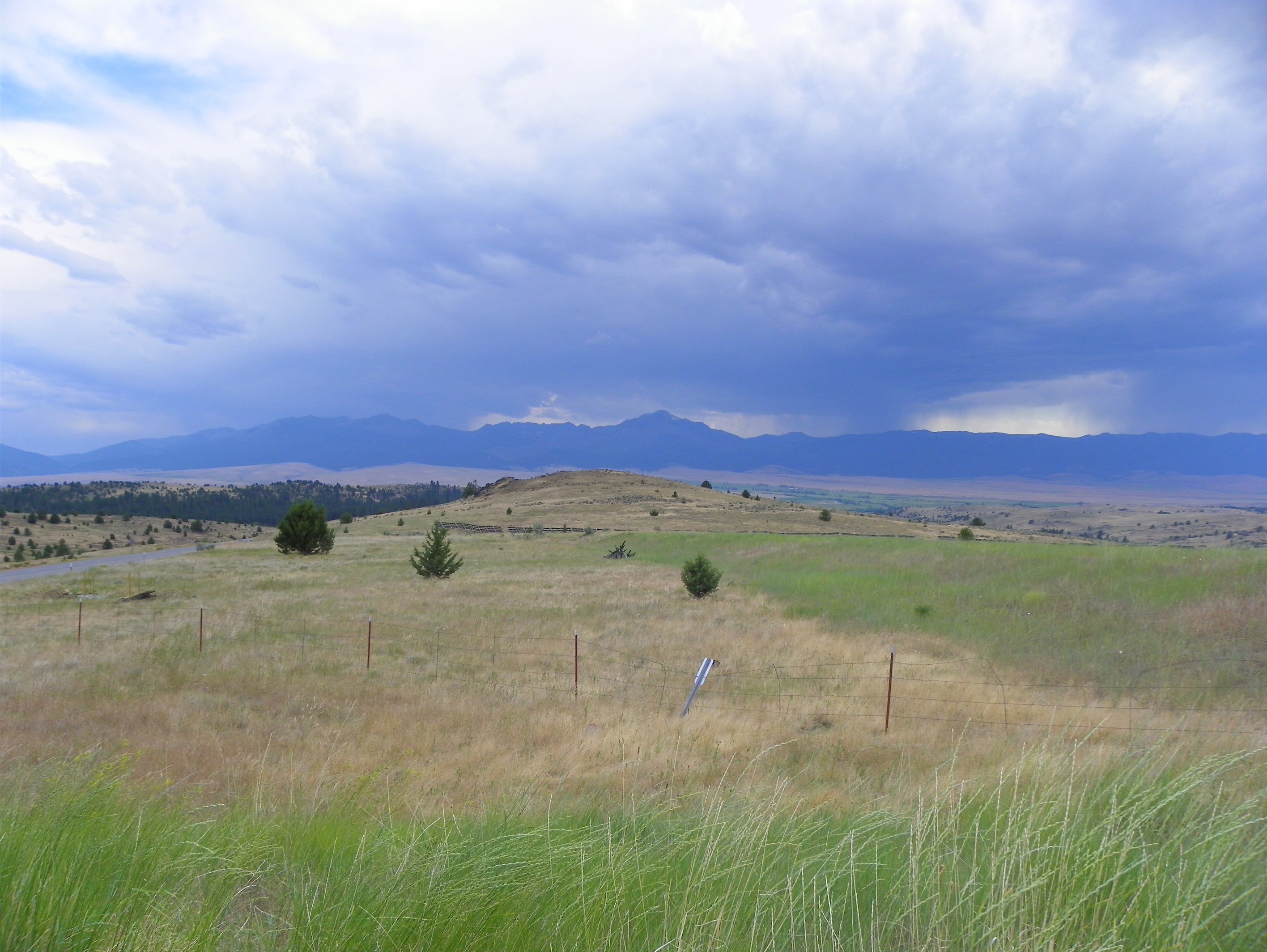
The Strawberry Mountains & John Day River Valley
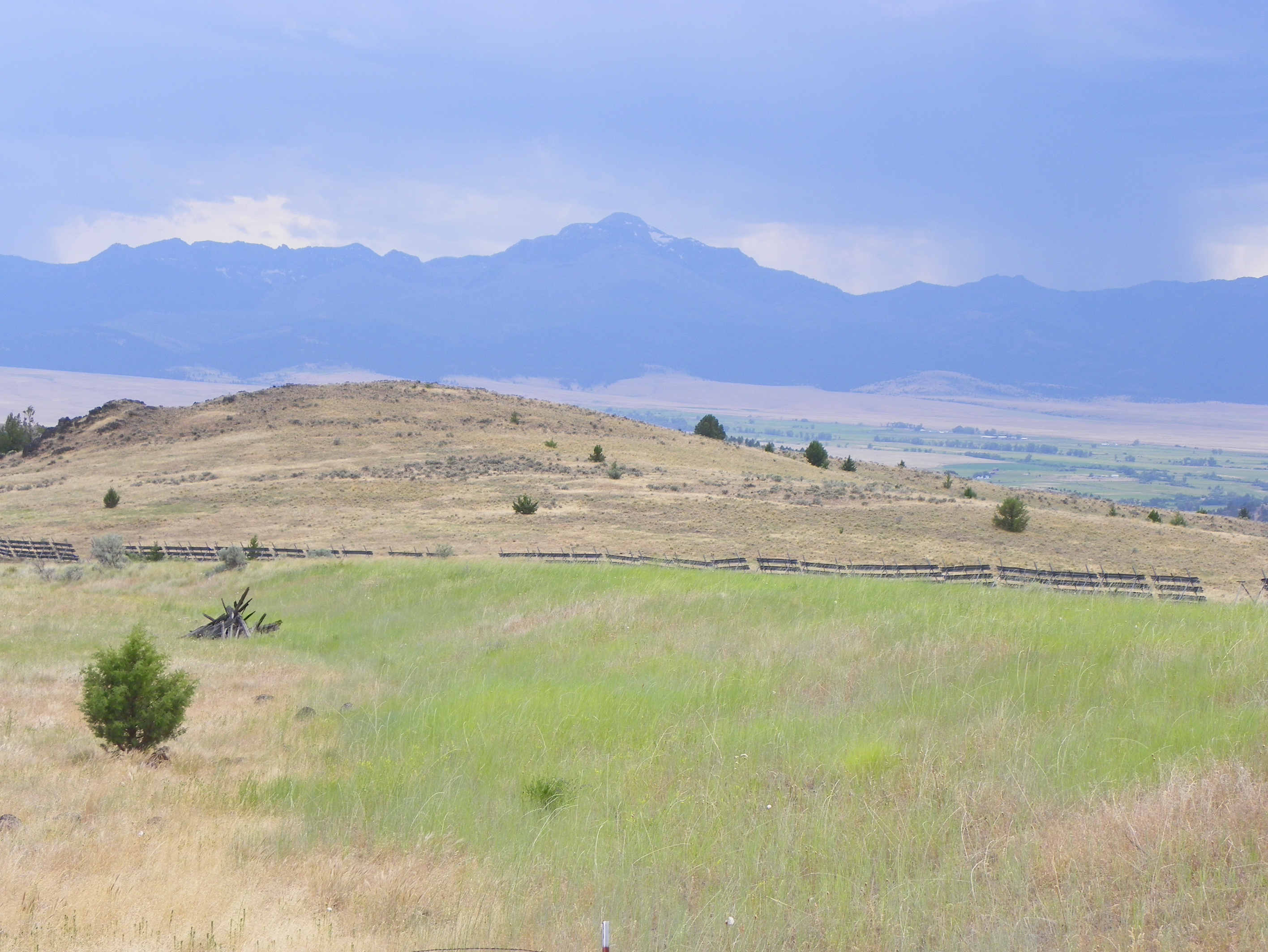
Strawberry Mountain Range
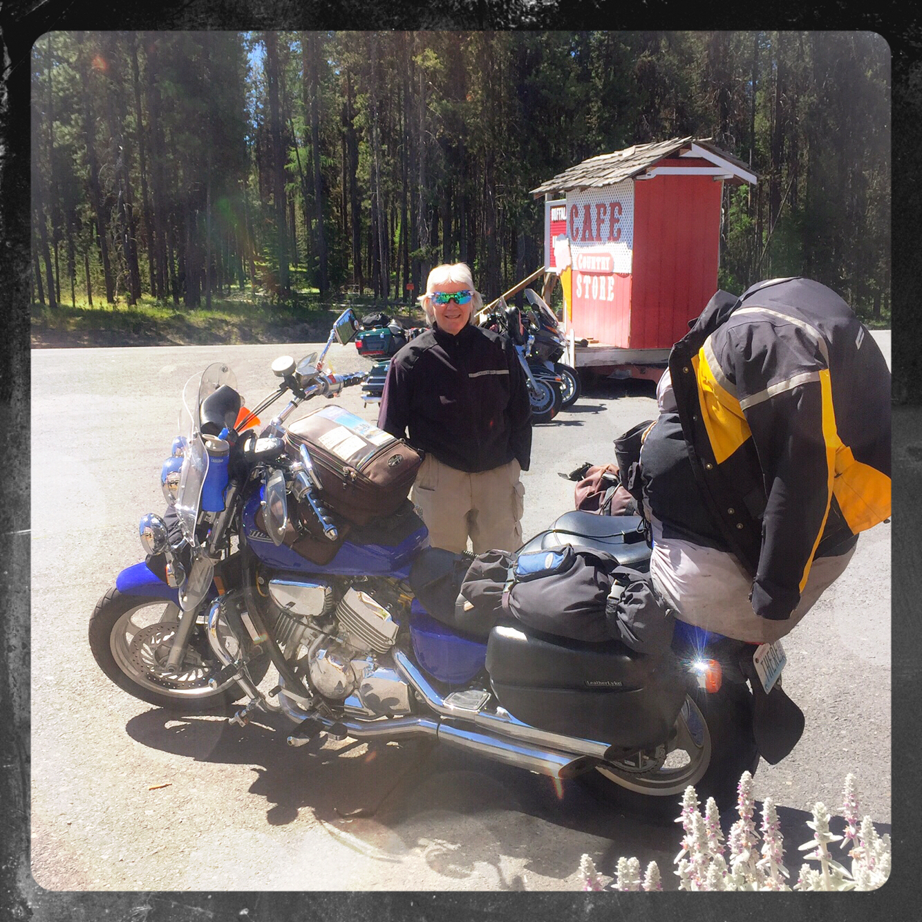
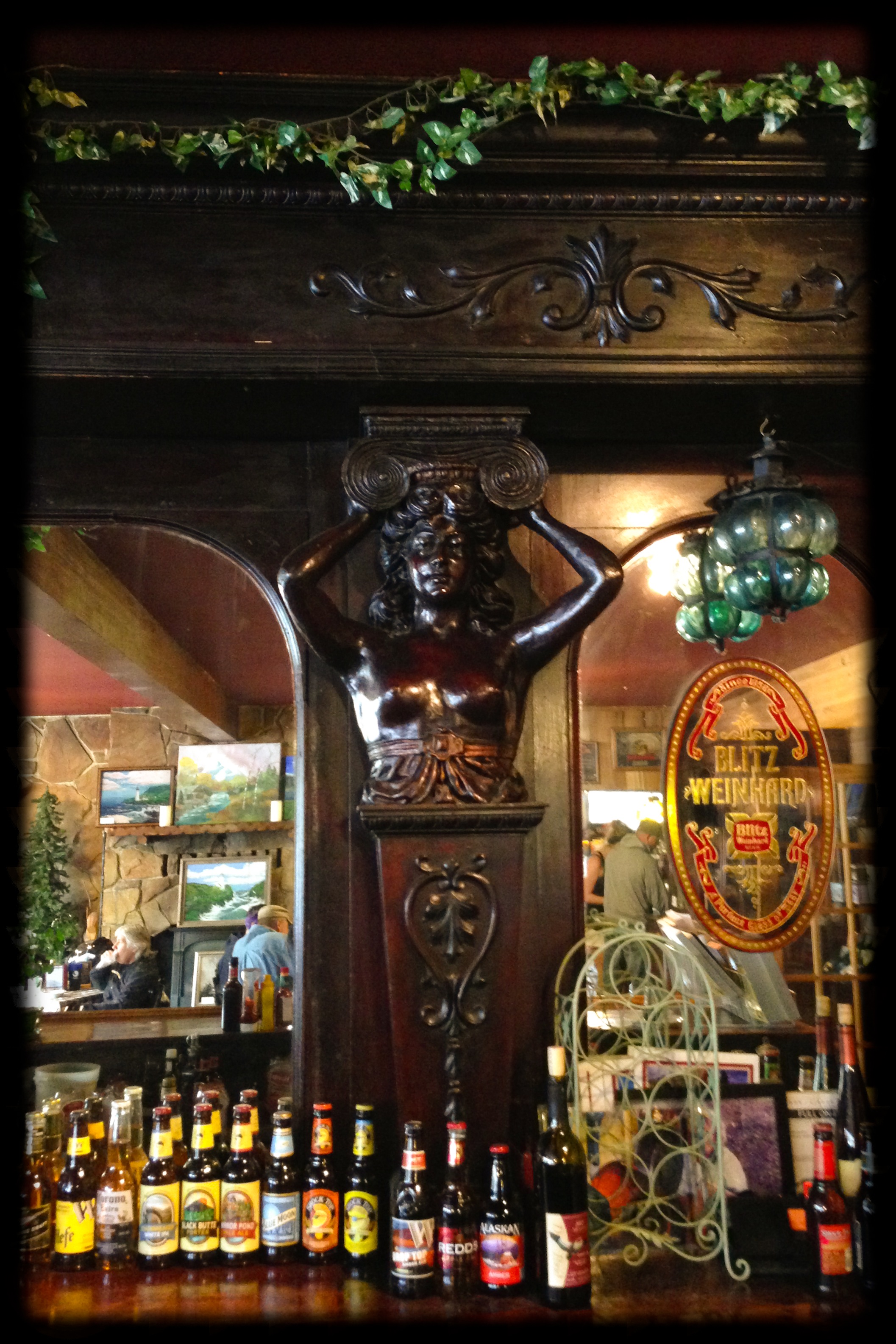
Austin House Cafe

Shades of mid morning cobbler

2015-07-28 09;49;59
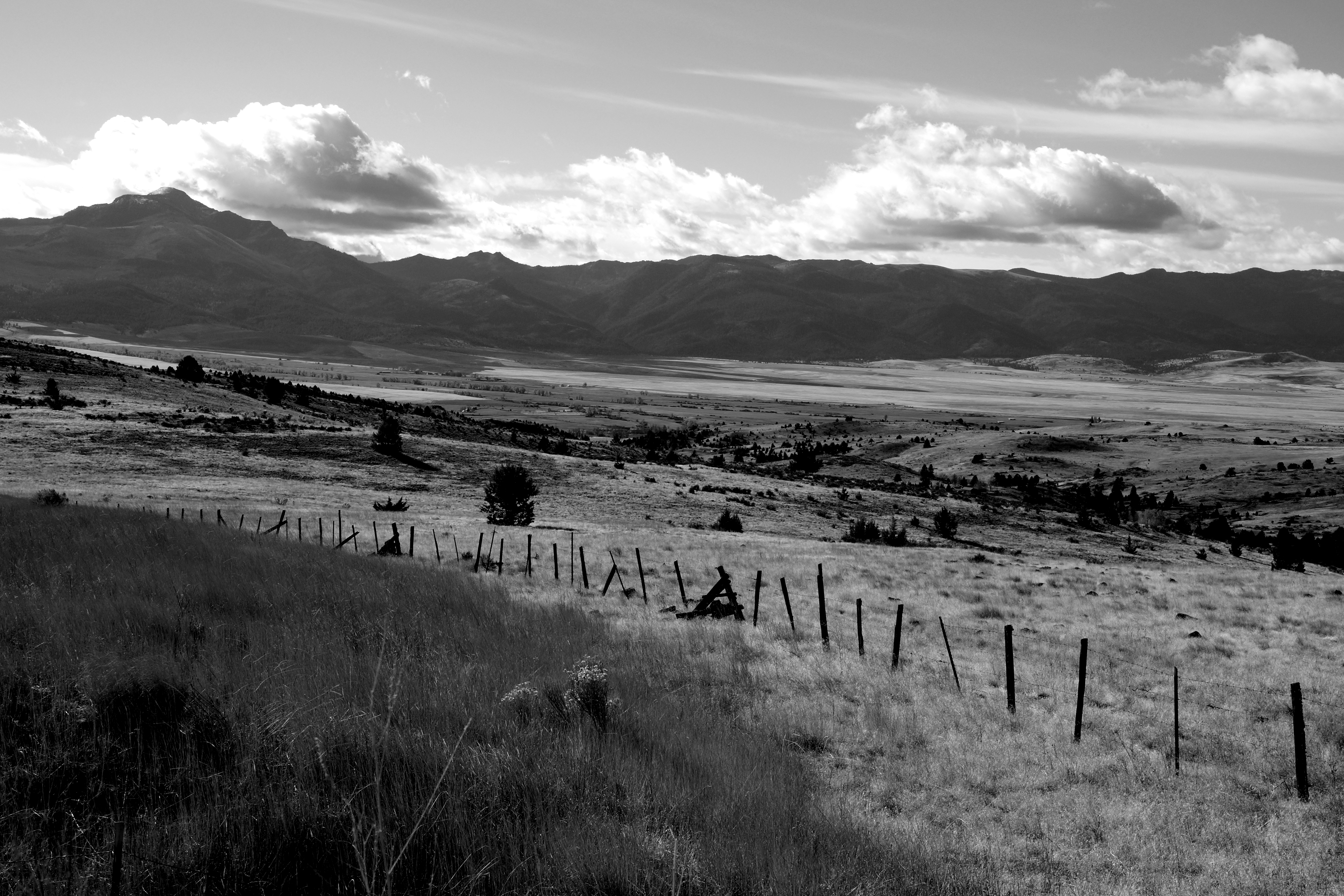
Eastern Oregon Landscape
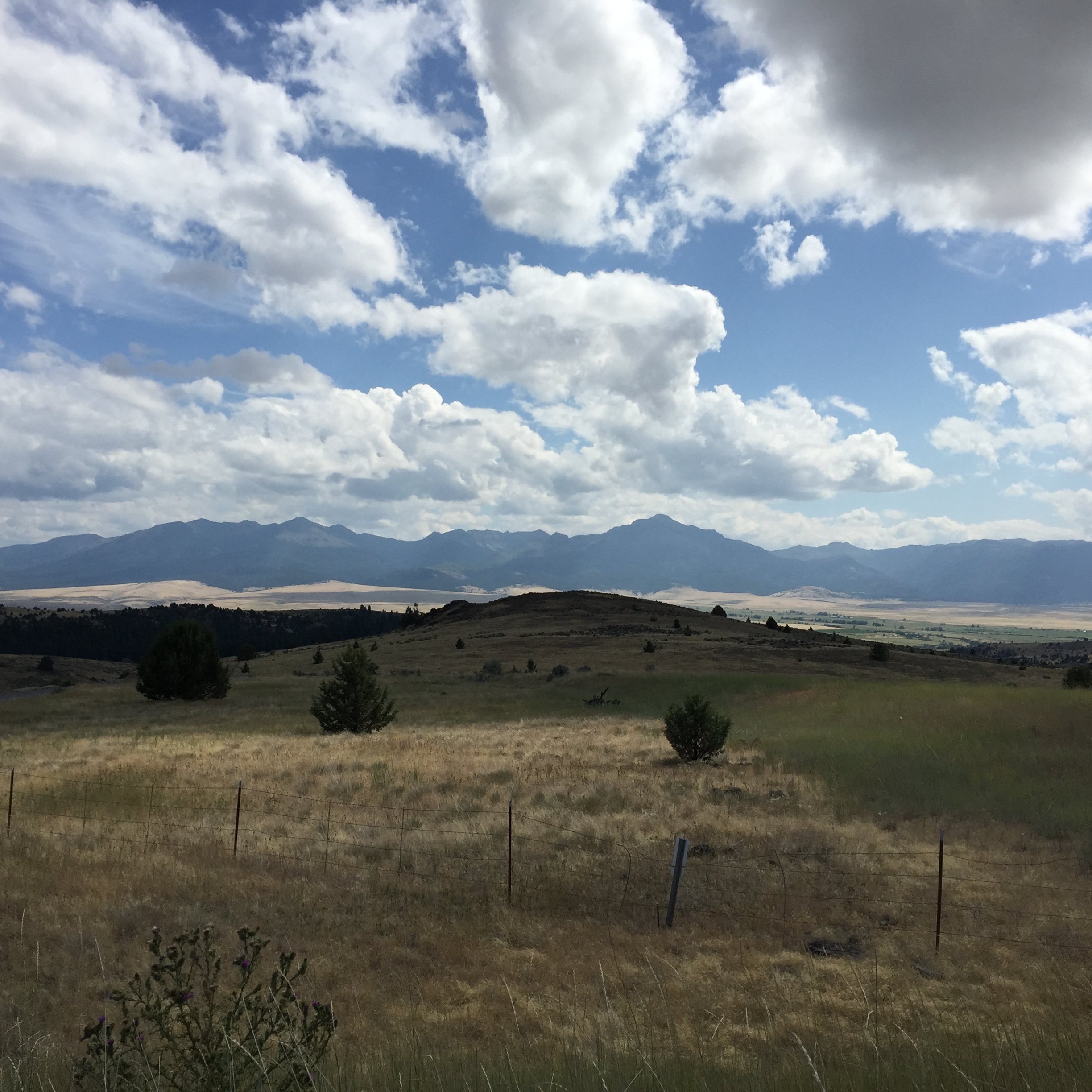
Strawberry Range

Blackberry cobbler break
Chicago 1864 / Austin House, Oregon 2014

mountain cafe break
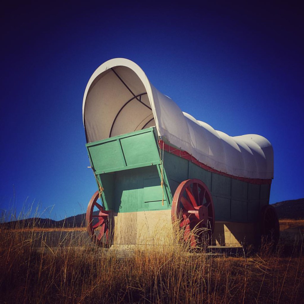
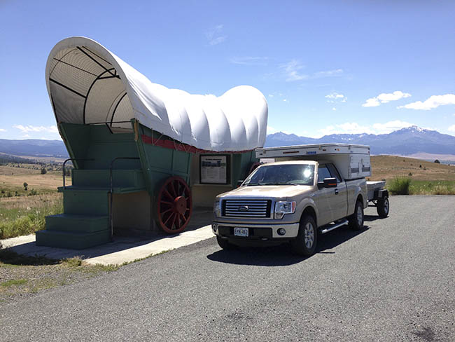
Traveling Hwy 26 in eastern Oregon on the Journey Through Time Scenic Byway, one of the stops is this viewpoint over the John Day River Valley east of Prairie City with this oversized replica of the type of covered wagon used by the Oregon Trail pioneers.
Oregon Constastoga
アメリカ合衆国 〒 オレゴン州 ベイツの地図
別の場所を検索
アメリカ合衆国 〒 オレゴン州 ベイツでの場所
近所の場所
Co Rd 20A, Bates, OR アメリカ合衆国County Road 20A
アメリカ合衆国 〒 オレゴン州 グラニット
アメリカ合衆国 〒 オレゴン州 サンプター
アメリカ合衆国 〒 オレゴン州 ボーン
アメリカ合衆国 オレゴン州 グラント
アメリカ合衆国 〒 オレゴン州 ジョン・デイ
アメリカ合衆国 オレゴン州 アンソニー・レイクス
アメリカ合衆国 〒 オレゴン州 ジョン・デイ
アメリカ合衆国 〒 オレゴン州 キャニオンシティ
アメリカ合衆国 〒 オレゴン州 デール
アメリカ合衆国 〒 オレゴン州 ロング・クリーク
Harper Creek Rd, Mt Vernon, OR アメリカ合衆国ハーパー・クリーク・ロード
アメリカ合衆国 オレゴン州 マーダラーズ川
アメリカ合衆国 オレゴン州 モニュメント
最近の検索
- アメリカ合衆国 アラスカ州 レッド・ドッグ・マイン日の出日の入り時間
- Am bhf, Borken, ドイツアム・バーンホーフ日の出日の入り時間
- 4th St E, Sonoma, CA, USA日の出日の入り時間
- Oakland Ave, Williamsport, PA アメリカ合衆国日の出日の入り時間
- Via Roma, Pieranica CR, イタリアローマ通り日の出日の入り時間
- クロアチア 〒 ドゥブロブニク GradClock Tower of Dubrovnik日の出日の入り時間
- アルゼンチン チュブ州 トレリュー日の出日の入り時間
- Hartfords Bluff Cir, Mt Pleasant, SC アメリカ合衆国日の出日の入り時間
- 日本、熊本県熊本市北区日の出日の入り時間
- 中華人民共和国 福州市 平潭県 平潭島日の出日の入り時間