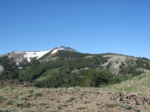
アメリカ合衆国 カリフォルニア州 アンテロープ・ピーク日の出日の入り時間
Location: アメリカ合衆国 > カリフォルニア州 > モノ > アメリカ合衆国 カリフォルニア州 コールヴィル >
時間帯:
America/Los_Angeles
現地時間:
2025-07-08 20:17:42
経度:
-119.5573918
緯度:
38.4704667
今日の日の出時刻:
05:42:52 AM
今日の日の入時刻:
08:24:20 PM
今日の日長:
14h 41m 28s
明日の日の出時刻:
05:43:32 AM
明日の日の入時刻:
08:23:57 PM
明日の日長:
14h 40m 25s
すべて表示する
| 日付 | 日出 | 日没 | 日長 |
|---|---|---|---|
| 2025年01月01日 | 07:15:41 AM | 04:49:13 PM | 9h 33m 32s |
| 2025年01月02日 | 07:15:45 AM | 04:50:04 PM | 9h 34m 19s |
| 2025年01月03日 | 07:15:47 AM | 04:50:56 PM | 9h 35m 9s |
| 2025年01月04日 | 07:15:47 AM | 04:51:49 PM | 9h 36m 2s |
| 2025年01月05日 | 07:15:45 AM | 04:52:44 PM | 9h 36m 59s |
| 2025年01月06日 | 07:15:41 AM | 04:53:40 PM | 9h 37m 59s |
| 2025年01月07日 | 07:15:35 AM | 04:54:36 PM | 9h 39m 1s |
| 2025年01月08日 | 07:15:27 AM | 04:55:34 PM | 9h 40m 7s |
| 2025年01月09日 | 07:15:16 AM | 04:56:33 PM | 9h 41m 17s |
| 2025年01月10日 | 07:15:04 AM | 04:57:33 PM | 9h 42m 29s |
| 2025年01月11日 | 07:14:49 AM | 04:58:33 PM | 9h 43m 44s |
| 2025年01月12日 | 07:14:32 AM | 04:59:35 PM | 9h 45m 3s |
| 2025年01月13日 | 07:14:13 AM | 05:00:37 PM | 9h 46m 24s |
| 2025年01月14日 | 07:13:52 AM | 05:01:40 PM | 9h 47m 48s |
| 2025年01月15日 | 07:13:29 AM | 05:02:44 PM | 9h 49m 15s |
| 2025年01月16日 | 07:13:04 AM | 05:03:48 PM | 9h 50m 44s |
| 2025年01月17日 | 07:12:37 AM | 05:04:53 PM | 9h 52m 16s |
| 2025年01月18日 | 07:12:08 AM | 05:05:59 PM | 9h 53m 51s |
| 2025年01月19日 | 07:11:37 AM | 05:07:05 PM | 9h 55m 28s |
| 2025年01月20日 | 07:11:05 AM | 05:08:11 PM | 9h 57m 6s |
| 2025年01月21日 | 07:10:30 AM | 05:09:18 PM | 9h 58m 48s |
| 2025年01月22日 | 07:09:53 AM | 05:10:25 PM | 10h 0m 32s |
| 2025年01月23日 | 07:09:14 AM | 05:11:33 PM | 10h 2m 19s |
| 2025年01月24日 | 07:08:34 AM | 05:12:40 PM | 10h 4m 6s |
| 2025年01月25日 | 07:07:51 AM | 05:13:48 PM | 10h 5m 57s |
| 2025年01月26日 | 07:07:07 AM | 05:14:57 PM | 10h 7m 50s |
| 2025年01月27日 | 07:06:21 AM | 05:16:05 PM | 10h 9m 44s |
| 2025年01月28日 | 07:05:34 AM | 05:17:13 PM | 10h 11m 39s |
| 2025年01月29日 | 07:04:44 AM | 05:18:22 PM | 10h 13m 38s |
| 2025年01月30日 | 07:03:53 AM | 05:19:30 PM | 10h 15m 37s |
| 2025年01月31日 | 07:03:00 AM | 05:20:39 PM | 10h 17m 39s |
| 2025年02月01日 | 07:02:06 AM | 05:21:48 PM | 10h 19m 42s |
| 2025年02月02日 | 07:01:10 AM | 05:22:56 PM | 10h 21m 46s |
| 2025年02月03日 | 07:00:13 AM | 05:24:05 PM | 10h 23m 52s |
| 2025年02月04日 | 06:59:14 AM | 05:25:13 PM | 10h 25m 59s |
| 2025年02月05日 | 06:58:13 AM | 05:26:21 PM | 10h 28m 8s |
| 2025年02月06日 | 06:57:11 AM | 05:27:30 PM | 10h 30m 19s |
| 2025年02月07日 | 06:56:08 AM | 05:28:38 PM | 10h 32m 30s |
| 2025年02月08日 | 06:55:03 AM | 05:29:45 PM | 10h 34m 42s |
| 2025年02月09日 | 06:53:57 AM | 05:30:53 PM | 10h 36m 56s |
| 2025年02月10日 | 06:52:50 AM | 05:32:00 PM | 10h 39m 10s |
| 2025年02月11日 | 06:51:41 AM | 05:33:08 PM | 10h 41m 27s |
| 2025年02月12日 | 06:50:31 AM | 05:34:15 PM | 10h 43m 44s |
| 2025年02月13日 | 06:49:20 AM | 05:35:21 PM | 10h 46m 1s |
| 2025年02月14日 | 06:48:07 AM | 05:36:28 PM | 10h 48m 21s |
| 2025年02月15日 | 06:46:54 AM | 05:37:34 PM | 10h 50m 40s |
| 2025年02月16日 | 06:45:39 AM | 05:38:40 PM | 10h 53m 1s |
| 2025年02月17日 | 06:44:23 AM | 05:39:45 PM | 10h 55m 22s |
| 2025年02月18日 | 06:43:06 AM | 05:40:51 PM | 10h 57m 45s |
| 2025年02月19日 | 06:41:48 AM | 05:41:56 PM | 11h 0m 8s |
| 2025年02月20日 | 06:40:30 AM | 05:43:00 PM | 11h 2m 30s |
| 2025年02月21日 | 06:39:10 AM | 05:44:04 PM | 11h 4m 54s |
| 2025年02月22日 | 06:37:49 AM | 05:45:09 PM | 11h 7m 20s |
| 2025年02月23日 | 06:36:28 AM | 05:46:12 PM | 11h 9m 44s |
| 2025年02月24日 | 06:35:05 AM | 05:47:16 PM | 11h 12m 11s |
| 2025年02月25日 | 06:33:42 AM | 05:48:19 PM | 11h 14m 37s |
| 2025年02月26日 | 06:32:18 AM | 05:49:21 PM | 11h 17m 3s |
| 2025年02月27日 | 06:30:53 AM | 05:50:24 PM | 11h 19m 31s |
| 2025年02月28日 | 06:29:28 AM | 05:51:26 PM | 11h 21m 58s |
| 2025年03月01日 | 06:28:02 AM | 05:52:28 PM | 11h 24m 26s |
| 2025年03月02日 | 06:26:35 AM | 05:53:29 PM | 11h 26m 54s |
| 2025年03月03日 | 06:25:07 AM | 05:54:31 PM | 11h 29m 24s |
| 2025年03月04日 | 06:23:39 AM | 05:55:32 PM | 11h 31m 53s |
| 2025年03月05日 | 06:22:11 AM | 05:56:32 PM | 11h 34m 21s |
| 2025年03月06日 | 06:20:42 AM | 05:57:33 PM | 11h 36m 51s |
| 2025年03月07日 | 06:19:12 AM | 05:58:33 PM | 11h 39m 21s |
| 2025年03月08日 | 06:17:42 AM | 05:59:33 PM | 11h 41m 51s |
| 2025年03月09日 | 07:16:15 AM | 07:00:30 PM | 11h 44m 15s |
| 2025年03月10日 | 07:14:44 AM | 07:01:29 PM | 11h 46m 45s |
| 2025年03月11日 | 07:13:13 AM | 07:02:29 PM | 11h 49m 16s |
| 2025年03月12日 | 07:11:42 AM | 07:03:27 PM | 11h 51m 45s |
| 2025年03月13日 | 07:10:10 AM | 07:04:26 PM | 11h 54m 16s |
| 2025年03月14日 | 07:08:38 AM | 07:05:25 PM | 11h 56m 47s |
| 2025年03月15日 | 07:07:05 AM | 07:06:23 PM | 11h 59m 18s |
| 2025年03月16日 | 07:05:33 AM | 07:07:21 PM | 12h 1m 48s |
| 2025年03月17日 | 07:04:00 AM | 07:08:19 PM | 12h 4m 19s |
| 2025年03月18日 | 07:02:27 AM | 07:09:17 PM | 12h 6m 50s |
| 2025年03月19日 | 07:00:54 AM | 07:10:15 PM | 12h 9m 21s |
| 2025年03月20日 | 06:59:21 AM | 07:11:12 PM | 12h 11m 51s |
| 2025年03月21日 | 06:57:47 AM | 07:12:10 PM | 12h 14m 23s |
| 2025年03月22日 | 06:56:14 AM | 07:13:07 PM | 12h 16m 53s |
| 2025年03月23日 | 06:54:41 AM | 07:14:04 PM | 12h 19m 23s |
| 2025年03月24日 | 06:53:08 AM | 07:15:01 PM | 12h 21m 53s |
| 2025年03月25日 | 06:51:34 AM | 07:15:58 PM | 12h 24m 24s |
| 2025年03月26日 | 06:50:01 AM | 07:16:55 PM | 12h 26m 54s |
| 2025年03月27日 | 06:48:28 AM | 07:17:52 PM | 12h 29m 24s |
| 2025年03月28日 | 06:46:55 AM | 07:18:48 PM | 12h 31m 53s |
| 2025年03月29日 | 06:45:23 AM | 07:19:45 PM | 12h 34m 22s |
| 2025年03月30日 | 06:43:50 AM | 07:20:42 PM | 12h 36m 52s |
| 2025年03月31日 | 06:42:18 AM | 07:21:38 PM | 12h 39m 20s |
| 2025年04月01日 | 06:40:46 AM | 07:22:35 PM | 12h 41m 49s |
| 2025年04月02日 | 06:39:15 AM | 07:23:31 PM | 12h 44m 16s |
| 2025年04月03日 | 06:37:43 AM | 07:24:28 PM | 12h 46m 45s |
| 2025年04月04日 | 06:36:12 AM | 07:25:25 PM | 12h 49m 13s |
| 2025年04月05日 | 06:34:42 AM | 07:26:21 PM | 12h 51m 39s |
| 2025年04月06日 | 06:33:12 AM | 07:27:18 PM | 12h 54m 6s |
| 2025年04月07日 | 06:31:42 AM | 07:28:14 PM | 12h 56m 32s |
| 2025年04月08日 | 06:30:13 AM | 07:29:11 PM | 12h 58m 58s |
| 2025年04月09日 | 06:28:44 AM | 07:30:08 PM | 13h 1m 24s |
| 2025年04月10日 | 06:27:16 AM | 07:31:04 PM | 13h 3m 48s |
| 2025年04月11日 | 06:25:48 AM | 07:32:01 PM | 13h 6m 13s |
| 2025年04月12日 | 06:24:21 AM | 07:32:58 PM | 13h 8m 37s |
| 2025年04月13日 | 06:22:55 AM | 07:33:54 PM | 13h 10m 59s |
| 2025年04月14日 | 06:21:29 AM | 07:34:51 PM | 13h 13m 22s |
| 2025年04月15日 | 06:20:04 AM | 07:35:48 PM | 13h 15m 44s |
| 2025年04月16日 | 06:18:40 AM | 07:36:45 PM | 13h 18m 5s |
| 2025年04月17日 | 06:17:16 AM | 07:37:42 PM | 13h 20m 26s |
| 2025年04月18日 | 06:15:53 AM | 07:38:39 PM | 13h 22m 46s |
| 2025年04月19日 | 06:14:31 AM | 07:39:36 PM | 13h 25m 5s |
| 2025年04月20日 | 06:13:10 AM | 07:40:33 PM | 13h 27m 23s |
| 2025年04月21日 | 06:11:50 AM | 07:41:30 PM | 13h 29m 40s |
| 2025年04月22日 | 06:10:30 AM | 07:42:27 PM | 13h 31m 57s |
| 2025年04月23日 | 06:09:12 AM | 07:43:24 PM | 13h 34m 12s |
| 2025年04月24日 | 06:07:55 AM | 07:44:21 PM | 13h 36m 26s |
| 2025年04月25日 | 06:06:38 AM | 07:45:18 PM | 13h 38m 40s |
| 2025年04月26日 | 06:05:23 AM | 07:46:15 PM | 13h 40m 52s |
| 2025年04月27日 | 06:04:08 AM | 07:47:12 PM | 13h 43m 4s |
| 2025年04月28日 | 06:02:55 AM | 07:48:09 PM | 13h 45m 14s |
| 2025年04月29日 | 06:01:43 AM | 07:49:06 PM | 13h 47m 23s |
| 2025年04月30日 | 06:00:32 AM | 07:50:02 PM | 13h 49m 30s |
| 2025年05月01日 | 05:59:22 AM | 07:50:59 PM | 13h 51m 37s |
| 2025年05月02日 | 05:58:13 AM | 07:51:56 PM | 13h 53m 43s |
| 2025年05月03日 | 05:57:06 AM | 07:52:52 PM | 13h 55m 46s |
| 2025年05月04日 | 05:55:59 AM | 07:53:48 PM | 13h 57m 49s |
| 2025年05月05日 | 05:54:54 AM | 07:54:44 PM | 13h 59m 50s |
| 2025年05月06日 | 05:53:51 AM | 07:55:40 PM | 14h 1m 49s |
| 2025年05月07日 | 05:52:49 AM | 07:56:36 PM | 14h 3m 47s |
| 2025年05月08日 | 05:51:48 AM | 07:57:31 PM | 14h 5m 43s |
| 2025年05月09日 | 05:50:48 AM | 07:58:27 PM | 14h 7m 39s |
| 2025年05月10日 | 05:49:50 AM | 07:59:22 PM | 14h 9m 32s |
| 2025年05月11日 | 05:48:54 AM | 08:00:16 PM | 14h 11m 22s |
| 2025年05月12日 | 05:47:59 AM | 08:01:11 PM | 14h 13m 12s |
| 2025年05月13日 | 05:47:05 AM | 08:02:04 PM | 14h 14m 59s |
| 2025年05月14日 | 05:46:13 AM | 08:02:58 PM | 14h 16m 45s |
| 2025年05月15日 | 05:45:23 AM | 08:03:51 PM | 14h 18m 28s |
| 2025年05月16日 | 05:44:34 AM | 08:04:44 PM | 14h 20m 10s |
| 2025年05月17日 | 05:43:47 AM | 08:05:36 PM | 14h 21m 49s |
| 2025年05月18日 | 05:43:01 AM | 08:06:27 PM | 14h 23m 26s |
| 2025年05月19日 | 05:42:17 AM | 08:07:18 PM | 14h 25m 1s |
| 2025年05月20日 | 05:41:35 AM | 08:08:09 PM | 14h 26m 34s |
| 2025年05月21日 | 05:40:54 AM | 08:08:59 PM | 14h 28m 5s |
| 2025年05月22日 | 05:40:15 AM | 08:09:48 PM | 14h 29m 33s |
| 2025年05月23日 | 05:39:38 AM | 08:10:36 PM | 14h 30m 58s |
| 2025年05月24日 | 05:39:02 AM | 08:11:24 PM | 14h 32m 22s |
| 2025年05月25日 | 05:38:29 AM | 08:12:11 PM | 14h 33m 42s |
| 2025年05月26日 | 05:37:57 AM | 08:12:57 PM | 14h 35m 0s |
| 2025年05月27日 | 05:37:27 AM | 08:13:42 PM | 14h 36m 15s |
| 2025年05月28日 | 05:36:58 AM | 08:14:26 PM | 14h 37m 28s |
| 2025年05月29日 | 05:36:32 AM | 08:15:09 PM | 14h 38m 37s |
| 2025年05月30日 | 05:36:07 AM | 08:15:52 PM | 14h 39m 45s |
| 2025年05月31日 | 05:35:44 AM | 08:16:33 PM | 14h 40m 49s |
| 2025年06月01日 | 05:35:23 AM | 08:17:13 PM | 14h 41m 50s |
| 2025年06月02日 | 05:35:04 AM | 08:17:52 PM | 14h 42m 48s |
| 2025年06月03日 | 05:34:46 AM | 08:18:30 PM | 14h 43m 44s |
| 2025年06月04日 | 05:34:31 AM | 08:19:07 PM | 14h 44m 36s |
| 2025年06月05日 | 05:34:17 AM | 08:19:43 PM | 14h 45m 26s |
| 2025年06月06日 | 05:34:06 AM | 08:20:17 PM | 14h 46m 11s |
| 2025年06月07日 | 05:33:56 AM | 08:20:50 PM | 14h 46m 54s |
| 2025年06月08日 | 05:33:47 AM | 08:21:22 PM | 14h 47m 35s |
| 2025年06月09日 | 05:33:41 AM | 08:21:52 PM | 14h 48m 11s |
| 2025年06月10日 | 05:33:37 AM | 08:22:21 PM | 14h 48m 44s |
| 2025年06月11日 | 05:33:34 AM | 08:22:48 PM | 14h 49m 14s |
| 2025年06月12日 | 05:33:33 AM | 08:23:14 PM | 14h 49m 41s |
| 2025年06月13日 | 05:33:34 AM | 08:23:39 PM | 14h 50m 5s |
| 2025年06月14日 | 05:33:37 AM | 08:24:02 PM | 14h 50m 25s |
| 2025年06月15日 | 05:33:42 AM | 08:24:23 PM | 14h 50m 41s |
| 2025年06月16日 | 05:33:48 AM | 08:24:43 PM | 14h 50m 55s |
| 2025年06月17日 | 05:33:56 AM | 08:25:01 PM | 14h 51m 5s |
| 2025年06月18日 | 05:34:06 AM | 08:25:17 PM | 14h 51m 11s |
| 2025年06月19日 | 05:34:17 AM | 08:25:32 PM | 14h 51m 15s |
| 2025年06月20日 | 05:34:30 AM | 08:25:45 PM | 14h 51m 15s |
| 2025年06月21日 | 05:34:45 AM | 08:25:56 PM | 14h 51m 11s |
| 2025年06月22日 | 05:35:01 AM | 08:26:06 PM | 14h 51m 5s |
| 2025年06月23日 | 05:35:19 AM | 08:26:14 PM | 14h 50m 55s |
| 2025年06月24日 | 05:35:39 AM | 08:26:20 PM | 14h 50m 41s |
| 2025年06月25日 | 05:36:00 AM | 08:26:24 PM | 14h 50m 24s |
| 2025年06月26日 | 05:36:22 AM | 08:26:26 PM | 14h 50m 4s |
| 2025年06月27日 | 05:36:46 AM | 08:26:27 PM | 14h 49m 41s |
| 2025年06月28日 | 05:37:12 AM | 08:26:25 PM | 14h 49m 13s |
| 2025年06月29日 | 05:37:39 AM | 08:26:22 PM | 14h 48m 43s |
| 2025年06月30日 | 05:38:07 AM | 08:26:17 PM | 14h 48m 10s |
| 2025年07月01日 | 05:38:37 AM | 08:26:10 PM | 14h 47m 33s |
| 2025年07月02日 | 05:39:08 AM | 08:26:01 PM | 14h 46m 53s |
| 2025年07月03日 | 05:39:40 AM | 08:25:50 PM | 14h 46m 10s |
| 2025年07月04日 | 05:40:13 AM | 08:25:37 PM | 14h 45m 24s |
| 2025年07月05日 | 05:40:48 AM | 08:25:23 PM | 14h 44m 35s |
| 2025年07月06日 | 05:41:23 AM | 08:25:06 PM | 14h 43m 43s |
| 2025年07月07日 | 05:42:00 AM | 08:24:48 PM | 14h 42m 48s |
| 2025年07月08日 | 05:42:38 AM | 08:24:28 PM | 14h 41m 50s |
| 2025年07月09日 | 05:43:17 AM | 08:24:06 PM | 14h 40m 49s |
| 2025年07月10日 | 05:43:57 AM | 08:23:42 PM | 14h 39m 45s |
| 2025年07月11日 | 05:44:38 AM | 08:23:16 PM | 14h 38m 38s |
| 2025年07月12日 | 05:45:19 AM | 08:22:48 PM | 14h 37m 29s |
| 2025年07月13日 | 05:46:02 AM | 08:22:19 PM | 14h 36m 17s |
| 2025年07月14日 | 05:46:45 AM | 08:21:48 PM | 14h 35m 3s |
| 2025年07月15日 | 05:47:30 AM | 08:21:14 PM | 14h 33m 44s |
| 2025年07月16日 | 05:48:15 AM | 08:20:39 PM | 14h 32m 24s |
| 2025年07月17日 | 05:49:00 AM | 08:20:03 PM | 14h 31m 3s |
| 2025年07月18日 | 05:49:47 AM | 08:19:24 PM | 14h 29m 37s |
| 2025年07月19日 | 05:50:34 AM | 08:18:44 PM | 14h 28m 10s |
| 2025年07月20日 | 05:51:21 AM | 08:18:02 PM | 14h 26m 41s |
| 2025年07月21日 | 05:52:09 AM | 08:17:18 PM | 14h 25m 9s |
| 2025年07月22日 | 05:52:58 AM | 08:16:33 PM | 14h 23m 35s |
| 2025年07月23日 | 05:53:47 AM | 08:15:46 PM | 14h 21m 59s |
| 2025年07月24日 | 05:54:37 AM | 08:14:57 PM | 14h 20m 20s |
| 2025年07月25日 | 05:55:27 AM | 08:14:07 PM | 14h 18m 40s |
| 2025年07月26日 | 05:56:18 AM | 08:13:15 PM | 14h 16m 57s |
| 2025年07月27日 | 05:57:08 AM | 08:12:21 PM | 14h 15m 13s |
| 2025年07月28日 | 05:58:00 AM | 08:11:26 PM | 14h 13m 26s |
| 2025年07月29日 | 05:58:51 AM | 08:10:30 PM | 14h 11m 39s |
| 2025年07月30日 | 05:59:43 AM | 08:09:32 PM | 14h 9m 49s |
| 2025年07月31日 | 06:00:35 AM | 08:08:32 PM | 14h 7m 57s |
| 2025年08月01日 | 06:01:27 AM | 08:07:31 PM | 14h 6m 4s |
| 2025年08月02日 | 06:02:20 AM | 08:06:29 PM | 14h 4m 9s |
| 2025年08月03日 | 06:03:12 AM | 08:05:25 PM | 14h 2m 13s |
| 2025年08月04日 | 06:04:05 AM | 08:04:20 PM | 14h 0m 15s |
| 2025年08月05日 | 06:04:58 AM | 08:03:13 PM | 13h 58m 15s |
| 2025年08月06日 | 06:05:51 AM | 08:02:06 PM | 13h 56m 15s |
| 2025年08月07日 | 06:06:44 AM | 08:00:57 PM | 13h 54m 13s |
| 2025年08月08日 | 06:07:37 AM | 07:59:46 PM | 13h 52m 9s |
| 2025年08月09日 | 06:08:31 AM | 07:58:35 PM | 13h 50m 4s |
| 2025年08月10日 | 06:09:24 AM | 07:57:22 PM | 13h 47m 58s |
| 2025年08月11日 | 06:10:17 AM | 07:56:08 PM | 13h 45m 51s |
| 2025年08月12日 | 06:11:11 AM | 07:54:53 PM | 13h 43m 42s |
| 2025年08月13日 | 06:12:04 AM | 07:53:37 PM | 13h 41m 33s |
| 2025年08月14日 | 06:12:57 AM | 07:52:20 PM | 13h 39m 23s |
| 2025年08月15日 | 06:13:51 AM | 07:51:02 PM | 13h 37m 11s |
| 2025年08月16日 | 06:14:44 AM | 07:49:43 PM | 13h 34m 59s |
| 2025年08月17日 | 06:15:37 AM | 07:48:23 PM | 13h 32m 46s |
| 2025年08月18日 | 06:16:31 AM | 07:47:02 PM | 13h 30m 31s |
| 2025年08月19日 | 06:17:24 AM | 07:45:40 PM | 13h 28m 16s |
| 2025年08月20日 | 06:18:17 AM | 07:44:17 PM | 13h 26m 0s |
| 2025年08月21日 | 06:19:10 AM | 07:42:53 PM | 13h 23m 43s |
| 2025年08月22日 | 06:20:03 AM | 07:41:29 PM | 13h 21m 26s |
| 2025年08月23日 | 06:20:56 AM | 07:40:03 PM | 13h 19m 7s |
| 2025年08月24日 | 06:21:49 AM | 07:38:37 PM | 13h 16m 48s |
| 2025年08月25日 | 06:22:42 AM | 07:37:10 PM | 13h 14m 28s |
| 2025年08月26日 | 06:23:34 AM | 07:35:43 PM | 13h 12m 9s |
| 2025年08月27日 | 06:24:27 AM | 07:34:15 PM | 13h 9m 48s |
| 2025年08月28日 | 06:25:20 AM | 07:32:46 PM | 13h 7m 26s |
| 2025年08月29日 | 06:26:12 AM | 07:31:16 PM | 13h 5m 4s |
| 2025年08月30日 | 06:27:05 AM | 07:29:46 PM | 13h 2m 41s |
| 2025年08月31日 | 06:27:57 AM | 07:28:16 PM | 13h 0m 19s |
| 2025年09月01日 | 06:28:50 AM | 07:26:45 PM | 12h 57m 55s |
| 2025年09月02日 | 06:29:42 AM | 07:25:13 PM | 12h 55m 31s |
| 2025年09月03日 | 06:30:34 AM | 07:23:41 PM | 12h 53m 7s |
| 2025年09月04日 | 06:31:26 AM | 07:22:09 PM | 12h 50m 43s |
| 2025年09月05日 | 06:32:19 AM | 07:20:36 PM | 12h 48m 17s |
| 2025年09月06日 | 06:33:11 AM | 07:19:03 PM | 12h 45m 52s |
| 2025年09月07日 | 06:34:03 AM | 07:17:29 PM | 12h 43m 26s |
| 2025年09月08日 | 06:34:55 AM | 07:15:55 PM | 12h 41m 0s |
| 2025年09月09日 | 06:35:47 AM | 07:14:21 PM | 12h 38m 34s |
| 2025年09月10日 | 06:36:40 AM | 07:12:46 PM | 12h 36m 6s |
| 2025年09月11日 | 06:37:32 AM | 07:11:12 PM | 12h 33m 40s |
| 2025年09月12日 | 06:38:24 AM | 07:09:37 PM | 12h 31m 13s |
| 2025年09月13日 | 06:39:16 AM | 07:08:02 PM | 12h 28m 46s |
| 2025年09月14日 | 06:40:09 AM | 07:06:27 PM | 12h 26m 18s |
| 2025年09月15日 | 06:41:01 AM | 07:04:51 PM | 12h 23m 50s |
| 2025年09月16日 | 06:41:54 AM | 07:03:16 PM | 12h 21m 22s |
| 2025年09月17日 | 06:42:46 AM | 07:01:40 PM | 12h 18m 54s |
| 2025年09月18日 | 06:43:39 AM | 07:00:05 PM | 12h 16m 26s |
| 2025年09月19日 | 06:44:32 AM | 06:58:29 PM | 12h 13m 57s |
| 2025年09月20日 | 06:45:25 AM | 06:56:54 PM | 12h 11m 29s |
| 2025年09月21日 | 06:46:18 AM | 06:55:19 PM | 12h 9m 1s |
| 2025年09月22日 | 06:47:11 AM | 06:53:43 PM | 12h 6m 32s |
| 2025年09月23日 | 06:48:04 AM | 06:52:08 PM | 12h 4m 4s |
| 2025年09月24日 | 06:48:58 AM | 06:50:33 PM | 12h 1m 35s |
| 2025年09月25日 | 06:49:51 AM | 06:48:58 PM | 11h 59m 7s |
| 2025年09月26日 | 06:50:45 AM | 06:47:24 PM | 11h 56m 39s |
| 2025年09月27日 | 06:51:39 AM | 06:45:50 PM | 11h 54m 11s |
| 2025年09月28日 | 06:52:33 AM | 06:44:15 PM | 11h 51m 42s |
| 2025年09月29日 | 06:53:28 AM | 06:42:42 PM | 11h 49m 14s |
| 2025年09月30日 | 06:54:22 AM | 06:41:08 PM | 11h 46m 46s |
| 2025年10月01日 | 06:55:17 AM | 06:39:35 PM | 11h 44m 18s |
| 2025年10月02日 | 06:56:12 AM | 06:38:02 PM | 11h 41m 50s |
| 2025年10月03日 | 06:57:08 AM | 06:36:30 PM | 11h 39m 22s |
| 2025年10月04日 | 06:58:04 AM | 06:34:58 PM | 11h 36m 54s |
| 2025年10月05日 | 06:59:00 AM | 06:33:27 PM | 11h 34m 27s |
| 2025年10月06日 | 06:59:56 AM | 06:31:56 PM | 11h 32m 0s |
| 2025年10月07日 | 07:00:52 AM | 06:30:26 PM | 11h 29m 34s |
| 2025年10月08日 | 07:01:49 AM | 06:28:56 PM | 11h 27m 7s |
| 2025年10月09日 | 07:02:46 AM | 06:27:27 PM | 11h 24m 41s |
| 2025年10月10日 | 07:03:44 AM | 06:25:59 PM | 11h 22m 15s |
| 2025年10月11日 | 07:04:42 AM | 06:24:31 PM | 11h 19m 49s |
| 2025年10月12日 | 07:05:40 AM | 06:23:04 PM | 11h 17m 24s |
| 2025年10月13日 | 07:06:38 AM | 06:21:38 PM | 11h 15m 0s |
| 2025年10月14日 | 07:07:37 AM | 06:20:12 PM | 11h 12m 35s |
| 2025年10月15日 | 07:08:36 AM | 06:18:48 PM | 11h 10m 12s |
| 2025年10月16日 | 07:09:36 AM | 06:17:24 PM | 11h 7m 48s |
| 2025年10月17日 | 07:10:35 AM | 06:16:01 PM | 11h 5m 26s |
| 2025年10月18日 | 07:11:36 AM | 06:14:39 PM | 11h 3m 3s |
| 2025年10月19日 | 07:12:36 AM | 06:13:17 PM | 11h 0m 41s |
| 2025年10月20日 | 07:13:37 AM | 06:11:57 PM | 10h 58m 20s |
| 2025年10月21日 | 07:14:38 AM | 06:10:38 PM | 10h 56m 0s |
| 2025年10月22日 | 07:15:40 AM | 06:09:20 PM | 10h 53m 40s |
| 2025年10月23日 | 07:16:41 AM | 06:08:03 PM | 10h 51m 22s |
| 2025年10月24日 | 07:17:44 AM | 06:06:47 PM | 10h 49m 3s |
| 2025年10月25日 | 07:18:46 AM | 06:05:32 PM | 10h 46m 46s |
| 2025年10月26日 | 07:19:49 AM | 06:04:18 PM | 10h 44m 29s |
| 2025年10月27日 | 07:20:52 AM | 06:03:06 PM | 10h 42m 14s |
| 2025年10月28日 | 07:21:55 AM | 06:01:54 PM | 10h 39m 59s |
| 2025年10月29日 | 07:22:59 AM | 06:00:44 PM | 10h 37m 45s |
| 2025年10月30日 | 07:24:03 AM | 05:59:36 PM | 10h 35m 33s |
| 2025年10月31日 | 07:25:07 AM | 05:58:28 PM | 10h 33m 21s |
| 2025年11月01日 | 07:26:11 AM | 05:57:22 PM | 10h 31m 11s |
| 2025年11月02日 | 06:27:19 AM | 04:56:15 PM | 10h 28m 56s |
| 2025年11月03日 | 06:28:23 AM | 04:55:12 PM | 10h 26m 49s |
| 2025年11月04日 | 06:29:28 AM | 04:54:11 PM | 10h 24m 43s |
| 2025年11月05日 | 06:30:33 AM | 04:53:11 PM | 10h 22m 38s |
| 2025年11月06日 | 06:31:39 AM | 04:52:12 PM | 10h 20m 33s |
| 2025年11月07日 | 06:32:44 AM | 04:51:15 PM | 10h 18m 31s |
| 2025年11月08日 | 06:33:49 AM | 04:50:20 PM | 10h 16m 31s |
| 2025年11月09日 | 06:34:55 AM | 04:49:26 PM | 10h 14m 31s |
| 2025年11月10日 | 06:36:00 AM | 04:48:34 PM | 10h 12m 34s |
| 2025年11月11日 | 06:37:06 AM | 04:47:44 PM | 10h 10m 38s |
| 2025年11月12日 | 06:38:11 AM | 04:46:55 PM | 10h 8m 44s |
| 2025年11月13日 | 06:39:17 AM | 04:46:08 PM | 10h 6m 51s |
| 2025年11月14日 | 06:40:22 AM | 04:45:23 PM | 10h 5m 1s |
| 2025年11月15日 | 06:41:27 AM | 04:44:40 PM | 10h 3m 13s |
| 2025年11月16日 | 06:42:32 AM | 04:43:59 PM | 10h 1m 27s |
| 2025年11月17日 | 06:43:37 AM | 04:43:19 PM | 9h 59m 42s |
| 2025年11月18日 | 06:44:42 AM | 04:42:42 PM | 9h 58m 0s |
| 2025年11月19日 | 06:45:46 AM | 04:42:06 PM | 9h 56m 20s |
| 2025年11月20日 | 06:46:50 AM | 04:41:33 PM | 9h 54m 43s |
| 2025年11月21日 | 06:47:53 AM | 04:41:01 PM | 9h 53m 8s |
| 2025年11月22日 | 06:48:56 AM | 04:40:31 PM | 9h 51m 35s |
| 2025年11月23日 | 06:49:59 AM | 04:40:04 PM | 9h 50m 5s |
| 2025年11月24日 | 06:51:01 AM | 04:39:38 PM | 9h 48m 37s |
| 2025年11月25日 | 06:52:02 AM | 04:39:15 PM | 9h 47m 13s |
| 2025年11月26日 | 06:53:03 AM | 04:38:53 PM | 9h 45m 50s |
| 2025年11月27日 | 06:54:03 AM | 04:38:34 PM | 9h 44m 31s |
| 2025年11月28日 | 06:55:02 AM | 04:38:17 PM | 9h 43m 15s |
| 2025年11月29日 | 06:56:01 AM | 04:38:01 PM | 9h 42m 0s |
| 2025年11月30日 | 06:56:59 AM | 04:37:48 PM | 9h 40m 49s |
| 2025年12月01日 | 06:57:56 AM | 04:37:38 PM | 9h 39m 42s |
| 2025年12月02日 | 06:58:52 AM | 04:37:29 PM | 9h 38m 37s |
| 2025年12月03日 | 06:59:47 AM | 04:37:22 PM | 9h 37m 35s |
| 2025年12月04日 | 07:00:41 AM | 04:37:18 PM | 9h 36m 37s |
| 2025年12月05日 | 07:01:34 AM | 04:37:16 PM | 9h 35m 42s |
| 2025年12月06日 | 07:02:25 AM | 04:37:16 PM | 9h 34m 51s |
| 2025年12月07日 | 07:03:16 AM | 04:37:18 PM | 9h 34m 2s |
| 2025年12月08日 | 07:04:05 AM | 04:37:22 PM | 9h 33m 17s |
| 2025年12月09日 | 07:04:53 AM | 04:37:29 PM | 9h 32m 36s |
| 2025年12月10日 | 07:05:40 AM | 04:37:37 PM | 9h 31m 57s |
| 2025年12月11日 | 07:06:25 AM | 04:37:48 PM | 9h 31m 23s |
| 2025年12月12日 | 07:07:09 AM | 04:38:01 PM | 9h 30m 52s |
| 2025年12月13日 | 07:07:51 AM | 04:38:16 PM | 9h 30m 25s |
| 2025年12月14日 | 07:08:32 AM | 04:38:33 PM | 9h 30m 1s |
| 2025年12月15日 | 07:09:11 AM | 04:38:52 PM | 9h 29m 41s |
| 2025年12月16日 | 07:09:49 AM | 04:39:13 PM | 9h 29m 24s |
| 2025年12月17日 | 07:10:25 AM | 04:39:36 PM | 9h 29m 11s |
| 2025年12月18日 | 07:10:59 AM | 04:40:01 PM | 9h 29m 2s |
| 2025年12月19日 | 07:11:32 AM | 04:40:28 PM | 9h 28m 56s |
| 2025年12月20日 | 07:12:02 AM | 04:40:57 PM | 9h 28m 55s |
| 2025年12月21日 | 07:12:31 AM | 04:41:28 PM | 9h 28m 57s |
| 2025年12月22日 | 07:12:58 AM | 04:42:00 PM | 9h 29m 2s |
| 2025年12月23日 | 07:13:23 AM | 04:42:35 PM | 9h 29m 12s |
| 2025年12月24日 | 07:13:46 AM | 04:43:11 PM | 9h 29m 25s |
| 2025年12月25日 | 07:14:07 AM | 04:43:49 PM | 9h 29m 42s |
| 2025年12月26日 | 07:14:27 AM | 04:44:29 PM | 9h 30m 2s |
| 2025年12月27日 | 07:14:44 AM | 04:45:11 PM | 9h 30m 27s |
| 2025年12月28日 | 07:14:59 AM | 04:45:54 PM | 9h 30m 55s |
| 2025年12月29日 | 07:15:12 AM | 04:46:38 PM | 9h 31m 26s |
| 2025年12月30日 | 07:15:23 AM | 04:47:24 PM | 9h 32m 1s |
| 2025年12月31日 | 07:15:32 AM | 04:48:12 PM | 9h 32m 40s |
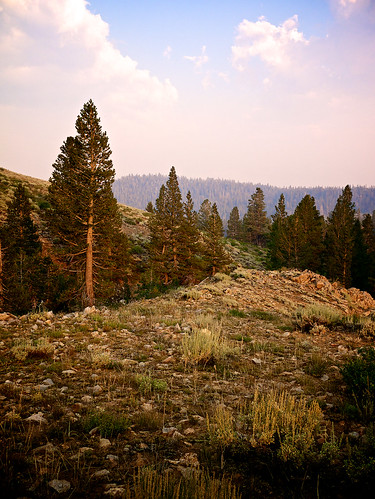
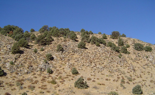
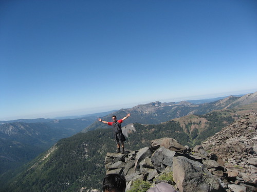
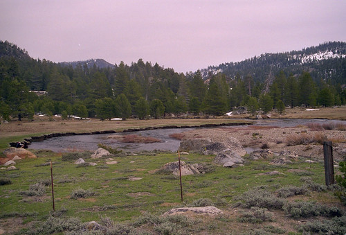
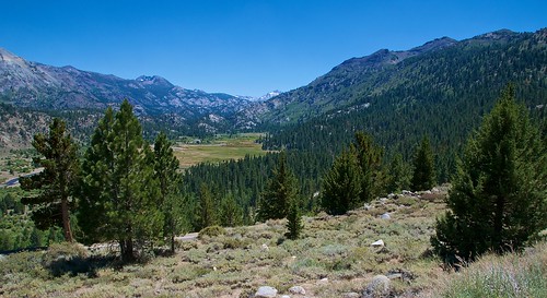
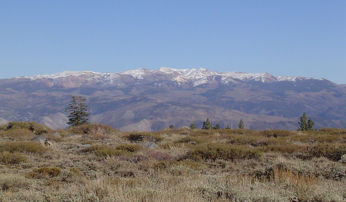
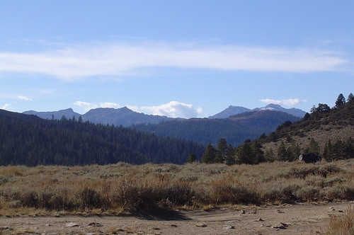
写真
アメリカ合衆国 カリフォルニア州 アンテロープ・ピークの地図
別の場所を検索
近所の場所
アメリカ合衆国 カリフォルニア州 ロスト・キャノン・ピーク
アメリカ合衆国 カリフォルニア州 ミネラル山
アメリカ合衆国 カリフォルニア州 ホワイトクリフ・ピーク
アメリカ合衆国 カリフォルニア州 ホワイト山
アメリカ合衆国 〒 カリフォルニア州 スタニスロース・ピーク
アメリカ合衆国 カリフォルニア州 ソノラ・パス
アメリカ合衆国 〒 カリフォルニア州 ディサスター・ピーク
アメリカ合衆国 カリフォルニア州 シエラ・ネバダ山脈
アメリカ合衆国 〒 カリフォルニア州 アーノット・ピーク
アメリカ合衆国 トーパス湖
アメリカ合衆国 カリフォルニア州 レビット湖
アメリカ合衆国 カリフォルニア州 レビット・ピーク
アメリカ合衆国 〒 カリフォルニア州 ナイト・キャップ・ピーク
アメリカ合衆国 カリフォルニア州 ハイランド・ピーク
アメリカ合衆国 〒 ネバダ州 トーパス・レイク
アメリカ合衆国 カリフォルニア州 ボールド・ピーク
アメリカ合衆国 〒 カリフォルニア州 ケネディ・ピーク
California, アメリカ合衆国クラーク・フォーク・キャンプグランド
アメリカ合衆国 〒 カリフォルニア州 モロ山
アメリカ合衆国 〒 カリフォルニア州 エアオーラ・ピーク
最近の検索
- アメリカ合衆国 アラスカ州 レッド・ドッグ・マイン日の出日の入り時間
- Am bhf, Borken, ドイツアム・バーンホーフ日の出日の入り時間
- 4th St E, Sonoma, CA, USA日の出日の入り時間
- Oakland Ave, Williamsport, PA アメリカ合衆国日の出日の入り時間
- Via Roma, Pieranica CR, イタリアローマ通り日の出日の入り時間
- クロアチア 〒 ドゥブロブニク GradClock Tower of Dubrovnik日の出日の入り時間
- アルゼンチン チュブ州 トレリュー日の出日の入り時間
- Hartfords Bluff Cir, Mt Pleasant, SC アメリカ合衆国日の出日の入り時間
- 日本、熊本県熊本市北区日の出日の入り時間
- 中華人民共和国 福州市 平潭県 平潭島日の出日の入り時間
