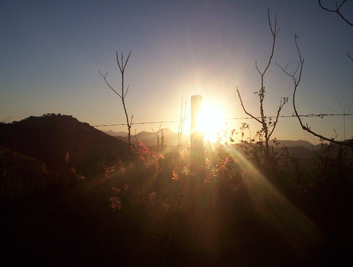
Zona horaria:hora estándar de Brasilia
Hora local:martes, 10 de noviembre de 2026 11:40
Longitud:-44.5550308
Latitud:-18.512178
Amanecer hoy:5:16:05
Atardecer hoy:18:10:52
Horas de luz hoy:12h 54m 47s
Amanecer mañana:5:15:47
Atardecer mañana:18:11:24
Horas de luz mañana:12h 55m 37s

: Mostrar todas las fechas

Fecha Salida de sol Puesta de sol Duración del día
1 de ene. de 2026 5:25:44 18:39:05 13h 13m 21s
1 de feb. de 2026 5:45:06 18:40:40 12h 55m 33s
1 de mar. de 2026 5:57:57 18:26:34 12h 28m 36s
1 de abr. de 2026 6:05:36 18:01:32 11h 55m 55s
1 de may. de 2026 6:13:15 17:40:02 11h 26m 47s
1 de jun. de 2026 6:24:29 17:30:12 11h 5m 43s
1 de jul. de 2026 6:32:06 17:33:54 11h 1m 47s
1 de ago. de 2026 6:27:29 17:44:09 11h 16m 39s
1 de sep. de 2026 6:08:14 17:51:59 11h 43m 44s
1 de oct. de 2026 5:42:14 17:56:44 12h 14m 29s
1 de nov. de 2026 5:20:08 18:05:59 12h 45m 51s
10 de nov. de 2026 5:16:24 18:10:20 12h 53m 56s
11 de nov. de 2026 5:16:05 18:10:52 12h 54m 47s
1 de dic. de 2026 5:14:00 18:22:41 13h 8m 41s

Fotos de amanecer y atardecer

Sunrise from the Summit at Pico da Bandeira (Flag Peak) at 2,892 m (9,488 ft) MSL, Caparaó National Park, on the border between the municipalities of Ibitirama (Espírito Santo State) and Alto Caparaó  by ER's Eyes - Our planet is so beautiful., legends and history

Pico da Bandeira is considered the highest point in exclusively Brazilian terri
Sunrise from the Summit at Pico da Bandeira (Flag Peak) at 2,892 m (9,488 ft) MSL, Caparaó National Park, on the border between the municipalities of Ibitirama (Espírito Santo State) and Alto Caparaó by ER's Eyes - Our planet is so beautiful.
Pedra da Mina: Where the Rain Reigns and the Wind Whispers (or Yells). by ER's Eyes - Our planet is so beautiful., At 2,798 meters (9,180 feet), Pedra da Mina reigns as Brazil’s fourth-highest peak and the Mantiquei
Pedra da Mina: Where the Rain Reigns and the Wind Whispers (or Yells). by ER's Eyes - Our planet is so beautiful.
Climbing down Pico do Cristal (Crystal Peak) at 2,770 m (9,087 ft) MSL, Caparaó National Park, Alto Caparaó, Minas Gerais State, Brazil. by ER's Eyes - Our planet is so beautiful.,  
In this photograph, you will have the exact idea of the trail to reach the third highest in Brazil
Climbing down Pico do Cristal (Crystal Peak) at 2,770 m (9,087 ft) MSL, Caparaó National Park, Alto Caparaó, Minas Gerais State, Brazil. by ER's Eyes - Our planet is so beautiful.
Twilight from the Summit at Pico da Bandeira (Flag Peak) at 2,892 m (9,488 ft) MSL, Caparaó National Park, on the border between the municipalities of Ibitirama (Espírito Santo State) and Alto Caparaó by ER's Eyes - Our planet is so beautiful., It is the third highest mountain in Brazil, situated on the border of Espírito Santo and Minas Gerai
Twilight from the Summit at Pico da Bandeira (Flag Peak) at 2,892 m (9,488 ft) MSL, Caparaó National Park, on the border between the municipalities of Ibitirama (Espírito Santo State) and Alto Caparaó by ER's Eyes - Our planet is so beautiful.
Sunrise from the Summit at Pico da Bandeira (Flag Peak) at 2,892 m (9,488 ft) MSL, Caparaó National Park, on the border between the municipalities of Ibitirama (Espírito Santo State) and Alto Caparaó  by ER's Eyes - Our planet is so beautiful., Pico da Bandeira (2,892 m / 9,488 ft) is the highest point in the region. Other peaks also worth men
Sunrise from the Summit at Pico da Bandeira (Flag Peak) at 2,892 m (9,488 ft) MSL, Caparaó National Park, on the border between the municipalities of Ibitirama (Espírito Santo State) and Alto Caparaó by ER's Eyes - Our planet is so beautiful.
Sunrise from the Summit at Pico da Bandeira (Flag Peak) at 2,892 m (9,488 ft) MSL, Caparaó National Park, on the border between the municipalities of Ibitirama (Espírito Santo State) and Alto Caparaó  by ER's Eyes - Our planet is so beautiful., The Serra do Caparaó has a very representative area of Atlantic Forest, with unique examples of alpi
Sunrise from the Summit at Pico da Bandeira (Flag Peak) at 2,892 m (9,488 ft) MSL, Caparaó National Park, on the border between the municipalities of Ibitirama (Espírito Santo State) and Alto Caparaó by ER's Eyes - Our planet is so beautiful.
Sunrise from the Summit at Pico da Bandeira (Flag Peak) at 2,892 m (9,488 ft) MSL, Caparaó National Park, on the border between the municipalities of Ibitirama (Espírito Santo State) and Alto Caparaó  by ER's Eyes - Our planet is so beautiful., The Cristal peak is the sixth highest peak in Brazil, with 2,769.05 meters of altitude, according to
Sunrise from the Summit at Pico da Bandeira (Flag Peak) at 2,892 m (9,488 ft) MSL, Caparaó National Park, on the border between the municipalities of Ibitirama (Espírito Santo State) and Alto Caparaó by ER's Eyes - Our planet is so beautiful.
Sunrise from the Summit at Pico da Bandeira (Flag Peak) at 2,892 m (9,488 ft) MSL, Caparaó National Park, on the border between the municipalities of Ibitirama (Espírito Santo State) and Alto Caparaó  by ER's Eyes - Our planet is so beautiful., My eldest nephew and his girlfriend in their moments of affection and contemplation, after the arduo
Sunrise from the Summit at Pico da Bandeira (Flag Peak) at 2,892 m (9,488 ft) MSL, Caparaó National Park, on the border between the municipalities of Ibitirama (Espírito Santo State) and Alto Caparaó by ER's Eyes - Our planet is so beautiful.
Pico da Bandeira (Flag Peak) seen from the Summit of Pico do Calçado (Shoe Peak) at 2,849 m (9,347 ft), Caparaó National Park, on the border between the municipalities of Ibitirama (Espírito Santo Sta by ER's Eyes - Our planet is so beautiful., Summit and canyon on the side of Espírito Santo.

How many trails of those massive mountain ranges w
Pico da Bandeira (Flag Peak) seen from the Summit of Pico do Calçado (Shoe Peak) at 2,849 m (9,347 ft), Caparaó National Park, on the border between the municipalities of Ibitirama (Espírito Santo Sta by ER's Eyes - Our planet is so beautiful.
Sunrise from the Summit at Pico da Bandeira (Flag Peak) at 2,892 m (9,488 ft) MSL, Caparaó National Park, on the border between the municipalities of Ibitirama (Espírito Santo State) and Alto Caparaó  by ER's Eyes - Our planet is so beautiful., The peak has this name because, around 1859, Emperor Pedro II determined that an Empire flag be plac
Sunrise from the Summit at Pico da Bandeira (Flag Peak) at 2,892 m (9,488 ft) MSL, Caparaó National Park, on the border between the municipalities of Ibitirama (Espírito Santo State) and Alto Caparaó by ER's Eyes - Our planet is so beautiful.
Pedra Duas Irmãs (Two Sisters Stone) at 2,390 m (7,841 ft) MSL, Trail by way of Caparaó-Capixaba, Caparaó National Park, Alto Caparaó, Minas Gerais State, Brazil. by ER's Eyes - Our planet is so beautiful., Rocky massif with a summit at an altitude of 2,600 m (8,530 ft) MSL, located near the Casa Queimada
Pedra Duas Irmãs (Two Sisters Stone) at 2,390 m (7,841 ft) MSL, Trail by way of Caparaó-Capixaba, Caparaó National Park, Alto Caparaó, Minas Gerais State, Brazil. by ER's Eyes - Our planet is so beautiful.
Sunrise from the Cruzeiro at the Summit at Pico da Bandeira (Flag Peak) at 2,892 m (9,488 ft) MSL, Caparaó National Park, on the border between the municipalities of Ibitirama (Espírito Santo State) a by ER's Eyes - Our planet is so beautiful., – Pico da Bandeira: 2,892 m / 9,488 ft;
– Peak 2 or Pico do Cruzeiro: 2,852 m / 9,356 ft;


Around 5
Sunrise from the Cruzeiro at the Summit at Pico da Bandeira (Flag Peak) at 2,892 m (9,488 ft) MSL, Caparaó National Park, on the border between the municipalities of Ibitirama (Espírito Santo State) a by ER's Eyes - Our planet is so beautiful.
Sunrise from the Summit at Pico da Bandeira (Flag Peak) at 2,892 m (9,488 ft) MSL, Caparaó National Park, on the border between the municipalities of Ibitirama (Espírito Santo State) and Alto Caparaó  by ER's Eyes - Our planet is so beautiful., View of Serra do Caparaó, with Pico do Calçado in evidence. In the background can be seen the Serra
Sunrise from the Summit at Pico da Bandeira (Flag Peak) at 2,892 m (9,488 ft) MSL, Caparaó National Park, on the border between the municipalities of Ibitirama (Espírito Santo State) and Alto Caparaó by ER's Eyes - Our planet is so beautiful.
Sunrise from the Summit at Pico da Bandeira (Flag Peak) at 2,892 m (9,488 ft) MSL, Caparaó National Park, on the border between the municipalities of Ibitirama (Espírito Santo State) and Alto Caparaó  by ER's Eyes - Our planet is so beautiful., The peak of Cristal is a massive point that has this denomination due to its abundant rock formation
Sunrise from the Summit at Pico da Bandeira (Flag Peak) at 2,892 m (9,488 ft) MSL, Caparaó National Park, on the border between the municipalities of Ibitirama (Espírito Santo State) and Alto Caparaó by ER's Eyes - Our planet is so beautiful.
Trail by way of Caparaó-Capixaba at 2,480 m (8,136 ft) MSL, Caparaó National Park, Dores do Rio Preto, Espírito Santo State, Brazil. by ER's Eyes - Our planet is so beautiful., Calçado and Cristal Peaks covered by fog at the end of the afternoon and without sunset.

We tested
Trail by way of Caparaó-Capixaba at 2,480 m (8,136 ft) MSL, Caparaó National Park, Dores do Rio Preto, Espírito Santo State, Brazil. by ER's Eyes - Our planet is so beautiful.
Trail by way of Caparaó-Capixaba at 2,540 m (8,333 ft) MSL, Caparaó National Park, Dores do Rio Preto, Espírito Santo State, Brazil. by ER's Eyes - Our planet is so beautiful., Picos do Calçado (Shoe Peak) and Calçado Mirim (Little Shoe Peak) are covered by fog in the late aft
Trail by way of Caparaó-Capixaba at 2,540 m (8,333 ft) MSL, Caparaó National Park, Dores do Rio Preto, Espírito Santo State, Brazil. by ER's Eyes - Our planet is so beautiful.
Sunset in the Wolf's Farm by de Paula FJ, A Fazenda do Lobo, localizada na Região Sudeste do Brasil, no Estado de Minas Gerais, é uma propried
Sunset in the Wolf's Farm by de Paula FJ
Church of St. Francis of Paula by Marcelo De Podestá, Church of St. Francis of Paula

Ouro Preto (Black Gold) is a city in the state of Minas Gerais, Braz
Church of St. Francis of Paula by Marcelo De Podestá
Casa da Serra Caparaó (Caparao Mountain Range House) at 1,220 m (4,002 ft) MSL, Forquilha do Rio, Minas Gerais State, Brazil. by ER's Eyes - Our planet is so beautiful., We had the option of renting one of the guest houses (the white house) fully equipped or the space i
Casa da Serra Caparaó (Caparao Mountain Range House) at 1,220 m (4,002 ft) MSL, Forquilha do Rio, Minas Gerais State, Brazil. by ER's Eyes - Our planet is so beautiful.
Church of St. Francis of Paula by Marcelo De Podestá, Church of St. Francis of Paula 

Ouro Preto (Black Gold) is a city in the state of Minas Gerais, Bra
Church of St. Francis of Paula by Marcelo De Podestá
Sunset in the Cerrado of Brazil by Francisco Aragão, = = = = = = = = = = = = = = = = = = = = = = = = = =
<b>© Copyright 2014 Francisco Aragão</b>
<b>© AL
Sunset in the Cerrado of Brazil by Francisco Aragão
Cerrado de Goiás / Brazilian Savannah by Francisco Aragão, = = = = = = = = = = = = = = = = = = = = = = = = = = = =
<b>Francisco Aragão © 2014. All Rights Reser
Cerrado de Goiás / Brazilian Savannah by Francisco Aragão
Paisagem rural - Rural scene by Dircinha -,  Rio Grande do Sul  

Rio Grande do Sul is one of 27 units of Brazil. Located in the South, has limi
Paisagem rural - Rural scene by Dircinha -
Golden Sky by de Paula FJ, A Fazenda do Lobo, localizada na Região Sudeste do Brasil, no Estado de Minas Gerais, é uma propried
Golden Sky by de Paula FJ
Fogão a lenha do Restaurante Xapurí em Belo Horizonte, Estado de MG,  Brasil - Wood stove of Xapuri Restaurant in Belo Horizonte, Minas Gerais state, Brazil by de Paula FJ, Português
De um brilho sereno e intenso, os olhos verdes de Nelsa Trombino iluminam uma face plena e
Fogão a lenha do Restaurante Xapurí em Belo Horizonte, Estado de MG, Brasil - Wood stove of Xapuri Restaurant in Belo Horizonte, Minas Gerais state, Brazil by de Paula FJ
Ouro Preto & Sunset by Luís Henrique Boucault, Photo of the Mirante das Lajes, Ouro Preto, Minas Gerais, Brazilpaisagem street tourist historic lan
Ouro Preto & Sunset by Luís Henrique Boucault
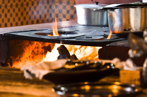
Fogão a lenha do Restaurante Xapurí em Belo Horizonte, Estado de MG,  Brasil - Wood stove of Xapuri Restaurant in Belo Horizonte, Minas Gerais state, Brazil by de Paula FJ, ortuguês
De um brilho sereno e intenso, os olhos verdes de Nelsa Trombino iluminam uma face plena e
Fogão a lenha do Restaurante Xapurí em Belo Horizonte, Estado de MG, Brasil - Wood stove of Xapuri Restaurant in Belo Horizonte, Minas Gerais state, Brazil by de Paula FJ
Fogão a lenha do Restaurante Xapurí em Belo Horizonte, Estado de MG,  Brasil - Wood stove of Xapuri Restaurant in Belo Horizonte, Minas Gerais state, Brazil by de Paula FJ, ortuguês
De um brilho sereno e intenso, os olhos verdes de Nelsa Trombino iluminam uma face plena e
Fogão a lenha do Restaurante Xapurí em Belo Horizonte, Estado de MG, Brasil - Wood stove of Xapuri Restaurant in Belo Horizonte, Minas Gerais state, Brazil by de Paula FJ
Sunrise in the Wolf's Farm by de Paula FJ, A Fazenda do Lobo, localizada na Região Sudeste do Brasil, no Estado de Minas Gerais, é uma propried
Sunrise in the Wolf's Farm by de Paula FJ
Vista parcial de Uberaba by Francisco Aragão,  = = = = = = = = = = = = = = = = = = = = = = = = = = = =
<b>Francisco Aragão © 2015. All Rights Rese
Vista parcial de Uberaba by Francisco Aragão
"The Brazillian coffe" @ Minas Gerais - Brazil by higordepadua, The sunset on the mountains of Minas Gerais and the coffee plantations.

Coffee production in Brazil
"The Brazillian coffe" @ Minas Gerais - Brazil by higordepadua
Golden Sky by de Paula FJ, A Fazenda do Lobo, localizada na Região Sudeste do Brasil, no Estado de Minas Gerais, é uma propried
Golden Sky by de Paula FJ
30,000 views. Thank you! by Ricardo Carreon, A month an a half ago, on April 17th, 2007 I was thanking you all for the 20,000 views of my stream.
30,000 views. Thank you! by Ricardo Carreon
"quem te conhece não esquece jamais... óh Minas Gerais!" by Ruby Augusto, 
* <b>aos FLICKEIROS mineiros, minha Homenagem: o SOL das Minas!!!!</b> 
"Minas Gerais, quem te
"quem te conhece não esquece jamais... óh Minas Gerais!" by Ruby Augusto
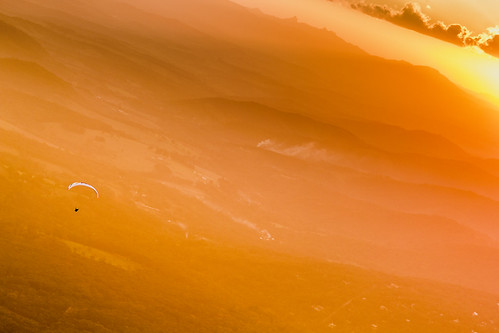
Paragliding at Sunset Over Hazy Mountain Range by Marcos Felipe T.D., <a href="http://www.istockphoto.com/file_closeup.php?id=70976881" rel="nofollow">Buy this picture he
Paragliding at Sunset Over Hazy Mountain Range by Marcos Felipe T.D.
Around the River Sao Francisco, Brazil by MadonnaJ, The Sao Francisco  is a river in Brazil. With a length of 2,914 kilometres (1,811 mi), it is the lon
Around the River Sao Francisco, Brazil by MadonnaJ
Golden Tree by de Paula FJ, A Fazenda do Lobo, localizada na Região Sudeste do Brasil, no Estado de Minas Gerais, é uma propried
Golden Tree by de Paula FJ
Amanhecer Mineiro by Ricardo Carreon, "Sunrise, Minas style". The day starts in Poços de Caldas, state of Minas Gerais. 

Amazin
Amanhecer Mineiro by Ricardo Carreon
Reflective sky by Marcel Figueiredo, While overflying the north of Minas Gerais state in Brazil We were able to see a couple of satellite
Reflective sky by Marcel Figueiredo
Ent by 웃 JuareZeitgeist, @Sul de MG | South of Minas Gerais state - Brazil.treesdiestandingup tree sky clouds nuvens crepuscu
Ent by 웃 JuareZeitgeist
Church of St. Francis of Paula by Marcelo De Podestá, Ouro Preto (Black Gold) is a city in the state of Minas Gerais, Brazil, a former colonial mining tow
Church of St. Francis of Paula by Marcelo De Podestá
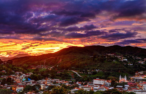
The sunset in late spring by RST Photo & Film, 
Another sunset in the state of Minas Gerais in Brazil. Photography performed with the HDR feature a
The sunset in late spring by RST Photo & Film
The Sun breaks the darkness... by Vinicius Montgomery - Itajubá-MG - Brazil, Sun, mountains and clouds in the last autumn day (20/06) in Itajubá, South of Minas Gerais state, Br
The Sun breaks the darkness... by Vinicius Montgomery - Itajubá-MG - Brazil
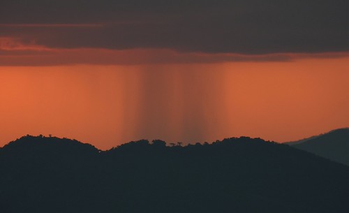
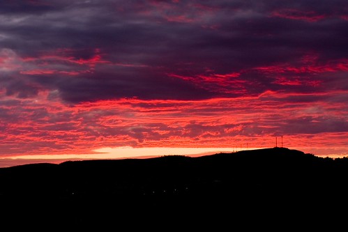
Dark rain in the south of Minas Gerais state, Brazil. by Vinicius Montgomery - Itajubá-MG - Brazil, pedralva pedrão minas gerais itajubá dark rain after sunset prof vinícius montgomery
Dark rain in the south of Minas Gerais state, Brazil. by Vinicius Montgomery - Itajubá-MG - Brazil
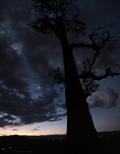
Perseid's Moon | Lua dos Perseídeos by 웃 JuareZeitgeist, @Sul de MG / South of Minas Gerais state - Brazil.lua moon rising dawn amanhacer nova new dusk noite
Perseid's Moon | Lua dos Perseídeos by 웃 JuareZeitgeist
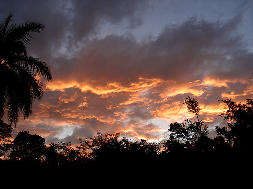
TaKe Me HoMe by HeLMut G., Sunset at Lapinha, a smal village in Cipó Hill at the state of Minas Gerais, Brasil.searchthebest am
TaKe Me HoMe by HeLMut G.
Is this real? by Vinicius Montgomery - Itajubá-MG - Brazil, A magic sunset in the mountains in the South of Minas Gerais state, Brazil.sunset minas gerais brazi
Is this real? by Vinicius Montgomery - Itajubá-MG - Brazil
Dew by Marcelo Brando, Tiradentes, State of Minas Gerais
Brazil
<a href="http://www.marcelobrando.com.br" rel="nofollow">ww
Dew by Marcelo Brando
Campo Grande by Emiel Dekker, Campo Grande is the capital and largest city of the Brazilian state of Mato Grosso do Sul in the Cen
Campo Grande by Emiel Dekker
O Último Por-de-Sol. by JucaFii, Antes da chuva que assolou meio Brasil eu ainda consegui visitar um por-de-sol mineiro, amen. Aí est
O Último Por-de-Sol. by JucaFii
Mountains and the orange sky of Itajubá. by Vinicius Montgomery - Itajubá-MG - Brazil, Pedra Amarela, Itajubá, south of Minas Gerais state, Brazil.pedra amarela itajubá minas gerais brazi
Mountains and the orange sky of Itajubá. by Vinicius Montgomery - Itajubá-MG - Brazil
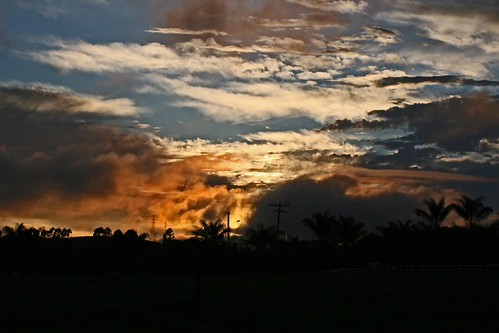
Sunset in a hot and dry day at the end of winter in Itajubá. by Vinicius Montgomery - Itajubá-MG - Brazil, Sunset after many weeks without a drop of rain in the mountains of the South of Minas Gerais state,
Sunset in a hot and dry day at the end of winter in Itajubá. by Vinicius Montgomery - Itajubá-MG - Brazil
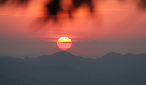
Sun and the Mountains by Vinicius Montgomery - Itajubá-MG - Brazil, In the South of Minas Gerais state - Brazil.prof vinícius montgomery brasópolis piranguçu minas gera
Sun and the Mountains by Vinicius Montgomery - Itajubá-MG - Brazil
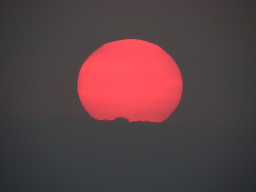
Red Sun in the mountains of South of Minas Gerais state, Brazil. by Vinicius Montgomery - Itajubá-MG - Brazil, casa nas nuvens prof vinícius montgomery sunset brazil minas gerais itajubá maria da fé mantiqueira
Red Sun in the mountains of South of Minas Gerais state, Brazil. by Vinicius Montgomery - Itajubá-MG - Brazil
Sun in the clouds... by Vinicius Montgomery - Itajubá-MG - Brazil, Just before the sunset in Piranguçu, South of Minas Gerais state, Brazil (1st Aug 2020).sunset sun m
Sun in the clouds... by Vinicius Montgomery - Itajubá-MG - Brazil
Just before the sunset in the mountains of Minas Gerais, Brazil. by Vinicius Montgomery - Itajubá-MG - Brazil, A magic place among Itajubá, Pedralva and Maria da Fé, cities in the south of Minas Gerais state, Br
Just before the sunset in the mountains of Minas Gerais, Brazil. by Vinicius Montgomery - Itajubá-MG - Brazil
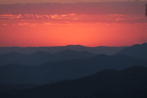
Just after the Sunset by Vinicius Montgomery - Itajubá-MG - Brazil, In the mountains of south of Minas Gerais state, Brazil.sunset minas gerais mantiqueira prof viníciu
Just after the Sunset by Vinicius Montgomery - Itajubá-MG - Brazil
Rio de Janeiro by Tula_tulipa, <b>O Rio de Janeiro é uma das 27 unidades federativas do Brasil. Situa-se na porção leste da região
Rio de Janeiro by Tula_tulipa
Pôr-do-sol pelo caminho... by NatiLady, This is a very old pic that I love, and i think it was my first sunset shot with a digital camera. I
Pôr-do-sol pelo caminho... by NatiLady