Horas de salida y puesta de sol de St. Anthony, Idaho, EE. UU.
Location: Estados Unidos > Idaho > Condado de Fremont >
Zona horaria:
America/Denver
Hora local:
2025-07-07 21:31:10
Longitud:
-111.6821847
Latitud:
43.9663008
Salida de sol de hoy:
05:52:56 AM
Puesta de sol de hoy:
09:10:58 PM
La duración del día hoy:
15h 18m 2s
Salida de sol de mañana:
05:53:42 AM
Puesta de sol de mañana:
09:10:30 PM
La duración del día mañana:
15h 16m 48s
Mostrar todas las fechas
| Fecha | Salida de sol | Puesta de sol | Duración del día |
|---|---|---|---|
| 01/01/2025 | 08:01:15 AM | 05:00:35 PM | 8h 59m 20s |
| 02/01/2025 | 08:01:14 AM | 05:01:32 PM | 9h 0m 18s |
| 03/01/2025 | 08:01:10 AM | 05:02:30 PM | 9h 1m 20s |
| 04/01/2025 | 08:01:04 AM | 05:03:30 PM | 9h 2m 26s |
| 05/01/2025 | 08:00:55 AM | 05:04:31 PM | 9h 3m 36s |
| 06/01/2025 | 08:00:44 AM | 05:05:34 PM | 9h 4m 50s |
| 07/01/2025 | 08:00:30 AM | 05:06:38 PM | 9h 6m 8s |
| 08/01/2025 | 08:00:13 AM | 05:07:44 PM | 9h 7m 31s |
| 09/01/2025 | 07:59:54 AM | 05:08:52 PM | 9h 8m 58s |
| 10/01/2025 | 07:59:33 AM | 05:10:00 PM | 9h 10m 27s |
| 11/01/2025 | 07:59:09 AM | 05:11:10 PM | 9h 12m 1s |
| 12/01/2025 | 07:58:43 AM | 05:12:21 PM | 9h 13m 38s |
| 13/01/2025 | 07:58:15 AM | 05:13:33 PM | 9h 15m 18s |
| 14/01/2025 | 07:57:44 AM | 05:14:46 PM | 9h 17m 2s |
| 15/01/2025 | 07:57:10 AM | 05:16:00 PM | 9h 18m 50s |
| 16/01/2025 | 07:56:35 AM | 05:17:15 PM | 9h 20m 40s |
| 17/01/2025 | 07:55:57 AM | 05:18:31 PM | 9h 22m 34s |
| 18/01/2025 | 07:55:17 AM | 05:19:48 PM | 9h 24m 31s |
| 19/01/2025 | 07:54:34 AM | 05:21:06 PM | 9h 26m 32s |
| 20/01/2025 | 07:53:50 AM | 05:22:24 PM | 9h 28m 34s |
| 21/01/2025 | 07:53:03 AM | 05:23:43 PM | 9h 30m 40s |
| 22/01/2025 | 07:52:14 AM | 05:25:02 PM | 9h 32m 48s |
| 23/01/2025 | 07:51:23 AM | 05:26:22 PM | 9h 34m 59s |
| 24/01/2025 | 07:50:30 AM | 05:27:43 PM | 9h 37m 13s |
| 25/01/2025 | 07:49:34 AM | 05:29:04 PM | 9h 39m 30s |
| 26/01/2025 | 07:48:37 AM | 05:30:25 PM | 9h 41m 48s |
| 27/01/2025 | 07:47:38 AM | 05:31:47 PM | 9h 44m 9s |
| 28/01/2025 | 07:46:37 AM | 05:33:09 PM | 9h 46m 32s |
| 29/01/2025 | 07:45:34 AM | 05:34:31 PM | 9h 48m 57s |
| 30/01/2025 | 07:44:29 AM | 05:35:53 PM | 9h 51m 24s |
| 31/01/2025 | 07:43:22 AM | 05:37:16 PM | 9h 53m 54s |
| 01/02/2025 | 07:42:14 AM | 05:38:39 PM | 9h 56m 25s |
| 02/02/2025 | 07:41:04 AM | 05:40:02 PM | 9h 58m 58s |
| 03/02/2025 | 07:39:52 AM | 05:41:25 PM | 10h 1m 33s |
| 04/02/2025 | 07:38:39 AM | 05:42:48 PM | 10h 4m 9s |
| 05/02/2025 | 07:37:24 AM | 05:44:11 PM | 10h 6m 47s |
| 06/02/2025 | 07:36:07 AM | 05:45:33 PM | 10h 9m 26s |
| 07/02/2025 | 07:34:49 AM | 05:46:56 PM | 10h 12m 7s |
| 08/02/2025 | 07:33:29 AM | 05:48:19 PM | 10h 14m 50s |
| 09/02/2025 | 07:32:08 AM | 05:49:42 PM | 10h 17m 34s |
| 10/02/2025 | 07:30:45 AM | 05:51:04 PM | 10h 20m 19s |
| 11/02/2025 | 07:29:22 AM | 05:52:27 PM | 10h 23m 5s |
| 12/02/2025 | 07:27:56 AM | 05:53:49 PM | 10h 25m 53s |
| 13/02/2025 | 07:26:30 AM | 05:55:11 PM | 10h 28m 41s |
| 14/02/2025 | 07:25:02 AM | 05:56:33 PM | 10h 31m 31s |
| 15/02/2025 | 07:23:33 AM | 05:57:55 PM | 10h 34m 22s |
| 16/02/2025 | 07:22:03 AM | 05:59:16 PM | 10h 37m 13s |
| 17/02/2025 | 07:20:32 AM | 06:00:37 PM | 10h 40m 5s |
| 18/02/2025 | 07:18:59 AM | 06:01:58 PM | 10h 42m 59s |
| 19/02/2025 | 07:17:26 AM | 06:03:19 PM | 10h 45m 53s |
| 20/02/2025 | 07:15:51 AM | 06:04:40 PM | 10h 48m 49s |
| 21/02/2025 | 07:14:16 AM | 06:06:00 PM | 10h 51m 44s |
| 22/02/2025 | 07:12:39 AM | 06:07:20 PM | 10h 54m 41s |
| 23/02/2025 | 07:11:02 AM | 06:08:39 PM | 10h 57m 37s |
| 24/02/2025 | 07:09:23 AM | 06:09:59 PM | 11h 0m 36s |
| 25/02/2025 | 07:07:44 AM | 06:11:18 PM | 11h 3m 34s |
| 26/02/2025 | 07:06:04 AM | 06:12:36 PM | 11h 6m 32s |
| 27/02/2025 | 07:04:24 AM | 06:13:55 PM | 11h 9m 31s |
| 28/02/2025 | 07:02:42 AM | 06:15:13 PM | 11h 12m 31s |
| 01/03/2025 | 07:01:00 AM | 06:16:31 PM | 11h 15m 31s |
| 02/03/2025 | 06:59:17 AM | 06:17:48 PM | 11h 18m 31s |
| 03/03/2025 | 06:57:34 AM | 06:19:06 PM | 11h 21m 32s |
| 04/03/2025 | 06:55:50 AM | 06:20:23 PM | 11h 24m 33s |
| 05/03/2025 | 06:54:05 AM | 06:21:40 PM | 11h 27m 35s |
| 06/03/2025 | 06:52:20 AM | 06:22:56 PM | 11h 30m 36s |
| 07/03/2025 | 06:50:34 AM | 06:24:12 PM | 11h 33m 38s |
| 08/03/2025 | 06:48:48 AM | 06:25:28 PM | 11h 36m 40s |
| 09/03/2025 | 07:47:06 AM | 07:26:41 PM | 11h 39m 35s |
| 10/03/2025 | 07:45:19 AM | 07:27:56 PM | 11h 42m 37s |
| 11/03/2025 | 07:43:32 AM | 07:29:12 PM | 11h 45m 40s |
| 12/03/2025 | 07:41:44 AM | 07:30:27 PM | 11h 48m 43s |
| 13/03/2025 | 07:39:56 AM | 07:31:42 PM | 11h 51m 46s |
| 14/03/2025 | 07:38:08 AM | 07:32:56 PM | 11h 54m 48s |
| 15/03/2025 | 07:36:19 AM | 07:34:11 PM | 11h 57m 52s |
| 16/03/2025 | 07:34:31 AM | 07:35:25 PM | 12h 0m 54s |
| 17/03/2025 | 07:32:42 AM | 07:36:39 PM | 12h 3m 57s |
| 18/03/2025 | 07:30:53 AM | 07:37:53 PM | 12h 7m 0s |
| 19/03/2025 | 07:29:03 AM | 07:39:07 PM | 12h 10m 4s |
| 20/03/2025 | 07:27:14 AM | 07:40:21 PM | 12h 13m 7s |
| 21/03/2025 | 07:25:25 AM | 07:41:34 PM | 12h 16m 9s |
| 22/03/2025 | 07:23:35 AM | 07:42:48 PM | 12h 19m 13s |
| 23/03/2025 | 07:21:46 AM | 07:44:01 PM | 12h 22m 15s |
| 24/03/2025 | 07:19:57 AM | 07:45:14 PM | 12h 25m 17s |
| 25/03/2025 | 07:18:07 AM | 07:46:27 PM | 12h 28m 20s |
| 26/03/2025 | 07:16:18 AM | 07:47:40 PM | 12h 31m 22s |
| 27/03/2025 | 07:14:29 AM | 07:48:53 PM | 12h 34m 24s |
| 28/03/2025 | 07:12:40 AM | 07:50:06 PM | 12h 37m 26s |
| 29/03/2025 | 07:10:52 AM | 07:51:18 PM | 12h 40m 26s |
| 30/03/2025 | 07:09:03 AM | 07:52:31 PM | 12h 43m 28s |
| 31/03/2025 | 07:07:15 AM | 07:53:44 PM | 12h 46m 29s |
| 01/04/2025 | 07:05:27 AM | 07:54:56 PM | 12h 49m 29s |
| 02/04/2025 | 07:03:39 AM | 07:56:09 PM | 12h 52m 30s |
| 03/04/2025 | 07:01:52 AM | 07:57:21 PM | 12h 55m 29s |
| 04/04/2025 | 07:00:05 AM | 07:58:34 PM | 12h 58m 29s |
| 05/04/2025 | 06:58:18 AM | 07:59:47 PM | 13h 1m 29s |
| 06/04/2025 | 06:56:32 AM | 08:00:59 PM | 13h 4m 27s |
| 07/04/2025 | 06:54:47 AM | 08:02:12 PM | 13h 7m 25s |
| 08/04/2025 | 06:53:02 AM | 08:03:24 PM | 13h 10m 22s |
| 09/04/2025 | 06:51:17 AM | 08:04:37 PM | 13h 13m 20s |
| 10/04/2025 | 06:49:33 AM | 08:05:49 PM | 13h 16m 16s |
| 11/04/2025 | 06:47:49 AM | 08:07:02 PM | 13h 19m 13s |
| 12/04/2025 | 06:46:07 AM | 08:08:14 PM | 13h 22m 7s |
| 13/04/2025 | 06:44:24 AM | 08:09:26 PM | 13h 25m 2s |
| 14/04/2025 | 06:42:43 AM | 08:10:39 PM | 13h 27m 56s |
| 15/04/2025 | 06:41:02 AM | 08:11:51 PM | 13h 30m 49s |
| 16/04/2025 | 06:39:22 AM | 08:13:04 PM | 13h 33m 42s |
| 17/04/2025 | 06:37:43 AM | 08:14:16 PM | 13h 36m 33s |
| 18/04/2025 | 06:36:05 AM | 08:15:29 PM | 13h 39m 24s |
| 19/04/2025 | 06:34:27 AM | 08:16:41 PM | 13h 42m 14s |
| 20/04/2025 | 06:32:51 AM | 08:17:54 PM | 13h 45m 3s |
| 21/04/2025 | 06:31:15 AM | 08:19:06 PM | 13h 47m 51s |
| 22/04/2025 | 06:29:40 AM | 08:20:18 PM | 13h 50m 38s |
| 23/04/2025 | 06:28:06 AM | 08:21:31 PM | 13h 53m 25s |
| 24/04/2025 | 06:26:34 AM | 08:22:43 PM | 13h 56m 9s |
| 25/04/2025 | 06:25:02 AM | 08:23:55 PM | 13h 58m 53s |
| 26/04/2025 | 06:23:32 AM | 08:25:07 PM | 14h 1m 35s |
| 27/04/2025 | 06:22:02 AM | 08:26:19 PM | 14h 4m 17s |
| 28/04/2025 | 06:20:34 AM | 08:27:31 PM | 14h 6m 57s |
| 29/04/2025 | 06:19:07 AM | 08:28:42 PM | 14h 9m 35s |
| 30/04/2025 | 06:17:41 AM | 08:29:54 PM | 14h 12m 13s |
| 01/05/2025 | 06:16:17 AM | 08:31:05 PM | 14h 14m 48s |
| 02/05/2025 | 06:14:53 AM | 08:32:16 PM | 14h 17m 23s |
| 03/05/2025 | 06:13:31 AM | 08:33:27 PM | 14h 19m 56s |
| 04/05/2025 | 06:12:11 AM | 08:34:37 PM | 14h 22m 26s |
| 05/05/2025 | 06:10:52 AM | 08:35:47 PM | 14h 24m 55s |
| 06/05/2025 | 06:09:34 AM | 08:36:57 PM | 14h 27m 23s |
| 07/05/2025 | 06:08:18 AM | 08:38:07 PM | 14h 29m 49s |
| 08/05/2025 | 06:07:04 AM | 08:39:16 PM | 14h 32m 12s |
| 09/05/2025 | 06:05:51 AM | 08:40:25 PM | 14h 34m 34s |
| 10/05/2025 | 06:04:39 AM | 08:41:33 PM | 14h 36m 54s |
| 11/05/2025 | 06:03:29 AM | 08:42:41 PM | 14h 39m 12s |
| 12/05/2025 | 06:02:21 AM | 08:43:48 PM | 14h 41m 27s |
| 13/05/2025 | 06:01:15 AM | 08:44:55 PM | 14h 43m 40s |
| 14/05/2025 | 06:00:10 AM | 08:46:01 PM | 14h 45m 51s |
| 15/05/2025 | 05:59:07 AM | 08:47:07 PM | 14h 48m 0s |
| 16/05/2025 | 05:58:05 AM | 08:48:12 PM | 14h 50m 7s |
| 17/05/2025 | 05:57:06 AM | 08:49:16 PM | 14h 52m 10s |
| 18/05/2025 | 05:56:09 AM | 08:50:19 PM | 14h 54m 10s |
| 19/05/2025 | 05:55:13 AM | 08:51:22 PM | 14h 56m 9s |
| 20/05/2025 | 05:54:19 AM | 08:52:24 PM | 14h 58m 5s |
| 21/05/2025 | 05:53:27 AM | 08:53:25 PM | 14h 59m 58s |
| 22/05/2025 | 05:52:37 AM | 08:54:25 PM | 15h 1m 48s |
| 23/05/2025 | 05:51:50 AM | 08:55:23 PM | 15h 3m 33s |
| 24/05/2025 | 05:51:04 AM | 08:56:21 PM | 15h 5m 17s |
| 25/05/2025 | 05:50:20 AM | 08:57:18 PM | 15h 6m 58s |
| 26/05/2025 | 05:49:38 AM | 08:58:14 PM | 15h 8m 36s |
| 27/05/2025 | 05:48:59 AM | 08:59:09 PM | 15h 10m 10s |
| 28/05/2025 | 05:48:21 AM | 09:00:02 PM | 15h 11m 41s |
| 29/05/2025 | 05:47:46 AM | 09:00:54 PM | 15h 13m 8s |
| 30/05/2025 | 05:47:12 AM | 09:01:45 PM | 15h 14m 33s |
| 31/05/2025 | 05:46:41 AM | 09:02:35 PM | 15h 15m 54s |
| 01/06/2025 | 05:46:12 AM | 09:03:23 PM | 15h 17m 11s |
| 02/06/2025 | 05:45:46 AM | 09:04:09 PM | 15h 18m 23s |
| 03/06/2025 | 05:45:21 AM | 09:04:54 PM | 15h 19m 33s |
| 04/06/2025 | 05:44:59 AM | 09:05:38 PM | 15h 20m 39s |
| 05/06/2025 | 05:44:39 AM | 09:06:20 PM | 15h 21m 41s |
| 06/06/2025 | 05:44:21 AM | 09:07:00 PM | 15h 22m 39s |
| 07/06/2025 | 05:44:05 AM | 09:07:39 PM | 15h 23m 34s |
| 08/06/2025 | 05:43:52 AM | 09:08:16 PM | 15h 24m 24s |
| 09/06/2025 | 05:43:41 AM | 09:08:51 PM | 15h 25m 10s |
| 10/06/2025 | 05:43:32 AM | 09:09:24 PM | 15h 25m 52s |
| 11/06/2025 | 05:43:26 AM | 09:09:55 PM | 15h 26m 29s |
| 12/06/2025 | 05:43:21 AM | 09:10:25 PM | 15h 27m 4s |
| 13/06/2025 | 05:43:19 AM | 09:10:52 PM | 15h 27m 33s |
| 14/06/2025 | 05:43:19 AM | 09:11:18 PM | 15h 27m 59s |
| 15/06/2025 | 05:43:21 AM | 09:11:42 PM | 15h 28m 21s |
| 16/06/2025 | 05:43:26 AM | 09:12:03 PM | 15h 28m 37s |
| 17/06/2025 | 05:43:32 AM | 09:12:23 PM | 15h 28m 51s |
| 18/06/2025 | 05:43:41 AM | 09:12:40 PM | 15h 28m 59s |
| 19/06/2025 | 05:43:52 AM | 09:12:55 PM | 15h 29m 3s |
| 20/06/2025 | 05:44:05 AM | 09:13:09 PM | 15h 29m 4s |
| 21/06/2025 | 05:44:20 AM | 09:13:20 PM | 15h 29m 0s |
| 22/06/2025 | 05:44:37 AM | 09:13:28 PM | 15h 28m 51s |
| 23/06/2025 | 05:44:56 AM | 09:13:35 PM | 15h 28m 39s |
| 24/06/2025 | 05:45:17 AM | 09:13:39 PM | 15h 28m 22s |
| 25/06/2025 | 05:45:40 AM | 09:13:41 PM | 15h 28m 1s |
| 26/06/2025 | 05:46:06 AM | 09:13:41 PM | 15h 27m 35s |
| 27/06/2025 | 05:46:32 AM | 09:13:39 PM | 15h 27m 7s |
| 28/06/2025 | 05:47:01 AM | 09:13:34 PM | 15h 26m 33s |
| 29/06/2025 | 05:47:32 AM | 09:13:27 PM | 15h 25m 55s |
| 30/06/2025 | 05:48:04 AM | 09:13:18 PM | 15h 25m 14s |
| 01/07/2025 | 05:48:38 AM | 09:13:06 PM | 15h 24m 28s |
| 02/07/2025 | 05:49:14 AM | 09:12:53 PM | 15h 23m 39s |
| 03/07/2025 | 05:49:52 AM | 09:12:37 PM | 15h 22m 45s |
| 04/07/2025 | 05:50:31 AM | 09:12:18 PM | 15h 21m 47s |
| 05/07/2025 | 05:51:12 AM | 09:11:58 PM | 15h 20m 46s |
| 06/07/2025 | 05:51:54 AM | 09:11:35 PM | 15h 19m 41s |
| 07/07/2025 | 05:52:38 AM | 09:11:10 PM | 15h 18m 32s |
| 08/07/2025 | 05:53:23 AM | 09:10:42 PM | 15h 17m 19s |
| 09/07/2025 | 05:54:09 AM | 09:10:12 PM | 15h 16m 3s |
| 10/07/2025 | 05:54:57 AM | 09:09:41 PM | 15h 14m 44s |
| 11/07/2025 | 05:55:46 AM | 09:09:07 PM | 15h 13m 21s |
| 12/07/2025 | 05:56:36 AM | 09:08:30 PM | 15h 11m 54s |
| 13/07/2025 | 05:57:28 AM | 09:07:52 PM | 15h 10m 24s |
| 14/07/2025 | 05:58:21 AM | 09:07:11 PM | 15h 8m 50s |
| 15/07/2025 | 05:59:14 AM | 09:06:29 PM | 15h 7m 15s |
| 16/07/2025 | 06:00:09 AM | 09:05:44 PM | 15h 5m 35s |
| 17/07/2025 | 06:01:05 AM | 09:04:57 PM | 15h 3m 52s |
| 18/07/2025 | 06:02:02 AM | 09:04:09 PM | 15h 2m 7s |
| 19/07/2025 | 06:02:59 AM | 09:03:18 PM | 15h 0m 19s |
| 20/07/2025 | 06:03:58 AM | 09:02:25 PM | 14h 58m 27s |
| 21/07/2025 | 06:04:57 AM | 09:01:30 PM | 14h 56m 33s |
| 22/07/2025 | 06:05:57 AM | 09:00:33 PM | 14h 54m 36s |
| 23/07/2025 | 06:06:58 AM | 08:59:35 PM | 14h 52m 37s |
| 24/07/2025 | 06:08:00 AM | 08:58:34 PM | 14h 50m 34s |
| 25/07/2025 | 06:09:02 AM | 08:57:32 PM | 14h 48m 30s |
| 26/07/2025 | 06:10:05 AM | 08:56:28 PM | 14h 46m 23s |
| 27/07/2025 | 06:11:08 AM | 08:55:22 PM | 14h 44m 14s |
| 28/07/2025 | 06:12:12 AM | 08:54:14 PM | 14h 42m 2s |
| 29/07/2025 | 06:13:16 AM | 08:53:05 PM | 14h 39m 49s |
| 30/07/2025 | 06:14:21 AM | 08:51:54 PM | 14h 37m 33s |
| 31/07/2025 | 06:15:26 AM | 08:50:41 PM | 14h 35m 15s |
| 01/08/2025 | 06:16:32 AM | 08:49:27 PM | 14h 32m 55s |
| 02/08/2025 | 06:17:38 AM | 08:48:11 PM | 14h 30m 33s |
| 03/08/2025 | 06:18:44 AM | 08:46:54 PM | 14h 28m 10s |
| 04/08/2025 | 06:19:50 AM | 08:45:35 PM | 14h 25m 45s |
| 05/08/2025 | 06:20:57 AM | 08:44:15 PM | 14h 23m 18s |
| 06/08/2025 | 06:22:04 AM | 08:42:53 PM | 14h 20m 49s |
| 07/08/2025 | 06:23:11 AM | 08:41:30 PM | 14h 18m 19s |
| 08/08/2025 | 06:24:19 AM | 08:40:06 PM | 14h 15m 47s |
| 09/08/2025 | 06:25:27 AM | 08:38:40 PM | 14h 13m 13s |
| 10/08/2025 | 06:26:34 AM | 08:37:13 PM | 14h 10m 39s |
| 11/08/2025 | 06:27:42 AM | 08:35:45 PM | 14h 8m 3s |
| 12/08/2025 | 06:28:50 AM | 08:34:15 PM | 14h 5m 25s |
| 13/08/2025 | 06:29:58 AM | 08:32:44 PM | 14h 2m 46s |
| 14/08/2025 | 06:31:06 AM | 08:31:13 PM | 14h 0m 7s |
| 15/08/2025 | 06:32:15 AM | 08:29:40 PM | 13h 57m 25s |
| 16/08/2025 | 06:33:23 AM | 08:28:06 PM | 13h 54m 43s |
| 17/08/2025 | 06:34:31 AM | 08:26:31 PM | 13h 52m 0s |
| 18/08/2025 | 06:35:39 AM | 08:24:54 PM | 13h 49m 15s |
| 19/08/2025 | 06:36:48 AM | 08:23:17 PM | 13h 46m 29s |
| 20/08/2025 | 06:37:56 AM | 08:21:39 PM | 13h 43m 43s |
| 21/08/2025 | 06:39:04 AM | 08:20:01 PM | 13h 40m 57s |
| 22/08/2025 | 06:40:13 AM | 08:18:21 PM | 13h 38m 8s |
| 23/08/2025 | 06:41:21 AM | 08:16:40 PM | 13h 35m 19s |
| 24/08/2025 | 06:42:29 AM | 08:14:59 PM | 13h 32m 30s |
| 25/08/2025 | 06:43:38 AM | 08:13:17 PM | 13h 29m 39s |
| 26/08/2025 | 06:44:46 AM | 08:11:34 PM | 13h 26m 48s |
| 27/08/2025 | 06:45:54 AM | 08:09:50 PM | 13h 23m 56s |
| 28/08/2025 | 06:47:02 AM | 08:08:06 PM | 13h 21m 4s |
| 29/08/2025 | 06:48:10 AM | 08:06:21 PM | 13h 18m 11s |
| 30/08/2025 | 06:49:18 AM | 08:04:35 PM | 13h 15m 17s |
| 31/08/2025 | 06:50:26 AM | 08:02:49 PM | 13h 12m 23s |
| 01/09/2025 | 06:51:34 AM | 08:01:02 PM | 13h 9m 28s |
| 02/09/2025 | 06:52:42 AM | 07:59:15 PM | 13h 6m 33s |
| 03/09/2025 | 06:53:50 AM | 07:57:27 PM | 13h 3m 37s |
| 04/09/2025 | 06:54:58 AM | 07:55:39 PM | 13h 0m 41s |
| 05/09/2025 | 06:56:06 AM | 07:53:51 PM | 12h 57m 45s |
| 06/09/2025 | 06:57:14 AM | 07:52:02 PM | 12h 54m 48s |
| 07/09/2025 | 06:58:22 AM | 07:50:12 PM | 12h 51m 50s |
| 08/09/2025 | 06:59:30 AM | 07:48:23 PM | 12h 48m 53s |
| 09/09/2025 | 07:00:38 AM | 07:46:33 PM | 12h 45m 55s |
| 10/09/2025 | 07:01:46 AM | 07:44:43 PM | 12h 42m 57s |
| 11/09/2025 | 07:02:54 AM | 07:42:52 PM | 12h 39m 58s |
| 12/09/2025 | 07:04:02 AM | 07:41:01 PM | 12h 36m 59s |
| 13/09/2025 | 07:05:10 AM | 07:39:11 PM | 12h 34m 1s |
| 14/09/2025 | 07:06:18 AM | 07:37:20 PM | 12h 31m 2s |
| 15/09/2025 | 07:07:27 AM | 07:35:28 PM | 12h 28m 1s |
| 16/09/2025 | 07:08:35 AM | 07:33:37 PM | 12h 25m 2s |
| 17/09/2025 | 07:09:43 AM | 07:31:46 PM | 12h 22m 3s |
| 18/09/2025 | 07:10:52 AM | 07:29:55 PM | 12h 19m 3s |
| 19/09/2025 | 07:12:00 AM | 07:28:03 PM | 12h 16m 3s |
| 20/09/2025 | 07:13:09 AM | 07:26:12 PM | 12h 13m 3s |
| 21/09/2025 | 07:14:18 AM | 07:24:21 PM | 12h 10m 3s |
| 22/09/2025 | 07:15:27 AM | 07:22:30 PM | 12h 7m 3s |
| 23/09/2025 | 07:16:36 AM | 07:20:39 PM | 12h 4m 3s |
| 24/09/2025 | 07:17:46 AM | 07:18:48 PM | 12h 1m 2s |
| 25/09/2025 | 07:18:55 AM | 07:16:57 PM | 11h 58m 2s |
| 26/09/2025 | 07:20:05 AM | 07:15:06 PM | 11h 55m 1s |
| 27/09/2025 | 07:21:15 AM | 07:13:16 PM | 11h 52m 1s |
| 28/09/2025 | 07:22:25 AM | 07:11:26 PM | 11h 49m 1s |
| 29/09/2025 | 07:23:35 AM | 07:09:37 PM | 11h 46m 2s |
| 30/09/2025 | 07:24:46 AM | 07:07:47 PM | 11h 43m 1s |
| 01/10/2025 | 07:25:57 AM | 07:05:58 PM | 11h 40m 1s |
| 02/10/2025 | 07:27:08 AM | 07:04:10 PM | 11h 37m 2s |
| 03/10/2025 | 07:28:19 AM | 07:02:22 PM | 11h 34m 3s |
| 04/10/2025 | 07:29:30 AM | 07:00:34 PM | 11h 31m 4s |
| 05/10/2025 | 07:30:42 AM | 06:58:47 PM | 11h 28m 5s |
| 06/10/2025 | 07:31:54 AM | 06:57:00 PM | 11h 25m 6s |
| 07/10/2025 | 07:33:07 AM | 06:55:14 PM | 11h 22m 7s |
| 08/10/2025 | 07:34:19 AM | 06:53:28 PM | 11h 19m 9s |
| 09/10/2025 | 07:35:32 AM | 06:51:43 PM | 11h 16m 11s |
| 10/10/2025 | 07:36:45 AM | 06:49:59 PM | 11h 13m 14s |
| 11/10/2025 | 07:37:59 AM | 06:48:16 PM | 11h 10m 17s |
| 12/10/2025 | 07:39:13 AM | 06:46:33 PM | 11h 7m 20s |
| 13/10/2025 | 07:40:27 AM | 06:44:51 PM | 11h 4m 24s |
| 14/10/2025 | 07:41:42 AM | 06:43:09 PM | 11h 1m 27s |
| 15/10/2025 | 07:42:56 AM | 06:41:29 PM | 10h 58m 33s |
| 16/10/2025 | 07:44:11 AM | 06:39:49 PM | 10h 55m 38s |
| 17/10/2025 | 07:45:27 AM | 06:38:11 PM | 10h 52m 44s |
| 18/10/2025 | 07:46:43 AM | 06:36:33 PM | 10h 49m 50s |
| 19/10/2025 | 07:47:59 AM | 06:34:56 PM | 10h 46m 57s |
| 20/10/2025 | 07:49:15 AM | 06:33:20 PM | 10h 44m 5s |
| 21/10/2025 | 07:50:32 AM | 06:31:45 PM | 10h 41m 13s |
| 22/10/2025 | 07:51:48 AM | 06:30:12 PM | 10h 38m 24s |
| 23/10/2025 | 07:53:06 AM | 06:28:39 PM | 10h 35m 33s |
| 24/10/2025 | 07:54:23 AM | 06:27:08 PM | 10h 32m 45s |
| 25/10/2025 | 07:55:41 AM | 06:25:38 PM | 10h 29m 57s |
| 26/10/2025 | 07:56:59 AM | 06:24:09 PM | 10h 27m 10s |
| 27/10/2025 | 07:58:17 AM | 06:22:41 PM | 10h 24m 24s |
| 28/10/2025 | 07:59:35 AM | 06:21:14 PM | 10h 21m 39s |
| 29/10/2025 | 08:00:54 AM | 06:19:49 PM | 10h 18m 55s |
| 30/10/2025 | 08:02:13 AM | 06:18:26 PM | 10h 16m 13s |
| 31/10/2025 | 08:03:32 AM | 06:17:03 PM | 10h 13m 31s |
| 01/11/2025 | 08:04:51 AM | 06:15:43 PM | 10h 10m 52s |
| 02/11/2025 | 07:06:13 AM | 05:14:20 PM | 10h 8m 7s |
| 03/11/2025 | 07:07:33 AM | 05:13:02 PM | 10h 5m 29s |
| 04/11/2025 | 07:08:52 AM | 05:11:46 PM | 10h 2m 54s |
| 05/11/2025 | 07:10:12 AM | 05:10:32 PM | 10h 0m 20s |
| 06/11/2025 | 07:11:31 AM | 05:09:19 PM | 9h 57m 48s |
| 07/11/2025 | 07:12:51 AM | 05:08:08 PM | 9h 55m 17s |
| 08/11/2025 | 07:14:10 AM | 05:06:58 PM | 9h 52m 48s |
| 09/11/2025 | 07:15:29 AM | 05:05:51 PM | 9h 50m 22s |
| 10/11/2025 | 07:16:48 AM | 05:04:45 PM | 9h 47m 57s |
| 11/11/2025 | 07:18:07 AM | 05:03:41 PM | 9h 45m 34s |
| 12/11/2025 | 07:19:26 AM | 05:02:39 PM | 9h 43m 13s |
| 13/11/2025 | 07:20:45 AM | 05:01:39 PM | 9h 40m 54s |
| 14/11/2025 | 07:22:03 AM | 05:00:41 PM | 9h 38m 38s |
| 15/11/2025 | 07:23:21 AM | 04:59:45 PM | 9h 36m 24s |
| 16/11/2025 | 07:24:39 AM | 04:58:51 PM | 9h 34m 12s |
| 17/11/2025 | 07:25:56 AM | 04:57:59 PM | 9h 32m 3s |
| 18/11/2025 | 07:27:12 AM | 04:57:09 PM | 9h 29m 57s |
| 19/11/2025 | 07:28:29 AM | 04:56:22 PM | 9h 27m 53s |
| 20/11/2025 | 07:29:44 AM | 04:55:36 PM | 9h 25m 52s |
| 21/11/2025 | 07:30:59 AM | 04:54:53 PM | 9h 23m 54s |
| 22/11/2025 | 07:32:13 AM | 04:54:12 PM | 9h 21m 59s |
| 23/11/2025 | 07:33:27 AM | 04:53:33 PM | 9h 20m 6s |
| 24/11/2025 | 07:34:39 AM | 04:52:57 PM | 9h 18m 18s |
| 25/11/2025 | 07:35:51 AM | 04:52:23 PM | 9h 16m 32s |
| 26/11/2025 | 07:37:02 AM | 04:51:51 PM | 9h 14m 49s |
| 27/11/2025 | 07:38:12 AM | 04:51:22 PM | 9h 13m 10s |
| 28/11/2025 | 07:39:21 AM | 04:50:56 PM | 9h 11m 35s |
| 29/11/2025 | 07:40:28 AM | 04:50:31 PM | 9h 10m 3s |
| 30/11/2025 | 07:41:35 AM | 04:50:09 PM | 9h 8m 34s |
| 01/12/2025 | 07:42:40 AM | 04:49:50 PM | 9h 7m 10s |
| 02/12/2025 | 07:43:44 AM | 04:49:33 PM | 9h 5m 49s |
| 03/12/2025 | 07:44:47 AM | 04:49:19 PM | 9h 4m 32s |
| 04/12/2025 | 07:45:48 AM | 04:49:07 PM | 9h 3m 19s |
| 05/12/2025 | 07:46:48 AM | 04:48:58 PM | 9h 2m 10s |
| 06/12/2025 | 07:47:47 AM | 04:48:51 PM | 9h 1m 4s |
| 07/12/2025 | 07:48:43 AM | 04:48:47 PM | 9h 0m 4s |
| 08/12/2025 | 07:49:38 AM | 04:48:46 PM | 8h 59m 8s |
| 09/12/2025 | 07:50:32 AM | 04:48:47 PM | 8h 58m 15s |
| 10/12/2025 | 07:51:23 AM | 04:48:51 PM | 8h 57m 28s |
| 11/12/2025 | 07:52:13 AM | 04:48:57 PM | 8h 56m 44s |
| 12/12/2025 | 07:53:01 AM | 04:49:05 PM | 8h 56m 4s |
| 13/12/2025 | 07:53:47 AM | 04:49:17 PM | 8h 55m 30s |
| 14/12/2025 | 07:54:30 AM | 04:49:31 PM | 8h 55m 1s |
| 15/12/2025 | 07:55:12 AM | 04:49:47 PM | 8h 54m 35s |
| 16/12/2025 | 07:55:52 AM | 04:50:06 PM | 8h 54m 14s |
| 17/12/2025 | 07:56:30 AM | 04:50:27 PM | 8h 53m 57s |
| 18/12/2025 | 07:57:05 AM | 04:50:51 PM | 8h 53m 46s |
| 19/12/2025 | 07:57:38 AM | 04:51:17 PM | 8h 53m 39s |
| 20/12/2025 | 07:58:09 AM | 04:51:46 PM | 8h 53m 37s |
| 21/12/2025 | 07:58:38 AM | 04:52:17 PM | 8h 53m 39s |
| 22/12/2025 | 07:59:05 AM | 04:52:50 PM | 8h 53m 45s |
| 23/12/2025 | 07:59:29 AM | 04:53:26 PM | 8h 53m 57s |
| 24/12/2025 | 07:59:50 AM | 04:54:03 PM | 8h 54m 13s |
| 25/12/2025 | 08:00:09 AM | 04:54:43 PM | 8h 54m 34s |
| 26/12/2025 | 08:00:26 AM | 04:55:26 PM | 8h 55m 0s |
| 27/12/2025 | 08:00:41 AM | 04:56:10 PM | 8h 55m 29s |
| 28/12/2025 | 08:00:52 AM | 04:56:56 PM | 8h 56m 4s |
| 29/12/2025 | 08:01:02 AM | 04:57:45 PM | 8h 56m 43s |
| 30/12/2025 | 08:01:09 AM | 04:58:35 PM | 8h 57m 26s |
| 31/12/2025 | 08:01:13 AM | 04:59:27 PM | 8h 58m 14s |
Fotos
Monkey Rock

Monkey Rock From the Side
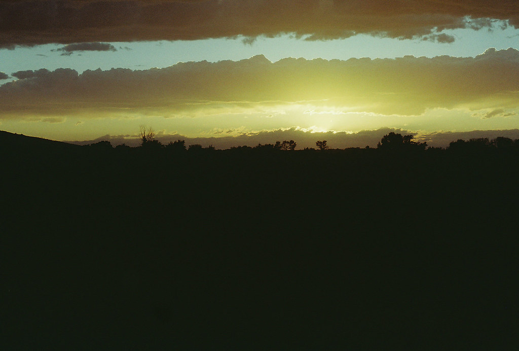
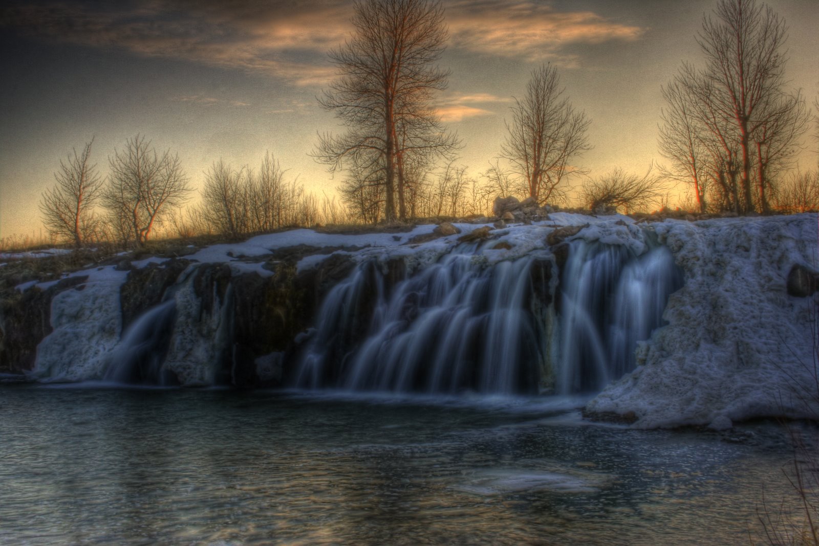
Henrys Fork Sunset

Sunset on Henry's Fork

Common Yellowthroat view #2, Chester Wetlands, Chester, ID 2012
[IDAHO-L-0147] Teton Dam Flood - Newdale
[IDAHO-L-0148] Teton Dam Flood - Newdale
[IDAHO-L-0149] Teton Dam Flood - Newdale
[IDAHO-L-0150] Teton Dam Flood - Newdale

The Henry's Fork (of the Snake River)

The Dunes

Having fun.

All Photos-4702
Teton Dam
Ruins of Teton Dam
DJI00360.JPG
Mapa de St. Anthony, Idaho, EE. UU.
Buscar otro lugar
Lugares cercanos
W 2nd N, St Anthony, ID, EE. UU.
Teton Hwy, St Anthony, ID, EE. UU.
N E, St Anthony, ID, EE. UU.
Teton, Idaho, EE. UU.
44 Main St, Teton, ID, EE. UU.
Newdale, Idaho, EE. UU.
Sugar City, Idaho, EE. UU.
ID-33, Rexburg, ID, EE. UU.
E N, Sugar City, ID, EE. UU.
Teton River, Idaho, EE. UU.
E N, Teton, ID, EE. UU.
Rexburg Rapids, 50 W 2nd N, Rexburg, ID, EE. UU.
Rexburg, ID - BYU Idaho, Rexburg, Idaho, EE. UU.
Rexburg, Idaho, EE. UU.
S 2nd E, Rexburg, ID, EE. UU.
Park St, Rexburg, ID, EE. UU.
W 5th S, Rexburg, ID, EE. UU.
N E, Ashton, ID, EE. UU.
N W, Rexburg, ID, EE. UU.
Taylor Ln, Rexburg, ID, EE. UU.
Búsquedas recientes
- Horas de salida y puesta de sol de Red Dog Mine, AK, USA
- Horas de salida y puesta de sol de Am Bahnhof, Am bhf, Borken, Germany
- Horas de salida y puesta de sol de 4th St E, Sonoma, CA, EE. UU.
- Horas de salida y puesta de sol de Oakland Ave, Williamsport, PA, EE. UU.
- Horas de salida y puesta de sol de Via Roma, Pieranica CR, Italia
- Horas de salida y puesta de sol de Torre del reloj, Grad, Dubrovnik (Ragusa), Croacia
- Horas de salida y puesta de sol de Trelew, Chubut, Argentina
- Horas de salida y puesta de sol de Hartfords Bluff Cir, Mt Pleasant, SC, EE. UU.
- Horas de salida y puesta de sol de Kita Ward, Kumamoto, Japón
- Horas de salida y puesta de sol de Pingtan Island, Pingtan County, Fuzhou, China