Horas de salida y puesta de sol de Myrtle Falls Trail, West Side Rd, Bonners Ferry, ID, EE. UU.
Location: Estados Unidos > Idaho > Bonners Ferry >
Zona horaria:
America/Los_Angeles
Hora local:
2025-07-01 15:37:04
Longitud:
-116.4163984
Latitud:
48.7073396
Salida de sol de hoy:
04:48:11 AM
Puesta de sol de hoy:
08:51:36 PM
La duración del día hoy:
16h 3m 25s
Salida de sol de mañana:
04:48:53 AM
Puesta de sol de mañana:
08:51:15 PM
La duración del día mañana:
16h 2m 22s
Mostrar todas las fechas
| Fecha | Salida de sol | Puesta de sol | Duración del día |
|---|---|---|---|
| 01/01/2025 | 07:38:12 AM | 04:01:34 PM | 8h 23m 22s |
| 02/01/2025 | 07:38:04 AM | 04:02:37 PM | 8h 24m 33s |
| 03/01/2025 | 07:37:53 AM | 04:03:42 PM | 8h 25m 49s |
| 04/01/2025 | 07:37:39 AM | 04:04:50 PM | 8h 27m 11s |
| 05/01/2025 | 07:37:22 AM | 04:05:59 PM | 8h 28m 37s |
| 06/01/2025 | 07:37:02 AM | 04:07:10 PM | 8h 30m 8s |
| 07/01/2025 | 07:36:40 AM | 04:08:24 PM | 8h 31m 44s |
| 08/01/2025 | 07:36:14 AM | 04:09:39 PM | 8h 33m 25s |
| 09/01/2025 | 07:35:46 AM | 04:10:56 PM | 8h 35m 10s |
| 10/01/2025 | 07:35:14 AM | 04:12:14 PM | 8h 37m 0s |
| 11/01/2025 | 07:34:40 AM | 04:13:34 PM | 8h 38m 54s |
| 12/01/2025 | 07:34:03 AM | 04:14:56 PM | 8h 40m 53s |
| 13/01/2025 | 07:33:24 AM | 04:16:19 PM | 8h 42m 55s |
| 14/01/2025 | 07:32:41 AM | 04:17:43 PM | 8h 45m 2s |
| 15/01/2025 | 07:31:56 AM | 04:19:09 PM | 8h 47m 13s |
| 16/01/2025 | 07:31:09 AM | 04:20:36 PM | 8h 49m 27s |
| 17/01/2025 | 07:30:18 AM | 04:22:04 PM | 8h 51m 46s |
| 18/01/2025 | 07:29:26 AM | 04:23:34 PM | 8h 54m 8s |
| 19/01/2025 | 07:28:30 AM | 04:25:04 PM | 8h 56m 34s |
| 20/01/2025 | 07:27:33 AM | 04:26:35 PM | 8h 59m 2s |
| 21/01/2025 | 07:26:32 AM | 04:28:07 PM | 9h 1m 35s |
| 22/01/2025 | 07:25:30 AM | 04:29:40 PM | 9h 4m 10s |
| 23/01/2025 | 07:24:25 AM | 04:31:14 PM | 9h 6m 49s |
| 24/01/2025 | 07:23:18 AM | 04:32:48 PM | 9h 9m 30s |
| 25/01/2025 | 07:22:08 AM | 04:34:23 PM | 9h 12m 15s |
| 26/01/2025 | 07:20:57 AM | 04:35:59 PM | 9h 15m 2s |
| 27/01/2025 | 07:19:43 AM | 04:37:35 PM | 9h 17m 52s |
| 28/01/2025 | 07:18:27 AM | 04:39:12 PM | 9h 20m 45s |
| 29/01/2025 | 07:17:10 AM | 04:40:49 PM | 9h 23m 39s |
| 30/01/2025 | 07:15:50 AM | 04:42:26 PM | 9h 26m 36s |
| 31/01/2025 | 07:14:28 AM | 04:44:04 PM | 9h 29m 36s |
| 01/02/2025 | 07:13:04 AM | 04:45:42 PM | 9h 32m 38s |
| 02/02/2025 | 07:11:39 AM | 04:47:20 PM | 9h 35m 41s |
| 03/02/2025 | 07:10:12 AM | 04:48:58 PM | 9h 38m 46s |
| 04/02/2025 | 07:08:43 AM | 04:50:37 PM | 9h 41m 54s |
| 05/02/2025 | 07:07:12 AM | 04:52:15 PM | 9h 45m 3s |
| 06/02/2025 | 07:05:39 AM | 04:53:54 PM | 9h 48m 15s |
| 07/02/2025 | 07:04:05 AM | 04:55:32 PM | 9h 51m 27s |
| 08/02/2025 | 07:02:30 AM | 04:57:11 PM | 9h 54m 41s |
| 09/02/2025 | 07:00:53 AM | 04:58:50 PM | 9h 57m 57s |
| 10/02/2025 | 06:59:14 AM | 05:00:28 PM | 10h 1m 14s |
| 11/02/2025 | 06:57:34 AM | 05:02:07 PM | 10h 4m 33s |
| 12/02/2025 | 06:55:53 AM | 05:03:45 PM | 10h 7m 52s |
| 13/02/2025 | 06:54:10 AM | 05:05:23 PM | 10h 11m 13s |
| 14/02/2025 | 06:52:26 AM | 05:07:01 PM | 10h 14m 35s |
| 15/02/2025 | 06:50:41 AM | 05:08:39 PM | 10h 17m 58s |
| 16/02/2025 | 06:48:54 AM | 05:10:17 PM | 10h 21m 23s |
| 17/02/2025 | 06:47:07 AM | 05:11:54 PM | 10h 24m 47s |
| 18/02/2025 | 06:45:18 AM | 05:13:31 PM | 10h 28m 13s |
| 19/02/2025 | 06:43:28 AM | 05:15:09 PM | 10h 31m 41s |
| 20/02/2025 | 06:41:37 AM | 05:16:45 PM | 10h 35m 8s |
| 21/02/2025 | 06:39:45 AM | 05:18:22 PM | 10h 38m 37s |
| 22/02/2025 | 06:37:52 AM | 05:19:58 PM | 10h 42m 6s |
| 23/02/2025 | 06:35:58 AM | 05:21:34 PM | 10h 45m 36s |
| 24/02/2025 | 06:34:03 AM | 05:23:10 PM | 10h 49m 7s |
| 25/02/2025 | 06:32:08 AM | 05:24:45 PM | 10h 52m 37s |
| 26/02/2025 | 06:30:11 AM | 05:26:21 PM | 10h 56m 10s |
| 27/02/2025 | 06:28:14 AM | 05:27:56 PM | 10h 59m 42s |
| 28/02/2025 | 06:26:16 AM | 05:29:30 PM | 11h 3m 14s |
| 01/03/2025 | 06:24:17 AM | 05:31:05 PM | 11h 6m 48s |
| 02/03/2025 | 06:22:18 AM | 05:32:39 PM | 11h 10m 21s |
| 03/03/2025 | 06:20:18 AM | 05:34:12 PM | 11h 13m 54s |
| 04/03/2025 | 06:18:18 AM | 05:35:46 PM | 11h 17m 28s |
| 05/03/2025 | 06:16:16 AM | 05:37:19 PM | 11h 21m 3s |
| 06/03/2025 | 06:14:15 AM | 05:38:52 PM | 11h 24m 37s |
| 07/03/2025 | 06:12:12 AM | 05:40:25 PM | 11h 28m 13s |
| 08/03/2025 | 06:10:10 AM | 05:41:58 PM | 11h 31m 48s |
| 09/03/2025 | 07:08:12 AM | 06:43:26 PM | 11h 35m 14s |
| 10/03/2025 | 07:06:08 AM | 06:44:58 PM | 11h 38m 50s |
| 11/03/2025 | 07:04:04 AM | 06:46:30 PM | 11h 42m 26s |
| 12/03/2025 | 07:02:00 AM | 06:48:01 PM | 11h 46m 1s |
| 13/03/2025 | 06:59:56 AM | 06:49:33 PM | 11h 49m 37s |
| 14/03/2025 | 06:57:51 AM | 06:51:04 PM | 11h 53m 13s |
| 15/03/2025 | 06:55:46 AM | 06:52:35 PM | 11h 56m 49s |
| 16/03/2025 | 06:53:41 AM | 06:54:06 PM | 12h 0m 25s |
| 17/03/2025 | 06:51:35 AM | 06:55:36 PM | 12h 4m 1s |
| 18/03/2025 | 06:49:30 AM | 06:57:07 PM | 12h 7m 37s |
| 19/03/2025 | 06:47:24 AM | 06:58:37 PM | 12h 11m 13s |
| 20/03/2025 | 06:45:18 AM | 07:00:07 PM | 12h 14m 49s |
| 21/03/2025 | 06:43:12 AM | 07:01:37 PM | 12h 18m 25s |
| 22/03/2025 | 06:41:06 AM | 07:03:07 PM | 12h 22m 1s |
| 23/03/2025 | 06:39:00 AM | 07:04:37 PM | 12h 25m 37s |
| 24/03/2025 | 06:36:55 AM | 07:06:07 PM | 12h 29m 12s |
| 25/03/2025 | 06:34:49 AM | 07:07:36 PM | 12h 32m 47s |
| 26/03/2025 | 06:32:43 AM | 07:09:06 PM | 12h 36m 23s |
| 27/03/2025 | 06:30:38 AM | 07:10:35 PM | 12h 39m 57s |
| 28/03/2025 | 06:28:32 AM | 07:12:04 PM | 12h 43m 32s |
| 29/03/2025 | 06:26:27 AM | 07:13:34 PM | 12h 47m 7s |
| 30/03/2025 | 06:24:22 AM | 07:15:03 PM | 12h 50m 41s |
| 31/03/2025 | 06:22:17 AM | 07:16:32 PM | 12h 54m 15s |
| 01/04/2025 | 06:20:13 AM | 07:18:01 PM | 12h 57m 48s |
| 02/04/2025 | 06:18:09 AM | 07:19:30 PM | 13h 1m 21s |
| 03/04/2025 | 06:16:05 AM | 07:20:59 PM | 13h 4m 54s |
| 04/04/2025 | 06:14:02 AM | 07:22:28 PM | 13h 8m 26s |
| 05/04/2025 | 06:11:59 AM | 07:23:57 PM | 13h 11m 58s |
| 06/04/2025 | 06:09:56 AM | 07:25:26 PM | 13h 15m 30s |
| 07/04/2025 | 06:07:54 AM | 07:26:55 PM | 13h 19m 1s |
| 08/04/2025 | 06:05:52 AM | 07:28:24 PM | 13h 22m 32s |
| 09/04/2025 | 06:03:51 AM | 07:29:53 PM | 13h 26m 2s |
| 10/04/2025 | 06:01:51 AM | 07:31:22 PM | 13h 29m 31s |
| 11/04/2025 | 05:59:51 AM | 07:32:51 PM | 13h 33m 0s |
| 12/04/2025 | 05:57:52 AM | 07:34:19 PM | 13h 36m 27s |
| 13/04/2025 | 05:55:53 AM | 07:35:48 PM | 13h 39m 55s |
| 14/04/2025 | 05:53:56 AM | 07:37:17 PM | 13h 43m 21s |
| 15/04/2025 | 05:51:59 AM | 07:38:46 PM | 13h 46m 47s |
| 16/04/2025 | 05:50:02 AM | 07:40:15 PM | 13h 50m 13s |
| 17/04/2025 | 05:48:07 AM | 07:41:44 PM | 13h 53m 37s |
| 18/04/2025 | 05:46:12 AM | 07:43:12 PM | 13h 57m 0s |
| 19/04/2025 | 05:44:19 AM | 07:44:41 PM | 14h 0m 22s |
| 20/04/2025 | 05:42:26 AM | 07:46:10 PM | 14h 3m 44s |
| 21/04/2025 | 05:40:34 AM | 07:47:38 PM | 14h 7m 4s |
| 22/04/2025 | 05:38:43 AM | 07:49:07 PM | 14h 10m 24s |
| 23/04/2025 | 05:36:53 AM | 07:50:35 PM | 14h 13m 42s |
| 24/04/2025 | 05:35:05 AM | 07:52:03 PM | 14h 16m 58s |
| 25/04/2025 | 05:33:17 AM | 07:53:31 PM | 14h 20m 14s |
| 26/04/2025 | 05:31:31 AM | 07:54:59 PM | 14h 23m 28s |
| 27/04/2025 | 05:29:45 AM | 07:56:27 PM | 14h 26m 42s |
| 28/04/2025 | 05:28:01 AM | 07:57:55 PM | 14h 29m 54s |
| 29/04/2025 | 05:26:19 AM | 07:59:22 PM | 14h 33m 3s |
| 30/04/2025 | 05:24:37 AM | 08:00:49 PM | 14h 36m 12s |
| 01/05/2025 | 05:22:57 AM | 08:02:16 PM | 14h 39m 19s |
| 02/05/2025 | 05:21:19 AM | 08:03:42 PM | 14h 42m 23s |
| 03/05/2025 | 05:19:41 AM | 08:05:09 PM | 14h 45m 28s |
| 04/05/2025 | 05:18:06 AM | 08:06:34 PM | 14h 48m 28s |
| 05/05/2025 | 05:16:31 AM | 08:08:00 PM | 14h 51m 29s |
| 06/05/2025 | 05:14:59 AM | 08:09:25 PM | 14h 54m 26s |
| 07/05/2025 | 05:13:28 AM | 08:10:49 PM | 14h 57m 21s |
| 08/05/2025 | 05:11:58 AM | 08:12:13 PM | 15h 0m 15s |
| 09/05/2025 | 05:10:31 AM | 08:13:37 PM | 15h 3m 6s |
| 10/05/2025 | 05:09:05 AM | 08:15:00 PM | 15h 5m 55s |
| 11/05/2025 | 05:07:40 AM | 08:16:22 PM | 15h 8m 42s |
| 12/05/2025 | 05:06:18 AM | 08:17:44 PM | 15h 11m 26s |
| 13/05/2025 | 05:04:58 AM | 08:19:04 PM | 15h 14m 6s |
| 14/05/2025 | 05:03:39 AM | 08:20:25 PM | 15h 16m 46s |
| 15/05/2025 | 05:02:22 AM | 08:21:44 PM | 15h 19m 22s |
| 16/05/2025 | 05:01:08 AM | 08:23:02 PM | 15h 21m 54s |
| 17/05/2025 | 04:59:55 AM | 08:24:20 PM | 15h 24m 25s |
| 18/05/2025 | 04:58:44 AM | 08:25:36 PM | 15h 26m 52s |
| 19/05/2025 | 04:57:36 AM | 08:26:52 PM | 15h 29m 16s |
| 20/05/2025 | 04:56:30 AM | 08:28:06 PM | 15h 31m 36s |
| 21/05/2025 | 04:55:26 AM | 08:29:19 PM | 15h 33m 53s |
| 22/05/2025 | 04:54:24 AM | 08:30:31 PM | 15h 36m 7s |
| 23/05/2025 | 04:53:24 AM | 08:31:42 PM | 15h 38m 18s |
| 24/05/2025 | 04:52:27 AM | 08:32:51 PM | 15h 40m 24s |
| 25/05/2025 | 04:51:32 AM | 08:34:00 PM | 15h 42m 28s |
| 26/05/2025 | 04:50:39 AM | 08:35:06 PM | 15h 44m 27s |
| 27/05/2025 | 04:49:49 AM | 08:36:11 PM | 15h 46m 22s |
| 28/05/2025 | 04:49:02 AM | 08:37:15 PM | 15h 48m 13s |
| 29/05/2025 | 04:48:16 AM | 08:38:17 PM | 15h 50m 1s |
| 30/05/2025 | 04:47:34 AM | 08:39:17 PM | 15h 51m 43s |
| 31/05/2025 | 04:46:53 AM | 08:40:16 PM | 15h 53m 23s |
| 01/06/2025 | 04:46:16 AM | 08:41:13 PM | 15h 54m 57s |
| 02/06/2025 | 04:45:41 AM | 08:42:08 PM | 15h 56m 27s |
| 03/06/2025 | 04:45:08 AM | 08:43:01 PM | 15h 57m 53s |
| 04/06/2025 | 04:44:39 AM | 08:43:52 PM | 15h 59m 13s |
| 05/06/2025 | 04:44:12 AM | 08:44:41 PM | 16h 0m 29s |
| 06/06/2025 | 04:43:47 AM | 08:45:28 PM | 16h 1m 41s |
| 07/06/2025 | 04:43:25 AM | 08:46:12 PM | 16h 2m 47s |
| 08/06/2025 | 04:43:06 AM | 08:46:55 PM | 16h 3m 49s |
| 09/06/2025 | 04:42:50 AM | 08:47:36 PM | 16h 4m 46s |
| 10/06/2025 | 04:42:36 AM | 08:48:14 PM | 16h 5m 38s |
| 11/06/2025 | 04:42:25 AM | 08:48:49 PM | 16h 6m 24s |
| 12/06/2025 | 04:42:17 AM | 08:49:23 PM | 16h 7m 6s |
| 13/06/2025 | 04:42:11 AM | 08:49:54 PM | 16h 7m 43s |
| 14/06/2025 | 04:42:09 AM | 08:50:22 PM | 16h 8m 13s |
| 15/06/2025 | 04:42:08 AM | 08:50:48 PM | 16h 8m 40s |
| 16/06/2025 | 04:42:11 AM | 08:51:12 PM | 16h 9m 1s |
| 17/06/2025 | 04:42:16 AM | 08:51:33 PM | 16h 9m 17s |
| 18/06/2025 | 04:42:24 AM | 08:51:51 PM | 16h 9m 27s |
| 19/06/2025 | 04:42:34 AM | 08:52:07 PM | 16h 9m 33s |
| 20/06/2025 | 04:42:48 AM | 08:52:20 PM | 16h 9m 32s |
| 21/06/2025 | 04:43:03 AM | 08:52:30 PM | 16h 9m 27s |
| 22/06/2025 | 04:43:22 AM | 08:52:38 PM | 16h 9m 16s |
| 23/06/2025 | 04:43:42 AM | 08:52:43 PM | 16h 9m 1s |
| 24/06/2025 | 04:44:06 AM | 08:52:45 PM | 16h 8m 39s |
| 25/06/2025 | 04:44:31 AM | 08:52:44 PM | 16h 8m 13s |
| 26/06/2025 | 04:45:00 AM | 08:52:41 PM | 16h 7m 41s |
| 27/06/2025 | 04:45:30 AM | 08:52:35 PM | 16h 7m 5s |
| 28/06/2025 | 04:46:03 AM | 08:52:26 PM | 16h 6m 23s |
| 29/06/2025 | 04:46:38 AM | 08:52:15 PM | 16h 5m 37s |
| 30/06/2025 | 04:47:16 AM | 08:52:00 PM | 16h 4m 44s |
| 01/07/2025 | 04:47:55 AM | 08:51:43 PM | 16h 3m 48s |
| 02/07/2025 | 04:48:37 AM | 08:51:24 PM | 16h 2m 47s |
| 03/07/2025 | 04:49:21 AM | 08:51:01 PM | 16h 1m 40s |
| 04/07/2025 | 04:50:07 AM | 08:50:36 PM | 16h 0m 29s |
| 05/07/2025 | 04:50:55 AM | 08:50:08 PM | 15h 59m 13s |
| 06/07/2025 | 04:51:45 AM | 08:49:37 PM | 15h 57m 52s |
| 07/07/2025 | 04:52:36 AM | 08:49:04 PM | 15h 56m 28s |
| 08/07/2025 | 04:53:30 AM | 08:48:28 PM | 15h 54m 58s |
| 09/07/2025 | 04:54:25 AM | 08:47:50 PM | 15h 53m 25s |
| 10/07/2025 | 04:55:22 AM | 08:47:08 PM | 15h 51m 46s |
| 11/07/2025 | 04:56:21 AM | 08:46:25 PM | 15h 50m 4s |
| 12/07/2025 | 04:57:21 AM | 08:45:39 PM | 15h 48m 18s |
| 13/07/2025 | 04:58:23 AM | 08:44:50 PM | 15h 46m 27s |
| 14/07/2025 | 04:59:26 AM | 08:43:59 PM | 15h 44m 33s |
| 15/07/2025 | 05:00:31 AM | 08:43:05 PM | 15h 42m 34s |
| 16/07/2025 | 05:01:37 AM | 08:42:09 PM | 15h 40m 32s |
| 17/07/2025 | 05:02:44 AM | 08:41:11 PM | 15h 38m 27s |
| 18/07/2025 | 05:03:53 AM | 08:40:10 PM | 15h 36m 17s |
| 19/07/2025 | 05:05:03 AM | 08:39:07 PM | 15h 34m 4s |
| 20/07/2025 | 05:06:13 AM | 08:38:02 PM | 15h 31m 49s |
| 21/07/2025 | 05:07:25 AM | 08:36:55 PM | 15h 29m 30s |
| 22/07/2025 | 05:08:38 AM | 08:35:45 PM | 15h 27m 7s |
| 23/07/2025 | 05:09:52 AM | 08:34:33 PM | 15h 24m 41s |
| 24/07/2025 | 05:11:07 AM | 08:33:20 PM | 15h 22m 13s |
| 25/07/2025 | 05:12:22 AM | 08:32:04 PM | 15h 19m 42s |
| 26/07/2025 | 05:13:39 AM | 08:30:46 PM | 15h 17m 7s |
| 27/07/2025 | 05:14:56 AM | 08:29:26 PM | 15h 14m 30s |
| 28/07/2025 | 05:16:14 AM | 08:28:05 PM | 15h 11m 51s |
| 29/07/2025 | 05:17:32 AM | 08:26:41 PM | 15h 9m 9s |
| 30/07/2025 | 05:18:51 AM | 08:25:16 PM | 15h 6m 25s |
| 31/07/2025 | 05:20:11 AM | 08:23:49 PM | 15h 3m 38s |
| 01/08/2025 | 05:21:31 AM | 08:22:20 PM | 15h 0m 49s |
| 02/08/2025 | 05:22:52 AM | 08:20:49 PM | 14h 57m 57s |
| 03/08/2025 | 05:24:13 AM | 08:19:17 PM | 14h 55m 4s |
| 04/08/2025 | 05:25:34 AM | 08:17:43 PM | 14h 52m 9s |
| 05/08/2025 | 05:26:56 AM | 08:16:08 PM | 14h 49m 12s |
| 06/08/2025 | 05:28:18 AM | 08:14:31 PM | 14h 46m 13s |
| 07/08/2025 | 05:29:41 AM | 08:12:52 PM | 14h 43m 11s |
| 08/08/2025 | 05:31:04 AM | 08:11:12 PM | 14h 40m 8s |
| 09/08/2025 | 05:32:27 AM | 08:09:31 PM | 14h 37m 4s |
| 10/08/2025 | 05:33:50 AM | 08:07:49 PM | 14h 33m 59s |
| 11/08/2025 | 05:35:13 AM | 08:06:05 PM | 14h 30m 52s |
| 12/08/2025 | 05:36:37 AM | 08:04:19 PM | 14h 27m 42s |
| 13/08/2025 | 05:38:01 AM | 08:02:33 PM | 14h 24m 32s |
| 14/08/2025 | 05:39:25 AM | 08:00:45 PM | 14h 21m 20s |
| 15/08/2025 | 05:40:49 AM | 07:58:57 PM | 14h 18m 8s |
| 16/08/2025 | 05:42:13 AM | 07:57:07 PM | 14h 14m 54s |
| 17/08/2025 | 05:43:37 AM | 07:55:16 PM | 14h 11m 39s |
| 18/08/2025 | 05:45:01 AM | 07:53:24 PM | 14h 8m 23s |
| 19/08/2025 | 05:46:25 AM | 07:51:31 PM | 14h 5m 6s |
| 20/08/2025 | 05:47:50 AM | 07:49:37 PM | 14h 1m 47s |
| 21/08/2025 | 05:49:14 AM | 07:47:42 PM | 13h 58m 28s |
| 22/08/2025 | 05:50:38 AM | 07:45:46 PM | 13h 55m 8s |
| 23/08/2025 | 05:52:03 AM | 07:43:49 PM | 13h 51m 46s |
| 24/08/2025 | 05:53:27 AM | 07:41:52 PM | 13h 48m 25s |
| 25/08/2025 | 05:54:51 AM | 07:39:53 PM | 13h 45m 2s |
| 26/08/2025 | 05:56:16 AM | 07:37:54 PM | 13h 41m 38s |
| 27/08/2025 | 05:57:40 AM | 07:35:54 PM | 13h 38m 14s |
| 28/08/2025 | 05:59:04 AM | 07:33:54 PM | 13h 34m 50s |
| 29/08/2025 | 06:00:29 AM | 07:31:53 PM | 13h 31m 24s |
| 30/08/2025 | 06:01:53 AM | 07:29:51 PM | 13h 27m 58s |
| 31/08/2025 | 06:03:17 AM | 07:27:49 PM | 13h 24m 32s |
| 01/09/2025 | 06:04:41 AM | 07:25:46 PM | 13h 21m 5s |
| 02/09/2025 | 06:06:06 AM | 07:23:42 PM | 13h 17m 36s |
| 03/09/2025 | 06:07:30 AM | 07:21:38 PM | 13h 14m 8s |
| 04/09/2025 | 06:08:54 AM | 07:19:34 PM | 13h 10m 40s |
| 05/09/2025 | 06:10:18 AM | 07:17:29 PM | 13h 7m 11s |
| 06/09/2025 | 06:11:42 AM | 07:15:24 PM | 13h 3m 42s |
| 07/09/2025 | 06:13:06 AM | 07:13:18 PM | 13h 0m 12s |
| 08/09/2025 | 06:14:31 AM | 07:11:12 PM | 12h 56m 41s |
| 09/09/2025 | 06:15:55 AM | 07:09:06 PM | 12h 53m 11s |
| 10/09/2025 | 06:17:19 AM | 07:07:00 PM | 12h 49m 41s |
| 11/09/2025 | 06:18:43 AM | 07:04:53 PM | 12h 46m 10s |
| 12/09/2025 | 06:20:08 AM | 07:02:46 PM | 12h 42m 38s |
| 13/09/2025 | 06:21:32 AM | 07:00:39 PM | 12h 39m 7s |
| 14/09/2025 | 06:22:56 AM | 06:58:32 PM | 12h 35m 36s |
| 15/09/2025 | 06:24:21 AM | 06:56:24 PM | 12h 32m 3s |
| 16/09/2025 | 06:25:46 AM | 06:54:17 PM | 12h 28m 31s |
| 17/09/2025 | 06:27:10 AM | 06:52:09 PM | 12h 24m 59s |
| 18/09/2025 | 06:28:35 AM | 06:50:02 PM | 12h 21m 27s |
| 19/09/2025 | 06:30:00 AM | 06:47:54 PM | 12h 17m 54s |
| 20/09/2025 | 06:31:25 AM | 06:45:46 PM | 12h 14m 21s |
| 21/09/2025 | 06:32:50 AM | 06:43:39 PM | 12h 10m 49s |
| 22/09/2025 | 06:34:15 AM | 06:41:32 PM | 12h 7m 17s |
| 23/09/2025 | 06:35:41 AM | 06:39:24 PM | 12h 3m 43s |
| 24/09/2025 | 06:37:06 AM | 06:37:17 PM | 12h 0m 11s |
| 25/09/2025 | 06:38:32 AM | 06:35:10 PM | 11h 56m 38s |
| 26/09/2025 | 06:39:58 AM | 06:33:03 PM | 11h 53m 5s |
| 27/09/2025 | 06:41:24 AM | 06:30:57 PM | 11h 49m 33s |
| 28/09/2025 | 06:42:51 AM | 06:28:51 PM | 11h 46m 0s |
| 29/09/2025 | 06:44:17 AM | 06:26:45 PM | 11h 42m 28s |
| 30/09/2025 | 06:45:44 AM | 06:24:39 PM | 11h 38m 55s |
| 01/10/2025 | 06:47:11 AM | 06:22:34 PM | 11h 35m 23s |
| 02/10/2025 | 06:48:39 AM | 06:20:29 PM | 11h 31m 50s |
| 03/10/2025 | 06:50:06 AM | 06:18:25 PM | 11h 28m 19s |
| 04/10/2025 | 06:51:34 AM | 06:16:21 PM | 11h 24m 47s |
| 05/10/2025 | 06:53:02 AM | 06:14:17 PM | 11h 21m 15s |
| 06/10/2025 | 06:54:30 AM | 06:12:14 PM | 11h 17m 44s |
| 07/10/2025 | 06:55:59 AM | 06:10:12 PM | 11h 14m 13s |
| 08/10/2025 | 06:57:28 AM | 06:08:10 PM | 11h 10m 42s |
| 09/10/2025 | 06:58:57 AM | 06:06:09 PM | 11h 7m 12s |
| 10/10/2025 | 07:00:27 AM | 06:04:09 PM | 11h 3m 42s |
| 11/10/2025 | 07:01:57 AM | 06:02:09 PM | 11h 0m 12s |
| 12/10/2025 | 07:03:27 AM | 06:00:10 PM | 10h 56m 43s |
| 13/10/2025 | 07:04:57 AM | 05:58:12 PM | 10h 53m 15s |
| 14/10/2025 | 07:06:28 AM | 05:56:14 PM | 10h 49m 46s |
| 15/10/2025 | 07:07:59 AM | 05:54:17 PM | 10h 46m 18s |
| 16/10/2025 | 07:09:30 AM | 05:52:22 PM | 10h 42m 52s |
| 17/10/2025 | 07:11:02 AM | 05:50:27 PM | 10h 39m 25s |
| 18/10/2025 | 07:12:34 AM | 05:48:33 PM | 10h 35m 59s |
| 19/10/2025 | 07:14:06 AM | 05:46:40 PM | 10h 32m 34s |
| 20/10/2025 | 07:15:38 AM | 05:44:48 PM | 10h 29m 10s |
| 21/10/2025 | 07:17:11 AM | 05:42:57 PM | 10h 25m 46s |
| 22/10/2025 | 07:18:44 AM | 05:41:08 PM | 10h 22m 24s |
| 23/10/2025 | 07:20:17 AM | 05:39:19 PM | 10h 19m 2s |
| 24/10/2025 | 07:21:51 AM | 05:37:32 PM | 10h 15m 41s |
| 25/10/2025 | 07:23:25 AM | 05:35:46 PM | 10h 12m 21s |
| 26/10/2025 | 07:24:59 AM | 05:34:01 PM | 10h 9m 2s |
| 27/10/2025 | 07:26:33 AM | 05:32:17 PM | 10h 5m 44s |
| 28/10/2025 | 07:28:07 AM | 05:30:35 PM | 10h 2m 28s |
| 29/10/2025 | 07:29:41 AM | 05:28:54 PM | 9h 59m 13s |
| 30/10/2025 | 07:31:16 AM | 05:27:15 PM | 9h 55m 59s |
| 31/10/2025 | 07:32:51 AM | 05:25:37 PM | 9h 52m 46s |
| 01/11/2025 | 07:34:25 AM | 05:24:01 PM | 9h 49m 36s |
| 02/11/2025 | 06:36:04 AM | 04:22:22 PM | 9h 46m 18s |
| 03/11/2025 | 06:37:39 AM | 04:20:49 PM | 9h 43m 10s |
| 04/11/2025 | 06:39:14 AM | 04:19:17 PM | 9h 40m 3s |
| 05/11/2025 | 06:40:48 AM | 04:17:48 PM | 9h 37m 0s |
| 06/11/2025 | 06:42:23 AM | 04:16:20 PM | 9h 33m 57s |
| 07/11/2025 | 06:43:57 AM | 04:14:54 PM | 9h 30m 57s |
| 08/11/2025 | 06:45:32 AM | 04:13:30 PM | 9h 27m 58s |
| 09/11/2025 | 06:47:06 AM | 04:12:07 PM | 9h 25m 1s |
| 10/11/2025 | 06:48:40 AM | 04:10:47 PM | 9h 22m 7s |
| 11/11/2025 | 06:50:13 AM | 04:09:29 PM | 9h 19m 16s |
| 12/11/2025 | 06:51:46 AM | 04:08:12 PM | 9h 16m 26s |
| 13/11/2025 | 06:53:19 AM | 04:06:58 PM | 9h 13m 39s |
| 14/11/2025 | 06:54:51 AM | 04:05:46 PM | 9h 10m 55s |
| 15/11/2025 | 06:56:23 AM | 04:04:36 PM | 9h 8m 13s |
| 16/11/2025 | 06:57:54 AM | 04:03:29 PM | 9h 5m 35s |
| 17/11/2025 | 06:59:25 AM | 04:02:24 PM | 9h 2m 59s |
| 18/11/2025 | 07:00:55 AM | 04:01:21 PM | 9h 0m 26s |
| 19/11/2025 | 07:02:24 AM | 04:00:20 PM | 8h 57m 56s |
| 20/11/2025 | 07:03:52 AM | 03:59:22 PM | 8h 55m 30s |
| 21/11/2025 | 07:05:20 AM | 03:58:27 PM | 8h 53m 7s |
| 22/11/2025 | 07:06:46 AM | 03:57:33 PM | 8h 50m 47s |
| 23/11/2025 | 07:08:11 AM | 03:56:43 PM | 8h 48m 32s |
| 24/11/2025 | 07:09:36 AM | 03:55:55 PM | 8h 46m 19s |
| 25/11/2025 | 07:10:59 AM | 03:55:10 PM | 8h 44m 11s |
| 26/11/2025 | 07:12:21 AM | 03:54:27 PM | 8h 42m 6s |
| 27/11/2025 | 07:13:41 AM | 03:53:48 PM | 8h 40m 7s |
| 28/11/2025 | 07:15:00 AM | 03:53:11 PM | 8h 38m 11s |
| 29/11/2025 | 07:16:18 AM | 03:52:36 PM | 8h 36m 18s |
| 30/11/2025 | 07:17:34 AM | 03:52:05 PM | 8h 34m 31s |
| 01/12/2025 | 07:18:49 AM | 03:51:37 PM | 8h 32m 48s |
| 02/12/2025 | 07:20:02 AM | 03:51:11 PM | 8h 31m 9s |
| 03/12/2025 | 07:21:13 AM | 03:50:48 PM | 8h 29m 35s |
| 04/12/2025 | 07:22:22 AM | 03:50:29 PM | 8h 28m 7s |
| 05/12/2025 | 07:23:30 AM | 03:50:12 PM | 8h 26m 42s |
| 06/12/2025 | 07:24:35 AM | 03:49:58 PM | 8h 25m 23s |
| 07/12/2025 | 07:25:39 AM | 03:49:47 PM | 8h 24m 8s |
| 08/12/2025 | 07:26:40 AM | 03:49:40 PM | 8h 23m 0s |
| 09/12/2025 | 07:27:39 AM | 03:49:35 PM | 8h 21m 56s |
| 10/12/2025 | 07:28:36 AM | 03:49:33 PM | 8h 20m 57s |
| 11/12/2025 | 07:29:30 AM | 03:49:35 PM | 8h 20m 5s |
| 12/12/2025 | 07:30:22 AM | 03:49:39 PM | 8h 19m 17s |
| 13/12/2025 | 07:31:12 AM | 03:49:47 PM | 8h 18m 35s |
| 14/12/2025 | 07:31:59 AM | 03:49:57 PM | 8h 17m 58s |
| 15/12/2025 | 07:32:44 AM | 03:50:11 PM | 8h 17m 27s |
| 16/12/2025 | 07:33:26 AM | 03:50:28 PM | 8h 17m 2s |
| 17/12/2025 | 07:34:05 AM | 03:50:47 PM | 8h 16m 42s |
| 18/12/2025 | 07:34:42 AM | 03:51:10 PM | 8h 16m 28s |
| 19/12/2025 | 07:35:16 AM | 03:51:35 PM | 8h 16m 19s |
| 20/12/2025 | 07:35:47 AM | 03:52:04 PM | 8h 16m 17s |
| 21/12/2025 | 07:36:15 AM | 03:52:35 PM | 8h 16m 20s |
| 22/12/2025 | 07:36:41 AM | 03:53:10 PM | 8h 16m 29s |
| 23/12/2025 | 07:37:03 AM | 03:53:47 PM | 8h 16m 44s |
| 24/12/2025 | 07:37:23 AM | 03:54:26 PM | 8h 17m 3s |
| 25/12/2025 | 07:37:40 AM | 03:55:09 PM | 8h 17m 29s |
| 26/12/2025 | 07:37:53 AM | 03:55:54 PM | 8h 18m 1s |
| 27/12/2025 | 07:38:04 AM | 03:56:42 PM | 8h 18m 38s |
| 28/12/2025 | 07:38:12 AM | 03:57:33 PM | 8h 19m 21s |
| 29/12/2025 | 07:38:17 AM | 03:58:26 PM | 8h 20m 9s |
| 30/12/2025 | 07:38:18 AM | 03:59:21 PM | 8h 21m 3s |
| 31/12/2025 | 07:38:17 AM | 04:00:19 PM | 8h 22m 2s |
Fotos
Exhale...
Sunset on the Selkirks
Sunset on the Selkirks
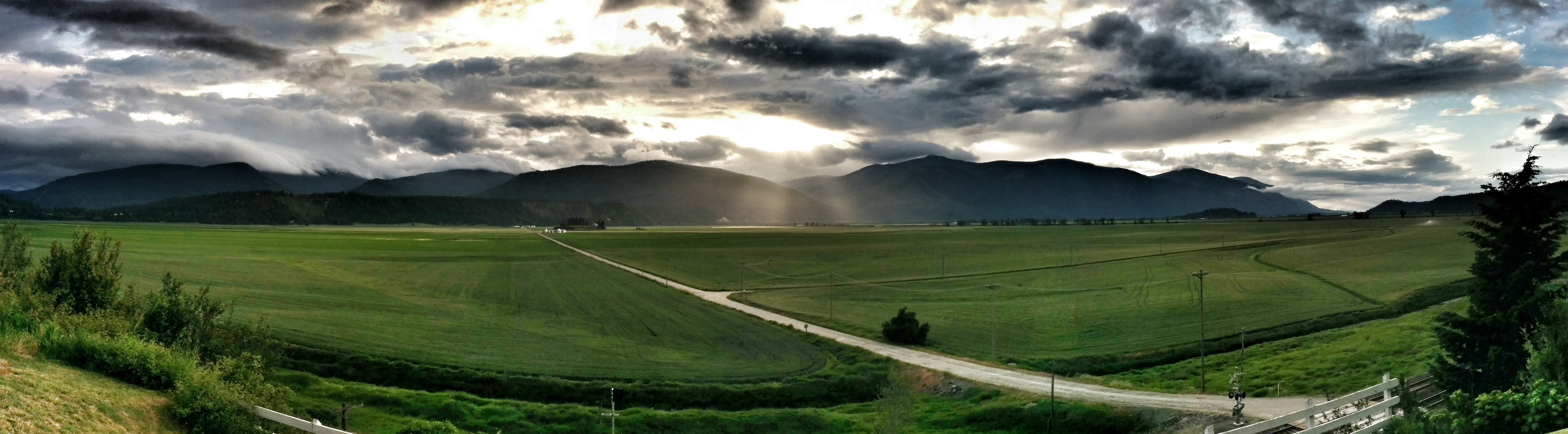
Sunset over Kootenai Valley

The headwall
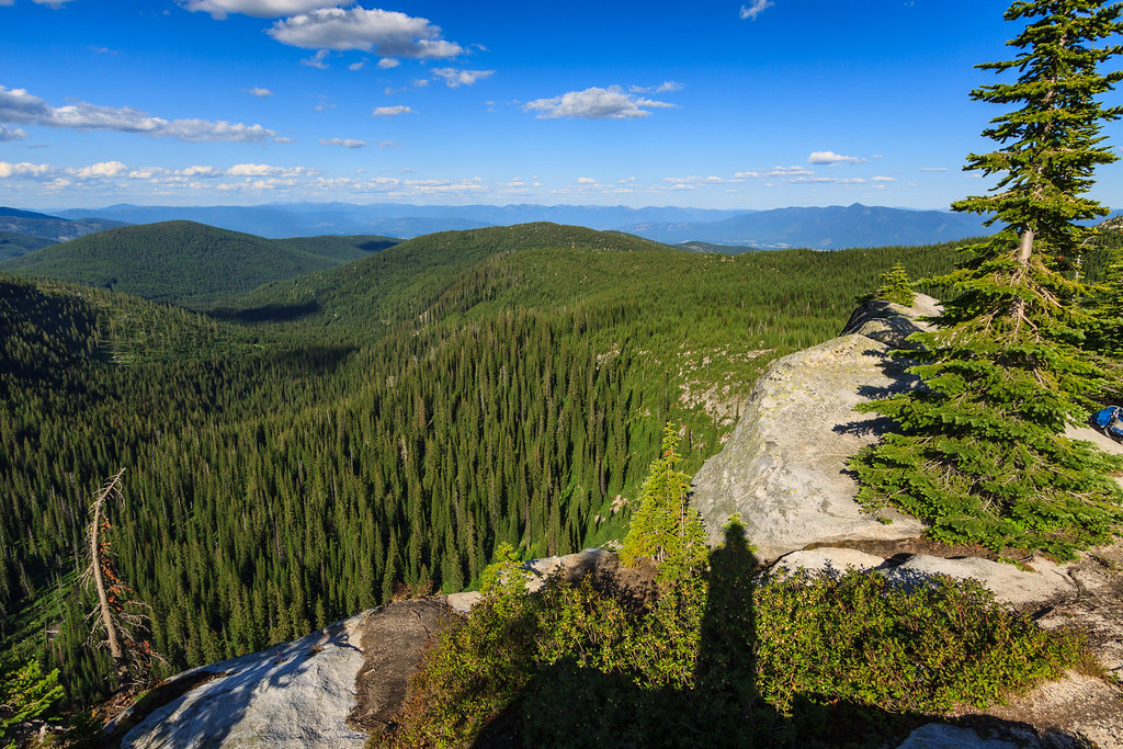
View of the eastern valley
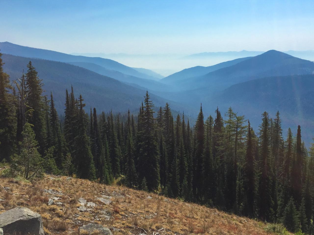
View east down Myrtle Creek from the trail to Myrtle Peak

Elephant Man Doing the Splits
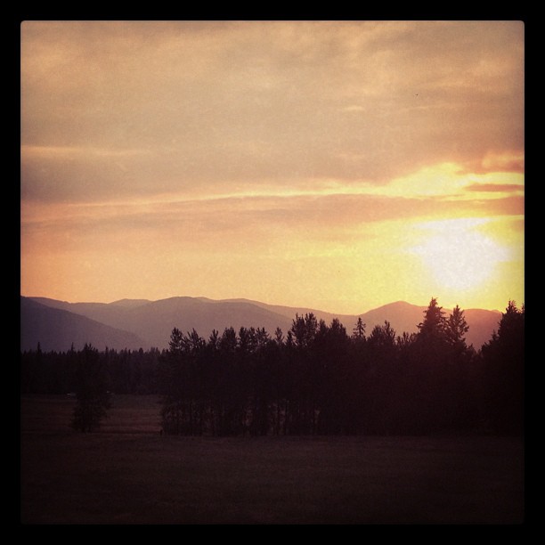
Kootenai Valley sunset
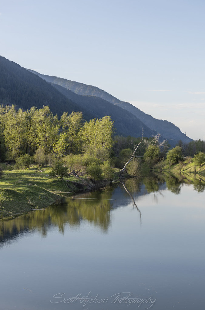
Kootenai River Cottonwood Snag Reflection Near Cascade Creek
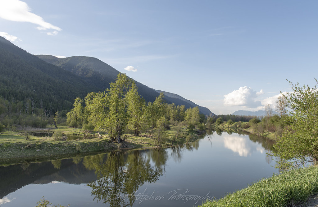
Kootenai River Reflection Near Cascade Creek

Eagle Soaring along Kootneai River
Kootenai River Reflection
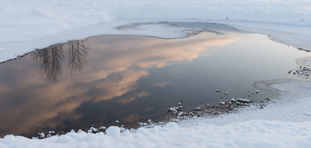
Cloud Reflection
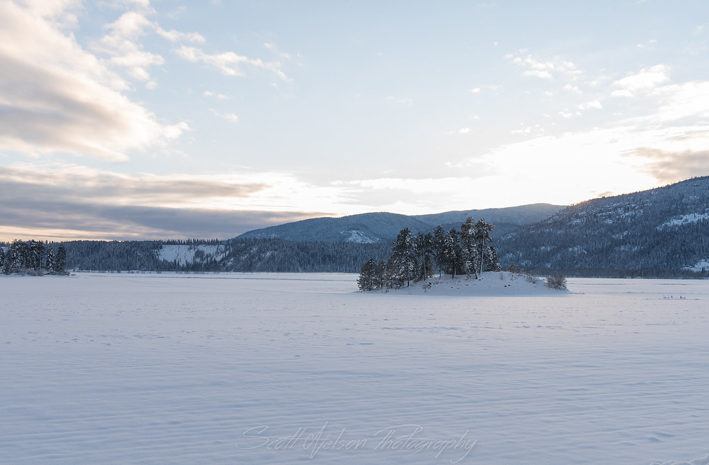
Frozen Islands
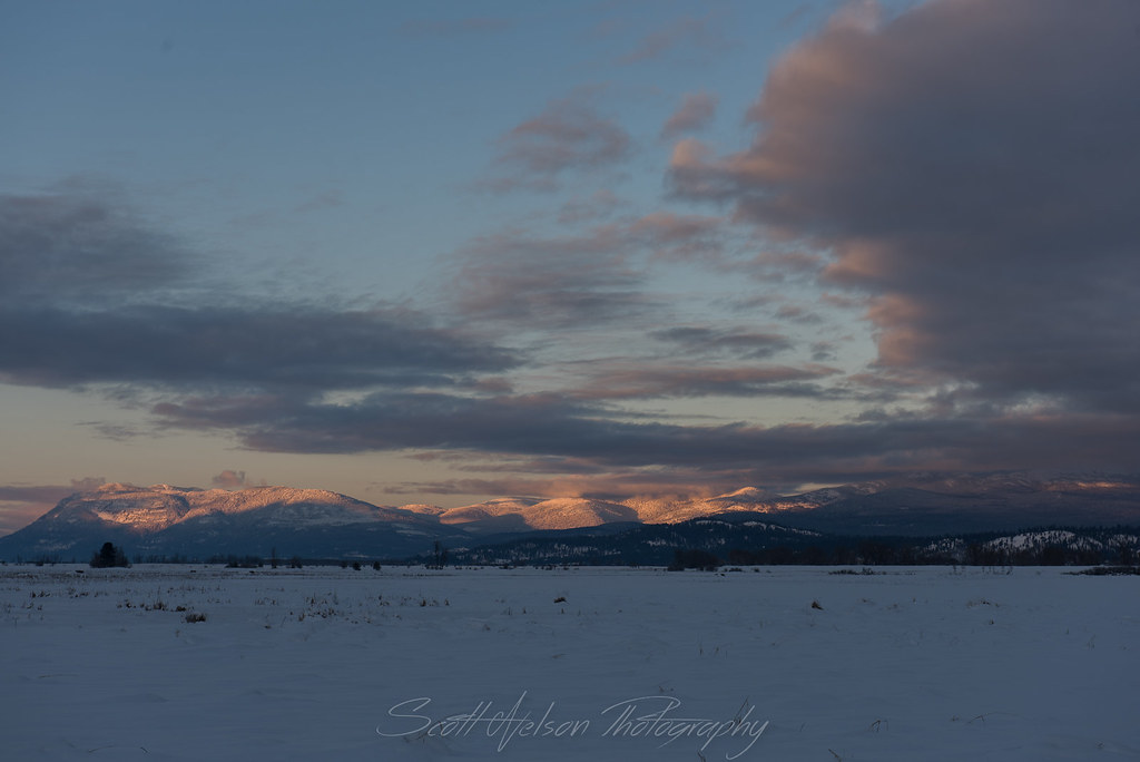
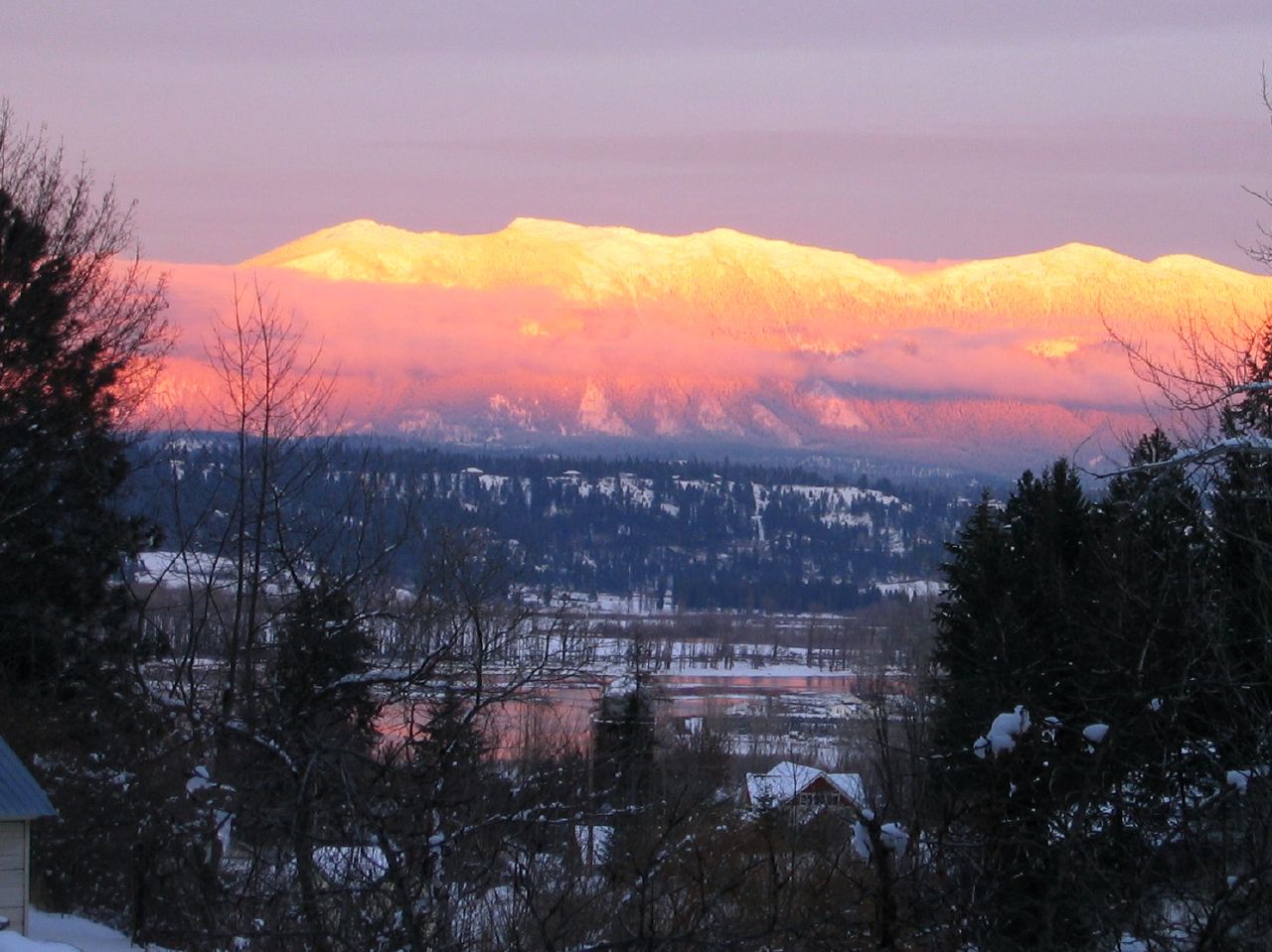
Kootenai Valley Sunsetting over Mountain
IMG_8248.jpg
IMG_8239.jpg
IMG_8230.jpg

Winking Owl In Cottonwood
IMG_8236.jpg
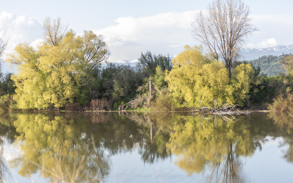
Golden Cottonwood
Highland Flats, irrigation dam development
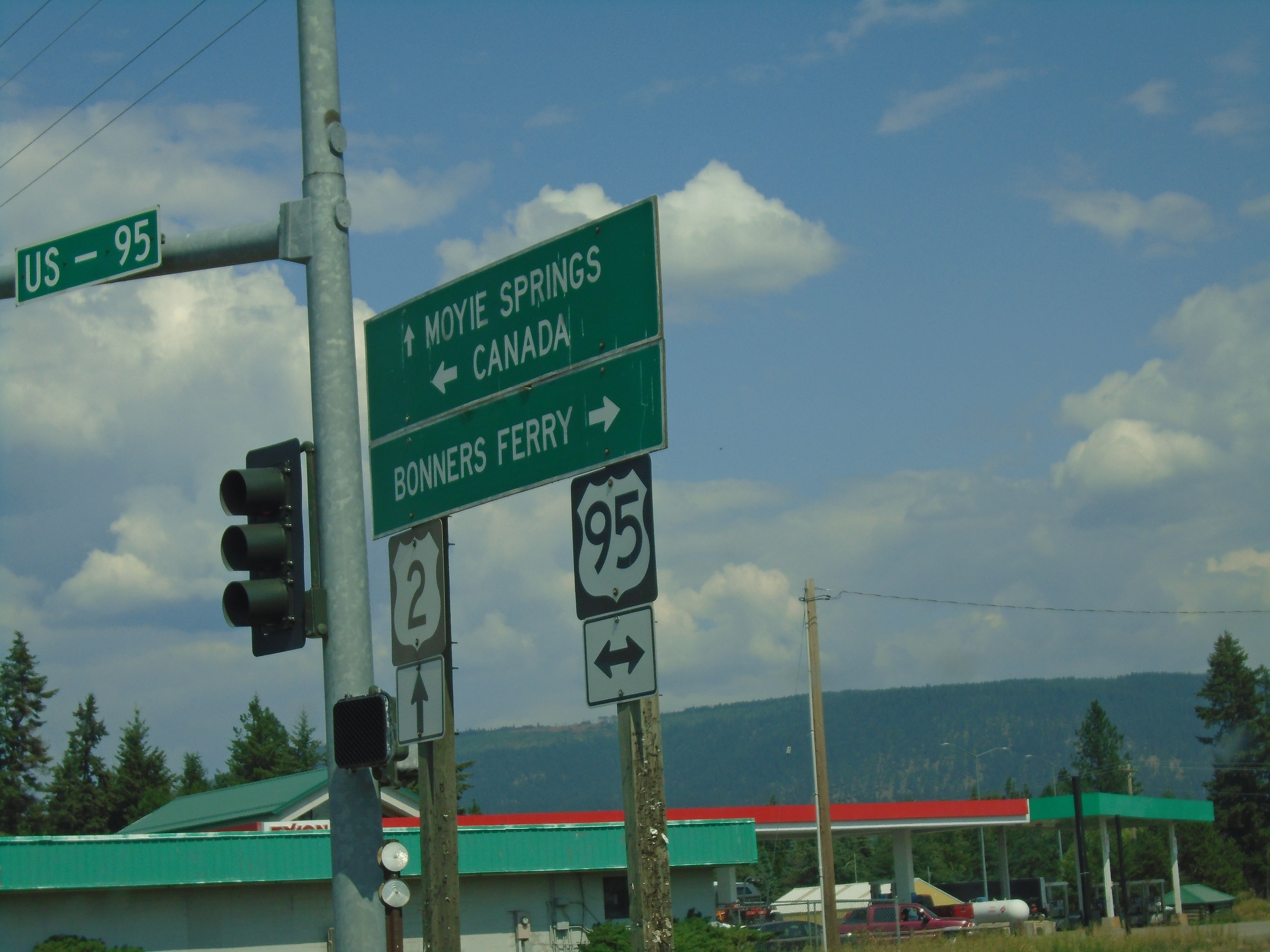
US-95 North/US-2 East at US-95/US-2 Split
Sand Hill Road East at US-2 and US-95 Junction
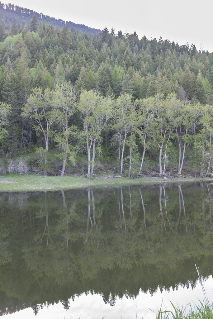
Kootenai River Cottonwood Reflection Near Cascade Creek
Mapa de Myrtle Falls Trail, West Side Rd, Bonners Ferry, ID, EE. UU.
Buscar otro lugar
Lugares cercanos
District 5 Rd, Bonners Ferry, ID, EE. UU.
Success Ln, Naples, ID, EE. UU.
Crow Street, Bonners Ferry, ID, EE. UU.
Madison St, Bonners Ferry, ID, EE. UU.
Madison Street, Madison St, Bonners Ferry, ID, EE. UU.
Bonners Ferry, Idaho, EE. UU.
Kootenai Street, Kootenai St, Bonners Ferry, ID, EE. UU.
Pot Hole Road, Pot Hole Rd, Idaho, EE. UU.
Kootenai Trail Rd, Bonners Ferry, ID, EE. UU.
US-95, Bonners Ferry, ID, EE. UU.
Fawn Lane Farms, Fawn Lane, Bonners Ferry, ID, EE. UU.
Tower Rd, Naples, ID, EE. UU.
Lone Pony Ln, Bonners Ferry, ID, EE. UU.
Bane Ln, Bonners Ferry, ID, EE. UU.
Naples, ID, EE. UU.
Fall Creek Rd, Naples, ID, EE. UU.
Fall Creek Rd, Naples, ID, EE. UU.
Fall Creek Rd, Naples, ID, EE. UU.
48 Fall Creek Rd, Naples, ID, EE. UU.
Templeman Lake Rd, Bonners Ferry, ID, EE. UU.
Búsquedas recientes
- Horas de salida y puesta de sol de Red Dog Mine, AK, USA
- Horas de salida y puesta de sol de Am Bahnhof, Am bhf, Borken, Germany
- Horas de salida y puesta de sol de 4th St E, Sonoma, CA, EE. UU.
- Horas de salida y puesta de sol de Oakland Ave, Williamsport, PA, EE. UU.
- Horas de salida y puesta de sol de Via Roma, Pieranica CR, Italia
- Horas de salida y puesta de sol de Torre del reloj, Grad, Dubrovnik (Ragusa), Croacia
- Horas de salida y puesta de sol de Trelew, Chubut, Argentina
- Horas de salida y puesta de sol de Hartfords Bluff Cir, Mt Pleasant, SC, EE. UU.
- Horas de salida y puesta de sol de Kita Ward, Kumamoto, Japón
- Horas de salida y puesta de sol de Pingtan Island, Pingtan County, Fuzhou, China