Zeitzone:Rocky-Mountains-Normalzeit
Ortszeit:Montag, 9. November 2026 09:29
Länge:-110.770938
Breite:32.9875659
Sonnenaufgang Heute:06:49:31
Sonnenuntergang Heute:17:26:59
Tageslänge heute:10h 37m 28s
Sonnenaufgang morgen:06:50:26
Sonnenuntergang Morgen:17:26:17
Tageslänge von morgen:10h 35m 51s

: Alle Termine anzeigen

Datum Sonnenaufgang Sonnenuntergang Tageslänge
1. Jan. 2026 07:27:04 17:27:39 10h 0m 34s
1. Feb. 2026 07:20:18 17:55:15 10h 34m 57s
1. März 2026 06:53:45 18:20:26 11h 26m 40s
1. Apr. 2026 06:13:25 18:43:20 12h 29m 54s
1. Mai 2026 05:37:45 19:05:13 13h 27m 28s
1. Juni 2026 05:17:10 19:27:18 14h 10m 7s
1. Juli 2026 05:18:54 19:36:54 14h 18m 0s
1. Aug. 2026 05:37:01 19:24:20 13h 47m 19s
1. Sep. 2026 05:58:22 18:51:27 12h 53m 5s
1. Okt. 2026 06:17:44 18:10:51 11h 53m 7s
1. Nov. 2026 06:41:27 17:34:23 10h 52m 55s
10. Nov. 2026 06:49:31 17:26:59 10h 37m 28s
11. Nov. 2026 06:50:26 17:26:17 10h 35m 51s
1. Dez. 2026 07:08:38 17:17:55 10h 9m 17s

Fotos von Sonnenaufgang und Sonnenuntergang

Aries by CEBImagery.com, Aries

Model Liana Riveranaked aries arizona back beauty cactus copper corridor desert model natural
Aries by CEBImagery.com
Sunset in the Desert, N of Zapata Wash, San Pedro River Valley, N of Mammoth, AZ - Color Photo Art by Lon&Queta, Abe’s Garden, N of Zapata Wash, E of Highway 77, San Pedro River Valley, N of Mammoth, AZ - Color Ph
Sunset in the Desert, N of Zapata Wash, San Pedro River Valley, N of Mammoth, AZ - Color Photo Art by Lon&Queta
Aravaipa Canyon approach - Brandenburg Mountain and Ranger's house at Sunrise (EXPLORE) by Al_HikesAZ, This is Brandenburg Mountain and Brandenburg Ranger Station at Sunrise as I approach Aravaipa Canyon
Aravaipa Canyon approach - Brandenburg Mountain and Ranger's house at Sunrise (EXPLORE) by Al_HikesAZ
Cholla Sunset, N of Zapata Wash, San Pedro River Valley, N of Mammoth, AZ - Color Photo Art by Lon&Queta, Abe’s Garden, named after Abe Yañez, who first showed us this area, N of Zapata Wash, San Pedro Rive
Cholla Sunset, N of Zapata Wash, San Pedro River Valley, N of Mammoth, AZ - Color Photo Art by Lon&Queta
Sonoran Desert Sunset, N of Zapata Wash, San Pedro River Valley, N of Mammoth, AZ by Lon&Queta, Abe’s Garden, N of Zapata Wash, E of Highway 77, San Pedro River Valley, N of Mammoth, AZ2023 arizon
Sonoran Desert Sunset, N of Zapata Wash, San Pedro River Valley, N of Mammoth, AZ by Lon&Queta
Morning rituals by Moffat Road, Just after sunrise at 6:13 a.m. on April 21, 2017, a Copper Basin Railway employee goes about the mo
Morning rituals by Moffat Road
Desert Dusk by Dave Blaze Rail Photography, This is a very high ISO image and a bit grainy considering it pushed the low light capabilities of t
Desert Dusk by Dave Blaze Rail Photography
Moonset - Aravaipa Canyon by Al_HikesAZ, I was greeted by the sunrise.  I was bid goodbye by the moon setting.  Aravaipa Canyon is a magical
Moonset - Aravaipa Canyon by Al_HikesAZ
Aravaipa Evening by isaac.borrego, water stream evening sunset trees creek aravaipacanyon arizona canonrebelxsi canyon desert unitedsta
Aravaipa Evening by isaac.borrego
Setting sun with Saguaro and Ocotillo; "Buckhorn Flats" N of Zapata Wash road to Holy Joe Canyon, NE of Mammoth, AZ by Lon&Queta, Setting sun with Saguaro and Ocotillo; "Buckhorn Flats" N of Zapata Wash road to Holy Joe
Setting sun with Saguaro and Ocotillo; "Buckhorn Flats" N of Zapata Wash road to Holy Joe Canyon, NE of Mammoth, AZ by Lon&Queta
Setting sun with Saguaro and Jumping Cholla Cacti; "Buckhorn Flats" N of Zapata Wash road to Holy Joe Canyon, NE of Mammoth, AZ by Lon&Queta, Setting sun with Saguaro and Jumping Cholla Cacti; "Buckhorn Flats" N of Zapata Wash road
Setting sun with Saguaro and Jumping Cholla Cacti; "Buckhorn Flats" N of Zapata Wash road to Holy Joe Canyon, NE of Mammoth, AZ by Lon&Queta
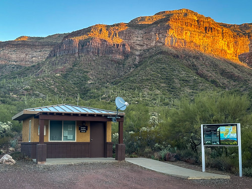
Brandenburg Ranger's station at sunrise - Aravaipa Canyon approach by Al_HikesAZ, This is the Brandenburg Ranger Station Kiosk at Sunrise as I approach Aravaipa Canyon from the west.
Brandenburg Ranger's station at sunrise - Aravaipa Canyon approach by Al_HikesAZ
Aravaipa Canyon approach - Brandenburg Mountain and Ranger's house at Sunrise by Al_HikesAZ, This is Brandenburg Mountain and Brandenburg Ranger Station at Sunrise as I approach Aravaipa Canyon
Aravaipa Canyon approach - Brandenburg Mountain and Ranger's house at Sunrise by Al_HikesAZ
Sunset at Abe’s Garden, N of Zapata Wash, San Pedro River Valley, N of Mammoth, AZ by Lon&Queta, Abe’s Garden named after an old friend who first showed us the area, N of Zapata Wash, San Pedro Riv
Sunset at Abe’s Garden, N of Zapata Wash, San Pedro River Valley, N of Mammoth, AZ by Lon&Queta
Sunset in the Sonoran Desert, N of Zapata Wash, San Pedro River Valley, N of Mammoth, AZ by Lon&Queta, N of Zapata Wash, San Pedro River Valley, N of Mammoth, AZarizona usa cacti landscapes flickr desert
Sunset in the Sonoran Desert, N of Zapata Wash, San Pedro River Valley, N of Mammoth, AZ by Lon&Queta
Saguaro Sunset, N of Zapata Wash, San Pedro River Valley, N of Mammoth, AZ by Lon&Queta, Abe’s Garden, N of Zapata Wash, E of Highway 77, San Pedro River Valley, N of Mammoth, AZ2023 arizon
Saguaro Sunset, N of Zapata Wash, San Pedro River Valley, N of Mammoth, AZ by Lon&Queta
Sunset at Abe’s Garden, N of Zapata Wash, San Pedro River Valley, N of Mammoth, AZ - Color Photo Art by Lon&Queta, We call this place Abe’s Garden, after Abe Yañez, a previous neighbor, miner, part Yaqui, part Apach
Sunset at Abe’s Garden, N of Zapata Wash, San Pedro River Valley, N of Mammoth, AZ - Color Photo Art by Lon&Queta
Setting sun with Saguaro and Jumping Cholla Cacti; "Buckhorn Flats" N of Zapata Wash road to Holy Joe Canyon, NE of Mammoth, AZ (1) by Lon&Queta, Setting sun with Saguaro and Jumping Cholla Cacti; "Buckhorn Flats" N of Zapata Wash road
Setting sun with Saguaro and Jumping Cholla Cacti; "Buckhorn Flats" N of Zapata Wash road to Holy Joe Canyon, NE of Mammoth, AZ (1) by Lon&Queta
Last Light - Abe’s Garden, N of Zapata Wash, San Pedro River Valley, N of Mammoth, AZ by Lon&Queta, Abe’s Garden (a beautiful area that an old friend of ours originally showed us, out in the middle of
Last Light - Abe’s Garden, N of Zapata Wash, San Pedro River Valley, N of Mammoth, AZ by Lon&Queta
Sonoran Desert Sunset, N of Zapata Wash, San Pedro River Valley, N of Mammoth, AZ - Color Photo Art by Lon&Queta, Abe’s Garden, named after a friend who first showed us this area, N of Zapata Wash, San Pedro River
Sonoran Desert Sunset, N of Zapata Wash, San Pedro River Valley, N of Mammoth, AZ - Color Photo Art by Lon&Queta
Saguaro at Sunset, N of Zapata Wash, E of Highway 77, San Pedro River Valley, N of Mammoth, AZ by Lon&Queta, Abe’s Garden, N of Zapata Wash, E of Highway 77, San Pedro River Valley, N of Mammoth, AZarizona usa
Saguaro at Sunset, N of Zapata Wash, E of Highway 77, San Pedro River Valley, N of Mammoth, AZ by Lon&Queta
Abe’s Garden with Ocotillo art Sunset, N of Zapata Wash, San Pedro River Valley, N of Mammoth, AZ by Lon&Queta, Abe’s Garden, a place we named after an old friend of ours Abe Yañez, who showed it to us, N of Zapa
Abe’s Garden with Ocotillo art Sunset, N of Zapata Wash, San Pedro River Valley, N of Mammoth, AZ by Lon&Queta
Saguaro at Sunset; N of Kelvin - Florence road, Tortilla Mountains, W of Kearny, AZ by Lon&Queta, Campsite; N of Kelvin - Florence road, Tortilla Mountains, W of Kearny, AZ2008 arizona cacti desert
Saguaro at Sunset; N of Kelvin - Florence road, Tortilla Mountains, W of Kearny, AZ by Lon&Queta
Sunset N of Zapata Wash, E of Highway 77, San Pedro River Valley, N of Mammoth, AZ - Color Photo Art by Lon&Queta, A place we call "Abe’s Garden" because Abe Yañez was the person who showed it to us; N of
Sunset N of Zapata Wash, E of Highway 77, San Pedro River Valley, N of Mammoth, AZ - Color Photo Art by Lon&Queta
Sunset in a special place; N of Zapata Wash, E of Highway 77, San Pedro River Valley, N of Mammoth, AZ by Lon&Queta, Abe’s Garden, N of Zapata Wash, E of Highway 77, San Pedro River Valley, N of Mammoth, AZarizona cac
Sunset in a special place; N of Zapata Wash, E of Highway 77, San Pedro River Valley, N of Mammoth, AZ by Lon&Queta
Saguaro Sunset, N of Zapata Wash, E of Highway 77, San Pedro River Valley, N of Mammoth, AZ by Lon&Queta, Abe’s Garden, N of Zapata Wash, E of Highway 77, San Pedro River Valley, N of Mammoth, AZarizona usa
Saguaro Sunset, N of Zapata Wash, E of Highway 77, San Pedro River Valley, N of Mammoth, AZ by Lon&Queta
Jumping Cholla Cactus, N of Zapata Wash, San Pedro River Valley, N of Mammoth, AZ by Lon&Queta, Abe’s Garden, N of Zapata Wash, E of Highway 77, San Pedro River Valley, N of Mammoth, AZ2023 arizon
Jumping Cholla Cactus, N of Zapata Wash, San Pedro River Valley, N of Mammoth, AZ by Lon&Queta
Palo Verde Tree at sunset, N of Kelvin - Florence road, Tortilla Mountains, W of Kearny, AZ by Lon&Queta, Palo Verde Tree; N of Kelvin - Florence road, Tortilla Mountains, W of Kearny, AZ2008 arizona banana
Palo Verde Tree at sunset, N of Kelvin - Florence road, Tortilla Mountains, W of Kearny, AZ by Lon&Queta
Teddy Bear Chola at Sunset, N of Zapata Wash, E of Highway 77, San Pedro River Valley, N of Mammoth, AZ by Lon&Queta, Abe’s Garden, N of Zapata Wash, E of Highway 77, San Pedro River Valley, N of Mammoth, AZ2023 arizon
Teddy Bear Chola at Sunset, N of Zapata Wash, E of Highway 77, San Pedro River Valley, N of Mammoth, AZ by Lon&Queta
Sunset; Tortilla Mountains, W of Kearny, AZ by Lon&Queta, Sunset; N of Kelvin - Florence road, Tortilla Mountains, W of Kearny, AZ2008 arizona cacti desert fl
Sunset; Tortilla Mountains, W of Kearny, AZ by Lon&Queta
Campsite; N of Kelvin - Florence road, Tortilla Mountains, W of Kearny, AZ by Lon&Queta, Campsite;N of Kelvin - Florence road, Tortilla Mountains, W of Kearny, AZ2008 arizona cacti desert f
Campsite; N of Kelvin - Florence road, Tortilla Mountains, W of Kearny, AZ by Lon&Queta
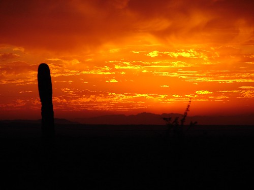
2ndNight'sSunset04 by galiuros, Along the Arizona Trail between Freeman Road and Kelvin Bridge.sunset arizonatrail
2ndNight'sSunset04 by galiuros
CBRY505_Kearny by johndbireland,
CBRY505_Kearny by johndbireland
120910-039-San Carlos Lake-Arizona by skw9413,      Late afternoon lighting created some interesting shadows as the darkened sandbar indicates in t
120910-039-San Carlos Lake-Arizona by skw9413
120910-019-San Carlos Lake At Coolidge Dam by skw9413,      Late afternoon shadows poke out onto the San Carlos Lake at the inlet side of the Coolidge Dam
120910-019-San Carlos Lake At Coolidge Dam by skw9413