Peak 09-48, East Kootenay A, BC V0B, Kanada Sonnenaufgang Sonnenuntergang Zeiten
Location: Kanada > Britisch-Kolumbien > Regional District of East Kootenay > East Kootenay A >
Zeitzone:
America/Edmonton
Ortszeit:
2025-06-05 04:40:03
Länge:
-114.8066666
Breite:
50.1516666
Sonnenaufgang Heute:
05:31:12 AM
Sonnenuntergang Heute:
09:44:34 PM
Tageslänge heute:
16h 13m 22s
Sonnenaufgang morgen:
05:30:43 AM
Sonnenuntergang Morgen:
09:45:25 PM
Tageslänge von morgen:
16h 14m 42s
Alle Termine anzeigen
| Datum | Sonnenaufgang | Sonnenuntergang | Tageslänge |
|---|---|---|---|
| 2025-01-01 | 08:38:05 AM | 04:48:46 PM | 8h 10m 41s |
| 2025-01-02 | 08:37:55 AM | 04:49:51 PM | 8h 11m 56s |
| 2025-01-03 | 08:37:42 AM | 04:50:59 PM | 8h 13m 17s |
| 2025-01-04 | 08:37:25 AM | 04:52:09 PM | 8h 14m 44s |
| 2025-01-05 | 08:37:05 AM | 04:53:21 PM | 8h 16m 16s |
| 2025-01-06 | 08:36:43 AM | 04:54:35 PM | 8h 17m 52s |
| 2025-01-07 | 08:36:17 AM | 04:55:51 PM | 8h 19m 34s |
| 2025-01-08 | 08:35:48 AM | 04:57:10 PM | 8h 21m 22s |
| 2025-01-09 | 08:35:16 AM | 04:58:30 PM | 8h 23m 14s |
| 2025-01-10 | 08:34:42 AM | 04:59:52 PM | 8h 25m 10s |
| 2025-01-11 | 08:34:04 AM | 05:01:16 PM | 8h 27m 12s |
| 2025-01-12 | 08:33:23 AM | 05:02:41 PM | 8h 29m 18s |
| 2025-01-13 | 08:32:40 AM | 05:04:08 PM | 8h 31m 28s |
| 2025-01-14 | 08:31:53 AM | 05:05:37 PM | 8h 33m 44s |
| 2025-01-15 | 08:31:04 AM | 05:07:07 PM | 8h 36m 3s |
| 2025-01-16 | 08:30:12 AM | 05:08:38 PM | 8h 38m 26s |
| 2025-01-17 | 08:29:18 AM | 05:10:11 PM | 8h 40m 53s |
| 2025-01-18 | 08:28:21 AM | 05:11:44 PM | 8h 43m 23s |
| 2025-01-19 | 08:27:21 AM | 05:13:19 PM | 8h 45m 58s |
| 2025-01-20 | 08:26:19 AM | 05:14:55 PM | 8h 48m 36s |
| 2025-01-21 | 08:25:14 AM | 05:16:32 PM | 8h 51m 18s |
| 2025-01-22 | 08:24:07 AM | 05:18:10 PM | 8h 54m 3s |
| 2025-01-23 | 08:22:57 AM | 05:19:48 PM | 8h 56m 51s |
| 2025-01-24 | 08:21:45 AM | 05:21:27 PM | 8h 59m 42s |
| 2025-01-25 | 08:20:31 AM | 05:23:07 PM | 9h 2m 36s |
| 2025-01-26 | 08:19:14 AM | 05:24:48 PM | 9h 5m 34s |
| 2025-01-27 | 08:17:55 AM | 05:26:29 PM | 9h 8m 34s |
| 2025-01-28 | 08:16:34 AM | 05:28:11 PM | 9h 11m 37s |
| 2025-01-29 | 08:15:11 AM | 05:29:53 PM | 9h 14m 42s |
| 2025-01-30 | 08:13:46 AM | 05:31:36 PM | 9h 17m 50s |
| 2025-01-31 | 08:12:19 AM | 05:33:19 PM | 9h 21m 0s |
| 2025-02-01 | 08:10:51 AM | 05:35:02 PM | 9h 24m 11s |
| 2025-02-02 | 08:09:20 AM | 05:36:46 PM | 9h 27m 26s |
| 2025-02-03 | 08:07:47 AM | 05:38:30 PM | 9h 30m 43s |
| 2025-02-04 | 08:06:13 AM | 05:40:13 PM | 9h 34m 0s |
| 2025-02-05 | 08:04:36 AM | 05:41:57 PM | 9h 37m 21s |
| 2025-02-06 | 08:02:59 AM | 05:43:42 PM | 9h 40m 43s |
| 2025-02-07 | 08:01:19 AM | 05:45:26 PM | 9h 44m 7s |
| 2025-02-08 | 07:59:38 AM | 05:47:10 PM | 9h 47m 32s |
| 2025-02-09 | 07:57:55 AM | 05:48:54 PM | 9h 50m 59s |
| 2025-02-10 | 07:56:11 AM | 05:50:38 PM | 9h 54m 27s |
| 2025-02-11 | 07:54:26 AM | 05:52:22 PM | 9h 57m 56s |
| 2025-02-12 | 07:52:39 AM | 05:54:06 PM | 10h 1m 27s |
| 2025-02-13 | 07:50:51 AM | 05:55:50 PM | 10h 4m 59s |
| 2025-02-14 | 07:49:01 AM | 05:57:34 PM | 10h 8m 33s |
| 2025-02-15 | 07:47:10 AM | 05:59:17 PM | 10h 12m 7s |
| 2025-02-16 | 07:45:18 AM | 06:01:01 PM | 10h 15m 43s |
| 2025-02-17 | 07:43:25 AM | 06:02:44 PM | 10h 19m 19s |
| 2025-02-18 | 07:41:30 AM | 06:04:27 PM | 10h 22m 57s |
| 2025-02-19 | 07:39:35 AM | 06:06:10 PM | 10h 26m 35s |
| 2025-02-20 | 07:37:38 AM | 06:07:52 PM | 10h 30m 14s |
| 2025-02-21 | 07:35:41 AM | 06:09:34 PM | 10h 33m 53s |
| 2025-02-22 | 07:33:42 AM | 06:11:16 PM | 10h 37m 34s |
| 2025-02-23 | 07:31:43 AM | 06:12:58 PM | 10h 41m 15s |
| 2025-02-24 | 07:29:42 AM | 06:14:39 PM | 10h 44m 57s |
| 2025-02-25 | 07:27:41 AM | 06:16:21 PM | 10h 48m 40s |
| 2025-02-26 | 07:25:39 AM | 06:18:02 PM | 10h 52m 23s |
| 2025-02-27 | 07:23:36 AM | 06:19:42 PM | 10h 56m 6s |
| 2025-02-28 | 07:21:32 AM | 06:21:22 PM | 10h 59m 50s |
| 2025-03-01 | 07:19:28 AM | 06:23:03 PM | 11h 3m 35s |
| 2025-03-02 | 07:17:23 AM | 06:24:42 PM | 11h 7m 19s |
| 2025-03-03 | 07:15:17 AM | 06:26:22 PM | 11h 11m 5s |
| 2025-03-04 | 07:13:11 AM | 06:28:01 PM | 11h 14m 50s |
| 2025-03-05 | 07:11:04 AM | 06:29:40 PM | 11h 18m 36s |
| 2025-03-06 | 07:08:57 AM | 06:31:19 PM | 11h 22m 22s |
| 2025-03-07 | 07:06:49 AM | 06:32:57 PM | 11h 26m 8s |
| 2025-03-08 | 07:04:41 AM | 06:34:35 PM | 11h 29m 54s |
| 2025-03-09 | 08:02:37 AM | 07:36:09 PM | 11h 33m 32s |
| 2025-03-10 | 08:00:28 AM | 07:37:47 PM | 11h 37m 19s |
| 2025-03-11 | 07:58:19 AM | 07:39:24 PM | 11h 41m 5s |
| 2025-03-12 | 07:56:09 AM | 07:41:02 PM | 11h 44m 53s |
| 2025-03-13 | 07:53:59 AM | 07:42:39 PM | 11h 48m 40s |
| 2025-03-14 | 07:51:48 AM | 07:44:16 PM | 11h 52m 28s |
| 2025-03-15 | 07:49:37 AM | 07:45:52 PM | 11h 56m 15s |
| 2025-03-16 | 07:47:27 AM | 07:47:29 PM | 12h 0m 2s |
| 2025-03-17 | 07:45:15 AM | 07:49:05 PM | 12h 3m 50s |
| 2025-03-18 | 07:43:04 AM | 07:50:41 PM | 12h 7m 37s |
| 2025-03-19 | 07:40:53 AM | 07:52:17 PM | 12h 11m 24s |
| 2025-03-20 | 07:38:41 AM | 07:53:53 PM | 12h 15m 12s |
| 2025-03-21 | 07:36:30 AM | 07:55:29 PM | 12h 18m 59s |
| 2025-03-22 | 07:34:18 AM | 07:57:04 PM | 12h 22m 46s |
| 2025-03-23 | 07:32:07 AM | 07:58:39 PM | 12h 26m 32s |
| 2025-03-24 | 07:29:55 AM | 08:00:15 PM | 12h 30m 20s |
| 2025-03-25 | 07:27:44 AM | 08:01:50 PM | 12h 34m 6s |
| 2025-03-26 | 07:25:33 AM | 08:03:25 PM | 12h 37m 52s |
| 2025-03-27 | 07:23:21 AM | 08:05:00 PM | 12h 41m 39s |
| 2025-03-28 | 07:21:10 AM | 08:06:35 PM | 12h 45m 25s |
| 2025-03-29 | 07:18:59 AM | 08:08:10 PM | 12h 49m 11s |
| 2025-03-30 | 07:16:49 AM | 08:09:45 PM | 12h 52m 56s |
| 2025-03-31 | 07:14:38 AM | 08:11:20 PM | 12h 56m 42s |
| 2025-04-01 | 07:12:28 AM | 08:12:54 PM | 13h 0m 26s |
| 2025-04-02 | 07:10:18 AM | 08:14:29 PM | 13h 4m 11s |
| 2025-04-03 | 07:08:09 AM | 08:16:04 PM | 13h 7m 55s |
| 2025-04-04 | 07:06:00 AM | 08:17:39 PM | 13h 11m 39s |
| 2025-04-05 | 07:03:51 AM | 08:19:13 PM | 13h 15m 22s |
| 2025-04-06 | 07:01:43 AM | 08:20:48 PM | 13h 19m 5s |
| 2025-04-07 | 06:59:35 AM | 08:22:23 PM | 13h 22m 48s |
| 2025-04-08 | 06:57:28 AM | 08:23:57 PM | 13h 26m 29s |
| 2025-04-09 | 06:55:21 AM | 08:25:32 PM | 13h 30m 11s |
| 2025-04-10 | 06:53:15 AM | 08:27:06 PM | 13h 33m 51s |
| 2025-04-11 | 06:51:09 AM | 08:28:41 PM | 13h 37m 32s |
| 2025-04-12 | 06:49:05 AM | 08:30:16 PM | 13h 41m 11s |
| 2025-04-13 | 06:47:00 AM | 08:31:50 PM | 13h 44m 50s |
| 2025-04-14 | 06:44:57 AM | 08:33:25 PM | 13h 48m 28s |
| 2025-04-15 | 06:42:54 AM | 08:34:59 PM | 13h 52m 5s |
| 2025-04-16 | 06:40:52 AM | 08:36:34 PM | 13h 55m 42s |
| 2025-04-17 | 06:38:51 AM | 08:38:08 PM | 13h 59m 17s |
| 2025-04-18 | 06:36:51 AM | 08:39:43 PM | 14h 2m 52s |
| 2025-04-19 | 06:34:51 AM | 08:41:17 PM | 14h 6m 26s |
| 2025-04-20 | 06:32:53 AM | 08:42:51 PM | 14h 9m 58s |
| 2025-04-21 | 06:30:55 AM | 08:44:25 PM | 14h 13m 30s |
| 2025-04-22 | 06:28:59 AM | 08:46:00 PM | 14h 17m 1s |
| 2025-04-23 | 06:27:03 AM | 08:47:34 PM | 14h 20m 31s |
| 2025-04-24 | 06:25:09 AM | 08:49:07 PM | 14h 23m 58s |
| 2025-04-25 | 06:23:15 AM | 08:50:41 PM | 14h 27m 26s |
| 2025-04-26 | 06:21:23 AM | 08:52:15 PM | 14h 30m 52s |
| 2025-04-27 | 06:19:32 AM | 08:53:48 PM | 14h 34m 16s |
| 2025-04-28 | 06:17:43 AM | 08:55:21 PM | 14h 37m 38s |
| 2025-04-29 | 06:15:54 AM | 08:56:54 PM | 14h 41m 0s |
| 2025-04-30 | 06:14:07 AM | 08:58:27 PM | 14h 44m 20s |
| 2025-05-01 | 06:12:22 AM | 08:59:59 PM | 14h 47m 37s |
| 2025-05-02 | 06:10:37 AM | 09:01:31 PM | 14h 50m 54s |
| 2025-05-03 | 06:08:55 AM | 09:03:03 PM | 14h 54m 8s |
| 2025-05-04 | 06:07:13 AM | 09:04:34 PM | 14h 57m 21s |
| 2025-05-05 | 06:05:34 AM | 09:06:05 PM | 15h 0m 31s |
| 2025-05-06 | 06:03:55 AM | 09:07:36 PM | 15h 3m 41s |
| 2025-05-07 | 06:02:19 AM | 09:09:06 PM | 15h 6m 47s |
| 2025-05-08 | 06:00:44 AM | 09:10:35 PM | 15h 9m 51s |
| 2025-05-09 | 05:59:11 AM | 09:12:04 PM | 15h 12m 53s |
| 2025-05-10 | 05:57:40 AM | 09:13:32 PM | 15h 15m 52s |
| 2025-05-11 | 05:56:10 AM | 09:15:00 PM | 15h 18m 50s |
| 2025-05-12 | 05:54:43 AM | 09:16:26 PM | 15h 21m 43s |
| 2025-05-13 | 05:53:17 AM | 09:17:52 PM | 15h 24m 35s |
| 2025-05-14 | 05:51:53 AM | 09:19:18 PM | 15h 27m 25s |
| 2025-05-15 | 05:50:31 AM | 09:20:42 PM | 15h 30m 11s |
| 2025-05-16 | 05:49:12 AM | 09:22:05 PM | 15h 32m 53s |
| 2025-05-17 | 05:47:54 AM | 09:23:28 PM | 15h 35m 34s |
| 2025-05-18 | 05:46:39 AM | 09:24:49 PM | 15h 38m 10s |
| 2025-05-19 | 05:45:25 AM | 09:26:09 PM | 15h 40m 44s |
| 2025-05-20 | 05:44:14 AM | 09:27:28 PM | 15h 43m 14s |
| 2025-05-21 | 05:43:06 AM | 09:28:46 PM | 15h 45m 40s |
| 2025-05-22 | 05:41:59 AM | 09:30:03 PM | 15h 48m 4s |
| 2025-05-23 | 05:40:55 AM | 09:31:18 PM | 15h 50m 23s |
| 2025-05-24 | 05:39:53 AM | 09:32:32 PM | 15h 52m 39s |
| 2025-05-25 | 05:38:54 AM | 09:33:44 PM | 15h 54m 50s |
| 2025-05-26 | 05:37:57 AM | 09:34:55 PM | 15h 56m 58s |
| 2025-05-27 | 05:37:03 AM | 09:36:04 PM | 15h 59m 1s |
| 2025-05-28 | 05:36:12 AM | 09:37:11 PM | 16h 0m 59s |
| 2025-05-29 | 05:35:23 AM | 09:38:17 PM | 16h 2m 54s |
| 2025-05-30 | 05:34:36 AM | 09:39:21 PM | 16h 4m 45s |
| 2025-05-31 | 05:33:52 AM | 09:40:23 PM | 16h 6m 31s |
| 2025-06-01 | 05:33:11 AM | 09:41:23 PM | 16h 8m 12s |
| 2025-06-02 | 05:32:33 AM | 09:42:22 PM | 16h 9m 49s |
| 2025-06-03 | 05:31:58 AM | 09:43:18 PM | 16h 11m 20s |
| 2025-06-04 | 05:31:25 AM | 09:44:12 PM | 16h 12m 47s |
| 2025-06-05 | 05:30:55 AM | 09:45:04 PM | 16h 14m 9s |
| 2025-06-06 | 05:30:28 AM | 09:45:53 PM | 16h 15m 25s |
| 2025-06-07 | 05:30:03 AM | 09:46:41 PM | 16h 16m 38s |
| 2025-06-08 | 05:29:42 AM | 09:47:26 PM | 16h 17m 44s |
| 2025-06-09 | 05:29:23 AM | 09:48:08 PM | 16h 18m 45s |
| 2025-06-10 | 05:29:08 AM | 09:48:48 PM | 16h 19m 40s |
| 2025-06-11 | 05:28:55 AM | 09:49:26 PM | 16h 20m 31s |
| 2025-06-12 | 05:28:45 AM | 09:50:01 PM | 16h 21m 16s |
| 2025-06-13 | 05:28:38 AM | 09:50:33 PM | 16h 21m 55s |
| 2025-06-14 | 05:28:34 AM | 09:51:03 PM | 16h 22m 29s |
| 2025-06-15 | 05:28:33 AM | 09:51:30 PM | 16h 22m 57s |
| 2025-06-16 | 05:28:34 AM | 09:51:55 PM | 16h 23m 21s |
| 2025-06-17 | 05:28:39 AM | 09:52:16 PM | 16h 23m 37s |
| 2025-06-18 | 05:28:46 AM | 09:52:35 PM | 16h 23m 49s |
| 2025-06-19 | 05:28:56 AM | 09:52:51 PM | 16h 23m 55s |
| 2025-06-20 | 05:29:09 AM | 09:53:04 PM | 16h 23m 55s |
| 2025-06-21 | 05:29:25 AM | 09:53:14 PM | 16h 23m 49s |
| 2025-06-22 | 05:29:44 AM | 09:53:22 PM | 16h 23m 38s |
| 2025-06-23 | 05:30:05 AM | 09:53:26 PM | 16h 23m 21s |
| 2025-06-24 | 05:30:29 AM | 09:53:28 PM | 16h 22m 59s |
| 2025-06-25 | 05:30:55 AM | 09:53:27 PM | 16h 22m 32s |
| 2025-06-26 | 05:31:25 AM | 09:53:22 PM | 16h 21m 57s |
| 2025-06-27 | 05:31:56 AM | 09:53:15 PM | 16h 21m 19s |
| 2025-06-28 | 05:32:31 AM | 09:53:05 PM | 16h 20m 34s |
| 2025-06-29 | 05:33:07 AM | 09:52:52 PM | 16h 19m 45s |
| 2025-06-30 | 05:33:47 AM | 09:52:36 PM | 16h 18m 49s |
| 2025-07-01 | 05:34:28 AM | 09:52:17 PM | 16h 17m 49s |
| 2025-07-02 | 05:35:12 AM | 09:51:55 PM | 16h 16m 43s |
| 2025-07-03 | 05:35:58 AM | 09:51:30 PM | 16h 15m 32s |
| 2025-07-04 | 05:36:47 AM | 09:51:02 PM | 16h 14m 15s |
| 2025-07-05 | 05:37:37 AM | 09:50:32 PM | 16h 12m 55s |
| 2025-07-06 | 05:38:30 AM | 09:49:59 PM | 16h 11m 29s |
| 2025-07-07 | 05:39:24 AM | 09:49:23 PM | 16h 9m 59s |
| 2025-07-08 | 05:40:21 AM | 09:48:44 PM | 16h 8m 23s |
| 2025-07-09 | 05:41:20 AM | 09:48:02 PM | 16h 6m 42s |
| 2025-07-10 | 05:42:20 AM | 09:47:17 PM | 16h 4m 57s |
| 2025-07-11 | 05:43:22 AM | 09:46:30 PM | 16h 3m 8s |
| 2025-07-12 | 05:44:26 AM | 09:45:41 PM | 16h 1m 15s |
| 2025-07-13 | 05:45:32 AM | 09:44:48 PM | 15h 59m 16s |
| 2025-07-14 | 05:46:39 AM | 09:43:53 PM | 15h 57m 14s |
| 2025-07-15 | 05:47:47 AM | 09:42:56 PM | 15h 55m 9s |
| 2025-07-16 | 05:48:57 AM | 09:41:56 PM | 15h 52m 59s |
| 2025-07-17 | 05:50:09 AM | 09:40:53 PM | 15h 50m 44s |
| 2025-07-18 | 05:51:22 AM | 09:39:48 PM | 15h 48m 26s |
| 2025-07-19 | 05:52:36 AM | 09:38:41 PM | 15h 46m 5s |
| 2025-07-20 | 05:53:51 AM | 09:37:32 PM | 15h 43m 41s |
| 2025-07-21 | 05:55:07 AM | 09:36:20 PM | 15h 41m 13s |
| 2025-07-22 | 05:56:25 AM | 09:35:06 PM | 15h 38m 41s |
| 2025-07-23 | 05:57:43 AM | 09:33:49 PM | 15h 36m 6s |
| 2025-07-24 | 05:59:03 AM | 09:32:31 PM | 15h 33m 28s |
| 2025-07-25 | 06:00:23 AM | 09:31:10 PM | 15h 30m 47s |
| 2025-07-26 | 06:01:45 AM | 09:29:47 PM | 15h 28m 2s |
| 2025-07-27 | 06:03:07 AM | 09:28:23 PM | 15h 25m 16s |
| 2025-07-28 | 06:04:30 AM | 09:26:56 PM | 15h 22m 26s |
| 2025-07-29 | 06:05:53 AM | 09:25:28 PM | 15h 19m 35s |
| 2025-07-30 | 06:07:17 AM | 09:23:57 PM | 15h 16m 40s |
| 2025-07-31 | 06:08:42 AM | 09:22:25 PM | 15h 13m 43s |
| 2025-08-01 | 06:10:08 AM | 09:20:51 PM | 15h 10m 43s |
| 2025-08-02 | 06:11:33 AM | 09:19:15 PM | 15h 7m 42s |
| 2025-08-03 | 06:13:00 AM | 09:17:38 PM | 15h 4m 38s |
| 2025-08-04 | 06:14:27 AM | 09:15:59 PM | 15h 1m 32s |
| 2025-08-05 | 06:15:54 AM | 09:14:18 PM | 14h 58m 24s |
| 2025-08-06 | 06:17:22 AM | 09:12:36 PM | 14h 55m 14s |
| 2025-08-07 | 06:18:49 AM | 09:10:52 PM | 14h 52m 3s |
| 2025-08-08 | 06:20:18 AM | 09:09:07 PM | 14h 48m 49s |
| 2025-08-09 | 06:21:46 AM | 09:07:20 PM | 14h 45m 34s |
| 2025-08-10 | 06:23:15 AM | 09:05:32 PM | 14h 42m 17s |
| 2025-08-11 | 06:24:44 AM | 09:03:42 PM | 14h 38m 58s |
| 2025-08-12 | 06:26:13 AM | 09:01:52 PM | 14h 35m 39s |
| 2025-08-13 | 06:27:42 AM | 09:00:00 PM | 14h 32m 18s |
| 2025-08-14 | 06:29:12 AM | 08:58:07 PM | 14h 28m 55s |
| 2025-08-15 | 06:30:41 AM | 08:56:12 PM | 14h 25m 31s |
| 2025-08-16 | 06:32:11 AM | 08:54:17 PM | 14h 22m 6s |
| 2025-08-17 | 06:33:41 AM | 08:52:20 PM | 14h 18m 39s |
| 2025-08-18 | 06:35:11 AM | 08:50:23 PM | 14h 15m 12s |
| 2025-08-19 | 06:36:40 AM | 08:48:24 PM | 14h 11m 44s |
| 2025-08-20 | 06:38:10 AM | 08:46:25 PM | 14h 8m 15s |
| 2025-08-21 | 06:39:40 AM | 08:44:24 PM | 14h 4m 44s |
| 2025-08-22 | 06:41:10 AM | 08:42:23 PM | 14h 1m 13s |
| 2025-08-23 | 06:42:40 AM | 08:40:21 PM | 13h 57m 41s |
| 2025-08-24 | 06:44:10 AM | 08:38:17 PM | 13h 54m 7s |
| 2025-08-25 | 06:45:40 AM | 08:36:14 PM | 13h 50m 34s |
| 2025-08-26 | 06:47:10 AM | 08:34:09 PM | 13h 46m 59s |
| 2025-08-27 | 06:48:40 AM | 08:32:03 PM | 13h 43m 23s |
| 2025-08-28 | 06:50:10 AM | 08:29:57 PM | 13h 39m 47s |
| 2025-08-29 | 06:51:40 AM | 08:27:51 PM | 13h 36m 11s |
| 2025-08-30 | 06:53:10 AM | 08:25:43 PM | 13h 32m 33s |
| 2025-08-31 | 06:54:39 AM | 08:23:35 PM | 13h 28m 56s |
| 2025-09-01 | 06:56:09 AM | 08:21:27 PM | 13h 25m 18s |
| 2025-09-02 | 06:57:39 AM | 08:19:18 PM | 13h 21m 39s |
| 2025-09-03 | 06:59:09 AM | 08:17:08 PM | 13h 17m 59s |
| 2025-09-04 | 07:00:39 AM | 08:14:58 PM | 13h 14m 19s |
| 2025-09-05 | 07:02:08 AM | 08:12:48 PM | 13h 10m 40s |
| 2025-09-06 | 07:03:38 AM | 08:10:37 PM | 13h 6m 59s |
| 2025-09-07 | 07:05:08 AM | 08:08:26 PM | 13h 3m 18s |
| 2025-09-08 | 07:06:38 AM | 08:06:15 PM | 12h 59m 37s |
| 2025-09-09 | 07:08:07 AM | 08:04:03 PM | 12h 55m 56s |
| 2025-09-10 | 07:09:37 AM | 08:01:51 PM | 12h 52m 14s |
| 2025-09-11 | 07:11:07 AM | 07:59:38 PM | 12h 48m 31s |
| 2025-09-12 | 07:12:37 AM | 07:57:26 PM | 12h 44m 49s |
| 2025-09-13 | 07:14:07 AM | 07:55:13 PM | 12h 41m 6s |
| 2025-09-14 | 07:15:37 AM | 07:53:00 PM | 12h 37m 23s |
| 2025-09-15 | 07:17:07 AM | 07:50:47 PM | 12h 33m 40s |
| 2025-09-16 | 07:18:37 AM | 07:48:34 PM | 12h 29m 57s |
| 2025-09-17 | 07:20:07 AM | 07:46:21 PM | 12h 26m 14s |
| 2025-09-18 | 07:21:38 AM | 07:44:08 PM | 12h 22m 30s |
| 2025-09-19 | 07:23:08 AM | 07:41:55 PM | 12h 18m 47s |
| 2025-09-20 | 07:24:39 AM | 07:39:42 PM | 12h 15m 3s |
| 2025-09-21 | 07:26:09 AM | 07:37:29 PM | 12h 11m 20s |
| 2025-09-22 | 07:27:40 AM | 07:35:16 PM | 12h 7m 36s |
| 2025-09-23 | 07:29:11 AM | 07:33:03 PM | 12h 3m 52s |
| 2025-09-24 | 07:30:43 AM | 07:30:50 PM | 12h 0m 7s |
| 2025-09-25 | 07:32:14 AM | 07:28:38 PM | 11h 56m 24s |
| 2025-09-26 | 07:33:45 AM | 07:26:25 PM | 11h 52m 40s |
| 2025-09-27 | 07:35:17 AM | 07:24:13 PM | 11h 48m 56s |
| 2025-09-28 | 07:36:49 AM | 07:22:01 PM | 11h 45m 12s |
| 2025-09-29 | 07:38:21 AM | 07:19:50 PM | 11h 41m 29s |
| 2025-09-30 | 07:39:54 AM | 07:17:39 PM | 11h 37m 45s |
| 2025-10-01 | 07:41:26 AM | 07:15:28 PM | 11h 34m 2s |
| 2025-10-02 | 07:42:59 AM | 07:13:18 PM | 11h 30m 19s |
| 2025-10-03 | 07:44:32 AM | 07:11:08 PM | 11h 26m 36s |
| 2025-10-04 | 07:46:06 AM | 07:08:58 PM | 11h 22m 52s |
| 2025-10-05 | 07:47:39 AM | 07:06:49 PM | 11h 19m 10s |
| 2025-10-06 | 07:49:13 AM | 07:04:40 PM | 11h 15m 27s |
| 2025-10-07 | 07:50:48 AM | 07:02:32 PM | 11h 11m 44s |
| 2025-10-08 | 07:52:22 AM | 07:00:25 PM | 11h 8m 3s |
| 2025-10-09 | 07:53:57 AM | 06:58:18 PM | 11h 4m 21s |
| 2025-10-10 | 07:55:32 AM | 06:56:12 PM | 11h 0m 40s |
| 2025-10-11 | 07:57:07 AM | 06:54:07 PM | 10h 57m 0s |
| 2025-10-12 | 07:58:43 AM | 06:52:02 PM | 10h 53m 19s |
| 2025-10-13 | 08:00:19 AM | 06:49:58 PM | 10h 49m 39s |
| 2025-10-14 | 08:01:55 AM | 06:47:55 PM | 10h 46m 0s |
| 2025-10-15 | 08:03:32 AM | 06:45:53 PM | 10h 42m 21s |
| 2025-10-16 | 08:05:09 AM | 06:43:51 PM | 10h 38m 42s |
| 2025-10-17 | 08:06:46 AM | 06:41:51 PM | 10h 35m 5s |
| 2025-10-18 | 08:08:24 AM | 06:39:51 PM | 10h 31m 27s |
| 2025-10-19 | 08:10:01 AM | 06:37:53 PM | 10h 27m 52s |
| 2025-10-20 | 08:11:40 AM | 06:35:55 PM | 10h 24m 15s |
| 2025-10-21 | 08:13:18 AM | 06:33:59 PM | 10h 20m 41s |
| 2025-10-22 | 08:14:56 AM | 06:32:03 PM | 10h 17m 7s |
| 2025-10-23 | 08:16:35 AM | 06:30:09 PM | 10h 13m 34s |
| 2025-10-24 | 08:18:14 AM | 06:28:16 PM | 10h 10m 2s |
| 2025-10-25 | 08:19:54 AM | 06:26:24 PM | 10h 6m 30s |
| 2025-10-26 | 08:21:33 AM | 06:24:34 PM | 10h 3m 1s |
| 2025-10-27 | 08:23:13 AM | 06:22:45 PM | 9h 59m 32s |
| 2025-10-28 | 08:24:53 AM | 06:20:57 PM | 9h 56m 4s |
| 2025-10-29 | 08:26:33 AM | 06:19:11 PM | 9h 52m 38s |
| 2025-10-30 | 08:28:13 AM | 06:17:26 PM | 9h 49m 13s |
| 2025-10-31 | 08:29:53 AM | 06:15:42 PM | 9h 45m 49s |
| 2025-11-01 | 08:31:33 AM | 06:14:00 PM | 9h 42m 27s |
| 2025-11-02 | 07:33:17 AM | 05:12:16 PM | 9h 38m 59s |
| 2025-11-03 | 07:34:58 AM | 05:10:37 PM | 9h 35m 39s |
| 2025-11-04 | 07:36:38 AM | 05:09:00 PM | 9h 32m 22s |
| 2025-11-05 | 07:38:18 AM | 05:07:25 PM | 9h 29m 7s |
| 2025-11-06 | 07:39:58 AM | 05:05:52 PM | 9h 25m 54s |
| 2025-11-07 | 07:41:38 AM | 05:04:21 PM | 9h 22m 43s |
| 2025-11-08 | 07:43:17 AM | 05:02:51 PM | 9h 19m 34s |
| 2025-11-09 | 07:44:57 AM | 05:01:23 PM | 9h 16m 26s |
| 2025-11-10 | 07:46:36 AM | 04:59:58 PM | 9h 13m 22s |
| 2025-11-11 | 07:48:14 AM | 04:58:34 PM | 9h 10m 20s |
| 2025-11-12 | 07:49:53 AM | 04:57:13 PM | 9h 7m 20s |
| 2025-11-13 | 07:51:31 AM | 04:55:53 PM | 9h 4m 22s |
| 2025-11-14 | 07:53:08 AM | 04:54:36 PM | 9h 1m 28s |
| 2025-11-15 | 07:54:45 AM | 04:53:21 PM | 8h 58m 36s |
| 2025-11-16 | 07:56:21 AM | 04:52:09 PM | 8h 55m 48s |
| 2025-11-17 | 07:57:56 AM | 04:50:58 PM | 8h 53m 2s |
| 2025-11-18 | 07:59:31 AM | 04:49:51 PM | 8h 50m 20s |
| 2025-11-19 | 08:01:05 AM | 04:48:45 PM | 8h 47m 40s |
| 2025-11-20 | 08:02:38 AM | 04:47:42 PM | 8h 45m 4s |
| 2025-11-21 | 08:04:10 AM | 04:46:42 PM | 8h 42m 32s |
| 2025-11-22 | 08:05:41 AM | 04:45:45 PM | 8h 40m 4s |
| 2025-11-23 | 08:07:10 AM | 04:44:50 PM | 8h 37m 40s |
| 2025-11-24 | 08:08:39 AM | 04:43:57 PM | 8h 35m 18s |
| 2025-11-25 | 08:10:06 AM | 04:43:08 PM | 8h 33m 2s |
| 2025-11-26 | 08:11:32 AM | 04:42:21 PM | 8h 30m 49s |
| 2025-11-27 | 08:12:57 AM | 04:41:37 PM | 8h 28m 40s |
| 2025-11-28 | 08:14:20 AM | 04:40:56 PM | 8h 26m 36s |
| 2025-11-29 | 08:15:41 AM | 04:40:18 PM | 8h 24m 37s |
| 2025-11-30 | 08:17:01 AM | 04:39:43 PM | 8h 22m 42s |
| 2025-12-01 | 08:18:19 AM | 04:39:11 PM | 8h 20m 52s |
| 2025-12-02 | 08:19:36 AM | 04:38:42 PM | 8h 19m 6s |
| 2025-12-03 | 08:20:50 AM | 04:38:16 PM | 8h 17m 26s |
| 2025-12-04 | 08:22:02 AM | 04:37:54 PM | 8h 15m 52s |
| 2025-12-05 | 08:23:13 AM | 04:37:34 PM | 8h 14m 21s |
| 2025-12-06 | 08:24:21 AM | 04:37:17 PM | 8h 12m 56s |
| 2025-12-07 | 08:25:27 AM | 04:37:04 PM | 8h 11m 37s |
| 2025-12-08 | 08:26:31 AM | 04:36:54 PM | 8h 10m 23s |
| 2025-12-09 | 08:27:32 AM | 04:36:47 PM | 8h 9m 15s |
| 2025-12-10 | 08:28:31 AM | 04:36:43 PM | 8h 8m 12s |
| 2025-12-11 | 08:29:27 AM | 04:36:42 PM | 8h 7m 15s |
| 2025-12-12 | 08:30:21 AM | 04:36:45 PM | 8h 6m 24s |
| 2025-12-13 | 08:31:12 AM | 04:36:51 PM | 8h 5m 39s |
| 2025-12-14 | 08:32:01 AM | 04:37:00 PM | 8h 4m 59s |
| 2025-12-15 | 08:32:47 AM | 04:37:13 PM | 8h 4m 26s |
| 2025-12-16 | 08:33:30 AM | 04:37:28 PM | 8h 3m 58s |
| 2025-12-17 | 08:34:10 AM | 04:37:47 PM | 8h 3m 37s |
| 2025-12-18 | 08:34:47 AM | 04:38:09 PM | 8h 3m 22s |
| 2025-12-19 | 08:35:22 AM | 04:38:34 PM | 8h 3m 12s |
| 2025-12-20 | 08:35:53 AM | 04:39:02 PM | 8h 3m 9s |
| 2025-12-21 | 08:36:21 AM | 04:39:34 PM | 8h 3m 13s |
| 2025-12-22 | 08:36:47 AM | 04:40:08 PM | 8h 3m 21s |
| 2025-12-23 | 08:37:09 AM | 04:40:45 PM | 8h 3m 36s |
| 2025-12-24 | 08:37:28 AM | 04:41:26 PM | 8h 3m 58s |
| 2025-12-25 | 08:37:44 AM | 04:42:09 PM | 8h 4m 25s |
| 2025-12-26 | 08:37:57 AM | 04:42:55 PM | 8h 4m 58s |
| 2025-12-27 | 08:38:06 AM | 04:43:44 PM | 8h 5m 38s |
| 2025-12-28 | 08:38:13 AM | 04:44:36 PM | 8h 6m 23s |
| 2025-12-29 | 08:38:16 AM | 04:45:31 PM | 8h 7m 15s |
| 2025-12-30 | 08:38:16 AM | 04:46:28 PM | 8h 8m 12s |
| 2025-12-31 | 08:38:13 AM | 04:47:28 PM | 8h 9m 15s |
Fotos
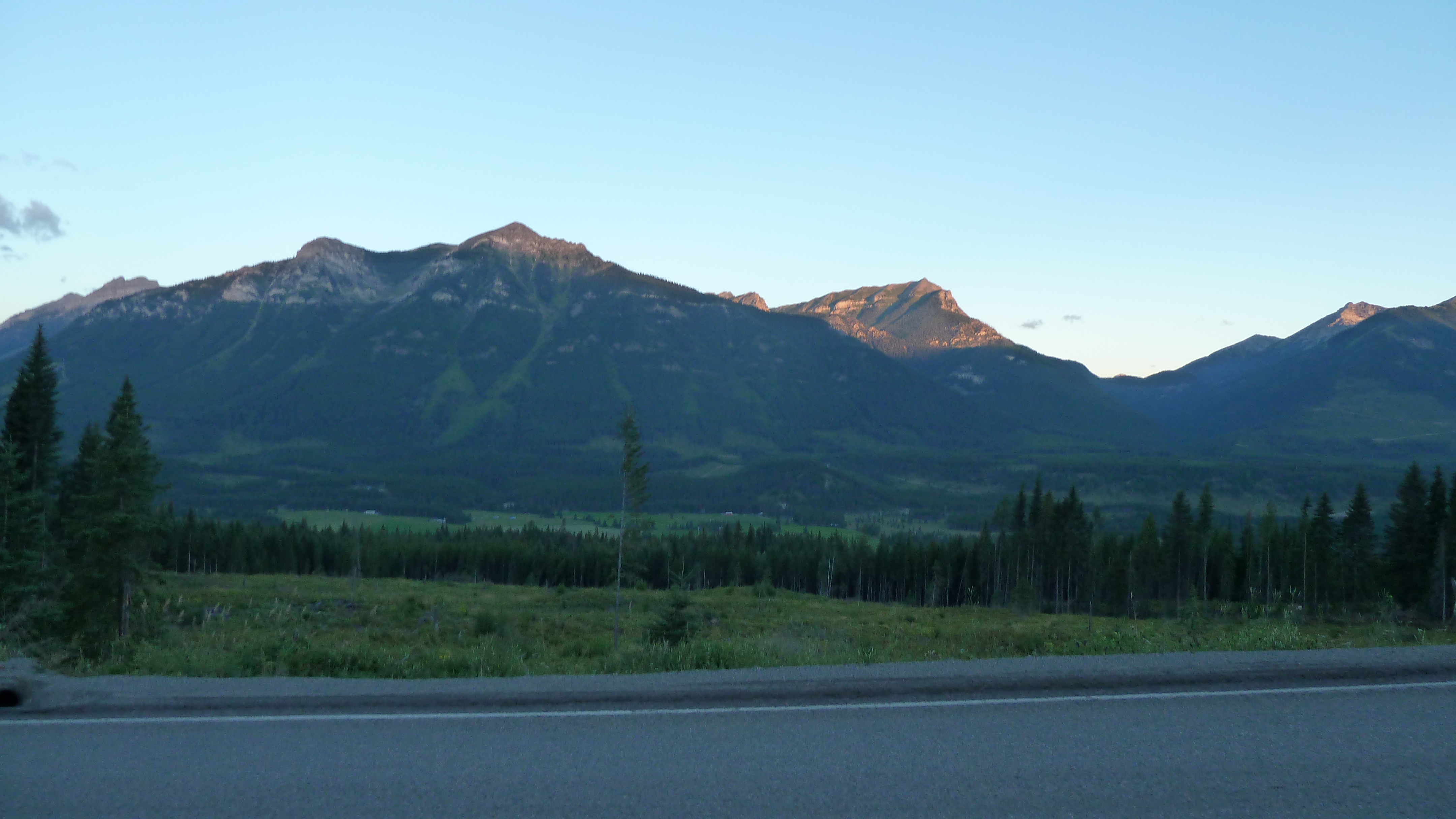
Sunrise on road out of Elkford

Sunrise on road out of Elkford
View from the 2nd floor roof @ greenhills. Looking west
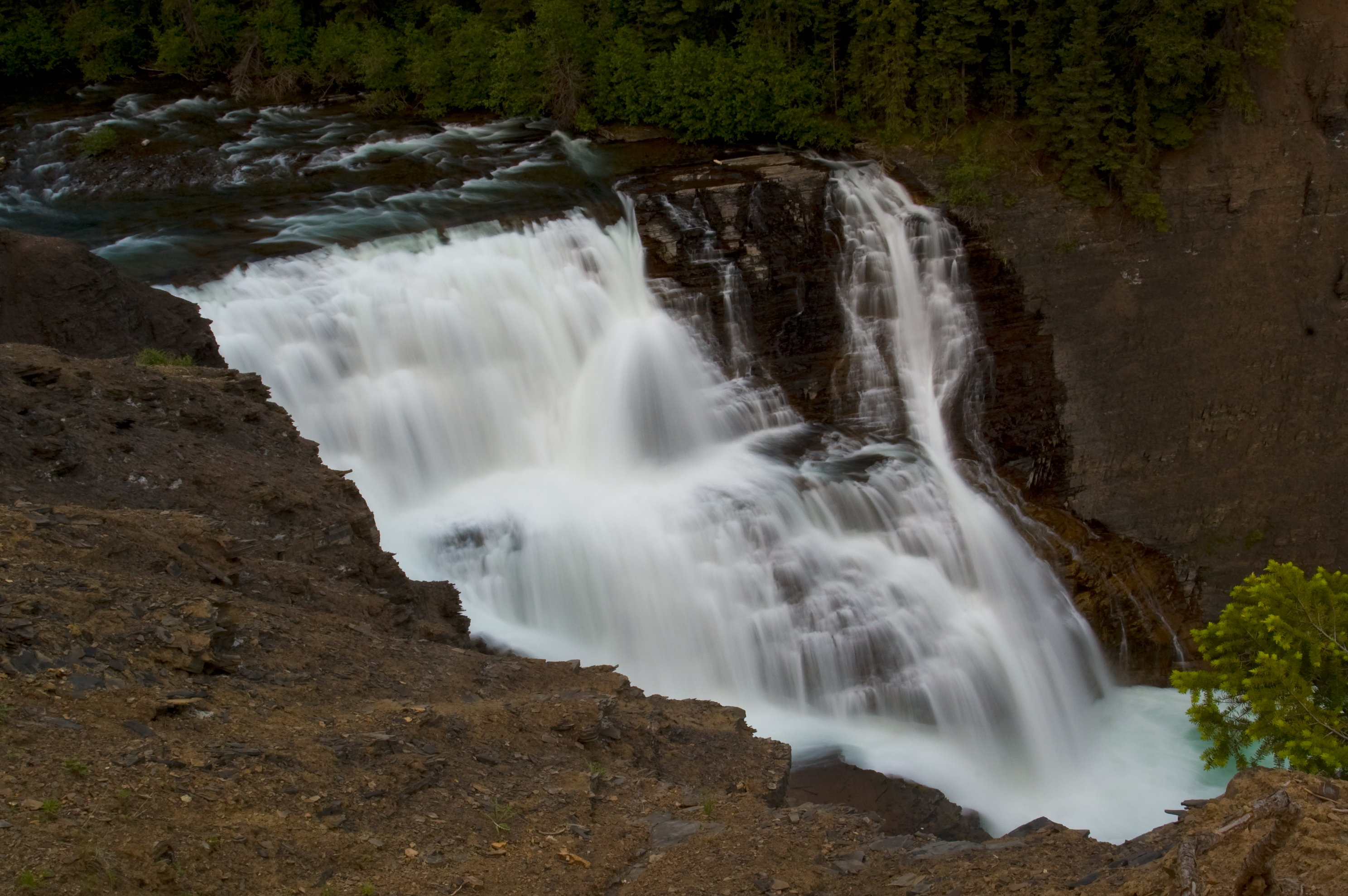
Josephine Falls
Slides north of harvest area
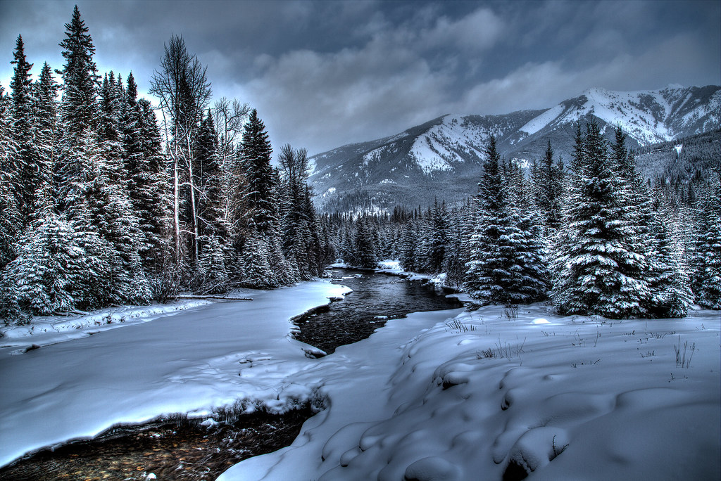
Winter River
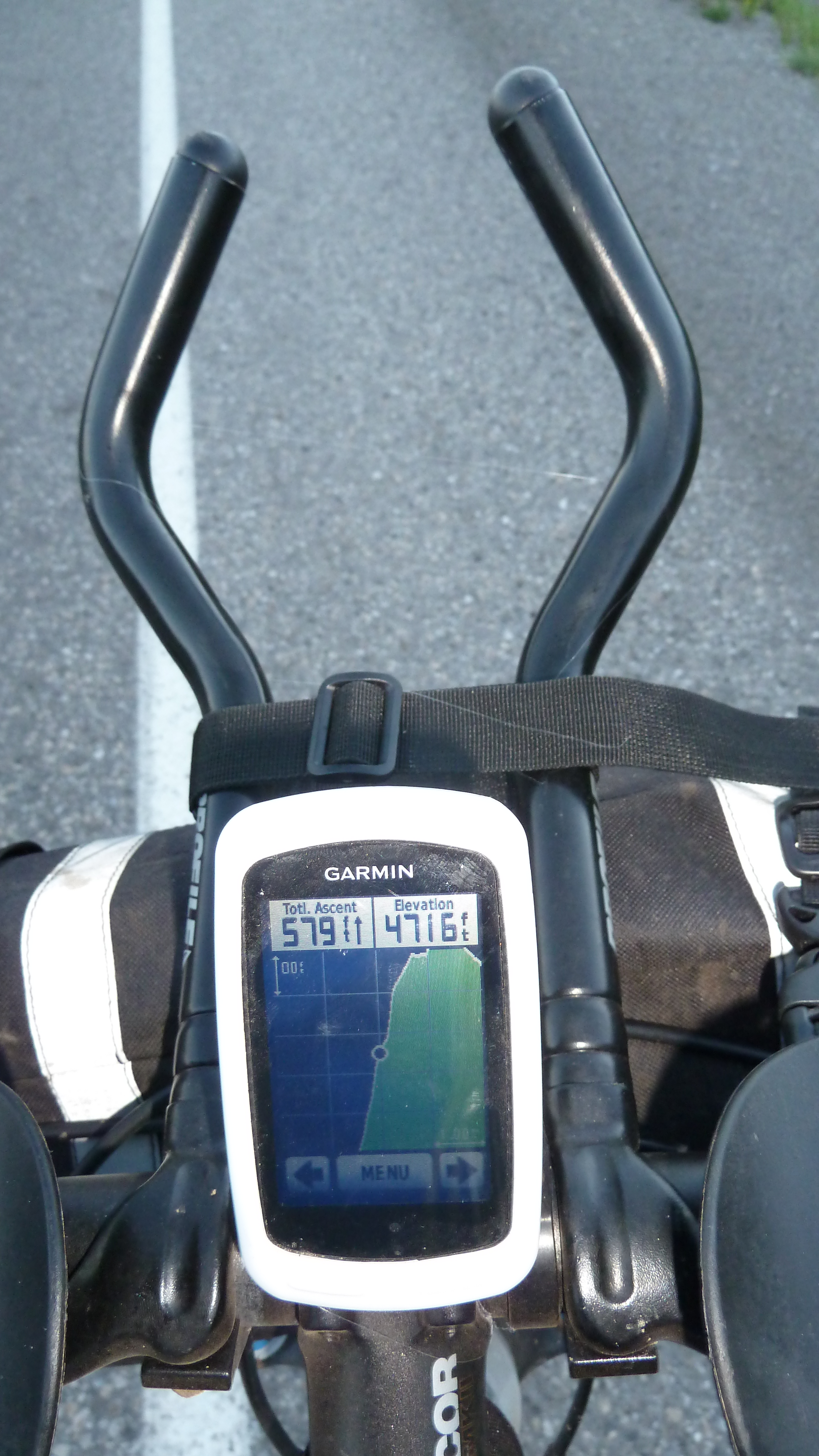
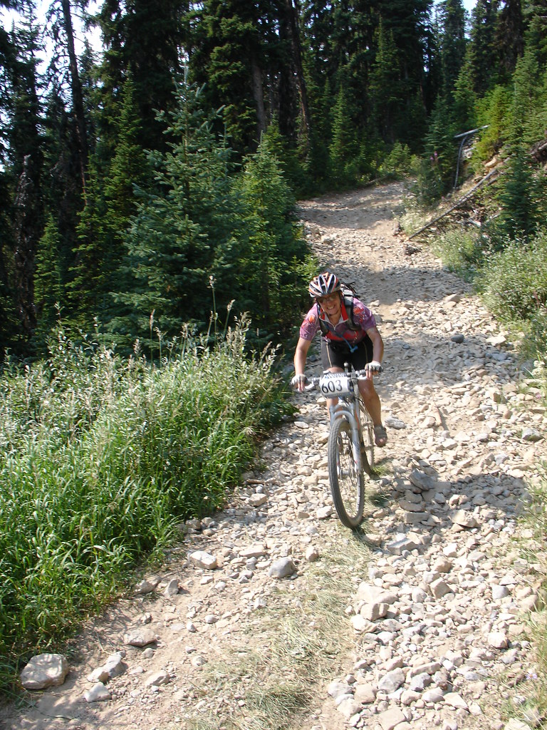
Navigation Center on Bike...
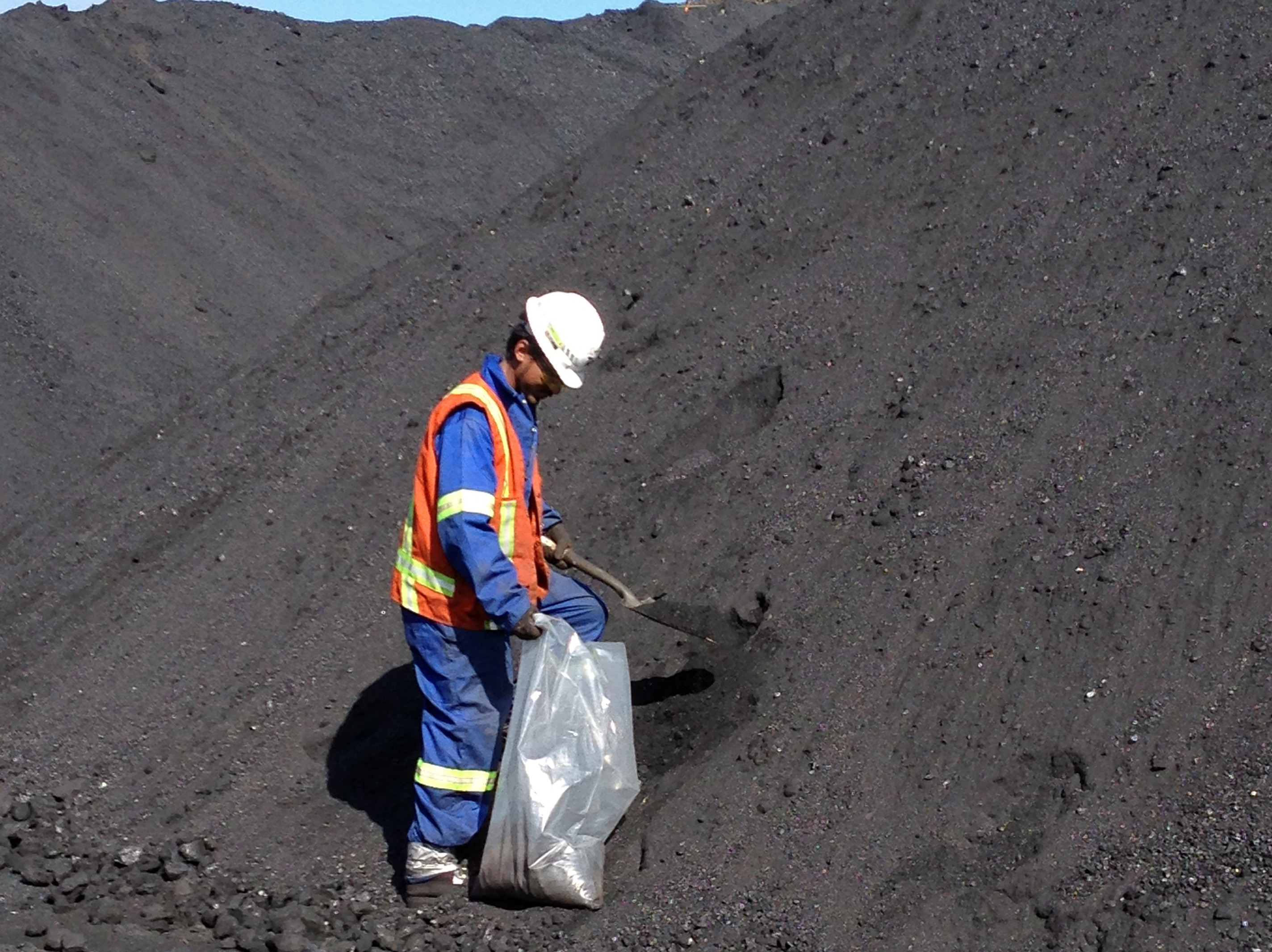
Sampling coal from coal pile; Photo: Saleh Ewan
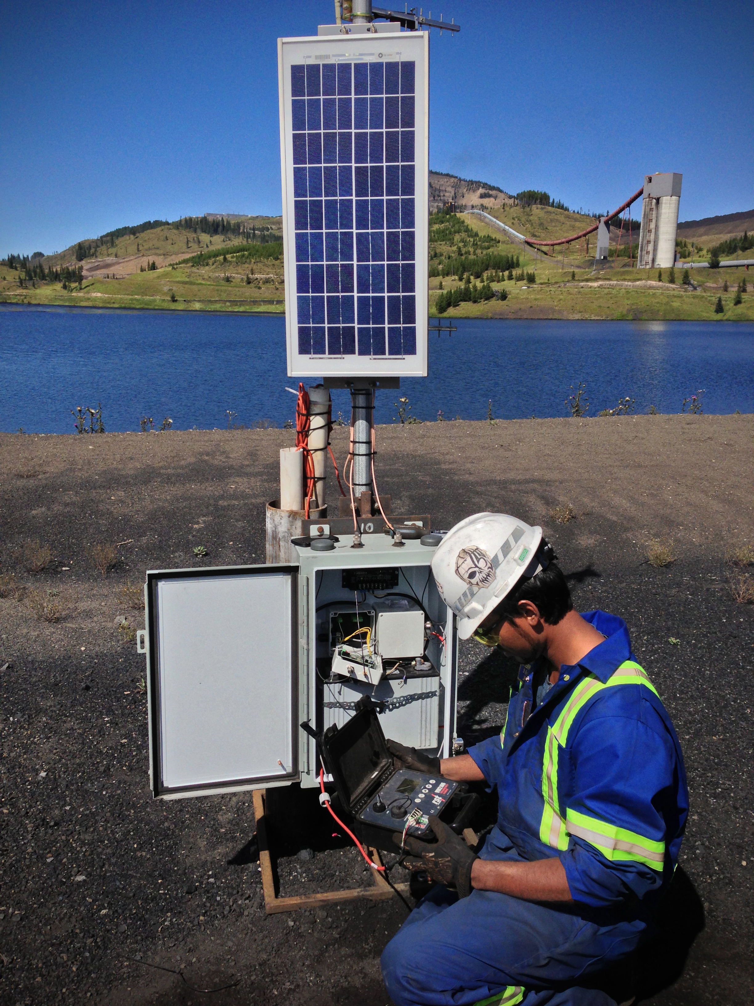
Taking reading from piezometer for "Slug test"; Photo: Saleh Ewan
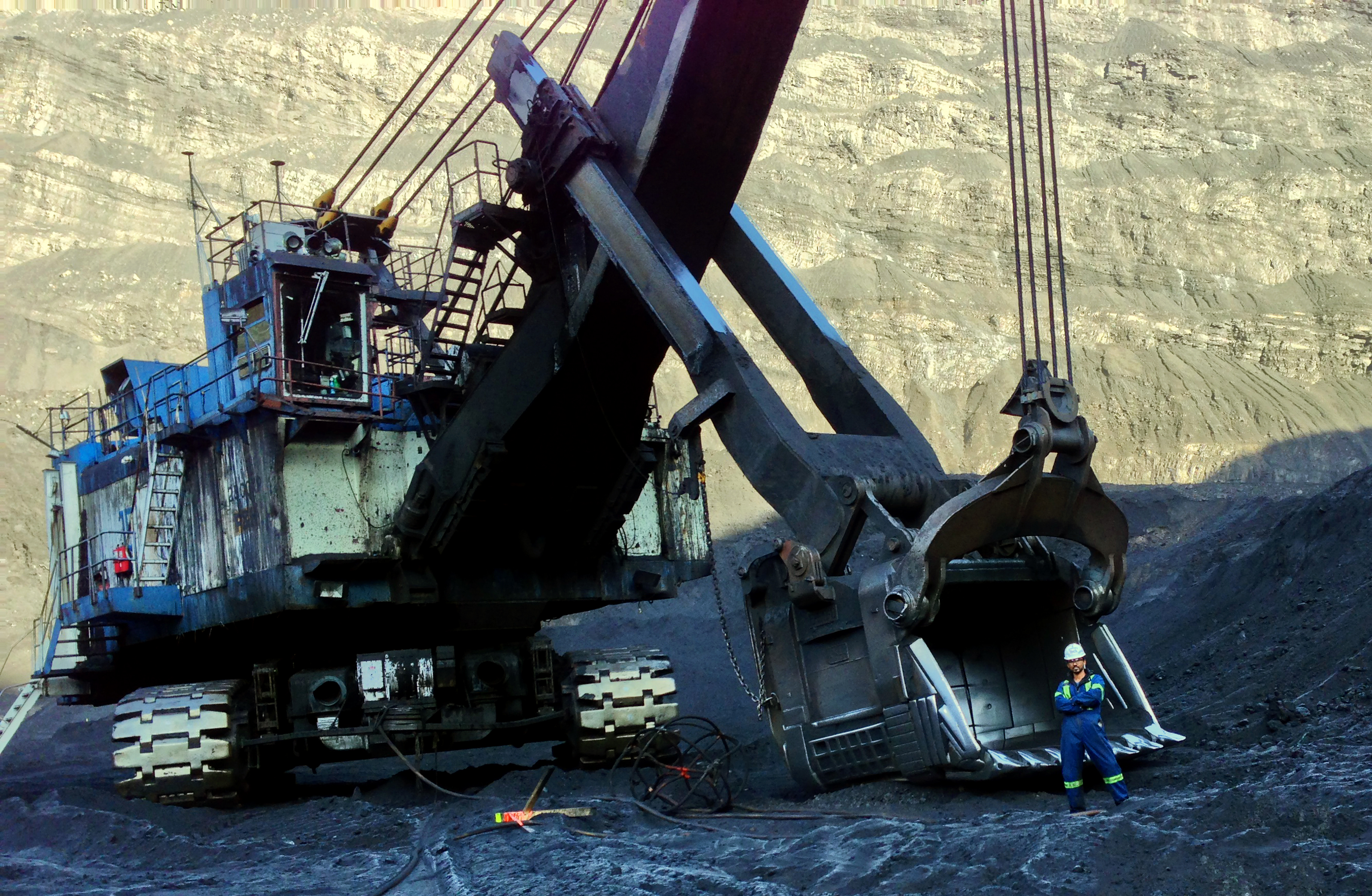
Size comparison: Man and Machine; Photo: Saleh Ewan
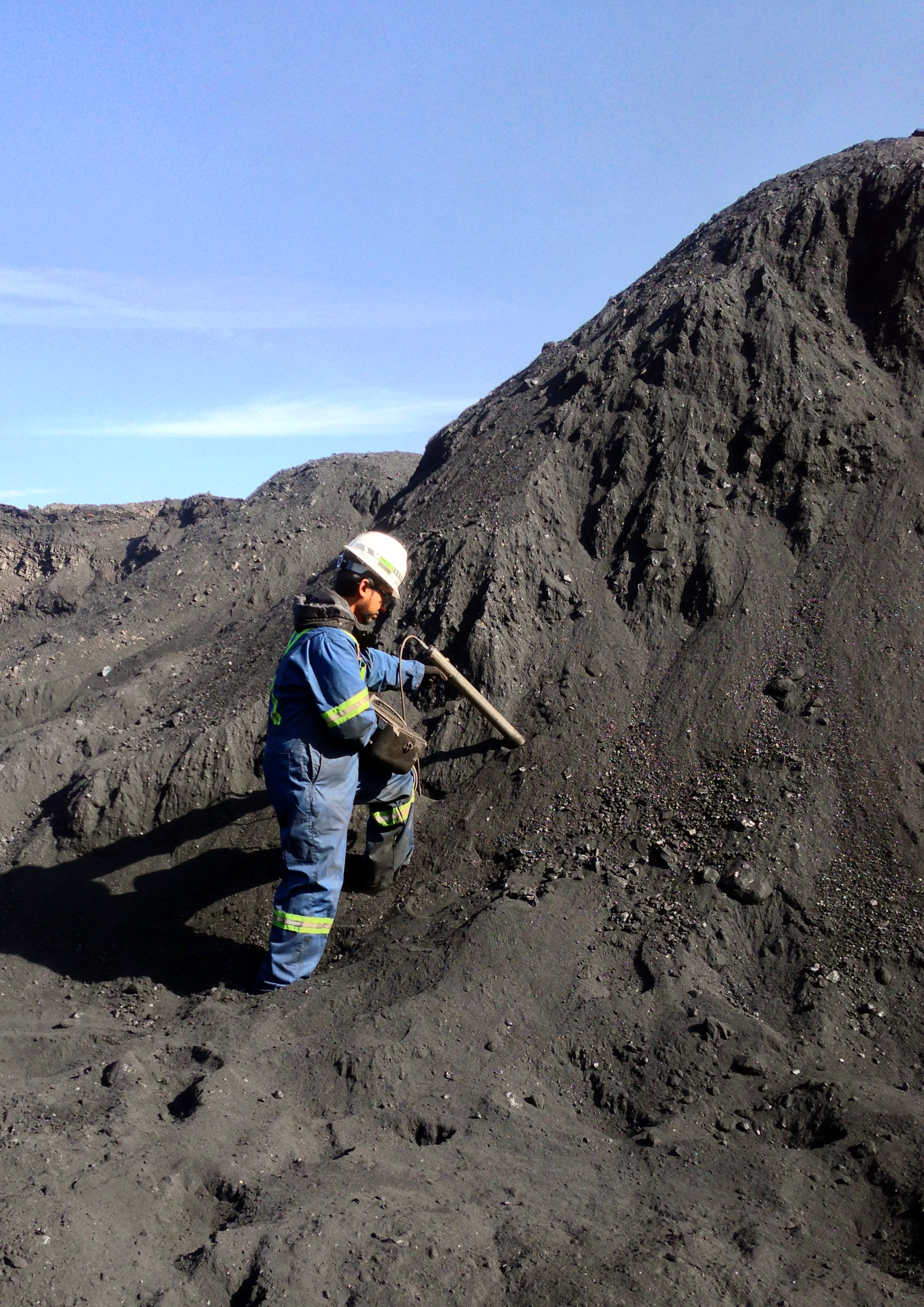
Checking ash percentage in coal pile using ash probe; Photo: Saleh Ewan
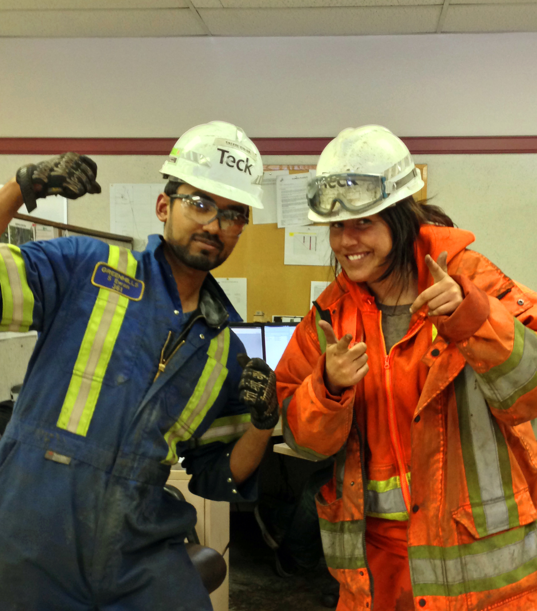
Fellow McGillian at Teck; Photo: Saleh Ewan
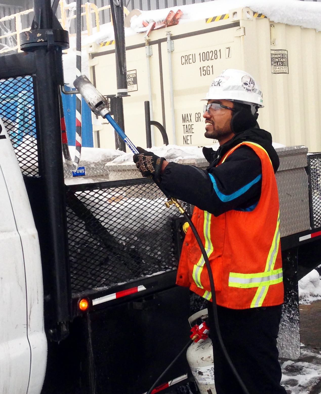
Melting ice from logging truck using a tiger torch; Photo: Saleh Ewan
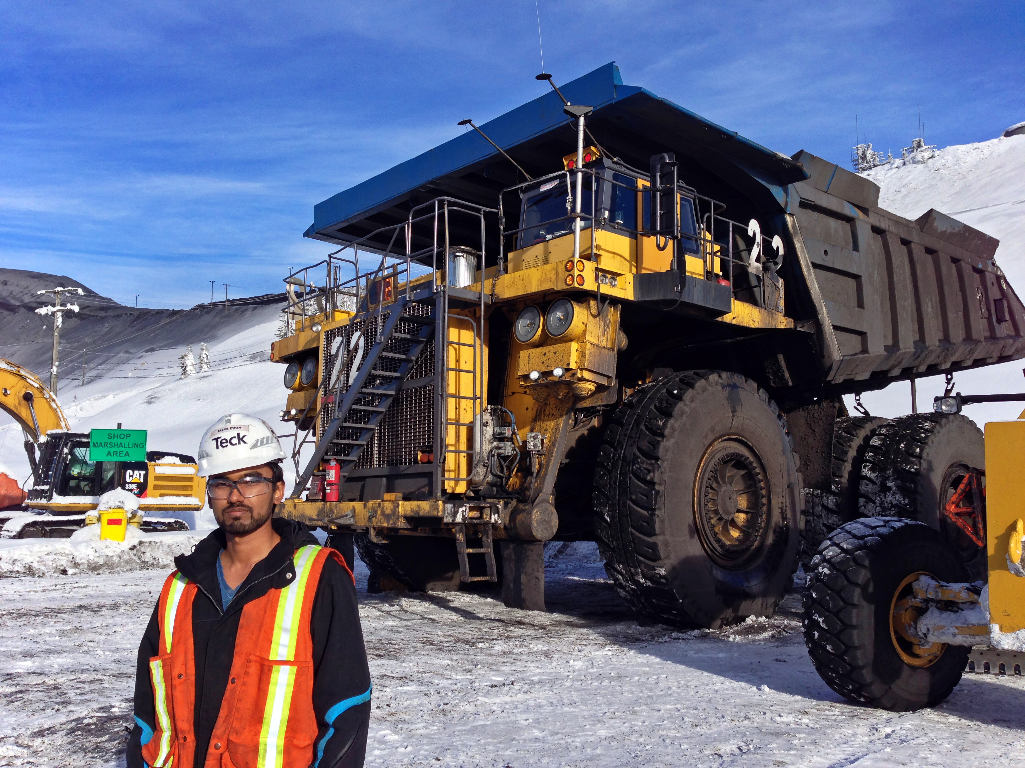
Komatsu 830E Haul Truck; Photo: Saleh Ewan

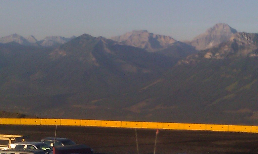
View of Rocky Mountain from Teck's Greenhills Operation; Photo: Saleh Ewan
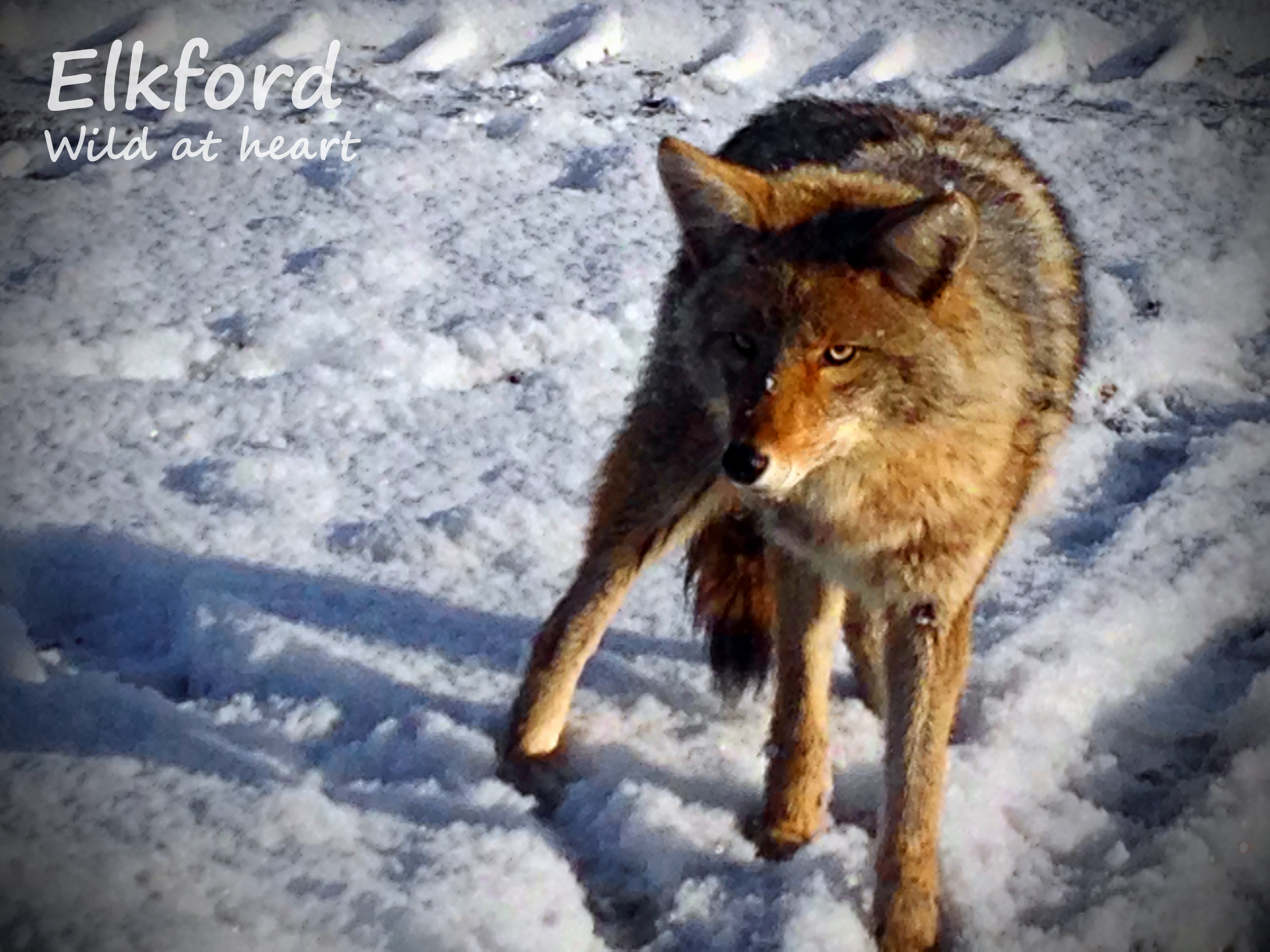
Elkford: Wild at heart
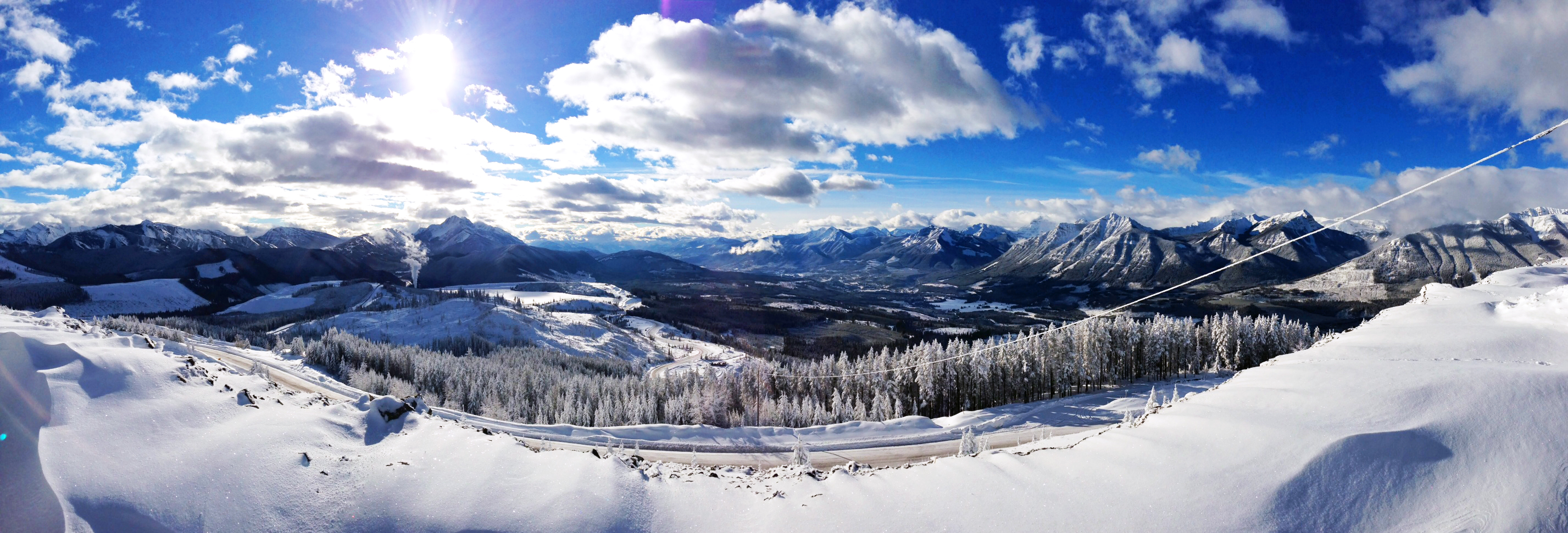
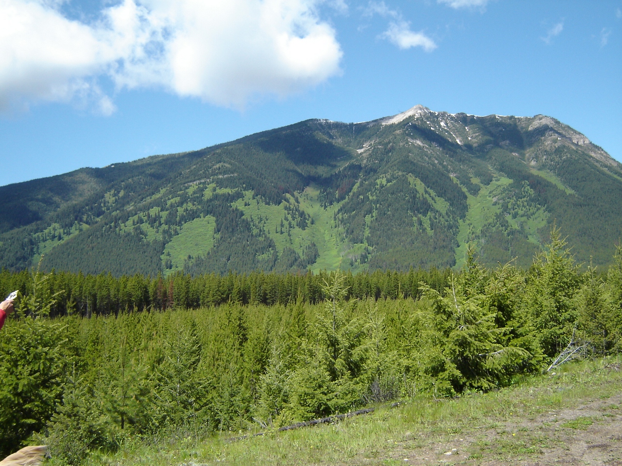
Mountain Range, Elkford
DSC05074.JPG
DSC05073.JPG
DSC05072.JPG
DSC05071.JPG
DSC05070.JPG
Peak 09-48, East Kootenay A, BC V0B, Kanada Karte
Suchen Sie einen anderen Ort
Nahe Plätze
O'Rourke W3, East Kootenay A, BC V0B, Kanada
Gass SW3, East Kootenay A, BC V0B, Kanada
Gass N3, East Kootenay A, BC V0B, Kanada
Mount Pierce, East Kootenay A, BC V0B, Kanada
Mount Gass, East Kootenay A, BC V0B, Kanada
Mount Farquhar, East Kootenay A, BC V0B, Kanada
Mount Scrimger, East Kootenay A, BC V0B, Kanada
Gill Peak, East Kootenay A, BC V0B, Kanada
Elkford, BC V0B, Kanada
Mount Etherington, East Kootenay A, BC V0B, Kanada
Courcelette Peak, East Kootenay A, BC V0B, Kanada
Courcelette NW2, East Kootenay A, BC V0B, Kanada
Mount Cornwell, East Kootenay A, BC V0B, Kanada
Baril Peak, Kananaskis, AB T0L, Kanada
Mount Tuxford, East Kootenay A, BC V0B, Kanada
Courcelette NW3, East Kootenay A, BC V0B, Kanada
Elkford, Britisch-Kolumbien V0B, Kanada
Nashton Crescent, Elkford, BC V0B 1H0, Kanada
High Rock Range, East Kootenay A, BC V0B, Kanada
Mount Veits, East Kootenay A, BC V0B, Kanada
Letzte Suche
- Red Dog Mine, AK, USA Sonnenaufgang Sonnenuntergang Zeiten
- Am Bahnhof, Am bhf, Borken, Germany Sonnenaufgang Sonnenuntergang Zeiten
- 4th St E, Sonoma, CA, USA Sonnenaufgang Sonnenuntergang Zeiten
- Oakland Ave, Williamsport, PA, USA Sonnenaufgang Sonnenuntergang Zeiten
- Via Roma, Pieranica CR, Italien Sonnenaufgang Sonnenuntergang Zeiten
- Glockenturm, Grad, Dubrovnik, Kroatien Sonnenaufgang Sonnenuntergang Zeiten
- Trelew, Chubut Province, Argentina Sonnenaufgang Sonnenuntergang Zeiten
- Hartfords Bluff Cir, Mt Pleasant, SC, USA Sonnenaufgang Sonnenuntergang Zeiten
- Kita-ku, Kumamoto, Präfektur Kumamoto, Japan Sonnenaufgang Sonnenuntergang Zeiten
- Pingtan Island, Pingtan County, Fuzhou, China Sonnenaufgang Sonnenuntergang Zeiten