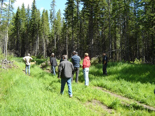
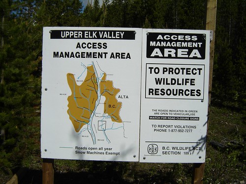
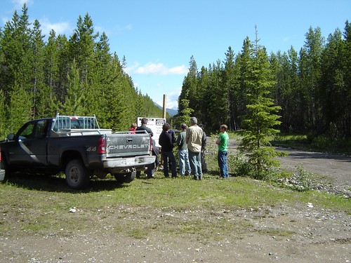
O'Rourke W3, East Kootenay A, BC V0B, Kanada Sonnenaufgang Sonnenuntergang Zeiten
Location: Kanada > Britisch-Kolumbien > Regional District of East Kootenay > East Kootenay A >
Zeitzone:
America/Edmonton
Ortszeit:
2025-06-26 14:57:09
Länge:
-114.7683333
Breite:
50.1613888
Sonnenaufgang Heute:
05:31:25 AM
Sonnenuntergang Heute:
09:53:13 PM
Tageslänge heute:
16h 21m 48s
Sonnenaufgang morgen:
05:31:58 AM
Sonnenuntergang Morgen:
09:53:05 PM
Tageslänge von morgen:
16h 21m 7s
Alle Termine anzeigen
| Datum | Sonnenaufgang | Sonnenuntergang | Tageslänge |
|---|---|---|---|
| 2025-01-01 | 08:37:59 AM | 04:48:34 PM | 8h 10m 35s |
| 2025-01-02 | 08:37:48 AM | 04:49:39 PM | 8h 11m 51s |
| 2025-01-03 | 08:37:35 AM | 04:50:47 PM | 8h 13m 12s |
| 2025-01-04 | 08:37:18 AM | 04:51:57 PM | 8h 14m 39s |
| 2025-01-05 | 08:36:59 AM | 04:53:09 PM | 8h 16m 10s |
| 2025-01-06 | 08:36:36 AM | 04:54:23 PM | 8h 17m 47s |
| 2025-01-07 | 08:36:10 AM | 04:55:40 PM | 8h 19m 30s |
| 2025-01-08 | 08:35:41 AM | 04:56:58 PM | 8h 21m 17s |
| 2025-01-09 | 08:35:10 AM | 04:58:18 PM | 8h 23m 8s |
| 2025-01-10 | 08:34:35 AM | 04:59:40 PM | 8h 25m 5s |
| 2025-01-11 | 08:33:57 AM | 05:01:04 PM | 8h 27m 7s |
| 2025-01-12 | 08:33:16 AM | 05:02:30 PM | 8h 29m 14s |
| 2025-01-13 | 08:32:33 AM | 05:03:57 PM | 8h 31m 24s |
| 2025-01-14 | 08:31:47 AM | 05:05:25 PM | 8h 33m 38s |
| 2025-01-15 | 08:30:57 AM | 05:06:55 PM | 8h 35m 58s |
| 2025-01-16 | 08:30:06 AM | 05:08:26 PM | 8h 38m 20s |
| 2025-01-17 | 08:29:11 AM | 05:09:59 PM | 8h 40m 48s |
| 2025-01-18 | 08:28:14 AM | 05:11:33 PM | 8h 43m 19s |
| 2025-01-19 | 08:27:14 AM | 05:13:08 PM | 8h 45m 54s |
| 2025-01-20 | 08:26:12 AM | 05:14:44 PM | 8h 48m 32s |
| 2025-01-21 | 08:25:07 AM | 05:16:20 PM | 8h 51m 13s |
| 2025-01-22 | 08:23:59 AM | 05:17:58 PM | 8h 53m 59s |
| 2025-01-23 | 08:22:50 AM | 05:19:37 PM | 8h 56m 47s |
| 2025-01-24 | 08:21:38 AM | 05:21:16 PM | 8h 59m 38s |
| 2025-01-25 | 08:20:23 AM | 05:22:56 PM | 9h 2m 33s |
| 2025-01-26 | 08:19:07 AM | 05:24:37 PM | 9h 5m 30s |
| 2025-01-27 | 08:17:48 AM | 05:26:18 PM | 9h 8m 30s |
| 2025-01-28 | 08:16:27 AM | 05:28:00 PM | 9h 11m 33s |
| 2025-01-29 | 08:15:04 AM | 05:29:42 PM | 9h 14m 38s |
| 2025-01-30 | 08:13:39 AM | 05:31:25 PM | 9h 17m 46s |
| 2025-01-31 | 08:12:12 AM | 05:33:08 PM | 9h 20m 56s |
| 2025-02-01 | 08:10:43 AM | 05:34:51 PM | 9h 24m 8s |
| 2025-02-02 | 08:09:12 AM | 05:36:35 PM | 9h 27m 23s |
| 2025-02-03 | 08:07:40 AM | 05:38:19 PM | 9h 30m 39s |
| 2025-02-04 | 08:06:05 AM | 05:40:03 PM | 9h 33m 58s |
| 2025-02-05 | 08:04:29 AM | 05:41:47 PM | 9h 37m 18s |
| 2025-02-06 | 08:02:51 AM | 05:43:31 PM | 9h 40m 40s |
| 2025-02-07 | 08:01:11 AM | 05:45:15 PM | 9h 44m 4s |
| 2025-02-08 | 07:59:30 AM | 05:46:59 PM | 9h 47m 29s |
| 2025-02-09 | 07:57:48 AM | 05:48:44 PM | 9h 50m 56s |
| 2025-02-10 | 07:56:04 AM | 05:50:28 PM | 9h 54m 24s |
| 2025-02-11 | 07:54:18 AM | 05:52:12 PM | 9h 57m 54s |
| 2025-02-12 | 07:52:31 AM | 05:53:56 PM | 10h 1m 25s |
| 2025-02-13 | 07:50:43 AM | 05:55:40 PM | 10h 4m 57s |
| 2025-02-14 | 07:48:53 AM | 05:57:23 PM | 10h 8m 30s |
| 2025-02-15 | 07:47:02 AM | 05:59:07 PM | 10h 12m 5s |
| 2025-02-16 | 07:45:10 AM | 06:00:50 PM | 10h 15m 40s |
| 2025-02-17 | 07:43:17 AM | 06:02:34 PM | 10h 19m 17s |
| 2025-02-18 | 07:41:22 AM | 06:04:17 PM | 10h 22m 55s |
| 2025-02-19 | 07:39:27 AM | 06:05:59 PM | 10h 26m 32s |
| 2025-02-20 | 07:37:30 AM | 06:07:42 PM | 10h 30m 12s |
| 2025-02-21 | 07:35:32 AM | 06:09:24 PM | 10h 33m 52s |
| 2025-02-22 | 07:33:34 AM | 06:11:06 PM | 10h 37m 32s |
| 2025-02-23 | 07:31:34 AM | 06:12:48 PM | 10h 41m 14s |
| 2025-02-24 | 07:29:34 AM | 06:14:29 PM | 10h 44m 55s |
| 2025-02-25 | 07:27:32 AM | 06:16:11 PM | 10h 48m 39s |
| 2025-02-26 | 07:25:30 AM | 06:17:52 PM | 10h 52m 22s |
| 2025-02-27 | 07:23:27 AM | 06:19:32 PM | 10h 56m 5s |
| 2025-02-28 | 07:21:24 AM | 06:21:13 PM | 10h 59m 49s |
| 2025-03-01 | 07:19:19 AM | 06:22:53 PM | 11h 3m 34s |
| 2025-03-02 | 07:17:14 AM | 06:24:33 PM | 11h 7m 19s |
| 2025-03-03 | 07:15:09 AM | 06:26:12 PM | 11h 11m 3s |
| 2025-03-04 | 07:13:02 AM | 06:27:51 PM | 11h 14m 49s |
| 2025-03-05 | 07:10:56 AM | 06:29:30 PM | 11h 18m 34s |
| 2025-03-06 | 07:08:48 AM | 06:31:09 PM | 11h 22m 21s |
| 2025-03-07 | 07:06:40 AM | 06:32:48 PM | 11h 26m 8s |
| 2025-03-08 | 07:04:32 AM | 06:34:26 PM | 11h 29m 54s |
| 2025-03-09 | 08:02:28 AM | 07:36:00 PM | 11h 33m 32s |
| 2025-03-10 | 08:00:19 AM | 07:37:37 PM | 11h 37m 18s |
| 2025-03-11 | 07:58:10 AM | 07:39:15 PM | 11h 41m 5s |
| 2025-03-12 | 07:56:00 AM | 07:40:52 PM | 11h 44m 52s |
| 2025-03-13 | 07:53:50 AM | 07:42:29 PM | 11h 48m 39s |
| 2025-03-14 | 07:51:39 AM | 07:44:06 PM | 11h 52m 27s |
| 2025-03-15 | 07:49:28 AM | 07:45:43 PM | 11h 56m 15s |
| 2025-03-16 | 07:47:17 AM | 07:47:19 PM | 12h 0m 2s |
| 2025-03-17 | 07:45:06 AM | 07:48:56 PM | 12h 3m 50s |
| 2025-03-18 | 07:42:55 AM | 07:50:32 PM | 12h 7m 37s |
| 2025-03-19 | 07:40:44 AM | 07:52:08 PM | 12h 11m 24s |
| 2025-03-20 | 07:38:32 AM | 07:53:44 PM | 12h 15m 12s |
| 2025-03-21 | 07:36:21 AM | 07:55:19 PM | 12h 18m 58s |
| 2025-03-22 | 07:34:09 AM | 07:56:55 PM | 12h 22m 46s |
| 2025-03-23 | 07:31:57 AM | 07:58:31 PM | 12h 26m 34s |
| 2025-03-24 | 07:29:46 AM | 08:00:06 PM | 12h 30m 20s |
| 2025-03-25 | 07:27:34 AM | 08:01:41 PM | 12h 34m 7s |
| 2025-03-26 | 07:25:23 AM | 08:03:16 PM | 12h 37m 53s |
| 2025-03-27 | 07:23:12 AM | 08:04:51 PM | 12h 41m 39s |
| 2025-03-28 | 07:21:01 AM | 08:06:26 PM | 12h 45m 25s |
| 2025-03-29 | 07:18:50 AM | 08:08:01 PM | 12h 49m 11s |
| 2025-03-30 | 07:16:39 AM | 08:09:36 PM | 12h 52m 57s |
| 2025-03-31 | 07:14:29 AM | 08:11:11 PM | 12h 56m 42s |
| 2025-04-01 | 07:12:18 AM | 08:12:46 PM | 13h 0m 28s |
| 2025-04-02 | 07:10:09 AM | 08:14:21 PM | 13h 4m 12s |
| 2025-04-03 | 07:07:59 AM | 08:15:55 PM | 13h 7m 56s |
| 2025-04-04 | 07:05:50 AM | 08:17:30 PM | 13h 11m 40s |
| 2025-04-05 | 07:03:41 AM | 08:19:05 PM | 13h 15m 24s |
| 2025-04-06 | 07:01:33 AM | 08:20:39 PM | 13h 19m 6s |
| 2025-04-07 | 06:59:25 AM | 08:22:14 PM | 13h 22m 49s |
| 2025-04-08 | 06:57:18 AM | 08:23:49 PM | 13h 26m 31s |
| 2025-04-09 | 06:55:11 AM | 08:25:23 PM | 13h 30m 12s |
| 2025-04-10 | 06:53:05 AM | 08:26:58 PM | 13h 33m 53s |
| 2025-04-11 | 06:50:59 AM | 08:28:33 PM | 13h 37m 34s |
| 2025-04-12 | 06:48:54 AM | 08:30:07 PM | 13h 41m 13s |
| 2025-04-13 | 06:46:50 AM | 08:31:42 PM | 13h 44m 52s |
| 2025-04-14 | 06:44:47 AM | 08:33:17 PM | 13h 48m 30s |
| 2025-04-15 | 06:42:44 AM | 08:34:51 PM | 13h 52m 7s |
| 2025-04-16 | 06:40:42 AM | 08:36:26 PM | 13h 55m 44s |
| 2025-04-17 | 06:38:40 AM | 08:38:00 PM | 13h 59m 20s |
| 2025-04-18 | 06:36:40 AM | 08:39:35 PM | 14h 2m 55s |
| 2025-04-19 | 06:34:41 AM | 08:41:09 PM | 14h 6m 28s |
| 2025-04-20 | 06:32:42 AM | 08:42:43 PM | 14h 10m 1s |
| 2025-04-21 | 06:30:45 AM | 08:44:18 PM | 14h 13m 33s |
| 2025-04-22 | 06:28:48 AM | 08:45:52 PM | 14h 17m 4s |
| 2025-04-23 | 06:26:52 AM | 08:47:26 PM | 14h 20m 34s |
| 2025-04-24 | 06:24:58 AM | 08:49:00 PM | 14h 24m 2s |
| 2025-04-25 | 06:23:05 AM | 08:50:34 PM | 14h 27m 29s |
| 2025-04-26 | 06:21:13 AM | 08:52:07 PM | 14h 30m 54s |
| 2025-04-27 | 06:19:22 AM | 08:53:41 PM | 14h 34m 19s |
| 2025-04-28 | 06:17:32 AM | 08:55:14 PM | 14h 37m 42s |
| 2025-04-29 | 06:15:44 AM | 08:56:47 PM | 14h 41m 3s |
| 2025-04-30 | 06:13:56 AM | 08:58:19 PM | 14h 44m 23s |
| 2025-05-01 | 06:12:11 AM | 08:59:52 PM | 14h 47m 41s |
| 2025-05-02 | 06:10:26 AM | 09:01:24 PM | 14h 50m 58s |
| 2025-05-03 | 06:08:44 AM | 09:02:56 PM | 14h 54m 12s |
| 2025-05-04 | 06:07:02 AM | 09:04:27 PM | 14h 57m 25s |
| 2025-05-05 | 06:05:23 AM | 09:05:58 PM | 15h 0m 35s |
| 2025-05-06 | 06:03:44 AM | 09:07:29 PM | 15h 3m 45s |
| 2025-05-07 | 06:02:08 AM | 09:08:58 PM | 15h 6m 50s |
| 2025-05-08 | 06:00:33 AM | 09:10:28 PM | 15h 9m 55s |
| 2025-05-09 | 05:59:00 AM | 09:11:57 PM | 15h 12m 57s |
| 2025-05-10 | 05:57:28 AM | 09:13:25 PM | 15h 15m 57s |
| 2025-05-11 | 05:55:59 AM | 09:14:53 PM | 15h 18m 54s |
| 2025-05-12 | 05:54:31 AM | 09:16:19 PM | 15h 21m 48s |
| 2025-05-13 | 05:53:05 AM | 09:17:45 PM | 15h 24m 40s |
| 2025-05-14 | 05:51:42 AM | 09:19:11 PM | 15h 27m 29s |
| 2025-05-15 | 05:50:20 AM | 09:20:35 PM | 15h 30m 15s |
| 2025-05-16 | 05:49:00 AM | 09:21:58 PM | 15h 32m 58s |
| 2025-05-17 | 05:47:43 AM | 09:23:21 PM | 15h 35m 38s |
| 2025-05-18 | 05:46:27 AM | 09:24:42 PM | 15h 38m 15s |
| 2025-05-19 | 05:45:14 AM | 09:26:02 PM | 15h 40m 48s |
| 2025-05-20 | 05:44:03 AM | 09:27:21 PM | 15h 43m 18s |
| 2025-05-21 | 05:42:54 AM | 09:28:39 PM | 15h 45m 45s |
| 2025-05-22 | 05:41:47 AM | 09:29:56 PM | 15h 48m 9s |
| 2025-05-23 | 05:40:43 AM | 09:31:11 PM | 15h 50m 28s |
| 2025-05-24 | 05:39:42 AM | 09:32:25 PM | 15h 52m 43s |
| 2025-05-25 | 05:38:42 AM | 09:33:37 PM | 15h 54m 55s |
| 2025-05-26 | 05:37:46 AM | 09:34:48 PM | 15h 57m 2s |
| 2025-05-27 | 05:36:51 AM | 09:35:57 PM | 15h 59m 6s |
| 2025-05-28 | 05:36:00 AM | 09:37:05 PM | 16h 1m 5s |
| 2025-05-29 | 05:35:11 AM | 09:38:11 PM | 16h 3m 0s |
| 2025-05-30 | 05:34:24 AM | 09:39:15 PM | 16h 4m 51s |
| 2025-05-31 | 05:33:40 AM | 09:40:17 PM | 16h 6m 37s |
| 2025-06-01 | 05:32:59 AM | 09:41:17 PM | 16h 8m 18s |
| 2025-06-02 | 05:32:21 AM | 09:42:15 PM | 16h 9m 54s |
| 2025-06-03 | 05:31:46 AM | 09:43:11 PM | 16h 11m 25s |
| 2025-06-04 | 05:31:13 AM | 09:44:05 PM | 16h 12m 52s |
| 2025-06-05 | 05:30:43 AM | 09:44:57 PM | 16h 14m 14s |
| 2025-06-06 | 05:30:16 AM | 09:45:47 PM | 16h 15m 31s |
| 2025-06-07 | 05:29:51 AM | 09:46:34 PM | 16h 16m 43s |
| 2025-06-08 | 05:29:30 AM | 09:47:19 PM | 16h 17m 49s |
| 2025-06-09 | 05:29:11 AM | 09:48:02 PM | 16h 18m 51s |
| 2025-06-10 | 05:28:56 AM | 09:48:42 PM | 16h 19m 46s |
| 2025-06-11 | 05:28:43 AM | 09:49:20 PM | 16h 20m 37s |
| 2025-06-12 | 05:28:33 AM | 09:49:55 PM | 16h 21m 22s |
| 2025-06-13 | 05:28:26 AM | 09:50:27 PM | 16h 22m 1s |
| 2025-06-14 | 05:28:22 AM | 09:50:57 PM | 16h 22m 35s |
| 2025-06-15 | 05:28:21 AM | 09:51:24 PM | 16h 23m 3s |
| 2025-06-16 | 05:28:22 AM | 09:51:48 PM | 16h 23m 26s |
| 2025-06-17 | 05:28:27 AM | 09:52:10 PM | 16h 23m 43s |
| 2025-06-18 | 05:28:34 AM | 09:52:29 PM | 16h 23m 55s |
| 2025-06-19 | 05:28:44 AM | 09:52:45 PM | 16h 24m 1s |
| 2025-06-20 | 05:28:57 AM | 09:52:58 PM | 16h 24m 1s |
| 2025-06-21 | 05:29:13 AM | 09:53:08 PM | 16h 23m 55s |
| 2025-06-22 | 05:29:31 AM | 09:53:16 PM | 16h 23m 45s |
| 2025-06-23 | 05:29:53 AM | 09:53:20 PM | 16h 23m 27s |
| 2025-06-24 | 05:30:17 AM | 09:53:22 PM | 16h 23m 5s |
| 2025-06-25 | 05:30:43 AM | 09:53:20 PM | 16h 22m 37s |
| 2025-06-26 | 05:31:12 AM | 09:53:16 PM | 16h 22m 4s |
| 2025-06-27 | 05:31:44 AM | 09:53:09 PM | 16h 21m 25s |
| 2025-06-28 | 05:32:18 AM | 09:52:59 PM | 16h 20m 41s |
| 2025-06-29 | 05:32:55 AM | 09:52:45 PM | 16h 19m 50s |
| 2025-06-30 | 05:33:34 AM | 09:52:29 PM | 16h 18m 55s |
| 2025-07-01 | 05:34:16 AM | 09:52:10 PM | 16h 17m 54s |
| 2025-07-02 | 05:35:00 AM | 09:51:49 PM | 16h 16m 49s |
| 2025-07-03 | 05:35:46 AM | 09:51:24 PM | 16h 15m 38s |
| 2025-07-04 | 05:36:35 AM | 09:50:56 PM | 16h 14m 21s |
| 2025-07-05 | 05:37:25 AM | 09:50:26 PM | 16h 13m 1s |
| 2025-07-06 | 05:38:18 AM | 09:49:52 PM | 16h 11m 34s |
| 2025-07-07 | 05:39:12 AM | 09:49:16 PM | 16h 10m 4s |
| 2025-07-08 | 05:40:09 AM | 09:48:37 PM | 16h 8m 28s |
| 2025-07-09 | 05:41:08 AM | 09:47:55 PM | 16h 6m 47s |
| 2025-07-10 | 05:42:08 AM | 09:47:11 PM | 16h 5m 3s |
| 2025-07-11 | 05:43:10 AM | 09:46:24 PM | 16h 3m 14s |
| 2025-07-12 | 05:44:14 AM | 09:45:34 PM | 16h 1m 20s |
| 2025-07-13 | 05:45:20 AM | 09:44:42 PM | 15h 59m 22s |
| 2025-07-14 | 05:46:27 AM | 09:43:47 PM | 15h 57m 20s |
| 2025-07-15 | 05:47:35 AM | 09:42:49 PM | 15h 55m 14s |
| 2025-07-16 | 05:48:46 AM | 09:41:49 PM | 15h 53m 3s |
| 2025-07-17 | 05:49:57 AM | 09:40:47 PM | 15h 50m 50s |
| 2025-07-18 | 05:51:10 AM | 09:39:42 PM | 15h 48m 32s |
| 2025-07-19 | 05:52:24 AM | 09:38:34 PM | 15h 46m 10s |
| 2025-07-20 | 05:53:39 AM | 09:37:25 PM | 15h 43m 46s |
| 2025-07-21 | 05:54:56 AM | 09:36:13 PM | 15h 41m 17s |
| 2025-07-22 | 05:56:13 AM | 09:34:59 PM | 15h 38m 46s |
| 2025-07-23 | 05:57:32 AM | 09:33:42 PM | 15h 36m 10s |
| 2025-07-24 | 05:58:51 AM | 09:32:24 PM | 15h 33m 33s |
| 2025-07-25 | 06:00:12 AM | 09:31:03 PM | 15h 30m 51s |
| 2025-07-26 | 06:01:33 AM | 09:29:41 PM | 15h 28m 8s |
| 2025-07-27 | 06:02:55 AM | 09:28:16 PM | 15h 25m 21s |
| 2025-07-28 | 06:04:18 AM | 09:26:49 PM | 15h 22m 31s |
| 2025-07-29 | 06:05:42 AM | 09:25:21 PM | 15h 19m 39s |
| 2025-07-30 | 06:07:06 AM | 09:23:50 PM | 15h 16m 44s |
| 2025-07-31 | 06:08:31 AM | 09:22:18 PM | 15h 13m 47s |
| 2025-08-01 | 06:09:56 AM | 09:20:44 PM | 15h 10m 48s |
| 2025-08-02 | 06:11:22 AM | 09:19:08 PM | 15h 7m 46s |
| 2025-08-03 | 06:12:49 AM | 09:17:30 PM | 15h 4m 41s |
| 2025-08-04 | 06:14:16 AM | 09:15:51 PM | 15h 1m 35s |
| 2025-08-05 | 06:15:43 AM | 09:14:11 PM | 14h 58m 28s |
| 2025-08-06 | 06:17:10 AM | 09:12:28 PM | 14h 55m 18s |
| 2025-08-07 | 06:18:38 AM | 09:10:44 PM | 14h 52m 6s |
| 2025-08-08 | 06:20:07 AM | 09:08:59 PM | 14h 48m 52s |
| 2025-08-09 | 06:21:35 AM | 09:07:12 PM | 14h 45m 37s |
| 2025-08-10 | 06:23:04 AM | 09:05:24 PM | 14h 42m 20s |
| 2025-08-11 | 06:24:33 AM | 09:03:35 PM | 14h 39m 2s |
| 2025-08-12 | 06:26:02 AM | 09:01:44 PM | 14h 35m 42s |
| 2025-08-13 | 06:27:32 AM | 08:59:52 PM | 14h 32m 20s |
| 2025-08-14 | 06:29:01 AM | 08:57:59 PM | 14h 28m 58s |
| 2025-08-15 | 06:30:31 AM | 08:56:05 PM | 14h 25m 34s |
| 2025-08-16 | 06:32:00 AM | 08:54:09 PM | 14h 22m 9s |
| 2025-08-17 | 06:33:30 AM | 08:52:13 PM | 14h 18m 43s |
| 2025-08-18 | 06:35:00 AM | 08:50:15 PM | 14h 15m 15s |
| 2025-08-19 | 06:36:30 AM | 08:48:16 PM | 14h 11m 46s |
| 2025-08-20 | 06:38:00 AM | 08:46:17 PM | 14h 8m 17s |
| 2025-08-21 | 06:39:30 AM | 08:44:16 PM | 14h 4m 46s |
| 2025-08-22 | 06:41:00 AM | 08:42:15 PM | 14h 1m 15s |
| 2025-08-23 | 06:42:30 AM | 08:40:13 PM | 13h 57m 43s |
| 2025-08-24 | 06:44:00 AM | 08:38:09 PM | 13h 54m 9s |
| 2025-08-25 | 06:45:30 AM | 08:36:05 PM | 13h 50m 35s |
| 2025-08-26 | 06:47:00 AM | 08:34:01 PM | 13h 47m 1s |
| 2025-08-27 | 06:48:30 AM | 08:31:55 PM | 13h 43m 25s |
| 2025-08-28 | 06:50:00 AM | 08:29:49 PM | 13h 39m 49s |
| 2025-08-29 | 06:51:30 AM | 08:27:42 PM | 13h 36m 12s |
| 2025-08-30 | 06:52:59 AM | 08:25:35 PM | 13h 32m 36s |
| 2025-08-31 | 06:54:29 AM | 08:23:27 PM | 13h 28m 58s |
| 2025-09-01 | 06:55:59 AM | 08:21:19 PM | 13h 25m 20s |
| 2025-09-02 | 06:57:29 AM | 08:19:09 PM | 13h 21m 40s |
| 2025-09-03 | 06:58:59 AM | 08:17:00 PM | 13h 18m 1s |
| 2025-09-04 | 07:00:29 AM | 08:14:50 PM | 13h 14m 21s |
| 2025-09-05 | 07:01:58 AM | 08:12:40 PM | 13h 10m 42s |
| 2025-09-06 | 07:03:28 AM | 08:10:29 PM | 13h 7m 1s |
| 2025-09-07 | 07:04:58 AM | 08:08:17 PM | 13h 3m 19s |
| 2025-09-08 | 07:06:28 AM | 08:06:06 PM | 12h 59m 38s |
| 2025-09-09 | 07:07:58 AM | 08:03:54 PM | 12h 55m 56s |
| 2025-09-10 | 07:09:28 AM | 08:01:42 PM | 12h 52m 14s |
| 2025-09-11 | 07:10:57 AM | 07:59:30 PM | 12h 48m 33s |
| 2025-09-12 | 07:12:27 AM | 07:57:17 PM | 12h 44m 50s |
| 2025-09-13 | 07:13:57 AM | 07:55:04 PM | 12h 41m 7s |
| 2025-09-14 | 07:15:27 AM | 07:52:52 PM | 12h 37m 25s |
| 2025-09-15 | 07:16:57 AM | 07:50:39 PM | 12h 33m 42s |
| 2025-09-16 | 07:18:28 AM | 07:48:25 PM | 12h 29m 57s |
| 2025-09-17 | 07:19:58 AM | 07:46:12 PM | 12h 26m 14s |
| 2025-09-18 | 07:21:28 AM | 07:43:59 PM | 12h 22m 31s |
| 2025-09-19 | 07:22:59 AM | 07:41:46 PM | 12h 18m 47s |
| 2025-09-20 | 07:24:29 AM | 07:39:33 PM | 12h 15m 4s |
| 2025-09-21 | 07:26:00 AM | 07:37:20 PM | 12h 11m 20s |
| 2025-09-22 | 07:27:31 AM | 07:35:07 PM | 12h 7m 36s |
| 2025-09-23 | 07:29:02 AM | 07:32:54 PM | 12h 3m 52s |
| 2025-09-24 | 07:30:33 AM | 07:30:41 PM | 12h 0m 8s |
| 2025-09-25 | 07:32:05 AM | 07:28:28 PM | 11h 56m 23s |
| 2025-09-26 | 07:33:36 AM | 07:26:16 PM | 11h 52m 40s |
| 2025-09-27 | 07:35:08 AM | 07:24:04 PM | 11h 48m 56s |
| 2025-09-28 | 07:36:40 AM | 07:21:52 PM | 11h 45m 12s |
| 2025-09-29 | 07:38:12 AM | 07:19:41 PM | 11h 41m 29s |
| 2025-09-30 | 07:39:45 AM | 07:17:29 PM | 11h 37m 44s |
| 2025-10-01 | 07:41:17 AM | 07:15:18 PM | 11h 34m 1s |
| 2025-10-02 | 07:42:50 AM | 07:13:08 PM | 11h 30m 18s |
| 2025-10-03 | 07:44:23 AM | 07:10:58 PM | 11h 26m 35s |
| 2025-10-04 | 07:45:57 AM | 07:08:48 PM | 11h 22m 51s |
| 2025-10-05 | 07:47:31 AM | 07:06:39 PM | 11h 19m 8s |
| 2025-10-06 | 07:49:05 AM | 07:04:31 PM | 11h 15m 26s |
| 2025-10-07 | 07:50:39 AM | 07:02:23 PM | 11h 11m 44s |
| 2025-10-08 | 07:52:13 AM | 07:00:15 PM | 11h 8m 2s |
| 2025-10-09 | 07:53:48 AM | 06:58:08 PM | 11h 4m 20s |
| 2025-10-10 | 07:55:23 AM | 06:56:02 PM | 11h 0m 39s |
| 2025-10-11 | 07:56:59 AM | 06:53:57 PM | 10h 56m 58s |
| 2025-10-12 | 07:58:35 AM | 06:51:52 PM | 10h 53m 17s |
| 2025-10-13 | 08:00:11 AM | 06:49:48 PM | 10h 49m 37s |
| 2025-10-14 | 08:01:47 AM | 06:47:45 PM | 10h 45m 58s |
| 2025-10-15 | 08:03:24 AM | 06:45:43 PM | 10h 42m 19s |
| 2025-10-16 | 08:05:01 AM | 06:43:41 PM | 10h 38m 40s |
| 2025-10-17 | 08:06:38 AM | 06:41:41 PM | 10h 35m 3s |
| 2025-10-18 | 08:08:15 AM | 06:39:41 PM | 10h 31m 26s |
| 2025-10-19 | 08:09:53 AM | 06:37:43 PM | 10h 27m 50s |
| 2025-10-20 | 08:11:31 AM | 06:35:45 PM | 10h 24m 14s |
| 2025-10-21 | 08:13:10 AM | 06:33:48 PM | 10h 20m 38s |
| 2025-10-22 | 08:14:48 AM | 06:31:53 PM | 10h 17m 5s |
| 2025-10-23 | 08:16:27 AM | 06:29:59 PM | 10h 13m 32s |
| 2025-10-24 | 08:18:06 AM | 06:28:06 PM | 10h 10m 0s |
| 2025-10-25 | 08:19:46 AM | 06:26:14 PM | 10h 6m 28s |
| 2025-10-26 | 08:21:25 AM | 06:24:23 PM | 10h 2m 58s |
| 2025-10-27 | 08:23:05 AM | 06:22:34 PM | 9h 59m 29s |
| 2025-10-28 | 08:24:45 AM | 06:20:46 PM | 9h 56m 1s |
| 2025-10-29 | 08:26:25 AM | 06:19:00 PM | 9h 52m 35s |
| 2025-10-30 | 08:28:05 AM | 06:17:15 PM | 9h 49m 10s |
| 2025-10-31 | 08:29:45 AM | 06:15:32 PM | 9h 45m 47s |
| 2025-11-01 | 08:31:25 AM | 06:13:50 PM | 9h 42m 25s |
| 2025-11-02 | 07:33:10 AM | 05:12:05 PM | 9h 38m 55s |
| 2025-11-03 | 07:34:50 AM | 05:10:27 PM | 9h 35m 37s |
| 2025-11-04 | 07:36:30 AM | 05:08:50 PM | 9h 32m 20s |
| 2025-11-05 | 07:38:10 AM | 05:07:14 PM | 9h 29m 4s |
| 2025-11-06 | 07:39:50 AM | 05:05:41 PM | 9h 25m 51s |
| 2025-11-07 | 07:41:30 AM | 05:04:10 PM | 9h 22m 40s |
| 2025-11-08 | 07:43:10 AM | 05:02:40 PM | 9h 19m 30s |
| 2025-11-09 | 07:44:49 AM | 05:01:12 PM | 9h 16m 23s |
| 2025-11-10 | 07:46:28 AM | 04:59:47 PM | 9h 13m 19s |
| 2025-11-11 | 07:48:07 AM | 04:58:23 PM | 9h 10m 16s |
| 2025-11-12 | 07:49:45 AM | 04:57:01 PM | 9h 7m 16s |
| 2025-11-13 | 07:51:23 AM | 04:55:42 PM | 9h 4m 19s |
| 2025-11-14 | 07:53:01 AM | 04:54:25 PM | 9h 1m 24s |
| 2025-11-15 | 07:54:38 AM | 04:53:10 PM | 8h 58m 32s |
| 2025-11-16 | 07:56:14 AM | 04:51:57 PM | 8h 55m 43s |
| 2025-11-17 | 07:57:49 AM | 04:50:47 PM | 8h 52m 58s |
| 2025-11-18 | 07:59:24 AM | 04:49:39 PM | 8h 50m 15s |
| 2025-11-19 | 08:00:58 AM | 04:48:34 PM | 8h 47m 36s |
| 2025-11-20 | 08:02:31 AM | 04:47:31 PM | 8h 45m 0s |
| 2025-11-21 | 08:04:03 AM | 04:46:31 PM | 8h 42m 28s |
| 2025-11-22 | 08:05:34 AM | 04:45:33 PM | 8h 39m 59s |
| 2025-11-23 | 08:07:03 AM | 04:44:38 PM | 8h 37m 35s |
| 2025-11-24 | 08:08:32 AM | 04:43:46 PM | 8h 35m 14s |
| 2025-11-25 | 08:09:59 AM | 04:42:56 PM | 8h 32m 57s |
| 2025-11-26 | 08:11:25 AM | 04:42:10 PM | 8h 30m 45s |
| 2025-11-27 | 08:12:50 AM | 04:41:26 PM | 8h 28m 36s |
| 2025-11-28 | 08:14:13 AM | 04:40:45 PM | 8h 26m 32s |
| 2025-11-29 | 08:15:35 AM | 04:40:07 PM | 8h 24m 32s |
| 2025-11-30 | 08:16:55 AM | 04:39:32 PM | 8h 22m 37s |
| 2025-12-01 | 08:18:13 AM | 04:39:00 PM | 8h 20m 47s |
| 2025-12-02 | 08:19:29 AM | 04:38:31 PM | 8h 19m 2s |
| 2025-12-03 | 08:20:43 AM | 04:38:05 PM | 8h 17m 22s |
| 2025-12-04 | 08:21:56 AM | 04:37:42 PM | 8h 15m 46s |
| 2025-12-05 | 08:23:06 AM | 04:37:22 PM | 8h 14m 16s |
| 2025-12-06 | 08:24:14 AM | 04:37:05 PM | 8h 12m 51s |
| 2025-12-07 | 08:25:20 AM | 04:36:52 PM | 8h 11m 32s |
| 2025-12-08 | 08:26:24 AM | 04:36:42 PM | 8h 10m 18s |
| 2025-12-09 | 08:27:25 AM | 04:36:35 PM | 8h 9m 10s |
| 2025-12-10 | 08:28:24 AM | 04:36:31 PM | 8h 8m 7s |
| 2025-12-11 | 08:29:21 AM | 04:36:31 PM | 8h 7m 10s |
| 2025-12-12 | 08:30:15 AM | 04:36:33 PM | 8h 6m 18s |
| 2025-12-13 | 08:31:06 AM | 04:36:39 PM | 8h 5m 33s |
| 2025-12-14 | 08:31:55 AM | 04:36:48 PM | 8h 4m 53s |
| 2025-12-15 | 08:32:40 AM | 04:37:01 PM | 8h 4m 21s |
| 2025-12-16 | 08:33:23 AM | 04:37:16 PM | 8h 3m 53s |
| 2025-12-17 | 08:34:04 AM | 04:37:35 PM | 8h 3m 31s |
| 2025-12-18 | 08:34:41 AM | 04:37:57 PM | 8h 3m 16s |
| 2025-12-19 | 08:35:15 AM | 04:38:22 PM | 8h 3m 7s |
| 2025-12-20 | 08:35:47 AM | 04:38:50 PM | 8h 3m 3s |
| 2025-12-21 | 08:36:15 AM | 04:39:22 PM | 8h 3m 7s |
| 2025-12-22 | 08:36:40 AM | 04:39:56 PM | 8h 3m 16s |
| 2025-12-23 | 08:37:02 AM | 04:40:34 PM | 8h 3m 32s |
| 2025-12-24 | 08:37:22 AM | 04:41:14 PM | 8h 3m 52s |
| 2025-12-25 | 08:37:37 AM | 04:41:57 PM | 8h 4m 20s |
| 2025-12-26 | 08:37:50 AM | 04:42:43 PM | 8h 4m 53s |
| 2025-12-27 | 08:38:00 AM | 04:43:33 PM | 8h 5m 33s |
| 2025-12-28 | 08:38:06 AM | 04:44:24 PM | 8h 6m 18s |
| 2025-12-29 | 08:38:10 AM | 04:45:19 PM | 8h 7m 9s |
| 2025-12-30 | 08:38:10 AM | 04:46:16 PM | 8h 8m 6s |
| 2025-12-31 | 08:38:07 AM | 04:47:16 PM | 8h 9m 9s |
Fotos
O'Rourke W3, East Kootenay A, BC V0B, Kanada Karte
Suchen Sie einen anderen Ort
Nahe Plätze
Gass N3, East Kootenay A, BC V0B, Kanada
Peak 09-48, East Kootenay A, BC V0B, Kanada
Mount Pierce, East Kootenay A, BC V0B, Kanada
Mount Gass, East Kootenay A, BC V0B, Kanada
Gass SW3, East Kootenay A, BC V0B, Kanada
Mount Farquhar, East Kootenay A, BC V0B, Kanada
Mount Scrimger, East Kootenay A, BC V0B, Kanada
Mount Etherington, East Kootenay A, BC V0B, Kanada
Gill Peak, East Kootenay A, BC V0B, Kanada
Courcelette Peak, East Kootenay A, BC V0B, Kanada
Baril Peak, Kananaskis, AB T0L, Kanada
Mount Cornwell, East Kootenay A, BC V0B, Kanada
Elkford, BC V0B, Kanada
Courcelette NW2, East Kootenay A, BC V0B, Kanada
High Rock Range, East Kootenay A, BC V0B, Kanada
Courcelette NW3, East Kootenay A, BC V0B, Kanada
Mount Tuxford, East Kootenay A, BC V0B, Kanada
Mount Armstrong, East Kootenay A, BC V0B, Kanada
Mount Veits, East Kootenay A, BC V0B, Kanada
Mount Shankland, East Kootenay A, BC V0B, Kanada
Letzte Suche
- Red Dog Mine, AK, USA Sonnenaufgang Sonnenuntergang Zeiten
- Am Bahnhof, Am bhf, Borken, Germany Sonnenaufgang Sonnenuntergang Zeiten
- 4th St E, Sonoma, CA, USA Sonnenaufgang Sonnenuntergang Zeiten
- Oakland Ave, Williamsport, PA, USA Sonnenaufgang Sonnenuntergang Zeiten
- Via Roma, Pieranica CR, Italien Sonnenaufgang Sonnenuntergang Zeiten
- Glockenturm, Grad, Dubrovnik, Kroatien Sonnenaufgang Sonnenuntergang Zeiten
- Trelew, Chubut Province, Argentina Sonnenaufgang Sonnenuntergang Zeiten
- Hartfords Bluff Cir, Mt Pleasant, SC, USA Sonnenaufgang Sonnenuntergang Zeiten
- Kita-ku, Kumamoto, Präfektur Kumamoto, Japan Sonnenaufgang Sonnenuntergang Zeiten
- Pingtan Island, Pingtan County, Fuzhou, China Sonnenaufgang Sonnenuntergang Zeiten
