Timezone:Mountain Standard Time
Current Time:Friday, November 20, 2026 12:39 PM
Longitude:-106.1619873
Latitude:38.3172608
Sunrise Time Today:6:52:52 AM
Sunset Time Today:4:50:37 PM
Daylength Today:9h 57m 45s
Sunrise Time Tomorrow:6:53:56 AM
Sunset Time Tomorrow:4:50:04 PM
Daylength Tomorrow:9h 56m 7s

: Show All Dates

Date Sunrise Time Sunset Time Daylength
Jan 1, 2026 7:22:42 AM 4:55:08 PM 9h 32m 25s
Feb 1, 2026 7:11:54 AM 5:26:47 PM 10h 14m 53s
Mar 1, 2026 6:39:34 AM 5:57:45 PM 11h 18m 11s
Apr 1, 2026 6:52:20 AM 7:27:33 PM 12h 35m 12s
May 1, 2026 6:10:17 AM 7:55:49 PM 13h 45m 31s
Jun 1, 2026 5:44:44 AM 8:22:52 PM 14h 38m 8s
Jul 1, 2026 5:45:29 AM 8:33:26 PM 14h 47m 56s
Aug 1, 2026 6:07:15 AM 8:17:14 PM 14h 9m 59s
Sep 1, 2026 6:34:43 AM 7:38:15 PM 13h 3m 31s
Oct 1, 2026 7:00:37 AM 6:51:06 PM 11h 50m 28s
Nov 1, 2026 7:30:59 AM 6:07:59 PM 10h 36m 59s
Nov 21, 2026 6:52:52 AM 4:50:37 PM 9h 57m 45s
Nov 22, 2026 6:53:56 AM 4:50:04 PM 9h 56m 7s
Dec 1, 2026 7:03:12 AM 4:46:27 PM 9h 43m 14s

Sunrise & Sunset Photos

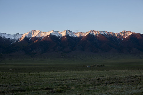
Ranch at sundown by Jeff Mitton, The ranch settles into evening as the last rays of sunlight catch the Sangre de Cristo Mountains. Sh
Ranch at sundown by Jeff Mitton
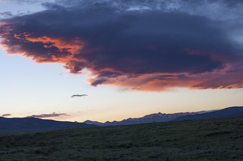
Sawatch Sundown by Jeff Mitton, Clouds flare above the Sawatch Mountains at sundown, while the snow reflects the warm glow.sunset sn
Sawatch Sundown by Jeff Mitton
Sargents Mesa and Mount Ouray, Segment 16, Colorado Trail, CO by chfstew, CO (Saguache County)

Day 2 Marshall Pass Rd (Segment 16) to Sargents Mesa (Segment 16)

Woke up to
Sargents Mesa and Mount Ouray, Segment 16, Colorado Trail, CO by chfstew
Rainbow in the San Luis Valley by mouser-nerdbot, Seen while driving south on 285 towards Alamosa, this very bright rainbow put on a good show at suns
Rainbow in the San Luis Valley by mouser-nerdbot
Marshall Pass Sunset by green.bean73, View looking southwest from the lower end of Marshall Pass, Colorado. 8/30/11mountains nature landsc
Marshall Pass Sunset by green.bean73
Wedding rehearsal time! by pam sattler, Outside Salida, COwedding square colorado bachelorette squareformat bridesmaid amaro iphoneography i
Wedding rehearsal time! by pam sattler
Rainbow in the San Luis Valley by mouser-nerdbot, Seen while driving south on 285 towards Alamosa, this very bright rainbow put on a good show at suns
Rainbow in the San Luis Valley by mouser-nerdbot
Monarch Spur Campground, Salida, CO by chfstew, Salida, CO (Chaffee County)

A nice campground with tent sites down by the river.chfstew colorado co
Monarch Spur Campground, Salida, CO by chfstew
WP_20140822_005 by falcon170ct, clouds sunrise dawn colorado hanggliding villagrove coloradoflyweek
WP_20140822_005 by falcon170ct
WP_20140822_003 by falcon170ct, clouds sunrise dawn colorado hanggliding villagrove coloradoflyweek
WP_20140822_003 by falcon170ct
Arriving at Larry and Tiffany's by falcon170ct, It's not easy to see here but there is a cow stuck in the cow guard.clouds sunrise dawn colorado han
Arriving at Larry and Tiffany's by falcon170ct
WP_20140822_007 by falcon170ct, clouds sunrise dawn colorado hanggliding villagrove coloradoflyweek
WP_20140822_007 by falcon170ct
WP_20140822_001 by falcon170ct, clouds sunrise dawn colorado hanggliding villagrove coloradoflyweek
WP_20140822_001 by falcon170ct
WP_20140822_002 by falcon170ct, clouds sunrise dawn colorado hanggliding villagrove coloradoflyweek
WP_20140822_002 by falcon170ct
IMG_3120 by falcon170ct, sunset clouds colorado dusk hanggliding villagrove coloradoflyweek
IMG_3120 by falcon170ct
DSCN1607 by distantpeak, On my way to Blank Gulch Trailhead. Mount Shavano is rising from the plains.usa mountains sunrise co
DSCN1607 by distantpeak
IMG_3119 by falcon170ct, sunset clouds colorado dusk hanggliding villagrove coloradoflyweek
IMG_3119 by falcon170ct
IMG_8566_7_8_9_HDR_PAINTERLY2 by David C. Miller, 8566: The pockets of aspens beyond the dead ones at treeline. View of the San Luis valley to the SW.
IMG_8566_7_8_9_HDR_PAINTERLY2 by David C. Miller
Sunset @ Sargent's Mesa by jmb_co,
Sunset @ Sargent's Mesa by jmb_co
Where the waters part way. A misty morning heading over Monarch Pass. #mountains #mountainpass #sunrise #morning #fog #mist #clouds #monarchpass #continentaldivide by Cedar Spring Wolf, instagramapp square squareformat iphoneography uploaded:by=instagram
Where the waters part way. A misty morning heading over Monarch Pass. #mountains #mountainpass #sunrise #morning #fog #mist #clouds #monarchpass #continentaldivide by Cedar Spring Wolf
IMG_1775 by laura brockman,
IMG_1775 by laura brockman
Sunset @ Sargent's Mesa by jmb_co,
Sunset @ Sargent's Mesa by jmb_co
The clouds bring some amazing colors. Morning over the Continental Divide. #mountains #mountainpass #rockies #mist #clouds #sunrise #colors #fog #continentaldivide by Cedar Spring Wolf, instagramapp square squareformat iphoneography uploaded:by=instagram
The clouds bring some amazing colors. Morning over the Continental Divide. #mountains #mountainpass #rockies #mist #clouds #sunrise #colors #fog #continentaldivide by Cedar Spring Wolf
IMG_8498_500_501_HDR_PAINTERLY2 by David C. Miller, 8498: Mt. Ouray above Brook creek. Location marked near N38.33793 W105.89958 at 11,453'.
IMG_8498_500_501_HDR_PAINTERLY2 by David C. Miller
Sunset @ Sargent's Mesa by jmb_co,
Sunset @ Sargent's Mesa by jmb_co
IMG_4354_5_6_HDR_PAINTERLY2 by David C. Miller, *4354: Elkhorn gulch and Round mountain from the summit of Hayden peak at N38.27512 W106.10384 at 12
IMG_4354_5_6_HDR_PAINTERLY2 by David C. Miller
Sunrise @ Sargent's Mesa Camp by jmb_co,
Sunrise @ Sargent's Mesa Camp by jmb_co
Sargent's Mesa Sunrise by jmb_co,
Sargent's Mesa Sunrise by jmb_co
Sargent's Mesa Sunrise by jmb_co,
Sargent's Mesa Sunrise by jmb_co