Texas Creek Rd, Carlton, WA 美國的日出日落時間表
Location: 美國 > 華盛頓 > WA 美國 >
時區:
America/Los_Angeles
當地時間:
2024-04-27 15:01:52
經度:
-120.0167003
緯度:
48.2023655
今天日出時間:
05:44:23 AM
今天日落時間:
08:10:27 PM
今天日照時長:
14h 26m 4s
明天日出時間:
05:42:41 AM
明天日落時間:
08:11:53 PM
明天日照時長:
14h 29m 12s
顯示所有日期
| 日期 | 日出 | 日落 | 日照時長 |
|---|---|---|---|
| 2024年01月01日 | 07:50:33 AM | 04:17:20 PM | 8h 26m 47s |
| 2024年01月02日 | 07:50:28 AM | 04:18:20 PM | 8h 27m 52s |
| 2024年01月03日 | 07:50:20 AM | 04:19:23 PM | 8h 29m 3s |
| 2024年01月04日 | 07:50:09 AM | 04:20:28 PM | 8h 30m 19s |
| 2024年01月05日 | 07:49:56 AM | 04:21:35 PM | 8h 31m 39s |
| 2024年01月06日 | 07:49:39 AM | 04:22:44 PM | 8h 33m 5s |
| 2024年01月07日 | 07:49:20 AM | 04:23:55 PM | 8h 34m 35s |
| 2024年01月08日 | 07:48:57 AM | 04:25:07 PM | 8h 36m 10s |
| 2024年01月09日 | 07:48:32 AM | 04:26:22 PM | 8h 37m 50s |
| 2024年01月10日 | 07:48:04 AM | 04:27:38 PM | 8h 39m 34s |
| 2024年01月11日 | 07:47:33 AM | 04:28:55 PM | 8h 41m 22s |
| 2024年01月12日 | 07:46:59 AM | 04:30:15 PM | 8h 43m 16s |
| 2024年01月13日 | 07:46:23 AM | 04:31:35 PM | 8h 45m 12s |
| 2024年01月14日 | 07:45:44 AM | 04:32:58 PM | 8h 47m 14s |
| 2024年01月15日 | 07:45:03 AM | 04:34:21 PM | 8h 49m 18s |
| 2024年01月16日 | 07:44:18 AM | 04:35:46 PM | 8h 51m 28s |
| 2024年01月17日 | 07:43:31 AM | 04:37:12 PM | 8h 53m 41s |
| 2024年01月18日 | 07:42:42 AM | 04:38:39 PM | 8h 55m 57s |
| 2024年01月19日 | 07:41:50 AM | 04:40:07 PM | 8h 58m 17s |
| 2024年01月20日 | 07:40:56 AM | 04:41:36 PM | 9h 0m 40s |
| 2024年01月21日 | 07:39:59 AM | 04:43:06 PM | 9h 3m 7s |
| 2024年01月22日 | 07:39:00 AM | 04:44:36 PM | 9h 5m 36s |
| 2024年01月23日 | 07:37:58 AM | 04:46:08 PM | 9h 8m 10s |
| 2024年01月24日 | 07:36:54 AM | 04:47:40 PM | 9h 10m 46s |
| 2024年01月25日 | 07:35:48 AM | 04:49:13 PM | 9h 13m 25s |
| 2024年01月26日 | 07:34:40 AM | 04:50:47 PM | 9h 16m 7s |
| 2024年01月27日 | 07:33:30 AM | 04:52:21 PM | 9h 18m 51s |
| 2024年01月28日 | 07:32:17 AM | 04:53:55 PM | 9h 21m 38s |
| 2024年01月29日 | 07:31:02 AM | 04:55:30 PM | 9h 24m 28s |
| 2024年01月30日 | 07:29:46 AM | 04:57:05 PM | 9h 27m 19s |
| 2024年01月31日 | 07:28:27 AM | 04:58:41 PM | 9h 30m 14s |
| 2024年02月01日 | 07:27:07 AM | 05:00:17 PM | 9h 33m 10s |
| 2024年02月02日 | 07:25:45 AM | 05:01:53 PM | 9h 36m 8s |
| 2024年02月03日 | 07:24:20 AM | 05:03:30 PM | 9h 39m 10s |
| 2024年02月04日 | 07:22:54 AM | 05:05:06 PM | 9h 42m 12s |
| 2024年02月05日 | 07:21:27 AM | 05:06:43 PM | 9h 45m 16s |
| 2024年02月06日 | 07:19:57 AM | 05:08:20 PM | 9h 48m 23s |
| 2024年02月07日 | 07:18:26 AM | 05:09:56 PM | 9h 51m 30s |
| 2024年02月08日 | 07:16:54 AM | 05:11:33 PM | 9h 54m 39s |
| 2024年02月09日 | 07:15:20 AM | 05:13:10 PM | 9h 57m 50s |
| 2024年02月10日 | 07:13:44 AM | 05:14:47 PM | 10h 1m 3s |
| 2024年02月11日 | 07:12:07 AM | 05:16:23 PM | 10h 4m 16s |
| 2024年02月12日 | 07:10:29 AM | 05:18:00 PM | 10h 7m 31s |
| 2024年02月13日 | 07:08:49 AM | 05:19:36 PM | 10h 10m 47s |
| 2024年02月14日 | 07:07:08 AM | 05:21:13 PM | 10h 14m 5s |
| 2024年02月15日 | 07:05:25 AM | 05:22:49 PM | 10h 17m 24s |
| 2024年02月16日 | 07:03:41 AM | 05:24:25 PM | 10h 20m 44s |
| 2024年02月17日 | 07:01:56 AM | 05:26:00 PM | 10h 24m 4s |
| 2024年02月18日 | 07:00:10 AM | 05:27:36 PM | 10h 27m 26s |
| 2024年02月19日 | 06:58:23 AM | 05:29:11 PM | 10h 30m 48s |
| 2024年02月20日 | 06:56:35 AM | 05:30:46 PM | 10h 34m 11s |
| 2024年02月21日 | 06:54:46 AM | 05:32:21 PM | 10h 37m 35s |
| 2024年02月22日 | 06:52:55 AM | 05:33:56 PM | 10h 41m 1s |
| 2024年02月23日 | 06:51:04 AM | 05:35:30 PM | 10h 44m 26s |
| 2024年02月24日 | 06:49:12 AM | 05:37:04 PM | 10h 47m 52s |
| 2024年02月25日 | 06:47:19 AM | 05:38:38 PM | 10h 51m 19s |
| 2024年02月26日 | 06:45:25 AM | 05:40:11 PM | 10h 54m 46s |
| 2024年02月27日 | 06:43:30 AM | 05:41:45 PM | 10h 58m 15s |
| 2024年02月28日 | 06:41:35 AM | 05:43:18 PM | 11h 1m 43s |
| 2024年02月29日 | 06:39:38 AM | 05:44:50 PM | 11h 5m 12s |
| 2024年03月01日 | 06:37:41 AM | 05:46:23 PM | 11h 8m 42s |
| 2024年03月02日 | 06:35:44 AM | 05:47:55 PM | 11h 12m 11s |
| 2024年03月03日 | 06:33:46 AM | 05:49:27 PM | 11h 15m 41s |
| 2024年03月04日 | 06:31:47 AM | 05:50:58 PM | 11h 19m 11s |
| 2024年03月05日 | 06:29:47 AM | 05:52:29 PM | 11h 22m 42s |
| 2024年03月06日 | 06:27:47 AM | 05:54:01 PM | 11h 26m 14s |
| 2024年03月07日 | 06:25:47 AM | 05:55:31 PM | 11h 29m 44s |
| 2024年03月08日 | 06:23:46 AM | 05:57:02 PM | 11h 33m 16s |
| 2024年03月09日 | 06:21:45 AM | 05:58:32 PM | 11h 36m 47s |
| 2024年03月10日 | 07:19:48 AM | 06:59:58 PM | 11h 40m 10s |
| 2024年03月11日 | 07:17:46 AM | 07:01:28 PM | 11h 43m 42s |
| 2024年03月12日 | 07:15:44 AM | 07:02:58 PM | 11h 47m 14s |
| 2024年03月13日 | 07:13:41 AM | 07:04:27 PM | 11h 50m 46s |
| 2024年03月14日 | 07:11:38 AM | 07:05:57 PM | 11h 54m 19s |
| 2024年03月15日 | 07:09:35 AM | 07:07:26 PM | 11h 57m 51s |
| 2024年03月16日 | 07:07:31 AM | 07:08:54 PM | 12h 1m 23s |
| 2024年03月17日 | 07:05:28 AM | 07:10:23 PM | 12h 4m 55s |
| 2024年03月18日 | 07:03:24 AM | 07:11:52 PM | 12h 8m 28s |
| 2024年03月19日 | 07:01:20 AM | 07:13:20 PM | 12h 12m 0s |
| 2024年03月20日 | 06:59:16 AM | 07:14:48 PM | 12h 15m 32s |
| 2024年03月21日 | 06:57:12 AM | 07:16:16 PM | 12h 19m 4s |
| 2024年03月22日 | 06:55:08 AM | 07:17:44 PM | 12h 22m 36s |
| 2024年03月23日 | 06:53:04 AM | 07:19:12 PM | 12h 26m 8s |
| 2024年03月24日 | 06:51:00 AM | 07:20:40 PM | 12h 29m 40s |
| 2024年03月25日 | 06:48:57 AM | 07:22:07 PM | 12h 33m 10s |
| 2024年03月26日 | 06:46:53 AM | 07:23:35 PM | 12h 36m 42s |
| 2024年03月27日 | 06:44:49 AM | 07:25:02 PM | 12h 40m 13s |
| 2024年03月28日 | 06:42:46 AM | 07:26:30 PM | 12h 43m 44s |
| 2024年03月29日 | 06:40:43 AM | 07:27:57 PM | 12h 47m 14s |
| 2024年03月30日 | 06:38:40 AM | 07:29:24 PM | 12h 50m 44s |
| 2024年03月31日 | 06:36:37 AM | 07:30:52 PM | 12h 54m 15s |
| 2024年04月01日 | 06:34:34 AM | 07:32:19 PM | 12h 57m 45s |
| 2024年04月02日 | 06:32:32 AM | 07:33:46 PM | 13h 1m 14s |
| 2024年04月03日 | 06:30:30 AM | 07:35:13 PM | 13h 4m 43s |
| 2024年04月04日 | 06:28:29 AM | 07:36:40 PM | 13h 8m 11s |
| 2024年04月05日 | 06:26:28 AM | 07:38:07 PM | 13h 11m 39s |
| 2024年04月06日 | 06:24:27 AM | 07:39:34 PM | 13h 15m 7s |
| 2024年04月07日 | 06:22:27 AM | 07:41:01 PM | 13h 18m 34s |
| 2024年04月08日 | 06:20:28 AM | 07:42:28 PM | 13h 22m 0s |
| 2024年04月09日 | 06:18:29 AM | 07:43:55 PM | 13h 25m 26s |
| 2024年04月10日 | 06:16:31 AM | 07:45:22 PM | 13h 28m 51s |
| 2024年04月11日 | 06:14:33 AM | 07:46:49 PM | 13h 32m 16s |
| 2024年04月12日 | 06:12:36 AM | 07:48:16 PM | 13h 35m 40s |
| 2024年04月13日 | 06:10:39 AM | 07:49:43 PM | 13h 39m 4s |
| 2024年04月14日 | 06:08:44 AM | 07:51:10 PM | 13h 42m 26s |
| 2024年04月15日 | 06:06:49 AM | 07:52:37 PM | 13h 45m 48s |
| 2024年04月16日 | 06:04:54 AM | 07:54:04 PM | 13h 49m 10s |
| 2024年04月17日 | 06:03:01 AM | 07:55:31 PM | 13h 52m 30s |
| 2024年04月18日 | 06:01:09 AM | 07:56:58 PM | 13h 55m 49s |
| 2024年04月19日 | 05:59:17 AM | 07:58:24 PM | 13h 59m 7s |
| 2024年04月20日 | 05:57:26 AM | 07:59:51 PM | 14h 2m 25s |
| 2024年04月21日 | 05:55:37 AM | 08:01:18 PM | 14h 5m 41s |
| 2024年04月22日 | 05:53:48 AM | 08:02:44 PM | 14h 8m 56s |
| 2024年04月23日 | 05:52:00 AM | 08:04:11 PM | 14h 12m 11s |
| 2024年04月24日 | 05:50:14 AM | 08:05:37 PM | 14h 15m 23s |
| 2024年04月25日 | 05:48:28 AM | 08:07:03 PM | 14h 18m 35s |
| 2024年04月26日 | 05:46:44 AM | 08:08:29 PM | 14h 21m 45s |
| 2024年04月27日 | 05:45:01 AM | 08:09:55 PM | 14h 24m 54s |
| 2024年04月28日 | 05:43:19 AM | 08:11:21 PM | 14h 28m 2s |
| 2024年04月29日 | 05:41:39 AM | 08:12:46 PM | 14h 31m 7s |
| 2024年04月30日 | 05:39:59 AM | 08:14:11 PM | 14h 34m 12s |
| 2024年05月01日 | 05:38:22 AM | 08:15:36 PM | 14h 37m 14s |
| 2024年05月02日 | 05:36:45 AM | 08:17:01 PM | 14h 40m 16s |
| 2024年05月03日 | 05:35:10 AM | 08:18:25 PM | 14h 43m 15s |
| 2024年05月04日 | 05:33:37 AM | 08:19:49 PM | 14h 46m 12s |
| 2024年05月05日 | 05:32:05 AM | 08:21:13 PM | 14h 49m 8s |
| 2024年05月06日 | 05:30:34 AM | 08:22:36 PM | 14h 52m 2s |
| 2024年05月07日 | 05:29:05 AM | 08:23:58 PM | 14h 54m 53s |
| 2024年05月08日 | 05:27:38 AM | 08:25:21 PM | 14h 57m 43s |
| 2024年05月09日 | 05:26:12 AM | 08:26:42 PM | 15h 0m 30s |
| 2024年05月10日 | 05:24:49 AM | 08:28:03 PM | 15h 3m 14s |
| 2024年05月11日 | 05:23:27 AM | 08:29:23 PM | 15h 5m 56s |
| 2024年05月12日 | 05:22:06 AM | 08:30:43 PM | 15h 8m 37s |
| 2024年05月13日 | 05:20:48 AM | 08:32:02 PM | 15h 11m 14s |
| 2024年05月14日 | 05:19:32 AM | 08:33:20 PM | 15h 13m 48s |
| 2024年05月15日 | 05:18:17 AM | 08:34:38 PM | 15h 16m 21s |
| 2024年05月16日 | 05:17:05 AM | 08:35:54 PM | 15h 18m 49s |
| 2024年05月17日 | 05:15:54 AM | 08:37:10 PM | 15h 21m 16s |
| 2024年05月18日 | 05:14:46 AM | 08:38:25 PM | 15h 23m 39s |
| 2024年05月19日 | 05:13:39 AM | 08:39:38 PM | 15h 25m 59s |
| 2024年05月20日 | 05:12:35 AM | 08:40:51 PM | 15h 28m 16s |
| 2024年05月21日 | 05:11:33 AM | 08:42:02 PM | 15h 30m 29s |
| 2024年05月22日 | 05:10:33 AM | 08:43:13 PM | 15h 32m 40s |
| 2024年05月23日 | 05:09:35 AM | 08:44:22 PM | 15h 34m 47s |
| 2024年05月24日 | 05:08:40 AM | 08:45:29 PM | 15h 36m 49s |
| 2024年05月25日 | 05:07:47 AM | 08:46:36 PM | 15h 38m 49s |
| 2024年05月26日 | 05:06:57 AM | 08:47:41 PM | 15h 40m 44s |
| 2024年05月27日 | 05:06:08 AM | 08:48:44 PM | 15h 42m 36s |
| 2024年05月28日 | 05:05:22 AM | 08:49:46 PM | 15h 44m 24s |
| 2024年05月29日 | 05:04:39 AM | 08:50:46 PM | 15h 46m 7s |
| 2024年05月30日 | 05:03:58 AM | 08:51:45 PM | 15h 47m 47s |
| 2024年05月31日 | 05:03:20 AM | 08:52:42 PM | 15h 49m 22s |
| 2024年06月01日 | 05:02:44 AM | 08:53:37 PM | 15h 50m 53s |
| 2024年06月02日 | 05:02:11 AM | 08:54:31 PM | 15h 52m 20s |
| 2024年06月03日 | 05:01:40 AM | 08:55:23 PM | 15h 53m 43s |
| 2024年06月04日 | 05:01:12 AM | 08:56:12 PM | 15h 55m 0s |
| 2024年06月05日 | 05:00:46 AM | 08:57:00 PM | 15h 56m 14s |
| 2024年06月06日 | 05:00:23 AM | 08:57:45 PM | 15h 57m 22s |
| 2024年06月07日 | 05:00:03 AM | 08:58:29 PM | 15h 58m 26s |
| 2024年06月08日 | 04:59:45 AM | 08:59:10 PM | 15h 59m 25s |
| 2024年06月09日 | 04:59:30 AM | 08:59:49 PM | 16h 0m 19s |
| 2024年06月10日 | 04:59:18 AM | 09:00:26 PM | 16h 1m 8s |
| 2024年06月11日 | 04:59:08 AM | 09:01:01 PM | 16h 1m 53s |
| 2024年06月12日 | 04:59:01 AM | 09:01:33 PM | 16h 2m 32s |
| 2024年06月13日 | 04:58:56 AM | 09:02:03 PM | 16h 3m 7s |
| 2024年06月14日 | 04:58:54 AM | 09:02:31 PM | 16h 3m 37s |
| 2024年06月15日 | 04:58:55 AM | 09:02:56 PM | 16h 4m 1s |
| 2024年06月16日 | 04:58:59 AM | 09:03:19 PM | 16h 4m 20s |
| 2024年06月17日 | 04:59:05 AM | 09:03:39 PM | 16h 4m 34s |
| 2024年06月18日 | 04:59:13 AM | 09:03:56 PM | 16h 4m 43s |
| 2024年06月19日 | 04:59:24 AM | 09:04:11 PM | 16h 4m 47s |
| 2024年06月20日 | 04:59:38 AM | 09:04:24 PM | 16h 4m 46s |
| 2024年06月21日 | 04:59:54 AM | 09:04:33 PM | 16h 4m 39s |
| 2024年06月22日 | 05:00:13 AM | 09:04:40 PM | 16h 4m 27s |
| 2024年06月23日 | 05:00:34 AM | 09:04:45 PM | 16h 4m 11s |
| 2024年06月24日 | 05:00:58 AM | 09:04:47 PM | 16h 3m 49s |
| 2024年06月25日 | 05:01:24 AM | 09:04:46 PM | 16h 3m 22s |
| 2024年06月26日 | 05:01:53 AM | 09:04:42 PM | 16h 2m 49s |
| 2024年06月27日 | 05:02:23 AM | 09:04:36 PM | 16h 2m 13s |
| 2024年06月28日 | 05:02:56 AM | 09:04:27 PM | 16h 1m 31s |
| 2024年06月29日 | 05:03:31 AM | 09:04:15 PM | 16h 0m 44s |
| 2024年06月30日 | 05:04:09 AM | 09:04:01 PM | 15h 59m 52s |
| 2024年07月01日 | 05:04:48 AM | 09:03:44 PM | 15h 58m 56s |
| 2024年07月02日 | 05:05:30 AM | 09:03:24 PM | 15h 57m 54s |
| 2024年07月03日 | 05:06:14 AM | 09:03:02 PM | 15h 56m 48s |
| 2024年07月04日 | 05:06:59 AM | 09:02:37 PM | 15h 55m 38s |
| 2024年07月05日 | 05:07:47 AM | 09:02:09 PM | 15h 54m 22s |
| 2024年07月06日 | 05:08:36 AM | 09:01:38 PM | 15h 53m 2s |
| 2024年07月07日 | 05:09:27 AM | 09:01:06 PM | 15h 51m 39s |
| 2024年07月08日 | 05:10:20 AM | 09:00:30 PM | 15h 50m 10s |
| 2024年07月09日 | 05:11:15 AM | 08:59:52 PM | 15h 48m 37s |
| 2024年07月10日 | 05:12:11 AM | 08:59:11 PM | 15h 47m 0s |
| 2024年07月11日 | 05:13:09 AM | 08:58:28 PM | 15h 45m 19s |
| 2024年07月12日 | 05:14:09 AM | 08:57:43 PM | 15h 43m 34s |
| 2024年07月13日 | 05:15:10 AM | 08:56:54 PM | 15h 41m 44s |
| 2024年07月14日 | 05:16:12 AM | 08:56:04 PM | 15h 39m 52s |
| 2024年07月15日 | 05:17:16 AM | 08:55:11 PM | 15h 37m 55s |
| 2024年07月16日 | 05:18:21 AM | 08:54:16 PM | 15h 35m 55s |
| 2024年07月17日 | 05:19:27 AM | 08:53:18 PM | 15h 33m 51s |
| 2024年07月18日 | 05:20:34 AM | 08:52:18 PM | 15h 31m 44s |
| 2024年07月19日 | 05:21:43 AM | 08:51:16 PM | 15h 29m 33s |
| 2024年07月20日 | 05:22:52 AM | 08:50:12 PM | 15h 27m 20s |
| 2024年07月21日 | 05:24:03 AM | 08:49:06 PM | 15h 25m 3s |
| 2024年07月22日 | 05:25:15 AM | 08:47:57 PM | 15h 22m 42s |
| 2024年07月23日 | 05:26:27 AM | 08:46:46 PM | 15h 20m 19s |
| 2024年07月24日 | 05:27:41 AM | 08:45:34 PM | 15h 17m 53s |
| 2024年07月25日 | 05:28:55 AM | 08:44:19 PM | 15h 15m 24s |
| 2024年07月26日 | 05:30:10 AM | 08:43:02 PM | 15h 12m 52s |
| 2024年07月27日 | 05:31:25 AM | 08:41:44 PM | 15h 10m 19s |
| 2024年07月28日 | 05:32:42 AM | 08:40:23 PM | 15h 7m 41s |
| 2024年07月29日 | 05:33:59 AM | 08:39:01 PM | 15h 5m 2s |
| 2024年07月30日 | 05:35:16 AM | 08:37:37 PM | 15h 2m 21s |
| 2024年07月31日 | 05:36:34 AM | 08:36:11 PM | 14h 59m 37s |
| 2024年08月01日 | 05:37:53 AM | 08:34:44 PM | 14h 56m 51s |
| 2024年08月02日 | 05:39:12 AM | 08:33:14 PM | 14h 54m 2s |
| 2024年08月03日 | 05:40:31 AM | 08:31:43 PM | 14h 51m 12s |
| 2024年08月04日 | 05:41:51 AM | 08:30:11 PM | 14h 48m 20s |
| 2024年08月05日 | 05:43:11 AM | 08:28:37 PM | 14h 45m 26s |
| 2024年08月06日 | 05:44:32 AM | 08:27:01 PM | 14h 42m 29s |
| 2024年08月07日 | 05:45:52 AM | 08:25:24 PM | 14h 39m 32s |
| 2024年08月08日 | 05:47:13 AM | 08:23:46 PM | 14h 36m 33s |
| 2024年08月09日 | 05:48:35 AM | 08:22:06 PM | 14h 33m 31s |
| 2024年08月10日 | 05:49:56 AM | 08:20:25 PM | 14h 30m 29s |
| 2024年08月11日 | 05:51:18 AM | 08:18:43 PM | 14h 27m 25s |
| 2024年08月12日 | 05:52:40 AM | 08:16:59 PM | 14h 24m 19s |
| 2024年08月13日 | 05:54:02 AM | 08:15:14 PM | 14h 21m 12s |
| 2024年08月14日 | 05:55:24 AM | 08:13:28 PM | 14h 18m 4s |
| 2024年08月15日 | 05:56:46 AM | 08:11:41 PM | 14h 14m 55s |
| 2024年08月16日 | 05:58:08 AM | 08:09:53 PM | 14h 11m 45s |
| 2024年08月17日 | 05:59:30 AM | 08:08:03 PM | 14h 8m 33s |
| 2024年08月18日 | 06:00:53 AM | 08:06:13 PM | 14h 5m 20s |
| 2024年08月19日 | 06:02:15 AM | 08:04:21 PM | 14h 2m 6s |
| 2024年08月20日 | 06:03:38 AM | 08:02:29 PM | 13h 58m 51s |
| 2024年08月21日 | 06:05:00 AM | 08:00:36 PM | 13h 55m 36s |
| 2024年08月22日 | 06:06:23 AM | 07:58:41 PM | 13h 52m 18s |
| 2024年08月23日 | 06:07:45 AM | 07:56:46 PM | 13h 49m 1s |
| 2024年08月24日 | 06:09:08 AM | 07:54:50 PM | 13h 45m 42s |
| 2024年08月25日 | 06:10:30 AM | 07:52:54 PM | 13h 42m 24s |
| 2024年08月26日 | 06:11:53 AM | 07:50:56 PM | 13h 39m 3s |
| 2024年08月27日 | 06:13:15 AM | 07:48:58 PM | 13h 35m 43s |
| 2024年08月28日 | 06:14:37 AM | 07:47:00 PM | 13h 32m 23s |
| 2024年08月29日 | 06:16:00 AM | 07:45:00 PM | 13h 29m 0s |
| 2024年08月30日 | 06:17:22 AM | 07:43:00 PM | 13h 25m 38s |
| 2024年08月31日 | 06:18:45 AM | 07:40:59 PM | 13h 22m 14s |
| 2024年09月01日 | 06:20:07 AM | 07:38:58 PM | 13h 18m 51s |
| 2024年09月02日 | 06:21:29 AM | 07:36:57 PM | 13h 15m 28s |
| 2024年09月03日 | 06:22:52 AM | 07:34:54 PM | 13h 12m 2s |
| 2024年09月04日 | 06:24:14 AM | 07:32:52 PM | 13h 8m 38s |
| 2024年09月05日 | 06:25:36 AM | 07:30:49 PM | 13h 5m 13s |
| 2024年09月06日 | 06:26:58 AM | 07:28:45 PM | 13h 1m 47s |
| 2024年09月07日 | 06:28:21 AM | 07:26:41 PM | 12h 58m 20s |
| 2024年09月08日 | 06:29:43 AM | 07:24:37 PM | 12h 54m 54s |
| 2024年09月09日 | 06:31:05 AM | 07:22:33 PM | 12h 51m 28s |
| 2024年09月10日 | 06:32:28 AM | 07:20:28 PM | 12h 48m 0s |
| 2024年09月11日 | 06:33:50 AM | 07:18:23 PM | 12h 44m 33s |
| 2024年09月12日 | 06:35:13 AM | 07:16:18 PM | 12h 41m 5s |
| 2024年09月13日 | 06:36:35 AM | 07:14:13 PM | 12h 37m 38s |
| 2024年09月14日 | 06:37:58 AM | 07:12:08 PM | 12h 34m 10s |
| 2024年09月15日 | 06:39:20 AM | 07:10:02 PM | 12h 30m 42s |
| 2024年09月16日 | 06:40:43 AM | 07:07:56 PM | 12h 27m 13s |
| 2024年09月17日 | 06:42:06 AM | 07:05:51 PM | 12h 23m 45s |
| 2024年09月18日 | 06:43:29 AM | 07:03:45 PM | 12h 20m 16s |
| 2024年09月19日 | 06:44:52 AM | 07:01:39 PM | 12h 16m 47s |
| 2024年09月20日 | 06:46:15 AM | 06:59:34 PM | 12h 13m 19s |
| 2024年09月21日 | 06:47:38 AM | 06:57:28 PM | 12h 9m 50s |
| 2024年09月22日 | 06:49:02 AM | 06:55:22 PM | 12h 6m 20s |
| 2024年09月23日 | 06:50:25 AM | 06:53:17 PM | 12h 2m 52s |
| 2024年09月24日 | 06:51:49 AM | 06:51:12 PM | 11h 59m 23s |
| 2024年09月25日 | 06:53:13 AM | 06:49:07 PM | 11h 55m 54s |
| 2024年09月26日 | 06:54:37 AM | 06:47:02 PM | 11h 52m 25s |
| 2024年09月27日 | 06:56:02 AM | 06:44:57 PM | 11h 48m 55s |
| 2024年09月28日 | 06:57:26 AM | 06:42:53 PM | 11h 45m 27s |
| 2024年09月29日 | 06:58:51 AM | 06:40:49 PM | 11h 41m 58s |
| 2024年09月30日 | 07:00:16 AM | 06:38:46 PM | 11h 38m 30s |
| 2024年10月01日 | 07:01:41 AM | 06:36:42 PM | 11h 35m 1s |
| 2024年10月02日 | 07:03:07 AM | 06:34:39 PM | 11h 31m 32s |
| 2024年10月03日 | 07:04:33 AM | 06:32:37 PM | 11h 28m 4s |
| 2024年10月04日 | 07:05:59 AM | 06:30:35 PM | 11h 24m 36s |
| 2024年10月05日 | 07:07:25 AM | 06:28:34 PM | 11h 21m 9s |
| 2024年10月06日 | 07:08:52 AM | 06:26:33 PM | 11h 17m 41s |
| 2024年10月07日 | 07:10:18 AM | 06:24:32 PM | 11h 14m 14s |
| 2024年10月08日 | 07:11:46 AM | 06:22:33 PM | 11h 10m 47s |
| 2024年10月09日 | 07:13:13 AM | 06:20:34 PM | 11h 7m 21s |
| 2024年10月10日 | 07:14:41 AM | 06:18:35 PM | 11h 3m 54s |
| 2024年10月11日 | 07:16:09 AM | 06:16:38 PM | 11h 0m 29s |
| 2024年10月12日 | 07:17:37 AM | 06:14:41 PM | 10h 57m 4s |
| 2024年10月13日 | 07:19:06 AM | 06:12:44 PM | 10h 53m 38s |
| 2024年10月14日 | 07:20:35 AM | 06:10:49 PM | 10h 50m 14s |
| 2024年10月15日 | 07:22:04 AM | 06:08:54 PM | 10h 46m 50s |
| 2024年10月16日 | 07:23:33 AM | 06:07:01 PM | 10h 43m 28s |
| 2024年10月17日 | 07:25:03 AM | 06:05:08 PM | 10h 40m 5s |
| 2024年10月18日 | 07:26:33 AM | 06:03:16 PM | 10h 36m 43s |
| 2024年10月19日 | 07:28:04 AM | 06:01:25 PM | 10h 33m 21s |
| 2024年10月20日 | 07:29:34 AM | 05:59:36 PM | 10h 30m 2s |
| 2024年10月21日 | 07:31:05 AM | 05:57:47 PM | 10h 26m 42s |
| 2024年10月22日 | 07:32:37 AM | 05:55:59 PM | 10h 23m 22s |
| 2024年10月23日 | 07:34:08 AM | 05:54:13 PM | 10h 20m 5s |
| 2024年10月24日 | 07:35:40 AM | 05:52:28 PM | 10h 16m 48s |
| 2024年10月25日 | 07:37:12 AM | 05:50:44 PM | 10h 13m 32s |
| 2024年10月26日 | 07:38:44 AM | 05:49:01 PM | 10h 10m 17s |
| 2024年10月27日 | 07:40:16 AM | 05:47:20 PM | 10h 7m 4s |
| 2024年10月28日 | 07:41:49 AM | 05:45:40 PM | 10h 3m 51s |
| 2024年10月29日 | 07:43:21 AM | 05:44:01 PM | 10h 0m 40s |
| 2024年10月30日 | 07:44:54 AM | 05:42:24 PM | 9h 57m 30s |
| 2024年10月31日 | 07:46:27 AM | 05:40:48 PM | 9h 54m 21s |
| 2024年11月01日 | 07:48:00 AM | 05:39:14 PM | 9h 51m 14s |
| 2024年11月02日 | 07:49:33 AM | 05:37:42 PM | 9h 48m 9s |
| 2024年11月03日 | 06:51:09 AM | 04:36:07 PM | 9h 44m 58s |
| 2024年11月04日 | 06:52:42 AM | 04:34:38 PM | 9h 41m 56s |
| 2024年11月05日 | 06:54:15 AM | 04:33:11 PM | 9h 38m 56s |
| 2024年11月06日 | 06:55:48 AM | 04:31:45 PM | 9h 35m 57s |
| 2024年11月07日 | 06:57:21 AM | 04:30:21 PM | 9h 33m 0s |
| 2024年11月08日 | 06:58:53 AM | 04:28:59 PM | 9h 30m 6s |
| 2024年11月09日 | 07:00:26 AM | 04:27:39 PM | 9h 27m 13s |
| 2024年11月10日 | 07:01:58 AM | 04:26:21 PM | 9h 24m 23s |
| 2024年11月11日 | 07:03:29 AM | 04:25:05 PM | 9h 21m 36s |
| 2024年11月12日 | 07:05:01 AM | 04:23:51 PM | 9h 18m 50s |
| 2024年11月13日 | 07:06:32 AM | 04:22:39 PM | 9h 16m 7s |
| 2024年11月14日 | 07:08:02 AM | 04:21:29 PM | 9h 13m 27s |
| 2024年11月15日 | 07:09:32 AM | 04:20:22 PM | 9h 10m 50s |
| 2024年11月16日 | 07:11:02 AM | 04:19:16 PM | 9h 8m 14s |
| 2024年11月17日 | 07:12:30 AM | 04:18:13 PM | 9h 5m 43s |
| 2024年11月18日 | 07:13:59 AM | 04:17:12 PM | 9h 3m 13s |
| 2024年11月19日 | 07:15:26 AM | 04:16:14 PM | 9h 0m 48s |
| 2024年11月20日 | 07:16:52 AM | 04:15:18 PM | 8h 58m 26s |
| 2024年11月21日 | 07:18:18 AM | 04:14:25 PM | 8h 56m 7s |
| 2024年11月22日 | 07:19:43 AM | 04:13:34 PM | 8h 53m 51s |
| 2024年11月23日 | 07:21:07 AM | 04:12:45 PM | 8h 51m 38s |
| 2024年11月24日 | 07:22:29 AM | 04:11:59 PM | 8h 49m 30s |
| 2024年11月25日 | 07:23:51 AM | 04:11:16 PM | 8h 47m 25s |
| 2024年11月26日 | 07:25:11 AM | 04:10:36 PM | 8h 45m 25s |
| 2024年11月27日 | 07:26:30 AM | 04:09:58 PM | 8h 43m 28s |
| 2024年11月28日 | 07:27:47 AM | 04:09:23 PM | 8h 41m 36s |
| 2024年11月29日 | 07:29:04 AM | 04:08:50 PM | 8h 39m 46s |
| 2024年11月30日 | 07:30:18 AM | 04:08:21 PM | 8h 38m 3s |
| 2024年12月01日 | 07:31:31 AM | 04:07:54 PM | 8h 36m 23s |
| 2024年12月02日 | 07:32:43 AM | 04:07:31 PM | 8h 34m 48s |
| 2024年12月03日 | 07:33:52 AM | 04:07:10 PM | 8h 33m 18s |
| 2024年12月04日 | 07:35:00 AM | 04:06:52 PM | 8h 31m 52s |
| 2024年12月05日 | 07:36:06 AM | 04:06:37 PM | 8h 30m 31s |
| 2024年12月06日 | 07:37:10 AM | 04:06:24 PM | 8h 29m 14s |
| 2024年12月07日 | 07:38:12 AM | 04:06:15 PM | 8h 28m 3s |
| 2024年12月08日 | 07:39:12 AM | 04:06:09 PM | 8h 26m 57s |
| 2024年12月09日 | 07:40:10 AM | 04:06:06 PM | 8h 25m 56s |
| 2024年12月10日 | 07:41:06 AM | 04:06:06 PM | 8h 25m 0s |
| 2024年12月11日 | 07:41:59 AM | 04:06:09 PM | 8h 24m 10s |
| 2024年12月12日 | 07:42:50 AM | 04:06:14 PM | 8h 23m 24s |
| 2024年12月13日 | 07:43:39 AM | 04:06:23 PM | 8h 22m 44s |
| 2024年12月14日 | 07:44:25 AM | 04:06:35 PM | 8h 22m 10s |
| 2024年12月15日 | 07:45:09 AM | 04:06:50 PM | 8h 21m 41s |
| 2024年12月16日 | 07:45:50 AM | 04:07:07 PM | 8h 21m 17s |
| 2024年12月17日 | 07:46:28 AM | 04:07:28 PM | 8h 21m 0s |
| 2024年12月18日 | 07:47:04 AM | 04:07:51 PM | 8h 20m 47s |
| 2024年12月19日 | 07:47:37 AM | 04:08:18 PM | 8h 20m 41s |
| 2024年12月20日 | 07:48:07 AM | 04:08:47 PM | 8h 20m 40s |
| 2024年12月21日 | 07:48:35 AM | 04:09:19 PM | 8h 20m 44s |
| 2024年12月22日 | 07:49:00 AM | 04:09:54 PM | 8h 20m 54s |
| 2024年12月23日 | 07:49:22 AM | 04:10:31 PM | 8h 21m 9s |
| 2024年12月24日 | 07:49:41 AM | 04:11:12 PM | 8h 21m 31s |
| 2024年12月25日 | 07:49:57 AM | 04:11:55 PM | 8h 21m 58s |
| 2024年12月26日 | 07:50:11 AM | 04:12:40 PM | 8h 22m 29s |
| 2024年12月27日 | 07:50:21 AM | 04:13:28 PM | 8h 23m 7s |
| 2024年12月28日 | 07:50:29 AM | 04:14:19 PM | 8h 23m 50s |
| 2024年12月29日 | 07:50:33 AM | 04:15:12 PM | 8h 24m 39s |
| 2024年12月30日 | 07:50:35 AM | 04:16:07 PM | 8h 25m 32s |
日出日落照片

Smoky Gradient

Long view

Methow, Washington - July 5, 2019: Old abandoned building for the former Wagon Wheel Cafe and motel, closed for many years, along the North Cascades Scenic Byway

Methow, Washington - July 5, 2019: Old abandoned sign for the former Wagon Wheel Cafe and motel, closed for many years, along the North Cascades Scenic Byway

Methow, Washington - July 5, 2019: Old abandoned sign for the former Wagon Wheel Cafe and motel, closed for many years, along the North Cascades Scenic Byway

Methow, Washington - July 5, 2019: Old abandoned sign for the former Wagon Wheel Cafe and motel, closed for many years, along the North Cascades Scenic Byway

Methow, Washington - July 5, 2019: Old abandoned sign for the former Wagon Wheel Cafe and motel, closed for many years, along the North Cascades Scenic Byway

Methow River

Methow River

Golden Doe

2015. Roy Magelssen setting up a Douglas-fir beetle monitoring trap at Gold Creek on the Methow Valley Ranger District. Okanogan-Wenatchee National Forest, Washington.

Troubled bridge over water

Sign for Washington State Highway 20 Junction, toward towns of Okanogan and Burlington. As seen from the North Cascades Highway

Devastation near the epicenter of the Carlton Complex fires of 2015

2017. Aerial observer Justin Hof looks out the window of a Kodiak to identify forest insect and disease damage. He will record areas of damage and causal agent(s) with the digital sketch mapping system in his lap. Methow area, Washington.

Silver Side Channel Revival

Methow River Planting

burned forest from 2014 fire along FS road 41_3_06122016

FS road 41_06122016

Lyall's mariposa lily (Calochortus lyallii), FS road 41_2_06122016
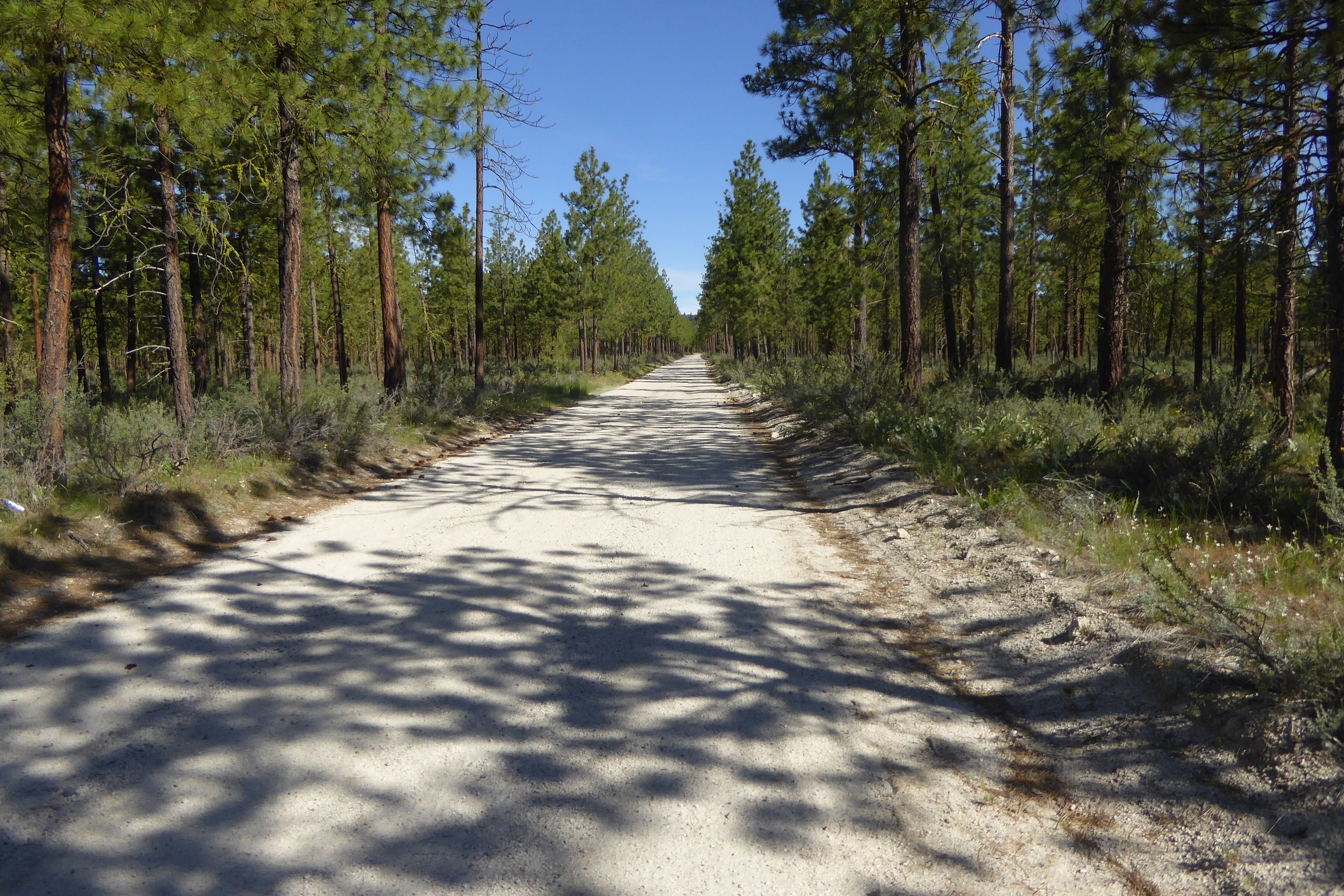
empty road north of Brewster, WA_06122016

One year after the Carlton Complex #fire. Largest forest fire in state history.
Texas Creek Rd, Carlton, WA 美國的地圖
搜索其他地方的日出日落時間
附近地點
54 Sanctuary Ln, Carlton, WA 美國
Texas Creek Rd, Carlton, WA 美國
French Creek Rd, Methow, WA 美國French Creek Road
Methow, WA, 美國
42 Old Carlton Rd, Carlton, WA 美國
Carlton, WA 美國
WA-, Carlton, WA 美國Carlton RV Park
Smith Canyon Rd, Carlton, WA 美國
WA-20, Washington, 美國Washington 20
美國華盛頓帕特羅斯
Alta Lake State Park, Washington 美國
Twisp, WA, 美國
Balky Hill Rd, Twisp, WA 美國Pipestone Canyon Ranch
14 Kamsak Rd, Brewster, WA 美國
Cooper Mountain Rd, Washington, 美國Cooper Mountain Road
Kamsak Rd, Washington 美國Kamsak Road
17 Kamsak Rd, Brewster, WA 美國
Fox Peak, Washington 美國
West Main Street, Brewster, WA 美國NAPA Auto Parts - Hamilton Farm Equipment Center
Griggs Ave E, Brewster, WA 美國
最近搜索
- 阿根廷布宜諾斯艾利斯聖特爾莫區的日出日落時間表
- Congressional Dr, Stevensville, MD, USA的日出日落時間表
- Papingo 04希臘的日出日落時間表
- Kranto 7-oji g. 8"N, Kaunas, 立陶宛Pagonija rock的日出日落時間表
- Co Rd 87, Jamestown, CO 美國的日出日落時間表
- 哥倫比亞昆迪納馬卡省滕霍的日出日落時間表
- -1 Gosho, Ichihara, Chiba -, Japan的日出日落時間表
- -日本的日出日落時間表
- Co Rd A, Truth or Consequences, NM 美國美國太空港的日出日落時間表
- 美國羅德島州沃威克的日出日落時間表