Texas Creek Rd, Carlton, WA, USA Sonnenaufgang Sonnenuntergang Zeiten
Location: USA > Washington > Carlton >
Zeitzone:
America/Los_Angeles
Ortszeit:
2024-04-28 09:51:02
Länge:
-120.0167003
Breite:
48.2023655
Sonnenaufgang Heute:
05:42:41 AM
Sonnenuntergang Heute:
08:11:53 PM
Tageslänge heute:
14h 29m 12s
Sonnenaufgang morgen:
05:41:01 AM
Sonnenuntergang Morgen:
08:13:18 PM
Tageslänge von morgen:
14h 32m 17s
Alle Termine anzeigen
| Datum | Sonnenaufgang | Sonnenuntergang | Tageslänge |
|---|---|---|---|
| 2024-01-01 | 07:50:33 AM | 04:17:20 PM | 8h 26m 47s |
| 2024-01-02 | 07:50:28 AM | 04:18:20 PM | 8h 27m 52s |
| 2024-01-03 | 07:50:20 AM | 04:19:23 PM | 8h 29m 3s |
| 2024-01-04 | 07:50:09 AM | 04:20:28 PM | 8h 30m 19s |
| 2024-01-05 | 07:49:56 AM | 04:21:35 PM | 8h 31m 39s |
| 2024-01-06 | 07:49:39 AM | 04:22:44 PM | 8h 33m 5s |
| 2024-01-07 | 07:49:20 AM | 04:23:55 PM | 8h 34m 35s |
| 2024-01-08 | 07:48:57 AM | 04:25:07 PM | 8h 36m 10s |
| 2024-01-09 | 07:48:32 AM | 04:26:22 PM | 8h 37m 50s |
| 2024-01-10 | 07:48:04 AM | 04:27:38 PM | 8h 39m 34s |
| 2024-01-11 | 07:47:33 AM | 04:28:55 PM | 8h 41m 22s |
| 2024-01-12 | 07:46:59 AM | 04:30:15 PM | 8h 43m 16s |
| 2024-01-13 | 07:46:23 AM | 04:31:35 PM | 8h 45m 12s |
| 2024-01-14 | 07:45:44 AM | 04:32:58 PM | 8h 47m 14s |
| 2024-01-15 | 07:45:03 AM | 04:34:21 PM | 8h 49m 18s |
| 2024-01-16 | 07:44:18 AM | 04:35:46 PM | 8h 51m 28s |
| 2024-01-17 | 07:43:31 AM | 04:37:12 PM | 8h 53m 41s |
| 2024-01-18 | 07:42:42 AM | 04:38:39 PM | 8h 55m 57s |
| 2024-01-19 | 07:41:50 AM | 04:40:07 PM | 8h 58m 17s |
| 2024-01-20 | 07:40:56 AM | 04:41:36 PM | 9h 0m 40s |
| 2024-01-21 | 07:39:59 AM | 04:43:06 PM | 9h 3m 7s |
| 2024-01-22 | 07:39:00 AM | 04:44:36 PM | 9h 5m 36s |
| 2024-01-23 | 07:37:58 AM | 04:46:08 PM | 9h 8m 10s |
| 2024-01-24 | 07:36:54 AM | 04:47:40 PM | 9h 10m 46s |
| 2024-01-25 | 07:35:48 AM | 04:49:13 PM | 9h 13m 25s |
| 2024-01-26 | 07:34:40 AM | 04:50:47 PM | 9h 16m 7s |
| 2024-01-27 | 07:33:30 AM | 04:52:21 PM | 9h 18m 51s |
| 2024-01-28 | 07:32:17 AM | 04:53:55 PM | 9h 21m 38s |
| 2024-01-29 | 07:31:02 AM | 04:55:30 PM | 9h 24m 28s |
| 2024-01-30 | 07:29:46 AM | 04:57:05 PM | 9h 27m 19s |
| 2024-01-31 | 07:28:27 AM | 04:58:41 PM | 9h 30m 14s |
| 2024-02-01 | 07:27:07 AM | 05:00:17 PM | 9h 33m 10s |
| 2024-02-02 | 07:25:45 AM | 05:01:53 PM | 9h 36m 8s |
| 2024-02-03 | 07:24:20 AM | 05:03:30 PM | 9h 39m 10s |
| 2024-02-04 | 07:22:54 AM | 05:05:06 PM | 9h 42m 12s |
| 2024-02-05 | 07:21:27 AM | 05:06:43 PM | 9h 45m 16s |
| 2024-02-06 | 07:19:57 AM | 05:08:20 PM | 9h 48m 23s |
| 2024-02-07 | 07:18:26 AM | 05:09:56 PM | 9h 51m 30s |
| 2024-02-08 | 07:16:54 AM | 05:11:33 PM | 9h 54m 39s |
| 2024-02-09 | 07:15:20 AM | 05:13:10 PM | 9h 57m 50s |
| 2024-02-10 | 07:13:44 AM | 05:14:47 PM | 10h 1m 3s |
| 2024-02-11 | 07:12:07 AM | 05:16:23 PM | 10h 4m 16s |
| 2024-02-12 | 07:10:29 AM | 05:18:00 PM | 10h 7m 31s |
| 2024-02-13 | 07:08:49 AM | 05:19:36 PM | 10h 10m 47s |
| 2024-02-14 | 07:07:08 AM | 05:21:13 PM | 10h 14m 5s |
| 2024-02-15 | 07:05:25 AM | 05:22:49 PM | 10h 17m 24s |
| 2024-02-16 | 07:03:41 AM | 05:24:25 PM | 10h 20m 44s |
| 2024-02-17 | 07:01:56 AM | 05:26:00 PM | 10h 24m 4s |
| 2024-02-18 | 07:00:10 AM | 05:27:36 PM | 10h 27m 26s |
| 2024-02-19 | 06:58:23 AM | 05:29:11 PM | 10h 30m 48s |
| 2024-02-20 | 06:56:35 AM | 05:30:46 PM | 10h 34m 11s |
| 2024-02-21 | 06:54:46 AM | 05:32:21 PM | 10h 37m 35s |
| 2024-02-22 | 06:52:55 AM | 05:33:56 PM | 10h 41m 1s |
| 2024-02-23 | 06:51:04 AM | 05:35:30 PM | 10h 44m 26s |
| 2024-02-24 | 06:49:12 AM | 05:37:04 PM | 10h 47m 52s |
| 2024-02-25 | 06:47:19 AM | 05:38:38 PM | 10h 51m 19s |
| 2024-02-26 | 06:45:25 AM | 05:40:11 PM | 10h 54m 46s |
| 2024-02-27 | 06:43:30 AM | 05:41:45 PM | 10h 58m 15s |
| 2024-02-28 | 06:41:35 AM | 05:43:18 PM | 11h 1m 43s |
| 2024-02-29 | 06:39:38 AM | 05:44:50 PM | 11h 5m 12s |
| 2024-03-01 | 06:37:41 AM | 05:46:23 PM | 11h 8m 42s |
| 2024-03-02 | 06:35:44 AM | 05:47:55 PM | 11h 12m 11s |
| 2024-03-03 | 06:33:46 AM | 05:49:27 PM | 11h 15m 41s |
| 2024-03-04 | 06:31:47 AM | 05:50:58 PM | 11h 19m 11s |
| 2024-03-05 | 06:29:47 AM | 05:52:29 PM | 11h 22m 42s |
| 2024-03-06 | 06:27:47 AM | 05:54:01 PM | 11h 26m 14s |
| 2024-03-07 | 06:25:47 AM | 05:55:31 PM | 11h 29m 44s |
| 2024-03-08 | 06:23:46 AM | 05:57:02 PM | 11h 33m 16s |
| 2024-03-09 | 06:21:45 AM | 05:58:32 PM | 11h 36m 47s |
| 2024-03-10 | 07:19:48 AM | 06:59:58 PM | 11h 40m 10s |
| 2024-03-11 | 07:17:46 AM | 07:01:28 PM | 11h 43m 42s |
| 2024-03-12 | 07:15:44 AM | 07:02:58 PM | 11h 47m 14s |
| 2024-03-13 | 07:13:41 AM | 07:04:27 PM | 11h 50m 46s |
| 2024-03-14 | 07:11:38 AM | 07:05:57 PM | 11h 54m 19s |
| 2024-03-15 | 07:09:35 AM | 07:07:26 PM | 11h 57m 51s |
| 2024-03-16 | 07:07:31 AM | 07:08:54 PM | 12h 1m 23s |
| 2024-03-17 | 07:05:28 AM | 07:10:23 PM | 12h 4m 55s |
| 2024-03-18 | 07:03:24 AM | 07:11:52 PM | 12h 8m 28s |
| 2024-03-19 | 07:01:20 AM | 07:13:20 PM | 12h 12m 0s |
| 2024-03-20 | 06:59:16 AM | 07:14:48 PM | 12h 15m 32s |
| 2024-03-21 | 06:57:12 AM | 07:16:16 PM | 12h 19m 4s |
| 2024-03-22 | 06:55:08 AM | 07:17:44 PM | 12h 22m 36s |
| 2024-03-23 | 06:53:04 AM | 07:19:12 PM | 12h 26m 8s |
| 2024-03-24 | 06:51:00 AM | 07:20:40 PM | 12h 29m 40s |
| 2024-03-25 | 06:48:57 AM | 07:22:07 PM | 12h 33m 10s |
| 2024-03-26 | 06:46:53 AM | 07:23:35 PM | 12h 36m 42s |
| 2024-03-27 | 06:44:49 AM | 07:25:02 PM | 12h 40m 13s |
| 2024-03-28 | 06:42:46 AM | 07:26:30 PM | 12h 43m 44s |
| 2024-03-29 | 06:40:43 AM | 07:27:57 PM | 12h 47m 14s |
| 2024-03-30 | 06:38:40 AM | 07:29:24 PM | 12h 50m 44s |
| 2024-03-31 | 06:36:37 AM | 07:30:52 PM | 12h 54m 15s |
| 2024-04-01 | 06:34:34 AM | 07:32:19 PM | 12h 57m 45s |
| 2024-04-02 | 06:32:32 AM | 07:33:46 PM | 13h 1m 14s |
| 2024-04-03 | 06:30:30 AM | 07:35:13 PM | 13h 4m 43s |
| 2024-04-04 | 06:28:29 AM | 07:36:40 PM | 13h 8m 11s |
| 2024-04-05 | 06:26:28 AM | 07:38:07 PM | 13h 11m 39s |
| 2024-04-06 | 06:24:27 AM | 07:39:34 PM | 13h 15m 7s |
| 2024-04-07 | 06:22:27 AM | 07:41:01 PM | 13h 18m 34s |
| 2024-04-08 | 06:20:28 AM | 07:42:28 PM | 13h 22m 0s |
| 2024-04-09 | 06:18:29 AM | 07:43:55 PM | 13h 25m 26s |
| 2024-04-10 | 06:16:31 AM | 07:45:22 PM | 13h 28m 51s |
| 2024-04-11 | 06:14:33 AM | 07:46:49 PM | 13h 32m 16s |
| 2024-04-12 | 06:12:36 AM | 07:48:16 PM | 13h 35m 40s |
| 2024-04-13 | 06:10:39 AM | 07:49:43 PM | 13h 39m 4s |
| 2024-04-14 | 06:08:44 AM | 07:51:10 PM | 13h 42m 26s |
| 2024-04-15 | 06:06:49 AM | 07:52:37 PM | 13h 45m 48s |
| 2024-04-16 | 06:04:54 AM | 07:54:04 PM | 13h 49m 10s |
| 2024-04-17 | 06:03:01 AM | 07:55:31 PM | 13h 52m 30s |
| 2024-04-18 | 06:01:09 AM | 07:56:58 PM | 13h 55m 49s |
| 2024-04-19 | 05:59:17 AM | 07:58:24 PM | 13h 59m 7s |
| 2024-04-20 | 05:57:26 AM | 07:59:51 PM | 14h 2m 25s |
| 2024-04-21 | 05:55:37 AM | 08:01:18 PM | 14h 5m 41s |
| 2024-04-22 | 05:53:48 AM | 08:02:44 PM | 14h 8m 56s |
| 2024-04-23 | 05:52:00 AM | 08:04:11 PM | 14h 12m 11s |
| 2024-04-24 | 05:50:14 AM | 08:05:37 PM | 14h 15m 23s |
| 2024-04-25 | 05:48:28 AM | 08:07:03 PM | 14h 18m 35s |
| 2024-04-26 | 05:46:44 AM | 08:08:29 PM | 14h 21m 45s |
| 2024-04-27 | 05:45:01 AM | 08:09:55 PM | 14h 24m 54s |
| 2024-04-28 | 05:43:19 AM | 08:11:21 PM | 14h 28m 2s |
| 2024-04-29 | 05:41:39 AM | 08:12:46 PM | 14h 31m 7s |
| 2024-04-30 | 05:39:59 AM | 08:14:11 PM | 14h 34m 12s |
| 2024-05-01 | 05:38:22 AM | 08:15:36 PM | 14h 37m 14s |
| 2024-05-02 | 05:36:45 AM | 08:17:01 PM | 14h 40m 16s |
| 2024-05-03 | 05:35:10 AM | 08:18:25 PM | 14h 43m 15s |
| 2024-05-04 | 05:33:37 AM | 08:19:49 PM | 14h 46m 12s |
| 2024-05-05 | 05:32:05 AM | 08:21:13 PM | 14h 49m 8s |
| 2024-05-06 | 05:30:34 AM | 08:22:36 PM | 14h 52m 2s |
| 2024-05-07 | 05:29:05 AM | 08:23:58 PM | 14h 54m 53s |
| 2024-05-08 | 05:27:38 AM | 08:25:21 PM | 14h 57m 43s |
| 2024-05-09 | 05:26:12 AM | 08:26:42 PM | 15h 0m 30s |
| 2024-05-10 | 05:24:49 AM | 08:28:03 PM | 15h 3m 14s |
| 2024-05-11 | 05:23:27 AM | 08:29:23 PM | 15h 5m 56s |
| 2024-05-12 | 05:22:06 AM | 08:30:43 PM | 15h 8m 37s |
| 2024-05-13 | 05:20:48 AM | 08:32:02 PM | 15h 11m 14s |
| 2024-05-14 | 05:19:32 AM | 08:33:20 PM | 15h 13m 48s |
| 2024-05-15 | 05:18:17 AM | 08:34:38 PM | 15h 16m 21s |
| 2024-05-16 | 05:17:05 AM | 08:35:54 PM | 15h 18m 49s |
| 2024-05-17 | 05:15:54 AM | 08:37:10 PM | 15h 21m 16s |
| 2024-05-18 | 05:14:46 AM | 08:38:25 PM | 15h 23m 39s |
| 2024-05-19 | 05:13:39 AM | 08:39:38 PM | 15h 25m 59s |
| 2024-05-20 | 05:12:35 AM | 08:40:51 PM | 15h 28m 16s |
| 2024-05-21 | 05:11:33 AM | 08:42:02 PM | 15h 30m 29s |
| 2024-05-22 | 05:10:33 AM | 08:43:13 PM | 15h 32m 40s |
| 2024-05-23 | 05:09:35 AM | 08:44:22 PM | 15h 34m 47s |
| 2024-05-24 | 05:08:40 AM | 08:45:29 PM | 15h 36m 49s |
| 2024-05-25 | 05:07:47 AM | 08:46:36 PM | 15h 38m 49s |
| 2024-05-26 | 05:06:57 AM | 08:47:41 PM | 15h 40m 44s |
| 2024-05-27 | 05:06:08 AM | 08:48:44 PM | 15h 42m 36s |
| 2024-05-28 | 05:05:22 AM | 08:49:46 PM | 15h 44m 24s |
| 2024-05-29 | 05:04:39 AM | 08:50:46 PM | 15h 46m 7s |
| 2024-05-30 | 05:03:58 AM | 08:51:45 PM | 15h 47m 47s |
| 2024-05-31 | 05:03:20 AM | 08:52:42 PM | 15h 49m 22s |
| 2024-06-01 | 05:02:44 AM | 08:53:37 PM | 15h 50m 53s |
| 2024-06-02 | 05:02:11 AM | 08:54:31 PM | 15h 52m 20s |
| 2024-06-03 | 05:01:40 AM | 08:55:23 PM | 15h 53m 43s |
| 2024-06-04 | 05:01:12 AM | 08:56:12 PM | 15h 55m 0s |
| 2024-06-05 | 05:00:46 AM | 08:57:00 PM | 15h 56m 14s |
| 2024-06-06 | 05:00:23 AM | 08:57:45 PM | 15h 57m 22s |
| 2024-06-07 | 05:00:03 AM | 08:58:29 PM | 15h 58m 26s |
| 2024-06-08 | 04:59:45 AM | 08:59:10 PM | 15h 59m 25s |
| 2024-06-09 | 04:59:30 AM | 08:59:49 PM | 16h 0m 19s |
| 2024-06-10 | 04:59:18 AM | 09:00:26 PM | 16h 1m 8s |
| 2024-06-11 | 04:59:08 AM | 09:01:01 PM | 16h 1m 53s |
| 2024-06-12 | 04:59:01 AM | 09:01:33 PM | 16h 2m 32s |
| 2024-06-13 | 04:58:56 AM | 09:02:03 PM | 16h 3m 7s |
| 2024-06-14 | 04:58:54 AM | 09:02:31 PM | 16h 3m 37s |
| 2024-06-15 | 04:58:55 AM | 09:02:56 PM | 16h 4m 1s |
| 2024-06-16 | 04:58:59 AM | 09:03:19 PM | 16h 4m 20s |
| 2024-06-17 | 04:59:05 AM | 09:03:39 PM | 16h 4m 34s |
| 2024-06-18 | 04:59:13 AM | 09:03:56 PM | 16h 4m 43s |
| 2024-06-19 | 04:59:24 AM | 09:04:11 PM | 16h 4m 47s |
| 2024-06-20 | 04:59:38 AM | 09:04:24 PM | 16h 4m 46s |
| 2024-06-21 | 04:59:54 AM | 09:04:33 PM | 16h 4m 39s |
| 2024-06-22 | 05:00:13 AM | 09:04:40 PM | 16h 4m 27s |
| 2024-06-23 | 05:00:34 AM | 09:04:45 PM | 16h 4m 11s |
| 2024-06-24 | 05:00:58 AM | 09:04:47 PM | 16h 3m 49s |
| 2024-06-25 | 05:01:24 AM | 09:04:46 PM | 16h 3m 22s |
| 2024-06-26 | 05:01:53 AM | 09:04:42 PM | 16h 2m 49s |
| 2024-06-27 | 05:02:23 AM | 09:04:36 PM | 16h 2m 13s |
| 2024-06-28 | 05:02:56 AM | 09:04:27 PM | 16h 1m 31s |
| 2024-06-29 | 05:03:31 AM | 09:04:15 PM | 16h 0m 44s |
| 2024-06-30 | 05:04:09 AM | 09:04:01 PM | 15h 59m 52s |
| 2024-07-01 | 05:04:48 AM | 09:03:44 PM | 15h 58m 56s |
| 2024-07-02 | 05:05:30 AM | 09:03:24 PM | 15h 57m 54s |
| 2024-07-03 | 05:06:14 AM | 09:03:02 PM | 15h 56m 48s |
| 2024-07-04 | 05:06:59 AM | 09:02:37 PM | 15h 55m 38s |
| 2024-07-05 | 05:07:47 AM | 09:02:09 PM | 15h 54m 22s |
| 2024-07-06 | 05:08:36 AM | 09:01:38 PM | 15h 53m 2s |
| 2024-07-07 | 05:09:27 AM | 09:01:06 PM | 15h 51m 39s |
| 2024-07-08 | 05:10:20 AM | 09:00:30 PM | 15h 50m 10s |
| 2024-07-09 | 05:11:15 AM | 08:59:52 PM | 15h 48m 37s |
| 2024-07-10 | 05:12:11 AM | 08:59:11 PM | 15h 47m 0s |
| 2024-07-11 | 05:13:09 AM | 08:58:28 PM | 15h 45m 19s |
| 2024-07-12 | 05:14:09 AM | 08:57:43 PM | 15h 43m 34s |
| 2024-07-13 | 05:15:10 AM | 08:56:54 PM | 15h 41m 44s |
| 2024-07-14 | 05:16:12 AM | 08:56:04 PM | 15h 39m 52s |
| 2024-07-15 | 05:17:16 AM | 08:55:11 PM | 15h 37m 55s |
| 2024-07-16 | 05:18:21 AM | 08:54:16 PM | 15h 35m 55s |
| 2024-07-17 | 05:19:27 AM | 08:53:18 PM | 15h 33m 51s |
| 2024-07-18 | 05:20:34 AM | 08:52:18 PM | 15h 31m 44s |
| 2024-07-19 | 05:21:43 AM | 08:51:16 PM | 15h 29m 33s |
| 2024-07-20 | 05:22:52 AM | 08:50:12 PM | 15h 27m 20s |
| 2024-07-21 | 05:24:03 AM | 08:49:06 PM | 15h 25m 3s |
| 2024-07-22 | 05:25:15 AM | 08:47:57 PM | 15h 22m 42s |
| 2024-07-23 | 05:26:27 AM | 08:46:46 PM | 15h 20m 19s |
| 2024-07-24 | 05:27:41 AM | 08:45:34 PM | 15h 17m 53s |
| 2024-07-25 | 05:28:55 AM | 08:44:19 PM | 15h 15m 24s |
| 2024-07-26 | 05:30:10 AM | 08:43:02 PM | 15h 12m 52s |
| 2024-07-27 | 05:31:25 AM | 08:41:44 PM | 15h 10m 19s |
| 2024-07-28 | 05:32:42 AM | 08:40:23 PM | 15h 7m 41s |
| 2024-07-29 | 05:33:59 AM | 08:39:01 PM | 15h 5m 2s |
| 2024-07-30 | 05:35:16 AM | 08:37:37 PM | 15h 2m 21s |
| 2024-07-31 | 05:36:34 AM | 08:36:11 PM | 14h 59m 37s |
| 2024-08-01 | 05:37:53 AM | 08:34:44 PM | 14h 56m 51s |
| 2024-08-02 | 05:39:12 AM | 08:33:14 PM | 14h 54m 2s |
| 2024-08-03 | 05:40:31 AM | 08:31:43 PM | 14h 51m 12s |
| 2024-08-04 | 05:41:51 AM | 08:30:11 PM | 14h 48m 20s |
| 2024-08-05 | 05:43:11 AM | 08:28:37 PM | 14h 45m 26s |
| 2024-08-06 | 05:44:32 AM | 08:27:01 PM | 14h 42m 29s |
| 2024-08-07 | 05:45:52 AM | 08:25:24 PM | 14h 39m 32s |
| 2024-08-08 | 05:47:13 AM | 08:23:46 PM | 14h 36m 33s |
| 2024-08-09 | 05:48:35 AM | 08:22:06 PM | 14h 33m 31s |
| 2024-08-10 | 05:49:56 AM | 08:20:25 PM | 14h 30m 29s |
| 2024-08-11 | 05:51:18 AM | 08:18:43 PM | 14h 27m 25s |
| 2024-08-12 | 05:52:40 AM | 08:16:59 PM | 14h 24m 19s |
| 2024-08-13 | 05:54:02 AM | 08:15:14 PM | 14h 21m 12s |
| 2024-08-14 | 05:55:24 AM | 08:13:28 PM | 14h 18m 4s |
| 2024-08-15 | 05:56:46 AM | 08:11:41 PM | 14h 14m 55s |
| 2024-08-16 | 05:58:08 AM | 08:09:53 PM | 14h 11m 45s |
| 2024-08-17 | 05:59:30 AM | 08:08:03 PM | 14h 8m 33s |
| 2024-08-18 | 06:00:53 AM | 08:06:13 PM | 14h 5m 20s |
| 2024-08-19 | 06:02:15 AM | 08:04:21 PM | 14h 2m 6s |
| 2024-08-20 | 06:03:38 AM | 08:02:29 PM | 13h 58m 51s |
| 2024-08-21 | 06:05:00 AM | 08:00:36 PM | 13h 55m 36s |
| 2024-08-22 | 06:06:23 AM | 07:58:41 PM | 13h 52m 18s |
| 2024-08-23 | 06:07:45 AM | 07:56:46 PM | 13h 49m 1s |
| 2024-08-24 | 06:09:08 AM | 07:54:50 PM | 13h 45m 42s |
| 2024-08-25 | 06:10:30 AM | 07:52:54 PM | 13h 42m 24s |
| 2024-08-26 | 06:11:53 AM | 07:50:56 PM | 13h 39m 3s |
| 2024-08-27 | 06:13:15 AM | 07:48:58 PM | 13h 35m 43s |
| 2024-08-28 | 06:14:37 AM | 07:47:00 PM | 13h 32m 23s |
| 2024-08-29 | 06:16:00 AM | 07:45:00 PM | 13h 29m 0s |
| 2024-08-30 | 06:17:22 AM | 07:43:00 PM | 13h 25m 38s |
| 2024-08-31 | 06:18:45 AM | 07:40:59 PM | 13h 22m 14s |
| 2024-09-01 | 06:20:07 AM | 07:38:58 PM | 13h 18m 51s |
| 2024-09-02 | 06:21:29 AM | 07:36:57 PM | 13h 15m 28s |
| 2024-09-03 | 06:22:52 AM | 07:34:54 PM | 13h 12m 2s |
| 2024-09-04 | 06:24:14 AM | 07:32:52 PM | 13h 8m 38s |
| 2024-09-05 | 06:25:36 AM | 07:30:49 PM | 13h 5m 13s |
| 2024-09-06 | 06:26:58 AM | 07:28:45 PM | 13h 1m 47s |
| 2024-09-07 | 06:28:21 AM | 07:26:41 PM | 12h 58m 20s |
| 2024-09-08 | 06:29:43 AM | 07:24:37 PM | 12h 54m 54s |
| 2024-09-09 | 06:31:05 AM | 07:22:33 PM | 12h 51m 28s |
| 2024-09-10 | 06:32:28 AM | 07:20:28 PM | 12h 48m 0s |
| 2024-09-11 | 06:33:50 AM | 07:18:23 PM | 12h 44m 33s |
| 2024-09-12 | 06:35:13 AM | 07:16:18 PM | 12h 41m 5s |
| 2024-09-13 | 06:36:35 AM | 07:14:13 PM | 12h 37m 38s |
| 2024-09-14 | 06:37:58 AM | 07:12:08 PM | 12h 34m 10s |
| 2024-09-15 | 06:39:20 AM | 07:10:02 PM | 12h 30m 42s |
| 2024-09-16 | 06:40:43 AM | 07:07:56 PM | 12h 27m 13s |
| 2024-09-17 | 06:42:06 AM | 07:05:51 PM | 12h 23m 45s |
| 2024-09-18 | 06:43:29 AM | 07:03:45 PM | 12h 20m 16s |
| 2024-09-19 | 06:44:52 AM | 07:01:39 PM | 12h 16m 47s |
| 2024-09-20 | 06:46:15 AM | 06:59:34 PM | 12h 13m 19s |
| 2024-09-21 | 06:47:38 AM | 06:57:28 PM | 12h 9m 50s |
| 2024-09-22 | 06:49:02 AM | 06:55:22 PM | 12h 6m 20s |
| 2024-09-23 | 06:50:25 AM | 06:53:17 PM | 12h 2m 52s |
| 2024-09-24 | 06:51:49 AM | 06:51:12 PM | 11h 59m 23s |
| 2024-09-25 | 06:53:13 AM | 06:49:07 PM | 11h 55m 54s |
| 2024-09-26 | 06:54:37 AM | 06:47:02 PM | 11h 52m 25s |
| 2024-09-27 | 06:56:02 AM | 06:44:57 PM | 11h 48m 55s |
| 2024-09-28 | 06:57:26 AM | 06:42:53 PM | 11h 45m 27s |
| 2024-09-29 | 06:58:51 AM | 06:40:49 PM | 11h 41m 58s |
| 2024-09-30 | 07:00:16 AM | 06:38:46 PM | 11h 38m 30s |
| 2024-10-01 | 07:01:41 AM | 06:36:42 PM | 11h 35m 1s |
| 2024-10-02 | 07:03:07 AM | 06:34:39 PM | 11h 31m 32s |
| 2024-10-03 | 07:04:33 AM | 06:32:37 PM | 11h 28m 4s |
| 2024-10-04 | 07:05:59 AM | 06:30:35 PM | 11h 24m 36s |
| 2024-10-05 | 07:07:25 AM | 06:28:34 PM | 11h 21m 9s |
| 2024-10-06 | 07:08:52 AM | 06:26:33 PM | 11h 17m 41s |
| 2024-10-07 | 07:10:18 AM | 06:24:32 PM | 11h 14m 14s |
| 2024-10-08 | 07:11:46 AM | 06:22:33 PM | 11h 10m 47s |
| 2024-10-09 | 07:13:13 AM | 06:20:34 PM | 11h 7m 21s |
| 2024-10-10 | 07:14:41 AM | 06:18:35 PM | 11h 3m 54s |
| 2024-10-11 | 07:16:09 AM | 06:16:38 PM | 11h 0m 29s |
| 2024-10-12 | 07:17:37 AM | 06:14:41 PM | 10h 57m 4s |
| 2024-10-13 | 07:19:06 AM | 06:12:44 PM | 10h 53m 38s |
| 2024-10-14 | 07:20:35 AM | 06:10:49 PM | 10h 50m 14s |
| 2024-10-15 | 07:22:04 AM | 06:08:54 PM | 10h 46m 50s |
| 2024-10-16 | 07:23:33 AM | 06:07:01 PM | 10h 43m 28s |
| 2024-10-17 | 07:25:03 AM | 06:05:08 PM | 10h 40m 5s |
| 2024-10-18 | 07:26:33 AM | 06:03:16 PM | 10h 36m 43s |
| 2024-10-19 | 07:28:04 AM | 06:01:25 PM | 10h 33m 21s |
| 2024-10-20 | 07:29:34 AM | 05:59:36 PM | 10h 30m 2s |
| 2024-10-21 | 07:31:05 AM | 05:57:47 PM | 10h 26m 42s |
| 2024-10-22 | 07:32:37 AM | 05:55:59 PM | 10h 23m 22s |
| 2024-10-23 | 07:34:08 AM | 05:54:13 PM | 10h 20m 5s |
| 2024-10-24 | 07:35:40 AM | 05:52:28 PM | 10h 16m 48s |
| 2024-10-25 | 07:37:12 AM | 05:50:44 PM | 10h 13m 32s |
| 2024-10-26 | 07:38:44 AM | 05:49:01 PM | 10h 10m 17s |
| 2024-10-27 | 07:40:16 AM | 05:47:20 PM | 10h 7m 4s |
| 2024-10-28 | 07:41:49 AM | 05:45:40 PM | 10h 3m 51s |
| 2024-10-29 | 07:43:21 AM | 05:44:01 PM | 10h 0m 40s |
| 2024-10-30 | 07:44:54 AM | 05:42:24 PM | 9h 57m 30s |
| 2024-10-31 | 07:46:27 AM | 05:40:48 PM | 9h 54m 21s |
| 2024-11-01 | 07:48:00 AM | 05:39:14 PM | 9h 51m 14s |
| 2024-11-02 | 07:49:33 AM | 05:37:42 PM | 9h 48m 9s |
| 2024-11-03 | 06:51:09 AM | 04:36:07 PM | 9h 44m 58s |
| 2024-11-04 | 06:52:42 AM | 04:34:38 PM | 9h 41m 56s |
| 2024-11-05 | 06:54:15 AM | 04:33:11 PM | 9h 38m 56s |
| 2024-11-06 | 06:55:48 AM | 04:31:45 PM | 9h 35m 57s |
| 2024-11-07 | 06:57:21 AM | 04:30:21 PM | 9h 33m 0s |
| 2024-11-08 | 06:58:53 AM | 04:28:59 PM | 9h 30m 6s |
| 2024-11-09 | 07:00:26 AM | 04:27:39 PM | 9h 27m 13s |
| 2024-11-10 | 07:01:58 AM | 04:26:21 PM | 9h 24m 23s |
| 2024-11-11 | 07:03:29 AM | 04:25:05 PM | 9h 21m 36s |
| 2024-11-12 | 07:05:01 AM | 04:23:51 PM | 9h 18m 50s |
| 2024-11-13 | 07:06:32 AM | 04:22:39 PM | 9h 16m 7s |
| 2024-11-14 | 07:08:02 AM | 04:21:29 PM | 9h 13m 27s |
| 2024-11-15 | 07:09:32 AM | 04:20:22 PM | 9h 10m 50s |
| 2024-11-16 | 07:11:02 AM | 04:19:16 PM | 9h 8m 14s |
| 2024-11-17 | 07:12:30 AM | 04:18:13 PM | 9h 5m 43s |
| 2024-11-18 | 07:13:59 AM | 04:17:12 PM | 9h 3m 13s |
| 2024-11-19 | 07:15:26 AM | 04:16:14 PM | 9h 0m 48s |
| 2024-11-20 | 07:16:52 AM | 04:15:18 PM | 8h 58m 26s |
| 2024-11-21 | 07:18:18 AM | 04:14:25 PM | 8h 56m 7s |
| 2024-11-22 | 07:19:43 AM | 04:13:34 PM | 8h 53m 51s |
| 2024-11-23 | 07:21:07 AM | 04:12:45 PM | 8h 51m 38s |
| 2024-11-24 | 07:22:29 AM | 04:11:59 PM | 8h 49m 30s |
| 2024-11-25 | 07:23:51 AM | 04:11:16 PM | 8h 47m 25s |
| 2024-11-26 | 07:25:11 AM | 04:10:36 PM | 8h 45m 25s |
| 2024-11-27 | 07:26:30 AM | 04:09:58 PM | 8h 43m 28s |
| 2024-11-28 | 07:27:47 AM | 04:09:23 PM | 8h 41m 36s |
| 2024-11-29 | 07:29:04 AM | 04:08:50 PM | 8h 39m 46s |
| 2024-11-30 | 07:30:18 AM | 04:08:21 PM | 8h 38m 3s |
| 2024-12-01 | 07:31:31 AM | 04:07:54 PM | 8h 36m 23s |
| 2024-12-02 | 07:32:43 AM | 04:07:31 PM | 8h 34m 48s |
| 2024-12-03 | 07:33:52 AM | 04:07:10 PM | 8h 33m 18s |
| 2024-12-04 | 07:35:00 AM | 04:06:52 PM | 8h 31m 52s |
| 2024-12-05 | 07:36:06 AM | 04:06:37 PM | 8h 30m 31s |
| 2024-12-06 | 07:37:10 AM | 04:06:24 PM | 8h 29m 14s |
| 2024-12-07 | 07:38:12 AM | 04:06:15 PM | 8h 28m 3s |
| 2024-12-08 | 07:39:12 AM | 04:06:09 PM | 8h 26m 57s |
| 2024-12-09 | 07:40:10 AM | 04:06:06 PM | 8h 25m 56s |
| 2024-12-10 | 07:41:06 AM | 04:06:06 PM | 8h 25m 0s |
| 2024-12-11 | 07:41:59 AM | 04:06:09 PM | 8h 24m 10s |
| 2024-12-12 | 07:42:50 AM | 04:06:14 PM | 8h 23m 24s |
| 2024-12-13 | 07:43:39 AM | 04:06:23 PM | 8h 22m 44s |
| 2024-12-14 | 07:44:25 AM | 04:06:35 PM | 8h 22m 10s |
| 2024-12-15 | 07:45:09 AM | 04:06:50 PM | 8h 21m 41s |
| 2024-12-16 | 07:45:50 AM | 04:07:07 PM | 8h 21m 17s |
| 2024-12-17 | 07:46:28 AM | 04:07:28 PM | 8h 21m 0s |
| 2024-12-18 | 07:47:04 AM | 04:07:51 PM | 8h 20m 47s |
| 2024-12-19 | 07:47:37 AM | 04:08:18 PM | 8h 20m 41s |
| 2024-12-20 | 07:48:07 AM | 04:08:47 PM | 8h 20m 40s |
| 2024-12-21 | 07:48:35 AM | 04:09:19 PM | 8h 20m 44s |
| 2024-12-22 | 07:49:00 AM | 04:09:54 PM | 8h 20m 54s |
| 2024-12-23 | 07:49:22 AM | 04:10:31 PM | 8h 21m 9s |
| 2024-12-24 | 07:49:41 AM | 04:11:12 PM | 8h 21m 31s |
| 2024-12-25 | 07:49:57 AM | 04:11:55 PM | 8h 21m 58s |
| 2024-12-26 | 07:50:11 AM | 04:12:40 PM | 8h 22m 29s |
| 2024-12-27 | 07:50:21 AM | 04:13:28 PM | 8h 23m 7s |
| 2024-12-28 | 07:50:29 AM | 04:14:19 PM | 8h 23m 50s |
| 2024-12-29 | 07:50:33 AM | 04:15:12 PM | 8h 24m 39s |
| 2024-12-30 | 07:50:35 AM | 04:16:07 PM | 8h 25m 32s |
Fotos
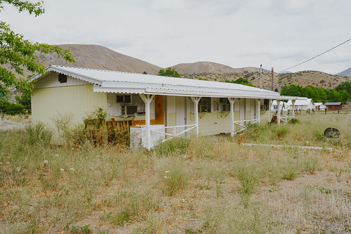
Methow, Washington - July 5, 2019: Old abandoned building for the former Wagon Wheel Cafe and motel, closed for many years, along the North Cascades Scenic Byway

Methow, Washington - July 5, 2019: Old abandoned sign for the former Wagon Wheel Cafe and motel, closed for many years, along the North Cascades Scenic Byway
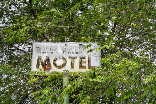
Methow, Washington - July 5, 2019: Old abandoned sign for the former Wagon Wheel Cafe and motel, closed for many years, along the North Cascades Scenic Byway
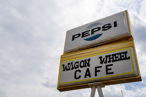
Methow, Washington - July 5, 2019: Old abandoned sign for the former Wagon Wheel Cafe and motel, closed for many years, along the North Cascades Scenic Byway
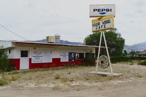
Methow, Washington - July 5, 2019: Old abandoned sign for the former Wagon Wheel Cafe and motel, closed for many years, along the North Cascades Scenic Byway
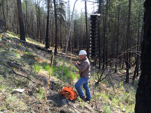
2015. Roy Magelssen setting up a Douglas-fir beetle monitoring trap at Gold Creek on the Methow Valley Ranger District. Okanogan-Wenatchee National Forest, Washington.
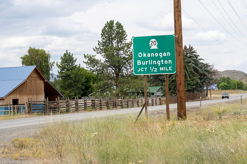
Sign for Washington State Highway 20 Junction, toward towns of Okanogan and Burlington. As seen from the North Cascades Highway
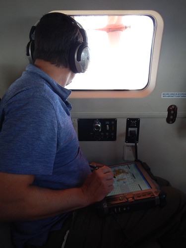
2017. Aerial observer Justin Hof looks out the window of a Kodiak to identify forest insect and disease damage. He will record areas of damage and causal agent(s) with the digital sketch mapping system in his lap. Methow area, Washington.
Texas Creek Rd, Carlton, WA, USA Karte
Suchen Sie einen anderen Ort
Nahe Plätze
54 Sanctuary Ln, Carlton, WA, USA
Texas Creek Rd, Carlton, WA, USA
French Creek Road, French Creek Rd, Methow, WA, USA
Methow, WA, USA
42 Old Carlton Rd, Carlton, WA, USA
Carlton, WA, USA
Carlton RV Park, WA-, Carlton, WA, USA
Smith Canyon Rd, Carlton, WA, USA
Washington 20, WA-20, Washington, USA
Pateros, WA, USA
Alta Lake State Park, Washington, USA
Twisp, WA, USA
Pipestone Canyon Ranch, Balky Hill Rd, Twisp, WA, USA
14 Kamsak Rd, Brewster, WA, USA
Cooper Mountain Road, Cooper Mountain Rd, Washington, USA
Kamsak Road, Kamsak Rd, Washington, USA
17 Kamsak Rd, Brewster, WA, USA
Fox Peak, Washington, USA
NAPA Auto Parts - Hamilton Farm Equipment Center, West Main Street, Brewster, WA, USA
Griggs Ave E, Brewster, WA, USA
Letzte Suche
- Jialuohu, Datong Township, Yilan County, Taiwan Sonnenaufgang Sonnenuntergang Zeiten
- 大下港, Sekizenoge, Imabari, Präfektur Ehime -, Japan Sonnenaufgang Sonnenuntergang Zeiten
- Oge port Ferry Terminal, -1 Sekizenōge, Imabari, Ehime -, Japan Sonnenaufgang Sonnenuntergang Zeiten
- San Telmo, Autonomen Stadt Buenos Aires, Argentinien Sonnenaufgang Sonnenuntergang Zeiten
- Congressional Dr, Stevensville, MD, USA Sonnenaufgang Sonnenuntergang Zeiten
- Papingo 04, Griechenland Sonnenaufgang Sonnenuntergang Zeiten
- Pagonija rock, Kranto 7-oji g. 8"N, Kaunas, Litauen Sonnenaufgang Sonnenuntergang Zeiten
- Co Rd 87, Jamestown, CO, USA Sonnenaufgang Sonnenuntergang Zeiten
- Tenjo, Cundinamarca, Colombia Sonnenaufgang Sonnenuntergang Zeiten
- -1 Gosho, Ichihara, Chiba -, Japan Sonnenaufgang Sonnenuntergang Zeiten

