NF--, Estacada, OR 美國5way的日出日落時間表
Location: 美國 > 俄勒冈州 > 克拉克默斯縣 > OR 美國 >
時區:
America/Los_Angeles
當地時間:
2024-05-05 09:55:38
經度:
-122.2692263
緯度:
45.1470147
今天日出時間:
05:49:14 AM
今天日落時間:
08:22:02 PM
今天日照時長:
14h 32m 48s
明天日出時間:
05:47:54 AM
明天日落時間:
08:23:15 PM
明天日照時長:
14h 35m 21s
顯示所有日期
| 日期 | 日出 | 日落 | 日照時長 |
|---|---|---|---|
| 2024年01月01日 | 07:47:45 AM | 04:38:09 PM | 8h 50m 24s |
| 2024年01月02日 | 07:47:45 AM | 04:39:05 PM | 8h 51m 20s |
| 2024年01月03日 | 07:47:41 AM | 04:40:04 PM | 8h 52m 23s |
| 2024年01月04日 | 07:47:35 AM | 04:41:04 PM | 8h 53m 29s |
| 2024年01月05日 | 07:47:26 AM | 04:42:06 PM | 8h 54m 40s |
| 2024年01月06日 | 07:47:15 AM | 04:43:10 PM | 8h 55m 55s |
| 2024年01月07日 | 07:47:01 AM | 04:44:15 PM | 8h 57m 14s |
| 2024年01月08日 | 07:46:44 AM | 04:45:22 PM | 8h 58m 38s |
| 2024年01月09日 | 07:46:25 AM | 04:46:30 PM | 9h 0m 5s |
| 2024年01月10日 | 07:46:03 AM | 04:47:40 PM | 9h 1m 37s |
| 2024年01月11日 | 07:45:39 AM | 04:48:51 PM | 9h 3m 12s |
| 2024年01月12日 | 07:45:12 AM | 04:50:04 PM | 9h 4m 52s |
| 2024年01月13日 | 07:44:42 AM | 04:51:18 PM | 9h 6m 36s |
| 2024年01月14日 | 07:44:11 AM | 04:52:33 PM | 9h 8m 22s |
| 2024年01月15日 | 07:43:36 AM | 04:53:49 PM | 9h 10m 13s |
| 2024年01月16日 | 07:43:00 AM | 04:55:06 PM | 9h 12m 6s |
| 2024年01月17日 | 07:42:21 AM | 04:56:24 PM | 9h 14m 3s |
| 2024年01月18日 | 07:41:39 AM | 04:57:43 PM | 9h 16m 4s |
| 2024年01月19日 | 07:40:56 AM | 04:59:03 PM | 9h 18m 7s |
| 2024年01月20日 | 07:40:09 AM | 05:00:23 PM | 9h 20m 14s |
| 2024年01月21日 | 07:39:21 AM | 05:01:45 PM | 9h 22m 24s |
| 2024年01月22日 | 07:38:31 AM | 05:03:07 PM | 9h 24m 36s |
| 2024年01月23日 | 07:37:38 AM | 05:04:29 PM | 9h 26m 51s |
| 2024年01月24日 | 07:36:43 AM | 05:05:53 PM | 9h 29m 10s |
| 2024年01月25日 | 07:35:46 AM | 05:07:17 PM | 9h 31m 31s |
| 2024年01月26日 | 07:34:47 AM | 05:08:41 PM | 9h 33m 54s |
| 2024年01月27日 | 07:33:46 AM | 05:10:06 PM | 9h 36m 20s |
| 2024年01月28日 | 07:32:43 AM | 05:11:31 PM | 9h 38m 48s |
| 2024年01月29日 | 07:31:38 AM | 05:12:56 PM | 9h 41m 18s |
| 2024年01月30日 | 07:30:31 AM | 05:14:22 PM | 9h 43m 51s |
| 2024年01月31日 | 07:29:22 AM | 05:15:48 PM | 9h 46m 26s |
| 2024年02月01日 | 07:28:12 AM | 05:17:14 PM | 9h 49m 2s |
| 2024年02月02日 | 07:26:59 AM | 05:18:40 PM | 9h 51m 41s |
| 2024年02月03日 | 07:25:45 AM | 05:20:06 PM | 9h 54m 21s |
| 2024年02月04日 | 07:24:29 AM | 05:21:33 PM | 9h 57m 4s |
| 2024年02月05日 | 07:23:12 AM | 05:22:59 PM | 9h 59m 47s |
| 2024年02月06日 | 07:21:52 AM | 05:24:26 PM | 10h 2m 34s |
| 2024年02月07日 | 07:20:32 AM | 05:25:53 PM | 10h 5m 21s |
| 2024年02月08日 | 07:19:09 AM | 05:27:19 PM | 10h 8m 10s |
| 2024年02月09日 | 07:17:46 AM | 05:28:45 PM | 10h 10m 59s |
| 2024年02月10日 | 07:16:20 AM | 05:30:12 PM | 10h 13m 52s |
| 2024年02月11日 | 07:14:54 AM | 05:31:38 PM | 10h 16m 44s |
| 2024年02月12日 | 07:13:26 AM | 05:33:04 PM | 10h 19m 38s |
| 2024年02月13日 | 07:11:56 AM | 05:34:30 PM | 10h 22m 34s |
| 2024年02月14日 | 07:10:26 AM | 05:35:56 PM | 10h 25m 30s |
| 2024年02月15日 | 07:08:54 AM | 05:37:21 PM | 10h 28m 27s |
| 2024年02月16日 | 07:07:21 AM | 05:38:47 PM | 10h 31m 26s |
| 2024年02月17日 | 07:05:46 AM | 05:40:12 PM | 10h 34m 26s |
| 2024年02月18日 | 07:04:11 AM | 05:41:37 PM | 10h 37m 26s |
| 2024年02月19日 | 07:02:34 AM | 05:43:01 PM | 10h 40m 27s |
| 2024年02月20日 | 07:00:57 AM | 05:44:26 PM | 10h 43m 29s |
| 2024年02月21日 | 06:59:18 AM | 05:45:50 PM | 10h 46m 32s |
| 2024年02月22日 | 06:57:38 AM | 05:47:14 PM | 10h 49m 36s |
| 2024年02月23日 | 06:55:58 AM | 05:48:37 PM | 10h 52m 39s |
| 2024年02月24日 | 06:54:16 AM | 05:50:01 PM | 10h 55m 45s |
| 2024年02月25日 | 06:52:34 AM | 05:51:24 PM | 10h 58m 50s |
| 2024年02月26日 | 06:50:51 AM | 05:52:47 PM | 11h 1m 56s |
| 2024年02月27日 | 06:49:07 AM | 05:54:09 PM | 11h 5m 2s |
| 2024年02月28日 | 06:47:22 AM | 05:55:31 PM | 11h 8m 9s |
| 2024年02月29日 | 06:45:37 AM | 05:56:53 PM | 11h 11m 16s |
| 2024年03月01日 | 06:43:50 AM | 05:58:15 PM | 11h 14m 25s |
| 2024年03月02日 | 06:42:03 AM | 05:59:36 PM | 11h 17m 33s |
| 2024年03月03日 | 06:40:16 AM | 06:00:57 PM | 11h 20m 41s |
| 2024年03月04日 | 06:38:28 AM | 06:02:18 PM | 11h 23m 50s |
| 2024年03月05日 | 06:36:39 AM | 06:03:39 PM | 11h 27m 0s |
| 2024年03月06日 | 06:34:50 AM | 06:04:59 PM | 11h 30m 9s |
| 2024年03月07日 | 06:33:00 AM | 06:06:19 PM | 11h 33m 19s |
| 2024年03月08日 | 06:31:10 AM | 06:07:39 PM | 11h 36m 29s |
| 2024年03月09日 | 06:29:20 AM | 06:08:58 PM | 11h 39m 38s |
| 2024年03月10日 | 07:27:33 AM | 07:10:14 PM | 11h 42m 41s |
| 2024年03月11日 | 07:25:42 AM | 07:11:33 PM | 11h 45m 51s |
| 2024年03月12日 | 07:23:50 AM | 07:12:52 PM | 11h 49m 2s |
| 2024年03月13日 | 07:21:59 AM | 07:14:11 PM | 11h 52m 12s |
| 2024年03月14日 | 07:20:06 AM | 07:15:29 PM | 11h 55m 23s |
| 2024年03月15日 | 07:18:14 AM | 07:16:47 PM | 11h 58m 33s |
| 2024年03月16日 | 07:16:21 AM | 07:18:06 PM | 12h 1m 45s |
| 2024年03月17日 | 07:14:28 AM | 07:19:23 PM | 12h 4m 55s |
| 2024年03月18日 | 07:12:35 AM | 07:20:41 PM | 12h 8m 6s |
| 2024年03月19日 | 07:10:42 AM | 07:21:59 PM | 12h 11m 17s |
| 2024年03月20日 | 07:08:49 AM | 07:23:16 PM | 12h 14m 27s |
| 2024年03月21日 | 07:06:56 AM | 07:24:34 PM | 12h 17m 38s |
| 2024年03月22日 | 07:05:03 AM | 07:25:51 PM | 12h 20m 48s |
| 2024年03月23日 | 07:03:10 AM | 07:27:08 PM | 12h 23m 58s |
| 2024年03月24日 | 07:01:16 AM | 07:28:25 PM | 12h 27m 9s |
| 2024年03月25日 | 06:59:23 AM | 07:29:42 PM | 12h 30m 19s |
| 2024年03月26日 | 06:57:30 AM | 07:30:58 PM | 12h 33m 28s |
| 2024年03月27日 | 06:55:37 AM | 07:32:15 PM | 12h 36m 38s |
| 2024年03月28日 | 06:53:45 AM | 07:33:32 PM | 12h 39m 47s |
| 2024年03月29日 | 06:51:52 AM | 07:34:48 PM | 12h 42m 56s |
| 2024年03月30日 | 06:50:00 AM | 07:36:05 PM | 12h 46m 5s |
| 2024年03月31日 | 06:48:08 AM | 07:37:21 PM | 12h 49m 13s |
| 2024年04月01日 | 06:46:16 AM | 07:38:38 PM | 12h 52m 22s |
| 2024年04月02日 | 06:44:25 AM | 07:39:54 PM | 12h 55m 29s |
| 2024年04月03日 | 06:42:34 AM | 07:41:11 PM | 12h 58m 37s |
| 2024年04月04日 | 06:40:43 AM | 07:42:27 PM | 13h 1m 44s |
| 2024年04月05日 | 06:38:53 AM | 07:43:43 PM | 13h 4m 50s |
| 2024年04月06日 | 06:37:03 AM | 07:45:00 PM | 13h 7m 57s |
| 2024年04月07日 | 06:35:14 AM | 07:46:16 PM | 13h 11m 2s |
| 2024年04月08日 | 06:33:25 AM | 07:47:32 PM | 13h 14m 7s |
| 2024年04月09日 | 06:31:37 AM | 07:48:48 PM | 13h 17m 11s |
| 2024年04月10日 | 06:29:49 AM | 07:50:05 PM | 13h 20m 16s |
| 2024年04月11日 | 06:28:02 AM | 07:51:21 PM | 13h 23m 19s |
| 2024年04月12日 | 06:26:16 AM | 07:52:37 PM | 13h 26m 21s |
| 2024年04月13日 | 06:24:30 AM | 07:53:54 PM | 13h 29m 24s |
| 2024年04月14日 | 06:22:45 AM | 07:55:10 PM | 13h 32m 25s |
| 2024年04月15日 | 06:21:01 AM | 07:56:26 PM | 13h 35m 25s |
| 2024年04月16日 | 06:19:17 AM | 07:57:42 PM | 13h 38m 25s |
| 2024年04月17日 | 06:17:34 AM | 07:58:59 PM | 13h 41m 25s |
| 2024年04月18日 | 06:15:52 AM | 08:00:15 PM | 13h 44m 23s |
| 2024年04月19日 | 06:14:11 AM | 08:01:31 PM | 13h 47m 20s |
| 2024年04月20日 | 06:12:31 AM | 08:02:47 PM | 13h 50m 16s |
| 2024年04月21日 | 06:10:52 AM | 08:04:03 PM | 13h 53m 11s |
| 2024年04月22日 | 06:09:14 AM | 08:05:19 PM | 13h 56m 5s |
| 2024年04月23日 | 06:07:37 AM | 08:06:35 PM | 13h 58m 58s |
| 2024年04月24日 | 06:06:01 AM | 08:07:51 PM | 14h 1m 50s |
| 2024年04月25日 | 06:04:26 AM | 08:09:07 PM | 14h 4m 41s |
| 2024年04月26日 | 06:02:52 AM | 08:10:22 PM | 14h 7m 30s |
| 2024年04月27日 | 06:01:19 AM | 08:11:38 PM | 14h 10m 19s |
| 2024年04月28日 | 05:59:48 AM | 08:12:53 PM | 14h 13m 5s |
| 2024年04月29日 | 05:58:18 AM | 08:14:08 PM | 14h 15m 50s |
| 2024年04月30日 | 05:56:49 AM | 08:15:23 PM | 14h 18m 34s |
| 2024年05月01日 | 05:55:21 AM | 08:16:38 PM | 14h 21m 17s |
| 2024年05月02日 | 05:53:55 AM | 08:17:53 PM | 14h 23m 58s |
| 2024年05月03日 | 05:52:30 AM | 08:19:07 PM | 14h 26m 37s |
| 2024年05月04日 | 05:51:06 AM | 08:20:21 PM | 14h 29m 15s |
| 2024年05月05日 | 05:49:44 AM | 08:21:34 PM | 14h 31m 50s |
| 2024年05月06日 | 05:48:24 AM | 08:22:47 PM | 14h 34m 23s |
| 2024年05月07日 | 05:47:05 AM | 08:24:00 PM | 14h 36m 55s |
| 2024年05月08日 | 05:45:47 AM | 08:25:13 PM | 14h 39m 26s |
| 2024年05月09日 | 05:44:31 AM | 08:26:25 PM | 14h 41m 54s |
| 2024年05月10日 | 05:43:17 AM | 08:27:36 PM | 14h 44m 19s |
| 2024年05月11日 | 05:42:04 AM | 08:28:47 PM | 14h 46m 43s |
| 2024年05月12日 | 05:40:53 AM | 08:29:57 PM | 14h 49m 4s |
| 2024年05月13日 | 05:39:44 AM | 08:31:07 PM | 14h 51m 23s |
| 2024年05月14日 | 05:38:37 AM | 08:32:16 PM | 14h 53m 39s |
| 2024年05月15日 | 05:37:31 AM | 08:33:25 PM | 14h 55m 54s |
| 2024年05月16日 | 05:36:28 AM | 08:34:32 PM | 14h 58m 4s |
| 2024年05月17日 | 05:35:26 AM | 08:35:39 PM | 15h 0m 13s |
| 2024年05月18日 | 05:34:26 AM | 08:36:46 PM | 15h 2m 20s |
| 2024年05月19日 | 05:33:28 AM | 08:37:51 PM | 15h 4m 23s |
| 2024年05月20日 | 05:32:32 AM | 08:38:55 PM | 15h 6m 23s |
| 2024年05月21日 | 05:31:38 AM | 08:39:59 PM | 15h 8m 21s |
| 2024年05月22日 | 05:30:46 AM | 08:41:01 PM | 15h 10m 15s |
| 2024年05月23日 | 05:29:56 AM | 08:42:02 PM | 15h 12m 6s |
| 2024年05月24日 | 05:29:08 AM | 08:43:02 PM | 15h 13m 54s |
| 2024年05月25日 | 05:28:23 AM | 08:44:01 PM | 15h 15m 38s |
| 2024年05月26日 | 05:27:39 AM | 08:44:59 PM | 15h 17m 20s |
| 2024年05月27日 | 05:26:58 AM | 08:45:56 PM | 15h 18m 58s |
| 2024年05月28日 | 05:26:19 AM | 08:46:51 PM | 15h 20m 32s |
| 2024年05月29日 | 05:25:42 AM | 08:47:45 PM | 15h 22m 3s |
| 2024年05月30日 | 05:25:07 AM | 08:48:38 PM | 15h 23m 31s |
| 2024年05月31日 | 05:24:35 AM | 08:49:29 PM | 15h 24m 54s |
| 2024年06月01日 | 05:24:05 AM | 08:50:18 PM | 15h 26m 13s |
| 2024年06月02日 | 05:23:37 AM | 08:51:06 PM | 15h 27m 29s |
| 2024年06月03日 | 05:23:11 AM | 08:51:53 PM | 15h 28m 42s |
| 2024年06月04日 | 05:22:48 AM | 08:52:37 PM | 15h 29m 49s |
| 2024年06月05日 | 05:22:27 AM | 08:53:20 PM | 15h 30m 53s |
| 2024年06月06日 | 05:22:08 AM | 08:54:01 PM | 15h 31m 53s |
| 2024年06月07日 | 05:21:52 AM | 08:54:41 PM | 15h 32m 49s |
| 2024年06月08日 | 05:21:38 AM | 08:55:18 PM | 15h 33m 40s |
| 2024年06月09日 | 05:21:27 AM | 08:55:54 PM | 15h 34m 27s |
| 2024年06月10日 | 05:21:17 AM | 08:56:28 PM | 15h 35m 11s |
| 2024年06月11日 | 05:21:10 AM | 08:57:00 PM | 15h 35m 50s |
| 2024年06月12日 | 05:21:06 AM | 08:57:30 PM | 15h 36m 24s |
| 2024年06月13日 | 05:21:04 AM | 08:57:57 PM | 15h 36m 53s |
| 2024年06月14日 | 05:21:04 AM | 08:58:23 PM | 15h 37m 19s |
| 2024年06月15日 | 05:21:06 AM | 08:58:46 PM | 15h 37m 40s |
| 2024年06月16日 | 05:21:11 AM | 08:59:08 PM | 15h 37m 57s |
| 2024年06月17日 | 05:21:18 AM | 08:59:27 PM | 15h 38m 9s |
| 2024年06月18日 | 05:21:27 AM | 08:59:44 PM | 15h 38m 17s |
| 2024年06月19日 | 05:21:39 AM | 08:59:59 PM | 15h 38m 20s |
| 2024年06月20日 | 05:21:52 AM | 09:00:11 PM | 15h 38m 19s |
| 2024年06月21日 | 05:22:08 AM | 09:00:21 PM | 15h 38m 13s |
| 2024年06月22日 | 05:22:26 AM | 09:00:29 PM | 15h 38m 3s |
| 2024年06月23日 | 05:22:46 AM | 09:00:35 PM | 15h 37m 49s |
| 2024年06月24日 | 05:23:08 AM | 09:00:38 PM | 15h 37m 30s |
| 2024年06月25日 | 05:23:33 AM | 09:00:39 PM | 15h 37m 6s |
| 2024年06月26日 | 05:23:59 AM | 09:00:37 PM | 15h 36m 38s |
| 2024年06月27日 | 05:24:27 AM | 09:00:33 PM | 15h 36m 6s |
| 2024年06月28日 | 05:24:58 AM | 09:00:27 PM | 15h 35m 29s |
| 2024年06月29日 | 05:25:30 AM | 09:00:18 PM | 15h 34m 48s |
| 2024年06月30日 | 05:26:04 AM | 09:00:07 PM | 15h 34m 3s |
| 2024年07月01日 | 05:26:40 AM | 08:59:54 PM | 15h 33m 14s |
| 2024年07月02日 | 05:27:18 AM | 08:59:38 PM | 15h 32m 20s |
| 2024年07月03日 | 05:27:57 AM | 08:59:19 PM | 15h 31m 22s |
| 2024年07月04日 | 05:28:38 AM | 08:58:59 PM | 15h 30m 21s |
| 2024年07月05日 | 05:29:21 AM | 08:58:36 PM | 15h 29m 15s |
| 2024年07月06日 | 05:30:05 AM | 08:58:11 PM | 15h 28m 6s |
| 2024年07月07日 | 05:30:51 AM | 08:57:43 PM | 15h 26m 52s |
| 2024年07月08日 | 05:31:39 AM | 08:57:13 PM | 15h 25m 34s |
| 2024年07月09日 | 05:32:28 AM | 08:56:41 PM | 15h 24m 13s |
| 2024年07月10日 | 05:33:18 AM | 08:56:06 PM | 15h 22m 48s |
| 2024年07月11日 | 05:34:10 AM | 08:55:29 PM | 15h 21m 19s |
| 2024年07月12日 | 05:35:02 AM | 08:54:50 PM | 15h 19m 48s |
| 2024年07月13日 | 05:35:57 AM | 08:54:09 PM | 15h 18m 12s |
| 2024年07月14日 | 05:36:52 AM | 08:53:25 PM | 15h 16m 33s |
| 2024年07月15日 | 05:37:49 AM | 08:52:39 PM | 15h 14m 50s |
| 2024年07月16日 | 05:38:46 AM | 08:51:52 PM | 15h 13m 6s |
| 2024年07月17日 | 05:39:45 AM | 08:51:02 PM | 15h 11m 17s |
| 2024年07月18日 | 05:40:45 AM | 08:50:09 PM | 15h 9m 24s |
| 2024年07月19日 | 05:41:45 AM | 08:49:15 PM | 15h 7m 30s |
| 2024年07月20日 | 05:42:47 AM | 08:48:19 PM | 15h 5m 32s |
| 2024年07月21日 | 05:43:49 AM | 08:47:21 PM | 15h 3m 32s |
| 2024年07月22日 | 05:44:52 AM | 08:46:21 PM | 15h 1m 29s |
| 2024年07月23日 | 05:45:56 AM | 08:45:19 PM | 14h 59m 23s |
| 2024年07月24日 | 05:47:01 AM | 08:44:14 PM | 14h 57m 13s |
| 2024年07月25日 | 05:48:06 AM | 08:43:09 PM | 14h 55m 3s |
| 2024年07月26日 | 05:49:12 AM | 08:42:01 PM | 14h 52m 49s |
| 2024年07月27日 | 05:50:19 AM | 08:40:51 PM | 14h 50m 32s |
| 2024年07月28日 | 05:51:26 AM | 08:39:40 PM | 14h 48m 14s |
| 2024年07月29日 | 05:52:34 AM | 08:38:27 PM | 14h 45m 53s |
| 2024年07月30日 | 05:53:42 AM | 08:37:12 PM | 14h 43m 30s |
| 2024年07月31日 | 05:54:51 AM | 08:35:56 PM | 14h 41m 5s |
| 2024年08月01日 | 05:56:00 AM | 08:34:38 PM | 14h 38m 38s |
| 2024年08月02日 | 05:57:09 AM | 08:33:18 PM | 14h 36m 9s |
| 2024年08月03日 | 05:58:19 AM | 08:31:57 PM | 14h 33m 38s |
| 2024年08月04日 | 05:59:29 AM | 08:30:34 PM | 14h 31m 5s |
| 2024年08月05日 | 06:00:39 AM | 08:29:10 PM | 14h 28m 31s |
| 2024年08月06日 | 06:01:50 AM | 08:27:44 PM | 14h 25m 54s |
| 2024年08月07日 | 06:03:01 AM | 08:26:17 PM | 14h 23m 16s |
| 2024年08月08日 | 06:04:12 AM | 08:24:49 PM | 14h 20m 37s |
| 2024年08月09日 | 06:05:23 AM | 08:23:19 PM | 14h 17m 56s |
| 2024年08月10日 | 06:06:34 AM | 08:21:48 PM | 14h 15m 14s |
| 2024年08月11日 | 06:07:46 AM | 08:20:16 PM | 14h 12m 30s |
| 2024年08月12日 | 06:08:57 AM | 08:18:43 PM | 14h 9m 46s |
| 2024年08月13日 | 06:10:09 AM | 08:17:08 PM | 14h 6m 59s |
| 2024年08月14日 | 06:11:21 AM | 08:15:32 PM | 14h 4m 11s |
| 2024年08月15日 | 06:12:33 AM | 08:13:55 PM | 14h 1m 22s |
| 2024年08月16日 | 06:13:45 AM | 08:12:17 PM | 13h 58m 32s |
| 2024年08月17日 | 06:14:56 AM | 08:10:38 PM | 13h 55m 42s |
| 2024年08月18日 | 06:16:08 AM | 08:08:58 PM | 13h 52m 50s |
| 2024年08月19日 | 06:17:20 AM | 08:07:17 PM | 13h 49m 57s |
| 2024年08月20日 | 06:18:32 AM | 08:05:35 PM | 13h 47m 3s |
| 2024年08月21日 | 06:19:44 AM | 08:03:52 PM | 13h 44m 8s |
| 2024年08月22日 | 06:20:56 AM | 08:02:09 PM | 13h 41m 13s |
| 2024年08月23日 | 06:22:08 AM | 08:00:24 PM | 13h 38m 16s |
| 2024年08月24日 | 06:23:20 AM | 07:58:39 PM | 13h 35m 19s |
| 2024年08月25日 | 06:24:32 AM | 07:56:53 PM | 13h 32m 21s |
| 2024年08月26日 | 06:25:44 AM | 07:55:06 PM | 13h 29m 22s |
| 2024年08月27日 | 06:26:56 AM | 07:53:18 PM | 13h 26m 22s |
| 2024年08月28日 | 06:28:08 AM | 07:51:30 PM | 13h 23m 22s |
| 2024年08月29日 | 06:29:20 AM | 07:49:41 PM | 13h 20m 21s |
| 2024年08月30日 | 06:30:32 AM | 07:47:51 PM | 13h 17m 19s |
| 2024年08月31日 | 06:31:44 AM | 07:46:01 PM | 13h 14m 17s |
| 2024年09月01日 | 06:32:55 AM | 07:44:11 PM | 13h 11m 16s |
| 2024年09月02日 | 06:34:07 AM | 07:42:20 PM | 13h 8m 13s |
| 2024年09月03日 | 06:35:19 AM | 07:40:28 PM | 13h 5m 9s |
| 2024年09月04日 | 06:36:31 AM | 07:38:36 PM | 13h 2m 5s |
| 2024年09月05日 | 06:37:42 AM | 07:36:43 PM | 12h 59m 1s |
| 2024年09月06日 | 06:38:54 AM | 07:34:51 PM | 12h 55m 57s |
| 2024年09月07日 | 06:40:06 AM | 07:32:57 PM | 12h 52m 51s |
| 2024年09月08日 | 06:41:17 AM | 07:31:04 PM | 12h 49m 47s |
| 2024年09月09日 | 06:42:29 AM | 07:29:10 PM | 12h 46m 41s |
| 2024年09月10日 | 06:43:41 AM | 07:27:16 PM | 12h 43m 35s |
| 2024年09月11日 | 06:44:53 AM | 07:25:22 PM | 12h 40m 29s |
| 2024年09月12日 | 06:46:05 AM | 07:23:27 PM | 12h 37m 22s |
| 2024年09月13日 | 06:47:17 AM | 07:21:32 PM | 12h 34m 15s |
| 2024年09月14日 | 06:48:29 AM | 07:19:38 PM | 12h 31m 9s |
| 2024年09月15日 | 06:49:41 AM | 07:17:43 PM | 12h 28m 2s |
| 2024年09月16日 | 06:50:53 AM | 07:15:48 PM | 12h 24m 55s |
| 2024年09月17日 | 06:52:05 AM | 07:13:52 PM | 12h 21m 47s |
| 2024年09月18日 | 06:53:17 AM | 07:11:57 PM | 12h 18m 40s |
| 2024年09月19日 | 06:54:30 AM | 07:10:02 PM | 12h 15m 32s |
| 2024年09月20日 | 06:55:42 AM | 07:08:07 PM | 12h 12m 25s |
| 2024年09月21日 | 06:56:55 AM | 07:06:12 PM | 12h 9m 17s |
| 2024年09月22日 | 06:58:08 AM | 07:04:17 PM | 12h 6m 9s |
| 2024年09月23日 | 06:59:21 AM | 07:02:22 PM | 12h 3m 1s |
| 2024年09月24日 | 07:00:34 AM | 07:00:28 PM | 11h 59m 54s |
| 2024年09月25日 | 07:01:48 AM | 06:58:33 PM | 11h 56m 45s |
| 2024年09月26日 | 07:03:01 AM | 06:56:39 PM | 11h 53m 38s |
| 2024年09月27日 | 07:04:15 AM | 06:54:45 PM | 11h 50m 30s |
| 2024年09月28日 | 07:05:29 AM | 06:52:52 PM | 11h 47m 23s |
| 2024年09月29日 | 07:06:43 AM | 06:50:58 PM | 11h 44m 15s |
| 2024年09月30日 | 07:07:58 AM | 06:49:05 PM | 11h 41m 7s |
| 2024年10月01日 | 07:09:12 AM | 06:47:13 PM | 11h 38m 1s |
| 2024年10月02日 | 07:10:27 AM | 06:45:20 PM | 11h 34m 53s |
| 2024年10月03日 | 07:11:42 AM | 06:43:28 PM | 11h 31m 46s |
| 2024年10月04日 | 07:12:58 AM | 06:41:37 PM | 11h 28m 39s |
| 2024年10月05日 | 07:14:13 AM | 06:39:46 PM | 11h 25m 33s |
| 2024年10月06日 | 07:15:29 AM | 06:37:56 PM | 11h 22m 27s |
| 2024年10月07日 | 07:16:46 AM | 06:36:06 PM | 11h 19m 20s |
| 2024年10月08日 | 07:18:02 AM | 06:34:17 PM | 11h 16m 15s |
| 2024年10月09日 | 07:19:19 AM | 06:32:29 PM | 11h 13m 10s |
| 2024年10月10日 | 07:20:36 AM | 06:30:41 PM | 11h 10m 5s |
| 2024年10月11日 | 07:21:53 AM | 06:28:54 PM | 11h 7m 1s |
| 2024年10月12日 | 07:23:11 AM | 06:27:07 PM | 11h 3m 56s |
| 2024年10月13日 | 07:24:29 AM | 06:25:22 PM | 11h 0m 53s |
| 2024年10月14日 | 07:25:48 AM | 06:23:37 PM | 10h 57m 49s |
| 2024年10月15日 | 07:27:06 AM | 06:21:53 PM | 10h 54m 47s |
| 2024年10月16日 | 07:28:25 AM | 06:20:10 PM | 10h 51m 45s |
| 2024年10月17日 | 07:29:45 AM | 06:18:28 PM | 10h 48m 43s |
| 2024年10月18日 | 07:31:04 AM | 06:16:47 PM | 10h 45m 43s |
| 2024年10月19日 | 07:32:24 AM | 06:15:06 PM | 10h 42m 42s |
| 2024年10月20日 | 07:33:44 AM | 06:13:27 PM | 10h 39m 43s |
| 2024年10月21日 | 07:35:05 AM | 06:11:49 PM | 10h 36m 44s |
| 2024年10月22日 | 07:36:25 AM | 06:10:12 PM | 10h 33m 47s |
| 2024年10月23日 | 07:37:46 AM | 06:08:36 PM | 10h 30m 50s |
| 2024年10月24日 | 07:39:08 AM | 06:07:01 PM | 10h 27m 53s |
| 2024年10月25日 | 07:40:29 AM | 06:05:28 PM | 10h 24m 59s |
| 2024年10月26日 | 07:41:51 AM | 06:03:55 PM | 10h 22m 4s |
| 2024年10月27日 | 07:43:13 AM | 06:02:24 PM | 10h 19m 11s |
| 2024年10月28日 | 07:44:35 AM | 06:00:55 PM | 10h 16m 20s |
| 2024年10月29日 | 07:45:57 AM | 05:59:26 PM | 10h 13m 29s |
| 2024年10月30日 | 07:47:20 AM | 05:58:00 PM | 10h 10m 40s |
| 2024年10月31日 | 07:48:42 AM | 05:56:34 PM | 10h 7m 52s |
| 2024年11月01日 | 07:50:05 AM | 05:55:10 PM | 10h 5m 5s |
| 2024年11月02日 | 07:51:28 AM | 05:53:48 PM | 10h 2m 20s |
| 2024年11月03日 | 06:52:54 AM | 04:52:24 PM | 9h 59m 30s |
| 2024年11月04日 | 06:54:17 AM | 04:51:05 PM | 9h 56m 48s |
| 2024年11月05日 | 06:55:40 AM | 04:49:47 PM | 9h 54m 7s |
| 2024年11月06日 | 06:57:03 AM | 04:48:31 PM | 9h 51m 28s |
| 2024年11月07日 | 06:58:26 AM | 04:47:17 PM | 9h 48m 51s |
| 2024年11月08日 | 06:59:49 AM | 04:46:05 PM | 9h 46m 16s |
| 2024年11月09日 | 07:01:11 AM | 04:44:55 PM | 9h 43m 44s |
| 2024年11月10日 | 07:02:34 AM | 04:43:46 PM | 9h 41m 12s |
| 2024年11月11日 | 07:03:56 AM | 04:42:40 PM | 9h 38m 44s |
| 2024年11月12日 | 07:05:18 AM | 04:41:35 PM | 9h 36m 17s |
| 2024年11月13日 | 07:06:40 AM | 04:40:32 PM | 9h 33m 52s |
| 2024年11月14日 | 07:08:01 AM | 04:39:32 PM | 9h 31m 31s |
| 2024年11月15日 | 07:09:22 AM | 04:38:33 PM | 9h 29m 11s |
| 2024年11月16日 | 07:10:43 AM | 04:37:37 PM | 9h 26m 54s |
| 2024年11月17日 | 07:12:03 AM | 04:36:42 PM | 9h 24m 39s |
| 2024年11月18日 | 07:13:22 AM | 04:35:50 PM | 9h 22m 28s |
| 2024年11月19日 | 07:14:41 AM | 04:35:00 PM | 9h 20m 19s |
| 2024年11月20日 | 07:15:59 AM | 04:34:13 PM | 9h 18m 14s |
| 2024年11月21日 | 07:17:17 AM | 04:33:27 PM | 9h 16m 10s |
| 2024年11月22日 | 07:18:34 AM | 04:32:44 PM | 9h 14m 10s |
| 2024年11月23日 | 07:19:49 AM | 04:32:04 PM | 9h 12m 15s |
| 2024年11月24日 | 07:21:04 AM | 04:31:25 PM | 9h 10m 21s |
| 2024年11月25日 | 07:22:19 AM | 04:30:50 PM | 9h 8m 31s |
| 2024年11月26日 | 07:23:32 AM | 04:30:16 PM | 9h 6m 44s |
| 2024年11月27日 | 07:24:44 AM | 04:29:46 PM | 9h 5m 2s |
| 2024年11月28日 | 07:25:54 AM | 04:29:17 PM | 9h 3m 23s |
| 2024年11月29日 | 07:27:04 AM | 04:28:52 PM | 9h 1m 48s |
| 2024年11月30日 | 07:28:12 AM | 04:28:28 PM | 9h 0m 16s |
| 2024年12月01日 | 07:29:19 AM | 04:28:08 PM | 8h 58m 49s |
| 2024年12月02日 | 07:30:25 AM | 04:27:50 PM | 8h 57m 25s |
| 2024年12月03日 | 07:31:29 AM | 04:27:34 PM | 8h 56m 5s |
| 2024年12月04日 | 07:32:32 AM | 04:27:22 PM | 8h 54m 50s |
| 2024年12月05日 | 07:33:33 AM | 04:27:12 PM | 8h 53m 39s |
| 2024年12月06日 | 07:34:32 AM | 04:27:04 PM | 8h 52m 32s |
| 2024年12月07日 | 07:35:30 AM | 04:26:59 PM | 8h 51m 29s |
| 2024年12月08日 | 07:36:26 AM | 04:26:57 PM | 8h 50m 31s |
| 2024年12月09日 | 07:37:20 AM | 04:26:58 PM | 8h 49m 38s |
| 2024年12月10日 | 07:38:12 AM | 04:27:01 PM | 8h 48m 49s |
| 2024年12月11日 | 07:39:02 AM | 04:27:07 PM | 8h 48m 5s |
| 2024年12月12日 | 07:39:50 AM | 04:27:16 PM | 8h 47m 26s |
| 2024年12月13日 | 07:40:36 AM | 04:27:27 PM | 8h 46m 51s |
| 2024年12月14日 | 07:41:20 AM | 04:27:41 PM | 8h 46m 21s |
| 2024年12月15日 | 07:42:02 AM | 04:27:57 PM | 8h 45m 55s |
| 2024年12月16日 | 07:42:42 AM | 04:28:16 PM | 8h 45m 34s |
| 2024年12月17日 | 07:43:19 AM | 04:28:38 PM | 8h 45m 19s |
| 2024年12月18日 | 07:43:54 AM | 04:29:02 PM | 8h 45m 8s |
| 2024年12月19日 | 07:44:27 AM | 04:29:29 PM | 8h 45m 2s |
| 2024年12月20日 | 07:44:57 AM | 04:29:59 PM | 8h 45m 2s |
| 2024年12月21日 | 07:45:25 AM | 04:30:30 PM | 8h 45m 5s |
| 2024年12月22日 | 07:45:51 AM | 04:31:05 PM | 8h 45m 14s |
| 2024年12月23日 | 07:46:14 AM | 04:31:41 PM | 8h 45m 27s |
| 2024年12月24日 | 07:46:34 AM | 04:32:20 PM | 8h 45m 46s |
| 2024年12月25日 | 07:46:52 AM | 04:33:01 PM | 8h 46m 9s |
| 2024年12月26日 | 07:47:07 AM | 04:33:45 PM | 8h 46m 38s |
| 2024年12月27日 | 07:47:20 AM | 04:34:31 PM | 8h 47m 11s |
| 2024年12月28日 | 07:47:30 AM | 04:35:19 PM | 8h 47m 49s |
| 2024年12月29日 | 07:47:38 AM | 04:36:09 PM | 8h 48m 31s |
| 2024年12月30日 | 07:47:43 AM | 04:37:01 PM | 8h 49m 18s |
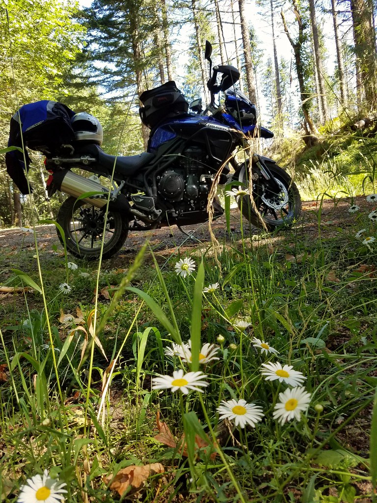
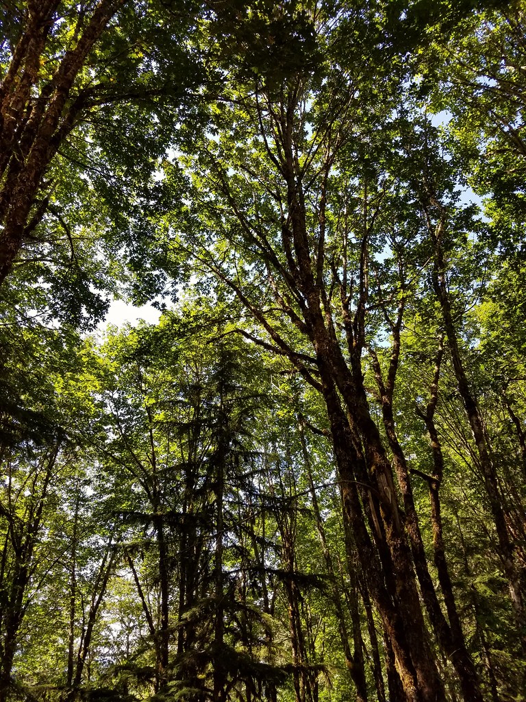
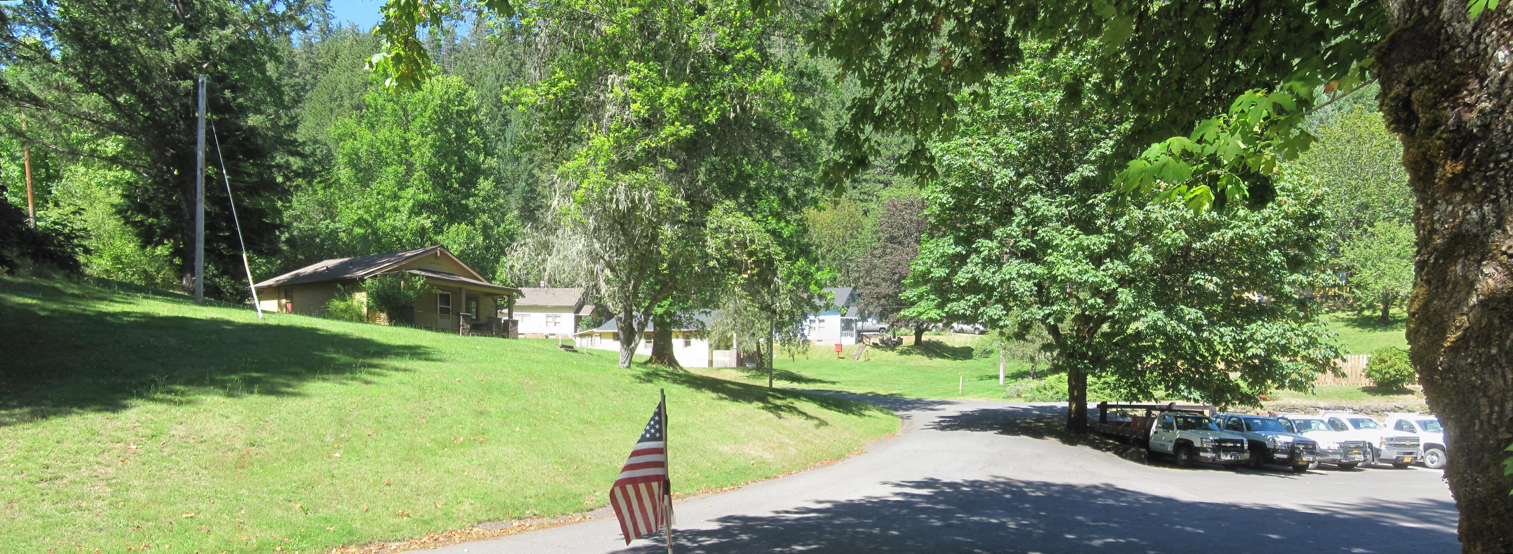
日出日落照片
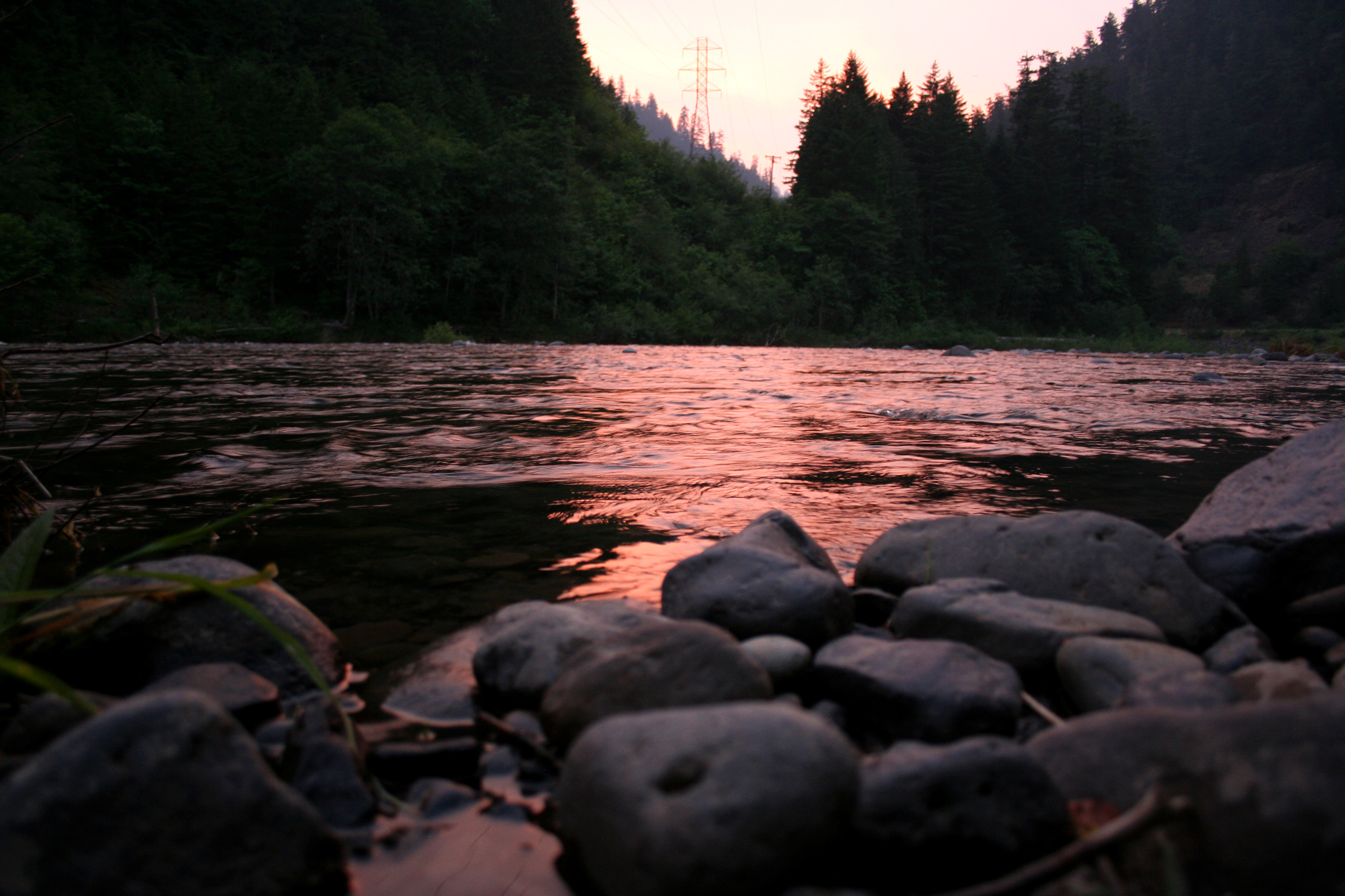
the river at sunset

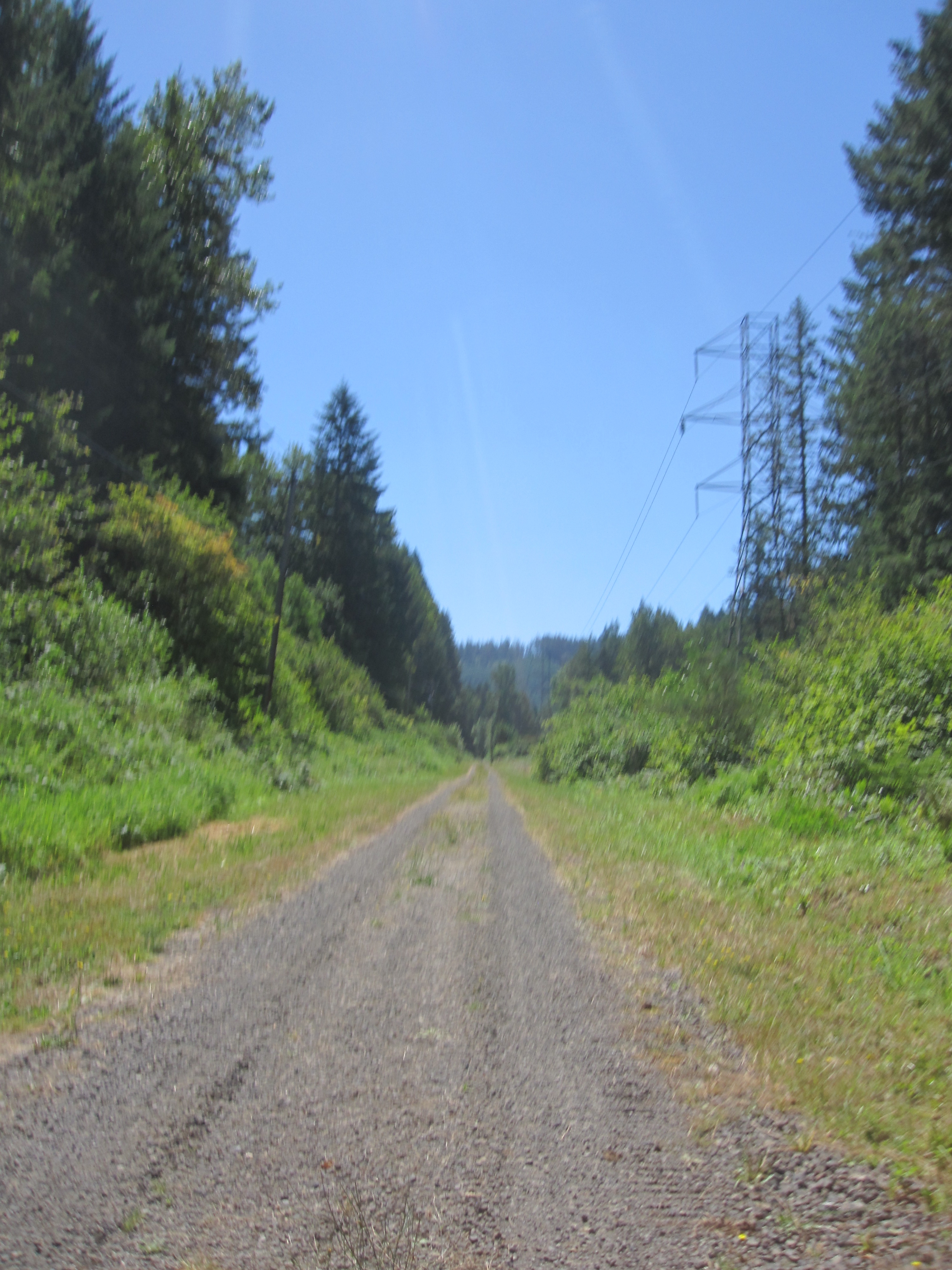
Clackamas River Trail

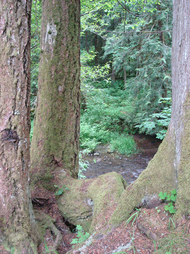
Thirty Seconds on Fish Creek
The Thinkin' Spot
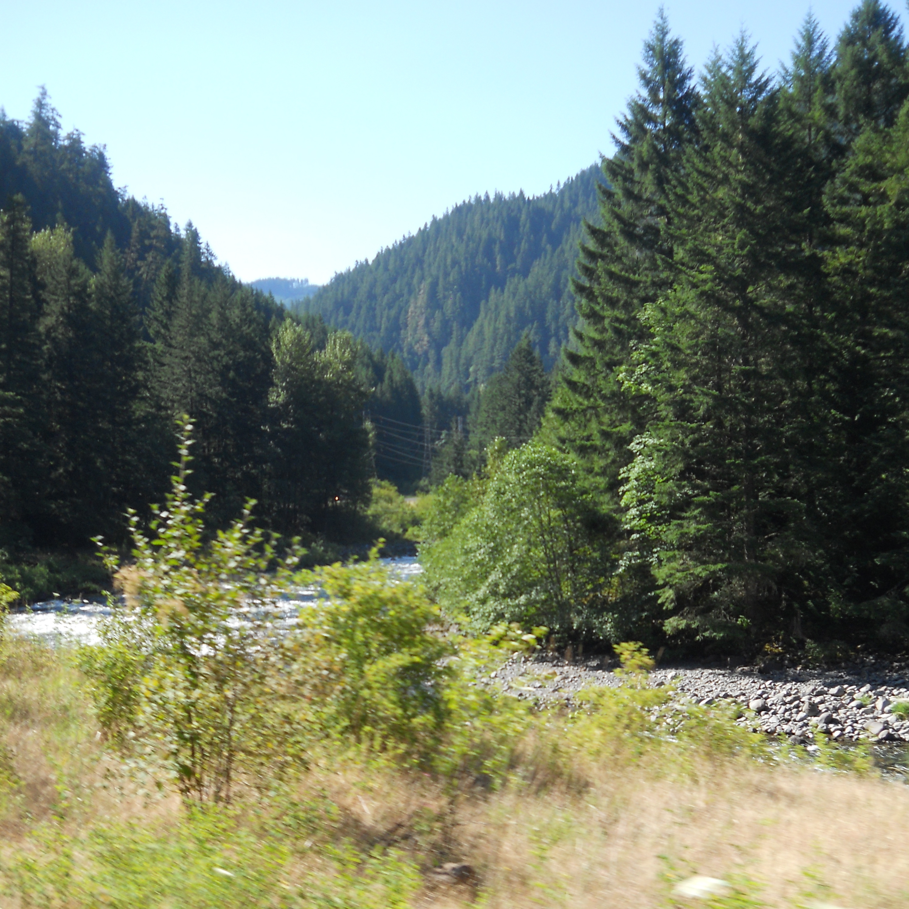
A scenic view along the Clackamas
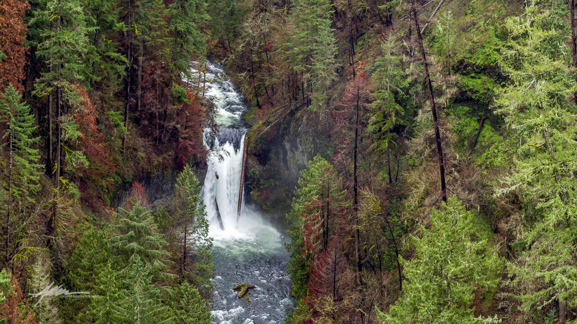
Clackamas South Fork Lower Falls

no need for words that you understand. speak into the woods. listen for the chirp. hunt down the neat. watch and learn from how we see the passing of the sun.
8.4.16.
8.4.16.
Three Lynx mini-panorama
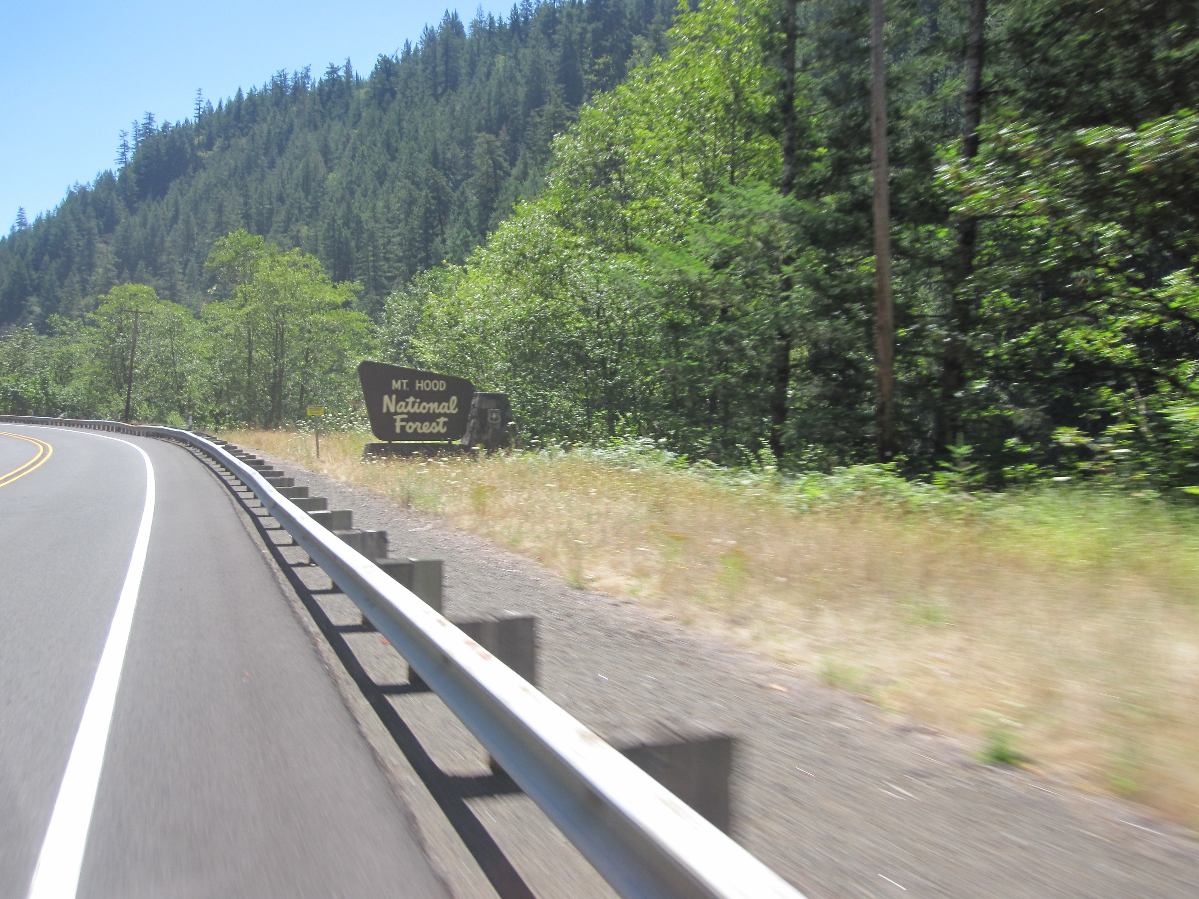
Back into the semi-wilderness
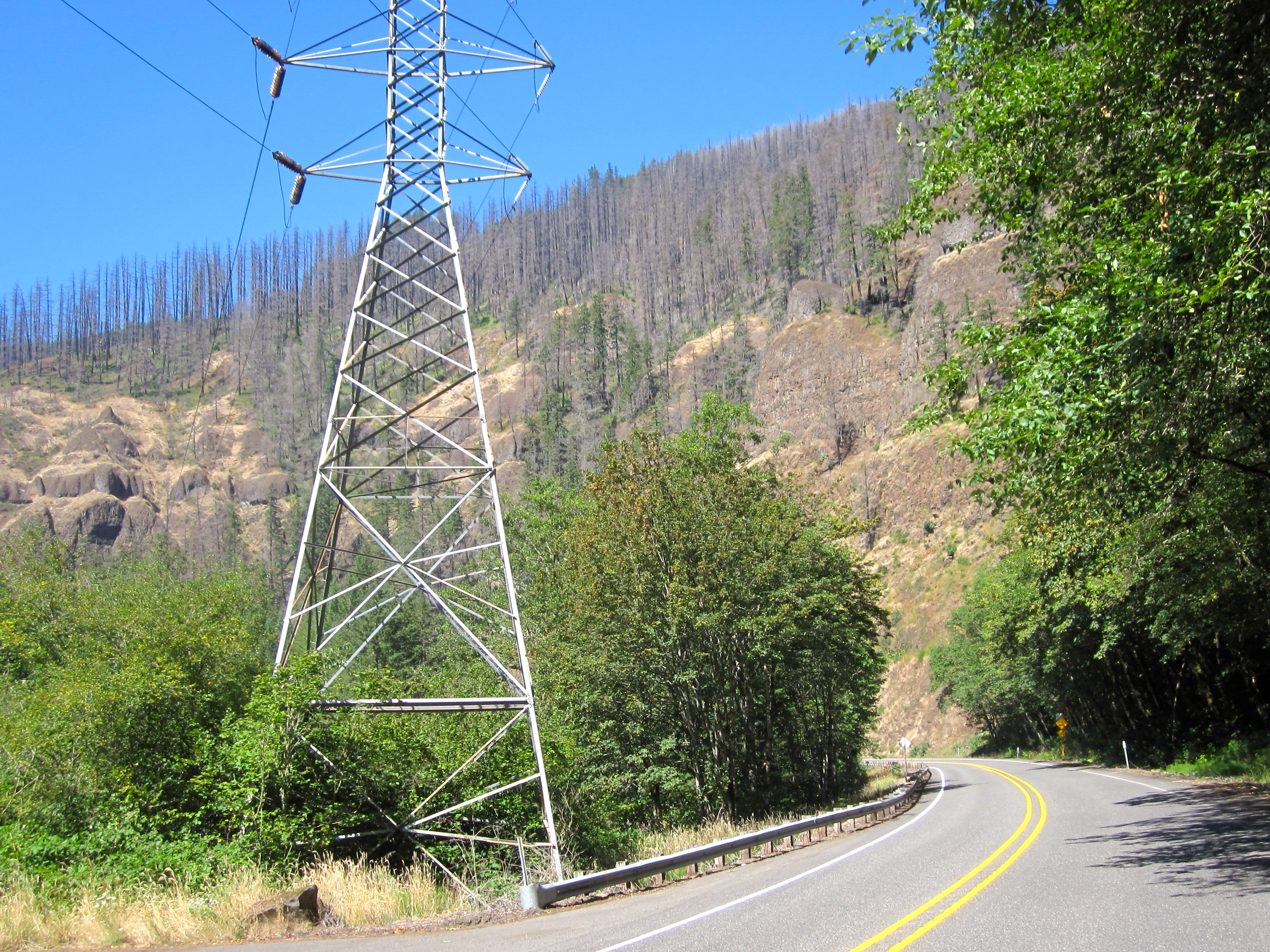
Riding along a chunk of the long-vanished Portland Traction line to the Oak Grove hydro project
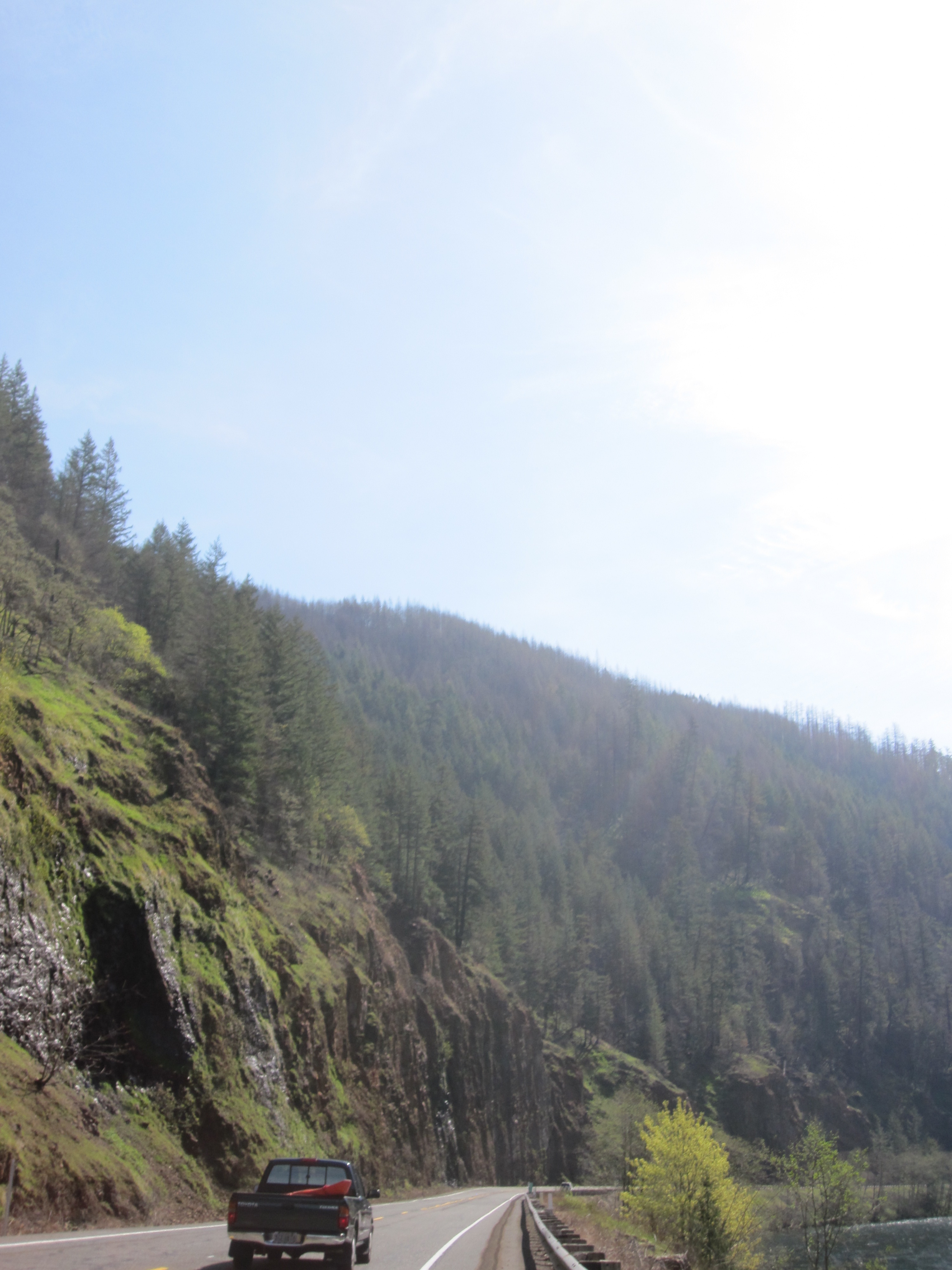
The rock formations are much more intricate than they appeared when they were covered with trees
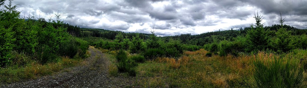
Oregon Tree Farm Panorama

Kevin L

Kevin rides ahead as we wind our way back to civilization
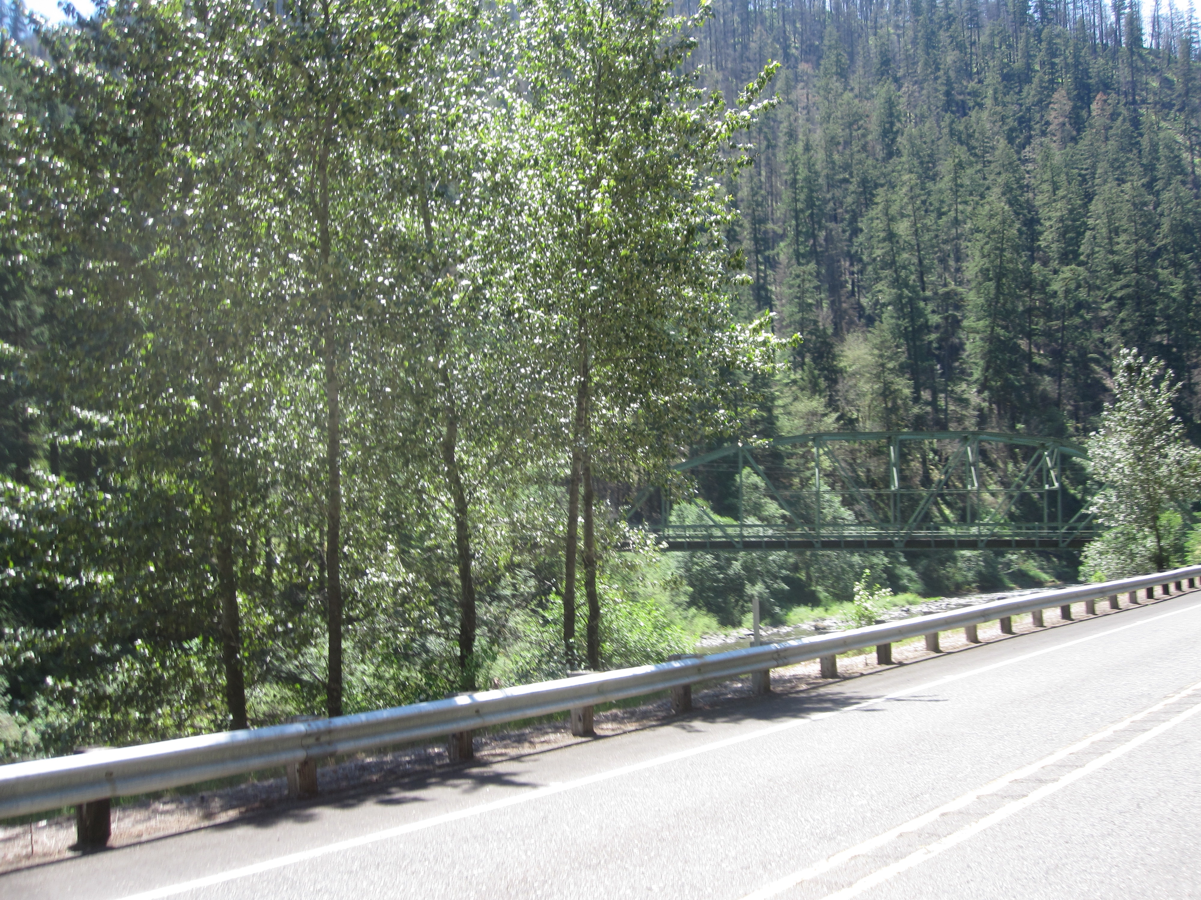
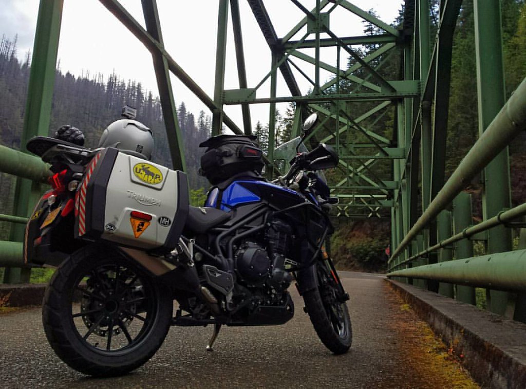
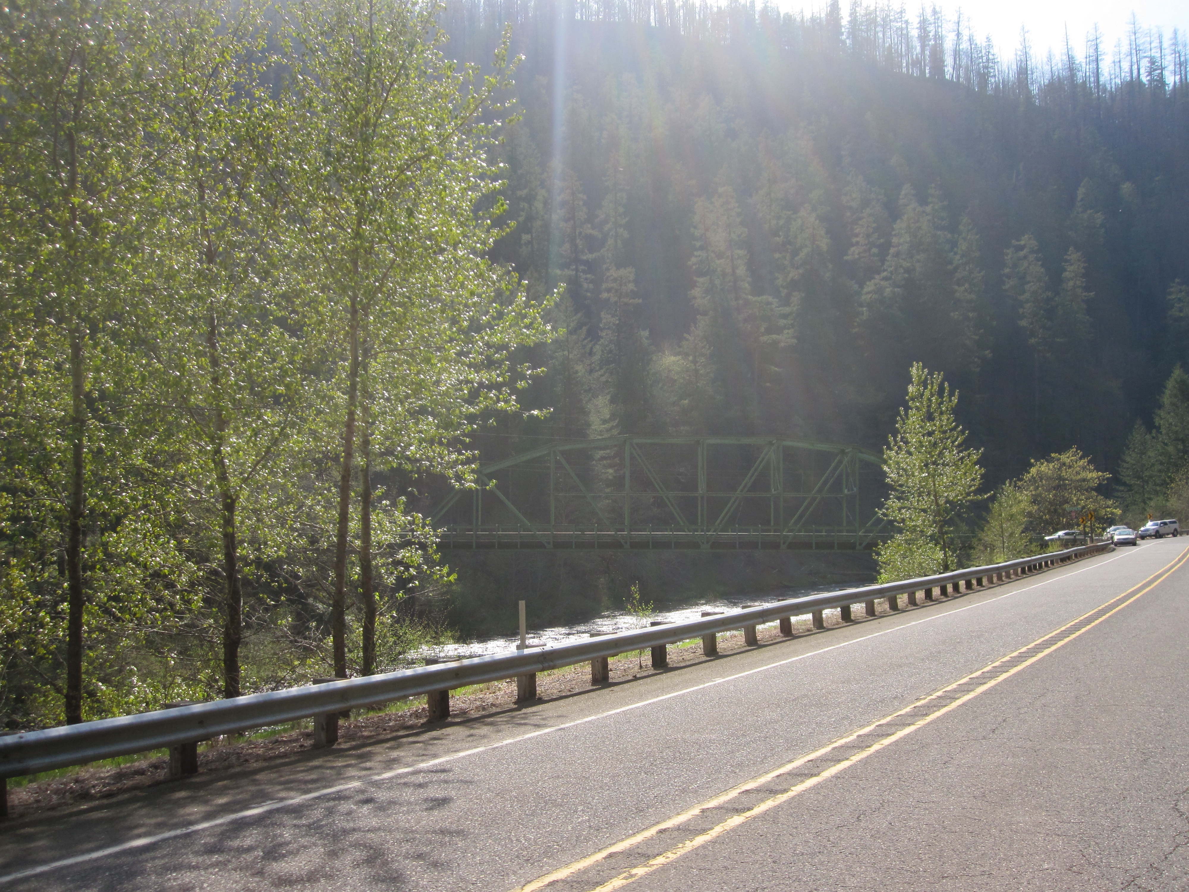
Stealth Memaloose bridge
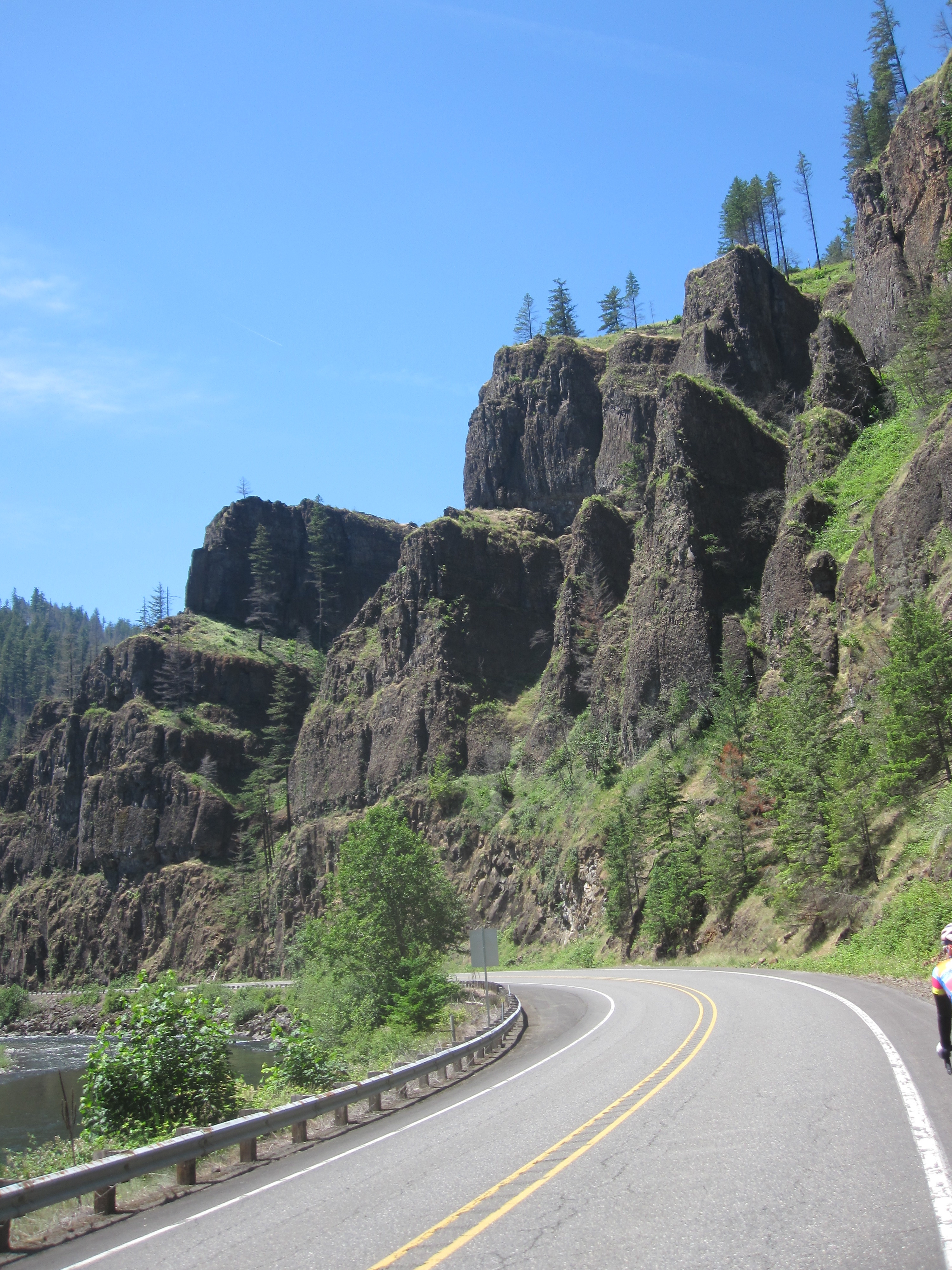
These cliffs look much more dramatic now that all those pesky trees have been burned away

5.24.16.
Closed, but my GPS didn't know that...

#wildiris #wildflowers #nature #oregon #iphoneography
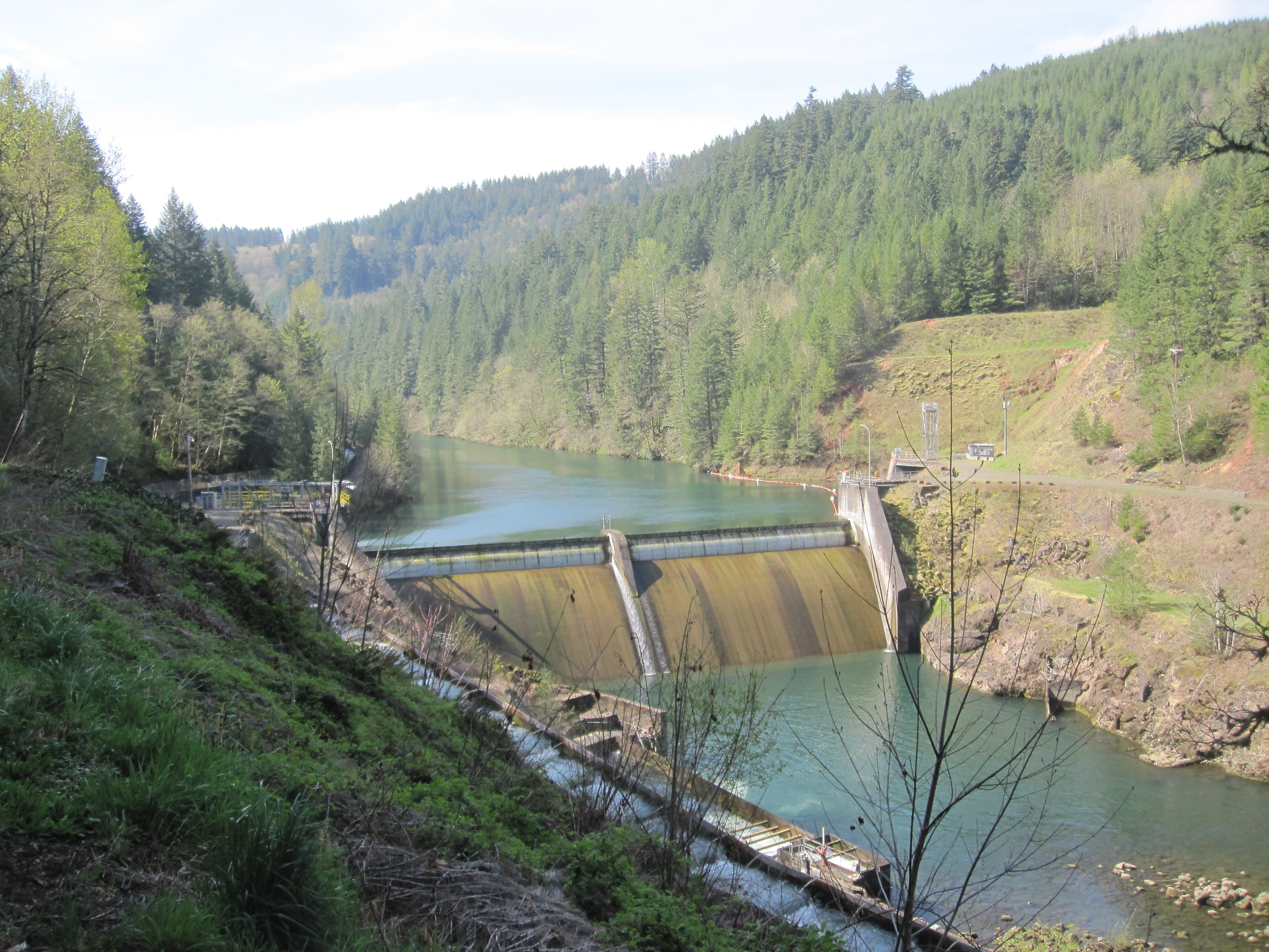
The water is low at Faraday Dam
The Memaloose bridge from the south
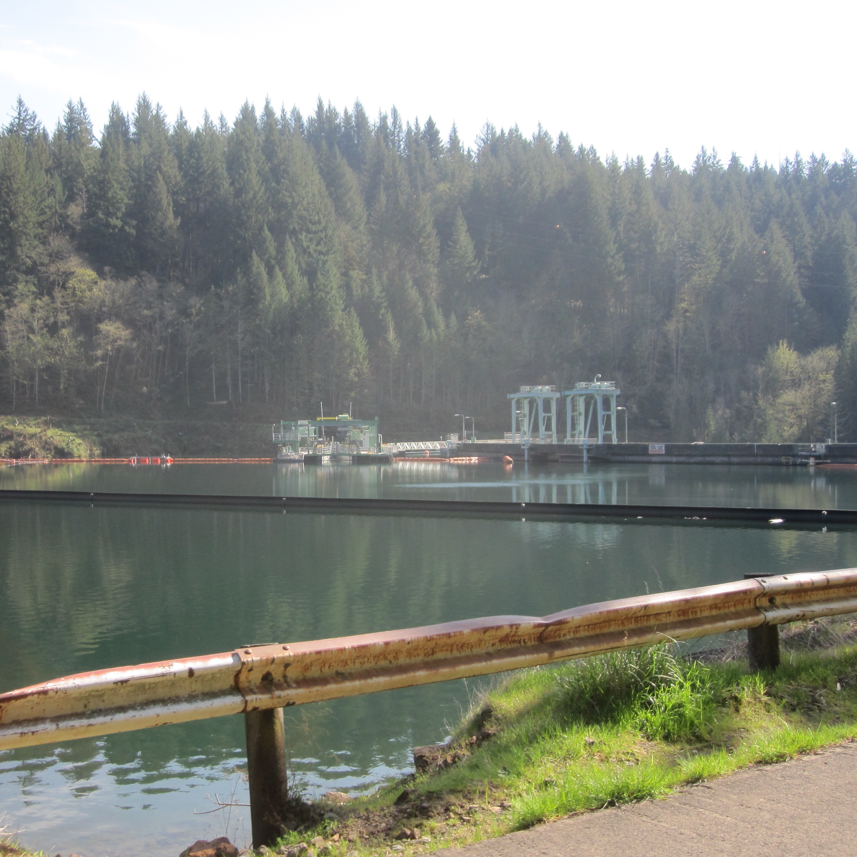
The new collection structure for the fish ladder at the North Fork reservoir
The south end of Faraday Road
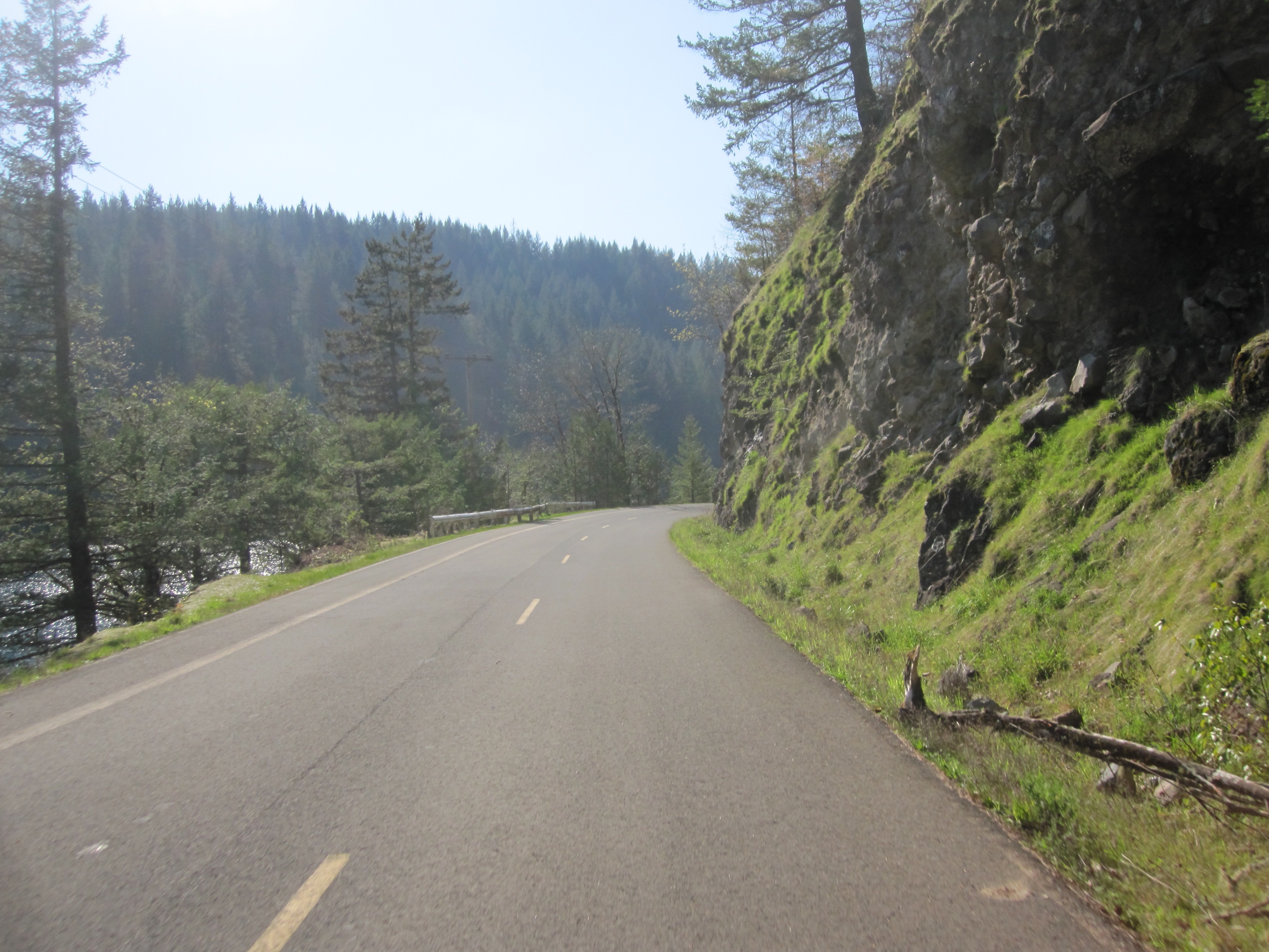
Winding my way (increasingly slowly) up the gorge
NF--, Estacada, OR 美國5way的地圖
搜索其他地方的日出日落時間
附近地點
NF--, Colton, OR 美國National Forest Development Road -
Goat Mountain, Oregon 美國
Elwood Rd, Colton, OR 美國Elwood Road
S Elwood Rd, Colton, OR 美國
S Skinner Rd, Estacada, OR 美國
SE Tumala Mountain Rd, Estacada, OR 美國
S Kinzy Rd, Estacada, OR 美國
SE Bowman Rd, Estacada, OR 美國Southeast Bowman Road
SE Surface Rd, Estacada, OR 美國
SE Buzz Rd, Estacada, OR 美國Southeast Buzz Road
OR-, Estacada, OR 美國
SE Moss Hill Rd, Estacada, OR 美國
SE George Rd, Estacada, OR 美國
SE Coupland Rd, Estacada, OR 美國
SE Oak View Ln, Estacada, OR 美國
Southeast 1st Avenue, Estacada, OR 美國
S Poplar Rd, Estacada, OR 美國South Poplar Road
S Poplar Rd, Estacada, OR 美國
NE Ginseng Dr, Estacada, OR 美國
Estacada, OR 美國
最近搜索
- Presidente Quintana & Emilio Mitre, Carlos Keen, Provincia de Buenos Aires, 阿根廷的日出日落時間表
- Deep Gap Farm Rd E, Mill Spring, NC 美國的日出日落時間表
- 中國廣東省佛山市南海區九江鎮的日出日落時間表
- 美國加利福尼亞山景城的日出日落時間表
- Shuenhigashi, Shari, Shari District, Hokkaido -日本Road to the sky observatory的日出日落時間表
- 台灣高雄市鼓山區柴山大路31號海岸咖啡的日出日落時間表
- Estates Loop, Priest River, ID 美國的日出日落時間表
- Woodland Oak Pl, Thousand Oaks, CA 美國的日出日落時間表
- Sarangdanda 尼泊爾的日出日落時間表
- Nakanoshima, Shiogama, Miyagi -日本的日出日落時間表