5way, NF--, Estacada, OR, USA Sonnenaufgang Sonnenuntergang Zeiten
Location: USA > Oregon > Clackamas County > Estacada >
Zeitzone:
America/Los_Angeles
Ortszeit:
2024-05-16 12:48:14
Länge:
-122.2692263
Breite:
45.1470147
Sonnenaufgang Heute:
05:36:04 AM
Sonnenuntergang Heute:
08:34:58 PM
Tageslänge heute:
14h 58m 54s
Sonnenaufgang morgen:
05:35:03 AM
Sonnenuntergang Morgen:
08:36:04 PM
Tageslänge von morgen:
15h 1m 1s
Alle Termine anzeigen
| Datum | Sonnenaufgang | Sonnenuntergang | Tageslänge |
|---|---|---|---|
| 2024-01-01 | 07:47:45 AM | 04:38:09 PM | 8h 50m 24s |
| 2024-01-02 | 07:47:45 AM | 04:39:05 PM | 8h 51m 20s |
| 2024-01-03 | 07:47:41 AM | 04:40:04 PM | 8h 52m 23s |
| 2024-01-04 | 07:47:35 AM | 04:41:04 PM | 8h 53m 29s |
| 2024-01-05 | 07:47:26 AM | 04:42:06 PM | 8h 54m 40s |
| 2024-01-06 | 07:47:15 AM | 04:43:10 PM | 8h 55m 55s |
| 2024-01-07 | 07:47:01 AM | 04:44:15 PM | 8h 57m 14s |
| 2024-01-08 | 07:46:44 AM | 04:45:22 PM | 8h 58m 38s |
| 2024-01-09 | 07:46:25 AM | 04:46:30 PM | 9h 0m 5s |
| 2024-01-10 | 07:46:03 AM | 04:47:40 PM | 9h 1m 37s |
| 2024-01-11 | 07:45:39 AM | 04:48:51 PM | 9h 3m 12s |
| 2024-01-12 | 07:45:12 AM | 04:50:04 PM | 9h 4m 52s |
| 2024-01-13 | 07:44:42 AM | 04:51:18 PM | 9h 6m 36s |
| 2024-01-14 | 07:44:11 AM | 04:52:33 PM | 9h 8m 22s |
| 2024-01-15 | 07:43:36 AM | 04:53:49 PM | 9h 10m 13s |
| 2024-01-16 | 07:43:00 AM | 04:55:06 PM | 9h 12m 6s |
| 2024-01-17 | 07:42:21 AM | 04:56:24 PM | 9h 14m 3s |
| 2024-01-18 | 07:41:39 AM | 04:57:43 PM | 9h 16m 4s |
| 2024-01-19 | 07:40:56 AM | 04:59:03 PM | 9h 18m 7s |
| 2024-01-20 | 07:40:09 AM | 05:00:23 PM | 9h 20m 14s |
| 2024-01-21 | 07:39:21 AM | 05:01:45 PM | 9h 22m 24s |
| 2024-01-22 | 07:38:31 AM | 05:03:07 PM | 9h 24m 36s |
| 2024-01-23 | 07:37:38 AM | 05:04:29 PM | 9h 26m 51s |
| 2024-01-24 | 07:36:43 AM | 05:05:53 PM | 9h 29m 10s |
| 2024-01-25 | 07:35:46 AM | 05:07:17 PM | 9h 31m 31s |
| 2024-01-26 | 07:34:47 AM | 05:08:41 PM | 9h 33m 54s |
| 2024-01-27 | 07:33:46 AM | 05:10:06 PM | 9h 36m 20s |
| 2024-01-28 | 07:32:43 AM | 05:11:31 PM | 9h 38m 48s |
| 2024-01-29 | 07:31:38 AM | 05:12:56 PM | 9h 41m 18s |
| 2024-01-30 | 07:30:31 AM | 05:14:22 PM | 9h 43m 51s |
| 2024-01-31 | 07:29:22 AM | 05:15:48 PM | 9h 46m 26s |
| 2024-02-01 | 07:28:12 AM | 05:17:14 PM | 9h 49m 2s |
| 2024-02-02 | 07:26:59 AM | 05:18:40 PM | 9h 51m 41s |
| 2024-02-03 | 07:25:45 AM | 05:20:06 PM | 9h 54m 21s |
| 2024-02-04 | 07:24:29 AM | 05:21:33 PM | 9h 57m 4s |
| 2024-02-05 | 07:23:12 AM | 05:22:59 PM | 9h 59m 47s |
| 2024-02-06 | 07:21:52 AM | 05:24:26 PM | 10h 2m 34s |
| 2024-02-07 | 07:20:32 AM | 05:25:53 PM | 10h 5m 21s |
| 2024-02-08 | 07:19:09 AM | 05:27:19 PM | 10h 8m 10s |
| 2024-02-09 | 07:17:46 AM | 05:28:45 PM | 10h 10m 59s |
| 2024-02-10 | 07:16:20 AM | 05:30:12 PM | 10h 13m 52s |
| 2024-02-11 | 07:14:54 AM | 05:31:38 PM | 10h 16m 44s |
| 2024-02-12 | 07:13:26 AM | 05:33:04 PM | 10h 19m 38s |
| 2024-02-13 | 07:11:56 AM | 05:34:30 PM | 10h 22m 34s |
| 2024-02-14 | 07:10:26 AM | 05:35:56 PM | 10h 25m 30s |
| 2024-02-15 | 07:08:54 AM | 05:37:21 PM | 10h 28m 27s |
| 2024-02-16 | 07:07:21 AM | 05:38:47 PM | 10h 31m 26s |
| 2024-02-17 | 07:05:46 AM | 05:40:12 PM | 10h 34m 26s |
| 2024-02-18 | 07:04:11 AM | 05:41:37 PM | 10h 37m 26s |
| 2024-02-19 | 07:02:34 AM | 05:43:01 PM | 10h 40m 27s |
| 2024-02-20 | 07:00:57 AM | 05:44:26 PM | 10h 43m 29s |
| 2024-02-21 | 06:59:18 AM | 05:45:50 PM | 10h 46m 32s |
| 2024-02-22 | 06:57:38 AM | 05:47:14 PM | 10h 49m 36s |
| 2024-02-23 | 06:55:58 AM | 05:48:37 PM | 10h 52m 39s |
| 2024-02-24 | 06:54:16 AM | 05:50:01 PM | 10h 55m 45s |
| 2024-02-25 | 06:52:34 AM | 05:51:24 PM | 10h 58m 50s |
| 2024-02-26 | 06:50:51 AM | 05:52:47 PM | 11h 1m 56s |
| 2024-02-27 | 06:49:07 AM | 05:54:09 PM | 11h 5m 2s |
| 2024-02-28 | 06:47:22 AM | 05:55:31 PM | 11h 8m 9s |
| 2024-02-29 | 06:45:37 AM | 05:56:53 PM | 11h 11m 16s |
| 2024-03-01 | 06:43:50 AM | 05:58:15 PM | 11h 14m 25s |
| 2024-03-02 | 06:42:03 AM | 05:59:36 PM | 11h 17m 33s |
| 2024-03-03 | 06:40:16 AM | 06:00:57 PM | 11h 20m 41s |
| 2024-03-04 | 06:38:28 AM | 06:02:18 PM | 11h 23m 50s |
| 2024-03-05 | 06:36:39 AM | 06:03:39 PM | 11h 27m 0s |
| 2024-03-06 | 06:34:50 AM | 06:04:59 PM | 11h 30m 9s |
| 2024-03-07 | 06:33:00 AM | 06:06:19 PM | 11h 33m 19s |
| 2024-03-08 | 06:31:10 AM | 06:07:39 PM | 11h 36m 29s |
| 2024-03-09 | 06:29:20 AM | 06:08:58 PM | 11h 39m 38s |
| 2024-03-10 | 07:27:33 AM | 07:10:14 PM | 11h 42m 41s |
| 2024-03-11 | 07:25:42 AM | 07:11:33 PM | 11h 45m 51s |
| 2024-03-12 | 07:23:50 AM | 07:12:52 PM | 11h 49m 2s |
| 2024-03-13 | 07:21:59 AM | 07:14:11 PM | 11h 52m 12s |
| 2024-03-14 | 07:20:06 AM | 07:15:29 PM | 11h 55m 23s |
| 2024-03-15 | 07:18:14 AM | 07:16:47 PM | 11h 58m 33s |
| 2024-03-16 | 07:16:21 AM | 07:18:06 PM | 12h 1m 45s |
| 2024-03-17 | 07:14:28 AM | 07:19:23 PM | 12h 4m 55s |
| 2024-03-18 | 07:12:35 AM | 07:20:41 PM | 12h 8m 6s |
| 2024-03-19 | 07:10:42 AM | 07:21:59 PM | 12h 11m 17s |
| 2024-03-20 | 07:08:49 AM | 07:23:16 PM | 12h 14m 27s |
| 2024-03-21 | 07:06:56 AM | 07:24:34 PM | 12h 17m 38s |
| 2024-03-22 | 07:05:03 AM | 07:25:51 PM | 12h 20m 48s |
| 2024-03-23 | 07:03:10 AM | 07:27:08 PM | 12h 23m 58s |
| 2024-03-24 | 07:01:16 AM | 07:28:25 PM | 12h 27m 9s |
| 2024-03-25 | 06:59:23 AM | 07:29:42 PM | 12h 30m 19s |
| 2024-03-26 | 06:57:30 AM | 07:30:58 PM | 12h 33m 28s |
| 2024-03-27 | 06:55:37 AM | 07:32:15 PM | 12h 36m 38s |
| 2024-03-28 | 06:53:45 AM | 07:33:32 PM | 12h 39m 47s |
| 2024-03-29 | 06:51:52 AM | 07:34:48 PM | 12h 42m 56s |
| 2024-03-30 | 06:50:00 AM | 07:36:05 PM | 12h 46m 5s |
| 2024-03-31 | 06:48:08 AM | 07:37:21 PM | 12h 49m 13s |
| 2024-04-01 | 06:46:16 AM | 07:38:38 PM | 12h 52m 22s |
| 2024-04-02 | 06:44:25 AM | 07:39:54 PM | 12h 55m 29s |
| 2024-04-03 | 06:42:34 AM | 07:41:11 PM | 12h 58m 37s |
| 2024-04-04 | 06:40:43 AM | 07:42:27 PM | 13h 1m 44s |
| 2024-04-05 | 06:38:53 AM | 07:43:43 PM | 13h 4m 50s |
| 2024-04-06 | 06:37:03 AM | 07:45:00 PM | 13h 7m 57s |
| 2024-04-07 | 06:35:14 AM | 07:46:16 PM | 13h 11m 2s |
| 2024-04-08 | 06:33:25 AM | 07:47:32 PM | 13h 14m 7s |
| 2024-04-09 | 06:31:37 AM | 07:48:48 PM | 13h 17m 11s |
| 2024-04-10 | 06:29:49 AM | 07:50:05 PM | 13h 20m 16s |
| 2024-04-11 | 06:28:02 AM | 07:51:21 PM | 13h 23m 19s |
| 2024-04-12 | 06:26:16 AM | 07:52:37 PM | 13h 26m 21s |
| 2024-04-13 | 06:24:30 AM | 07:53:54 PM | 13h 29m 24s |
| 2024-04-14 | 06:22:45 AM | 07:55:10 PM | 13h 32m 25s |
| 2024-04-15 | 06:21:01 AM | 07:56:26 PM | 13h 35m 25s |
| 2024-04-16 | 06:19:17 AM | 07:57:42 PM | 13h 38m 25s |
| 2024-04-17 | 06:17:34 AM | 07:58:59 PM | 13h 41m 25s |
| 2024-04-18 | 06:15:52 AM | 08:00:15 PM | 13h 44m 23s |
| 2024-04-19 | 06:14:11 AM | 08:01:31 PM | 13h 47m 20s |
| 2024-04-20 | 06:12:31 AM | 08:02:47 PM | 13h 50m 16s |
| 2024-04-21 | 06:10:52 AM | 08:04:03 PM | 13h 53m 11s |
| 2024-04-22 | 06:09:14 AM | 08:05:19 PM | 13h 56m 5s |
| 2024-04-23 | 06:07:37 AM | 08:06:35 PM | 13h 58m 58s |
| 2024-04-24 | 06:06:01 AM | 08:07:51 PM | 14h 1m 50s |
| 2024-04-25 | 06:04:26 AM | 08:09:07 PM | 14h 4m 41s |
| 2024-04-26 | 06:02:52 AM | 08:10:22 PM | 14h 7m 30s |
| 2024-04-27 | 06:01:19 AM | 08:11:38 PM | 14h 10m 19s |
| 2024-04-28 | 05:59:48 AM | 08:12:53 PM | 14h 13m 5s |
| 2024-04-29 | 05:58:18 AM | 08:14:08 PM | 14h 15m 50s |
| 2024-04-30 | 05:56:49 AM | 08:15:23 PM | 14h 18m 34s |
| 2024-05-01 | 05:55:21 AM | 08:16:38 PM | 14h 21m 17s |
| 2024-05-02 | 05:53:55 AM | 08:17:53 PM | 14h 23m 58s |
| 2024-05-03 | 05:52:30 AM | 08:19:07 PM | 14h 26m 37s |
| 2024-05-04 | 05:51:06 AM | 08:20:21 PM | 14h 29m 15s |
| 2024-05-05 | 05:49:44 AM | 08:21:34 PM | 14h 31m 50s |
| 2024-05-06 | 05:48:24 AM | 08:22:47 PM | 14h 34m 23s |
| 2024-05-07 | 05:47:05 AM | 08:24:00 PM | 14h 36m 55s |
| 2024-05-08 | 05:45:47 AM | 08:25:13 PM | 14h 39m 26s |
| 2024-05-09 | 05:44:31 AM | 08:26:25 PM | 14h 41m 54s |
| 2024-05-10 | 05:43:17 AM | 08:27:36 PM | 14h 44m 19s |
| 2024-05-11 | 05:42:04 AM | 08:28:47 PM | 14h 46m 43s |
| 2024-05-12 | 05:40:53 AM | 08:29:57 PM | 14h 49m 4s |
| 2024-05-13 | 05:39:44 AM | 08:31:07 PM | 14h 51m 23s |
| 2024-05-14 | 05:38:37 AM | 08:32:16 PM | 14h 53m 39s |
| 2024-05-15 | 05:37:31 AM | 08:33:25 PM | 14h 55m 54s |
| 2024-05-16 | 05:36:28 AM | 08:34:32 PM | 14h 58m 4s |
| 2024-05-17 | 05:35:26 AM | 08:35:39 PM | 15h 0m 13s |
| 2024-05-18 | 05:34:26 AM | 08:36:46 PM | 15h 2m 20s |
| 2024-05-19 | 05:33:28 AM | 08:37:51 PM | 15h 4m 23s |
| 2024-05-20 | 05:32:32 AM | 08:38:55 PM | 15h 6m 23s |
| 2024-05-21 | 05:31:38 AM | 08:39:59 PM | 15h 8m 21s |
| 2024-05-22 | 05:30:46 AM | 08:41:01 PM | 15h 10m 15s |
| 2024-05-23 | 05:29:56 AM | 08:42:02 PM | 15h 12m 6s |
| 2024-05-24 | 05:29:08 AM | 08:43:02 PM | 15h 13m 54s |
| 2024-05-25 | 05:28:23 AM | 08:44:01 PM | 15h 15m 38s |
| 2024-05-26 | 05:27:39 AM | 08:44:59 PM | 15h 17m 20s |
| 2024-05-27 | 05:26:58 AM | 08:45:56 PM | 15h 18m 58s |
| 2024-05-28 | 05:26:19 AM | 08:46:51 PM | 15h 20m 32s |
| 2024-05-29 | 05:25:42 AM | 08:47:45 PM | 15h 22m 3s |
| 2024-05-30 | 05:25:07 AM | 08:48:38 PM | 15h 23m 31s |
| 2024-05-31 | 05:24:35 AM | 08:49:29 PM | 15h 24m 54s |
| 2024-06-01 | 05:24:05 AM | 08:50:18 PM | 15h 26m 13s |
| 2024-06-02 | 05:23:37 AM | 08:51:06 PM | 15h 27m 29s |
| 2024-06-03 | 05:23:11 AM | 08:51:53 PM | 15h 28m 42s |
| 2024-06-04 | 05:22:48 AM | 08:52:37 PM | 15h 29m 49s |
| 2024-06-05 | 05:22:27 AM | 08:53:20 PM | 15h 30m 53s |
| 2024-06-06 | 05:22:08 AM | 08:54:01 PM | 15h 31m 53s |
| 2024-06-07 | 05:21:52 AM | 08:54:41 PM | 15h 32m 49s |
| 2024-06-08 | 05:21:38 AM | 08:55:18 PM | 15h 33m 40s |
| 2024-06-09 | 05:21:27 AM | 08:55:54 PM | 15h 34m 27s |
| 2024-06-10 | 05:21:17 AM | 08:56:28 PM | 15h 35m 11s |
| 2024-06-11 | 05:21:10 AM | 08:57:00 PM | 15h 35m 50s |
| 2024-06-12 | 05:21:06 AM | 08:57:30 PM | 15h 36m 24s |
| 2024-06-13 | 05:21:04 AM | 08:57:57 PM | 15h 36m 53s |
| 2024-06-14 | 05:21:04 AM | 08:58:23 PM | 15h 37m 19s |
| 2024-06-15 | 05:21:06 AM | 08:58:46 PM | 15h 37m 40s |
| 2024-06-16 | 05:21:11 AM | 08:59:08 PM | 15h 37m 57s |
| 2024-06-17 | 05:21:18 AM | 08:59:27 PM | 15h 38m 9s |
| 2024-06-18 | 05:21:27 AM | 08:59:44 PM | 15h 38m 17s |
| 2024-06-19 | 05:21:39 AM | 08:59:59 PM | 15h 38m 20s |
| 2024-06-20 | 05:21:52 AM | 09:00:11 PM | 15h 38m 19s |
| 2024-06-21 | 05:22:08 AM | 09:00:21 PM | 15h 38m 13s |
| 2024-06-22 | 05:22:26 AM | 09:00:29 PM | 15h 38m 3s |
| 2024-06-23 | 05:22:46 AM | 09:00:35 PM | 15h 37m 49s |
| 2024-06-24 | 05:23:08 AM | 09:00:38 PM | 15h 37m 30s |
| 2024-06-25 | 05:23:33 AM | 09:00:39 PM | 15h 37m 6s |
| 2024-06-26 | 05:23:59 AM | 09:00:37 PM | 15h 36m 38s |
| 2024-06-27 | 05:24:27 AM | 09:00:33 PM | 15h 36m 6s |
| 2024-06-28 | 05:24:58 AM | 09:00:27 PM | 15h 35m 29s |
| 2024-06-29 | 05:25:30 AM | 09:00:18 PM | 15h 34m 48s |
| 2024-06-30 | 05:26:04 AM | 09:00:07 PM | 15h 34m 3s |
| 2024-07-01 | 05:26:40 AM | 08:59:54 PM | 15h 33m 14s |
| 2024-07-02 | 05:27:18 AM | 08:59:38 PM | 15h 32m 20s |
| 2024-07-03 | 05:27:57 AM | 08:59:19 PM | 15h 31m 22s |
| 2024-07-04 | 05:28:38 AM | 08:58:59 PM | 15h 30m 21s |
| 2024-07-05 | 05:29:21 AM | 08:58:36 PM | 15h 29m 15s |
| 2024-07-06 | 05:30:05 AM | 08:58:11 PM | 15h 28m 6s |
| 2024-07-07 | 05:30:51 AM | 08:57:43 PM | 15h 26m 52s |
| 2024-07-08 | 05:31:39 AM | 08:57:13 PM | 15h 25m 34s |
| 2024-07-09 | 05:32:28 AM | 08:56:41 PM | 15h 24m 13s |
| 2024-07-10 | 05:33:18 AM | 08:56:06 PM | 15h 22m 48s |
| 2024-07-11 | 05:34:10 AM | 08:55:29 PM | 15h 21m 19s |
| 2024-07-12 | 05:35:02 AM | 08:54:50 PM | 15h 19m 48s |
| 2024-07-13 | 05:35:57 AM | 08:54:09 PM | 15h 18m 12s |
| 2024-07-14 | 05:36:52 AM | 08:53:25 PM | 15h 16m 33s |
| 2024-07-15 | 05:37:49 AM | 08:52:39 PM | 15h 14m 50s |
| 2024-07-16 | 05:38:46 AM | 08:51:52 PM | 15h 13m 6s |
| 2024-07-17 | 05:39:45 AM | 08:51:02 PM | 15h 11m 17s |
| 2024-07-18 | 05:40:45 AM | 08:50:09 PM | 15h 9m 24s |
| 2024-07-19 | 05:41:45 AM | 08:49:15 PM | 15h 7m 30s |
| 2024-07-20 | 05:42:47 AM | 08:48:19 PM | 15h 5m 32s |
| 2024-07-21 | 05:43:49 AM | 08:47:21 PM | 15h 3m 32s |
| 2024-07-22 | 05:44:52 AM | 08:46:21 PM | 15h 1m 29s |
| 2024-07-23 | 05:45:56 AM | 08:45:19 PM | 14h 59m 23s |
| 2024-07-24 | 05:47:01 AM | 08:44:14 PM | 14h 57m 13s |
| 2024-07-25 | 05:48:06 AM | 08:43:09 PM | 14h 55m 3s |
| 2024-07-26 | 05:49:12 AM | 08:42:01 PM | 14h 52m 49s |
| 2024-07-27 | 05:50:19 AM | 08:40:51 PM | 14h 50m 32s |
| 2024-07-28 | 05:51:26 AM | 08:39:40 PM | 14h 48m 14s |
| 2024-07-29 | 05:52:34 AM | 08:38:27 PM | 14h 45m 53s |
| 2024-07-30 | 05:53:42 AM | 08:37:12 PM | 14h 43m 30s |
| 2024-07-31 | 05:54:51 AM | 08:35:56 PM | 14h 41m 5s |
| 2024-08-01 | 05:56:00 AM | 08:34:38 PM | 14h 38m 38s |
| 2024-08-02 | 05:57:09 AM | 08:33:18 PM | 14h 36m 9s |
| 2024-08-03 | 05:58:19 AM | 08:31:57 PM | 14h 33m 38s |
| 2024-08-04 | 05:59:29 AM | 08:30:34 PM | 14h 31m 5s |
| 2024-08-05 | 06:00:39 AM | 08:29:10 PM | 14h 28m 31s |
| 2024-08-06 | 06:01:50 AM | 08:27:44 PM | 14h 25m 54s |
| 2024-08-07 | 06:03:01 AM | 08:26:17 PM | 14h 23m 16s |
| 2024-08-08 | 06:04:12 AM | 08:24:49 PM | 14h 20m 37s |
| 2024-08-09 | 06:05:23 AM | 08:23:19 PM | 14h 17m 56s |
| 2024-08-10 | 06:06:34 AM | 08:21:48 PM | 14h 15m 14s |
| 2024-08-11 | 06:07:46 AM | 08:20:16 PM | 14h 12m 30s |
| 2024-08-12 | 06:08:57 AM | 08:18:43 PM | 14h 9m 46s |
| 2024-08-13 | 06:10:09 AM | 08:17:08 PM | 14h 6m 59s |
| 2024-08-14 | 06:11:21 AM | 08:15:32 PM | 14h 4m 11s |
| 2024-08-15 | 06:12:33 AM | 08:13:55 PM | 14h 1m 22s |
| 2024-08-16 | 06:13:45 AM | 08:12:17 PM | 13h 58m 32s |
| 2024-08-17 | 06:14:56 AM | 08:10:38 PM | 13h 55m 42s |
| 2024-08-18 | 06:16:08 AM | 08:08:58 PM | 13h 52m 50s |
| 2024-08-19 | 06:17:20 AM | 08:07:17 PM | 13h 49m 57s |
| 2024-08-20 | 06:18:32 AM | 08:05:35 PM | 13h 47m 3s |
| 2024-08-21 | 06:19:44 AM | 08:03:52 PM | 13h 44m 8s |
| 2024-08-22 | 06:20:56 AM | 08:02:09 PM | 13h 41m 13s |
| 2024-08-23 | 06:22:08 AM | 08:00:24 PM | 13h 38m 16s |
| 2024-08-24 | 06:23:20 AM | 07:58:39 PM | 13h 35m 19s |
| 2024-08-25 | 06:24:32 AM | 07:56:53 PM | 13h 32m 21s |
| 2024-08-26 | 06:25:44 AM | 07:55:06 PM | 13h 29m 22s |
| 2024-08-27 | 06:26:56 AM | 07:53:18 PM | 13h 26m 22s |
| 2024-08-28 | 06:28:08 AM | 07:51:30 PM | 13h 23m 22s |
| 2024-08-29 | 06:29:20 AM | 07:49:41 PM | 13h 20m 21s |
| 2024-08-30 | 06:30:32 AM | 07:47:51 PM | 13h 17m 19s |
| 2024-08-31 | 06:31:44 AM | 07:46:01 PM | 13h 14m 17s |
| 2024-09-01 | 06:32:55 AM | 07:44:11 PM | 13h 11m 16s |
| 2024-09-02 | 06:34:07 AM | 07:42:20 PM | 13h 8m 13s |
| 2024-09-03 | 06:35:19 AM | 07:40:28 PM | 13h 5m 9s |
| 2024-09-04 | 06:36:31 AM | 07:38:36 PM | 13h 2m 5s |
| 2024-09-05 | 06:37:42 AM | 07:36:43 PM | 12h 59m 1s |
| 2024-09-06 | 06:38:54 AM | 07:34:51 PM | 12h 55m 57s |
| 2024-09-07 | 06:40:06 AM | 07:32:57 PM | 12h 52m 51s |
| 2024-09-08 | 06:41:17 AM | 07:31:04 PM | 12h 49m 47s |
| 2024-09-09 | 06:42:29 AM | 07:29:10 PM | 12h 46m 41s |
| 2024-09-10 | 06:43:41 AM | 07:27:16 PM | 12h 43m 35s |
| 2024-09-11 | 06:44:53 AM | 07:25:22 PM | 12h 40m 29s |
| 2024-09-12 | 06:46:05 AM | 07:23:27 PM | 12h 37m 22s |
| 2024-09-13 | 06:47:17 AM | 07:21:32 PM | 12h 34m 15s |
| 2024-09-14 | 06:48:29 AM | 07:19:38 PM | 12h 31m 9s |
| 2024-09-15 | 06:49:41 AM | 07:17:43 PM | 12h 28m 2s |
| 2024-09-16 | 06:50:53 AM | 07:15:48 PM | 12h 24m 55s |
| 2024-09-17 | 06:52:05 AM | 07:13:52 PM | 12h 21m 47s |
| 2024-09-18 | 06:53:17 AM | 07:11:57 PM | 12h 18m 40s |
| 2024-09-19 | 06:54:30 AM | 07:10:02 PM | 12h 15m 32s |
| 2024-09-20 | 06:55:42 AM | 07:08:07 PM | 12h 12m 25s |
| 2024-09-21 | 06:56:55 AM | 07:06:12 PM | 12h 9m 17s |
| 2024-09-22 | 06:58:08 AM | 07:04:17 PM | 12h 6m 9s |
| 2024-09-23 | 06:59:21 AM | 07:02:22 PM | 12h 3m 1s |
| 2024-09-24 | 07:00:34 AM | 07:00:28 PM | 11h 59m 54s |
| 2024-09-25 | 07:01:48 AM | 06:58:33 PM | 11h 56m 45s |
| 2024-09-26 | 07:03:01 AM | 06:56:39 PM | 11h 53m 38s |
| 2024-09-27 | 07:04:15 AM | 06:54:45 PM | 11h 50m 30s |
| 2024-09-28 | 07:05:29 AM | 06:52:52 PM | 11h 47m 23s |
| 2024-09-29 | 07:06:43 AM | 06:50:58 PM | 11h 44m 15s |
| 2024-09-30 | 07:07:58 AM | 06:49:05 PM | 11h 41m 7s |
| 2024-10-01 | 07:09:12 AM | 06:47:13 PM | 11h 38m 1s |
| 2024-10-02 | 07:10:27 AM | 06:45:20 PM | 11h 34m 53s |
| 2024-10-03 | 07:11:42 AM | 06:43:28 PM | 11h 31m 46s |
| 2024-10-04 | 07:12:58 AM | 06:41:37 PM | 11h 28m 39s |
| 2024-10-05 | 07:14:13 AM | 06:39:46 PM | 11h 25m 33s |
| 2024-10-06 | 07:15:29 AM | 06:37:56 PM | 11h 22m 27s |
| 2024-10-07 | 07:16:46 AM | 06:36:06 PM | 11h 19m 20s |
| 2024-10-08 | 07:18:02 AM | 06:34:17 PM | 11h 16m 15s |
| 2024-10-09 | 07:19:19 AM | 06:32:29 PM | 11h 13m 10s |
| 2024-10-10 | 07:20:36 AM | 06:30:41 PM | 11h 10m 5s |
| 2024-10-11 | 07:21:53 AM | 06:28:54 PM | 11h 7m 1s |
| 2024-10-12 | 07:23:11 AM | 06:27:07 PM | 11h 3m 56s |
| 2024-10-13 | 07:24:29 AM | 06:25:22 PM | 11h 0m 53s |
| 2024-10-14 | 07:25:48 AM | 06:23:37 PM | 10h 57m 49s |
| 2024-10-15 | 07:27:06 AM | 06:21:53 PM | 10h 54m 47s |
| 2024-10-16 | 07:28:25 AM | 06:20:10 PM | 10h 51m 45s |
| 2024-10-17 | 07:29:45 AM | 06:18:28 PM | 10h 48m 43s |
| 2024-10-18 | 07:31:04 AM | 06:16:47 PM | 10h 45m 43s |
| 2024-10-19 | 07:32:24 AM | 06:15:06 PM | 10h 42m 42s |
| 2024-10-20 | 07:33:44 AM | 06:13:27 PM | 10h 39m 43s |
| 2024-10-21 | 07:35:05 AM | 06:11:49 PM | 10h 36m 44s |
| 2024-10-22 | 07:36:25 AM | 06:10:12 PM | 10h 33m 47s |
| 2024-10-23 | 07:37:46 AM | 06:08:36 PM | 10h 30m 50s |
| 2024-10-24 | 07:39:08 AM | 06:07:01 PM | 10h 27m 53s |
| 2024-10-25 | 07:40:29 AM | 06:05:28 PM | 10h 24m 59s |
| 2024-10-26 | 07:41:51 AM | 06:03:55 PM | 10h 22m 4s |
| 2024-10-27 | 07:43:13 AM | 06:02:24 PM | 10h 19m 11s |
| 2024-10-28 | 07:44:35 AM | 06:00:55 PM | 10h 16m 20s |
| 2024-10-29 | 07:45:57 AM | 05:59:26 PM | 10h 13m 29s |
| 2024-10-30 | 07:47:20 AM | 05:58:00 PM | 10h 10m 40s |
| 2024-10-31 | 07:48:42 AM | 05:56:34 PM | 10h 7m 52s |
| 2024-11-01 | 07:50:05 AM | 05:55:10 PM | 10h 5m 5s |
| 2024-11-02 | 07:51:28 AM | 05:53:48 PM | 10h 2m 20s |
| 2024-11-03 | 06:52:54 AM | 04:52:24 PM | 9h 59m 30s |
| 2024-11-04 | 06:54:17 AM | 04:51:05 PM | 9h 56m 48s |
| 2024-11-05 | 06:55:40 AM | 04:49:47 PM | 9h 54m 7s |
| 2024-11-06 | 06:57:03 AM | 04:48:31 PM | 9h 51m 28s |
| 2024-11-07 | 06:58:26 AM | 04:47:17 PM | 9h 48m 51s |
| 2024-11-08 | 06:59:49 AM | 04:46:05 PM | 9h 46m 16s |
| 2024-11-09 | 07:01:11 AM | 04:44:55 PM | 9h 43m 44s |
| 2024-11-10 | 07:02:34 AM | 04:43:46 PM | 9h 41m 12s |
| 2024-11-11 | 07:03:56 AM | 04:42:40 PM | 9h 38m 44s |
| 2024-11-12 | 07:05:18 AM | 04:41:35 PM | 9h 36m 17s |
| 2024-11-13 | 07:06:40 AM | 04:40:32 PM | 9h 33m 52s |
| 2024-11-14 | 07:08:01 AM | 04:39:32 PM | 9h 31m 31s |
| 2024-11-15 | 07:09:22 AM | 04:38:33 PM | 9h 29m 11s |
| 2024-11-16 | 07:10:43 AM | 04:37:37 PM | 9h 26m 54s |
| 2024-11-17 | 07:12:03 AM | 04:36:42 PM | 9h 24m 39s |
| 2024-11-18 | 07:13:22 AM | 04:35:50 PM | 9h 22m 28s |
| 2024-11-19 | 07:14:41 AM | 04:35:00 PM | 9h 20m 19s |
| 2024-11-20 | 07:15:59 AM | 04:34:13 PM | 9h 18m 14s |
| 2024-11-21 | 07:17:17 AM | 04:33:27 PM | 9h 16m 10s |
| 2024-11-22 | 07:18:34 AM | 04:32:44 PM | 9h 14m 10s |
| 2024-11-23 | 07:19:49 AM | 04:32:04 PM | 9h 12m 15s |
| 2024-11-24 | 07:21:04 AM | 04:31:25 PM | 9h 10m 21s |
| 2024-11-25 | 07:22:19 AM | 04:30:50 PM | 9h 8m 31s |
| 2024-11-26 | 07:23:32 AM | 04:30:16 PM | 9h 6m 44s |
| 2024-11-27 | 07:24:44 AM | 04:29:46 PM | 9h 5m 2s |
| 2024-11-28 | 07:25:54 AM | 04:29:17 PM | 9h 3m 23s |
| 2024-11-29 | 07:27:04 AM | 04:28:52 PM | 9h 1m 48s |
| 2024-11-30 | 07:28:12 AM | 04:28:28 PM | 9h 0m 16s |
| 2024-12-01 | 07:29:19 AM | 04:28:08 PM | 8h 58m 49s |
| 2024-12-02 | 07:30:25 AM | 04:27:50 PM | 8h 57m 25s |
| 2024-12-03 | 07:31:29 AM | 04:27:34 PM | 8h 56m 5s |
| 2024-12-04 | 07:32:32 AM | 04:27:22 PM | 8h 54m 50s |
| 2024-12-05 | 07:33:33 AM | 04:27:12 PM | 8h 53m 39s |
| 2024-12-06 | 07:34:32 AM | 04:27:04 PM | 8h 52m 32s |
| 2024-12-07 | 07:35:30 AM | 04:26:59 PM | 8h 51m 29s |
| 2024-12-08 | 07:36:26 AM | 04:26:57 PM | 8h 50m 31s |
| 2024-12-09 | 07:37:20 AM | 04:26:58 PM | 8h 49m 38s |
| 2024-12-10 | 07:38:12 AM | 04:27:01 PM | 8h 48m 49s |
| 2024-12-11 | 07:39:02 AM | 04:27:07 PM | 8h 48m 5s |
| 2024-12-12 | 07:39:50 AM | 04:27:16 PM | 8h 47m 26s |
| 2024-12-13 | 07:40:36 AM | 04:27:27 PM | 8h 46m 51s |
| 2024-12-14 | 07:41:20 AM | 04:27:41 PM | 8h 46m 21s |
| 2024-12-15 | 07:42:02 AM | 04:27:57 PM | 8h 45m 55s |
| 2024-12-16 | 07:42:42 AM | 04:28:16 PM | 8h 45m 34s |
| 2024-12-17 | 07:43:19 AM | 04:28:38 PM | 8h 45m 19s |
| 2024-12-18 | 07:43:54 AM | 04:29:02 PM | 8h 45m 8s |
| 2024-12-19 | 07:44:27 AM | 04:29:29 PM | 8h 45m 2s |
| 2024-12-20 | 07:44:57 AM | 04:29:59 PM | 8h 45m 2s |
| 2024-12-21 | 07:45:25 AM | 04:30:30 PM | 8h 45m 5s |
| 2024-12-22 | 07:45:51 AM | 04:31:05 PM | 8h 45m 14s |
| 2024-12-23 | 07:46:14 AM | 04:31:41 PM | 8h 45m 27s |
| 2024-12-24 | 07:46:34 AM | 04:32:20 PM | 8h 45m 46s |
| 2024-12-25 | 07:46:52 AM | 04:33:01 PM | 8h 46m 9s |
| 2024-12-26 | 07:47:07 AM | 04:33:45 PM | 8h 46m 38s |
| 2024-12-27 | 07:47:20 AM | 04:34:31 PM | 8h 47m 11s |
| 2024-12-28 | 07:47:30 AM | 04:35:19 PM | 8h 47m 49s |
| 2024-12-29 | 07:47:38 AM | 04:36:09 PM | 8h 48m 31s |
| 2024-12-30 | 07:47:43 AM | 04:37:01 PM | 8h 49m 18s |
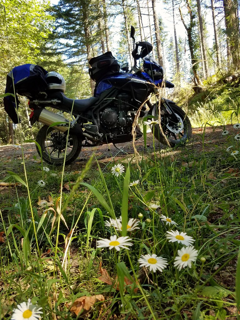
Fotos
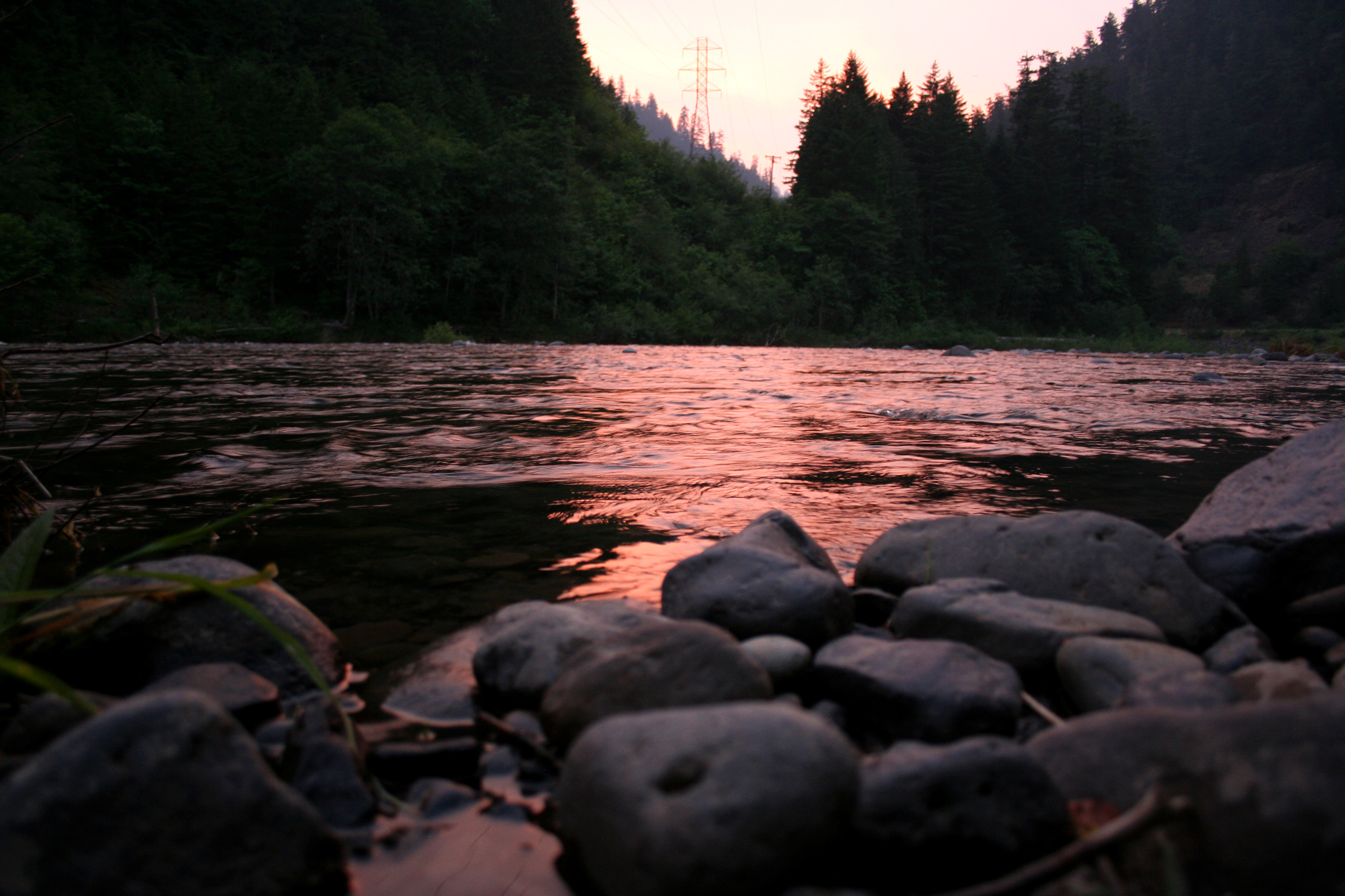
the river at sunset

Clackamas River Trail

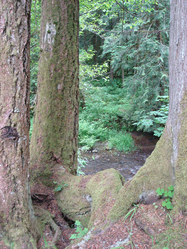
Thirty Seconds on Fish Creek
The Thinkin' Spot
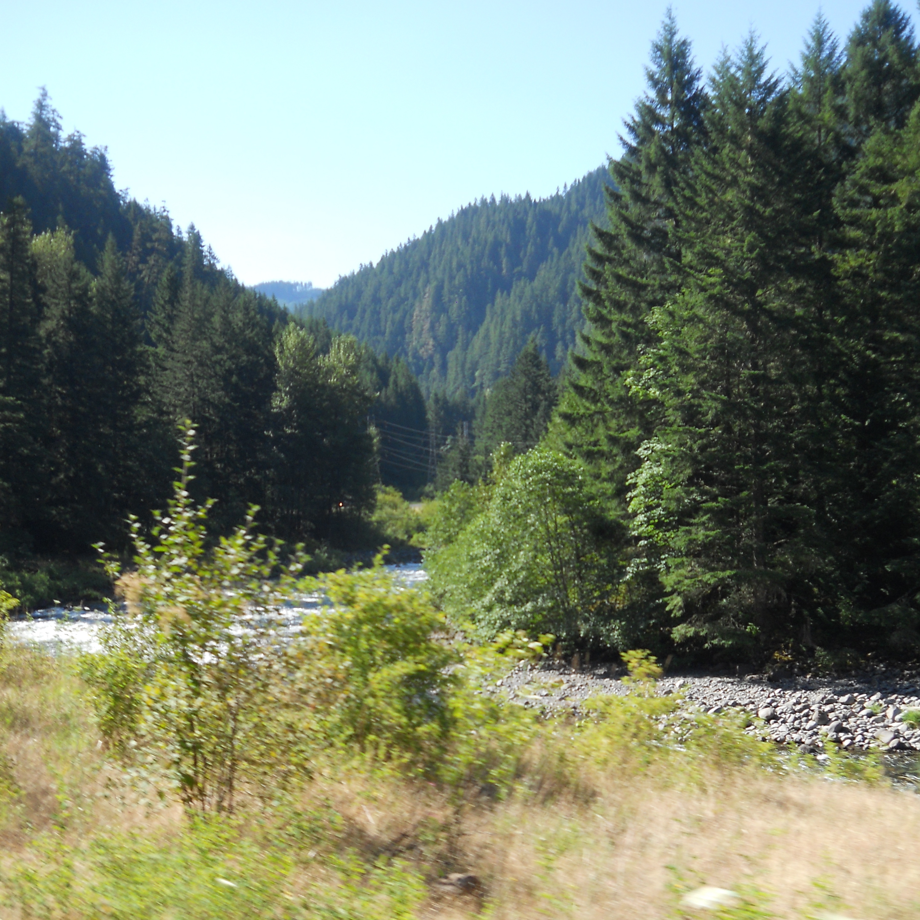
A scenic view along the Clackamas
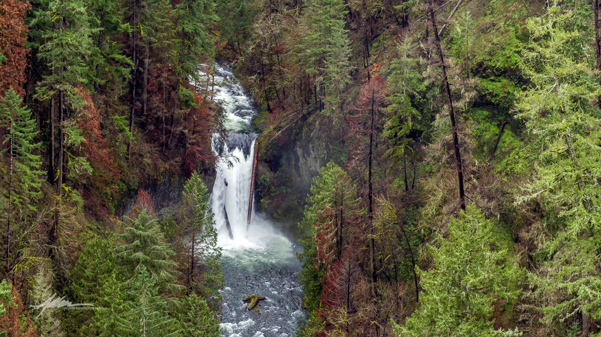
Clackamas South Fork Lower Falls

no need for words that you understand. speak into the woods. listen for the chirp. hunt down the neat. watch and learn from how we see the passing of the sun.
8.4.16.
8.4.16.
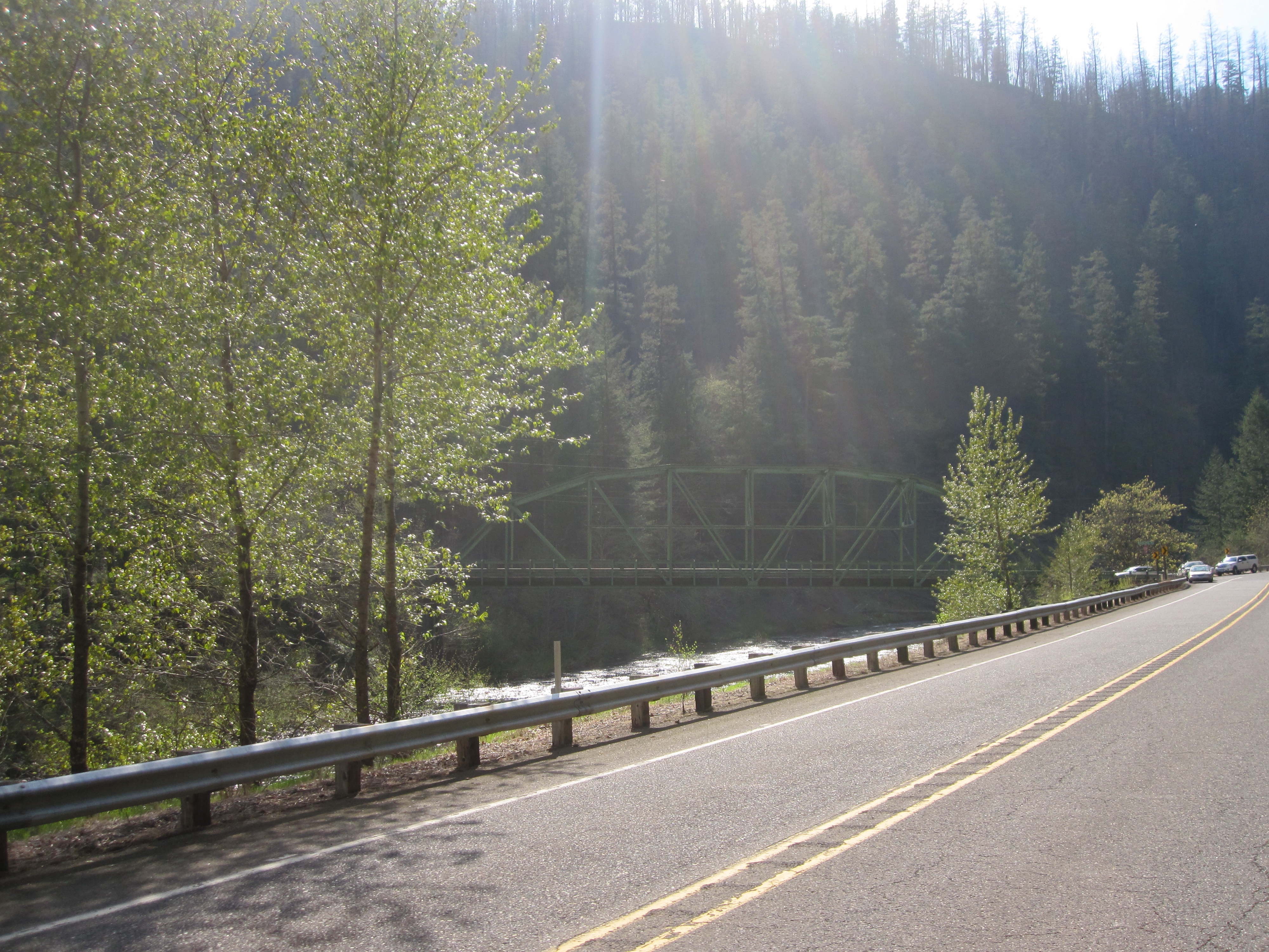
Three Lynx mini-panorama
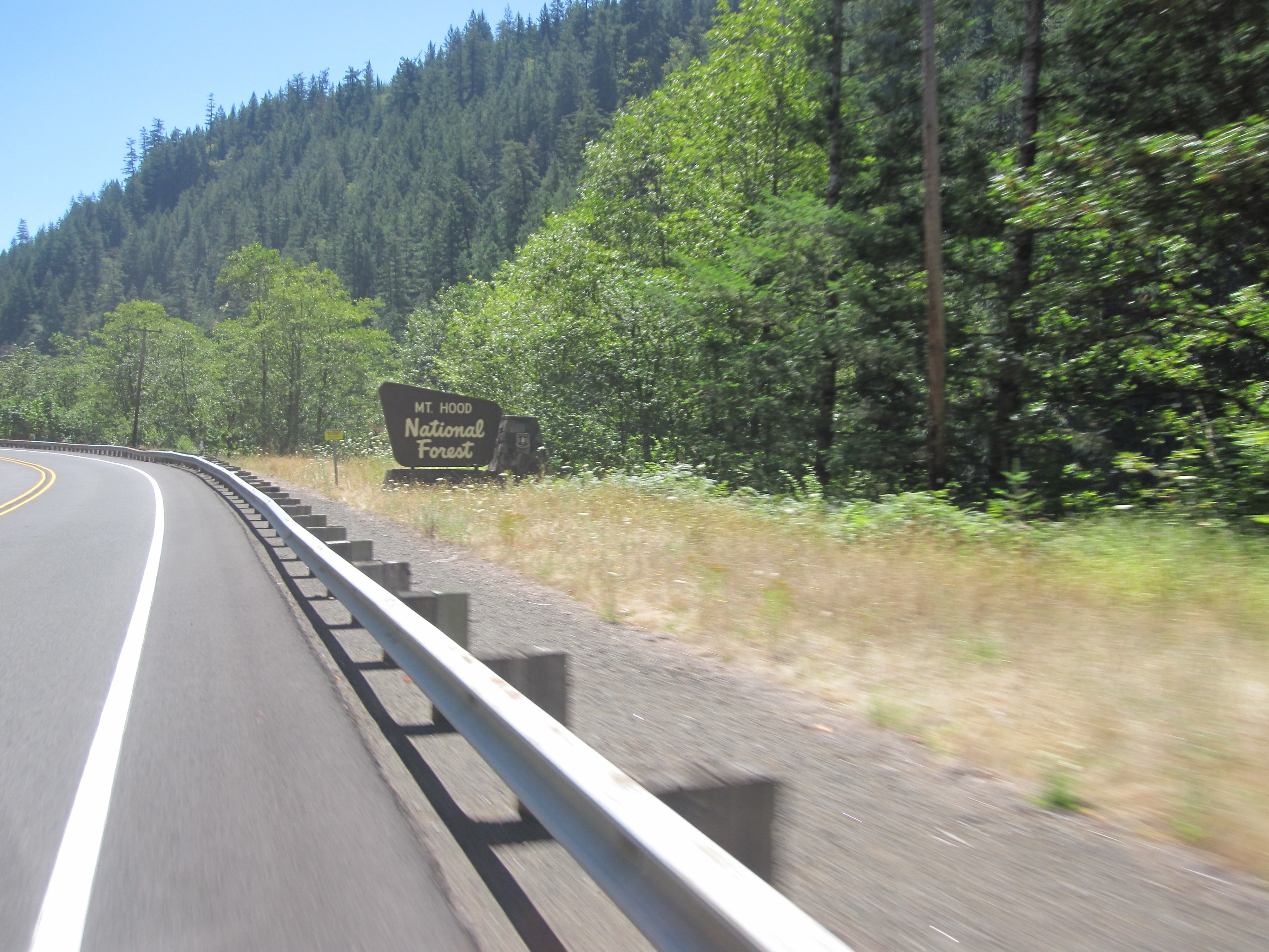
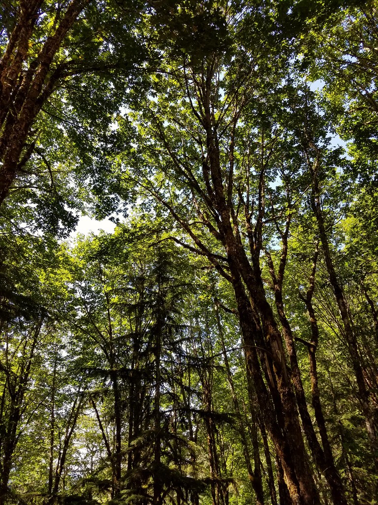
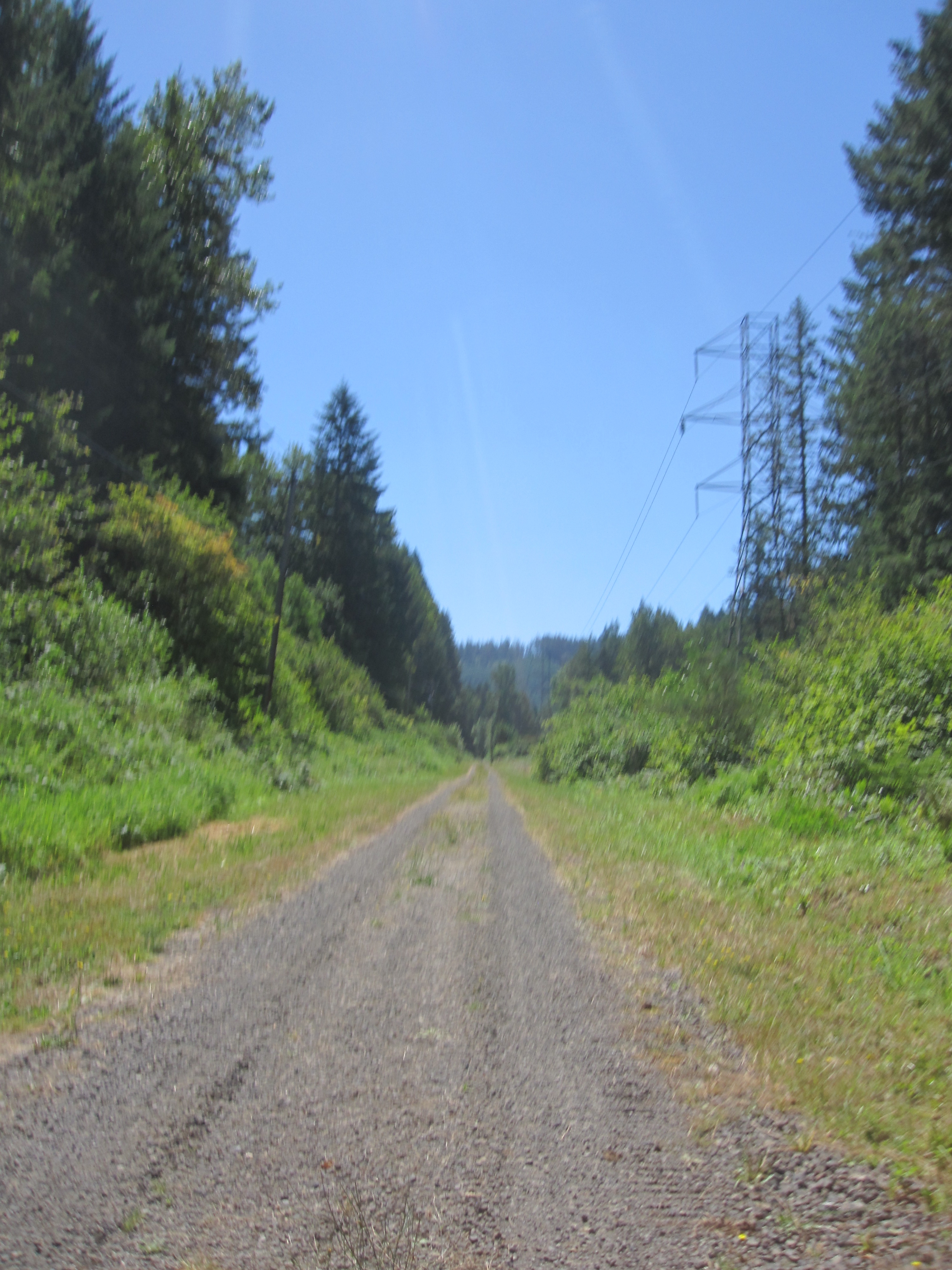
Back into the semi-wilderness
Riding along a chunk of the long-vanished Portland Traction line to the Oak Grove hydro project
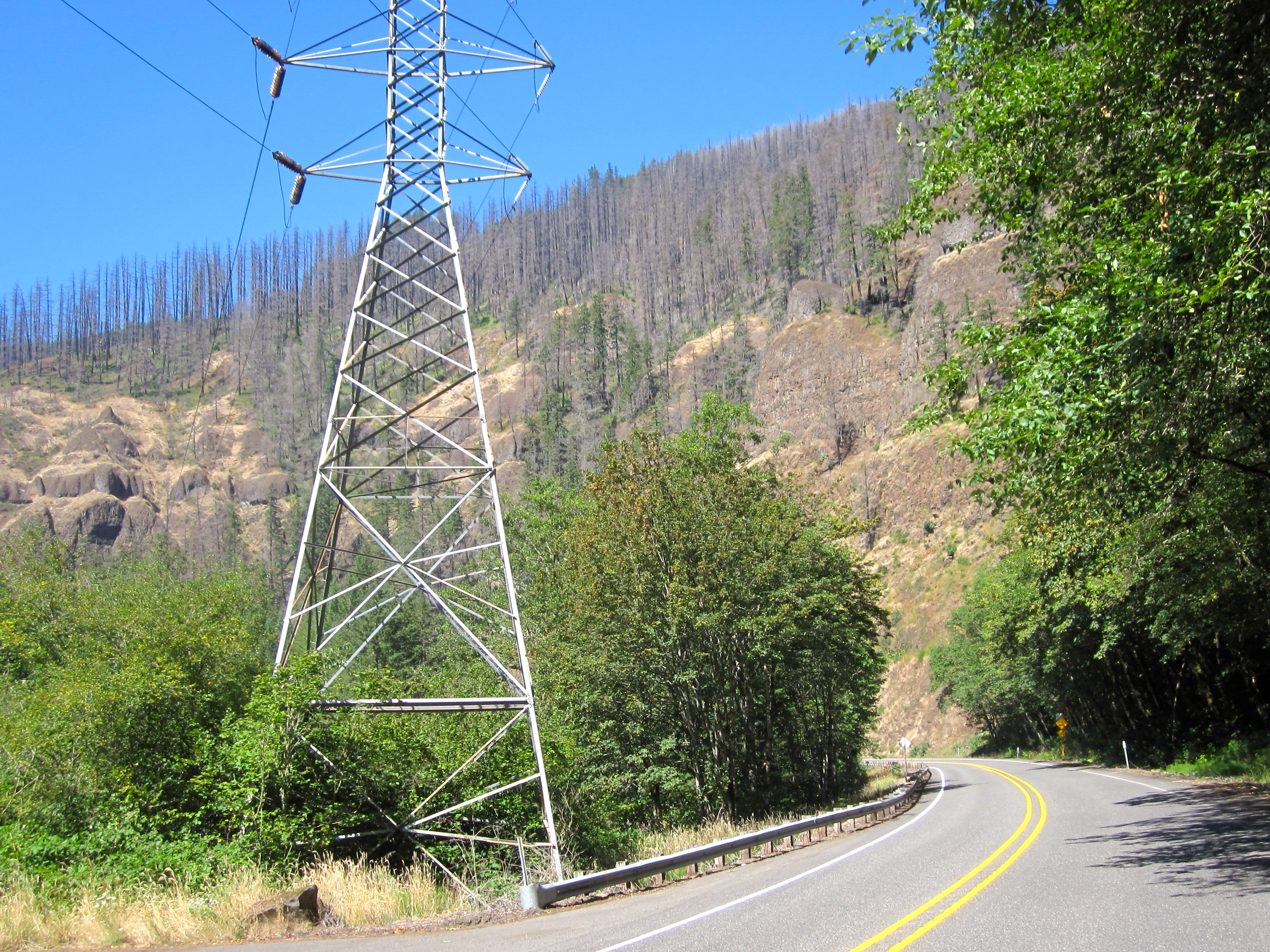
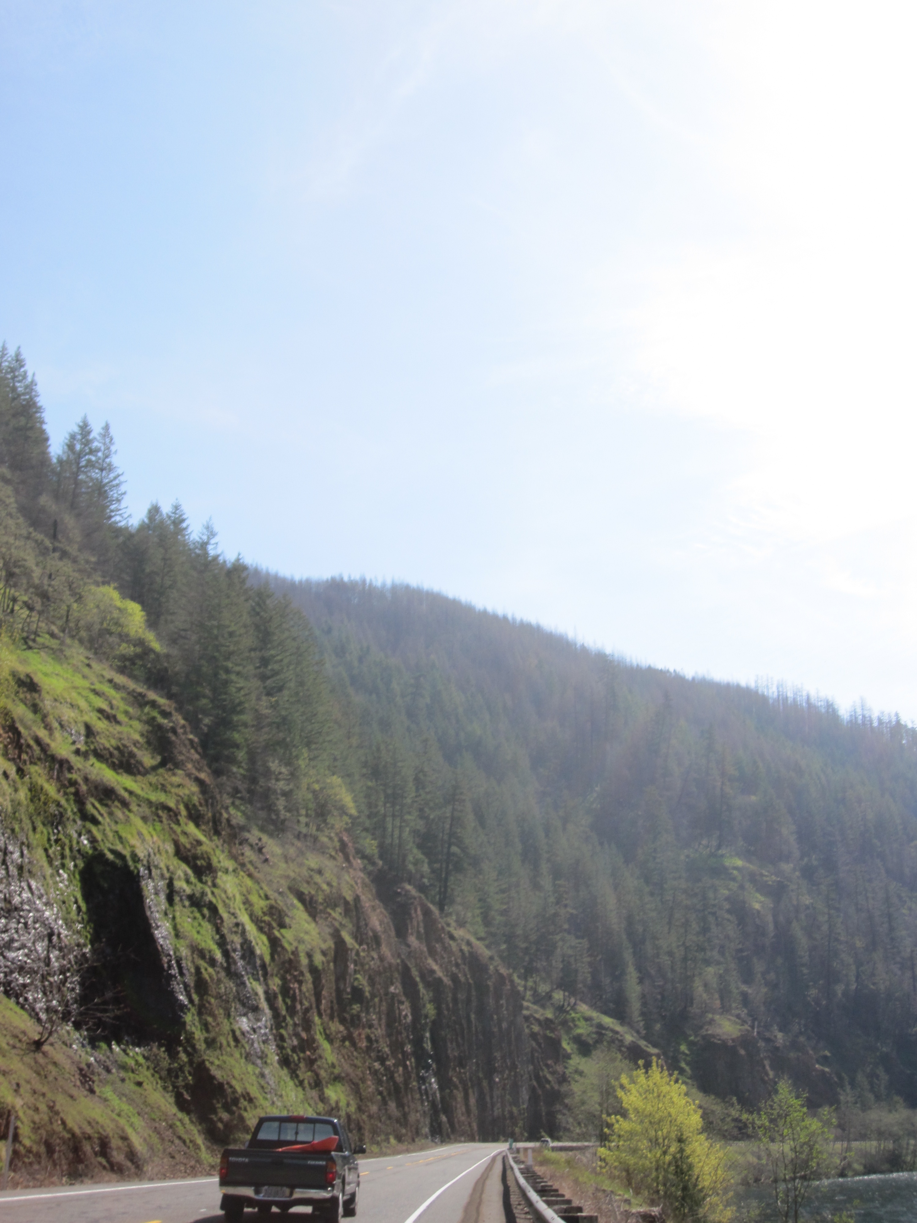
The rock formations are much more intricate than they appeared when they were covered with trees
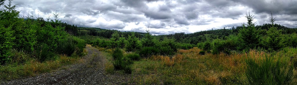
Oregon Tree Farm Panorama

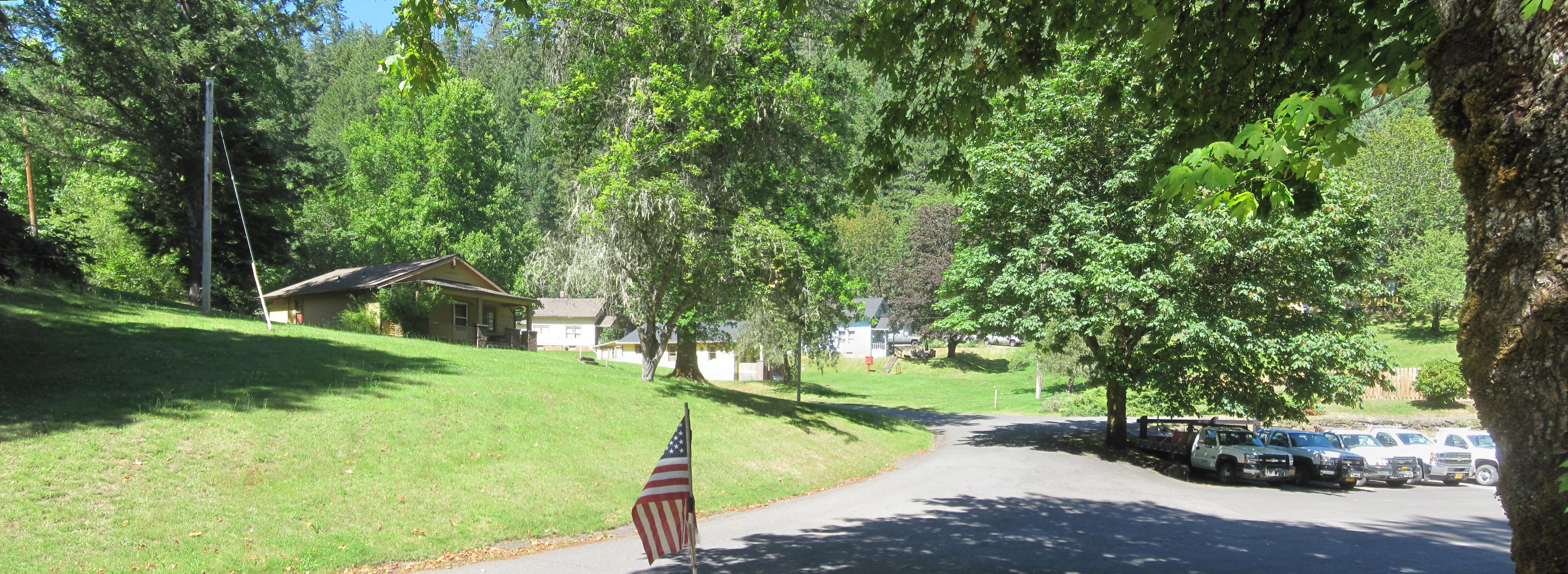
Kevin L

Kevin rides ahead as we wind our way back to civilization
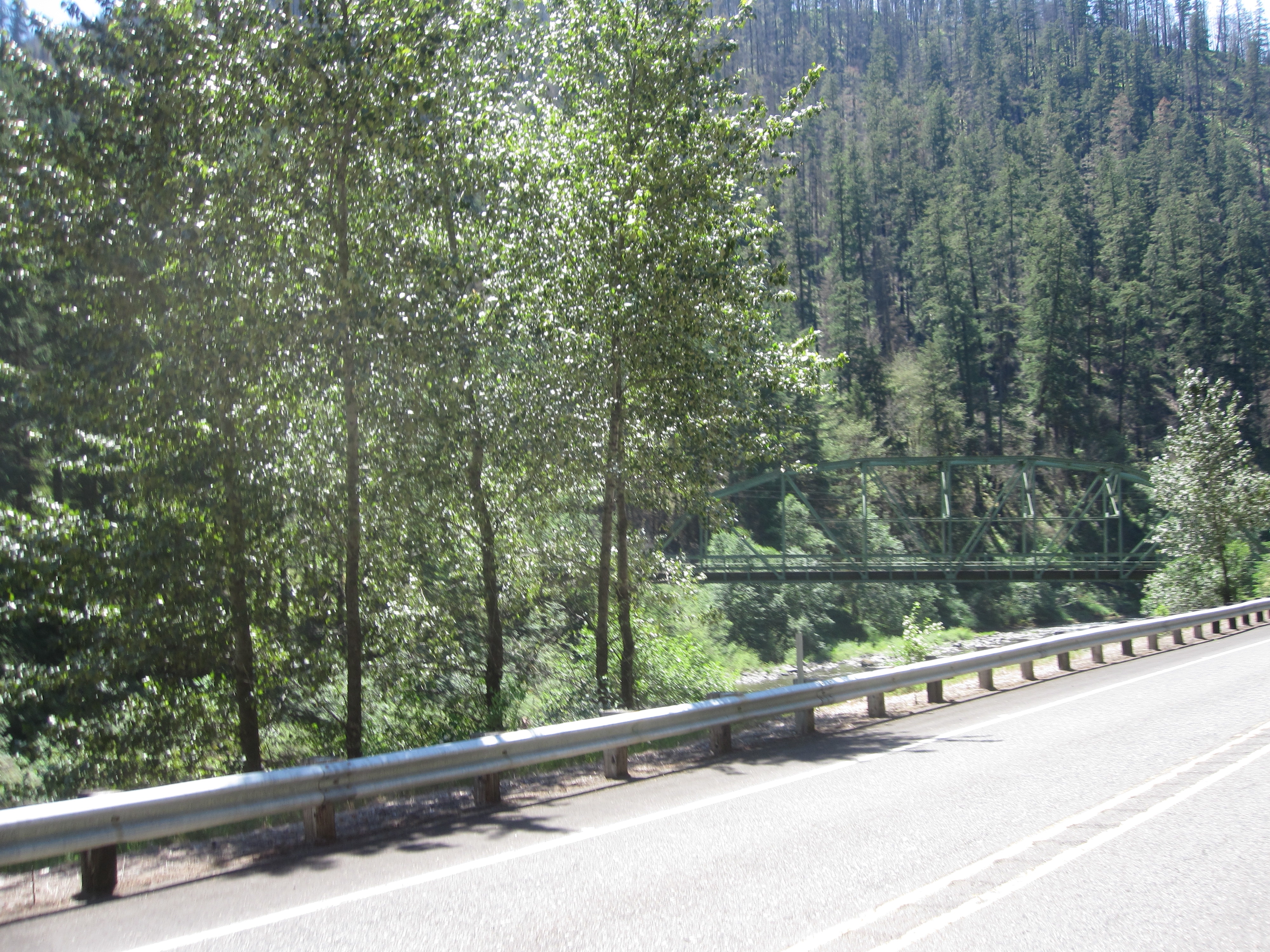
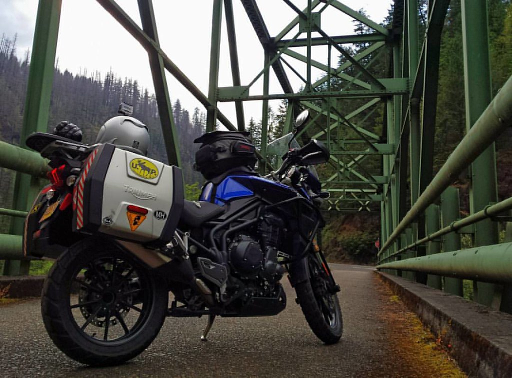
Stealth Memaloose bridge
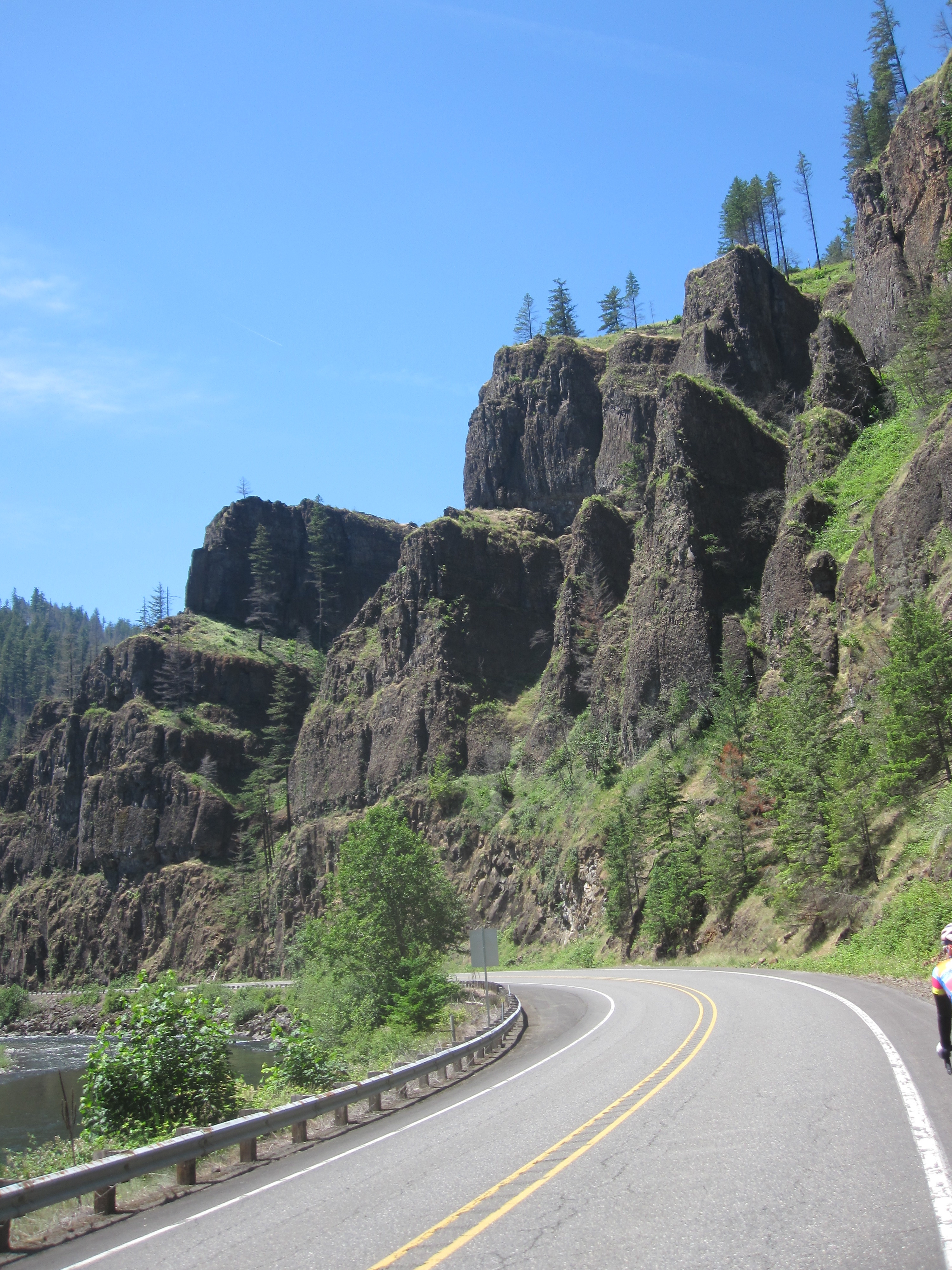
These cliffs look much more dramatic now that all those pesky trees have been burned away

5.24.16.
Closed, but my GPS didn't know that...

#wildiris #wildflowers #nature #oregon #iphoneography
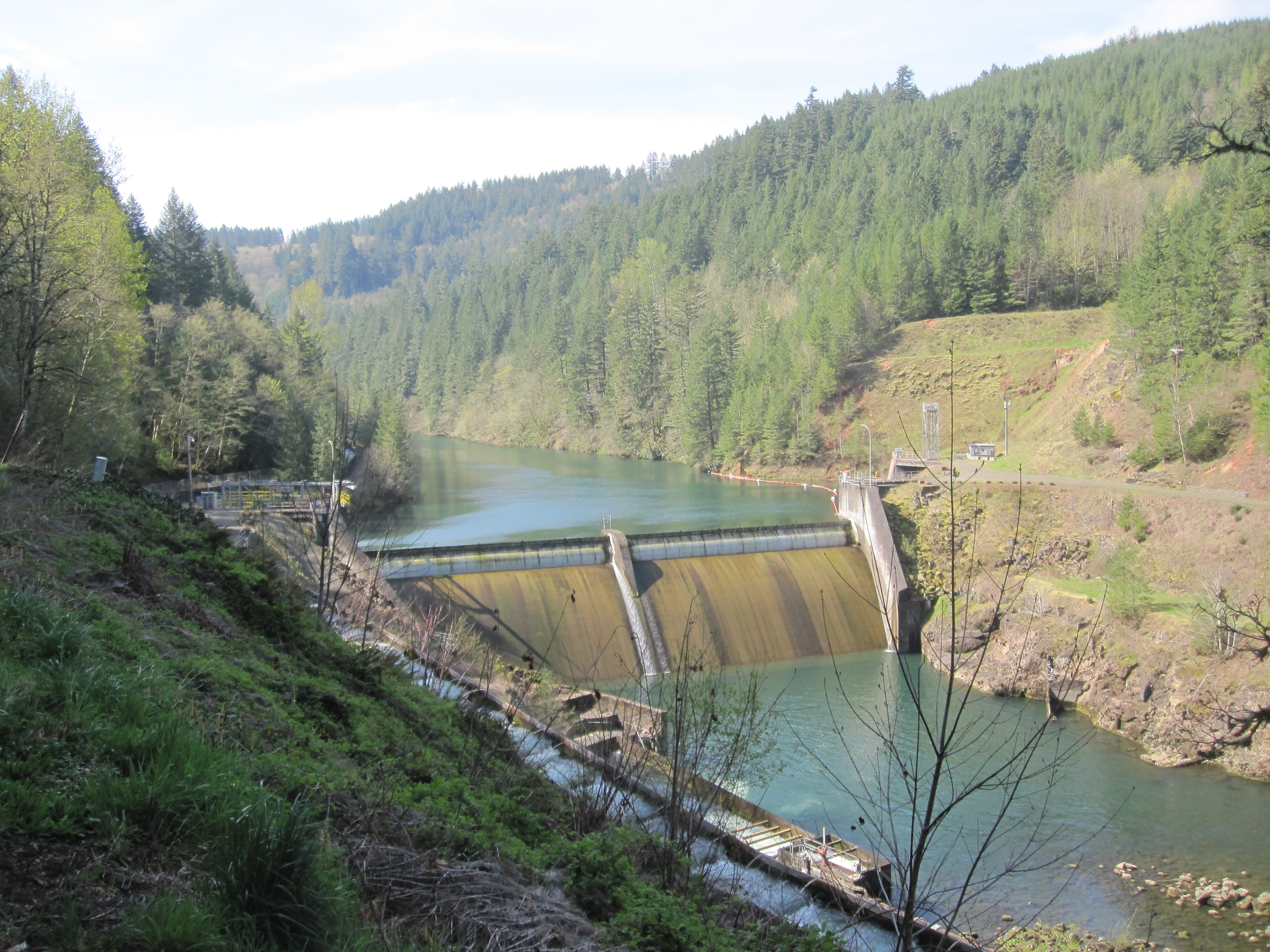
The water is low at Faraday Dam
The Memaloose bridge from the south
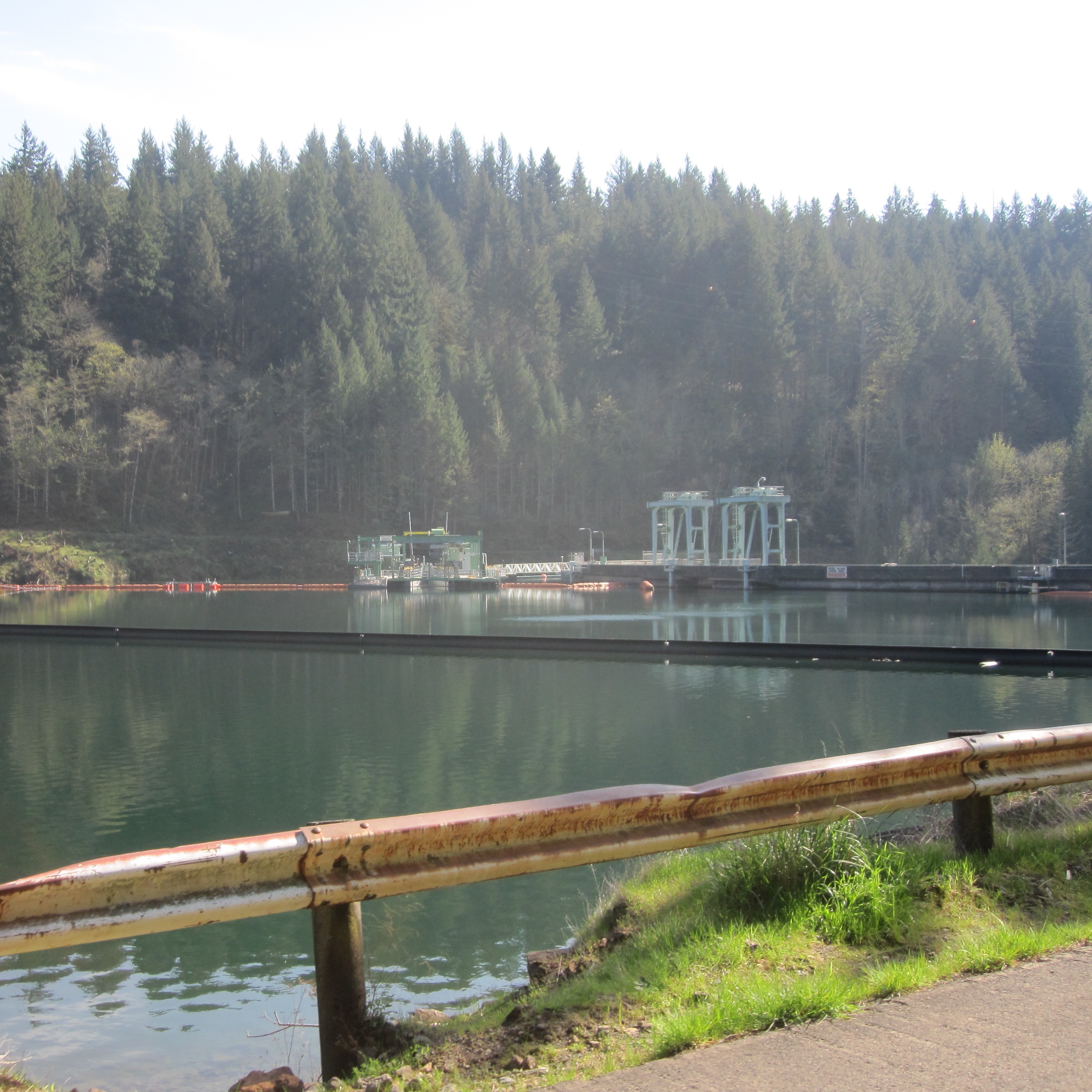
The new collection structure for the fish ladder at the North Fork reservoir
The south end of Faraday Road
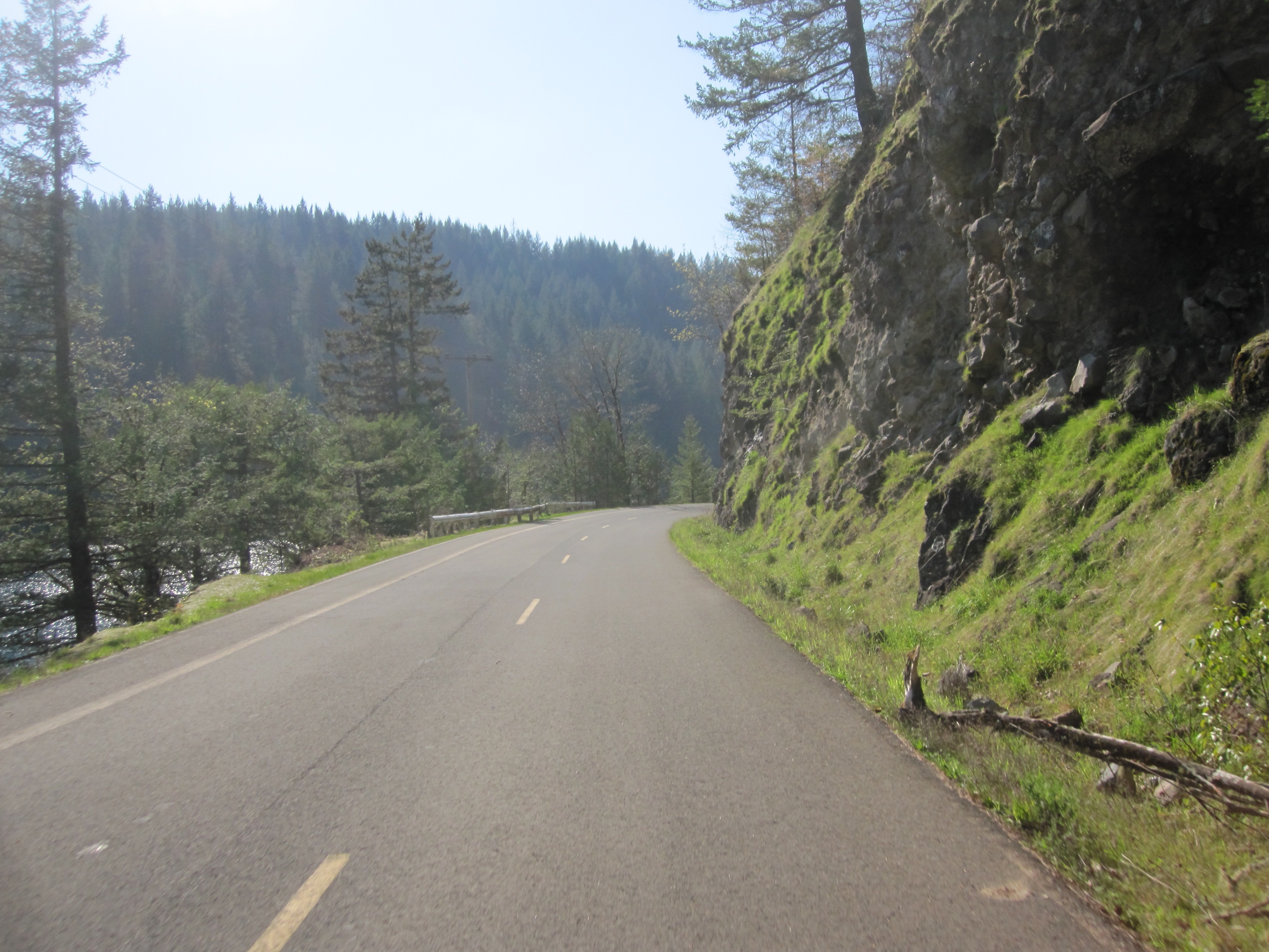
Winding my way (increasingly slowly) up the gorge
5way, NF--, Estacada, OR, USA Karte
Suchen Sie einen anderen Ort
Nahe Plätze
National Forest Development Road -, NF--, Colton, OR, USA
Goat Mountain, Oregon, USA
Elwood Road, Elwood Rd, Colton, OR, USA
S Elwood Rd, Colton, OR, USA
S Skinner Rd, Estacada, OR, USA
SE Tumala Mountain Rd, Estacada, OR, USA
S Kinzy Rd, Estacada, OR, USA
Southeast Bowman Road, SE Bowman Rd, Estacada, OR, USA
SE Surface Rd, Estacada, OR, USA
Southeast Buzz Road, SE Buzz Rd, Estacada, OR, USA
OR-, Estacada, OR, USA
SE Moss Hill Rd, Estacada, OR, USA
SE George Rd, Estacada, OR, USA
SE Coupland Rd, Estacada, OR, USA
SE Oak View Ln, Estacada, OR, USA
Southeast 1st Avenue, Estacada, OR, USA
South Poplar Road, S Poplar Rd, Estacada, OR, USA
S Poplar Rd, Estacada, OR, USA
NE Ginseng Dr, Estacada, OR, USA
Estacada, OR, USA
Letzte Suche
- 55 Cassick Valley Rd, Wellfleet, MA, USA Sonnenaufgang Sonnenuntergang Zeiten
- 高尾山口駅, Takaomachi, Hachiōji, Präfektur Tokio -, Japan Sonnenaufgang Sonnenuntergang Zeiten
- Somanouchicho, Tenri, Nara -, Japan Sonnenaufgang Sonnenuntergang Zeiten
- Ternate Utara, Ternate City, Nord-Molukken, Indonesien Sonnenaufgang Sonnenuntergang Zeiten
- Zhongzheng South Road, Zhongzheng S Rd, Sanchong District, New Taipei City, Taiwan Sonnenaufgang Sonnenuntergang Zeiten
- Lualaba, Demokratische Republik Kongo Sonnenaufgang Sonnenuntergang Zeiten
- A Pobra de Trives, Province of Ourense, Spain Sonnenaufgang Sonnenuntergang Zeiten
- Šodolovci, Kroatien Sonnenaufgang Sonnenuntergang Zeiten
- Pünderich, Germany Sonnenaufgang Sonnenuntergang Zeiten
- Steamboat Island Road Northwest, Olympia, WA, USA Sonnenaufgang Sonnenuntergang Zeiten