Sunrise Sunset Times of The Falls, NS B0K, Canada
Location: Canada > Nova Scotia > Colchester County > Colchester >
Timezone:
America/Halifax
Current Time:
2025-06-13 14:49:47
Longitude:
-63.2366346
Latitude:
45.6203812
Sunrise Today:
05:23:01 AM
Sunset Today:
09:03:43 PM
Daylength Today:
15h 40m 42s
Sunrise Tomorrow:
05:23:01 AM
Sunset Tomorrow:
09:04:09 PM
Daylength Tomorrow:
15h 41m 8s
Year Show All Dates
| Date | Sunrise | Sunset | Daylength |
|---|---|---|---|
| 01/01/2025 | 07:53:21 AM | 04:40:41 PM | 8h 47m 20s |
| 01/02/2025 | 07:53:18 AM | 04:41:39 PM | 8h 48m 21s |
| 01/03/2025 | 07:53:13 AM | 04:42:39 PM | 8h 49m 26s |
| 01/04/2025 | 07:53:05 AM | 04:43:41 PM | 8h 50m 36s |
| 01/05/2025 | 07:52:54 AM | 04:44:44 PM | 8h 51m 50s |
| 01/06/2025 | 07:52:41 AM | 04:45:50 PM | 8h 53m 9s |
| 01/07/2025 | 07:52:25 AM | 04:46:56 PM | 8h 54m 31s |
| 01/08/2025 | 07:52:06 AM | 04:48:05 PM | 8h 55m 59s |
| 01/09/2025 | 07:51:45 AM | 04:49:15 PM | 8h 57m 30s |
| 01/10/2025 | 07:51:21 AM | 04:50:26 PM | 8h 59m 5s |
| 01/11/2025 | 07:50:55 AM | 04:51:39 PM | 9h 0m 44s |
| 01/12/2025 | 07:50:26 AM | 04:52:53 PM | 9h 2m 27s |
| 01/13/2025 | 07:49:55 AM | 04:54:08 PM | 9h 4m 13s |
| 01/14/2025 | 07:49:21 AM | 04:55:24 PM | 9h 6m 3s |
| 01/15/2025 | 07:48:44 AM | 04:56:42 PM | 9h 7m 58s |
| 01/16/2025 | 07:48:06 AM | 04:58:01 PM | 9h 9m 55s |
| 01/17/2025 | 07:47:24 AM | 04:59:20 PM | 9h 11m 56s |
| 01/18/2025 | 07:46:41 AM | 05:00:41 PM | 9h 14m 0s |
| 01/19/2025 | 07:45:55 AM | 05:02:02 PM | 9h 16m 7s |
| 01/20/2025 | 07:45:07 AM | 05:03:24 PM | 9h 18m 17s |
| 01/21/2025 | 07:44:16 AM | 05:04:47 PM | 9h 20m 31s |
| 01/22/2025 | 07:43:23 AM | 05:06:11 PM | 9h 22m 48s |
| 01/23/2025 | 07:42:29 AM | 05:07:35 PM | 9h 25m 6s |
| 01/24/2025 | 07:41:31 AM | 05:09:00 PM | 9h 27m 29s |
| 01/25/2025 | 07:40:32 AM | 05:10:25 PM | 9h 29m 53s |
| 01/26/2025 | 07:39:31 AM | 05:11:51 PM | 9h 32m 20s |
| 01/27/2025 | 07:38:28 AM | 05:13:17 PM | 9h 34m 49s |
| 01/28/2025 | 07:37:22 AM | 05:14:44 PM | 9h 37m 22s |
| 01/29/2025 | 07:36:15 AM | 05:16:11 PM | 9h 39m 56s |
| 01/30/2025 | 07:35:06 AM | 05:17:38 PM | 9h 42m 32s |
| 01/31/2025 | 07:33:55 AM | 05:19:06 PM | 9h 45m 11s |
| 02/01/2025 | 07:32:42 AM | 05:20:33 PM | 9h 47m 51s |
| 02/02/2025 | 07:31:28 AM | 05:22:01 PM | 9h 50m 33s |
| 02/03/2025 | 07:30:11 AM | 05:23:29 PM | 9h 53m 18s |
| 02/04/2025 | 07:28:53 AM | 05:24:57 PM | 9h 56m 4s |
| 02/05/2025 | 07:27:33 AM | 05:26:25 PM | 9h 58m 52s |
| 02/06/2025 | 07:26:12 AM | 05:27:53 PM | 10h 1m 41s |
| 02/07/2025 | 07:24:49 AM | 05:29:21 PM | 10h 4m 32s |
| 02/08/2025 | 07:23:25 AM | 05:30:49 PM | 10h 7m 24s |
| 02/09/2025 | 07:21:59 AM | 05:32:17 PM | 10h 10m 18s |
| 02/10/2025 | 07:20:31 AM | 05:33:45 PM | 10h 13m 14s |
| 02/11/2025 | 07:19:03 AM | 05:35:12 PM | 10h 16m 9s |
| 02/12/2025 | 07:17:33 AM | 05:36:40 PM | 10h 19m 7s |
| 02/13/2025 | 07:16:01 AM | 05:38:07 PM | 10h 22m 6s |
| 02/14/2025 | 07:14:28 AM | 05:39:35 PM | 10h 25m 7s |
| 02/15/2025 | 07:12:54 AM | 05:41:02 PM | 10h 28m 8s |
| 02/16/2025 | 07:11:19 AM | 05:42:28 PM | 10h 31m 9s |
| 02/17/2025 | 07:09:43 AM | 05:43:55 PM | 10h 34m 12s |
| 02/18/2025 | 07:08:05 AM | 05:45:21 PM | 10h 37m 16s |
| 02/19/2025 | 07:06:27 AM | 05:46:48 PM | 10h 40m 21s |
| 02/20/2025 | 07:04:47 AM | 05:48:13 PM | 10h 43m 26s |
| 02/21/2025 | 07:03:07 AM | 05:49:39 PM | 10h 46m 32s |
| 02/22/2025 | 07:01:25 AM | 05:51:04 PM | 10h 49m 39s |
| 02/23/2025 | 06:59:42 AM | 05:52:29 PM | 10h 52m 47s |
| 02/24/2025 | 06:57:59 AM | 05:53:54 PM | 10h 55m 55s |
| 02/25/2025 | 06:56:15 AM | 05:55:19 PM | 10h 59m 4s |
| 02/26/2025 | 06:54:30 AM | 05:56:43 PM | 11h 2m 13s |
| 02/27/2025 | 06:52:44 AM | 05:58:07 PM | 11h 5m 23s |
| 02/28/2025 | 06:50:57 AM | 05:59:31 PM | 11h 8m 34s |
| 03/01/2025 | 06:49:10 AM | 06:00:54 PM | 11h 11m 44s |
| 03/02/2025 | 06:47:22 AM | 06:02:17 PM | 11h 14m 55s |
| 03/03/2025 | 06:45:33 AM | 06:03:40 PM | 11h 18m 7s |
| 03/04/2025 | 06:43:43 AM | 06:05:02 PM | 11h 21m 19s |
| 03/05/2025 | 06:41:54 AM | 06:06:25 PM | 11h 24m 31s |
| 03/06/2025 | 06:40:03 AM | 06:07:47 PM | 11h 27m 44s |
| 03/07/2025 | 06:38:12 AM | 06:09:08 PM | 11h 30m 56s |
| 03/08/2025 | 06:36:21 AM | 06:10:30 PM | 11h 34m 9s |
| 03/09/2025 | 07:34:33 AM | 07:11:48 PM | 11h 37m 15s |
| 03/10/2025 | 07:32:41 AM | 07:13:09 PM | 11h 40m 28s |
| 03/11/2025 | 07:30:48 AM | 07:14:30 PM | 11h 43m 42s |
| 03/12/2025 | 07:28:55 AM | 07:15:50 PM | 11h 46m 55s |
| 03/13/2025 | 07:27:02 AM | 07:17:11 PM | 11h 50m 9s |
| 03/14/2025 | 07:25:08 AM | 07:18:31 PM | 11h 53m 23s |
| 03/15/2025 | 07:23:15 AM | 07:19:51 PM | 11h 56m 36s |
| 03/16/2025 | 07:21:20 AM | 07:21:11 PM | 11h 59m 51s |
| 03/17/2025 | 07:19:26 AM | 07:22:30 PM | 12h 3m 4s |
| 03/18/2025 | 07:17:32 AM | 07:23:50 PM | 12h 6m 18s |
| 03/19/2025 | 07:15:37 AM | 07:25:09 PM | 12h 9m 32s |
| 03/20/2025 | 07:13:42 AM | 07:26:28 PM | 12h 12m 46s |
| 03/21/2025 | 07:11:48 AM | 07:27:47 PM | 12h 15m 59s |
| 03/22/2025 | 07:09:53 AM | 07:29:06 PM | 12h 19m 13s |
| 03/23/2025 | 07:07:58 AM | 07:30:25 PM | 12h 22m 27s |
| 03/24/2025 | 07:06:03 AM | 07:31:43 PM | 12h 25m 40s |
| 03/25/2025 | 07:04:08 AM | 07:33:02 PM | 12h 28m 54s |
| 03/26/2025 | 07:02:14 AM | 07:34:20 PM | 12h 32m 6s |
| 03/27/2025 | 07:00:19 AM | 07:35:38 PM | 12h 35m 19s |
| 03/28/2025 | 06:58:25 AM | 07:36:57 PM | 12h 38m 32s |
| 03/29/2025 | 06:56:31 AM | 07:38:15 PM | 12h 41m 44s |
| 03/30/2025 | 06:54:37 AM | 07:39:33 PM | 12h 44m 56s |
| 03/31/2025 | 06:52:43 AM | 07:40:51 PM | 12h 48m 8s |
| 04/01/2025 | 06:50:49 AM | 07:42:09 PM | 12h 51m 20s |
| 04/02/2025 | 06:48:56 AM | 07:43:27 PM | 12h 54m 31s |
| 04/03/2025 | 06:47:03 AM | 07:44:45 PM | 12h 57m 42s |
| 04/04/2025 | 06:45:11 AM | 07:46:03 PM | 13h 0m 52s |
| 04/05/2025 | 06:43:19 AM | 07:47:21 PM | 13h 4m 2s |
| 04/06/2025 | 06:41:27 AM | 07:48:39 PM | 13h 7m 12s |
| 04/07/2025 | 06:39:36 AM | 07:49:57 PM | 13h 10m 21s |
| 04/08/2025 | 06:37:45 AM | 07:51:15 PM | 13h 13m 30s |
| 04/09/2025 | 06:35:55 AM | 07:52:33 PM | 13h 16m 38s |
| 04/10/2025 | 06:34:06 AM | 07:53:50 PM | 13h 19m 44s |
| 04/11/2025 | 06:32:17 AM | 07:55:08 PM | 13h 22m 51s |
| 04/12/2025 | 06:30:28 AM | 07:56:26 PM | 13h 25m 58s |
| 04/13/2025 | 06:28:41 AM | 07:57:44 PM | 13h 29m 3s |
| 04/14/2025 | 06:26:54 AM | 07:59:02 PM | 13h 32m 8s |
| 04/15/2025 | 06:25:07 AM | 08:00:20 PM | 13h 35m 13s |
| 04/16/2025 | 06:23:22 AM | 08:01:38 PM | 13h 38m 16s |
| 04/17/2025 | 06:21:37 AM | 08:02:55 PM | 13h 41m 18s |
| 04/18/2025 | 06:19:53 AM | 08:04:13 PM | 13h 44m 20s |
| 04/19/2025 | 06:18:10 AM | 08:05:31 PM | 13h 47m 21s |
| 04/20/2025 | 06:16:28 AM | 08:06:49 PM | 13h 50m 21s |
| 04/21/2025 | 06:14:47 AM | 08:08:06 PM | 13h 53m 19s |
| 04/22/2025 | 06:13:07 AM | 08:09:24 PM | 13h 56m 17s |
| 04/23/2025 | 06:11:27 AM | 08:10:41 PM | 13h 59m 14s |
| 04/24/2025 | 06:09:49 AM | 08:11:59 PM | 14h 2m 10s |
| 04/25/2025 | 06:08:12 AM | 08:13:16 PM | 14h 5m 4s |
| 04/26/2025 | 06:06:36 AM | 08:14:33 PM | 14h 7m 57s |
| 04/27/2025 | 06:05:01 AM | 08:15:50 PM | 14h 10m 49s |
| 04/28/2025 | 06:03:27 AM | 08:17:07 PM | 14h 13m 40s |
| 04/29/2025 | 06:01:55 AM | 08:18:24 PM | 14h 16m 29s |
| 04/30/2025 | 06:00:24 AM | 08:19:41 PM | 14h 19m 17s |
| 05/01/2025 | 05:58:54 AM | 08:20:57 PM | 14h 22m 3s |
| 05/02/2025 | 05:57:25 AM | 08:22:13 PM | 14h 24m 48s |
| 05/03/2025 | 05:55:58 AM | 08:23:29 PM | 14h 27m 31s |
| 05/04/2025 | 05:54:32 AM | 08:24:45 PM | 14h 30m 13s |
| 05/05/2025 | 05:53:08 AM | 08:26:00 PM | 14h 32m 52s |
| 05/06/2025 | 05:51:45 AM | 08:27:15 PM | 14h 35m 30s |
| 05/07/2025 | 05:50:24 AM | 08:28:29 PM | 14h 38m 5s |
| 05/08/2025 | 05:49:04 AM | 08:29:43 PM | 14h 40m 39s |
| 05/09/2025 | 05:47:46 AM | 08:30:57 PM | 14h 43m 11s |
| 05/10/2025 | 05:46:29 AM | 08:32:10 PM | 14h 45m 41s |
| 05/11/2025 | 05:45:14 AM | 08:33:23 PM | 14h 48m 9s |
| 05/12/2025 | 05:44:01 AM | 08:34:35 PM | 14h 50m 34s |
| 05/13/2025 | 05:42:49 AM | 08:35:46 PM | 14h 52m 57s |
| 05/14/2025 | 05:41:40 AM | 08:36:57 PM | 14h 55m 17s |
| 05/15/2025 | 05:40:32 AM | 08:38:07 PM | 14h 57m 35s |
| 05/16/2025 | 05:39:26 AM | 08:39:17 PM | 14h 59m 51s |
| 05/17/2025 | 05:38:21 AM | 08:40:25 PM | 15h 2m 4s |
| 05/18/2025 | 05:37:19 AM | 08:41:33 PM | 15h 4m 14s |
| 05/19/2025 | 05:36:19 AM | 08:42:40 PM | 15h 6m 21s |
| 05/20/2025 | 05:35:21 AM | 08:43:46 PM | 15h 8m 25s |
| 05/21/2025 | 05:34:24 AM | 08:44:51 PM | 15h 10m 27s |
| 05/22/2025 | 05:33:30 AM | 08:45:55 PM | 15h 12m 25s |
| 05/23/2025 | 05:32:38 AM | 08:46:58 PM | 15h 14m 20s |
| 05/24/2025 | 05:31:48 AM | 08:48:00 PM | 15h 16m 12s |
| 05/25/2025 | 05:31:00 AM | 08:49:01 PM | 15h 18m 1s |
| 05/26/2025 | 05:30:14 AM | 08:50:01 PM | 15h 19m 47s |
| 05/27/2025 | 05:29:31 AM | 08:50:59 PM | 15h 21m 28s |
| 05/28/2025 | 05:28:49 AM | 08:51:56 PM | 15h 23m 7s |
| 05/29/2025 | 05:28:10 AM | 08:52:52 PM | 15h 24m 42s |
| 05/30/2025 | 05:27:33 AM | 08:53:46 PM | 15h 26m 13s |
| 05/31/2025 | 05:26:59 AM | 08:54:39 PM | 15h 27m 40s |
| 06/01/2025 | 05:26:26 AM | 08:55:30 PM | 15h 29m 4s |
| 06/02/2025 | 05:25:56 AM | 08:56:19 PM | 15h 30m 23s |
| 06/03/2025 | 05:25:29 AM | 08:57:08 PM | 15h 31m 39s |
| 06/04/2025 | 05:25:03 AM | 08:57:54 PM | 15h 32m 51s |
| 06/05/2025 | 05:24:40 AM | 08:58:39 PM | 15h 33m 59s |
| 06/06/2025 | 05:24:20 AM | 08:59:21 PM | 15h 35m 1s |
| 06/07/2025 | 05:24:02 AM | 09:00:03 PM | 15h 36m 1s |
| 06/08/2025 | 05:23:46 AM | 09:00:42 PM | 15h 36m 56s |
| 06/09/2025 | 05:23:32 AM | 09:01:19 PM | 15h 37m 47s |
| 06/10/2025 | 05:23:21 AM | 09:01:54 PM | 15h 38m 33s |
| 06/11/2025 | 05:23:13 AM | 09:02:28 PM | 15h 39m 15s |
| 06/12/2025 | 05:23:06 AM | 09:02:59 PM | 15h 39m 53s |
| 06/13/2025 | 05:23:03 AM | 09:03:28 PM | 15h 40m 25s |
| 06/14/2025 | 05:23:01 AM | 09:03:55 PM | 15h 40m 54s |
| 06/15/2025 | 05:23:02 AM | 09:04:20 PM | 15h 41m 18s |
| 06/16/2025 | 05:23:05 AM | 09:04:43 PM | 15h 41m 38s |
| 06/17/2025 | 05:23:11 AM | 09:05:04 PM | 15h 41m 53s |
| 06/18/2025 | 05:23:18 AM | 09:05:22 PM | 15h 42m 4s |
| 06/19/2025 | 05:23:28 AM | 09:05:38 PM | 15h 42m 10s |
| 06/20/2025 | 05:23:41 AM | 09:05:52 PM | 15h 42m 11s |
| 06/21/2025 | 05:23:56 AM | 09:06:03 PM | 15h 42m 7s |
| 06/22/2025 | 05:24:12 AM | 09:06:13 PM | 15h 42m 1s |
| 06/23/2025 | 05:24:31 AM | 09:06:19 PM | 15h 41m 48s |
| 06/24/2025 | 05:24:53 AM | 09:06:24 PM | 15h 41m 31s |
| 06/25/2025 | 05:25:16 AM | 09:06:26 PM | 15h 41m 10s |
| 06/26/2025 | 05:25:41 AM | 09:06:25 PM | 15h 40m 44s |
| 06/27/2025 | 05:26:09 AM | 09:06:22 PM | 15h 40m 13s |
| 06/28/2025 | 05:26:39 AM | 09:06:17 PM | 15h 39m 38s |
| 06/29/2025 | 05:27:10 AM | 09:06:09 PM | 15h 38m 59s |
| 06/30/2025 | 05:27:43 AM | 09:05:59 PM | 15h 38m 16s |
| 07/01/2025 | 05:28:19 AM | 09:05:46 PM | 15h 37m 27s |
| 07/02/2025 | 05:28:56 AM | 09:05:31 PM | 15h 36m 35s |
| 07/03/2025 | 05:29:35 AM | 09:05:14 PM | 15h 35m 39s |
| 07/04/2025 | 05:30:16 AM | 09:04:54 PM | 15h 34m 38s |
| 07/05/2025 | 05:30:58 AM | 09:04:32 PM | 15h 33m 34s |
| 07/06/2025 | 05:31:43 AM | 09:04:07 PM | 15h 32m 24s |
| 07/07/2025 | 05:32:28 AM | 09:03:40 PM | 15h 31m 12s |
| 07/08/2025 | 05:33:16 AM | 09:03:11 PM | 15h 29m 55s |
| 07/09/2025 | 05:34:05 AM | 09:02:39 PM | 15h 28m 34s |
| 07/10/2025 | 05:34:55 AM | 09:02:05 PM | 15h 27m 10s |
| 07/11/2025 | 05:35:47 AM | 09:01:28 PM | 15h 25m 41s |
| 07/12/2025 | 05:36:40 AM | 09:00:50 PM | 15h 24m 10s |
| 07/13/2025 | 05:37:34 AM | 09:00:09 PM | 15h 22m 35s |
| 07/14/2025 | 05:38:30 AM | 08:59:25 PM | 15h 20m 55s |
| 07/15/2025 | 05:39:27 AM | 08:58:40 PM | 15h 19m 13s |
| 07/16/2025 | 05:40:25 AM | 08:57:52 PM | 15h 17m 27s |
| 07/17/2025 | 05:41:24 AM | 08:57:02 PM | 15h 15m 38s |
| 07/18/2025 | 05:42:24 AM | 08:56:10 PM | 15h 13m 46s |
| 07/19/2025 | 05:43:25 AM | 08:55:16 PM | 15h 11m 51s |
| 07/20/2025 | 05:44:28 AM | 08:54:20 PM | 15h 9m 52s |
| 07/21/2025 | 05:45:31 AM | 08:53:22 PM | 15h 7m 51s |
| 07/22/2025 | 05:46:35 AM | 08:52:21 PM | 15h 5m 46s |
| 07/23/2025 | 05:47:39 AM | 08:51:19 PM | 15h 3m 40s |
| 07/24/2025 | 05:48:45 AM | 08:50:15 PM | 15h 1m 30s |
| 07/25/2025 | 05:49:51 AM | 08:49:09 PM | 14h 59m 18s |
| 07/26/2025 | 05:50:58 AM | 08:48:01 PM | 14h 57m 3s |
| 07/27/2025 | 05:52:06 AM | 08:46:51 PM | 14h 54m 45s |
| 07/28/2025 | 05:53:14 AM | 08:45:40 PM | 14h 52m 26s |
| 07/29/2025 | 05:54:22 AM | 08:44:26 PM | 14h 50m 4s |
| 07/30/2025 | 05:55:32 AM | 08:43:11 PM | 14h 47m 39s |
| 07/31/2025 | 05:56:41 AM | 08:41:54 PM | 14h 45m 13s |
| 08/01/2025 | 05:57:52 AM | 08:40:36 PM | 14h 42m 44s |
| 08/02/2025 | 05:59:02 AM | 08:39:16 PM | 14h 40m 14s |
| 08/03/2025 | 06:00:13 AM | 08:37:54 PM | 14h 37m 41s |
| 08/04/2025 | 06:01:24 AM | 08:36:31 PM | 14h 35m 7s |
| 08/05/2025 | 06:02:36 AM | 08:35:06 PM | 14h 32m 30s |
| 08/06/2025 | 06:03:48 AM | 08:33:40 PM | 14h 29m 52s |
| 08/07/2025 | 06:05:00 AM | 08:32:12 PM | 14h 27m 12s |
| 08/08/2025 | 06:06:12 AM | 08:30:43 PM | 14h 24m 31s |
| 08/09/2025 | 06:07:25 AM | 08:29:13 PM | 14h 21m 48s |
| 08/10/2025 | 06:08:38 AM | 08:27:41 PM | 14h 19m 3s |
| 08/11/2025 | 06:09:51 AM | 08:26:08 PM | 14h 16m 17s |
| 08/12/2025 | 06:11:04 AM | 08:24:34 PM | 14h 13m 30s |
| 08/13/2025 | 06:12:17 AM | 08:22:58 PM | 14h 10m 41s |
| 08/14/2025 | 06:13:30 AM | 08:21:21 PM | 14h 7m 51s |
| 08/15/2025 | 06:14:43 AM | 08:19:44 PM | 14h 5m 1s |
| 08/16/2025 | 06:15:57 AM | 08:18:05 PM | 14h 2m 8s |
| 08/17/2025 | 06:17:10 AM | 08:16:25 PM | 13h 59m 15s |
| 08/18/2025 | 06:18:24 AM | 08:14:44 PM | 13h 56m 20s |
| 08/19/2025 | 06:19:37 AM | 08:13:02 PM | 13h 53m 25s |
| 08/20/2025 | 06:20:51 AM | 08:11:19 PM | 13h 50m 28s |
| 08/21/2025 | 06:22:04 AM | 08:09:35 PM | 13h 47m 31s |
| 08/22/2025 | 06:23:18 AM | 08:07:50 PM | 13h 44m 32s |
| 08/23/2025 | 06:24:31 AM | 08:06:05 PM | 13h 41m 34s |
| 08/24/2025 | 06:25:45 AM | 08:04:18 PM | 13h 38m 33s |
| 08/25/2025 | 06:26:58 AM | 08:02:31 PM | 13h 35m 33s |
| 08/26/2025 | 06:28:12 AM | 08:00:43 PM | 13h 32m 31s |
| 08/27/2025 | 06:29:25 AM | 07:58:54 PM | 13h 29m 29s |
| 08/28/2025 | 06:30:39 AM | 07:57:05 PM | 13h 26m 26s |
| 08/29/2025 | 06:31:52 AM | 07:55:15 PM | 13h 23m 23s |
| 08/30/2025 | 06:33:05 AM | 07:53:24 PM | 13h 20m 19s |
| 08/31/2025 | 06:34:19 AM | 07:51:33 PM | 13h 17m 14s |
| 09/01/2025 | 06:35:32 AM | 07:49:41 PM | 13h 14m 9s |
| 09/02/2025 | 06:36:45 AM | 07:47:48 PM | 13h 11m 3s |
| 09/03/2025 | 06:37:59 AM | 07:45:55 PM | 13h 7m 56s |
| 09/04/2025 | 06:39:12 AM | 07:44:02 PM | 13h 4m 50s |
| 09/05/2025 | 06:40:25 AM | 07:42:08 PM | 13h 1m 43s |
| 09/06/2025 | 06:41:39 AM | 07:40:14 PM | 12h 58m 35s |
| 09/07/2025 | 06:42:52 AM | 07:38:20 PM | 12h 55m 28s |
| 09/08/2025 | 06:44:05 AM | 07:36:25 PM | 12h 52m 20s |
| 09/09/2025 | 06:45:18 AM | 07:34:29 PM | 12h 49m 11s |
| 09/10/2025 | 06:46:32 AM | 07:32:34 PM | 12h 46m 2s |
| 09/11/2025 | 06:47:45 AM | 07:30:38 PM | 12h 42m 53s |
| 09/12/2025 | 06:48:59 AM | 07:28:42 PM | 12h 39m 43s |
| 09/13/2025 | 06:50:12 AM | 07:26:46 PM | 12h 36m 34s |
| 09/14/2025 | 06:51:26 AM | 07:24:50 PM | 12h 33m 24s |
| 09/15/2025 | 06:52:39 AM | 07:22:53 PM | 12h 30m 14s |
| 09/16/2025 | 06:53:53 AM | 07:20:57 PM | 12h 27m 4s |
| 09/17/2025 | 06:55:07 AM | 07:19:00 PM | 12h 23m 53s |
| 09/18/2025 | 06:56:20 AM | 07:17:03 PM | 12h 20m 43s |
| 09/19/2025 | 06:57:34 AM | 07:15:07 PM | 12h 17m 33s |
| 09/20/2025 | 06:58:48 AM | 07:13:10 PM | 12h 14m 22s |
| 09/21/2025 | 07:00:03 AM | 07:11:13 PM | 12h 11m 10s |
| 09/22/2025 | 07:01:17 AM | 07:09:17 PM | 12h 8m 0s |
| 09/23/2025 | 07:02:31 AM | 07:07:20 PM | 12h 4m 49s |
| 09/24/2025 | 07:03:46 AM | 07:05:24 PM | 12h 1m 38s |
| 09/25/2025 | 07:05:01 AM | 07:03:28 PM | 11h 58m 27s |
| 09/26/2025 | 07:06:16 AM | 07:01:32 PM | 11h 55m 16s |
| 09/27/2025 | 07:07:31 AM | 06:59:36 PM | 11h 52m 5s |
| 09/28/2025 | 07:08:47 AM | 06:57:41 PM | 11h 48m 54s |
| 09/29/2025 | 07:10:02 AM | 06:55:46 PM | 11h 45m 44s |
| 09/30/2025 | 07:11:18 AM | 06:53:51 PM | 11h 42m 33s |
| 10/01/2025 | 07:12:34 AM | 06:51:57 PM | 11h 39m 23s |
| 10/02/2025 | 07:13:50 AM | 06:50:03 PM | 11h 36m 13s |
| 10/03/2025 | 07:15:07 AM | 06:48:09 PM | 11h 33m 2s |
| 10/04/2025 | 07:16:24 AM | 06:46:16 PM | 11h 29m 52s |
| 10/05/2025 | 07:17:41 AM | 06:44:23 PM | 11h 26m 42s |
| 10/06/2025 | 07:18:58 AM | 06:42:31 PM | 11h 23m 33s |
| 10/07/2025 | 07:20:16 AM | 06:40:39 PM | 11h 20m 23s |
| 10/08/2025 | 07:21:34 AM | 06:38:48 PM | 11h 17m 14s |
| 10/09/2025 | 07:22:52 AM | 06:36:58 PM | 11h 14m 6s |
| 10/10/2025 | 07:24:11 AM | 06:35:08 PM | 11h 10m 57s |
| 10/11/2025 | 07:25:29 AM | 06:33:19 PM | 11h 7m 50s |
| 10/12/2025 | 07:26:49 AM | 06:31:31 PM | 11h 4m 42s |
| 10/13/2025 | 07:28:08 AM | 06:29:43 PM | 11h 1m 35s |
| 10/14/2025 | 07:29:28 AM | 06:27:56 PM | 10h 58m 28s |
| 10/15/2025 | 07:30:48 AM | 06:26:10 PM | 10h 55m 22s |
| 10/16/2025 | 07:32:08 AM | 06:24:25 PM | 10h 52m 17s |
| 10/17/2025 | 07:33:29 AM | 06:22:41 PM | 10h 49m 12s |
| 10/18/2025 | 07:34:50 AM | 06:20:58 PM | 10h 46m 8s |
| 10/19/2025 | 07:36:11 AM | 06:19:15 PM | 10h 43m 4s |
| 10/20/2025 | 07:37:32 AM | 06:17:34 PM | 10h 40m 2s |
| 10/21/2025 | 07:38:54 AM | 06:15:53 PM | 10h 36m 59s |
| 10/22/2025 | 07:40:16 AM | 06:14:14 PM | 10h 33m 58s |
| 10/23/2025 | 07:41:39 AM | 06:12:36 PM | 10h 30m 57s |
| 10/24/2025 | 07:43:01 AM | 06:10:59 PM | 10h 27m 58s |
| 10/25/2025 | 07:44:24 AM | 06:09:23 PM | 10h 24m 59s |
| 10/26/2025 | 07:45:47 AM | 06:07:49 PM | 10h 22m 2s |
| 10/27/2025 | 07:47:11 AM | 06:06:16 PM | 10h 19m 5s |
| 10/28/2025 | 07:48:34 AM | 06:04:44 PM | 10h 16m 10s |
| 10/29/2025 | 07:49:58 AM | 06:03:13 PM | 10h 13m 15s |
| 10/30/2025 | 07:51:22 AM | 06:01:44 PM | 10h 10m 22s |
| 10/31/2025 | 07:52:46 AM | 06:00:16 PM | 10h 7m 30s |
| 11/01/2025 | 07:54:10 AM | 05:58:50 PM | 10h 4m 40s |
| 11/02/2025 | 06:55:38 AM | 04:57:22 PM | 10h 1m 44s |
| 11/03/2025 | 06:57:02 AM | 04:55:58 PM | 9h 58m 56s |
| 11/04/2025 | 06:58:27 AM | 04:54:37 PM | 9h 56m 10s |
| 11/05/2025 | 06:59:51 AM | 04:53:17 PM | 9h 53m 26s |
| 11/06/2025 | 07:01:15 AM | 04:51:59 PM | 9h 50m 44s |
| 11/07/2025 | 07:02:40 AM | 04:50:42 PM | 9h 48m 2s |
| 11/08/2025 | 07:04:04 AM | 04:49:28 PM | 9h 45m 24s |
| 11/09/2025 | 07:05:28 AM | 04:48:15 PM | 9h 42m 47s |
| 11/10/2025 | 07:06:52 AM | 04:47:04 PM | 9h 40m 12s |
| 11/11/2025 | 07:08:16 AM | 04:45:55 PM | 9h 37m 39s |
| 11/12/2025 | 07:09:39 AM | 04:44:48 PM | 9h 35m 9s |
| 11/13/2025 | 07:11:03 AM | 04:43:42 PM | 9h 32m 39s |
| 11/14/2025 | 07:12:26 AM | 04:42:39 PM | 9h 30m 13s |
| 11/15/2025 | 07:13:48 AM | 04:41:38 PM | 9h 27m 50s |
| 11/16/2025 | 07:15:10 AM | 04:40:39 PM | 9h 25m 29s |
| 11/17/2025 | 07:16:32 AM | 04:39:42 PM | 9h 23m 10s |
| 11/18/2025 | 07:17:53 AM | 04:38:48 PM | 9h 20m 55s |
| 11/19/2025 | 07:19:13 AM | 04:37:55 PM | 9h 18m 42s |
| 11/20/2025 | 07:20:33 AM | 04:37:05 PM | 9h 16m 32s |
| 11/21/2025 | 07:21:52 AM | 04:36:17 PM | 9h 14m 25s |
| 11/22/2025 | 07:23:11 AM | 04:35:32 PM | 9h 12m 21s |
| 11/23/2025 | 07:24:28 AM | 04:34:49 PM | 9h 10m 21s |
| 11/24/2025 | 07:25:45 AM | 04:34:08 PM | 9h 8m 23s |
| 11/25/2025 | 07:27:01 AM | 04:33:30 PM | 9h 6m 29s |
| 11/26/2025 | 07:28:15 AM | 04:32:54 PM | 9h 4m 39s |
| 11/27/2025 | 07:29:29 AM | 04:32:21 PM | 9h 2m 52s |
| 11/28/2025 | 07:30:41 AM | 04:31:50 PM | 9h 1m 9s |
| 11/29/2025 | 07:31:53 AM | 04:31:22 PM | 8h 59m 29s |
| 11/30/2025 | 07:33:03 AM | 04:30:56 PM | 8h 57m 53s |
| 12/01/2025 | 07:34:11 AM | 04:30:33 PM | 8h 56m 22s |
| 12/02/2025 | 07:35:19 AM | 04:30:13 PM | 8h 54m 54s |
| 12/03/2025 | 07:36:24 AM | 04:29:55 PM | 8h 53m 31s |
| 12/04/2025 | 07:37:29 AM | 04:29:40 PM | 8h 52m 11s |
| 12/05/2025 | 07:38:31 AM | 04:29:28 PM | 8h 50m 57s |
| 12/06/2025 | 07:39:32 AM | 04:29:18 PM | 8h 49m 46s |
| 12/07/2025 | 07:40:32 AM | 04:29:11 PM | 8h 48m 39s |
| 12/08/2025 | 07:41:29 AM | 04:29:07 PM | 8h 47m 38s |
| 12/09/2025 | 07:42:25 AM | 04:29:06 PM | 8h 46m 41s |
| 12/10/2025 | 07:43:19 AM | 04:29:07 PM | 8h 45m 48s |
| 12/11/2025 | 07:44:10 AM | 04:29:11 PM | 8h 45m 1s |
| 12/12/2025 | 07:45:00 AM | 04:29:17 PM | 8h 44m 17s |
| 12/13/2025 | 07:45:48 AM | 04:29:27 PM | 8h 43m 39s |
| 12/14/2025 | 07:46:33 AM | 04:29:39 PM | 8h 43m 6s |
| 12/15/2025 | 07:47:17 AM | 04:29:53 PM | 8h 42m 36s |
| 12/16/2025 | 07:47:58 AM | 04:30:11 PM | 8h 42m 13s |
| 12/17/2025 | 07:48:37 AM | 04:30:31 PM | 8h 41m 54s |
| 12/18/2025 | 07:49:13 AM | 04:30:54 PM | 8h 41m 41s |
| 12/19/2025 | 07:49:47 AM | 04:31:19 PM | 8h 41m 32s |
| 12/20/2025 | 07:50:19 AM | 04:31:47 PM | 8h 41m 28s |
| 12/21/2025 | 07:50:48 AM | 04:32:17 PM | 8h 41m 29s |
| 12/22/2025 | 07:51:15 AM | 04:32:50 PM | 8h 41m 35s |
| 12/23/2025 | 07:51:39 AM | 04:33:25 PM | 8h 41m 46s |
| 12/24/2025 | 07:52:01 AM | 04:34:03 PM | 8h 42m 2s |
| 12/25/2025 | 07:52:20 AM | 04:34:43 PM | 8h 42m 23s |
| 12/26/2025 | 07:52:37 AM | 04:35:26 PM | 8h 42m 49s |
| 12/27/2025 | 07:52:51 AM | 04:36:11 PM | 8h 43m 20s |
| 12/28/2025 | 07:53:02 AM | 04:36:58 PM | 8h 43m 56s |
| 12/29/2025 | 07:53:11 AM | 04:37:47 PM | 8h 44m 36s |
| 12/30/2025 | 07:53:17 AM | 04:38:38 PM | 8h 45m 21s |
| 12/31/2025 | 07:53:20 AM | 04:39:32 PM | 8h 46m 12s |
Sunrise & Sunset Photos
Broken mirror

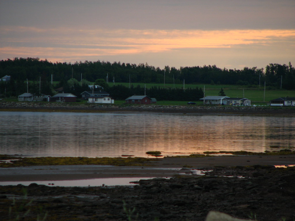
Low Tide
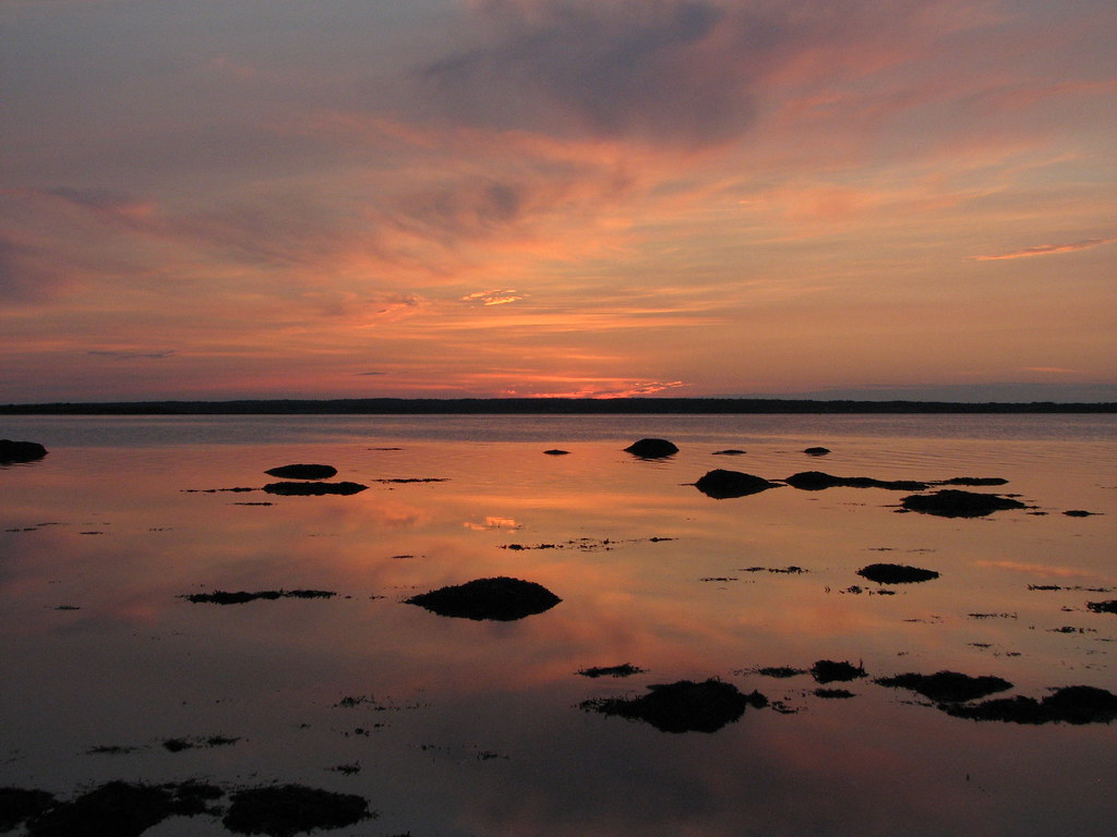
Sunrise
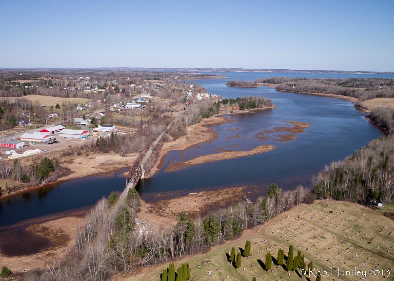
Aerial view of the town of Tatamagouche, Nova Scotia alongside the Waugh River - Kite Aerial Photography (KAP)

Aerial view of the town of Tatamagouche, Nova Scotia alongside the Waugh River - Kite Aerial Photography (KAP)

Aerial view of the Waugh River flowing past Tatamagouche, Nova Scotia - Kite Aerial Photography (KAP)

Waterfall at Earltown

Waterfall at Earltown2
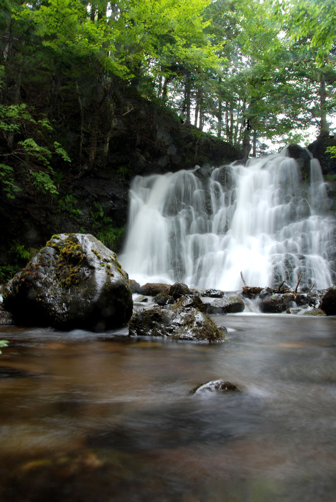
Earltown Falls in Nova Scotia
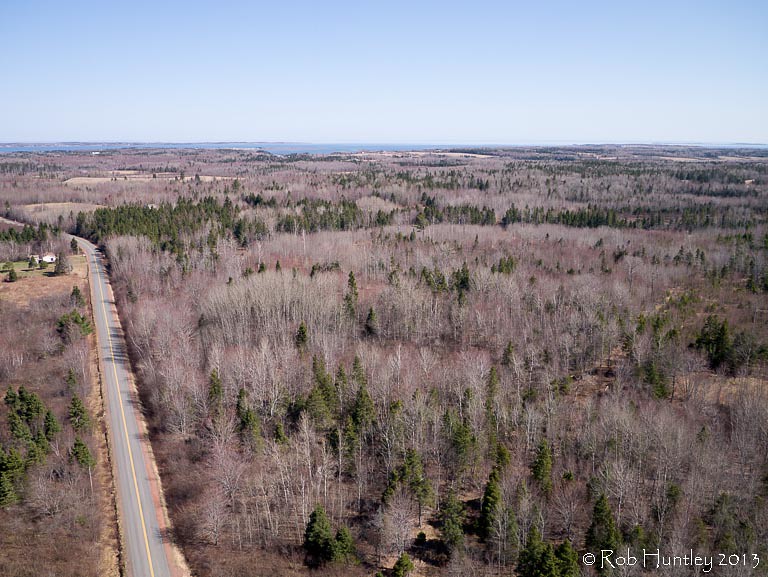
Aerial view of a road through the countryside near Tatamagouche, Nova Scotia - Kite Aerial Photography (KAP)
The Falls, NS B0K, Canada Map
Search another place
Near Places
Balmoral Rd, Tatamagouche, NS B0K 1V0, Canada
Balfron, NS B0K 1V0, Canada
Matheson Brook Rd, Tatamagouche, NS B0K 1V0, Canada
Tatamagouche, NS B0K 1V0, Canada
Balmoral Mills, NS B0K, Canada
Nuttby Mountain, Nuttby, NS B6L 6N2, Canada
Nuttby, NS, Canada
Waldegrave, NS B0K, Canada
NS-, Tatamagouche, NS B0K 1V0, Canada
11 Alex Cox Rd, Tatamagouche, NS B0K 1V0, Canada
Barrachois, NS B0K 1V0, Canada
Nova Scotia, NS-, Colchester, Subd. B, NS B0K, Canada
Truro Rd, McCallum Settlement, NS B6L 6V5, Canada
Hobby Barn, NS-, Upper North River, NS B6L 6J8, Canada
Upper North River, NS B6L, Canada
68 College Grant Rd, Scotsburn, NS B0K 1R0, Canada
College Grant, NS B0K 1N0, Canada
Kemptown, NS, Canada
North River, NS B6L, Canada
Upper Brookside Road, Upper Brookside Rd, Colchester, Subd. B, NS B6L, Canada
Recent Searches
- Sunrise Sunset Times of Red Dog Mine, AK, USA
- Sunrise Sunset Times of Am Bahnhof, Am bhf, Borken, Germany
- Sunrise Sunset Times of 4th St E, Sonoma, CA, USA
- Sunrise Sunset Times of Oakland Ave, Williamsport, PA, USA
- Sunrise Sunset Times of Via Roma, Pieranica CR, Italy
- Sunrise Sunset Times of Clock Tower of Dubrovnik, Grad, Dubrovnik, Croatia
- Sunrise Sunset Times of Trelew, Chubut Province, Argentina
- Sunrise Sunset Times of Hartfords Bluff Cir, Mt Pleasant, SC, USA
- Sunrise Sunset Times of Kita Ward, Kumamoto, Japan
- Sunrise Sunset Times of Pingtan Island, Pingtan County, Fuzhou, China