Horas de salida y puesta de sol de The Falls, NS B0K, Canadá
Location: Canadá > Nueva Escocia > Condado de Colchester > Colchester >
Zona horaria:
America/Halifax
Hora local:
2024-04-28 11:50:57
Longitud:
-63.2366346
Latitud:
45.6203812
Salida de sol de hoy:
06:03:48 AM
Puesta de sol de hoy:
08:16:51 PM
La duración del día hoy:
14h 13m 3s
Salida de sol de mañana:
06:02:15 AM
Puesta de sol de mañana:
08:18:08 PM
La duración del día mañana:
14h 15m 53s
Mostrar todas las fechas
| Fecha | Salida de sol | Puesta de sol | Duración del día |
|---|---|---|---|
| 01/01/2024 | 07:53:21 AM | 04:39:59 PM | 8h 46m 38s |
| 02/01/2024 | 07:53:21 AM | 04:40:55 PM | 8h 47m 34s |
| 03/01/2024 | 07:53:17 AM | 04:41:54 PM | 8h 48m 37s |
| 04/01/2024 | 07:53:11 AM | 04:42:54 PM | 8h 49m 43s |
| 05/01/2024 | 07:53:03 AM | 04:43:56 PM | 8h 50m 53s |
| 06/01/2024 | 07:52:51 AM | 04:45:00 PM | 8h 52m 9s |
| 07/01/2024 | 07:52:37 AM | 04:46:06 PM | 8h 53m 29s |
| 08/01/2024 | 07:52:21 AM | 04:47:13 PM | 8h 54m 52s |
| 09/01/2024 | 07:52:02 AM | 04:48:22 PM | 8h 56m 20s |
| 10/01/2024 | 07:51:40 AM | 04:49:32 PM | 8h 57m 52s |
| 11/01/2024 | 07:51:15 AM | 04:50:44 PM | 8h 59m 29s |
| 12/01/2024 | 07:50:48 AM | 04:51:57 PM | 9h 1m 9s |
| 13/01/2024 | 07:50:19 AM | 04:53:11 PM | 9h 2m 52s |
| 14/01/2024 | 07:49:47 AM | 04:54:27 PM | 9h 4m 40s |
| 15/01/2024 | 07:49:12 AM | 04:55:43 PM | 9h 6m 31s |
| 16/01/2024 | 07:48:35 AM | 04:57:01 PM | 9h 8m 26s |
| 17/01/2024 | 07:47:56 AM | 04:58:20 PM | 9h 10m 24s |
| 18/01/2024 | 07:47:14 AM | 04:59:40 PM | 9h 12m 26s |
| 19/01/2024 | 07:46:30 AM | 05:01:01 PM | 9h 14m 31s |
| 20/01/2024 | 07:45:44 AM | 05:02:22 PM | 9h 16m 38s |
| 21/01/2024 | 07:44:55 AM | 05:03:45 PM | 9h 18m 50s |
| 22/01/2024 | 07:44:04 AM | 05:05:08 PM | 9h 21m 4s |
| 23/01/2024 | 07:43:11 AM | 05:06:31 PM | 9h 23m 20s |
| 24/01/2024 | 07:42:15 AM | 05:07:56 PM | 9h 25m 41s |
| 25/01/2024 | 07:41:17 AM | 05:09:21 PM | 9h 28m 4s |
| 26/01/2024 | 07:40:18 AM | 05:10:46 PM | 9h 30m 28s |
| 27/01/2024 | 07:39:16 AM | 05:12:12 PM | 9h 32m 56s |
| 28/01/2024 | 07:38:12 AM | 05:13:39 PM | 9h 35m 27s |
| 29/01/2024 | 07:37:06 AM | 05:15:05 PM | 9h 37m 59s |
| 30/01/2024 | 07:35:59 AM | 05:16:32 PM | 9h 40m 33s |
| 31/01/2024 | 07:34:49 AM | 05:17:59 PM | 9h 43m 10s |
| 01/02/2024 | 07:33:38 AM | 05:19:27 PM | 9h 45m 49s |
| 02/02/2024 | 07:32:24 AM | 05:20:55 PM | 9h 48m 31s |
| 03/02/2024 | 07:31:09 AM | 05:22:22 PM | 9h 51m 13s |
| 04/02/2024 | 07:29:53 AM | 05:23:50 PM | 9h 53m 57s |
| 05/02/2024 | 07:28:34 AM | 05:25:18 PM | 9h 56m 44s |
| 06/02/2024 | 07:27:14 AM | 05:26:46 PM | 9h 59m 32s |
| 07/02/2024 | 07:25:52 AM | 05:28:14 PM | 10h 2m 22s |
| 08/02/2024 | 07:24:29 AM | 05:29:42 PM | 10h 5m 13s |
| 09/02/2024 | 07:23:04 AM | 05:31:10 PM | 10h 8m 6s |
| 10/02/2024 | 07:21:38 AM | 05:32:38 PM | 10h 11m 0s |
| 11/02/2024 | 07:20:10 AM | 05:34:06 PM | 10h 13m 56s |
| 12/02/2024 | 07:18:41 AM | 05:35:34 PM | 10h 16m 53s |
| 13/02/2024 | 07:17:11 AM | 05:37:01 PM | 10h 19m 50s |
| 14/02/2024 | 07:15:39 AM | 05:38:29 PM | 10h 22m 50s |
| 15/02/2024 | 07:14:06 AM | 05:39:56 PM | 10h 25m 50s |
| 16/02/2024 | 07:12:32 AM | 05:41:23 PM | 10h 28m 51s |
| 17/02/2024 | 07:10:56 AM | 05:42:50 PM | 10h 31m 54s |
| 18/02/2024 | 07:09:19 AM | 05:44:16 PM | 10h 34m 57s |
| 19/02/2024 | 07:07:42 AM | 05:45:42 PM | 10h 38m 0s |
| 20/02/2024 | 07:06:03 AM | 05:47:08 PM | 10h 41m 5s |
| 21/02/2024 | 07:04:23 AM | 05:48:34 PM | 10h 44m 11s |
| 22/02/2024 | 07:02:42 AM | 05:50:00 PM | 10h 47m 18s |
| 23/02/2024 | 07:01:00 AM | 05:51:25 PM | 10h 50m 25s |
| 24/02/2024 | 06:59:18 AM | 05:52:50 PM | 10h 53m 32s |
| 25/02/2024 | 06:57:34 AM | 05:54:15 PM | 10h 56m 41s |
| 26/02/2024 | 06:55:49 AM | 05:55:39 PM | 10h 59m 50s |
| 27/02/2024 | 06:54:04 AM | 05:57:03 PM | 11h 2m 59s |
| 28/02/2024 | 06:52:18 AM | 05:58:27 PM | 11h 6m 9s |
| 29/02/2024 | 06:50:31 AM | 05:59:51 PM | 11h 9m 20s |
| 01/03/2024 | 06:48:44 AM | 06:01:14 PM | 11h 12m 30s |
| 02/03/2024 | 06:46:55 AM | 06:02:37 PM | 11h 15m 42s |
| 03/03/2024 | 06:45:06 AM | 06:04:00 PM | 11h 18m 54s |
| 04/03/2024 | 06:43:17 AM | 06:05:22 PM | 11h 22m 5s |
| 05/03/2024 | 06:41:27 AM | 06:06:45 PM | 11h 25m 18s |
| 06/03/2024 | 06:39:36 AM | 06:08:07 PM | 11h 28m 31s |
| 07/03/2024 | 06:37:45 AM | 06:09:28 PM | 11h 31m 43s |
| 08/03/2024 | 06:35:54 AM | 06:10:50 PM | 11h 34m 56s |
| 09/03/2024 | 06:34:02 AM | 06:12:11 PM | 11h 38m 9s |
| 10/03/2024 | 07:32:14 AM | 07:13:29 PM | 11h 41m 15s |
| 11/03/2024 | 07:30:21 AM | 07:14:49 PM | 11h 44m 28s |
| 12/03/2024 | 07:28:28 AM | 07:16:10 PM | 11h 47m 42s |
| 13/03/2024 | 07:26:35 AM | 07:17:30 PM | 11h 50m 55s |
| 14/03/2024 | 07:24:41 AM | 07:18:50 PM | 11h 54m 9s |
| 15/03/2024 | 07:22:47 AM | 07:20:10 PM | 11h 57m 23s |
| 16/03/2024 | 07:20:53 AM | 07:21:30 PM | 12h 0m 37s |
| 17/03/2024 | 07:18:58 AM | 07:22:49 PM | 12h 3m 51s |
| 18/03/2024 | 07:17:04 AM | 07:24:09 PM | 12h 7m 5s |
| 19/03/2024 | 07:15:09 AM | 07:25:28 PM | 12h 10m 19s |
| 20/03/2024 | 07:13:15 AM | 07:26:47 PM | 12h 13m 32s |
| 21/03/2024 | 07:11:20 AM | 07:28:06 PM | 12h 16m 46s |
| 22/03/2024 | 07:09:25 AM | 07:29:25 PM | 12h 20m 0s |
| 23/03/2024 | 07:07:30 AM | 07:30:44 PM | 12h 23m 14s |
| 24/03/2024 | 07:05:35 AM | 07:32:02 PM | 12h 26m 27s |
| 25/03/2024 | 07:03:41 AM | 07:33:21 PM | 12h 29m 40s |
| 26/03/2024 | 07:01:46 AM | 07:34:39 PM | 12h 32m 53s |
| 27/03/2024 | 06:59:51 AM | 07:35:57 PM | 12h 36m 6s |
| 28/03/2024 | 06:57:57 AM | 07:37:16 PM | 12h 39m 19s |
| 29/03/2024 | 06:56:03 AM | 07:38:34 PM | 12h 42m 31s |
| 30/03/2024 | 06:54:09 AM | 07:39:52 PM | 12h 45m 43s |
| 31/03/2024 | 06:52:15 AM | 07:41:10 PM | 12h 48m 55s |
| 01/04/2024 | 06:50:22 AM | 07:42:28 PM | 12h 52m 6s |
| 02/04/2024 | 06:48:29 AM | 07:43:46 PM | 12h 55m 17s |
| 03/04/2024 | 06:46:36 AM | 07:45:04 PM | 12h 58m 28s |
| 04/04/2024 | 06:44:44 AM | 07:46:22 PM | 13h 1m 38s |
| 05/04/2024 | 06:42:52 AM | 07:47:40 PM | 13h 4m 48s |
| 06/04/2024 | 06:41:00 AM | 07:48:58 PM | 13h 7m 58s |
| 07/04/2024 | 06:39:09 AM | 07:50:16 PM | 13h 11m 7s |
| 08/04/2024 | 06:37:19 AM | 07:51:34 PM | 13h 14m 15s |
| 09/04/2024 | 06:35:29 AM | 07:52:51 PM | 13h 17m 22s |
| 10/04/2024 | 06:33:39 AM | 07:54:09 PM | 13h 20m 30s |
| 11/04/2024 | 06:31:50 AM | 07:55:27 PM | 13h 23m 37s |
| 12/04/2024 | 06:30:02 AM | 07:56:45 PM | 13h 26m 43s |
| 13/04/2024 | 06:28:15 AM | 07:58:03 PM | 13h 29m 48s |
| 14/04/2024 | 06:26:28 AM | 07:59:21 PM | 13h 32m 53s |
| 15/04/2024 | 06:24:42 AM | 08:00:39 PM | 13h 35m 57s |
| 16/04/2024 | 06:22:56 AM | 08:01:56 PM | 13h 39m 0s |
| 17/04/2024 | 06:21:12 AM | 08:03:14 PM | 13h 42m 2s |
| 18/04/2024 | 06:19:28 AM | 08:04:32 PM | 13h 45m 4s |
| 19/04/2024 | 06:17:45 AM | 08:05:50 PM | 13h 48m 5s |
| 20/04/2024 | 06:16:03 AM | 08:07:07 PM | 13h 51m 4s |
| 21/04/2024 | 06:14:22 AM | 08:08:25 PM | 13h 54m 3s |
| 22/04/2024 | 06:12:42 AM | 08:09:43 PM | 13h 57m 1s |
| 23/04/2024 | 06:11:03 AM | 08:11:00 PM | 13h 59m 57s |
| 24/04/2024 | 06:09:25 AM | 08:12:18 PM | 14h 2m 53s |
| 25/04/2024 | 06:07:49 AM | 08:13:35 PM | 14h 5m 46s |
| 26/04/2024 | 06:06:13 AM | 08:14:52 PM | 14h 8m 39s |
| 27/04/2024 | 06:04:38 AM | 08:16:09 PM | 14h 11m 31s |
| 28/04/2024 | 06:03:05 AM | 08:17:26 PM | 14h 14m 21s |
| 29/04/2024 | 06:01:33 AM | 08:18:43 PM | 14h 17m 10s |
| 30/04/2024 | 06:00:02 AM | 08:19:59 PM | 14h 19m 57s |
| 01/05/2024 | 05:58:32 AM | 08:21:15 PM | 14h 22m 43s |
| 02/05/2024 | 05:57:04 AM | 08:22:31 PM | 14h 25m 27s |
| 03/05/2024 | 05:55:37 AM | 08:23:47 PM | 14h 28m 10s |
| 04/05/2024 | 05:54:12 AM | 08:25:03 PM | 14h 30m 51s |
| 05/05/2024 | 05:52:48 AM | 08:26:18 PM | 14h 33m 30s |
| 06/05/2024 | 05:51:25 AM | 08:27:33 PM | 14h 36m 8s |
| 07/05/2024 | 05:50:04 AM | 08:28:47 PM | 14h 38m 43s |
| 08/05/2024 | 05:48:45 AM | 08:30:01 PM | 14h 41m 16s |
| 09/05/2024 | 05:47:27 AM | 08:31:15 PM | 14h 43m 48s |
| 10/05/2024 | 05:46:11 AM | 08:32:28 PM | 14h 46m 17s |
| 11/05/2024 | 05:44:56 AM | 08:33:40 PM | 14h 48m 44s |
| 12/05/2024 | 05:43:43 AM | 08:34:52 PM | 14h 51m 9s |
| 13/05/2024 | 05:42:32 AM | 08:36:03 PM | 14h 53m 31s |
| 14/05/2024 | 05:41:23 AM | 08:37:14 PM | 14h 55m 51s |
| 15/05/2024 | 05:40:15 AM | 08:38:24 PM | 14h 58m 9s |
| 16/05/2024 | 05:39:10 AM | 08:39:33 PM | 15h 0m 23s |
| 17/05/2024 | 05:38:06 AM | 08:40:42 PM | 15h 2m 36s |
| 18/05/2024 | 05:37:04 AM | 08:41:49 PM | 15h 4m 45s |
| 19/05/2024 | 05:36:05 AM | 08:42:56 PM | 15h 6m 51s |
| 20/05/2024 | 05:35:07 AM | 08:44:02 PM | 15h 8m 55s |
| 21/05/2024 | 05:34:11 AM | 08:45:07 PM | 15h 10m 56s |
| 22/05/2024 | 05:33:17 AM | 08:46:11 PM | 15h 12m 54s |
| 23/05/2024 | 05:32:25 AM | 08:47:13 PM | 15h 14m 48s |
| 24/05/2024 | 05:31:36 AM | 08:48:15 PM | 15h 16m 39s |
| 25/05/2024 | 05:30:48 AM | 08:49:15 PM | 15h 18m 27s |
| 26/05/2024 | 05:30:03 AM | 08:50:15 PM | 15h 20m 12s |
| 27/05/2024 | 05:29:20 AM | 08:51:13 PM | 15h 21m 53s |
| 28/05/2024 | 05:28:39 AM | 08:52:09 PM | 15h 23m 30s |
| 29/05/2024 | 05:28:01 AM | 08:53:05 PM | 15h 25m 4s |
| 30/05/2024 | 05:27:24 AM | 08:53:59 PM | 15h 26m 35s |
| 31/05/2024 | 05:26:50 AM | 08:54:51 PM | 15h 28m 1s |
| 01/06/2024 | 05:26:19 AM | 08:55:42 PM | 15h 29m 23s |
| 02/06/2024 | 05:25:49 AM | 08:56:31 PM | 15h 30m 42s |
| 03/06/2024 | 05:25:22 AM | 08:57:19 PM | 15h 31m 57s |
| 04/06/2024 | 05:24:57 AM | 08:58:05 PM | 15h 33m 8s |
| 05/06/2024 | 05:24:35 AM | 08:58:49 PM | 15h 34m 14s |
| 06/06/2024 | 05:24:15 AM | 08:59:31 PM | 15h 35m 16s |
| 07/06/2024 | 05:23:57 AM | 09:00:12 PM | 15h 36m 15s |
| 08/06/2024 | 05:23:42 AM | 09:00:51 PM | 15h 37m 9s |
| 09/06/2024 | 05:23:29 AM | 09:01:28 PM | 15h 37m 59s |
| 10/06/2024 | 05:23:19 AM | 09:02:03 PM | 15h 38m 44s |
| 11/06/2024 | 05:23:11 AM | 09:02:35 PM | 15h 39m 24s |
| 12/06/2024 | 05:23:05 AM | 09:03:06 PM | 15h 40m 1s |
| 13/06/2024 | 05:23:02 AM | 09:03:35 PM | 15h 40m 33s |
| 14/06/2024 | 05:23:01 AM | 09:04:02 PM | 15h 41m 1s |
| 15/06/2024 | 05:23:02 AM | 09:04:26 PM | 15h 41m 24s |
| 16/06/2024 | 05:23:06 AM | 09:04:48 PM | 15h 41m 42s |
| 17/06/2024 | 05:23:12 AM | 09:05:08 PM | 15h 41m 56s |
| 18/06/2024 | 05:23:20 AM | 09:05:26 PM | 15h 42m 6s |
| 19/06/2024 | 05:23:31 AM | 09:05:42 PM | 15h 42m 11s |
| 20/06/2024 | 05:23:44 AM | 09:05:55 PM | 15h 42m 11s |
| 21/06/2024 | 05:23:59 AM | 09:06:06 PM | 15h 42m 7s |
| 22/06/2024 | 05:24:17 AM | 09:06:14 PM | 15h 41m 57s |
| 23/06/2024 | 05:24:36 AM | 09:06:20 PM | 15h 41m 44s |
| 24/06/2024 | 05:24:58 AM | 09:06:24 PM | 15h 41m 26s |
| 25/06/2024 | 05:25:22 AM | 09:06:26 PM | 15h 41m 4s |
| 26/06/2024 | 05:25:48 AM | 09:06:25 PM | 15h 40m 37s |
| 27/06/2024 | 05:26:16 AM | 09:06:21 PM | 15h 40m 5s |
| 28/06/2024 | 05:26:46 AM | 09:06:15 PM | 15h 39m 29s |
| 29/06/2024 | 05:27:18 AM | 09:06:07 PM | 15h 38m 49s |
| 30/06/2024 | 05:27:52 AM | 09:05:56 PM | 15h 38m 4s |
| 01/07/2024 | 05:28:27 AM | 09:05:43 PM | 15h 37m 16s |
| 02/07/2024 | 05:29:05 AM | 09:05:27 PM | 15h 36m 22s |
| 03/07/2024 | 05:29:45 AM | 09:05:09 PM | 15h 35m 24s |
| 04/07/2024 | 05:30:26 AM | 09:04:49 PM | 15h 34m 23s |
| 05/07/2024 | 05:31:09 AM | 09:04:26 PM | 15h 33m 17s |
| 06/07/2024 | 05:31:53 AM | 09:04:01 PM | 15h 32m 8s |
| 07/07/2024 | 05:32:39 AM | 09:03:33 PM | 15h 30m 54s |
| 08/07/2024 | 05:33:27 AM | 09:03:03 PM | 15h 29m 36s |
| 09/07/2024 | 05:34:16 AM | 09:02:31 PM | 15h 28m 15s |
| 10/07/2024 | 05:35:07 AM | 09:01:56 PM | 15h 26m 49s |
| 11/07/2024 | 05:35:59 AM | 09:01:19 PM | 15h 25m 20s |
| 12/07/2024 | 05:36:53 AM | 09:00:40 PM | 15h 23m 47s |
| 13/07/2024 | 05:37:47 AM | 08:59:58 PM | 15h 22m 11s |
| 14/07/2024 | 05:38:43 AM | 08:59:14 PM | 15h 20m 31s |
| 15/07/2024 | 05:39:40 AM | 08:58:28 PM | 15h 18m 48s |
| 16/07/2024 | 05:40:39 AM | 08:57:40 PM | 15h 17m 1s |
| 17/07/2024 | 05:41:38 AM | 08:56:50 PM | 15h 15m 12s |
| 18/07/2024 | 05:42:39 AM | 08:55:57 PM | 15h 13m 18s |
| 19/07/2024 | 05:43:40 AM | 08:55:03 PM | 15h 11m 23s |
| 20/07/2024 | 05:44:43 AM | 08:54:06 PM | 15h 9m 23s |
| 21/07/2024 | 05:45:46 AM | 08:53:07 PM | 15h 7m 21s |
| 22/07/2024 | 05:46:50 AM | 08:52:07 PM | 15h 5m 17s |
| 23/07/2024 | 05:47:55 AM | 08:51:04 PM | 15h 3m 9s |
| 24/07/2024 | 05:49:01 AM | 08:49:59 PM | 15h 0m 58s |
| 25/07/2024 | 05:50:07 AM | 08:48:53 PM | 14h 58m 46s |
| 26/07/2024 | 05:51:14 AM | 08:47:44 PM | 14h 56m 30s |
| 27/07/2024 | 05:52:22 AM | 08:46:34 PM | 14h 54m 12s |
| 28/07/2024 | 05:53:30 AM | 08:45:22 PM | 14h 51m 52s |
| 29/07/2024 | 05:54:39 AM | 08:44:08 PM | 14h 49m 29s |
| 30/07/2024 | 05:55:48 AM | 08:42:52 PM | 14h 47m 4s |
| 31/07/2024 | 05:56:58 AM | 08:41:35 PM | 14h 44m 37s |
| 01/08/2024 | 05:58:08 AM | 08:40:16 PM | 14h 42m 8s |
| 02/08/2024 | 05:59:19 AM | 08:38:56 PM | 14h 39m 37s |
| 03/08/2024 | 06:00:30 AM | 08:37:34 PM | 14h 37m 4s |
| 04/08/2024 | 06:01:41 AM | 08:36:10 PM | 14h 34m 29s |
| 05/08/2024 | 06:02:53 AM | 08:34:45 PM | 14h 31m 52s |
| 06/08/2024 | 06:04:05 AM | 08:33:19 PM | 14h 29m 14s |
| 07/08/2024 | 06:05:17 AM | 08:31:51 PM | 14h 26m 34s |
| 08/08/2024 | 06:06:30 AM | 08:30:21 PM | 14h 23m 51s |
| 09/08/2024 | 06:07:42 AM | 08:28:50 PM | 14h 21m 8s |
| 10/08/2024 | 06:08:55 AM | 08:27:18 PM | 14h 18m 23s |
| 11/08/2024 | 06:10:08 AM | 08:25:45 PM | 14h 15m 37s |
| 12/08/2024 | 06:11:21 AM | 08:24:10 PM | 14h 12m 49s |
| 13/08/2024 | 06:12:34 AM | 08:22:35 PM | 14h 10m 1s |
| 14/08/2024 | 06:13:48 AM | 08:20:58 PM | 14h 7m 10s |
| 15/08/2024 | 06:15:01 AM | 08:19:20 PM | 14h 4m 19s |
| 16/08/2024 | 06:16:14 AM | 08:17:41 PM | 14h 1m 27s |
| 17/08/2024 | 06:17:28 AM | 08:16:00 PM | 13h 58m 32s |
| 18/08/2024 | 06:18:41 AM | 08:14:19 PM | 13h 55m 38s |
| 19/08/2024 | 06:19:55 AM | 08:12:37 PM | 13h 52m 42s |
| 20/08/2024 | 06:21:08 AM | 08:10:54 PM | 13h 49m 46s |
| 21/08/2024 | 06:22:22 AM | 08:09:10 PM | 13h 46m 48s |
| 22/08/2024 | 06:23:35 AM | 08:07:25 PM | 13h 43m 50s |
| 23/08/2024 | 06:24:49 AM | 08:05:39 PM | 13h 40m 50s |
| 24/08/2024 | 06:26:02 AM | 08:03:52 PM | 13h 37m 50s |
| 25/08/2024 | 06:27:16 AM | 08:02:05 PM | 13h 34m 49s |
| 26/08/2024 | 06:28:29 AM | 08:00:17 PM | 13h 31m 48s |
| 27/08/2024 | 06:29:43 AM | 07:58:28 PM | 13h 28m 45s |
| 28/08/2024 | 06:30:56 AM | 07:56:38 PM | 13h 25m 42s |
| 29/08/2024 | 06:32:10 AM | 07:54:48 PM | 13h 22m 38s |
| 30/08/2024 | 06:33:23 AM | 07:52:57 PM | 13h 19m 34s |
| 31/08/2024 | 06:34:36 AM | 07:51:06 PM | 13h 16m 30s |
| 01/09/2024 | 06:35:50 AM | 07:49:14 PM | 13h 13m 24s |
| 02/09/2024 | 06:37:03 AM | 07:47:21 PM | 13h 10m 18s |
| 03/09/2024 | 06:38:16 AM | 07:45:28 PM | 13h 7m 12s |
| 04/09/2024 | 06:39:30 AM | 07:43:35 PM | 13h 4m 5s |
| 05/09/2024 | 06:40:43 AM | 07:41:41 PM | 13h 0m 58s |
| 06/09/2024 | 06:41:56 AM | 07:39:46 PM | 12h 57m 50s |
| 07/09/2024 | 06:43:10 AM | 07:37:52 PM | 12h 54m 42s |
| 08/09/2024 | 06:44:23 AM | 07:35:57 PM | 12h 51m 34s |
| 09/09/2024 | 06:45:36 AM | 07:34:01 PM | 12h 48m 25s |
| 10/09/2024 | 06:46:49 AM | 07:32:06 PM | 12h 45m 17s |
| 11/09/2024 | 06:48:03 AM | 07:30:10 PM | 12h 42m 7s |
| 12/09/2024 | 06:49:16 AM | 07:28:14 PM | 12h 38m 58s |
| 13/09/2024 | 06:50:30 AM | 07:26:18 PM | 12h 35m 48s |
| 14/09/2024 | 06:51:43 AM | 07:24:21 PM | 12h 32m 38s |
| 15/09/2024 | 06:52:57 AM | 07:22:25 PM | 12h 29m 28s |
| 16/09/2024 | 06:54:11 AM | 07:20:28 PM | 12h 26m 17s |
| 17/09/2024 | 06:55:24 AM | 07:18:32 PM | 12h 23m 8s |
| 18/09/2024 | 06:56:38 AM | 07:16:35 PM | 12h 19m 57s |
| 19/09/2024 | 06:57:52 AM | 07:14:38 PM | 12h 16m 46s |
| 20/09/2024 | 06:59:06 AM | 07:12:42 PM | 12h 13m 36s |
| 21/09/2024 | 07:00:21 AM | 07:10:45 PM | 12h 10m 24s |
| 22/09/2024 | 07:01:35 AM | 07:08:49 PM | 12h 7m 14s |
| 23/09/2024 | 07:02:49 AM | 07:06:52 PM | 12h 4m 3s |
| 24/09/2024 | 07:04:04 AM | 07:04:56 PM | 12h 0m 52s |
| 25/09/2024 | 07:05:19 AM | 07:03:00 PM | 11h 57m 41s |
| 26/09/2024 | 07:06:34 AM | 07:01:04 PM | 11h 54m 30s |
| 27/09/2024 | 07:07:49 AM | 06:59:08 PM | 11h 51m 19s |
| 28/09/2024 | 07:09:05 AM | 06:57:13 PM | 11h 48m 8s |
| 29/09/2024 | 07:10:20 AM | 06:55:18 PM | 11h 44m 58s |
| 30/09/2024 | 07:11:36 AM | 06:53:23 PM | 11h 41m 47s |
| 01/10/2024 | 07:12:53 AM | 06:51:29 PM | 11h 38m 36s |
| 02/10/2024 | 07:14:09 AM | 06:49:35 PM | 11h 35m 26s |
| 03/10/2024 | 07:15:26 AM | 06:47:42 PM | 11h 32m 16s |
| 04/10/2024 | 07:16:42 AM | 06:45:49 PM | 11h 29m 7s |
| 05/10/2024 | 07:18:00 AM | 06:43:56 PM | 11h 25m 56s |
| 06/10/2024 | 07:19:17 AM | 06:42:04 PM | 11h 22m 47s |
| 07/10/2024 | 07:20:35 AM | 06:40:12 PM | 11h 19m 37s |
| 08/10/2024 | 07:21:53 AM | 06:38:22 PM | 11h 16m 29s |
| 09/10/2024 | 07:23:11 AM | 06:36:31 PM | 11h 13m 20s |
| 10/10/2024 | 07:24:30 AM | 06:34:42 PM | 11h 10m 12s |
| 11/10/2024 | 07:25:49 AM | 06:32:53 PM | 11h 7m 4s |
| 12/10/2024 | 07:27:08 AM | 06:31:05 PM | 11h 3m 57s |
| 13/10/2024 | 07:28:27 AM | 06:29:17 PM | 11h 0m 50s |
| 14/10/2024 | 07:29:47 AM | 06:27:30 PM | 10h 57m 43s |
| 15/10/2024 | 07:31:07 AM | 06:25:45 PM | 10h 54m 38s |
| 16/10/2024 | 07:32:28 AM | 06:24:00 PM | 10h 51m 32s |
| 17/10/2024 | 07:33:48 AM | 06:22:16 PM | 10h 48m 28s |
| 18/10/2024 | 07:35:09 AM | 06:20:33 PM | 10h 45m 24s |
| 19/10/2024 | 07:36:31 AM | 06:18:51 PM | 10h 42m 20s |
| 20/10/2024 | 07:37:52 AM | 06:17:09 PM | 10h 39m 17s |
| 21/10/2024 | 07:39:14 AM | 06:15:29 PM | 10h 36m 15s |
| 22/10/2024 | 07:40:36 AM | 06:13:50 PM | 10h 33m 14s |
| 23/10/2024 | 07:41:59 AM | 06:12:13 PM | 10h 30m 14s |
| 24/10/2024 | 07:43:21 AM | 06:10:36 PM | 10h 27m 15s |
| 25/10/2024 | 07:44:44 AM | 06:09:00 PM | 10h 24m 16s |
| 26/10/2024 | 07:46:08 AM | 06:07:26 PM | 10h 21m 18s |
| 27/10/2024 | 07:47:31 AM | 06:05:53 PM | 10h 18m 22s |
| 28/10/2024 | 07:48:55 AM | 06:04:22 PM | 10h 15m 27s |
| 29/10/2024 | 07:50:18 AM | 06:02:51 PM | 10h 12m 33s |
| 30/10/2024 | 07:51:42 AM | 06:01:23 PM | 10h 9m 41s |
| 31/10/2024 | 07:53:06 AM | 05:59:55 PM | 10h 6m 49s |
| 01/11/2024 | 07:54:31 AM | 05:58:29 PM | 10h 3m 58s |
| 02/11/2024 | 07:55:55 AM | 05:57:05 PM | 10h 1m 10s |
| 03/11/2024 | 06:57:23 AM | 04:55:39 PM | 9h 58m 16s |
| 04/11/2024 | 06:58:47 AM | 04:54:17 PM | 9h 55m 30s |
| 05/11/2024 | 07:00:12 AM | 04:52:58 PM | 9h 52m 46s |
| 06/11/2024 | 07:01:36 AM | 04:51:40 PM | 9h 50m 4s |
| 07/11/2024 | 07:03:00 AM | 04:50:24 PM | 9h 47m 24s |
| 08/11/2024 | 07:04:25 AM | 04:49:10 PM | 9h 44m 45s |
| 09/11/2024 | 07:05:49 AM | 04:47:58 PM | 9h 42m 9s |
| 10/11/2024 | 07:07:13 AM | 04:46:47 PM | 9h 39m 34s |
| 11/11/2024 | 07:08:36 AM | 04:45:38 PM | 9h 37m 2s |
| 12/11/2024 | 07:10:00 AM | 04:44:32 PM | 9h 34m 32s |
| 13/11/2024 | 07:11:23 AM | 04:43:27 PM | 9h 32m 4s |
| 14/11/2024 | 07:12:46 AM | 04:42:24 PM | 9h 29m 38s |
| 15/11/2024 | 07:14:08 AM | 04:41:24 PM | 9h 27m 16s |
| 16/11/2024 | 07:15:30 AM | 04:40:25 PM | 9h 24m 55s |
| 17/11/2024 | 07:16:52 AM | 04:39:29 PM | 9h 22m 37s |
| 18/11/2024 | 07:18:13 AM | 04:38:35 PM | 9h 20m 22s |
| 19/11/2024 | 07:19:33 AM | 04:37:43 PM | 9h 18m 10s |
| 20/11/2024 | 07:20:53 AM | 04:36:53 PM | 9h 16m 0s |
| 21/11/2024 | 07:22:11 AM | 04:36:06 PM | 9h 13m 55s |
| 22/11/2024 | 07:23:30 AM | 04:35:21 PM | 9h 11m 51s |
| 23/11/2024 | 07:24:47 AM | 04:34:39 PM | 9h 9m 52s |
| 24/11/2024 | 07:26:03 AM | 04:33:59 PM | 9h 7m 56s |
| 25/11/2024 | 07:27:19 AM | 04:33:21 PM | 9h 6m 2s |
| 26/11/2024 | 07:28:33 AM | 04:32:46 PM | 9h 4m 13s |
| 27/11/2024 | 07:29:47 AM | 04:32:13 PM | 9h 2m 26s |
| 28/11/2024 | 07:30:59 AM | 04:31:43 PM | 9h 0m 44s |
| 29/11/2024 | 07:32:10 AM | 04:31:15 PM | 8h 59m 5s |
| 30/11/2024 | 07:33:20 AM | 04:30:50 PM | 8h 57m 30s |
| 01/12/2024 | 07:34:28 AM | 04:30:28 PM | 8h 56m 0s |
| 02/12/2024 | 07:35:35 AM | 04:30:08 PM | 8h 54m 33s |
| 03/12/2024 | 07:36:40 AM | 04:29:51 PM | 8h 53m 11s |
| 04/12/2024 | 07:37:44 AM | 04:29:37 PM | 8h 51m 53s |
| 05/12/2024 | 07:38:46 AM | 04:29:25 PM | 8h 50m 39s |
| 06/12/2024 | 07:39:47 AM | 04:29:16 PM | 8h 49m 29s |
| 07/12/2024 | 07:40:46 AM | 04:29:10 PM | 8h 48m 24s |
| 08/12/2024 | 07:41:43 AM | 04:29:07 PM | 8h 47m 24s |
| 09/12/2024 | 07:42:38 AM | 04:29:06 PM | 8h 46m 28s |
| 10/12/2024 | 07:43:32 AM | 04:29:08 PM | 8h 45m 36s |
| 11/12/2024 | 07:44:23 AM | 04:29:12 PM | 8h 44m 49s |
| 12/12/2024 | 07:45:12 AM | 04:29:19 PM | 8h 44m 7s |
| 13/12/2024 | 07:45:59 AM | 04:29:29 PM | 8h 43m 30s |
| 14/12/2024 | 07:46:44 AM | 04:29:42 PM | 8h 42m 58s |
| 15/12/2024 | 07:47:27 AM | 04:29:58 PM | 8h 42m 31s |
| 16/12/2024 | 07:48:08 AM | 04:30:16 PM | 8h 42m 8s |
| 17/12/2024 | 07:48:46 AM | 04:30:36 PM | 8h 41m 50s |
| 18/12/2024 | 07:49:22 AM | 04:31:00 PM | 8h 41m 38s |
| 19/12/2024 | 07:49:56 AM | 04:31:25 PM | 8h 41m 29s |
| 20/12/2024 | 07:50:27 AM | 04:31:54 PM | 8h 41m 27s |
| 21/12/2024 | 07:50:55 AM | 04:32:25 PM | 8h 41m 30s |
| 22/12/2024 | 07:51:21 AM | 04:32:58 PM | 8h 41m 37s |
| 23/12/2024 | 07:51:45 AM | 04:33:34 PM | 8h 41m 49s |
| 24/12/2024 | 07:52:06 AM | 04:34:13 PM | 8h 42m 7s |
| 25/12/2024 | 07:52:25 AM | 04:34:53 PM | 8h 42m 28s |
| 26/12/2024 | 07:52:41 AM | 04:35:37 PM | 8h 42m 56s |
| 27/12/2024 | 07:52:54 AM | 04:36:22 PM | 8h 43m 28s |
| 28/12/2024 | 07:53:05 AM | 04:37:10 PM | 8h 44m 5s |
| 29/12/2024 | 07:53:13 AM | 04:37:59 PM | 8h 44m 46s |
| 30/12/2024 | 07:53:18 AM | 04:38:51 PM | 8h 45m 33s |
Fotos
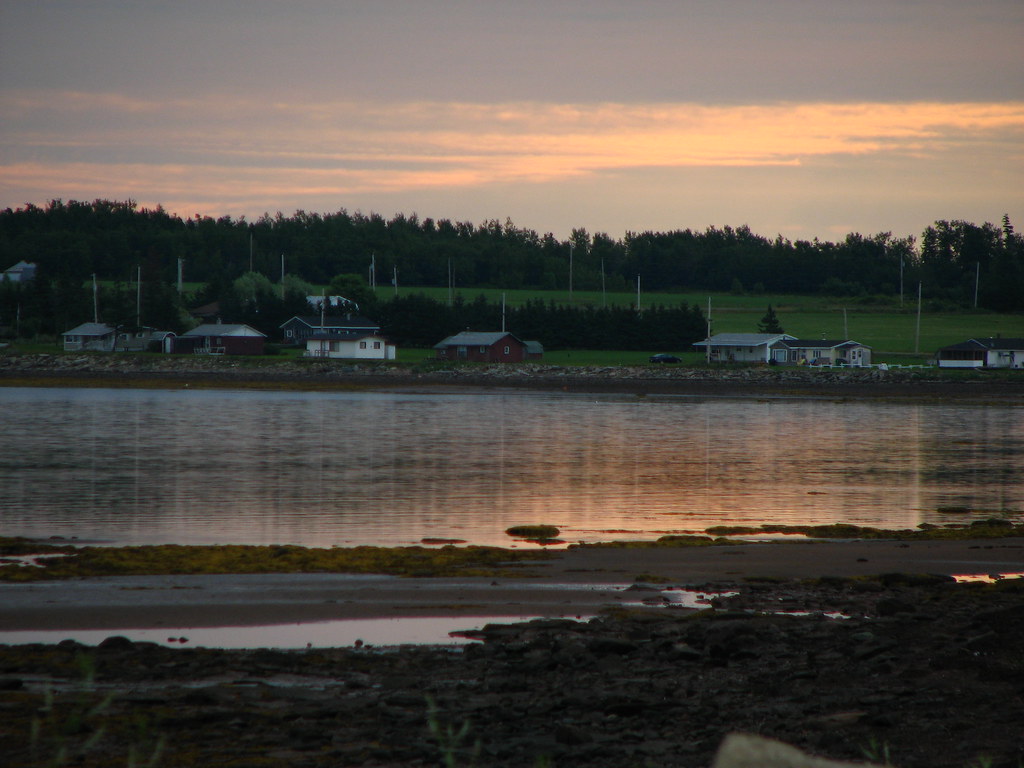
Broken mirror

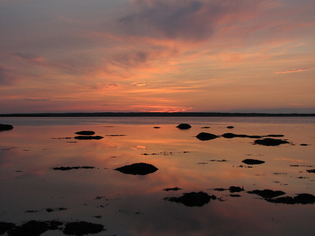
Low Tide
Sunrise
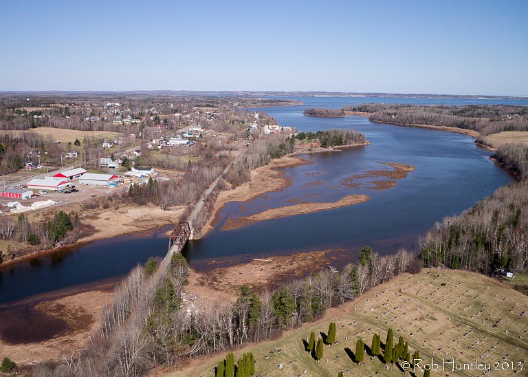
Aerial view of the town of Tatamagouche, Nova Scotia alongside the Waugh River - Kite Aerial Photography (KAP)

Aerial view of the town of Tatamagouche, Nova Scotia alongside the Waugh River - Kite Aerial Photography (KAP)

Aerial view of the Waugh River flowing past Tatamagouche, Nova Scotia - Kite Aerial Photography (KAP)

Waterfall at Earltown

Waterfall at Earltown2
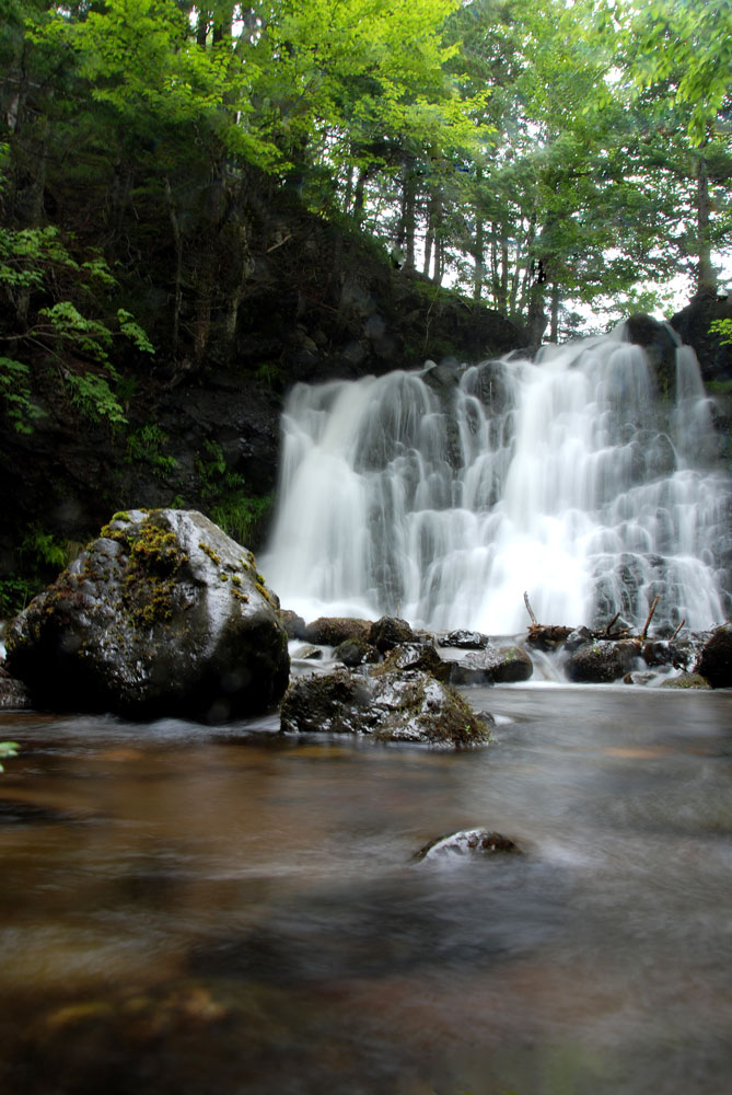
Earltown Falls in Nova Scotia
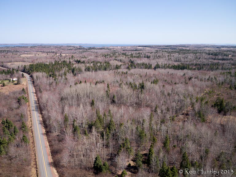
Aerial view of a road through the countryside near Tatamagouche, Nova Scotia - Kite Aerial Photography (KAP)
Mapa de The Falls, NS B0K, Canadá
Buscar otro lugar
Lugares cercanos
Balmoral Rd, Tatamagouche, NS B0K 1V0, Canadá
Balfron, NS B0K 1V0, Canadá
Matheson Brook Rd, Tatamagouche, NS B0K 1V0, Canadá
Tatamagouche, NS B0K 1V0, Canadá
Balmoral Mills, NS B0K, Canadá
Nuttby Mountain, Nuttby, NS B6L 6N2, Canadá
Nuttby, NS, Canadá
Waldegrave, NS B0K, Canadá
NS-, Tatamagouche, NS B0K 1V0, Canadá
11 Alex Cox Rd, Tatamagouche, NS B0K 1V0, Canadá
Barrachois, NS B0K 1V0, Canadá
Nova Scotia, NS-, Colchester, Subd. B, NS B0K, Canadá
Truro Rd, McCallum Settlement, NS B6L 6V5, Canadá
Hobby Barn, NS-, Upper North River, NS B6L 6J8, Canadá
Upper North River, NS B6L, Canadá
68 College Grant Rd, Scotsburn, NS B0K 1R0, Canadá
College Grant, NS B0K 1N0, Canadá
Kemptown, NS, Canadá
North River, NS B6L, Canadá
Upper Brookside Road, Upper Brookside Rd, Colchester, Subd. B, NS B6L, Canadá
Búsquedas recientes
- Horas de salida y puesta de sol de Jialuohu, Datong Township, Yilan County, Taiwan
- Horas de salida y puesta de sol de 大下港, Sekizenoge, Imabari, Prefectura de Ehime -, Japón
- Horas de salida y puesta de sol de Oge port Ferry Terminal, -1 Sekizenōge, Imabari, Ehime -, Japón
- Horas de salida y puesta de sol de San Telmo, Cdad. Autónoma de Buenos Aires, Argentina
- Horas de salida y puesta de sol de Congressional Dr, Stevensville, MD, USA
- Horas de salida y puesta de sol de Papingo 04, Grecia
- Horas de salida y puesta de sol de Pagonija rock, Kranto 7-oji g. 8"N, Kaunas, Lituania
- Horas de salida y puesta de sol de Co Rd 87, Jamestown, CO, EE. UU.
- Horas de salida y puesta de sol de Tenjo, Cundinamarca, Colombia
- Horas de salida y puesta de sol de -1 Gosho, Ichihara, Chiba -, Japón