Skyline Dr, Myrtle Creek, OR アメリカ合衆国日の出日の入り時間
Location: アメリカ合衆国 > オレゴン州 > ダグラス > アメリカ合衆国 〒 オレゴン州 マートル・クリーク >
時間帯:
America/Los_Angeles
現地時間:
2024-05-18 07:12:21
経度:
-123.3457539
緯度:
43.0086558
今日の日の出時刻:
05:45:59 AM
今日の日の入時刻:
08:33:45 PM
今日の日長:
14h 47m 46s
明日の日の出時刻:
05:45:05 AM
明日の日の入時刻:
08:34:45 PM
明日の日長:
14h 49m 40s
すべて表示する
| 日付 | 日出 | 日没 | 日長 |
|---|---|---|---|
| 2024年01月01日 | 07:44:40 AM | 04:49:51 PM | 9h 5m 11s |
| 2024年01月02日 | 07:44:41 AM | 04:50:45 PM | 9h 6m 4s |
| 2024年01月03日 | 07:44:40 AM | 04:51:41 PM | 9h 7m 1s |
| 2024年01月04日 | 07:44:37 AM | 04:52:39 PM | 9h 8m 2s |
| 2024年01月05日 | 07:44:31 AM | 04:53:38 PM | 9h 9m 7s |
| 2024年01月06日 | 07:44:23 AM | 04:54:38 PM | 9h 10m 15s |
| 2024年01月07日 | 07:44:12 AM | 04:55:40 PM | 9h 11m 28s |
| 2024年01月08日 | 07:43:59 AM | 04:56:44 PM | 9h 12m 45s |
| 2024年01月09日 | 07:43:43 AM | 04:57:48 PM | 9h 14m 5s |
| 2024年01月10日 | 07:43:26 AM | 04:58:54 PM | 9h 15m 28s |
| 2024年01月11日 | 07:43:05 AM | 05:00:02 PM | 9h 16m 57s |
| 2024年01月12日 | 07:42:42 AM | 05:01:10 PM | 9h 18m 28s |
| 2024年01月13日 | 07:42:17 AM | 05:02:20 PM | 9h 20m 3s |
| 2024年01月14日 | 07:41:50 AM | 05:03:30 PM | 9h 21m 40s |
| 2024年01月15日 | 07:41:20 AM | 05:04:42 PM | 9h 23m 22s |
| 2024年01月16日 | 07:40:48 AM | 05:05:54 PM | 9h 25m 6s |
| 2024年01月17日 | 07:40:14 AM | 05:07:07 PM | 9h 26m 53s |
| 2024年01月18日 | 07:39:37 AM | 05:08:21 PM | 9h 28m 44s |
| 2024年01月19日 | 07:38:59 AM | 05:09:36 PM | 9h 30m 37s |
| 2024年01月20日 | 07:38:18 AM | 05:10:52 PM | 9h 32m 34s |
| 2024年01月21日 | 07:37:35 AM | 05:12:08 PM | 9h 34m 33s |
| 2024年01月22日 | 07:36:50 AM | 05:13:25 PM | 9h 36m 35s |
| 2024年01月23日 | 07:36:02 AM | 05:14:42 PM | 9h 38m 40s |
| 2024年01月24日 | 07:35:13 AM | 05:16:00 PM | 9h 40m 47s |
| 2024年01月25日 | 07:34:22 AM | 05:17:18 PM | 9h 42m 56s |
| 2024年01月26日 | 07:33:28 AM | 05:18:37 PM | 9h 45m 9s |
| 2024年01月27日 | 07:32:33 AM | 05:19:55 PM | 9h 47m 22s |
| 2024年01月28日 | 07:31:36 AM | 05:21:15 PM | 9h 49m 39s |
| 2024年01月29日 | 07:30:37 AM | 05:22:34 PM | 9h 51m 57s |
| 2024年01月30日 | 07:29:36 AM | 05:23:54 PM | 9h 54m 18s |
| 2024年01月31日 | 07:28:33 AM | 05:25:14 PM | 9h 56m 41s |
| 2024年02月01日 | 07:27:28 AM | 05:26:34 PM | 9h 59m 6s |
| 2024年02月02日 | 07:26:22 AM | 05:27:54 PM | 10h 1m 32s |
| 2024年02月03日 | 07:25:14 AM | 05:29:14 PM | 10h 4m 0s |
| 2024年02月04日 | 07:24:05 AM | 05:30:34 PM | 10h 6m 29s |
| 2024年02月05日 | 07:22:53 AM | 05:31:54 PM | 10h 9m 1s |
| 2024年02月06日 | 07:21:41 AM | 05:33:15 PM | 10h 11m 34s |
| 2024年02月07日 | 07:20:26 AM | 05:34:35 PM | 10h 14m 9s |
| 2024年02月08日 | 07:19:10 AM | 05:35:55 PM | 10h 16m 45s |
| 2024年02月09日 | 07:17:53 AM | 05:37:15 PM | 10h 19m 22s |
| 2024年02月10日 | 07:16:34 AM | 05:38:34 PM | 10h 22m 0s |
| 2024年02月11日 | 07:15:14 AM | 05:39:54 PM | 10h 24m 40s |
| 2024年02月12日 | 07:13:53 AM | 05:41:14 PM | 10h 27m 21s |
| 2024年02月13日 | 07:12:30 AM | 05:42:33 PM | 10h 30m 3s |
| 2024年02月14日 | 07:11:06 AM | 05:43:52 PM | 10h 32m 46s |
| 2024年02月15日 | 07:09:41 AM | 05:45:11 PM | 10h 35m 30s |
| 2024年02月16日 | 07:08:14 AM | 05:46:30 PM | 10h 38m 16s |
| 2024年02月17日 | 07:06:47 AM | 05:47:48 PM | 10h 41m 1s |
| 2024年02月18日 | 07:05:18 AM | 05:49:06 PM | 10h 43m 48s |
| 2024年02月19日 | 07:03:48 AM | 05:50:24 PM | 10h 46m 36s |
| 2024年02月20日 | 07:02:17 AM | 05:51:42 PM | 10h 49m 25s |
| 2024年02月21日 | 07:00:45 AM | 05:52:59 PM | 10h 52m 14s |
| 2024年02月22日 | 06:59:13 AM | 05:54:16 PM | 10h 55m 3s |
| 2024年02月23日 | 06:57:39 AM | 05:55:33 PM | 10h 57m 54s |
| 2024年02月24日 | 06:56:04 AM | 05:56:50 PM | 11h 0m 46s |
| 2024年02月25日 | 06:54:29 AM | 05:58:06 PM | 11h 3m 37s |
| 2024年02月26日 | 06:52:52 AM | 05:59:22 PM | 11h 6m 30s |
| 2024年02月27日 | 06:51:15 AM | 06:00:38 PM | 11h 9m 23s |
| 2024年02月28日 | 06:49:37 AM | 06:01:53 PM | 11h 12m 16s |
| 2024年02月29日 | 06:47:58 AM | 06:03:08 PM | 11h 15m 10s |
| 2024年03月01日 | 06:46:19 AM | 06:04:23 PM | 11h 18m 4s |
| 2024年03月02日 | 06:44:39 AM | 06:05:37 PM | 11h 20m 58s |
| 2024年03月03日 | 06:42:58 AM | 06:06:52 PM | 11h 23m 54s |
| 2024年03月04日 | 06:41:17 AM | 06:08:06 PM | 11h 26m 49s |
| 2024年03月05日 | 06:39:35 AM | 06:09:19 PM | 11h 29m 44s |
| 2024年03月06日 | 06:37:53 AM | 06:10:33 PM | 11h 32m 40s |
| 2024年03月07日 | 06:36:10 AM | 06:11:46 PM | 11h 35m 36s |
| 2024年03月08日 | 06:34:27 AM | 06:12:59 PM | 11h 38m 32s |
| 2024年03月09日 | 06:32:43 AM | 06:14:11 PM | 11h 41m 28s |
| 2024年03月10日 | 07:31:03 AM | 07:15:21 PM | 11h 44m 18s |
| 2024年03月11日 | 07:29:19 AM | 07:16:33 PM | 11h 47m 14s |
| 2024年03月12日 | 07:27:34 AM | 07:17:45 PM | 11h 50m 11s |
| 2024年03月13日 | 07:25:49 AM | 07:18:57 PM | 11h 53m 8s |
| 2024年03月14日 | 07:24:04 AM | 07:20:08 PM | 11h 56m 4s |
| 2024年03月15日 | 07:22:18 AM | 07:21:20 PM | 11h 59m 2s |
| 2024年03月16日 | 07:20:32 AM | 07:22:31 PM | 12h 1m 59s |
| 2024年03月17日 | 07:18:47 AM | 07:23:42 PM | 12h 4m 55s |
| 2024年03月18日 | 07:17:00 AM | 07:24:53 PM | 12h 7m 53s |
| 2024年03月19日 | 07:15:14 AM | 07:26:04 PM | 12h 10m 50s |
| 2024年03月20日 | 07:13:28 AM | 07:27:14 PM | 12h 13m 46s |
| 2024年03月21日 | 07:11:42 AM | 07:28:25 PM | 12h 16m 43s |
| 2024年03月22日 | 07:09:55 AM | 07:29:35 PM | 12h 19m 40s |
| 2024年03月23日 | 07:08:09 AM | 07:30:45 PM | 12h 22m 36s |
| 2024年03月24日 | 07:06:23 AM | 07:31:55 PM | 12h 25m 32s |
| 2024年03月25日 | 07:04:36 AM | 07:33:05 PM | 12h 28m 29s |
| 2024年03月26日 | 07:02:50 AM | 07:34:15 PM | 12h 31m 25s |
| 2024年03月27日 | 07:01:04 AM | 07:35:25 PM | 12h 34m 21s |
| 2024年03月28日 | 06:59:18 AM | 07:36:35 PM | 12h 37m 17s |
| 2024年03月29日 | 06:57:33 AM | 07:37:45 PM | 12h 40m 12s |
| 2024年03月30日 | 06:55:47 AM | 07:38:54 PM | 12h 43m 7s |
| 2024年03月31日 | 06:54:02 AM | 07:40:04 PM | 12h 46m 2s |
| 2024年04月01日 | 06:52:17 AM | 07:41:14 PM | 12h 48m 57s |
| 2024年04月02日 | 06:50:33 AM | 07:42:23 PM | 12h 51m 50s |
| 2024年04月03日 | 06:48:48 AM | 07:43:33 PM | 12h 54m 45s |
| 2024年04月04日 | 06:47:05 AM | 07:44:42 PM | 12h 57m 37s |
| 2024年04月05日 | 06:45:21 AM | 07:45:52 PM | 13h 0m 31s |
| 2024年04月06日 | 06:43:38 AM | 07:47:01 PM | 13h 3m 23s |
| 2024年04月07日 | 06:41:56 AM | 07:48:11 PM | 13h 6m 15s |
| 2024年04月08日 | 06:40:14 AM | 07:49:20 PM | 13h 9m 6s |
| 2024年04月09日 | 06:38:32 AM | 07:50:30 PM | 13h 11m 58s |
| 2024年04月10日 | 06:36:51 AM | 07:51:39 PM | 13h 14m 48s |
| 2024年04月11日 | 06:35:11 AM | 07:52:49 PM | 13h 17m 38s |
| 2024年04月12日 | 06:33:31 AM | 07:53:58 PM | 13h 20m 27s |
| 2024年04月13日 | 06:31:52 AM | 07:55:08 PM | 13h 23m 16s |
| 2024年04月14日 | 06:30:14 AM | 07:56:17 PM | 13h 26m 3s |
| 2024年04月15日 | 06:28:36 AM | 07:57:27 PM | 13h 28m 51s |
| 2024年04月16日 | 06:27:00 AM | 07:58:36 PM | 13h 31m 36s |
| 2024年04月17日 | 06:25:24 AM | 07:59:46 PM | 13h 34m 22s |
| 2024年04月18日 | 06:23:48 AM | 08:00:56 PM | 13h 37m 8s |
| 2024年04月19日 | 06:22:14 AM | 08:02:05 PM | 13h 39m 51s |
| 2024年04月20日 | 06:20:41 AM | 08:03:15 PM | 13h 42m 34s |
| 2024年04月21日 | 06:19:08 AM | 08:04:24 PM | 13h 45m 16s |
| 2024年04月22日 | 06:17:37 AM | 08:05:33 PM | 13h 47m 56s |
| 2024年04月23日 | 06:16:06 AM | 08:06:43 PM | 13h 50m 37s |
| 2024年04月24日 | 06:14:37 AM | 08:07:52 PM | 13h 53m 15s |
| 2024年04月25日 | 06:13:08 AM | 08:09:01 PM | 13h 55m 53s |
| 2024年04月26日 | 06:11:41 AM | 08:10:10 PM | 13h 58m 29s |
| 2024年04月27日 | 06:10:15 AM | 08:11:19 PM | 14h 1m 4s |
| 2024年04月28日 | 06:08:50 AM | 08:12:28 PM | 14h 3m 38s |
| 2024年04月29日 | 06:07:26 AM | 08:13:37 PM | 14h 6m 11s |
| 2024年04月30日 | 06:06:03 AM | 08:14:46 PM | 14h 8m 43s |
| 2024年05月01日 | 06:04:42 AM | 08:15:54 PM | 14h 11m 12s |
| 2024年05月02日 | 06:03:22 AM | 08:17:02 PM | 14h 13m 40s |
| 2024年05月03日 | 06:02:03 AM | 08:18:10 PM | 14h 16m 7s |
| 2024年05月04日 | 06:00:46 AM | 08:19:18 PM | 14h 18m 32s |
| 2024年05月05日 | 05:59:30 AM | 08:20:25 PM | 14h 20m 55s |
| 2024年05月06日 | 05:58:15 AM | 08:21:32 PM | 14h 23m 17s |
| 2024年05月07日 | 05:57:02 AM | 08:22:39 PM | 14h 25m 37s |
| 2024年05月08日 | 05:55:51 AM | 08:23:46 PM | 14h 27m 55s |
| 2024年05月09日 | 05:54:41 AM | 08:24:52 PM | 14h 30m 11s |
| 2024年05月10日 | 05:53:32 AM | 08:25:57 PM | 14h 32m 25s |
| 2024年05月11日 | 05:52:26 AM | 08:27:03 PM | 14h 34m 37s |
| 2024年05月12日 | 05:51:20 AM | 08:28:07 PM | 14h 36m 47s |
| 2024年05月13日 | 05:50:17 AM | 08:29:11 PM | 14h 38m 54s |
| 2024年05月14日 | 05:49:15 AM | 08:30:15 PM | 14h 41m 0s |
| 2024年05月15日 | 05:48:15 AM | 08:31:18 PM | 14h 43m 3s |
| 2024年05月16日 | 05:47:17 AM | 08:32:20 PM | 14h 45m 3s |
| 2024年05月17日 | 05:46:20 AM | 08:33:22 PM | 14h 47m 2s |
| 2024年05月18日 | 05:45:25 AM | 08:34:23 PM | 14h 48m 58s |
| 2024年05月19日 | 05:44:33 AM | 08:35:23 PM | 14h 50m 50s |
| 2024年05月20日 | 05:43:42 AM | 08:36:22 PM | 14h 52m 40s |
| 2024年05月21日 | 05:42:52 AM | 08:37:21 PM | 14h 54m 29s |
| 2024年05月22日 | 05:42:05 AM | 08:38:18 PM | 14h 56m 13s |
| 2024年05月23日 | 05:41:20 AM | 08:39:15 PM | 14h 57m 55s |
| 2024年05月24日 | 05:40:37 AM | 08:40:11 PM | 14h 59m 34s |
| 2024年05月25日 | 05:39:56 AM | 08:41:05 PM | 15h 1m 9s |
| 2024年05月26日 | 05:39:16 AM | 08:41:59 PM | 15h 2m 43s |
| 2024年05月27日 | 05:38:39 AM | 08:42:51 PM | 15h 4m 12s |
| 2024年05月28日 | 05:38:04 AM | 08:43:43 PM | 15h 5m 39s |
| 2024年05月29日 | 05:37:31 AM | 08:44:33 PM | 15h 7m 2s |
| 2024年05月30日 | 05:37:00 AM | 08:45:21 PM | 15h 8m 21s |
| 2024年05月31日 | 05:36:31 AM | 08:46:09 PM | 15h 9m 38s |
| 2024年06月01日 | 05:36:05 AM | 08:46:55 PM | 15h 10m 50s |
| 2024年06月02日 | 05:35:40 AM | 08:47:40 PM | 15h 12m 0s |
| 2024年06月03日 | 05:35:17 AM | 08:48:23 PM | 15h 13m 6s |
| 2024年06月04日 | 05:34:57 AM | 08:49:05 PM | 15h 14m 8s |
| 2024年06月05日 | 05:34:39 AM | 08:49:45 PM | 15h 15m 6s |
| 2024年06月06日 | 05:34:23 AM | 08:50:23 PM | 15h 16m 0s |
| 2024年06月07日 | 05:34:09 AM | 08:51:01 PM | 15h 16m 52s |
| 2024年06月08日 | 05:33:58 AM | 08:51:36 PM | 15h 17m 38s |
| 2024年06月09日 | 05:33:48 AM | 08:52:09 PM | 15h 18m 21s |
| 2024年06月10日 | 05:33:41 AM | 08:52:41 PM | 15h 19m 0s |
| 2024年06月11日 | 05:33:36 AM | 08:53:11 PM | 15h 19m 35s |
| 2024年06月12日 | 05:33:33 AM | 08:53:40 PM | 15h 20m 7s |
| 2024年06月13日 | 05:33:32 AM | 08:54:06 PM | 15h 20m 34s |
| 2024年06月14日 | 05:33:33 AM | 08:54:31 PM | 15h 20m 58s |
| 2024年06月15日 | 05:33:36 AM | 08:54:53 PM | 15h 21m 17s |
| 2024年06月16日 | 05:33:42 AM | 08:55:14 PM | 15h 21m 32s |
| 2024年06月17日 | 05:33:49 AM | 08:55:32 PM | 15h 21m 43s |
| 2024年06月18日 | 05:33:59 AM | 08:55:49 PM | 15h 21m 50s |
| 2024年06月19日 | 05:34:10 AM | 08:56:04 PM | 15h 21m 54s |
| 2024年06月20日 | 05:34:24 AM | 08:56:16 PM | 15h 21m 52s |
| 2024年06月21日 | 05:34:39 AM | 08:56:27 PM | 15h 21m 48s |
| 2024年06月22日 | 05:34:57 AM | 08:56:35 PM | 15h 21m 38s |
| 2024年06月23日 | 05:35:17 AM | 08:56:41 PM | 15h 21m 24s |
| 2024年06月24日 | 05:35:38 AM | 08:56:45 PM | 15h 21m 7s |
| 2024年06月25日 | 05:36:01 AM | 08:56:47 PM | 15h 20m 46s |
| 2024年06月26日 | 05:36:26 AM | 08:56:46 PM | 15h 20m 20s |
| 2024年06月27日 | 05:36:53 AM | 08:56:44 PM | 15h 19m 51s |
| 2024年06月28日 | 05:37:22 AM | 08:56:39 PM | 15h 19m 17s |
| 2024年06月29日 | 05:37:52 AM | 08:56:32 PM | 15h 18m 40s |
| 2024年06月30日 | 05:38:25 AM | 08:56:23 PM | 15h 17m 58s |
| 2024年07月01日 | 05:38:58 AM | 08:56:12 PM | 15h 17m 14s |
| 2024年07月02日 | 05:39:34 AM | 08:55:58 PM | 15h 16m 24s |
| 2024年07月03日 | 05:40:11 AM | 08:55:43 PM | 15h 15m 32s |
| 2024年07月04日 | 05:40:49 AM | 08:55:25 PM | 15h 14m 36s |
| 2024年07月05日 | 05:41:29 AM | 08:55:05 PM | 15h 13m 36s |
| 2024年07月06日 | 05:42:10 AM | 08:54:42 PM | 15h 12m 32s |
| 2024年07月07日 | 05:42:53 AM | 08:54:18 PM | 15h 11m 25s |
| 2024年07月08日 | 05:43:37 AM | 08:53:51 PM | 15h 10m 14s |
| 2024年07月09日 | 05:44:23 AM | 08:53:22 PM | 15h 8m 59s |
| 2024年07月10日 | 05:45:09 AM | 08:52:51 PM | 15h 7m 42s |
| 2024年07月11日 | 05:45:57 AM | 08:52:18 PM | 15h 6m 21s |
| 2024年07月12日 | 05:46:46 AM | 08:51:43 PM | 15h 4m 57s |
| 2024年07月13日 | 05:47:36 AM | 08:51:06 PM | 15h 3m 30s |
| 2024年07月14日 | 05:48:28 AM | 08:50:26 PM | 15h 1m 58s |
| 2024年07月15日 | 05:49:20 AM | 08:49:45 PM | 15h 0m 25s |
| 2024年07月16日 | 05:50:13 AM | 08:49:02 PM | 14h 58m 49s |
| 2024年07月17日 | 05:51:07 AM | 08:48:16 PM | 14h 57m 9s |
| 2024年07月18日 | 05:52:02 AM | 08:47:29 PM | 14h 55m 27s |
| 2024年07月19日 | 05:52:58 AM | 08:46:39 PM | 14h 53m 41s |
| 2024年07月20日 | 05:53:55 AM | 08:45:48 PM | 14h 51m 53s |
| 2024年07月21日 | 05:54:52 AM | 08:44:55 PM | 14h 50m 3s |
| 2024年07月22日 | 05:55:50 AM | 08:44:00 PM | 14h 48m 10s |
| 2024年07月23日 | 05:56:49 AM | 08:43:03 PM | 14h 46m 14s |
| 2024年07月24日 | 05:57:48 AM | 08:42:04 PM | 14h 44m 16s |
| 2024年07月25日 | 05:58:48 AM | 08:41:03 PM | 14h 42m 15s |
| 2024年07月26日 | 05:59:49 AM | 08:40:01 PM | 14h 40m 12s |
| 2024年07月27日 | 06:00:50 AM | 08:38:57 PM | 14h 38m 7s |
| 2024年07月28日 | 06:01:52 AM | 08:37:51 PM | 14h 35m 59s |
| 2024年07月29日 | 06:02:54 AM | 08:36:44 PM | 14h 33m 50s |
| 2024年07月30日 | 06:03:56 AM | 08:35:35 PM | 14h 31m 39s |
| 2024年07月31日 | 06:04:59 AM | 08:34:24 PM | 14h 29m 25s |
| 2024年08月01日 | 06:06:02 AM | 08:33:12 PM | 14h 27m 10s |
| 2024年08月02日 | 06:07:05 AM | 08:31:58 PM | 14h 24m 53s |
| 2024年08月03日 | 06:08:09 AM | 08:30:43 PM | 14h 22m 34s |
| 2024年08月04日 | 06:09:13 AM | 08:29:27 PM | 14h 20m 14s |
| 2024年08月05日 | 06:10:17 AM | 08:28:09 PM | 14h 17m 52s |
| 2024年08月06日 | 06:11:22 AM | 08:26:49 PM | 14h 15m 27s |
| 2024年08月07日 | 06:12:26 AM | 08:25:28 PM | 14h 13m 2s |
| 2024年08月08日 | 06:13:31 AM | 08:24:06 PM | 14h 10m 35s |
| 2024年08月09日 | 06:14:36 AM | 08:22:43 PM | 14h 8m 7s |
| 2024年08月10日 | 06:15:41 AM | 08:21:18 PM | 14h 5m 37s |
| 2024年08月11日 | 06:16:46 AM | 08:19:52 PM | 14h 3m 6s |
| 2024年08月12日 | 06:17:52 AM | 08:18:25 PM | 14h 0m 33s |
| 2024年08月13日 | 06:18:57 AM | 08:16:57 PM | 13h 58m 0s |
| 2024年08月14日 | 06:20:02 AM | 08:15:27 PM | 13h 55m 25s |
| 2024年08月15日 | 06:21:08 AM | 08:13:57 PM | 13h 52m 49s |
| 2024年08月16日 | 06:22:13 AM | 08:12:25 PM | 13h 50m 12s |
| 2024年08月17日 | 06:23:19 AM | 08:10:53 PM | 13h 47m 34s |
| 2024年08月18日 | 06:24:24 AM | 08:09:19 PM | 13h 44m 55s |
| 2024年08月19日 | 06:25:30 AM | 08:07:45 PM | 13h 42m 15s |
| 2024年08月20日 | 06:26:35 AM | 08:06:09 PM | 13h 39m 34s |
| 2024年08月21日 | 06:27:40 AM | 08:04:33 PM | 13h 36m 53s |
| 2024年08月22日 | 06:28:46 AM | 08:02:56 PM | 13h 34m 10s |
| 2024年08月23日 | 06:29:51 AM | 08:01:18 PM | 13h 31m 27s |
| 2024年08月24日 | 06:30:57 AM | 07:59:39 PM | 13h 28m 42s |
| 2024年08月25日 | 06:32:02 AM | 07:58:00 PM | 13h 25m 58s |
| 2024年08月26日 | 06:33:07 AM | 07:56:19 PM | 13h 23m 12s |
| 2024年08月27日 | 06:34:12 AM | 07:54:38 PM | 13h 20m 26s |
| 2024年08月28日 | 06:35:18 AM | 07:52:57 PM | 13h 17m 39s |
| 2024年08月29日 | 06:36:23 AM | 07:51:15 PM | 13h 14m 52s |
| 2024年08月30日 | 06:37:28 AM | 07:49:32 PM | 13h 12m 4s |
| 2024年08月31日 | 06:38:33 AM | 07:47:48 PM | 13h 9m 15s |
| 2024年09月01日 | 06:39:38 AM | 07:46:05 PM | 13h 6m 27s |
| 2024年09月02日 | 06:40:43 AM | 07:44:20 PM | 13h 3m 37s |
| 2024年09月03日 | 06:41:48 AM | 07:42:35 PM | 13h 0m 47s |
| 2024年09月04日 | 06:42:53 AM | 07:40:50 PM | 12h 57m 57s |
| 2024年09月05日 | 06:43:58 AM | 07:39:04 PM | 12h 55m 6s |
| 2024年09月06日 | 06:45:03 AM | 07:37:18 PM | 12h 52m 15s |
| 2024年09月07日 | 06:46:08 AM | 07:35:32 PM | 12h 49m 24s |
| 2024年09月08日 | 06:47:13 AM | 07:33:45 PM | 12h 46m 32s |
| 2024年09月09日 | 06:48:18 AM | 07:31:58 PM | 12h 43m 40s |
| 2024年09月10日 | 06:49:23 AM | 07:30:10 PM | 12h 40m 47s |
| 2024年09月11日 | 06:50:28 AM | 07:28:23 PM | 12h 37m 55s |
| 2024年09月12日 | 06:51:34 AM | 07:26:35 PM | 12h 35m 1s |
| 2024年09月13日 | 06:52:39 AM | 07:24:47 PM | 12h 32m 8s |
| 2024年09月14日 | 06:53:44 AM | 07:22:59 PM | 12h 29m 15s |
| 2024年09月15日 | 06:54:49 AM | 07:21:11 PM | 12h 26m 22s |
| 2024年09月16日 | 06:55:55 AM | 07:19:22 PM | 12h 23m 27s |
| 2024年09月17日 | 06:57:00 AM | 07:17:34 PM | 12h 20m 34s |
| 2024年09月18日 | 06:58:06 AM | 07:15:46 PM | 12h 17m 40s |
| 2024年09月19日 | 06:59:11 AM | 07:13:57 PM | 12h 14m 46s |
| 2024年09月20日 | 07:00:17 AM | 07:12:09 PM | 12h 11m 52s |
| 2024年09月21日 | 07:01:23 AM | 07:10:21 PM | 12h 8m 58s |
| 2024年09月22日 | 07:02:29 AM | 07:08:33 PM | 12h 6m 4s |
| 2024年09月23日 | 07:03:36 AM | 07:06:45 PM | 12h 3m 9s |
| 2024年09月24日 | 07:04:42 AM | 07:04:57 PM | 12h 0m 15s |
| 2024年09月25日 | 07:05:49 AM | 07:03:09 PM | 11h 57m 20s |
| 2024年09月26日 | 07:06:55 AM | 07:01:22 PM | 11h 54m 27s |
| 2024年09月27日 | 07:08:02 AM | 06:59:34 PM | 11h 51m 32s |
| 2024年09月28日 | 07:09:10 AM | 06:57:47 PM | 11h 48m 37s |
| 2024年09月29日 | 07:10:17 AM | 06:56:01 PM | 11h 45m 44s |
| 2024年09月30日 | 07:11:25 AM | 06:54:15 PM | 11h 42m 50s |
| 2024年10月01日 | 07:12:33 AM | 06:52:29 PM | 11h 39m 56s |
| 2024年10月02日 | 07:13:41 AM | 06:50:43 PM | 11h 37m 2s |
| 2024年10月03日 | 07:14:49 AM | 06:48:58 PM | 11h 34m 9s |
| 2024年10月04日 | 07:15:58 AM | 06:47:14 PM | 11h 31m 16s |
| 2024年10月05日 | 07:17:07 AM | 06:45:30 PM | 11h 28m 23s |
| 2024年10月06日 | 07:18:16 AM | 06:43:46 PM | 11h 25m 30s |
| 2024年10月07日 | 07:19:25 AM | 06:42:03 PM | 11h 22m 38s |
| 2024年10月08日 | 07:20:35 AM | 06:40:21 PM | 11h 19m 46s |
| 2024年10月09日 | 07:21:45 AM | 06:38:39 PM | 11h 16m 54s |
| 2024年10月10日 | 07:22:56 AM | 06:36:58 PM | 11h 14m 2s |
| 2024年10月11日 | 07:24:06 AM | 06:35:17 PM | 11h 11m 11s |
| 2024年10月12日 | 07:25:17 AM | 06:33:38 PM | 11h 8m 21s |
| 2024年10月13日 | 07:26:29 AM | 06:31:59 PM | 11h 5m 30s |
| 2024年10月14日 | 07:27:40 AM | 06:30:21 PM | 11h 2m 41s |
| 2024年10月15日 | 07:28:52 AM | 06:28:44 PM | 10h 59m 52s |
| 2024年10月16日 | 07:30:05 AM | 06:27:07 PM | 10h 57m 2s |
| 2024年10月17日 | 07:31:17 AM | 06:25:32 PM | 10h 54m 15s |
| 2024年10月18日 | 07:32:30 AM | 06:23:57 PM | 10h 51m 27s |
| 2024年10月19日 | 07:33:43 AM | 06:22:24 PM | 10h 48m 41s |
| 2024年10月20日 | 07:34:57 AM | 06:20:51 PM | 10h 45m 54s |
| 2024年10月21日 | 07:36:11 AM | 06:19:19 PM | 10h 43m 8s |
| 2024年10月22日 | 07:37:25 AM | 06:17:49 PM | 10h 40m 24s |
| 2024年10月23日 | 07:38:39 AM | 06:16:20 PM | 10h 37m 41s |
| 2024年10月24日 | 07:39:54 AM | 06:14:52 PM | 10h 34m 58s |
| 2024年10月25日 | 07:41:09 AM | 06:13:25 PM | 10h 32m 16s |
| 2024年10月26日 | 07:42:24 AM | 06:11:59 PM | 10h 29m 35s |
| 2024年10月27日 | 07:43:39 AM | 06:10:34 PM | 10h 26m 55s |
| 2024年10月28日 | 07:44:55 AM | 06:09:11 PM | 10h 24m 16s |
| 2024年10月29日 | 07:46:11 AM | 06:07:49 PM | 10h 21m 38s |
| 2024年10月30日 | 07:47:27 AM | 06:06:29 PM | 10h 19m 2s |
| 2024年10月31日 | 07:48:43 AM | 06:05:10 PM | 10h 16m 27s |
| 2024年11月01日 | 07:49:59 AM | 06:03:53 PM | 10h 13m 54s |
| 2024年11月02日 | 07:51:16 AM | 06:02:36 PM | 10h 11m 20s |
| 2024年11月03日 | 06:52:36 AM | 05:01:19 PM | 10h 8m 43s |
| 2024年11月04日 | 06:53:52 AM | 05:00:06 PM | 10h 6m 14s |
| 2024年11月05日 | 06:55:09 AM | 04:58:55 PM | 10h 3m 46s |
| 2024年11月06日 | 06:56:26 AM | 04:57:45 PM | 10h 1m 19s |
| 2024年11月07日 | 06:57:43 AM | 04:56:37 PM | 9h 58m 54s |
| 2024年11月08日 | 06:58:59 AM | 04:55:31 PM | 9h 56m 32s |
| 2024年11月09日 | 07:00:16 AM | 04:54:27 PM | 9h 54m 11s |
| 2024年11月10日 | 07:01:33 AM | 04:53:24 PM | 9h 51m 51s |
| 2024年11月11日 | 07:02:49 AM | 04:52:23 PM | 9h 49m 34s |
| 2024年11月12日 | 07:04:05 AM | 04:51:24 PM | 9h 47m 19s |
| 2024年11月13日 | 07:05:21 AM | 04:50:27 PM | 9h 45m 6s |
| 2024年11月14日 | 07:06:37 AM | 04:49:32 PM | 9h 42m 55s |
| 2024年11月15日 | 07:07:52 AM | 04:48:40 PM | 9h 40m 48s |
| 2024年11月16日 | 07:09:07 AM | 04:47:49 PM | 9h 38m 42s |
| 2024年11月17日 | 07:10:22 AM | 04:47:00 PM | 9h 36m 38s |
| 2024年11月18日 | 07:11:36 AM | 04:46:13 PM | 9h 34m 37s |
| 2024年11月19日 | 07:12:50 AM | 04:45:28 PM | 9h 32m 38s |
| 2024年11月20日 | 07:14:03 AM | 04:44:46 PM | 9h 30m 43s |
| 2024年11月21日 | 07:15:16 AM | 04:44:05 PM | 9h 28m 49s |
| 2024年11月22日 | 07:16:27 AM | 04:43:27 PM | 9h 27m 0s |
| 2024年11月23日 | 07:17:39 AM | 04:42:51 PM | 9h 25m 12s |
| 2024年11月24日 | 07:18:49 AM | 04:42:18 PM | 9h 23m 29s |
| 2024年11月25日 | 07:19:59 AM | 04:41:47 PM | 9h 21m 48s |
| 2024年11月26日 | 07:21:07 AM | 04:41:18 PM | 9h 20m 11s |
| 2024年11月27日 | 07:22:15 AM | 04:40:51 PM | 9h 18m 36s |
| 2024年11月28日 | 07:23:22 AM | 04:40:27 PM | 9h 17m 5s |
| 2024年11月29日 | 07:24:27 AM | 04:40:05 PM | 9h 15m 38s |
| 2024年11月30日 | 07:25:32 AM | 04:39:46 PM | 9h 14m 14s |
| 2024年12月01日 | 07:26:35 AM | 04:39:29 PM | 9h 12m 54s |
| 2024年12月02日 | 07:27:37 AM | 04:39:14 PM | 9h 11m 37s |
| 2024年12月03日 | 07:28:38 AM | 04:39:02 PM | 9h 10m 24s |
| 2024年12月04日 | 07:29:38 AM | 04:38:53 PM | 9h 9m 15s |
| 2024年12月05日 | 07:30:36 AM | 04:38:46 PM | 9h 8m 10s |
| 2024年12月06日 | 07:31:32 AM | 04:38:41 PM | 9h 7m 9s |
| 2024年12月07日 | 07:32:27 AM | 04:38:39 PM | 9h 6m 12s |
| 2024年12月08日 | 07:33:21 AM | 04:38:39 PM | 9h 5m 18s |
| 2024年12月09日 | 07:34:12 AM | 04:38:42 PM | 9h 4m 30s |
| 2024年12月10日 | 07:35:03 AM | 04:38:48 PM | 9h 3m 45s |
| 2024年12月11日 | 07:35:51 AM | 04:38:55 PM | 9h 3m 4s |
| 2024年12月12日 | 07:36:37 AM | 04:39:06 PM | 9h 2m 29s |
| 2024年12月13日 | 07:37:22 AM | 04:39:18 PM | 9h 1m 56s |
| 2024年12月14日 | 07:38:05 AM | 04:39:34 PM | 9h 1m 29s |
| 2024年12月15日 | 07:38:45 AM | 04:39:51 PM | 9h 1m 6s |
| 2024年12月16日 | 07:39:24 AM | 04:40:11 PM | 9h 0m 47s |
| 2024年12月17日 | 07:40:01 AM | 04:40:34 PM | 9h 0m 33s |
| 2024年12月18日 | 07:40:35 AM | 04:40:58 PM | 9h 0m 23s |
| 2024年12月19日 | 07:41:08 AM | 04:41:25 PM | 9h 0m 17s |
| 2024年12月20日 | 07:41:38 AM | 04:41:55 PM | 9h 0m 17s |
| 2024年12月21日 | 07:42:06 AM | 04:42:26 PM | 9h 0m 20s |
| 2024年12月22日 | 07:42:32 AM | 04:43:00 PM | 9h 0m 28s |
| 2024年12月23日 | 07:42:55 AM | 04:43:36 PM | 9h 0m 41s |
| 2024年12月24日 | 07:43:17 AM | 04:44:14 PM | 9h 0m 57s |
| 2024年12月25日 | 07:43:36 AM | 04:44:55 PM | 9h 1m 19s |
| 2024年12月26日 | 07:43:52 AM | 04:45:37 PM | 9h 1m 45s |
| 2024年12月27日 | 07:44:06 AM | 04:46:22 PM | 9h 2m 16s |
| 2024年12月28日 | 07:44:18 AM | 04:47:08 PM | 9h 2m 50s |
| 2024年12月29日 | 07:44:27 AM | 04:47:56 PM | 9h 3m 29s |
| 2024年12月30日 | 07:44:34 AM | 04:48:46 PM | 9h 4m 12s |
写真

Semaphores at Sunset
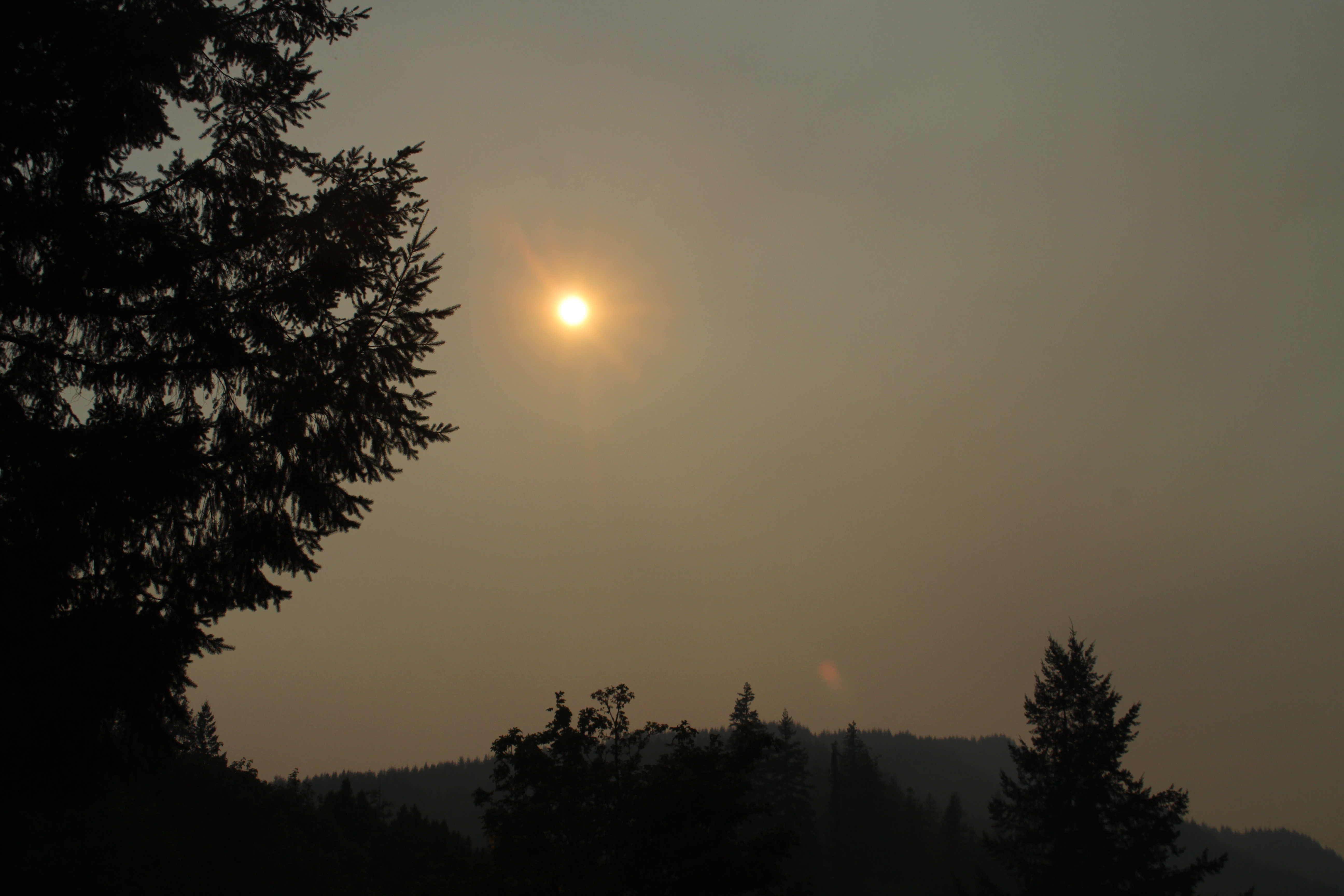
My backyard view, in the afternoon

IMG_5004.JPG

A view declining

At one point, ash was falling from the sky

Battle-Ready Cattle

Cow Creek Tribal timber sale: Gold Bluff
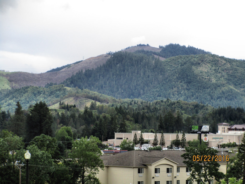
CAN-0522-011 - View
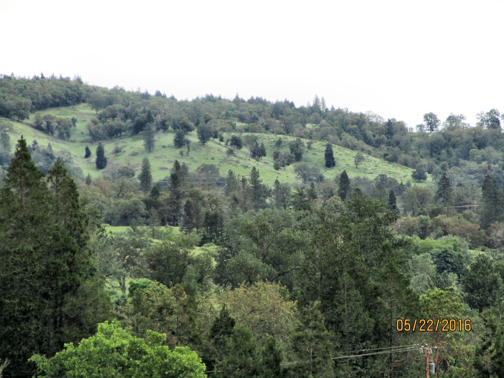
CAN-0522-010 - View
CAN-0522-008 - View

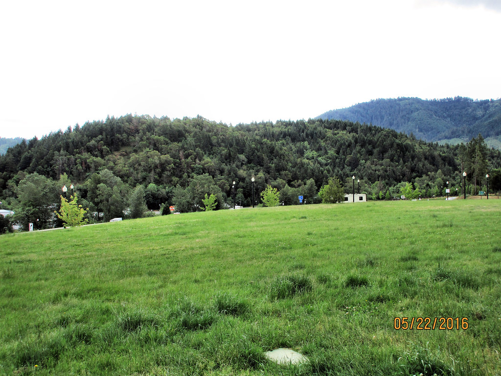
CAN-0522-009 - View

CAN-0522-006 - View

CAN-0522-007 - View

CAN-0522-012 - View
Skyline Dr, Myrtle Creek, OR アメリカ合衆国の地図
別の場所を検索
近所の場所
Boomer Hill Rd, Myrtle Creek, OR アメリカ合衆国
Boomer Hill Rd, Myrtle Creek, OR アメリカ合衆国
アメリカ合衆国 〒 オレゴン州 マートル・クリーク
アメリカ合衆国 〒 オレゴン州 リドル
アメリカ合衆国 〒 オレゴン州 サプライズ・バレー
Raleigh Dr, Winston, OR アメリカ合衆国ラリー・ドライブ
Creekside Rd, Canyonville, OR アメリカ合衆国
アメリカ合衆国 オレゴン州 キャニオンビル
Old Hwy 99 S, Winston, OR アメリカ合衆国
Old Hwy 99 S, Winston, OR アメリカ合衆国
Reston Ave, Winston, OR アメリカ合衆国
Reston Ave, Winston, OR アメリカ合衆国
5th St, Winston, OR アメリカ合衆国
アメリカ合衆国 〒 オレゴン州 ウィンストン
Pinnacle Ln, Roseburg, OR アメリカ合衆国
アメリカ合衆国 オレゴン州 ローズバーグ
アメリカ合衆国 オレゴン州 ダグラス
アメリカ合衆国 〒 オレゴン州 キャニオンビル
Austin Rd, Roseburg, OR アメリカ合衆国
Old Hwy 99 S, Roseburg, OR アメリカ合衆国
最近の検索
- Granada, Meta, Colombia日の出日の入り時間
- インド マハーラーシュトラ プネー ナル日の出日の入り時間
- Sri Bintang Hill Trail, Jalan 11/36, Taman Sri Bintang, Kuala Lumpur, Wilayah Persekutuan Kuala Lump日の出日の入り時間
- 日本、〒- 東京都台東区浅草2丁目3−1雷門日の出日の入り時間
- 日本、〒- 愛媛県今治市吉海町南浦日の出日の入り時間
- イギリス 〒FK8 スターリング キッペン日の出日の入り時間
- No. 23號, Zhongzheng Rd, Yuchi Township, Nantou County, 台湾 雲品温泉酒店日の出日の入り時間
- 日本、〒- 北海道岩見沢市北村赤川156−16日の出日の入り時間
- 55 Cassick Valley Rd, Wellfleet, MA アメリカ合衆国日の出日の入り時間
- 日本、〒- 東京都八王子市高尾町高尾山口駅日の出日の入り時間