CA-33, Maricopa, CA アメリカ合衆国日の出日の入り時間
Location: アメリカ合衆国 > カリフォルニア州 > サンタ・バーバラ >
時間帯:
America/Los_Angeles
現地時間:
2024-04-29 06:13:31
経度:
-119.476285
緯度:
34.8304199
今日の日の出時刻:
06:08:13 AM
今日の日の入時刻:
07:42:02 PM
今日の日長:
13h 33m 49s
明日の日の出時刻:
06:07:09 AM
明日の日の入時刻:
07:42:51 PM
明日の日長:
13h 35m 42s
すべて表示する
| 日付 | 日出 | 日没 | 日長 |
|---|---|---|---|
| 2024年01月01日 | 07:05:29 AM | 04:58:04 PM | 9h 52m 35s |
| 2024年01月02日 | 07:05:38 AM | 04:58:50 PM | 9h 53m 12s |
| 2024年01月03日 | 07:05:45 AM | 04:59:38 PM | 9h 53m 53s |
| 2024年01月04日 | 07:05:51 AM | 05:00:27 PM | 9h 54m 36s |
| 2024年01月05日 | 07:05:54 AM | 05:01:17 PM | 9h 55m 23s |
| 2024年01月06日 | 07:05:55 AM | 05:02:08 PM | 9h 56m 13s |
| 2024年01月07日 | 07:05:55 AM | 05:03:00 PM | 9h 57m 5s |
| 2024年01月08日 | 07:05:52 AM | 05:03:53 PM | 9h 58m 1s |
| 2024年01月09日 | 07:05:48 AM | 05:04:46 PM | 9h 58m 58s |
| 2024年01月10日 | 07:05:42 AM | 05:05:40 PM | 9h 59m 58s |
| 2024年01月11日 | 07:05:34 AM | 05:06:36 PM | 10h 1m 2s |
| 2024年01月12日 | 07:05:23 AM | 05:07:31 PM | 10h 2m 8s |
| 2024年01月13日 | 07:05:12 AM | 05:08:28 PM | 10h 3m 16s |
| 2024年01月14日 | 07:04:58 AM | 05:09:25 PM | 10h 4m 27s |
| 2024年01月15日 | 07:04:42 AM | 05:10:22 PM | 10h 5m 40s |
| 2024年01月16日 | 07:04:24 AM | 05:11:20 PM | 10h 6m 56s |
| 2024年01月17日 | 07:04:05 AM | 05:12:19 PM | 10h 8m 14s |
| 2024年01月18日 | 07:03:44 AM | 05:13:18 PM | 10h 9m 34s |
| 2024年01月19日 | 07:03:20 AM | 05:14:17 PM | 10h 10m 57s |
| 2024年01月20日 | 07:02:55 AM | 05:15:16 PM | 10h 12m 21s |
| 2024年01月21日 | 07:02:29 AM | 05:16:16 PM | 10h 13m 47s |
| 2024年01月22日 | 07:02:00 AM | 05:17:16 PM | 10h 15m 16s |
| 2024年01月23日 | 07:01:30 AM | 05:18:17 PM | 10h 16m 47s |
| 2024年01月24日 | 07:00:58 AM | 05:19:17 PM | 10h 18m 19s |
| 2024年01月25日 | 07:00:24 AM | 05:20:18 PM | 10h 19m 54s |
| 2024年01月26日 | 06:59:49 AM | 05:21:19 PM | 10h 21m 30s |
| 2024年01月27日 | 06:59:11 AM | 05:22:19 PM | 10h 23m 8s |
| 2024年01月28日 | 06:58:33 AM | 05:23:20 PM | 10h 24m 47s |
| 2024年01月29日 | 06:57:52 AM | 05:24:21 PM | 10h 26m 29s |
| 2024年01月30日 | 06:57:10 AM | 05:25:22 PM | 10h 28m 12s |
| 2024年01月31日 | 06:56:26 AM | 05:26:23 PM | 10h 29m 57s |
| 2024年02月01日 | 06:55:41 AM | 05:27:23 PM | 10h 31m 42s |
| 2024年02月02日 | 06:54:55 AM | 05:28:24 PM | 10h 33m 29s |
| 2024年02月03日 | 06:54:06 AM | 05:29:24 PM | 10h 35m 18s |
| 2024年02月04日 | 06:53:17 AM | 05:30:25 PM | 10h 37m 8s |
| 2024年02月05日 | 06:52:26 AM | 05:31:25 PM | 10h 38m 59s |
| 2024年02月06日 | 06:51:33 AM | 05:32:25 PM | 10h 40m 52s |
| 2024年02月07日 | 06:50:39 AM | 05:33:24 PM | 10h 42m 45s |
| 2024年02月08日 | 06:49:44 AM | 05:34:24 PM | 10h 44m 40s |
| 2024年02月09日 | 06:48:47 AM | 05:35:23 PM | 10h 46m 36s |
| 2024年02月10日 | 06:47:50 AM | 05:36:22 PM | 10h 48m 32s |
| 2024年02月11日 | 06:46:50 AM | 05:37:21 PM | 10h 50m 31s |
| 2024年02月12日 | 06:45:50 AM | 05:38:19 PM | 10h 52m 29s |
| 2024年02月13日 | 06:44:49 AM | 05:39:17 PM | 10h 54m 28s |
| 2024年02月14日 | 06:43:46 AM | 05:40:15 PM | 10h 56m 29s |
| 2024年02月15日 | 06:42:42 AM | 05:41:12 PM | 10h 58m 30s |
| 2024年02月16日 | 06:41:37 AM | 05:42:10 PM | 11h 0m 33s |
| 2024年02月17日 | 06:40:31 AM | 05:43:06 PM | 11h 2m 35s |
| 2024年02月18日 | 06:39:24 AM | 05:44:03 PM | 11h 4m 39s |
| 2024年02月19日 | 06:38:16 AM | 05:44:59 PM | 11h 6m 43s |
| 2024年02月20日 | 06:37:07 AM | 05:45:55 PM | 11h 8m 48s |
| 2024年02月21日 | 06:35:57 AM | 05:46:50 PM | 11h 10m 53s |
| 2024年02月22日 | 06:34:46 AM | 05:47:46 PM | 11h 13m 0s |
| 2024年02月23日 | 06:33:34 AM | 05:48:40 PM | 11h 15m 6s |
| 2024年02月24日 | 06:32:22 AM | 05:49:35 PM | 11h 17m 13s |
| 2024年02月25日 | 06:31:08 AM | 05:50:29 PM | 11h 19m 21s |
| 2024年02月26日 | 06:29:54 AM | 05:51:23 PM | 11h 21m 29s |
| 2024年02月27日 | 06:28:39 AM | 05:52:16 PM | 11h 23m 37s |
| 2024年02月28日 | 06:27:23 AM | 05:53:09 PM | 11h 25m 46s |
| 2024年02月29日 | 06:26:07 AM | 05:54:02 PM | 11h 27m 55s |
| 2024年03月01日 | 06:24:50 AM | 05:54:55 PM | 11h 30m 5s |
| 2024年03月02日 | 06:23:32 AM | 05:55:47 PM | 11h 32m 15s |
| 2024年03月03日 | 06:22:14 AM | 05:56:39 PM | 11h 34m 25s |
| 2024年03月04日 | 06:20:55 AM | 05:57:30 PM | 11h 36m 35s |
| 2024年03月05日 | 06:19:36 AM | 05:58:22 PM | 11h 38m 46s |
| 2024年03月06日 | 06:18:16 AM | 05:59:13 PM | 11h 40m 57s |
| 2024年03月07日 | 06:16:56 AM | 06:00:03 PM | 11h 43m 7s |
| 2024年03月08日 | 06:15:35 AM | 06:00:54 PM | 11h 45m 19s |
| 2024年03月09日 | 06:14:14 AM | 06:01:44 PM | 11h 47m 30s |
| 2024年03月10日 | 07:12:55 AM | 07:02:32 PM | 11h 49m 37s |
| 2024年03月11日 | 07:11:33 AM | 07:03:22 PM | 11h 51m 49s |
| 2024年03月12日 | 07:10:11 AM | 07:04:11 PM | 11h 54m 0s |
| 2024年03月13日 | 07:08:48 AM | 07:05:00 PM | 11h 56m 12s |
| 2024年03月14日 | 07:07:26 AM | 07:05:50 PM | 11h 58m 24s |
| 2024年03月15日 | 07:06:03 AM | 07:06:38 PM | 12h 0m 35s |
| 2024年03月16日 | 07:04:39 AM | 07:07:27 PM | 12h 2m 48s |
| 2024年03月17日 | 07:03:16 AM | 07:08:16 PM | 12h 5m 0s |
| 2024年03月18日 | 07:01:52 AM | 07:09:04 PM | 12h 7m 12s |
| 2024年03月19日 | 07:00:28 AM | 07:09:52 PM | 12h 9m 24s |
| 2024年03月20日 | 06:59:05 AM | 07:10:40 PM | 12h 11m 35s |
| 2024年03月21日 | 06:57:41 AM | 07:11:28 PM | 12h 13m 47s |
| 2024年03月22日 | 06:56:17 AM | 07:12:16 PM | 12h 15m 59s |
| 2024年03月23日 | 06:54:53 AM | 07:13:04 PM | 12h 18m 11s |
| 2024年03月24日 | 06:53:29 AM | 07:13:52 PM | 12h 20m 23s |
| 2024年03月25日 | 06:52:05 AM | 07:14:39 PM | 12h 22m 34s |
| 2024年03月26日 | 06:50:42 AM | 07:15:27 PM | 12h 24m 45s |
| 2024年03月27日 | 06:49:18 AM | 07:16:14 PM | 12h 26m 56s |
| 2024年03月28日 | 06:47:54 AM | 07:17:02 PM | 12h 29m 8s |
| 2024年03月29日 | 06:46:31 AM | 07:17:49 PM | 12h 31m 18s |
| 2024年03月30日 | 06:45:08 AM | 07:18:36 PM | 12h 33m 28s |
| 2024年03月31日 | 06:43:45 AM | 07:19:24 PM | 12h 35m 39s |
| 2024年04月01日 | 06:42:23 AM | 07:20:11 PM | 12h 37m 48s |
| 2024年04月02日 | 06:41:00 AM | 07:20:58 PM | 12h 39m 58s |
| 2024年04月03日 | 06:39:38 AM | 07:21:46 PM | 12h 42m 8s |
| 2024年04月04日 | 06:38:17 AM | 07:22:33 PM | 12h 44m 16s |
| 2024年04月05日 | 06:36:55 AM | 07:23:20 PM | 12h 46m 25s |
| 2024年04月06日 | 06:35:34 AM | 07:24:08 PM | 12h 48m 34s |
| 2024年04月07日 | 06:34:14 AM | 07:24:55 PM | 12h 50m 41s |
| 2024年04月08日 | 06:32:54 AM | 07:25:43 PM | 12h 52m 49s |
| 2024年04月09日 | 06:31:35 AM | 07:26:30 PM | 12h 54m 55s |
| 2024年04月10日 | 06:30:16 AM | 07:27:18 PM | 12h 57m 2s |
| 2024年04月11日 | 06:28:57 AM | 07:28:05 PM | 12h 59m 8s |
| 2024年04月12日 | 06:27:39 AM | 07:28:53 PM | 13h 1m 14s |
| 2024年04月13日 | 06:26:22 AM | 07:29:41 PM | 13h 3m 19s |
| 2024年04月14日 | 06:25:06 AM | 07:30:29 PM | 13h 5m 23s |
| 2024年04月15日 | 06:23:50 AM | 07:31:17 PM | 13h 7m 27s |
| 2024年04月16日 | 06:22:35 AM | 07:32:04 PM | 13h 9m 29s |
| 2024年04月17日 | 06:21:20 AM | 07:32:52 PM | 13h 11m 32s |
| 2024年04月18日 | 06:20:06 AM | 07:33:41 PM | 13h 13m 35s |
| 2024年04月19日 | 06:18:53 AM | 07:34:29 PM | 13h 15m 36s |
| 2024年04月20日 | 06:17:41 AM | 07:35:17 PM | 13h 17m 36s |
| 2024年04月21日 | 06:16:30 AM | 07:36:05 PM | 13h 19m 35s |
| 2024年04月22日 | 06:15:20 AM | 07:36:53 PM | 13h 21m 33s |
| 2024年04月23日 | 06:14:10 AM | 07:37:42 PM | 13h 23m 32s |
| 2024年04月24日 | 06:13:01 AM | 07:38:30 PM | 13h 25m 29s |
| 2024年04月25日 | 06:11:54 AM | 07:39:19 PM | 13h 27m 25s |
| 2024年04月26日 | 06:10:47 AM | 07:40:07 PM | 13h 29m 20s |
| 2024年04月27日 | 06:09:41 AM | 07:40:56 PM | 13h 31m 15s |
| 2024年04月28日 | 06:08:37 AM | 07:41:44 PM | 13h 33m 7s |
| 2024年04月29日 | 06:07:33 AM | 07:42:33 PM | 13h 35m 0s |
| 2024年04月30日 | 06:06:30 AM | 07:43:21 PM | 13h 36m 51s |
| 2024年05月01日 | 06:05:29 AM | 07:44:10 PM | 13h 38m 41s |
| 2024年05月02日 | 06:04:29 AM | 07:44:58 PM | 13h 40m 29s |
| 2024年05月03日 | 06:03:30 AM | 07:45:46 PM | 13h 42m 16s |
| 2024年05月04日 | 06:02:32 AM | 07:46:35 PM | 13h 44m 3s |
| 2024年05月05日 | 06:01:35 AM | 07:47:23 PM | 13h 45m 48s |
| 2024年05月06日 | 06:00:40 AM | 07:48:11 PM | 13h 47m 31s |
| 2024年05月07日 | 05:59:45 AM | 07:48:59 PM | 13h 49m 14s |
| 2024年05月08日 | 05:58:53 AM | 07:49:47 PM | 13h 50m 54s |
| 2024年05月09日 | 05:58:01 AM | 07:50:34 PM | 13h 52m 33s |
| 2024年05月10日 | 05:57:11 AM | 07:51:22 PM | 13h 54m 11s |
| 2024年05月11日 | 05:56:22 AM | 07:52:09 PM | 13h 55m 47s |
| 2024年05月12日 | 05:55:34 AM | 07:52:56 PM | 13h 57m 22s |
| 2024年05月13日 | 05:54:48 AM | 07:53:43 PM | 13h 58m 55s |
| 2024年05月14日 | 05:54:04 AM | 07:54:29 PM | 14h 0m 25s |
| 2024年05月15日 | 05:53:20 AM | 07:55:15 PM | 14h 1m 55s |
| 2024年05月16日 | 05:52:38 AM | 07:56:01 PM | 14h 3m 23s |
| 2024年05月17日 | 05:51:58 AM | 07:56:46 PM | 14h 4m 48s |
| 2024年05月18日 | 05:51:19 AM | 07:57:31 PM | 14h 6m 12s |
| 2024年05月19日 | 05:50:42 AM | 07:58:16 PM | 14h 7m 34s |
| 2024年05月20日 | 05:50:06 AM | 07:59:00 PM | 14h 8m 54s |
| 2024年05月21日 | 05:49:32 AM | 07:59:43 PM | 14h 10m 11s |
| 2024年05月22日 | 05:49:00 AM | 08:00:27 PM | 14h 11m 27s |
| 2024年05月23日 | 05:48:29 AM | 08:01:09 PM | 14h 12m 40s |
| 2024年05月24日 | 05:47:59 AM | 08:01:51 PM | 14h 13m 52s |
| 2024年05月25日 | 05:47:31 AM | 08:02:32 PM | 14h 15m 1s |
| 2024年05月26日 | 05:47:05 AM | 08:03:13 PM | 14h 16m 8s |
| 2024年05月27日 | 05:46:40 AM | 08:03:53 PM | 14h 17m 13s |
| 2024年05月28日 | 05:46:17 AM | 08:04:32 PM | 14h 18m 15s |
| 2024年05月29日 | 05:45:56 AM | 08:05:10 PM | 14h 19m 14s |
| 2024年05月30日 | 05:45:36 AM | 08:05:48 PM | 14h 20m 12s |
| 2024年05月31日 | 05:45:18 AM | 08:06:24 PM | 14h 21m 6s |
| 2024年06月01日 | 05:45:02 AM | 08:07:00 PM | 14h 21m 58s |
| 2024年06月02日 | 05:44:47 AM | 08:07:35 PM | 14h 22m 48s |
| 2024年06月03日 | 05:44:34 AM | 08:08:09 PM | 14h 23m 35s |
| 2024年06月04日 | 05:44:22 AM | 08:08:42 PM | 14h 24m 20s |
| 2024年06月05日 | 05:44:12 AM | 08:09:14 PM | 14h 25m 2s |
| 2024年06月06日 | 05:44:04 AM | 08:09:45 PM | 14h 25m 41s |
| 2024年06月07日 | 05:43:57 AM | 08:10:15 PM | 14h 26m 18s |
| 2024年06月08日 | 05:43:52 AM | 08:10:43 PM | 14h 26m 51s |
| 2024年06月09日 | 05:43:49 AM | 08:11:11 PM | 14h 27m 22s |
| 2024年06月10日 | 05:43:47 AM | 08:11:37 PM | 14h 27m 50s |
| 2024年06月11日 | 05:43:47 AM | 08:12:02 PM | 14h 28m 15s |
| 2024年06月12日 | 05:43:49 AM | 08:12:26 PM | 14h 28m 37s |
| 2024年06月13日 | 05:43:52 AM | 08:12:49 PM | 14h 28m 57s |
| 2024年06月14日 | 05:43:56 AM | 08:13:10 PM | 14h 29m 14s |
| 2024年06月15日 | 05:44:02 AM | 08:13:30 PM | 14h 29m 28s |
| 2024年06月16日 | 05:44:10 AM | 08:13:48 PM | 14h 29m 38s |
| 2024年06月17日 | 05:44:19 AM | 08:14:05 PM | 14h 29m 46s |
| 2024年06月18日 | 05:44:29 AM | 08:14:21 PM | 14h 29m 52s |
| 2024年06月19日 | 05:44:41 AM | 08:14:35 PM | 14h 29m 54s |
| 2024年06月20日 | 05:44:55 AM | 08:14:48 PM | 14h 29m 53s |
| 2024年06月21日 | 05:45:10 AM | 08:14:59 PM | 14h 29m 49s |
| 2024年06月22日 | 05:45:26 AM | 08:15:08 PM | 14h 29m 42s |
| 2024年06月23日 | 05:45:43 AM | 08:15:16 PM | 14h 29m 33s |
| 2024年06月24日 | 05:46:02 AM | 08:15:23 PM | 14h 29m 21s |
| 2024年06月25日 | 05:46:23 AM | 08:15:28 PM | 14h 29m 5s |
| 2024年06月26日 | 05:46:44 AM | 08:15:31 PM | 14h 28m 47s |
| 2024年06月27日 | 05:47:07 AM | 08:15:33 PM | 14h 28m 26s |
| 2024年06月28日 | 05:47:31 AM | 08:15:33 PM | 14h 28m 2s |
| 2024年06月29日 | 05:47:56 AM | 08:15:31 PM | 14h 27m 35s |
| 2024年06月30日 | 05:48:22 AM | 08:15:28 PM | 14h 27m 6s |
| 2024年07月01日 | 05:48:49 AM | 08:15:23 PM | 14h 26m 34s |
| 2024年07月02日 | 05:49:18 AM | 08:15:17 PM | 14h 25m 59s |
| 2024年07月03日 | 05:49:47 AM | 08:15:09 PM | 14h 25m 22s |
| 2024年07月04日 | 05:50:18 AM | 08:14:59 PM | 14h 24m 41s |
| 2024年07月05日 | 05:50:49 AM | 08:14:47 PM | 14h 23m 58s |
| 2024年07月06日 | 05:51:21 AM | 08:14:34 PM | 14h 23m 13s |
| 2024年07月07日 | 05:51:55 AM | 08:14:19 PM | 14h 22m 24s |
| 2024年07月08日 | 05:52:29 AM | 08:14:02 PM | 14h 21m 33s |
| 2024年07月09日 | 05:53:04 AM | 08:13:44 PM | 14h 20m 40s |
| 2024年07月10日 | 05:53:39 AM | 08:13:24 PM | 14h 19m 45s |
| 2024年07月11日 | 05:54:16 AM | 08:13:02 PM | 14h 18m 46s |
| 2024年07月12日 | 05:54:53 AM | 08:12:39 PM | 14h 17m 46s |
| 2024年07月13日 | 05:55:31 AM | 08:12:14 PM | 14h 16m 43s |
| 2024年07月14日 | 05:56:09 AM | 08:11:47 PM | 14h 15m 38s |
| 2024年07月15日 | 05:56:49 AM | 08:11:19 PM | 14h 14m 30s |
| 2024年07月16日 | 05:57:28 AM | 08:10:49 PM | 14h 13m 21s |
| 2024年07月17日 | 05:58:08 AM | 08:10:17 PM | 14h 12m 9s |
| 2024年07月18日 | 05:58:49 AM | 08:09:44 PM | 14h 10m 55s |
| 2024年07月19日 | 05:59:30 AM | 08:09:09 PM | 14h 9m 39s |
| 2024年07月20日 | 06:00:12 AM | 08:08:33 PM | 14h 8m 21s |
| 2024年07月21日 | 06:00:54 AM | 08:07:55 PM | 14h 7m 1s |
| 2024年07月22日 | 06:01:37 AM | 08:07:16 PM | 14h 5m 39s |
| 2024年07月23日 | 06:02:20 AM | 08:06:35 PM | 14h 4m 15s |
| 2024年07月24日 | 06:03:03 AM | 08:05:52 PM | 14h 2m 49s |
| 2024年07月25日 | 06:03:46 AM | 08:05:08 PM | 14h 1m 22s |
| 2024年07月26日 | 06:04:30 AM | 08:04:23 PM | 13h 59m 53s |
| 2024年07月27日 | 06:05:14 AM | 08:03:36 PM | 13h 58m 22s |
| 2024年07月28日 | 06:05:58 AM | 08:02:47 PM | 13h 56m 49s |
| 2024年07月29日 | 06:06:43 AM | 08:01:58 PM | 13h 55m 15s |
| 2024年07月30日 | 06:07:27 AM | 08:01:06 PM | 13h 53m 39s |
| 2024年07月31日 | 06:08:12 AM | 08:00:14 PM | 13h 52m 2s |
| 2024年08月01日 | 06:08:57 AM | 07:59:20 PM | 13h 50m 23s |
| 2024年08月02日 | 06:09:42 AM | 07:58:25 PM | 13h 48m 43s |
| 2024年08月03日 | 06:10:27 AM | 07:57:29 PM | 13h 47m 2s |
| 2024年08月04日 | 06:11:12 AM | 07:56:31 PM | 13h 45m 19s |
| 2024年08月05日 | 06:11:57 AM | 07:55:32 PM | 13h 43m 35s |
| 2024年08月06日 | 06:12:42 AM | 07:54:32 PM | 13h 41m 50s |
| 2024年08月07日 | 06:13:27 AM | 07:53:30 PM | 13h 40m 3s |
| 2024年08月08日 | 06:14:12 AM | 07:52:28 PM | 13h 38m 16s |
| 2024年08月09日 | 06:14:58 AM | 07:51:24 PM | 13h 36m 26s |
| 2024年08月10日 | 06:15:43 AM | 07:50:19 PM | 13h 34m 36s |
| 2024年08月11日 | 06:16:28 AM | 07:49:13 PM | 13h 32m 45s |
| 2024年08月12日 | 06:17:13 AM | 07:48:06 PM | 13h 30m 53s |
| 2024年08月13日 | 06:17:58 AM | 07:46:59 PM | 13h 29m 1s |
| 2024年08月14日 | 06:18:43 AM | 07:45:50 PM | 13h 27m 7s |
| 2024年08月15日 | 06:19:28 AM | 07:44:40 PM | 13h 25m 12s |
| 2024年08月16日 | 06:20:13 AM | 07:43:29 PM | 13h 23m 16s |
| 2024年08月17日 | 06:20:57 AM | 07:42:17 PM | 13h 21m 20s |
| 2024年08月18日 | 06:21:42 AM | 07:41:04 PM | 13h 19m 22s |
| 2024年08月19日 | 06:22:26 AM | 07:39:51 PM | 13h 17m 25s |
| 2024年08月20日 | 06:23:11 AM | 07:38:36 PM | 13h 15m 25s |
| 2024年08月21日 | 06:23:55 AM | 07:37:21 PM | 13h 13m 26s |
| 2024年08月22日 | 06:24:40 AM | 07:36:05 PM | 13h 11m 25s |
| 2024年08月23日 | 06:25:24 AM | 07:34:48 PM | 13h 9m 24s |
| 2024年08月24日 | 06:26:08 AM | 07:33:31 PM | 13h 7m 23s |
| 2024年08月25日 | 06:26:52 AM | 07:32:13 PM | 13h 5m 21s |
| 2024年08月26日 | 06:27:36 AM | 07:30:54 PM | 13h 3m 18s |
| 2024年08月27日 | 06:28:19 AM | 07:29:35 PM | 13h 1m 16s |
| 2024年08月28日 | 06:29:03 AM | 07:28:15 PM | 12h 59m 12s |
| 2024年08月29日 | 06:29:47 AM | 07:26:54 PM | 12h 57m 7s |
| 2024年08月30日 | 06:30:30 AM | 07:25:33 PM | 12h 55m 3s |
| 2024年08月31日 | 06:31:13 AM | 07:24:11 PM | 12h 52m 58s |
| 2024年09月01日 | 06:31:57 AM | 07:22:49 PM | 12h 50m 52s |
| 2024年09月02日 | 06:32:40 AM | 07:21:26 PM | 12h 48m 46s |
| 2024年09月03日 | 06:33:23 AM | 07:20:03 PM | 12h 46m 40s |
| 2024年09月04日 | 06:34:07 AM | 07:18:40 PM | 12h 44m 33s |
| 2024年09月05日 | 06:34:50 AM | 07:17:16 PM | 12h 42m 26s |
| 2024年09月06日 | 06:35:33 AM | 07:15:52 PM | 12h 40m 19s |
| 2024年09月07日 | 06:36:16 AM | 07:14:27 PM | 12h 38m 11s |
| 2024年09月08日 | 06:36:59 AM | 07:13:02 PM | 12h 36m 3s |
| 2024年09月09日 | 06:37:42 AM | 07:11:37 PM | 12h 33m 55s |
| 2024年09月10日 | 06:38:25 AM | 07:10:12 PM | 12h 31m 47s |
| 2024年09月11日 | 06:39:08 AM | 07:08:46 PM | 12h 29m 38s |
| 2024年09月12日 | 06:39:51 AM | 07:07:20 PM | 12h 27m 29s |
| 2024年09月13日 | 06:40:34 AM | 07:05:54 PM | 12h 25m 20s |
| 2024年09月14日 | 06:41:18 AM | 07:04:28 PM | 12h 23m 10s |
| 2024年09月15日 | 06:42:01 AM | 07:03:02 PM | 12h 21m 1s |
| 2024年09月16日 | 06:42:44 AM | 07:01:36 PM | 12h 18m 52s |
| 2024年09月17日 | 06:43:27 AM | 07:00:10 PM | 12h 16m 43s |
| 2024年09月18日 | 06:44:11 AM | 06:58:44 PM | 12h 14m 33s |
| 2024年09月19日 | 06:44:54 AM | 06:57:17 PM | 12h 12m 23s |
| 2024年09月20日 | 06:45:38 AM | 06:55:51 PM | 12h 10m 13s |
| 2024年09月21日 | 06:46:22 AM | 06:54:25 PM | 12h 8m 3s |
| 2024年09月22日 | 06:47:06 AM | 06:52:59 PM | 12h 5m 53s |
| 2024年09月23日 | 06:47:50 AM | 06:51:33 PM | 12h 3m 43s |
| 2024年09月24日 | 06:48:34 AM | 06:50:07 PM | 12h 1m 33s |
| 2024年09月25日 | 06:49:19 AM | 06:48:42 PM | 11h 59m 23s |
| 2024年09月26日 | 06:50:03 AM | 06:47:17 PM | 11h 57m 14s |
| 2024年09月27日 | 06:50:48 AM | 06:45:52 PM | 11h 55m 4s |
| 2024年09月28日 | 06:51:33 AM | 06:44:27 PM | 11h 52m 54s |
| 2024年09月29日 | 06:52:19 AM | 06:43:02 PM | 11h 50m 43s |
| 2024年09月30日 | 06:53:04 AM | 06:41:38 PM | 11h 48m 34s |
| 2024年10月01日 | 06:53:50 AM | 06:40:14 PM | 11h 46m 24s |
| 2024年10月02日 | 06:54:36 AM | 06:38:51 PM | 11h 44m 15s |
| 2024年10月03日 | 06:55:22 AM | 06:37:28 PM | 11h 42m 6s |
| 2024年10月04日 | 06:56:09 AM | 06:36:06 PM | 11h 39m 57s |
| 2024年10月05日 | 06:56:56 AM | 06:34:44 PM | 11h 37m 48s |
| 2024年10月06日 | 06:57:43 AM | 06:33:22 PM | 11h 35m 39s |
| 2024年10月07日 | 06:58:30 AM | 06:32:01 PM | 11h 33m 31s |
| 2024年10月08日 | 06:59:18 AM | 06:30:41 PM | 11h 31m 23s |
| 2024年10月09日 | 07:00:06 AM | 06:29:21 PM | 11h 29m 15s |
| 2024年10月10日 | 07:00:55 AM | 06:28:02 PM | 11h 27m 7s |
| 2024年10月11日 | 07:01:43 AM | 06:26:44 PM | 11h 25m 1s |
| 2024年10月12日 | 07:02:32 AM | 06:25:26 PM | 11h 22m 54s |
| 2024年10月13日 | 07:03:22 AM | 06:24:09 PM | 11h 20m 47s |
| 2024年10月14日 | 07:04:12 AM | 06:22:52 PM | 11h 18m 40s |
| 2024年10月15日 | 07:05:02 AM | 06:21:37 PM | 11h 16m 35s |
| 2024年10月16日 | 07:05:52 AM | 06:20:22 PM | 11h 14m 30s |
| 2024年10月17日 | 07:06:43 AM | 06:19:09 PM | 11h 12m 26s |
| 2024年10月18日 | 07:07:34 AM | 06:17:56 PM | 11h 10m 22s |
| 2024年10月19日 | 07:08:26 AM | 06:16:44 PM | 11h 8m 18s |
| 2024年10月20日 | 07:09:18 AM | 06:15:33 PM | 11h 6m 15s |
| 2024年10月21日 | 07:10:10 AM | 06:14:23 PM | 11h 4m 13s |
| 2024年10月22日 | 07:11:03 AM | 06:13:13 PM | 11h 2m 10s |
| 2024年10月23日 | 07:11:56 AM | 06:12:05 PM | 11h 0m 9s |
| 2024年10月24日 | 07:12:50 AM | 06:10:59 PM | 10h 58m 9s |
| 2024年10月25日 | 07:13:43 AM | 06:09:53 PM | 10h 56m 10s |
| 2024年10月26日 | 07:14:38 AM | 06:08:48 PM | 10h 54m 10s |
| 2024年10月27日 | 07:15:32 AM | 06:07:44 PM | 10h 52m 12s |
| 2024年10月28日 | 07:16:27 AM | 06:06:42 PM | 10h 50m 15s |
| 2024年10月29日 | 07:17:22 AM | 06:05:41 PM | 10h 48m 19s |
| 2024年10月30日 | 07:18:17 AM | 06:04:41 PM | 10h 46m 24s |
| 2024年10月31日 | 07:19:13 AM | 06:03:43 PM | 10h 44m 30s |
| 2024年11月01日 | 07:20:09 AM | 06:02:45 PM | 10h 42m 36s |
| 2024年11月02日 | 07:21:06 AM | 06:01:49 PM | 10h 40m 43s |
| 2024年11月03日 | 06:22:05 AM | 05:00:53 PM | 10h 38m 48s |
| 2024年11月04日 | 06:23:01 AM | 05:00:00 PM | 10h 36m 59s |
| 2024年11月05日 | 06:23:58 AM | 04:59:08 PM | 10h 35m 10s |
| 2024年11月06日 | 06:24:56 AM | 04:58:18 PM | 10h 33m 22s |
| 2024年11月07日 | 06:25:53 AM | 04:57:29 PM | 10h 31m 36s |
| 2024年11月08日 | 06:26:51 AM | 04:56:42 PM | 10h 29m 51s |
| 2024年11月09日 | 06:27:49 AM | 04:55:57 PM | 10h 28m 8s |
| 2024年11月10日 | 06:28:46 AM | 04:55:13 PM | 10h 26m 27s |
| 2024年11月11日 | 06:29:44 AM | 04:54:31 PM | 10h 24m 47s |
| 2024年11月12日 | 06:30:42 AM | 04:53:50 PM | 10h 23m 8s |
| 2024年11月13日 | 06:31:40 AM | 04:53:11 PM | 10h 21m 31s |
| 2024年11月14日 | 06:32:38 AM | 04:52:34 PM | 10h 19m 56s |
| 2024年11月15日 | 06:33:36 AM | 04:51:58 PM | 10h 18m 22s |
| 2024年11月16日 | 06:34:34 AM | 04:51:24 PM | 10h 16m 50s |
| 2024年11月17日 | 06:35:32 AM | 04:50:52 PM | 10h 15m 20s |
| 2024年11月18日 | 06:36:30 AM | 04:50:22 PM | 10h 13m 52s |
| 2024年11月19日 | 06:37:27 AM | 04:49:53 PM | 10h 12m 26s |
| 2024年11月20日 | 06:38:25 AM | 04:49:26 PM | 10h 11m 1s |
| 2024年11月21日 | 06:39:22 AM | 04:49:02 PM | 10h 9m 40s |
| 2024年11月22日 | 06:40:18 AM | 04:48:38 PM | 10h 8m 20s |
| 2024年11月23日 | 06:41:15 AM | 04:48:17 PM | 10h 7m 2s |
| 2024年11月24日 | 06:42:11 AM | 04:47:58 PM | 10h 5m 47s |
| 2024年11月25日 | 06:43:07 AM | 04:47:41 PM | 10h 4m 34s |
| 2024年11月26日 | 06:44:02 AM | 04:47:25 PM | 10h 3m 23s |
| 2024年11月27日 | 06:44:56 AM | 04:47:12 PM | 10h 2m 16s |
| 2024年11月28日 | 06:45:51 AM | 04:47:00 PM | 10h 1m 9s |
| 2024年11月29日 | 06:46:44 AM | 04:46:51 PM | 10h 0m 7s |
| 2024年11月30日 | 06:47:37 AM | 04:46:43 PM | 9h 59m 6s |
| 2024年12月01日 | 06:48:29 AM | 04:46:37 PM | 9h 58m 8s |
| 2024年12月02日 | 06:49:21 AM | 04:46:33 PM | 9h 57m 12s |
| 2024年12月03日 | 06:50:11 AM | 04:46:31 PM | 9h 56m 20s |
| 2024年12月04日 | 06:51:01 AM | 04:46:31 PM | 9h 55m 30s |
| 2024年12月05日 | 06:51:50 AM | 04:46:33 PM | 9h 54m 43s |
| 2024年12月06日 | 06:52:38 AM | 04:46:37 PM | 9h 53m 59s |
| 2024年12月07日 | 06:53:25 AM | 04:46:43 PM | 9h 53m 18s |
| 2024年12月08日 | 06:54:11 AM | 04:46:51 PM | 9h 52m 40s |
| 2024年12月09日 | 06:54:56 AM | 04:47:01 PM | 9h 52m 5s |
| 2024年12月10日 | 06:55:40 AM | 04:47:12 PM | 9h 51m 32s |
| 2024年12月11日 | 06:56:22 AM | 04:47:26 PM | 9h 51m 4s |
| 2024年12月12日 | 06:57:04 AM | 04:47:41 PM | 9h 50m 37s |
| 2024年12月13日 | 06:57:44 AM | 04:47:59 PM | 9h 50m 15s |
| 2024年12月14日 | 06:58:23 AM | 04:48:18 PM | 9h 49m 55s |
| 2024年12月15日 | 06:59:00 AM | 04:48:38 PM | 9h 49m 38s |
| 2024年12月16日 | 06:59:36 AM | 04:49:01 PM | 9h 49m 25s |
| 2024年12月17日 | 07:00:11 AM | 04:49:25 PM | 9h 49m 14s |
| 2024年12月18日 | 07:00:44 AM | 04:49:52 PM | 9h 49m 8s |
| 2024年12月19日 | 07:01:16 AM | 04:50:19 PM | 9h 49m 3s |
| 2024年12月20日 | 07:01:46 AM | 04:50:49 PM | 9h 49m 3s |
| 2024年12月21日 | 07:02:15 AM | 04:51:20 PM | 9h 49m 5s |
| 2024年12月22日 | 07:02:41 AM | 04:51:53 PM | 9h 49m 12s |
| 2024年12月23日 | 07:03:07 AM | 04:52:27 PM | 9h 49m 20s |
| 2024年12月24日 | 07:03:30 AM | 04:53:03 PM | 9h 49m 33s |
| 2024年12月25日 | 07:03:52 AM | 04:53:40 PM | 9h 49m 48s |
| 2024年12月26日 | 07:04:13 AM | 04:54:19 PM | 9h 50m 6s |
| 2024年12月27日 | 07:04:31 AM | 04:54:59 PM | 9h 50m 28s |
| 2024年12月28日 | 07:04:48 AM | 04:55:40 PM | 9h 50m 52s |
| 2024年12月29日 | 07:05:03 AM | 04:56:23 PM | 9h 51m 20s |
| 2024年12月30日 | 07:05:16 AM | 04:57:07 PM | 9h 51m 51s |
写真

Lonesome Highway

Dreaming of Carrizo

So long to 2014!
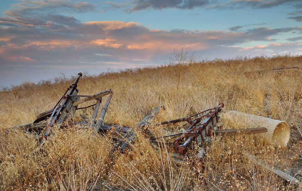
Abandoned in field

The Flower Pixies

valle vista sunrise

Me - at Bitter Creek National Wildlife Refuge
Air Travel- Ballinger Canyon

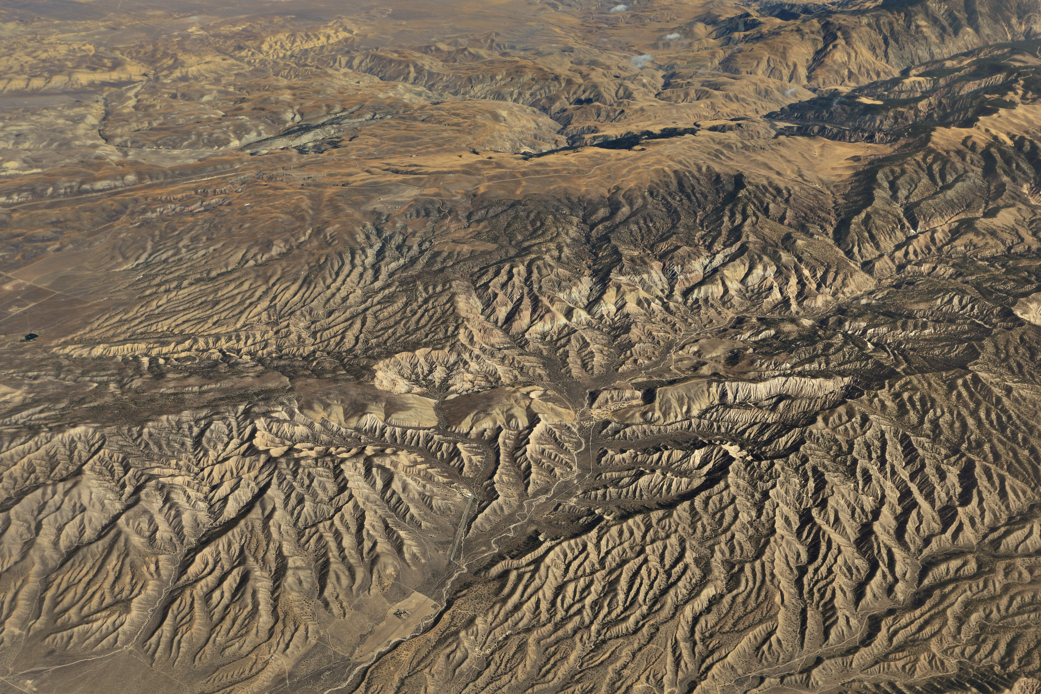
View of San Joaquin Valley from San Emigdio Mountains

Looking SSE from Cerro Noroests Rd.(2) - hdr hyper cross view 3d
CA-33, Maricopa, CA アメリカ合衆国の地図
別の場所を検索
近所の場所
El Roblar St, Maricopa, CA アメリカ合衆国
Maricopa, CA アメリカ合衆国レイズ・クリーク・キャンプグランド
Western Minerals Rd, Maricopa, CA アメリカ合衆国
アメリカ合衆国 〒 カリフォルニア州 マリコパ
アメリカ合衆国 〒 カリフォルニア州 ブラッシュ山
アメリカ合衆国 〒 カリフォルニア州 レイズ・ピーク
アメリカ合衆国 〒 カリフォルニア州 サン・エミグディオ山
Arroyo Way, Taft, CA アメリカ合衆国
Philippine St, Taft, CA アメリカ合衆国
Pinewood Ct, Frazier Park, CA アメリカ合衆国
Sage St, Taft, CA アメリカ合衆国
Copus Rd, Bakersfield, CA アメリカ合衆国
Banff Dr, Pine Mountain Club, CA アメリカ合衆国
Pine Valley Ln, Pine Mountain Club, CA アメリカ合衆国Pine Mountain Club Real Estate
Alpine St, Taft, CA アメリカ合衆国
Askin Dr unit d, Pine Mountain Club, CA アメリカ合衆国Peak to Peak Realty, Pine Mountain Club Ca
Askin Dr, Frazier Park, CA アメリカ合衆国
アメリカ合衆国 カリフォルニア州 タフト
Lucard St, Taft, CA アメリカ合衆国
Bernina Dr, Pine Mountain Club, CA アメリカ合衆国
最近の検索
- Leguwa ネパール日の出日の入り時間
- Shustino, Vladimir Oblast, ロシア日の出日の入り時間
- Lampiasi St, Sarasota, FL アメリカ合衆国日の出日の入り時間
- 日本、〒- 富山県富山市窪本町12−31 APAガーデンコート稲荷日の出日の入り時間
- 台湾 宜蘭県 大同郷Jialuohu日の出日の入り時間
- 日本、〒- 愛媛県今治市関前大下大下港日の出日の入り時間
- 日本、〒- 愛媛県今治市関前大下1930−1大下港フェリー乗り場日の出日の入り時間
- アルゼンチン ブエノスアイレス州 サン・テルモ日の出日の入り時間
- Congressional Dr, Stevensville, MD アメリカ合衆国日の出日の入り時間
- ギリシャ 〒 04 パピンゴ日の出日の入り時間