Maricopa, CA アメリカ合衆国レイズ・クリーク・キャンプグランド日の出日の入り時間
Location: アメリカ合衆国 > カリフォルニア州 > ベントゥーラ >
時間帯:
America/Los_Angeles
現地時間:
2024-05-01 04:01:29
経度:
-119.3077913
緯度:
34.6790203
今日の日の出時刻:
06:05:43 AM
今日の日の入時刻:
07:42:43 PM
今日の日長:
13h 37m 0s
明日の日の出時刻:
06:04:42 AM
明日の日の入時刻:
07:43:31 PM
明日の日長:
13h 38m 49s
すべて表示する
| 日付 | 日出 | 日没 | 日長 |
|---|---|---|---|
| 2024年01月01日 | 07:04:26 AM | 04:57:46 PM | 9h 53m 20s |
| 2024年01月02日 | 07:04:35 AM | 04:58:33 PM | 9h 53m 58s |
| 2024年01月03日 | 07:04:42 AM | 04:59:21 PM | 9h 54m 39s |
| 2024年01月04日 | 07:04:47 AM | 05:00:09 PM | 9h 55m 22s |
| 2024年01月05日 | 07:04:51 AM | 05:00:59 PM | 9h 56m 8s |
| 2024年01月06日 | 07:04:52 AM | 05:01:50 PM | 9h 56m 58s |
| 2024年01月07日 | 07:04:52 AM | 05:02:42 PM | 9h 57m 50s |
| 2024年01月08日 | 07:04:50 AM | 05:03:34 PM | 9h 58m 44s |
| 2024年01月09日 | 07:04:46 AM | 05:04:28 PM | 9h 59m 42s |
| 2024年01月10日 | 07:04:39 AM | 05:05:22 PM | 10h 0m 43s |
| 2024年01月11日 | 07:04:31 AM | 05:06:17 PM | 10h 1m 46s |
| 2024年01月12日 | 07:04:22 AM | 05:07:12 PM | 10h 2m 50s |
| 2024年01月13日 | 07:04:10 AM | 05:08:08 PM | 10h 3m 58s |
| 2024年01月14日 | 07:03:56 AM | 05:09:05 PM | 10h 5m 9s |
| 2024年01月15日 | 07:03:41 AM | 05:10:02 PM | 10h 6m 21s |
| 2024年01月16日 | 07:03:23 AM | 05:11:00 PM | 10h 7m 37s |
| 2024年01月17日 | 07:03:04 AM | 05:11:58 PM | 10h 8m 54s |
| 2024年01月18日 | 07:02:43 AM | 05:12:57 PM | 10h 10m 14s |
| 2024年01月19日 | 07:02:20 AM | 05:13:56 PM | 10h 11m 36s |
| 2024年01月20日 | 07:01:55 AM | 05:14:55 PM | 10h 13m 0s |
| 2024年01月21日 | 07:01:29 AM | 05:15:55 PM | 10h 14m 26s |
| 2024年01月22日 | 07:01:01 AM | 05:16:55 PM | 10h 15m 54s |
| 2024年01月23日 | 07:00:31 AM | 05:17:55 PM | 10h 17m 24s |
| 2024年01月24日 | 06:59:59 AM | 05:18:55 PM | 10h 18m 56s |
| 2024年01月25日 | 06:59:25 AM | 05:19:56 PM | 10h 20m 31s |
| 2024年01月26日 | 06:58:50 AM | 05:20:56 PM | 10h 22m 6s |
| 2024年01月27日 | 06:58:13 AM | 05:21:57 PM | 10h 23m 44s |
| 2024年01月28日 | 06:57:35 AM | 05:22:57 PM | 10h 25m 22s |
| 2024年01月29日 | 06:56:55 AM | 05:23:58 PM | 10h 27m 3s |
| 2024年01月30日 | 06:56:13 AM | 05:24:58 PM | 10h 28m 45s |
| 2024年01月31日 | 06:55:30 AM | 05:25:59 PM | 10h 30m 29s |
| 2024年02月01日 | 06:54:45 AM | 05:26:59 PM | 10h 32m 14s |
| 2024年02月02日 | 06:53:58 AM | 05:27:59 PM | 10h 34m 1s |
| 2024年02月03日 | 06:53:10 AM | 05:28:59 PM | 10h 35m 49s |
| 2024年02月04日 | 06:52:21 AM | 05:29:59 PM | 10h 37m 38s |
| 2024年02月05日 | 06:51:30 AM | 05:30:59 PM | 10h 39m 29s |
| 2024年02月06日 | 06:50:38 AM | 05:31:59 PM | 10h 41m 21s |
| 2024年02月07日 | 06:49:45 AM | 05:32:58 PM | 10h 43m 13s |
| 2024年02月08日 | 06:48:50 AM | 05:33:57 PM | 10h 45m 7s |
| 2024年02月09日 | 06:47:53 AM | 05:34:56 PM | 10h 47m 3s |
| 2024年02月10日 | 06:46:56 AM | 05:35:55 PM | 10h 48m 59s |
| 2024年02月11日 | 06:45:57 AM | 05:36:53 PM | 10h 50m 56s |
| 2024年02月12日 | 06:44:57 AM | 05:37:51 PM | 10h 52m 54s |
| 2024年02月13日 | 06:43:56 AM | 05:38:49 PM | 10h 54m 53s |
| 2024年02月14日 | 06:42:54 AM | 05:39:46 PM | 10h 56m 52s |
| 2024年02月15日 | 06:41:50 AM | 05:40:43 PM | 10h 58m 53s |
| 2024年02月16日 | 06:40:46 AM | 05:41:40 PM | 11h 0m 54s |
| 2024年02月17日 | 06:39:40 AM | 05:42:37 PM | 11h 2m 57s |
| 2024年02月18日 | 06:38:33 AM | 05:43:33 PM | 11h 5m 0s |
| 2024年02月19日 | 06:37:26 AM | 05:44:29 PM | 11h 7m 3s |
| 2024年02月20日 | 06:36:17 AM | 05:45:24 PM | 11h 9m 7s |
| 2024年02月21日 | 06:35:07 AM | 05:46:19 PM | 11h 11m 12s |
| 2024年02月22日 | 06:33:57 AM | 05:47:14 PM | 11h 13m 17s |
| 2024年02月23日 | 06:32:45 AM | 05:48:09 PM | 11h 15m 24s |
| 2024年02月24日 | 06:31:33 AM | 05:49:03 PM | 11h 17m 30s |
| 2024年02月25日 | 06:30:20 AM | 05:49:56 PM | 11h 19m 36s |
| 2024年02月26日 | 06:29:06 AM | 05:50:50 PM | 11h 21m 44s |
| 2024年02月27日 | 06:27:52 AM | 05:51:43 PM | 11h 23m 51s |
| 2024年02月28日 | 06:26:36 AM | 05:52:36 PM | 11h 26m 0s |
| 2024年02月29日 | 06:25:20 AM | 05:53:28 PM | 11h 28m 8s |
| 2024年03月01日 | 06:24:04 AM | 05:54:20 PM | 11h 30m 16s |
| 2024年03月02日 | 06:22:46 AM | 05:55:12 PM | 11h 32m 26s |
| 2024年03月03日 | 06:21:28 AM | 05:56:04 PM | 11h 34m 36s |
| 2024年03月04日 | 06:20:10 AM | 05:56:55 PM | 11h 36m 45s |
| 2024年03月05日 | 06:18:51 AM | 05:57:46 PM | 11h 38m 55s |
| 2024年03月06日 | 06:17:31 AM | 05:58:36 PM | 11h 41m 5s |
| 2024年03月07日 | 06:16:11 AM | 05:59:27 PM | 11h 43m 16s |
| 2024年03月08日 | 06:14:51 AM | 06:00:17 PM | 11h 45m 26s |
| 2024年03月09日 | 06:13:30 AM | 06:01:07 PM | 11h 47m 37s |
| 2024年03月10日 | 07:12:12 AM | 07:01:54 PM | 11h 49m 42s |
| 2024年03月11日 | 07:10:51 AM | 07:02:44 PM | 11h 51m 53s |
| 2024年03月12日 | 07:09:29 AM | 07:03:33 PM | 11h 54m 4s |
| 2024年03月13日 | 07:08:07 AM | 07:04:22 PM | 11h 56m 15s |
| 2024年03月14日 | 07:06:44 AM | 07:05:10 PM | 11h 58m 26s |
| 2024年03月15日 | 07:05:21 AM | 07:05:59 PM | 12h 0m 38s |
| 2024年03月16日 | 07:03:58 AM | 07:06:47 PM | 12h 2m 49s |
| 2024年03月17日 | 07:02:35 AM | 07:07:35 PM | 12h 5m 0s |
| 2024年03月18日 | 07:01:12 AM | 07:08:23 PM | 12h 7m 11s |
| 2024年03月19日 | 06:59:49 AM | 07:09:11 PM | 12h 9m 22s |
| 2024年03月20日 | 06:58:25 AM | 07:09:59 PM | 12h 11m 34s |
| 2024年03月21日 | 06:57:02 AM | 07:10:47 PM | 12h 13m 45s |
| 2024年03月22日 | 06:55:38 AM | 07:11:34 PM | 12h 15m 56s |
| 2024年03月23日 | 06:54:15 AM | 07:12:22 PM | 12h 18m 7s |
| 2024年03月24日 | 06:52:51 AM | 07:13:09 PM | 12h 20m 18s |
| 2024年03月25日 | 06:51:28 AM | 07:13:56 PM | 12h 22m 28s |
| 2024年03月26日 | 06:50:04 AM | 07:14:43 PM | 12h 24m 39s |
| 2024年03月27日 | 06:48:41 AM | 07:15:30 PM | 12h 26m 49s |
| 2024年03月28日 | 06:47:18 AM | 07:16:17 PM | 12h 28m 59s |
| 2024年03月29日 | 06:45:55 AM | 07:17:04 PM | 12h 31m 9s |
| 2024年03月30日 | 06:44:32 AM | 07:17:51 PM | 12h 33m 19s |
| 2024年03月31日 | 06:43:10 AM | 07:18:38 PM | 12h 35m 28s |
| 2024年04月01日 | 06:41:48 AM | 07:19:25 PM | 12h 37m 37s |
| 2024年04月02日 | 06:40:26 AM | 07:20:12 PM | 12h 39m 46s |
| 2024年04月03日 | 06:39:04 AM | 07:20:59 PM | 12h 41m 55s |
| 2024年04月04日 | 06:37:43 AM | 07:21:46 PM | 12h 44m 3s |
| 2024年04月05日 | 06:36:22 AM | 07:22:33 PM | 12h 46m 11s |
| 2024年04月06日 | 06:35:01 AM | 07:23:20 PM | 12h 48m 19s |
| 2024年04月07日 | 06:33:41 AM | 07:24:07 PM | 12h 50m 26s |
| 2024年04月08日 | 06:32:22 AM | 07:24:54 PM | 12h 52m 32s |
| 2024年04月09日 | 06:31:03 AM | 07:25:41 PM | 12h 54m 38s |
| 2024年04月10日 | 06:29:44 AM | 07:26:29 PM | 12h 56m 45s |
| 2024年04月11日 | 06:28:26 AM | 07:27:16 PM | 12h 58m 50s |
| 2024年04月12日 | 06:27:09 AM | 07:28:03 PM | 13h 0m 54s |
| 2024年04月13日 | 06:25:52 AM | 07:28:51 PM | 13h 2m 59s |
| 2024年04月14日 | 06:24:35 AM | 07:29:38 PM | 13h 5m 3s |
| 2024年04月15日 | 06:23:20 AM | 07:30:26 PM | 13h 7m 6s |
| 2024年04月16日 | 06:22:05 AM | 07:31:13 PM | 13h 9m 8s |
| 2024年04月17日 | 06:20:51 AM | 07:32:01 PM | 13h 11m 10s |
| 2024年04月18日 | 06:19:38 AM | 07:32:49 PM | 13h 13m 11s |
| 2024年04月19日 | 06:18:25 AM | 07:33:36 PM | 13h 15m 11s |
| 2024年04月20日 | 06:17:13 AM | 07:34:24 PM | 13h 17m 11s |
| 2024年04月21日 | 06:16:02 AM | 07:35:12 PM | 13h 19m 10s |
| 2024年04月22日 | 06:14:52 AM | 07:36:00 PM | 13h 21m 8s |
| 2024年04月23日 | 06:13:43 AM | 07:36:48 PM | 13h 23m 5s |
| 2024年04月24日 | 06:12:35 AM | 07:37:36 PM | 13h 25m 1s |
| 2024年04月25日 | 06:11:27 AM | 07:38:24 PM | 13h 26m 57s |
| 2024年04月26日 | 06:10:21 AM | 07:39:12 PM | 13h 28m 51s |
| 2024年04月27日 | 06:09:15 AM | 07:40:01 PM | 13h 30m 46s |
| 2024年04月28日 | 06:08:11 AM | 07:40:49 PM | 13h 32m 38s |
| 2024年04月29日 | 06:07:08 AM | 07:41:37 PM | 13h 34m 29s |
| 2024年04月30日 | 06:06:06 AM | 07:42:25 PM | 13h 36m 19s |
| 2024年05月01日 | 06:05:05 AM | 07:43:13 PM | 13h 38m 8s |
| 2024年05月02日 | 06:04:05 AM | 07:44:01 PM | 13h 39m 56s |
| 2024年05月03日 | 06:03:06 AM | 07:44:49 PM | 13h 41m 43s |
| 2024年05月04日 | 06:02:08 AM | 07:45:37 PM | 13h 43m 29s |
| 2024年05月05日 | 06:01:12 AM | 07:46:25 PM | 13h 45m 13s |
| 2024年05月06日 | 06:00:17 AM | 07:47:13 PM | 13h 46m 56s |
| 2024年05月07日 | 05:59:23 AM | 07:48:01 PM | 13h 48m 38s |
| 2024年05月08日 | 05:58:30 AM | 07:48:48 PM | 13h 50m 18s |
| 2024年05月09日 | 05:57:39 AM | 07:49:35 PM | 13h 51m 56s |
| 2024年05月10日 | 05:56:49 AM | 07:50:23 PM | 13h 53m 34s |
| 2024年05月11日 | 05:56:00 AM | 07:51:10 PM | 13h 55m 10s |
| 2024年05月12日 | 05:55:13 AM | 07:51:56 PM | 13h 56m 43s |
| 2024年05月13日 | 05:54:27 AM | 07:52:43 PM | 13h 58m 16s |
| 2024年05月14日 | 05:53:43 AM | 07:53:29 PM | 13h 59m 46s |
| 2024年05月15日 | 05:53:00 AM | 07:54:15 PM | 14h 1m 15s |
| 2024年05月16日 | 05:52:18 AM | 07:55:00 PM | 14h 2m 42s |
| 2024年05月17日 | 05:51:38 AM | 07:55:45 PM | 14h 4m 7s |
| 2024年05月18日 | 05:51:00 AM | 07:56:30 PM | 14h 5m 30s |
| 2024年05月19日 | 05:50:23 AM | 07:57:14 PM | 14h 6m 51s |
| 2024年05月20日 | 05:49:47 AM | 07:57:58 PM | 14h 8m 11s |
| 2024年05月21日 | 05:49:13 AM | 07:58:42 PM | 14h 9m 29s |
| 2024年05月22日 | 05:48:41 AM | 07:59:24 PM | 14h 10m 43s |
| 2024年05月23日 | 05:48:10 AM | 08:00:07 PM | 14h 11m 57s |
| 2024年05月24日 | 05:47:41 AM | 08:00:48 PM | 14h 13m 7s |
| 2024年05月25日 | 05:47:13 AM | 08:01:29 PM | 14h 14m 16s |
| 2024年05月26日 | 05:46:47 AM | 08:02:10 PM | 14h 15m 23s |
| 2024年05月27日 | 05:46:23 AM | 08:02:49 PM | 14h 16m 26s |
| 2024年05月28日 | 05:46:00 AM | 08:03:28 PM | 14h 17m 28s |
| 2024年05月29日 | 05:45:39 AM | 08:04:07 PM | 14h 18m 28s |
| 2024年05月30日 | 05:45:19 AM | 08:04:44 PM | 14h 19m 25s |
| 2024年05月31日 | 05:45:01 AM | 08:05:20 PM | 14h 20m 19s |
| 2024年06月01日 | 05:44:45 AM | 08:05:56 PM | 14h 21m 11s |
| 2024年06月02日 | 05:44:30 AM | 08:06:31 PM | 14h 22m 1s |
| 2024年06月03日 | 05:44:17 AM | 08:07:05 PM | 14h 22m 48s |
| 2024年06月04日 | 05:44:06 AM | 08:07:38 PM | 14h 23m 32s |
| 2024年06月05日 | 05:43:56 AM | 08:08:09 PM | 14h 24m 13s |
| 2024年06月06日 | 05:43:48 AM | 08:08:40 PM | 14h 24m 52s |
| 2024年06月07日 | 05:43:41 AM | 08:09:10 PM | 14h 25m 29s |
| 2024年06月08日 | 05:43:37 AM | 08:09:38 PM | 14h 26m 1s |
| 2024年06月09日 | 05:43:33 AM | 08:10:06 PM | 14h 26m 33s |
| 2024年06月10日 | 05:43:32 AM | 08:10:32 PM | 14h 27m 0s |
| 2024年06月11日 | 05:43:32 AM | 08:10:57 PM | 14h 27m 25s |
| 2024年06月12日 | 05:43:33 AM | 08:11:21 PM | 14h 27m 48s |
| 2024年06月13日 | 05:43:36 AM | 08:11:43 PM | 14h 28m 7s |
| 2024年06月14日 | 05:43:41 AM | 08:12:04 PM | 14h 28m 23s |
| 2024年06月15日 | 05:43:47 AM | 08:12:24 PM | 14h 28m 37s |
| 2024年06月16日 | 05:43:54 AM | 08:12:43 PM | 14h 28m 49s |
| 2024年06月17日 | 05:44:03 AM | 08:13:00 PM | 14h 28m 57s |
| 2024年06月18日 | 05:44:14 AM | 08:13:15 PM | 14h 29m 1s |
| 2024年06月19日 | 05:44:26 AM | 08:13:29 PM | 14h 29m 3s |
| 2024年06月20日 | 05:44:39 AM | 08:13:42 PM | 14h 29m 3s |
| 2024年06月21日 | 05:44:54 AM | 08:13:53 PM | 14h 28m 59s |
| 2024年06月22日 | 05:45:11 AM | 08:14:03 PM | 14h 28m 52s |
| 2024年06月23日 | 05:45:28 AM | 08:14:11 PM | 14h 28m 43s |
| 2024年06月24日 | 05:45:47 AM | 08:14:17 PM | 14h 28m 30s |
| 2024年06月25日 | 05:46:07 AM | 08:14:22 PM | 14h 28m 15s |
| 2024年06月26日 | 05:46:29 AM | 08:14:26 PM | 14h 27m 57s |
| 2024年06月27日 | 05:46:51 AM | 08:14:28 PM | 14h 27m 37s |
| 2024年06月28日 | 05:47:15 AM | 08:14:28 PM | 14h 27m 13s |
| 2024年06月29日 | 05:47:40 AM | 08:14:26 PM | 14h 26m 46s |
| 2024年06月30日 | 05:48:06 AM | 08:14:23 PM | 14h 26m 17s |
| 2024年07月01日 | 05:48:33 AM | 08:14:18 PM | 14h 25m 45s |
| 2024年07月02日 | 05:49:02 AM | 08:14:12 PM | 14h 25m 10s |
| 2024年07月03日 | 05:49:31 AM | 08:14:04 PM | 14h 24m 33s |
| 2024年07月04日 | 05:50:01 AM | 08:13:54 PM | 14h 23m 53s |
| 2024年07月05日 | 05:50:33 AM | 08:13:43 PM | 14h 23m 10s |
| 2024年07月06日 | 05:51:05 AM | 08:13:29 PM | 14h 22m 24s |
| 2024年07月07日 | 05:51:38 AM | 08:13:15 PM | 14h 21m 37s |
| 2024年07月08日 | 05:52:12 AM | 08:12:58 PM | 14h 20m 46s |
| 2024年07月09日 | 05:52:47 AM | 08:12:40 PM | 14h 19m 53s |
| 2024年07月10日 | 05:53:22 AM | 08:12:20 PM | 14h 18m 58s |
| 2024年07月11日 | 05:53:58 AM | 08:11:59 PM | 14h 18m 1s |
| 2024年07月12日 | 05:54:35 AM | 08:11:35 PM | 14h 17m 0s |
| 2024年07月13日 | 05:55:13 AM | 08:11:11 PM | 14h 15m 58s |
| 2024年07月14日 | 05:55:51 AM | 08:10:44 PM | 14h 14m 53s |
| 2024年07月15日 | 05:56:30 AM | 08:10:16 PM | 14h 13m 46s |
| 2024年07月16日 | 05:57:10 AM | 08:09:46 PM | 14h 12m 36s |
| 2024年07月17日 | 05:57:50 AM | 08:09:15 PM | 14h 11m 25s |
| 2024年07月18日 | 05:58:30 AM | 08:08:42 PM | 14h 10m 12s |
| 2024年07月19日 | 05:59:11 AM | 08:08:07 PM | 14h 8m 56s |
| 2024年07月20日 | 05:59:53 AM | 08:07:31 PM | 14h 7m 38s |
| 2024年07月21日 | 06:00:35 AM | 08:06:54 PM | 14h 6m 19s |
| 2024年07月22日 | 06:01:17 AM | 08:06:14 PM | 14h 4m 57s |
| 2024年07月23日 | 06:02:00 AM | 08:05:34 PM | 14h 3m 34s |
| 2024年07月24日 | 06:02:43 AM | 08:04:52 PM | 14h 2m 9s |
| 2024年07月25日 | 06:03:26 AM | 08:04:08 PM | 14h 0m 42s |
| 2024年07月26日 | 06:04:09 AM | 08:03:23 PM | 13h 59m 14s |
| 2024年07月27日 | 06:04:53 AM | 08:02:36 PM | 13h 57m 43s |
| 2024年07月28日 | 06:05:37 AM | 08:01:48 PM | 13h 56m 11s |
| 2024年07月29日 | 06:06:21 AM | 08:00:58 PM | 13h 54m 37s |
| 2024年07月30日 | 06:07:05 AM | 08:00:08 PM | 13h 53m 3s |
| 2024年07月31日 | 06:07:50 AM | 07:59:15 PM | 13h 51m 25s |
| 2024年08月01日 | 06:08:34 AM | 07:58:22 PM | 13h 49m 48s |
| 2024年08月02日 | 06:09:19 AM | 07:57:27 PM | 13h 48m 8s |
| 2024年08月03日 | 06:10:04 AM | 07:56:31 PM | 13h 46m 27s |
| 2024年08月04日 | 06:10:48 AM | 07:55:33 PM | 13h 44m 45s |
| 2024年08月05日 | 06:11:33 AM | 07:54:35 PM | 13h 43m 2s |
| 2024年08月06日 | 06:12:18 AM | 07:53:35 PM | 13h 41m 17s |
| 2024年08月07日 | 06:13:03 AM | 07:52:34 PM | 13h 39m 31s |
| 2024年08月08日 | 06:13:48 AM | 07:51:31 PM | 13h 37m 43s |
| 2024年08月09日 | 06:14:33 AM | 07:50:28 PM | 13h 35m 55s |
| 2024年08月10日 | 06:15:17 AM | 07:49:24 PM | 13h 34m 7s |
| 2024年08月11日 | 06:16:02 AM | 07:48:18 PM | 13h 32m 16s |
| 2024年08月12日 | 06:16:47 AM | 07:47:12 PM | 13h 30m 25s |
| 2024年08月13日 | 06:17:32 AM | 07:46:04 PM | 13h 28m 32s |
| 2024年08月14日 | 06:18:16 AM | 07:44:55 PM | 13h 26m 39s |
| 2024年08月15日 | 06:19:01 AM | 07:43:46 PM | 13h 24m 45s |
| 2024年08月16日 | 06:19:45 AM | 07:42:35 PM | 13h 22m 50s |
| 2024年08月17日 | 06:20:30 AM | 07:41:24 PM | 13h 20m 54s |
| 2024年08月18日 | 06:21:14 AM | 07:40:11 PM | 13h 18m 57s |
| 2024年08月19日 | 06:21:58 AM | 07:38:58 PM | 13h 17m 0s |
| 2024年08月20日 | 06:22:42 AM | 07:37:44 PM | 13h 15m 2s |
| 2024年08月21日 | 06:23:26 AM | 07:36:29 PM | 13h 13m 3s |
| 2024年08月22日 | 06:24:10 AM | 07:35:14 PM | 13h 11m 4s |
| 2024年08月23日 | 06:24:54 AM | 07:33:57 PM | 13h 9m 3s |
| 2024年08月24日 | 06:25:38 AM | 07:32:40 PM | 13h 7m 2s |
| 2024年08月25日 | 06:26:21 AM | 07:31:22 PM | 13h 5m 1s |
| 2024年08月26日 | 06:27:05 AM | 07:30:04 PM | 13h 2m 59s |
| 2024年08月27日 | 06:27:48 AM | 07:28:45 PM | 13h 0m 57s |
| 2024年08月28日 | 06:28:32 AM | 07:27:25 PM | 12h 58m 53s |
| 2024年08月29日 | 06:29:15 AM | 07:26:05 PM | 12h 56m 50s |
| 2024年08月30日 | 06:29:58 AM | 07:24:44 PM | 12h 54m 46s |
| 2024年08月31日 | 06:30:41 AM | 07:23:23 PM | 12h 52m 42s |
| 2024年09月01日 | 06:31:24 AM | 07:22:01 PM | 12h 50m 37s |
| 2024年09月02日 | 06:32:07 AM | 07:20:39 PM | 12h 48m 32s |
| 2024年09月03日 | 06:32:50 AM | 07:19:16 PM | 12h 46m 26s |
| 2024年09月04日 | 06:33:33 AM | 07:17:53 PM | 12h 44m 20s |
| 2024年09月05日 | 06:34:15 AM | 07:16:29 PM | 12h 42m 14s |
| 2024年09月06日 | 06:34:58 AM | 07:15:05 PM | 12h 40m 7s |
| 2024年09月07日 | 06:35:41 AM | 07:13:41 PM | 12h 38m 0s |
| 2024年09月08日 | 06:36:24 AM | 07:12:17 PM | 12h 35m 53s |
| 2024年09月09日 | 06:37:06 AM | 07:10:52 PM | 12h 33m 46s |
| 2024年09月10日 | 06:37:49 AM | 07:09:27 PM | 12h 31m 38s |
| 2024年09月11日 | 06:38:32 AM | 07:08:02 PM | 12h 29m 30s |
| 2024年09月12日 | 06:39:14 AM | 07:06:36 PM | 12h 27m 22s |
| 2024年09月13日 | 06:39:57 AM | 07:05:11 PM | 12h 25m 14s |
| 2024年09月14日 | 06:40:40 AM | 07:03:45 PM | 12h 23m 5s |
| 2024年09月15日 | 06:41:23 AM | 07:02:19 PM | 12h 20m 56s |
| 2024年09月16日 | 06:42:06 AM | 07:00:53 PM | 12h 18m 47s |
| 2024年09月17日 | 06:42:49 AM | 06:59:28 PM | 12h 16m 39s |
| 2024年09月18日 | 06:43:32 AM | 06:58:02 PM | 12h 14m 30s |
| 2024年09月19日 | 06:44:15 AM | 06:56:36 PM | 12h 12m 21s |
| 2024年09月20日 | 06:44:58 AM | 06:55:10 PM | 12h 10m 12s |
| 2024年09月21日 | 06:45:42 AM | 06:53:44 PM | 12h 8m 2s |
| 2024年09月22日 | 06:46:26 AM | 06:52:19 PM | 12h 5m 53s |
| 2024年09月23日 | 06:47:09 AM | 06:50:53 PM | 12h 3m 44s |
| 2024年09月24日 | 06:47:53 AM | 06:49:28 PM | 12h 1m 35s |
| 2024年09月25日 | 06:48:37 AM | 06:48:03 PM | 11h 59m 26s |
| 2024年09月26日 | 06:49:22 AM | 06:46:38 PM | 11h 57m 16s |
| 2024年09月27日 | 06:50:06 AM | 06:45:13 PM | 11h 55m 7s |
| 2024年09月28日 | 06:50:51 AM | 06:43:49 PM | 11h 52m 58s |
| 2024年09月29日 | 06:51:36 AM | 06:42:24 PM | 11h 50m 48s |
| 2024年09月30日 | 06:52:21 AM | 06:41:01 PM | 11h 48m 40s |
| 2024年10月01日 | 06:53:06 AM | 06:39:37 PM | 11h 46m 31s |
| 2024年10月02日 | 06:53:52 AM | 06:38:14 PM | 11h 44m 22s |
| 2024年10月03日 | 06:54:38 AM | 06:36:52 PM | 11h 42m 14s |
| 2024年10月04日 | 06:55:24 AM | 06:35:30 PM | 11h 40m 6s |
| 2024年10月05日 | 06:56:11 AM | 06:34:08 PM | 11h 37m 57s |
| 2024年10月06日 | 06:56:57 AM | 06:32:47 PM | 11h 35m 50s |
| 2024年10月07日 | 06:57:44 AM | 06:31:26 PM | 11h 33m 42s |
| 2024年10月08日 | 06:58:32 AM | 06:30:06 PM | 11h 31m 34s |
| 2024年10月09日 | 06:59:20 AM | 06:28:47 PM | 11h 29m 27s |
| 2024年10月10日 | 07:00:08 AM | 06:27:28 PM | 11h 27m 20s |
| 2024年10月11日 | 07:00:56 AM | 06:26:10 PM | 11h 25m 14s |
| 2024年10月12日 | 07:01:45 AM | 06:24:53 PM | 11h 23m 8s |
| 2024年10月13日 | 07:02:34 AM | 06:23:36 PM | 11h 21m 2s |
| 2024年10月14日 | 07:03:23 AM | 06:22:20 PM | 11h 18m 57s |
| 2024年10月15日 | 07:04:13 AM | 06:21:05 PM | 11h 16m 52s |
| 2024年10月16日 | 07:05:03 AM | 06:19:51 PM | 11h 14m 48s |
| 2024年10月17日 | 07:05:54 AM | 06:18:37 PM | 11h 12m 43s |
| 2024年10月18日 | 07:06:45 AM | 06:17:25 PM | 11h 10m 40s |
| 2024年10月19日 | 07:07:36 AM | 06:16:13 PM | 11h 8m 37s |
| 2024年10月20日 | 07:08:28 AM | 06:15:02 PM | 11h 6m 34s |
| 2024年10月21日 | 07:09:20 AM | 06:13:53 PM | 11h 4m 33s |
| 2024年10月22日 | 07:10:12 AM | 06:12:44 PM | 11h 2m 32s |
| 2024年10月23日 | 07:11:05 AM | 06:11:36 PM | 11h 0m 31s |
| 2024年10月24日 | 07:11:58 AM | 06:10:30 PM | 10h 58m 32s |
| 2024年10月25日 | 07:12:51 AM | 06:09:24 PM | 10h 56m 33s |
| 2024年10月26日 | 07:13:45 AM | 06:08:20 PM | 10h 54m 35s |
| 2024年10月27日 | 07:14:39 AM | 06:07:17 PM | 10h 52m 38s |
| 2024年10月28日 | 07:15:34 AM | 06:06:15 PM | 10h 50m 41s |
| 2024年10月29日 | 07:16:28 AM | 06:05:14 PM | 10h 48m 46s |
| 2024年10月30日 | 07:17:24 AM | 06:04:14 PM | 10h 46m 50s |
| 2024年10月31日 | 07:18:19 AM | 06:03:16 PM | 10h 44m 57s |
| 2024年11月01日 | 07:19:15 AM | 06:02:19 PM | 10h 43m 4s |
| 2024年11月02日 | 07:20:11 AM | 06:01:24 PM | 10h 41m 13s |
| 2024年11月03日 | 06:21:09 AM | 05:00:27 PM | 10h 39m 18s |
| 2024年11月04日 | 06:22:06 AM | 04:59:34 PM | 10h 37m 28s |
| 2024年11月05日 | 06:23:03 AM | 04:58:43 PM | 10h 35m 40s |
| 2024年11月06日 | 06:23:59 AM | 04:57:53 PM | 10h 33m 54s |
| 2024年11月07日 | 06:24:57 AM | 04:57:05 PM | 10h 32m 8s |
| 2024年11月08日 | 06:25:54 AM | 04:56:18 PM | 10h 30m 24s |
| 2024年11月09日 | 06:26:51 AM | 04:55:33 PM | 10h 28m 42s |
| 2024年11月10日 | 06:27:49 AM | 04:54:49 PM | 10h 27m 0s |
| 2024年11月11日 | 06:28:47 AM | 04:54:07 PM | 10h 25m 20s |
| 2024年11月12日 | 06:29:44 AM | 04:53:27 PM | 10h 23m 43s |
| 2024年11月13日 | 06:30:42 AM | 04:52:48 PM | 10h 22m 6s |
| 2024年11月14日 | 06:31:40 AM | 04:52:11 PM | 10h 20m 31s |
| 2024年11月15日 | 06:32:37 AM | 04:51:36 PM | 10h 18m 59s |
| 2024年11月16日 | 06:33:35 AM | 04:51:02 PM | 10h 17m 27s |
| 2024年11月17日 | 06:34:33 AM | 04:50:31 PM | 10h 15m 58s |
| 2024年11月18日 | 06:35:30 AM | 04:50:00 PM | 10h 14m 30s |
| 2024年11月19日 | 06:36:27 AM | 04:49:32 PM | 10h 13m 5s |
| 2024年11月20日 | 06:37:24 AM | 04:49:06 PM | 10h 11m 42s |
| 2024年11月21日 | 06:38:21 AM | 04:48:41 PM | 10h 10m 20s |
| 2024年11月22日 | 06:39:18 AM | 04:48:18 PM | 10h 9m 0s |
| 2024年11月23日 | 06:40:14 AM | 04:47:57 PM | 10h 7m 43s |
| 2024年11月24日 | 06:41:10 AM | 04:47:38 PM | 10h 6m 28s |
| 2024年11月25日 | 06:42:05 AM | 04:47:21 PM | 10h 5m 16s |
| 2024年11月26日 | 06:43:00 AM | 04:47:06 PM | 10h 4m 6s |
| 2024年11月27日 | 06:43:55 AM | 04:46:53 PM | 10h 2m 58s |
| 2024年11月28日 | 06:44:49 AM | 04:46:41 PM | 10h 1m 52s |
| 2024年11月29日 | 06:45:42 AM | 04:46:32 PM | 10h 0m 50s |
| 2024年11月30日 | 06:46:35 AM | 04:46:24 PM | 9h 59m 49s |
| 2024年12月01日 | 06:47:27 AM | 04:46:19 PM | 9h 58m 52s |
| 2024年12月02日 | 06:48:18 AM | 04:46:15 PM | 9h 57m 57s |
| 2024年12月03日 | 06:49:08 AM | 04:46:13 PM | 9h 57m 5s |
| 2024年12月04日 | 06:49:58 AM | 04:46:14 PM | 9h 56m 16s |
| 2024年12月05日 | 06:50:47 AM | 04:46:16 PM | 9h 55m 29s |
| 2024年12月06日 | 06:51:35 AM | 04:46:20 PM | 9h 54m 45s |
| 2024年12月07日 | 06:52:21 AM | 04:46:26 PM | 9h 54m 5s |
| 2024年12月08日 | 06:53:07 AM | 04:46:34 PM | 9h 53m 27s |
| 2024年12月09日 | 06:53:52 AM | 04:46:44 PM | 9h 52m 52s |
| 2024年12月10日 | 06:54:36 AM | 04:46:55 PM | 9h 52m 19s |
| 2024年12月11日 | 06:55:18 AM | 04:47:09 PM | 9h 51m 51s |
| 2024年12月12日 | 06:56:00 AM | 04:47:24 PM | 9h 51m 24s |
| 2024年12月13日 | 06:56:40 AM | 04:47:42 PM | 9h 51m 2s |
| 2024年12月14日 | 06:57:19 AM | 04:48:01 PM | 9h 50m 42s |
| 2024年12月15日 | 06:57:56 AM | 04:48:22 PM | 9h 50m 26s |
| 2024年12月16日 | 06:58:32 AM | 04:48:44 PM | 9h 50m 12s |
| 2024年12月17日 | 06:59:07 AM | 04:49:09 PM | 9h 50m 2s |
| 2024年12月18日 | 06:59:40 AM | 04:49:35 PM | 9h 49m 55s |
| 2024年12月19日 | 07:00:12 AM | 04:50:03 PM | 9h 49m 51s |
| 2024年12月20日 | 07:00:42 AM | 04:50:32 PM | 9h 49m 50s |
| 2024年12月21日 | 07:01:10 AM | 04:51:03 PM | 9h 49m 53s |
| 2024年12月22日 | 07:01:37 AM | 04:51:36 PM | 9h 49m 59s |
| 2024年12月23日 | 07:02:03 AM | 04:52:10 PM | 9h 50m 7s |
| 2024年12月24日 | 07:02:26 AM | 04:52:46 PM | 9h 50m 20s |
| 2024年12月25日 | 07:02:48 AM | 04:53:23 PM | 9h 50m 35s |
| 2024年12月26日 | 07:03:09 AM | 04:54:02 PM | 9h 50m 53s |
| 2024年12月27日 | 07:03:27 AM | 04:54:42 PM | 9h 51m 15s |
| 2024年12月28日 | 07:03:44 AM | 04:55:23 PM | 9h 51m 39s |
| 2024年12月29日 | 07:03:59 AM | 04:56:06 PM | 9h 52m 7s |
| 2024年12月30日 | 07:04:12 AM | 04:56:50 PM | 9h 52m 38s |
写真

sunset after the eclipse 2
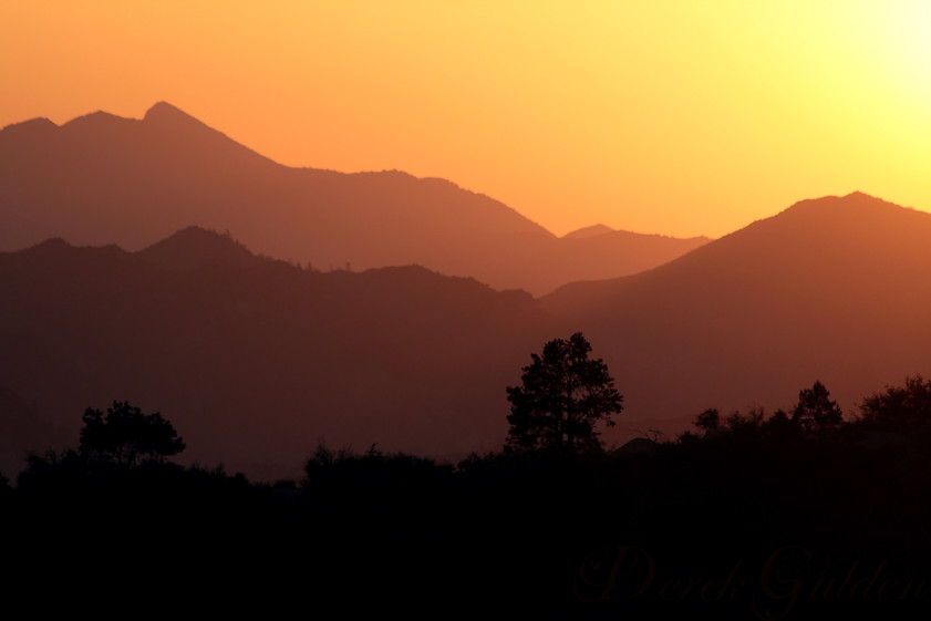
sunset after the eclipse
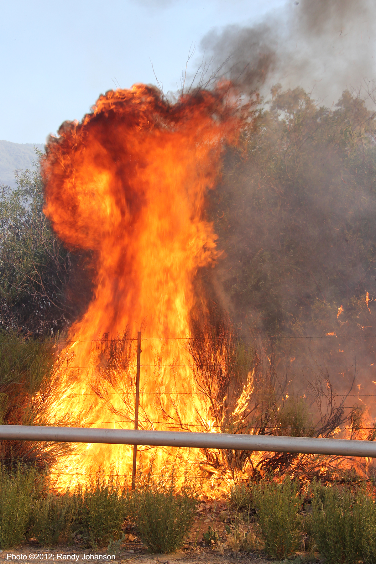
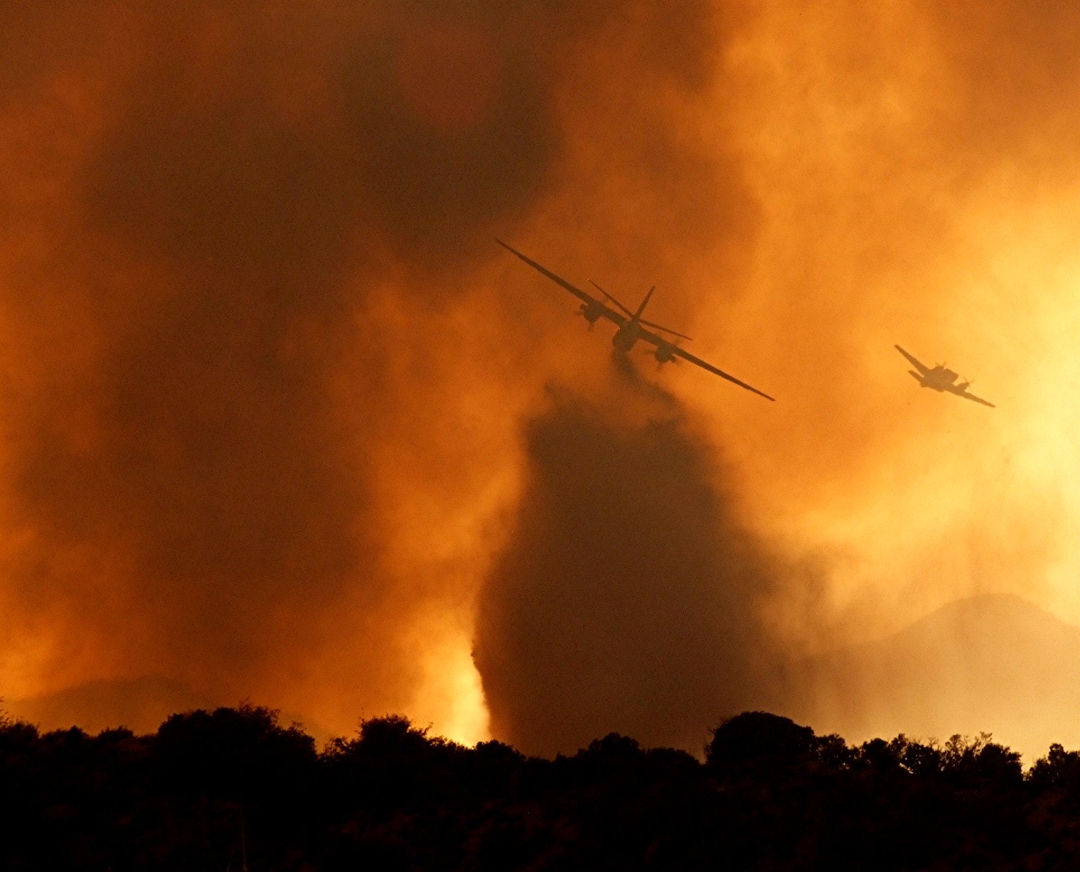
Ozena Incident
OZENA CAMP GROUND - BRUSH
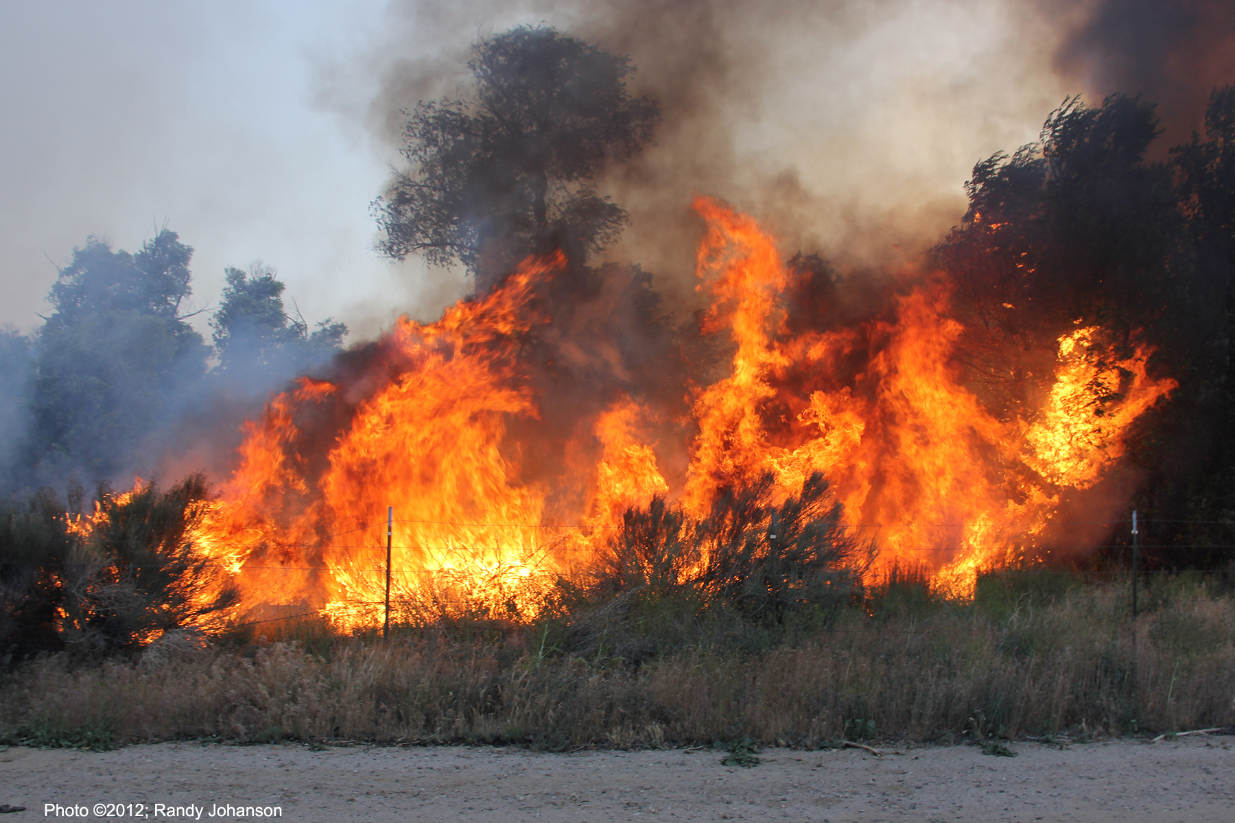
Ozena Incident
eastern sky @ sunset
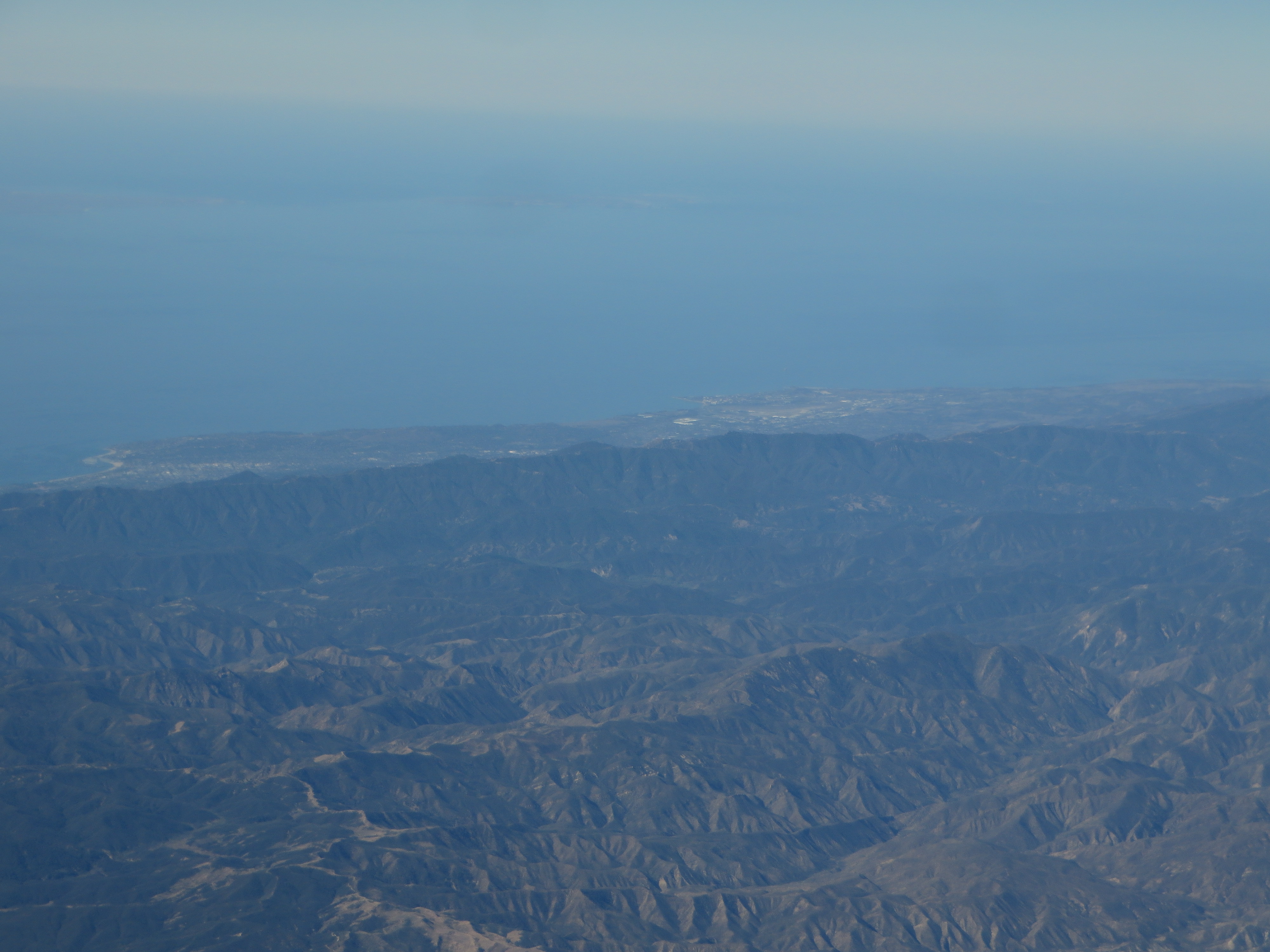
Santa Barbara, California

Cave's Eye View: Bird's Beak

view from the tent
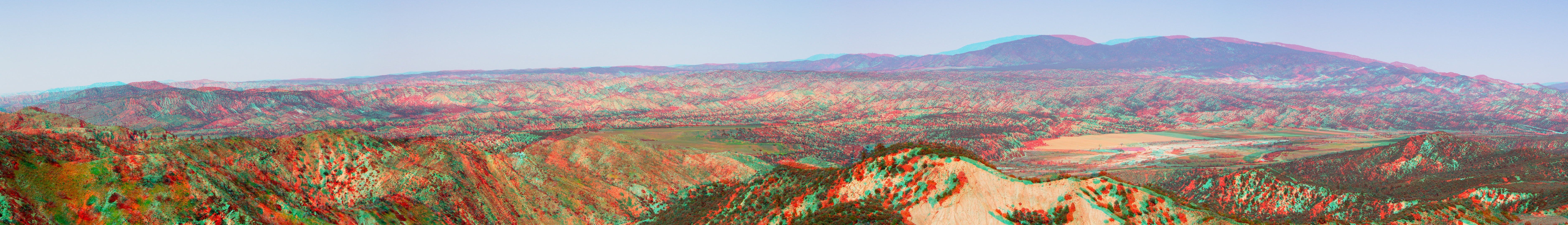
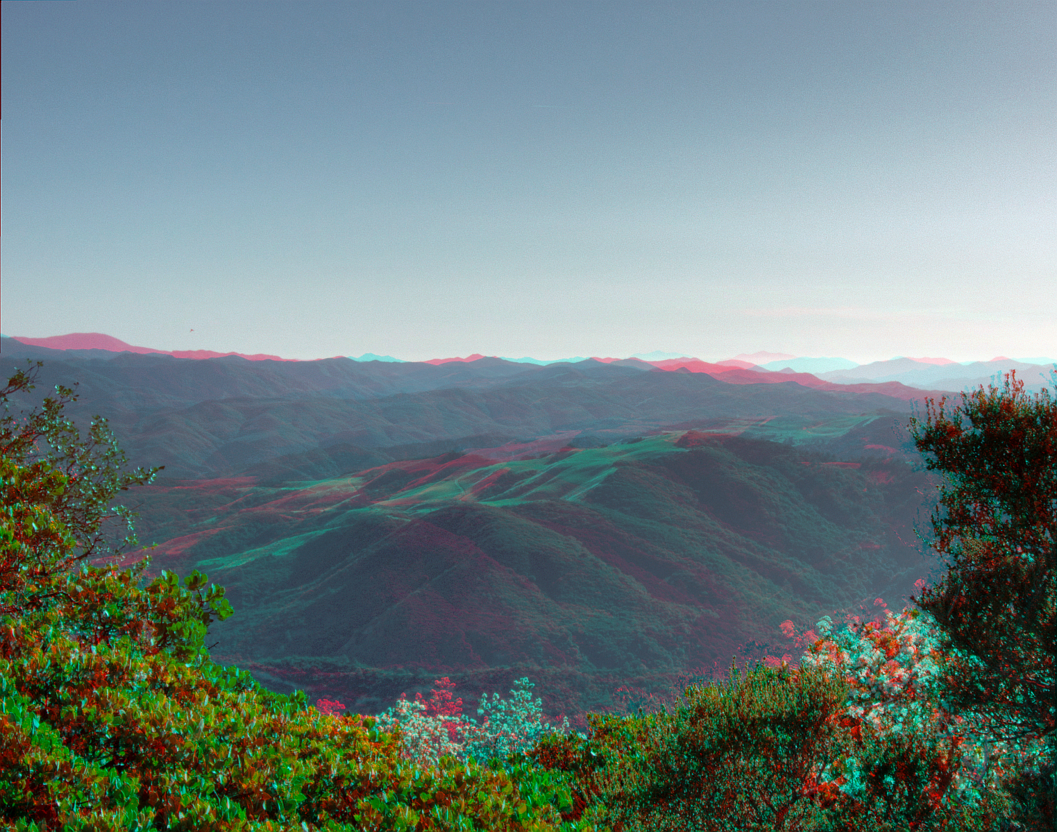
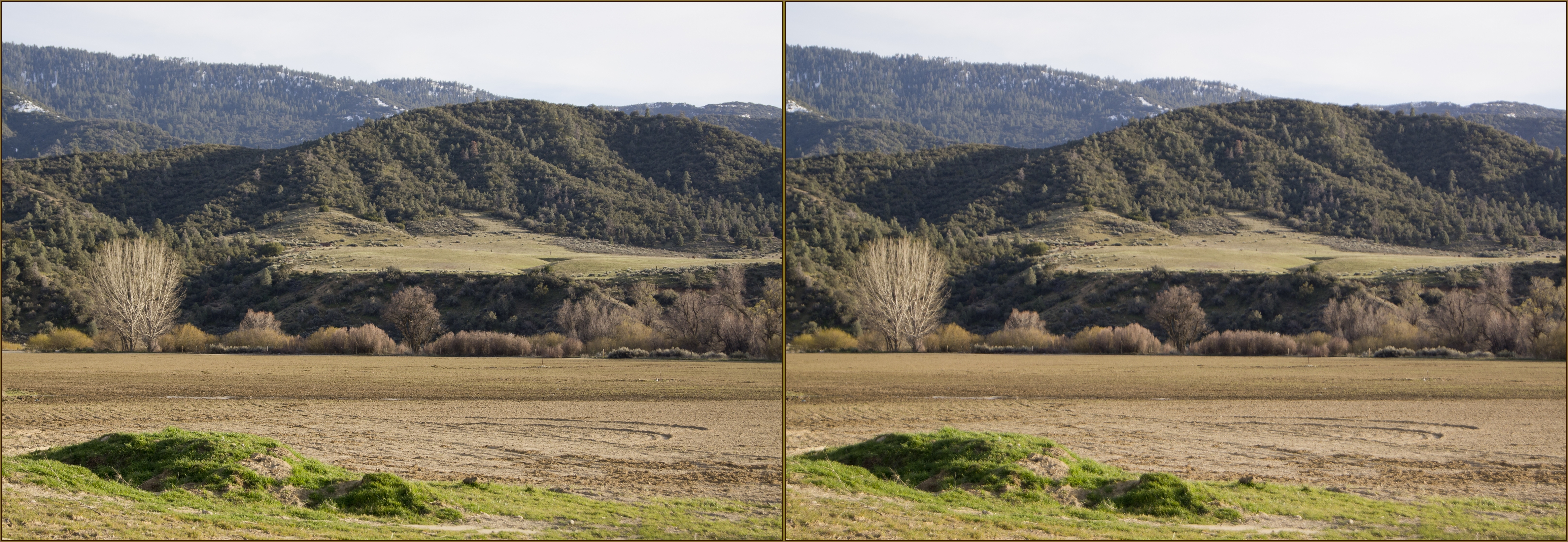
Cuyama Valley broad view panorama hyper 3d
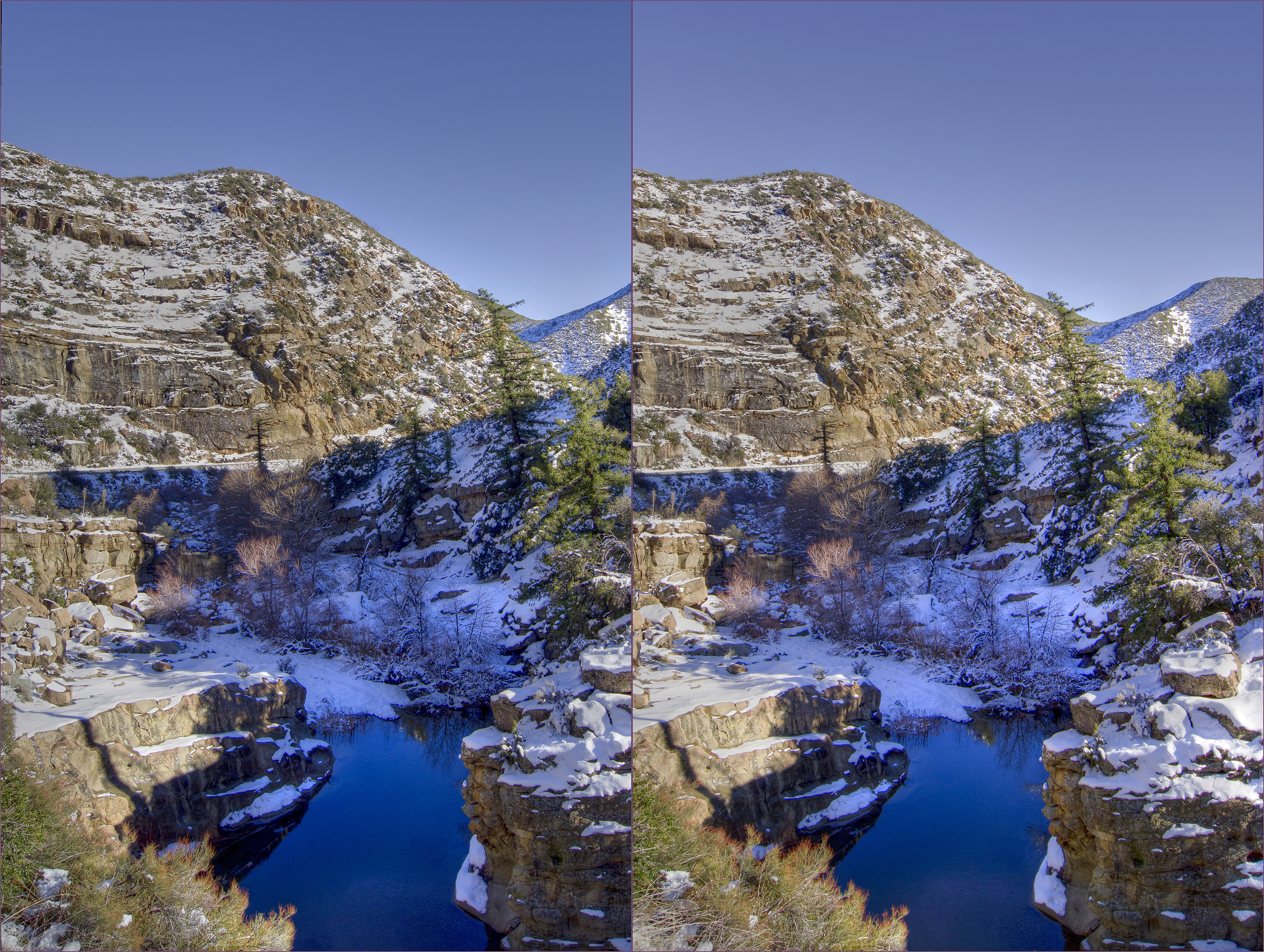
Sespe creek 2 Hi-Res hdr hyper cross view 3d
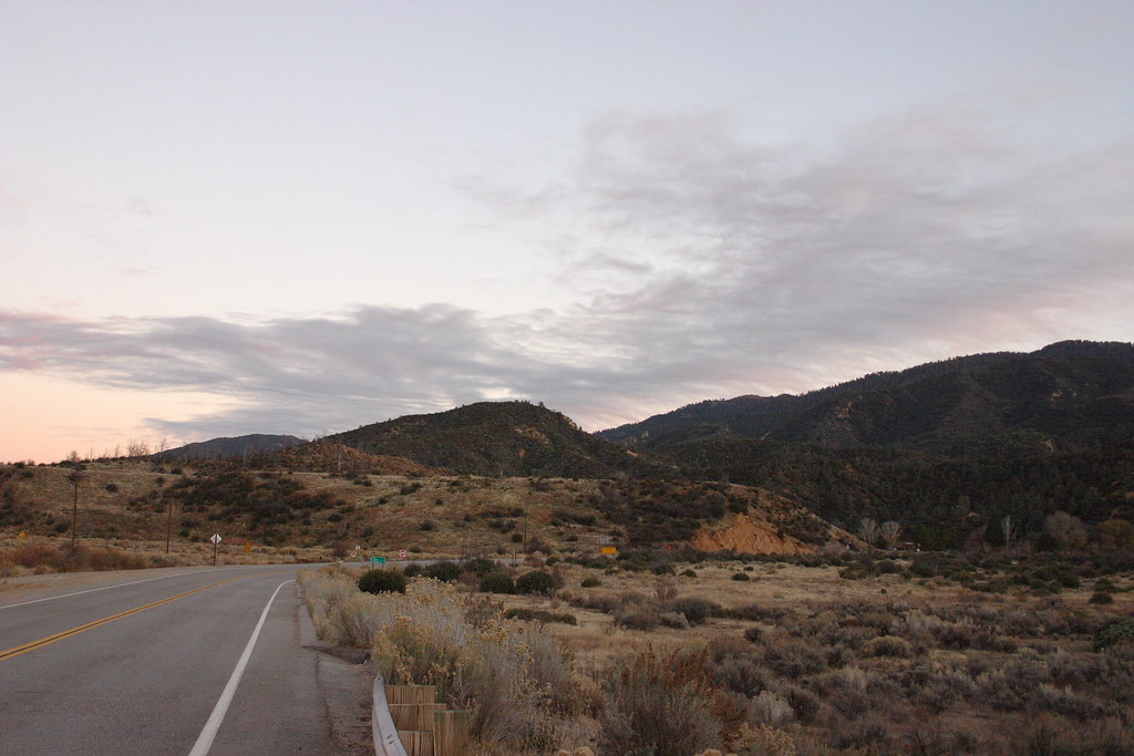
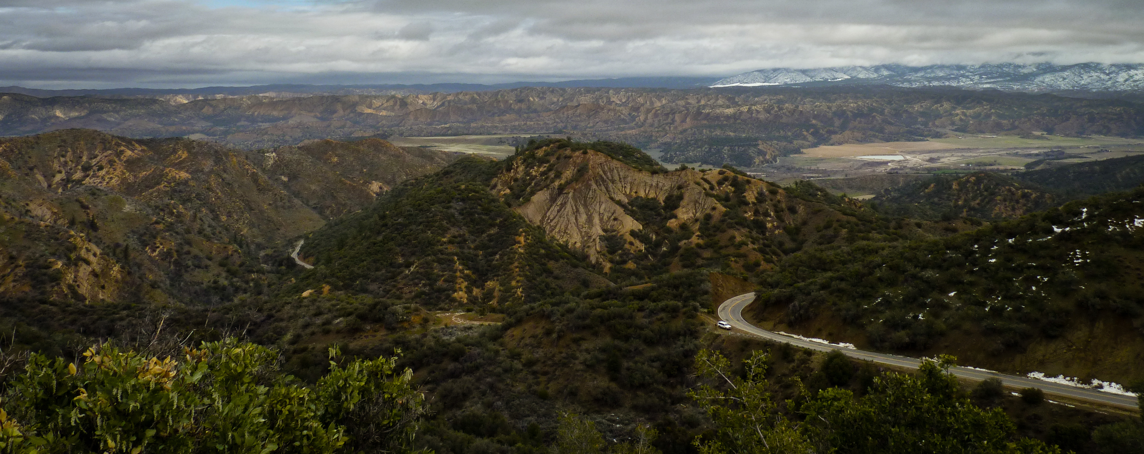
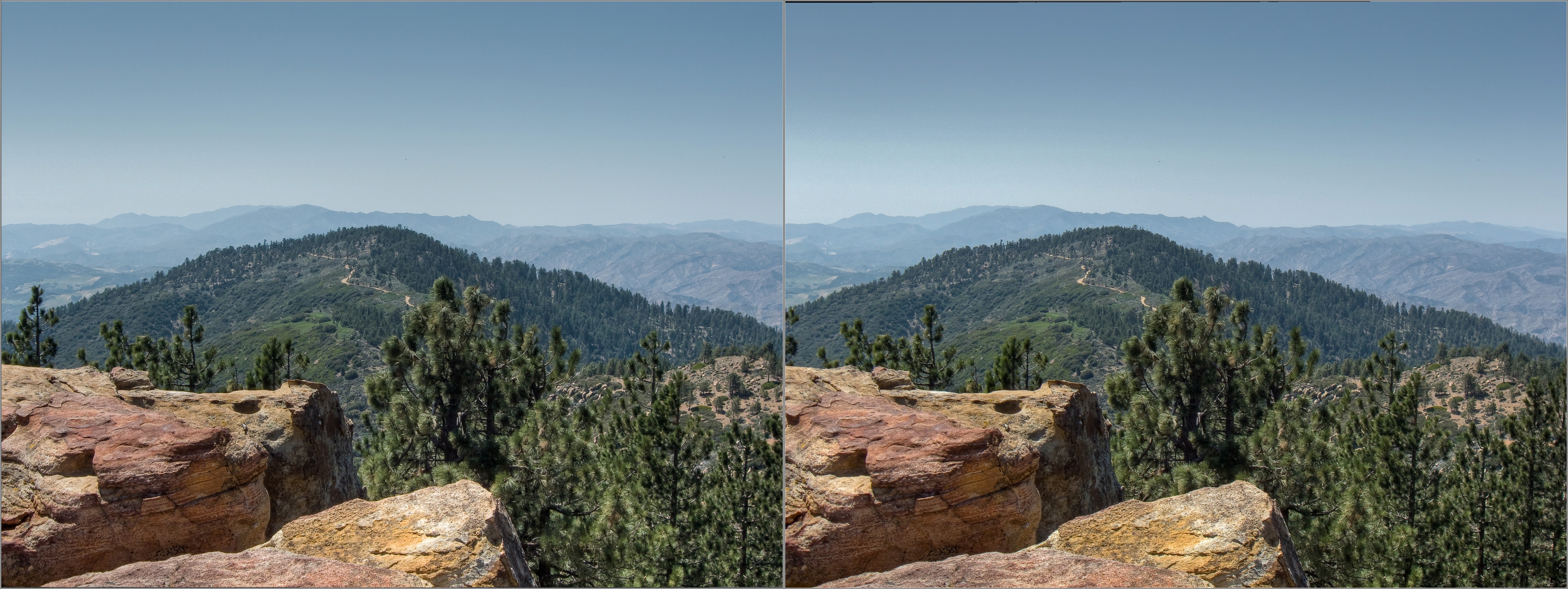
View West from Pine Mountain Ridge Rd. hdr 3d
Cuyama Valley
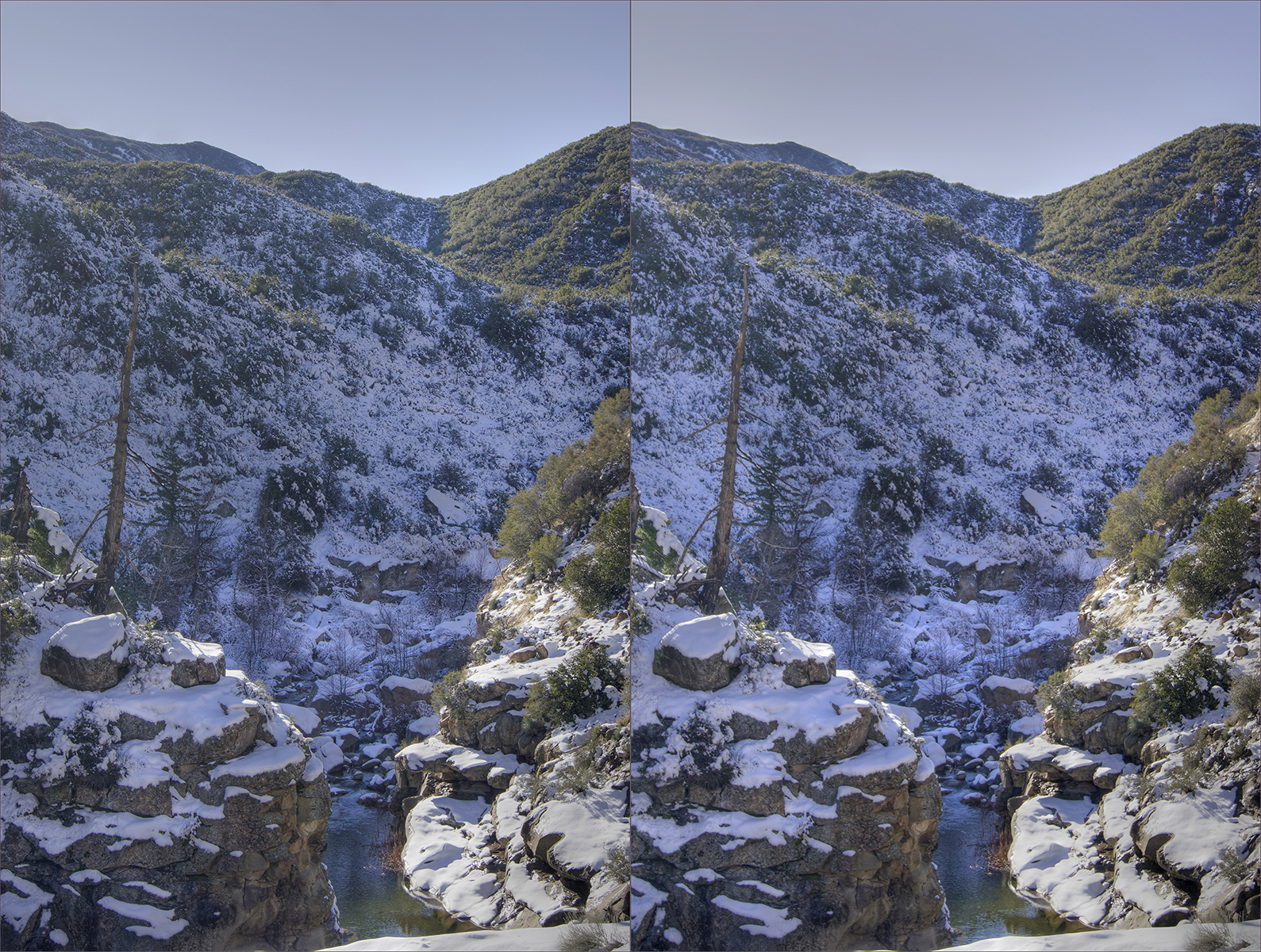
Sespe creek hdr hyper cross view 3d
Facing North On Top Of The Pine Mountain Ridgeline: Bear Creek Headwaters And the Lockwood Valley Beyond
Ozena cross view 3d
View WSW from Reyes Peak-2 pseudo_hdr coss-view 3d
View North from Raspberry/Reyes Saddle
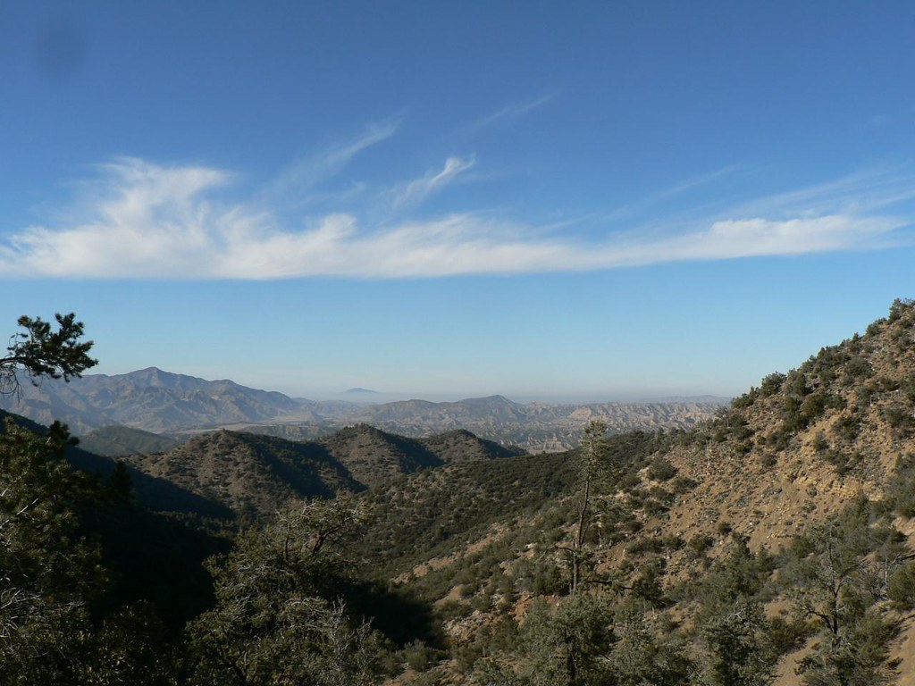
out a ways

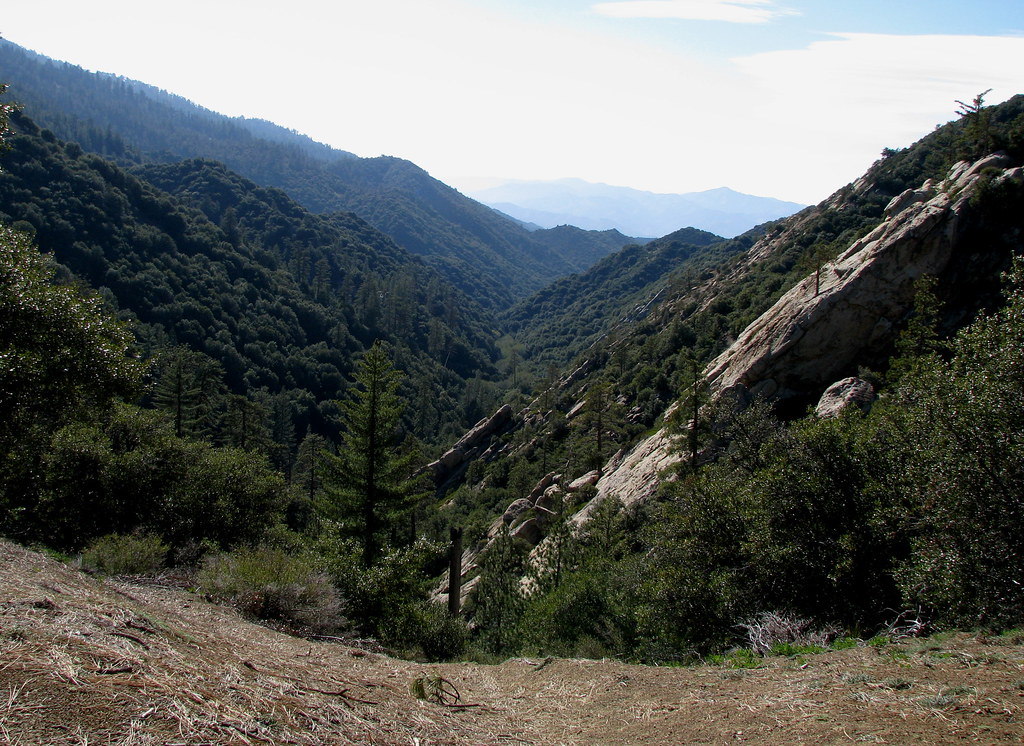
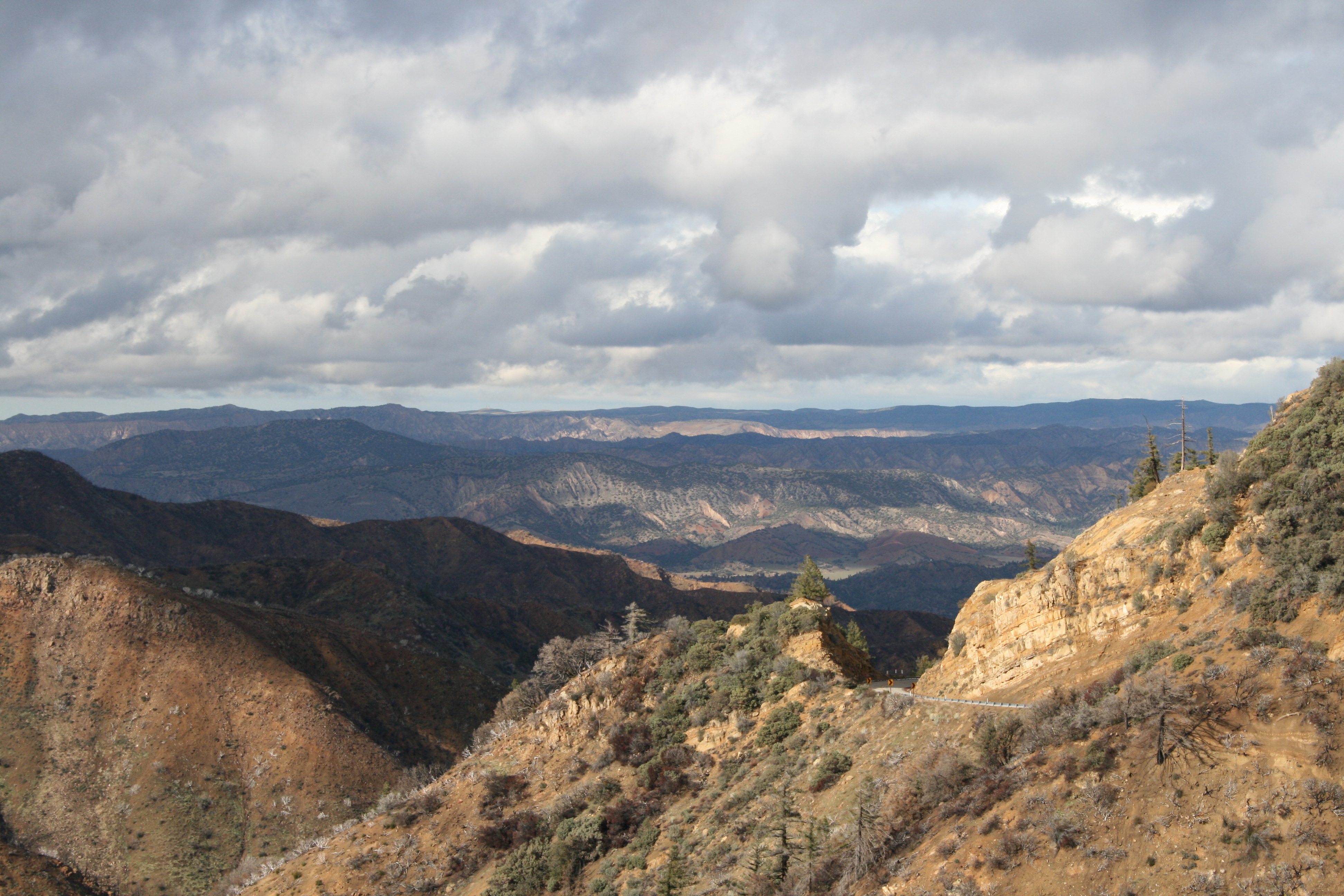
View from Haddock Mountain
Rock with a View
Maricopa, CA アメリカ合衆国レイズ・クリーク・キャンプグランドの地図
別の場所を検索
近所の場所
アメリカ合衆国 〒 カリフォルニア州 レイズ・ピーク
アメリカ合衆国 〒 カリフォルニア州 サン・ギレルモ山
アメリカ合衆国 〒 カリフォルニア州 ソーン・ポイント
S Matilija Hot Springs Rd, Ojai, CA アメリカ合衆国マティリヤ・ホット・スプリングス
Matilija Hot Springs Rd, Ojai, CA アメリカ合衆国
アメリカ合衆国 〒 カリフォルニア州 ピノス山
Banff Dr, Pine Mountain Club, CA アメリカ合衆国
Bernina Dr, Pine Mountain Club, CA アメリカ合衆国
Pinewood Ct, Frazier Park, CA アメリカ合衆国
Bernina Dr, Frazier Park, CA アメリカ合衆国
Lassen Way, Pine Mountain Club, CA アメリカ合衆国
Freeman Dr, Pine Mountain Club, CA アメリカ合衆国
Lassen Way, Pine Mountain Club, CA アメリカ合衆国
El Roblar St, Maricopa, CA アメリカ合衆国
アメリカ合衆国 〒 カリフォルニア州 ブラッシュ山
Woodland Dr, Pine Mountain Club, CA アメリカ合衆国
Askin Dr unit d, Pine Mountain Club, CA アメリカ合衆国Peak to Peak Realty, Pine Mountain Club Ca
Pine Valley Ln, Pine Mountain Club, CA アメリカ合衆国Pine Mountain Club Real Estate
Zurich Way, Pine Mountain Club, CA アメリカ合衆国
Askin Dr, Frazier Park, CA アメリカ合衆国
最近の検索
- スペイン 〒 ビスカヤ オチャンディオ日の出日の入り時間
- Sattva Horizon, 4JC6+G9P, Vinayak Nagar, Kattigenahalli, Bengaluru, Karnataka, India日の出日の入り時間
- Mount Fuji, Kitayama, Fujinomiya, Shizuoka -, Japan日の出日の入り時間
- Laurel Rd, Townsend, TN アメリカ合衆国日の出日の入り時間
- 中華人民共和国 Guang Dong Sheng, Shen Zhen Shi, Long Gang Qu, 海滨南路GFPQ+R9Q 海浜南路日の出日の入り時間
- Redondo Ave, Long Beach, CA アメリカ合衆国日の出日の入り時間
- Ulitsa Kalinina, 79, Rezh, Sverdlovskaya oblast', ロシア日の出日の入り時間
- Leguwa ネパール日の出日の入り時間
- Shustino, Vladimir Oblast, ロシア日の出日の入り時間
- Lampiasi St, Sarasota, FL アメリカ合衆国日の出日の入り時間