Horas de salida y puesta de sol de Cottonwood Campground, Naches, WA, EE. UU.
Location: Estados Unidos > Washington > Naches >
Zona horaria:
America/Los_Angeles
Hora local:
2024-05-19 00:09:09
Longitud:
-121.0261111
Latitud:
46.9072222
Salida de sol de hoy:
05:23:06 AM
Puesta de sol de hoy:
08:38:11 PM
La duración del día hoy:
15h 15m 5s
Salida de sol de mañana:
05:22:04 AM
Puesta de sol de mañana:
08:39:21 PM
La duración del día mañana:
15h 17m 17s
Mostrar todas las fechas
| Fecha | Salida de sol | Puesta de sol | Duración del día |
|---|---|---|---|
| 01/01/2024 | 07:49:23 AM | 04:26:34 PM | 8h 37m 11s |
| 02/01/2024 | 07:49:20 AM | 04:27:33 PM | 8h 38m 13s |
| 03/01/2024 | 07:49:14 AM | 04:28:34 PM | 8h 39m 20s |
| 04/01/2024 | 07:49:05 AM | 04:29:37 PM | 8h 40m 32s |
| 05/01/2024 | 07:48:54 AM | 04:30:41 PM | 8h 41m 47s |
| 06/01/2024 | 07:48:40 AM | 04:31:48 PM | 8h 43m 8s |
| 07/01/2024 | 07:48:22 AM | 04:32:56 PM | 8h 44m 34s |
| 08/01/2024 | 07:48:03 AM | 04:34:06 PM | 8h 46m 3s |
| 09/01/2024 | 07:47:40 AM | 04:35:18 PM | 8h 47m 38s |
| 10/01/2024 | 07:47:15 AM | 04:36:31 PM | 8h 49m 16s |
| 11/01/2024 | 07:46:47 AM | 04:37:46 PM | 8h 50m 59s |
| 12/01/2024 | 07:46:16 AM | 04:39:02 PM | 8h 52m 46s |
| 13/01/2024 | 07:45:43 AM | 04:40:20 PM | 8h 54m 37s |
| 14/01/2024 | 07:45:07 AM | 04:41:39 PM | 8h 56m 32s |
| 15/01/2024 | 07:44:29 AM | 04:42:59 PM | 8h 58m 30s |
| 16/01/2024 | 07:43:48 AM | 04:44:20 PM | 9h 0m 32s |
| 17/01/2024 | 07:43:05 AM | 04:45:43 PM | 9h 2m 38s |
| 18/01/2024 | 07:42:19 AM | 04:47:06 PM | 9h 4m 47s |
| 19/01/2024 | 07:41:31 AM | 04:48:31 PM | 9h 7m 0s |
| 20/01/2024 | 07:40:40 AM | 04:49:56 PM | 9h 9m 16s |
| 21/01/2024 | 07:39:47 AM | 04:51:22 PM | 9h 11m 35s |
| 22/01/2024 | 07:38:52 AM | 04:52:49 PM | 9h 13m 57s |
| 23/01/2024 | 07:37:54 AM | 04:54:17 PM | 9h 16m 23s |
| 24/01/2024 | 07:36:54 AM | 04:55:45 PM | 9h 18m 51s |
| 25/01/2024 | 07:35:52 AM | 04:57:14 PM | 9h 21m 22s |
| 26/01/2024 | 07:34:48 AM | 04:58:43 PM | 9h 23m 55s |
| 27/01/2024 | 07:33:42 AM | 05:00:13 PM | 9h 26m 31s |
| 28/01/2024 | 07:32:33 AM | 05:01:44 PM | 9h 29m 11s |
| 29/01/2024 | 07:31:23 AM | 05:03:14 PM | 9h 31m 51s |
| 30/01/2024 | 07:30:11 AM | 05:04:45 PM | 9h 34m 34s |
| 31/01/2024 | 07:28:56 AM | 05:06:17 PM | 9h 37m 21s |
| 01/02/2024 | 07:27:40 AM | 05:07:48 PM | 9h 40m 8s |
| 02/02/2024 | 07:26:22 AM | 05:09:20 PM | 9h 42m 58s |
| 03/02/2024 | 07:25:03 AM | 05:10:52 PM | 9h 45m 49s |
| 04/02/2024 | 07:23:41 AM | 05:12:24 PM | 9h 48m 43s |
| 05/02/2024 | 07:22:18 AM | 05:13:56 PM | 9h 51m 38s |
| 06/02/2024 | 07:20:53 AM | 05:15:29 PM | 9h 54m 36s |
| 07/02/2024 | 07:19:27 AM | 05:17:01 PM | 9h 57m 34s |
| 08/02/2024 | 07:17:58 AM | 05:18:33 PM | 10h 0m 35s |
| 09/02/2024 | 07:16:29 AM | 05:20:05 PM | 10h 3m 36s |
| 10/02/2024 | 07:14:58 AM | 05:21:37 PM | 10h 6m 39s |
| 11/02/2024 | 07:13:25 AM | 05:23:10 PM | 10h 9m 45s |
| 12/02/2024 | 07:11:52 AM | 05:24:42 PM | 10h 12m 50s |
| 13/02/2024 | 07:10:16 AM | 05:26:13 PM | 10h 15m 57s |
| 14/02/2024 | 07:08:40 AM | 05:27:45 PM | 10h 19m 5s |
| 15/02/2024 | 07:07:02 AM | 05:29:16 PM | 10h 22m 14s |
| 16/02/2024 | 07:05:23 AM | 05:30:48 PM | 10h 25m 25s |
| 17/02/2024 | 07:03:43 AM | 05:32:19 PM | 10h 28m 36s |
| 18/02/2024 | 07:02:01 AM | 05:33:50 PM | 10h 31m 49s |
| 19/02/2024 | 07:00:19 AM | 05:35:20 PM | 10h 35m 1s |
| 20/02/2024 | 06:58:35 AM | 05:36:51 PM | 10h 38m 16s |
| 21/02/2024 | 06:56:50 AM | 05:38:21 PM | 10h 41m 31s |
| 22/02/2024 | 06:55:05 AM | 05:39:51 PM | 10h 44m 46s |
| 23/02/2024 | 06:53:18 AM | 05:41:20 PM | 10h 48m 2s |
| 24/02/2024 | 06:51:31 AM | 05:42:50 PM | 10h 51m 19s |
| 25/02/2024 | 06:49:42 AM | 05:44:19 PM | 10h 54m 37s |
| 26/02/2024 | 06:47:53 AM | 05:45:48 PM | 10h 57m 55s |
| 27/02/2024 | 06:46:03 AM | 05:47:16 PM | 11h 1m 13s |
| 28/02/2024 | 06:44:12 AM | 05:48:44 PM | 11h 4m 32s |
| 29/02/2024 | 06:42:21 AM | 05:50:12 PM | 11h 7m 51s |
| 01/03/2024 | 06:40:29 AM | 05:51:40 PM | 11h 11m 11s |
| 02/03/2024 | 06:38:36 AM | 05:53:07 PM | 11h 14m 31s |
| 03/03/2024 | 06:36:42 AM | 05:54:34 PM | 11h 17m 52s |
| 04/03/2024 | 06:34:48 AM | 05:56:01 PM | 11h 21m 13s |
| 05/03/2024 | 06:32:53 AM | 05:57:28 PM | 11h 24m 35s |
| 06/03/2024 | 06:30:58 AM | 05:58:54 PM | 11h 27m 56s |
| 07/03/2024 | 06:29:02 AM | 06:00:20 PM | 11h 31m 18s |
| 08/03/2024 | 06:27:06 AM | 06:01:46 PM | 11h 34m 40s |
| 09/03/2024 | 06:25:10 AM | 06:03:12 PM | 11h 38m 2s |
| 10/03/2024 | 07:23:17 AM | 07:04:34 PM | 11h 41m 17s |
| 11/03/2024 | 07:21:20 AM | 07:05:59 PM | 11h 44m 39s |
| 12/03/2024 | 07:19:22 AM | 07:07:24 PM | 11h 48m 2s |
| 13/03/2024 | 07:17:24 AM | 07:08:48 PM | 11h 51m 24s |
| 14/03/2024 | 07:15:26 AM | 07:10:13 PM | 11h 54m 47s |
| 15/03/2024 | 07:13:28 AM | 07:11:37 PM | 11h 58m 9s |
| 16/03/2024 | 07:11:29 AM | 07:13:01 PM | 12h 1m 32s |
| 17/03/2024 | 07:09:30 AM | 07:14:25 PM | 12h 4m 55s |
| 18/03/2024 | 07:07:31 AM | 07:15:49 PM | 12h 8m 18s |
| 19/03/2024 | 07:05:32 AM | 07:17:13 PM | 12h 11m 41s |
| 20/03/2024 | 07:03:33 AM | 07:18:36 PM | 12h 15m 3s |
| 21/03/2024 | 07:01:34 AM | 07:19:59 PM | 12h 18m 25s |
| 22/03/2024 | 06:59:34 AM | 07:21:23 PM | 12h 21m 49s |
| 23/03/2024 | 06:57:35 AM | 07:22:46 PM | 12h 25m 11s |
| 24/03/2024 | 06:55:36 AM | 07:24:09 PM | 12h 28m 33s |
| 25/03/2024 | 06:53:37 AM | 07:25:32 PM | 12h 31m 55s |
| 26/03/2024 | 06:51:38 AM | 07:26:55 PM | 12h 35m 17s |
| 27/03/2024 | 06:49:39 AM | 07:28:17 PM | 12h 38m 38s |
| 28/03/2024 | 06:47:40 AM | 07:29:40 PM | 12h 42m 0s |
| 29/03/2024 | 06:45:41 AM | 07:31:03 PM | 12h 45m 22s |
| 30/03/2024 | 06:43:43 AM | 07:32:25 PM | 12h 48m 42s |
| 31/03/2024 | 06:41:45 AM | 07:33:48 PM | 12h 52m 3s |
| 01/04/2024 | 06:39:47 AM | 07:35:10 PM | 12h 55m 23s |
| 02/04/2024 | 06:37:50 AM | 07:36:33 PM | 12h 58m 43s |
| 03/04/2024 | 06:35:53 AM | 07:37:55 PM | 13h 2m 2s |
| 04/04/2024 | 06:33:56 AM | 07:39:17 PM | 13h 5m 21s |
| 05/04/2024 | 06:32:00 AM | 07:40:40 PM | 13h 8m 40s |
| 06/04/2024 | 06:30:04 AM | 07:42:02 PM | 13h 11m 58s |
| 07/04/2024 | 06:28:09 AM | 07:43:24 PM | 13h 15m 15s |
| 08/04/2024 | 06:26:14 AM | 07:44:47 PM | 13h 18m 33s |
| 09/04/2024 | 06:24:20 AM | 07:46:09 PM | 13h 21m 49s |
| 10/04/2024 | 06:22:26 AM | 07:47:31 PM | 13h 25m 5s |
| 11/04/2024 | 06:20:33 AM | 07:48:54 PM | 13h 28m 21s |
| 12/04/2024 | 06:18:40 AM | 07:50:16 PM | 13h 31m 36s |
| 13/04/2024 | 06:16:49 AM | 07:51:38 PM | 13h 34m 49s |
| 14/04/2024 | 06:14:58 AM | 07:53:00 PM | 13h 38m 2s |
| 15/04/2024 | 06:13:07 AM | 07:54:23 PM | 13h 41m 16s |
| 16/04/2024 | 06:11:18 AM | 07:55:45 PM | 13h 44m 27s |
| 17/04/2024 | 06:09:29 AM | 07:57:07 PM | 13h 47m 38s |
| 18/04/2024 | 06:07:41 AM | 07:58:29 PM | 13h 50m 48s |
| 19/04/2024 | 06:05:55 AM | 07:59:51 PM | 13h 53m 56s |
| 20/04/2024 | 06:04:09 AM | 08:01:13 PM | 13h 57m 4s |
| 21/04/2024 | 06:02:24 AM | 08:02:35 PM | 14h 0m 11s |
| 22/04/2024 | 06:00:40 AM | 08:03:57 PM | 14h 3m 17s |
| 23/04/2024 | 05:58:57 AM | 08:05:19 PM | 14h 6m 22s |
| 24/04/2024 | 05:57:15 AM | 08:06:41 PM | 14h 9m 26s |
| 25/04/2024 | 05:55:34 AM | 08:08:02 PM | 14h 12m 28s |
| 26/04/2024 | 05:53:54 AM | 08:09:24 PM | 14h 15m 30s |
| 27/04/2024 | 05:52:16 AM | 08:10:45 PM | 14h 18m 29s |
| 28/04/2024 | 05:50:38 AM | 08:12:06 PM | 14h 21m 28s |
| 29/04/2024 | 05:49:02 AM | 08:13:27 PM | 14h 24m 25s |
| 30/04/2024 | 05:47:28 AM | 08:14:48 PM | 14h 27m 20s |
| 01/05/2024 | 05:45:54 AM | 08:16:08 PM | 14h 30m 14s |
| 02/05/2024 | 05:44:22 AM | 08:17:28 PM | 14h 33m 6s |
| 03/05/2024 | 05:42:52 AM | 08:18:48 PM | 14h 35m 56s |
| 04/05/2024 | 05:41:23 AM | 08:20:08 PM | 14h 38m 45s |
| 05/05/2024 | 05:39:55 AM | 08:21:27 PM | 14h 41m 32s |
| 06/05/2024 | 05:38:29 AM | 08:22:45 PM | 14h 44m 16s |
| 07/05/2024 | 05:37:04 AM | 08:24:04 PM | 14h 47m 0s |
| 08/05/2024 | 05:35:41 AM | 08:25:22 PM | 14h 49m 41s |
| 09/05/2024 | 05:34:20 AM | 08:26:39 PM | 14h 52m 19s |
| 10/05/2024 | 05:33:01 AM | 08:27:56 PM | 14h 54m 55s |
| 11/05/2024 | 05:31:43 AM | 08:29:12 PM | 14h 57m 29s |
| 12/05/2024 | 05:30:27 AM | 08:30:27 PM | 15h 0m 0s |
| 13/05/2024 | 05:29:12 AM | 08:31:42 PM | 15h 2m 30s |
| 14/05/2024 | 05:28:00 AM | 08:32:56 PM | 15h 4m 56s |
| 15/05/2024 | 05:26:50 AM | 08:34:10 PM | 15h 7m 20s |
| 16/05/2024 | 05:25:41 AM | 08:35:22 PM | 15h 9m 41s |
| 17/05/2024 | 05:24:34 AM | 08:36:34 PM | 15h 12m 0s |
| 18/05/2024 | 05:23:30 AM | 08:37:45 PM | 15h 14m 15s |
| 19/05/2024 | 05:22:27 AM | 08:38:55 PM | 15h 16m 28s |
| 20/05/2024 | 05:21:26 AM | 08:40:04 PM | 15h 18m 38s |
| 21/05/2024 | 05:20:28 AM | 08:41:12 PM | 15h 20m 44s |
| 22/05/2024 | 05:19:32 AM | 08:42:18 PM | 15h 22m 46s |
| 23/05/2024 | 05:18:37 AM | 08:43:24 PM | 15h 24m 47s |
| 24/05/2024 | 05:17:46 AM | 08:44:28 PM | 15h 26m 42s |
| 25/05/2024 | 05:16:56 AM | 08:45:32 PM | 15h 28m 36s |
| 26/05/2024 | 05:16:08 AM | 08:46:33 PM | 15h 30m 25s |
| 27/05/2024 | 05:15:23 AM | 08:47:34 PM | 15h 32m 11s |
| 28/05/2024 | 05:14:40 AM | 08:48:33 PM | 15h 33m 53s |
| 29/05/2024 | 05:14:00 AM | 08:49:30 PM | 15h 35m 30s |
| 30/05/2024 | 05:13:22 AM | 08:50:26 PM | 15h 37m 4s |
| 31/05/2024 | 05:12:46 AM | 08:51:20 PM | 15h 38m 34s |
| 01/06/2024 | 05:12:13 AM | 08:52:13 PM | 15h 40m 0s |
| 02/06/2024 | 05:11:42 AM | 08:53:04 PM | 15h 41m 22s |
| 03/06/2024 | 05:11:13 AM | 08:53:53 PM | 15h 42m 40s |
| 04/06/2024 | 05:10:47 AM | 08:54:41 PM | 15h 43m 54s |
| 05/06/2024 | 05:10:24 AM | 08:55:26 PM | 15h 45m 2s |
| 06/06/2024 | 05:10:03 AM | 08:56:10 PM | 15h 46m 7s |
| 07/06/2024 | 05:09:44 AM | 08:56:52 PM | 15h 47m 8s |
| 08/06/2024 | 05:09:28 AM | 08:57:31 PM | 15h 48m 3s |
| 09/06/2024 | 05:09:15 AM | 08:58:09 PM | 15h 48m 54s |
| 10/06/2024 | 05:09:04 AM | 08:58:45 PM | 15h 49m 41s |
| 11/06/2024 | 05:08:56 AM | 08:59:18 PM | 15h 50m 22s |
| 12/06/2024 | 05:08:50 AM | 08:59:49 PM | 15h 50m 59s |
| 13/06/2024 | 05:08:46 AM | 09:00:18 PM | 15h 51m 32s |
| 14/06/2024 | 05:08:45 AM | 09:00:45 PM | 15h 52m 0s |
| 15/06/2024 | 05:08:47 AM | 09:01:09 PM | 15h 52m 22s |
| 16/06/2024 | 05:08:51 AM | 09:01:31 PM | 15h 52m 40s |
| 17/06/2024 | 05:08:57 AM | 09:01:51 PM | 15h 52m 54s |
| 18/06/2024 | 05:09:06 AM | 09:02:08 PM | 15h 53m 2s |
| 19/06/2024 | 05:09:17 AM | 09:02:23 PM | 15h 53m 6s |
| 20/06/2024 | 05:09:31 AM | 09:02:35 PM | 15h 53m 4s |
| 21/06/2024 | 05:09:47 AM | 09:02:45 PM | 15h 52m 58s |
| 22/06/2024 | 05:10:06 AM | 09:02:53 PM | 15h 52m 47s |
| 23/06/2024 | 05:10:26 AM | 09:02:58 PM | 15h 52m 32s |
| 24/06/2024 | 05:10:49 AM | 09:03:00 PM | 15h 52m 11s |
| 25/06/2024 | 05:11:15 AM | 09:03:00 PM | 15h 51m 45s |
| 26/06/2024 | 05:11:42 AM | 09:02:57 PM | 15h 51m 15s |
| 27/06/2024 | 05:12:12 AM | 09:02:52 PM | 15h 50m 40s |
| 28/06/2024 | 05:12:43 AM | 09:02:44 PM | 15h 50m 1s |
| 29/06/2024 | 05:13:17 AM | 09:02:34 PM | 15h 49m 17s |
| 30/06/2024 | 05:13:53 AM | 09:02:21 PM | 15h 48m 28s |
| 01/07/2024 | 05:14:31 AM | 09:02:06 PM | 15h 47m 35s |
| 02/07/2024 | 05:15:11 AM | 09:01:48 PM | 15h 46m 37s |
| 03/07/2024 | 05:15:53 AM | 09:01:27 PM | 15h 45m 34s |
| 04/07/2024 | 05:16:36 AM | 09:01:04 PM | 15h 44m 28s |
| 05/07/2024 | 05:17:22 AM | 09:00:38 PM | 15h 43m 16s |
| 06/07/2024 | 05:18:09 AM | 09:00:10 PM | 15h 42m 1s |
| 07/07/2024 | 05:18:58 AM | 08:59:40 PM | 15h 40m 42s |
| 08/07/2024 | 05:19:48 AM | 08:59:07 PM | 15h 39m 19s |
| 09/07/2024 | 05:20:40 AM | 08:58:31 PM | 15h 37m 51s |
| 10/07/2024 | 05:21:34 AM | 08:57:53 PM | 15h 36m 19s |
| 11/07/2024 | 05:22:29 AM | 08:57:13 PM | 15h 34m 44s |
| 12/07/2024 | 05:23:26 AM | 08:56:30 PM | 15h 33m 4s |
| 13/07/2024 | 05:24:23 AM | 08:55:45 PM | 15h 31m 22s |
| 14/07/2024 | 05:25:23 AM | 08:54:58 PM | 15h 29m 35s |
| 15/07/2024 | 05:26:23 AM | 08:54:08 PM | 15h 27m 45s |
| 16/07/2024 | 05:27:25 AM | 08:53:16 PM | 15h 25m 51s |
| 17/07/2024 | 05:28:28 AM | 08:52:22 PM | 15h 23m 54s |
| 18/07/2024 | 05:29:32 AM | 08:51:26 PM | 15h 21m 54s |
| 19/07/2024 | 05:30:37 AM | 08:50:27 PM | 15h 19m 50s |
| 20/07/2024 | 05:31:43 AM | 08:49:26 PM | 15h 17m 43s |
| 21/07/2024 | 05:32:50 AM | 08:48:24 PM | 15h 15m 34s |
| 22/07/2024 | 05:33:58 AM | 08:47:19 PM | 15h 13m 21s |
| 23/07/2024 | 05:35:06 AM | 08:46:12 PM | 15h 11m 6s |
| 24/07/2024 | 05:36:16 AM | 08:45:03 PM | 15h 8m 47s |
| 25/07/2024 | 05:37:26 AM | 08:43:52 PM | 15h 6m 26s |
| 26/07/2024 | 05:38:37 AM | 08:42:40 PM | 15h 4m 3s |
| 27/07/2024 | 05:39:49 AM | 08:41:25 PM | 15h 1m 36s |
| 28/07/2024 | 05:41:01 AM | 08:40:09 PM | 14h 59m 8s |
| 29/07/2024 | 05:42:14 AM | 08:38:50 PM | 14h 56m 36s |
| 30/07/2024 | 05:43:27 AM | 08:37:30 PM | 14h 54m 3s |
| 31/07/2024 | 05:44:41 AM | 08:36:09 PM | 14h 51m 28s |
| 01/08/2024 | 05:45:55 AM | 08:34:45 PM | 14h 48m 50s |
| 02/08/2024 | 05:47:10 AM | 08:33:20 PM | 14h 46m 10s |
| 03/08/2024 | 05:48:25 AM | 08:31:54 PM | 14h 43m 29s |
| 04/08/2024 | 05:49:41 AM | 08:30:26 PM | 14h 40m 45s |
| 05/08/2024 | 05:50:56 AM | 08:28:56 PM | 14h 38m 0s |
| 06/08/2024 | 05:52:13 AM | 08:27:25 PM | 14h 35m 12s |
| 07/08/2024 | 05:53:29 AM | 08:25:52 PM | 14h 32m 23s |
| 08/08/2024 | 05:54:46 AM | 08:24:18 PM | 14h 29m 32s |
| 09/08/2024 | 05:56:02 AM | 08:22:43 PM | 14h 26m 41s |
| 10/08/2024 | 05:57:19 AM | 08:21:06 PM | 14h 23m 47s |
| 11/08/2024 | 05:58:37 AM | 08:19:29 PM | 14h 20m 52s |
| 12/08/2024 | 05:59:54 AM | 08:17:49 PM | 14h 17m 55s |
| 13/08/2024 | 06:01:11 AM | 08:16:09 PM | 14h 14m 58s |
| 14/08/2024 | 06:02:29 AM | 08:14:27 PM | 14h 11m 58s |
| 15/08/2024 | 06:03:46 AM | 08:12:45 PM | 14h 8m 59s |
| 16/08/2024 | 06:05:04 AM | 08:11:01 PM | 14h 5m 57s |
| 17/08/2024 | 06:06:22 AM | 08:09:16 PM | 14h 2m 54s |
| 18/08/2024 | 06:07:40 AM | 08:07:30 PM | 13h 59m 50s |
| 19/08/2024 | 06:08:58 AM | 08:05:43 PM | 13h 56m 45s |
| 20/08/2024 | 06:10:15 AM | 08:03:56 PM | 13h 53m 41s |
| 21/08/2024 | 06:11:33 AM | 08:02:07 PM | 13h 50m 34s |
| 22/08/2024 | 06:12:51 AM | 08:00:17 PM | 13h 47m 26s |
| 23/08/2024 | 06:14:09 AM | 07:58:27 PM | 13h 44m 18s |
| 24/08/2024 | 06:15:27 AM | 07:56:36 PM | 13h 41m 9s |
| 25/08/2024 | 06:16:45 AM | 07:54:44 PM | 13h 37m 59s |
| 26/08/2024 | 06:18:03 AM | 07:52:51 PM | 13h 34m 48s |
| 27/08/2024 | 06:19:20 AM | 07:50:57 PM | 13h 31m 37s |
| 28/08/2024 | 06:20:38 AM | 07:49:03 PM | 13h 28m 25s |
| 29/08/2024 | 06:21:56 AM | 07:47:08 PM | 13h 25m 12s |
| 30/08/2024 | 06:23:14 AM | 07:45:13 PM | 13h 21m 59s |
| 31/08/2024 | 06:24:31 AM | 07:43:17 PM | 13h 18m 46s |
| 01/09/2024 | 06:25:49 AM | 07:41:20 PM | 13h 15m 31s |
| 02/09/2024 | 06:27:07 AM | 07:39:23 PM | 13h 12m 16s |
| 03/09/2024 | 06:28:24 AM | 07:37:26 PM | 13h 9m 2s |
| 04/09/2024 | 06:29:42 AM | 07:35:28 PM | 13h 5m 46s |
| 05/09/2024 | 06:31:00 AM | 07:33:29 PM | 13h 2m 29s |
| 06/09/2024 | 06:32:17 AM | 07:31:31 PM | 12h 59m 14s |
| 07/09/2024 | 06:33:35 AM | 07:29:31 PM | 12h 55m 56s |
| 08/09/2024 | 06:34:53 AM | 07:27:32 PM | 12h 52m 39s |
| 09/09/2024 | 06:36:10 AM | 07:25:32 PM | 12h 49m 22s |
| 10/09/2024 | 06:37:28 AM | 07:23:32 PM | 12h 46m 4s |
| 11/09/2024 | 06:38:46 AM | 07:21:32 PM | 12h 42m 46s |
| 12/09/2024 | 06:40:04 AM | 07:19:31 PM | 12h 39m 27s |
| 13/09/2024 | 06:41:22 AM | 07:17:31 PM | 12h 36m 9s |
| 14/09/2024 | 06:42:40 AM | 07:15:30 PM | 12h 32m 50s |
| 15/09/2024 | 06:43:58 AM | 07:13:29 PM | 12h 29m 31s |
| 16/09/2024 | 06:45:16 AM | 07:11:28 PM | 12h 26m 12s |
| 17/09/2024 | 06:46:34 AM | 07:09:27 PM | 12h 22m 53s |
| 18/09/2024 | 06:47:52 AM | 07:07:26 PM | 12h 19m 34s |
| 19/09/2024 | 06:49:11 AM | 07:05:25 PM | 12h 16m 14s |
| 20/09/2024 | 06:50:29 AM | 07:03:24 PM | 12h 12m 55s |
| 21/09/2024 | 06:51:48 AM | 07:01:23 PM | 12h 9m 35s |
| 22/09/2024 | 06:53:07 AM | 06:59:22 PM | 12h 6m 15s |
| 23/09/2024 | 06:54:26 AM | 06:57:21 PM | 12h 2m 55s |
| 24/09/2024 | 06:55:45 AM | 06:55:21 PM | 11h 59m 36s |
| 25/09/2024 | 06:57:04 AM | 06:53:20 PM | 11h 56m 16s |
| 26/09/2024 | 06:58:24 AM | 06:51:20 PM | 11h 52m 56s |
| 27/09/2024 | 06:59:43 AM | 06:49:20 PM | 11h 49m 37s |
| 28/09/2024 | 07:01:03 AM | 06:47:21 PM | 11h 46m 18s |
| 29/09/2024 | 07:02:23 AM | 06:45:21 PM | 11h 42m 58s |
| 30/09/2024 | 07:03:44 AM | 06:43:22 PM | 11h 39m 38s |
| 01/10/2024 | 07:05:04 AM | 06:41:24 PM | 11h 36m 20s |
| 02/10/2024 | 07:06:25 AM | 06:39:25 PM | 11h 33m 0s |
| 03/10/2024 | 07:07:46 AM | 06:37:28 PM | 11h 29m 42s |
| 04/10/2024 | 07:09:08 AM | 06:35:30 PM | 11h 26m 22s |
| 05/10/2024 | 07:10:29 AM | 06:33:34 PM | 11h 23m 5s |
| 06/10/2024 | 07:11:51 AM | 06:31:37 PM | 11h 19m 46s |
| 07/10/2024 | 07:13:14 AM | 06:29:42 PM | 11h 16m 28s |
| 08/10/2024 | 07:14:36 AM | 06:27:47 PM | 11h 13m 11s |
| 09/10/2024 | 07:15:59 AM | 06:25:52 PM | 11h 9m 53s |
| 10/10/2024 | 07:17:22 AM | 06:23:58 PM | 11h 6m 36s |
| 11/10/2024 | 07:18:45 AM | 06:22:05 PM | 11h 3m 20s |
| 12/10/2024 | 07:20:09 AM | 06:20:13 PM | 11h 0m 4s |
| 13/10/2024 | 07:21:33 AM | 06:18:21 PM | 10h 56m 48s |
| 14/10/2024 | 07:22:57 AM | 06:16:31 PM | 10h 53m 34s |
| 15/10/2024 | 07:24:22 AM | 06:14:41 PM | 10h 50m 19s |
| 16/10/2024 | 07:25:47 AM | 06:12:52 PM | 10h 47m 5s |
| 17/10/2024 | 07:27:12 AM | 06:11:04 PM | 10h 43m 52s |
| 18/10/2024 | 07:28:37 AM | 06:09:17 PM | 10h 40m 40s |
| 19/10/2024 | 07:30:03 AM | 06:07:30 PM | 10h 37m 27s |
| 20/10/2024 | 07:31:29 AM | 06:05:45 PM | 10h 34m 16s |
| 21/10/2024 | 07:32:56 AM | 06:04:01 PM | 10h 31m 5s |
| 22/10/2024 | 07:34:22 AM | 06:02:18 PM | 10h 27m 56s |
| 23/10/2024 | 07:35:49 AM | 06:00:36 PM | 10h 24m 47s |
| 24/10/2024 | 07:37:16 AM | 05:58:56 PM | 10h 21m 40s |
| 25/10/2024 | 07:38:44 AM | 05:57:16 PM | 10h 18m 32s |
| 26/10/2024 | 07:40:11 AM | 05:55:38 PM | 10h 15m 27s |
| 27/10/2024 | 07:41:39 AM | 05:54:02 PM | 10h 12m 23s |
| 28/10/2024 | 07:43:07 AM | 05:52:26 PM | 10h 9m 19s |
| 29/10/2024 | 07:44:35 AM | 05:50:52 PM | 10h 6m 17s |
| 30/10/2024 | 07:46:03 AM | 05:49:19 PM | 10h 3m 16s |
| 31/10/2024 | 07:47:31 AM | 05:47:48 PM | 10h 0m 17s |
| 01/11/2024 | 07:49:00 AM | 05:46:19 PM | 9h 57m 19s |
| 02/11/2024 | 07:50:28 AM | 05:44:51 PM | 9h 54m 23s |
| 03/11/2024 | 06:52:01 AM | 04:43:21 PM | 9h 51m 20s |
| 04/11/2024 | 06:53:29 AM | 04:41:56 PM | 9h 48m 27s |
| 05/11/2024 | 06:54:58 AM | 04:40:33 PM | 9h 45m 35s |
| 06/11/2024 | 06:56:26 AM | 04:39:12 PM | 9h 42m 46s |
| 07/11/2024 | 06:57:54 AM | 04:37:52 PM | 9h 39m 58s |
| 08/11/2024 | 06:59:23 AM | 04:36:34 PM | 9h 37m 11s |
| 09/11/2024 | 07:00:51 AM | 04:35:19 PM | 9h 34m 28s |
| 10/11/2024 | 07:02:18 AM | 04:34:05 PM | 9h 31m 47s |
| 11/11/2024 | 07:03:46 AM | 04:32:53 PM | 9h 29m 7s |
| 12/11/2024 | 07:05:13 AM | 04:31:43 PM | 9h 26m 30s |
| 13/11/2024 | 07:06:40 AM | 04:30:35 PM | 9h 23m 55s |
| 14/11/2024 | 07:08:07 AM | 04:29:29 PM | 9h 21m 22s |
| 15/11/2024 | 07:09:33 AM | 04:28:26 PM | 9h 18m 53s |
| 16/11/2024 | 07:10:58 AM | 04:27:24 PM | 9h 16m 26s |
| 17/11/2024 | 07:12:23 AM | 04:26:25 PM | 9h 14m 2s |
| 18/11/2024 | 07:13:47 AM | 04:25:28 PM | 9h 11m 41s |
| 19/11/2024 | 07:15:11 AM | 04:24:34 PM | 9h 9m 23s |
| 20/11/2024 | 07:16:34 AM | 04:23:41 PM | 9h 7m 7s |
| 21/11/2024 | 07:17:56 AM | 04:22:52 PM | 9h 4m 56s |
| 22/11/2024 | 07:19:17 AM | 04:22:04 PM | 9h 2m 47s |
| 23/11/2024 | 07:20:37 AM | 04:21:19 PM | 9h 0m 42s |
| 24/11/2024 | 07:21:56 AM | 04:20:37 PM | 8h 58m 41s |
| 25/11/2024 | 07:23:15 AM | 04:19:57 PM | 8h 56m 42s |
| 26/11/2024 | 07:24:32 AM | 04:19:20 PM | 8h 54m 48s |
| 27/11/2024 | 07:25:47 AM | 04:18:45 PM | 8h 52m 58s |
| 28/11/2024 | 07:27:02 AM | 04:18:13 PM | 8h 51m 11s |
| 29/11/2024 | 07:28:15 AM | 04:17:43 PM | 8h 49m 28s |
| 30/11/2024 | 07:29:27 AM | 04:17:17 PM | 8h 47m 50s |
| 01/12/2024 | 07:30:38 AM | 04:16:53 PM | 8h 46m 15s |
| 02/12/2024 | 07:31:46 AM | 04:16:32 PM | 8h 44m 46s |
| 03/12/2024 | 07:32:54 AM | 04:16:13 PM | 8h 43m 19s |
| 04/12/2024 | 07:33:59 AM | 04:15:58 PM | 8h 41m 59s |
| 05/12/2024 | 07:35:03 AM | 04:15:45 PM | 8h 40m 42s |
| 06/12/2024 | 07:36:05 AM | 04:15:35 PM | 8h 39m 30s |
| 07/12/2024 | 07:37:05 AM | 04:15:27 PM | 8h 38m 22s |
| 08/12/2024 | 07:38:03 AM | 04:15:23 PM | 8h 37m 20s |
| 09/12/2024 | 07:38:59 AM | 04:15:22 PM | 8h 36m 23s |
| 10/12/2024 | 07:39:53 AM | 04:15:23 PM | 8h 35m 30s |
| 11/12/2024 | 07:40:45 AM | 04:15:27 PM | 8h 34m 42s |
| 12/12/2024 | 07:41:35 AM | 04:15:34 PM | 8h 33m 59s |
| 13/12/2024 | 07:42:22 AM | 04:15:44 PM | 8h 33m 22s |
| 14/12/2024 | 07:43:08 AM | 04:15:57 PM | 8h 32m 49s |
| 15/12/2024 | 07:43:50 AM | 04:16:12 PM | 8h 32m 22s |
| 16/12/2024 | 07:44:31 AM | 04:16:31 PM | 8h 32m 0s |
| 17/12/2024 | 07:45:09 AM | 04:16:52 PM | 8h 31m 43s |
| 18/12/2024 | 07:45:44 AM | 04:17:16 PM | 8h 31m 32s |
| 19/12/2024 | 07:46:17 AM | 04:17:42 PM | 8h 31m 25s |
| 20/12/2024 | 07:46:48 AM | 04:18:11 PM | 8h 31m 23s |
| 21/12/2024 | 07:47:15 AM | 04:18:43 PM | 8h 31m 28s |
| 22/12/2024 | 07:47:40 AM | 04:19:18 PM | 8h 31m 38s |
| 23/12/2024 | 07:48:03 AM | 04:19:55 PM | 8h 31m 52s |
| 24/12/2024 | 07:48:23 AM | 04:20:35 PM | 8h 32m 12s |
| 25/12/2024 | 07:48:40 AM | 04:21:17 PM | 8h 32m 37s |
| 26/12/2024 | 07:48:54 AM | 04:22:02 PM | 8h 33m 8s |
| 27/12/2024 | 07:49:05 AM | 04:22:49 PM | 8h 33m 44s |
| 28/12/2024 | 07:49:14 AM | 04:23:38 PM | 8h 34m 24s |
| 29/12/2024 | 07:49:20 AM | 04:24:30 PM | 8h 35m 10s |
| 30/12/2024 | 07:49:23 AM | 04:25:24 PM | 8h 36m 1s |
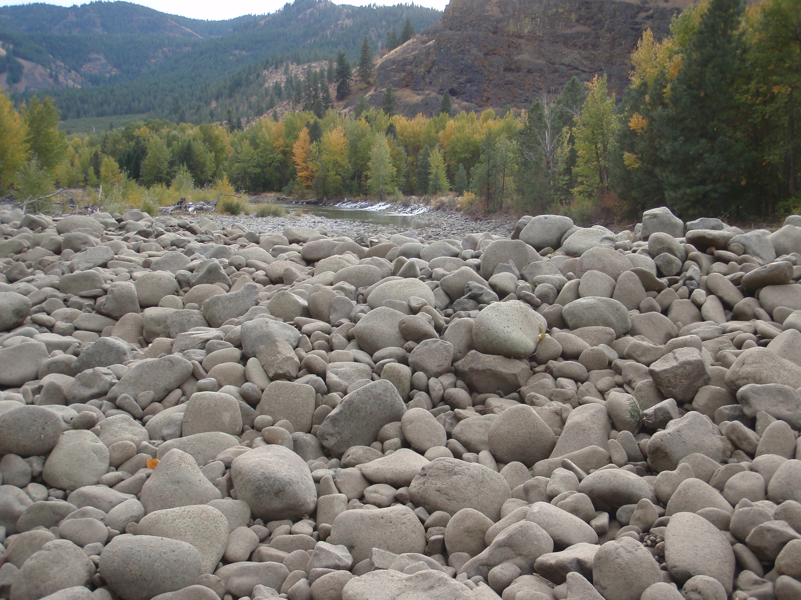
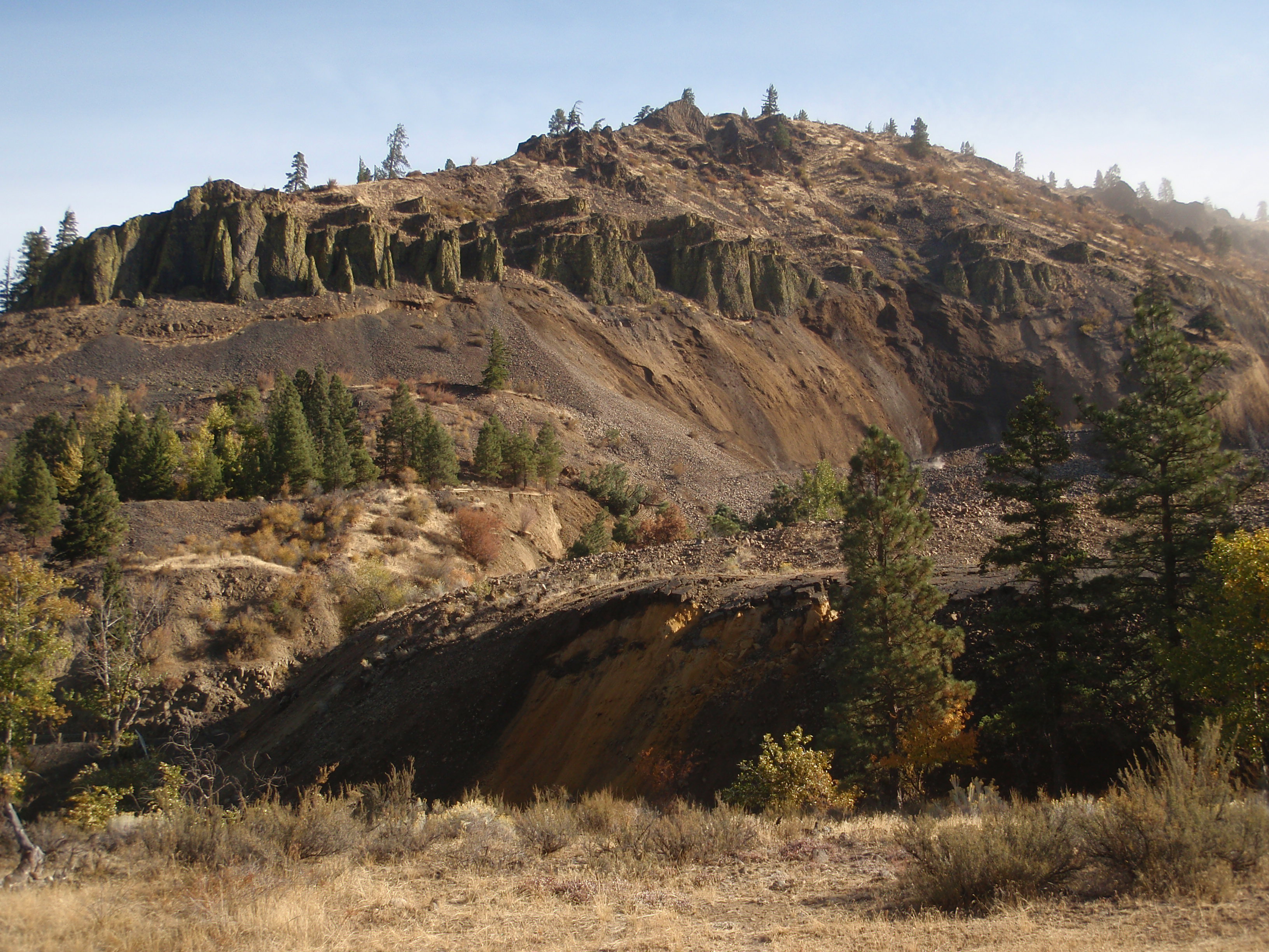
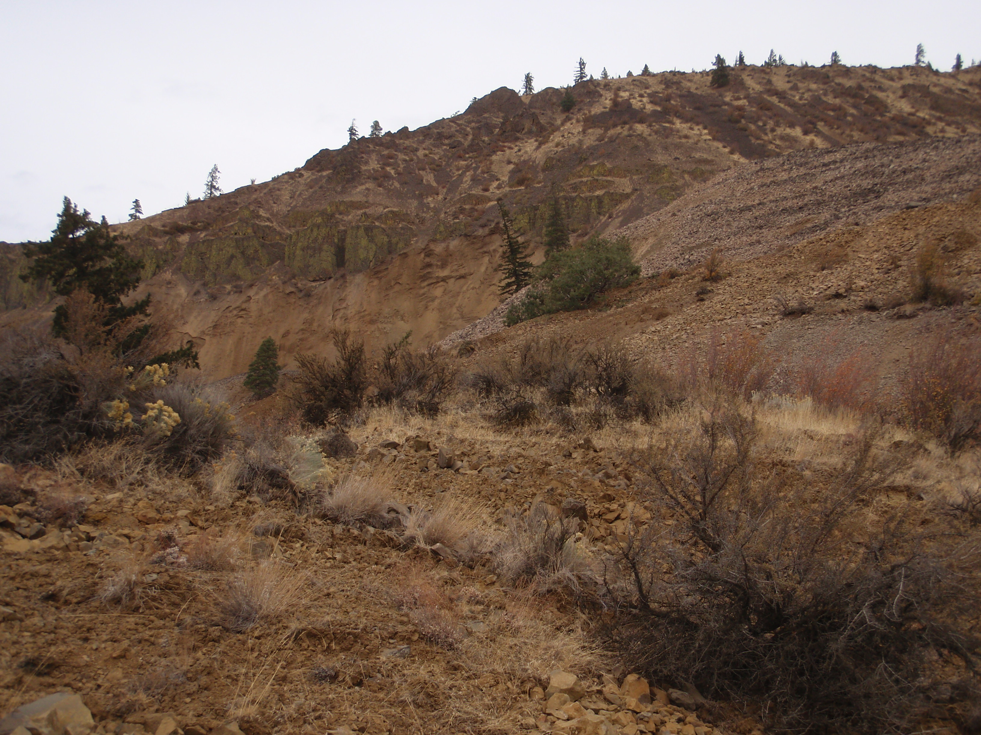
Fotos
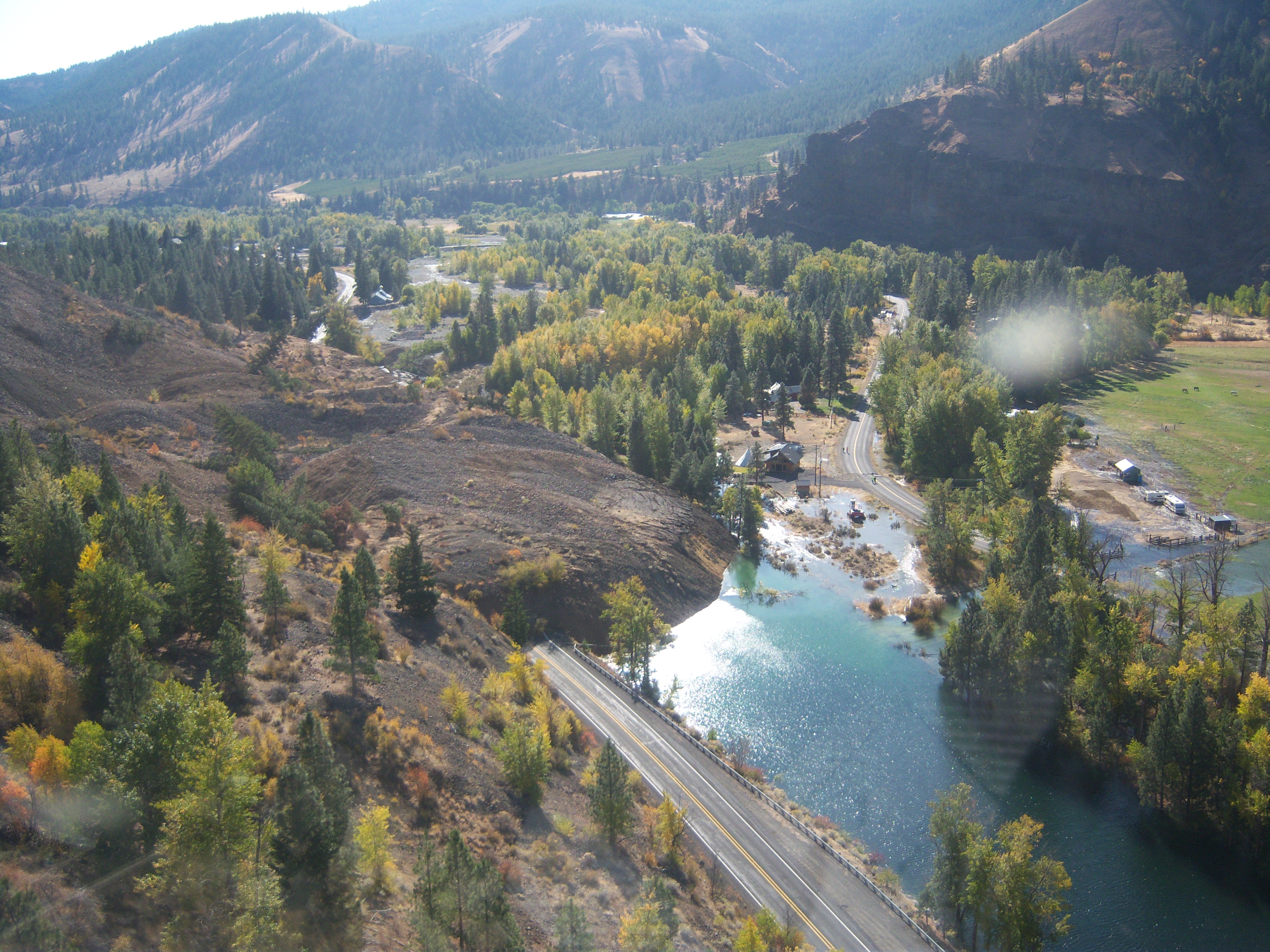
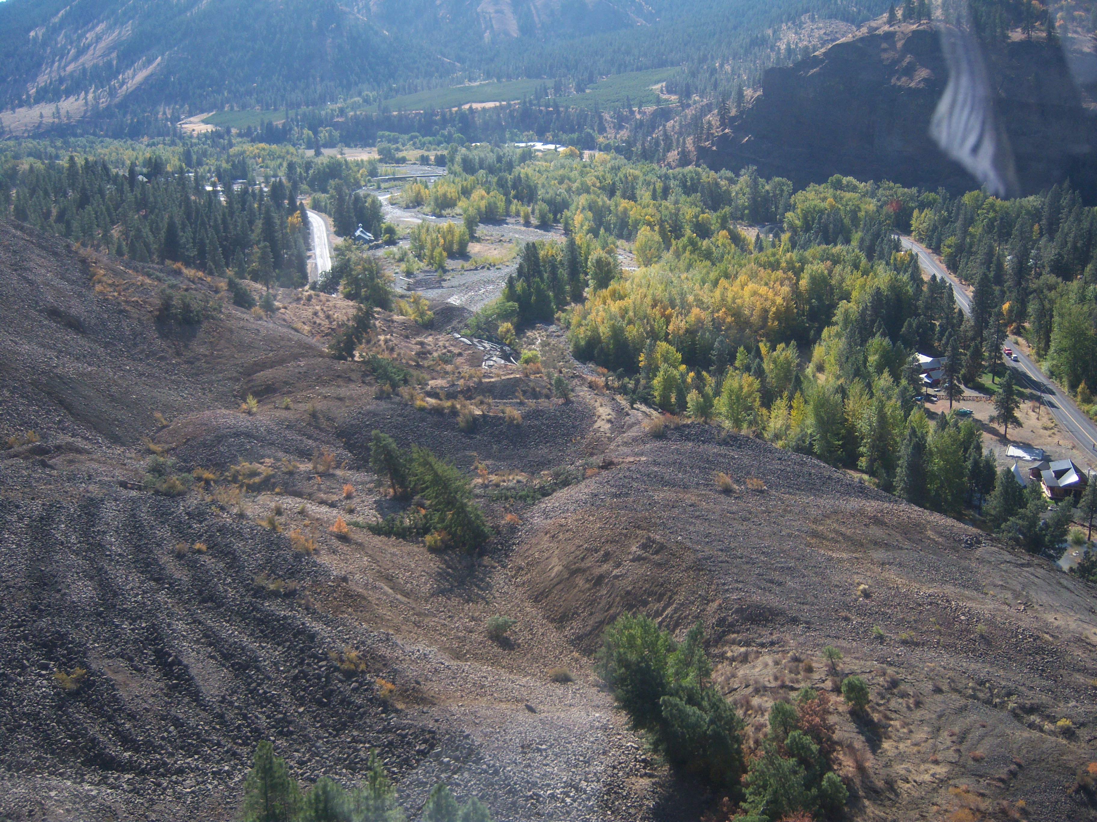
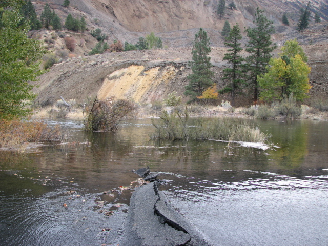
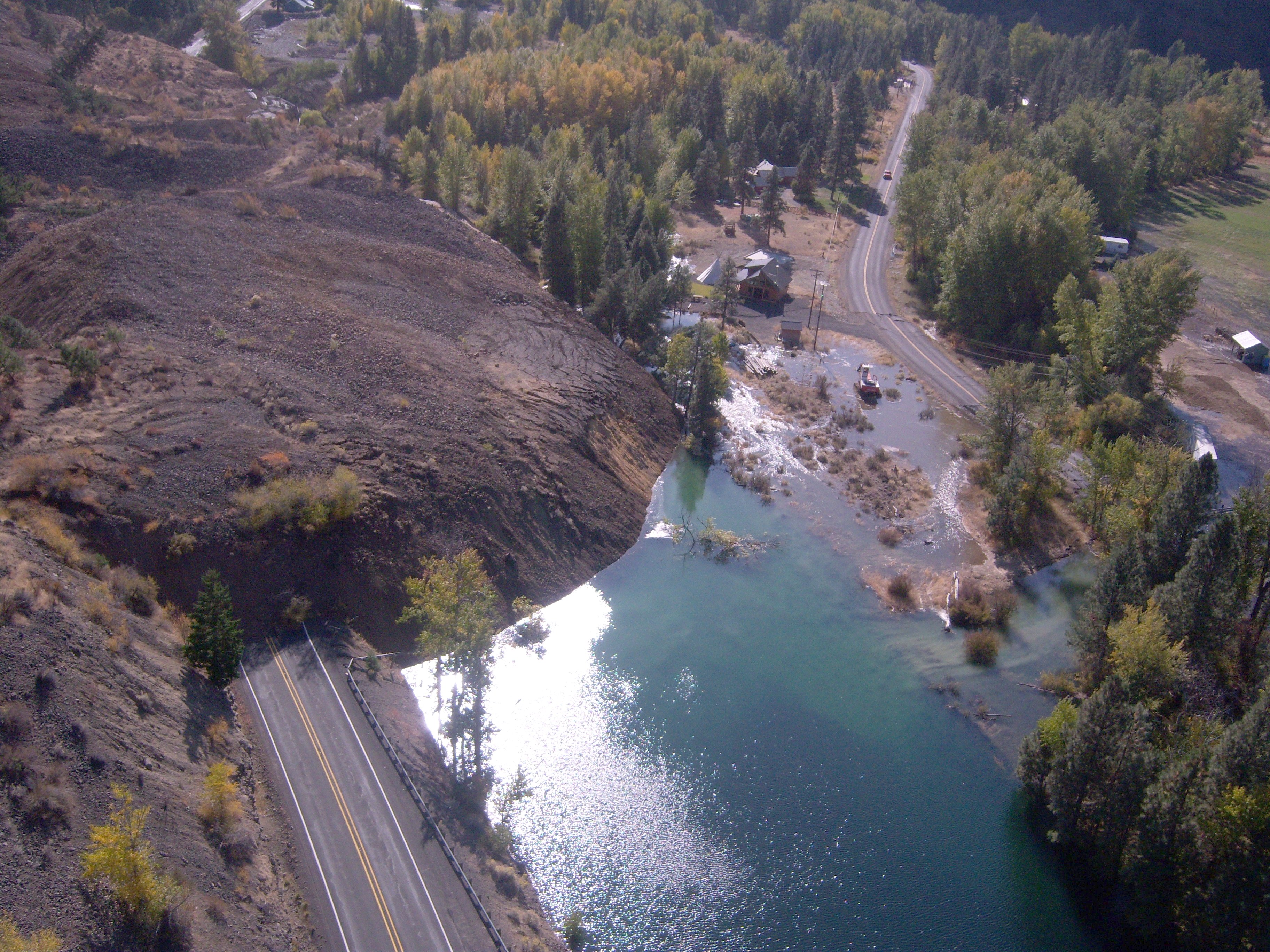
SR 410 Nile Valley Landslide (west of Naches)
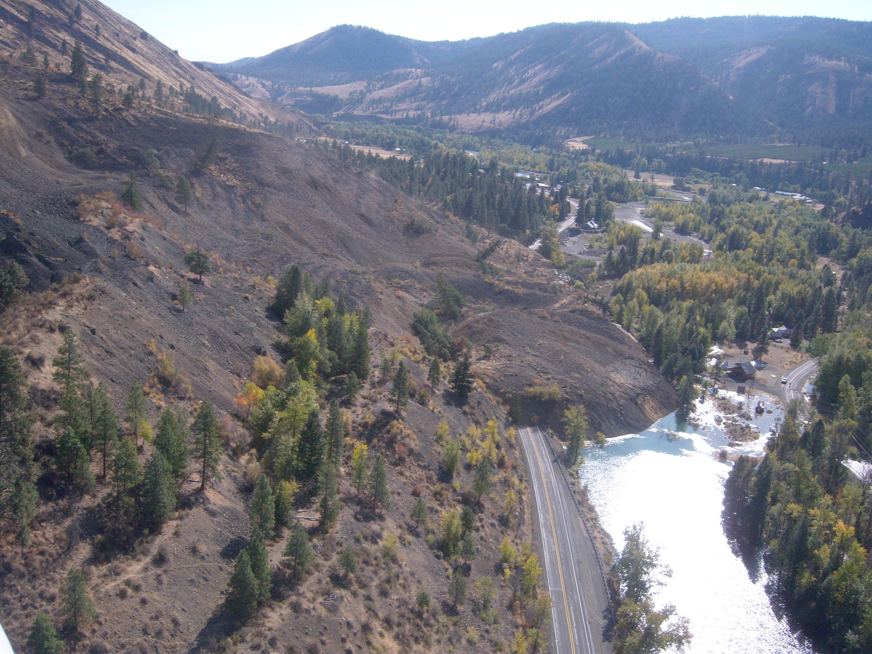
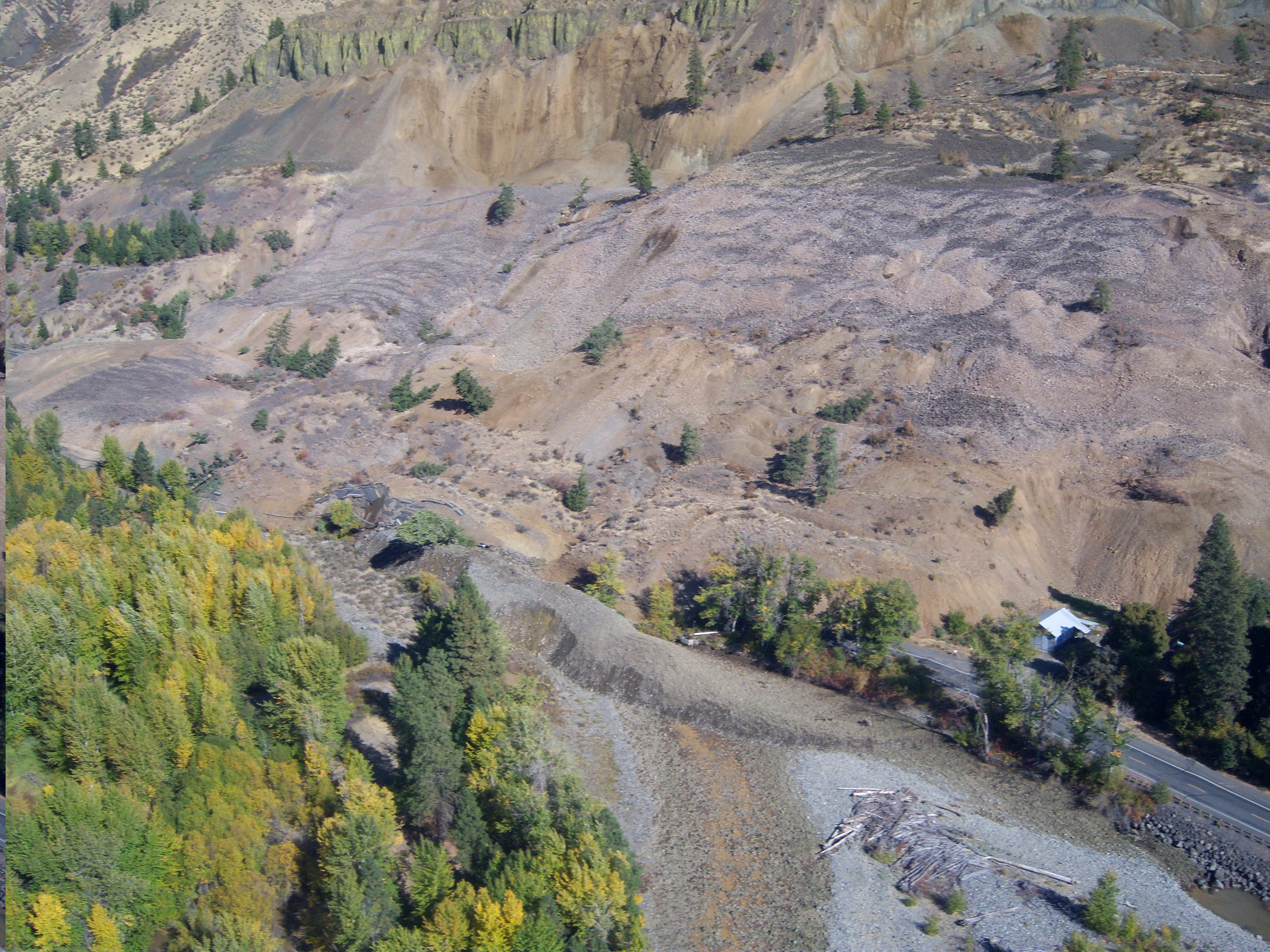
SR 410 Nile Valley Landslide (west of Naches)
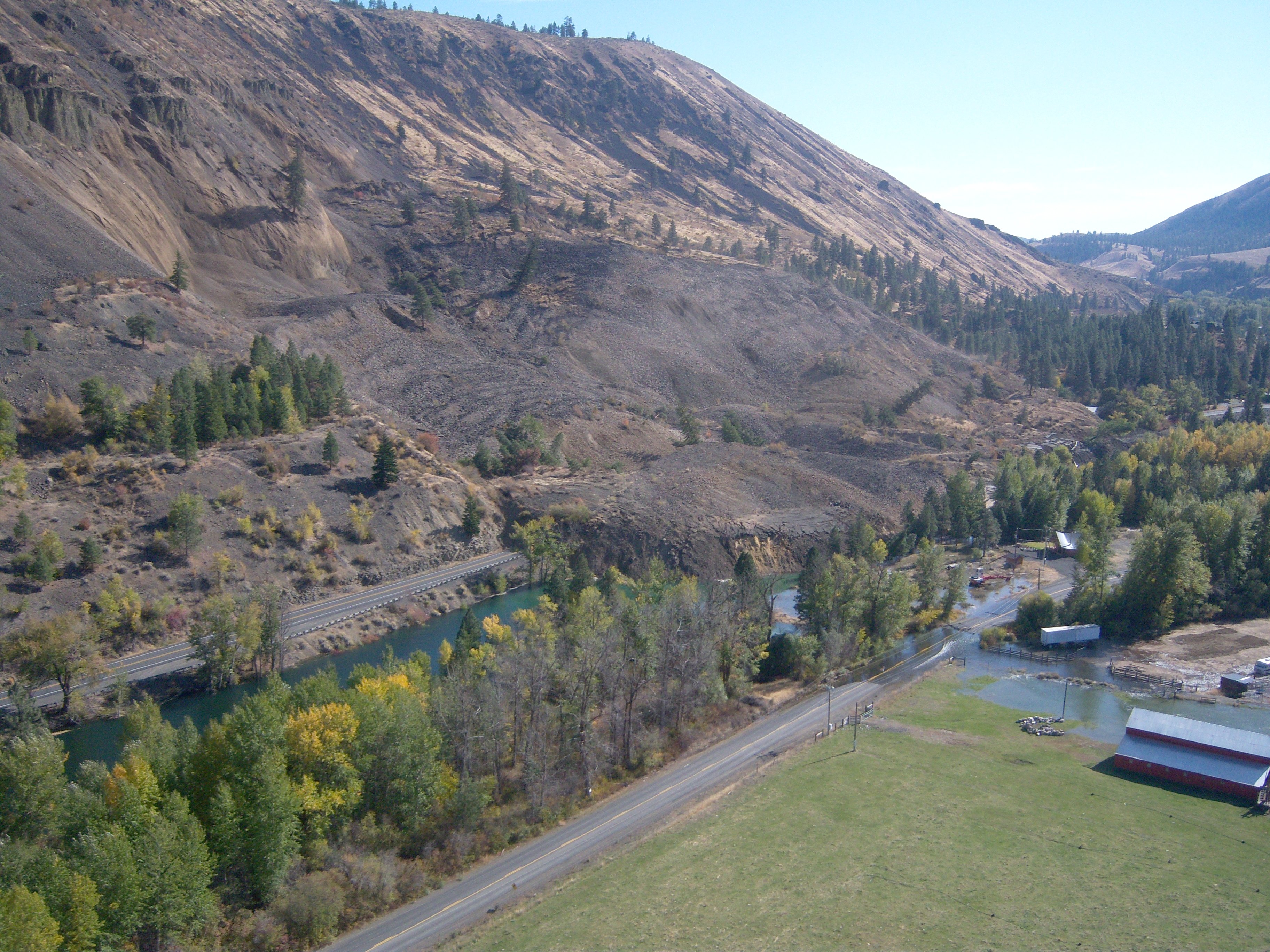
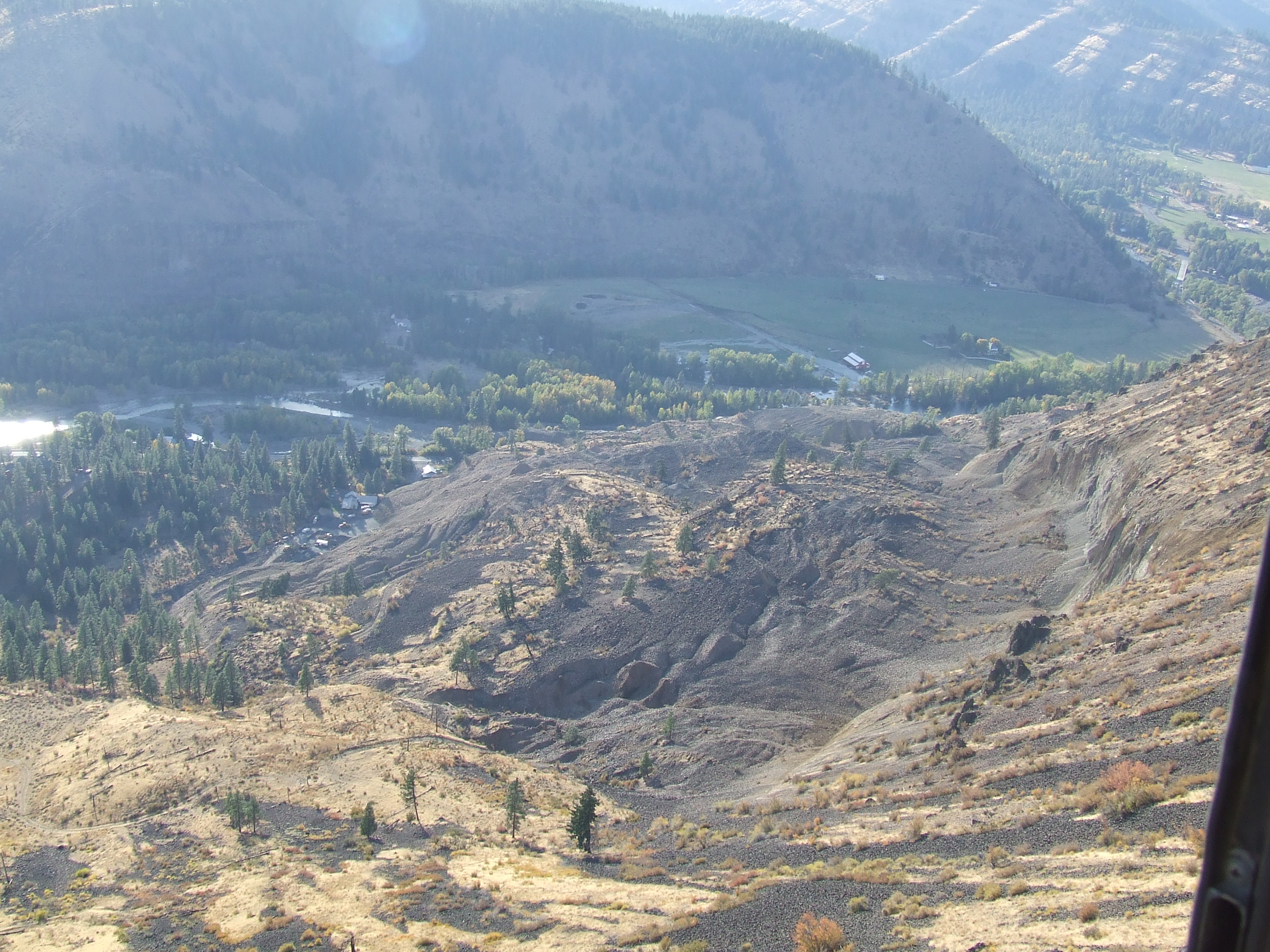
SR 410 Nile Valley Landslide (west of Naches)

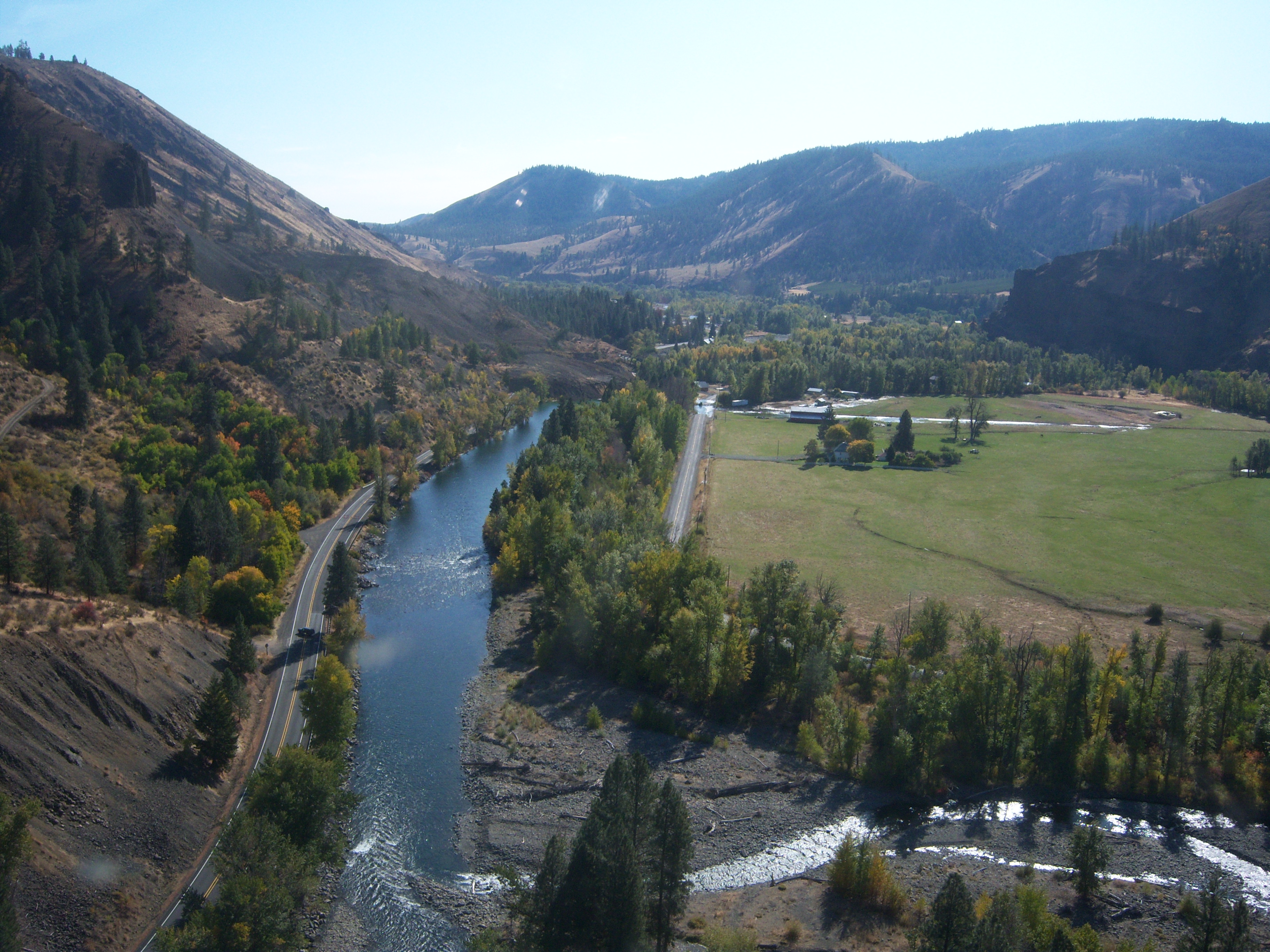
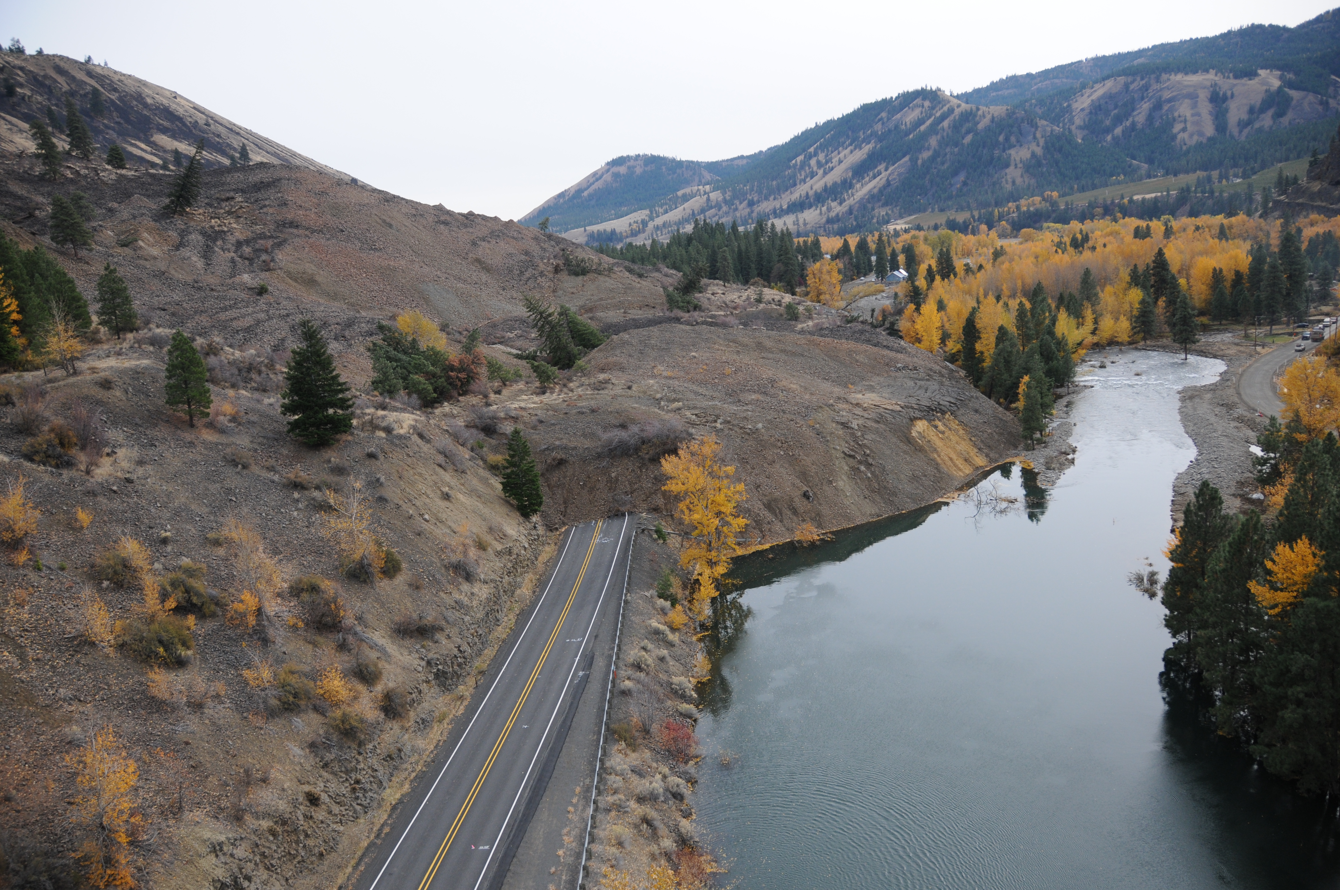
SR 410 Nile Valley Landslide (west of Naches)
SR 410 Nile Valley Landslide (west of Naches)
SR 410 Nile Valley Landslide (west of Naches)
SR 410 Nile Valley Landslide (west of Naches)
Nile Landslide Northeast View
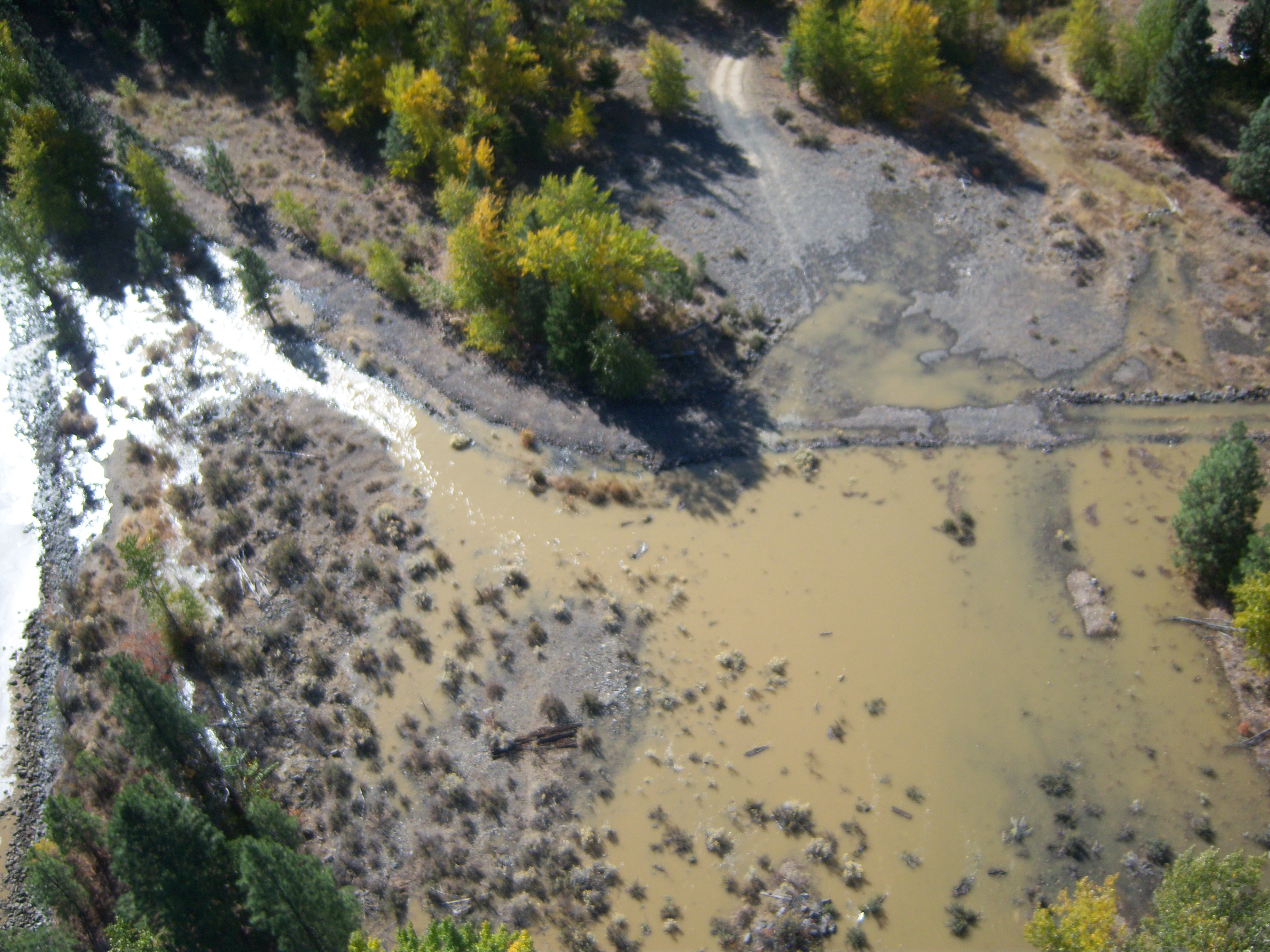
SR 410 Nile Valley Landslide - Oct. 2009
SR 410 Nile Valley Landslide - Oct. 2009

SR 410 Nile Valley Landslide - Oct. 2009

SR 410 Nile Valley Landslide - Oct. 2009
SR 410 Nile Valley Landslide (west of Naches)
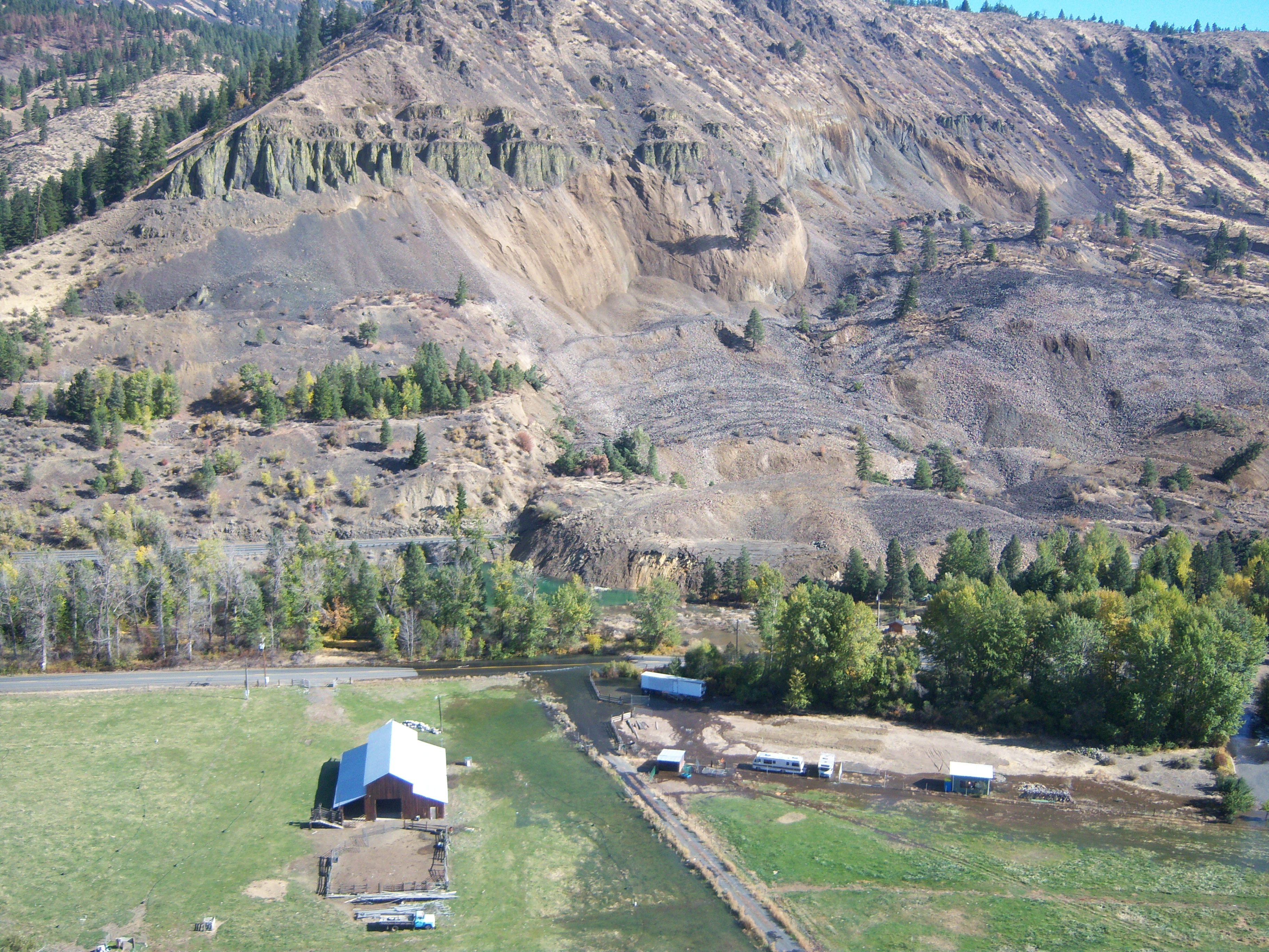
SR 410 Nile Valley Landslide (west of Naches)
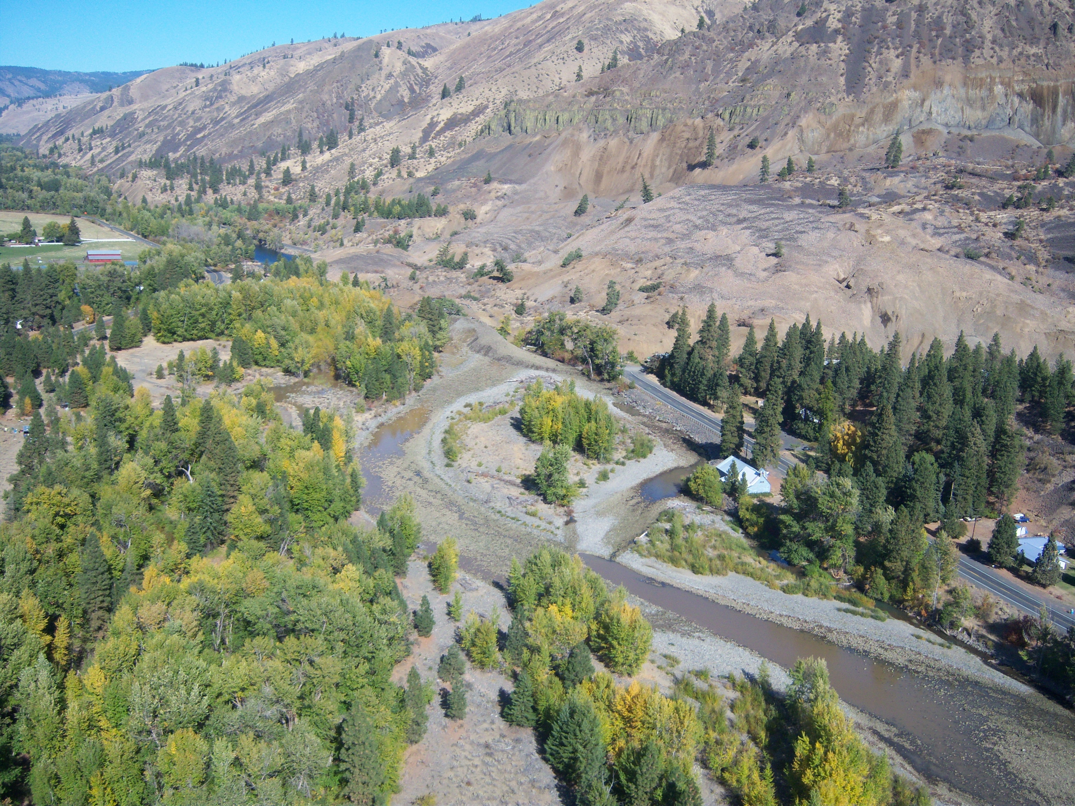
SR 410 Nile Valley Landslide (west of Naches)
SR 410 Nile Valley Landslide (west of Naches)
SR 410 Landslide
SR 410 Nile Valley Landslide (west of Naches)
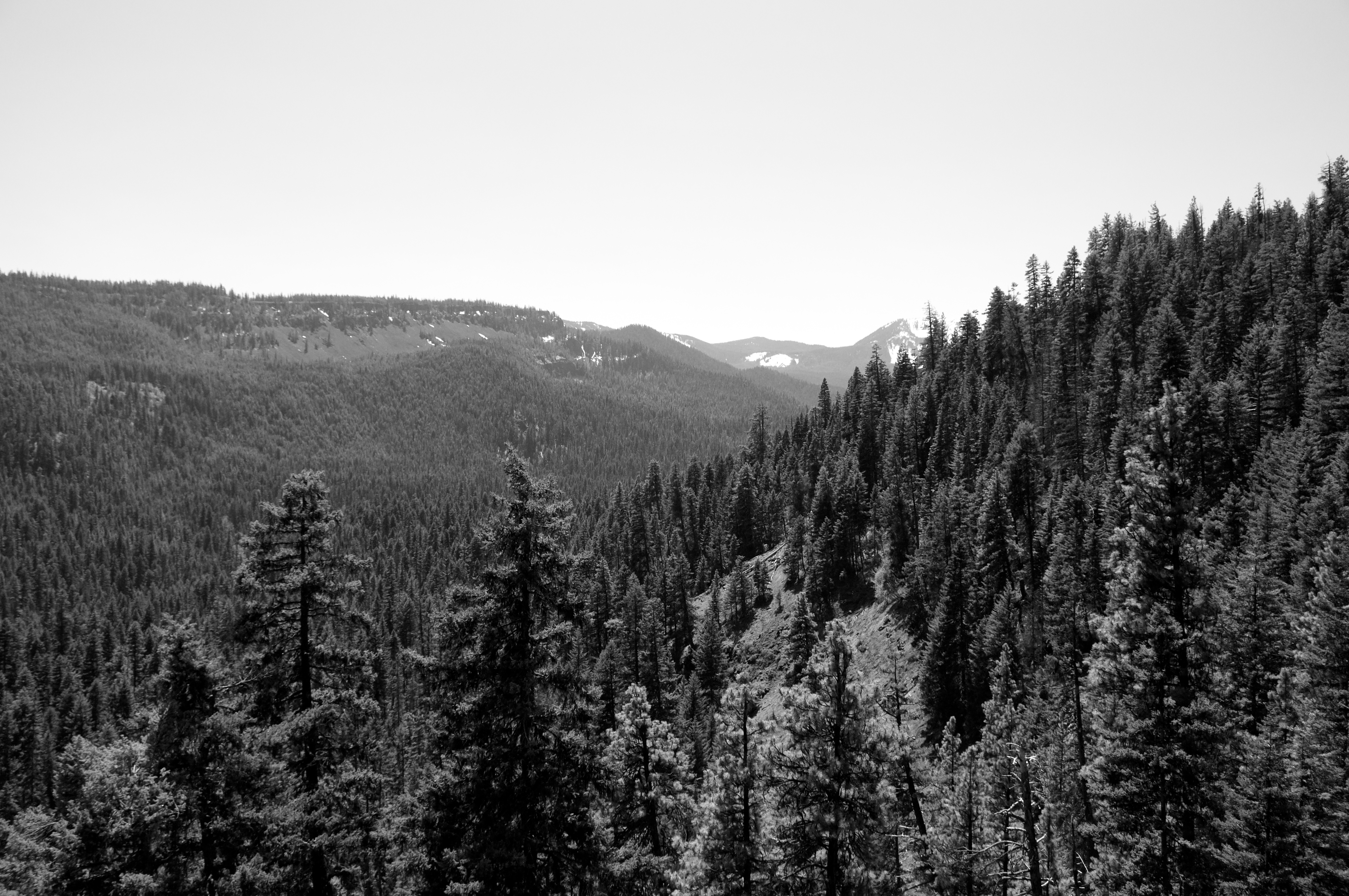
A Wonderfully Expansive View of Western Washington
SR 410 Nile Valley Landslide (west of Naches)
Mapa de Cottonwood Campground, Naches, WA, EE. UU.
Buscar otro lugar
Lugares cercanos
WA-, Naches, WA, EE. UU.
American River, WA, EE. UU.
Old Scab Mountain, Washington, EE. UU.
Goose Prairie, Washington, EE. UU.
Mohar Rd, Cle Elum, WA, EE. UU.
Fifes Ridge East, Washington, EE. UU.
Marie Rd, Cle Elum, WA, EE. UU.
Golf Course Rd, Cle Elum, WA, EE. UU.
South Cle Elum, Washington, EE. UU.
Nelson Siding Rd, Cle Elum, WA, EE. UU.
Rimrock Lake, Washington, EE. UU.
Cle Elum, Washington, EE. UU.
Heron Dr, Cle Elum, WA, EE. UU.
Wapiti Dr, Cle Elum, WA, EE. UU.
Fifes Peaks West, Washington, EE. UU.
S 7th St, Cle Elum, WA, EE. UU.
Roslyn, Washington, EE. UU.
Fifes Ridge West, Washington, EE. UU.
Ronald, Washington, EE. UU.
Shady Glen Dr, Easton, WA, EE. UU.
Búsquedas recientes
- Horas de salida y puesta de sol de Eldorado do Sul - RS, Brazil
- Horas de salida y puesta de sol de Eldorado do Sul - Parque Eldorado, Eldorado do Sul - RS, -, Brasil
- Horas de salida y puesta de sol de Granada, Meta, Colombia
- Horas de salida y puesta de sol de Narhe, Pune, Maharashtra, India
- Horas de salida y puesta de sol de Sri Bintang Hill Trail, Jalan 11/36, Taman Sri Bintang, Kuala Lumpur, Wilayah Persekutuan Kuala Lump
- Horas de salida y puesta de sol de Portón Kaminarimon, 2-chōme-3-1 Asakusa, Taito City, Tokyo -, Japón
- Horas de salida y puesta de sol de Yoshiumicho Minamiura, Imabari, Ehime -, Japan
- Horas de salida y puesta de sol de Kippen, Stirling FK8, Reino Unido
- Horas de salida y puesta de sol de Fleur de Chine Hotel Sun Moon Lake, No. 23號, Zhongzheng Rd, Yuchi Township, Nantou County, Taiwán
- Horas de salida y puesta de sol de -16 Kitamuraakagawa, Iwamizawa, Hokkaido -, Japón