Sunrise Sunset Times of E Lewis Ranch Rd, Winkelman, AZ, USA
Location: United States > Arizona > Pinal County > Winkelman >
Timezone:
America/Phoenix
Current Time:
2024-04-29 06:06:50
Longitude:
-110.583203
Latitude:
32.876905
Sunrise Today:
05:35:50 AM
Sunset Today:
07:03:17 PM
Daylength Today:
13h 27m 27s
Sunrise Tomorrow:
05:34:51 AM
Sunset Tomorrow:
07:04:01 PM
Daylength Tomorrow:
13h 29m 10s
Year Show All Dates
| Date | Sunrise | Sunset | Daylength |
|---|---|---|---|
| 01/01/2024 | 07:25:03 AM | 05:27:18 PM | 10h 2m 15s |
| 01/02/2024 | 07:25:13 AM | 05:28:03 PM | 10h 2m 50s |
| 01/03/2024 | 07:25:22 AM | 05:28:50 PM | 10h 3m 28s |
| 01/04/2024 | 07:25:29 AM | 05:29:37 PM | 10h 4m 8s |
| 01/05/2024 | 07:25:34 AM | 05:30:25 PM | 10h 4m 51s |
| 01/06/2024 | 07:25:37 AM | 05:31:14 PM | 10h 5m 37s |
| 01/07/2024 | 07:25:39 AM | 05:32:04 PM | 10h 6m 25s |
| 01/08/2024 | 07:25:39 AM | 05:32:54 PM | 10h 7m 15s |
| 01/09/2024 | 07:25:37 AM | 05:33:45 PM | 10h 8m 8s |
| 01/10/2024 | 07:25:33 AM | 05:34:37 PM | 10h 9m 4s |
| 01/11/2024 | 07:25:27 AM | 05:35:30 PM | 10h 10m 3s |
| 01/12/2024 | 07:25:20 AM | 05:36:23 PM | 10h 11m 3s |
| 01/13/2024 | 07:25:11 AM | 05:37:17 PM | 10h 12m 6s |
| 01/14/2024 | 07:25:00 AM | 05:38:11 PM | 10h 13m 11s |
| 01/15/2024 | 07:24:47 AM | 05:39:06 PM | 10h 14m 19s |
| 01/16/2024 | 07:24:32 AM | 05:40:01 PM | 10h 15m 29s |
| 01/17/2024 | 07:24:16 AM | 05:40:57 PM | 10h 16m 41s |
| 01/18/2024 | 07:23:58 AM | 05:41:52 PM | 10h 17m 54s |
| 01/19/2024 | 07:23:38 AM | 05:42:48 PM | 10h 19m 10s |
| 01/20/2024 | 07:23:16 AM | 05:43:45 PM | 10h 20m 29s |
| 01/21/2024 | 07:22:53 AM | 05:44:41 PM | 10h 21m 48s |
| 01/22/2024 | 07:22:28 AM | 05:45:38 PM | 10h 23m 10s |
| 01/23/2024 | 07:22:01 AM | 05:46:35 PM | 10h 24m 34s |
| 01/24/2024 | 07:21:32 AM | 05:47:32 PM | 10h 26m 0s |
| 01/25/2024 | 07:21:02 AM | 05:48:29 PM | 10h 27m 27s |
| 01/26/2024 | 07:20:30 AM | 05:49:26 PM | 10h 28m 56s |
| 01/27/2024 | 07:19:57 AM | 05:50:24 PM | 10h 30m 27s |
| 01/28/2024 | 07:19:22 AM | 05:51:21 PM | 10h 31m 59s |
| 01/29/2024 | 07:18:45 AM | 05:52:18 PM | 10h 33m 33s |
| 01/30/2024 | 07:18:07 AM | 05:53:15 PM | 10h 35m 8s |
| 01/31/2024 | 07:17:28 AM | 05:54:12 PM | 10h 36m 44s |
| 02/01/2024 | 07:16:46 AM | 05:55:08 PM | 10h 38m 22s |
| 02/02/2024 | 07:16:04 AM | 05:56:05 PM | 10h 40m 1s |
| 02/03/2024 | 07:15:20 AM | 05:57:01 PM | 10h 41m 41s |
| 02/04/2024 | 07:14:34 AM | 05:57:58 PM | 10h 43m 24s |
| 02/05/2024 | 07:13:47 AM | 05:58:54 PM | 10h 45m 7s |
| 02/06/2024 | 07:12:59 AM | 05:59:50 PM | 10h 46m 51s |
| 02/07/2024 | 07:12:09 AM | 06:00:45 PM | 10h 48m 36s |
| 02/08/2024 | 07:11:18 AM | 06:01:40 PM | 10h 50m 22s |
| 02/09/2024 | 07:10:26 AM | 06:02:35 PM | 10h 52m 9s |
| 02/10/2024 | 07:09:33 AM | 06:03:30 PM | 10h 53m 57s |
| 02/11/2024 | 07:08:38 AM | 06:04:24 PM | 10h 55m 46s |
| 02/12/2024 | 07:07:42 AM | 06:05:19 PM | 10h 57m 37s |
| 02/13/2024 | 07:06:45 AM | 06:06:12 PM | 10h 59m 27s |
| 02/14/2024 | 07:05:47 AM | 06:07:06 PM | 11h 1m 19s |
| 02/15/2024 | 07:04:47 AM | 06:07:59 PM | 11h 3m 12s |
| 02/16/2024 | 07:03:47 AM | 06:08:52 PM | 11h 5m 5s |
| 02/17/2024 | 07:02:45 AM | 06:09:44 PM | 11h 6m 59s |
| 02/18/2024 | 07:01:43 AM | 06:10:36 PM | 11h 8m 53s |
| 02/19/2024 | 07:00:39 AM | 06:11:28 PM | 11h 10m 49s |
| 02/20/2024 | 06:59:35 AM | 06:12:19 PM | 11h 12m 44s |
| 02/21/2024 | 06:58:30 AM | 06:13:10 PM | 11h 14m 40s |
| 02/22/2024 | 06:57:23 AM | 06:14:01 PM | 11h 16m 38s |
| 02/23/2024 | 06:56:16 AM | 06:14:51 PM | 11h 18m 35s |
| 02/24/2024 | 06:55:08 AM | 06:15:41 PM | 11h 20m 33s |
| 02/25/2024 | 06:53:59 AM | 06:16:31 PM | 11h 22m 32s |
| 02/26/2024 | 06:52:50 AM | 06:17:20 PM | 11h 24m 30s |
| 02/27/2024 | 06:51:40 AM | 06:18:09 PM | 11h 26m 29s |
| 02/28/2024 | 06:50:29 AM | 06:18:57 PM | 11h 28m 28s |
| 02/29/2024 | 06:49:17 AM | 06:19:45 PM | 11h 30m 28s |
| 03/01/2024 | 06:48:04 AM | 06:20:33 PM | 11h 32m 29s |
| 03/02/2024 | 06:46:51 AM | 06:21:21 PM | 11h 34m 30s |
| 03/03/2024 | 06:45:38 AM | 06:22:08 PM | 11h 36m 30s |
| 03/04/2024 | 06:44:24 AM | 06:22:55 PM | 11h 38m 31s |
| 03/05/2024 | 06:43:09 AM | 06:23:42 PM | 11h 40m 33s |
| 03/06/2024 | 06:41:54 AM | 06:24:28 PM | 11h 42m 34s |
| 03/07/2024 | 06:40:38 AM | 06:25:14 PM | 11h 44m 36s |
| 03/08/2024 | 06:39:22 AM | 06:26:00 PM | 11h 46m 38s |
| 03/09/2024 | 06:38:06 AM | 06:26:45 PM | 11h 48m 39s |
| 03/10/2024 | 06:36:49 AM | 06:27:31 PM | 11h 50m 42s |
| 03/11/2024 | 06:35:31 AM | 06:28:16 PM | 11h 52m 45s |
| 03/12/2024 | 06:34:14 AM | 06:29:01 PM | 11h 54m 47s |
| 03/13/2024 | 06:32:56 AM | 06:29:45 PM | 11h 56m 49s |
| 03/14/2024 | 06:31:38 AM | 06:30:30 PM | 11h 58m 52s |
| 03/15/2024 | 06:30:19 AM | 06:31:14 PM | 12h 0m 55s |
| 03/16/2024 | 06:29:01 AM | 06:31:58 PM | 12h 2m 57s |
| 03/17/2024 | 06:27:42 AM | 06:32:42 PM | 12h 5m 0s |
| 03/18/2024 | 06:26:23 AM | 06:33:25 PM | 12h 7m 2s |
| 03/19/2024 | 06:25:04 AM | 06:34:09 PM | 12h 9m 5s |
| 03/20/2024 | 06:23:45 AM | 06:34:52 PM | 12h 11m 7s |
| 03/21/2024 | 06:22:26 AM | 06:35:36 PM | 12h 13m 10s |
| 03/22/2024 | 06:21:07 AM | 06:36:19 PM | 12h 15m 12s |
| 03/23/2024 | 06:19:47 AM | 06:37:02 PM | 12h 17m 15s |
| 03/24/2024 | 06:18:28 AM | 06:37:45 PM | 12h 19m 17s |
| 03/25/2024 | 06:17:09 AM | 06:38:28 PM | 12h 21m 19s |
| 03/26/2024 | 06:15:50 AM | 06:39:11 PM | 12h 23m 21s |
| 03/27/2024 | 06:14:31 AM | 06:39:54 PM | 12h 25m 23s |
| 03/28/2024 | 06:13:12 AM | 06:40:36 PM | 12h 27m 24s |
| 03/29/2024 | 06:11:53 AM | 06:41:19 PM | 12h 29m 26s |
| 03/30/2024 | 06:10:35 AM | 06:42:02 PM | 12h 31m 27s |
| 03/31/2024 | 06:09:17 AM | 06:42:44 PM | 12h 33m 27s |
| 04/01/2024 | 06:07:59 AM | 06:43:27 PM | 12h 35m 28s |
| 04/02/2024 | 06:06:41 AM | 06:44:10 PM | 12h 37m 29s |
| 04/03/2024 | 06:05:24 AM | 06:44:52 PM | 12h 39m 28s |
| 04/04/2024 | 06:04:07 AM | 06:45:35 PM | 12h 41m 28s |
| 04/05/2024 | 06:02:50 AM | 06:46:18 PM | 12h 43m 28s |
| 04/06/2024 | 06:01:34 AM | 06:47:01 PM | 12h 45m 27s |
| 04/07/2024 | 06:00:18 AM | 06:47:44 PM | 12h 47m 26s |
| 04/08/2024 | 05:59:02 AM | 06:48:26 PM | 12h 49m 24s |
| 04/09/2024 | 05:57:48 AM | 06:49:09 PM | 12h 51m 21s |
| 04/10/2024 | 05:56:33 AM | 06:49:52 PM | 12h 53m 19s |
| 04/11/2024 | 05:55:19 AM | 06:50:36 PM | 12h 55m 17s |
| 04/12/2024 | 05:54:06 AM | 06:51:19 PM | 12h 57m 13s |
| 04/13/2024 | 05:52:53 AM | 06:52:02 PM | 12h 59m 9s |
| 04/14/2024 | 05:51:41 AM | 06:52:45 PM | 13h 1m 4s |
| 04/15/2024 | 05:50:30 AM | 06:53:29 PM | 13h 2m 59s |
| 04/16/2024 | 05:49:19 AM | 06:54:12 PM | 13h 4m 53s |
| 04/17/2024 | 05:48:09 AM | 06:54:56 PM | 13h 6m 47s |
| 04/18/2024 | 05:46:59 AM | 06:55:39 PM | 13h 8m 40s |
| 04/19/2024 | 05:45:51 AM | 06:56:23 PM | 13h 10m 32s |
| 04/20/2024 | 05:44:43 AM | 06:57:07 PM | 13h 12m 24s |
| 04/21/2024 | 05:43:36 AM | 06:57:51 PM | 13h 14m 15s |
| 04/22/2024 | 05:42:30 AM | 06:58:35 PM | 13h 16m 5s |
| 04/23/2024 | 05:41:25 AM | 06:59:19 PM | 13h 17m 54s |
| 04/24/2024 | 05:40:20 AM | 07:00:03 PM | 13h 19m 43s |
| 04/25/2024 | 05:39:17 AM | 07:00:47 PM | 13h 21m 30s |
| 04/26/2024 | 05:38:14 AM | 07:01:32 PM | 13h 23m 18s |
| 04/27/2024 | 05:37:13 AM | 07:02:16 PM | 13h 25m 3s |
| 04/28/2024 | 05:36:12 AM | 07:03:00 PM | 13h 26m 48s |
| 04/29/2024 | 05:35:13 AM | 07:03:45 PM | 13h 28m 32s |
| 04/30/2024 | 05:34:14 AM | 07:04:29 PM | 13h 30m 15s |
| 05/01/2024 | 05:33:17 AM | 07:05:14 PM | 13h 31m 57s |
| 05/02/2024 | 05:32:20 AM | 07:05:58 PM | 13h 33m 38s |
| 05/03/2024 | 05:31:25 AM | 07:06:42 PM | 13h 35m 17s |
| 05/04/2024 | 05:30:31 AM | 07:07:27 PM | 13h 36m 56s |
| 05/05/2024 | 05:29:38 AM | 07:08:11 PM | 13h 38m 33s |
| 05/06/2024 | 05:28:47 AM | 07:08:55 PM | 13h 40m 8s |
| 05/07/2024 | 05:27:56 AM | 07:09:39 PM | 13h 41m 43s |
| 05/08/2024 | 05:27:07 AM | 07:10:23 PM | 13h 43m 16s |
| 05/09/2024 | 05:26:19 AM | 07:11:07 PM | 13h 44m 48s |
| 05/10/2024 | 05:25:33 AM | 07:11:51 PM | 13h 46m 18s |
| 05/11/2024 | 05:24:47 AM | 07:12:35 PM | 13h 47m 48s |
| 05/12/2024 | 05:24:03 AM | 07:13:18 PM | 13h 49m 15s |
| 05/13/2024 | 05:23:21 AM | 07:14:02 PM | 13h 50m 41s |
| 05/14/2024 | 05:22:39 AM | 07:14:45 PM | 13h 52m 6s |
| 05/15/2024 | 05:21:59 AM | 07:15:27 PM | 13h 53m 28s |
| 05/16/2024 | 05:21:21 AM | 07:16:10 PM | 13h 54m 49s |
| 05/17/2024 | 05:20:44 AM | 07:16:52 PM | 13h 56m 8s |
| 05/18/2024 | 05:20:08 AM | 07:17:34 PM | 13h 57m 26s |
| 05/19/2024 | 05:19:34 AM | 07:18:15 PM | 13h 58m 41s |
| 05/20/2024 | 05:19:01 AM | 07:18:56 PM | 13h 59m 55s |
| 05/21/2024 | 05:18:30 AM | 07:19:37 PM | 14h 1m 7s |
| 05/22/2024 | 05:18:00 AM | 07:20:17 PM | 14h 2m 17s |
| 05/23/2024 | 05:17:32 AM | 07:20:57 PM | 14h 3m 25s |
| 05/24/2024 | 05:17:05 AM | 07:21:36 PM | 14h 4m 31s |
| 05/25/2024 | 05:16:40 AM | 07:22:15 PM | 14h 5m 35s |
| 05/26/2024 | 05:16:16 AM | 07:22:53 PM | 14h 6m 37s |
| 05/27/2024 | 05:15:54 AM | 07:23:30 PM | 14h 7m 36s |
| 05/28/2024 | 05:15:33 AM | 07:24:07 PM | 14h 8m 34s |
| 05/29/2024 | 05:15:14 AM | 07:24:43 PM | 14h 9m 29s |
| 05/30/2024 | 05:14:56 AM | 07:25:18 PM | 14h 10m 22s |
| 05/31/2024 | 05:14:40 AM | 07:25:53 PM | 14h 11m 13s |
| 06/01/2024 | 05:14:26 AM | 07:26:27 PM | 14h 12m 1s |
| 06/02/2024 | 05:14:13 AM | 07:27:00 PM | 14h 12m 47s |
| 06/03/2024 | 05:14:01 AM | 07:27:32 PM | 14h 13m 31s |
| 06/04/2024 | 05:13:52 AM | 07:28:03 PM | 14h 14m 11s |
| 06/05/2024 | 05:13:43 AM | 07:28:34 PM | 14h 14m 51s |
| 06/06/2024 | 05:13:37 AM | 07:29:03 PM | 14h 15m 26s |
| 06/07/2024 | 05:13:31 AM | 07:29:32 PM | 14h 16m 1s |
| 06/08/2024 | 05:13:28 AM | 07:29:59 PM | 14h 16m 31s |
| 06/09/2024 | 05:13:25 AM | 07:30:25 PM | 14h 17m 0s |
| 06/10/2024 | 05:13:25 AM | 07:30:51 PM | 14h 17m 26s |
| 06/11/2024 | 05:13:25 AM | 07:31:15 PM | 14h 17m 50s |
| 06/12/2024 | 05:13:28 AM | 07:31:38 PM | 14h 18m 10s |
| 06/13/2024 | 05:13:31 AM | 07:31:59 PM | 14h 18m 28s |
| 06/14/2024 | 05:13:36 AM | 07:32:20 PM | 14h 18m 44s |
| 06/15/2024 | 05:13:43 AM | 07:32:39 PM | 14h 18m 56s |
| 06/16/2024 | 05:13:51 AM | 07:32:57 PM | 14h 19m 6s |
| 06/17/2024 | 05:14:00 AM | 07:33:14 PM | 14h 19m 14s |
| 06/18/2024 | 05:14:11 AM | 07:33:30 PM | 14h 19m 19s |
| 06/19/2024 | 05:14:23 AM | 07:33:44 PM | 14h 19m 21s |
| 06/20/2024 | 05:14:37 AM | 07:33:56 PM | 14h 19m 19s |
| 06/21/2024 | 05:14:51 AM | 07:34:08 PM | 14h 19m 17s |
| 06/22/2024 | 05:15:07 AM | 07:34:18 PM | 14h 19m 11s |
| 06/23/2024 | 05:15:24 AM | 07:34:26 PM | 14h 19m 2s |
| 06/24/2024 | 05:15:43 AM | 07:34:33 PM | 14h 18m 50s |
| 06/25/2024 | 05:16:02 AM | 07:34:39 PM | 14h 18m 37s |
| 06/26/2024 | 05:16:23 AM | 07:34:43 PM | 14h 18m 20s |
| 06/27/2024 | 05:16:45 AM | 07:34:45 PM | 14h 18m 0s |
| 06/28/2024 | 05:17:08 AM | 07:34:46 PM | 14h 17m 38s |
| 06/29/2024 | 05:17:32 AM | 07:34:46 PM | 14h 17m 14s |
| 06/30/2024 | 05:17:57 AM | 07:34:44 PM | 14h 16m 47s |
| 07/01/2024 | 05:18:23 AM | 07:34:40 PM | 14h 16m 17s |
| 07/02/2024 | 05:18:50 AM | 07:34:35 PM | 14h 15m 45s |
| 07/03/2024 | 05:19:18 AM | 07:34:28 PM | 14h 15m 10s |
| 07/04/2024 | 05:19:47 AM | 07:34:20 PM | 14h 14m 33s |
| 07/05/2024 | 05:20:17 AM | 07:34:10 PM | 14h 13m 53s |
| 07/06/2024 | 05:20:47 AM | 07:33:59 PM | 14h 13m 12s |
| 07/07/2024 | 05:21:19 AM | 07:33:46 PM | 14h 12m 27s |
| 07/08/2024 | 05:21:51 AM | 07:33:31 PM | 14h 11m 40s |
| 07/09/2024 | 05:22:24 AM | 07:33:15 PM | 14h 10m 51s |
| 07/10/2024 | 05:22:57 AM | 07:32:57 PM | 14h 10m 0s |
| 07/11/2024 | 05:23:31 AM | 07:32:38 PM | 14h 9m 7s |
| 07/12/2024 | 05:24:06 AM | 07:32:17 PM | 14h 8m 11s |
| 07/13/2024 | 05:24:42 AM | 07:31:54 PM | 14h 7m 12s |
| 07/14/2024 | 05:25:18 AM | 07:31:30 PM | 14h 6m 12s |
| 07/15/2024 | 05:25:54 AM | 07:31:04 PM | 14h 5m 10s |
| 07/16/2024 | 05:26:31 AM | 07:30:37 PM | 14h 4m 6s |
| 07/17/2024 | 05:27:09 AM | 07:30:08 PM | 14h 2m 59s |
| 07/18/2024 | 05:27:47 AM | 07:29:38 PM | 14h 1m 51s |
| 07/19/2024 | 05:28:25 AM | 07:29:06 PM | 14h 0m 41s |
| 07/20/2024 | 05:29:04 AM | 07:28:33 PM | 13h 59m 29s |
| 07/21/2024 | 05:29:43 AM | 07:27:58 PM | 13h 58m 15s |
| 07/22/2024 | 05:30:22 AM | 07:27:21 PM | 13h 56m 59s |
| 07/23/2024 | 05:31:02 AM | 07:26:44 PM | 13h 55m 42s |
| 07/24/2024 | 05:31:42 AM | 07:26:04 PM | 13h 54m 22s |
| 07/25/2024 | 05:32:22 AM | 07:25:24 PM | 13h 53m 2s |
| 07/26/2024 | 05:33:03 AM | 07:24:42 PM | 13h 51m 39s |
| 07/27/2024 | 05:33:43 AM | 07:23:58 PM | 13h 50m 15s |
| 07/28/2024 | 05:34:24 AM | 07:23:13 PM | 13h 48m 49s |
| 07/29/2024 | 05:35:05 AM | 07:22:27 PM | 13h 47m 22s |
| 07/30/2024 | 05:35:46 AM | 07:21:39 PM | 13h 45m 53s |
| 07/31/2024 | 05:36:27 AM | 07:20:51 PM | 13h 44m 24s |
| 08/01/2024 | 05:37:08 AM | 07:20:00 PM | 13h 42m 52s |
| 08/02/2024 | 05:37:49 AM | 07:19:09 PM | 13h 41m 20s |
| 08/03/2024 | 05:38:30 AM | 07:18:16 PM | 13h 39m 46s |
| 08/04/2024 | 05:39:12 AM | 07:17:22 PM | 13h 38m 10s |
| 08/05/2024 | 05:39:53 AM | 07:16:27 PM | 13h 36m 34s |
| 08/06/2024 | 05:40:34 AM | 07:15:31 PM | 13h 34m 57s |
| 08/07/2024 | 05:41:16 AM | 07:14:34 PM | 13h 33m 18s |
| 08/08/2024 | 05:41:57 AM | 07:13:35 PM | 13h 31m 38s |
| 08/09/2024 | 05:42:38 AM | 07:12:36 PM | 13h 29m 58s |
| 08/10/2024 | 05:43:19 AM | 07:11:35 PM | 13h 28m 16s |
| 08/11/2024 | 05:44:00 AM | 07:10:33 PM | 13h 26m 33s |
| 08/12/2024 | 05:44:41 AM | 07:09:30 PM | 13h 24m 49s |
| 08/13/2024 | 05:45:22 AM | 07:08:26 PM | 13h 23m 4s |
| 08/14/2024 | 05:46:03 AM | 07:07:22 PM | 13h 21m 19s |
| 08/15/2024 | 05:46:43 AM | 07:06:16 PM | 13h 19m 33s |
| 08/16/2024 | 05:47:24 AM | 07:05:09 PM | 13h 17m 45s |
| 08/17/2024 | 05:48:05 AM | 07:04:02 PM | 13h 15m 57s |
| 08/18/2024 | 05:48:45 AM | 07:02:53 PM | 13h 14m 8s |
| 08/19/2024 | 05:49:25 AM | 07:01:44 PM | 13h 12m 19s |
| 08/20/2024 | 05:50:05 AM | 07:00:34 PM | 13h 10m 29s |
| 08/21/2024 | 05:50:45 AM | 06:59:23 PM | 13h 8m 38s |
| 08/22/2024 | 05:51:25 AM | 06:58:12 PM | 13h 6m 47s |
| 08/23/2024 | 05:52:05 AM | 06:56:59 PM | 13h 4m 54s |
| 08/24/2024 | 05:52:45 AM | 06:55:46 PM | 13h 3m 1s |
| 08/25/2024 | 05:53:24 AM | 06:54:33 PM | 13h 1m 9s |
| 08/26/2024 | 05:54:04 AM | 06:53:18 PM | 12h 59m 14s |
| 08/27/2024 | 05:54:43 AM | 06:52:03 PM | 12h 57m 20s |
| 08/28/2024 | 05:55:22 AM | 06:50:48 PM | 12h 55m 26s |
| 08/29/2024 | 05:56:01 AM | 06:49:31 PM | 12h 53m 30s |
| 08/30/2024 | 05:56:40 AM | 06:48:15 PM | 12h 51m 35s |
| 08/31/2024 | 05:57:19 AM | 06:46:58 PM | 12h 49m 39s |
| 09/01/2024 | 05:57:58 AM | 06:45:40 PM | 12h 47m 42s |
| 09/02/2024 | 05:58:37 AM | 06:44:22 PM | 12h 45m 45s |
| 09/03/2024 | 05:59:16 AM | 06:43:03 PM | 12h 43m 47s |
| 09/04/2024 | 05:59:54 AM | 06:41:44 PM | 12h 41m 50s |
| 09/05/2024 | 06:00:33 AM | 06:40:25 PM | 12h 39m 52s |
| 09/06/2024 | 06:01:12 AM | 06:39:05 PM | 12h 37m 53s |
| 09/07/2024 | 06:01:50 AM | 06:37:45 PM | 12h 35m 55s |
| 09/08/2024 | 06:02:29 AM | 06:36:25 PM | 12h 33m 56s |
| 09/09/2024 | 06:03:07 AM | 06:35:04 PM | 12h 31m 57s |
| 09/10/2024 | 06:03:46 AM | 06:33:44 PM | 12h 29m 58s |
| 09/11/2024 | 06:04:24 AM | 06:32:23 PM | 12h 27m 59s |
| 09/12/2024 | 06:05:03 AM | 06:31:01 PM | 12h 25m 58s |
| 09/13/2024 | 06:05:41 AM | 06:29:40 PM | 12h 23m 59s |
| 09/14/2024 | 06:06:20 AM | 06:28:19 PM | 12h 21m 59s |
| 09/15/2024 | 06:06:58 AM | 06:26:57 PM | 12h 19m 59s |
| 09/16/2024 | 06:07:37 AM | 06:25:36 PM | 12h 17m 59s |
| 09/17/2024 | 06:08:16 AM | 06:24:14 PM | 12h 15m 58s |
| 09/18/2024 | 06:08:55 AM | 06:22:52 PM | 12h 13m 57s |
| 09/19/2024 | 06:09:34 AM | 06:21:31 PM | 12h 11m 57s |
| 09/20/2024 | 06:10:13 AM | 06:20:09 PM | 12h 9m 56s |
| 09/21/2024 | 06:10:52 AM | 06:18:48 PM | 12h 7m 56s |
| 09/22/2024 | 06:11:31 AM | 06:17:26 PM | 12h 5m 55s |
| 09/23/2024 | 06:12:11 AM | 06:16:05 PM | 12h 3m 54s |
| 09/24/2024 | 06:12:50 AM | 06:14:44 PM | 12h 1m 54s |
| 09/25/2024 | 06:13:30 AM | 06:13:23 PM | 11h 59m 53s |
| 09/26/2024 | 06:14:10 AM | 06:12:02 PM | 11h 57m 52s |
| 09/27/2024 | 06:14:50 AM | 06:10:42 PM | 11h 55m 52s |
| 09/28/2024 | 06:15:31 AM | 06:09:22 PM | 11h 53m 51s |
| 09/29/2024 | 06:16:11 AM | 06:08:02 PM | 11h 51m 51s |
| 09/30/2024 | 06:16:52 AM | 06:06:42 PM | 11h 49m 50s |
| 10/01/2024 | 06:17:34 AM | 06:05:23 PM | 11h 47m 49s |
| 10/02/2024 | 06:18:15 AM | 06:04:04 PM | 11h 45m 49s |
| 10/03/2024 | 06:18:57 AM | 06:02:46 PM | 11h 43m 49s |
| 10/04/2024 | 06:19:39 AM | 06:01:28 PM | 11h 41m 49s |
| 10/05/2024 | 06:20:21 AM | 06:00:11 PM | 11h 39m 50s |
| 10/06/2024 | 06:21:03 AM | 05:58:54 PM | 11h 37m 51s |
| 10/07/2024 | 06:21:46 AM | 05:57:37 PM | 11h 35m 51s |
| 10/08/2024 | 06:22:29 AM | 05:56:22 PM | 11h 33m 53s |
| 10/09/2024 | 06:23:13 AM | 05:55:06 PM | 11h 31m 53s |
| 10/10/2024 | 06:23:57 AM | 05:53:52 PM | 11h 29m 55s |
| 10/11/2024 | 06:24:41 AM | 05:52:38 PM | 11h 27m 57s |
| 10/12/2024 | 06:25:25 AM | 05:51:25 PM | 11h 26m 0s |
| 10/13/2024 | 06:26:10 AM | 05:50:12 PM | 11h 24m 2s |
| 10/14/2024 | 06:26:56 AM | 05:49:00 PM | 11h 22m 4s |
| 10/15/2024 | 06:27:41 AM | 05:47:49 PM | 11h 20m 8s |
| 10/16/2024 | 06:28:27 AM | 05:46:39 PM | 11h 18m 12s |
| 10/17/2024 | 06:29:14 AM | 05:45:30 PM | 11h 16m 16s |
| 10/18/2024 | 06:30:00 AM | 05:44:22 PM | 11h 14m 22s |
| 10/19/2024 | 06:30:48 AM | 05:43:14 PM | 11h 12m 26s |
| 10/20/2024 | 06:31:35 AM | 05:42:07 PM | 11h 10m 32s |
| 10/21/2024 | 06:32:23 AM | 05:41:02 PM | 11h 8m 39s |
| 10/22/2024 | 06:33:11 AM | 05:39:57 PM | 11h 6m 46s |
| 10/23/2024 | 06:34:00 AM | 05:38:53 PM | 11h 4m 53s |
| 10/24/2024 | 06:34:49 AM | 05:37:51 PM | 11h 3m 2s |
| 10/25/2024 | 06:35:39 AM | 05:36:49 PM | 11h 1m 10s |
| 10/26/2024 | 06:36:28 AM | 05:35:49 PM | 10h 59m 21s |
| 10/27/2024 | 06:37:18 AM | 05:34:50 PM | 10h 57m 32s |
| 10/28/2024 | 06:38:09 AM | 05:33:51 PM | 10h 55m 42s |
| 10/29/2024 | 06:39:00 AM | 05:32:55 PM | 10h 53m 55s |
| 10/30/2024 | 06:39:51 AM | 05:31:59 PM | 10h 52m 8s |
| 10/31/2024 | 06:40:43 AM | 05:31:04 PM | 10h 50m 21s |
| 11/01/2024 | 06:41:35 AM | 05:30:11 PM | 10h 48m 36s |
| 11/02/2024 | 06:42:27 AM | 05:29:20 PM | 10h 46m 53s |
| 11/03/2024 | 06:43:19 AM | 05:28:29 PM | 10h 45m 10s |
| 11/04/2024 | 06:44:12 AM | 05:27:40 PM | 10h 43m 28s |
| 11/05/2024 | 06:45:05 AM | 05:26:52 PM | 10h 41m 47s |
| 11/06/2024 | 06:45:58 AM | 05:26:06 PM | 10h 40m 8s |
| 11/07/2024 | 06:46:52 AM | 05:25:21 PM | 10h 38m 29s |
| 11/08/2024 | 06:47:46 AM | 05:24:38 PM | 10h 36m 52s |
| 11/09/2024 | 06:48:39 AM | 05:23:56 PM | 10h 35m 17s |
| 11/10/2024 | 06:49:34 AM | 05:23:16 PM | 10h 33m 42s |
| 11/11/2024 | 06:50:28 AM | 05:22:37 PM | 10h 32m 9s |
| 11/12/2024 | 06:51:22 AM | 05:22:00 PM | 10h 30m 38s |
| 11/13/2024 | 06:52:16 AM | 05:21:25 PM | 10h 29m 9s |
| 11/14/2024 | 06:53:11 AM | 05:20:51 PM | 10h 27m 40s |
| 11/15/2024 | 06:54:05 AM | 05:20:19 PM | 10h 26m 14s |
| 11/16/2024 | 06:55:00 AM | 05:19:48 PM | 10h 24m 48s |
| 11/17/2024 | 06:55:54 AM | 05:19:19 PM | 10h 23m 25s |
| 11/18/2024 | 06:56:49 AM | 05:18:52 PM | 10h 22m 3s |
| 11/19/2024 | 06:57:43 AM | 05:18:27 PM | 10h 20m 44s |
| 11/20/2024 | 06:58:37 AM | 05:18:03 PM | 10h 19m 26s |
| 11/21/2024 | 06:59:31 AM | 05:17:41 PM | 10h 18m 10s |
| 11/22/2024 | 07:00:25 AM | 05:17:21 PM | 10h 16m 56s |
| 11/23/2024 | 07:01:18 AM | 05:17:03 PM | 10h 15m 45s |
| 11/24/2024 | 07:02:12 AM | 05:16:46 PM | 10h 14m 34s |
| 11/25/2024 | 07:03:05 AM | 05:16:31 PM | 10h 13m 26s |
| 11/26/2024 | 07:03:57 AM | 05:16:19 PM | 10h 12m 22s |
| 11/27/2024 | 07:04:49 AM | 05:16:08 PM | 10h 11m 19s |
| 11/28/2024 | 07:05:41 AM | 05:15:58 PM | 10h 10m 17s |
| 11/29/2024 | 07:06:32 AM | 05:15:51 PM | 10h 9m 19s |
| 11/30/2024 | 07:07:23 AM | 05:15:45 PM | 10h 8m 22s |
| 12/01/2024 | 07:08:13 AM | 05:15:42 PM | 10h 7m 29s |
| 12/02/2024 | 07:09:02 AM | 05:15:40 PM | 10h 6m 38s |
| 12/03/2024 | 07:09:51 AM | 05:15:40 PM | 10h 5m 49s |
| 12/04/2024 | 07:10:39 AM | 05:15:42 PM | 10h 5m 3s |
| 12/05/2024 | 07:11:26 AM | 05:15:46 PM | 10h 4m 20s |
| 12/06/2024 | 07:12:12 AM | 05:15:51 PM | 10h 3m 39s |
| 12/07/2024 | 07:12:58 AM | 05:15:58 PM | 10h 3m 0s |
| 12/08/2024 | 07:13:42 AM | 05:16:08 PM | 10h 2m 26s |
| 12/09/2024 | 07:14:26 AM | 05:16:19 PM | 10h 1m 53s |
| 12/10/2024 | 07:15:08 AM | 05:16:31 PM | 10h 1m 23s |
| 12/11/2024 | 07:15:50 AM | 05:16:46 PM | 10h 0m 56s |
| 12/12/2024 | 07:16:30 AM | 05:17:02 PM | 10h 0m 32s |
| 12/13/2024 | 07:17:10 AM | 05:17:20 PM | 10h 0m 10s |
| 12/14/2024 | 07:17:48 AM | 05:17:40 PM | 9h 59m 52s |
| 12/15/2024 | 07:18:25 AM | 05:18:01 PM | 9h 59m 36s |
| 12/16/2024 | 07:19:01 AM | 05:18:24 PM | 9h 59m 23s |
| 12/17/2024 | 07:19:35 AM | 05:18:49 PM | 9h 59m 14s |
| 12/18/2024 | 07:20:08 AM | 05:19:15 PM | 9h 59m 7s |
| 12/19/2024 | 07:20:40 AM | 05:19:43 PM | 9h 59m 3s |
| 12/20/2024 | 07:21:10 AM | 05:20:12 PM | 9h 59m 2s |
| 12/21/2024 | 07:21:39 AM | 05:20:43 PM | 9h 59m 4s |
| 12/22/2024 | 07:22:06 AM | 05:21:16 PM | 9h 59m 10s |
| 12/23/2024 | 07:22:32 AM | 05:21:50 PM | 9h 59m 18s |
| 12/24/2024 | 07:22:56 AM | 05:22:25 PM | 9h 59m 29s |
| 12/25/2024 | 07:23:18 AM | 05:23:01 PM | 9h 59m 43s |
| 12/26/2024 | 07:23:39 AM | 05:23:39 PM | 10h 0m 0s |
| 12/27/2024 | 07:23:59 AM | 05:24:18 PM | 10h 0m 19s |
| 12/28/2024 | 07:24:17 AM | 05:24:59 PM | 10h 0m 42s |
| 12/29/2024 | 07:24:33 AM | 05:25:40 PM | 10h 1m 7s |
| 12/30/2024 | 07:24:47 AM | 05:26:23 PM | 10h 1m 36s |
Sunrise & Sunset Photos
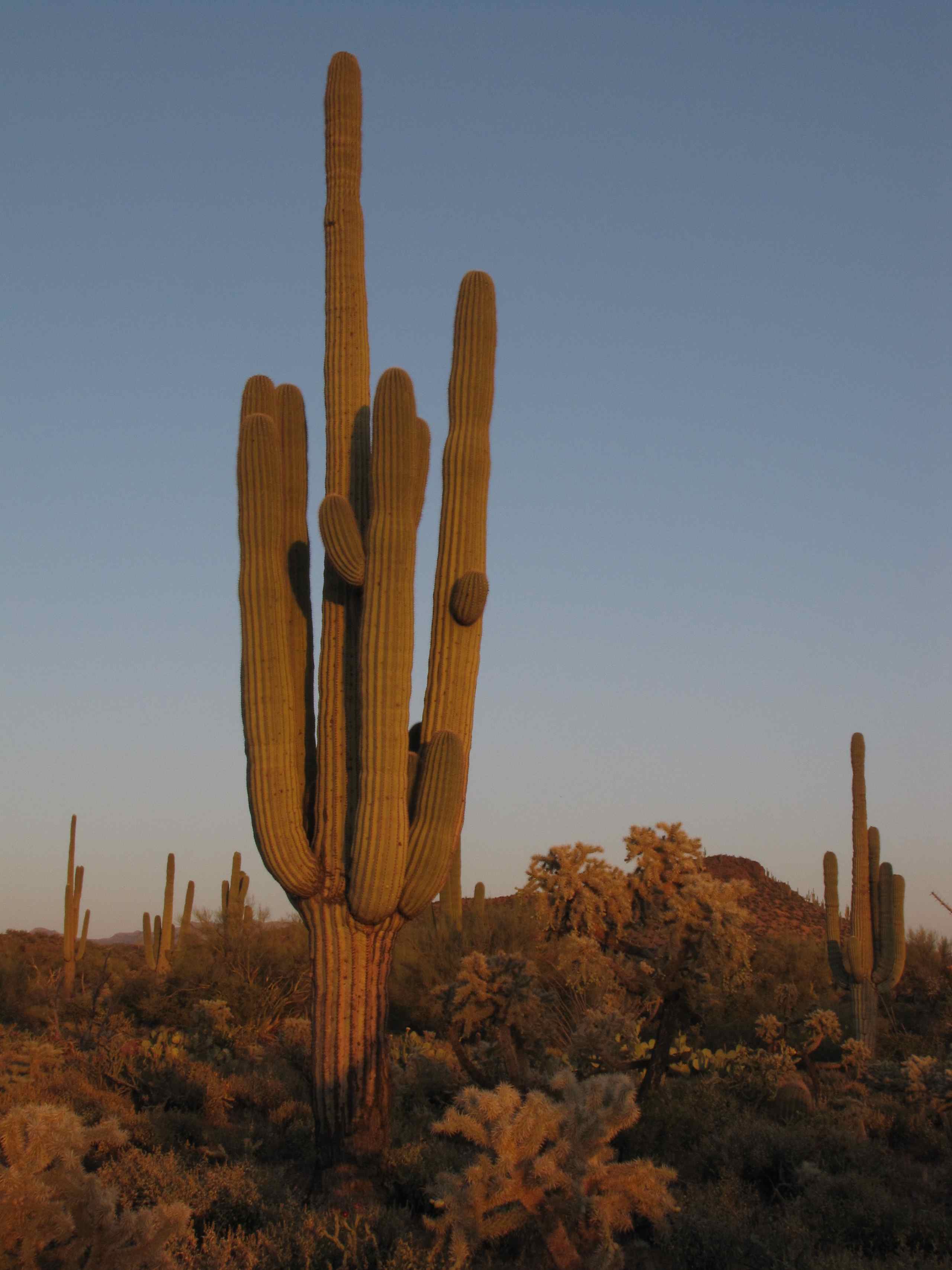
Setting sun with Saguaro and Jumping Cholla Cacti; "Buckhorn Flats" N of Zapata Wash road to Holy Joe Canyon, NE of Mammoth, AZ
Aravaipa Evening
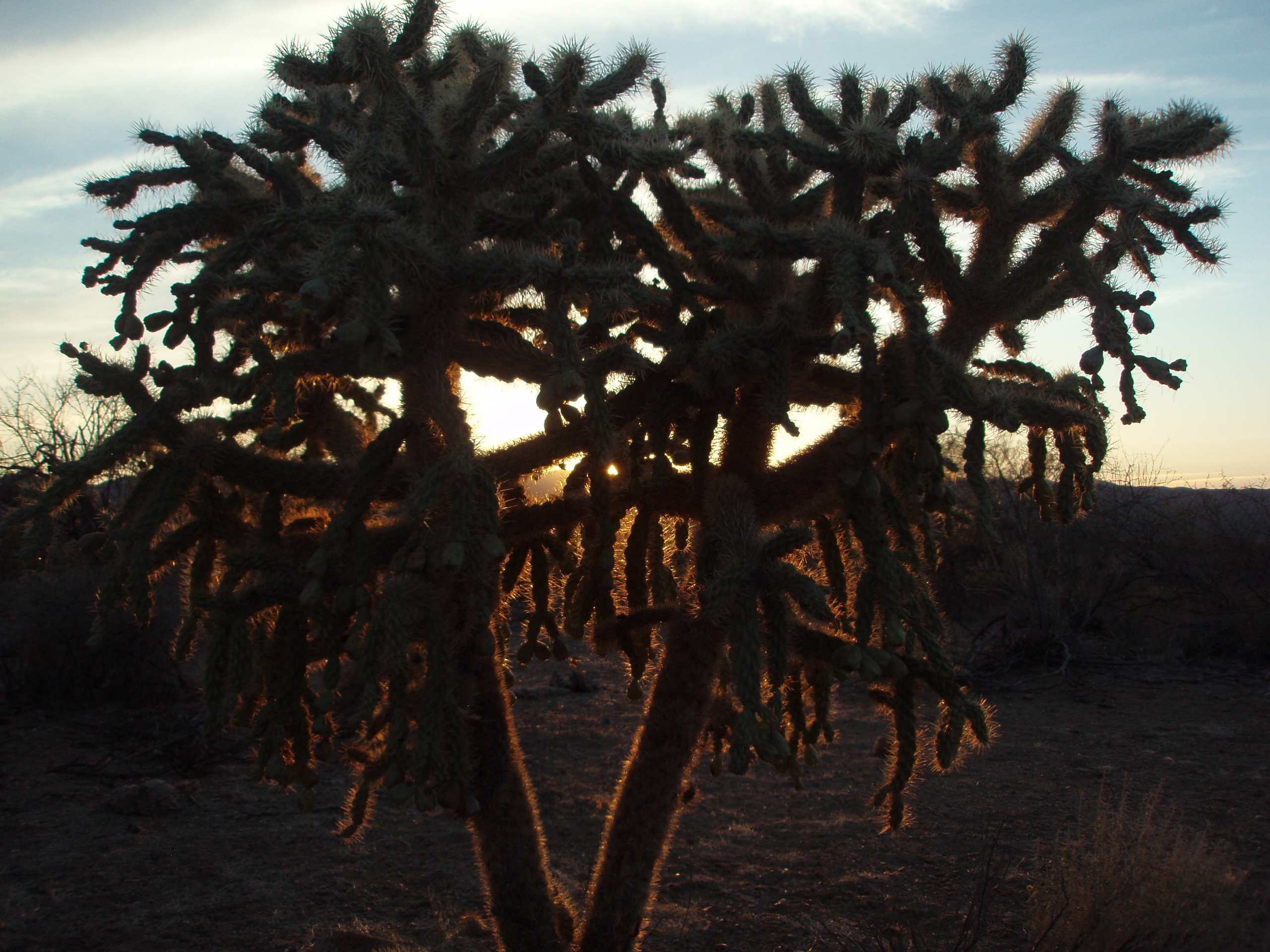
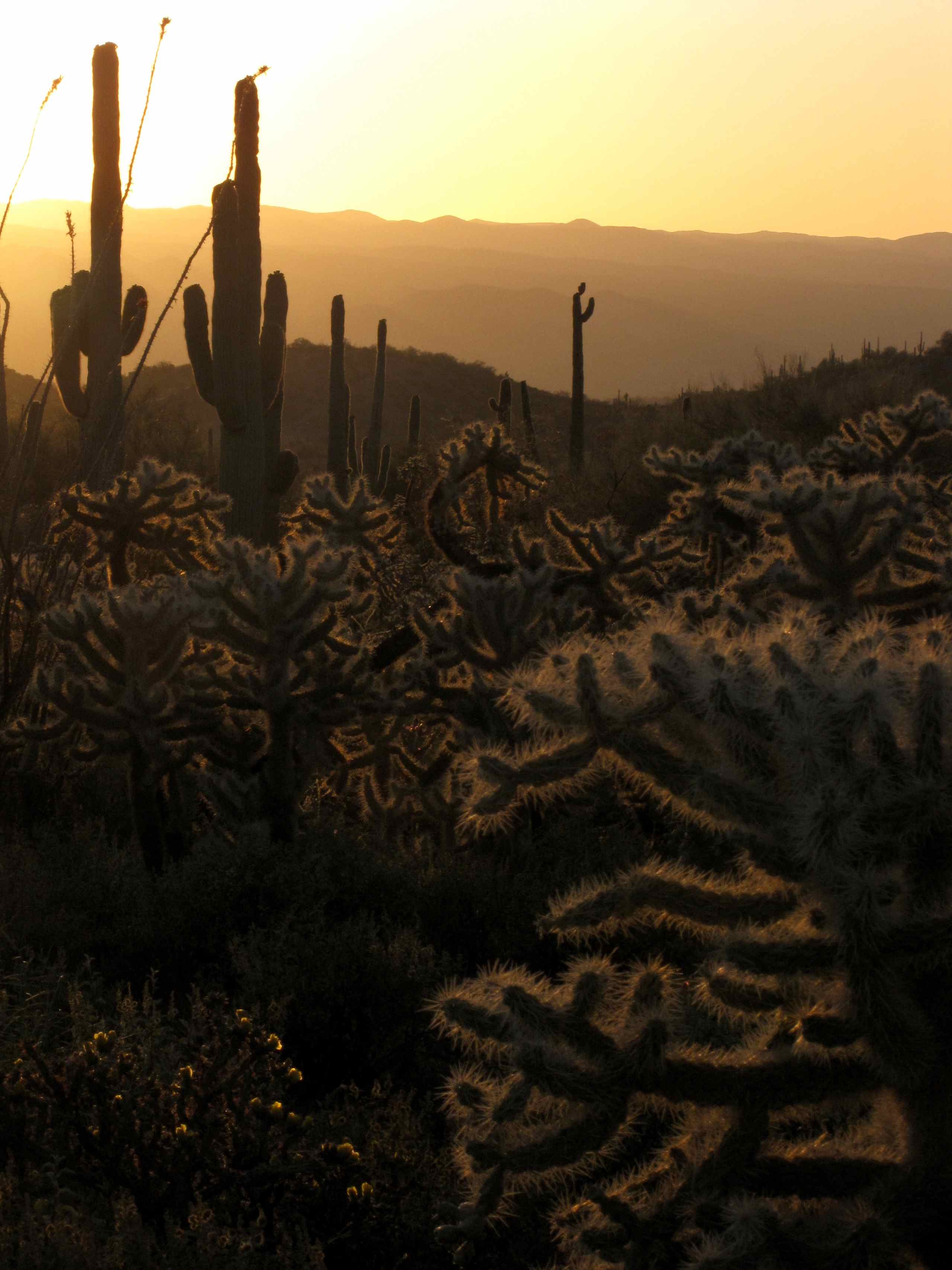
Jumping Cholla Cactus at Sunset; Cowboy Miller Road, E of Mammoth, AZ
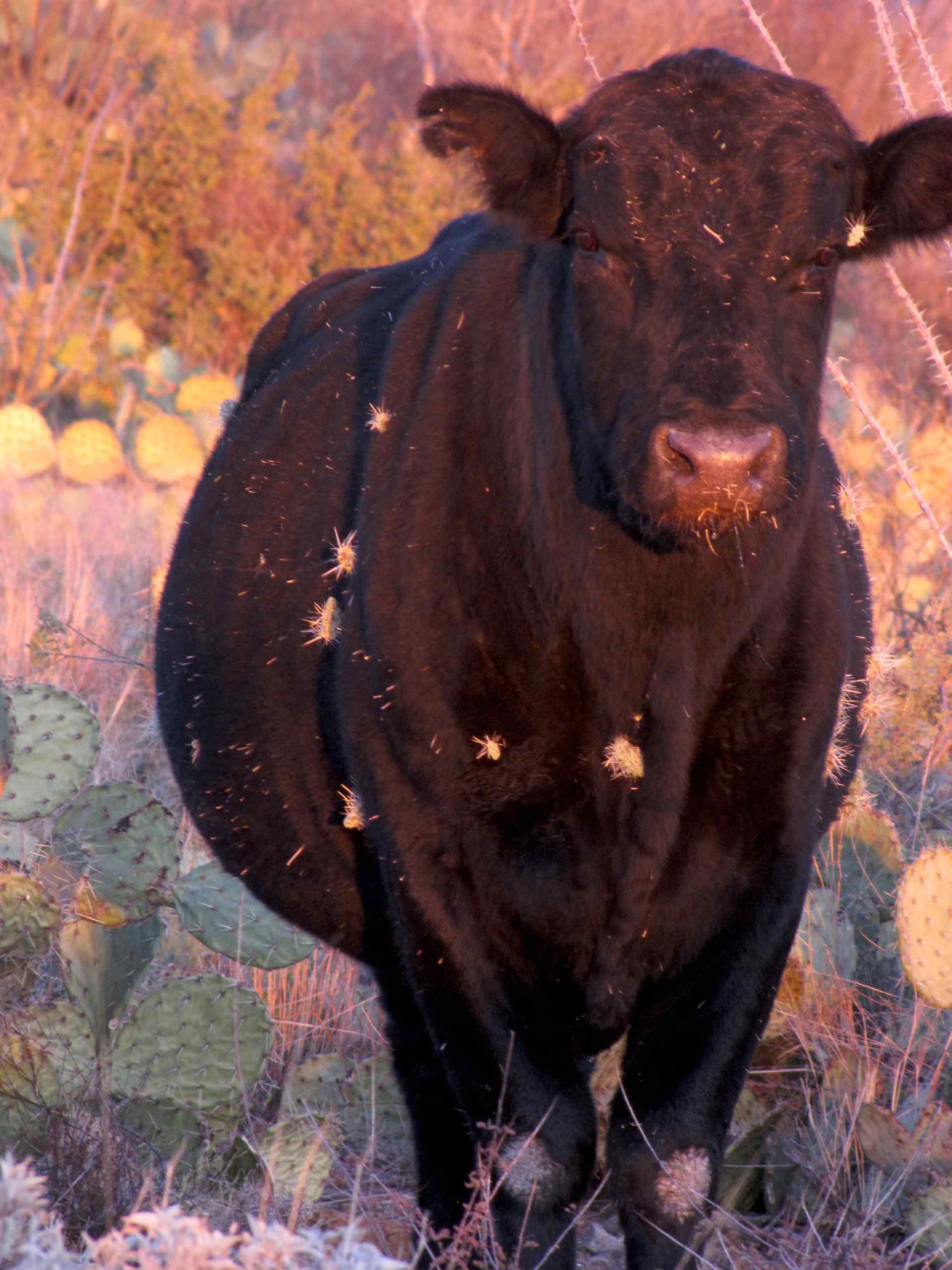
Cow covered with cholla cactus, Arizona
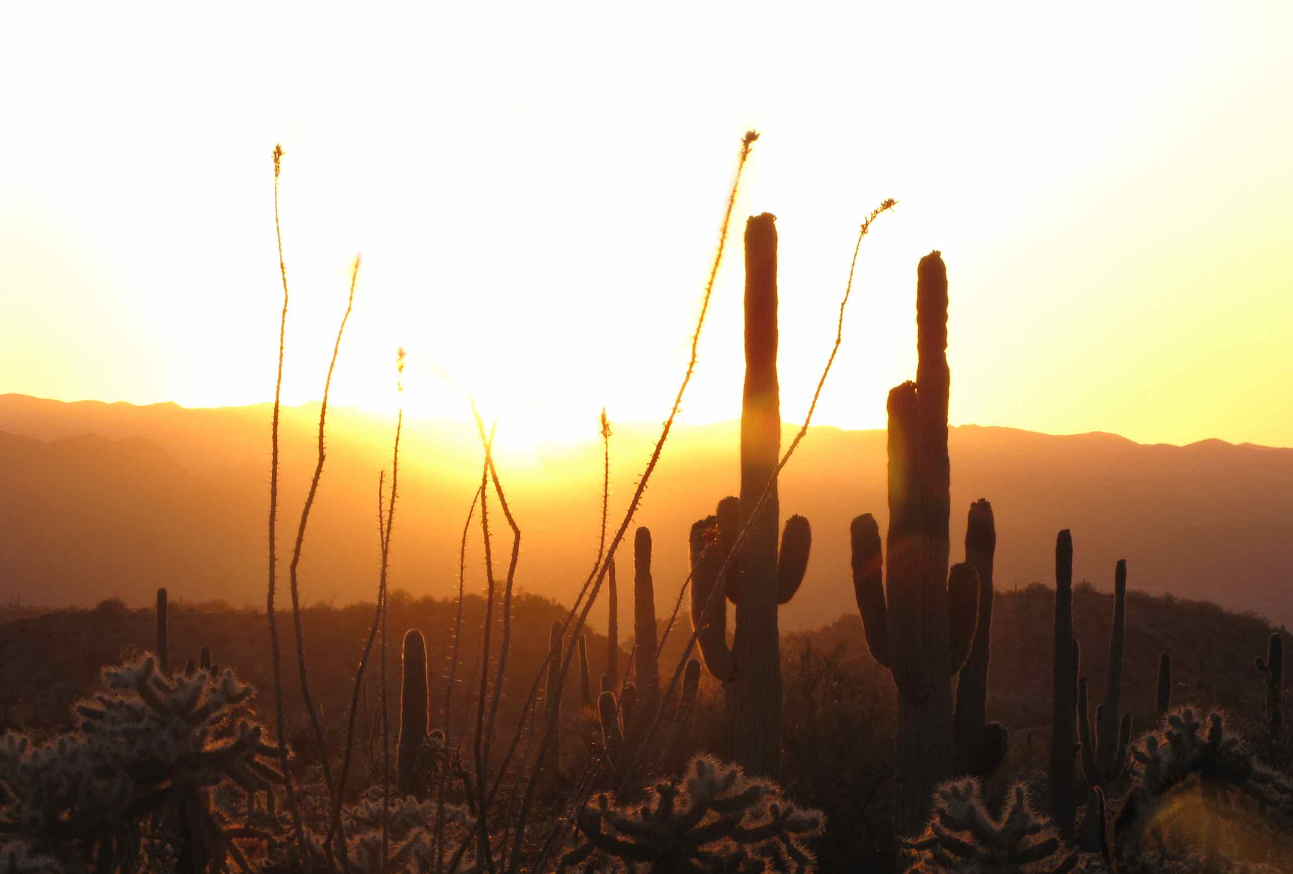
Setting sun with Saguaro and Ocotillo; "Buckhorn Flats" N of Zapata Wash road to Holy Joe Canyon, NE of Mammoth, AZ
Setting sun with Saguaro and Jumping Cholla Cacti; "Buckhorn Flats" N of Zapata Wash road to Holy Joe Canyon, NE of Mammoth, AZ (1)
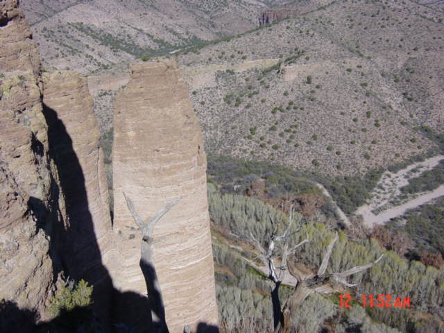
View of Chimney top 2
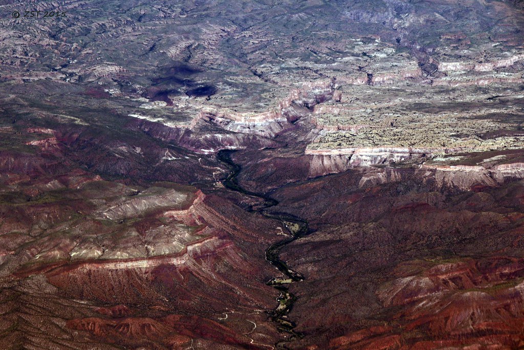
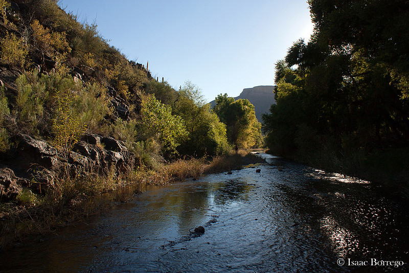
Aravaipa Creek, AZ

What a View

Flowering Ocotillos and Cholla and Saguaro cactus
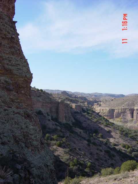
View looking NW down canyon

View of Galiuro Mountains from Freeman Road, W of Dudleyville, Arizona
E Lewis Ranch Rd, Winkelman, AZ, USA Map
Search another place
Near Places
E Aravaipa Rd, Winkelman, AZ, USA
Main St, Mammoth, AZ, USA
Mammoth, AZ, USA
N Cam Rio, Kearny, AZ, USA
Winkelman, AZ, USA
San Pedro River, Arizona, USA
4th St, Hayden, AZ, USA
Hayden, AZ, USA
Klondyke Rd, Willcox, AZ, USA
North Redington Road, N Redington Rd, Arizona, USA
W 4th Ave, San Manuel, AZ, USA
S Ave B, San Manuel, AZ, USA
W 3rd Ave, San Manuel, AZ, USA
San Manuel, AZ, USA
Oracle State Park, Wildlife Dr, Oracle, AZ, USA
West Oro Creek Drive, W Oro Creek Dr, Oracle, AZ, USA
N Cody Loop Rd, Oracle, AZ, USA
The Oracle Patio Cafe and Market, W American Ave, Oracle, AZ, USA
Oracle, AZ, USA
N John Adams St, Oracle, AZ, USA
Recent Searches
- Sunrise Sunset Times of Leguwa, Nepal
- Sunrise Sunset Times of Shustino, Vladimir Oblast, Russia
- Sunrise Sunset Times of Lampiasi St, Sarasota, FL, USA
- Sunrise Sunset Times of Japan, 〒- Toyama, Kubomotomachi, 12−31 APAガーデンコート稲荷
- Sunrise Sunset Times of Jialuohu, Datong Township, Yilan County, Taiwan
- Sunrise Sunset Times of 大下港, Sekizenoge, Imabari, Ehime -, Japan
- Sunrise Sunset Times of Oge port Ferry Terminal, -1 Sekizenōge, Imabari, Ehime -, Japan
- Sunrise Sunset Times of San Telmo, Buenos Aires, Argentina
- Sunrise Sunset Times of Congressional Dr, Stevensville, MD, USA
- Sunrise Sunset Times of Papingo 04, Greece