Higdon Rd, West Point, CA, USA Sonnenaufgang Sonnenuntergang Zeiten
Location: USA > Kalifornien > Calaveras County > West Point >
Zeitzone:
America/Los_Angeles
Ortszeit:
2024-05-01 18:38:29
Länge:
-120.582782
Breite:
38.394033
Sonnenaufgang Heute:
06:02:54 AM
Sonnenuntergang Heute:
07:55:31 PM
Tageslänge heute:
13h 52m 37s
Sonnenaufgang morgen:
06:01:46 AM
Sonnenuntergang Morgen:
07:56:27 PM
Tageslänge von morgen:
13h 54m 41s
Alle Termine anzeigen
| Datum | Sonnenaufgang | Sonnenuntergang | Tageslänge |
|---|---|---|---|
| 2024-01-01 | 07:19:29 AM | 04:52:55 PM | 9h 33m 26s |
| 2024-01-02 | 07:19:35 AM | 04:53:45 PM | 9h 34m 10s |
| 2024-01-03 | 07:19:39 AM | 04:54:36 PM | 9h 34m 57s |
| 2024-01-04 | 07:19:41 AM | 04:55:28 PM | 9h 35m 47s |
| 2024-01-05 | 07:19:41 AM | 04:56:22 PM | 9h 36m 41s |
| 2024-01-06 | 07:19:38 AM | 04:57:16 PM | 9h 37m 38s |
| 2024-01-07 | 07:19:34 AM | 04:58:12 PM | 9h 38m 38s |
| 2024-01-08 | 07:19:27 AM | 04:59:09 PM | 9h 39m 42s |
| 2024-01-09 | 07:19:18 AM | 05:00:07 PM | 9h 40m 49s |
| 2024-01-10 | 07:19:07 AM | 05:01:06 PM | 9h 41m 59s |
| 2024-01-11 | 07:18:54 AM | 05:02:06 PM | 9h 43m 12s |
| 2024-01-12 | 07:18:39 AM | 05:03:07 PM | 9h 44m 28s |
| 2024-01-13 | 07:18:22 AM | 05:04:08 PM | 9h 45m 46s |
| 2024-01-14 | 07:18:03 AM | 05:05:11 PM | 9h 47m 8s |
| 2024-01-15 | 07:17:42 AM | 05:06:14 PM | 9h 48m 32s |
| 2024-01-16 | 07:17:18 AM | 05:07:17 PM | 9h 49m 59s |
| 2024-01-17 | 07:16:53 AM | 05:08:22 PM | 9h 51m 29s |
| 2024-01-18 | 07:16:26 AM | 05:09:27 PM | 9h 53m 1s |
| 2024-01-19 | 07:15:56 AM | 05:10:32 PM | 9h 54m 36s |
| 2024-01-20 | 07:15:25 AM | 05:11:38 PM | 9h 56m 13s |
| 2024-01-21 | 07:14:52 AM | 05:12:45 PM | 9h 57m 53s |
| 2024-01-22 | 07:14:16 AM | 05:13:51 PM | 9h 59m 35s |
| 2024-01-23 | 07:13:39 AM | 05:14:58 PM | 10h 1m 19s |
| 2024-01-24 | 07:13:00 AM | 05:16:06 PM | 10h 3m 6s |
| 2024-01-25 | 07:12:20 AM | 05:17:13 PM | 10h 4m 53s |
| 2024-01-26 | 07:11:37 AM | 05:18:21 PM | 10h 6m 44s |
| 2024-01-27 | 07:10:53 AM | 05:19:29 PM | 10h 8m 36s |
| 2024-01-28 | 07:10:06 AM | 05:20:38 PM | 10h 10m 32s |
| 2024-01-29 | 07:09:18 AM | 05:21:46 PM | 10h 12m 28s |
| 2024-01-30 | 07:08:29 AM | 05:22:54 PM | 10h 14m 25s |
| 2024-01-31 | 07:07:38 AM | 05:24:03 PM | 10h 16m 25s |
| 2024-02-01 | 07:06:45 AM | 05:25:11 PM | 10h 18m 26s |
| 2024-02-02 | 07:05:50 AM | 05:26:20 PM | 10h 20m 30s |
| 2024-02-03 | 07:04:54 AM | 05:27:28 PM | 10h 22m 34s |
| 2024-02-04 | 07:03:56 AM | 05:28:36 PM | 10h 24m 40s |
| 2024-02-05 | 07:02:57 AM | 05:29:44 PM | 10h 26m 47s |
| 2024-02-06 | 07:01:56 AM | 05:30:52 PM | 10h 28m 56s |
| 2024-02-07 | 07:00:54 AM | 05:32:00 PM | 10h 31m 6s |
| 2024-02-08 | 06:59:51 AM | 05:33:08 PM | 10h 33m 17s |
| 2024-02-09 | 06:58:46 AM | 05:34:16 PM | 10h 35m 30s |
| 2024-02-10 | 06:57:39 AM | 05:35:23 PM | 10h 37m 44s |
| 2024-02-11 | 06:56:32 AM | 05:36:30 PM | 10h 39m 58s |
| 2024-02-12 | 06:55:23 AM | 05:37:37 PM | 10h 42m 14s |
| 2024-02-13 | 06:54:13 AM | 05:38:44 PM | 10h 44m 31s |
| 2024-02-14 | 06:53:02 AM | 05:39:50 PM | 10h 46m 48s |
| 2024-02-15 | 06:51:49 AM | 05:40:56 PM | 10h 49m 7s |
| 2024-02-16 | 06:50:35 AM | 05:42:02 PM | 10h 51m 27s |
| 2024-02-17 | 06:49:21 AM | 05:43:08 PM | 10h 53m 47s |
| 2024-02-18 | 06:48:05 AM | 05:44:13 PM | 10h 56m 8s |
| 2024-02-19 | 06:46:48 AM | 05:45:18 PM | 10h 58m 30s |
| 2024-02-20 | 06:45:30 AM | 05:46:23 PM | 11h 0m 53s |
| 2024-02-21 | 06:44:11 AM | 05:47:27 PM | 11h 3m 16s |
| 2024-02-22 | 06:42:51 AM | 05:48:31 PM | 11h 5m 40s |
| 2024-02-23 | 06:41:31 AM | 05:49:35 PM | 11h 8m 4s |
| 2024-02-24 | 06:40:09 AM | 05:50:39 PM | 11h 10m 30s |
| 2024-02-25 | 06:38:47 AM | 05:51:42 PM | 11h 12m 55s |
| 2024-02-26 | 06:37:24 AM | 05:52:44 PM | 11h 15m 20s |
| 2024-02-27 | 06:36:00 AM | 05:53:47 PM | 11h 17m 47s |
| 2024-02-28 | 06:34:35 AM | 05:54:49 PM | 11h 20m 14s |
| 2024-02-29 | 06:33:09 AM | 05:55:51 PM | 11h 22m 42s |
| 2024-03-01 | 06:31:43 AM | 05:56:53 PM | 11h 25m 10s |
| 2024-03-02 | 06:30:16 AM | 05:57:54 PM | 11h 27m 38s |
| 2024-03-03 | 06:28:49 AM | 05:58:55 PM | 11h 30m 6s |
| 2024-03-04 | 06:27:21 AM | 05:59:55 PM | 11h 32m 34s |
| 2024-03-05 | 06:25:53 AM | 06:00:56 PM | 11h 35m 3s |
| 2024-03-06 | 06:24:24 AM | 06:01:56 PM | 11h 37m 32s |
| 2024-03-07 | 06:22:54 AM | 06:02:56 PM | 11h 40m 2s |
| 2024-03-08 | 06:21:24 AM | 06:03:56 PM | 11h 42m 32s |
| 2024-03-09 | 06:19:54 AM | 06:04:55 PM | 11h 45m 1s |
| 2024-03-10 | 07:18:27 AM | 07:05:52 PM | 11h 47m 25s |
| 2024-03-11 | 07:16:56 AM | 07:06:50 PM | 11h 49m 54s |
| 2024-03-12 | 07:15:24 AM | 07:07:49 PM | 11h 52m 25s |
| 2024-03-13 | 07:13:52 AM | 07:08:48 PM | 11h 54m 56s |
| 2024-03-14 | 07:12:20 AM | 07:09:46 PM | 11h 57m 26s |
| 2024-03-15 | 07:10:48 AM | 07:10:44 PM | 11h 59m 56s |
| 2024-03-16 | 07:09:16 AM | 07:11:42 PM | 12h 2m 26s |
| 2024-03-17 | 07:07:43 AM | 07:12:40 PM | 12h 4m 57s |
| 2024-03-18 | 07:06:10 AM | 07:13:37 PM | 12h 7m 27s |
| 2024-03-19 | 07:04:37 AM | 07:14:35 PM | 12h 9m 58s |
| 2024-03-20 | 07:03:04 AM | 07:15:32 PM | 12h 12m 28s |
| 2024-03-21 | 07:01:31 AM | 07:16:29 PM | 12h 14m 58s |
| 2024-03-22 | 06:59:58 AM | 07:17:26 PM | 12h 17m 28s |
| 2024-03-23 | 06:58:25 AM | 07:18:23 PM | 12h 19m 58s |
| 2024-03-24 | 06:56:52 AM | 07:19:20 PM | 12h 22m 28s |
| 2024-03-25 | 06:55:19 AM | 07:20:16 PM | 12h 24m 57s |
| 2024-03-26 | 06:53:46 AM | 07:21:13 PM | 12h 27m 27s |
| 2024-03-27 | 06:52:14 AM | 07:22:10 PM | 12h 29m 56s |
| 2024-03-28 | 06:50:41 AM | 07:23:06 PM | 12h 32m 25s |
| 2024-03-29 | 06:49:09 AM | 07:24:03 PM | 12h 34m 54s |
| 2024-03-30 | 06:47:36 AM | 07:24:59 PM | 12h 37m 23s |
| 2024-03-31 | 06:46:05 AM | 07:25:55 PM | 12h 39m 50s |
| 2024-04-01 | 06:44:33 AM | 07:26:52 PM | 12h 42m 19s |
| 2024-04-02 | 06:43:01 AM | 07:27:48 PM | 12h 44m 47s |
| 2024-04-03 | 06:41:30 AM | 07:28:45 PM | 12h 47m 15s |
| 2024-04-04 | 06:40:00 AM | 07:29:41 PM | 12h 49m 41s |
| 2024-04-05 | 06:38:30 AM | 07:30:37 PM | 12h 52m 7s |
| 2024-04-06 | 06:37:00 AM | 07:31:34 PM | 12h 54m 34s |
| 2024-04-07 | 06:35:30 AM | 07:32:30 PM | 12h 57m 0s |
| 2024-04-08 | 06:34:01 AM | 07:33:26 PM | 12h 59m 25s |
| 2024-04-09 | 06:32:33 AM | 07:34:23 PM | 13h 1m 50s |
| 2024-04-10 | 06:31:05 AM | 07:35:19 PM | 13h 4m 14s |
| 2024-04-11 | 06:29:38 AM | 07:36:16 PM | 13h 6m 38s |
| 2024-04-12 | 06:28:11 AM | 07:37:12 PM | 13h 9m 1s |
| 2024-04-13 | 06:26:45 AM | 07:38:09 PM | 13h 11m 24s |
| 2024-04-14 | 06:25:20 AM | 07:39:06 PM | 13h 13m 46s |
| 2024-04-15 | 06:23:55 AM | 07:40:02 PM | 13h 16m 7s |
| 2024-04-16 | 06:22:31 AM | 07:40:59 PM | 13h 18m 28s |
| 2024-04-17 | 06:21:08 AM | 07:41:56 PM | 13h 20m 48s |
| 2024-04-18 | 06:19:46 AM | 07:42:52 PM | 13h 23m 6s |
| 2024-04-19 | 06:18:24 AM | 07:43:49 PM | 13h 25m 25s |
| 2024-04-20 | 06:17:03 AM | 07:44:46 PM | 13h 27m 43s |
| 2024-04-21 | 06:15:43 AM | 07:45:43 PM | 13h 30m 0s |
| 2024-04-22 | 06:14:24 AM | 07:46:40 PM | 13h 32m 16s |
| 2024-04-23 | 06:13:06 AM | 07:47:36 PM | 13h 34m 30s |
| 2024-04-24 | 06:11:49 AM | 07:48:33 PM | 13h 36m 44s |
| 2024-04-25 | 06:10:33 AM | 07:49:30 PM | 13h 38m 57s |
| 2024-04-26 | 06:09:18 AM | 07:50:27 PM | 13h 41m 9s |
| 2024-04-27 | 06:08:04 AM | 07:51:24 PM | 13h 43m 20s |
| 2024-04-28 | 06:06:51 AM | 07:52:20 PM | 13h 45m 29s |
| 2024-04-29 | 06:05:40 AM | 07:53:17 PM | 13h 47m 37s |
| 2024-04-30 | 06:04:29 AM | 07:54:14 PM | 13h 49m 45s |
| 2024-05-01 | 06:03:20 AM | 07:55:10 PM | 13h 51m 50s |
| 2024-05-02 | 06:02:12 AM | 07:56:06 PM | 13h 53m 54s |
| 2024-05-03 | 06:01:05 AM | 07:57:03 PM | 13h 55m 58s |
| 2024-05-04 | 05:59:59 AM | 07:57:59 PM | 13h 58m 0s |
| 2024-05-05 | 05:58:54 AM | 07:58:54 PM | 14h 0m 0s |
| 2024-05-06 | 05:57:51 AM | 07:59:50 PM | 14h 1m 59s |
| 2024-05-07 | 05:56:50 AM | 08:00:46 PM | 14h 3m 56s |
| 2024-05-08 | 05:55:49 AM | 08:01:41 PM | 14h 5m 52s |
| 2024-05-09 | 05:54:50 AM | 08:02:36 PM | 14h 7m 46s |
| 2024-05-10 | 05:53:53 AM | 08:03:31 PM | 14h 9m 38s |
| 2024-05-11 | 05:52:57 AM | 08:04:25 PM | 14h 11m 28s |
| 2024-05-12 | 05:52:02 AM | 08:05:19 PM | 14h 13m 17s |
| 2024-05-13 | 05:51:09 AM | 08:06:13 PM | 14h 15m 4s |
| 2024-05-14 | 05:50:18 AM | 08:07:06 PM | 14h 16m 48s |
| 2024-05-15 | 05:49:28 AM | 08:07:59 PM | 14h 18m 31s |
| 2024-05-16 | 05:48:39 AM | 08:08:51 PM | 14h 20m 12s |
| 2024-05-17 | 05:47:53 AM | 08:09:43 PM | 14h 21m 50s |
| 2024-05-18 | 05:47:08 AM | 08:10:34 PM | 14h 23m 26s |
| 2024-05-19 | 05:46:24 AM | 08:11:25 PM | 14h 25m 1s |
| 2024-05-20 | 05:45:42 AM | 08:12:15 PM | 14h 26m 33s |
| 2024-05-21 | 05:45:02 AM | 08:13:05 PM | 14h 28m 3s |
| 2024-05-22 | 05:44:24 AM | 08:13:53 PM | 14h 29m 29s |
| 2024-05-23 | 05:43:47 AM | 08:14:41 PM | 14h 30m 54s |
| 2024-05-24 | 05:43:12 AM | 08:15:29 PM | 14h 32m 17s |
| 2024-05-25 | 05:42:39 AM | 08:16:15 PM | 14h 33m 36s |
| 2024-05-26 | 05:42:08 AM | 08:17:01 PM | 14h 34m 53s |
| 2024-05-27 | 05:41:38 AM | 08:17:46 PM | 14h 36m 8s |
| 2024-05-28 | 05:41:10 AM | 08:18:30 PM | 14h 37m 20s |
| 2024-05-29 | 05:40:44 AM | 08:19:13 PM | 14h 38m 29s |
| 2024-05-30 | 05:40:20 AM | 08:19:55 PM | 14h 39m 35s |
| 2024-05-31 | 05:39:58 AM | 08:20:36 PM | 14h 40m 38s |
| 2024-06-01 | 05:39:38 AM | 08:21:16 PM | 14h 41m 38s |
| 2024-06-02 | 05:39:19 AM | 08:21:54 PM | 14h 42m 35s |
| 2024-06-03 | 05:39:02 AM | 08:22:32 PM | 14h 43m 30s |
| 2024-06-04 | 05:38:47 AM | 08:23:08 PM | 14h 44m 21s |
| 2024-06-05 | 05:38:34 AM | 08:23:44 PM | 14h 45m 10s |
| 2024-06-06 | 05:38:23 AM | 08:24:18 PM | 14h 45m 55s |
| 2024-06-07 | 05:38:13 AM | 08:24:50 PM | 14h 46m 37s |
| 2024-06-08 | 05:38:06 AM | 08:25:21 PM | 14h 47m 15s |
| 2024-06-09 | 05:38:00 AM | 08:25:51 PM | 14h 47m 51s |
| 2024-06-10 | 05:37:56 AM | 08:26:20 PM | 14h 48m 24s |
| 2024-06-11 | 05:37:54 AM | 08:26:47 PM | 14h 48m 53s |
| 2024-06-12 | 05:37:53 AM | 08:27:12 PM | 14h 49m 19s |
| 2024-06-13 | 05:37:55 AM | 08:27:36 PM | 14h 49m 41s |
| 2024-06-14 | 05:37:58 AM | 08:27:59 PM | 14h 50m 1s |
| 2024-06-15 | 05:38:03 AM | 08:28:20 PM | 14h 50m 17s |
| 2024-06-16 | 05:38:10 AM | 08:28:39 PM | 14h 50m 29s |
| 2024-06-17 | 05:38:18 AM | 08:28:57 PM | 14h 50m 39s |
| 2024-06-18 | 05:38:28 AM | 08:29:13 PM | 14h 50m 45s |
| 2024-06-19 | 05:38:40 AM | 08:29:27 PM | 14h 50m 47s |
| 2024-06-20 | 05:38:54 AM | 08:29:40 PM | 14h 50m 46s |
| 2024-06-21 | 05:39:09 AM | 08:29:51 PM | 14h 50m 42s |
| 2024-06-22 | 05:39:26 AM | 08:30:00 PM | 14h 50m 34s |
| 2024-06-23 | 05:39:44 AM | 08:30:07 PM | 14h 50m 23s |
| 2024-06-24 | 05:40:04 AM | 08:30:13 PM | 14h 50m 9s |
| 2024-06-25 | 05:40:25 AM | 08:30:16 PM | 14h 49m 51s |
| 2024-06-26 | 05:40:48 AM | 08:30:18 PM | 14h 49m 30s |
| 2024-06-27 | 05:41:13 AM | 08:30:18 PM | 14h 49m 5s |
| 2024-06-28 | 05:41:38 AM | 08:30:16 PM | 14h 48m 38s |
| 2024-06-29 | 05:42:06 AM | 08:30:13 PM | 14h 48m 7s |
| 2024-06-30 | 05:42:34 AM | 08:30:07 PM | 14h 47m 33s |
| 2024-07-01 | 05:43:04 AM | 08:30:00 PM | 14h 46m 56s |
| 2024-07-02 | 05:43:35 AM | 08:29:51 PM | 14h 46m 16s |
| 2024-07-03 | 05:44:07 AM | 08:29:39 PM | 14h 45m 32s |
| 2024-07-04 | 05:44:41 AM | 08:29:26 PM | 14h 44m 45s |
| 2024-07-05 | 05:45:16 AM | 08:29:11 PM | 14h 43m 55s |
| 2024-07-06 | 05:45:52 AM | 08:28:55 PM | 14h 43m 3s |
| 2024-07-07 | 05:46:29 AM | 08:28:36 PM | 14h 42m 7s |
| 2024-07-08 | 05:47:07 AM | 08:28:15 PM | 14h 41m 8s |
| 2024-07-09 | 05:47:46 AM | 08:27:53 PM | 14h 40m 7s |
| 2024-07-10 | 05:48:26 AM | 08:27:29 PM | 14h 39m 3s |
| 2024-07-11 | 05:49:07 AM | 08:27:02 PM | 14h 37m 55s |
| 2024-07-12 | 05:49:49 AM | 08:26:34 PM | 14h 36m 45s |
| 2024-07-13 | 05:50:31 AM | 08:26:05 PM | 14h 35m 34s |
| 2024-07-14 | 05:51:15 AM | 08:25:33 PM | 14h 34m 18s |
| 2024-07-15 | 05:51:59 AM | 08:24:59 PM | 14h 33m 0s |
| 2024-07-16 | 05:52:44 AM | 08:24:24 PM | 14h 31m 40s |
| 2024-07-17 | 05:53:30 AM | 08:23:47 PM | 14h 30m 17s |
| 2024-07-18 | 05:54:16 AM | 08:23:08 PM | 14h 28m 52s |
| 2024-07-19 | 05:55:03 AM | 08:22:28 PM | 14h 27m 25s |
| 2024-07-20 | 05:55:51 AM | 08:21:45 PM | 14h 25m 54s |
| 2024-07-21 | 05:56:39 AM | 08:21:01 PM | 14h 24m 22s |
| 2024-07-22 | 05:57:28 AM | 08:20:16 PM | 14h 22m 48s |
| 2024-07-23 | 05:58:17 AM | 08:19:28 PM | 14h 21m 11s |
| 2024-07-24 | 05:59:07 AM | 08:18:40 PM | 14h 19m 33s |
| 2024-07-25 | 05:59:57 AM | 08:17:49 PM | 14h 17m 52s |
| 2024-07-26 | 06:00:47 AM | 08:16:57 PM | 14h 16m 10s |
| 2024-07-27 | 06:01:38 AM | 08:16:03 PM | 14h 14m 25s |
| 2024-07-28 | 06:02:29 AM | 08:15:08 PM | 14h 12m 39s |
| 2024-07-29 | 06:03:20 AM | 08:14:11 PM | 14h 10m 51s |
| 2024-07-30 | 06:04:12 AM | 08:13:13 PM | 14h 9m 1s |
| 2024-07-31 | 06:05:04 AM | 08:12:13 PM | 14h 7m 9s |
| 2024-08-01 | 06:05:56 AM | 08:11:12 PM | 14h 5m 16s |
| 2024-08-02 | 06:06:48 AM | 08:10:09 PM | 14h 3m 21s |
| 2024-08-03 | 06:07:41 AM | 08:09:05 PM | 14h 1m 24s |
| 2024-08-04 | 06:08:34 AM | 08:08:00 PM | 13h 59m 26s |
| 2024-08-05 | 06:09:26 AM | 08:06:53 PM | 13h 57m 27s |
| 2024-08-06 | 06:10:19 AM | 08:05:46 PM | 13h 55m 27s |
| 2024-08-07 | 06:11:12 AM | 08:04:36 PM | 13h 53m 24s |
| 2024-08-08 | 06:12:05 AM | 08:03:26 PM | 13h 51m 21s |
| 2024-08-09 | 06:12:58 AM | 08:02:14 PM | 13h 49m 16s |
| 2024-08-10 | 06:13:52 AM | 08:01:02 PM | 13h 47m 10s |
| 2024-08-11 | 06:14:45 AM | 07:59:48 PM | 13h 45m 3s |
| 2024-08-12 | 06:15:38 AM | 07:58:33 PM | 13h 42m 55s |
| 2024-08-13 | 06:16:31 AM | 07:57:16 PM | 13h 40m 45s |
| 2024-08-14 | 06:17:24 AM | 07:55:59 PM | 13h 38m 35s |
| 2024-08-15 | 06:18:17 AM | 07:54:41 PM | 13h 36m 24s |
| 2024-08-16 | 06:19:10 AM | 07:53:22 PM | 13h 34m 12s |
| 2024-08-17 | 06:20:04 AM | 07:52:02 PM | 13h 31m 58s |
| 2024-08-18 | 06:20:57 AM | 07:50:41 PM | 13h 29m 44s |
| 2024-08-19 | 06:21:50 AM | 07:49:19 PM | 13h 27m 29s |
| 2024-08-20 | 06:22:43 AM | 07:47:56 PM | 13h 25m 13s |
| 2024-08-21 | 06:23:35 AM | 07:46:32 PM | 13h 22m 57s |
| 2024-08-22 | 06:24:28 AM | 07:45:08 PM | 13h 20m 40s |
| 2024-08-23 | 06:25:21 AM | 07:43:42 PM | 13h 18m 21s |
| 2024-08-24 | 06:26:14 AM | 07:42:16 PM | 13h 16m 2s |
| 2024-08-25 | 06:27:06 AM | 07:40:49 PM | 13h 13m 43s |
| 2024-08-26 | 06:27:59 AM | 07:39:22 PM | 13h 11m 23s |
| 2024-08-27 | 06:28:51 AM | 07:37:54 PM | 13h 9m 3s |
| 2024-08-28 | 06:29:44 AM | 07:36:25 PM | 13h 6m 41s |
| 2024-08-29 | 06:30:36 AM | 07:34:56 PM | 13h 4m 20s |
| 2024-08-30 | 06:31:28 AM | 07:33:26 PM | 13h 1m 58s |
| 2024-08-31 | 06:32:20 AM | 07:31:55 PM | 12h 59m 35s |
| 2024-09-01 | 06:33:13 AM | 07:30:24 PM | 12h 57m 11s |
| 2024-09-02 | 06:34:05 AM | 07:28:53 PM | 12h 54m 48s |
| 2024-09-03 | 06:34:57 AM | 07:27:21 PM | 12h 52m 24s |
| 2024-09-04 | 06:35:49 AM | 07:25:48 PM | 12h 49m 59s |
| 2024-09-05 | 06:36:41 AM | 07:24:16 PM | 12h 47m 35s |
| 2024-09-06 | 06:37:33 AM | 07:22:42 PM | 12h 45m 9s |
| 2024-09-07 | 06:38:25 AM | 07:21:09 PM | 12h 42m 44s |
| 2024-09-08 | 06:39:17 AM | 07:19:35 PM | 12h 40m 18s |
| 2024-09-09 | 06:40:09 AM | 07:18:01 PM | 12h 37m 52s |
| 2024-09-10 | 06:41:01 AM | 07:16:27 PM | 12h 35m 26s |
| 2024-09-11 | 06:41:53 AM | 07:14:52 PM | 12h 32m 59s |
| 2024-09-12 | 06:42:45 AM | 07:13:17 PM | 12h 30m 32s |
| 2024-09-13 | 06:43:37 AM | 07:11:43 PM | 12h 28m 6s |
| 2024-09-14 | 06:44:29 AM | 07:10:08 PM | 12h 25m 39s |
| 2024-09-15 | 06:45:22 AM | 07:08:32 PM | 12h 23m 10s |
| 2024-09-16 | 06:46:14 AM | 07:06:57 PM | 12h 20m 43s |
| 2024-09-17 | 06:47:06 AM | 07:05:22 PM | 12h 18m 16s |
| 2024-09-18 | 06:47:59 AM | 07:03:47 PM | 12h 15m 48s |
| 2024-09-19 | 06:48:51 AM | 07:02:11 PM | 12h 13m 20s |
| 2024-09-20 | 06:49:44 AM | 07:00:36 PM | 12h 10m 52s |
| 2024-09-21 | 06:50:37 AM | 06:59:01 PM | 12h 8m 24s |
| 2024-09-22 | 06:51:30 AM | 06:57:26 PM | 12h 5m 56s |
| 2024-09-23 | 06:52:23 AM | 06:55:51 PM | 12h 3m 28s |
| 2024-09-24 | 06:53:16 AM | 06:54:16 PM | 12h 1m 0s |
| 2024-09-25 | 06:54:10 AM | 06:52:42 PM | 11h 58m 32s |
| 2024-09-26 | 06:55:04 AM | 06:51:08 PM | 11h 56m 4s |
| 2024-09-27 | 06:55:57 AM | 06:49:33 PM | 11h 53m 36s |
| 2024-09-28 | 06:56:51 AM | 06:48:00 PM | 11h 51m 9s |
| 2024-09-29 | 06:57:46 AM | 06:46:26 PM | 11h 48m 40s |
| 2024-09-30 | 06:58:40 AM | 06:44:53 PM | 11h 46m 13s |
| 2024-10-01 | 06:59:35 AM | 06:43:20 PM | 11h 43m 45s |
| 2024-10-02 | 07:00:30 AM | 06:41:48 PM | 11h 41m 18s |
| 2024-10-03 | 07:01:25 AM | 06:40:16 PM | 11h 38m 51s |
| 2024-10-04 | 07:02:21 AM | 06:38:44 PM | 11h 36m 23s |
| 2024-10-05 | 07:03:17 AM | 06:37:13 PM | 11h 33m 56s |
| 2024-10-06 | 07:04:13 AM | 06:35:43 PM | 11h 31m 30s |
| 2024-10-07 | 07:05:09 AM | 06:34:13 PM | 11h 29m 4s |
| 2024-10-08 | 07:06:06 AM | 06:32:44 PM | 11h 26m 38s |
| 2024-10-09 | 07:07:03 AM | 06:31:15 PM | 11h 24m 12s |
| 2024-10-10 | 07:08:01 AM | 06:29:47 PM | 11h 21m 46s |
| 2024-10-11 | 07:08:58 AM | 06:28:20 PM | 11h 19m 22s |
| 2024-10-12 | 07:09:56 AM | 06:26:53 PM | 11h 16m 57s |
| 2024-10-13 | 07:10:55 AM | 06:25:27 PM | 11h 14m 32s |
| 2024-10-14 | 07:11:53 AM | 06:24:02 PM | 11h 12m 9s |
| 2024-10-15 | 07:12:52 AM | 06:22:38 PM | 11h 9m 46s |
| 2024-10-16 | 07:13:52 AM | 06:21:14 PM | 11h 7m 22s |
| 2024-10-17 | 07:14:51 AM | 06:19:52 PM | 11h 5m 1s |
| 2024-10-18 | 07:15:51 AM | 06:18:30 PM | 11h 2m 39s |
| 2024-10-19 | 07:16:52 AM | 06:17:09 PM | 11h 0m 17s |
| 2024-10-20 | 07:17:52 AM | 06:15:49 PM | 10h 57m 57s |
| 2024-10-21 | 07:18:53 AM | 06:14:31 PM | 10h 55m 38s |
| 2024-10-22 | 07:19:55 AM | 06:13:13 PM | 10h 53m 18s |
| 2024-10-23 | 07:20:57 AM | 06:11:56 PM | 10h 50m 59s |
| 2024-10-24 | 07:21:59 AM | 06:10:41 PM | 10h 48m 42s |
| 2024-10-25 | 07:23:01 AM | 06:09:26 PM | 10h 46m 25s |
| 2024-10-26 | 07:24:04 AM | 06:08:13 PM | 10h 44m 9s |
| 2024-10-27 | 07:25:07 AM | 06:07:01 PM | 10h 41m 54s |
| 2024-10-28 | 07:26:10 AM | 06:05:50 PM | 10h 39m 40s |
| 2024-10-29 | 07:27:13 AM | 06:04:41 PM | 10h 37m 28s |
| 2024-10-30 | 07:28:17 AM | 06:03:33 PM | 10h 35m 16s |
| 2024-10-31 | 07:29:21 AM | 06:02:26 PM | 10h 33m 5s |
| 2024-11-01 | 07:30:25 AM | 06:01:20 PM | 10h 30m 55s |
| 2024-11-02 | 07:31:30 AM | 06:00:16 PM | 10h 28m 46s |
| 2024-11-03 | 06:32:37 AM | 04:59:11 PM | 10h 26m 34s |
| 2024-11-04 | 06:33:42 AM | 04:58:10 PM | 10h 24m 28s |
| 2024-11-05 | 06:34:47 AM | 04:57:11 PM | 10h 22m 24s |
| 2024-11-06 | 06:35:52 AM | 04:56:13 PM | 10h 20m 21s |
| 2024-11-07 | 06:36:57 AM | 04:55:16 PM | 10h 18m 19s |
| 2024-11-08 | 06:38:03 AM | 04:54:22 PM | 10h 16m 19s |
| 2024-11-09 | 06:39:08 AM | 04:53:29 PM | 10h 14m 21s |
| 2024-11-10 | 06:40:13 AM | 04:52:37 PM | 10h 12m 24s |
| 2024-11-11 | 06:41:19 AM | 04:51:47 PM | 10h 10m 28s |
| 2024-11-12 | 06:42:24 AM | 04:51:00 PM | 10h 8m 36s |
| 2024-11-13 | 06:43:29 AM | 04:50:13 PM | 10h 6m 44s |
| 2024-11-14 | 06:44:34 AM | 04:49:29 PM | 10h 4m 55s |
| 2024-11-15 | 06:45:39 AM | 04:48:46 PM | 10h 3m 7s |
| 2024-11-16 | 06:46:44 AM | 04:48:06 PM | 10h 1m 22s |
| 2024-11-17 | 06:47:48 AM | 04:47:27 PM | 9h 59m 39s |
| 2024-11-18 | 06:48:53 AM | 04:46:50 PM | 9h 57m 57s |
| 2024-11-19 | 06:49:57 AM | 04:46:15 PM | 9h 56m 18s |
| 2024-11-20 | 06:51:00 AM | 04:45:42 PM | 9h 54m 42s |
| 2024-11-21 | 06:52:04 AM | 04:45:11 PM | 9h 53m 7s |
| 2024-11-22 | 06:53:06 AM | 04:44:42 PM | 9h 51m 36s |
| 2024-11-23 | 06:54:09 AM | 04:44:15 PM | 9h 50m 6s |
| 2024-11-24 | 06:55:10 AM | 04:43:50 PM | 9h 48m 40s |
| 2024-11-25 | 06:56:12 AM | 04:43:27 PM | 9h 47m 15s |
| 2024-11-26 | 06:57:12 AM | 04:43:06 PM | 9h 45m 54s |
| 2024-11-27 | 06:58:12 AM | 04:42:48 PM | 9h 44m 36s |
| 2024-11-28 | 06:59:11 AM | 04:42:31 PM | 9h 43m 20s |
| 2024-11-29 | 07:00:09 AM | 04:42:16 PM | 9h 42m 7s |
| 2024-11-30 | 07:01:07 AM | 04:42:04 PM | 9h 40m 57s |
| 2024-12-01 | 07:02:04 AM | 04:41:54 PM | 9h 39m 50s |
| 2024-12-02 | 07:02:59 AM | 04:41:46 PM | 9h 38m 47s |
| 2024-12-03 | 07:03:54 AM | 04:41:40 PM | 9h 37m 46s |
| 2024-12-04 | 07:04:47 AM | 04:41:36 PM | 9h 36m 49s |
| 2024-12-05 | 07:05:40 AM | 04:41:35 PM | 9h 35m 55s |
| 2024-12-06 | 07:06:31 AM | 04:41:35 PM | 9h 35m 4s |
| 2024-12-07 | 07:07:22 AM | 04:41:38 PM | 9h 34m 16s |
| 2024-12-08 | 07:08:11 AM | 04:41:43 PM | 9h 33m 32s |
| 2024-12-09 | 07:08:58 AM | 04:41:50 PM | 9h 32m 52s |
| 2024-12-10 | 07:09:44 AM | 04:41:59 PM | 9h 32m 15s |
| 2024-12-11 | 07:10:29 AM | 04:42:10 PM | 9h 31m 41s |
| 2024-12-12 | 07:11:13 AM | 04:42:24 PM | 9h 31m 11s |
| 2024-12-13 | 07:11:55 AM | 04:42:39 PM | 9h 30m 44s |
| 2024-12-14 | 07:12:35 AM | 04:42:57 PM | 9h 30m 22s |
| 2024-12-15 | 07:13:14 AM | 04:43:16 PM | 9h 30m 2s |
| 2024-12-16 | 07:13:51 AM | 04:43:38 PM | 9h 29m 47s |
| 2024-12-17 | 07:14:26 AM | 04:44:01 PM | 9h 29m 35s |
| 2024-12-18 | 07:15:00 AM | 04:44:27 PM | 9h 29m 27s |
| 2024-12-19 | 07:15:32 AM | 04:44:54 PM | 9h 29m 22s |
| 2024-12-20 | 07:16:02 AM | 04:45:24 PM | 9h 29m 22s |
| 2024-12-21 | 07:16:31 AM | 04:45:55 PM | 9h 29m 24s |
| 2024-12-22 | 07:16:57 AM | 04:46:28 PM | 9h 29m 31s |
| 2024-12-23 | 07:17:22 AM | 04:47:03 PM | 9h 29m 41s |
| 2024-12-24 | 07:17:44 AM | 04:47:40 PM | 9h 29m 56s |
| 2024-12-25 | 07:18:05 AM | 04:48:18 PM | 9h 30m 13s |
| 2024-12-26 | 07:18:24 AM | 04:48:59 PM | 9h 30m 35s |
| 2024-12-27 | 07:18:41 AM | 04:49:40 PM | 9h 30m 59s |
| 2024-12-28 | 07:18:56 AM | 04:50:24 PM | 9h 31m 28s |
| 2024-12-29 | 07:19:08 AM | 04:51:09 PM | 9h 32m 1s |
| 2024-12-30 | 07:19:19 AM | 04:51:55 PM | 9h 32m 36s |
Fotos
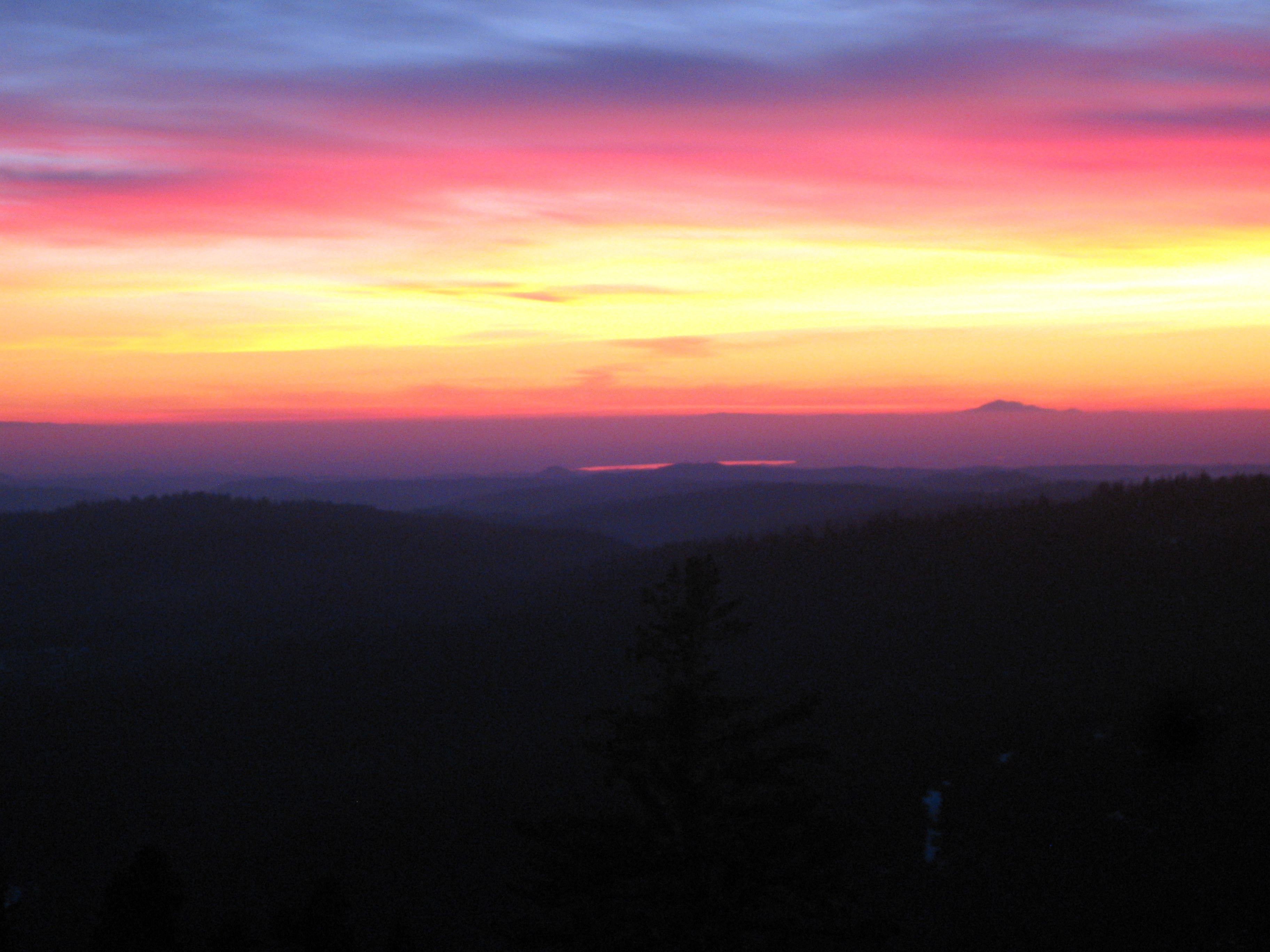
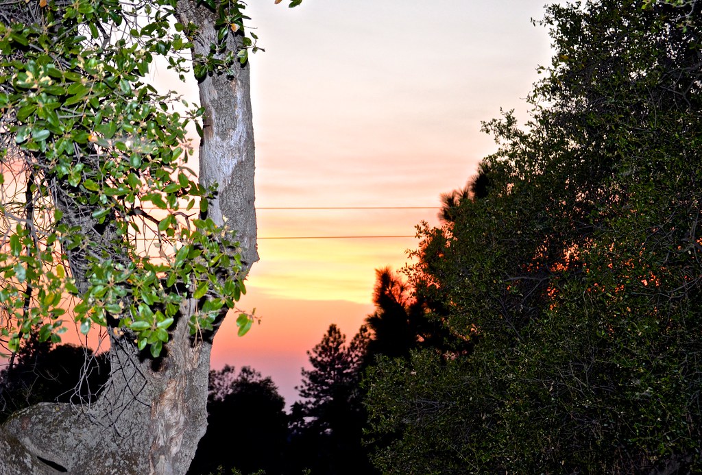
Painted Sky
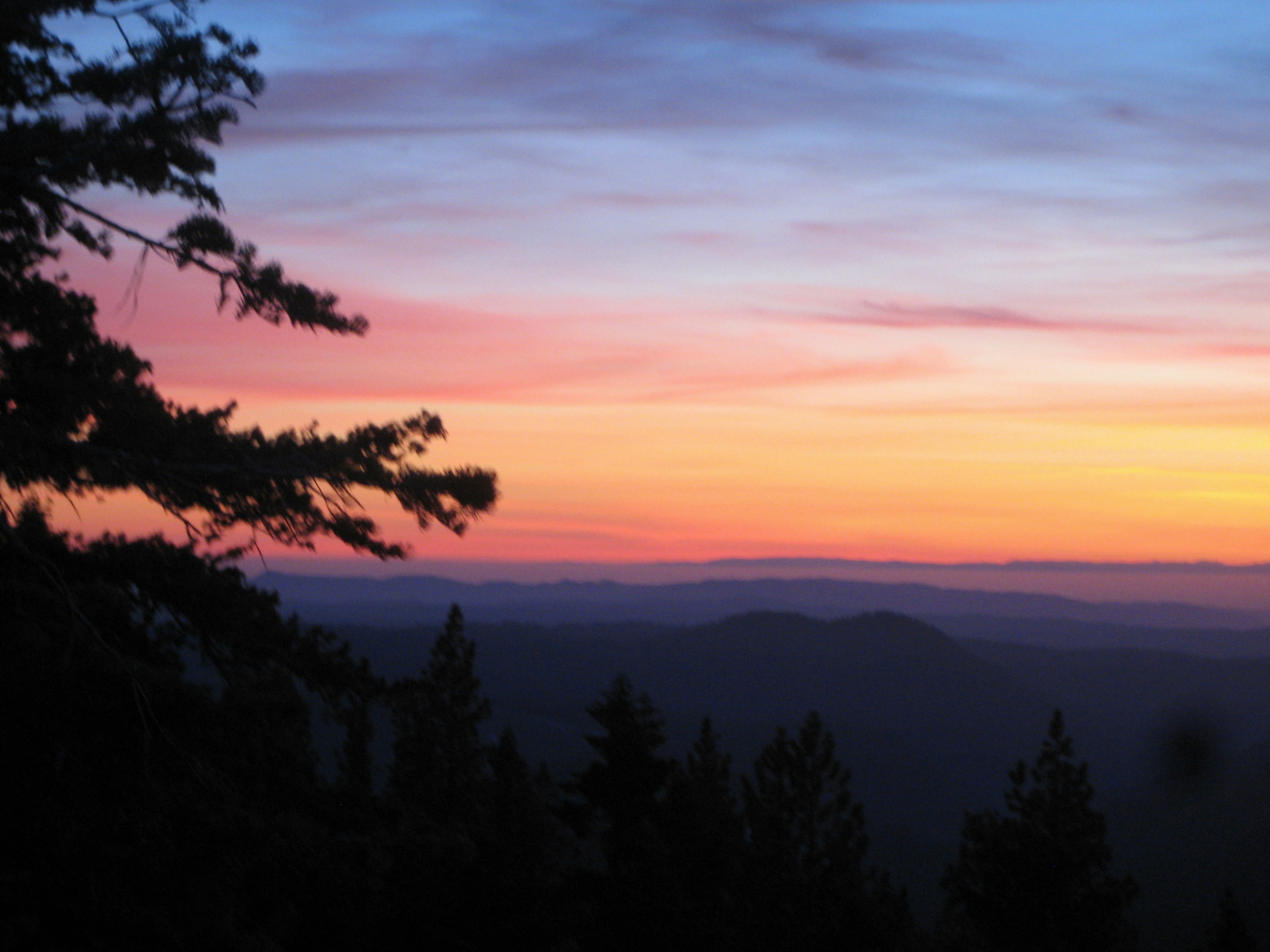
Living Color
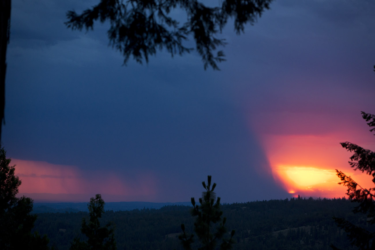
Sacramento deluge

First Sunset
Fire from beyond
#sunset #nature #mountains #pioneer
sunset, hilltop, Red Mule Ranch, Fiddletown,

sunset, "Cowboy Campfire", cowboy, Fiddletown, Red Mule Ranch, Ron Scofield

sunset, men,

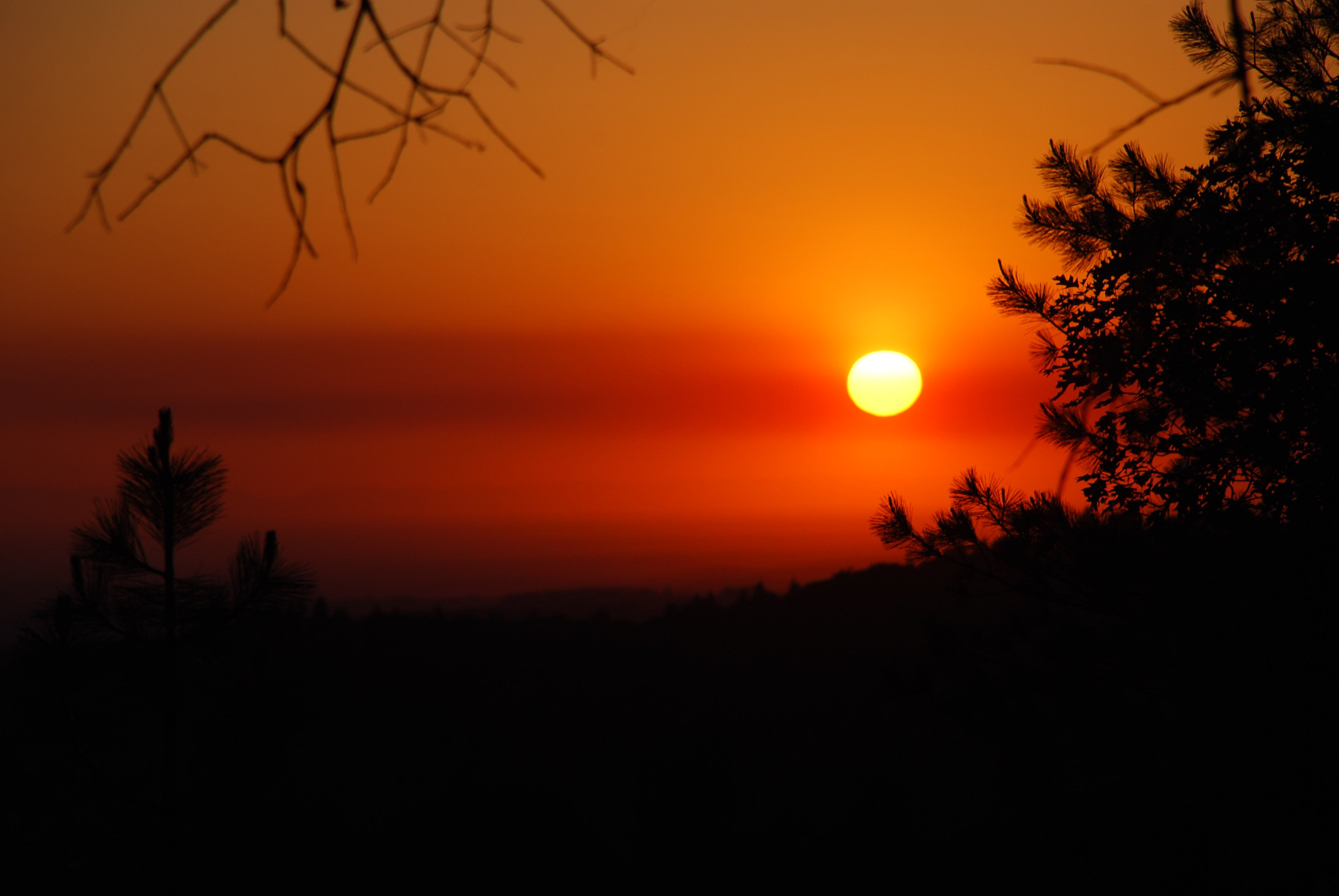
Red Sun

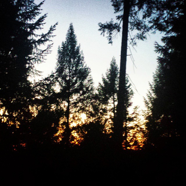
Sunrise through the trees in Amador County

Sunrise through the trees in Amador County

Sunrise through the trees in Amador County

Sunrise through the trees in Amador County

Sunrise through the trees in Amador County

Sunrise through the trees in Amador County

Sunrise through the trees in Amador County

Sunrise Behind the Trees Amador County

Sunrise through the trees in Amador County

Sunrise through the trees in Amador County

Sunrise through the trees in Amador County

Sunrise through the trees in Amador County

Sunrise through the trees in Amador County
Higdon Rd, West Point, CA, USA Karte
Suchen Sie einen anderen Ort
Nahe Plätze
Bobbie Ln, Pioneer, CA, USA
Kathy Ln, Pioneer, CA, USA
Pioneer Inn & Suites, CA-88, Pioneer, CA, USA
Gallagher's Pub, CA-88, Pioneer, CA, USA
Pioneer Post Office, Kalifornien, USA
Mollie Joyce Park, Woodfern Dr, Pioneer, CA, USA
Pioneer Hardware, CA-88, Pioneer, CA, USA
Pioneer, CA, USA
Carson Dr, Pioneer, CA, USA
W Point Pioneer Rd, West Point, CA, USA
Carson Drive, Carson Dr, California, USA
Glencoe, CA, USA
Ealey Rd, Glencoe, CA, USA
Pioneer Elementary School, CA-88, Pioneer, CA, USA
Meadow Crest Dr, Pioneer, CA, USA
United States Postal Service, CA-26, Glencoe, CA, USA
Le's Chinese Restaurant, CA-88, Pioneer, CA, USA
Schaefer Ranch Rd, Pioneer, CA, USA
Buckhorn Ridge Rd, Pioneer, CA, USA
Stanley Rd, West Point, CA, USA
Letzte Suche
- Kawanecho Sasamado, Shimada, Shizuoka -, Japan Sonnenaufgang Sonnenuntergang Zeiten
- 6 Rue Jules Ferry, Beausoleil, Frankreich Sonnenaufgang Sonnenuntergang Zeiten
- Otxandio, Biscay, Spain Sonnenaufgang Sonnenuntergang Zeiten
- Sattva Horizon, 4JC6+G9P, Vinayak Nagar, Kattigenahalli, Bengaluru, Karnataka, Indien Sonnenaufgang Sonnenuntergang Zeiten
- 富士山, Kitayama, Fujinomiya, Präfektur Shizuoka -, Japan Sonnenaufgang Sonnenuntergang Zeiten
- Laurel Rd, Townsend, TN, USA Sonnenaufgang Sonnenuntergang Zeiten
- Haibin South Road, China, Guang Dong Sheng, Shen Zhen Shi, Long Gang Qu, 海滨南路GFPQ+R9Q Sonnenaufgang Sonnenuntergang Zeiten
- Redondo Ave, Long Beach, CA, USA Sonnenaufgang Sonnenuntergang Zeiten
- Ulitsa Kalinina, 79, Rezh, Sverdlovskaya oblast', Russland Sonnenaufgang Sonnenuntergang Zeiten
- Leguwa, Nepal Sonnenaufgang Sonnenuntergang Zeiten